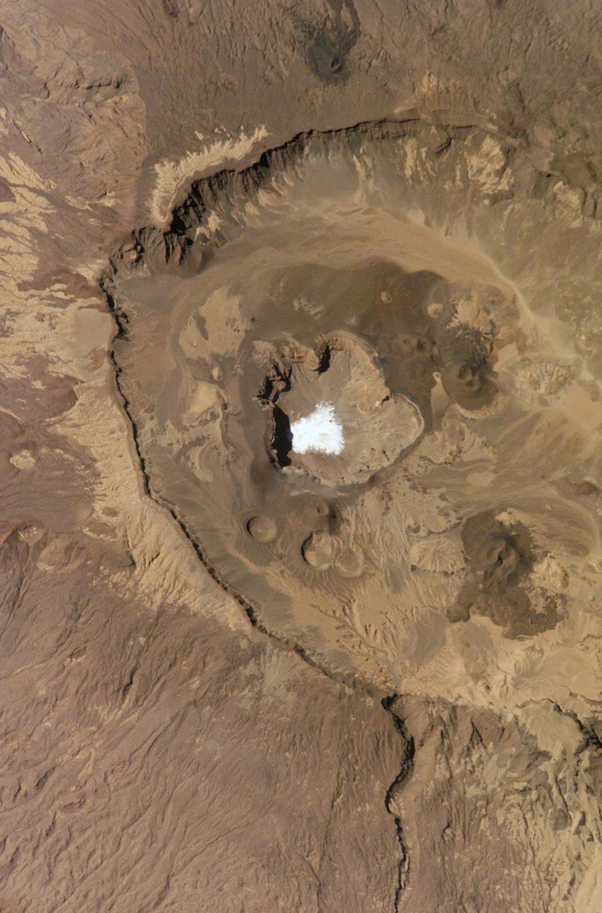
This is a view of the Emi Koussi Caldera captured by the Expedition Six Crew Observation (CEO) experiment aboard the International Space Station (ISS). Rising 2.3 km above the surrounding sandstone plains, Emi Koussi is a 6.5 km wide volcano located at the south end of the Tibesti Mountains in the central Sahara desert. The volcano is one of several in the Tibesti massif and has been used as a close analog to the famous Martian volcano Elysium Mons. Major charnels can be seen on volcanoes on both planets that indicate low points in caldera rims where lava spilled out of the pre-collapsed craters.
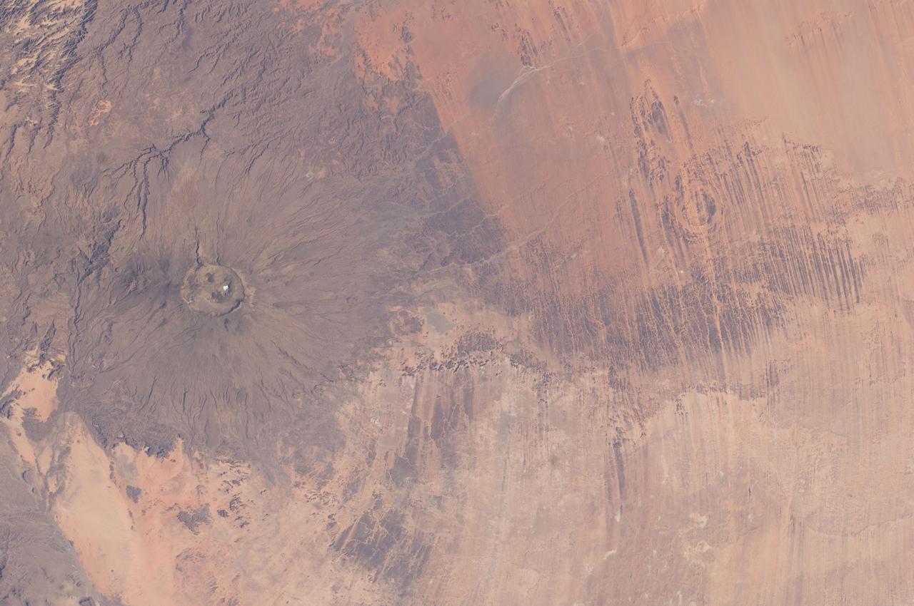
ISS030-E-005456 (26 Nov. 2011) --- Emi Koussi Volcano and Aorounga Impact Crater, Chad are featured in this image photographed by an Expedition 30 crew member on the International Space Station. This striking photograph features two examples of circular landscape features?labeled as craters?that were produced by very different geological processes. At left, the broad grey-green shield volcano of Emi Koussi is visible. The volcano is marked by three overlapping calderas formed by eruptions; these form a large oblong depression at the 3,415 meter ASL summit of the volcano. A smaller crater sits within the larger caldera depression. While volcanic activity has not been observed, nor is mentioned in the historical record, an active thermal area is located on the southern flank. The circular Aorounga Impact Crater is located approximately 110 kilometers to the southeast of Emi Koussi and has its origin in forces from above rather than eruptions from below. According to scientists, the Aorounga structure is thought to record a meteor impact approximately 345-370 million years ago. The circular feature visible at upper right may be only one of three impact craters formed by the same event ? the other two are buried by sand deposits. The linear features (lower right) that arc around Emi Koussi and overprint Aorounga and the surrounding bedrock are known as yardangs; these are rock ridges formed by wind erosion.
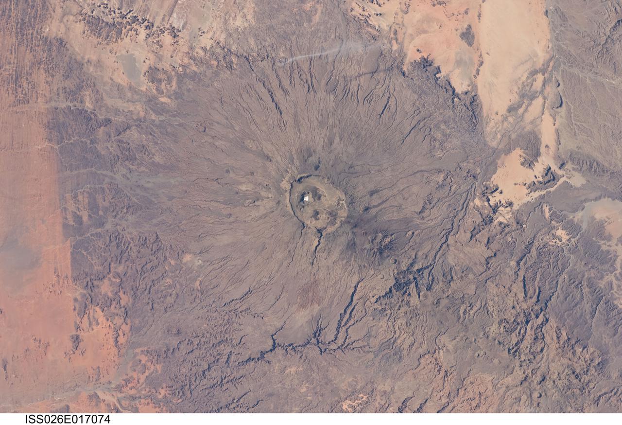
ISS026-E-017074 (11 Jan. 2011) --- Emi Koussi volcano in Chad is featured in this image photographed by an Expedition 26 crew member on the International Space Station. The large Emi Koussi volcano is located in northern Chad at the southeastern end of the Tibesti Range. The dark volcanic rocks of the volcano provide a sharp contrast to the underlying tan and light brown sandstones exposed to the west, south, and east. Emi Koussi is a shield volcano formed from relatively low viscosity lavas—flowing more like motor oil as opposed to toothpaste—and explosively-erupted ignimbrites that produce a characteristic low and broad structure that covers a wide area (approximately 60 x 80 kilometers). This photograph highlights the entire volcanic structure; at 3,415 meters above sea level, Emi Koussi is the highest summit of the Sahara region. The summit area contains three calderas formed by powerful eruptions. Two older, and overlapping, calderas form a depression approximately 12 x 15 kilometers in area bounded by a distinct rim (center). According to scientists, the youngest and smallest caldera, Era Kohor, formed as a result of eruptive activity that occurred within the past 2 million years. Young volcanic features including lava flows and scoria cones are also thought to be less than 2 million years old. There are no historical records of eruptive activity at Emi Koussi, but there is an active thermal area on the southern flank of the volcano.