Eos Chasma Mensa
Wonders of Eos Chasma
Eos Chasma Landslides
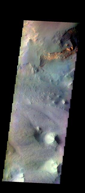
Context image The THEMIS camera contains 5 filters. The data from different filters can be combined in multiple ways to create a false color image. These false color images may reveal subtle variations of the surface not easily identified in a single band image. Today's false color image shows part of Eos Chasma. Orbit Number: 18300 Latitude: -14.9443 Longitude: 312.7 Instrument: VIS Captured: 2006-01-29 02:31. http://photojournal.jpl.nasa.gov/catalog/PIA20227
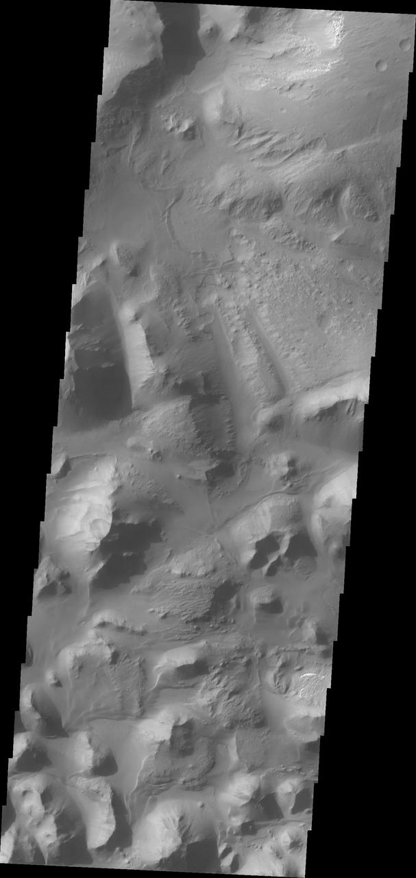
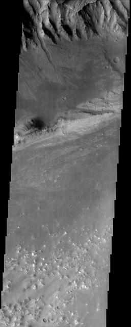
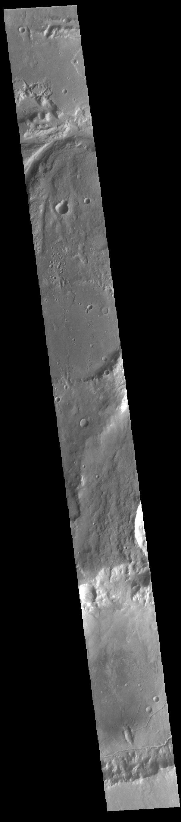
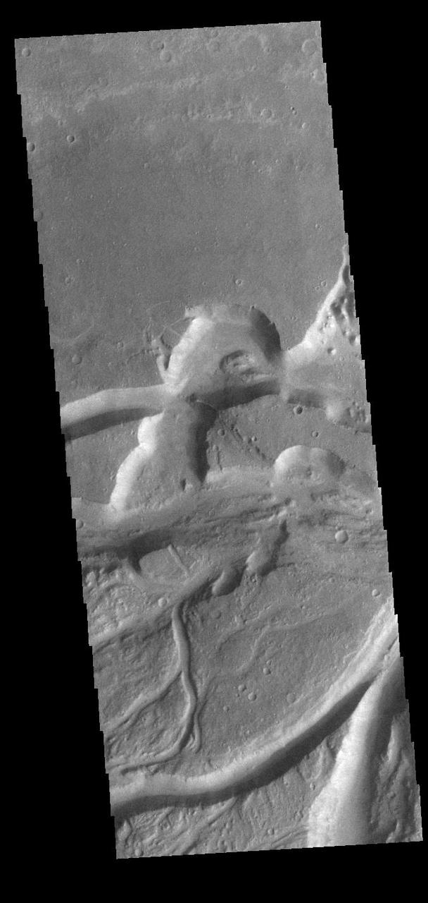
At eastern end of Valles Marineris is Eos Chasma. In Eos, the canyon system transitions into a region of chaos and then into major outflow channels. This image from NASA 2001 Mars Odyssey shows the transition into chaos.
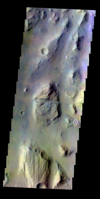
The THEMIS VIS camera contains 5 filters. The data from different filters can be combined in multiple ways to create a false color image. This false color image from NASA 2001 Mars Odyssey spacecraft shows part of of Eos Chasma.
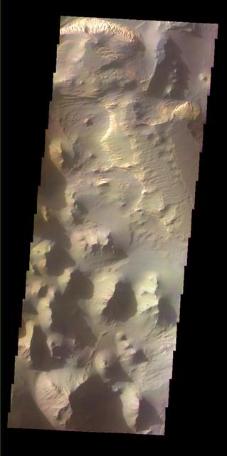
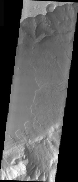
This image shows part of Eos Chasma
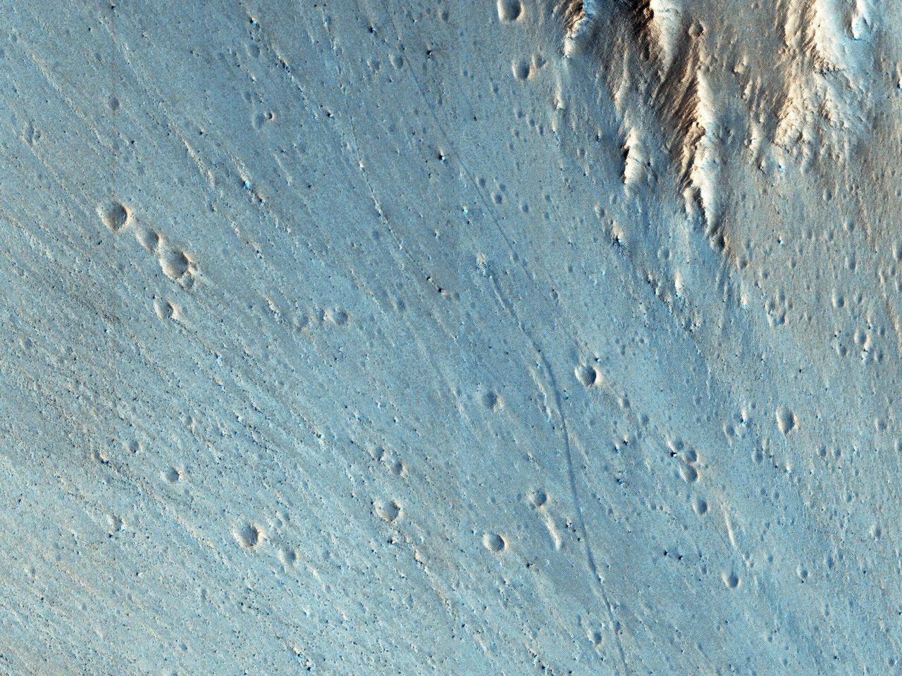
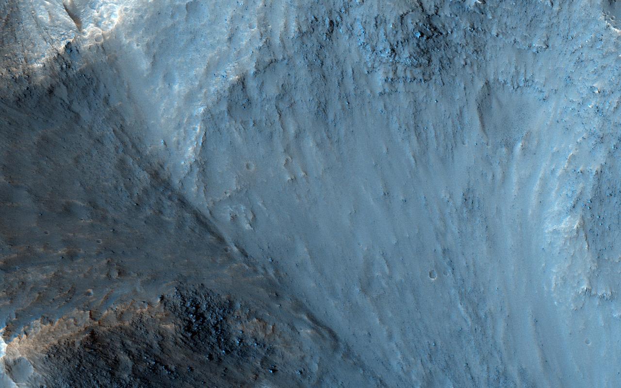
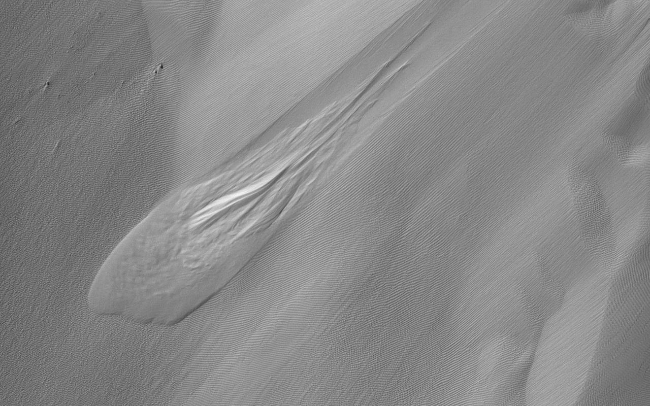
This picture of the rim of Eos Chasma in Valles Marineris shows active erosion of the Martian surface. Layered bedrock is exposed in a steep cliff on a spur of the canyon rim. Dark layers in this cliff are made up of large boulders up to 4 meters in diameter. The boulders are lined up along specific horizons, presumably individual lava flows, and are perched to descend down into the canyon upon the slightest disturbance. How long will the boulders remain poised to fall, and what will push them over the edge? Just as on Earth, the main factors that contribute to dry mass wasting erosion on Mars are frost heaving and thermal expansion and contraction due to changes in temperature. The temperature changes on Mars are extreme compared to Earth, because of the lack of humidity in the Martian atmosphere and the eccentricity of the Martian orbit. Each daily temperature cycle and each seasonal change from summer to winter produces a cycle of expansion and contraction that pushes the boulders gradually closer to the brink. Inevitably, the boulders fall from their precarious positions and plunge into the canyons below. Most simply slide down slope and collect just below the source layers. A few are launched along downward trajectories, travelling long distances before they settle on the slopes below. These trundling boulders left behind conspicuous tracks, up to a kilometer long. The tracks resemble dashed lines or perforations, indicating that the boulders bounced as they trundled down the slopes. The visibility of the boulder tracks suggests that this process may have taken place recently. The active Martian winds quickly erased the tracks of the rover Opportunity, for example. However, the gouges produced by trundling boulders probably go much deeper than the shallow compression of soil by the wheels of a relatively lightweight rover. The boulder tracks might persist for a much longer time span than the rover tracks for this reason. Nevertheless, the tracks of the boulders suggest that erosion of the rim of Eos Chasma is a process that continues today. http://photojournal.jpl.nasa.gov/catalog/PIA21203
This image shows a crater on the floor of Eos Chasma, part of the Valles Marineris canyon system. Craters on Mars are useful for geologists because they provide cross-sections into the subsurface. The south wall of this crater shows evidence of several different types of rock, with diverse colors. In the black and white parts of the image, it appears that there are two types of rock: one relatively light and one dark. However, in the 1.1 kilometer-wide color swath we can see that the dark rocks are more complicated, as some have a greenish tint and others are purple. Note that these are not the colors your eyes would see if you were there! In enhanced color, the HiRISE near-infrared data appears as red, the red is shown as green, and the blue-green data is shown as blue, allowing us to see more information at once. https://photojournal.jpl.nasa.gov/catalog/PIA25182
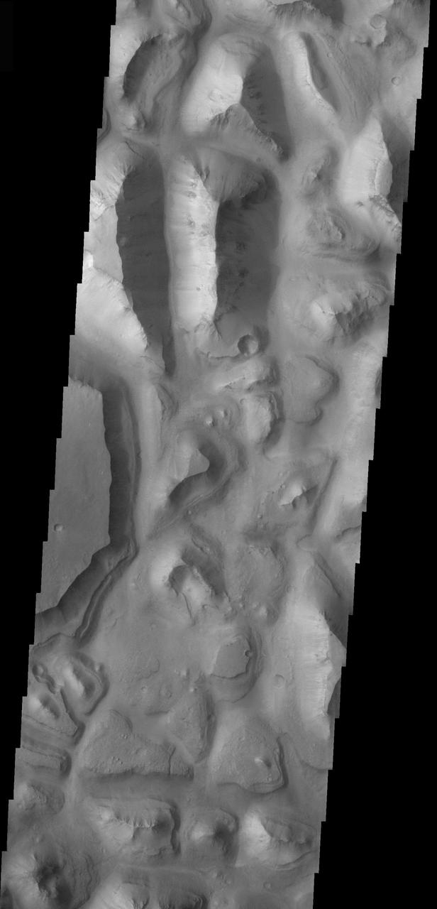
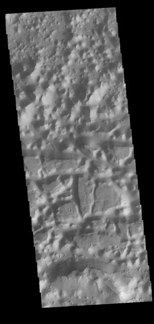
The floor of Eos Chasma is composed of thousands of small hills; this type of terrain is called chaos. This image from NASA Mars Odyssey and shows a small portion of Eos Chaos.
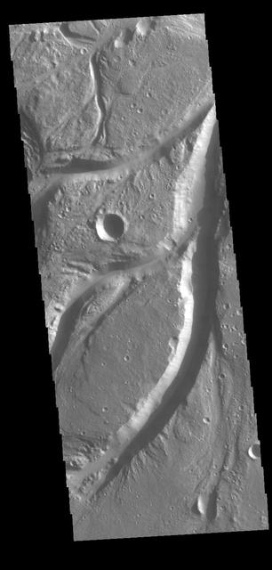
Osuga Valles is a complex set of channels located near Eos Chasma. Orbit Number: 71243 Latitude: -15.2123 Longitude: 321.617 Instrument: VIS Captured: 2018-01-05 06:57 https://photojournal.jpl.nasa.gov/catalog/PIA22372
At the eastern end of Valles Marineris the chasma floors are typically filled with the hills and mounds of chaos terrain as seen by NASA Mars Odyssey.
Osuga Valles lies around 170 kilometers to the south of Eos Chasma, which is at the eastern end of the vast Valles Marineris canyon system as seen by NASA Mars Reconnaissance Orbiter.
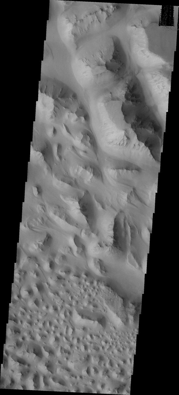
Today's VIS image shows a region of chaos terrain south of Eos Chasma. Chaos terrain is typified by regions of blocky, often steep sided, mesas interspersed with deep valleys. With time and erosion the valleys widen and the mesas become smaller. It has been proposed that a catastrophic outflow of subsurface water creates the chaos. Orbit Number: 90820 Latitude: -16.5354 Longitude: 319.24 Instrument: VIS Captured: 2022-06-05 10:07 https://photojournal.jpl.nasa.gov/catalog/PIA25513
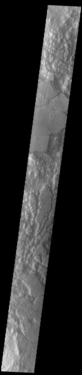
Today's VIS image shows a region of chaos terrain south of Eos Chasma. Chaos terrain is typified by regions of blocky, often steep sided, mesas interspersed with deep valleys. With time and erosion the valleys widen and the mesas become smaller. It has been proposed that a catastrophic outflow of subsurface water creates the chaos. Orbit Number: 93210 Latitude: -16.1911 Longitude: 318.75 Instrument: VIS Captured: 2022-12-19 04:19 https://photojournal.jpl.nasa.gov/catalog/PIA25848
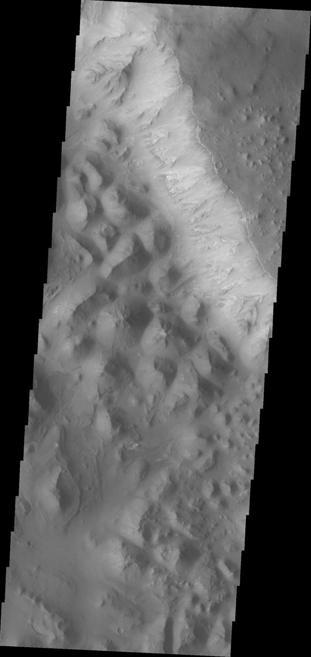
Today's VIS image is located in Margaritifer Terra near Eos Chasma. The ground in this region has been broken up into mesas and valleys, with the initial break up thought to be due to a release of groundwater. With continued erosion, the mesas become smaller and smaller, creating the jumble of hills seen at the bottom of this image. Orbit Number: 82609 Latitude: -16.5146 Longitude: 319.112 Instrument: VIS Captured: 2020-07-29 08:06 https://photojournal.jpl.nasa.gov/catalog/PIA24145
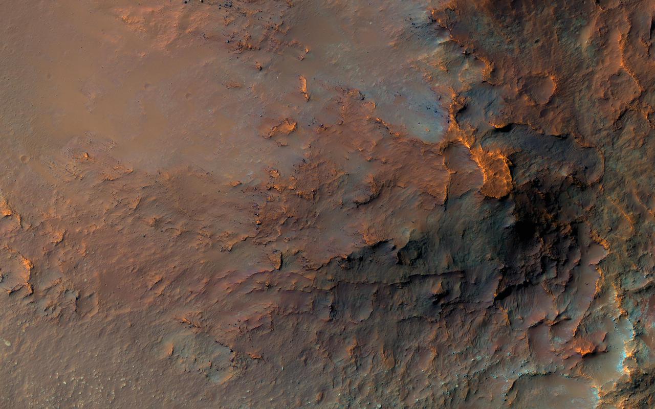
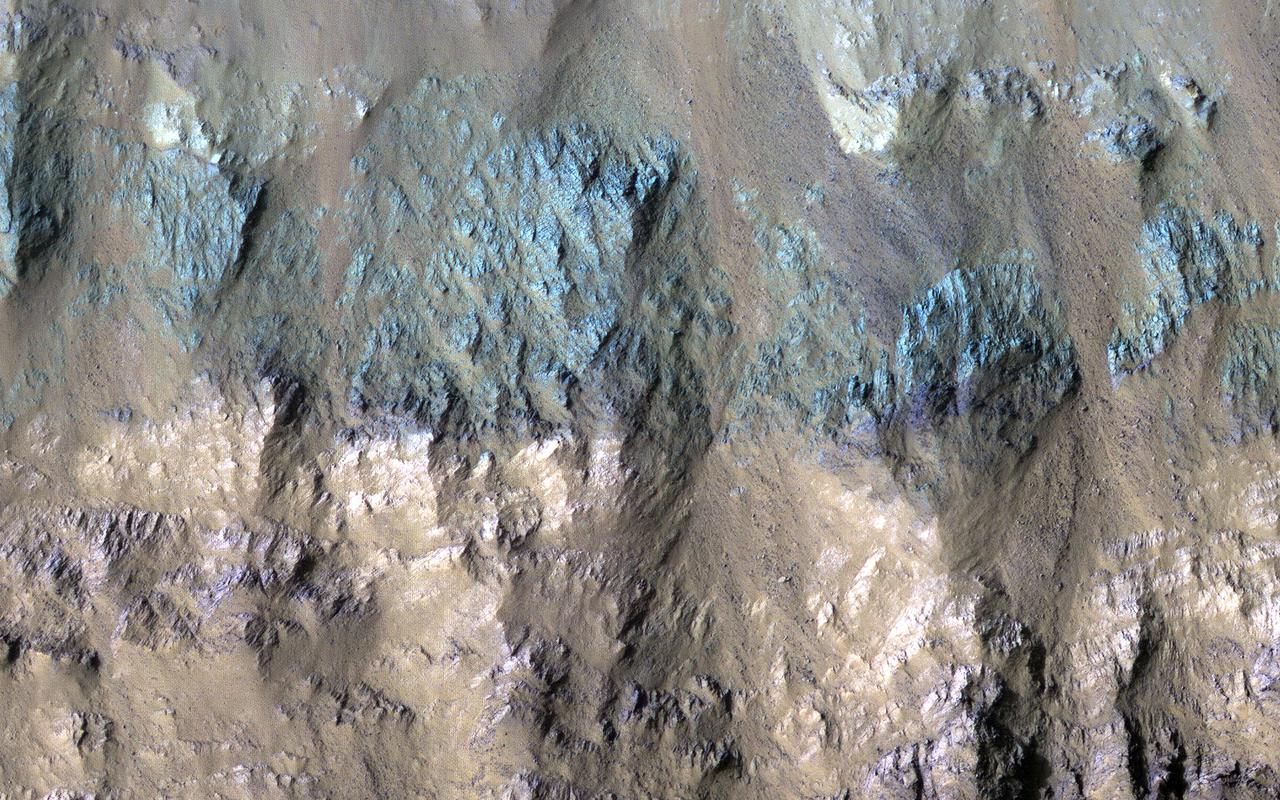
This image was requested in the very first month of MRO's Primary Science Phase, November 2006. Due to many competing targets in the Valles Marineris canyon system, it took nearly 15 years to acquire. But it was worth the wait! A massive landslide has transported diverse rocks from the canyon's wall layers down onto its floor, jumbling them up in the process. Lower-resolution infrared data had previously revealed an unusual concentration of the igneous mineral orthopyroxene at this location. The range of colors visible to HiRISE implies that many other minerals are present here as well. https://photojournal.jpl.nasa.gov/catalog/PIA24913
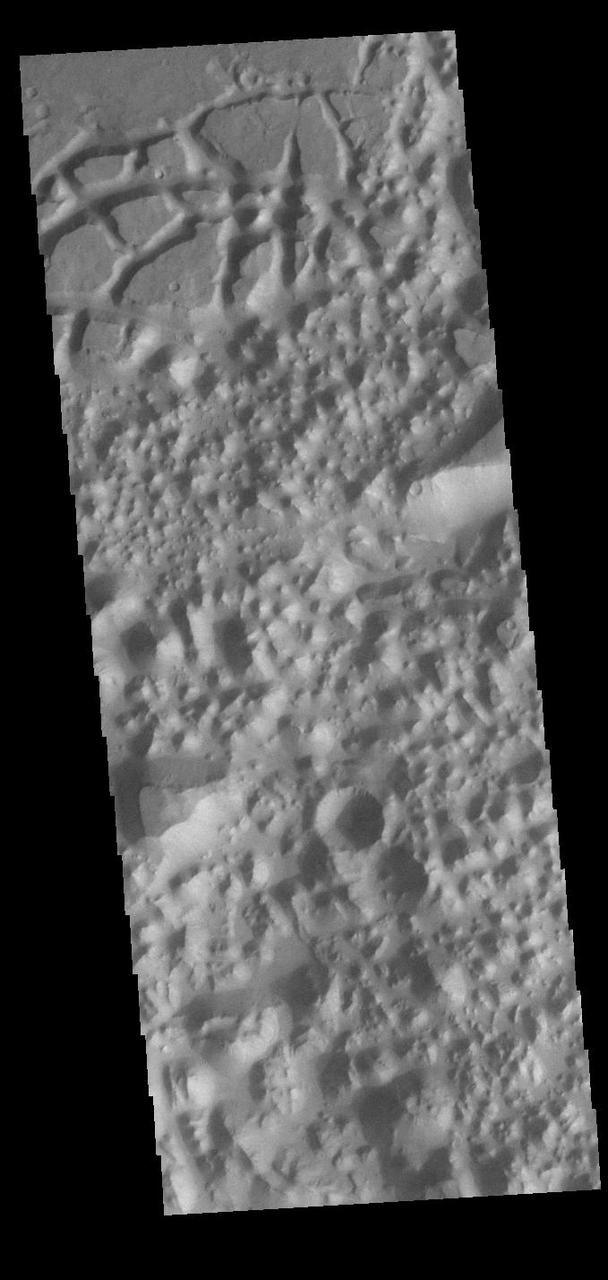
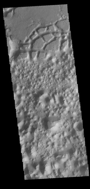
The top of today's VIS image shows a small section of Osuga Valles. Osuga Valles is a complex set of channels located near Eos Chasma. The channels were likely cut by multiple episodes of flowing water. Osuga Valles is 164km (101 miles) long. Orbit Number: 83133 Latitude: -15.8555 Longitude: 322.044 Instrument: VIS Captured: 2020-09-10 11:36 https://photojournal.jpl.nasa.gov/catalog/PIA24189
Chaos terrain is typified by regions of blocky, often steep sided, mesas interspersed with deep valleys. With time and erosion the valleys widen and the mesas become smaller. In this region south of Eos Chasma there are regions where the mesas have eroded down into small hills (top of the image), as well as large, steep sided mesas (center to bottom of the image). Orbit Number: 82921 Latitude: -16.8648 Longitude: 318.197 Instrument: VIS Captured: 2020-08-24 00:40 https://photojournal.jpl.nasa.gov/catalog/PIA24186
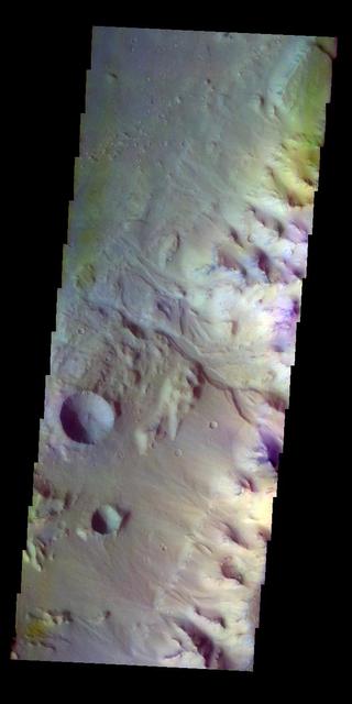
The THEMIS VIS camera contains 5 filters. The data from different filters can be combined in multiple ways to create a false color image. These false color images may reveal subtle variations of the surface not easily identified in a single band image. Today's false color image shows the margin between the highlands of Margaritifer Terra and Eos Chasma. An unnamed channel in the center of the image empties into the chasma. Orbit Number: 8191 Latitude: -10.784 Longitude: 322.952 Instrument: VIS Captured: 2003-10-19 19:20 http://photojournal.jpl.nasa.gov/catalog/PIA19730
In geology, a slump forms a mass of loosely consolidated material or a rock layer moves a short distance down a slope. The movement is characterized by sliding along a concave-upward or planar surface. Based on other HiRISE images, this particular slump occurred between 9 March 2020 and 17 February 2021, corresponding to the relatively warm spring and summer of the Southern Hemisphere. This is among the largest active slumps documented on Mars, about 700 meters (0.4 mile) long. Causes of slumping on Earth include earthquake shocks, reduction of friction through wetting, freezing and thawing, undercutting (such as from a stream), and loading of a slope. Based on the geomorphology of this region and other active slumps seen on Mars, we suspect loading of the slope via smaller-scale activity like gullies, recurring slope lineae and windblown deposits may have contributed to the slumping. Perhaps a Marsquake triggered the movement. Note to future Mars explorers: setting up camp at the base of this slope is not recommended. https://photojournal.jpl.nasa.gov/catalog/PIA25189
Today's VIS image shows a small section of Osuga Valles. Osuga Valles is a complex set of channels located near Eos Chasma. The channels were likely cut by multiple episodes of flowing water. Osuga Valles is 164km (101 miles) long. Orbit Number: 91057 Latitude: -14.717 Longitude: 321.586 Instrument: VIS Captured: 2022-06-24 22:29 https://photojournal.jpl.nasa.gov/catalog/PIA25532
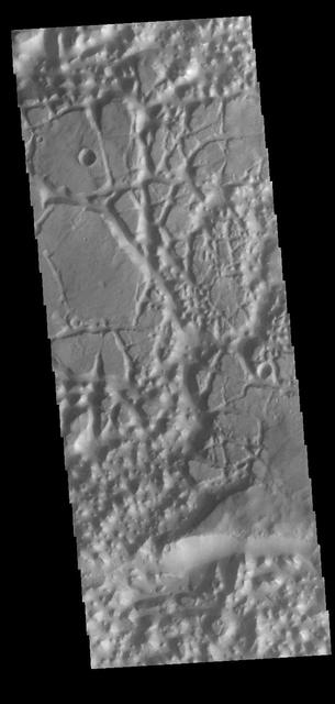
In planetary nomenclature, the descriptor term chaos means "distinctive area of broken terrain". The general morphology of chaos is steep-sided mesas in close proximity. This VIS image shows a region of chaos where the isolated mesas are still very large, as well as other locations that are already reduced by erosion into small mesas. This image is located south of Eos Chasma. Orbit Number: 82896 Latitude: -16.1936 Longitude: 319.319 Instrument: VIS Captured: 2020-08-21 23:16 https://photojournal.jpl.nasa.gov/catalog/PIA24181
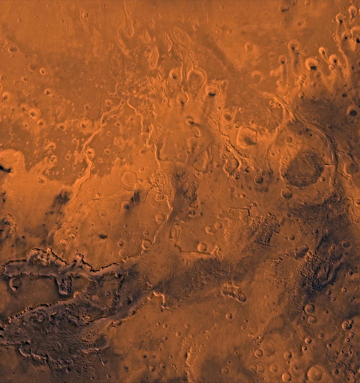
A color image of the south Chryse basin Valles Marineris outflow channels on Mars; north toward top. The scene shows on the southwest corner the chaotic terrain of the east part of Valles Marineris and two of its related canyons: Eos and Capri Chasmata (south to north). Ganges Chasma lies directly north. The chaos in the southern part of the image gives rise to several outflow channels, Shalbatana, Simud, Tiu, and Ares Valles (left to right), that drained north into the Chryse basin. The mouth of Ares Valles is the site of the Mars Pathfinder lander. This image is a composite of NASA's Viking medium-resolution images in black and white and low-resolution images in color. The image extends from latitude 20 degrees S. to 20 degrees N. and from longitude 15 degrees to 53 degrees; Mercator projection. http://photojournal.jpl.nasa.gov/catalog/PIA00418
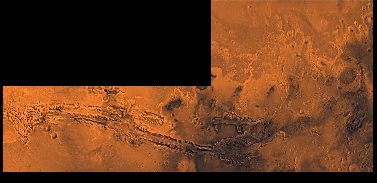
A color image of Valles Marineris, the great canyon and the south Chryse basin-Valles Marineris outflow channels of Mars; north toward top. The scene shows the entire Valles Marineris canyon system, over 3,000 km long and averaging 8 km deep, extending from Noctis Labyrinthus, the arcuate system of graben to the west, to the chaotic terrain to the east and related outflow canyons that drain toward the Chryse basin. Eos and Capri Chasmata (south to north) are two canyons connected to Valles Marineris. Ganges Chasma lies directly north. The chaos in the southeast part of the image gives rise to several outflow channels, Shalbatana, Simud, Tiu, and Ares Valles (left to right), that drained north into the Chryse basin. The mouth of Ares Valles is the site of the Mars Pathfinder lander. This image is a composite of Viking medium-resolution images in black and white and low-resolution images in color; Mercator projection. The image roughly extends from latitude 20 degrees S. to 20 degrees N. and from longitude 15 degrees to 102.5 degrees. The connected chasma or valleys of Valles Marineris may have formed from a combination of erosional collapse and structural activity. Layers of material in the eastern canyons might consist of carbonates deposited in ancient lakes, eolian deposits, or volcanic materials. Huge ancient river channels began from Valles Marineris and from adjacent canyons and ran north. Many of the channels flowed north into Chryse Basin. The south Chryse outflow channels are cut an average of 1 km into the cratered highland terrain. This terrain is about 9 km above datum near Valles Marineris and steadily decreases in elevation to 1 km below datum in the Chryse basin. Shalbatana is relatively narrow (10 km wide) but can reach 3 km in depth. The channel begins at a 2- to 3-km-deep circular depression within a large impact crater, whose floor is partly covered by chaotic material, and ends in Simud Valles. Tiu and Simud Valles consist of a complex of connected channel floors and chaotic terrain and extend as far south as and connect to eastern Valles Marineris. Ares Vallis originates from discontinuous patches of chaotic terrain within large craters. In the Chryse basin the Ares channel forks; one branch continues northwest into central Chryse Planitia and the other extends north into eastern Chryse Planitia. http://photojournal.jpl.nasa.gov/catalog/PIA00426