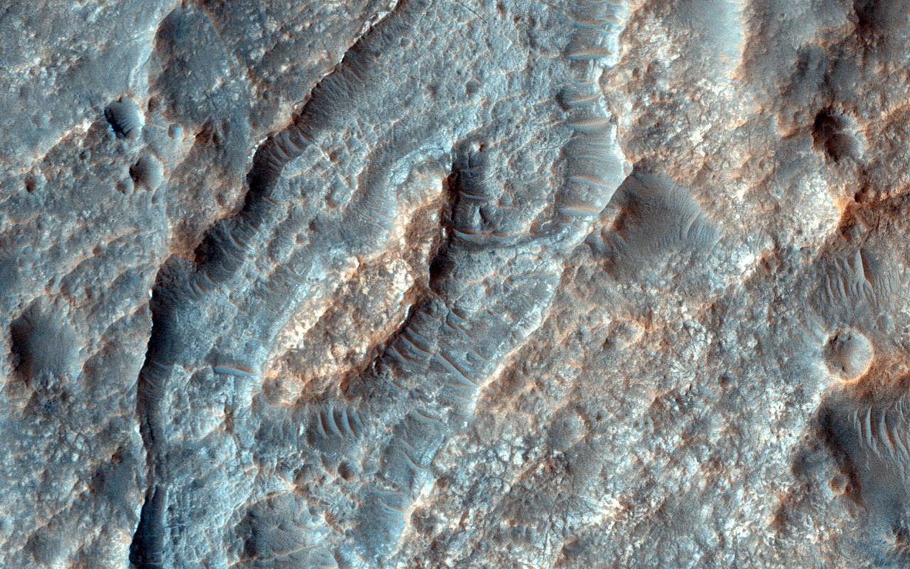
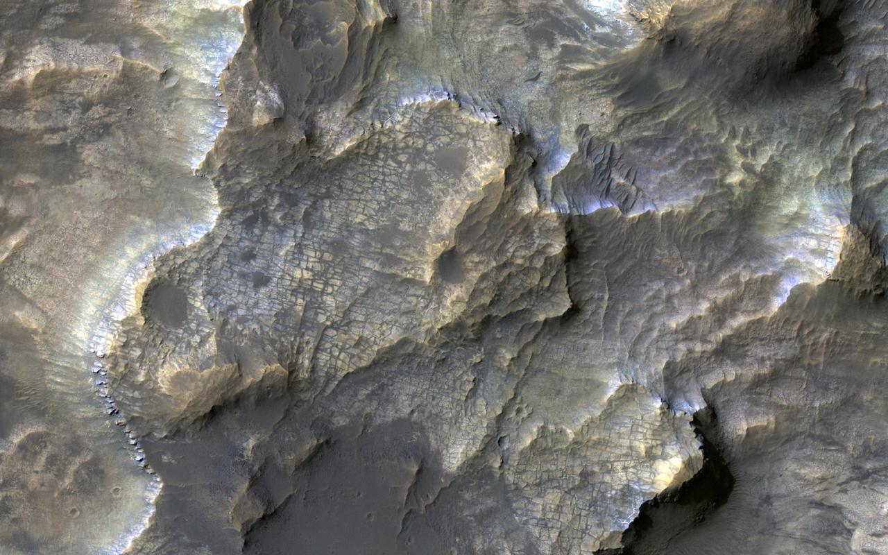
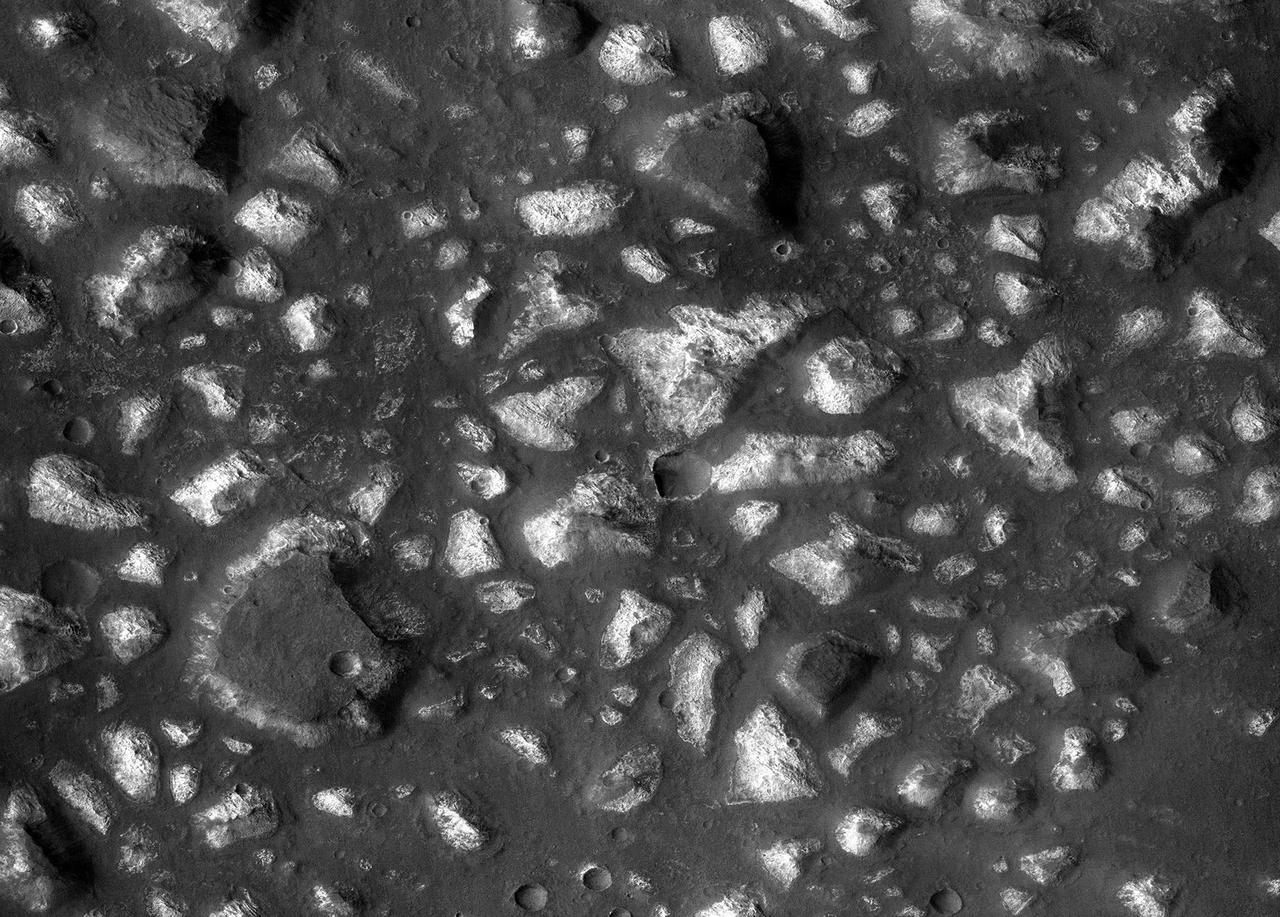
This closeup from NASA Mars Reconnaissance Orbiter covers a region in the Eridania Basin that shows interesting inverted ridges.
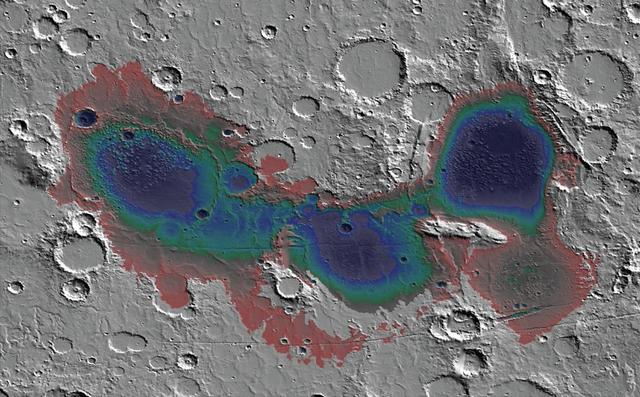
The Eridania basin of southern Mars is believed to have held a sea about 3.7 billion years ago, with seafloor deposits likely resulting from underwater hydrothermal activity. This graphic shows estimated depths of water in that ancient sea. A recent estimate of the total water volume of the ancient Eridania sea is about 50,000 cubic miles (210,000 cubic kilometers), about nine times the total volume of North America's Great Lakes. The map covers an area about 530 miles (850 kilometers) wide. This graphic was included in a 2017 report "Ancient hydrothermal seafloor deposits in Eridania basin on Mars" in Nature Communications. A reference bar indicating color coding of depth, from red, at right, showing depth of about 300 feet (100 meters) to black showing depth more than 10 times that depth. This graphic was included in a 2017 report "Ancient hydrothermal seafloor deposits in Eridania basin on Mars" in Nature Communications. https://photojournal.jpl.nasa.gov/catalog/PIA22059
Eridania Basin, located at the head of Maadim Vallis, has mounting geomorphic and spectral evidence that it may have been the site of an ancient inland sea. This image is from NASA Mars Reconnaissance Orbiter.
Eridania is the name of topographically enclosed basin located in the Southern highlands of Mars that has been suggested to be the site of a large ancient lake or inland sea. This image is from NASA Mars Reconnaissance Orbiter.
This colorful image, acquired on May 21, 2018 by NASA's Mars Reconnaissance Orbiter, shows clays within the Eridania basin region. Many scientists using orbital data have proposed that a large lake may have once existed here during the Late Noachian through Early Hesperian time periods, and then much of the water drained out to the north via Ma'adim Vallis. Understanding where and what kind of clay exists within this region using CRISM data can help scientists learn more about how long the postulated lake existed and the water chemistry within the lake. More information is available at https://photojournal.jpl.nasa.gov/catalog/PIA22588
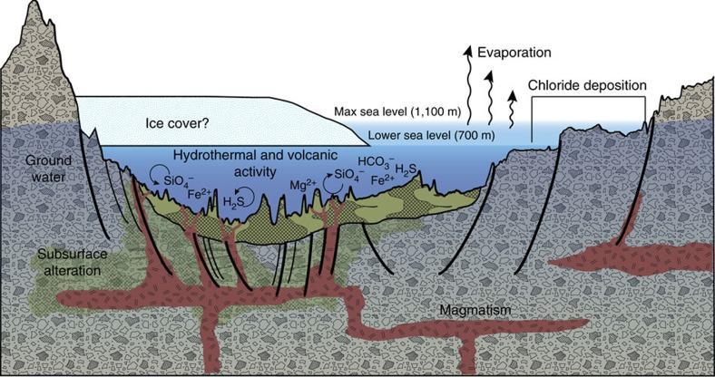
This diagram illustrates an interpretation for the origin of some deposits in the Eridania basin of southern Mars as resulting from seafloor hydrothermal activity more than 3 billion years ago. The ground level depicted is an exaggerated topography of a transect about 280 miles (450 kilometers) long. Blue portions of the diagram depict water-depth estimates and the possibility of ice covering the ancient sea. Thick, clay-rich deposits (green) formed through hydrothermal alteration of volcanic materials in deep water, by this model. Notations indicate deep-water reactions of iron and magnesium ions with silicates, sulfides and carbonates. Deep-seated structural discontinuities could have facilitated the ascent of magma from a mantle source. Chloride deposits formed from evaporation of seawater at higher elevations in the basin. https://photojournal.jpl.nasa.gov/catalog/PIA22060
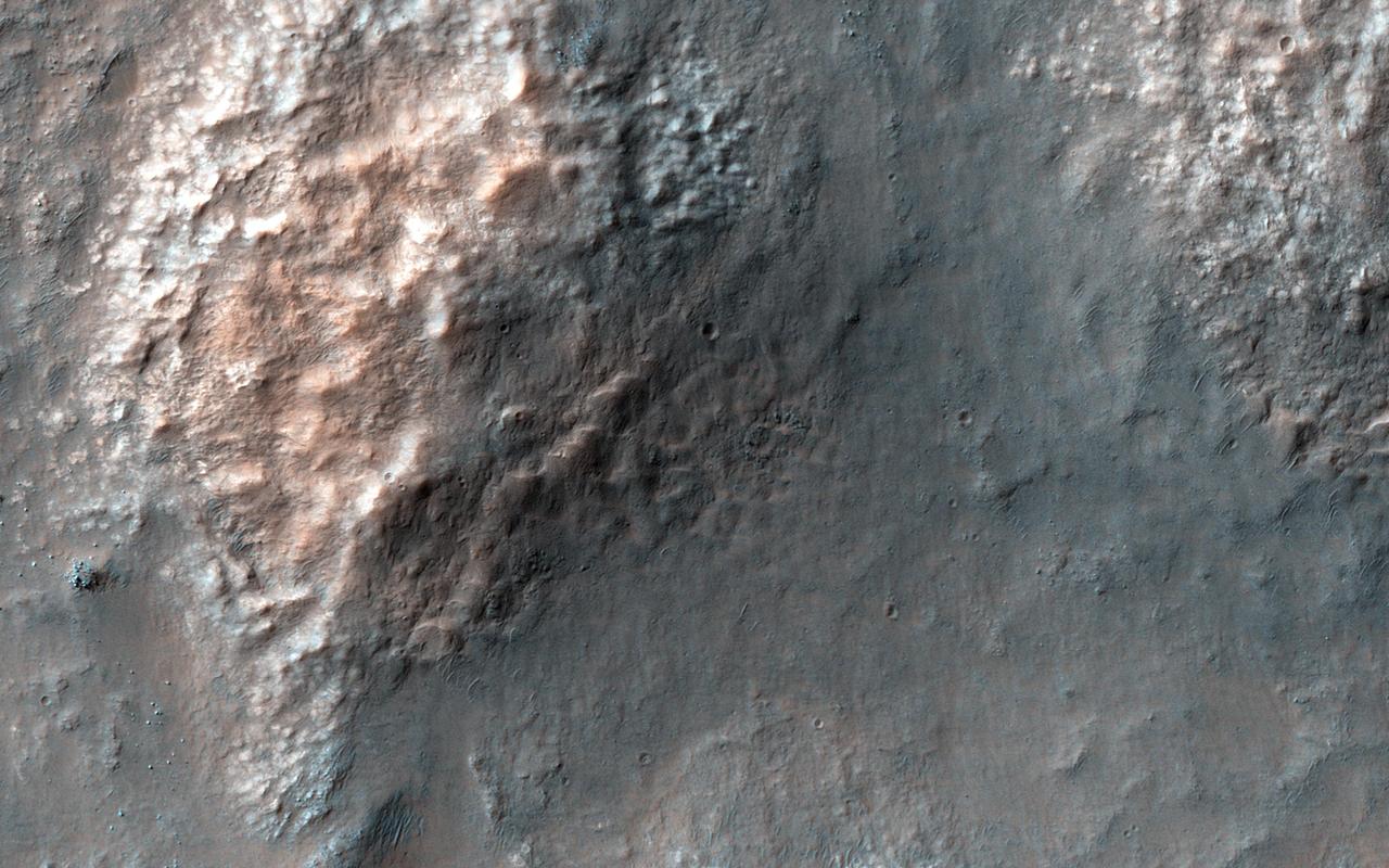
The Eridania Basin is thought to have once contained a large sea. This image from NASA Mars Reconnaissance Orbiter spacecraft shows the Gorgonum Basin, which lies along the eastern edge of Eridania.
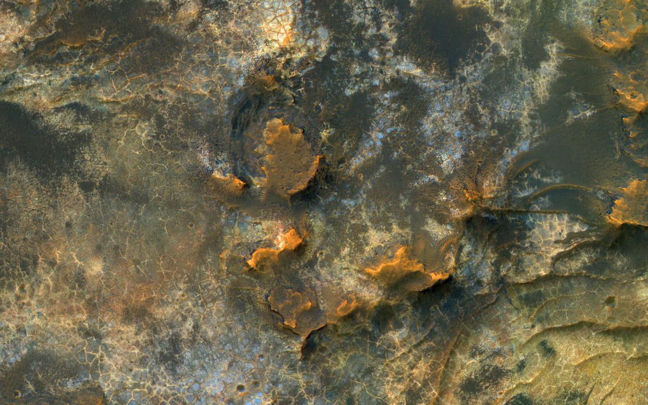
HiRISE reveals small-scale shapes that often correlate with mineral units and provides information about stratigraphy (i.e., what's on top and relative ages). This image was acquired for co-analysis with a spectrometer instrument also on our spacecraft called CRISM (Compact Reconnaissance Imaging Spectrometer for Mars). It shows polygonal units that match clay-rich areas. Plus, this region is colorful! This location, in Eridania Basin, was the site of an ancient lake, so these clay-rich sediments may have been habitable. While CRISM cannot acquire new data from their infrared channel due to lack of cooling, they have acquired much previous data that lacks HiRISE coverage. https://photojournal.jpl.nasa.gov/catalog/PIA23105
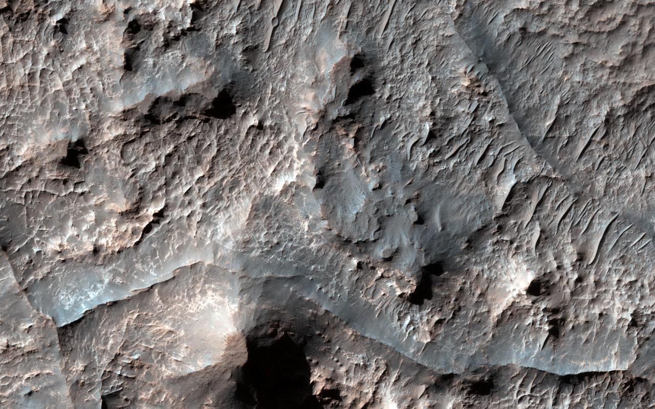
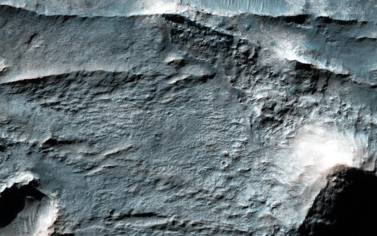
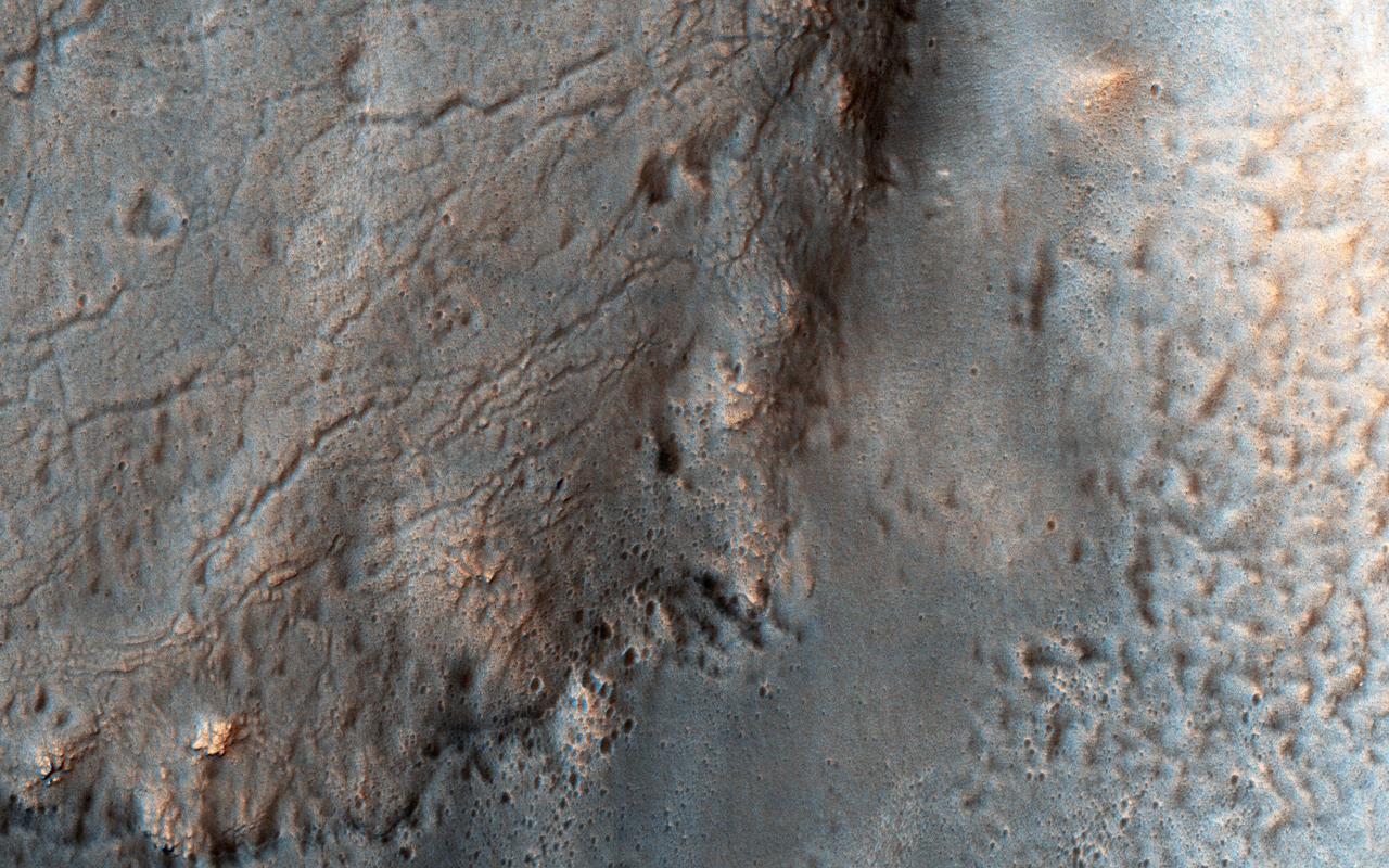
This view of a portion of the Eridania region of southern Mars shows fractured, dismembered blocks of deep-basin deposits that have been surrounded and partially buried by younger volcanic deposits. The image was taken by the Context Camera on NASA's Mars Reconnaissance Orbiter. The area covered by this view spans about 12 miles (20 kilometers) across. The shape and texture of the thick bedrock layers in the Eridania basin, together with the mix of minerals identified from orbit, led researchers to identify this as the site of possible seafloor hydrothermal deposits. A schematic cross section (PIA22059 of this terrain shows an interpretation of its origin. The mineral identifications were made from observations by the Mars Reconnaissance Orbiter's Compact Reconnaissance Imaging Spectrometer for Mars. This is a portion of Context Camera image B08_012563_1445. https://photojournal.jpl.nasa.gov/catalog/PIA22058
The ancient highland channels in this image empty into the Eridania Basin (not visible), a large topographically low enclosure with smooth-appearing terrains that may have once contained a large paleolake or ancient sea. Water in these channels flowed to the east into Ariadnes Basin, a smaller basin located within the confines of Eridiana. Light-toned knobs are exposed in the northern channel, while the other channels are partially filled with smooth appearing lobe-shaped surface flows that are extensively fractured when viewed at high-resolution. Although the origin of these knobs is not known, interpretations include fumarolic mounds, erosional remnants, pingos, mud volcanoes and spring mounds. The movement of the once ice-rich, channel-filling flows over the knobby terrains likely created radial tension stresses producing the cracks that we see on the surface of these deposits. As the material slowly thinned, it eventually led to the formation of an elephant skin-like texture. This texture is different from the surrounding eroding mantling deposit that has become pitted as the ice sublimated causing the overlying surface to collapse. The combination of such knobby terrain and smooth, channel-filling deposits are seen only in a few places on Mars. One such example is the Navua Valles channels northeast of the Hellas Basin that may have also hosted a large, ice-covered lake in the past. Their morphological similarities, particularly in their surface materials, suggest that they formed under similar paleoclimatic conditions. http://photojournal.jpl.nasa.gov/catalog/PIA12968