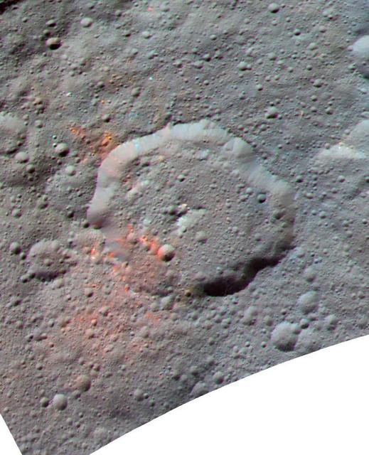
This enhanced color composite image, made with data from the framing camera aboard NASA's Dawn spacecraft, shows the area around Ernutet crater. The bright red portions appear redder with respect to the rest of Ceres. In a 2017 study in the journal Science, researchers from the Dawn science team found that these red areas around Ernutet are associated with evidence of organic material. Images taken using blue (440 nanometers), green (750 nanometers) and infrared (960 nanometers) spectral filters were combined to create the view. Ernutet Crater measures about 32 miles (52 kilometers) in diameter and is located in the northern hemisphere. http://photojournal.jpl.nasa.gov/catalog/PIA21419
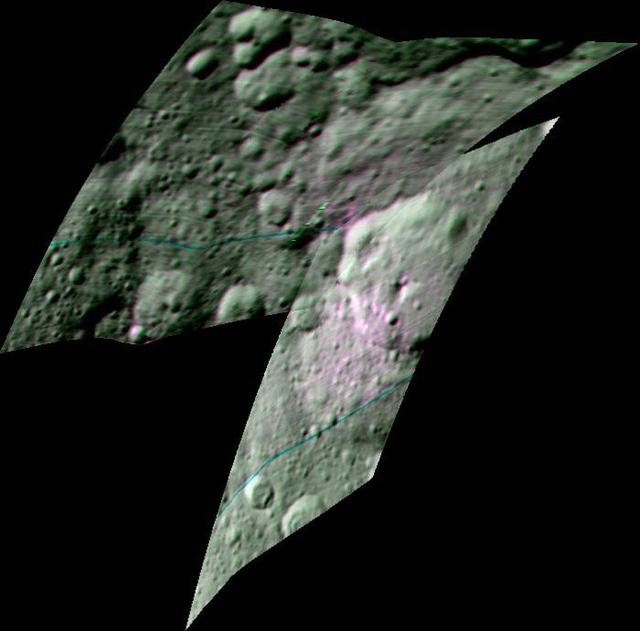
This enhanced color composite image from Dawn's visible and infrared mapping spectrometer shows the area around Ernutet Crater on Ceres. The instrument detected the evidence of organic materials in this area, as reported in a 2017 study in the journal Science. In this view, areas that appear pink with respect to the background appear to be rich in organics, and green areas are where organic material appears to be less abundant. Light with a wavelength of 2000 nanometers is shown in blue, 3400 nanometers is shown in green and 1700 nanometers is shown in red. http://photojournal.jpl.nasa.gov/catalog/PIA21420
Ernutet Crater is featured in this image from Ceres, taken by NASA Dawn spacecraft. Ernutet was named for the Egyptian cobra-headed goddess of the harvest. The crater measures about 32 miles 52 kilometers in diameter and is located in the northern hem
NASA Dawn spacecraft took this view from Ceres on June 16, 2016, showing Ernutet Crater 32 miles, 52 kilometers in diameter at top. NASA's Dawn spacecraft took this image on June 16, 2016, from its low-altitude mapping orbit, at a distance of about 240 miles (385 kilometers) above the surface. The image resolution is 120 feet (35 meters) per pixel. http://photojournal.jpl.nasa.gov/catalog/PIA20833
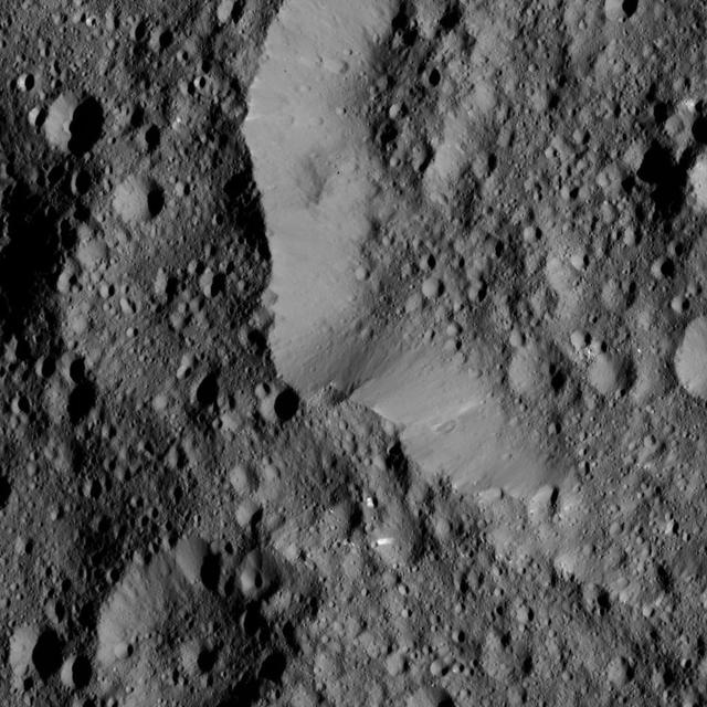
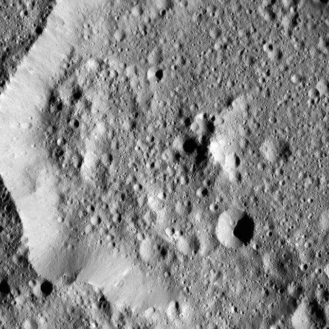
This view from NASA's Dawn spacecraft shows the rim of Ernutet Crater (32 miles, 52 kilometers in diameter) on Ceres. NASA's Dawn spacecraft took this image on June 17, 2016, from its low-altitude mapping orbit, at a distance of about 240 miles (385 kilometers) above the surface. The image resolution is 120 feet (35 meters) per pixel. http://photojournal.jpl.nasa.gov/catalog/PIA20862
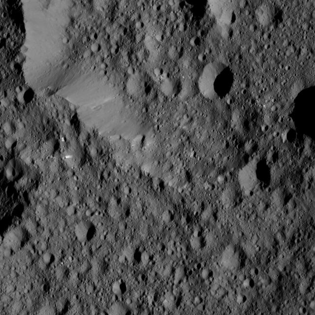
NASA's Dawn spacecraft took this image of Hakumyi Crater on Ceres, visible left of center. The crater is named after a Paraguayan, Brazilian and Bolivian spirit said to be helpful in gardening. Hakumyi, 18 miles (29 kilometers) in diameter, is located about 43 miles (70 kilometers) west of Ernutet Crater. Ernutet is where scientists found evidence of organic material, thanks to Dawn's visible and infrared mapping spectrometer. Evidence for organics was also found at the 4-mile (6.5 kilometer) wide fresh crater on the southern rim of Hakumyi and on the lobe-shaped flow of material that runs into Hakumyi. These two features look relatively young in comparison to the rest of Hakumyi Crater, whose rims and overall shape are subdued. The lobate flow is reminiscent of the Type I flows identified in multiple places at high latitudes on Ceres, and suggests a significant amount of ice near the surface. Dawn took this image on August 20, 2015, from 915 miles (1,470 kilometers) altitude. The center coordinates of this image are 48.9 degrees north latitude and 27.0 degrees east longitude. https://photojournal.jpl.nasa.gov/catalog/PIA21413