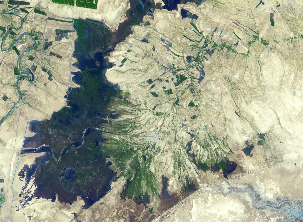
The town of Shadegan, Iran is northeast of where the Tigris and Euphrates Rivers enter the Persian Gulf. It sits near a wetland and upon land that was once part of an inland river delta. The long, linear orchards follow the topography created by the delta. The image was acquired September 3, 2012, covers an area of 40.6 by 55.3 km, and is located at 30.6 degrees north, 48.6 degrees east. http://photojournal.jpl.nasa.gov/catalog/PIA21170

This image from NASA EarthKAM is of the northern end of the Persian Gulf and the broad delta complex of the Tigris, Euphrates, Shatt al Arab, and Karun rivers has captured the arid-looking wetlands of northeast Kuwait Bubiyan Island,
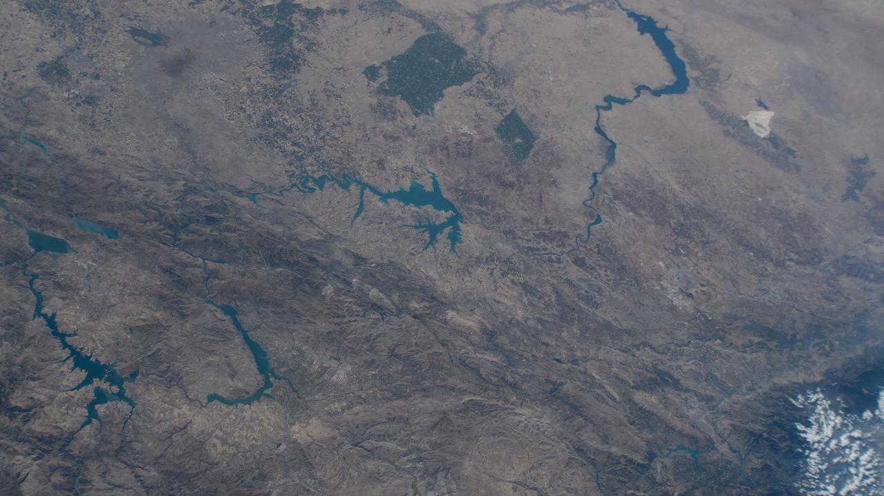
iss071e462180 (Aug. 9, 2024) --- Lake Assad in Syria (upper right) and lakes created by hydroelectric dams in Turkiye, all along the Euphrates River, are pictured from the International Space Station as it orbited 263 miles above the Turkish nation that connects Europe with Asia.
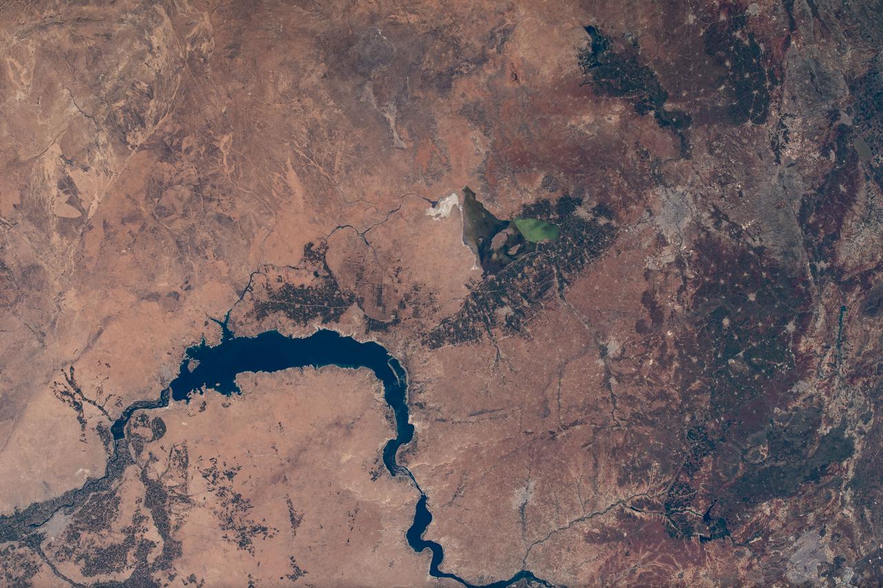
iss073e0379780 (July 20, 2025) --- The Euphrates River runs in between the large, artificial Lake Tharthar and the small Lake Habbaniyah to the northwest of Baghdad, Iraq, in this photograph from the International Space Station as it orbited 260 miles above the Middle Eastern nation. Credit: Roscosmos
This image, acquired by NASA Terra spacecraft, is of the ancient city of Uruk is located in present-day Iraq, on an abandoned channel of the Euphrates River.
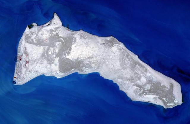
NASA Terra spacecraft captured Kuwait Failaka Island, located 50 km southeast of the spot where the Tigris and Euphrates Rivers empty into the Persian Gulf.

NASA Terra spacecraft captured this image north of the present town of Al Hillal, Iraq, in the fertile plain between the Tigris and the Euphrates Rivers, where the site of the legendary city of Babylon lies.
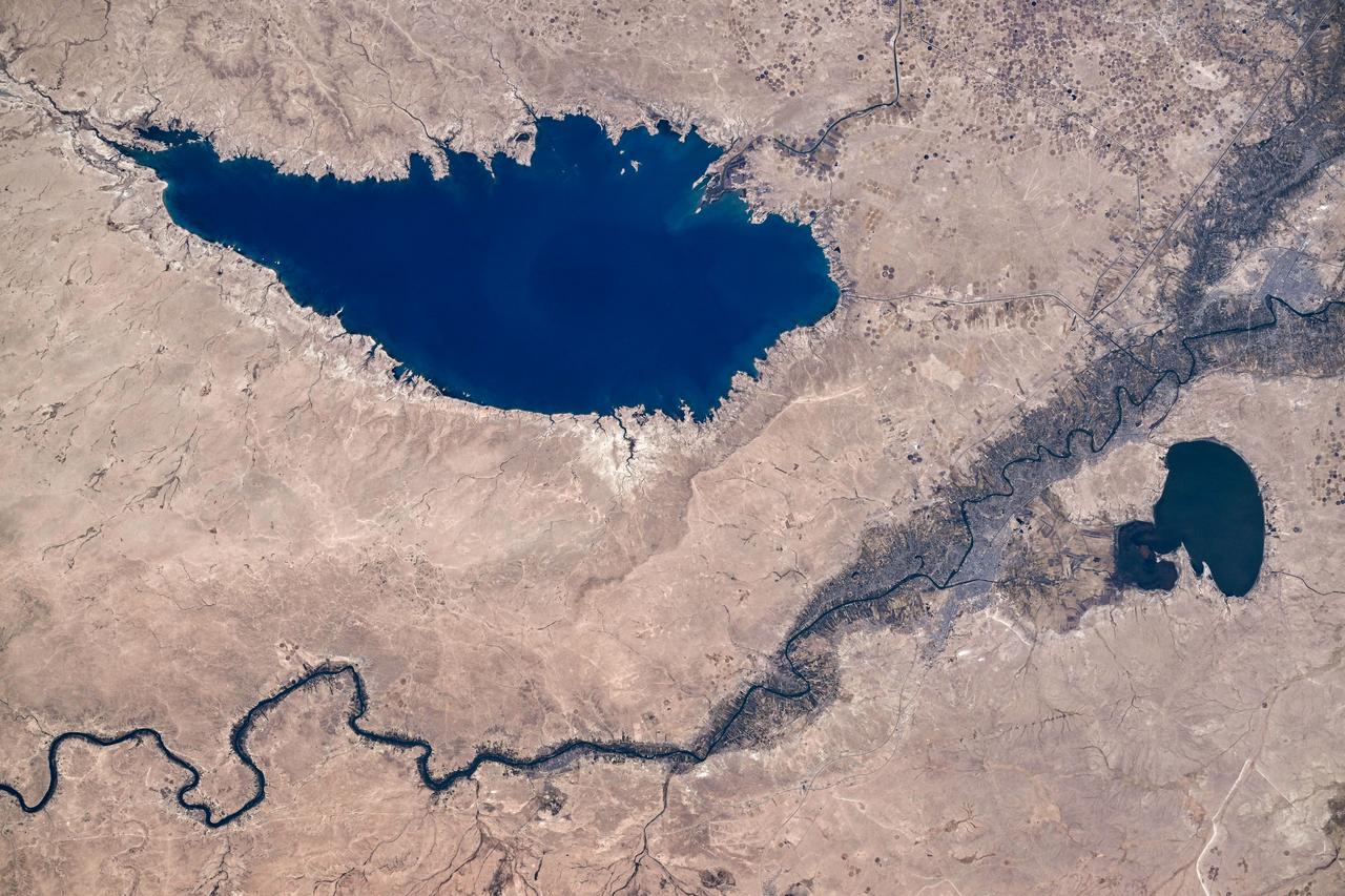
iss071e163367 (June 4, 2024) --- Baghdad, Iraq (lower left), is pictured near several bodies of water including (from left) Razazza Lake, Habbaniyah Lake, Therthar Lake, the Euphrates River, and Lake Qadisiyah created by the damming of the Euphrates. The International Space Station was orbiting 260 miles above the Middle East at the time of this photograph.
iss065e002136 (April 22, 2021) --- The Euphrates River flows through Lake Assad in Syria in this photograph from the International Space Station as it orbited 263 miles above.

iss069e053879 (Aug. 4, 2023) --- Northrop Grumman's Cygnus cargo craft is pictured from the International Space Station as it approaches while orbiting 260 miles above the Euphrates River in Iraq.
iss069e015083 (May 31, 2023) --- Lake Assad in Syria, a reservoir on the Euphrates River, is pictured from the International Space Station as it orbited 258 miles above the Middle East nation.
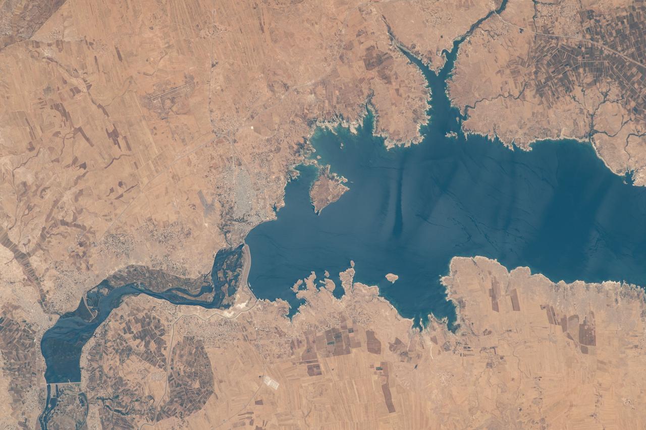
iss068e006715 (Oct. 1, 2022) --- This portion of the Euphrates River, containing the Keban Dam Reservoir created by the Keban Dam, is pictured in eastern Turkey from the International Space Station as it orbited 260 miles above.
The world's largest cemetery is located in the holy city of Najaf, Iraq, west of the Euphrates River, and along the Najaf Sea. The Wadi-al-Salam cemetery, Arabic for "Peace Valley", covers an area of about 10 square kilometers, and has over 6 million graves. Daily burials have been going on for over 1400 years. The image was acquired May 5, 2021, covers an area of 18 by 21.5 km, and is located at 32 degrees north, 44.3 degrees east. https://photojournal.jpl.nasa.gov/catalog/PIA25896
STS059-82-010 (9-20 April 1994) --- View northwestward of a small part of southeastern Iraq. The city of Basra can be seen in the lower left corner, and the former junction of the Tigris and Euphrates Rivers in the upper right. The streams have been channelized, in part to dewater and burn an extensive marsh. Hasselblad camera, 250mm lens.
ISS040-E-106243 (25 Aug. 2014) --- This panorama view, photographed by an Expedition 40 crew member on the International Space Station, shows the tropical blue waters of the Persian Gulf. Strong north winds often blow in summer, churning up dust from the entire length of the desert surfaces of the Tigris and Euphrates valleys (top left). Dust partly obscures the hundreds of kilometers of Iraq?s light-green agricultural lands along these rivers (left). The Caspian Sea cuts the horizon.
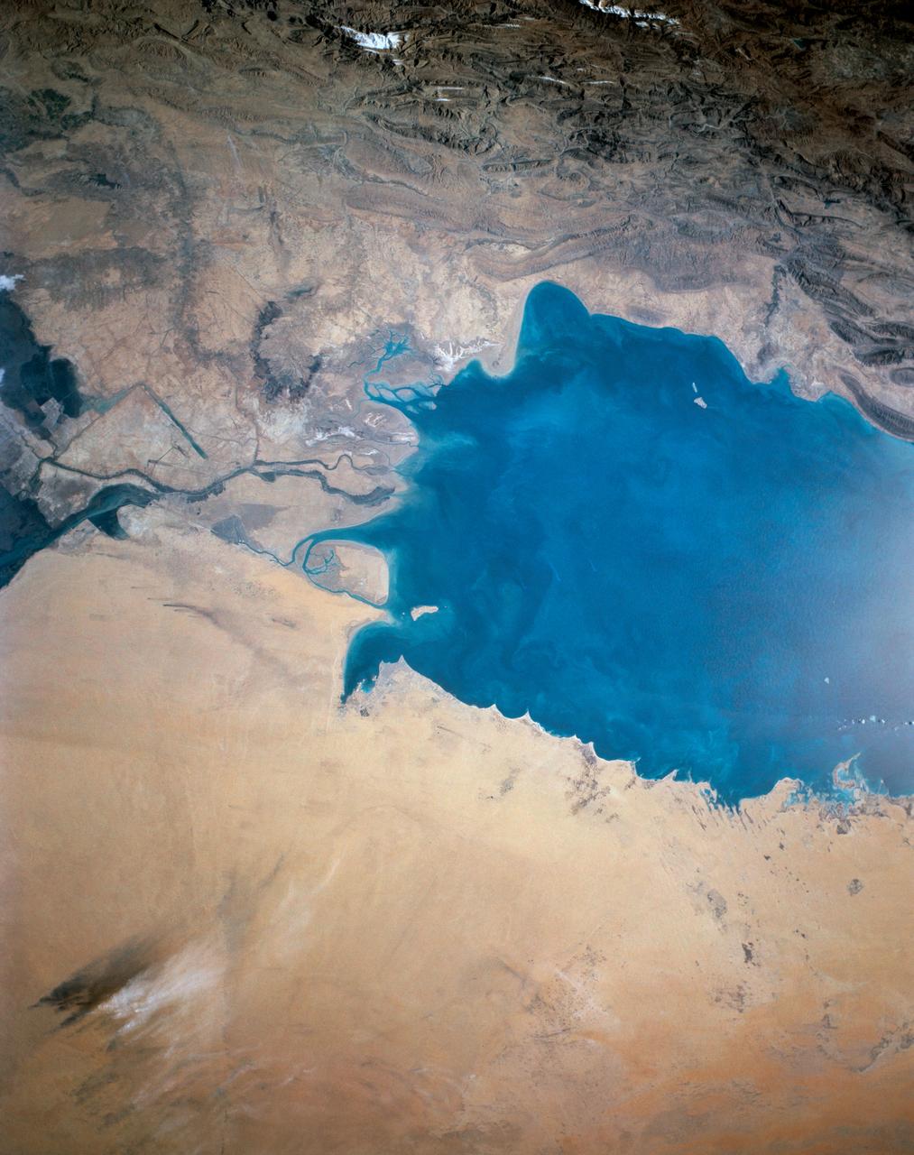
This view of the northern Persian Gulf shows Kuwait City and the Tigris and Euphrates River Deltas (29.5N, 48.5E). The oil laden sands and oil lakes of the Kuwait Oil Fields to the north and south of the city are clearly visible as dark patches surrounded by oil free desert sands. Comparison with earlier photos indicate that the oil laden sands are slowly being covered with clean sand carried by strong NW winds called Shmals.
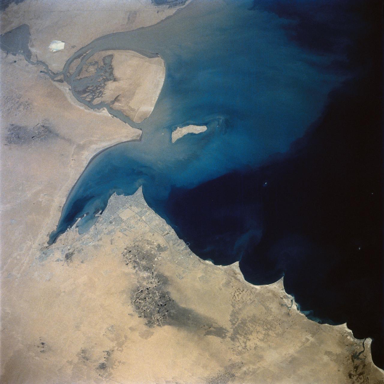
STS027-152-004 (2-6 Dec. 1988) --- Crew members for the STS-27 mission aboard the Earth-orbiting space shuttle Atlantis took this photo of the south Persian Gulf. with a hand-held, large format camera. The mouths of both the Tigris and Euphrates Rivers can be seen, as can nearly all the country of Kuwait. Photo credit: NASA
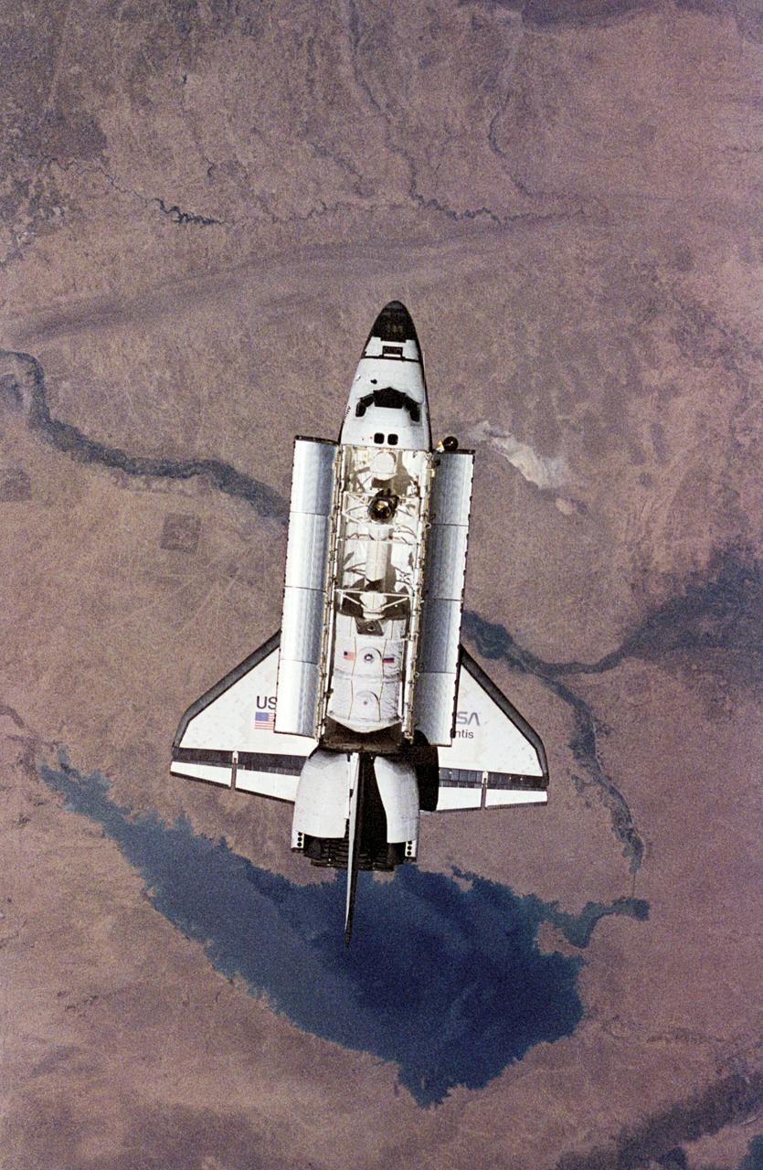
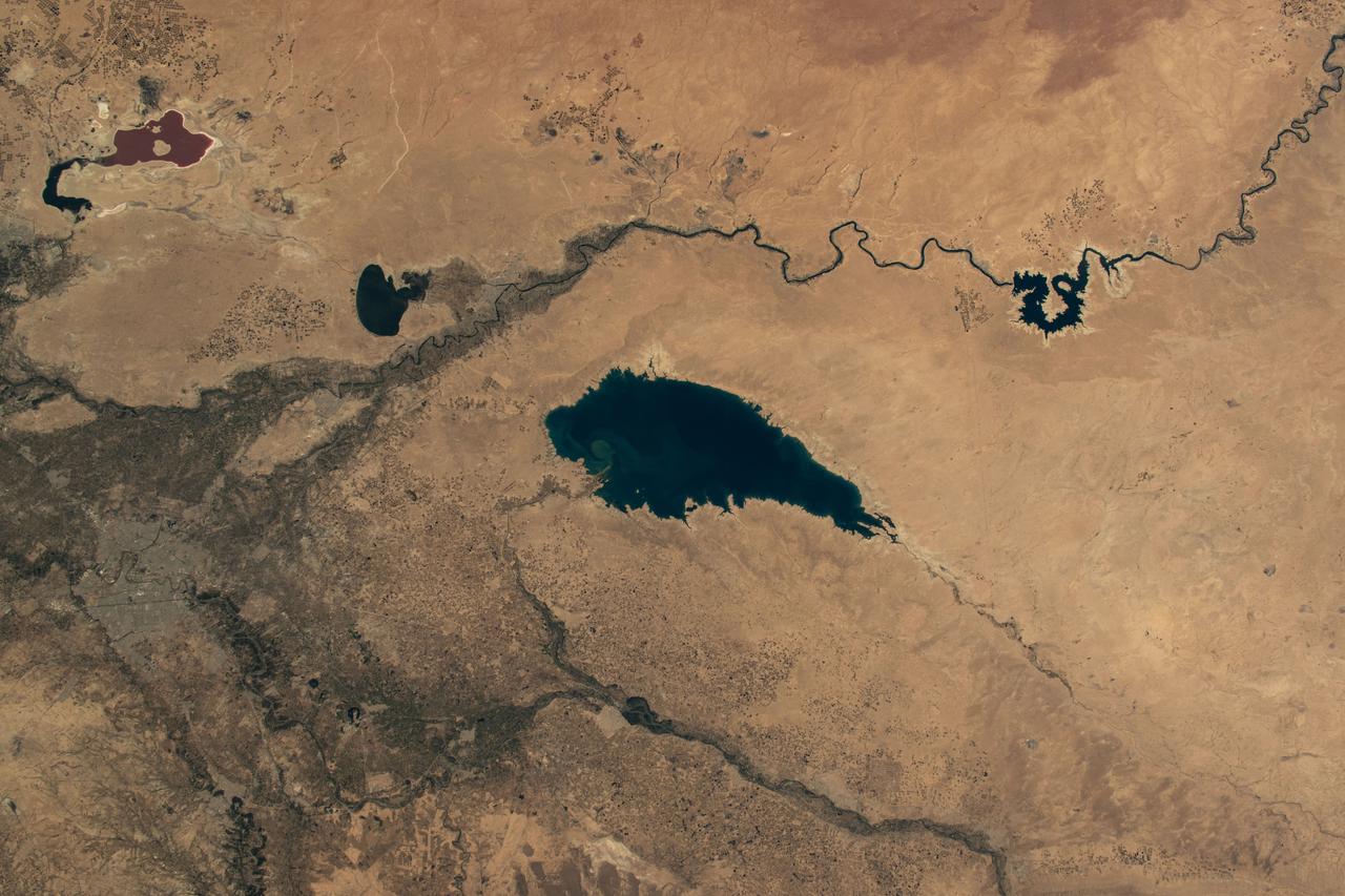
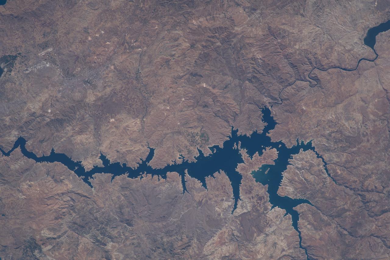
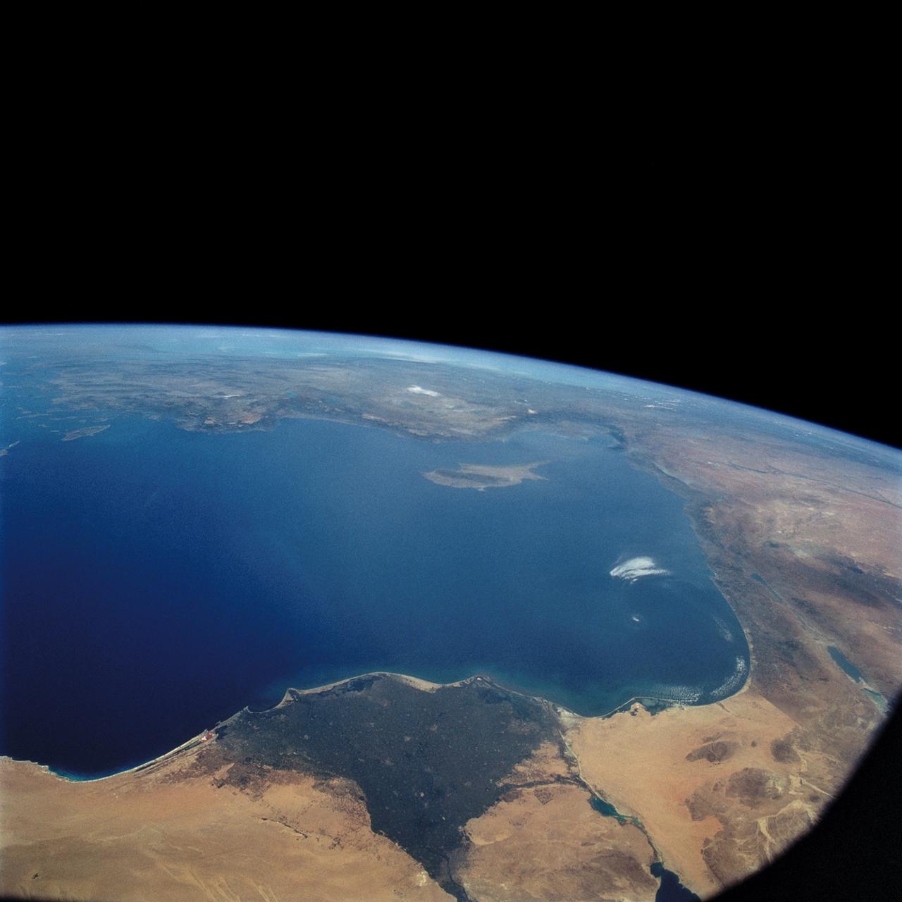
NM18-309-018 (28 June 1995) --- The Space Shuttle Atlantis orbits Earth at a point above Iraq as photographed by one of the Mir-18 crew members aboard Russia's Mir Space Station. The image was photographed prior to rendezvous and docking of the two spacecraft. The Spacelab science module and the tunnel connecting it to the crew cabin, as well as the added mechanism for interface with the Mir's docking system can be easily seen. The geography pictured is 60 miles northwest of Baghdad. The Buhayrat Ath Tharthar (reservoir) is the widest body of water visible. Also seen are the Tigris and Euphrates Rivers.
ISS040-E-113700 (31 Aug. 2014) --- This panorama view, photographed by an Expedition 40 crew member on the International Space Station, shows tan-colored dust of a major dust storm obscuring the Persian Gulf and the its northern shoreline. Strong north winds often blow in summer, churning up dust from the entire length of the desert surfaces of the Tigris and Euphrates valleys (top left). Dust partly obscures the hundreds of kilometers of Iraq’s light-green agricultural lands along these rivers (left). A line of thunderstorms is being set off by the Zagros Mountains of Iran (right), with the setting sun casting long shadows from the thunderheads. Space station crews see sixteen sunrises and sunsets every day from low Earth orbit. Here the crew captured dusk in a darkening Iranian landscape (right).
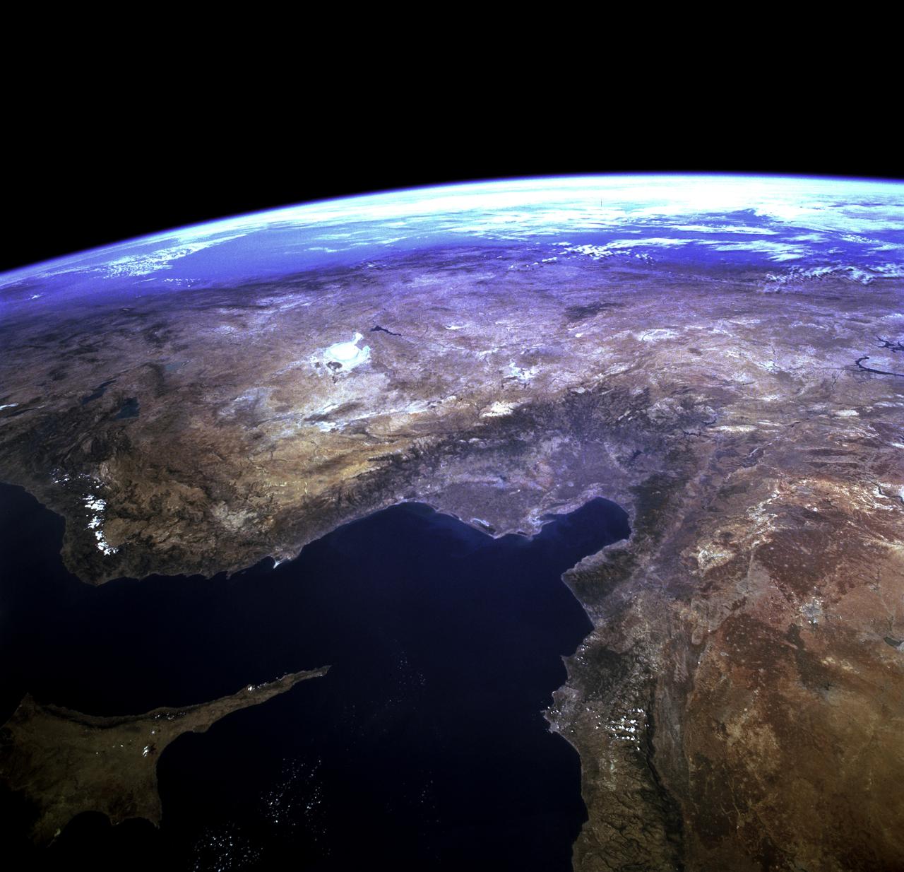
STS073-723-054 (21 October 1995) --- Central Turkey dominates this north-looking panorama, with the long fingered island of Cyprus lower left, surrounded by the deep blue waters of the Mediterranean Sea. Turkey's capital, Ankara, lies just north of the white bed of a dry lake in the center of the view. The city is supplied with water from the neighboring blue lake. The coast of Syria and Lebanon appear bottom right. Man-made lakes on the upper Euphrates River in eastern Turkey appear extreme right. According to scientists studying the STS-73 photo collection, the striking difference in visibility to north and south of Turkey suggests a pollution event over the Black Sea. Air pollution from East European industry flows down into the Black Sea basin, especially at the west end (haze top left) as shown in this view (compare clearer air top right).
STS057-73-075 (21 June-1 July 1993) --- Eastern Mediterranean from an unusually high vantage point over the Nile River, this north-looking view shows not only the eastern Mediterranean but also the entire landmass of Asia Minor, with the Black Sea dimly visible at the horizon. Many of the Greek islands can be seen in the Aegean Sea (top left), off the coast of Asia Minor. Cyprus is visible under atmospheric dust in the northeast corner of the Mediterranean. The dust cloud covers the east end of the Mediterranean, its western edge demarcated by a line that cuts the center of the Nile Delta. This dust cloud originated far to the west, in Algeria, and moved northeast over Sicily, southern Italy, and Greece. Part of the cloud then moved on over the Black Sea, but another part swerved southward back towards Egypt. A gyre of clouds in the southeast corner of the Mediterranean indicates a complementary counterclockwise (cyclonic) circulation of air. The Euphrates River appears as a thin green line (upper right) in the yellow Syrian Desert just south of the blue-green mountains of Turkey. The Dead Sea (lower right) lies in a rift valley which extends north into Turkey and south thousands of miles down the Gulf of Aqaba, the Red Sea, and on through East Africa. The straight international boundary between Israel and Egypt (where the coastline angles) is particularly clear in this view, marked by the thicker vegetation on the Israeli side of the border. The green delta of the Nile River appears in the foreground, with the great conurbation of Cairo seen as a gray area at the apex of the triangle. Most of Egypt's 52 million inhabitants live in the delta. On the east side of the delta, the Suez Canal is visible. On the western corner of the delta lies the ancient city of Alexandria, beside the orange and white salt pans. The World War II battlesite El Alamein lies on the coast.