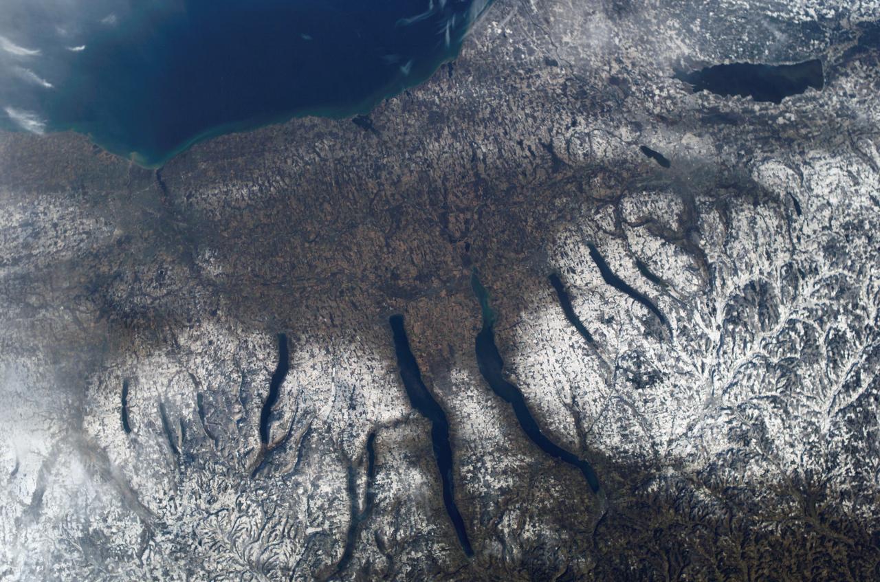
This view of the central portion of upstate New York, centers on the Finger Lakes. The large city on the shore of Lake Ontario, is Rochester. Although the city, being a business, educational and technical center, has no heavy industry, the outline of the city shows fairly well in the snow, but not as well as the outlines of industrial cities elsewhere in the world. The Finger Lakes are large linear lakes carved out by glaciers during the last ice age.
51B-33-028 (29 April-6 May 1985) --- An excellent view of the Finger Lakes area of New York, and including Lake Ontario and a small part of Ontario. The lakes are fjord-like remnants of the glacial era. The cities of Rochester, Syracuse, and Utica can be seen.
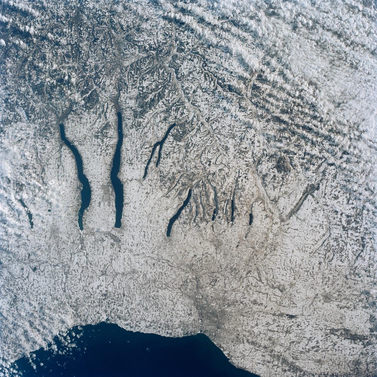
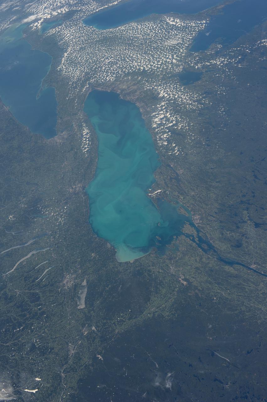
ISS010-E-09366 (4 December 2004) --- New York’s Finger Lakes region is featured in this digital image photographed by an Expedition 10 crewmember on the International Space Station. Shapes of the snow-covered hills are accented by the low sun angles, and contrast with the darker, finger-shaped lakes filling the region’s valleys. Scientists believe the steep, roughly parallel valleys and hills of the Finger Lakes region were shaped by advancing and retreating ice sheets that were as much as 2 miles deep during the last ice age. River valleys were scoured into deep troughs; many are now filled with lakes. The two largest lakes, Seneca and Cayuga, are so deep that the bases of their lakebeds are below sea level. The cities of Rochester, Syracuse and Ithaca are included in this field-of-view, as seen from the Space Station. These three cities enjoy large seasonal snowpacks, thanks to the influence of the Great Lakes producing lake-effect snowstorms. According to NASA scientists studying the Space Station imagery, despite its reputation for long winters, the region is balmy compared with the glacial climate present when the landscape was carved. Scientists believe, at the time of the greatest ice extent, yearly average temperatures over northern North America were several degrees lower than today.
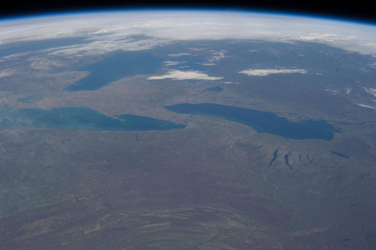
ISS028-E-013202 (4 July 2011) --- This nadir view from the International Space Station, flying at an altitude of approximately 220 miles, shows parts of two countries, including the Finger Lakes area of New York and part of two Great Lakes -- Ontario and Erie and the Niagara River, which connects them.
ISS035-E-034025 (2 May 2013) --- One of the Expedition 35 crew members aboard the Earth-orbiting International Space Station recorded this day time panorama, "looking" toward the west, which covers many of the Great Lakes. New York's Finger Lakes, in the bottom portion of the frame, appear near the bottom of the frame.
ISS028-E-013201 (4 July 2011) --- This nadir view from the International Space Station, flying at an altitude of approximately 220 miles, shows parts of two countries, including the Finger Lakes area of New York and part of two Great Lakes -- Ontario and Erie and the Niagara River, which connects them.
STS077-162-036 (19-29 May 1996) --- An oblique view of eastern New York State, Lake Ontario and the Saint Lawrence River. This view of New York State looking northeast was provided by the crew members of the mission. The Linhof camera, a 4x5 format instrument, provides a wide panorama of the region. If the picture is oriented with the NASA logo to the left bottom corner, North will be to the upper side of the frame. Lake Ontario is in the upper left corner and the Catskills are in the lower portion of the scene. The Finger Lakes from Cayuga to Oneida are in the left-center. One of the remarkable aspects of this photograph is this part of New York only averages 68 cloud free days per year. According to scientists studying the photo collection, the entire area of this photograph was covered by glaciers during the ice ages. The glaciers left their marks in the creation of the Finger Lakes and the formation of Lake Ontario.
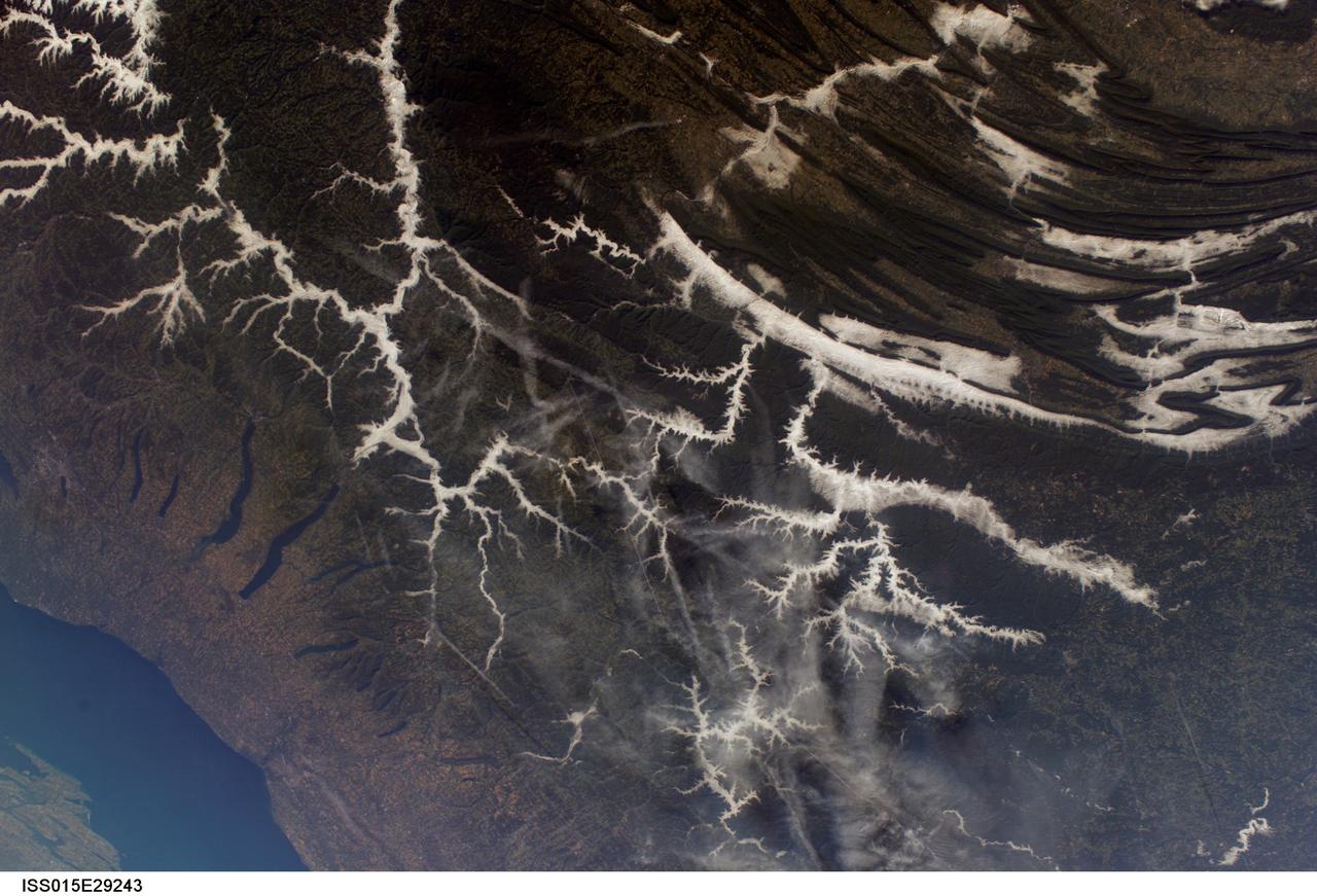
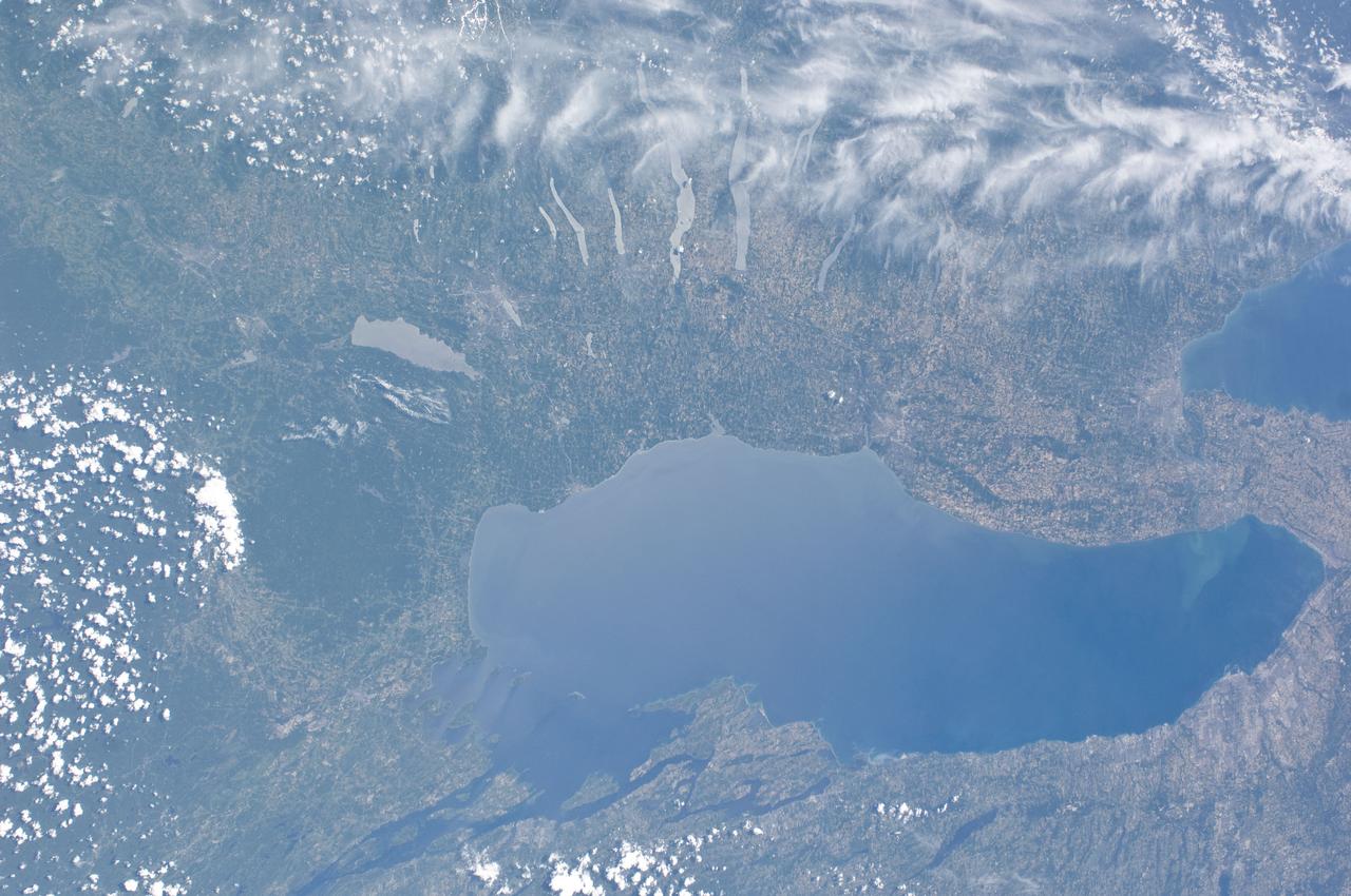
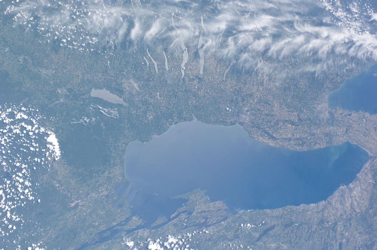
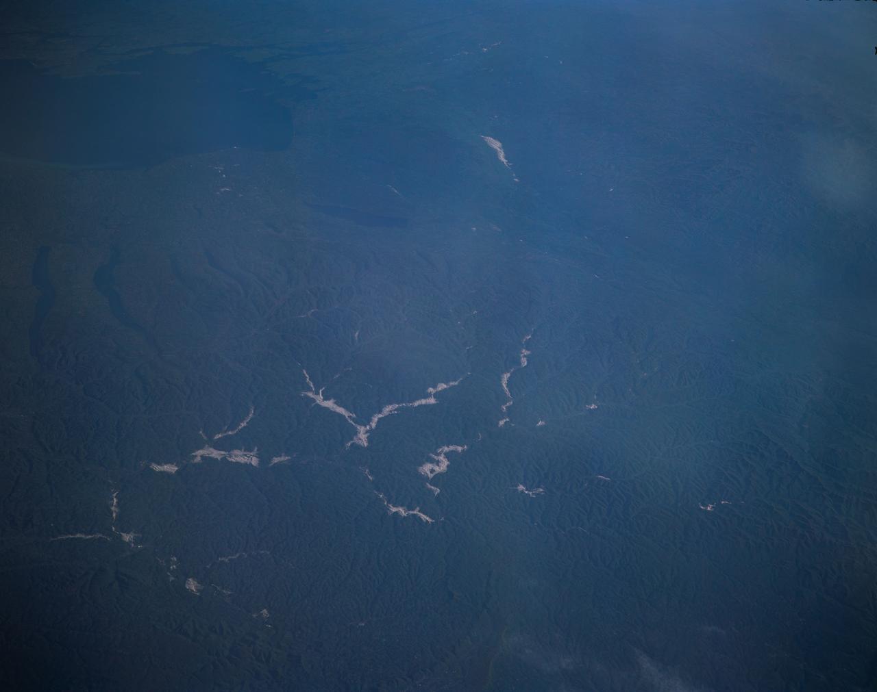
ISS015-E-029243 (25 Sept. 2007) --- Sun glint on several rivers in New York and Pennsylvania dominates this view from the International Space Station, photographed by one of the Expedition 15 crew members on Sept. 25, 2007. A small section of Lake Ontario is visible at bottom left, with New York's Finger Lakes easily recognizable above and to the right of it.

STS073-723-054 (21 October 1995) --- Central Turkey dominates this north-looking panorama, with the long fingered island of Cyprus lower left, surrounded by the deep blue waters of the Mediterranean Sea. Turkey's capital, Ankara, lies just north of the white bed of a dry lake in the center of the view. The city is supplied with water from the neighboring blue lake. The coast of Syria and Lebanon appear bottom right. Man-made lakes on the upper Euphrates River in eastern Turkey appear extreme right. According to scientists studying the STS-73 photo collection, the striking difference in visibility to north and south of Turkey suggests a pollution event over the Black Sea. Air pollution from East European industry flows down into the Black Sea basin, especially at the west end (haze top left) as shown in this view (compare clearer air top right).
ISS036-E-035635 (24 Aug. 2013) --- Plankton bloom and Lake Ontario are featured in this image photographed by an Expedition 36 crew member on the International Space Station. This photograph highlights a late summer plankton bloom visible throughout much of Lake Ontario (one of the Great Lakes, together with Michigan, Superior, Erie, and Huron). Cyanobacteria, or blue-green algae, can reach such large concentrations that they color the water to such an extent that the change is visible from orbit. Harmful algal blooms, or HABs, have been observed in all of the Great Lakes – particularly Lake Erie - and are associated with a variety of causative factors including changes in precipitation; drought; invasive species (quagga, zebra mussels, Asian carp); nutrient loading from runoff and sewage (nitrogen and phosphorus); and warmer average temperatures. In addition to reduced water quality and human health concerns, algal blooms can also lead to hypoxia (reduction of oxygen in the bottom waters) that kills large numbers of fish and other aquatic life. Lake Ontario, like the other Great Lakes Erie, Huron, and Superior is roughly divided between the USA and Canada. The USA side of Lake Ontario has its shoreline along the state of New York, while its Canadian shoreline lies within the province of Ontario. The city of Kingston, Ontario, is visible near the Saint Lawrence River outflow from the lake. Several other landscape features of New York State are visible in the image, including the Finger Lakes region to the west of Syracuse, NY (upper left). To the northeast of Syracuse, the dark wooded slopes of the Adirondack Mountains are visible at lower right. Patchy white cloud cover obscures much of the land surface to the west of Lake Ontario.
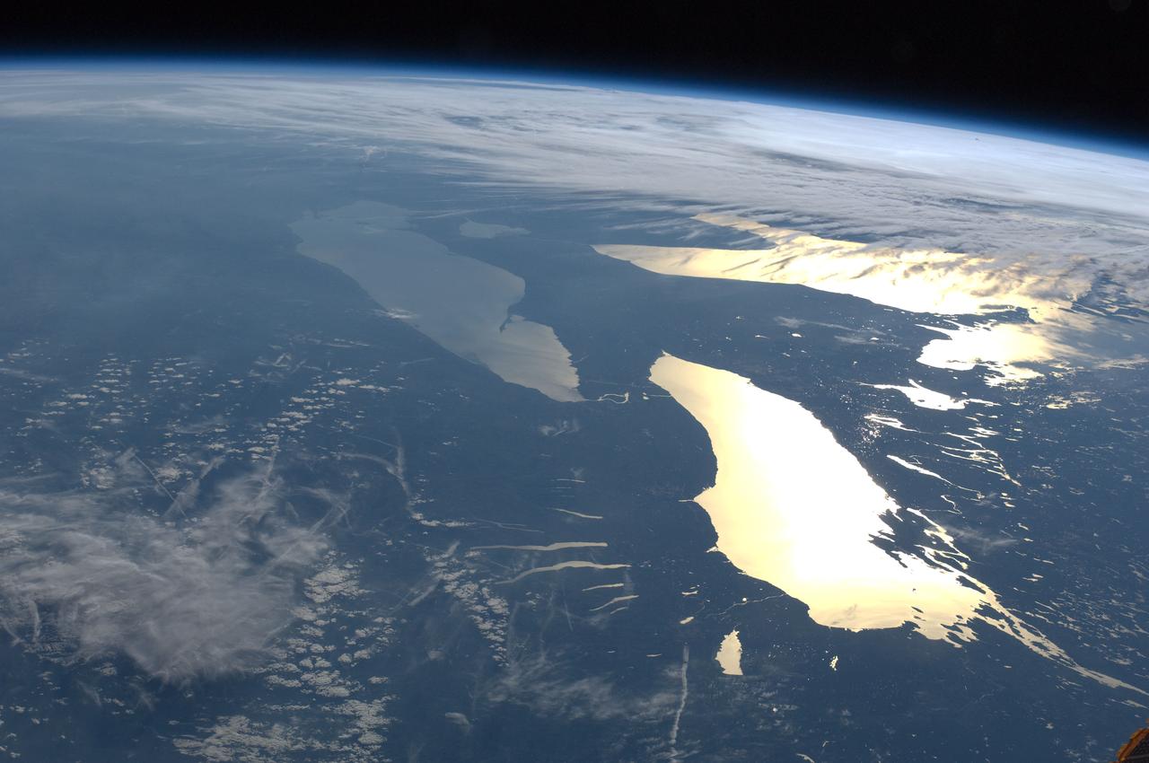
ISS031-E-123071 (14 June 2012) --- The Great Lakes in sunglint are featured in this image photographed by an Expedition 31 crew member on the International Space Station. From the vantage point of the space station, crew members observe many spectacular phenomena including aurora, noctilucent clouds, airglow, and sunglint on Earth?s water bodies. Sunglint is light reflected off of a water surface towards the observer such that it creates the appearance of a mirror-like surface. If the viewing and lighting conditions are ideal, that mirror-like surface can extend over very large areas, such as the entire surface of Lake Ontario (approximately 18,960 square kilometers). This photograph was taken while the space station was located over a point to the southeast of Nova Scotia (approximately 1,200 kilometers ground distance from the center point of the image). Lake Ontario, Lake Huron, the Finger Lakes of upstate New York, and numerous other bodies of water appear brilliantly lit by sunglint. To the west, Lake Erie is also highlighted by sunglint, but less light is being reflected back towards the observer resulting in a duller appearance. Much of central Canada is obscured by extensive cloud cover in the image, whereas a smaller grouping of clouds obscures the Appalachian range and Pennsylvania (lower left). The blue envelope of Earth?s atmosphere is visible above the curved limb, or horizon line that extends across the upper third of the image. Such panoramic views of the planet are readily taken through space station viewing ports with handheld digital cameras which allow the crew to take advantage of the full range of viewing angles.
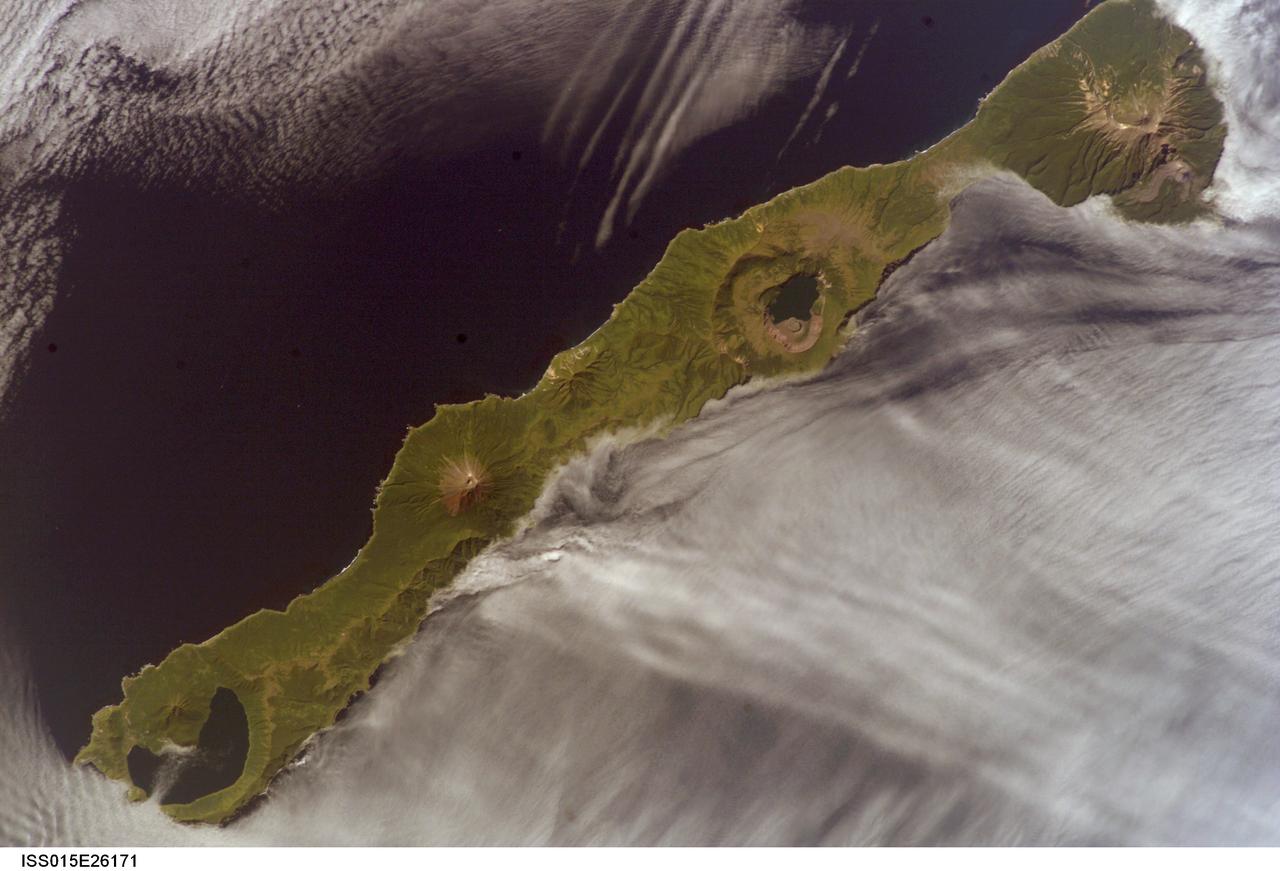
ISS015-E-26171 (1 Sept. 2007) --- Simushir Island, Kuril Archipelago, Russian Far East, is featured in this image photographed by an Expedition 15 crewmember on the International Space Station. Simushir is a deserted, 5-mile-wide volcanic island in the Kuril island chain, half way between northern Japan and the Kamchatka Peninsula of Russia. Four volcanoes - Milne, Prevo, Urataman and Zavaritski - have built cones that are high enough to rise above the altitude of green forest. The remaining remnant of Zavaritski volcano is a caldera -- a structure formed when a volcano collapses into its emptied magma chamber. A small lake fills the innermost of three nested calderas which make up Zavaritski Caldera. The larger caldera of Urataman Volcano is connected to the sea. A defunct Soviet naval base occupies the northern tip of the island next to this caldera. The islands and volcanoes of the Kuril chain are part of the Pacific Rim of Fire, marking the edge of the Pacific tectonic plate. Low stratus clouds approaching from the northwest (from the Sea of Okhotsk--top left) bank up against the northwest side of the island, making complex cloud patterns. A small finger of cloud can be seen entering the northernmost caldera (Urataman) at sea level. When this image was taken, the cloud layer had stopped at the northwest coast of the island, not flowing over even the low points of the island between the volcanoes. The cloud pattern suggests that the air mass flowed up and over the island, descending on the southeast side. This descending motion was enough--under stable atmospheric conditions--to warm up the atmosphere locally so that a cloud-free zone formed on the southeastern, lee side of the island.