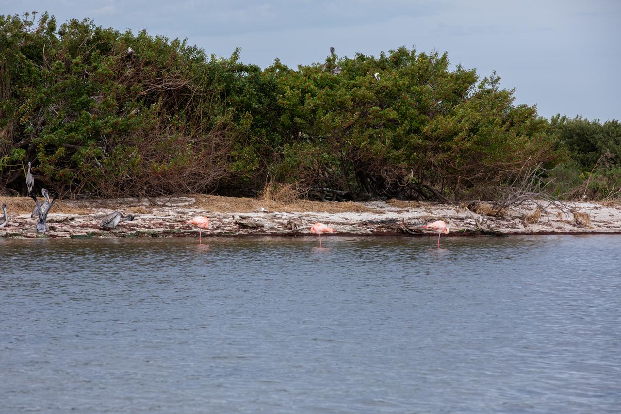
American Flamingos cool off in the Indian River at Haulover Canal on Merritt Island on Thursday, Jan. 11, 2024. The American Flamingos are more common in Mexico and Cuba but the winds from Hurricane Idalia relocated them to Florida in September 2023. Kennedy Space Center in Florida shares a border with the Merritt Island National Wildlife Refuge where more than 310 species of birds inhabit the refuge.
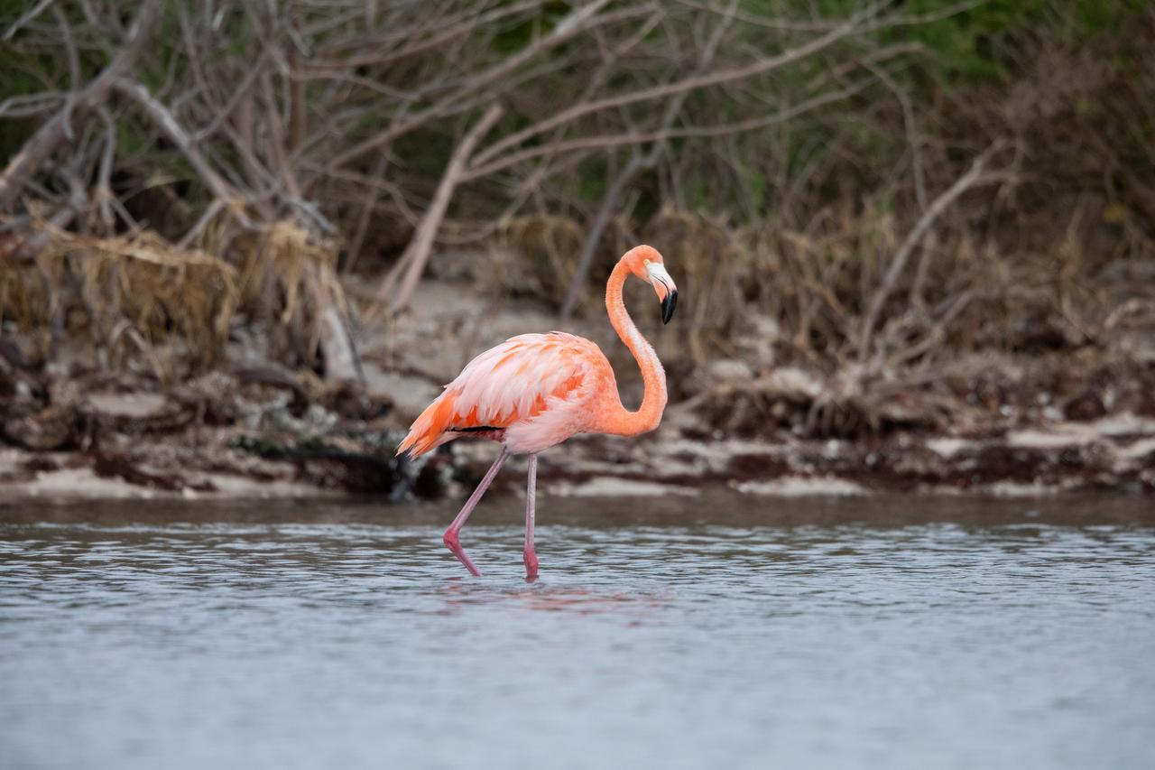
An American Flamingo cools off in the Indian River at Haulover Canal on Merritt Island on Thursday, Jan. 11, 2024. The American Flamingos are more common in Mexico and Cuba but the winds from Hurricane Idalia relocated them to Florida in September 2023. Kennedy Space Center in Florida shares a border with the Merritt Island National Wildlife Refuge where more than 310 species of birds inhabit the refuge.
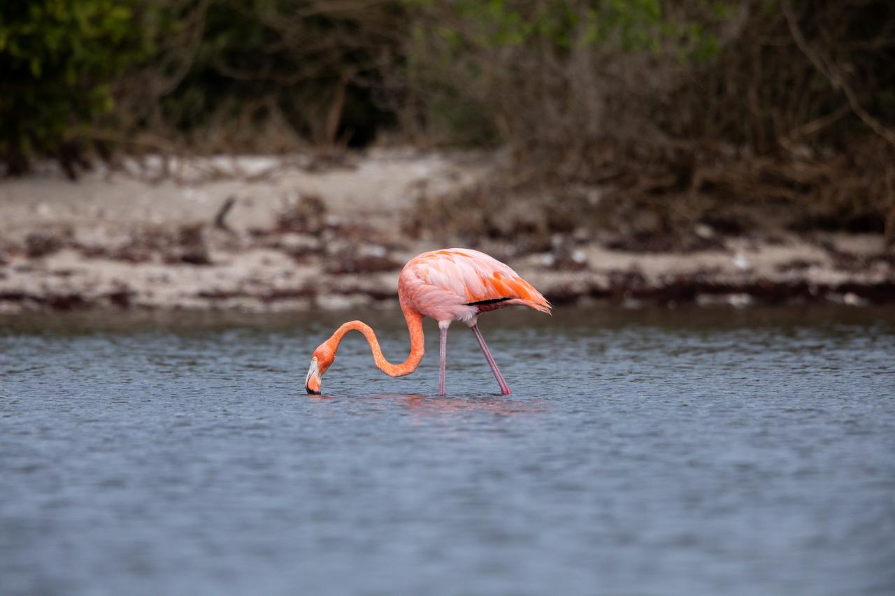
An American Flamingo takes a sip of water in the Indian River at Haulover Canal on Merritt Island on Thursday, Jan. 11, 2024. The American Flamingos are more common in Mexico and Cuba but the winds from Hurricane Idalia relocated them to Florida in September 2023. Kennedy Space Center in Florida shares a border with the Merritt Island National Wildlife Refuge where more than 310 species of birds inhabit the refuge.
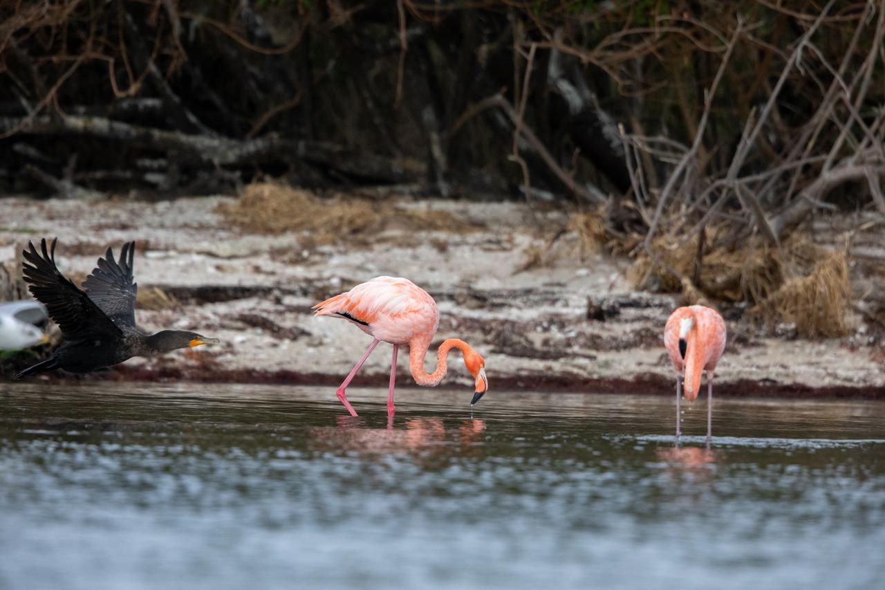
Three American Flamingos cool off in the Indian River at Haulover Canal on Merritt Island on Thursday, Jan. 11, 2024. The American Flamingos are more common in Mexico and Cuba but the winds from Hurricane Idalia relocated them to Florida in September 2023. Kennedy Space Center in Florida shares a border with the Merritt Island National Wildlife Refuge where more than 310 species of birds inhabit the refuge.

ISS012-E-06469 (3 Nov. 2005) --- A portion of Lake Poopo is featured in this image photographed by an Expedition 12 crewmember on the International Space Station. Lake Poopo sits high in the Bolivian Andes, catching runoff from its larger neighbor to the north - Lake Titicaca (not shown) - by way of the Desaguadero River (muddy area at the north end of the lake). Because Lake Poopo is very high in elevation (roughly 3400 meters or 11,000 feet above sea level), very shallow (generally less than 3 meters or 9 feet), and the regional climate is very dry, small changes in precipitation in the surrounding basin have large impacts on the water levels and areal extent of Lake Poopo. When the lake fills during wet periods, Poopo drains from the south end into Salar de Coipasa (not shown). Water levels in Poopo are important because it is one of South America’s largest saline lakes, and a prime stop for migratory birds, including flamingoes. NASA managers have tasked the station crew to track such changes, which are related to regional weather patterns. Lake Poopo’s sensitivity to precipitation in the high Andes (possibly reflecting larger climate cycles) provides an excellent visual indicator of these trends.
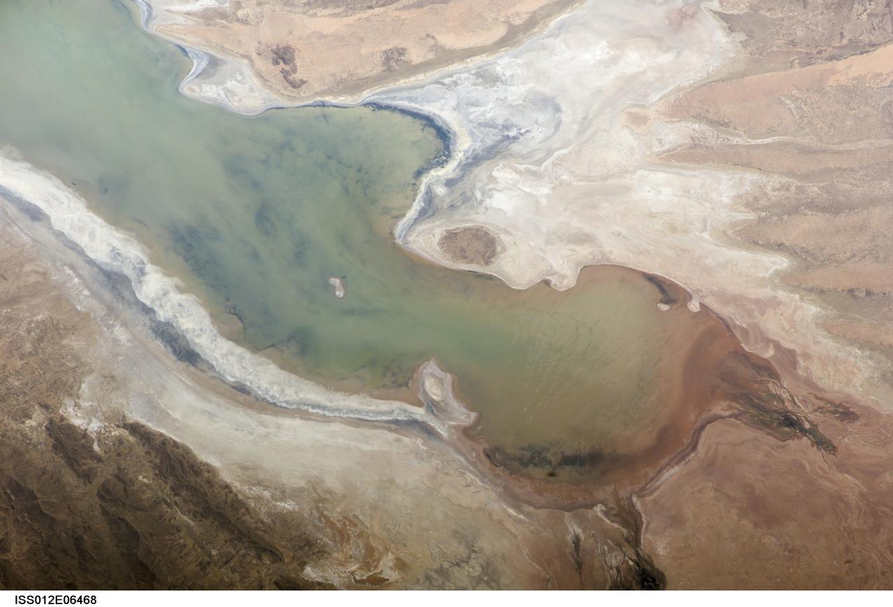
ISS012-E-06468 (3 Nov. 2005) --- A portion of Lake Poopo is featured in this image photographed by an Expedition 12 crewmember on the International Space Station. Lake Poopo sits high in the Bolivian Andes, catching runoff from its larger neighbor to the north - Lake Titicaca (not shown) - by way of the Desaguadero River (muddy area at the north end of the lake). Because Lake Poopo is very high in elevation (roughly 3400 meters or 11,000 feet above sea level), very shallow (generally less than 3 meters or 9 feet), and the regional climate is very dry, small changes in precipitation in the surrounding basin have large impacts on the water levels and areal extent of Lake Poopo. When the lake fills during wet periods, Poopo drains from the south end into Salar de Coipasa (not shown). Water levels in Poopo are important because it is one of South America’s largest saline lakes, and a prime stop for migratory birds, including flamingoes. NASA managers have tasked the station crew to track such changes, which are related to regional weather patterns. Lake Poopo’s sensitivity to precipitation in the high Andes (possibly reflecting larger climate cycles) provides an excellent visual indicator of these trends.
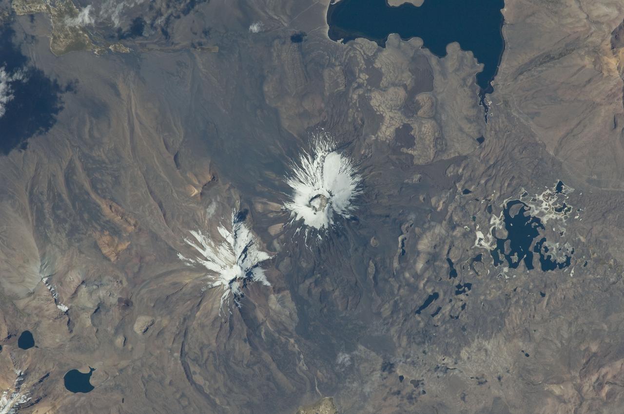
ISS029-E-020003 (7 Oct. 2011) --- Parinacota Volcano in the Chile-Bolivia border region, South America is featured in this image photographed by an Expedition 29 crew member on the International Space Station. Volcan Parinacota (?flamingo lake? in the regional Aymara language) is a potentially active stratovolcano located on the Altiplano, a high plateau situated within the Andes Mountains of west-central South America. While no direct observations of eruptive activity are recorded, surface exposure age-dating of lava flows suggests that activity occurred as recently as 290 AD approximately 300 years, according to scientists. Local Aymara stories also suggest that the volcano has erupted during the past 1,000 years. This detailed photograph highlights the symmetrical cone of Parinacota, with its well-developed summit crater (elevation 6,348 meters above sea level) at center. Dark brown to dark gray surfaces to the east and west of the summit include lava flows, pyroclastic deposits, and ash. A companion volcano, Pomerape, is located across a low saddle to the north ? scientists believe this volcano last erupted during the Pleistocene Epoch (extending from approximately 3 million to 12,000 years ago). The summits of both volcanoes are covered by white permanent snowpack and small glaciers. Together, the two volcanoes form the Nevados de Payachata volcanic area. Eruptive activity at Parinacota has directly influenced development of the local landscape beyond the emplacement of volcanic deposits ? approximately 8,000 years ago the western flank of the volcano collapsed, creating a debris avalanche that traveled 22 kilometers to the west. This debris avalanche blocked drainages, leading to the formation of Lake Chungara to the south (upper right). The uneven, hummocky surface of the debris avalanche deposit provides ample catchments for water, as evidenced by the numerous small ponds and Cotacotani Lake to the west.
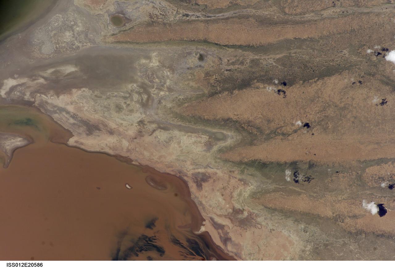
ISS012-E-20586 (9 March 2006) --- A portion of Lake Poopo is featured in this image photographed by an Expedition 12 crewmember on the International Space Station. Lake Poopo sits high in the Bolivian Andes, catching runoff from its larger neighbor to the north - Lake Titicaca (not shown) - by way of the Desaguadero River (muddy area at the north end of the lake). Because Lake Poopo is very high in elevation (roughly 3400 meters or 11,000 feet above sea level), very shallow (generally less than 3 meters or 9 feet), and the regional climate is very dry, small changes in precipitation in the surrounding basin have large impacts on the water levels and areal extent of Lake Poopo. When the lake fills during wet periods, Poopo drains from the south end into Salar de Coipasa (not shown). Water levels in Poopo are important because it is one of South America’s largest saline lakes, and a prime stop for migratory birds, including flamingoes. Last November, water levels had dropped, exposing large tracts of salt and mud flats. A wet and cool period between December and the end of February resulted in flooding of Poopo with muddy waters from the Desaguadero River. NASA managers have tasked the station crew to track such changes, which are related to regional weather patterns. Lake Poopo’s sensitivity to precipitation in the high Andes (possibly reflecting larger climate cycles) provides an excellent visual indicator of these trends.
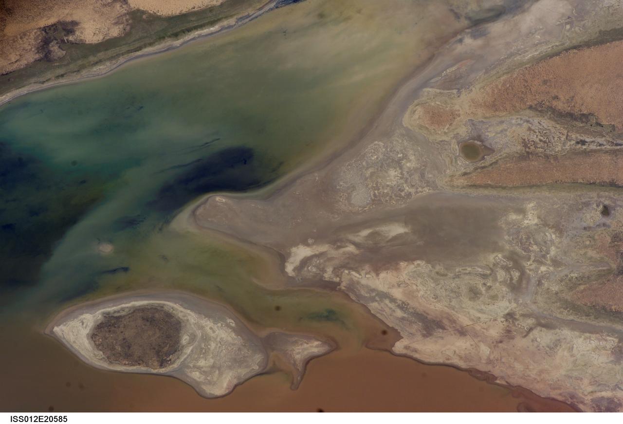
ISS012-E-20585 (9 March 2006) --- A portion of Lake Poopo is featured in this image photographed by an Expedition 12 crewmember on the International Space Station. Lake Poopo sits high in the Bolivian Andes, catching runoff from its larger neighbor to the north - Lake Titicaca (not shown) - by way of the Desaguadero River (muddy area at the north end of the lake). Because Lake Poopo is very high in elevation (roughly 3400 meters or 11,000 feet above sea level), very shallow (generally less than 3 meters or 9 feet), and the regional climate is very dry, small changes in precipitation in the surrounding basin have large impacts on the water levels and areal extent of Lake Poopo. When the lake fills during wet periods, Poopo drains from the south end into Salar de Coipasa (not shown). Water levels in Poopo are important because it is one of South America’s largest saline lakes, and a prime stop for migratory birds, including flamingoes. Last November, water levels had dropped, exposing large tracts of salt and mud flats. A wet and cool period between December and the end of February resulted in flooding of Poopo with muddy waters from the Desaguadero River. NASA managers have tasked the station crew to track such changes, which are related to regional weather patterns. Lake Poopo’s sensitivity to precipitation in the high Andes (possibly reflecting larger climate cycles) provides an excellent visual indicator of these trends.
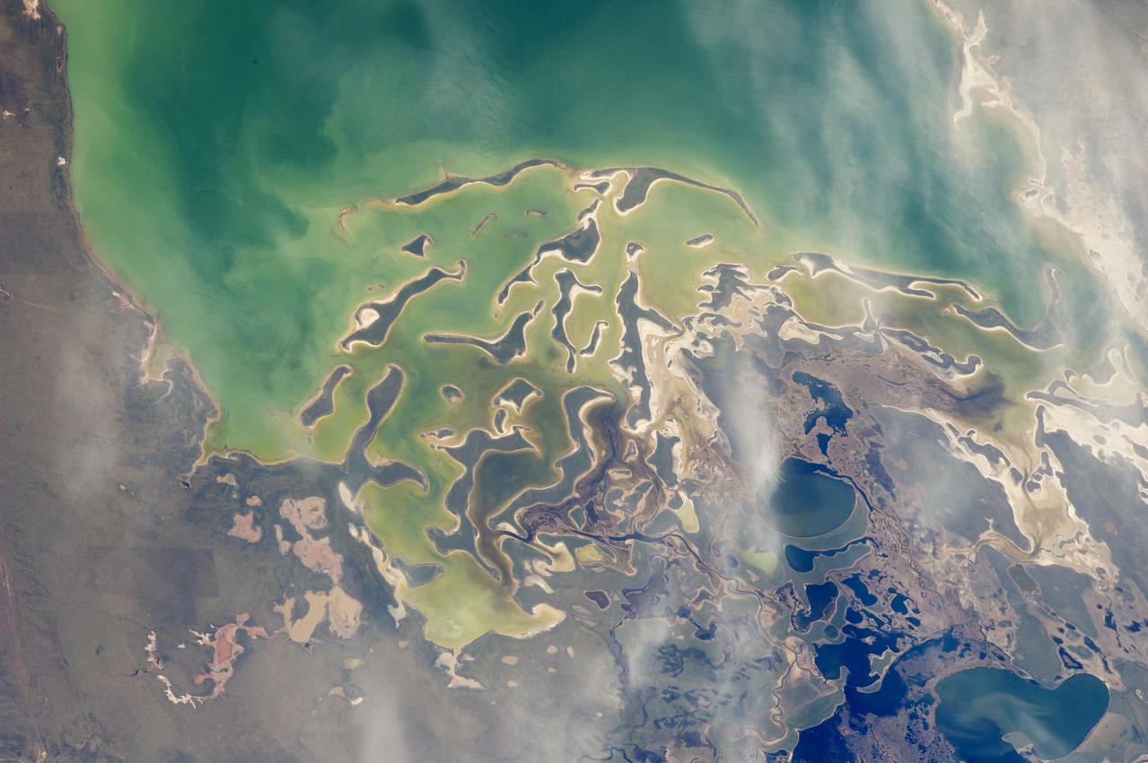
In orbit above the semi-desert grasslands in Kazakhstan, an astronaut aboard the International Space Station spotted one of the few features that stand out. Lake Tengiz is the only large lake (1590 square kilometers, 615 square miles) in northern Kazakhstan. Through white wisps of cloud, the crew member photographed the 50 kilometer-long eastern shore of the lake, with its thin, winding islands and white beaches. The islands and intervening waterways make a rich habitat for birds in this part of Asia. At least 318 species of birds have been identified at the lake; 22 of them are endangered. It is the northernmost habitat of the pink flamingo. The lake system is Kazakhstan’s first UNESCO World Heritage Site, and it has been declared a RAMSAR wetland site of international importance. Part of the richness of area is its complex hydrology. Fresh water enters the system via the Kulanutpes River, so there are small lakes (lower right) full of fresh water. But in this closed basin, the water in the main lake (top) slowly evaporates, becoming salty. Winds stir up bigger waves on the main lake, dispersing sediment and salt and making the water a cloudier and lighter blue-green. (Another astronaut photograph shows the entire lake system, while this story provides more information.) The strange shape of the islands is not easy to interpret. They may be drowned remnants of delta distributaries of the Kulanutpes River. Westerly winds probably have had a smoothing effect on the shorelines, especially in a shallow lake like Tengiz, which is only about 6 meters (20 feet) deep. The lake has an exciting history for people who follow space exploration. In 1976, a Soyuz spacecraft landed in the lake near the north shore (top right). The capsule crashed through the ice and sank during an October snowstorm when temperatures were -22°C (-8°F). Because of low power, the capsule was unheated and the crew was feared lost. It was many hours before the airtight capsule was located and divers could attach flotation tanks to get the capsule to the surface. It was then dragged ashore across the ice by helicopter. The rescue effort took nine hours before the crew was able to safely exit the capsule. Credit: <b><a href="http://www.earthobservatory.nasa.gov/" rel="nofollow"> NASA Earth Observatory</a></b> <b><a href="http://www.nasa.gov/audience/formedia/features/MP_Photo_Guidelines.html" rel="nofollow">NASA image use policy.</a></b> <b><a href="http://www.nasa.gov/centers/goddard/home/index.html" rel="nofollow">NASA Goddard Space Flight Center</a></b> enables NASA’s mission through four scientific endeavors: Earth Science, Heliophysics, Solar System Exploration, and Astrophysics. Goddard plays a leading role in NASA’s accomplishments by contributing compelling scientific knowledge to advance the Agency’s mission. <b>Follow us on <a href="http://twitter.com/NASAGoddardPix" rel="nofollow">Twitter</a></b> <b>Like us on <a href="http://www.facebook.com/pages/Greenbelt-MD/NASA-Goddard/395013845897?ref=tsd" rel="nofollow">Facebook</a></b> <b>Find us on <a href="http://instagrid.me/nasagoddard/?vm=grid" rel="nofollow">Instagram</a></b>