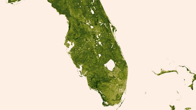
A "river of grass" extending south of Lake Okeechobee shows how the area was modified by man with visible areas of dense agriculture, urban sprawl and water conservation areas delineated by a series of waterways that crisscross Southern Florida. The image was created March 18-24, 2013 from the Visible-Infrared Imager/Radiometer Suite (VIIRS) instrument aboard the Suomi National Polar-orbiting Partnership or Suomi NPP satellite, a partnership between NASA and the National Oceanic and Atmospheric Administration, or NOAA. Credit: NASA/NOAA To read more go to: <a href="http://www.nasa.gov/mission_pages/NPP/news/vegetation.html" rel="nofollow">www.nasa.gov/mission_pages/NPP/news/vegetation.html</a> <b><a href="http://www.nasa.gov/audience/formedia/features/MP_Photo_Guidelines.html" rel="nofollow">NASA image use policy.</a></b> <b><a href="http://www.nasa.gov/centers/goddard/home/index.html" rel="nofollow">NASA Goddard Space Flight Center</a></b> enables NASA’s mission through four scientific endeavors: Earth Science, Heliophysics, Solar System Exploration, and Astrophysics. Goddard plays a leading role in NASA’s accomplishments by contributing compelling scientific knowledge to advance the Agency’s mission. <b>Follow us on <a href="http://twitter.com/NASA_GoddardPix" rel="nofollow">Twitter</a></b> <b>Like us on <a href="http://www.facebook.com/pages/Greenbelt-MD/NASA-Goddard/395013845897?ref=tsd" rel="nofollow">Facebook</a></b> <b>Find us on <a href="http://instagram.com/nasagoddard?vm=grid" rel="nofollow">Instagram</a></b>
Florida Everglades is a region of broad, slow-moving sheets of water flowing southward over low-lying areas from Lake Okeechobeeto the Gulf of Mexico. These images fromNASA Terra satellite show the Everglades region on January 16, 2002.
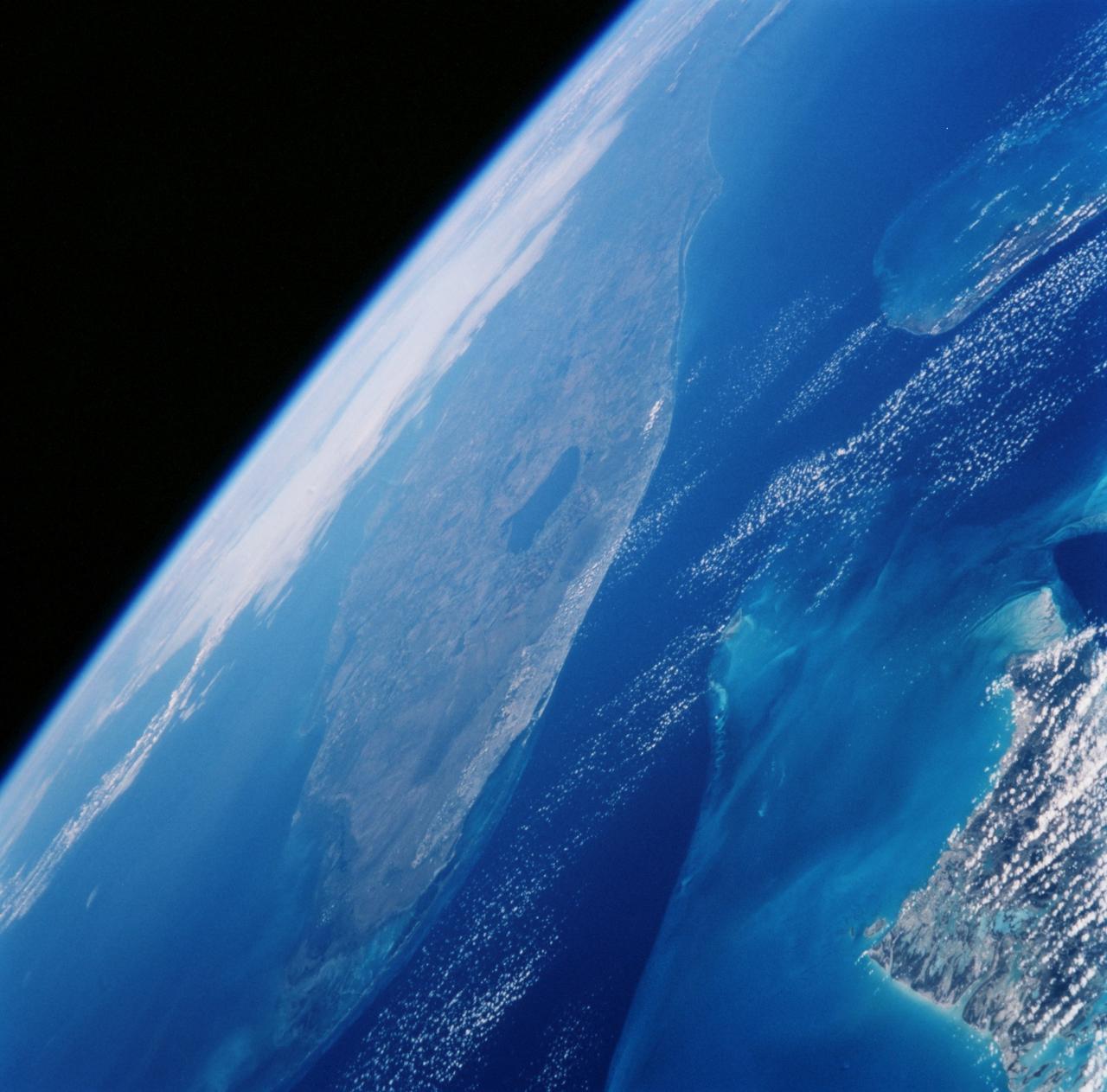
STS099-729-086 (11-22 February 2000) ---In this 70mm frame photographed by one of the STS-99 crew members, the city of Miami encroaches the eastern edge of the Everglades in Florida. The Everglades is an International Biosphere Reserve World Heritage Site. This subtropical wilderness encompasses a relatively flat (does not exceed 2.4 meters above sea level) saw-grass marsh region of 10,000 square kilometers (4,000 square miles). The only source of water in the Everglades is from rainfall. The flow of water is detectable in this image, slowly moving from Lake Okeechobee to Florida Bay; the light blue, shallow area (less than 3 meters) between the mainland and the Keys; and the southwestern Florida coast.
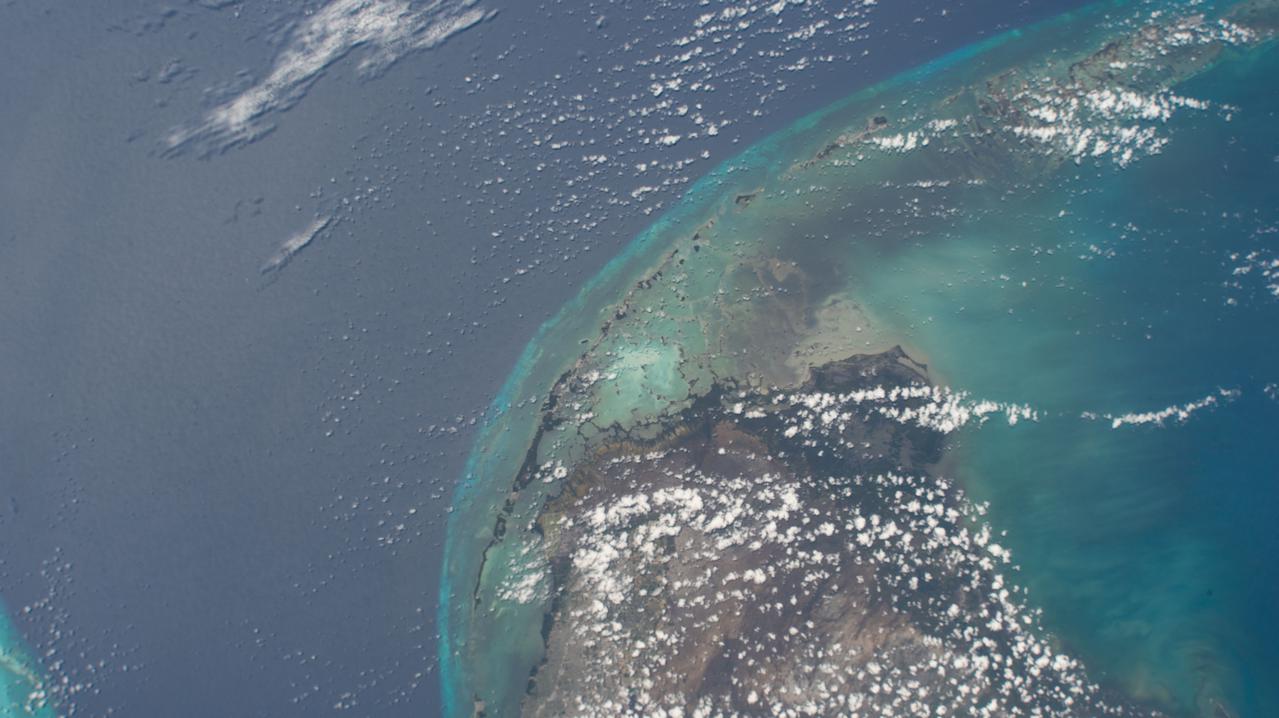
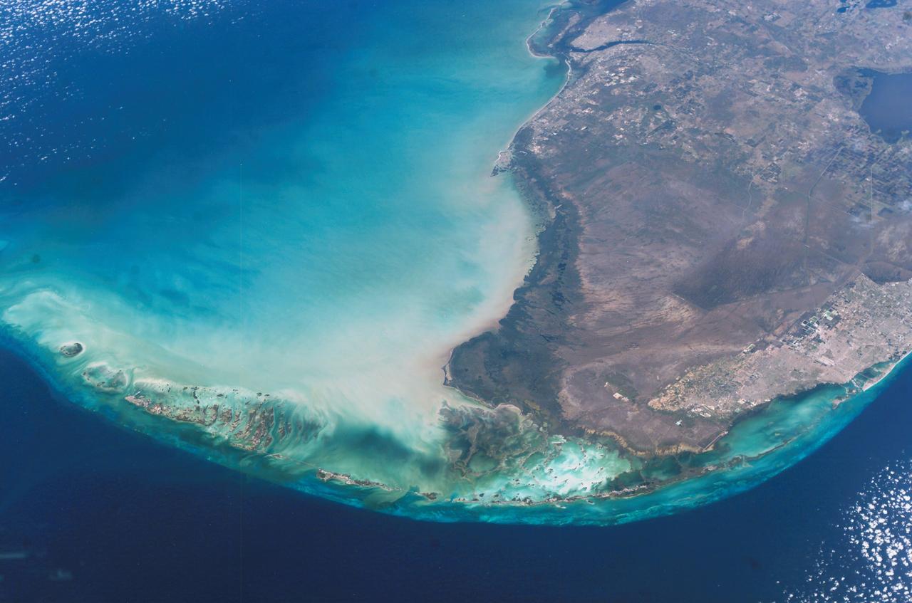
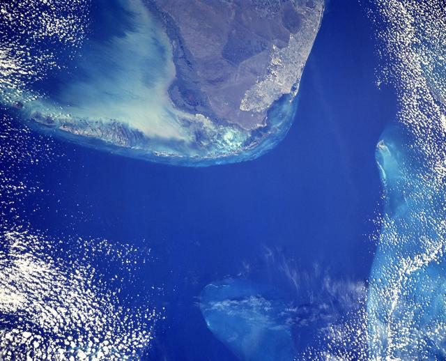
iss065e008077 (April 28, 2021) --- The Florida Keys and the Everglades National Park are pictured from the International Space Station as it orbited 262 miles above the Sunshine State of Florida.
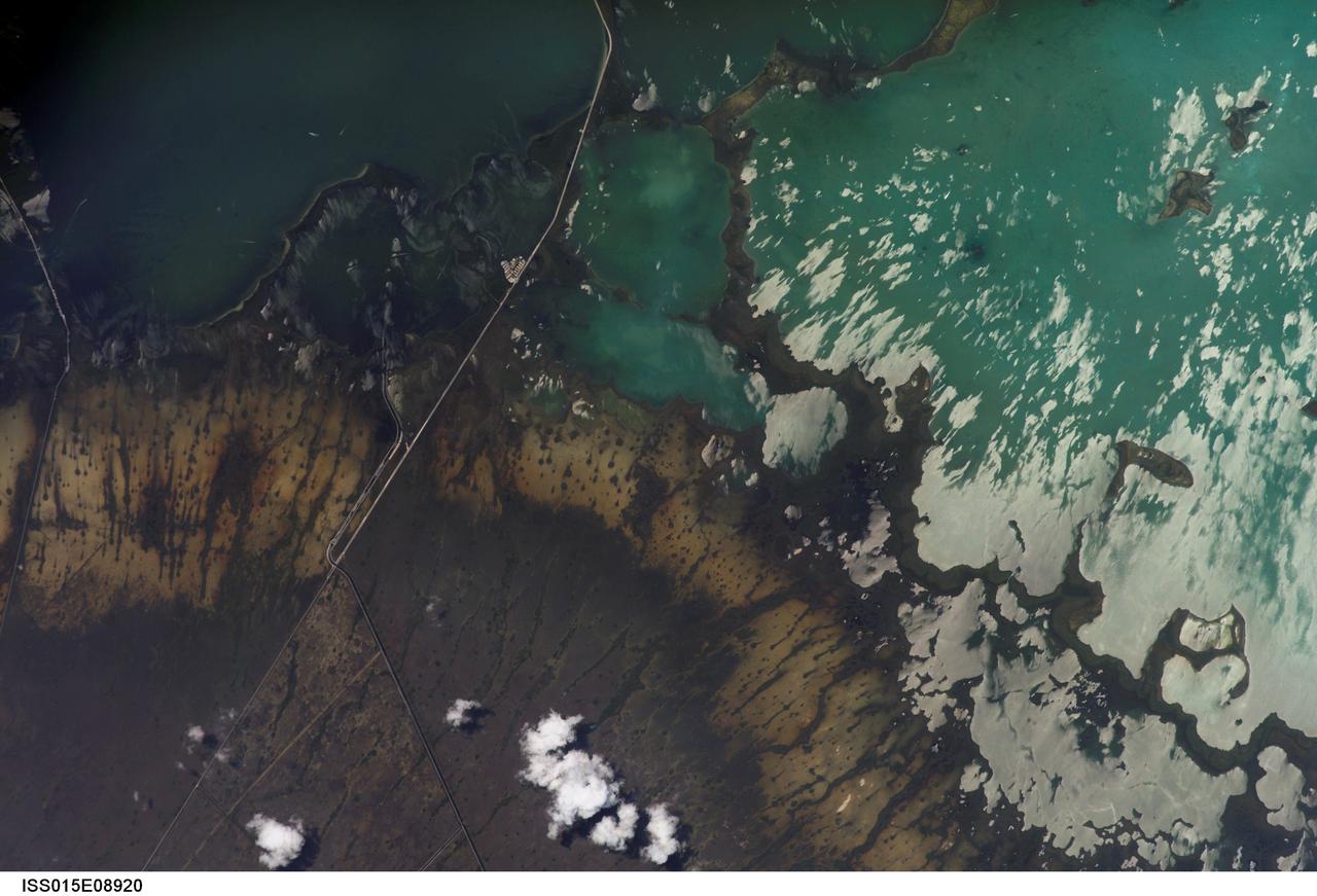
ISS015-E-08920 (19 May 2007) --- Southern Everglades National Park, Florida is featured in this image photographed by an Expedition 15 crewmember on the International Space Station. Everglades National Park in southern Florida is the largest subtropical wilderness in the United States. Known as the "river of grass", the Everglades wetlands and wooded uplands host a variety of endangered species including crocodiles, manatees, and panthers. During the late 19th and 20th centuries, the original 11,000 square miles of wetlands were viewed as useless swampland in need of reclamation. The success of reclamation efforts -- for agriculture and urban expansion in southern Florida -- has led to the loss of approximately 50 per cent of the original wetlands and 90 per cent of wading bird species. Today, an extensive restoration effort is underway to return portions of the Everglades to a more natural state and prevent further ecosystem degradation. This view highlights the southern Everglades estuarine ecosystem where the wetlands meet Florida Bay. Thin fingers of land and small islands (keys) host mangrove, hardwood hammocks, marsh and prairie (mainly dark to light green in the image). The tan and grayish-brown areas are dominantly scrub, marshland and prairie; small green "dots" and narrow lines in this region are isolated mangrove and hardwood stands indicating the general direction of slow water flow toward the bay. The silver-gray regions are water surfaces highlighted by sunglint. The roadway forming the western boundary of the National Park is US Route 1 connecting the Miami metropolitan area to the north (not shown) with the Florida Keys to the south (not shown). A small built feature visible along the roadway is a fishing camp.
ISS010-E-17590 (11 February 2005) --- Southern Florida and the Florida Keys are featured in this image photographed by an Expedition 10 crewmember on the International Space Station. Miami and Fort Lauderdale are visible on the Atlantic side. Everglades National Park and Fort Myers (Gulf of Mexico side) can also be seen, as can most of Lake Okeechobee.
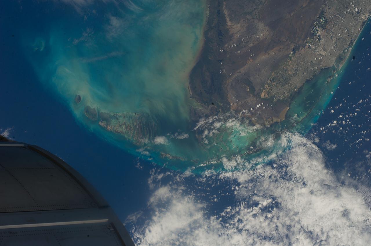
ISS040-E-000467 (17 May 2014) --- One of the Expedition 40 crew members aboard the International Space Station photographed this image of southern Florida, featuring Miami, the Everglades and the Florida Keys, on May 17, 2014. The object in lower left is part of one of the modules on the orbital outpost.
STS103-501-152 (19-27 December 1999) --- One of the astronauts aboard the Earth-orbiting Space Shuttle Discovery used a handheld large format camera to photograph this southern Florida scene. The city of Miami encroaches the eastern edge of the Everglades, which constitute an International Biosphere Reserve World Heritage Site. This subtropical wilderness encompasses a relatively flat (does not exceed 2.4 m above sea level) saw-grass marsh region of 10,000 square kilometers (4,000 square miles). According to NASA Earth scientists, the only source of water in the Everglades is from rainfall. The flow of water is detectable in this image, slowly moving from Lake Okeechobee to Florida Bay; the light blue, shallow area between the mainland and the Keys; and the southwestern Florida coast.
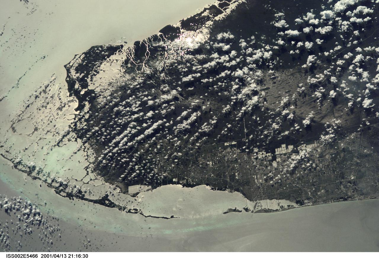
ISS002-E-5466 (13 April 2001) --- From the International Space Station (ISS), an Expedition Two crew member photographed southern Florida, including Dade County with Miami and Miami Beach; Everglades National Park; Big Cypress National Reserve; and the Florida Keys and many other recognizable areas. The crew member, using a digital still camera on this same pass, also recorded imagery of the Lake Okeechobee area, just north of the area represented in this frame.
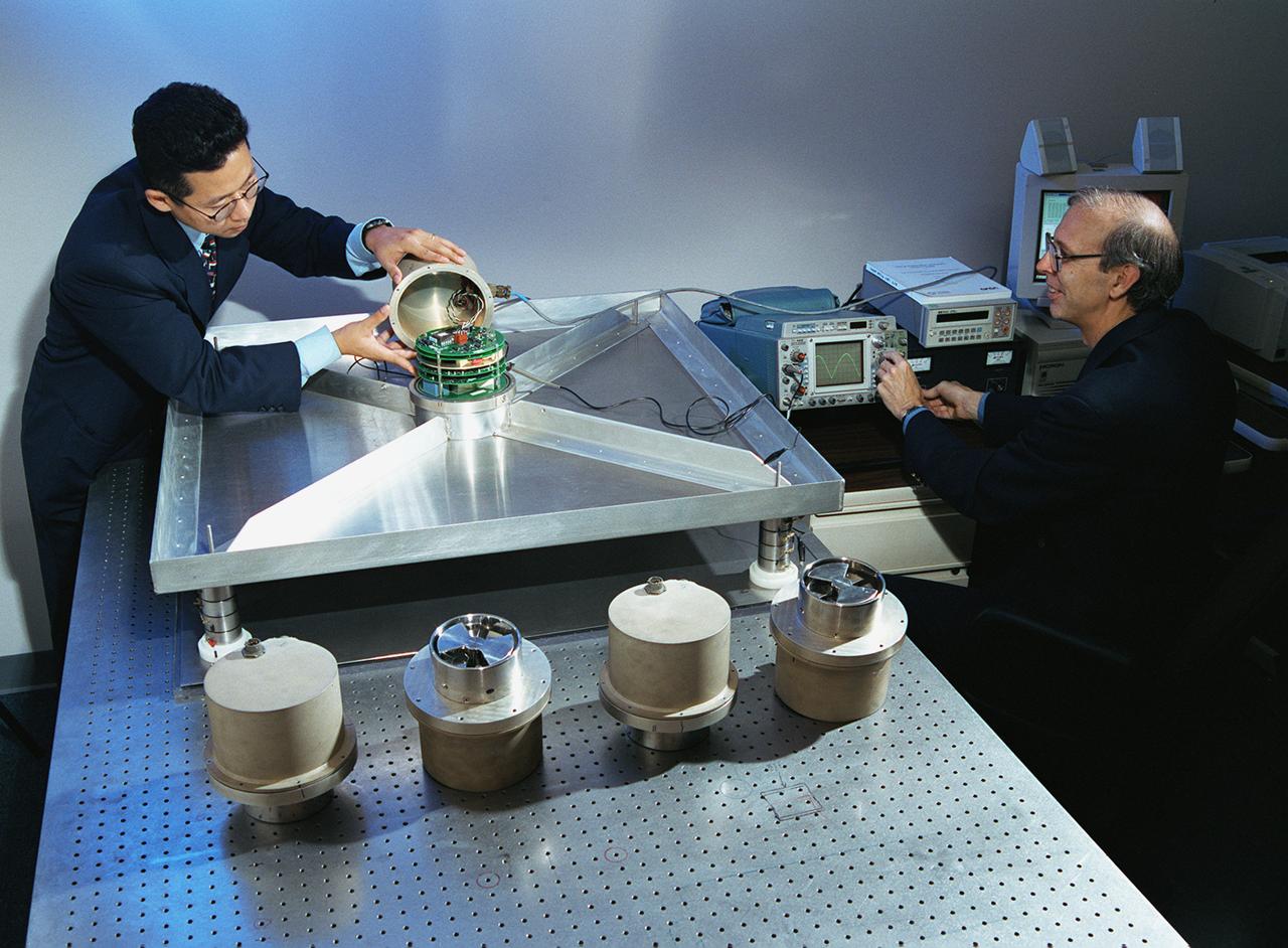
A NASA team studying the causes of electrical storms and their effects on our home planet achieved a milestone on August 21, 2002, completing the study's longest-duration research flight and monitoring four thunderstorms in succession. Radio news media can talk with Dr. Richard Blakeslee, the project's principal investigator, and Tony Kim, project manager at the Marshall Space Flight Center (MSFC), about their results and how their work will help improve future weather forecasting ability. Based at the Naval Air Station Key West, Florida, researchers with the Altus Cumulus Electrification Study (ACES) used the Altus II remotely- piloted aircraft to study a thunderstorm in the Atlantic Ocean off Key West, two storms at the western edge of the Everglades, and a large storm over the northwestern corner of the Everglades. This photograph shows Tony Kim And Dr. Richard Blakeslee of MSFC testing aircraft sensors that would be used to measure the electric fields produced by thunderstorm as part of NASA's ACES. With dual goals of gathering weather data safely and testing the adaptability of the uninhabited aircraft, the ACES study is a collaboration among the MSFC, the University of Alabama in Huntsville, NASA's Goddard Space Flight Center in Greenbelt, Maryland, Pernsylvania State University in University Park, and General Atomics Aeronautical Systems, Inc.
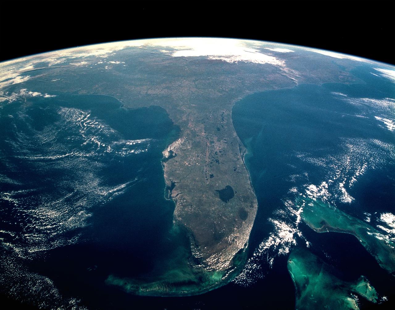
CAPE CANAVERAL, Fla. -- Taken during the STS-95 mission from a point over Cuba, this photo shows an oblique, foreshortened view of the Florida Peninsula, with the light blue, shallow seafloor of both the Florida Keys (curving across the bottom of the view) and the Bahama banks (right). "Popcorn" cumulus cloud covers Miami and the Southern Everglades, although the built-up area from Ft. Lauderdale to West Palm Beach can be discerned. Lake Okeechobee is the prominent waterbody in Florida. Cape Canaveral is shown well, half way up the peninsula. Orlando appears as the lighter patch West (left) of Cape Canaveral, near the middle of the peninsula. Cape Hatteras appears top right, with the North part of Chesapeake Bay also visible. This is a visibility of 16 degrees of latitude (23 degrees N over Cuba to 39 degrees at Baltimore), showing unusual atmospheric clarity.
A NASA team studying the causes of electrical storms and their effects on our home planet achieved a milestone on August 21, 2002, completing the study's longest-duration research flight and monitoring four thunderstorms in succession. Based at the Naval Air Station Key West, Florida, researchers with the Altus Cumulus Electrification Study (ACES) used the Altus II remotely-piloted aircraft to study thunderstorms in the Atlantic Ocean off Key West and the west of the Everglades. Using special equipment aboard the Altus II, scientists in ACES will gather electric, magnetic, and optical measurements of the thunderstorms, gauging elements such as lightning activity and the electrical environment in and around the storms. With dual goals of gathering weather data safely and testing the adaptability of the uninhabited aircraft, the ACES study is a collaboration among the Marshall Space Flight Center, the University of Alabama in Huntsville, NASA's Goddard Space Flight Center in Greenbelt, Maryland, Pernsylvania State University in University Park, and General Atomics Aeronautical Systems, Inc.
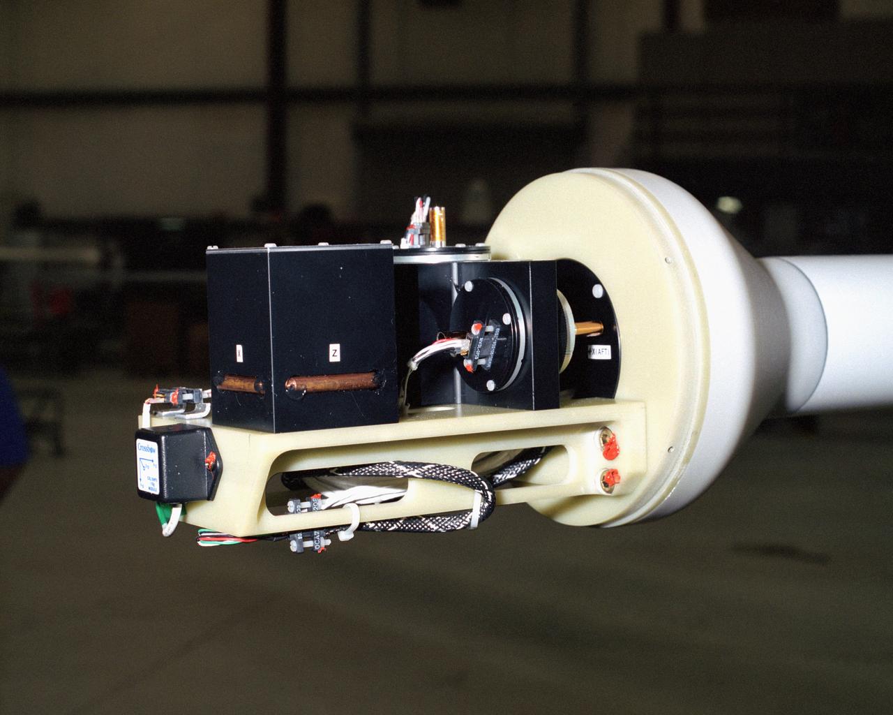
A NASA team studying the causes of electrical storms and their effects on our home planet achieved a milestone on August 21, 2002, completing the study's longest-duration research flight and monitoring four thunderstorms in succession. Based at the Naval Air Station Key West, Florida, researchers with the Altus Cumulus Electrification Study (ACES) used the Altus II remotely-piloted aircraft to study thunderstorms in the Atlantic Ocean off Key West and the west of the Everglades. Data obtained through sensors mounted to the aircraft will allow researchers in ACES to gauge elements such as lightning activity and the electrical environment in and around storms. By learning more about individual storms, scientists hope to better understand the global water and energy cycle, as well as climate variability. Contained in one portion of the aircraft is a three-axis magnetic search coil, which measures the AC magnetic field; a three-axis electric field change sensor; an accelerometer; and a three-axis magnetometer, which measures the DC magnetic field. With dual goals of gathering weather data safely and testing the adaptability of the uninhabited aircraft, the ACES study is a collaboration among the Marshall Space Flight Center, the University of Alabama in Huntsville, NASA's Goddard Space Flight Center in Greenbelt, Maryland, Pernsylvania State University in University Park, and General Atomics Aeronautical Systems, Inc.
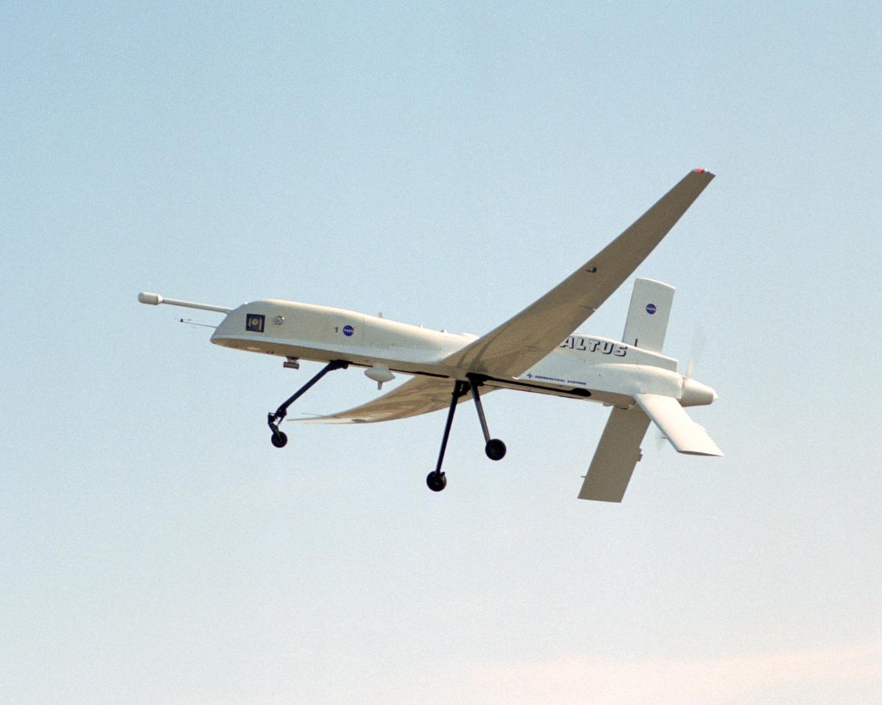
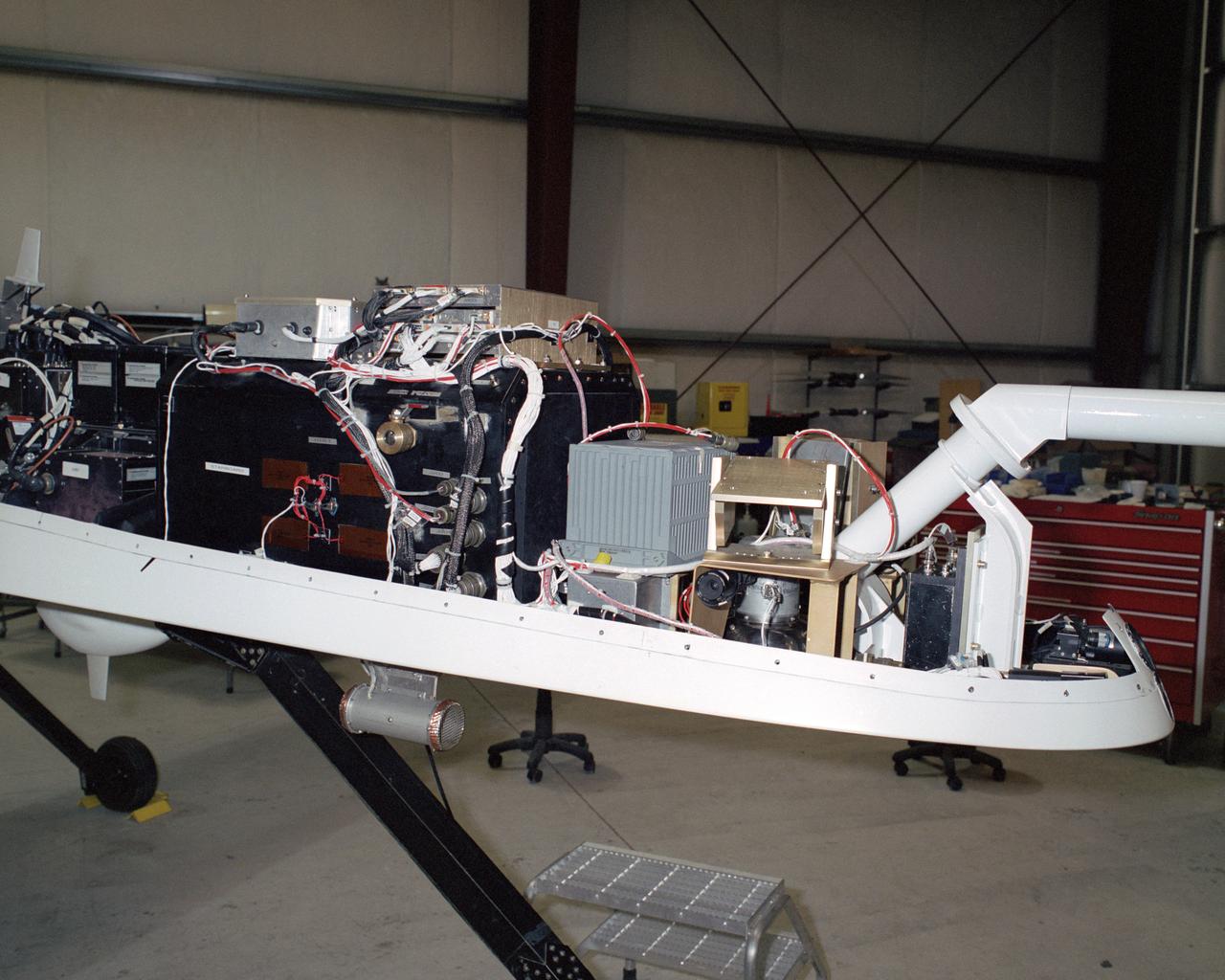
A NASA team studying the causes of electrical storms and their effects on our home planet achieved a milestone on August 21, 2002, completing the study's longest-duration research flight and monitoring four thunderstorms in succession. Based at the Naval Air Station Key West, Florida, researchers with the Altus Cumulus Electrification Study (ACES) used the Altus II remotely-piloted aircraft to study thunderstorms in the Atlantic Ocean off Key West and the west of the Everglades. The ACES lightning study used the Altus II twin turbo uninhabited aerial vehicle, built by General Atomics Aeronautical Systems, Inc. of San Diego. The Altus II was chosen for its slow flight speed of 75 to 100 knots (80 to 115 mph), long endurance, and high-altitude flight (up to 65,000 feet). These qualities gave the Altus II the ability to fly near and around thunderstorms for long periods of time, allowing investigations to be to be conducted over the entire life cycle of storms. The vehicle has a wing span of 55 feet and a payload capacity of over 300 lbs. With dual goals of gathering weather data safely and testing the adaptability of the uninhabited aircraft, the ACES study is a collaboration among the Marshall Space Flight Center, the University of Alabama in Huntsville, NASA,s Goddard Space Flight Center in Greenbelt, Maryland, Pernsylvania State University in University Park, and General Atomics Aeronautical Systems, Inc.
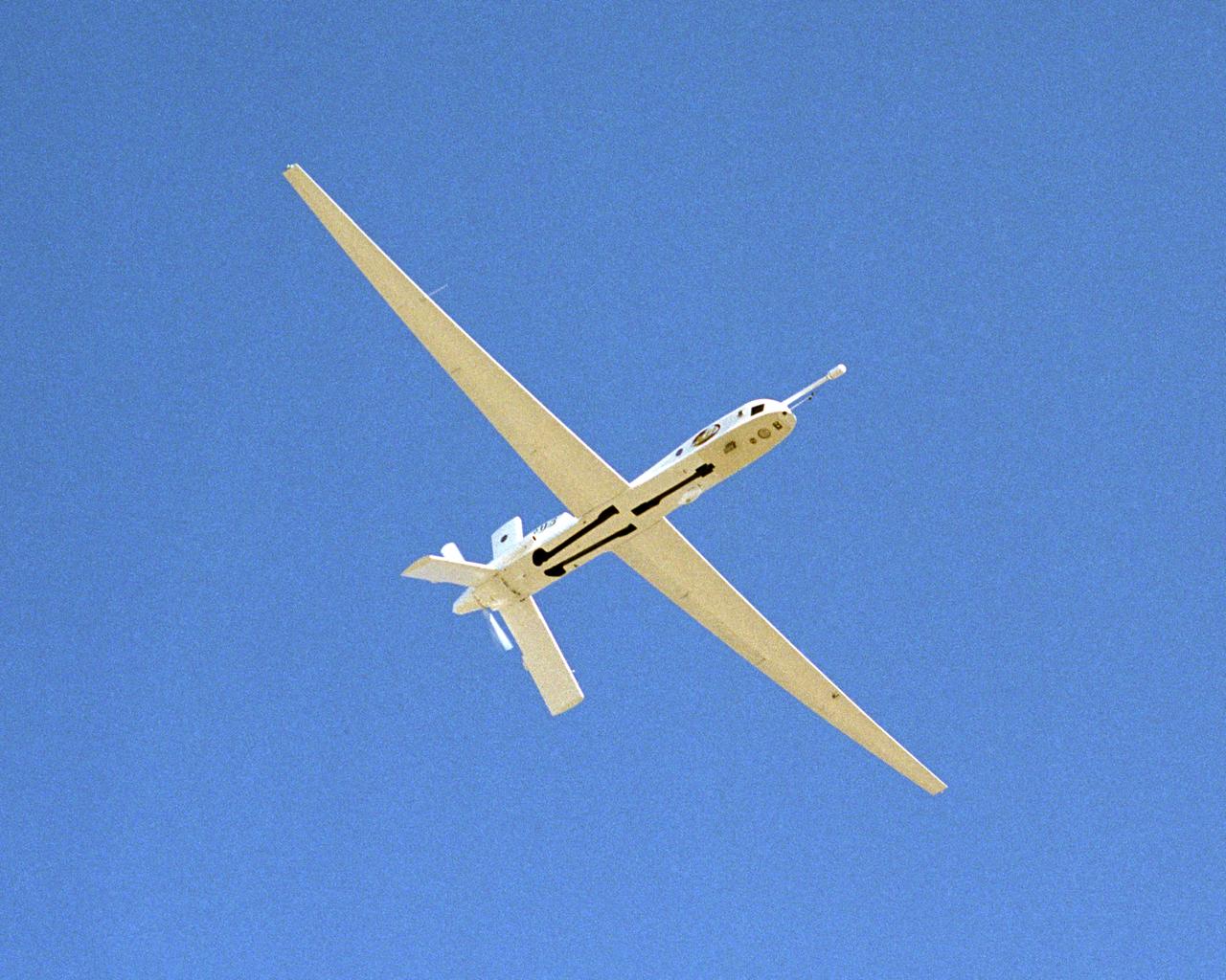
A NASA team studying the causes of electrical storms and their effects on our home planet achieved a milestone on August 21, 2002, completing the study's longest-duration research flight and monitoring four thunderstorms in succession. Based at the Naval Air Station Key West, Florida, researchers with the Altus Cumulus Electrification Study (ACES) used the Altus II remotely piloted aircraft to study thunderstorms in the Atlantic Ocean off Key West and the west of the Everglades. The ACES lightning study used the Altus II twin turbo uninhabited aerial vehicle, built by General Atomics Aeronautical Systems, Inc. of San Diego. The Altus II was chosen for its slow flight speed of 75 to 100 knots (80 to 115 mph), long endurance, and high-altitude flight (up to 65,000 feet). These qualities gave the Altus II the ability to fly near and around thunderstorms for long periods of time, allowing investigations to be conducted over the entire life cycle of storms. The vehicle has a wing span of 55 feet and a payload capacity of over 300 lbs. With dual goals of gathering weather data safely and testing the adaptability of the uninhabited aircraft, the ACES study is a collaboration among the Marshall Space Flight Center, the University of Alabama in Huntsville, NASA's Goddard Space Flight Center in Greenbelt, Maryland, Pernsylvania State University in University Park, and General Atomics Aeronautical Systems, Inc.
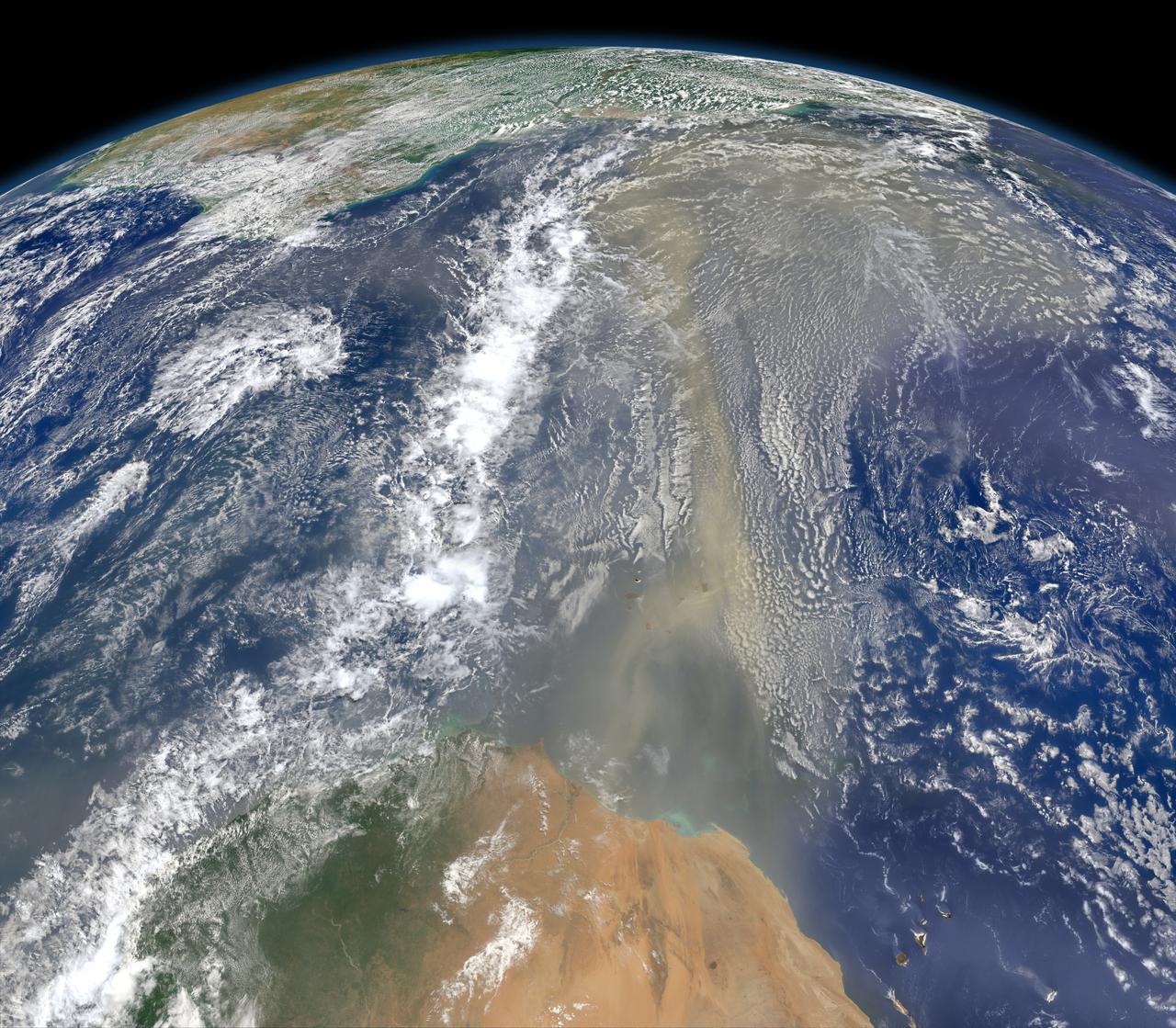
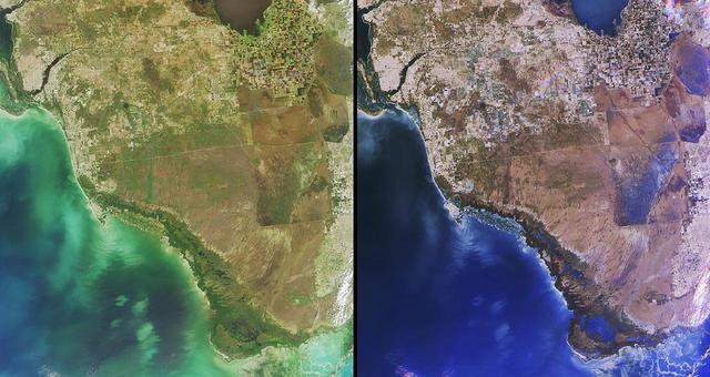
A piece of Africa—actually lots of them—began to arrive in the Americas in June 2014. On June 23, a lengthy river of dust from western Africa began to push across the Atlantic Ocean on easterly winds. A week later, the influx of dust was affecting air quality as far away as the southeastern United States. This composite image, made with data from the Visible Infrared Imaging Radiometer Suite (VIIRS) on Suomi NPP, shows dust heading west toward South America and the Gulf of Mexico on June 25, 2014. The dust flowed roughly parallel to a line of clouds in the intertropical convergence zone, an area near the equator where the trade winds come together and rain and clouds are common. In imagery captured by the Moderate Resolution Imaging Spectroradiometer (MODIS), the dust appeared to be streaming from Mauritania, Senegal, and Western Sahara, though some of it may have originated in countries farther to the east. Saharan dust has a range of impacts on ecosystems downwind. Each year, dust events like the one pictured here deliver about 40 million tons of dust from the Sahara to the Amazon River Basin. The minerals in the dust replenish nutrients in rainforest soils, which are continually depleted by drenching, tropical rains. Research focused on peat soils in the Everglades show that African dust has been arriving regularly in South Florida for thousands of years as well. In some instances, the impacts are harmful. Infusion of Saharan dust, for instance, can have a negative impact on air quality in the Americas. And scientists have linked African dust to outbreaks of certain types of toxic algal blooms in the Gulf of Mexico and southern Florida. Read more: <a href="http://1.usa.gov/1snkzmS" rel="nofollow">1.usa.gov/1snkzmS</a> NASA images by Norman Kuring, NASA’s Ocean Color web. Caption by Adam Voiland. Credit: <b><a href="http://www.earthobservatory.nasa.gov/" rel="nofollow"> NASA Earth Observatory</a></b> <b><a href="http://www.nasa.gov/audience/formedia/features/MP_Photo_Guidelines.html" rel="nofollow">NASA image use policy.</a></b> <b><a href="http://www.nasa.gov/centers/goddard/home/index.html" rel="nofollow">NASA Goddard Space Flight Center</a></b> enables NASA’s mission through four scientific endeavors: Earth Science, Heliophysics, Solar System Exploration, and Astrophysics. Goddard plays a leading role in NASA’s accomplishments by contributing compelling scientific knowledge to advance the Agency’s mission. <b>Follow us on <a href="http://twitter.com/NASAGoddardPix" rel="nofollow">Twitter</a></b> <b>Like us on <a href="http://www.facebook.com/pages/Greenbelt-MD/NASA-Goddard/395013845897?ref=tsd" rel="nofollow">Facebook</a></b> <b>Find us on <a href="http://instagram.com/nasagoddard?vm=grid" rel="nofollow">Instagram</a></b>