
Jasmine Hopkins, NASA Communications, moderates a science briefing held by NASA and the French space agency Centre National d’Études Spatiales (CNES) for the Surface Water and Ocean Topography (SWOT) mission on Dec. 13, 2022, at Vandenberg Space Force Base in California. SWOT is scheduled to launch on a SpaceX Falcon 9 from Space Launch Complex-4 East at Vandenberg on Dec. 15, 2022, at 3:46 a.m. PST. SWOT will be NASA’s first global survey of nearly all water on Earth’s surface. Scientists plan to use its observations to better understand the global water cycle, furnish insight into the ocean’s role in how climate change unfolds, and provide a global inventory of water resources. The SWOT mission is a collaborative effort between NASA and CNES with contributions from the Canadian Space Agency and the UK Space Agency. NASA’s Launch Services Program, based at the agency’s Kennedy Space Center in Florida, is managing the launch service.
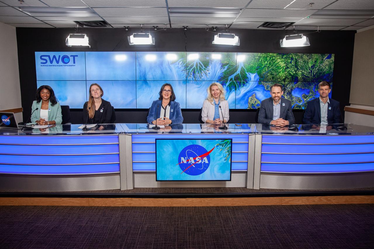
NASA and the French space agency Centre National d’Études Spatiales (CNES) hold a science briefing on the Surface Water and Ocean Topography (SWOT) mission on Dec. 13, 2022, at Vandenberg Space Force Base in California. Participating from left are Katherine Calvin, chief scientist and senior climate advisor, NASA; Selma Cherchali, Earth observation program head, CNES; Nadya Vinogradova Shiffer, SWOT program scientist, NASA; Tamlin Pavelsky, SWOT hydrology science lead, University of North Carolina; Benjamin Hamlington, research scientist, Sea Level and Ice Group, Jet Propulsion Laboratory. SWOT is scheduled to launch on a SpaceX Falcon 9 rocket from Space Launch Complex-4 East at Vandenberg on Dec. 15, 2022, at 3:46 a.m. PST. SWOT will be NASA’s first global survey of nearly all water on Earth’s surface. Scientists plan to use its observations to better understand the global water cycle, furnish insight into the ocean’s role in how climate change unfolds, and provide a global inventory of water resources. The SWOT mission is a collaborative effort between NASA and CNES with contributions from the Canadian Space Agency and the UK Space Agency. NASA’s Launch Services Program, based at the agency’s Kennedy Space Center in Florida, is managing the launch service.

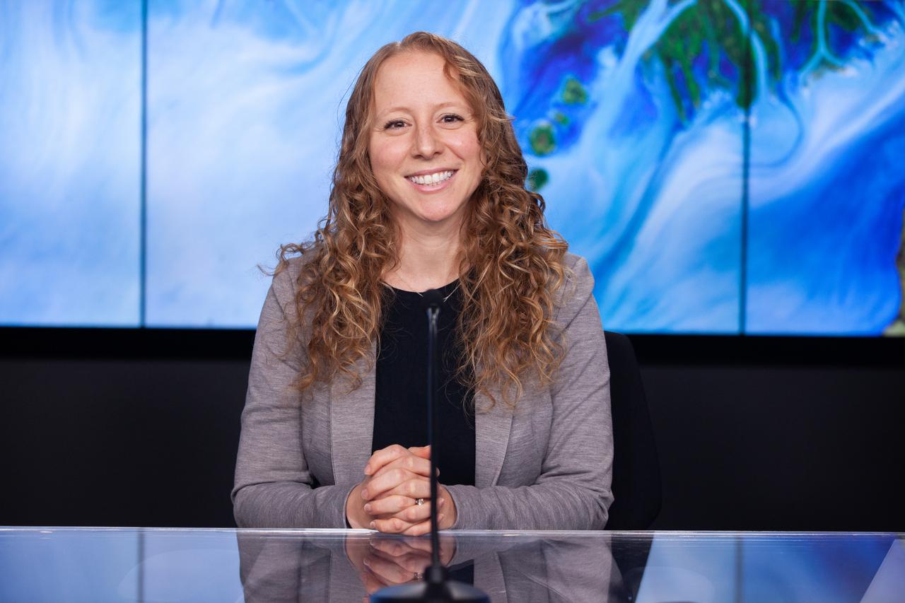
Selma Cherchali, Earth observation program head, CNES, participates in a science briefing held by NASA and the French space agency Centre National d’Études Spatiales (CNES) for the Surface Water and Ocean Topography (SWOT) mission on Dec. 13, 2022, at Vandenberg Space Force Base in California. SWOT is scheduled to launch on a SpaceX Falcon 9 rocket from Space Launch Complex-4 East at Vandenberg on Dec. 15, 2022, at 3:46 a.m. PST. SWOT will be NASA’s first global survey of nearly all water on Earth’s surface. Scientists plan to use its observations to better understand the global water cycle, furnish insight into the ocean’s role in how climate change unfolds, and provide a global inventory of water resources. The SWOT mission is a collaborative effort between NASA and CNES with contributions from the Canadian Space Agency and the UK Space Agency. NASA’s Launch Services Program, based at the agency’s Kennedy Space Center in Florida, is managing the launch service.

NASA and the French space agency Centre National d’Études Spatiales (CNES) hold a science briefing on the Surface Water and Ocean Topography (SWOT) mission on Dec. 13, 2022, at Vandenberg Space Force Base in California. Participating from left are Katherine Calvin, chief scientist and senior climate advisor, NASA; Selma Cherchali, Earth observation program head, CNES; Nadya Vinogradova Shiffer, SWOT program scientist, NASA; Tamlin Pavelsky, SWOT hydrology science lead, University of North Carolina; Benjamin Hamlington, research scientist, Sea Level and Ice Group, Jet Propulsion Laboratory. SWOT is scheduled to launch on a SpaceX Falcon 9 rocket from Space Launch Complex-4 East at Vandenberg on Dec. 15, 2022, at 3:46 a.m. PST. SWOT will be NASA’s first global survey of nearly all water on Earth’s surface. Scientists plan to use its observations to better understand the global water cycle, furnish insight into the ocean’s role in how climate change unfolds, and provide a global inventory of water resources. The SWOT mission is a collaborative effort between NASA and CNES with contributions from the Canadian Space Agency and the UK Space Agency. NASA’s Launch Services Program, based at the agency’s Kennedy Space Center in Florida, is managing the launch service.
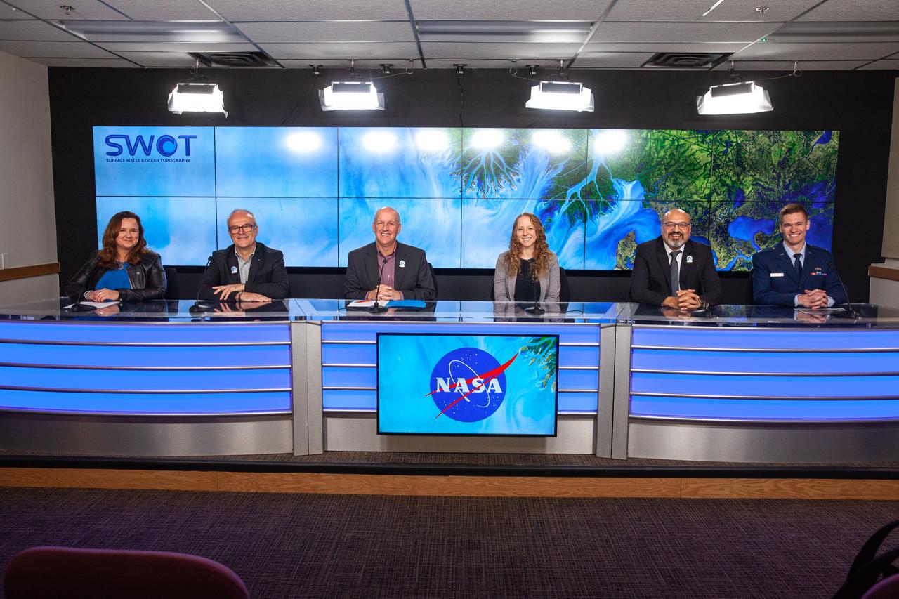
NASA, SpaceX, and the French space agency Centre National d’Études Spatiales (CNES) hold a prelaunch news conference for the Surface Water and Ocean Topography (SWOT) mission on Dec. 14, 2022, at Vandenberg Space Force Base in California. Participating from left are Karen St. Germain, Earth Science Division director, NASA; Thierry Lafon, SWOT project manager, CNES; Tim Dunn, launch director, NASA’s Launch Services Program; Julianna Scheiman, civil satellite missions director, SpaceX; Parag Vaze, SWOT project manager, Jet Propulsion Laboratory; Capt. Max Rush, launch weather officer, U.S. Air Force. SWOT is scheduled to launch on a SpaceX Falcon 9 rocket from Space Launch Complex-4 East at Vandenberg on Dec. 15, 2022, at 3:46 a.m. PST. SWOT will be NASA’s first global survey of nearly all water on Earth’s surface. Scientists plan to use its observations to better understand the global water cycle, furnish insight into the ocean’s role in how climate change unfolds, and provide a global inventory of water resources. The SWOT mission is a collaborative effort between NASA and CNES with contributions from the Canadian Space Agency and the UK Space Agency. NASA’s Launch Services Program, based at the agency’s Kennedy Space Center in Florida, is managing the launch service.
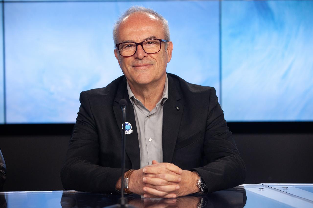
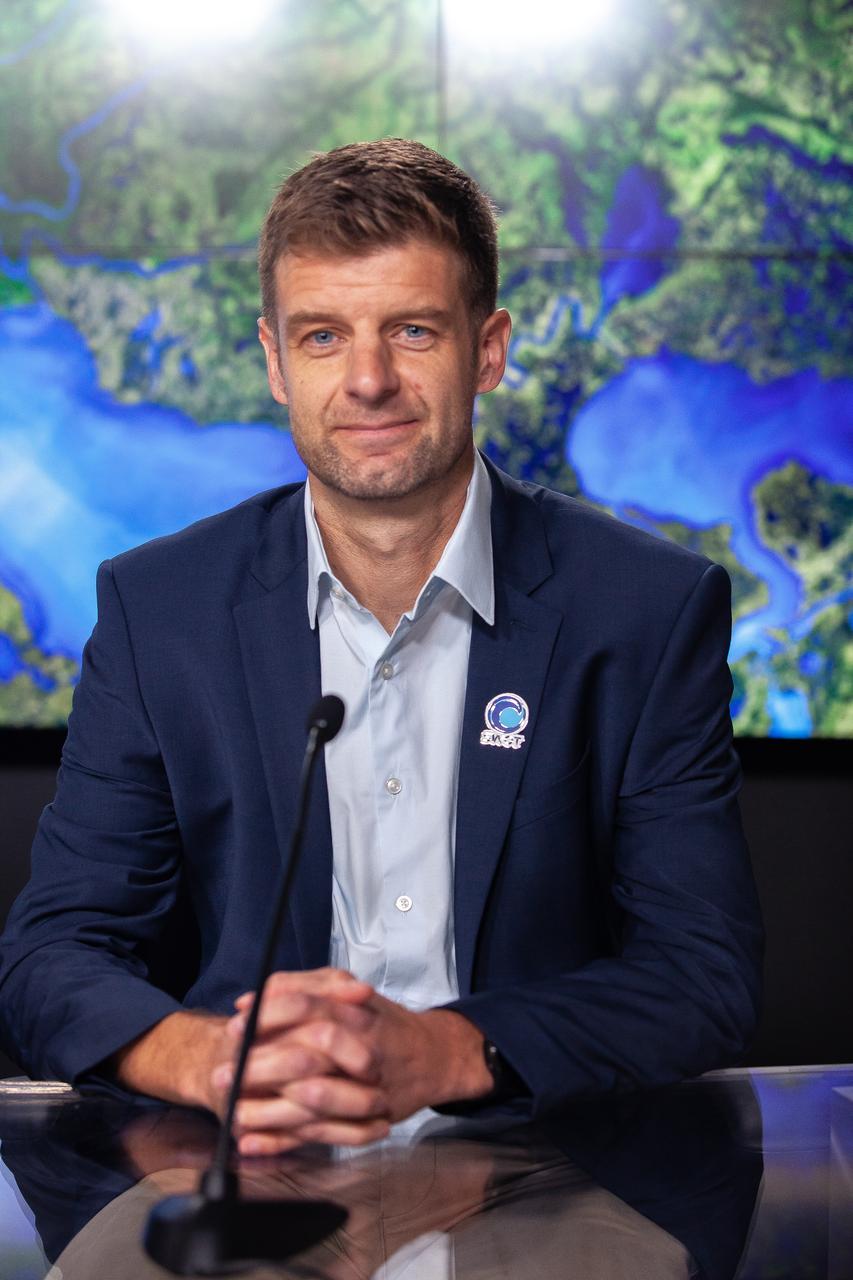
Thierry Lafon, SWOT project manager, CNES, participates in a prelaunch news conference held by NASA, SpaceX, and the French space agency Centre National d’Études Spatiales (CNES) for the Surface Water and Ocean Topography (SWOT) mission on Dec. 14, 2022, at Vandenberg Space Force Base in California. SWOT is scheduled to launch on a SpaceX Falcon 9 rocket from Space Launch Complex-4 East at Vandenberg on Dec. 15, 2022, at 3:46 a.m. PST. SWOT will be NASA’s first global survey of nearly all water on Earth’s surface. Scientists plan to use its observations to better understand the global water cycle, furnish insight into the ocean’s role in how climate change unfolds, and provide a global inventory of water resources. The SWOT mission is a collaborative effort between NASA and CNES with contributions from the Canadian Space Agency and the UK Space Agency. NASA’s Launch Services Program, based at the agency’s Kennedy Space Center in Florida, is managing the launch service.

Philippe Laudet, SEIS Project Manager, French National Space Agency (CNES) talks about Mars InSight during a social media briefing, Sunday, Nov. 25, 2018 at NASA's Jet Propulsion Laboratory in Pasadena, California. InSight, short for Interior Exploration using Seismic Investigations, Geodesy and Heat Transport, is a Mars lander designed to study the "inner space" of Mars: its crust, mantle, and core. InSight is scheduled to touch down on the Red Planet at approximately noon PST (3 p.m. EST) on Nov. 26. Photo Credit: (NASA/Bill Ingalls)
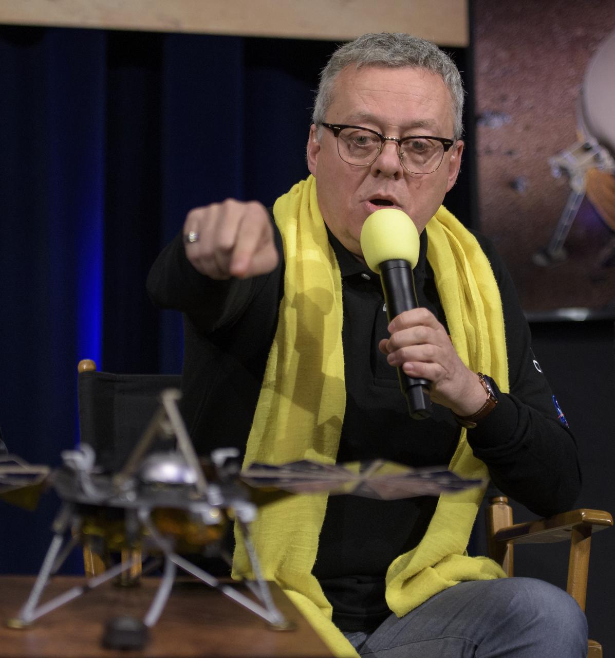
Philippe Laudet, SEIS Project Manager, French National Space Agency (CNES) talks about Mars InSight during a social media briefing, Sunday, Nov. 25, 2018 at NASA's Jet Propulsion Laboratory in Pasadena, California. InSight, short for Interior Exploration using Seismic Investigations, Geodesy and Heat Transport, is a Mars lander designed to study the "inner space" of Mars: its crust, mantle, and core. InSight is scheduled to touch down on the Red Planet at approximately noon PST (3 p.m. EST) on Nov. 26. Photo Credit: (NASA/Bill Ingalls)
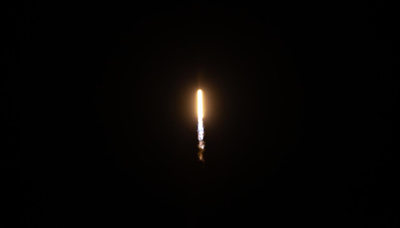
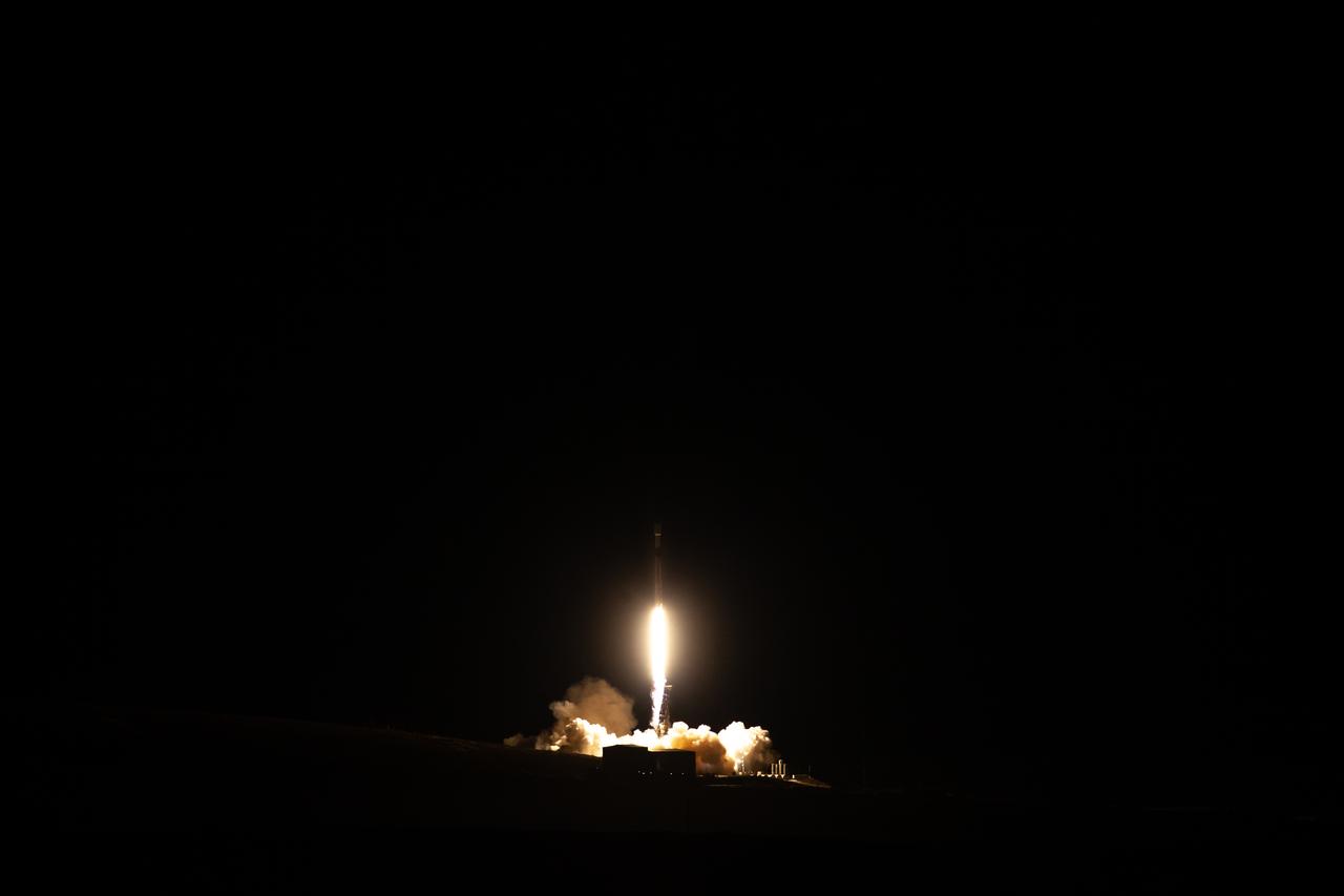
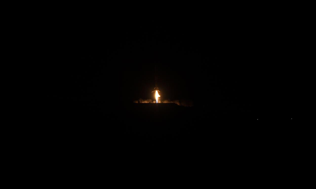
The SpaceX Falcon 9 rocket, carrying the Surface Water and Ocean Topography (SWOT) satellite, soars upward after lifting off from Space Launch Complex-4 East at Vandenberg Space Force Base in California on Dec. 16, 2022, at 3:46 a.m. PST. A collaboration between NASA and the French space agency Centre National d’Études Spatiales (CNES), with contributions from the Canadian Space Agency and the UK Space Agency, SWOT will be the first satellite to survey nearly all water on Earth’s surface. The satellite will help researchers understand how much water flows in and out of Earth’s freshwater bodies and will provide insight into the ocean’s role in climate change. The instruments onboard will measure the height of water in lakes, rivers, reservoirs, and the ocean, and will observe ocean features in higher definition than ever before. NASA’s Launch Services Program, based at the agency’s Kennedy Space Center in Florida, is managing the launch service.
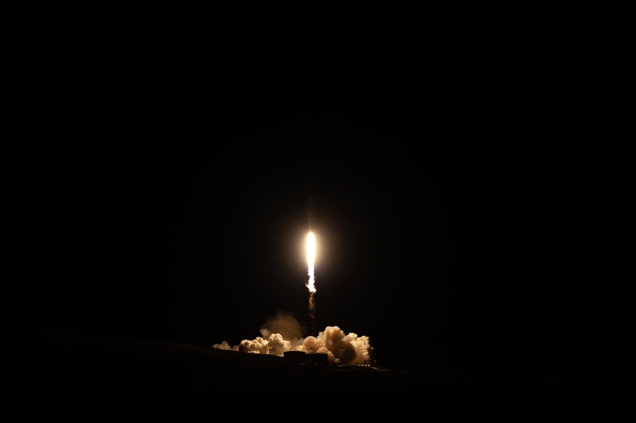
The SpaceX Falcon 9 rocket, carrying the Surface Water and Ocean Topography (SWOT) satellite, lifts off from Space Launch Complex-4 East at Vandenberg Space Force Base in California on Dec. 16, 2022, at 3:46 a.m. PST. A collaboration between NASA and the French space agency Centre National d’Études Spatiales (CNES), with contributions from the Canadian Space Agency and the UK Space Agency, SWOT will be the first satellite to survey nearly all water on Earth’s surface. The satellite will help researchers understand how much water flows in and out of Earth’s freshwater bodies and will provide insight into the ocean’s role in climate change. The instruments onboard will measure the height of water in lakes, rivers, reservoirs, and the ocean, and will observe ocean features in higher definition than ever before. NASA’s Launch Services Program, based at the agency’s Kennedy Space Center in Florida, is managing the launch service.
The SpaceX Falcon 9 rocket, carrying the Surface Water and Ocean Topography (SWOT) satellite, lifts off from Space Launch Complex-4 East at Vandenberg Space Force Base in California on Dec. 16, 2022, at 3:46 a.m. PST. A collaboration between NASA and the French space agency Centre National d’Études Spatiales (CNES), with contributions from the Canadian Space Agency and the UK Space Agency, SWOT will be the first satellite to survey nearly all water on Earth’s surface. The satellite will help researchers understand how much water flows in and out of Earth’s freshwater bodies and will provide insight into the ocean’s role in climate change. The instruments onboard will measure the height of water in lakes, rivers, reservoirs, and the ocean, and will observe ocean features in higher definition than ever before. NASA’s Launch Services Program, based at the agency’s Kennedy Space Center in Florida, is managing the launch service.
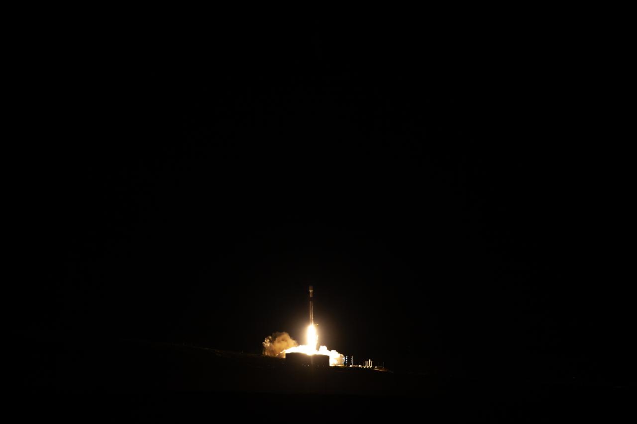
The SpaceX Falcon 9 rocket, carrying the Surface Water and Ocean Topography (SWOT) satellite, lifts off from Space Launch Complex-4 East at Vandenberg Space Force Base in California on Dec. 16, 2022, at 3:46 a.m. PST. A collaboration between NASA and the French space agency Centre National d’Études Spatiales (CNES), with contributions from the Canadian Space Agency and the UK Space Agency, SWOT will be the first satellite to survey nearly all water on Earth’s surface. The satellite will help researchers understand how much water flows in and out of Earth’s freshwater bodies and will provide insight into the ocean’s role in climate change. The instruments onboard will measure the height of water in lakes, rivers, reservoirs, and the ocean, and will observe ocean features in higher definition than ever before. NASA’s Launch Services Program, based at the agency’s Kennedy Space Center in Florida, is managing the launch service.
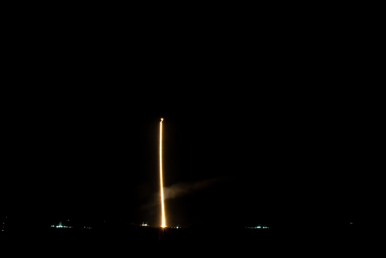
The SpaceX Falcon 9 rocket, carrying the Surface Water and Ocean Topography (SWOT) satellite, lifts off from Space Launch Complex-4 East at Vandenberg Space Force Base in California on Dec. 16, 2022, at 3:46 a.m. PST. A collaboration between NASA and the French space agency Centre National d’Études Spatiales (CNES), with contributions from the Canadian Space Agency and the UK Space Agency, SWOT will be the first satellite to survey nearly all water on Earth’s surface. The satellite will help researchers understand how much water flows in and out of Earth’s freshwater bodies and will provide insight into the ocean’s role in climate change. The instruments onboard will measure the height of water in lakes, rivers, reservoirs, and the ocean, and will observe ocean features in higher definition than ever before. NASA’s Launch Services Program, based at the agency’s Kennedy Space Center in Florida, is managing the launch service.
The first stage of the SpaceX Falcon 9 rocket lands at Vandenberg Space Force Base's landing zone 4 following the successful launch of the Surface Water and Ocean Topography (SWOT) satellite on Dec. 16, 2022. A collaboration between NASA and the French space agency Centre National d’Études Spatiales (CNES), with contributions from the Canadian Space Agency and the UK Space Agency, SWOT will be the first satellite to survey nearly all water on Earth’s surface. The satellite will help researchers understand how much water flows in and out of Earth’s freshwater bodies and will provide insight into the ocean’s role in climate change. The instruments onboard will measure the height of water in lakes, rivers, reservoirs, and the ocean, and will observe ocean features in higher definition than ever before. NASA’s Launch Services Program, based at the agency’s Kennedy Space Center in Florida, is managing the launch service.

Parag Vaze, SWOT project manager, Jet Propulsion Laboratory, participates in a prelaunch news conference held by NASA, SpaceX, and the French space agency Centre National d’Études Spatiales (CNES) for the Surface Water and Ocean Topography (SWOT) mission on Dec. 14, 2022, at Vandenberg Space Force Base in California. SWOT is scheduled to launch on a SpaceX Falcon 9 rocket from Space Launch Complex-4 East at Vandenberg on Dec. 15, 2022, at 3:46 a.m. PST. SWOT will be NASA’s first global survey of nearly all water on Earth’s surface. Scientists plan to use its observations to better understand the global water cycle, furnish insight into the ocean’s role in how climate change unfolds, and provide a global inventory of water resources. The SWOT mission is a collaborative effort between NASA and CNES with contributions from the Canadian Space Agency and the UK Space Agency. NASA’s Launch Services Program, based at the agency’s Kennedy Space Center in Florida, is managing the launch service.
Katherine Calvin, chief scientist and senior climate advisor, NASA, participates in a science briefing held by NASA and the French space agency Centre National d’Études Spatiales (CNES) for the Surface Water and Ocean Topography (SWOT) mission on Dec. 13, 2022, at Vandenberg Space Force Base in California. SWOT is scheduled to launch on a SpaceX Falcon 9 rocket from Space Launch Complex-4 East at Vandenberg on Dec. 15, 2022, at 3:46 a.m. PST. SWOT will be NASA’s first global survey of nearly all water on Earth’s surface. Scientists plan to use its observations to better understand the global water cycle, furnish insight into the ocean’s role in how climate change unfolds, and provide a global inventory of water resources. The SWOT mission is a collaborative effort between NASA and CNES with contributions from the Canadian Space Agency and the UK Space Agency. NASA’s Launch Services Program, based at the agency’s Kennedy Space Center in Florida, is managing the launch service.
Tamlin Pavelsky, SWOT hydrology science lead, University of North Carolina, participates in a science briefing held by NASA and the French space agency Centre National d’Études Spatiales (CNES) for the Surface Water and Ocean Topography (SWOT) mission on Dec. 13, 2022, at Vandenberg Space Force Base in California. SWOT is scheduled to launch on a SpaceX Falcon 9 rocket from Space Launch Complex-4 East at Vandenberg on Dec. 15, 2022, at 3:46 a.m. PST. SWOT will be NASA’s first global survey of nearly all water on Earth’s surface. Scientists plan to use its observations to better understand the global water cycle, furnish insight into the ocean’s role in how climate change unfolds, and provide a global inventory of water resources. The SWOT mission is a collaborative effort between NASA and CNES with contributions from the Canadian Space Agency and the UK Space Agency. NASA’s Launch Services Program, based at the agency’s Kennedy Space Center in Florida, is managing the launch service.

Nadya Vinogradova Shiffer, SWOT program scientist, NASA, participates in a science briefing held by NASA and the French space agency Centre National d’Études Spatiales (CNES) for the Surface Water and Ocean Topography (SWOT) mission on Dec. 13, 2022, at Vandenberg Space Force Base in California. SWOT is scheduled to launch on a SpaceX Falcon 9 rocket from Space Launch Complex-4 East at Vandenberg on Dec. 15, 2022, at 3:46 a.m. PST. SWOT will be NASA’s first global survey of nearly all water on Earth’s surface. Scientists plan to use its observations to better understand the global water cycle, furnish insight into the ocean’s role in how climate change unfolds, and provide a global inventory of water resources. The SWOT mission is a collaborative effort between NASA and CNES with contributions from the Canadian Space Agency and the UK Space Agency. NASA’s Launch Services Program, based at the agency’s Kennedy Space Center in Florida, is managing the launch service.

Tim Dunn, launch director, NASA’s Launch Services Program, participates in a prelaunch news conference held by NASA, SpaceX, and the French space agency Centre National d’Études Spatiales (CNES) for the Surface Water and Ocean Topography (SWOT) mission on Dec. 14, 2022, at Vandenberg Space Force Base in California. SWOT is scheduled to launch on a SpaceX Falcon 9 rocket from Space Launch Complex-4 East at Vandenberg on Dec. 15, 2022, at 3:46 a.m. PST. SWOT will be NASA’s first global survey of nearly all water on Earth’s surface. Scientists plan to use its observations to better understand the global water cycle, furnish insight into the ocean’s role in how climate change unfolds, and provide a global inventory of water resources. The SWOT mission is a collaborative effort between NASA and CNES with contributions from the Canadian Space Agency and the UK Space Agency. NASA’s Launch Services Program, based at the agency’s Kennedy Space Center in Florida, is managing the launch service.

Capt. Max Rush, launch weather officer, U.S. Air Force, participates in a prelaunch news conference held by NASA, SpaceX, and the French space agency Centre National d’Études Spatiales (CNES) for the Surface Water and Ocean Topography (SWOT) mission on Dec. 14, 2022, at Vandenberg Space Force Base in California. SWOT is scheduled to launch on a SpaceX Falcon 9 rocket from Space Launch Complex-4 East at Vandenberg on Dec. 15, 2022, at 3:46 a.m. PST. SWOT will be NASA’s first global survey of nearly all water on Earth’s surface. Scientists plan to use its observations to better understand the global water cycle, furnish insight into the ocean’s role in how climate change unfolds, and provide a global inventory of water resources. The SWOT mission is a collaborative effort between NASA and CNES with contributions from the Canadian Space Agency and the UK Space Agency. NASA’s Launch Services Program, based at the agency’s Kennedy Space Center in Florida, is managing the launch service.

Megan Cruz, NASA Communications, moderates a prelaunch news conference held by NASA, SpaceX, and the French space agency Centre National d’Études Spatiales (CNES) for the Surface Water and Ocean Topography (SWOT) mission on Dec. 14, 2022, at Vandenberg Space Force Base in California. SWOT is scheduled to launch on a SpaceX Falcon 9 rocket from Space Launch Complex-4 East at Vandenberg on Dec. 15, 2022, at 3:46 a.m. PST. SWOT will be NASA’s first global survey of nearly all water on Earth’s surface. Scientists plan to use its observations to better understand the global water cycle, furnish insight into the ocean’s role in how climate change unfolds, and provide a global inventory of water resources. The SWOT mission is a collaborative effort between NASA and CNES with contributions from the Canadian Space Agency and the UK Space Agency. NASA’s Launch Services Program, based at the agency’s Kennedy Space Center in Florida, is managing the launch service.

Karen St. Germain, Earth Science Division director, NASA, participates in a prelaunch news conference held by NASA, SpaceX, and the French space agency Centre National d’Études Spatiales (CNES) for the Surface Water and Ocean Topography (SWOT) mission on Dec. 14, 2022, at Vandenberg Space Force Base in California. SWOT is scheduled to launch on a SpaceX Falcon 9 rocket from Space Launch Complex-4 East at Vandenberg on Dec. 15, 2022, at 3:46 a.m. PST. SWOT will be NASA’s first global survey of nearly all water on Earth’s surface. Scientists plan to use its observations to better understand the global water cycle, furnish insight into the ocean’s role in how climate change unfolds, and provide a global inventory of water resources. The SWOT mission is a collaborative effort between NASA and CNES with contributions from the Canadian Space Agency and the UK Space Agency. NASA’s Launch Services Program, based at the agency’s Kennedy Space Center in Florida, is managing the launch service.
Benjamin Hamlington, research scientist, Sea Level and Ice Group, Jet Propulsion Laboratory, participates in a science briefing held by NASA and the French space agency Centre National d’Études Spatiales (CNES) for the Surface Water and Ocean Topography (SWOT) mission on Dec. 13, 2022, at Vandenberg Space Force Base in California. SWOT is scheduled to launch on a SpaceX Falcon 9 rocket from Space Launch Complex-4 East at Vandenberg on Dec. 15, 2022, at 3:46 a.m. PST. SWOT will be NASA’s first global survey of nearly all water on Earth’s surface. Scientists plan to use its observations to better understand the global water cycle, furnish insight into the ocean’s role in how climate change unfolds, and provide a global inventory of water resources. The SWOT mission is a collaborative effort between NASA and CNES with contributions from the Canadian Space Agency and the UK Space Agency. NASA’s Launch Services Program, based at the agency’s Kennedy Space Center in Florida, is managing the launch service.
Julianna Scheiman, civil satellite missions director, SpaceX, participates in a prelaunch news conference held by NASA, SpaceX, and the French space agency Centre National d’Études Spatiales (CNES) for the Surface Water and Ocean Topography (SWOT) mission on Dec. 14, 2022, at Vandenberg Space Force Base in California. SWOT is scheduled to launch on a SpaceX Falcon 9 rocket from Space Launch Complex-4 East at Vandenberg on Dec. 15, 2022, at 3:46 a.m. PST. SWOT will be NASA’s first global survey of nearly all water on Earth’s surface. Scientists plan to use its observations to better understand the global water cycle, furnish insight into the ocean’s role in how climate change unfolds, and provide a global inventory of water resources. The SWOT mission is a collaborative effort between NASA and CNES with contributions from the Canadian Space Agency and the UK Space Agency. NASA’s Launch Services Program, based at the agency’s Kennedy Space Center in Florida, is managing the launch service.

Official portrait of STS-65 International Microgravity Laboratory 2 (IML-2) backup Payload Specialist Jean-Jacques Favier. Favier is a member of the Centre National D'Etudes Spatiales (CNES), the French space agency.
Jean-Yves Le Gall, president of the French space agency, National Centre for Space Studies (CNES), tests a robotic arm at the NASA exhibit during the 70th International Astronautical Congress, Wednesday, Oct. 23, 2019, at the Walter E. Washington Convention Center in Washington. Photo credit: (NASA/Aubrey Gemignani)

Jean-Yves Le Gall, president of the French space agency, National Centre for Space Studies (CNES), tries virtual reality viewers at the NASA exhibit during the 70th International Astronautical Congress, Wednesday, Oct. 23, 2019, at the Walter E. Washington Convention Center in Washington. Photo credit: (NASA/Aubrey Gemignani)

Jean-Yves Le Gall, president of the French space agency, National Centre for Space Studies (CNES), center, shakes hands with NASA astronaut Doug Wheelock after he and Philippe Étienne, French Ambassador to the U.S., second from left, visited the NASA exhibit during the 70th International Astronautical Congress, Wednesday, Oct. 23, 2019, at the Walter E. Washington Convention Center in Washington. Photo credit: (NASA/Aubrey Gemignani)

Philippe Étienne, French Ambassador to the U.S., right, and Jean-Yves Le Gall, president of the French space agency, National Centre for Space Studies (CNES), left, try virtual reality viewers at the NASA exhibit during the 70th International Astronautical Congress, Wednesday, Oct. 23, 2019, at the Walter E. Washington Convention Center in Washington. Photo credit: (NASA/Aubrey Gemignani)

Philippe Étienne, French Ambassador to the U.S., center, and Jean-Yves Le Gall, president of the French space agency, National Centre for Space Studies (CNES), left, speak to NASA astronaut Doug Wheelock at the NASA exhibit during the 70th International Astronautical Congress, Wednesday, Oct. 23, 2019, at the Walter E. Washington Convention Center in Washington. Photo credit: (NASA/Aubrey Gemignani)

Philippe Étienne, French Ambassador to the U.S., center, and Jean-Yves Le Gall, president of the French space agency, National Centre for Space Studies (CNES), right, are seen talking to NASA Chief of Staff Janet Karika at the NASA exhibit during the 70th International Astronautical Congress, Wednesday, Oct. 23, 2019, at the Walter E. Washington Convention Center in Washington. Photo credit: (NASA/Aubrey Gemignani)

Jean-Yves Le Gall, president of the French space agency, National Centre for Space Studies (CNES), tests a robotic arm at the NASA exhibit, while Philippe Étienne, French Ambassador to the U.S., center, watches, during the 70th International Astronautical Congress, Wednesday, Oct. 23, 2019, at the Walter E. Washington Convention Center in Washington. Photo credit: (NASA/Aubrey Gemignani).
This narrated animation shows NASA's Perseverance rover on Mars and how the rover's SuperCam laser instrument works. SuperCam is led by Los Alamos National Laboratory in New Mexico, where the instrument's Body Unit was developed. That part of the instrument includes several spectrometers, control electronics and software. The Mast Unit was developed and built by several laboratories of the CNRS (French research center) and French universities under the contracting authority of CNES (French space agency). Calibration targets on the rover deck are provided by Spain's University of Valladolid. Animation available at https://photojournal.jpl.nasa.gov/catalog/PIA24426
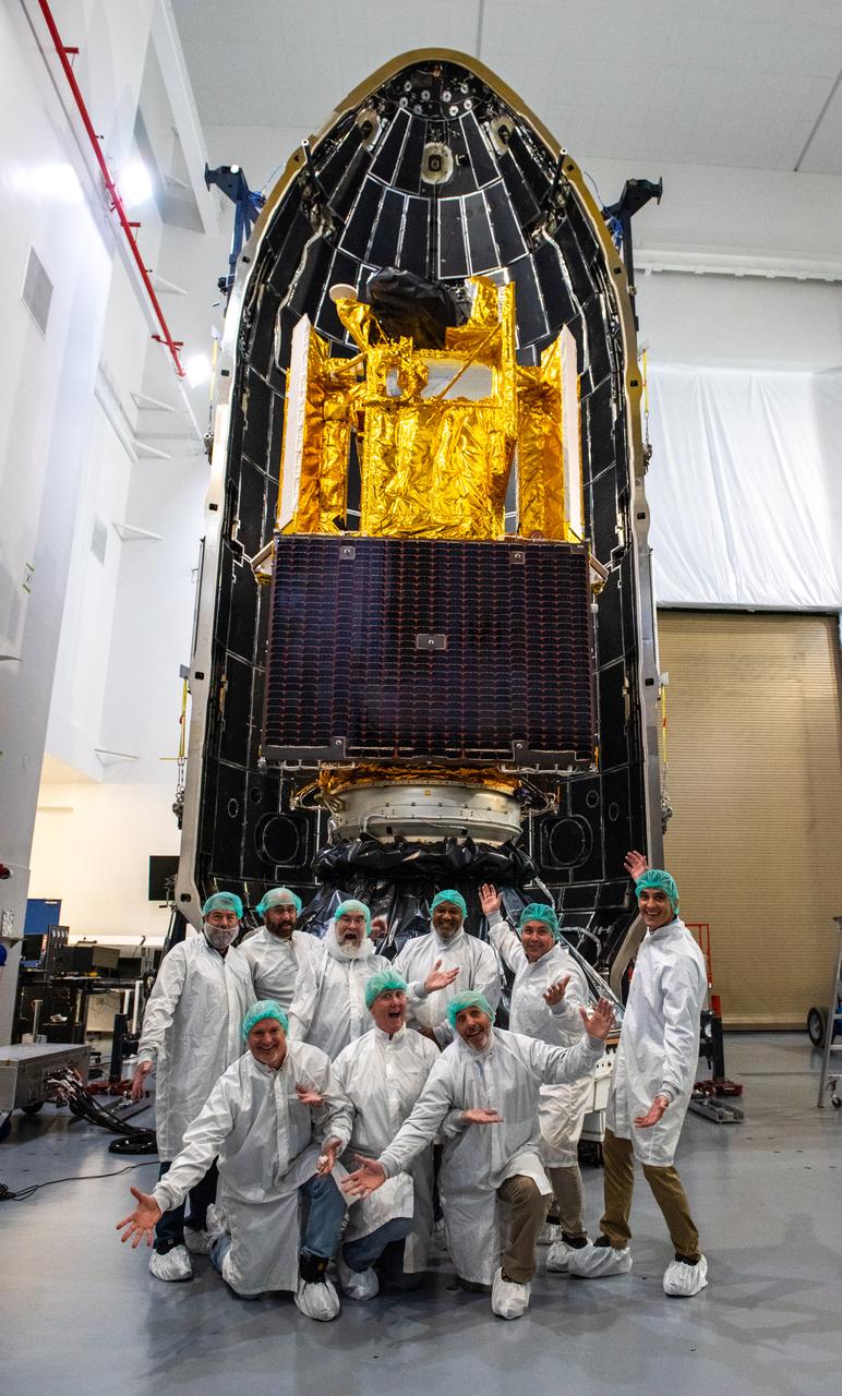
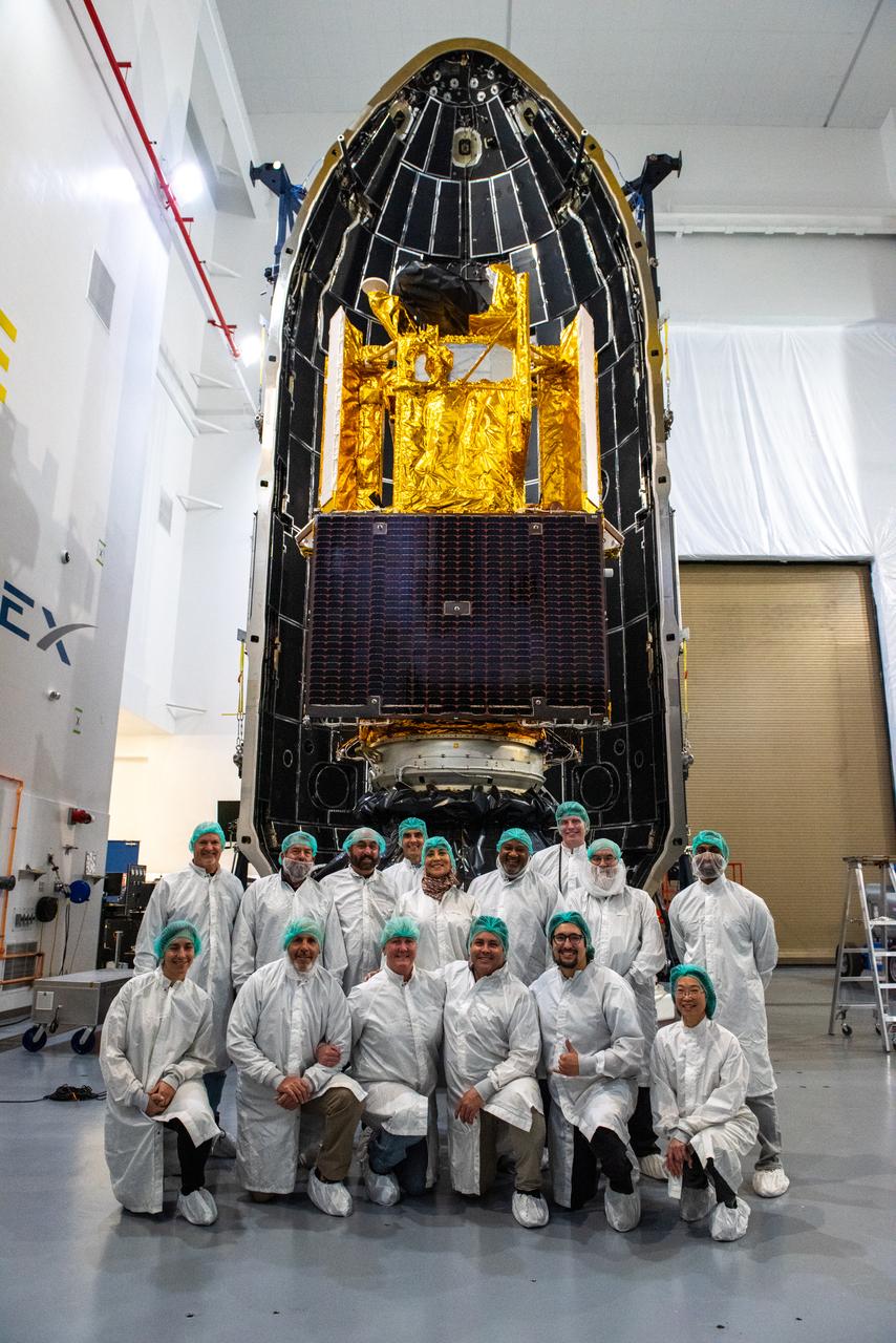
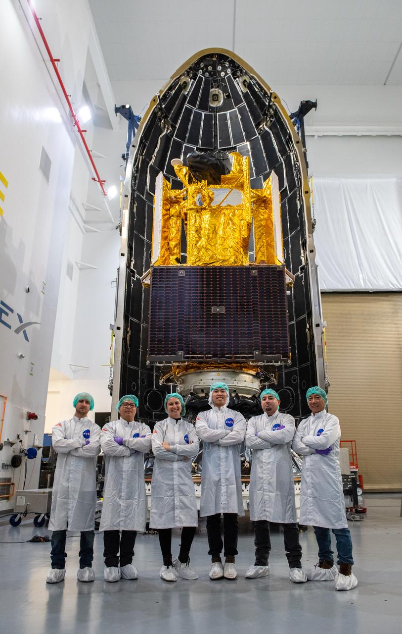
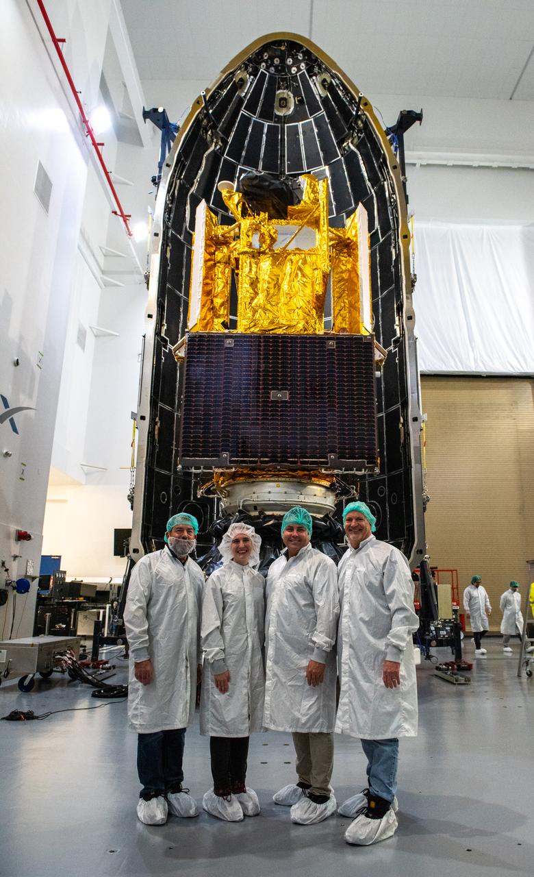
Inside the SpaceX facility at Vandenberg Space Force Base in California, the first half of the SpaceX Falcon 9 payload fairing is moved around the Surface Water and Ocean Topography (SWOT) satellite on Dec. 8, 2022. To mark the milestone, members of the processing team gather in front of the SWOT satellite. A collaboration between NASA and the French space agency Centre National d’Études Spatiales (CNES), with contributions from the Canadian Space Agency and the UK Space Agency, SWOT will be the first satellite to survey nearly all water on Earth’s surface. SWOT is scheduled to lift off aboard the SpaceX Falcon 9 rocket from Vandenberg on Dec. 15, 2022, at 3:46 a.m. PST.

Inside the SpaceX facility at Vandenberg Space Force Base in California, the first half of the SpaceX Falcon 9 payload fairing is moved around the Surface Water and Ocean Topography (SWOT) satellite on Dec. 8, 2022. To mark the milestone, members of the processing team gather in front of the SWOT satellite. A collaboration between NASA and the French space agency Centre National d’Études Spatiales (CNES), with contributions from the Canadian Space Agency and the UK Space Agency, SWOT will be the first satellite to survey nearly all water on Earth’s surface. SWOT is scheduled to lift off aboard the SpaceX Falcon 9 rocket from Vandenberg on Dec. 15, 2022, at 3:46 a.m. PST.
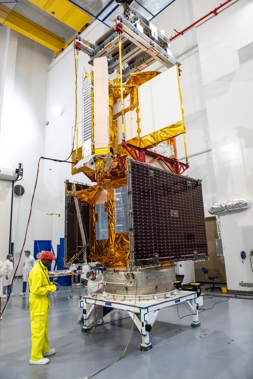
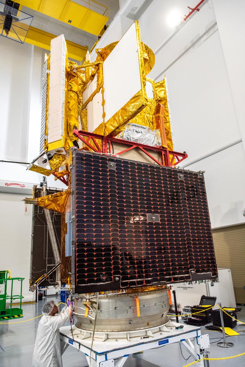
Inside the SpaceX facility at Vandenberg Space Force Base in California, a technician assists as a crane is used to lift the Surface Water and Ocean Topography (SWOT) satellite for mating to the payload adapter on Dec. 5, 2022. A collaboration between NASA and the French space agency Centre National d’Études Spatiales (CNES), with contributions from the Canadian Space Agency and the UK Space Agency, SWOT will be the first satellite to survey nearly all water on Earth’s surface. SWOT is scheduled to lift off aboard the SpaceX Falcon 9 rocket from Vandenberg on Dec. 15, 2022, at 3:46 a.m. PST.
Inside the SpaceX facility at Vandenberg Space Force Base in California, a crane is used to lift the Surface Water and Ocean Topography (SWOT) satellite for mating to the payload adapter on Dec. 5, 2022. A collaboration between NASA and the French space agency Centre National d’Études Spatiales (CNES), with contributions from the Canadian Space Agency and the UK Space Agency, SWOT will be the first satellite to survey nearly all water on Earth’s surface. SWOT is scheduled to lift off aboard the SpaceX Falcon 9 rocket from Vandenberg on Dec. 15, 2022, at 3:46 a.m. PST.
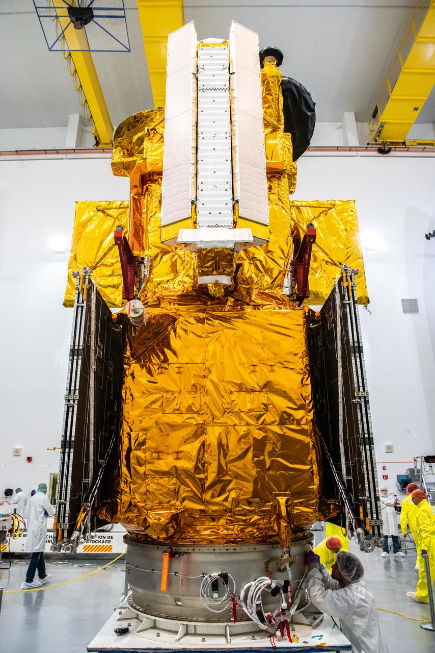
Inside the SpaceX facility at Vandenberg Space Force Base in California, decal fixtures are placed on the SpaceX Falcon 9 payload fairing of the Surface Water and Ocean Topography (SWOT) satellite on Dec. 9, 2022. A collaboration between NASA and the French space agency Centre National d’Études Spatiales (CNES), with contributions from the Canadian Space Agency and the UK Space Agency, SWOT will be the first satellite to survey nearly all water on Earth’s surface. SWOT is scheduled to lift off aboard the SpaceX Falcon 9 rocket from Vandenberg on Dec. 15, 2022, at 3:46 a.m. PST.
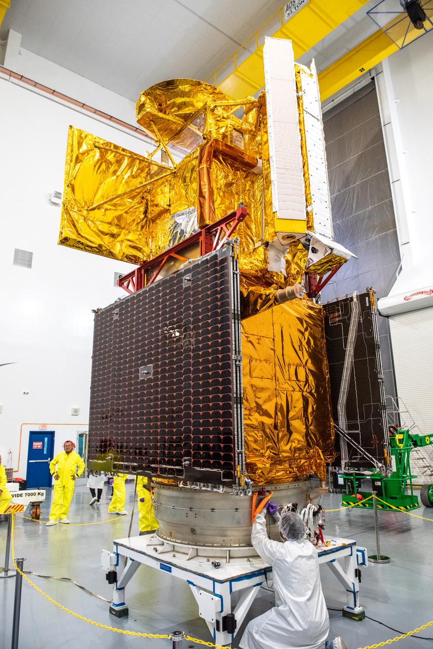
Inside the SpaceX facility at Vandenberg Space Force Base in California, a technician assists as a crane lowers the Surface Water and Ocean Topography (SWOT) satellite onto the payload adapter on Dec. 5, 2022. A collaboration between NASA and the French space agency Centre National d’Études Spatiales (CNES), with contributions from the Canadian Space Agency and the UK Space Agency, SWOT will be the first satellite to survey nearly all water on Earth’s surface. SWOT is scheduled to lift off aboard the SpaceX Falcon 9 rocket from Vandenberg on Dec. 15, 2022, at 3:46 a.m. PST.
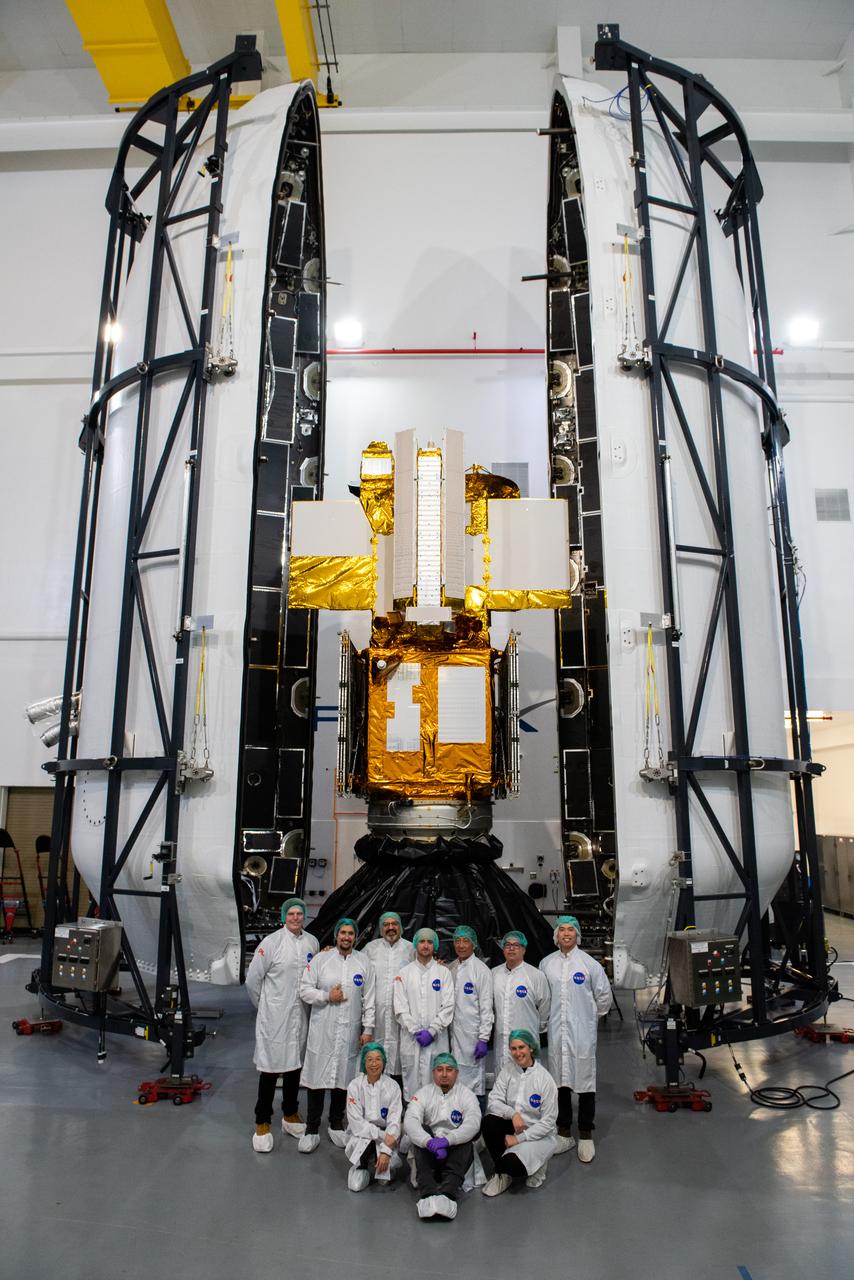
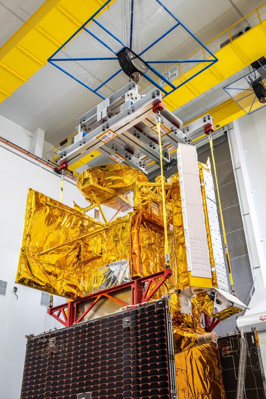
Inside the SpaceX facility at Vandenberg Space Force Base in California, both halves of the SpaceX Falcon 9 payload fairing are moved to enclose the Surface Water and Ocean Topography (SWOT) satellite on Dec. 8, 2022. To mark the milestone, members of the processing team gather in front of the SWOT satellite. A collaboration between NASA and the French space agency Centre National d’Études Spatiales (CNES), with contributions from the Canadian Space Agency and the UK Space Agency, SWOT will be the first satellite to survey nearly all water on Earth’s surface. SWOT is scheduled to lift off aboard the SpaceX Falcon 9 rocket from Vandenberg on Dec. 15, 2022, at 3:46 a.m. PST.
Inside the SpaceX facility at Vandenberg Space Force Base in California, a crane lifts the Surface Water and Ocean Topography (SWOT) satellite onto the payload adapter on Dec. 5, 2022. A collaboration between NASA and the French space agency Centre National d’Études Spatiales (CNES), with contributions from the Canadian Space Agency and the UK Space Agency, SWOT will be the first satellite to survey nearly all water on Earth’s surface. SWOT is scheduled to lift off aboard the SpaceX Falcon 9 rocket from Vandenberg on Dec. 15, 2022, at 3:46 a.m. PST.
Inside the SpaceX facility at Vandenberg Space Force Base in California, a crane is used to lower the Surface Water and Ocean Topography (SWOT) satellite for mating to the payload adapter on Dec. 5, 2022. A collaboration between NASA and the French space agency Centre National d’Études Spatiales (CNES), with contributions from the Canadian Space Agency and the UK Space Agency, SWOT will be the first satellite to survey nearly all water on Earth’s surface. SWOT is scheduled to lift off aboard the SpaceX Falcon 9 rocket from Vandenberg on Dec. 15, 2022, at 3:46 a.m. PST.
Inside the SpaceX facility at Vandenberg Space Force Base in California, the first half of the SpaceX Falcon 9 payload fairing is moved around the Surface Water and Ocean Topography (SWOT) satellite on Dec. 8, 2022. To mark the milestone, the processing team gathers in front of the SWOT satellite. A collaboration between NASA and the French space agency Centre National d’Études Spatiales (CNES), with contributions from the Canadian Space Agency and the UK Space Agency, SWOT will be the first satellite to survey nearly all water on Earth’s surface. SWOT is scheduled to lift off aboard the SpaceX Falcon 9 rocket from Vandenberg on Dec. 15, 2022, at 3:46 a.m. PST.
Inside the SpaceX facility at Vandenberg Space Force Base in California, a technician helps secure the Surface Water and Ocean Topography (SWOT) satellite onto the payload adapter on Dec. 5, 2022. A collaboration between NASA and the French space agency Centre National d’Études Spatiales (CNES), with contributions from the Canadian Space Agency and the UK Space Agency, SWOT will be the first satellite to survey nearly all water on Earth’s surface. SWOT is scheduled to lift off aboard the SpaceX Falcon 9 rocket from Vandenberg on Dec. 15, 2022, at 3:46 a.m. PST.
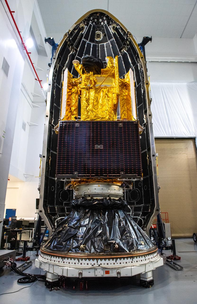
Inside the SpaceX facility at Vandenberg Space Force Base in California, the first half of the SpaceX Falcon 9 payload fairing is moved around the Surface Water and Ocean Topography (SWOT) satellite on Dec. 8, 2022. A collaboration between NASA and the French space agency Centre National d’Études Spatiales (CNES), with contributions from the Canadian Space Agency and the UK Space Agency, SWOT will be the first satellite to survey nearly all water on Earth’s surface. SWOT is scheduled to lift off aboard the SpaceX Falcon 9 rocket from Vandenberg on Dec. 15, 2022, at 3:46 a.m. PST.
Inside the SpaceX facility at Vandenberg Space Force Base in California, the first half of the SpaceX Falcon 9 payload fairing is moved around the Surface Water and Ocean Topography (SWOT) satellite on Dec. 8, 2022. To mark the milestone, members of the processing team gather in front of the SWOT satellite. A collaboration between NASA and the French space agency Centre National d’Études Spatiales (CNES), with contributions from the Canadian Space Agency and the UK Space Agency, SWOT will be the first satellite to survey nearly all water on Earth’s surface. SWOT is scheduled to lift off aboard the SpaceX Falcon 9 rocket from Vandenberg on Dec. 15, 2022, at 3:46 a.m. PST.
Inside the SpaceX facility at Vandenberg Space Force Base in California, the first half of the SpaceX Falcon 9 payload fairing is moved around the Surface Water and Ocean Topography (SWOT) satellite on Dec. 8, 2022. To mark the milestone, members of the processing team gather in front of the SWOT satellite. A collaboration between NASA and the French space agency Centre National d’Études Spatiales (CNES), with contributions from the Canadian Space Agency and the UK Space Agency, SWOT will be the first satellite to survey nearly all water on Earth’s surface. SWOT is scheduled to lift off aboard the SpaceX Falcon 9 rocket from Vandenberg on Dec. 15, 2022, at 3:46 a.m. PST.
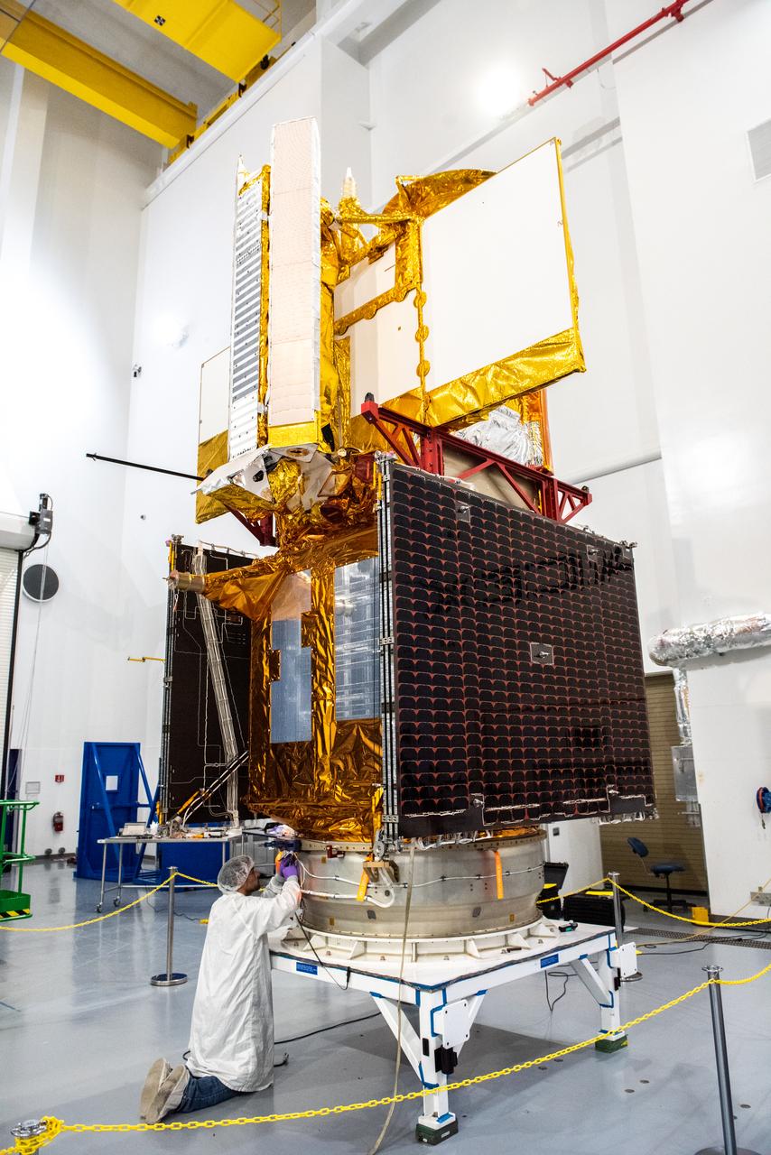
Inside the SpaceX facility at Vandenberg Space Force Base in California, a technician assists as a crane lowers the Surface Water and Ocean Topography (SWOT) satellite onto the payload adapter on Dec. 5, 2022. A collaboration between NASA and the French space agency Centre National d’Études Spatiales (CNES), with contributions from the Canadian Space Agency and the UK Space Agency, SWOT will be the first satellite to survey nearly all water on Earth’s surface. SWOT is scheduled to lift off aboard the SpaceX Falcon 9 rocket from Vandenberg on Dec. 15, 2022, at 3:46 a.m. PST.
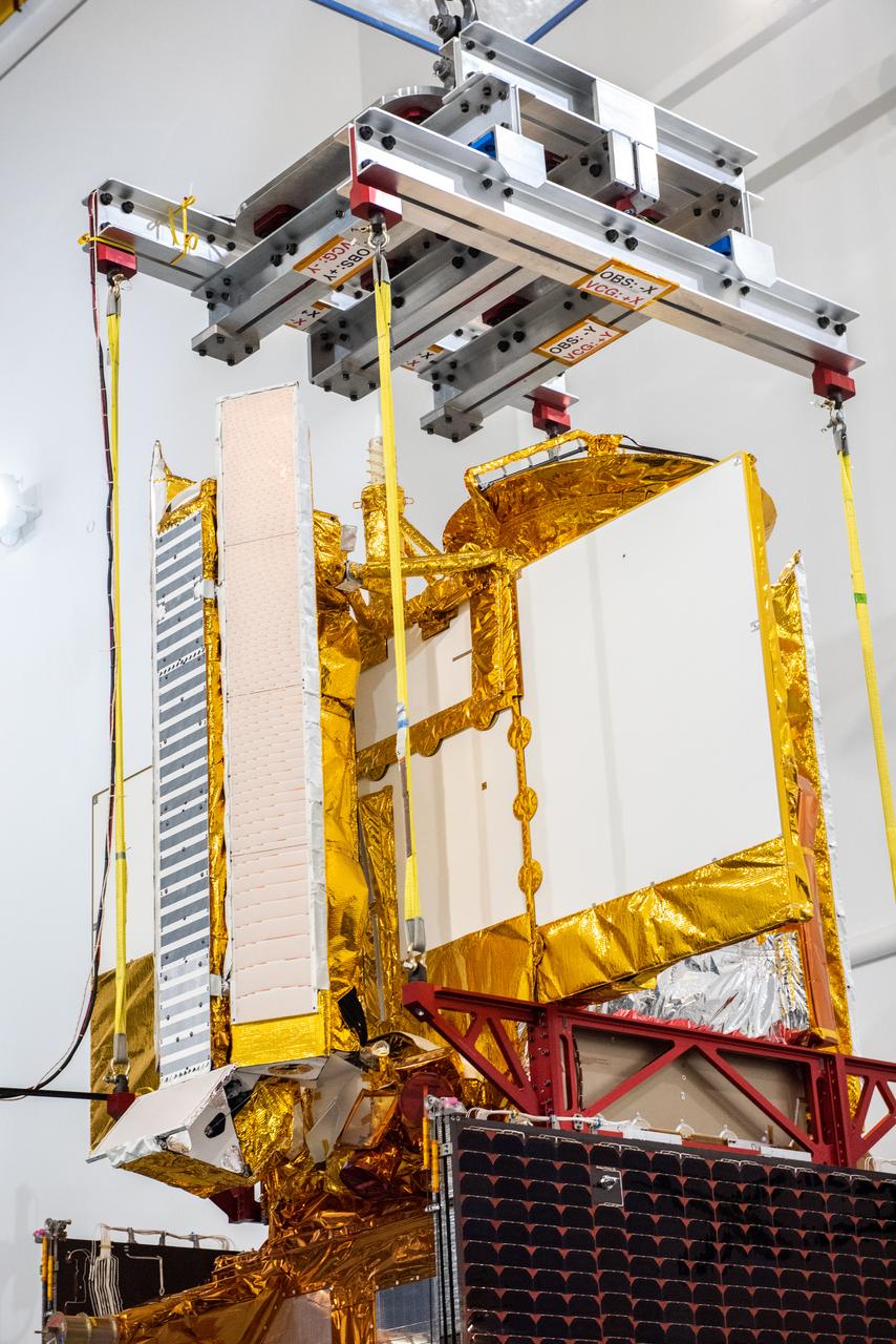
Inside the SpaceX facility at Vandenberg Space Force Base in California, a crane is used to lift the Surface Water and Ocean Topography (SWOT) satellite for mating to the payload adapter on Dec. 5, 2022. A collaboration between NASA and the French space agency Centre National d’Études Spatiales (CNES), with contributions from the Canadian Space Agency and the UK Space Agency, SWOT will be the first satellite to survey nearly all water on Earth’s surface. SWOT is scheduled to lift off aboard the SpaceX Falcon 9 rocket from Vandenberg on Dec. 15, 2022, at 3:46 a.m. PST.
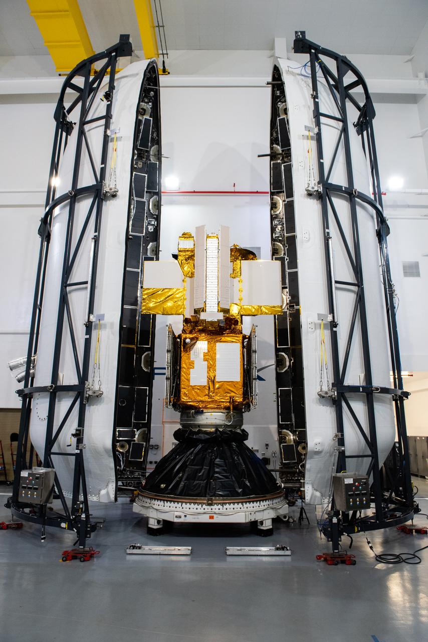
Inside the SpaceX facility at Vandenberg Space Force Base in California, both halves of the SpaceX Falcon 9 payload fairing are moved to enclose the Surface Water and Ocean Topography (SWOT) satellite on Dec. 8, 2022. A collaboration between NASA and the French space agency Centre National d’Études Spatiales (CNES), with contributions from the Canadian Space Agency and the UK Space Agency, SWOT will be the first satellite to survey nearly all water on Earth’s surface. SWOT is scheduled to lift off aboard the SpaceX Falcon 9 rocket from Vandenberg on Dec. 15, 2022, at 3:46 a.m. PST.
iss065e442803 (10/7/2021) --- European Space Agency (ESA) astronaut Thomas Pesquet gathers fluid physics and materials research hardware inside the International Space Station's Kibo laboratory module. Device for the Study of Critical Liquids and Crystallization (DECLIC) is a multi-user facility developed by the agency Centre National d’Etudes Spatiales (French Space Agency, CNES) and flown in collaboration with NASA. It is designed to support experiments in the fields of fluid physics and materials science. Special inserts allow researchers to study both ambient temperature critical point fluids and high temperature super-critical fluids. Another class of insert studies the dynamics and morphology of the fronts that form as a liquid material solidifies.
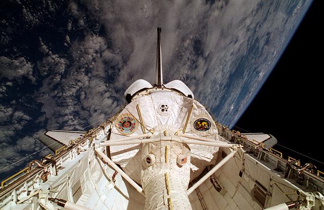
This is a Space Shuttle Columbia (STS-65) onboard photo of the second International Microgravity Laboratory (IML-2) in the cargo bay with Earth in the background. Mission objectives of IML-2 were to conduct science and technology investigations that required the low-gravity environment of space, with emphasis on experiments that studied the effects of microgravity on materials processes and living organisms. Materials science and life sciences are two of the most exciting areas of microgravity research because discoveries in these fields could greatly enhance the quality of life on Earth. If the structure of certain proteins can be determined by examining high-quality protein crystals grown in microgravity, advances can be made to improve the treatment of many human diseases. Electronic materials research in space may help us refine processes and make better products, such as computers, lasers, and other high-tech devices. The 14-nation European Space Agency (ESA), the Canadian Space Agency (SCA), the French National Center for Space Studies (CNES), the German Space Agency and the German Aerospace Research Establishment (DARA/DLR), and the National Space Development Agency of Japan (NASDA) participated in developing hardware and experiments for the IML missions. The missions were managed by NASA's Marshall Space Flight Center. The Orbiter Columbia was launched from the Kennedy Space Center on July 8, 1994 for the IML-2 mission.
This is the Space Shuttle Orbiter Discovery, STS-42 mission, with the First International Microgravity Laboratory (IML-1) module shown in the cargo bay. IML-1, the first in a series of Shuttle flights, was dedicated to study the fundamental materials and life sciences in the microgravity environment inside Spacelab, a laboratory carried aloft by the Shuttle. The mission explored how life forms adapt to weightlessness and investigated how materials behave when processed in space. The IML program gave a team of scientists from around the world access to a unique environment, one that is free from most of Earth's gravity. The 14-nation European Space Agency (ESA), the Canadian Space Agency (SCA), the French National Center for Space Studies (CNES), the German Space Agency and the German Aerospace Research Establishment (DARA/DLR), and the National Space Development Agency of Japan (NASDA) participated in developing hardware and experiments for the IML missions. The missions were managed by NASA's Marshall Space Flight Center. The Orbiter Discovery was launched on January 22, 1992 for the IML-1 mission.
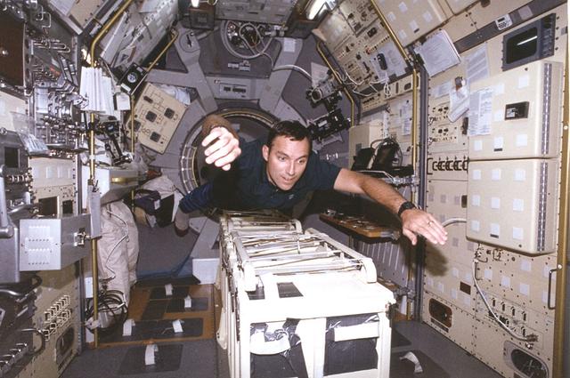
Astronaut Carl E. Walz, mission specialist, flies through the second International Microgravity Laboratory (IML-2) science module, STS-65 mission. IML was dedicated to study fundamental materials and life sciences in a microgravity environment inside Spacelab, a laboratory carried aloft by the Shuttle. The mission explored how life forms adapt to weightlessness and investigated how materials behave when processed in space. The IML program gave a team of scientists from around the world access to a unique environment, one that is free from most of Earth's gravity. Managed by the NASA Marshall Space Flight Center, the 14-nation European Space Agency (ESA), the Canadian Space Agency (SCA), the French National Center for Space Studies (CNES), the German Space Agency and the German Aerospace Research Establishment (DARA/DLR), and the National Space Development Agency of Japan (NASDA) participated in developing hardware and experiments for the IML missions. The missions were managed by NASA's Marshall Space Flight Center. The Orbiter Columbia was launched on July 8, 1994 for the IML-2 mission.
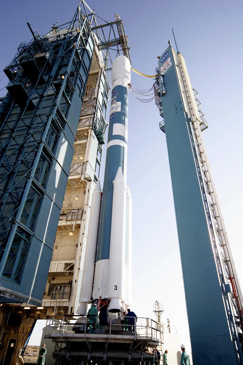
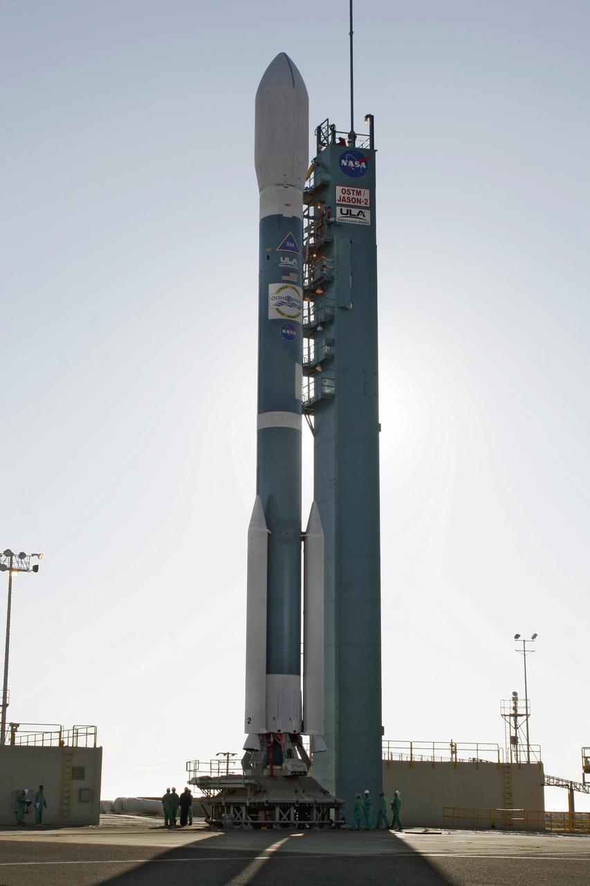
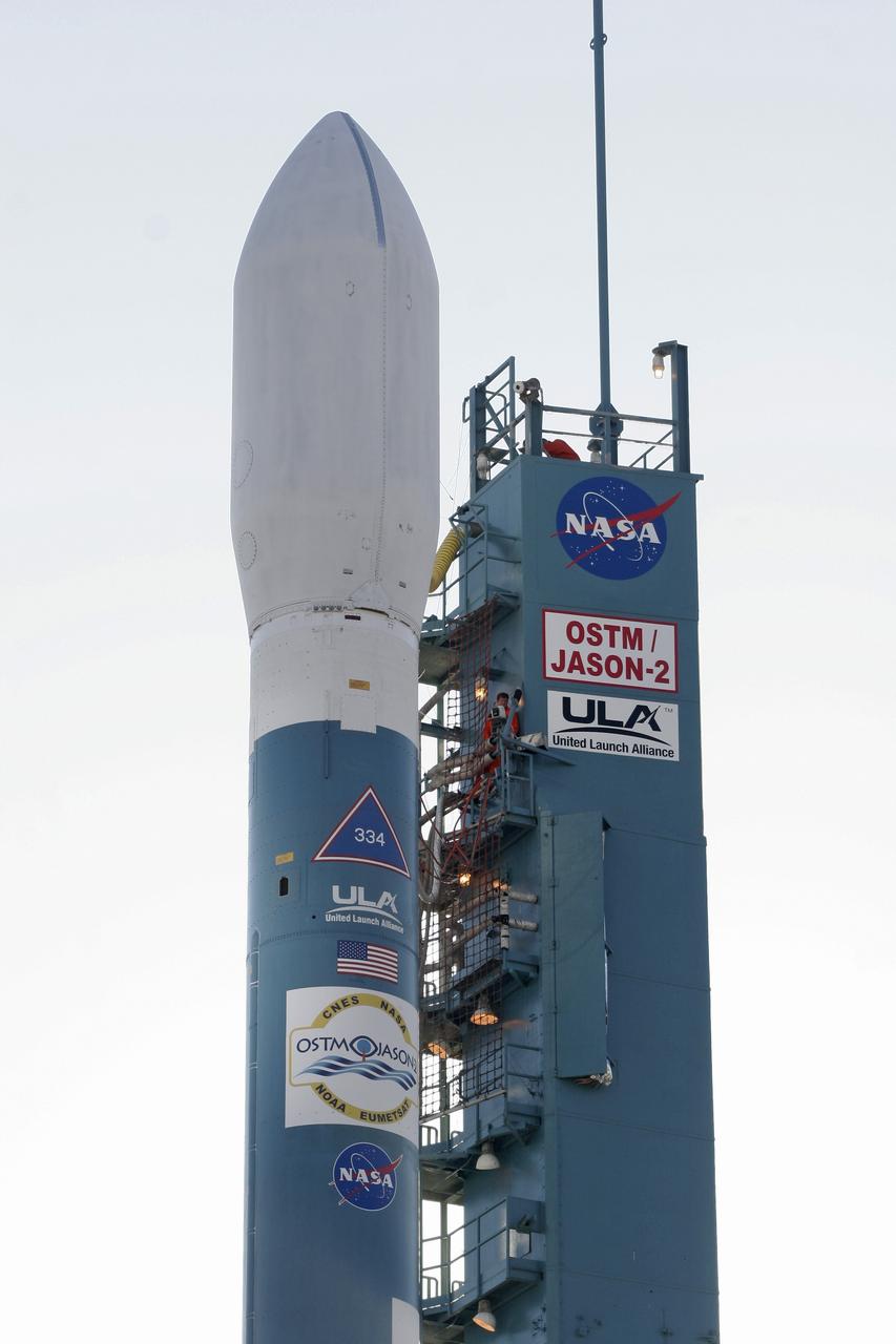
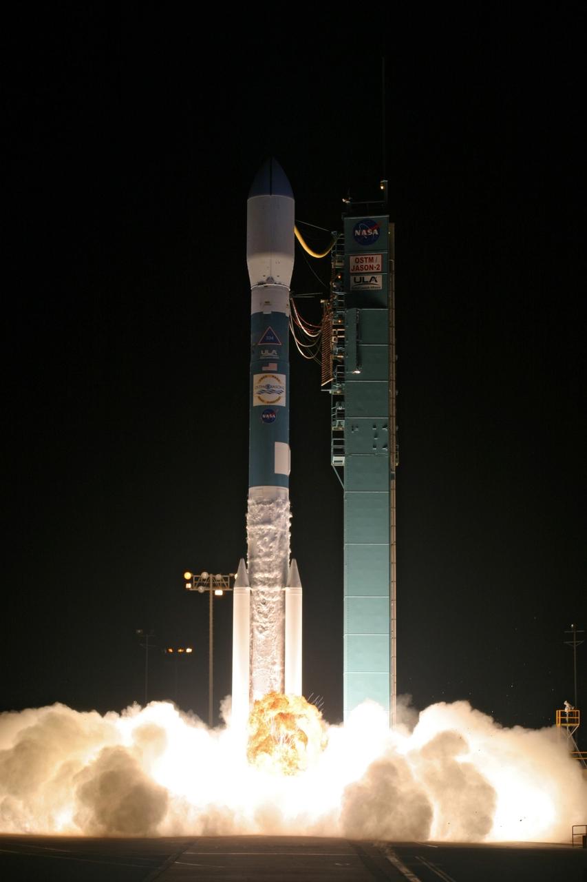
PASADENA, Calif. – A Delta II rocket carrying the Ocean Surface Topography Mission/Jason 2 satellite, is prepared for launch at Space Launch Complex 2 at Vandenberg Air Force Base, Calif. The OSTM/Jason 2 satellite will embark on a globe-circling voyage to continue charting sea level, a vital indicator of global climate change. The mission will return a vast amount of new data that will improve weather, climate and ocean forecasts. OSTM/Jason 2's expected lifetime of at least three years will extend into the next decade the continuous record of these data started in 1992 by NASA and the French space agency Centre National d'Etudes Spatiales, or CNES, with the TOPEX/Poseidon mission. The data collection was continued by the two agencies on Jason 1 in 2001. Photo credit: Carleton Bailie photograph for United Launch Alliance
PASADENA, Calif. – The NASA-French space agency Ocean Surface Topography Mission/Jason 2 satellite launched aboard a Delta II rocket from Space Launch Complex 2 at Vandenberg Air Force Base, Calif., at 12:46 a.m. PDT. Fifty-five minutes later, OSTM/Jason 2 separated from the rocket’s second stage, and then, unfurled its twin sets of solar arrays. The OSTM/Jason 2 satellite will embark on a globe-circling voyage to continue charting sea level, a vital indicator of global climate change. The mission will return a vast amount of new data that will improve weather, climate and ocean forecasts. OSTM/Jason 2's expected lifetime of at least three years will extend into the next decade the continuous record of these data started in 1992 by NASA and the French space agency Centre National d'Etudes Spatiales, or CNES, with the TOPEX/Poseidon mission. The data collection was continued by the two agencies on Jason 1 in 2001. Photo credit: Carleton Bailie photograph for United Launch Alliance
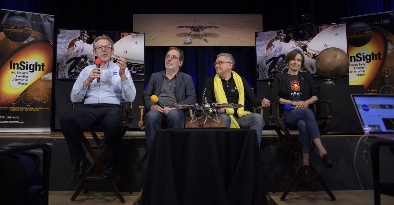
From left to right: NASA Chief Scientist Jim Green; HP3 Principle Investigator, German Aerospace Center (DLR), Tilman Spohn; SEIS Project Manager, French National Space Agency (CNES), Philippe Laudet; and InSight deputy principal investigator, NASA JPL, Sue Smrekar talk about Mars InSight during a social media briefing, Sunday, Nov. 25, 2018 at NASA's Jet Propulsion Laboratory in Pasadena, California. InSight, short for Interior Exploration using Seismic Investigations, Geodesy and Heat Transport, is a Mars lander designed to study the "inner space" of Mars: its crust, mantle, and core. InSight is scheduled to touch down on the Red Planet at approximately noon PST (3 p.m. EST) on Nov. 26. Photo Credit: (NASA/Bill Ingalls)
The new international satellite mission called Surface Water and Ocean Topography (SWOT) — slated for launch in late 2022 — will measure the height of Earth's surface water. The data the spacecraft will collect will help researchers understand and track the volume and location of water around the world. The satellite will assist with monitoring changes in floodplains and wetlands, measuring how much fresh water flows into and out of lakes and rivers and back to the ocean, and tracking regional shifts in sea level at scales never seen before. The satellite will also provide information on small-scale ocean currents that will support real-time marine operations affected by tides, currents, storm surge, sediment transport, and water quality issues. The payload is taking shape in a clean room at NASA's Jet Propulsion Laboratory in Southern California before being shipped to France. There, technicians and engineers from the French space agency Centre National d'Etudes Spatial (CNES), their prime contractor Thales Alenia Space, and JPL will complete the build and prepare the satellite for shipment to its California launch site at Vandenberg Air Force Base. JPL project manager Parag Vaze (pronounced vah-zay) is central to ensuring the handoff to his CNES counterpart Thierry Lafon goes smoothly. SWOT is being jointly developed by NASA and CNES, with contributions from the Canadian Space Agency (CSA) and United Kingdom Space Agency (UKSA). JPL, which is managed for NASA by Caltech in Pasadena, California, leads the U.S. component of the project. For the flight system, NASA is providing the Ka-band Radar Interferometer (KaRIn) instrument, a GPS science receiver, a laser retroreflector, and a two-beam microwave radiometer. CNES is providing the Doppler Orbitography and Radioposition Integrated by Satellite (DORIS) system, nadir altimeter, and the KaRIn RF subsystem (with support from the UKSA). CSA is providing the KaRIn high-power transmitter assembly. NASA is providing associated launch services. https://photojournal.jpl.nasa.gov/catalog/PIA24531
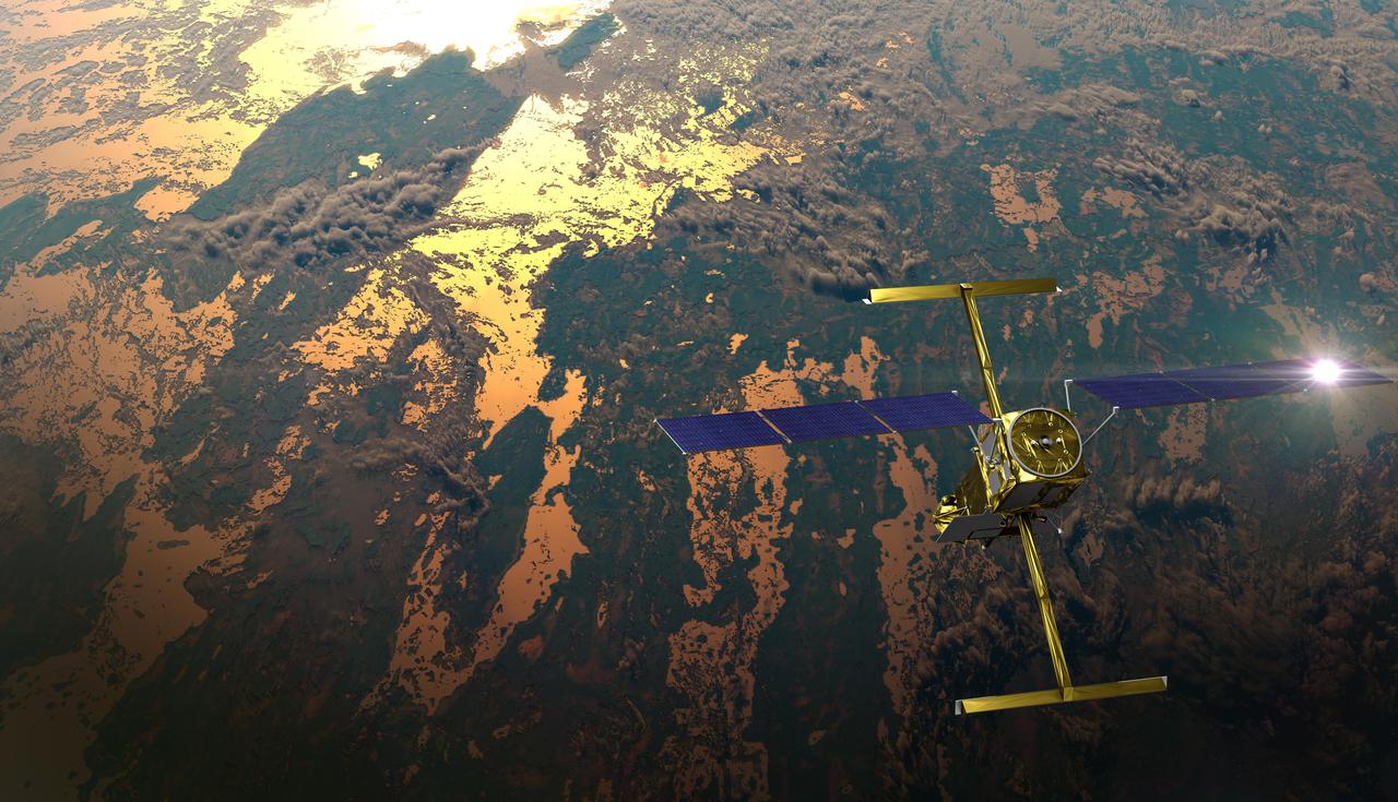
The international Surface Water and Ocean Topography (SWOT) satellite is shown in orbit over Earth in this illustration, with sunlight glinting off one of its solar arrays and both antennas of its Ka-band Radar Interferometer (KaRIn) instrument extended. The mission is a collaborative effort between NASA and the French space agency Centre National d'Études Spatiales (CNES) – with contributions from the Canadian Space Agency (CSA) and the UK Space Agency. KaRIn is the scientific heart of the SWOT satellite, which will survey the water on more than 90% of Earth's surface, measuring the height of water in lakes, rivers, reservoirs, and the ocean. To do that, KaRIn will transmit radar pulses to Earth's surface and use its two antennas to triangulate the return signals that bounce back. Mounted at the ends of a boom 33 feet (10 meters) long, the antennas will collect data along a swath 30 miles (50 kilometers) wide on either side of the satellite. KaRIn will operate in two modes: A lower-resolution mode over the ocean will involve significant onboard processing of the data to reduce the volume of information sent during downlinks to Earth; a higher-resolution mode will be used mainly over land. Scheduled to launch from Vandenberg Space Force Base in Central California on Dec. 15, 2022, SWOT is being jointly developed by NASA and CNES, with contributions from the CSA and the UK Space Agency. NASA's Jet Propulsion Laboratory, which is managed for the agency by Caltech in Pasadena, California, leads the U.S. component of the project. For the flight system payload, NASA is providing the Ka-band Radar Interferometer (KaRIn) instrument, a GPS science receiver, a laser retroreflector, a two-beam microwave radiometer, and NASA instrument operations. CNES is providing the Doppler Orbitography and Radioposition Integrated by Satellite (DORIS) system, the dual frequency Poseidon altimeter (developed by Thales Alenia Space), the KaRIn radio-frequency subsystem (together with Thales Alenia Space and with support from the UK Space Agency), the satellite platform, and ground control segment. CSA is providing the KaRIn high-power transmitter assembly. NASA is providing the launch vehicle and associated launch services. https://photojournal.jpl.nasa.gov/catalog/PIA25595
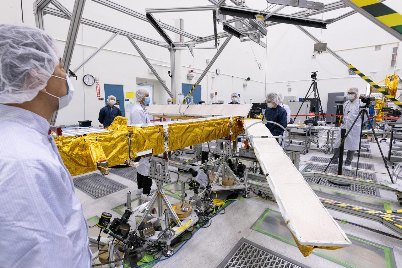
Members of the international Surface Water and Ocean Topography (SWOT) mission test one of the antennas for the Ka-band Radar Interferometer (KaRIn) instrument in a clean room at NASA's Jet Propulsion Laboratory in Southern California. The mission is a collaborative effort between NASA and the French space agency Centre National d'Études Spatiales (CNES) – with contributions from the Canadian Space Agency (CSA) and the UK Space Agency. KaRIn is the scientific heart of the SWOT satellite, which will survey the water on more than 90% of Earth's surface, measuring the height of water in lakes, rivers, reservoirs, and the ocean. To do that, KaRIn will transmit radar pulses to Earth's surface and use its two antennas to triangulate the return signals that bounce back. Mounted at the ends of a boom 33 feet (10 meters) long, the antennas will collect data along a swath 30 miles (50 kilometers) wide on either side of the satellite. KaRIn will operate in two modes: A lower-resolution mode over the ocean will involve significant onboard processing of the data to reduce the volume of information sent during downlinks to Earth; a higher-resolution mode will be used mainly over land. Scheduled to launch from Vandenberg Space Force Base in Central California on Dec. 15, 2022, SWOT is being jointly developed by NASA and CNES, with contributions from the CSA and the UK Space Agency. NASA's Jet Propulsion Laboratory, which is managed for the agency by Caltech in Pasadena, California, leads the U.S. component of the project. For the flight system payload, NASA is providing the Ka-band Radar Interferometer (KaRIn) instrument, a GPS science receiver, a laser retroreflector, a two-beam microwave radiometer, and NASA instrument operations. CNES is providing the Doppler Orbitography and Radioposition Integrated by Satellite (DORIS) system, the dual frequency Poseidon altimeter (developed by Thales Alenia Space), the KaRIn radio-frequency subsystem (together with Thales Alenia Space and with support from the UK Space Agency), the satellite platform, and ground control segment. CSA is providing the KaRIn high-power transmitter assembly. NASA is providing the launch vehicle and associated launch services. https://photojournal.jpl.nasa.gov/catalog/PIA25594
Workers in a clean room in Cannes, France, load the Surface Water and Ocean Topography (SWOT) satellite into a container in preparation for shipping the spacecraft to the U.S. SWOT is an international mission led by NASA and the French space agency Centre National d'Études Spatiales (CNES) that will survey water on more than 90% of Earth's surface. The spacecraft will view water in Earth's lakes, rivers, reservoirs, and the ocean in higher definition than ever before. The information that SWOT gathers will help inform water management decisions and prepare communities for rising seas and changing coastlines. It will also help researchers better understand the exchange of heat and carbon between the ocean and atmosphere, an important component of the role that Earth's ocean plays in the planet's climate. SWOT will launch out of the Vandenberg Space Force Base in central California no earlier than Dec. 5, 2022. SWOT is being jointly developed by NASA and CNES, with contributions from the Canadian Space Agency and the United Kingdom Space Agency. JPL, which is managed for NASA by Caltech in Pasadena, California, leads the U.S. component of the project. For the flight system payload, NASA is providing the KaRIn instrument, a GPS science receiver, a laser retroreflector, a two-beam microwave radiometer, and NASA instrument operations. CNES is providing the Doppler Orbitography and Radioposition Integrated by Satellite (DORIS) system, the dual frequency Poseidon altimeter (developed by Thales Alenia Space), the KaRIn radio-frequency subsystem (together with Thales Alenia Space and with support from the UK Space Agency), the platform, and ground control segment. CSA is providing the KaRIn high-power transmitter assembly. NASA is providing the launch vehicle and associated launch services. https://photojournal.jpl.nasa.gov/catalog/PIA24910
This enhanced-color close-up of a rock target called "Cine" was captured by the SuperCam instrument aboard NASA's Perseverance Mars rover on Sept. 17, 2021, the 206th Martian day, or sol, of rover's mission. SuperCam’s Remote Microscopic Imager took two images that were later combined to form this close-up. The target is 92 inches (2 meters) away, seen from the rover's mast. The image shows a rock layer made up of tightly packed millimeter-size gray, angular grains, or crystals. The image on the right shows a detail of the grain/crystal texture. The composition of this rock target was investigated with SuperCam's laser and spectrometer, along with the Mastcam-Z camera. Using these instruments, scientists can study the chemical composition of rocks from a distance. Analysis of "Cine" showed that it is rich in the mineral olivine. After the image was taken, the mission’s science team debated whether the rock is igneous (volcanic) or consists of fine sedimentary grains of igneous material that were cemented together in a watery environment. SuperCam is led by Los Alamos National Laboratory in New Mexico, where the instrument's body unit was developed. That part of the instrument includes several spectrometers as well as control electronics and software. The mast unit, including the Remote Microscopic Imager used for these images, was developed and built by several laboratories of the CNRS (the French research center) and French universities under the contracting authority of Centre National d'Etudes Spatiales (CNES), the French space agency. A key objective for Perseverance's mission on Mars is astrobiology, including the search for signs of ancient microbial life. The rover will characterize the planet's geology and past climate, pave the way for human exploration of the Red Planet, and be the first mission to collect and cache Martian rock and regolith (broken rock and dust). Subsequent NASA missions, in cooperation with ESA (European Space Agency), would send spacecraft to Mars to collect these sealed samples from the surface and return them to Earth for in-depth analysis. The Mars 2020 Perseverance mission is part of NASA's Moon to Mars exploration approach, which includes Artemis missions to the Moon that will help prepare for human exploration of the Red Planet. https://photojournal.jpl.nasa.gov/catalog/PIA24936
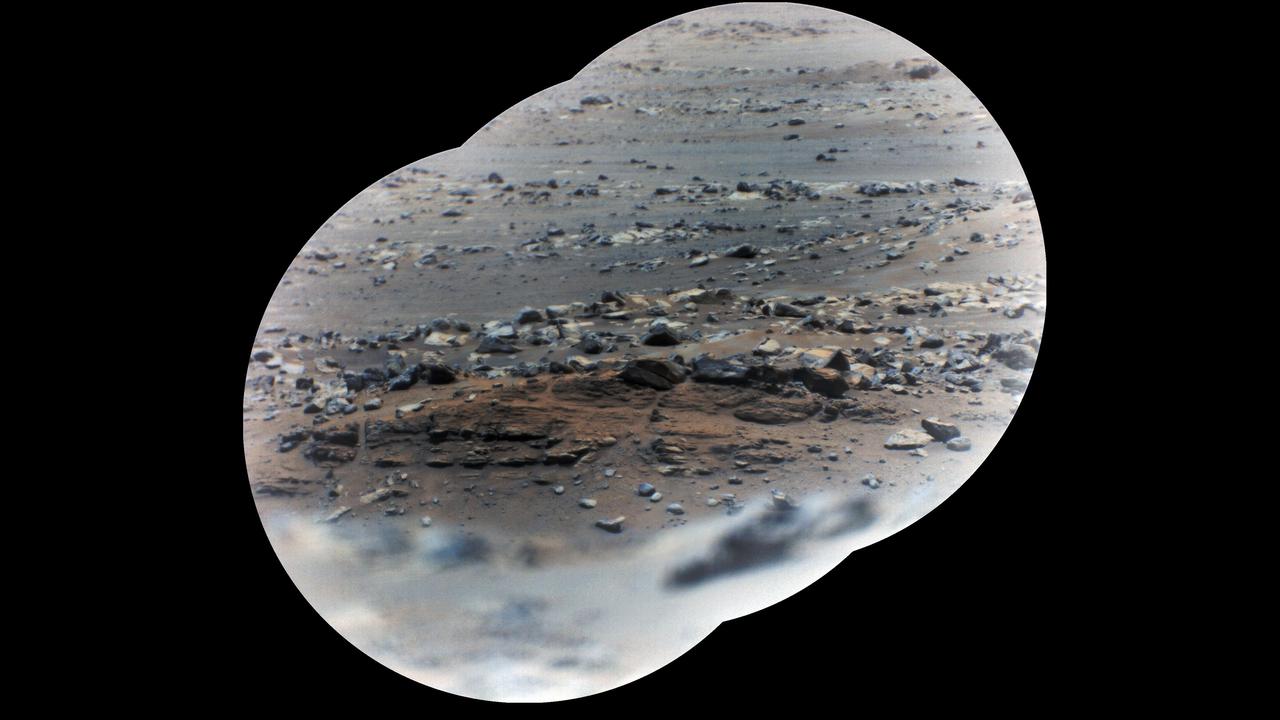
NASA's Perseverance rover took these zoomed-in images of a layered outcrop (just below center of image) nicknamed "Artuby" on June 17, 2021 (the 116th sol, or Martian Day, of its mission), from a little more than a third of a mile (615 meters) away. This mosaic is made up of three images taken by the Remote Microscopic Imager (RMI), part of the rover's SuperCam instrument. Each circular image has a field of view of 37.73 feet (11.50 meters) at this distance. The images were combined using an algorithm that weights the image centers. The outcrop shows evidence of being formed in an ancient lake. The feature is in the 'Verdon' quadrangle of Mars' Jezero Crater, south of the landing site. Artuby is the name of a river in southern France. Perseverance has been exploring the floor of Jezero Crater since it landed on Feb. 18, 2021. SuperCam is led by Los Alamos National Laboratory in New Mexico, where the instrument's Body Unit was developed. That part of the instrument includes several spectrometers as well as control electronics and software. The Mast Unit, including the RMI used for these images, was developed and built by several laboratories of the CNRS (the French research center) and French universities under the contracting authority of Centre National d'Etudes Spatiales (CNES, the French space agency). A key objective for Perseverance's mission on Mars is astrobiology, including the search for signs of ancient microbial life. The rover will characterize the planet's geology and past climate, pave the way for human exploration of the Red Planet, and be the first mission to collect and cache Martian rock and regolith (broken rock and dust). Subsequent NASA missions, in cooperation with ESA (European Space Agency), would send spacecraft to Mars to collect these sealed samples from the surface and return them to Earth for in-depth analysis. The Mars 2020 Perseverance mission is part of NASA's Moon to Mars exploration approach, which includes Artemis missions to the Moon that will help prepare for human exploration of the Red Planet. https://photojournal.jpl.nasa.gov/catalog/PIA24747
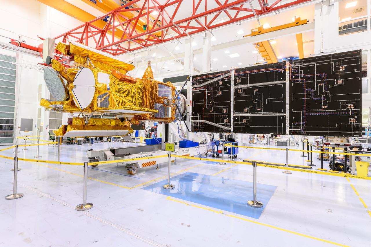
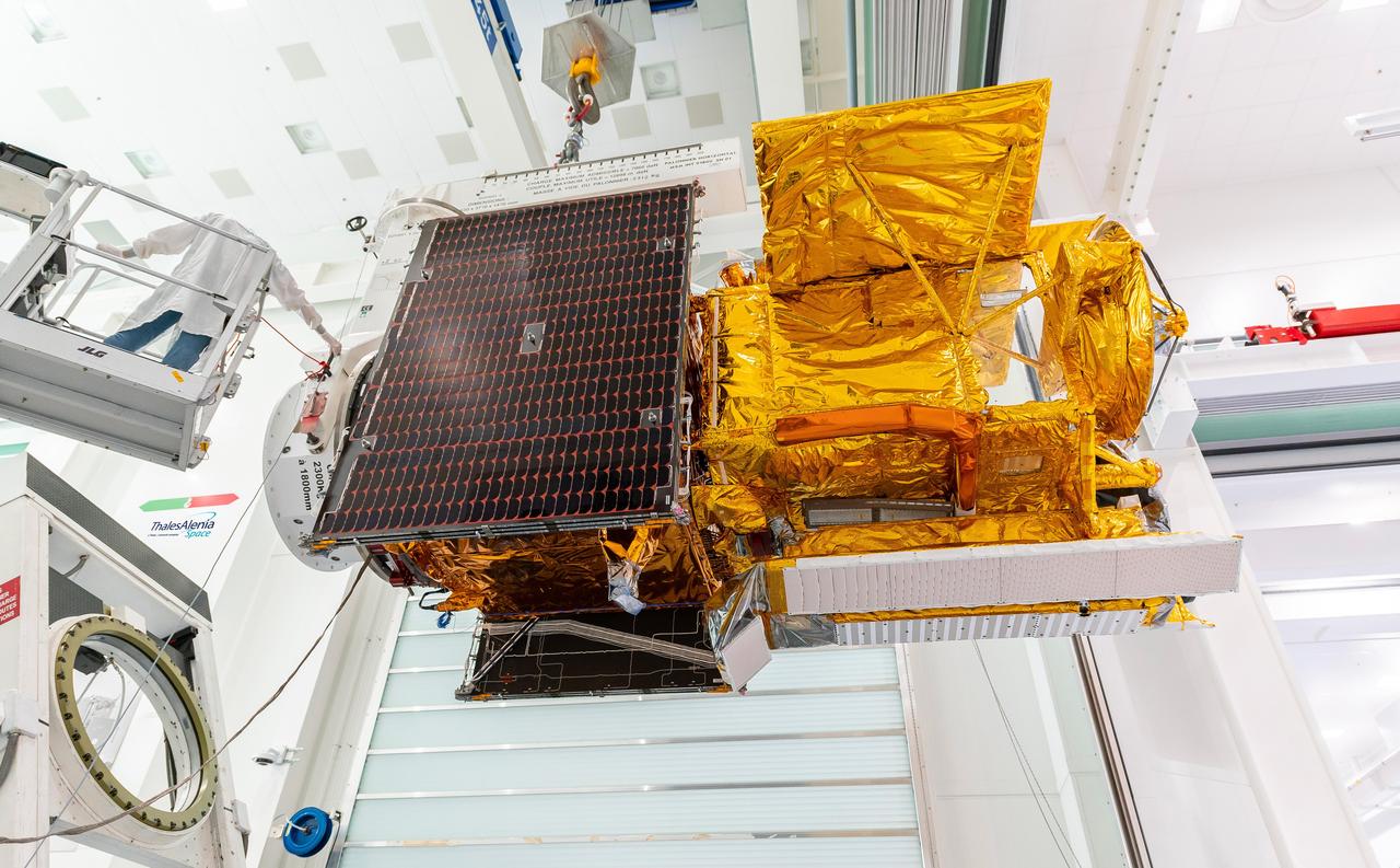
The solar panels on the Surface Water and Ocean Topography (SWOT) satellite unfold as part of a test in January 2022 at a Thales Alenia Space manufacturing facility near Cannes, France. The SWOT mission is being jointly led by NASA and the French space agency Centre National d'Études Spatiales (CNES), with contributions from the Canadian Space Agency and the United Kingdom Space Agency. Many of SWOT's radar instruments were built at NASA's Jet Propulsion Laboratory in Southern California before being transported to France, where Thales Alenia is assembling the full satellite. Following a series of tests, SWOT will be transported to Vandenberg Space Force Base in Southern California for launch in November 2022. In orbit, SWOT will collect information of unprecedented detail on sea-level height, which will help scientists study the role of ocean currents in moderating climate change, as well as the elevations of fresh water bodies, which will enable researchers for the first time to take inventory of the planet's rivers, lakes, reservoirs, and other surface water. https://photojournal.jpl.nasa.gov/catalog/PIA25147
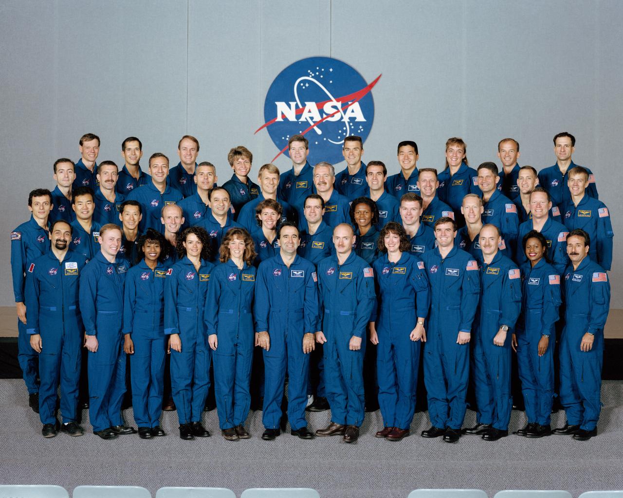
S96-18546 (5 Nov. 1996) --- Following their selection from among 2,400 applicants, the 44 astronaut candidates begin a lengthy period of training and evaluation at NASA's Johnson Space Center as they gather for their group portrait. This year?s class is the largest in the history of space shuttle astronauts and their early program predecessors. Ten pilots and 25 mission specialists make up the internationally diverse class. The international trainees represent the Canadian, Japanese, Italian, French, German and European space agencies. Back row ? from the left, Christer Fuglesang, John Herrington, Steve MacLean, Peggy Whitson, Stephen Frick, Duane Carey, Daniel Tani, Heidemarie Stefanyshyn-Piper, Jeffrey Williams and Donald Pettit. Second to back row ? from the left, Philippe Perrin, Daniel Burbank, Michael Massimino, Lee Morin, Piers Sellers, John Phillips, Richard Mastraccio, Christopher Loria, Paul Lockhart, Charles Hobaugh and William McCool. Second to front row ? from the left, Pedro Duque, Soichi Noguchi, Mamoru Mohri, Gerhard Thiele, Mark Polansky, Sandra Magnus, Paul Richards, Yvonne Cagle, James Kelly, Patrick Forrester and David Brown. Front row ? from the left, Umberto Guidoni, Edward Fincke, Stephanie Wilson, Julie Payette, Lisa Nowak, Fernando Caldeiro, Mark Kelly, Laurel Clark, Rex Walheim, Scott Kelly, Joan Higginbotham and Charles Camarda. Guidoni represents the Italian Space Agency (ASI). Fuglesang and Duque represent the European Space Agency (ESA). Mohri and Noguchi represent the Japanese Space Agency (NASDA). MacLean and Payette are with the Canadian Space Agency. Perrin is associated with the French Space Agency (CNES) and Thiele represents the German Space Agency (DARA). Photo credit: NASA or National Aeronautics and Space Administration
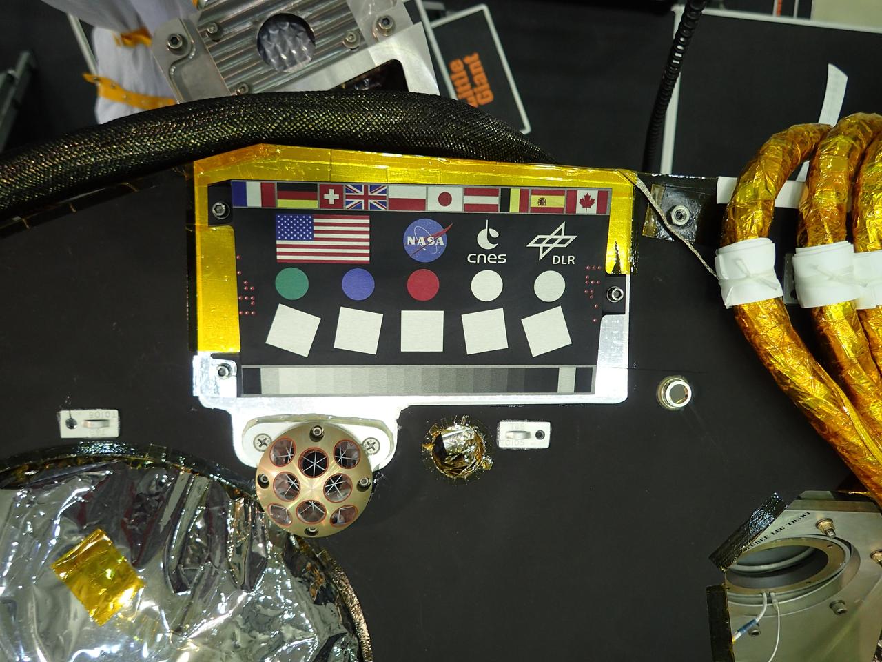
A camera calibration target sits on the deck of the NASA's InSight lander, adorned with the flags of the countries participating in the mission. The target, which will be viewed by InSight's cameras, provides a variety of colors and shapes to help calibrate the lander's cameras. It also shows off international flags representing the agencies, institutions and participating scientists of the mission as of late 2014 (since that time, Italy has contributed an experiment). In the second row are the United States flag and the logos of NASA, the French space agency CNES, which provided InSight's seismometer; and the German Aerospace Center DLR, which provided InSight's heat flow probe. Below the target in the photo is an Italian experiment called the Laser Retroreflector for InSight (LaRRI). LaRRI is the small, copper-colored dome covered with circles just below the calibration target; it won't actually play a role in InSight's mission. The national space agency of Italy (ASI, for Agenzia Spaziale Italiana) provided LaRRI to be used by a possible future Mars orbiter mission with a laser altimeter making extremely precise measurements of the lander's location for fundamental physics studies and precision cartography. A microchip bearing the names of nearly a million members of the public is visible in this image to the right of the calibration target. A second microchip with more than a million additional names was added after this photo was taken. https://photojournal.jpl.nasa.gov/catalog/PIA22540
These images from the Chemistry and Camera (ChemCam) instrument on NASA's Curiosity Mars rover indicate similarly dark material, but with very different chemistries, in mineral veins at "Garden City." Each of the side-by-side circular images covers an area about 2 inches (5 centimeters) in diameter. The images were taken by ChemCam's Remote Micro-Imager. Researchers used ChemCam's laser, telescope and spectrometers to examine the chemistry of material in these veins. While both of these veins are dark, their chemistries are very different, indicating that they were formed by different fluids. One common aspect of the chemistry in the dark material is an iron content higher than nearby bedrock. Thus the dark appearance may be result of similar iron content. The dark maerial in the vein on the left is enriched in calcium and contains calcium fluorine. The dark material in the vein on the right is enriched in magnesium, but not in calcium or calcium fluorine. Thus, the veins were formed by different fluids that deposited minerals in rock fractures. The Remote Micro-Imager took the image on the left on March 27, 2015, during the 938th Martian day, or sol, of Curiosity's work on Mars. The next day, it took the image on the right. A broader view of the prominent mineral veins at Garden City is at PIA19161. ChemCam is one of 10 instruments in Curiosity's science payload. The U.S. Department of Energy's Los Alamos National Laboratory, in Los Alamos, New Mexico, developed ChemCam in partnership with scientists and engineers funded by the French national space agency (CNES), the University of Toulouse and the French national research agency (CNRS). More information about ChemCam is available at http://www.msl-chemcam.com. http://photojournal.jpl.nasa.gov/catalog/PIA19924
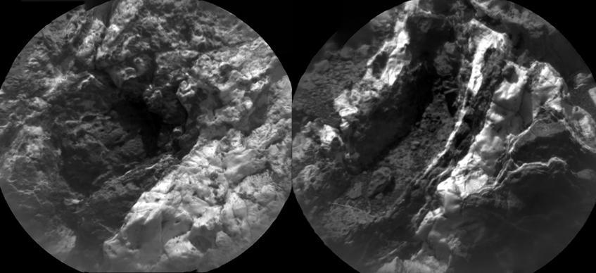
Composed of five images, this mosaic of the Jezero Crater's "Delta Scarp" was taken on March 17, 2021, by the Remote Microscopic Imager (RMI) camera aboard NASA's Perseverance rover from 1.4 miles (2.25 kilometers) away. Scientists believe the 377-foot-wide (115-meter-wide) escarpment is a portion of the remnants of a fan-shaped deposit of sediments that resulted from the confluence between an ancient river and an ancient lake. An annotated version of the same image (Figure 1) reveals location of a conglomerate (rock composed of coarse-grained pebbles mixed with sand) and examples of crossbedding (tilted layers of sedimentary rock that can result from water passing over a loose bed of sediment). Part of the SuperCam instrument, the RMI is able to spot an object the size of a softball from nearly a mile away, allowing scientists to take images of details from a long distance. It also provides fine details of nearby targets zapped by SuperCam's laser. SuperCam is led by Los Alamos National Laboratory in New Mexico, where the instrument's Body Unit was developed. That part of the instrument includes several spectrometers as well as control electronics and software. The Mast Unit was developed and built by several laboratories of the CNRS (the French research center) and French universities under the contracting authority of CNES (the French space agency). A key objective for Perseverance's mission on Mars is astrobiology, including the search for signs of ancient microbial life. The rover will characterize the planet's geology and past climate, pave the way for human exploration of the Red Planet, and be the first mission to collect and cache Martian rock and regolith (broken rock and dust). Subsequent NASA missions, in cooperation with ESA (European Space Agency), would send spacecraft to Mars to collect these sealed samples from the surface and return them to Earth for in-depth analysis. The Mars 2020 Perseverance mission is part of NASA's Moon to Mars exploration approach, which includes Artemis missions to the Moon that will help prepare for human exploration of the Red Planet. https://photojournal.jpl.nasa.gov/catalog/PIA24683
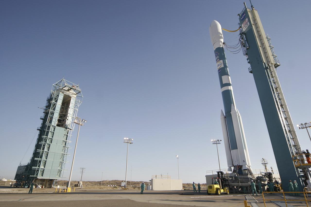
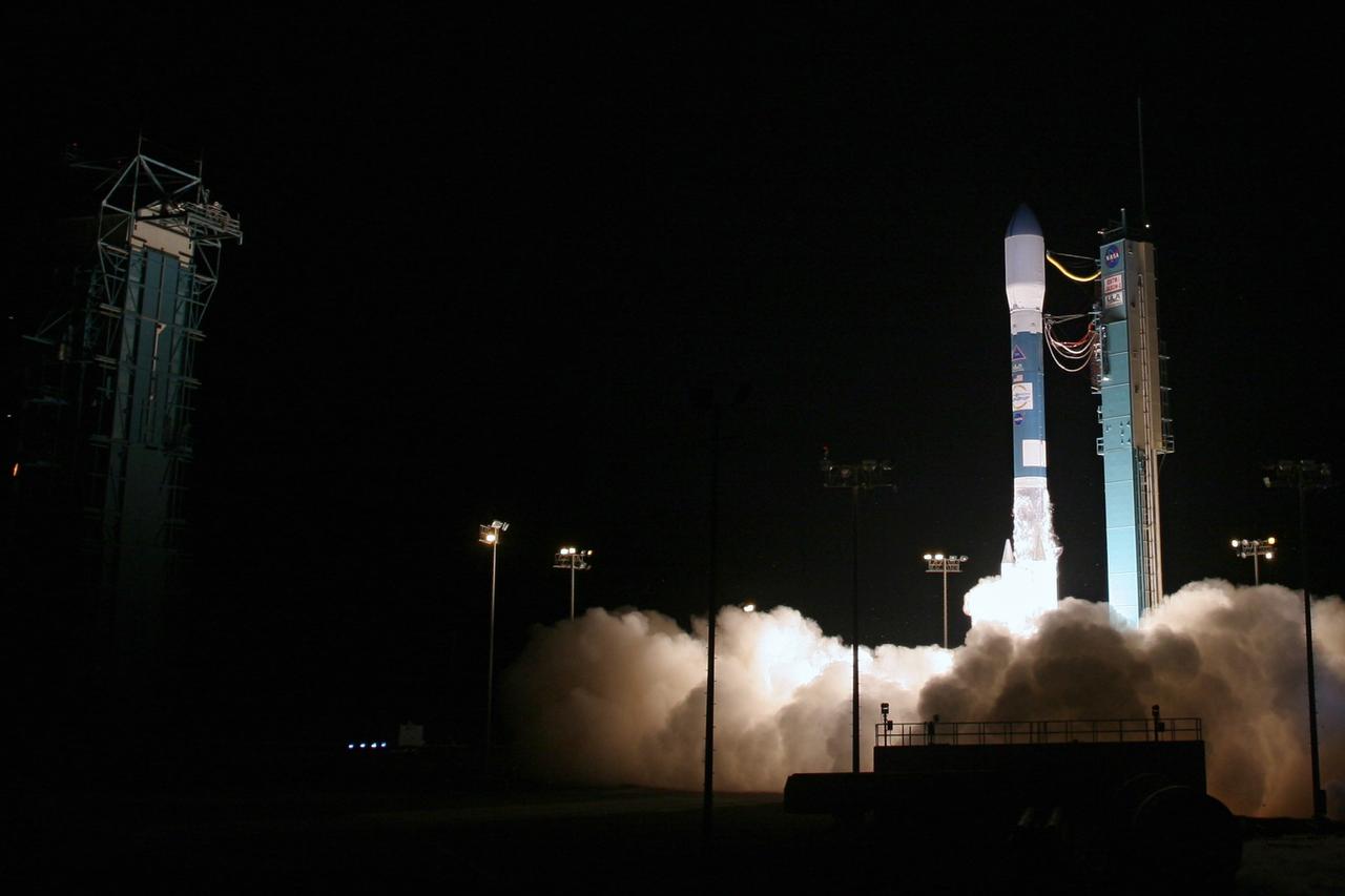
VANDENBERG AIR FORCE BASE, Calif. – The Delta II rocket with the Ocean Surface Topography Mission, or OSTM/Jason 2, aboard is poised for launch on Space Launch Complex 2 after rollback of the mobile service tower (at left). The OSTM/Jason 2 satellite will embark on a globe-circling voyage to continue charting sea level, a vital indicator of global climate change. The mission will return a vast amount of new data that will improve weather, climate and ocean forecasts. OSTM/Jason 2's expected lifetime of at least three years will extend into the next decade the continuous record of these data started in 1992 by NASA and the French space agency Centre National d'Etudes Spatiales, or CNES, with the TOPEX/Poseidon mission. The data collection was continued by the two agencies on Jason-1 in 2001. The launch window extends from 12:46 a.m. to 12:55 a.m. PDT. The satellite will be placed in an 830-mile-high orbit at an inclination of 66 degrees after separating from the Delta II 55 minutes after liftoff. Photo credit: Photograph by Carleton Bailie for United Launch Alliance
VANDENBERG AIR FORCE BASE, Calif. – The Delta II rocket with the Ocean Surface Topography Mission, or OSTM/Jason 2, aboard is poised for launch on Space Launch Complex 2 after rollback of the mobile service tower. The OSTM/Jason 2 satellite will embark on a globe-circling voyage to continue charting sea level, a vital indicator of global climate change. The mission will return a vast amount of new data that will improve weather, climate and ocean forecasts. OSTM/Jason 2's expected lifetime of at least three years will extend into the next decade the continuous record of these data started in 1992 by NASA and the French space agency Centre National d'Etudes Spatiales, or CNES, with the TOPEX/Poseidon mission. The data collection was continued by the two agencies on Jason-1 in 2001. The launch window extends from 12:46 a.m. to 12:55 a.m. PDT. The satellite will be placed in an 830-mile-high orbit at an inclination of 66 degrees after separating from the Delta II 55 minutes after liftoff. Photo credit: Photograph by Carleton Bailie for United Launch Alliance
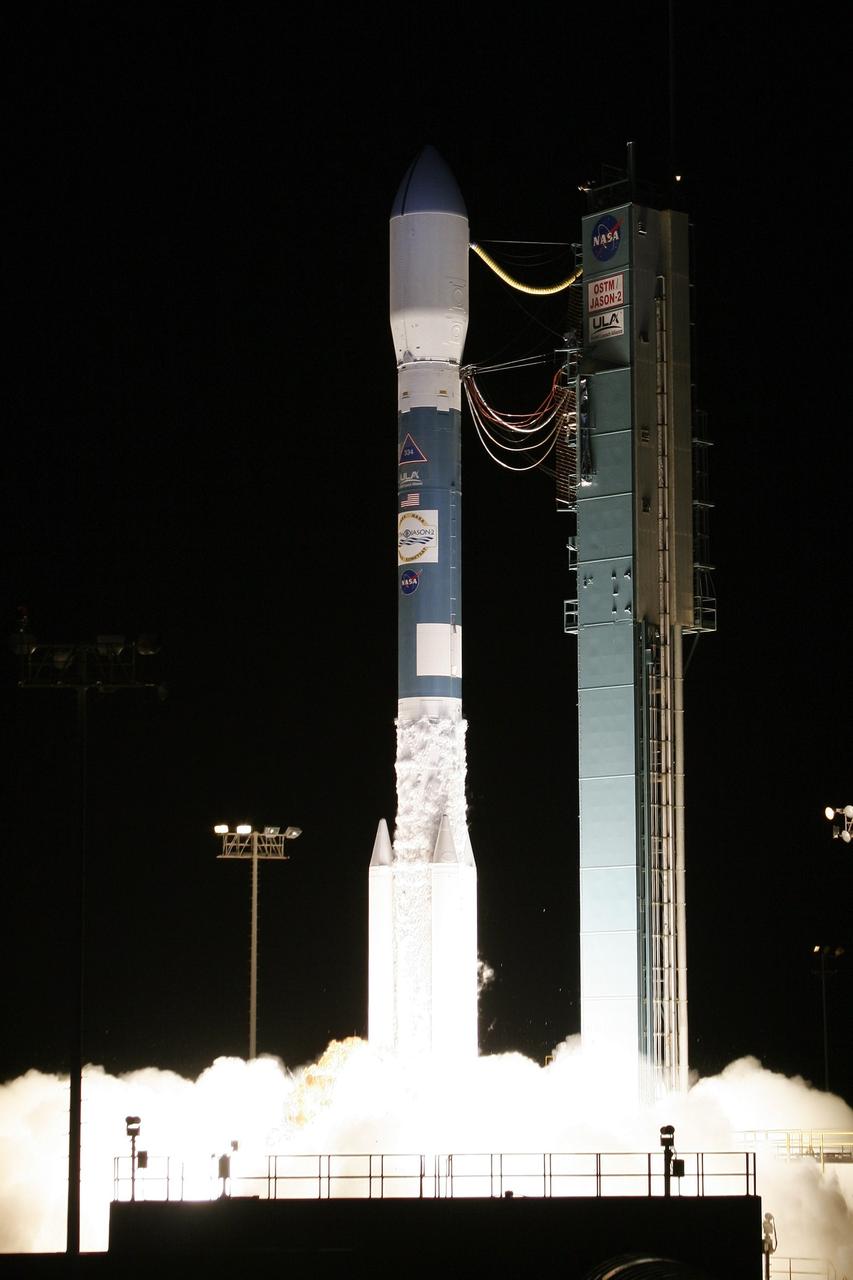
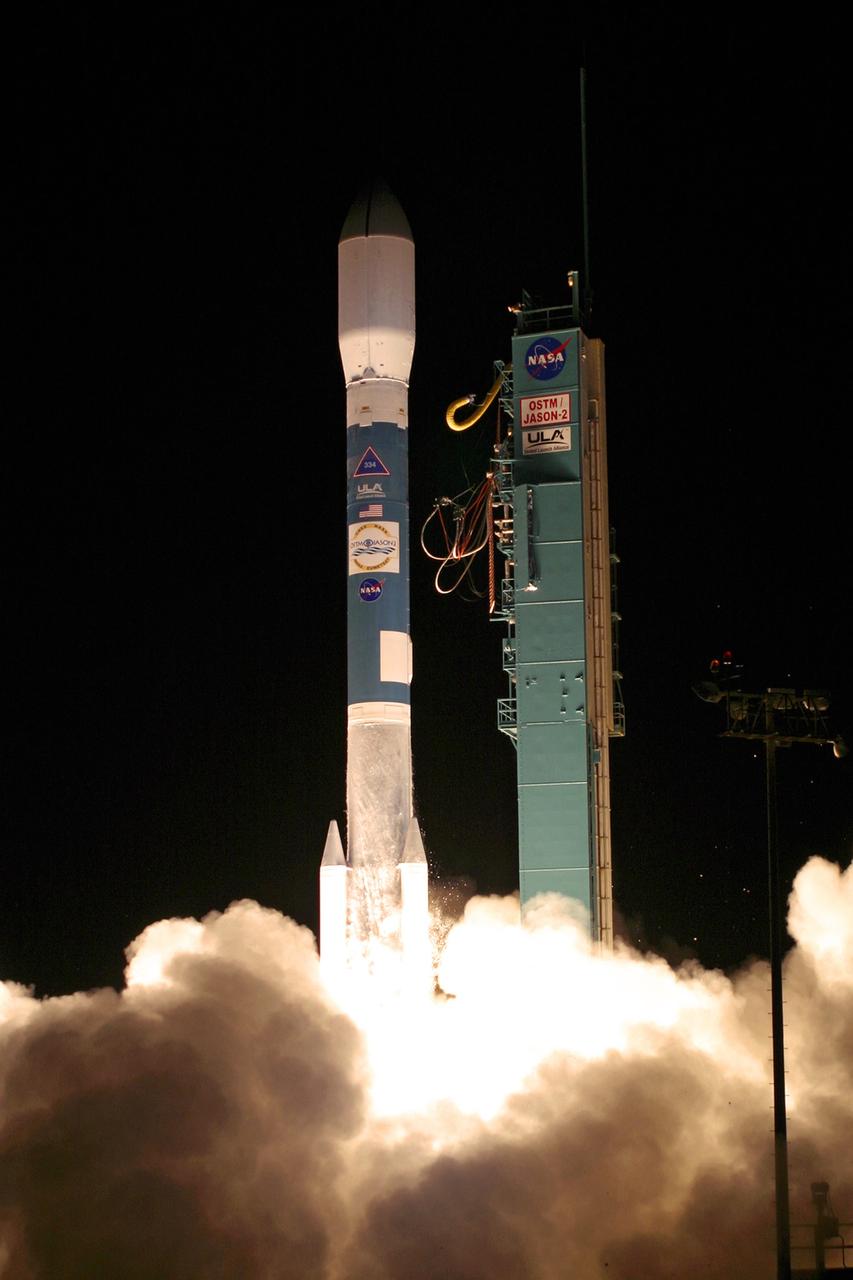
VANDENBERG AIR FORCE BASE, Calif. – Fiery clouds light up Space Launch Complex-2 at the liftoff of the Delta II rocket carrying the Ocean Surface Topography Mission, or OSTM/Jason 2, spacecraft. The OSTM/Jason 2 satellite will embark on a globe-circling voyage to continue charting sea level, a vital indicator of global climate change. The mission will return a vast amount of new data that will improve weather, climate and ocean forecasts. OSTM/Jason 2's expected lifetime of at least three years will extend into the next decade the continuous record of these data started in 1992 by NASA and the French space agency Centre National d'Etudes Spatiales, or CNES, with the TOPEX/Poseidon mission. The data collection was continued by the two agencies on Jason-1 in 2001. The launch window extends from 12:46 a.m. to 12:55 a.m. PDT. The satellite will be placed in an 830-mile-high orbit at an inclination of 66 degrees after separating from the Delta II 55 minutes after liftoff. Photo credit: Photograph by Carleton Bailie for United Launch Alliance
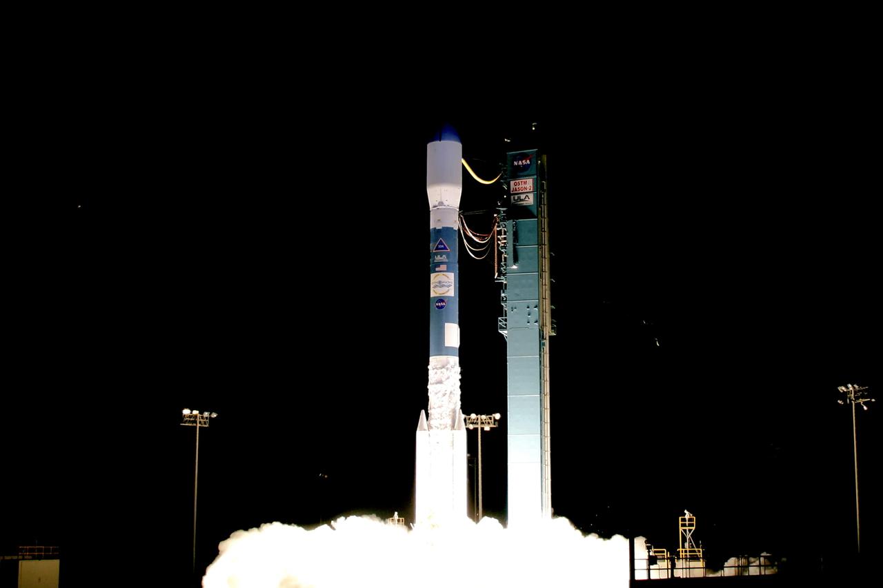
VANDENBERG AIR FORCE BASE, Calif. – Fiery clouds floating over the launch pad on Space Launch Complex-2 signal the liftoff of the Delta II rocket carrying the Ocean Surface Topography Mission, or OSTM/Jason 2, spacecraft. The OSTM/Jason 2 satellite will embark on a globe-circling voyage to continue charting sea level, a vital indicator of global climate change. The mission will return a vast amount of new data that will improve weather, climate and ocean forecasts. OSTM/Jason 2's expected lifetime of at least three years will extend into the next decade the continuous record of these data started in 1992 by NASA and the French space agency Centre National d'Etudes Spatiales, or CNES, with the TOPEX/Poseidon mission. The data collection was continued by the two agencies on Jason-1 in 2001. The launch window extends from 12:46 a.m. to 12:55 a.m. PDT. The satellite will be placed in an 830-mile-high orbit at an inclination of 66 degrees after separating from the Delta II 55 minutes after liftoff. Photo credit: Photograph by Carleton Bailie for United Launch Alliance
VANDENBERG AIR FORCE BASE, Calif. – The Delta II rocket with the Ocean Surface Topography Mission, or OSTM/Jason 2, aboard is poised for launch on Space Launch Complex 2 after rollback of the mobile service tower. The OSTM/Jason 2 satellite will embark on a globe-circling voyage to continue charting sea level, a vital indicator of global climate change. The mission will return a vast amount of new data that will improve weather, climate and ocean forecasts. OSTM/Jason 2's expected lifetime of at least three years will extend into the next decade the continuous record of these data started in 1992 by NASA and the French space agency Centre National d'Etudes Spatiales, or CNES, with the TOPEX/Poseidon mission. The data collection was continued by the two agencies on Jason-1 in 2001. The launch window extends from 12:46 a.m. to 12:55 a.m. PDT. The satellite will be placed in an 830-mile-high orbit at an inclination of 66 degrees after separating from the Delta II 55 minutes after liftoff. Photo credit: Photograph by Carleton Bailie for United Launch Alliance
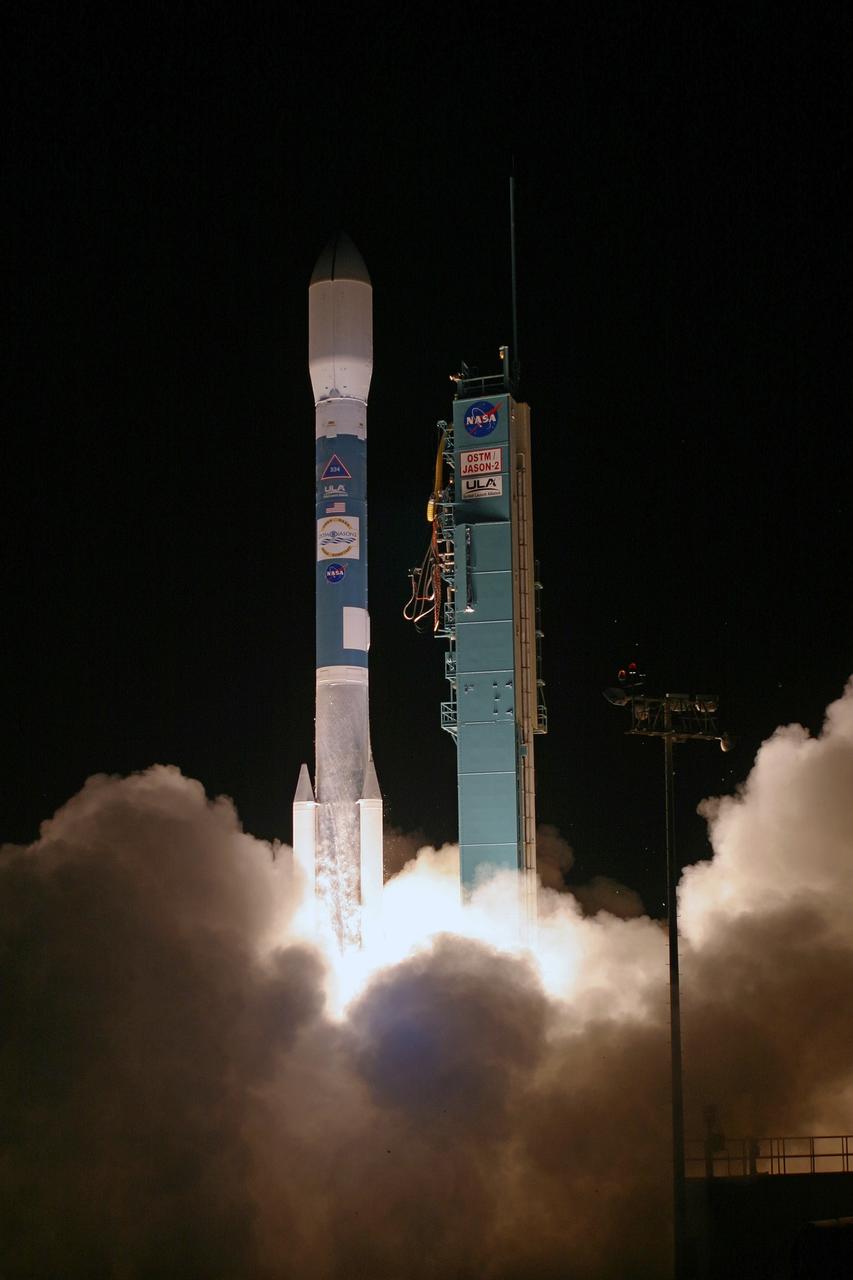
VANDENBERG AIR FORCE BASE, Calif. – Clouds of smoke and steam rise around the Delta II rocket as it lifts off Space Launch Complex-2 with the Ocean Surface Topography Mission, or OSTM/Jason 2, spacecraft aboard. The OSTM/Jason 2 satellite will embark on a globe-circling voyage to continue charting sea level, a vital indicator of global climate change. The mission will return a vast amount of new data that will improve weather, climate and ocean forecasts. OSTM/Jason 2's expected lifetime of at least three years will extend into the next decade the continuous record of these data started in 1992 by NASA and the French space agency Centre National d'Etudes Spatiales, or CNES, with the TOPEX/Poseidon mission. The data collection was continued by the two agencies on Jason-1 in 2001. The launch window extends from 12:46 a.m. to 12:55 a.m. PDT. The satellite will be placed in an 830-mile-high orbit at an inclination of 66 degrees after separating from the Delta II 55 minutes after liftoff. Photo credit: Photograph by Carleton Bailie for United Launch Alliance
VANDENBERG AIR FORCE BASE, Calif. – Clouds of smoke and steam rise spread across the launch pad on Space Launch Complex-2 as the Delta II rocket lifts off with the Ocean Surface Topography Mission, or OSTM/Jason 2, spacecraft aboard. The OSTM/Jason 2 satellite will embark on a globe-circling voyage to continue charting sea level, a vital indicator of global climate change. The mission will return a vast amount of new data that will improve weather, climate and ocean forecasts. OSTM/Jason 2's expected lifetime of at least three years will extend into the next decade the continuous record of these data started in 1992 by NASA and the French space agency Centre National d'Etudes Spatiales, or CNES, with the TOPEX/Poseidon mission. The data collection was continued by the two agencies on Jason-1 in 2001. The launch window extends from 12:46 a.m. to 12:55 a.m. PDT. The satellite will be placed in an 830-mile-high orbit at an inclination of 66 degrees after separating from the Delta II 55 minutes after liftoff. Photo credit: Photograph by Carleton Bailie for United Launch Alliance

VANDENBERG AIR FORCE BASE, Calif. – The Delta II rocket with the Ocean Surface Topography Mission, or OSTM/Jason 2, aboard is poised for launch on Space Launch Complex 2 after rollback of the mobile service tower. The OSTM/Jason 2 satellite will embark on a globe-circling voyage to continue charting sea level, a vital indicator of global climate change. The mission will return a vast amount of new data that will improve weather, climate and ocean forecasts. OSTM/Jason 2's expected lifetime of at least three years will extend into the next decade the continuous record of these data started in 1992 by NASA and the French space agency Centre National d'Etudes Spatiales, or CNES, with the TOPEX/Poseidon mission. The data collection was continued by the two agencies on Jason-1 in 2001. The launch window extends from 12:46 a.m. to 12:55 a.m. PDT. The satellite will be placed in an 830-mile-high orbit at an inclination of 66 degrees after separating from the Delta II 55 minutes after liftoff. Photo credit: Photograph by Carleton Bailie for United Launch Alliance
VANDENBERG AIR FORCE BASE, Calif. – Fiery clouds floating over the launch pad signal the liftoff of the Delta II rocket carrying the Ocean Surface Topography Mission, or OSTM/Jason 2, spacecraft. The OSTM/Jason 2 satellite will embark on a globe-circling voyage to continue charting sea level, a vital indicator of global climate change. The mission will return a vast amount of new data that will improve weather, climate and ocean forecasts. OSTM/Jason 2's expected lifetime of at least three years will extend into the next decade the continuous record of these data started in 1992 by NASA and the French space agency Centre National d'Etudes Spatiales, or CNES, with the TOPEX/Poseidon mission. The data collection was continued by the two agencies on Jason-1 in 2001. The launch window extends from 12:46 a.m. to 12:55 a.m. PDT. The satellite will be placed in an 830-mile-high orbit at an inclination of 66 degrees after separating from the Delta II 55 minutes after liftoff. Photo credit: Photograph by Carleton Bailie for United Launch Alliance
The IML-1 mission was the first in a series of Shuttle flights dedicated to fundamental materials and life sciences research with the international partners. The participating space agencies included: NASA, the 14-nation European Space Agency (ESA), the Canadian Space Agency (CSA), the French National Center of Space Studies (CNES), the German Space Agency and the German Aerospace Research Establishment (DAR/DLR), and the National Space Development Agency of Japan (NASDA). Dedicated to the study of life and materials sciences in microgravity, the IML missions explored how life forms adapt to weightlessness and investigated how materials behave when processed in space. Both life and materials sciences benefited from the extended periods of microgravity available inside the Spacelab science module in the cargo bay of the Space Shuttle Orbiter. In this photograph, Commander Ronald J. Grabe works with the Mental Workload and Performance Evaluation Experiment (MWPE) in the IML-1 module. This experiment was designed as a result of difficulty experienced by crewmembers working at a computer station on a previous Space Shuttle mission. The problem was due to the workstation's design being based on Earthbound conditions with the operator in a typical one-G standing position. Information gained from this experiment was used to design workstations for future Spacelab missions and the International Space Station. Managed by the Marshall Space Flight Center, IML-1 was launched on January 22, 1992 aboard the Space Shuttle Orbiter Discovery (STS-42 mission).
Astronaut David C. Hilmers conducts the Microgravity Vestibular Investigations (MVI) sitting in its rotator chair inside the IML-1 science module. When environmental conditions change so that the body receives new stimuli, the nervous system responds by interpreting the incoming sensory information differently. In space, the free-fall environment of an orbiting spacecraft requires that the body adapts to the virtual absence of gravity. Early in flights, crewmembers may feel disoriented or experience space motion sickness. MVI examined the effects of orbital flight on the human orientation system to obtain a better understanding of the mechanisms of adaptation to weightlessness. By provoking interactions among the vestibular, visual, and proprioceptive systems and then measuring the perceptual and sensorimotor reactions, scientists can study changes that are integral to the adaptive process. The IML-1 mission was the first in a series of Shuttle flights dedicated to fundamental materials and life sciences research with the international partners. The participating space agencies included: NASA, the 14-nation European Space Agency (ESA), the Canadian Space Agency (CSA), the French National Center of Space Studies (CNES), the German Space Agency and the German Aerospace Research Establishment (DAR/DLR), and the National Space Development Agency of Japan (NASDA). Both life and materials sciences benefited from the extended periods of microgravity available inside the Spacelab science module in the cargo bay of the Space Shuttle Orbiter. Managed by the Marshall Space Flight Center, IML-1 was launched on January 22, 1992 aboard the Space Shuttle Orbiter Discovery (STS-42 mission).
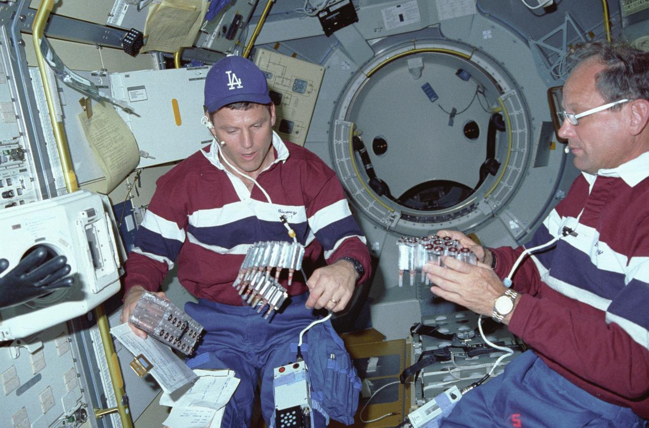
International Microgravity Laboratory-1 (IML-1) was the first in a series of Shuttle flights dedicated to fundamental materials and life sciences research with the international partners. The participating space agencies included: NASA, the 14-nation European Space Agency (ESA), the Canadian Space Agency (CSA), the French National Center of Space Studies (CNES), the German Space Agency and the German Aerospace Research Establishment (DAR/DLR), and the National Space Development Agency of Japan (NASDA). Dedicated to the study of life and materials sciences in microgravity, the IML missions explored how life forms adapt to weightlessness and investigated how materials behave when processed in space. Both life and materials sciences benefited from the extended periods of microgravity available inside the Spacelab science module in the cargo bay of the Space Shuttle Orbiter. In this photograph, Astronauts Stephen S. Oswald and Norman E. Thagard handle ampoules used in the Mercuric Iodide Crystal Growth (MICG) experiment. Mercury Iodide crystals have practical uses as sensitive x-ray and gamma-ray detectors. In addition to their exceptional electronic properties, these crystals can operate at room temperature rather than at the extremely low temperatures usually required by other materials. Because a bulky cooling system is urnecessary, these crystals could be useful in portable detector devices for nuclear power plant monitoring, natural resource prospecting, biomedical applications in diagnosis and therapy, and astronomical observation. Managed by the Marshall Space Flight Center, IML-1 was launched on January 22, 1992 aboard the Space Shuttle Orbiter Discovery (STS-42 mission).
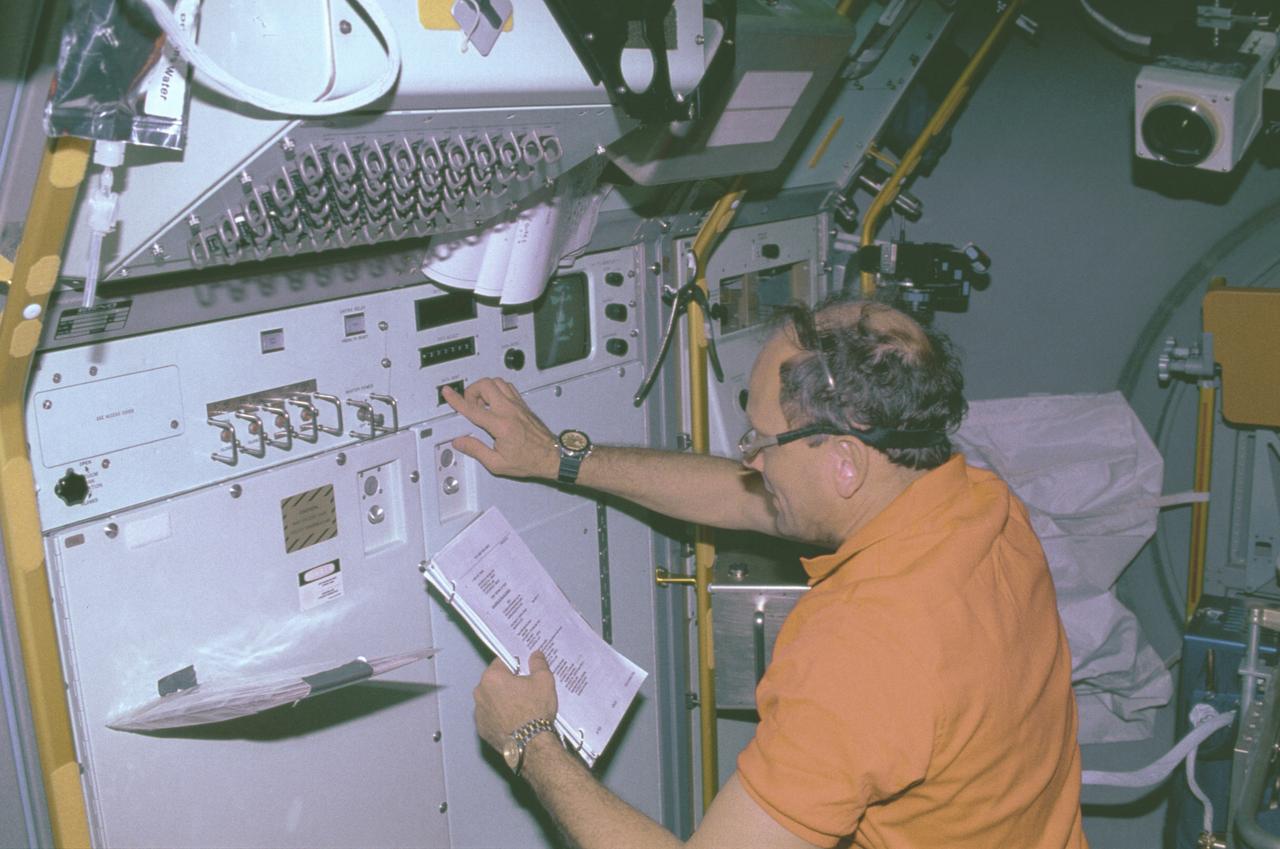
The IML-1 mission was the first in a series of Shuttle flights dedicated to fundamental materials and life sciences research with the international partners. The participating space agencies included: NASA, the 14-nation European Space Agency (ESA), the Canadian Space Agency (CSA), The French National Center of Space Studies (CNES), the German Space Agency and the German Aerospace Research Establishment (DAR/DLR), and the National Space Development Agency of Japan (NASDA). Dedicated to the study of life and materials sciences in microgravity, the IML missions explored how life forms adapt to weightlessness and investigated how materials behave when processed in space. Both life and materials sciences benefited from the extended periods of microgravity available inside the Spacelab science module in the cargo bay of the Space Shuttle Orbiter. This photograph shows Astronaut Norman Thagard performing the fluid experiment at the Fluid Experiment System (FES) facility inside the laboratory module. The FES facility had sophisticated optical systems for imaging fluid flows during materials processing, such as experiments to grow crystals from solution and solidify metal-modeling salts. A special laser diagnostic technique recorded the experiments, holograms were made for post-flight analysis, and video was used to view the samples in space and on the ground. Managed by the Marshall Space Flight Center (MSFC), the IML-1 mission was launched on January 22, 1992 aboard the Shuttle Orbiter Discovery (STS-42).
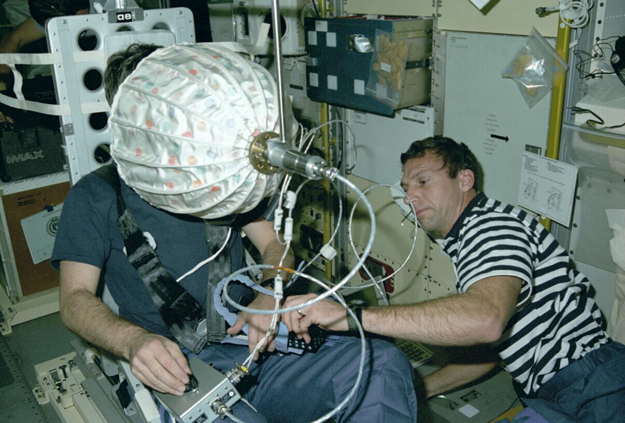
Astronaut Ulf Merbold on the stationary seat of the mini-sled, stares into an umbrella-shaped rotating dome with colored dots. Astronaut Merbold, assisted by astronaut David Hilmer, are conducting the Visual Simulator Experiment, a space physiology experiment. The Visual Stimulator Experiment measures the relative importance of visual and vestibular information in determining body orientation. When a person looks at a rotating visual field, a false sensation of self-rotation, called circularvection, results. In weightlessness, circularvection should increase immediately and may continue to increase as the nervous system comes to rely more on visual than vestibular cues. As Astronaut Merbold stares into the rotating dome with a pattern of colored dots and its interior, he turns a knob to indicate his perception of body rotation. The strength of circularvection is calculated by comparing signals from the dome and the knob. The greater the false sense of circularvection, the more the subject is relying on visual information instead of otolith information. The IML-1 mission was the first in a series of Shuttle flights dedicated to fundamental materials and life sciences research with the international partners. The participating space agencies included: NASA, the 14-nation European Space Agency (ESA), the Canadian Space Agency (CSA), the French National Center of Space Studies (CNES), the German Space Agency and the German Aerospace Research Establishment (DAR/DLR), and the National Space Development Agency of Japan (NASDA). Managed by the Marshall Space Flight Center, IML-1 was launched on January 22, 1992 aboard the Space Shuttle Orbiter Discovery (STS-42 mission).
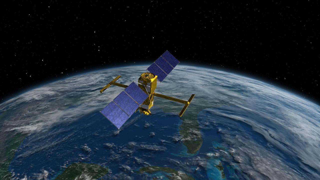
This illustration depicts the Surface Water and Ocean Topography (SWOT) satellite, a mission led by NASA and the French space agency Centre National d'Études Spatiales (CNES). The scientific heart of the SWOT satellite is the Ka-band Radar Interferometer (KaRIn) instrument, which will measure the height of water in Earth's lakes, rivers, reservoirs, and ocean. To do that, KaRIn will transmit radar pulses to Earth's surface and use two antennas – seen to the left and right of the spacecraft bus – to triangulate the return signals that bounce back. Mounted at the ends of a boom 33 feet (10 meters) long, the antennas will collect data over two swaths of Earth's surface at a time, each of them 30 miles (50 kilometers) wide and located on either side of the satellite. KaRIn will operate in two modes: A lower-resolution mode over the ocean will involve significant onboard processing of the data to reduce the volume of information sent during downlinks to Earth; a higher-resolution mode will be used mainly over land. https://photojournal.jpl.nasa.gov/catalog/PIA25621
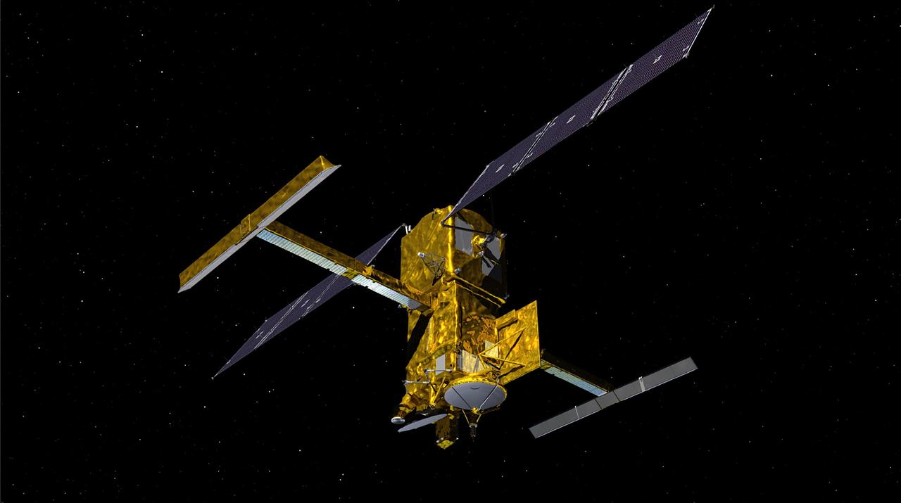
This illustration depicts the Surface Water and Ocean Topography satellite, a mission led by NASA and the French space agency Centre National d'Études Spatiales (CNES). The scientific heart of the SWOT satellite is the Ka-band Radar Interferometer (KaRIn) instrument, which will measure the height of water in Earth's lakes, rivers, reservoirs, and ocean. To do that, KaRIn will transmit radar pulses to Earth's surface and use two antennas – seen to the left and right of the spacecraft bus – to triangulate the return signals that bounce back. Mounted at the ends of a boom 33 feet (10 meters) long, the antennas will collect data over two swaths of Earth's surface at a time, each of them 30 miles (50 kilometers) wide and located on either side of the satellite. KaRIn will operate in two modes: A lower-resolution mode over the ocean will involve significant onboard processing of the data to reduce the volume of information sent during downlinks to Earth; a higher-resolution mode will be used mainly over land. https://photojournal.jpl.nasa.gov/catalog/PIA24530
This composite image of the "Delta Scarp" in Mars' Jezero Crater was generated using data from two imagers aboard NASA's Perseverance rover. Taken by the rover's Mastcam-Z, the bottom image shows both the base and plateau of the escarpment. The inset above, created from a mosaic of five Remote Microscopic Imager (RMI) pictures, zooms in on a 377-foot-wide (115-meter-wide) portion of the scarp, allowing closer inspection of some of its intriguing geologic features. Part of the rover's SuperCam instrument, the RMI is able to spot an object the size of a softball from nearly a mile away, allowing scientists to take images of details from a long distance. It also provides fine details of nearby targets zapped by SuperCam's laser. SuperCam is led by Los Alamos National Laboratory in New Mexico, where the instrument's Body Unit was developed. That part of the instrument includes several spectrometers, control electronics and software. The Mast Unit was developed and built by several laboratories of the CNRS (French National Centre for Scientific Research) and French universities under the contracting authority of CNES. Arizona State University in Tempe leads the operations of the Mastcam-Z instrument, working in collaboration with Malin Space Science Systems in San Diego. A key objective for Perseverance's mission on Mars is astrobiology, including the search for signs of ancient microbial life. The rover will characterize the planet's geology and past climate, pave the way for human exploration of the Red Planet, and be the first mission to collect and cache Martian rock and regolith (broken rock and dust). Subsequent NASA missions, in cooperation with ESA (European Space Agency), would send spacecraft to Mars to collect these sealed samples from the surface and return them to Earth for in-depth analysis. The Mars 2020 Perseverance mission is part of NASA's Moon to Mars exploration approach, which includes Artemis missions to the Moon that will help prepare for human exploration of the Red Planet. https://photojournal.jpl.nasa.gov/catalog/PIA24684
NASA's Perseverance Mars rover captured this doughnut-shaped rock in Jezero Crater from about 328 feet (100 meters) away using its Remote Microscopic Imager (RMI), part of the SuperCam instrument, on June 22, 2023, the 832nd Martian day, or sol, of the mission. Oddly shaped rocks aren't uncommon, either on Earth or Mars; they're often formed over eons as winds sandblast rock faces. This particular rock may have formed after a smaller rock (or multiple rocks) eroded near its center. That left behind a cavity that was later enlarged by the wind. Figure A shows the same rock in its broader context, when it was first spotted by the rover's Mastcam-Z instrument from about 1,312 feet (400 meters away) on April 15, 2023, the 765th Martian day, or sol, of the mission. SuperCam is led by Los Alamos National Laboratory in New Mexico, where the instrument's body unit was developed. That part of the instrument includes several spectrometers as well as control electronics and software. The mast unit, including RMI, was developed and built by several laboratories of the CNRS (the French research center) and French universities under the contracting authority of Centre National d'Études Spatiales (CNES), the French space agency. Arizona State University leads the operations of the Mastcam-Z instrument, working in collaboration with Malin Space Science Systems in San Diego, on the design, fabrication, testing, and operation of the cameras, and in collaboration with the Niels Bohr Institute of the University of Copenhagen on the design, fabrication, and testing of the calibration targets. A key objective for Perseverance's mission on Mars is astrobiology, including the search for signs of ancient microbial life. The rover will characterize the planet's geology and past climate, pave the way for human exploration of the Red Planet, and be the first mission to collect and cache Martian rock and regolith (broken rock and dust). Subsequent NASA missions, in cooperation with ESA (European Space Agency), would send spacecraft to Mars to collect these sealed samples from the surface and return them to Earth for in-depth analysis. The Mars 2020 Perseverance mission is part of NASA's Moon to Mars exploration approach, which includes Artemis missions to the Moon that will help prepare for human exploration of the Red Planet. https://photojournal.jpl.nasa.gov/catalog/PIA25916
The Remote Microscopic Imager (RMI) camera aboard NASA's Perseverance Mars rover took these zoomed-in images of the Ingenuity Mars Helicopter and one of its rotor blades on Feb. 24, 2024, the 1,072nd Martian day, or sol, of the mission. The mosaic shows the helicopter at right, standing at an angle near the apex of a sand ripple. About 49 feet (15 meters) to the west of the helicopter's location (just left of center in the image), a large portion of one of the helicopter's rotor blades lies on the surface. The Ingenuity team is considering a theory that the blade detached after the rotorcraft impacted the Martian surface at the conclusion of the helicopter's 72nd and final flight on Jan. 18, 2024. This mosaic is made up of seven images taken by the RMI, which is part of the rover's SuperCam instrument. At the time these images were taken, the distance between the rover and helicopter was about 1,365 feet (415 meters). Each circular image has a field of view of 26 feet (7.8 meters) at this distance. Able to spot a softball from nearly a mile away, the RMI allows scientists to take images of details from a long distance. It also provides fine details of nearby targets zapped by SuperCam's laser. SuperCam is led by Los Alamos National Laboratory in New Mexico, where the instrument's body unit was developed. The mast unit, including the RMI used for these images, was developed and built by several laboratories of the CNRS (the French research center) and French universities under the contracting authority of Centre National d'Études Spatiales (CNES), the French space agency. A key objective for Perseverance's mission on Mars is astrobiology, including the search for signs of ancient microbial life. The rover will characterize the planet's geology and past climate, pave the way for human exploration of the Red Planet, and be the first mission to collect and cache Martian rock and regolith (broken rock and dust). Subsequent NASA missions, in cooperation with ESA (European Space Agency), would send spacecraft to Mars to collect these sealed samples from the surface and return them to Earth for in-depth analysis. The Mars 2020 Perseverance mission is part of NASA's Moon to Mars exploration approach, which includes Artemis missions to the Moon that will help prepare for human exploration of the Red Planet. https://photojournal.jpl.nasa.gov/catalog/PIA26238
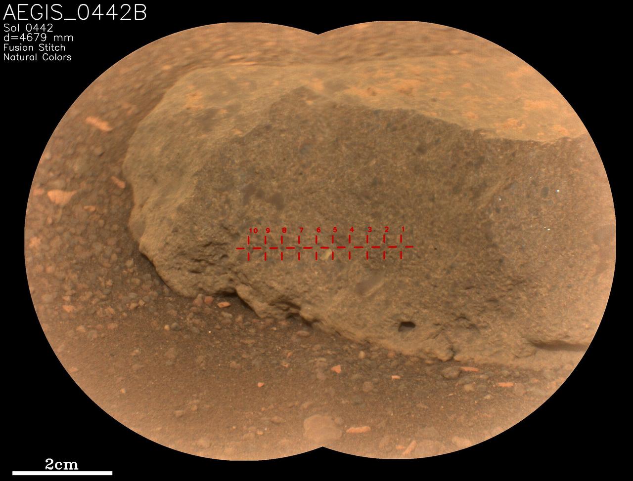
On May 18, 2022, NASA's Perseverance Mars rover used an artificial intelligence software called Autonomous Exploration for Gathering Increased Science (AEGIS) to select and target the rock seen in close-up here. It's one of two rocks that the AI for the first time helped Perseverance study without direction from the mission's team back on Earth. AEGIS was developed by NASA's Jet Propulsion Laboratory in Southern California – which also built Perseverance – to collect data on rocks and other Martian features that the rover discovers while driving. AEGIS is used in conjunction with Perseverance's SuperCam laser instrument, directing the laser to zap certain features that scientists have commanded the rover to look for. SuperCam used its Remote Micro-Imager (RMI) camera to take two images of this target, which were stitched together into the main picture seen here. The rock target, which was about 16 feet (5 meters) away from the rover, is named "AEGIS_0442B," referring to the Martian day, or sol, it was targeted (Sol 442) and that it was the second rock ("B") targeted by AEGIS on that sol. The red crosshairs seen across the rock target indicate each place AEGIS directed the laser to zap. SuperCam is led by Los Alamos National Laboratory in New Mexico, where the instrument's body unit was developed. That part of the instrument includes several spectrometers as well as control electronics and software. The mast unit, including RMI, was developed and built by several laboratories of the CNRS (the French research center) and French universities under the contracting authority of Centre National d'Études Spatiales (CNES), the French space agency. A key objective for Perseverance's mission on Mars is astrobiology, including the search for signs of ancient microbial life. The rover will characterize the planet's geology and past climate, pave the way for human exploration of the Red Planet, and be the first mission to collect and cache Martian rock and regolith (broken rock and dust). Subsequent NASA missions, in cooperation with ESA (European Space Agency), would send spacecraft to Mars to collect these sealed samples from the surface and return them to Earth for in-depth analysis. The Mars 2020 Perseverance mission is part of NASA's Moon to Mars exploration approach, which includes Artemis missions to the Moon that will help prepare for human exploration of the Red Planet. https://photojournal.jpl.nasa.gov/catalog/PIA25289
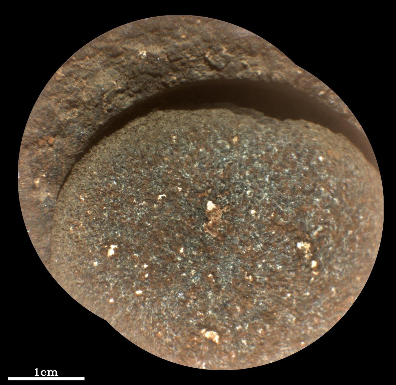
NASA's Perseverance Mars rover used its abrasion tool to grind down the rock surface at this target, nicknamed "Bellegarde," on Aug. 29, 2021, the 188th Martian day, or sol, of the mission. The abraded patch is 0.4 inches (5 centimeters) in diameter. The mission has nicknamed the rock itself "Rochette" and acquired its first two core samples from it. The rover abrades rocks using a tool on its robotic arm before drilling them in order to clear away dust and weathering rinds, allowing other instruments to study the rocks and determine if scientists want to grab a sample of them. This close-up image was produced by Perseverance's SuperCam instrument in natural color, as it would appear under daytime lighting conditions. Besides imagery, SuperCam has a rock-vaporizing laser and spectrometer. By studying a rock's vapor after each laser zap, scientists can study the chemical composition of rocks from a distance. Perseverance landed in Mars' Jezero Crater on Feb. 18, 2021, and has been exploring the floor of the crater since. At the time these images were taken, Perseverance was in an area nicknamed the "Crater Floor Fractured Rough" area. SuperCam is led by Los Alamos National Laboratory in New Mexico, where the instrument's Body Unit was developed. That part of the instrument includes several spectrometers as well as control electronics and software. The Mast Unit, including the Remote Microscopic Imager used for these images, was developed and built by several laboratories of the CNRS (the French research center) and French universities under the contracting authority of Centre National d'Etudes Spatiales (CNES, the French space agency). A key objective for Perseverance's mission on Mars is astrobiology, including the search for signs of ancient microbial life. The rover will characterize the planet's geology and past climate, pave the way for human exploration of the Red Planet, and be the first mission to collect and cache Martian rock and regolith (broken rock and dust). Subsequent NASA missions, in cooperation with ESA (European Space Agency), would send spacecraft to Mars to collect these sealed samples from the surface and return them to Earth for in-depth analysis. The Mars 2020 Perseverance mission is part of NASA's Moon to Mars exploration approach, which includes Artemis missions to the Moon that will help prepare for human exploration of the Red Planet. https://photojournal.jpl.nasa.gov/catalog/PIA24768
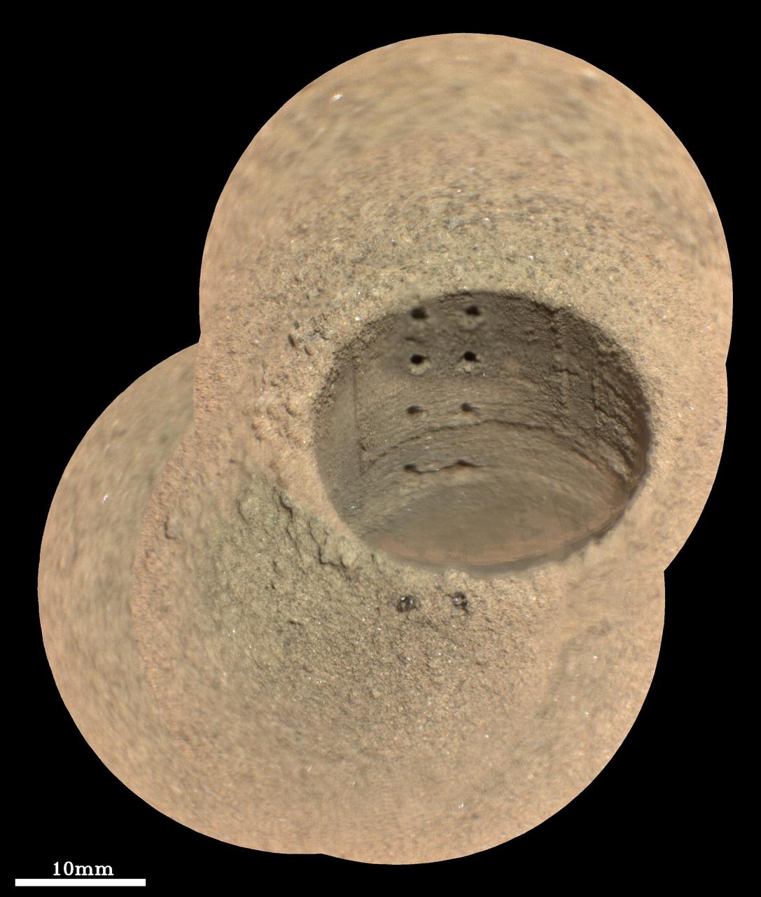
This composite image, made from four taken by the SuperCam instrument aboard NASA's Perseverance rover on August 8, 2021, shows the hole in a Martian rock where the rover attempted to collect its first sample; the small pits within it were created by laser zaps from SuperCam during subsequent efforts to analyze the rock's composition. The rover science team has nicknamed the drill hole "Roubion." The team believes that because of this rock's unusual composition, the process of extracting a core created a significant pile of tailings (or cuttings) around the coring hole. Eight pits produced by 30 laser shots each are seen in two columns inside the drill hole. The SuperCam team's analysis suggests that the top six pits penetrated the compacted mound of tailings around the hole, while the bottom two pits in the hole interrogated material below the rock surface. Two additional laser pits can be seen in the tailings at the near side of the hole. Two vertical ridges inside the hole – one on each side of the laser pits – were produced as the drill was removed, prior to laser analysis. Some bright mineral grains can be seen as glints in the tailings and in the drill hole. A few clumps or larger pieces of material are seen at the top of the tailings pile just to the left of the hole. The SuperCam images were taken from a distance of 7.32 feet (2.23 meters). A scale bar is included in this image. Perseverance landed in Mars' Jezero Crater on February 18, 2021, and has been exploring the floor of the crater since. At the time these images were taken, Perseverance was in an area nicknamed the "Crater Floor Fractured Rough" area. SuperCam is led by Los Alamos National Laboratory in New Mexico, where the instrument's Body Unit was developed. That part of the instrument includes several spectrometers as well as control electronics and software. The Mast Unit, including the Remote Microscopic Imager used for these images, was developed and built by several laboratories of the CNRS (the French research center) and French universities under the contracting authority of Centre National d'Etudes Spatiales (CNES, the French space agency). A key objective for Perseverance's mission on Mars is astrobiology, including the search for signs of ancient microbial life. The rover will characterize the planet's geology and past climate, pave the way for human exploration of the Red Planet, and be the first mission to collect and cache Martian rock and regolith (broken rock and dust). Subsequent NASA missions, in cooperation with ESA (European Space Agency), would send spacecraft to Mars to collect these sealed samples from the surface and return them to Earth for in-depth analysis. The Mars 2020 Perseverance mission is part of NASA's Moon to Mars exploration approach, which includes Artemis missions to the Moon that will help prepare for human exploration of the Red Planet. Movie available at https://photojournal.jpl.nasa.gov/catalog/PIA24749
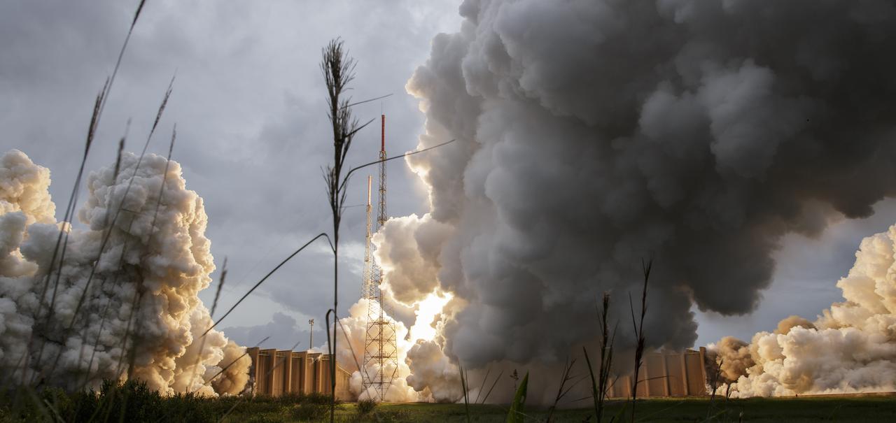
Steam and smoke from Arianespace's Ariane 5 Vulcain engine, center, and two solid rocket boosters, is seen as it launches with NASA’s James Webb Space Telescope onboard, Saturday, Dec. 25, 2021, from the ELA-3 Launch Zone of Europe’s Spaceport at the Guiana Space Centre in Kourou, French Guiana. The James Webb Space Telescope (sometimes called JWST or Webb) is a large infrared telescope with a 21.3 foot (6.5 meter) primary mirror. The observatory will study every phase of cosmic history—from within our solar system to the most distant observable galaxies in the early universe. Photo Credit: (NASA/Bill Ingalls)
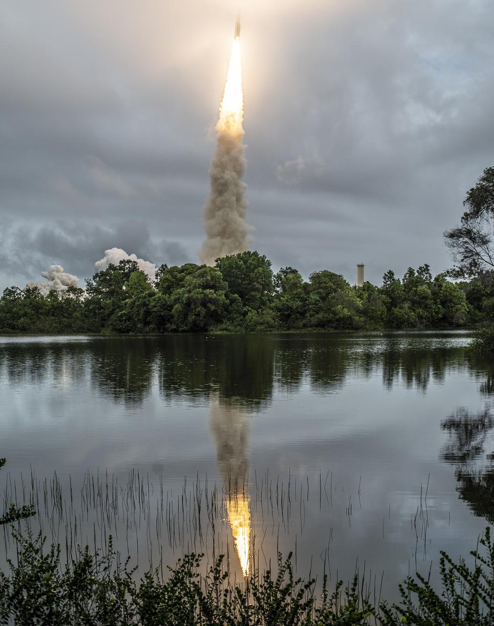
Arianespace's Ariane 5 rocket launches with NASA’s James Webb Space Telescope onboard, Saturday, Dec. 25, 2021, from the ELA-3 Launch Zone of Europe’s Spaceport at the Guiana Space Centre in Kourou, French Guiana. The James Webb Space Telescope (sometimes called JWST or Webb) is a large infrared telescope with a 21.3 foot (6.5 meter) primary mirror. The observatory will study every phase of cosmic history—from within our solar system to the most distant observable galaxies in the early universe. Photo Credit: (NASA/Chris Gunn)
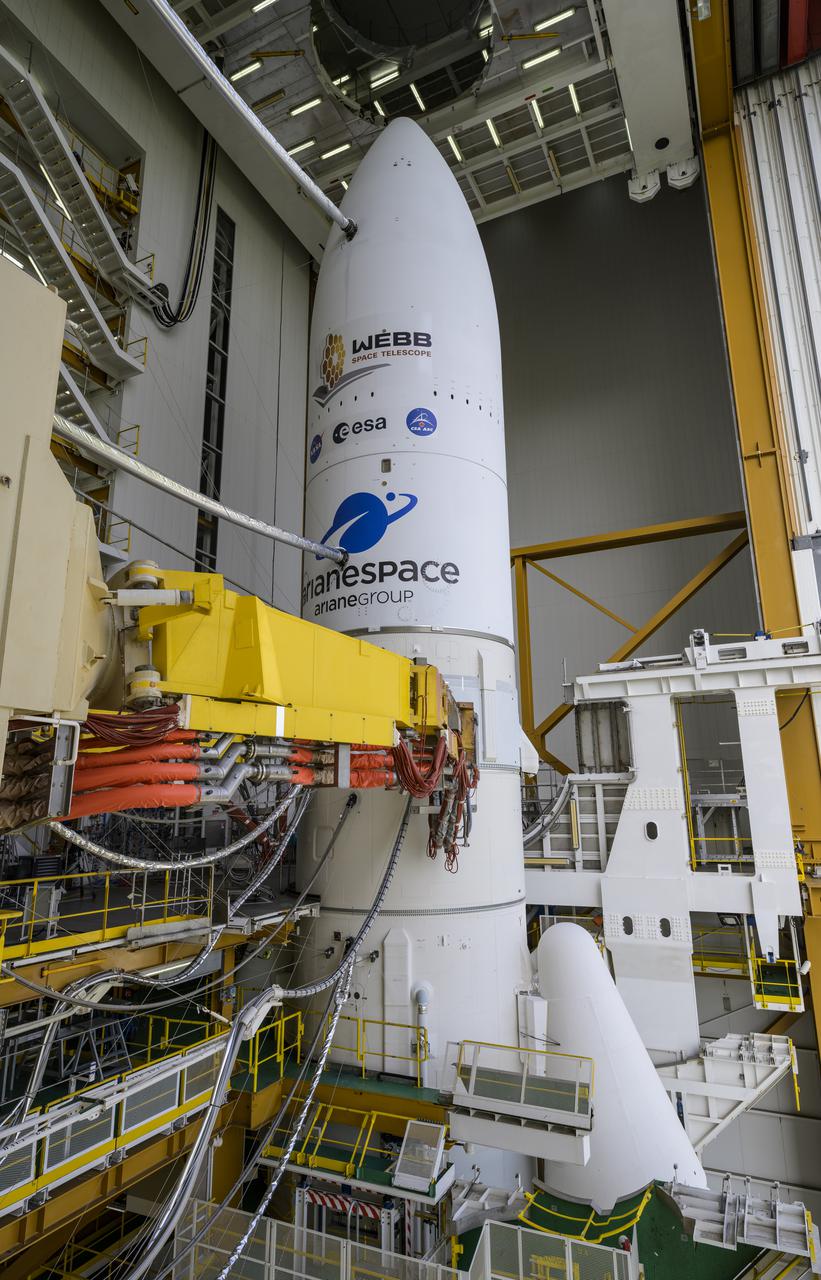
Arianespace's Ariane 5 rocket with NASA’s James Webb Space Telescope onboard, is seen ahead of rollout to the launch pad, Thursday, Dec. 23, 2021, at Europe’s Spaceport, the Guiana Space Center in Kourou, French Guiana. The James Webb Space Telescope (sometimes called JWST or Webb) is a large infrared telescope with a 21.3 foot (6.5 meter) primary mirror. The observatory will study every phase of cosmic history—from within our solar system to the most distant observable galaxies in the early universe. Photo Credit: (NASA/Bill Ingalls)
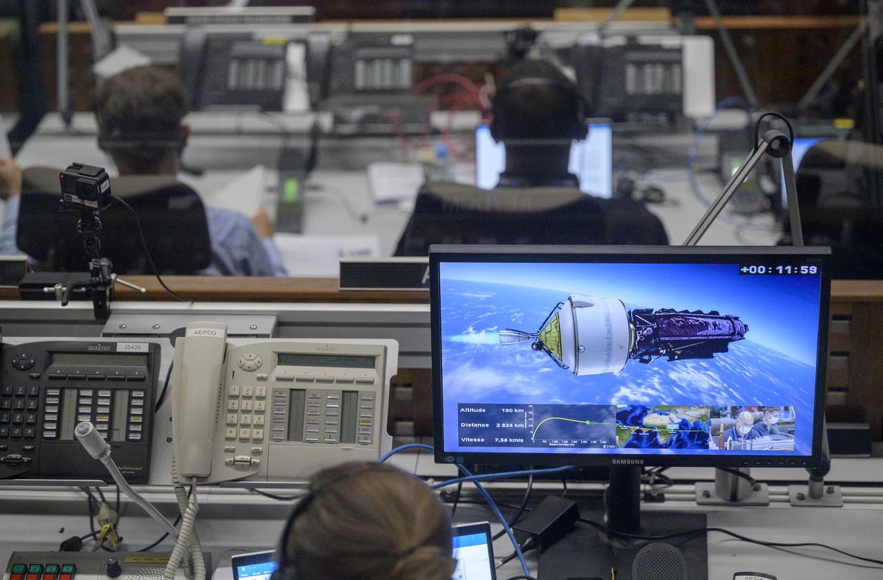
Launch teams monitor the flight progress of Arianespace's Ariane 5 rocket carrying NASA’s James Webb Space Telescope, Saturday, Dec. 25, 2021, in the Jupiter Center at the Guiana Space Center in Kourou, French Guiana. The James Webb Space Telescope (sometimes called JWST or Webb) is a large infrared telescope with a 21.3 foot (6.5 meter) primary mirror. The observatory will study every phase of cosmic history—from within our solar system to the most distant observable galaxies in the early universe. Photo Credit: (NASA/Bill Ingalls)
Arianespace's Ariane 5 rocket with NASA’s James Webb Space Telescope onboard, is seen ahead of rollout to the launch pad, Thursday, Dec. 23, 2021, at Europe’s Spaceport, the Guiana Space Center in Kourou, French Guiana. The James Webb Space Telescope (sometimes called JWST or Webb) is a large infrared telescope with a 21.3 foot (6.5 meter) primary mirror. The observatory will study every phase of cosmic history—from within our solar system to the most distant observable galaxies in the early universe. Photo Credit: (NASA/Bill Ingalls)
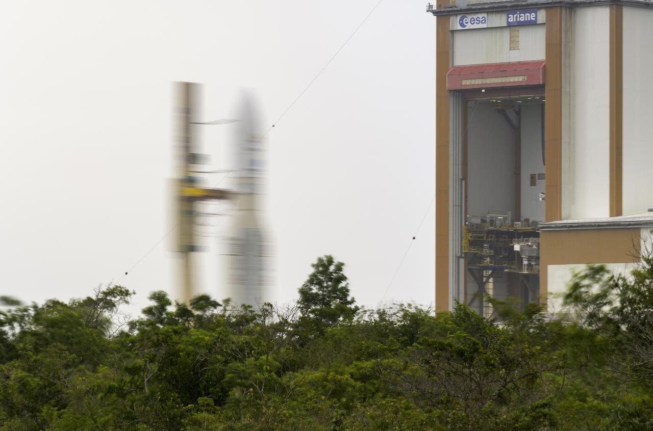
Arianespace's Ariane 5 rocket with NASA’s James Webb Space Telescope onboard, is seen in this 30 second exposure, as it is rolled out to the launch pad, Thursday, Dec. 23, 2021, at Europe’s Spaceport, the Guiana Space Center in Kourou, French Guiana. The James Webb Space Telescope (sometimes called JWST or Webb) is a large infrared telescope with a 21.3 foot (6.5 meter) primary mirror. The observatory will study every phase of cosmic history—from within our solar system to the most distant observable galaxies in the early universe. Photo Credit: (NASA/Bill Ingalls)

Launch teams monitor the countdown to the launch of Arianespace's Ariane 5 rocket carrying NASA’s James Webb Space Telescope, Saturday, Dec. 25, 2021, in the Jupiter Center at the Guiana Space Center in Kourou, French Guiana. The James Webb Space Telescope (sometimes called JWST or Webb) is a large infrared telescope with a 21.3 foot (6.5 meter) primary mirror. The observatory will study every phase of cosmic history—from within our solar system to the most distant observable galaxies in the early universe. Photo Credit: (NASA/Bill Ingalls)
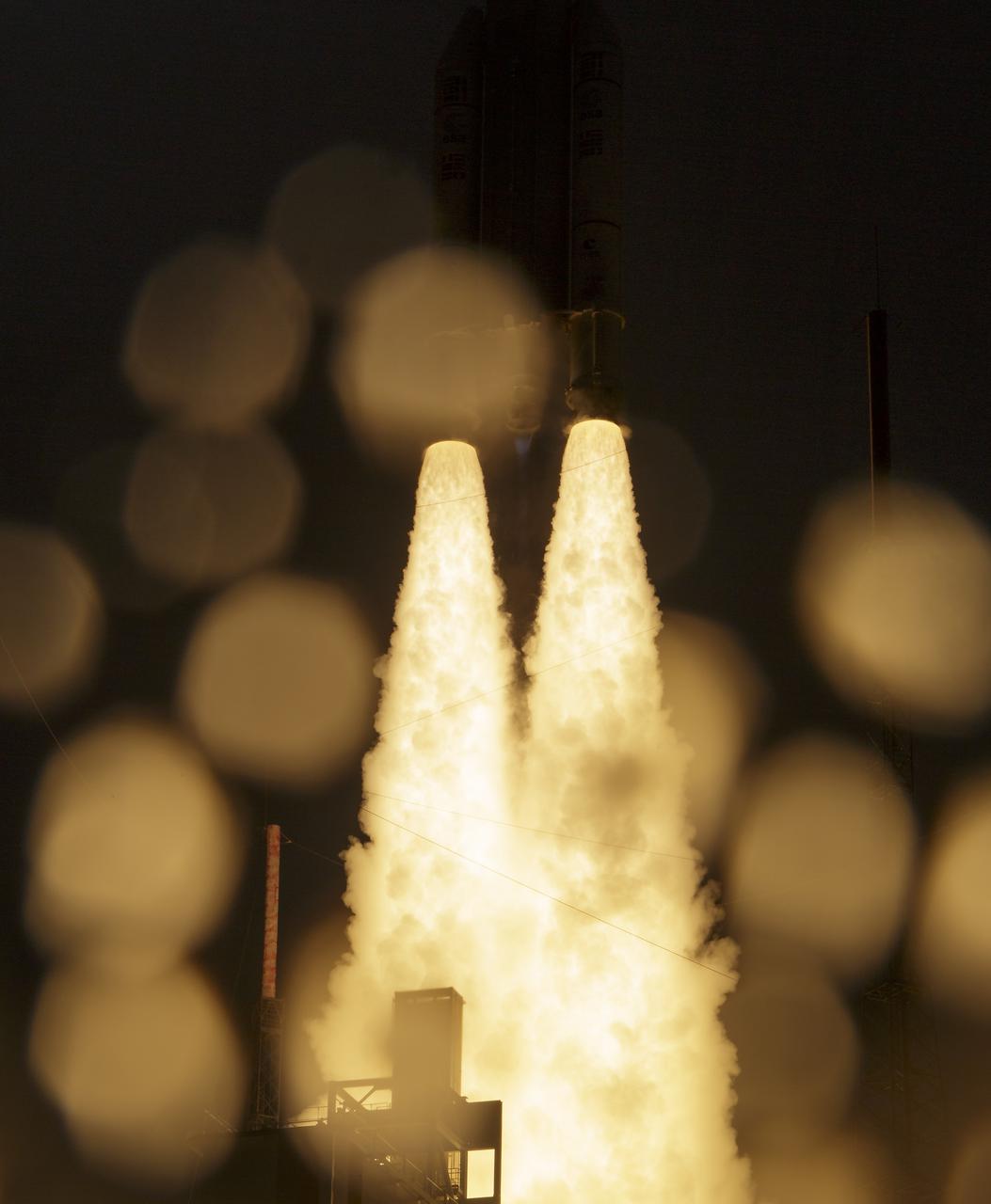
Arianespace's Ariane 5 rocket launches with NASA’s James Webb Space Telescope onboard, Saturday, Dec. 25, 2021, from the ELA-3 Launch Zone of Europe’s Spaceport at the Guiana Space Centre in Kourou, French Guiana. The James Webb Space Telescope (sometimes called JWST or Webb) is a large infrared telescope with a 21.3 foot (6.5 meter) primary mirror. The observatory will study every phase of cosmic history—from within our solar system to the most distant observable galaxies in the early universe. Photo Credit: (NASA/Bill Ingalls)
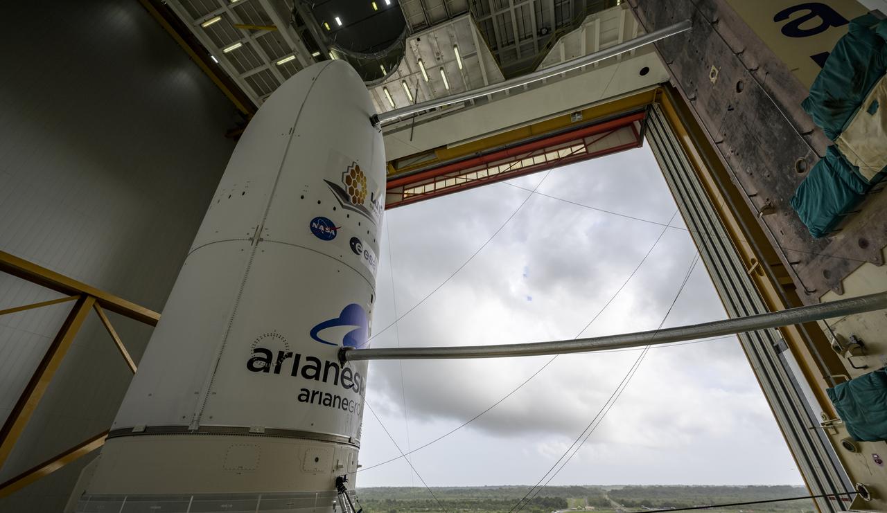
Arianespace's Ariane 5 rocket with NASA’s James Webb Space Telescope onboard, is seen ahead of rollout to the launch pad, Thursday, Dec. 23, 2021, at Europe’s Spaceport, the Guiana Space Center in Kourou, French Guiana. The James Webb Space Telescope (sometimes called JWST or Webb) is a large infrared telescope with a 21.3 foot (6.5 meter) primary mirror. The observatory will study every phase of cosmic history—from within our solar system to the most distant observable galaxies in the early universe. Photo Credit: (NASA/Bill Ingalls)
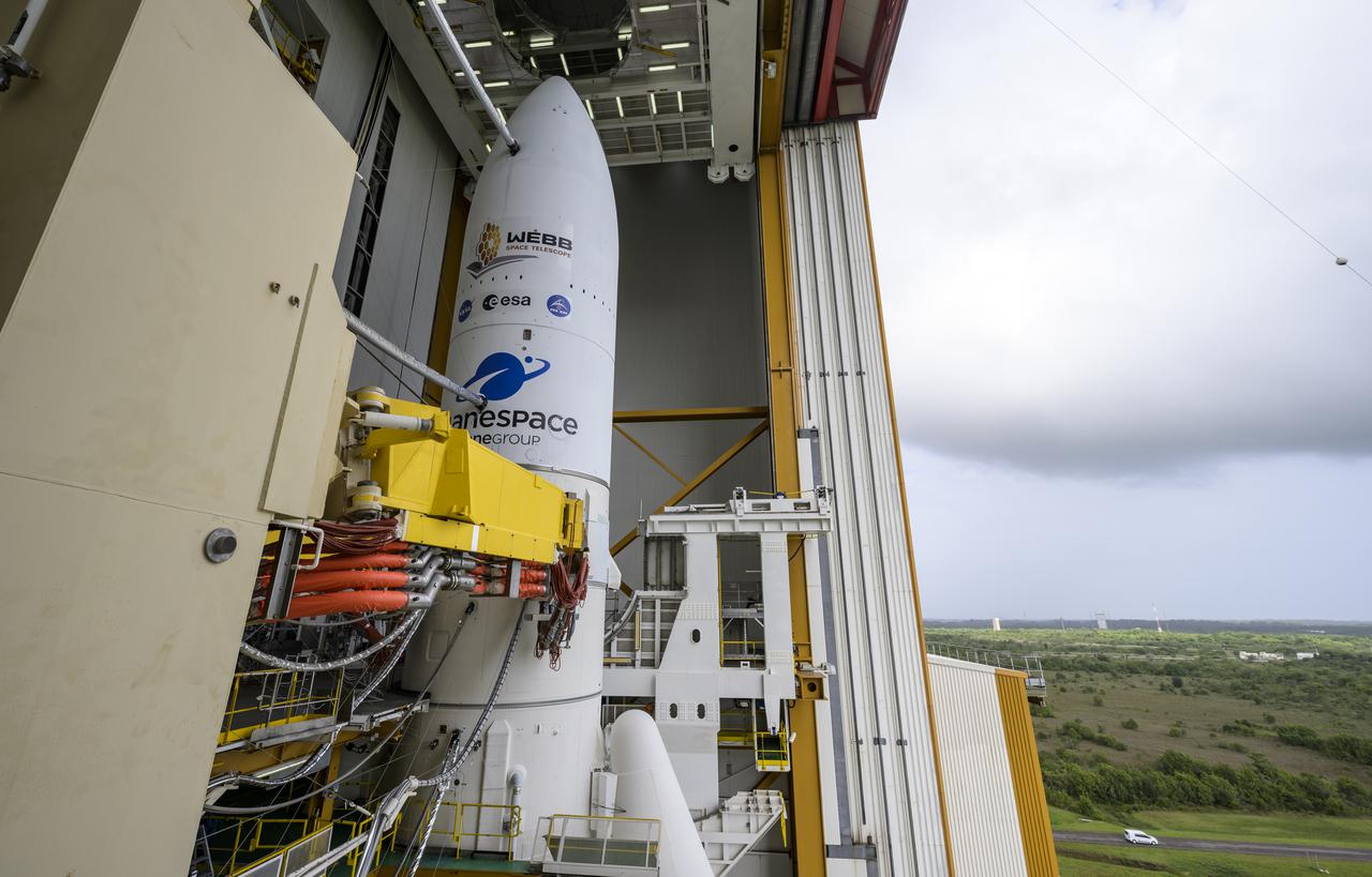
Arianespace's Ariane 5 rocket with NASA’s James Webb Space Telescope onboard, is seen ahead of rollout to the launch pad, Thursday, Dec. 23, 2021, at Europe’s Spaceport, the Guiana Space Center in Kourou, French Guiana. The James Webb Space Telescope (sometimes called JWST or Webb) is a large infrared telescope with a 21.3 foot (6.5 meter) primary mirror. The observatory will study every phase of cosmic history—from within our solar system to the most distant observable galaxies in the early universe. Photo Credit: (NASA/Bill Ingalls)