
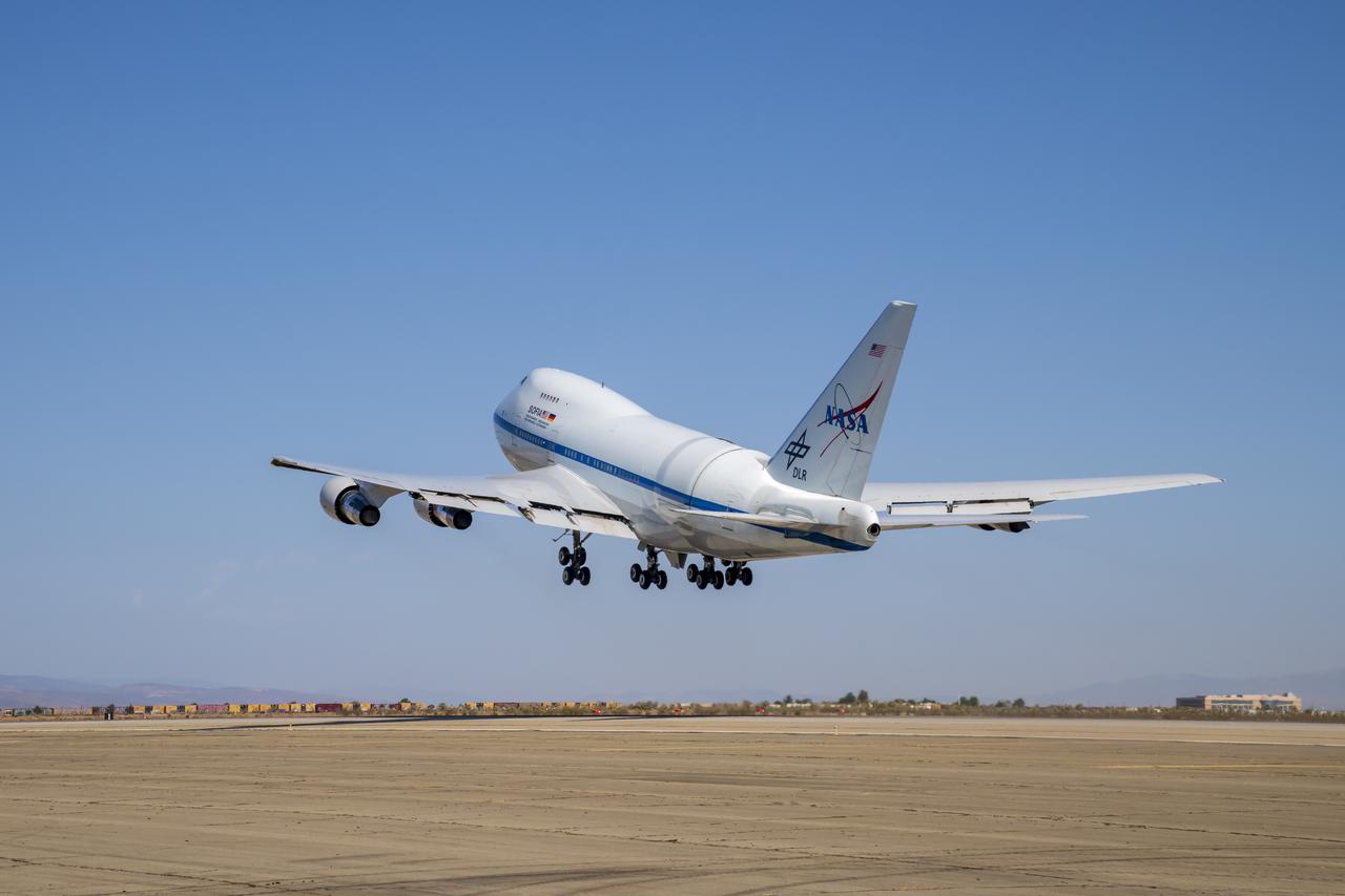
NASA’s Stratospheric Observatory for Infrared Astronomy, SOFIA, takes off from its base of operations at NASA’s Armstrong Flight Research Center’s Building 703 in Palmdale, California. The aircraft is on its way to Fa’a’ā, French Polynesia where it will be on a mission from July 19 to Sept. 12 to observe parts of the sky that are not visible from the Northern Hemisphere. NASA’s Stratospheric Observatory for Infrared Astronomy, SOFIA, takes off from its base of operations at NASA’s Armstrong Flight Research Center’s Building 703 in Palmdale, California. The aircraft is on its way to Fa’a’ā, French Polynesia where it will be on a mission from July 19 to Sept. 12 to observe parts of the sky that are not visible from the Northern Hemisphere.
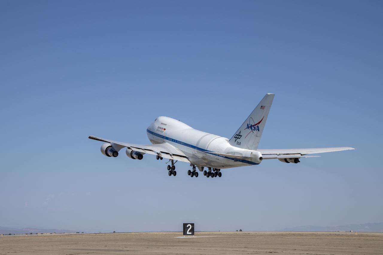
NASA’s Stratospheric Observatory for Infrared Astronomy, SOFIA, takes off from its base of operations at NASA’s Armstrong Flight Research Center’s Building 703 in Palmdale, California. The aircraft is on its way to Fa’a’ā, French Polynesia where it will be on a mission from July 19 to Sept. 12 to observe parts of the sky that are not visible from the Northern Hemisphere. NASA’s Stratospheric Observatory for Infrared Astronomy, SOFIA, takes off from its base of operations at NASA’s Armstrong Flight Research Center’s Building 703 in Palmdale, California. The aircraft is on its way to Fa’a’ā, French Polynesia where it will be on a mission from July 19 to Sept. 12 to observe parts of the sky that are not visible from the Northern Hemisphere.
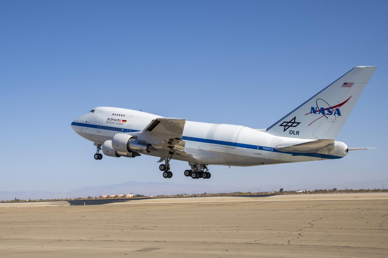
NASA’s Stratospheric Observatory for Infrared Astronomy, SOFIA, takes off from its base of operations at NASA’s Armstrong Flight Research Center’s Building 703 in Palmdale, California. The aircraft is on its way to Fa’a’ā, French Polynesia where it will be on a mission from July 19 to Sept. 12 to observe parts of the sky that are not visible from the Northern Hemisphere. NASA’s Stratospheric Observatory for Infrared Astronomy, SOFIA, takes off from its base of operations at NASA’s Armstrong Flight Research Center’s Building 703 in Palmdale, California. The aircraft is on its way to Fa’a’ā, French Polynesia where it will be on a mission from July 19 to Sept. 12 to observe parts of the sky that are not visible from the Northern Hemisphere.

NASA’s Stratospheric Observatory for Infrared Astronomy, SOFIA, takes off from its base of operations at NASA’s Armstrong Flight Research Center’s Building 703 in Palmdale, California. The aircraft is on its way to Fa’a’ā, French Polynesia where it will be on a mission from July 19 to Sept. 12 to observe parts of the sky that are not visible from the Northern Hemisphere. NASA’s Stratospheric Observatory for Infrared Astronomy, SOFIA, takes off from its base of operations at NASA’s Armstrong Flight Research Center’s Building 703 in Palmdale, California. The aircraft is on its way to Fa’a’ā, French Polynesia where it will be on a mission from July 19 to Sept. 12 to observe parts of the sky that are not visible from the Northern Hemisphere.
NASA’s Stratospheric Observatory for Infrared Astronomy, SOFIA, takes off from its base of operations at NASA’s Armstrong Flight Research Center’s Building 703 in Palmdale, California. The aircraft is on its way to Fa’a’ā, French Polynesia where it will be on a mission from July 19 to Sept. 12 to observe parts of the sky that are not visible from the Northern Hemisphere. NASA’s Stratospheric Observatory for Infrared Astronomy, SOFIA, takes off from its base of operations at NASA’s Armstrong Flight Research Center’s Building 703 in Palmdale, California. The aircraft is on its way to Fa’a’ā, French Polynesia where it will be on a mission from July 19 to Sept. 12 to observe parts of the sky that are not visible from the Northern Hemisphere.
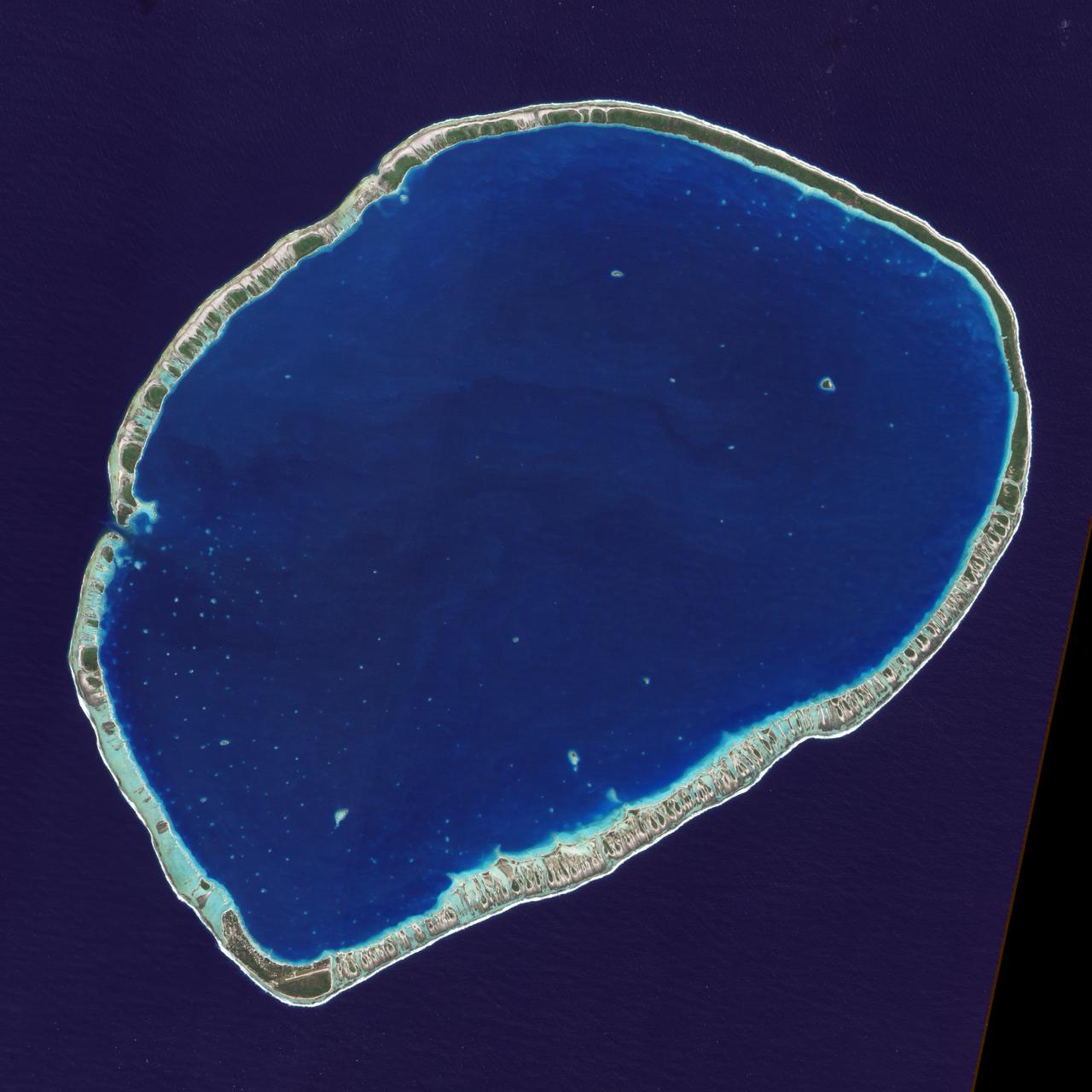
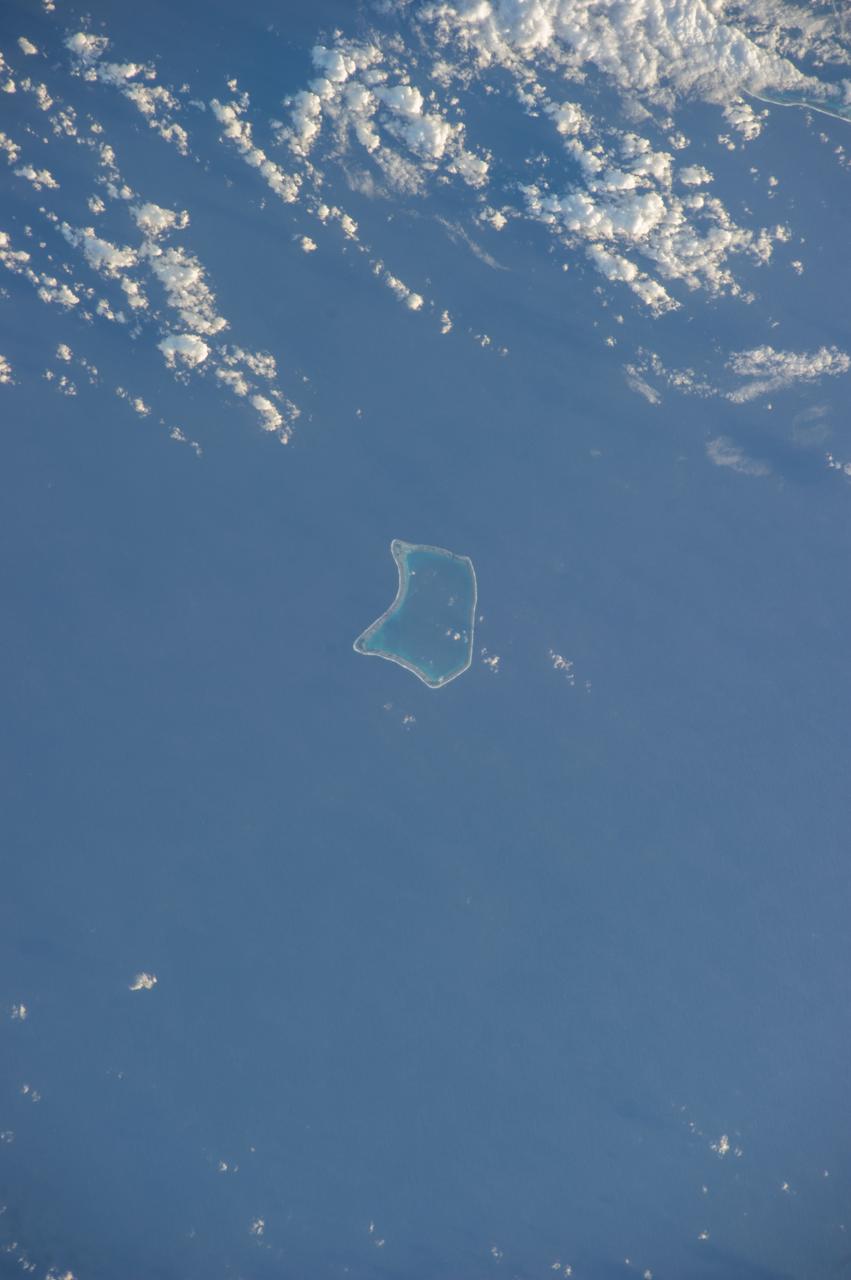
The islands and coral atolls of French Polynesia, located in the southern Pacific Ocean, epitomize the idea of tropical paradise: white sandy beaches, turquoise lagoons, and palm trees. Even from the distance of space, the view of these atolls is beautiful. This image from the Advanced Land Imager on NASA’s Earth Observing-1 (EO-1) satellite shows the southern part of Tikehau Atoll, one of the 78 coral atolls that make up the Tuamotu Archipelago. Patches of coral make star-like spots across the turquoise expanse of the lagoon. A line of tree-covered islets encircles the lagoon. At the southernmost tip of the atoll, a large islet accommodates a small village and an air strip. NASA image created by Jesse Allen, using EO-1 ALI data provided courtesy of the NASA EO-1 Team. Caption by Rebecca Lindsey. <b><a href="http://www.nasa.gov/audience/formedia/features/MP_Photo_Guidelines.html" rel="nofollow">NASA image use policy.</a></b> <b><a href="http://www.nasa.gov/centers/goddard/home/index.html" rel="nofollow">NASA Goddard Space Flight Center</a></b> enables NASA’s mission through four scientific endeavors: Earth Science, Heliophysics, Solar System Exploration, and Astrophysics. Goddard plays a leading role in NASA’s accomplishments by contributing compelling scientific knowledge to advance the Agency’s mission. <b>Follow us on <a href="http://twitter.com/NASAGoddardPix" rel="nofollow">Twitter</a></b> <b>Like us on <a href="http://www.facebook.com/pages/Greenbelt-MD/NASA-Goddard/395013845897?ref=tsd" rel="nofollow">Facebook</a></b> <b>Find us on <a href="http://instagrid.me/nasagoddard/?vm=grid" rel="nofollow">Instagram</a></b>
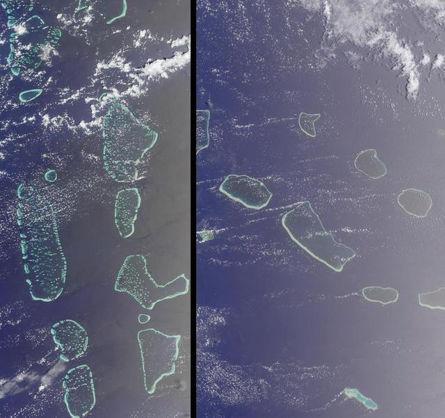
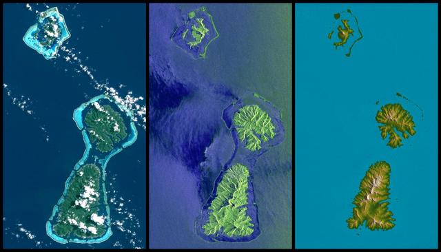
Maldives in the Indian Ocean and Tuamotu, French Polynesia is shown in this MISR Mystery Quiz #16 captured by NASA Terra spacecraft.
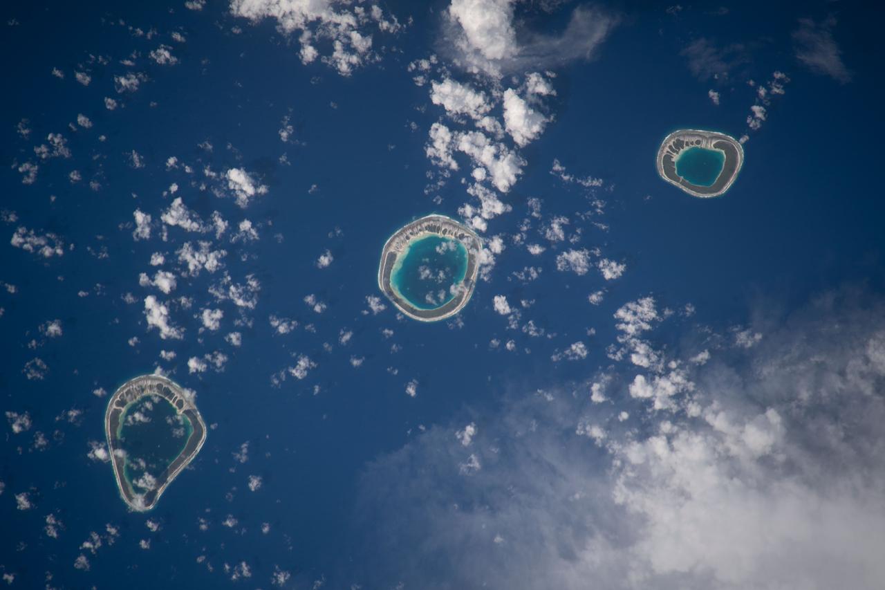
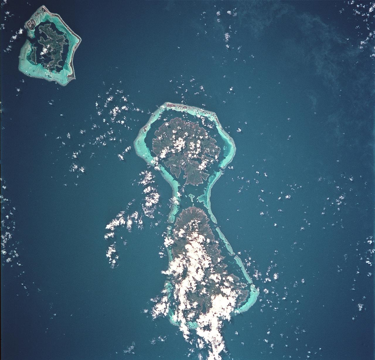
iss068e043869 (Jan. 30, 2023) --- The uninhabited atolls of (from left) Vahanga, Tenarungo, and Tenanaro, which are part of French Polynesia in the south Pacific Ocean, are pictured from the International Space Station as it orbited 260 miles above.
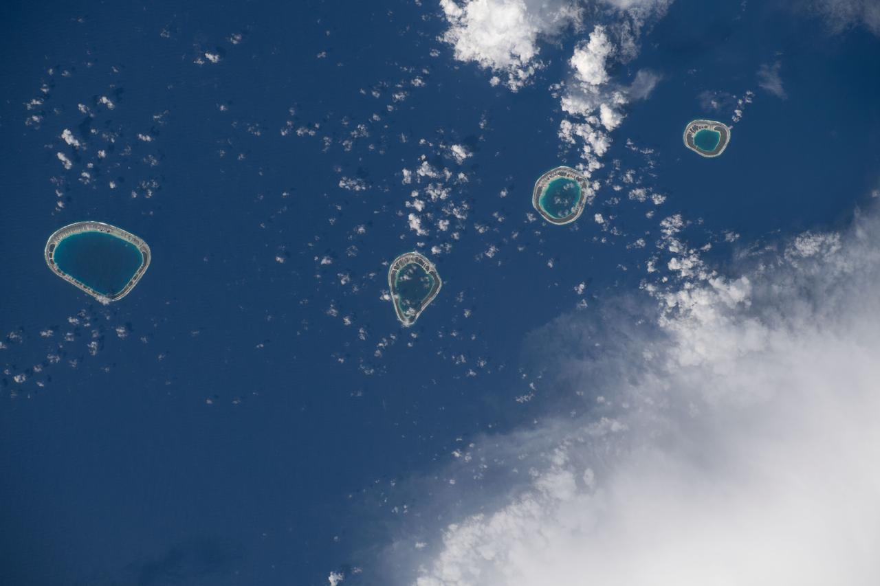
iss068e043864 (Jan. 30, 2023) --- The uninhabited atolls of (from left) Maturei Vavao, Vahanga, Tenarungo, and Tenanaro, which make up French Polynesia in the south Pacific Ocean, are pictured from the International Space Station as it orbited 260 miles above.
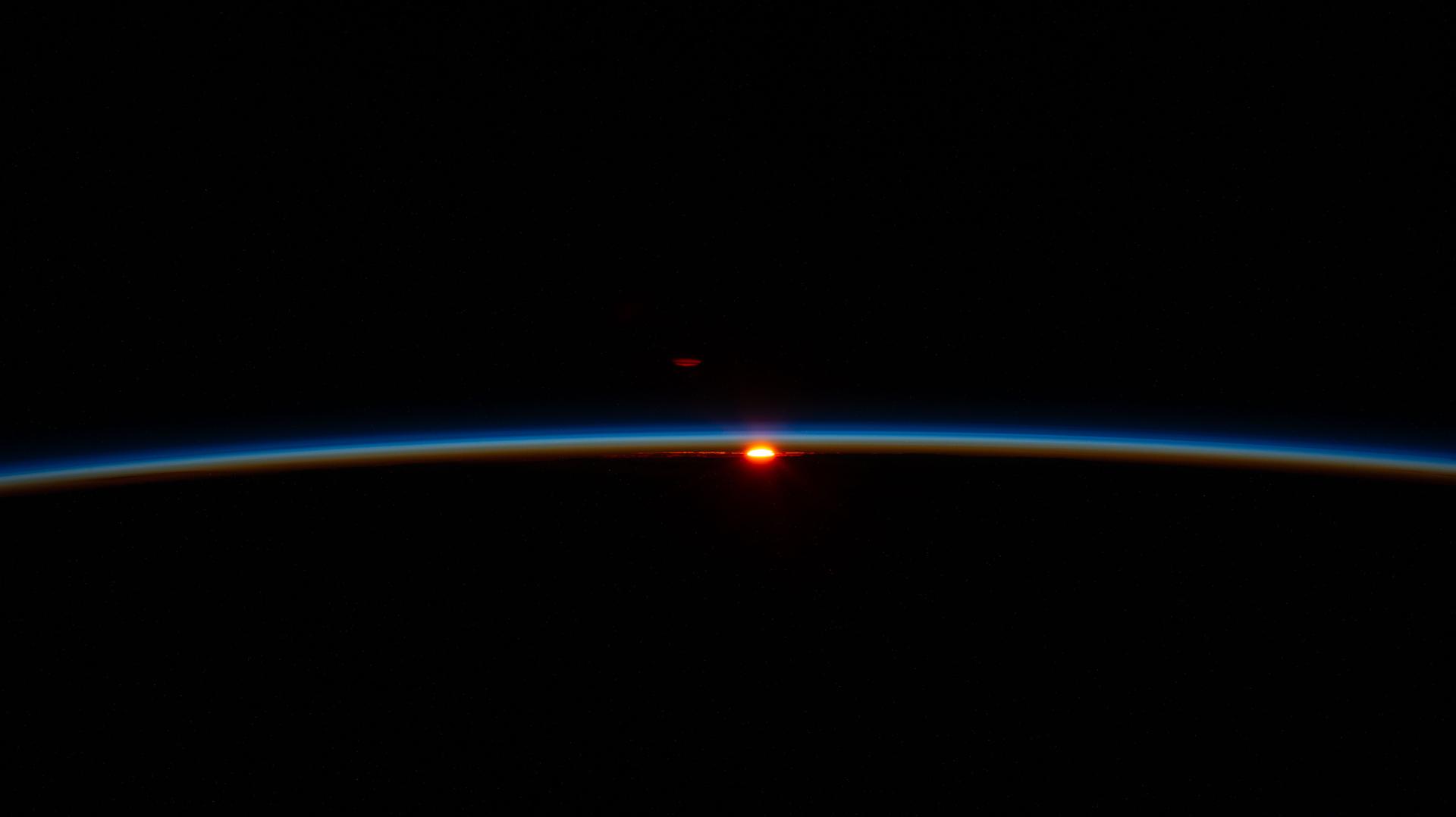
iss074e0089802 (Jan. 16, 2026) --- The first rays of an orbital sunrise illuminate Earth’s atmosphere in this photograph taken from the International Space Station as it orbited 268 miles above French Polynesia in the Pacific Ocean at approximately 2:52 a.m. local time.
ISS040-E-007404 (4 June 2014) --- One of the Expedition 40 crew members aboard the International Space Station on June 4, 2014, recorded this vertical image of Fangataufa Atoll, a small coral atoll on the eastern side of the Tuamotu Archipelago in French Polynesia in the South Pacific Ocean.

ISS040-E-129950 (4 Sept. 2014) --- In this photograph. taken by one of the Expedition 40 crew members aboard the Earth-orbiting International Space Station, the orange spot located in the very center is the sun, which appears to be sitting on Earth's limb. At far right, a small bright spot is believed to be a reflection from somewhere in the camera system or something on the orbital outpost. When the photographed was exposed, the orbital outpost was flying at an altutude of 226 nautical miles above a point near French Polynesia in the Pacific Ocean.
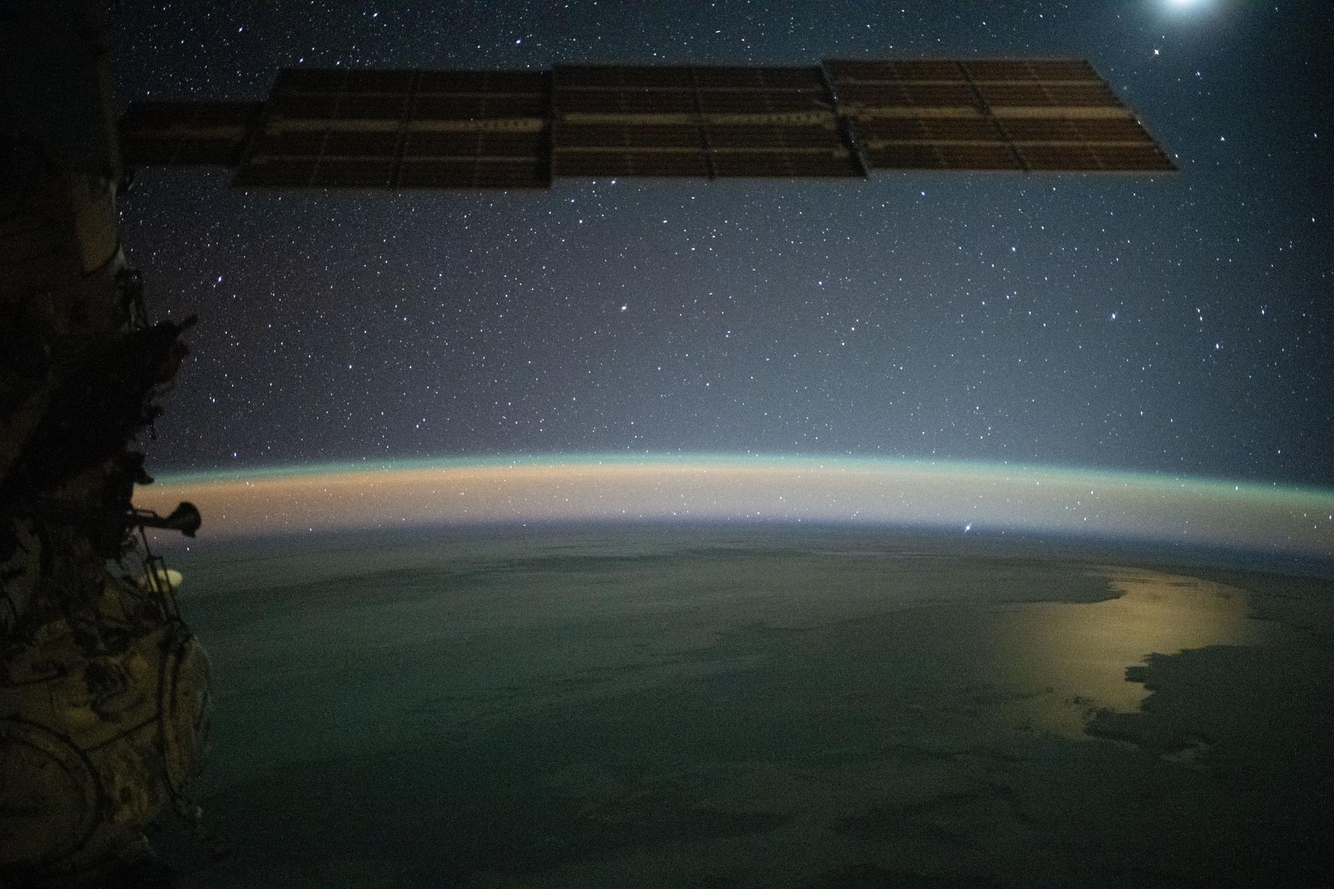
iss073e0982346 (Oct. 25, 2025) --- This serene image of the Moon (upper right) glinting off the Southern Pacific Ocean—beneath a yellow-green airglow and a starry night sky—was taken at approximately 8:59 p.m. local time from the International Space Station as it orbited 263 miles above Earth, southwest of French Polynesia, an overseas collectivity of France comprising more than 100 islands.
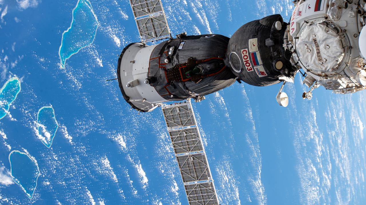
iss073e0002705 (April 26, 2025) --- The Soyuz MS-27 spacecraft is pictured docked to the Prichal module as the International Space Station orbited 264 miles above French Polynesia, France's oveseas collectivity of over 100 islands in the Pacific Ocean. The Soyuz launched NASA astronaut Jonny Kim and Roscosmos cosmonauts Sergey Ryzhikov and Alexey Zubritsky to the orbital outpost on April 8.
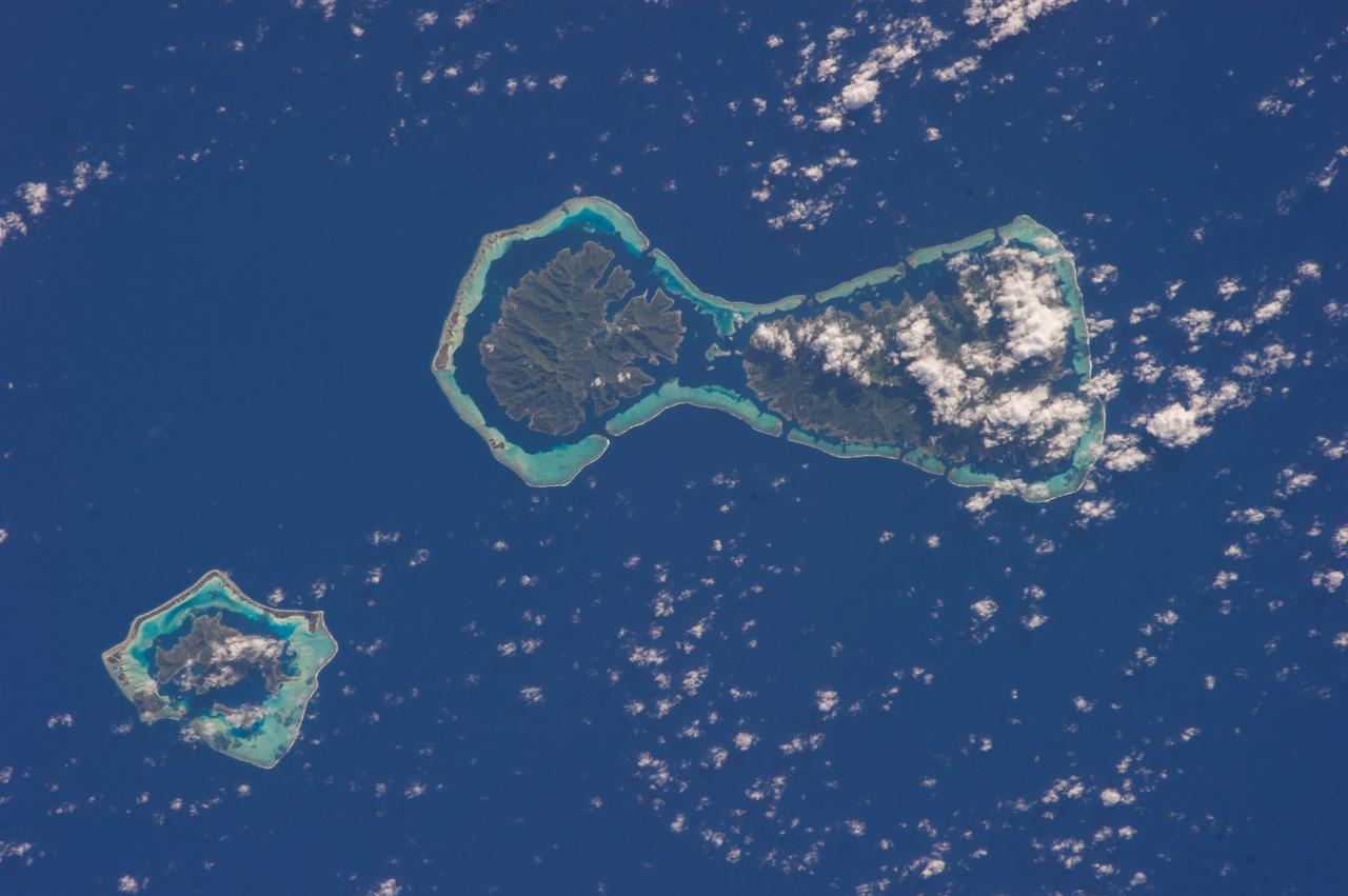
ISS037-E-022125 (28 Oct. 2013) --- The interesting color contrasts of the water surrounding the atolls of Pinaki (bottom) and Nukutavake in French Polynesia caught the eye of one of the Expedition 37 crew members aboard the Earth-orbiting International Space Station on Oct. 28. At first glance to a pair of sleepy eyes, the atolls might look somewhat like a bottle cap and a bottle opener.
STS093-717-066 (23-27 July 1999) --- The STS-93 astronauts aboard the Space Shuttle Columbia took this picture featuring the Society Islands. Delicate coral reefs ring the islands of Bora Bora (top), Tahaa (center) and Raiatea (bottom). The Society Islands, which also include the island of Tahiti, are one of many archipelagoes that constitute French Polynesia in the central South Pacific. When the photo was taken, the shuttle was flying over a point located at 16.2 degrees south latitude and 151.8 degrees west longitude. Data back information on the 70mm listed the time and date as 23:36:16 GMT, July 25, 1999 (Orbit 45).
Bora Bora, Tahaa, and Raiatea top to bottom are Polynesian Islands about 220 kilometers 135 miles west-northwest of Tahiti in the South Pacific.
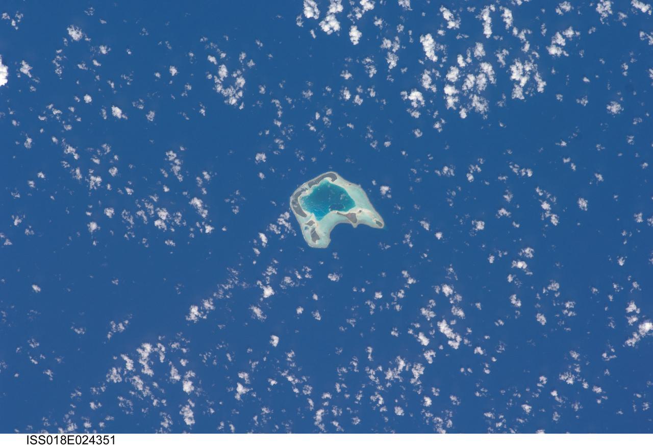
ISS018-E-024351 (27 Jan. 2009) --- Tetiaroa Island in French Polynesia is featured in this image photographed by an Expedition 18 crewmember on the International Space Station. This island, part of the Society Islands archipelago in the southern Pacific Ocean, is also known as ?Marlon Brando?s Island?. The late film star purchased the island ? more correctly, an atoll comprised of thirteen small islets (or motus) from the French Polynesian government for a total of 70,000 over 1966-1967. While the motus were his property, the government retained the rights to the coral reefs and lagoons to preserve control of marine resources. Following Brando?s death in 2004, ownership of the approximately 8 kilometers?wide atoll passed into other private hands, and there are now plans to build a luxury resort amongst the islets. This view illustrates the typical circular appearance of a fully-developed atoll. The ring of islands ? covered in green vegetation and white to tan sandy beaches ? develops on coral reefs, which originally form around a volcanic island. As the volcanic island gradually disappears due to subsidence and erosion, the coral reefs continue to grow upwards. Over time, the central volcanic island is completely submerged, leaving a ring of coral reefs and islands that surround a lagoon. The shallow lagoon waters appear blue-green in this image, and contrast with darker ? and deeper ? Pacific Ocean waters surrounding the atoll. One of the motus in the southern portion of the atoll, Tahuna Rahi, is a protected bird sanctuary, and is the nesting site of red- and brown-footed boobies, frigatebirds, and terns (among other species). Access to the atoll is via boat, as the airstrip was closed in 2004 due to safety and security concerns.
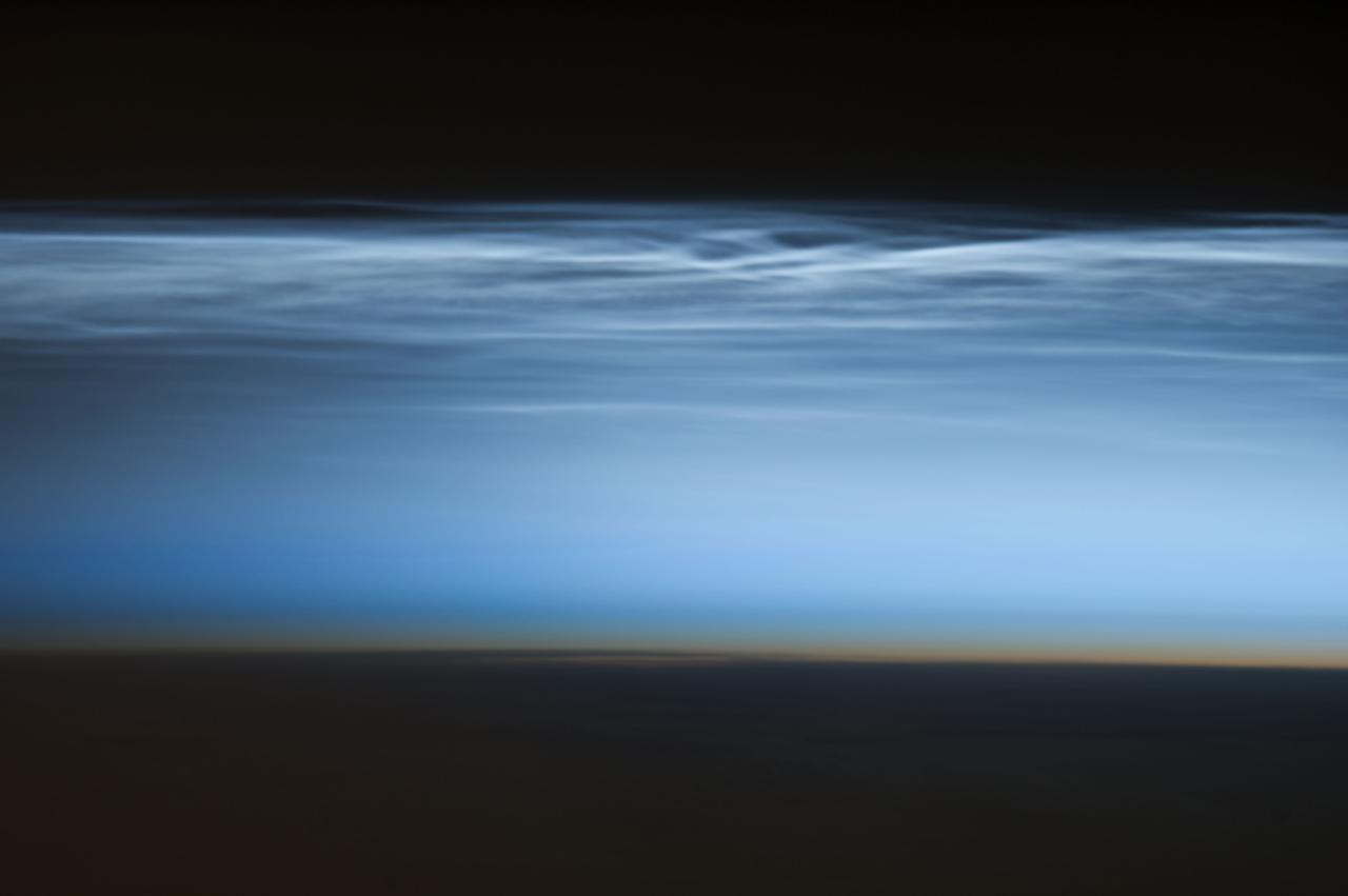
ISS034-E-024622 (5 Jan. 2013) --- Polar mesospheric clouds over the South Pacific Ocean are featured in this image photographed by an Expedition 34 crew member on the International Space Station. Polar mesospheric clouds—also known as noctilucent, or “night shining” clouds—are formed 76 to 85 kilometers above Earth’s surface near the mesosphere-thermosphere boundary of the atmosphere, a region known as the mesopause. At these altitudes, water vapor can freeze into clouds of ice crystals. When the sun is below the horizon such that the ground is in darkness, these high clouds may still be illuminated—lending them their ethereal, “night shining” qualities. Noctilucent clouds have been observed from all human vantage points in both the Northern and Southern Hemispheres – from the surface, in aircraft, and in orbit from the space station—and tend to be most visible during the late spring and early summer seasons. Polar mesospheric clouds also are of interest to scientists studying the atmosphere. While some scientists seek to understand their mechanisms of formation, others have identified them as potential indicators of atmospheric changes resulting from increases in greenhouse gas concentrations. This photograph was taken when the station was over the Pacific Ocean south of French Polynesia. While most polar mesospheric cloud images are taken from the orbital complex with relatively short focal length lens to maximize the field of view, this image was taken with a long lens (400 mm) allowing for additional detail of the cloud forms to be seen. Below the brightly-lit noctilucent clouds in the center of the image, the pale orange band indicates the stratosphere.
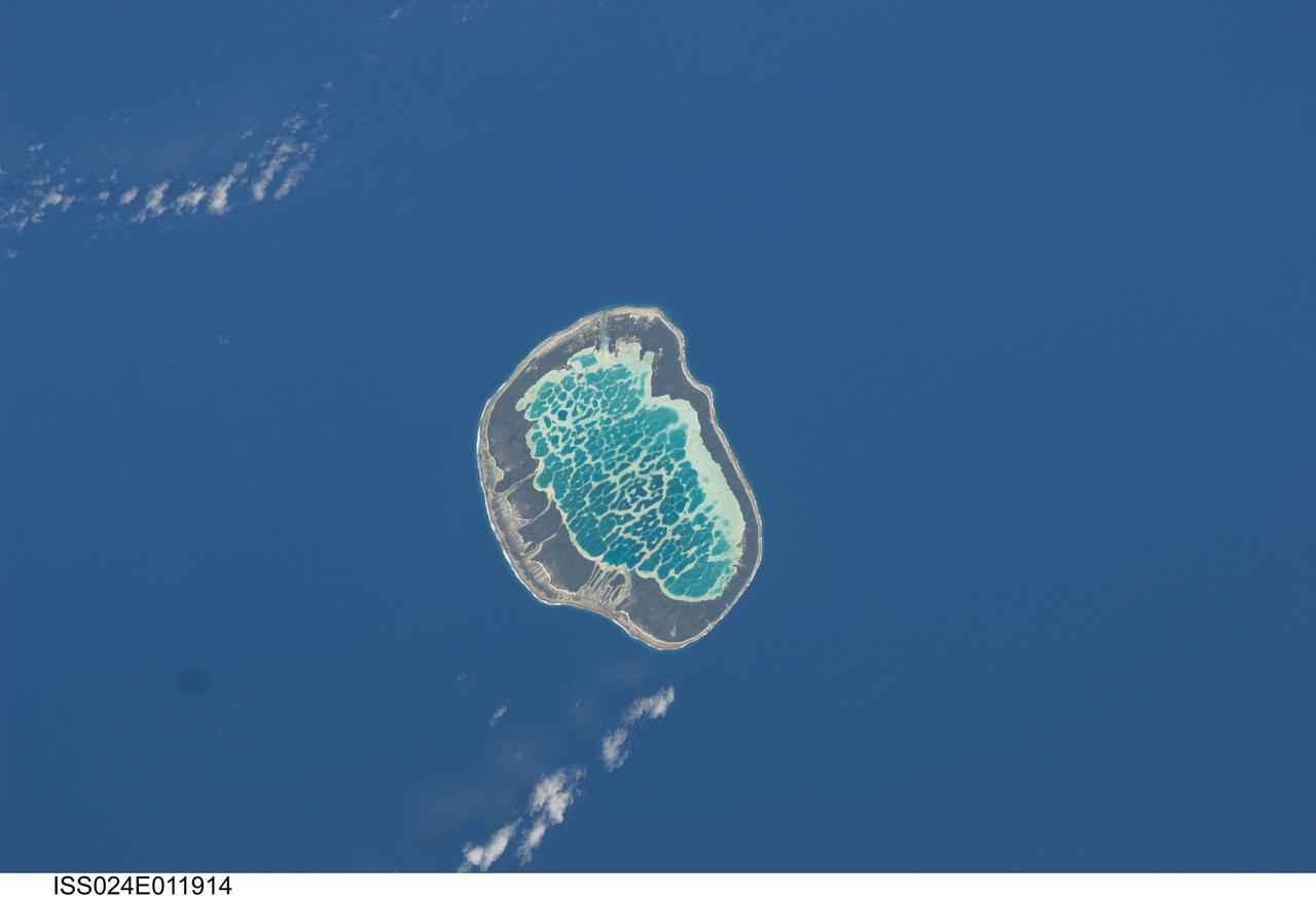
ISS024-E-011914 (13 Aug. 2010) --- Mataiva Atoll, Tuamotu Archipelago in the South Pacific Ocean is featured in this image photographed by an Expedition 24 crew member on the International Space Station. The Tuamotu Archipelago is part of French Polynesia, and forms the largest chain of atolls in the world. This photograph features Mataiva Atoll, the westernmost atoll of the Tuamotu chain. An atoll is a ring-shaped island that encloses a central lagoon. This distinctive morphology is usually associated with oceanic islands formed by volcanoes; coral reefs become established around the partially submerged volcanic cone. Over geologic time the central volcano becomes extinct, followed by erosion and subsidence beneath the sea surface, leaving the coral reefs as a ring around (or cap on) the submerged island remnant. Coral reefs exposed above the sea surface in turn experience erosion, sedimentation and soil formation, leading to the establishment of vegetation and complex ecosystems – including in many cases human habitation. Mataiva Atoll is notable in that its central lagoon includes a network of ridges (white, center) and small basins formed from eroded coral reefs. Mataiva means “nine eyes” in Tuamotuan, an allusion to nine narrow channels on the south-central portion of the island. The atoll is sparsely populated, with only a single village – Pahua – located on either side of the only pass providing constant connection between the shallow (light blue) water of the lagoon and the deeper (dark blue) adjacent Pacific Ocean. Much of the 10 kilometer-long atoll is covered with forest (greenish brown); vanilla and copra (dried coconut) are major exports from the atoll, but tourism is becoming a greater economic factor.