Frost on Mars
Enhanced by Frost
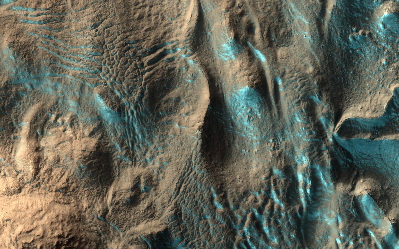
Dunes with Frost
Frost on Dunes
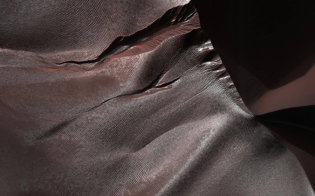
Frosted Dunes
Morning Frost on Martian Surface

Polygons in Martian Frost
Winter Frost and Fog

Seasonal Frost Changes on Mars

Polygons in Seasonal Frost

Frost on Utopia Planitia
Sand Dunes with Frost

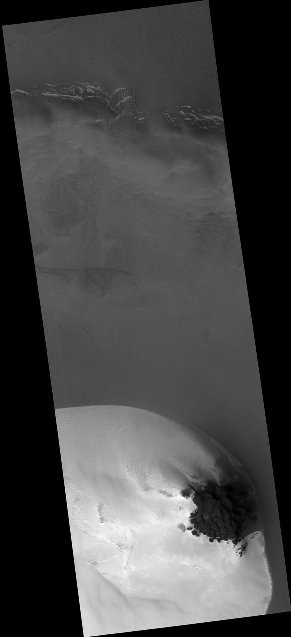
Frosted Chasma Boreale Dunes
Seasonal Frost in Terra Sirenum
Frost in Charitum Montes
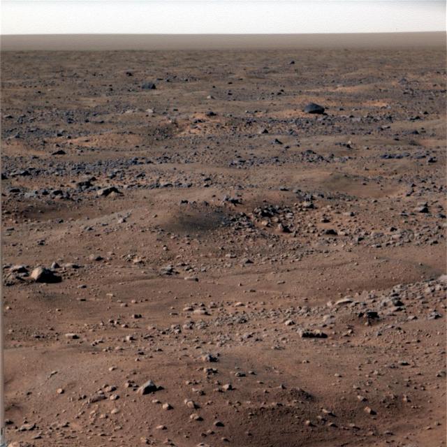
Frost on Mars Rover Opportunity
Frost-covered Dunes
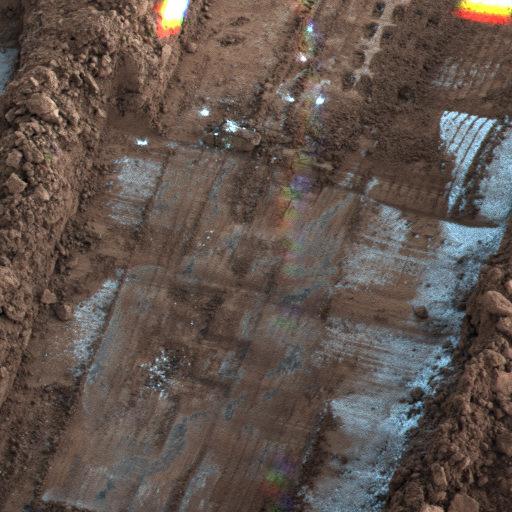
Frost seen on Snow White Trench
Winter Frosted Dunes in Kaiser Crater
Frosted Southern Plains in Early Spring
Frost at the Viking Lander 2 Site
Ice-frosted crater tops on Ganymede
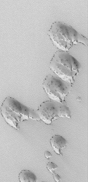
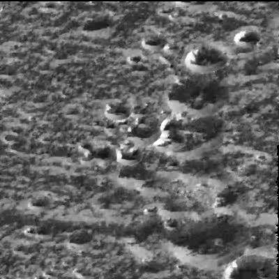
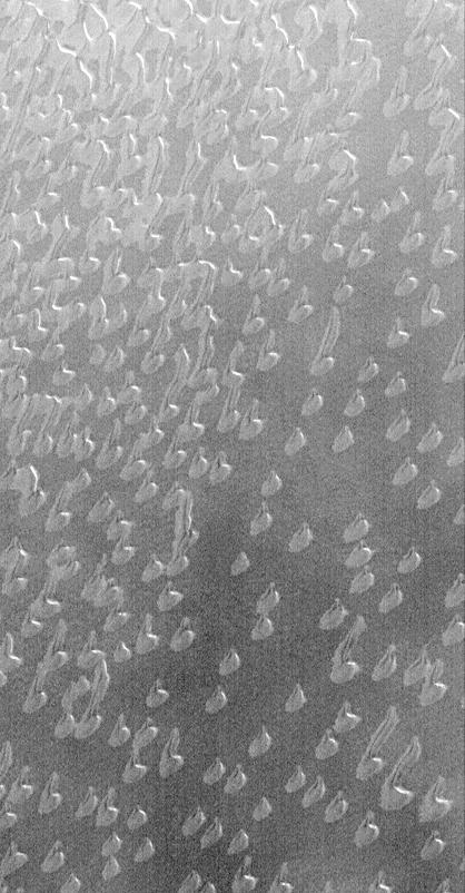
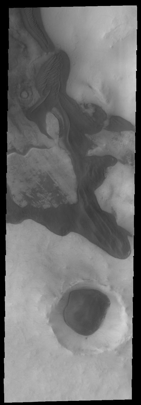
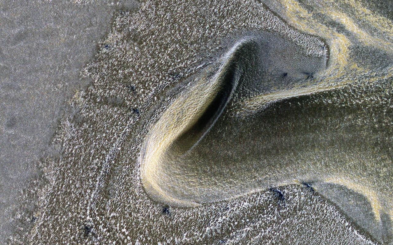
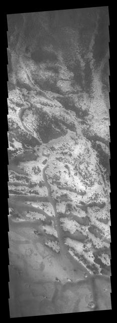
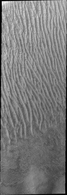
The dunes in this image from NASA 2001 Mars Odyssey spacecraft are still partial covered in frost. They will get darker and darker as the frost is removed and the underlying dark material is completely exposed.
Winter Frosts of the Retreating South Polar Cap
Frosted North Polar Sand Dunes in Early Spring
Autumn Frost, North Polar Sand Dunes
Frost Patch and Dunes in a Northern Hemisphere Crater

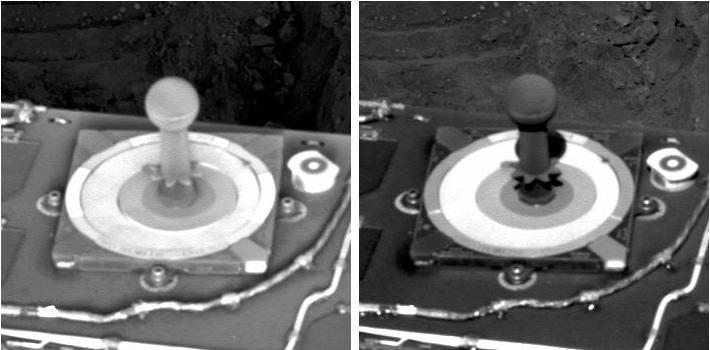
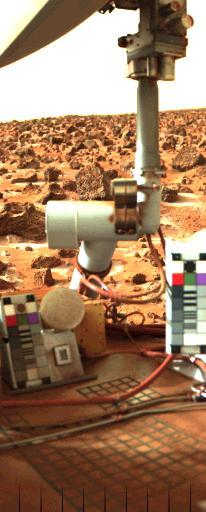
Morning Frost in Trench Dug by Phoenix, Sol 113
Frost-Covered Dunes in the North Polar Region
Gullies on Mars form during the winter, fluidized by carbon dioxide frost, so we monitor these sites for activity throughout the year. https://photojournal.jpl.nasa.gov/catalog/PIA23675
These dark dunes are frost covered for most of the year. As southern summer draws to a close, the dunes have been completely defrosted
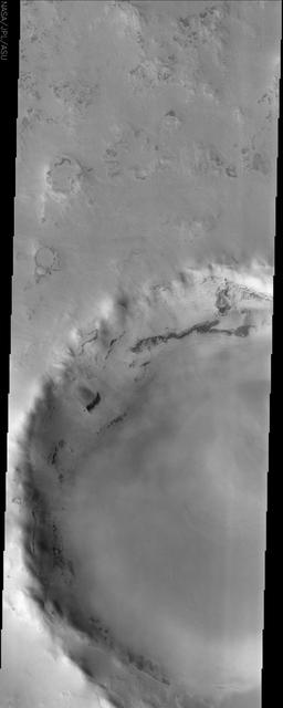
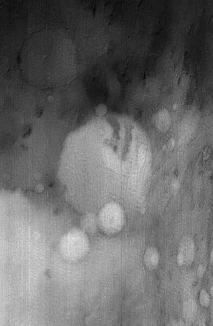
This image from NASA Mars Odyssey spacecraft displays a frosted crater in the Martian northern hemisphere. It was taken during the northern spring, when the CO2 ice cap starts to sublimate and recede.
Richardson Crater is home to this sea of sand dunes. It was fall in the Southern hemisphere when NASA MRO acquired this image of the dunes frosted with the first bit of carbon dioxide ice condensed from the atmosphere.
This image from NASA Mars Odyssey spacecraft displays sand dunes covered in CO2 frost. This is a region of Mars that contains circumpolar sand seas.
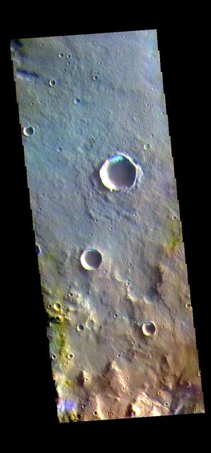
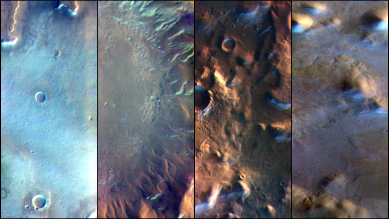
The THEMIS VIS camera contains 5 filters. The data from different filters can be combined in multiple ways to create a false color image. These false color images may reveal subtle variations of the surface not easily identified in a single band image. Today's false color image shows several small, unnamed craters in Terra Sirenum. The bright blue region on the inner crater rim is morning frost. Collected during the winter, south facing slopes stay in shadow and retain frost longer than the rest of the rim already in sunlight. Frosts are only identifiable in multi filter images. Orbit Number: 80442 Latitude: -36.3327 Longitude: 198.274 Instrument: VIS Captured: 2020-02-01 21:41 https://photojournal.jpl.nasa.gov/catalog/PIA24676
The Frosted Craters of Northern Spring and Southern Autumn - Barnard Crater

Morning Frost in Trench Dug by Phoenix, Sol 113 False Color
The Frosted Craters of Northern Spring and Southern Autumn - Lowell Crater
North Polar Cap Layers and Frost on the First Day of Summer
Polar Dunes In Summer Exhibit Frost Patches, Wind Streaks
Patches of Remnant Frost/Snow on Crater Rim in Northern Summer
The Frosted Craters of Northern Spring and Southern Autumn - Lomonosov Crater
The Frosted Craters of Northern Spring and Southern Autumn - Unnamed Crater
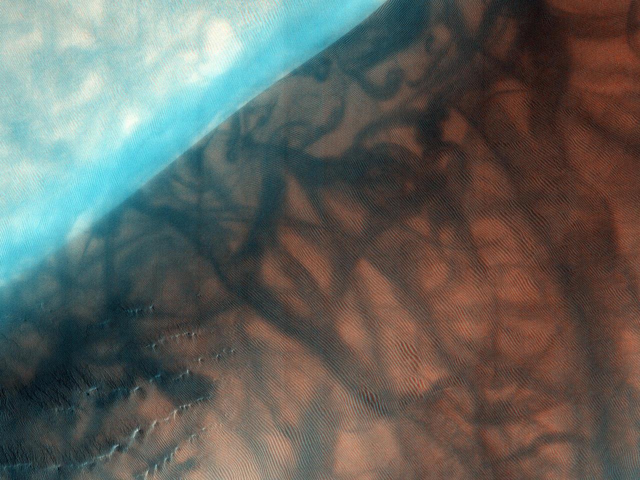
When we acquired this image, it was northern summer and southern winter on Mars, but signs of spring are already starting to appear at latitudes not far from the equator. This image of Penticton Crater, taken at latitude 38 degrees south, shows streamers of seasonal carbon dioxide ice (dry ice) only remaining in places in the terrain that are still partially in the shade. The turquoise-colored frost (enhanced color) is protected from the sun in shadowed dips in the ground while the sunlit surface nearby is already frost-free. https://photojournal.jpl.nasa.gov/catalog/PIA23667
The frosted gullies in this observation from NASA Mars Reconnaissance Orbiter are located along an irregularly shaped pit which lies within an impact crater in Sisyphi Planum ocated northwards of the Southern polar layered deposits.
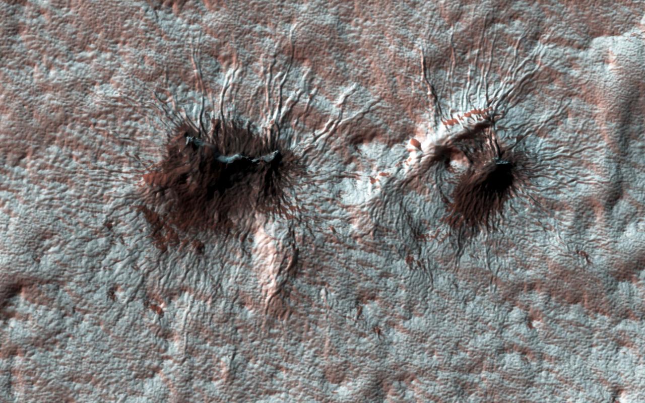
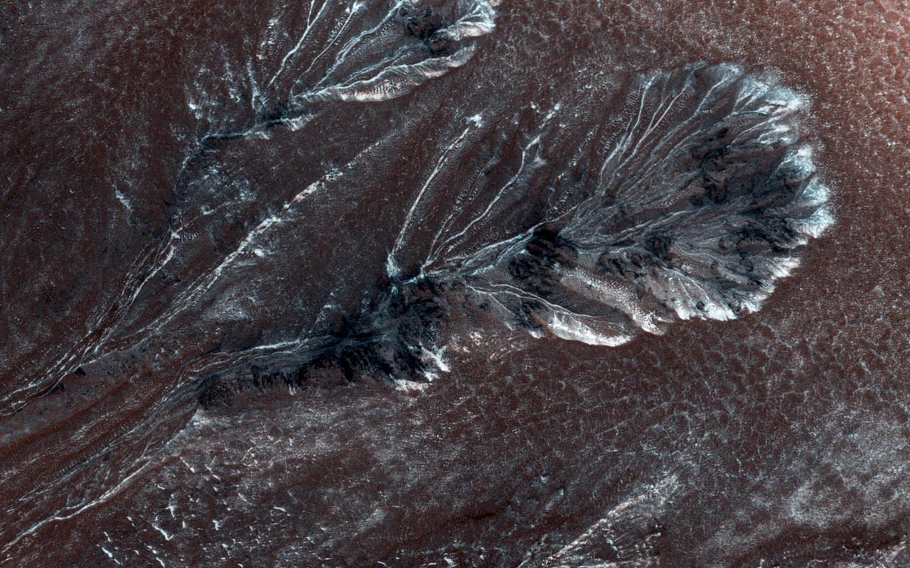
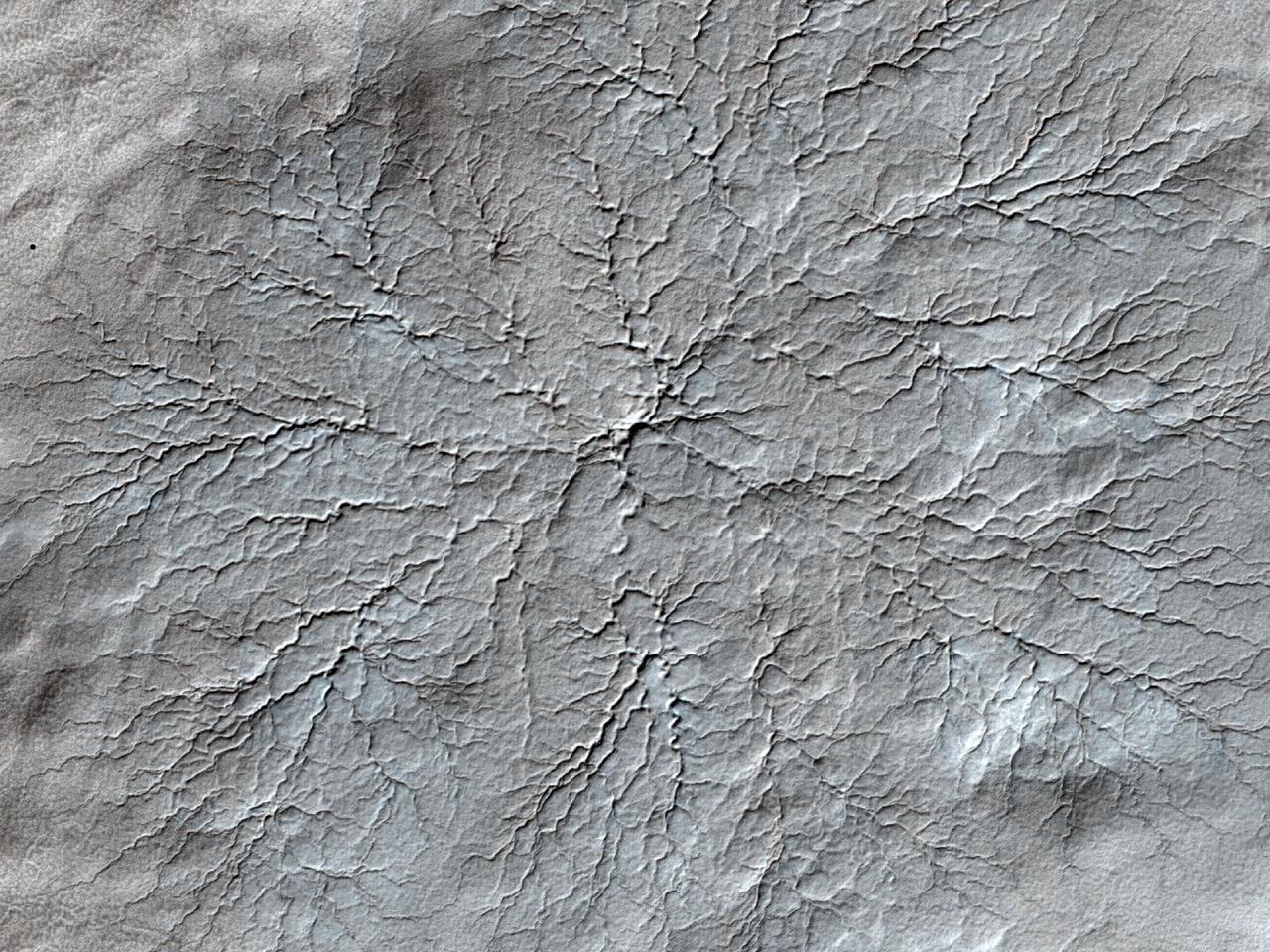
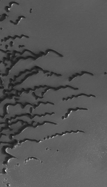
Subtle variations in color look like brush strokes as the lightly frosted terrain reflects light. These variations provide a backdrop to some exotic features referred to colloquially as "spiders." The radial channels branching out from a central depression are formed when the seasonal layer of dry ice turns to gas in the spring and erodes the surface, which is a uniquely Martian landform. http://photojournal.jpl.nasa.gov/catalog/PIA21214
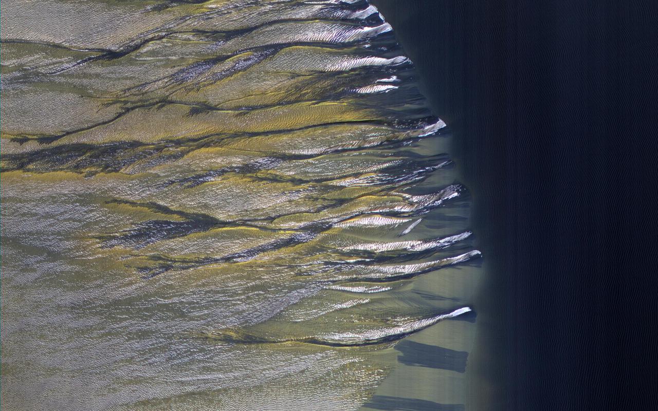
Usually, HiRISE takes pictures of well-illuminated terrain where there is plenty of light to produce clear images. Sometimes though, we would like to know what's going on in the dim wintertime areas. This picture was taken far north of the equator just two days after the winter solstice when the Sun was just a few degrees above the horizon. Sand dunes are moving across this landscape from top left to bottom right. Winter frost covers the colder, north-facing half of each dune (but not the warmer south-facing half). The frost here is a mixture of carbon dioxide ice and water ice and will disappear in a few months when spring arrives. https://photojournal.jpl.nasa.gov/catalog/PIA25552
This is the first of a new monitoring series to track seasonal processes. It is also a striking image with late winter angled illumination over dunes covered by carbon dioxide frost mixed with dust. Dark spots may be where sand is exposed from very early defrosting activity. The incidence angle is 87 degrees, or just 3 degrees above the horizon. https://photojournal.jpl.nasa.gov/catalog/PIA23231
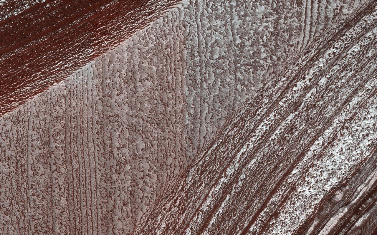
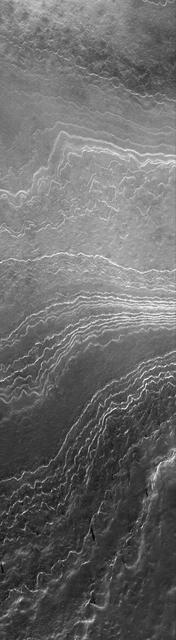
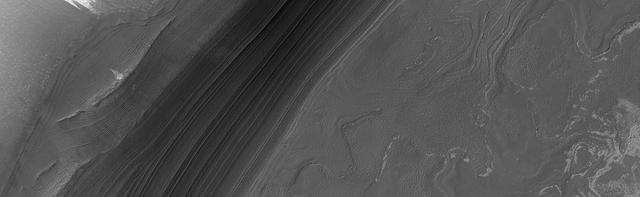
Mars' north polar layered deposits comprise a thick stack of icy layers. Part of this image from NASA's Mars Reconnaissance Orbiter (MRO) has lingering seasonal frost, which serves to accentuate those layers. An additional rationale for this observation is to document new activity in scarp erosion. More information is available at https://photojournal.jpl.nasa.gov/catalog/PIA22533
This image of a crater rim strikingly shows what appear to be bright white flows coming from gullies in the crater wall. However, HiRISE has been watching these gullies for some time (going all the way back to our first observation in 2012) and the flow features have been there for years. The new aspect is the bright white coloration, which is frost. This is the earliest in the springtime that this area has been observed, and just like some winter mornings here on Earth, the conditions on Mars can be just right for frost to form. The interesting thing is that the frost appears on the gully deposits and not as much on the surrounding rock, indicating the physical properties of the gully deposits are different. https://photojournal.jpl.nasa.gov/catalog/PIA23451
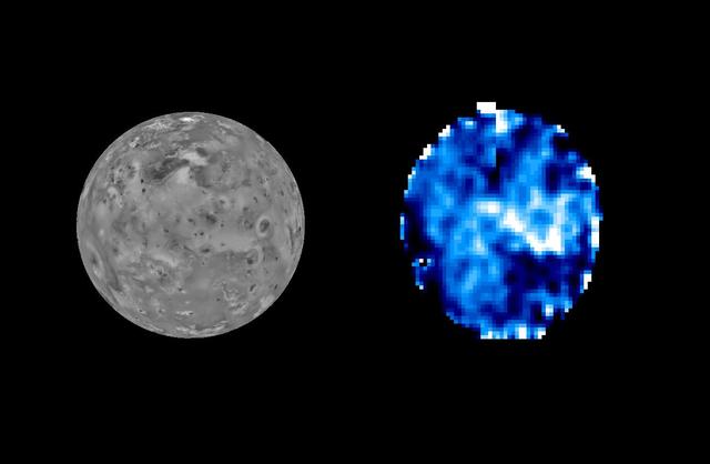
Sulfur dioxide, normally a gas at room temperatures, is known to exist on Io surface as a frost, condensing there from the hot gases emanating from the Io volcanoes. This image was taken in 1996 by NASA Galileo spacecraft.
Martian surface frost, made up largely of carbon dioxide, appears blueish-white in these images from the Thermal Emission Imaging System (THEMIS) camera aboard NASA's 2001 Odyssey orbiter. THEMIS takes images in both visible light perceptible to the human eye and heat-sensitive infrared. https://photojournal.jpl.nasa.gov/catalog/PIA25233
In an area like Russell Crater, very ancient impact crater, NASA Mars Reconnaissance Orbiter can follow changes in the terrain by comparing images taken at different times. Frost carbon dioxide ice is seen in this image.
This MOC image shows a nearly ice-free view of layers exposed by erosion in the north polar region. The light-toned patches are remnants of water ice frost

John Frost, Council Member, NASA Aerospace Safety Advisory Panel, testifies at a Senate Subcommittee on Commerce, Justice, Science, and Related Agencies of the Appropriations Committee hearing concerning the FY 2011 NASA Budget, Thursday, April 22, 2010 at the Dirksen Senate Office Building in Washington. Photo Credit: (NASA/Bill Ingalls)

John Frost, Council Member, NASA Aerospace Safety Advisory Panel, testifies at a Senate Subcommittee on Commerce, Justice, Science, and Related Agencies of the Appropriations Committee hearing concerning the FY 2011 NASA Budget, Thursday, April 22, 2010 at the Dirksen Senate Office Building in Washington. Photo Credit: (NASA/Bill Ingalls)
NASA CRISM onboard the Mars Reconnaissance Orbiter shows Mars seasonal caps consist of frozen carbon dioxide mixed with smaller amounts of water ice frost and dust.
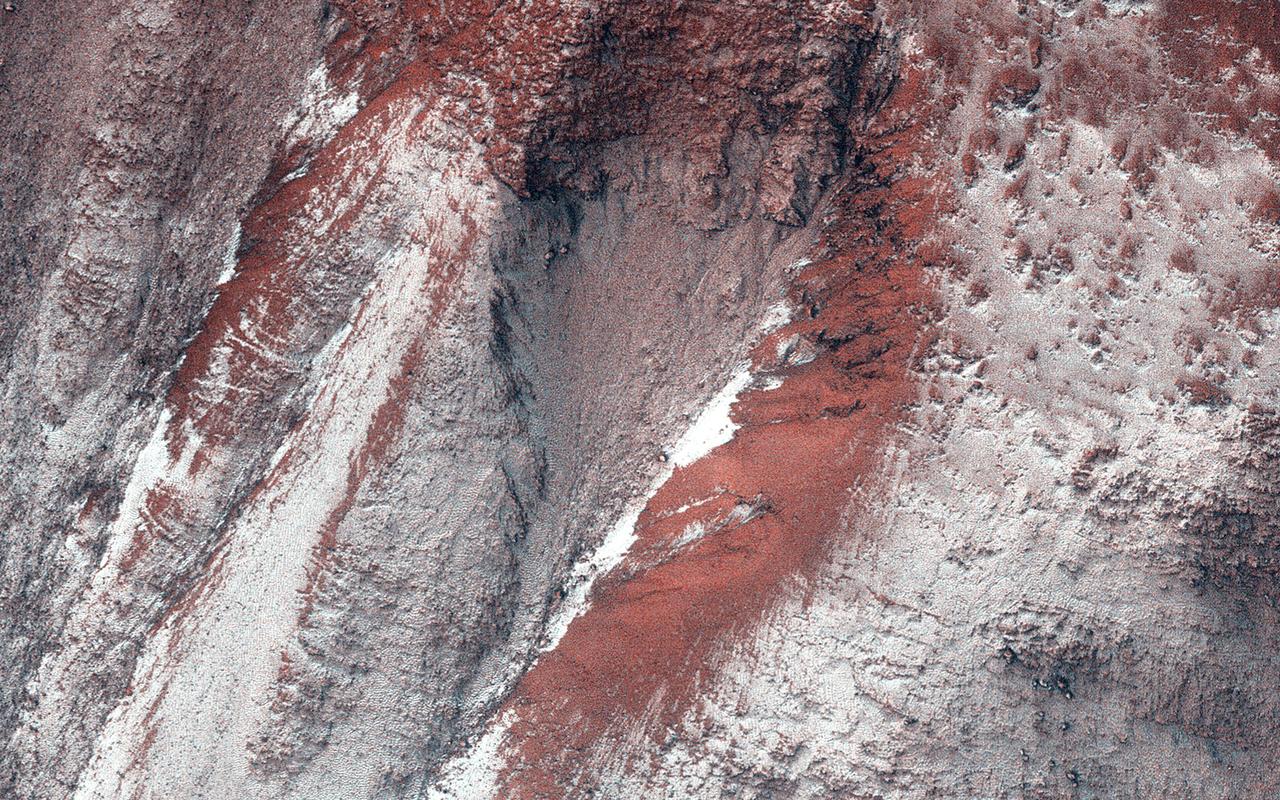
This image of the polar region illustrates the effect of the sun on polar frost. The highstanding ridges have lost all their frost cover, while the lows shaded by the ridges still have a bright frost cover
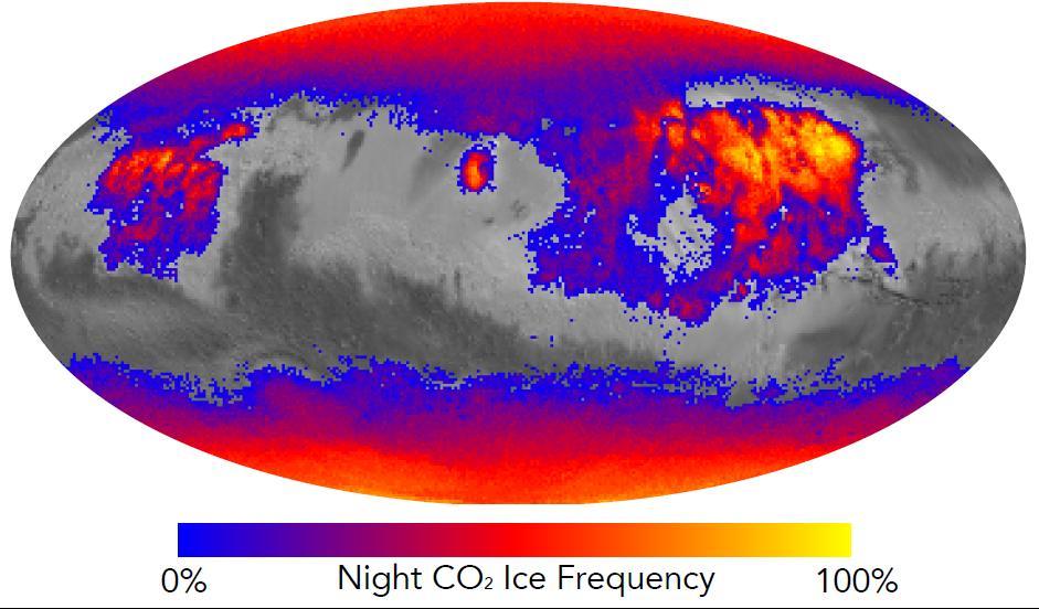
This map shows the frequency of carbon dioxide frost's presence at sunrise on Mars, as a percentage of days year-round. Carbon dioxide ice more often covers the ground at night in some mid-latitude regions than in polar regions, where it is generally absent for much of summer and fall. Color coding is based on data from the Mars Climate Sounder instrument on NASA's Mars Reconnaissance Orbiter. A color-key bar below the map shows how colors correspond to frequencies. Yellow indicates high frequencies, identifying areas where carbon dioxide ice is present on the ground at night during most of the year. Blue identifies areas where it is rarely present; red is intermediate. Areas without color coding are regions where carbon dioxide frost is not detected at any time of year. The areas with highest frequency of overnight carbon dioxide frost correspond to regions with surfaces of loose dust, which do not retain heat well, compared to rockier areas. Those areas also have some of the highest mid-afternoon temperatures on the planet. The dust surface heats up and cools off rapidly. http://photojournal.jpl.nasa.gov/catalog/PIA20758
The THEMIS VIS camera contains 5 filters. The data from different filters can be combined in multiple ways to create a false color image. These false color images may reveal subtle variations of the surface not easily identified in a single band image. Today's false color image shows several craters in Eridania Planitia. The small crater inside the larger crater is Gasa Crater. The larger crater is unnamed. The bright silver-blue region on the inner and outer crater rim is morning frost. Collected during the winter, south facing slopes stay in shadow and retain frost longer than the rest of the rim already in sunlight. Frosts are only identifiable in multi filter images. The THEMIS VIS camera is capable of capturing color images of the Martian surface using five different color filters. In this mode of operation, the spatial resolution and coverage of the image must be reduced to accommodate the additional data volume produced from using multiple filters. To make a color image, three of the five filter images (each in grayscale) are selected. Each is contrast enhanced and then converted to a red, green, or blue intensity image. These three images are then combined to produce a full color, single image. Because the THEMIS color filters don't span the full range of colors seen by the human eye, a color THEMIS image does not represent true color. Also, because each single-filter image is contrast enhanced before inclusion in the three-color image, the apparent color variation of the scene is exaggerated. Nevertheless, the color variation that does appear is representative of some change in color, however subtle, in the actual scene. Note that the long edges of THEMIS color images typically contain color artifacts that do not represent surface variation. Orbit Number: 88618 Latitude: -35.5932 Longitude: 129.422 Instrument: VIS Captured: 2021-12-06 02:28 https://photojournal.jpl.nasa.gov/catalog/PIA25389
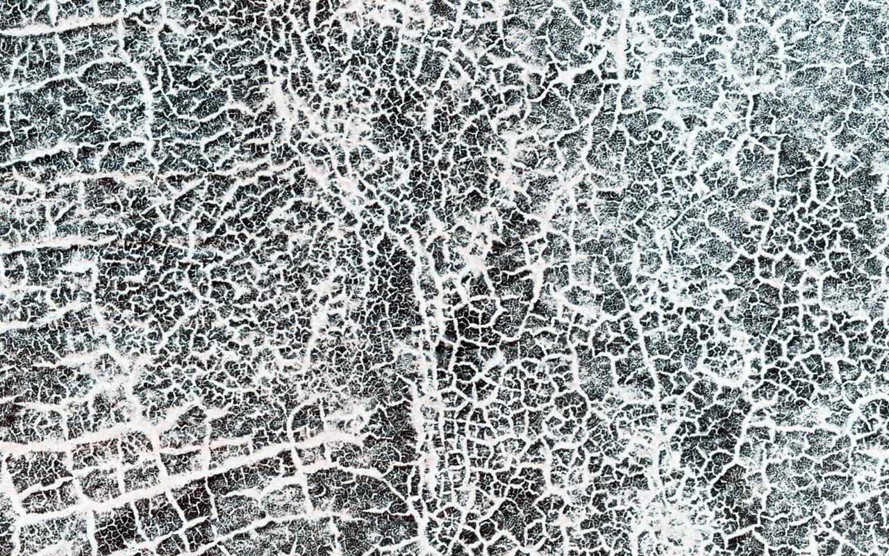
It's spring in the Northern Hemisphere of Mars (when this image was taken), and this area was recently completely covered by the seasonal frost cap. Here, we see polygonal patterns that are highlighted by carbon dioxide frost that has not entirely sublimed away. These organized patterns are likely caused by differences in the soil (regolith) characteristics such as grain size, density, even grain-shape and orientation in the underlying landforms and geologic materials. Variations in these characteristics strongly influence the strength of the ice-rich permafrost. This gives a preferred orientation to the stress field that produces the polygonal patterns. In this case, there appears to have been a meander in a fluvial channel in which sediments that differ from the native soil were deposited. The physical properties of these sediments probably change near the channel banks where flow rate drops off. Additionally, a high ice content might have resulted from a sediment-rich slurry flow that froze in place. Higher ice content will produce a weaker stress field and larger polygons, more so than just changes in grain size or orientation. https://photojournal.jpl.nasa.gov/catalog/PIA23581
These dunes in Richardson Crater are still frost covered in this image captured by NASA Mars Odyssey. As spring deepens the frost will sublimate and the dark dunes will appear.
The Russell Crater dune field is covered seasonally by carbon dioxide frost; this image from NASA Mars Reconnaissance Orbiter shows the dune field after the frost has sublimated. There are just a few patches left of the bright seasonal frost.
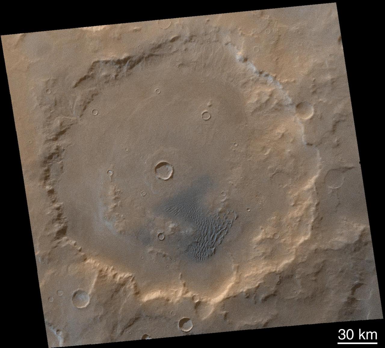
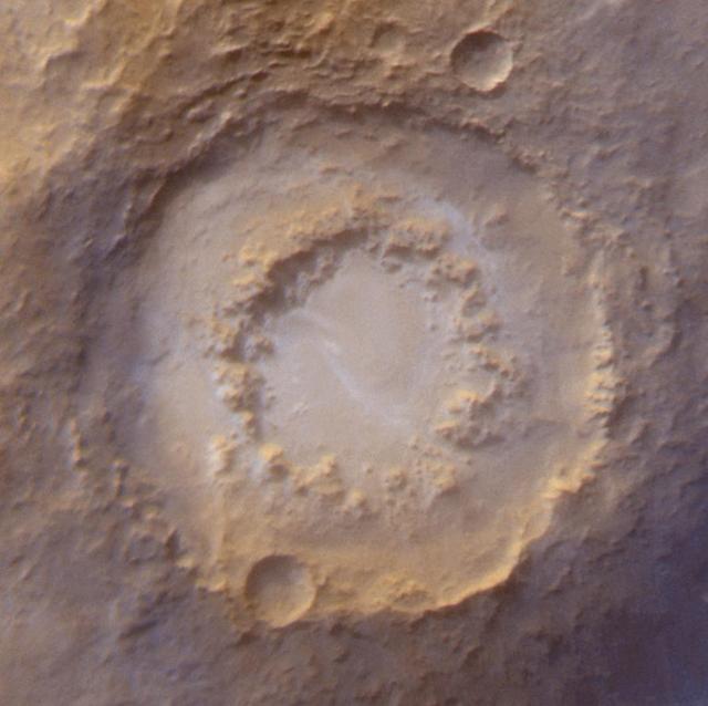
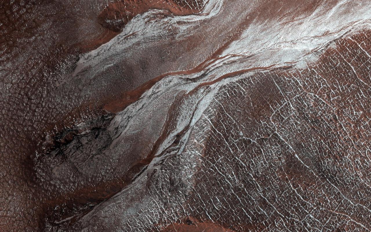
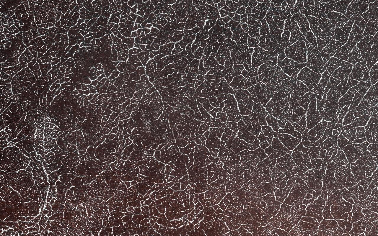
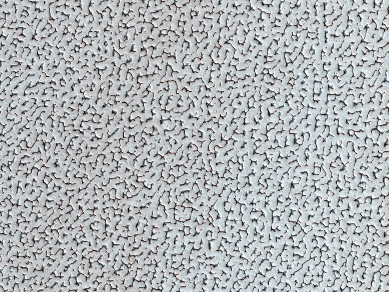
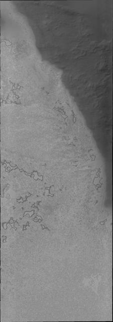
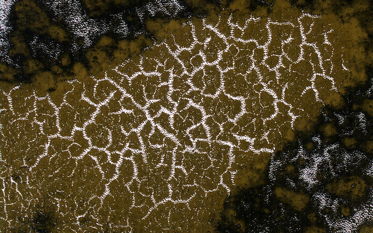
The arc of hills in this image from NASA Mars Reconnaissance Orbiter spacecraft is the rim of an old and infilled impact crater. The sediments that were deposited within the crater have since formed polygonal cracks due to repeated cycles of freezing and thawing. The process of polygon formation is common at these polar latitudes, but polygons are not always as striking as they are here. In this image, the polygons have been highlighted by persistent frost in the cracks. The crater rim constrains the polygon formation within the crater close to the rim, creating a spoke and ring pattern of cracks. This leads to more rectangular polygons than those near the center of the crater. The polygons close to the center of the crater display a more typical pattern. A closer look shows some of these central polygons, which have smaller polygons within them, and smaller polygons within those smaller polygons, which makes for a natural fractal. http://photojournal.jpl.nasa.gov/catalog/PIA20289

NASA Administrator Michael Griffin, left, and Associate Administrator for Space Operations William Gerstenmaier, right, look on as Space Shuttle Program Manager Wayne Hale talks from NASA's Marshall Space Flight Center about the space shuttle's ice frost ramps during a media briefing about the space shuttle program and processing for the STS-121 mission, Friday, April 28, 2006, at NASA Headquarters in Washington. Photo Credit (NASA/Bill Ingalls)

NASA Administrator Michael Griffin, left, and Associate Administrator for Space Operations William Gerstenmaier, right, look on as Space Shuttle Program Manager Wayne Hale from NASA's Marshall Space Flight Center, holds a test configuration of an ice frost ramp during a media briefing about the space shuttle program and processing for the STS-121 mission, Friday, April 28, 2006, at NASA Headquarters in Washington. Photo Credit (NASA/Bill Ingalls)
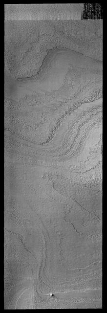
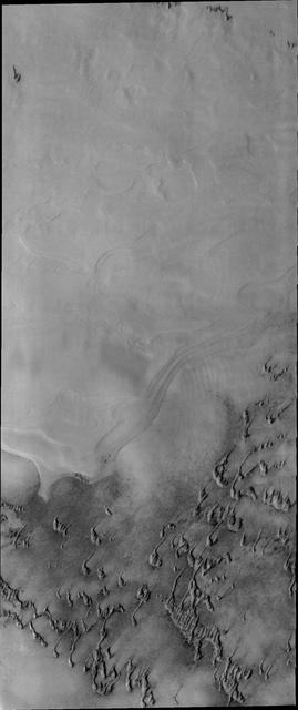
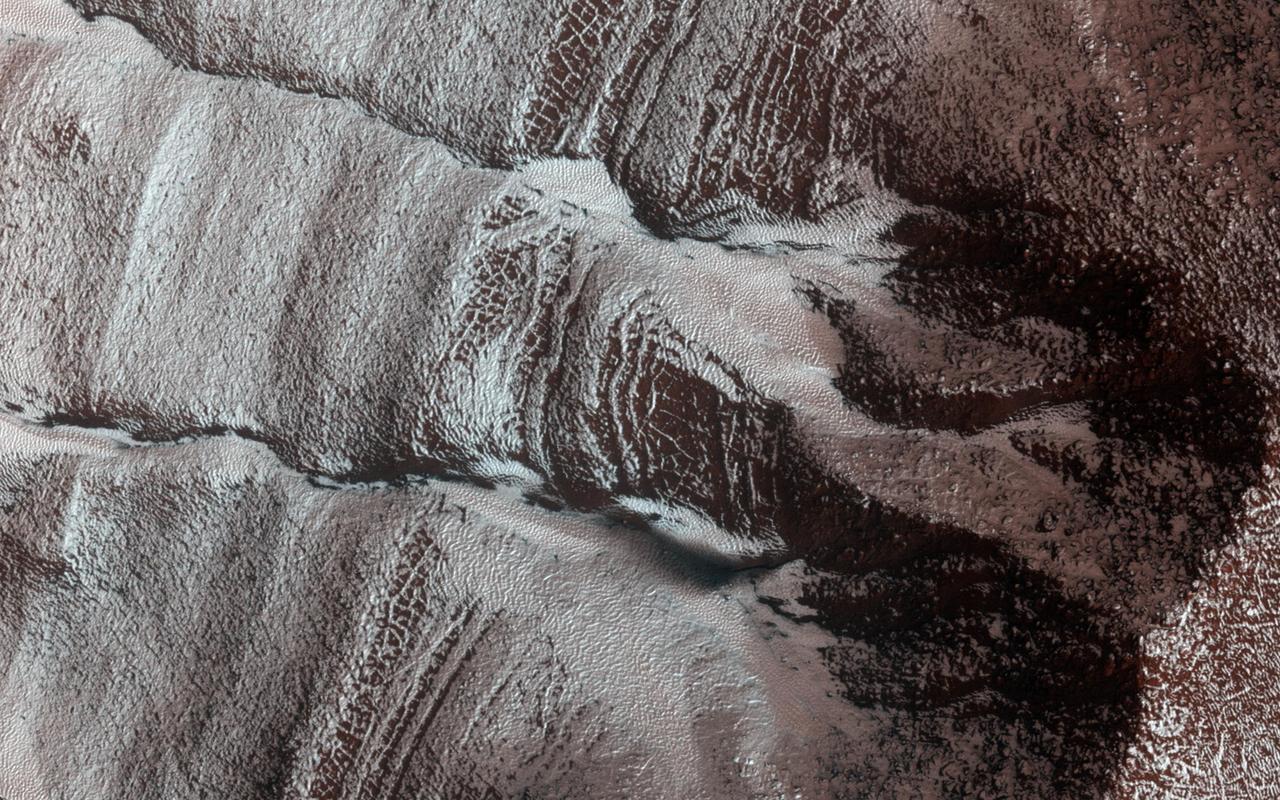
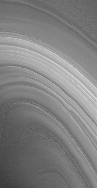
Late in the summer season, the numerous polar layers are free of frost and easily visible
This Mars MOC image shows dunes in the north polar region of Mars covered by a layer of carbon dioxide frost that accumulated during the winter in 2005. Dark spots indicate areas where frost has begun to sublime away
This image from NASA Mars Reconnaissance Orbiter is a view of the sand dune field in Richardson Crater covered with seasonal frost. The frost is a combination of frozen carbon dioxide and some water ice that covers the dunes in the winter and spring.
This image from NASA Mars Reconnaissance Orbiter shows frosted gullies on a south-facing slope within a crater. At this time of year only south-facing slopes retain the frost, while the north-facing slopes have melted.
Located at 64 degrees south latitude, the dunes in Wegener Crater are just beginning to lose their frost cover. The alt and pepper appearance is bright frost and dark dune on the crater floor in this image from NASA Mars Odyssey.
Seasonal frost commonly forms at middle and high latitudes on Mars, much like winter snow on Earth. However, on Mars most frost is carbon dioxide dry ice rather than water ice. This image is from NASA Mars Reconnaissance Orbiter. This image shows frost in gully alcoves in a crater on the Northern plains. The frost highlights details of the alcoves, since it forms in different amounts depending on slopes and shadows as well as the type of material making up the ground. Rugged rock outcrops appear dark and shadowed, while frost highlights the upper alcove and the steepest route down the slope. Most changes associated with gullies are observed in the Southern hemisphere. However, some are seen in the Northern hemisphere, where steep slopes are less common. HiRISE is monitoring these gullies to look for changes and to understand the behavior of the frost. http://photojournal.jpl.nasa.gov/catalog/PIA19852
This image from NASA Mars Reconnaissance Orbiter shows erosional features formed by seasonal frost near the south pole of Mars. During the winter, high latitudes on Mars build up deposits of carbon dioxide frost that can be several feet thick.
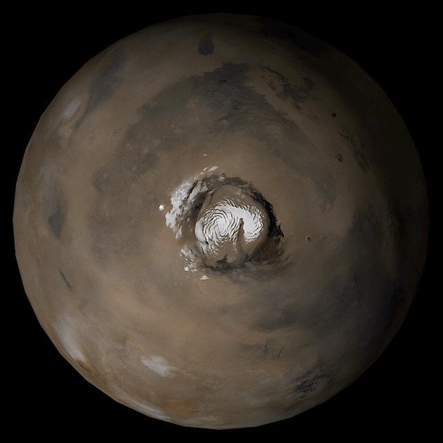
A bright ice cap of frozen water covers the North Pole of Mars as seen by NASA Mars Reconnaissance Orbiter. In winter, thin coverings of carbon dioxide and water frost covers this area and frosts finally disappear at end of the Martian spring season.

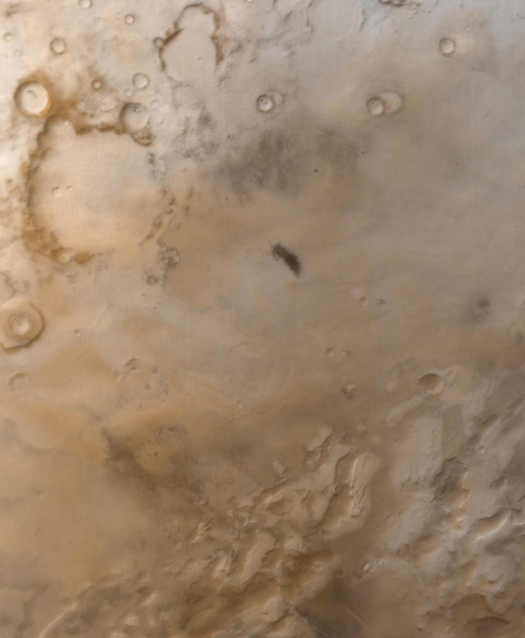
This MOC image shows dark sand dunes, with a thin coating of autumn frost, in the Ogygis Regio west of Argyre basin
This MOC image shows gullies overlain by seasonal frost in the north wall of an unnamed crater west of Hellas Planitia

Dark surface material is starting to appear as the frost is sublimated in this image of Pityusa Patera as seen by NASA Mars Odyssey.
This MOC image shows sand dunes overlain by a layer of seasonal carbon dioxide frost in the north polar region of Mars

In this image, NASA's Mars Reconnaissance Orbiter (MRO) observes an impact crater with associated bright deposits that at first glance give the appearance of seasonal frost or ice accumulations. MRO has an onboard spectrometer called CRISM that can distinguish between ices and other minerals. Unfortunately, there is currently no coverage of this particular spot. However, it can be deduced through several lines of evidence that this is, in fact, not ice. Just like Earth, Mars experiences seasons that change as the planet orbits the Sun. Seasonal changes are most apparent at the higher latitudes. As these regions in each hemisphere enter their respective summer seasons, the Sun rises higher in the Martian sky causing frost and ice to sublimate, and illuminate more features across the landscape. As the high latitudes of each hemisphere move toward their respective winters, the days (called "sols") grow shorter and the sun hangs low on the horizon, giving rise to prolonged periods of cold, darkness, and frost accumulation. First, it should be noted that at the time this image was taken, the Southern hemisphere is at the end of the summer season, so any frost or ice deposits have long since sublimated away. Second, numerous HiRISE images of seasonal targets show that ice accumulates on pole-facing slopes. The deposits in question are situated on a slope that faces the equator, and would not accumulate deposits of frost. Thus, it can be concluded that these exposures are light-toned mineral deposits. https://photojournal.jpl.nasa.gov/catalog/PIA21766
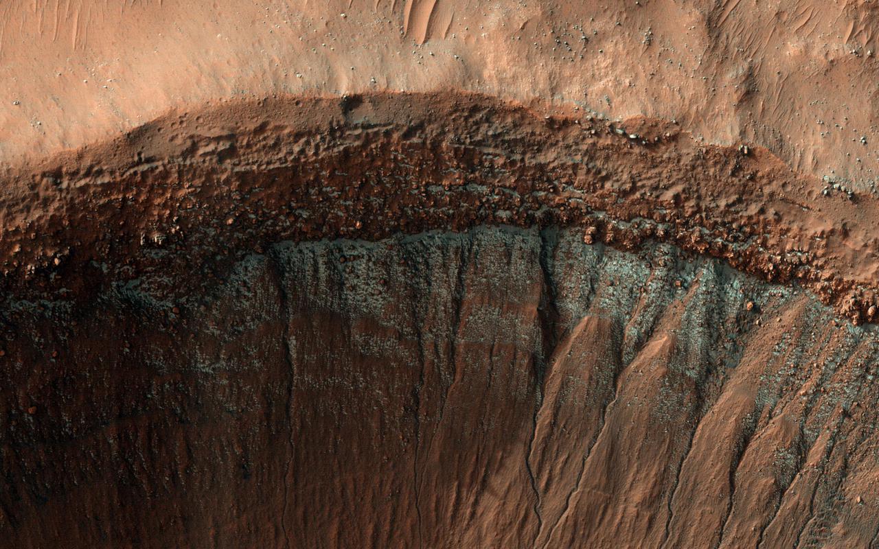
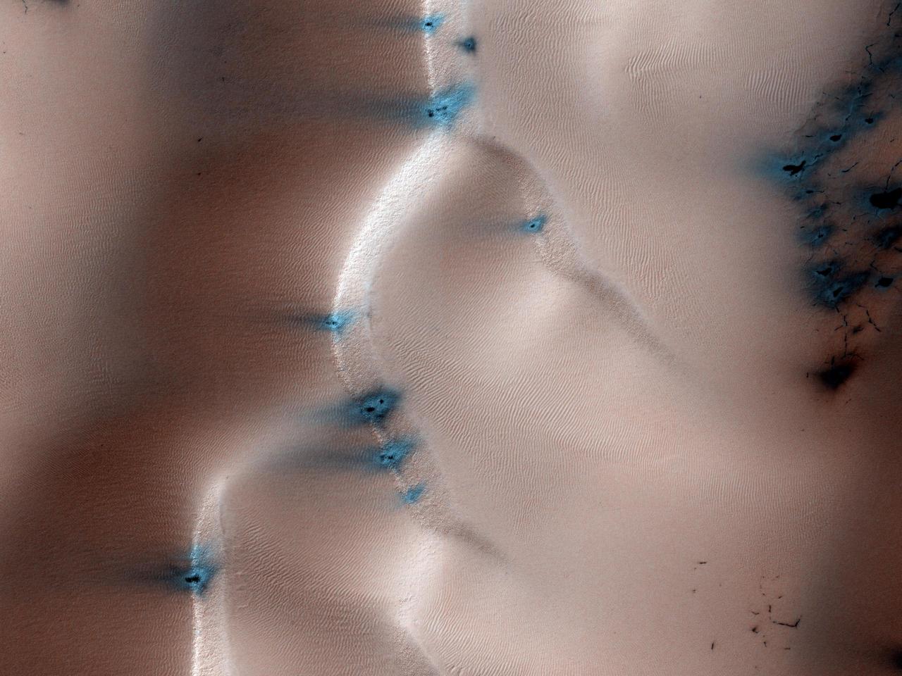
Every winter, a layer of carbon dioxide frost (dry ice) forms on the surface of Mars. At its greatest extent in mid-winter, this frost reaches from the poles down to the middle latitudes, until it is too warm and sunny to persist. In most places this is around 50 degrees latitude, similar to the latitude of southern Canada on Earth. However, small patches of dry ice are found closer to the equator on pole-facing slopes, which are colder because they receive less sunlight. This image was taken in the middle of winter in Mars' Southern Hemisphere, and shows a crater near 37 degrees south latitude. The south-facing slope has patchy bright frost, blue in enhanced color. This frost occurs in and around the many gullies on the slope, and in other images, has caused flows in the gullies. https://photojournal.jpl.nasa.gov/catalog/PIA25190
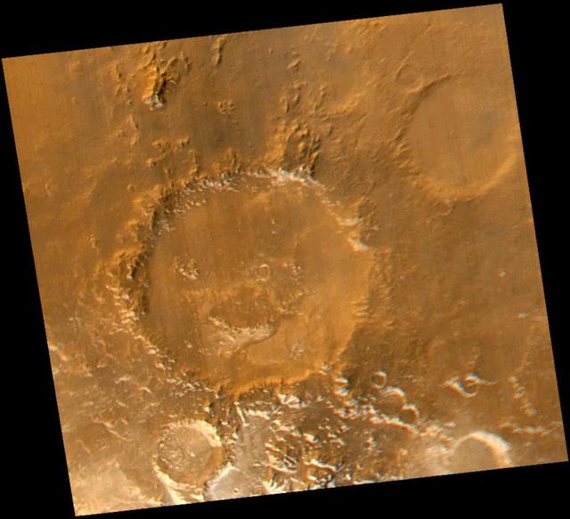
Smile! Spring has sprung in the martian southern hemisphere. With it comes the annual retreat of the winter polar frost cap. This view of "Happy Face Crater"--officially named "Galle Crater"--shows patches of white water ice frost in and around the crater's south-facing slopes. Slopes that face south will retain frost longer than north-facing slopes because they do not receive as much sunlight in early spring. This picture is a composite of images taken by the Mars Global Surveyor Mars Orbiter Camera (MOC) red and blue wide angle cameras. The wide angle cameras were designed to monitor the changing weather, frost, and wind patterns on Mars. Galle Crater is located on the east rim of the Argyre Basin and is about 215 kilometers (134 miles) across. In this picture, illumination is from the upper left and north is up. http://photojournal.jpl.nasa.gov/catalog/PIA02325
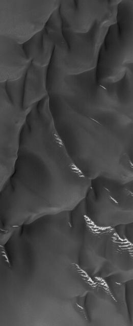
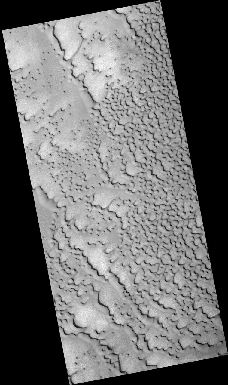
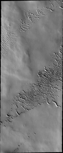
Today's VIS image shows a dune field on a crater floor in Terra Cimmeria. Dunes at high latitudes - near the polar caps - are affected by seasonal frost and ice. The interactions with frost/ice reduces the amount of movement of sand grains within the dunes. This changes the morphology of near polar dunes when compared to dunes at lower latitudes where ice/frost do not occur as frequently. This crater's latitude is 68 degrees south of the equator. Orbit Number: 75440 Latitude: -68.5479 Longitude: 163.063 Instrument: VIS Captured: 2018-12-16 23:56 https://photojournal.jpl.nasa.gov/catalog/PIA23035
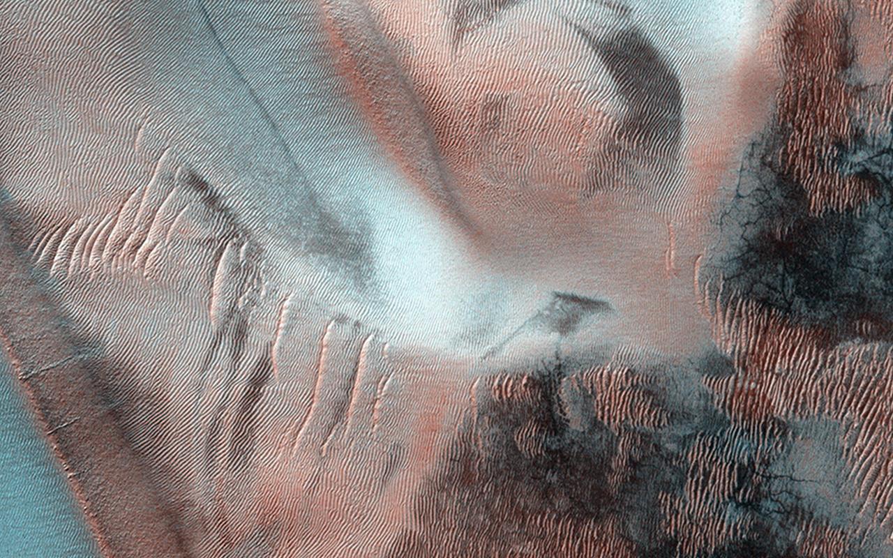
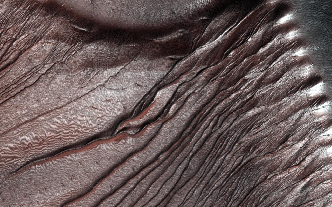
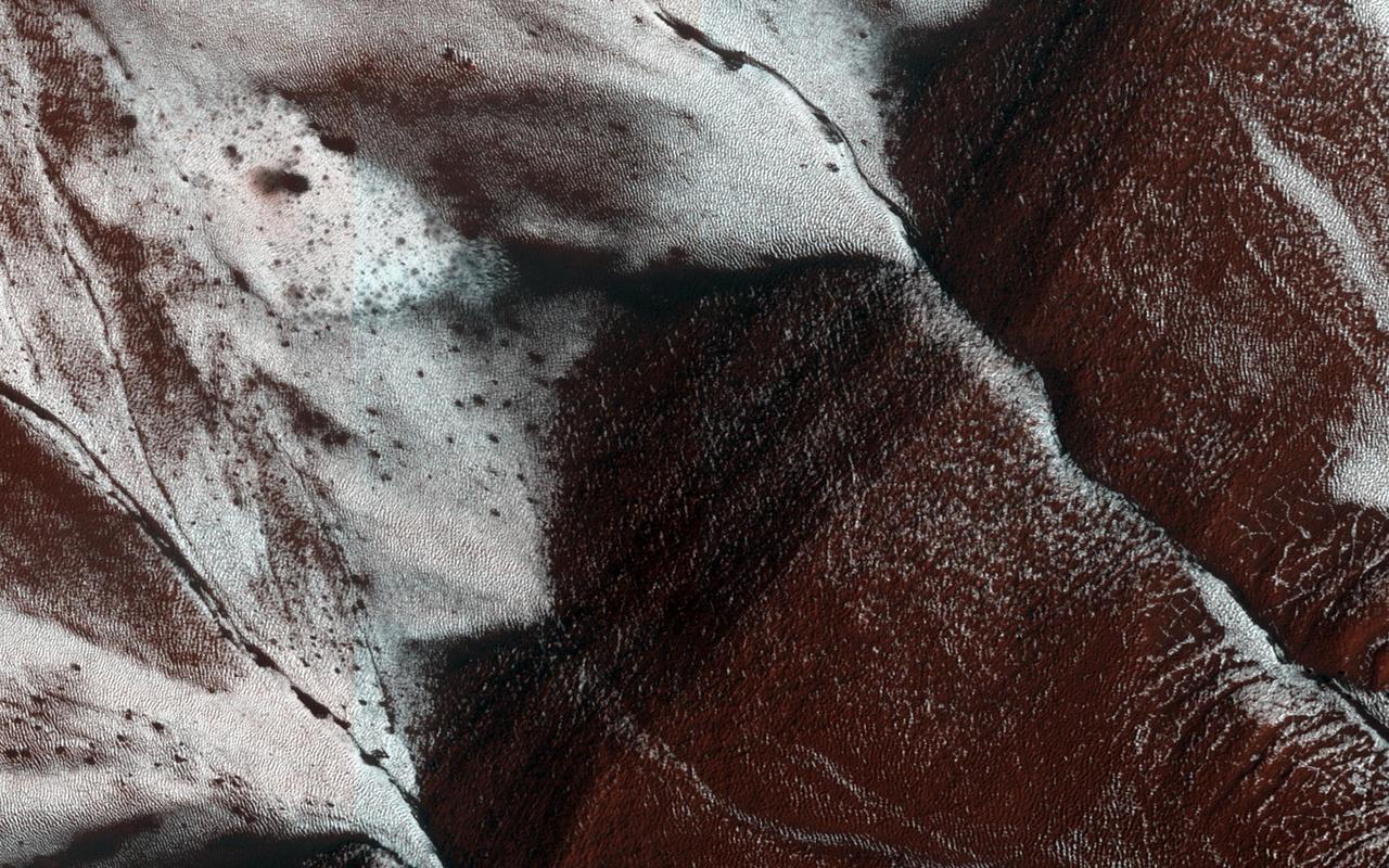
The dark sand dune at the center of this observation is covered in a blanket of white seasonal ice in the winter. In this Martian springtime image, the western slope of the dune is partly defrosted. Bright patches of frost (white in enhanced color) are clearly visible and are made up of water and carbon dioxide ices. Dark streaks of sand have flowed down the dune's slope that sometimes covers the frost. These flows are caused by the rapid transformation of the frost from ice to gas as the sun heats the dune in the spring. We can also see how these flows are diverted by the ripples on the dune. (The width of the cutout is around 520 meters.) https://photojournal.jpl.nasa.gov/catalog/PIA25188
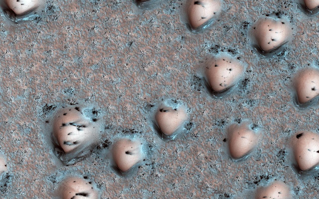
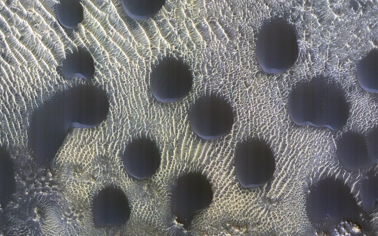
It's spring in the Northern Hemisphere of Mars, and the polar region is still blanketed by seasonal carbon dioxide frost (dry ice). This image shows an area near the sand sea (called an "erg") that is surrounding the water ice-rich layered deposits. The many bumps are sand dunes less than 100 meters across that are mostly covered by seasonal frost, appearing in a manner that looks artificial but is a natural consequence of the wind patterns in this region. The smaller, darker spots are places where the seasonal frost has sublimed away, exposing the dark surface below. The combination of these features makes for an unearthly scene! https://photojournal.jpl.nasa.gov/catalog/PIA23527
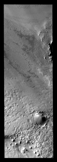
This crater is located south of Agassiz Crater. It is likely that the polar freeze/thaw/frost cycle is responsible for unusual appearance of the ejecta region around the crater
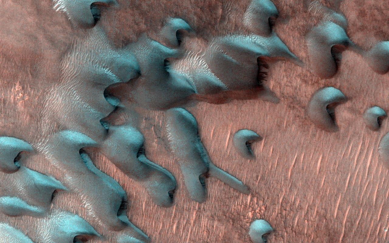
Dunes are common at both poles of Mars. These northern pole dunes are still covered in frost, as it is early springtime when this image was acquired by NASA 2001 Mars Odyssey.
Once the summer sun has removed all the frost, the surface texture of the polar cap ice is visible. Many different textures exist in the ice
With southern summer drawing to a close, the surface of the polar ice cap will begin to frost over on Mars as seen by NASA 2001 Mars Odyssey spacecraft.
This MOC image shows layers exposed in a trough in the martian north polar region. At the time the picture was acquired, the entire scene was covered by seasonal carbon dioxide frost
These bright and dark markings occurred near the end of summer in the south polar region. The dark material is likely dust that has been freed of frost cover
Monitoring by NASA Mars Reconnaissance Orbiter HiRISE has shown that gully formation on Mars occurs in winter and early spring in times and places with frost on the ground.
This image, taken by NASA 2001 Mars Odyssey spacecraft, of dunes in the north polar region was collected in early spring. Frost still covers the dunes.
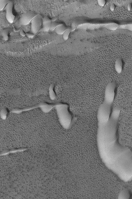
This MOC image shows a suite of dunes in one of the several north polar dune fields. The bright surfaces adjacent to some of the dunes are patches of frost
This MOC image shows layers exposed in a trough in the martian north polar region. At the time the picture was acquired, the entire scene was covered by seasonal carbon dioxide frost
Gullies on Martian sand dunes, like these in Matara Crater, have been very active, with many flows in the last ten years. The flows typically occur when seasonal frost is present. In this image from NASA's Mars Reconnaissance Orbiter we see frost in and around two gullies, which have both been active before. There are no fresh flows so far this year, but HiRISE will keep watching. https://photojournal.jpl.nasa.gov/catalog/PIA22349
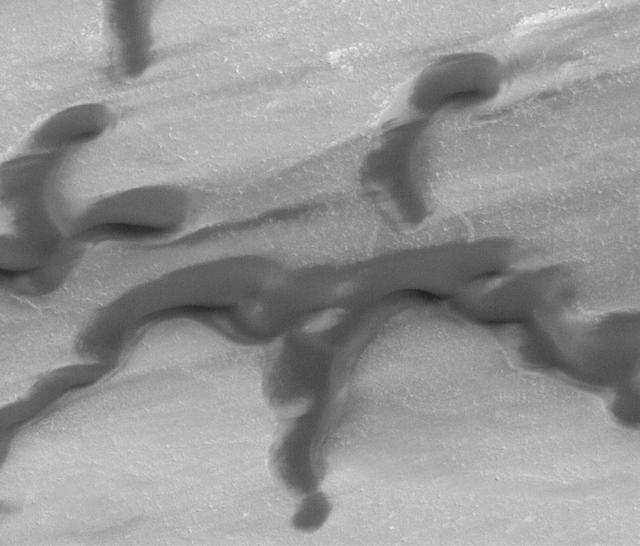
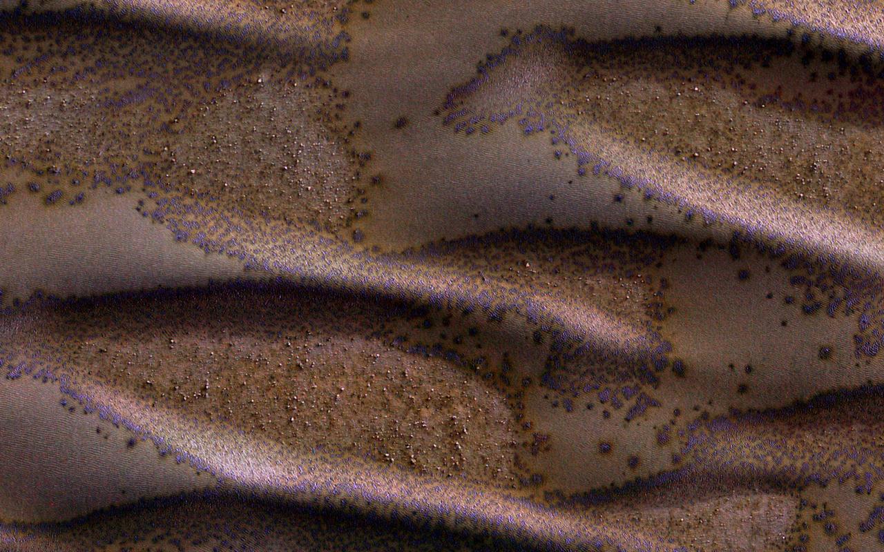
This image shows a field of sand dunes in the Martian springtime while the seasonal carbon dioxide frost is sublimating into the air. This sublimation process is not at all uniform, instead creating a pattern of dark spots. In addition, the inter-dune areas are also striking, with bright frost persisting in the troughs of polygons. Our enhanced-color cutout is centered on a brownish-colored inter-dune area. https://photojournal.jpl.nasa.gov/catalog/PIA26330
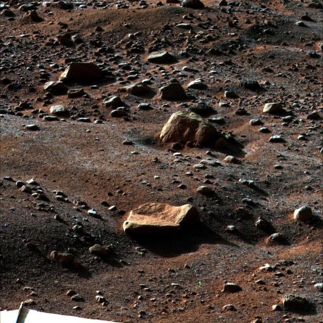
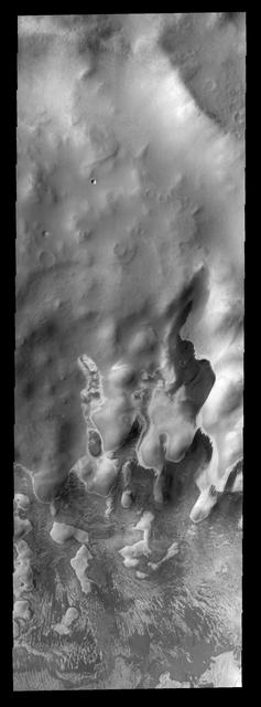
Sand dunes cover much of this terrain, which has large boulders lying on flat areas between the dunes in this image captured by NASA Mars Reconnaissance Orbiter spacecraft.

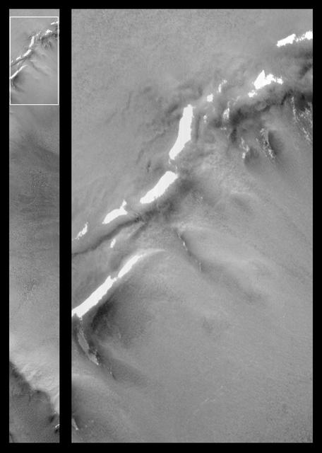
NASA's Mars Reconnaissance Orbiter (MRO) observed sand dunes in the north polar regions of Mars showing light coatings of pale orange dust blown partially across the dark basaltic sand. Around the edges of the dunes, patches of seasonal dry ice remain. These patches will be gone soon as they sublimate (turn from ice to gas) in the summer sun. Some blocks of ice are visible at the foot of an alcove formed by a sand avalanche down the slipface of the dune. https://photojournal.jpl.nasa.gov/catalog/PIA22511
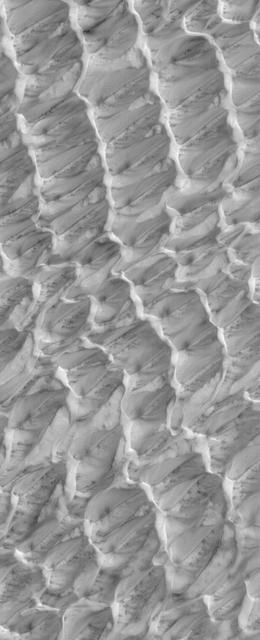
Sand dunes of many shapes and sizes are common on Mars. In this example, the dunes are almost perfectly circular, which is unusual. They are still slightly asymmetrical, with steep slip faces on the south ends. This indicates that sand generally moves to the south, but the winds may be variable. This is part of a series of images to monitor how frost disappears in the late winter; this observation appears to be free of frost. A previous image shows when the surface was covered by frost. https://photojournal.jpl.nasa.gov/catalog/PIA25795

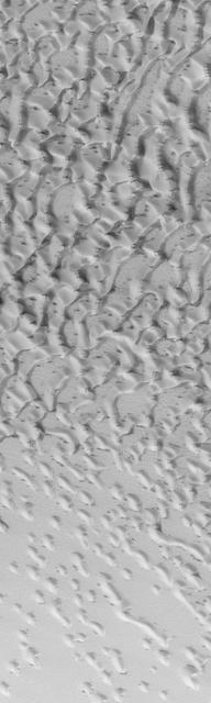
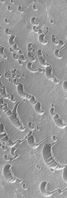
This MOC image shows dunes in the north polar region of Mars. In this scene, the dunes, and the plain on which the dunes reside, are at least in part covered by a bright carbon dioxide frost