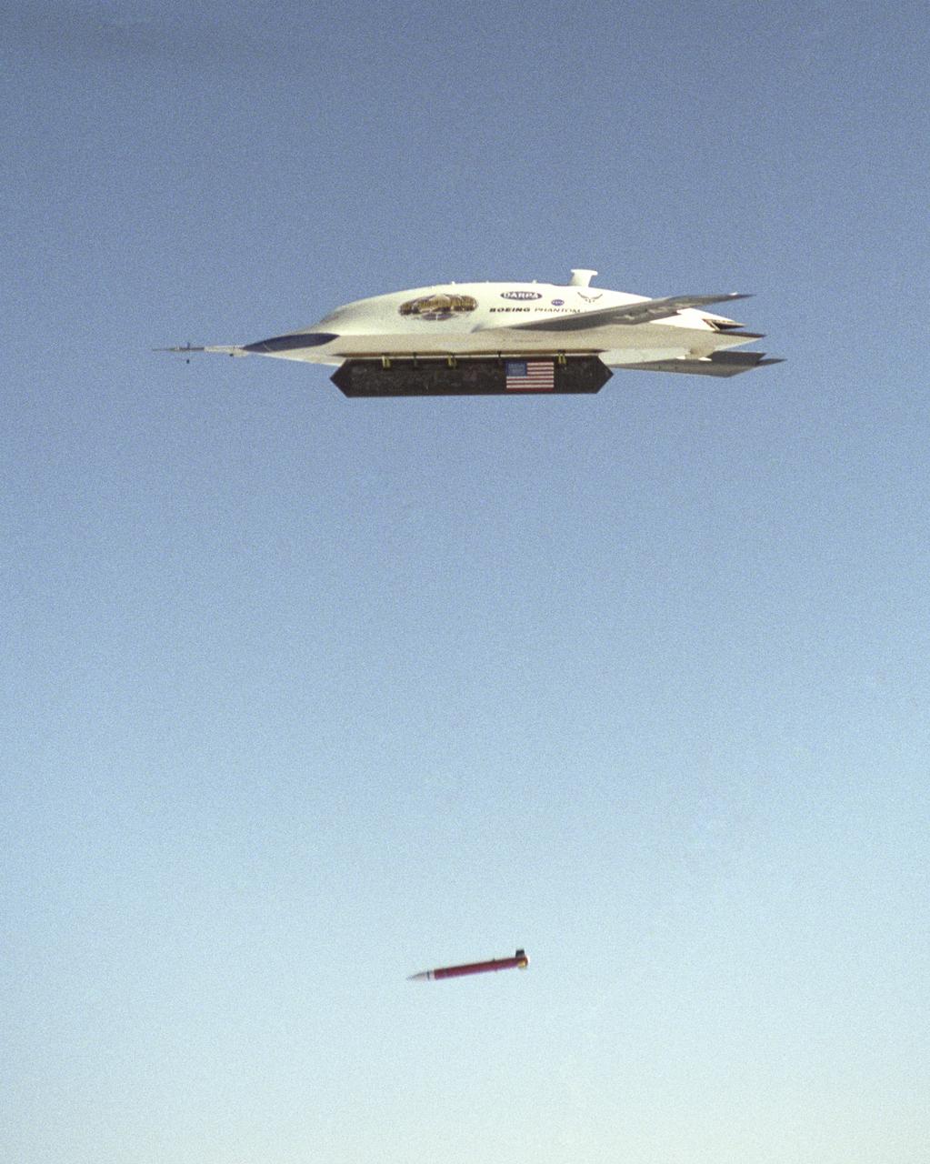
X-45A first GPS-guided weapon demonstration - weapon release

X-45A first GPS-guided weapon demonstration - weapon release
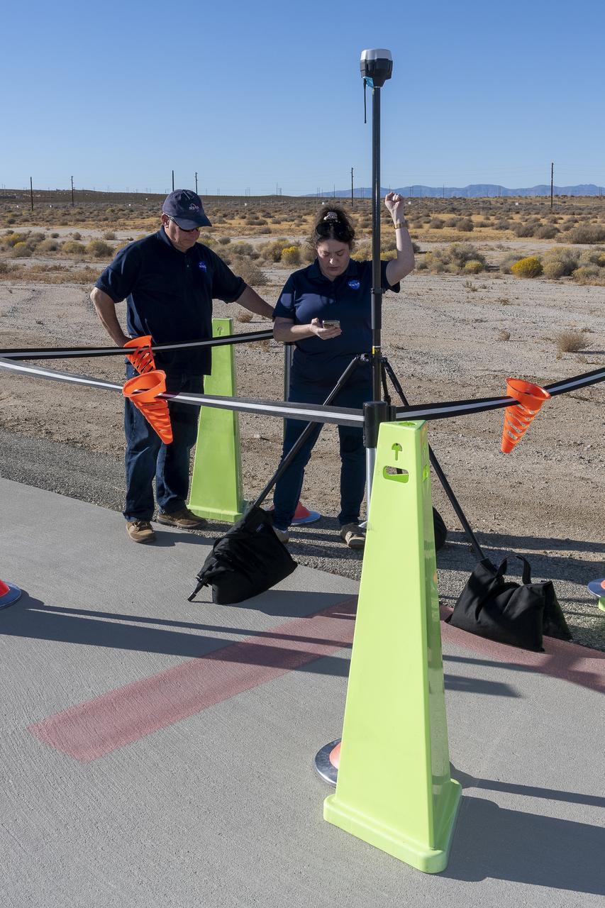
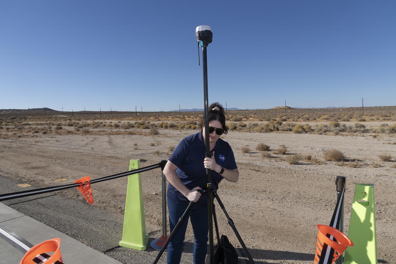
NASA Pathways intern Saré Culbertson, right, works with NASA operations engineer Jack Hayes at NASA’s Armstrong Flight Research Center in Edwards, California, on Nov. 7, 2024. They are verifying GPS and global navigation satellite system coordinates using Emlid Reach RS2+ receiver equipment, which supports surveying, mapping, and navigation in preparation for future air taxi test flight research.
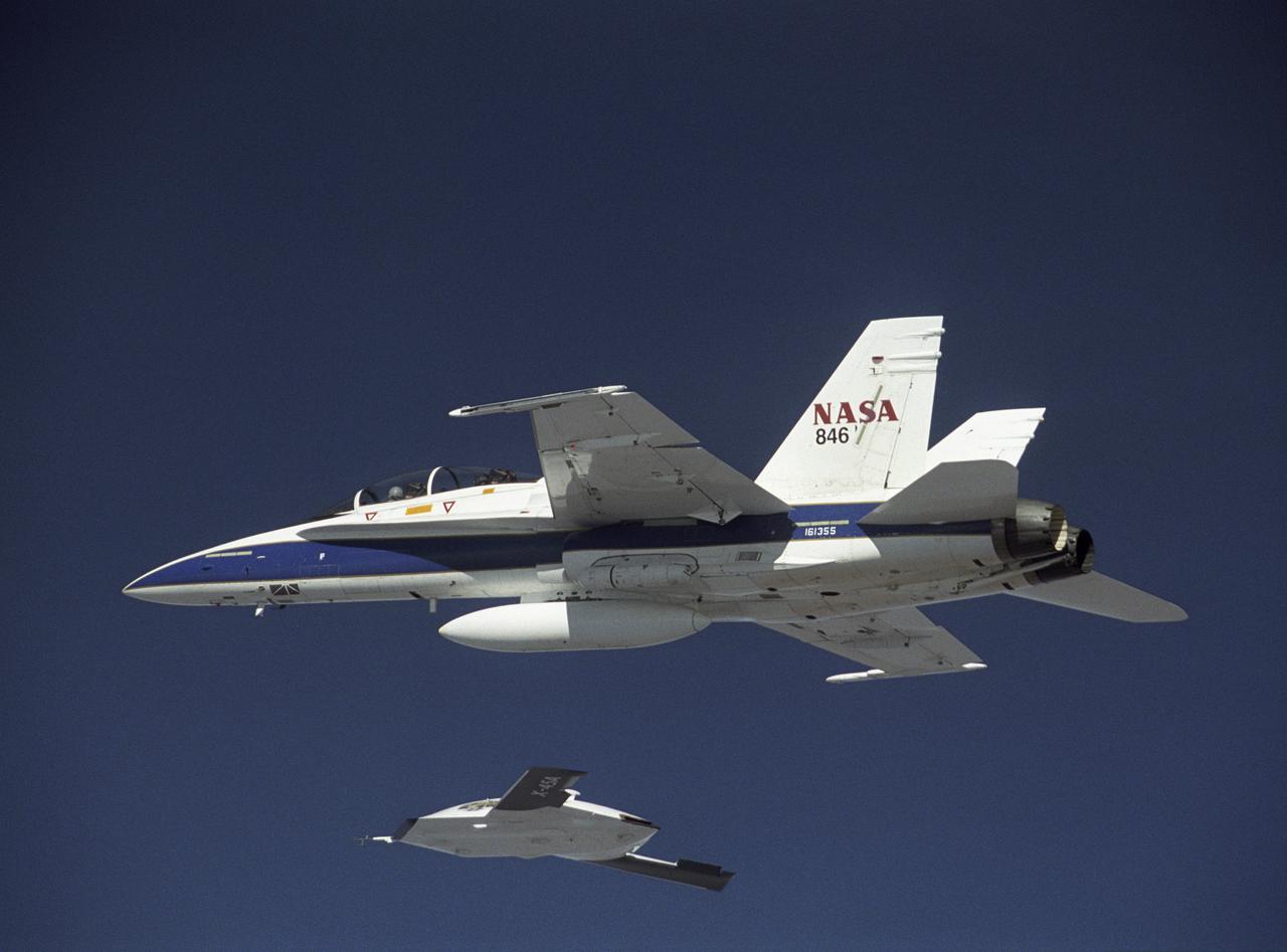
X-45A in flight with F-18 #846 chase aircraft, during first GPS-guided weapon demonstration flight.
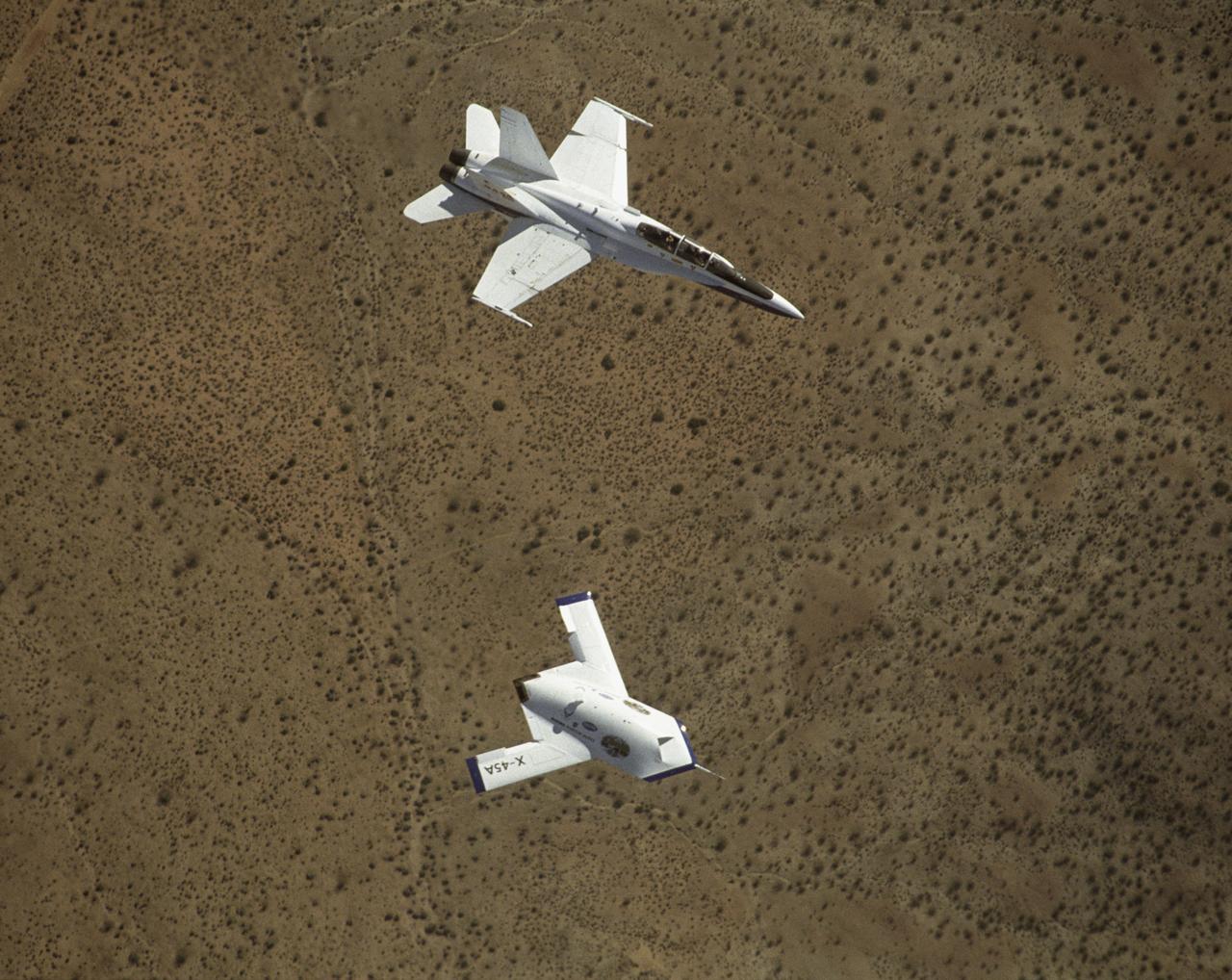
X-45A in flight with F-18 #846 chase aircraft, during first GPS-guided weapon demonstration flight.
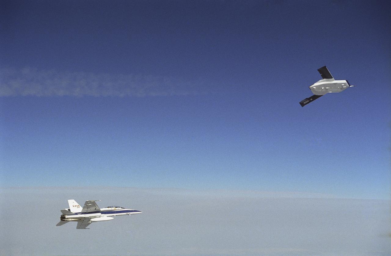
X-45A in flight with F-18 #846 chase aircraft, during first GPS-guided weapon demonstration flight.
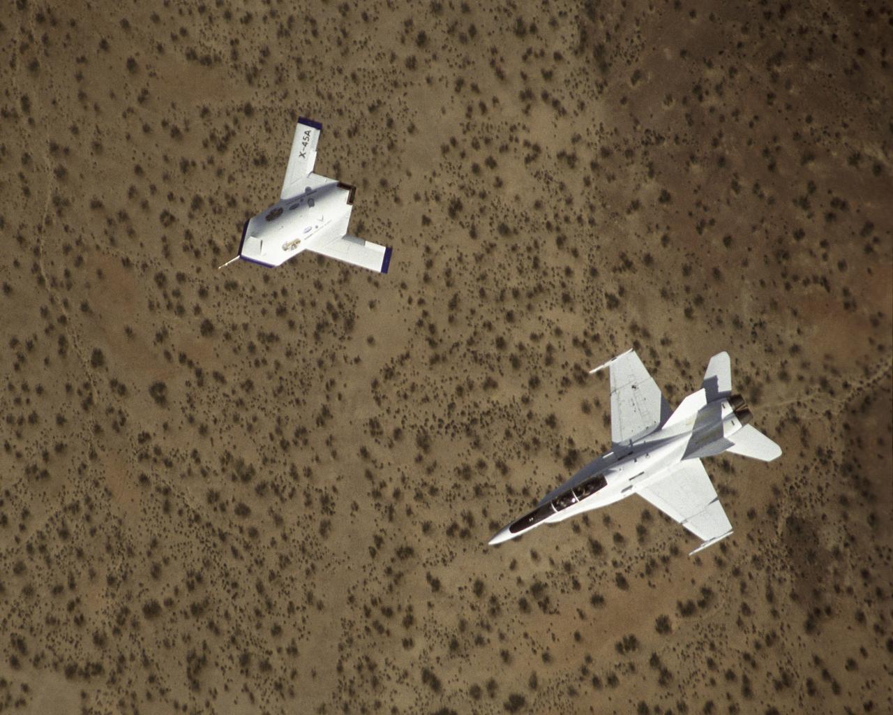
X-45A in flight with F-18 #846 chase aircraft, during first GPS-guided weapon demonstration flight.
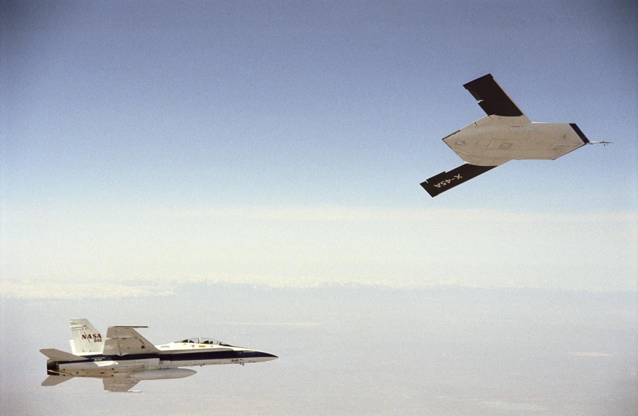
X-45A in flight with F-18 #846 chase aircraft, during first GPS-guided weapon demonstration flight.
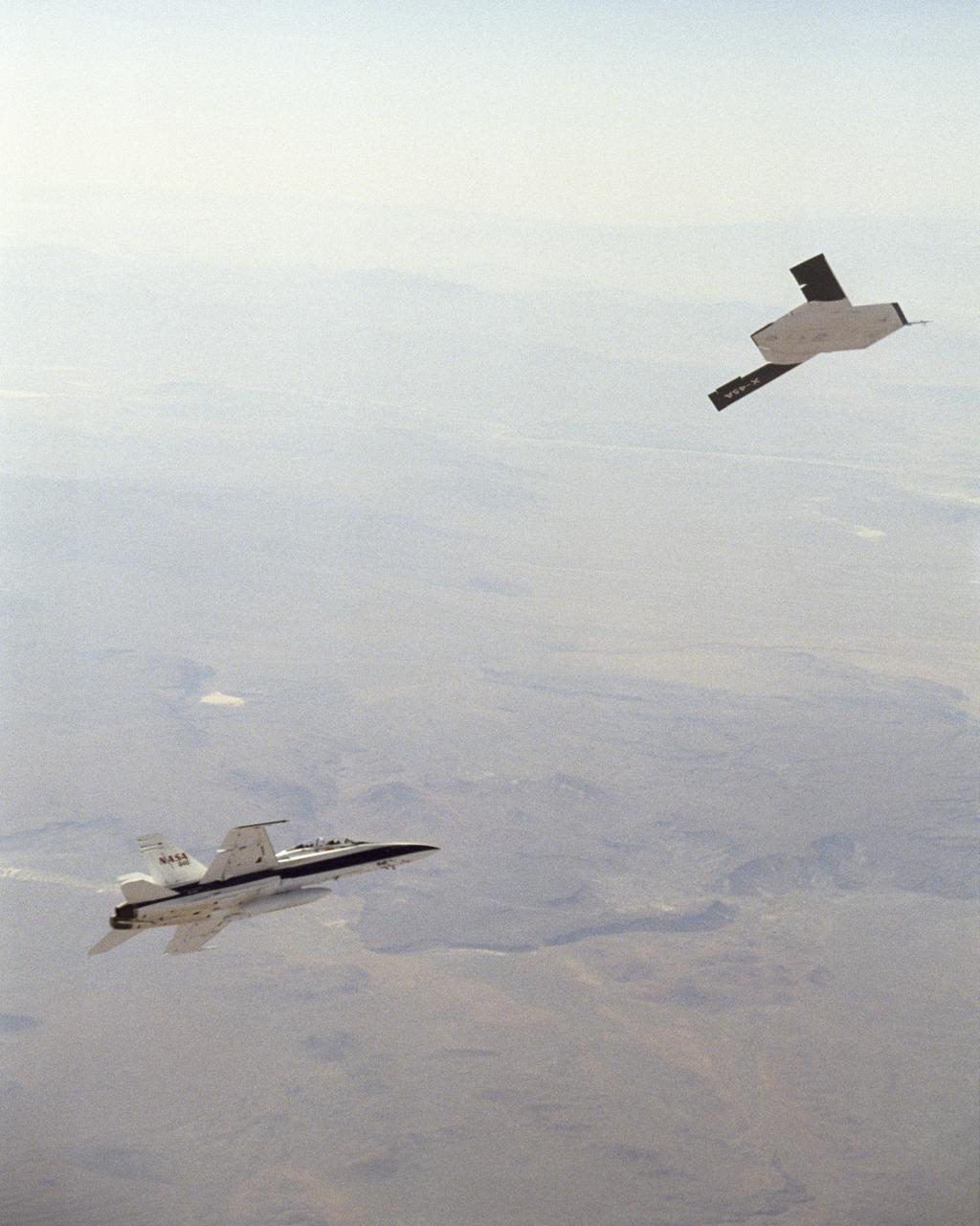
X-45A in flight with F-18 #846 chase aircraft, during first GPS-guided weapon demonstration flight.
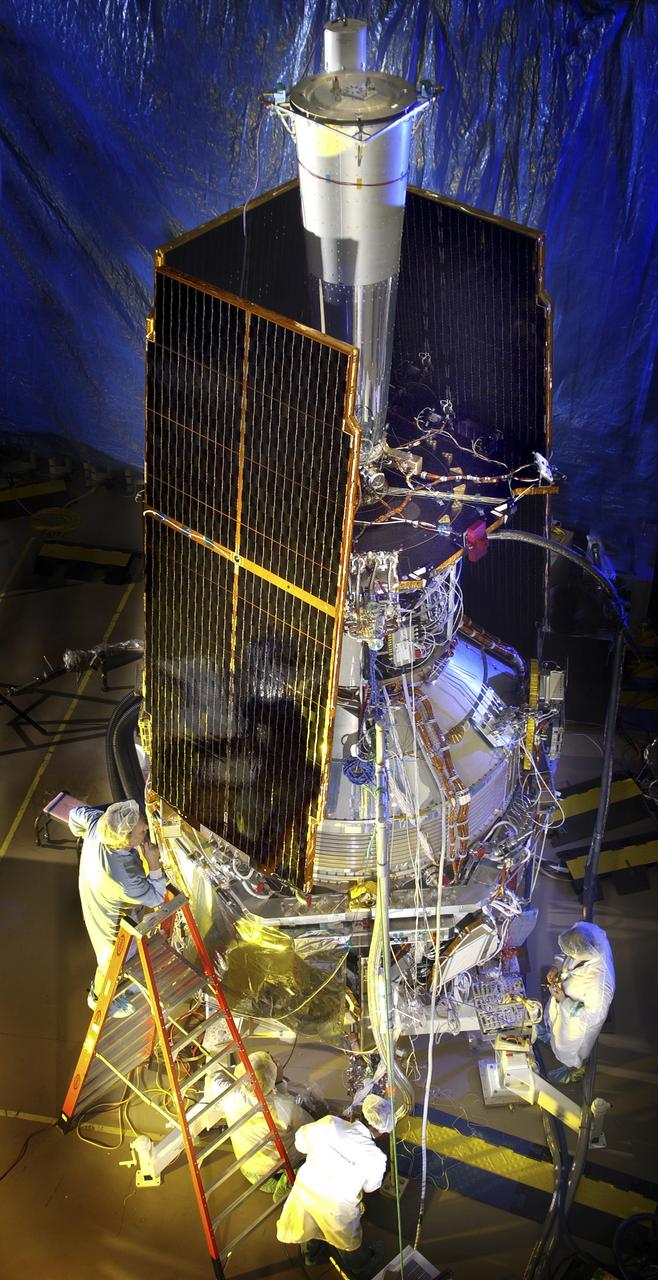
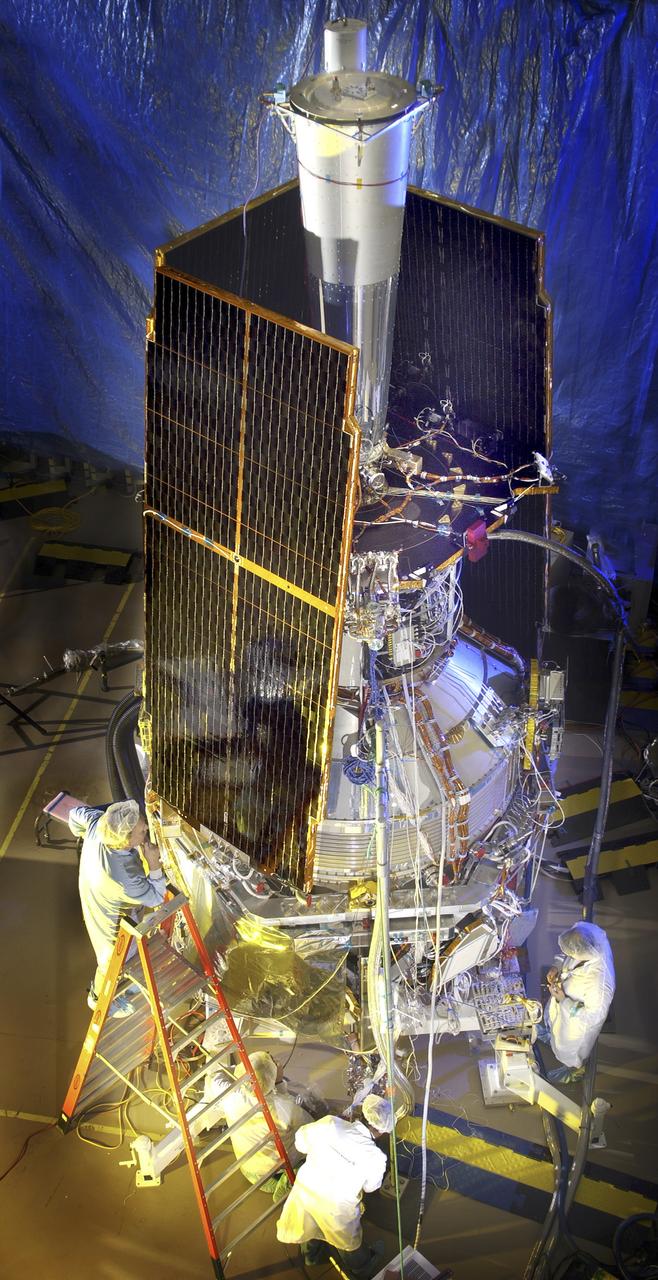
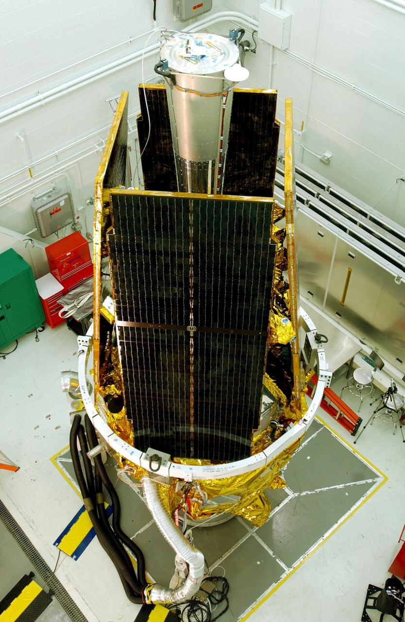
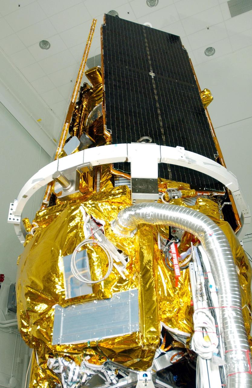
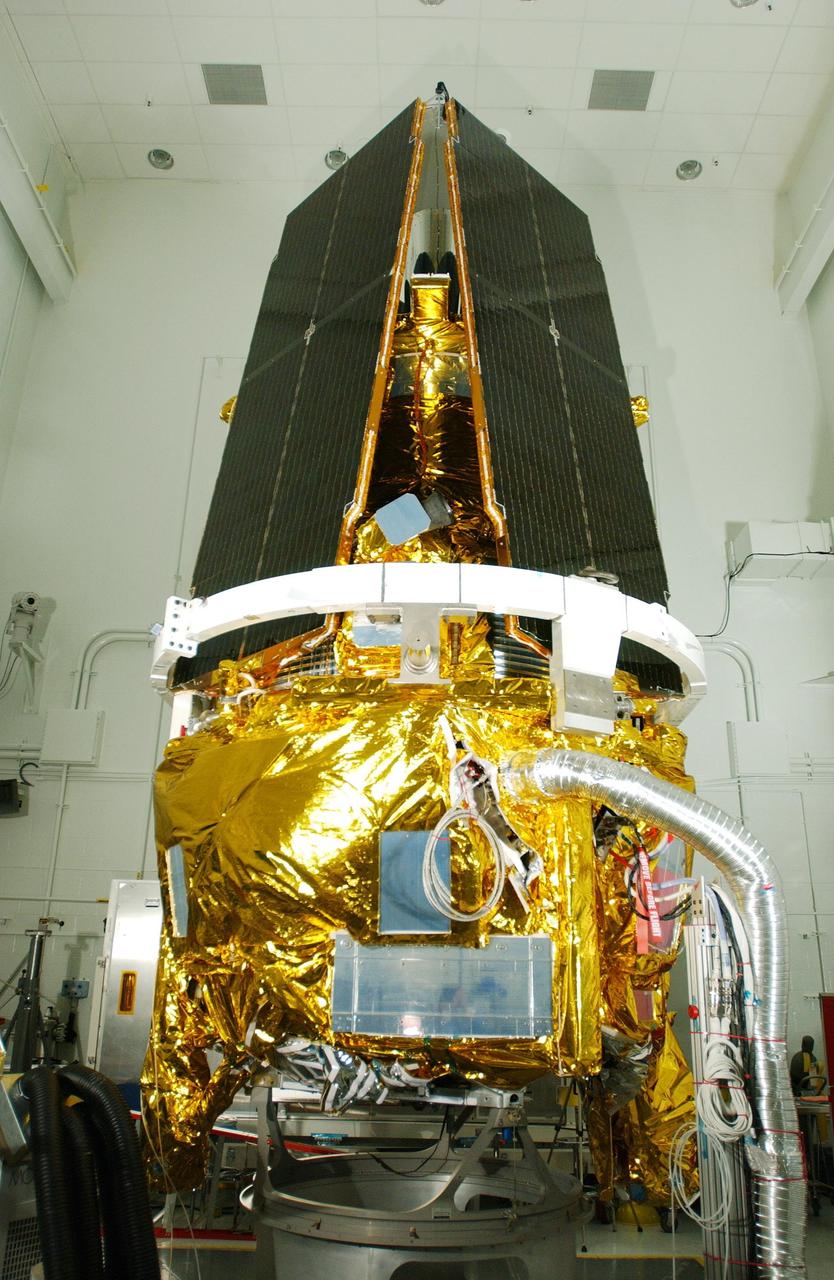
In this photo, the Gravity Probe B (GP-B) space vehicle is completed during the solar array installation. The GP-B is the relativity experiment developed at Stanford University to test two extraordinary predictions of Albert Einstein’s general theory of relativity. The experiment will measure, very precisely, the expected tiny changes in the direction of the spin axes of four gyroscopes contained in an Earth-orbiting satellite at a 400-mile altitude. So free are the gyroscopes from disturbance that they will provide an almost perfect space-time reference system. They will measure how space and time are very slightly warped by the presence of the Earth, and, more profoundly, how the Earth’s rotation very slightly drags space-time around with it. These effects, though small for the Earth, have far-reaching implications for the nature of matter and the structure of the Universe. GP-B is among the most thoroughly researched programs ever undertaken by NASA. This is the story of a scientific quest in which physicists and engineers have collaborated closely over many years. Inspired by their quest, they have invented a whole range of technologies that are already enlivening other branches of science and engineering. GP-B is scheduled for launch in April 2004 and managed for NASA by the Marshall Space Flight Center. Development of the GP-B is the responsibility of Stanford University along with major subcontractor Lockheed Martin Corporation. (Image credit to Russ Underwood, Lockheed Martin Corporation).
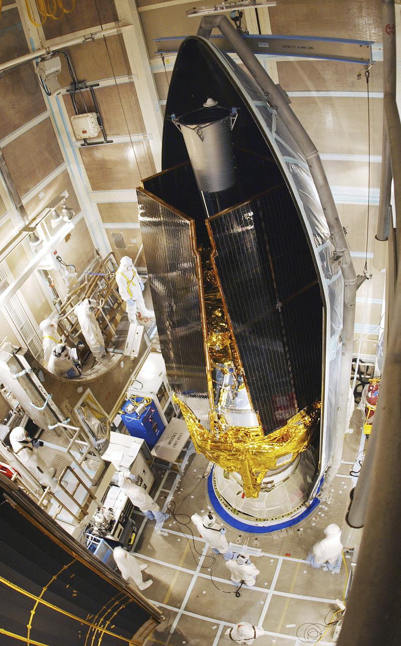
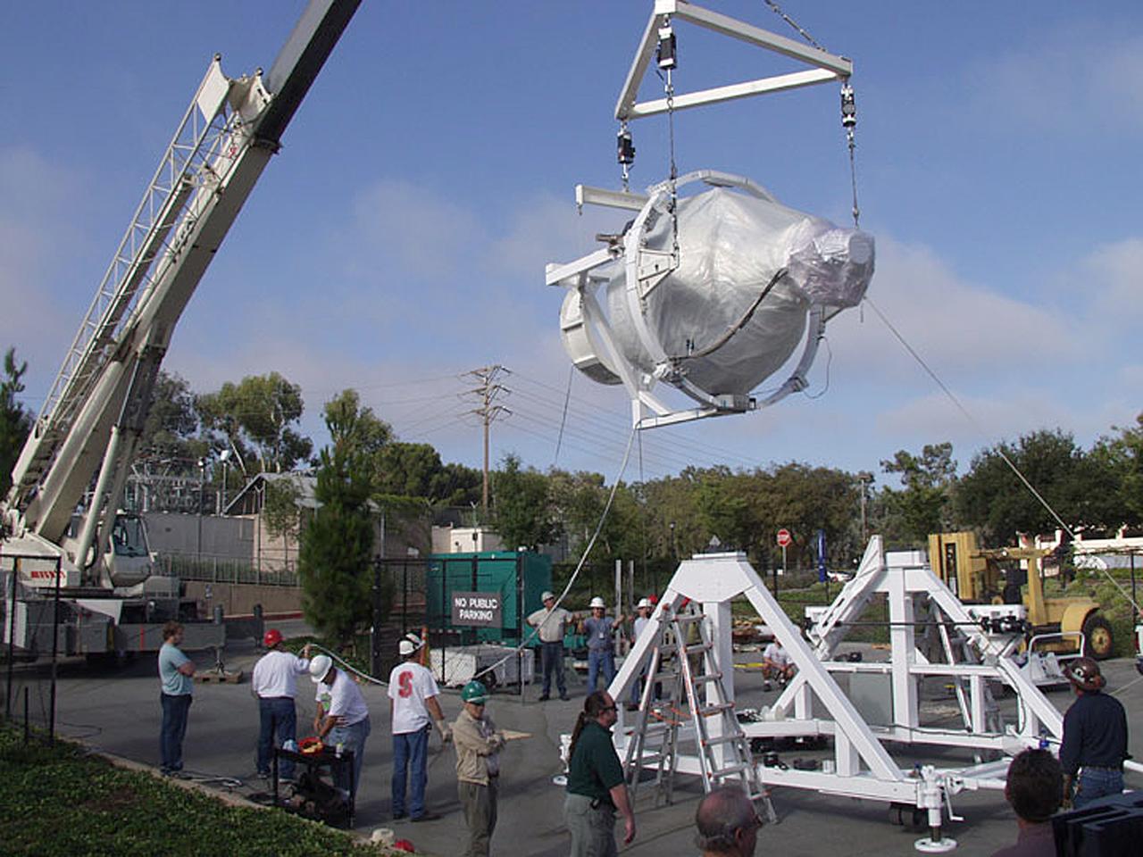
In this photo, the Gravity Probe B (GP-B) space vehicle is being encapsulated atop the Delta II launch vehicle. The GP-B is the relativity experiment developed at Stanford University to test two extraordinary predictions of Albert Einstein’s general theory of relativity. The experiment will measure, very precisely, the expected tiny changes in the direction of the spin axes of four gyroscopes contained in an Earth-orbiting satellite at a 400-mile altitude. So free are the gyroscopes from disturbance that they will provide an almost perfect space-time reference system. They will measure how space and time are very slightly warped by the presence of the Earth, and, more profoundly, how the Earth’s rotation very slightly drags space-time around with it. These effects, though small for the Earth, have far-reaching implications for the nature of matter and the structure of the Universe. GP-B is among the most thoroughly researched programs ever undertaken by NASA. This is the story of a scientific quest in which physicists and engineers have collaborated closely over many years. Inspired by their quest, they have invented a whole range of technologies that are already enlivening other branches of science and engineering. Launched April 20, 2004 , the GP-B program was managed for NASA by the Marshall Space Flight Center. Development of the GP-B is the responsibility of Stanford University along with major subcontractor Lockheed Martin Corporation. (Image credit to Russ Underwood, Lockheed Martin Corporation).
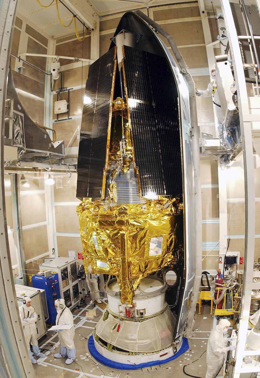
In this photo, the Gravity Probe B (GP-B) space vehicle is being assembled at the Sunnyvale, California location of the Lockheed Martin Corporation. The GP-B is the relativity experiment developed at Stanford University to test two extraordinary predictions of Albert Einstein’s general theory of relativity. The experiment will measure, very precisely, the expected tiny changes in the direction of the spin axes of four gyroscopes contained in an Earth-orbiting satellite at a 400-mile altitude. So free are the gyroscopes from disturbance that they will provide an almost perfect space-time reference system. They will measure how space and time are very slightly warped by the presence of the Earth, and, more profoundly, how the Earth’s rotation very slightly drags space-time around with it. These effects, though small for the Earth, have far-reaching implications for the nature of matter and the structure of the Universe. GP-B is among the most thoroughly researched programs ever undertaken by NASA. This is the story of a scientific quest in which physicists and engineers have collaborated closely over many years. Inspired by their quest, they have invented a whole range of technologies that are already enlivening other branches of science and engineering. Launched April 20, 2004 , the GP-B program was managed for NASA by the Marshall Space Flight Center. Development of the GP-B is the responsibility of Stanford University along with major subcontractor Lockheed Martin Corporation. (Image credit to Russ Underwood, Lockheed Martin Corporation).
In this photo, the Gravity Probe B (GP-B) space vehicle is being encapsulated atop the Delta II launch vehicle. The GP-B is the relativity experiment developed at Stanford University to test two extraordinary predictions of Albert Einstein’s general theory of relativity. The experiment will measure, very precisely, the expected tiny changes in the direction of the spin axes of four gyroscopes contained in an Earth-orbiting satellite at a 400-mile altitude. So free are the gyroscopes from disturbance that they will provide an almost perfect space-time reference system. They will measure how space and time are very slightly warped by the presence of the Earth, and, more profoundly, how the Earth’s rotation very slightly drags space-time around with it. These effects, though small for the Earth, have far-reaching implications for the nature of matter and the structure of the Universe. GP-B is among the most thoroughly researched programs ever undertaken by NASA. This is the story of a scientific quest in which physicists and engineers have collaborated closely over many years. Inspired by their quest, they have invented a whole range of technologies that are already enlivening other branches of science and engineering. Launched April 20, 2004 , the GP-B program was managed for NASA by the Marshall Space Flight Center. Development of the GP-B is the responsibility of Stanford University along with major subcontractor Lockheed Martin Corporation. (Image credit to Russ Underwood, Lockheed Martin Corporation).
The space vehicle for Gravity Probe B (GP-B) arrives at the launch site at Vandenburg Air Force Base. GP-B is the relativity experiment being developed at Stanford University to test two extraordinary predictions of Albert Einstein's general theory of relativity. The experiment will measure, very precisely, the expected tiny changes in the direction of the spin axes of four gyroscopes contained in an Earth-orbiting satellite at a 400-mile altitude. So free are the gyroscopes from disturbance that they will provide an almost perfect space-time reference system. They will measure how space and time are very slightly warped by the presence of the Earth, and, more profoundly, how the Earth's rotation very slightly drags space-time around with it. These effects, though small for the Earth, have far-reaching implications for the nature of matter and the structure of the Universe. GP-B is among the most thoroughly researched programs ever undertaken by NASA. This is the story of a scientific quest in which physicists and engineers have collaborated closely over many years. Inspired by their quest, they have invented a whole range of technologies that are already enlivening other branches of science and engineering. Scheduled for launch in 2003 and managed for NASA by the Marshall Space Flight Center, development of the GP-B is the responsibility of Stanford University, with major subcontractor Lockheed Martin Corporation.
The Gravity Probe B (GP-B) payload was hoisted by crane to the transportation truck in the W.W. Hansen Experimental Physics Laboratory in Stanford, California for shipment to the launch site at Vandenburg Air Force Base. GP-B is the relativity experiment being developed at Stanford University to test two extraordinary predictions of Albert Einstein’s general theory of relativity. The experiment will measure, very precisely, the expected tiny changes in the direction of the spin axes of four gyroscopes contained in an Earth-orbiting satellite at a 400-mile altitude. So free are the gyroscopes from disturbance that they will provide an almost perfect space-time reference system. They will measure how space and time are very slightly warped by the presence of the Earth, and, more profoundly, how the Earth’s rotation very slightly drags space-time around with it. These effects, though small for the Earth, have far-reaching implications for the nature of matter and the structure of the Universe. GP-B is among the most thoroughly researched programs ever undertaken by NASA. This is the story of a scientific quest in which physicists and engineers have collaborated closely over many years. Inspired by their quest, they have invented a whole range of technologies that are already enlivening other branches of science and engineering. Launched April 20, 2004, the GP-B program was managed for NASA by the Marshall Space Flight Center. Development of the GP-B is the responsibility of Stanford University, along with major subcontractor Lockheed Martin Corporation. (Photo Credit: Stanford University)
Gravity Probe-B (GP-B) is the relativity experiment being developed at Stanford University to test two extraordinary predictions of Albert Einstein's general theory of relativity. The experiment will measure, very precisely, the expected tiny changes in the direction of the spin axes of four gyroscopes contained in an Earth-orbiting satellite at a 400-mile altitude. So free are the gyroscopes from disturbance that they will provide an almost perfect space-time reference system. They will measure how space and time are very slightly warped by the presence of the Earth, and, more profoundly, how the Earth's rotation very slightly drags space-time around with it. These effects, though small for the Earth, have far-reaching implications for the nature of matter and the structure of the Universe. GP-B is among the most thoroughly researched programs ever undertaken by NASA. This is the story of a scientific quest in which physicists and engineers have collaborated closely over many years. Inspired by their quest, they have invented a whole range of technologies -- technologies that are already enlivening other branches of science and engineering. Scheduled for launch in 2003 and managed for NASA by Marshall Space Flight Center, development of GP-B is the responsibility of Stanford University, with major subcontractor Lockheed Martin Corporation.

Gravity Probe-B (GP-B) is the relativity experiment being developed at Stanford University to test two extraordinary predictions of Albert Einstein's general theory of relativity. The experiment will measure, very precisely, the expected tiny changes in the direction of the spin axes of four gyroscopes contained in an Earth-orbiting satellite at a 400-mile altitude. So free are the gyroscopes from disturbance that they will provide an almost perfect space-time reference system. They will measure how space and time are very slightly warped by the presence of the Earth, and, more profoundly, how the Earth's rotation very slightly drags space-time around with it. These effects, though small for the Earth, have far-reaching implications for the nature of matter and the structure of the Universe. GP-B is among the most thoroughly researched programs ever undertaken by NASA. This is the story of a scientific quest in which physicists and engineers have collaborated closely over many years. Inspired by their quest, they have invented a whole range of technologies -- technologies that are already enlivening other branches of science and engineering. Scheduled for launch in 2003 and managed for NASA by Marshall Space Flight Center, development of the GP-B is the responsibility of Stanford University, with major subcontractor Lockheed Martin Corporation.
Gravity Probe-B (GP-B) is the relativity experiment being developed at Stanford University to test two extraordinary predictions of Albert Einstein's general theory of relativity. The experiment will measure, very precisely, the expected tiny changes in the direction of the spin axes of four gyroscopes contained in an Earth-orbiting satellite at a 400-mile altitude. So free are the gyroscopes from disturbance that they will provide an almost perfect space-time reference system. They will measure how space and time are very slightly warped by the presence of the Earth, and, more profoundly, how the Earth's rotation very slightly drags space-time around with it. These effects, though small for the Earth, have far-reaching implications for the nature of matter and the structure of the Universe. GP-B is among the most thoroughly researched programs ever undertaken by NASA. This is the story of a scientific quest in which physicists and engineers have collaborated closely over many years. Inspired by their quest, they have invented a whole range of technologies -- technologies that are already enlivening other branches of science and engineering. Scheduled for launch in 2003 and managed for NASA by the Marshall Space Flight Center, development of GP-B is the responsibility of Stanford University, with major subcontractor Lockheed Martin Corporation.
Gravity Probe B (GP-B) is the relativity experiment developed at Stanford University to test two extraordinary predictions of Albert Einstein’s general theory of relativity. This photograph is of the Gravity Probe B flight dewar, a metal container made like a vacuum bottle that is used especially for storing liquefied gases, that will maintain the experiment at a temperature just above absolute zero, staying cold for two years. The experiment will measure, very precisely, the expected tiny changes in the direction of the spin axes of four gyroscopes contained in an Earth-orbiting satellite at 400-mile altitude. So free are the gyroscopes from disturbance that they will provide an almost perfect space-time reference system. They will measure how space and time are very slightly warped by the presence of the Earth, and, more profoundly, how the Earth’s rotation very slightly drags space-time around with it. These effects, though small for the Earth, have far-reaching implications for the nature of matter and the structure of the Universe. GP-B is among the most thoroughly researched programs ever undertaken by NASA. This is the story of a scientific quest in which physicists and engineers have collaborated closely over many years. Inspired by their quest, they have invented a whole range of technologies -- technologies that are already enlivening other branches of science and engineering. Launched in 2004 and managed for NASA by the Marshall Space Flight Center, development of the GP-B is the responsibility of Stanford University, with major subcontractor Lockheed Martin Corporation. (Photo Credit: Lockheed Martin Corporation/R. Underwood)
STS051-16-028 (12-22 Sept 1993) --- On Discovery's middeck, astronaut James H. Newman, mission specialist, works with an array of computers, including one devoted to Global Positioning System (GPS) operations, a general portable onboard computer displaying a tracking map, a portable audio data modem and another payload and general support computer. Newman was joined by four other NASA astronauts for almost ten full days in space.
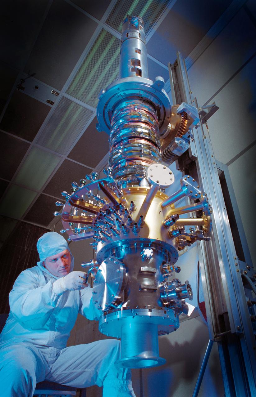
The space vehicle Gravity Probe B (GP-B) is the relativity experiment developed at Stanford University to test two extraordinary predictions of Albert Einstein’s general theory of relativity. The experiment will measure, very precisely, the expected tiny changes in the direction of the spin axes of four gyroscopes contained in an Earth-orbiting satellite at a 400-mile altitude. So free are the gyroscopes from disturbance that they will provide an almost perfect space-time reference system. They will measure how space and time are very slightly warped by the presence of the Earth, and, more profoundly, how the Earth’s rotation very slightly drags space-time around with it. These effects, though small for the Earth, have far-reaching implications for the nature of matter and the structure of the Universe. GP-B is among the most thoroughly researched programs ever undertaken by NASA. This is the story of a scientific quest in which physicists and engineers have collaborated closely over many years. Inspired by their quest, they have invented a whole range of technologies that are already enlivening other branches of science and engineering. In this photograph, engineer Gary Reynolds is inspecting the inside of the probe neck during probe thermal repairs. GP-B is scheduled for launch in April 2004 and managed for NASA by the Marshall Space Flight Center. Development of the GP-B is the responsibility of Stanford University along with major subcontractor Lockheed Martin Corporation. (Image credit to Russ Leese, Gravity Probe B, Stanford University)
In this photo, the Gravity Probe B (GP-B) detector mount assembly is shown in comparison to the size of a dime. The assembly is used to detect exactly how much starlight is coming through different beams from the beam splitter in the telescope. The measurements from the tiny chips inside are what keeps GP-B aimed at the guide star. The GP-B is the relativity experiment developed at Stanford University to test two extraordinary predictions of Albert Einstein’s general theory of relativity. The experiment will measure, very precisely, the expected tiny changes in the direction of the spin axes of four gyroscopes contained in an Earth-orbiting satellite at a 400-mile altitude. So free are the gyroscopes from disturbance that they will provide an almost perfect space-time reference system. They will measure how space and time are very slightly warped by the presence of the Earth, and, more profoundly, how the Earth’s rotation very slightly drags space-time around with it. These effects, though small for the Earth, have far-reaching implications for the nature of matter and the structure of the Universe. GP-B is among the most thoroughly researched programs ever undertaken by NASA. This is the story of a scientific quest in which physicists and engineers have collaborated closely over many years. Inspired by their quest, they have invented a whole range of technologies that are already enlivening other branches of science and engineering. Launched April 20, 2004 , the GP-B program was managed for NASA by the Marshall Space Flight Center. Development of the GP-B is the responsibility of Stanford University along with major subcontractor Lockheed Martin Corporation. (Image credit to Paul Ehrensberger, Stanford University.)
The Gravity Probe B (GP-B) is the relativity experiment developed at Stanford University to test two extraordinary predictions of Albert Einstein’s general theory of relativity. The experiment will measure, very precisely, the expected tiny changes in the direction of the spin axes of four gyroscopes contained in an Earth-orbiting satellite at a 400-mile altitude. So free are the gyroscopes from disturbance that they will provide an almost perfect space-time reference system. They will measure how space and time are very slightly warped by the presence of the Earth, and, more profoundly, how the Earth’s rotation very slightly drags space-time around with it. These effects, though small for the Earth, have far-reaching implications for the nature of matter and the structure of the Universe. In this photograph, the completed space vehicle is undergoing thermal vacuum environment testing. GP-B is among the most thoroughly researched programs ever undertaken by NASA. This is the story of a scientific quest in which physicists and engineers have collaborated closely over many years. Inspired by their quest, they have invented a whole range of technologies that are already enlivening other branches of science and engineering. Launched April 20, 2004 , the GP-B program was managed for NASA by the Marshall Space Flight Center. Development of the GP-B is the responsibility of Stanford University along with major subcontractor Lockheed Martin Corporation. (Image credit to Russ Underwood, Lockheed Martin Corporation.)

The Gravity Probe B (GP-B) is the relativity experiment developed at Stanford University to test two extraordinary predictions of Albert Einstein’s general theory of relativity. The experiment will measure, very precisely, the expected tiny changes in the direction of the spin axes of four gyroscopes contained in an Earth-orbiting satellite at a 400-mile altitude. So free are the gyroscopes from disturbance that they will provide an almost perfect space-time reference system. They will measure how space and time are very slightly warped by the presence of the Earth, and, more profoundly, how the Earth’s rotation very slightly drags space-time around with it. These effects, though small for the Earth, have far-reaching implications for the nature of matter and the structure of the Universe. In this photograph, Stanford engineer, Chris Gray, is inspecting the number 4 gyro under monochromatic light. GP-B is among the most thoroughly researched programs ever undertaken by NASA. This is the story of a scientific quest in which physicists and engineers have collaborated closely over many years. Inspired by their quest, they have invented a whole range of technologies that are already enlivening other branches of science and engineering. Launched April 20, 2004 , the GP-B program was managed for NASA by the Marshall Space Flight Center. Development of the GP-B is the responsibility of Stanford University along with major subcontractor Lockheed Martin Corporation. (Image credit to Russ Leese, Stanford University.)
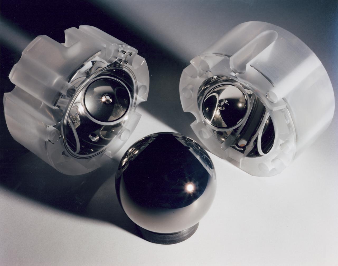
The Gravity Probe B (GP-B) is the relativity experiment developed at Stanford University to test two extraordinary predictions of Albert Einstein’s general theory of relativity. The experiment will measure, very precisely, the expected tiny changes in the direction of the spin axes of four gyroscopes contained in an Earth-orbiting satellite at a 400-mile altitude. So free are the gyroscopes from disturbance that they will provide an almost perfect space-time reference system. They will measure how space and time are very slightly warped by the presence of the Earth, and, more profoundly, how the Earth’s rotation very slightly drags space-time around with it. These effects, though small for the Earth, have far-reaching implications for the nature of matter and the structure of the Universe. This photograph is a close up of a niobium-coated gyroscope motor and its housing halves. GP-B is among the most thoroughly researched programs ever undertaken by NASA. This is the story of a scientific quest in which physicists and engineers have collaborated closely over many years. Inspired by their quest, they have invented a whole range of technologies that are already enlivening other branches of science and engineering. Launched April 20, 2004 , the GP-B program was managed for NASA by the Marshall Space Flight Center. Development of the GP-B is the responsibility of Stanford University along with major subcontractor Lockheed Martin Corporation. (Image credit to Don Harley.)
ISS010-E-20762 (21 March 2005) --- Astronaut Leroy Chiao, Expedition 10 commander and NASA ISS science officer, works with a Global Positioning System (GPS) Unit in the Zvezda Service Module of the International Space Station (ISS).
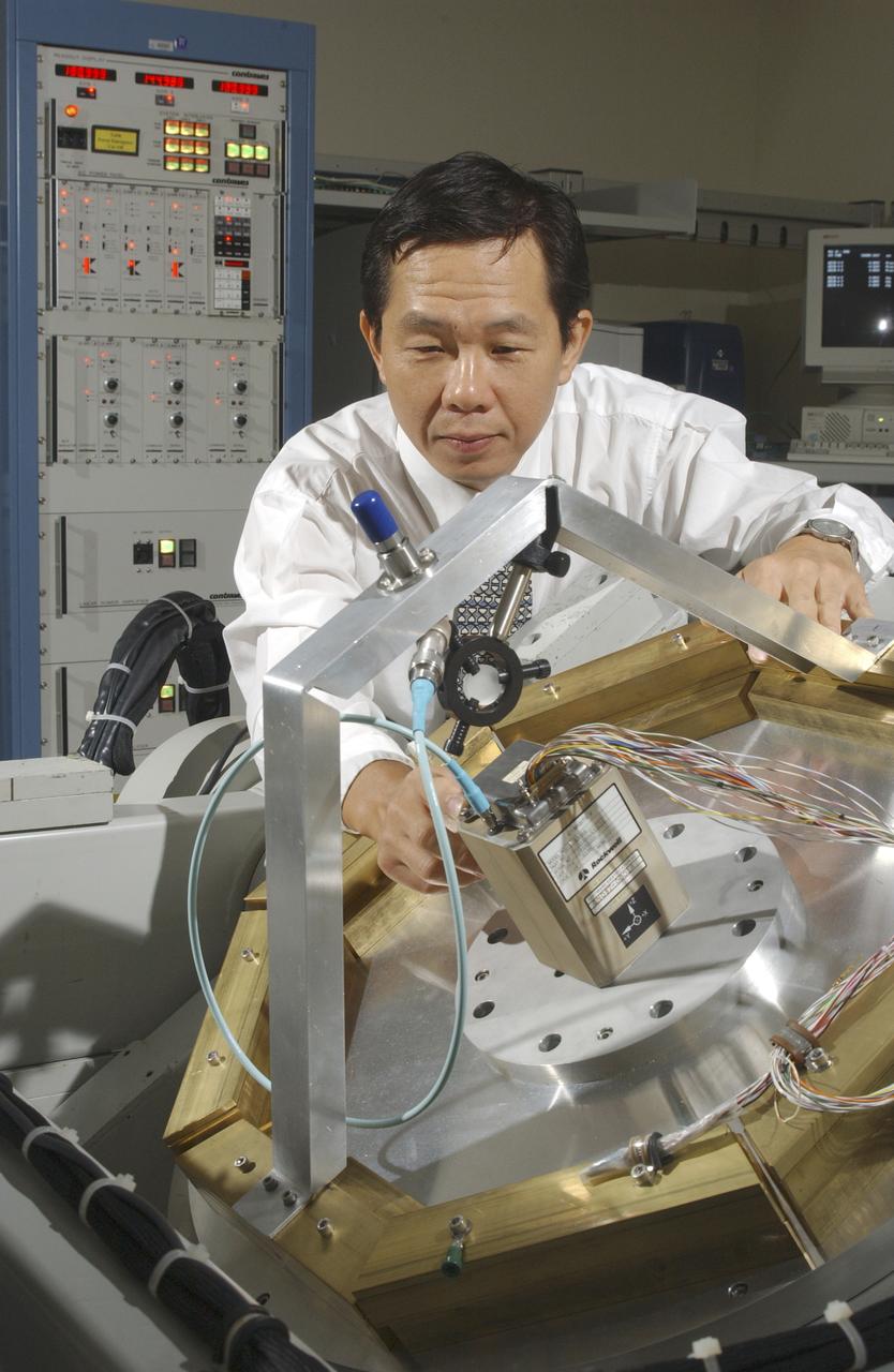
An array of components in a laboratory at NASA's Marshall Space Flight Center (MSFC) is being tested by the Flight Mechanics Office to develop an integrated navigation system for the second generation reusable launch vehicle. The laboratory is testing Global Positioning System (GPS) components, a satellite-based location and navigation system, and Inertial Navigation System (INS) components, sensors on a vehicle that determine angular velocity and linear acceleration at various points. The GPS and INS components work together to provide a space vehicle with guidance and navigation, like the push of the OnStar button in your car assists you with directions to a specific address. The integration will enable the vehicle operating system to track where the vehicle is in space and define its trajectory. The use of INS components for navigation is not new to space technology. The Space Shuttle currently uses them. However, the Space Launch Initiative is expanding the technology to integrate GPS and INS components to allow the vehicle to better define its position and more accurately determine vehicle acceleration and velocity. This advanced technology will lower operational costs and enhance the safety of reusable launch vehicles by providing a more comprehensive navigation system with greater capabilities. In this photograph, Dr. Jason Chuang of MSFC inspects an INS component in the laboratory.
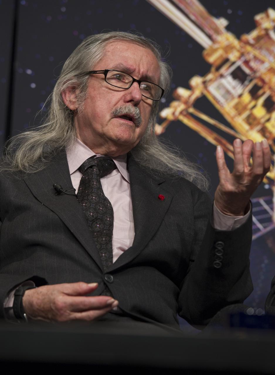
Clifford Will, Professor of Physics at Washington University in St. Louis, makes a point during a press conference, Wednesday, May 4, 2011, to discuss NASA's Gravity Probe B (GP-B) mission which has confirmed two key predictions derived from Albert Einstein's general theory of relativity, which the spacecraft was designed to test at NASA Headquarters in Washington. The experiment, launched in 2004, used four ultra-precise gyroscopes to measure the hypothesized geodetic effect, the warping of space and time around a gravitational body, and frame-dragging, the amount a spinning object pulls space and time with it as it rotates. Photo Credit: (NASA/Paul E. Alers)
Clifford Will, Professor of Physics at Washington University in St. Louis, foreground, answers questions during a press conference, Wednesday, May 4, 2011, to discuss NASA's Gravity Probe B (GP-B) mission which has confirmed two key predictions derived from Albert Einstein's general theory of relativity, which the spacecraft was designed to test at NASA Headquarters in Washington. The experiment, launched in 2004, used four ultra-precise gyroscopes to measure the hypothesized geodetic effect, the warping of space and time around a gravitational body, and frame-dragging, the amount a spinning object pulls space and time with it as it rotates. Photo Credit: (NASA/Paul E. Alers)
At the Operations and Support Building II at NASA's Kennedy Space Center in Florida, Vice President Mike Pence attends the launch attempt of SpaceX's Falcon 9 rocket carrying the U.S. Air Force's GPS III satellite from Space Launch Complex 40 on Cape Canaveral Air Force Station on Dec. 18, 2018.
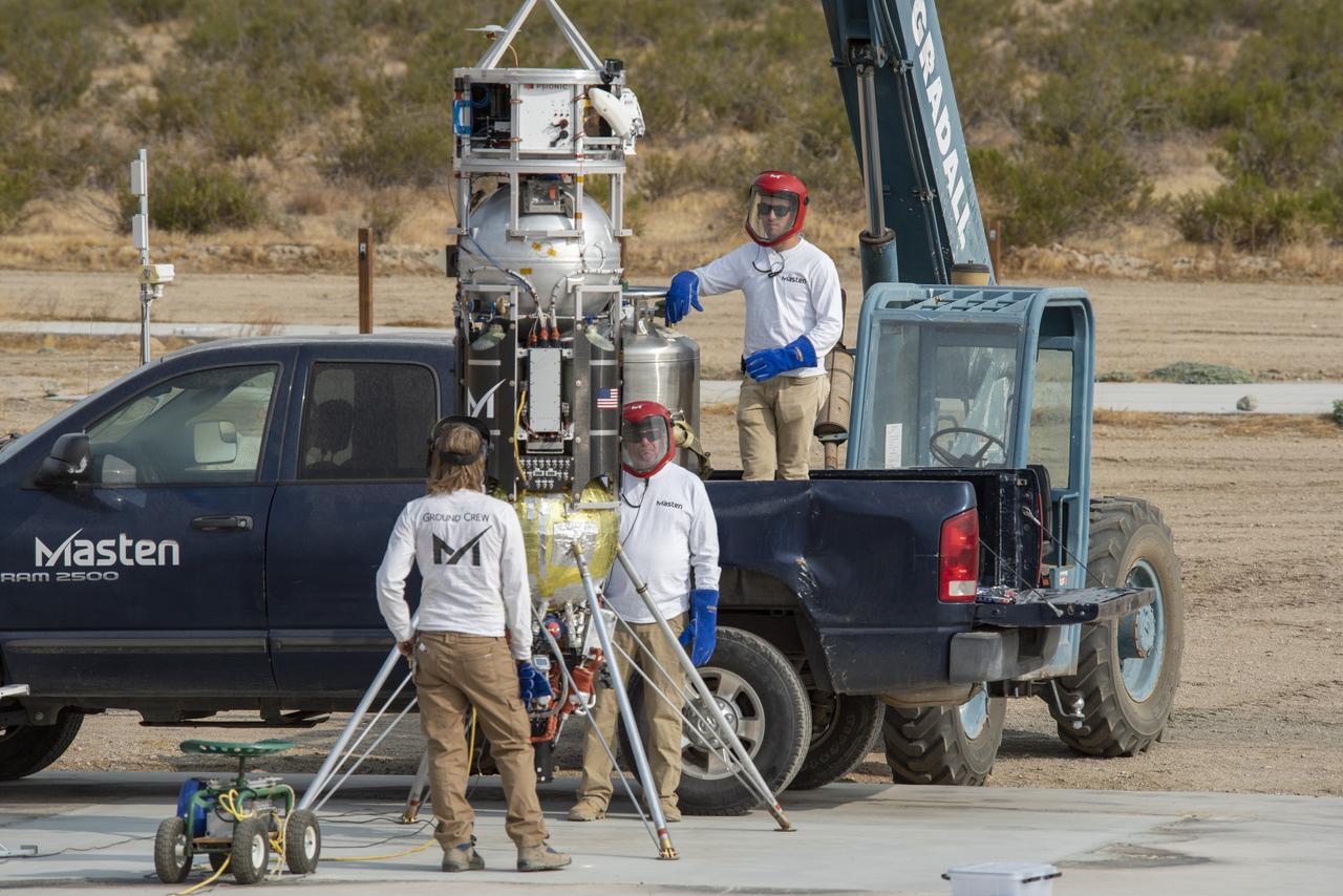
Masten Space Systems employees prepare its rocket to flight test NASA -licensed Psionic navigation doppler lidar technology that enables precision landing on celestial bodies where GPS for navigation only available on Earth is not an option.
Saré Culbertson, NASA Pathways intern at NASA’s Armstrong Flight Research Center in Edwards, California, adjusts the Emlid Reach RS2+ receiver equipment that connects with GPS and global navigation satellite systems on Nov. 7, 2024, in preparation for future air taxi test flight research.
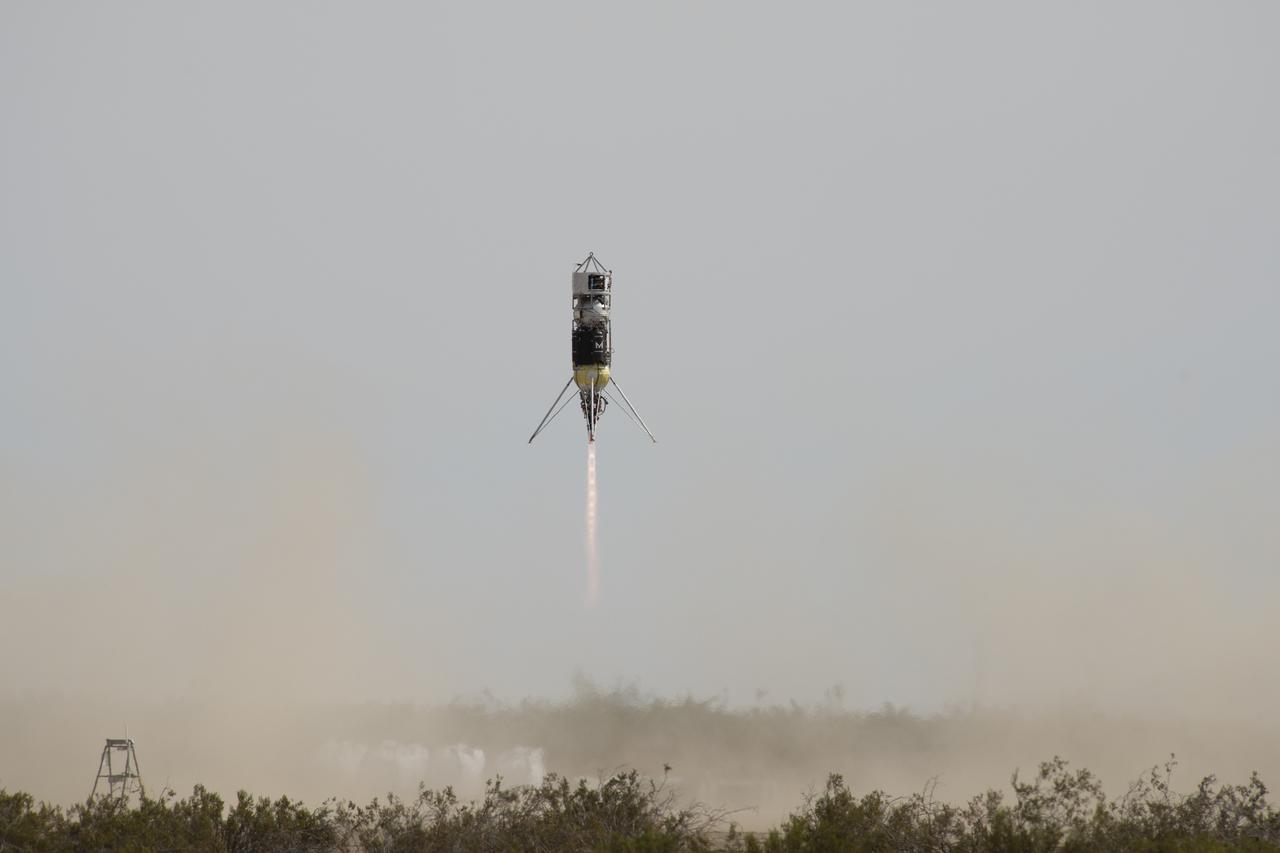
Masten Space Systems vertical takeoff vertical landing rocket launched September 10, 2020 to flight test NASA-licensed Psionic navigation doppler lidar technology that enables precision landing on celestial bodies where GPS for navigation only available on Earth is not an option.
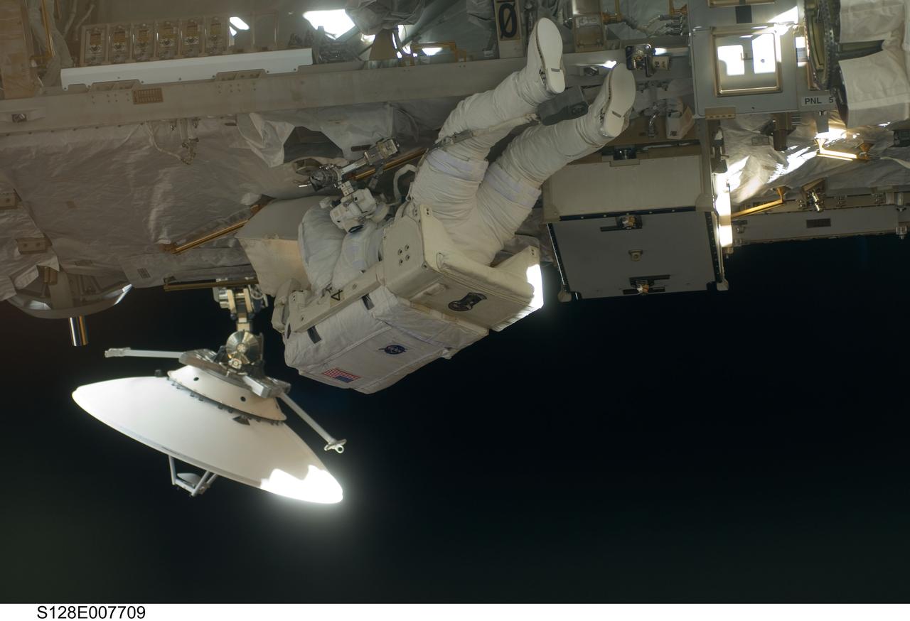
S128-E-007709 (5 Sept. 2009) --- European Space Agency astronaut Christer Fuglesang, STS-128 mission specialist, participates in the mission's third and final session of extravehicular activity (EVA) as construction and maintenance continue on the International Space Station. During the seven-hour, one-minute spacewalk, Fuglesang and NASA astronaut John “Danny” Olivas (out of frame), mission specialist, deployed the Payload Attachment System (PAS), replaced the Rate Gyro Assembly #2, installed two GPS antennae and did some work to prepare for the installation of Node 3 next year. During connection of one of two sets of avionics cables for Node 3, one of the connectors could not be mated. This cable and connector were wrapped in a protective sleeve and safed. All other cables were mated successfully.
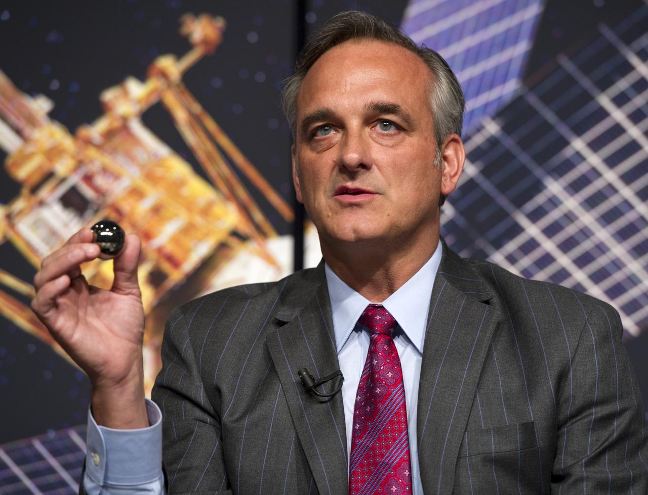
Rex Geveden, President of Teledyne Brown Engineering, makes a point during a press conference, Wednesday, May 4, 2011, to discuss NASA's Gravity Probe B (GP-B) mission which has confirmed two key predictions derived from Albert Einstein's general theory of relativity, which the spacecraft was designed to test at NASA Headquarters in Washington. The experiment, launched in 2004, used four ultra-precise gyroscopes to measure the hypothesized geodetic effect, the warping of space and time around a gravitational body, and frame-dragging, the amount a spinning object pulls space and time with it as it rotates. Photo Credit: (NASA/Paul E. Alers)
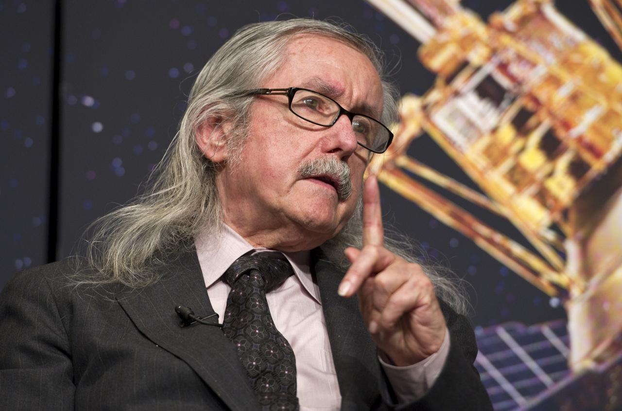
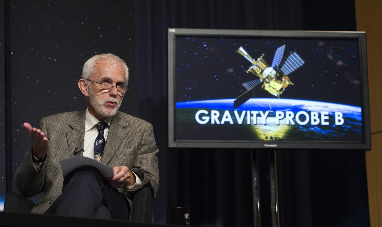
Francis Everitt, Principal Investigator for the Gravity Probe B Mission at Stanford University, makes a point during a press conference, Wednesday, May 4, 2011, to discuss NASA's Gravity Probe B (GP-B) mission which has confirmed two key predictions derived from Albert Einstein's general theory of relativity, which the spacecraft was designed to test at NASA Headquarters in Washington. The experiment, launched in 2004, used four ultra-precise gyroscopes to measure the hypothesized geodetic effect, the warping of space and time around a gravitational body, and frame-dragging, the amount a spinning object pulls space and time with it as it rotates. Photo Credit: (NASA/Paul E. Alers)
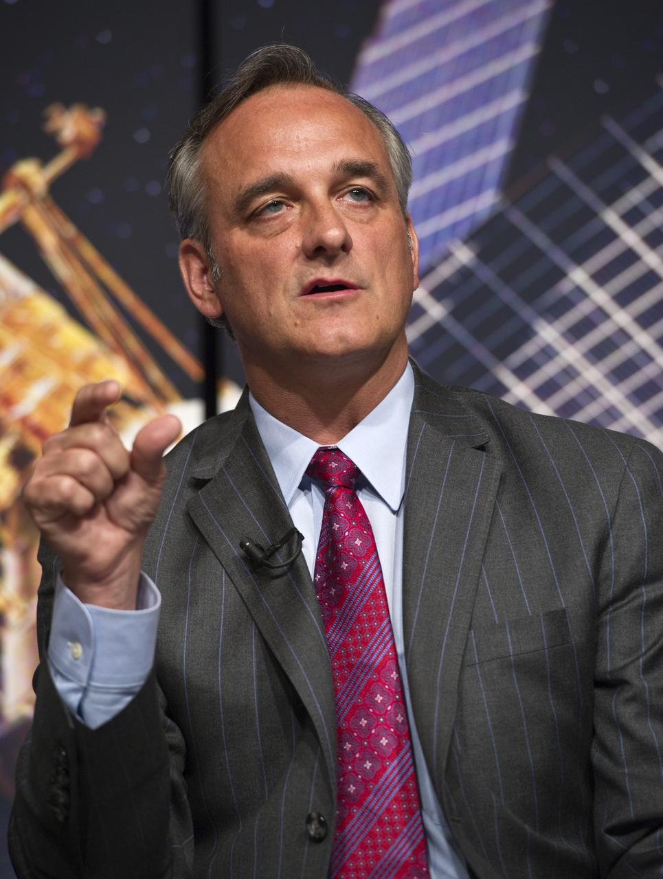
Rex Geveden, President of Teledyne Brown Engineering, makes a point during a press conference, Wednesday, May 4, 2011, to discuss NASA's Gravity Probe B (GP-B) mission which has confirmed two key predictions derived from Albert Einstein's general theory of relativity, which the spacecraft was designed to test at NASA Headquarters in Washington. The experiment, launched in 2004, used four ultra-precise gyroscopes to measure the hypothesized geodetic effect, the warping of space and time around a gravitational body, and frame-dragging, the amount a spinning object pulls space and time with it as it rotates. Photo Credit: (NASA/Paul E. Alers)
Francis Everitt, Principal Investigator for the Gravity Probe B Mission at Stanford University, makes a point during a press conference, Wednesday, May 4, 2011, to discuss NASA's Gravity Probe B (GP-B) mission which has confirmed two key predictions derived from Albert Einstein's general theory of relativity, which the spacecraft was designed to test at NASA Headquarters in Washington. The experiment, launched in 2004, used four ultra-precise gyroscopes to measure the hypothesized geodetic effect, the warping of space and time around a gravitational body, and frame-dragging, the amount a spinning object pulls space and time with it as it rotates. Photo Credit: (NASA/Paul E. Alers)
Francis Everitt, Principal Investigator for the Gravity Probe B Mission at Stanford University, second from left, makes a point during a press conference, Wednesday, May 4, 2011, to discuss NASA's Gravity Probe B (GP-B) mission which has confirmed two key predictions derived from Albert Einstein's general theory of relativity, which the spacecraft was designed to test at NASA Headquarters in Washington. The experiment, launched in 2004, used four ultra-precise gyroscopes to measure the hypothesized geodetic effect, the warping of space and time around a gravitational body, and frame-dragging, the amount a spinning object pulls space and time with it as it rotates. Photo Credit: (NASA/Paul E. Alers)
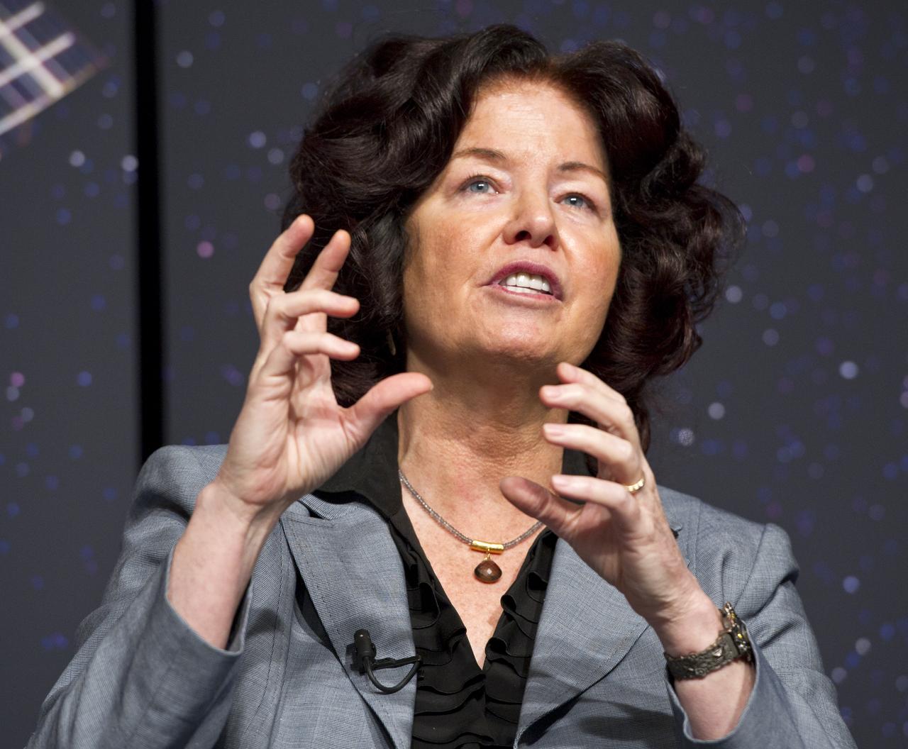
Colleen Hartman, Senior Advisor at NASA Headquarters and Research Professor at George Washington University, makes a point during a press conference, Wednesday, May 4, 2011, to discuss NASA's Gravity Probe B (GP-B) mission which has confirmed two key predictions derived from Albert Einstein's general theory of relativity, which the spacecraft was designed to test at NASA Headquarters in Washington. The experiment, launched in 2004, used four ultra-precise gyroscopes to measure the hypothesized geodetic effect, the warping of space and time around a gravitational body, and frame-dragging, the amount a spinning object pulls space and time with it as it rotates. Photo Credit: (NASA/Paul E. Alers)

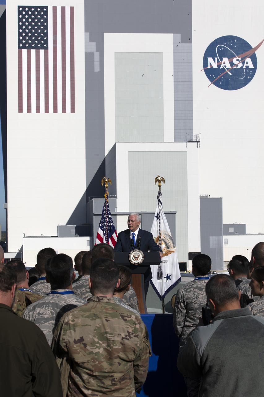
At the Operations and Support Building II at NASA's Kennedy Space Center in Florida, Vice President Mike Pence attends the launch attempt of SpaceX's Falcon 9 rocket carrying the U.S. Air Force's GPS III satellite from Space Launch Complex 40 on Cape Canaveral Air Force Station on Dec. 18, 2018. Speaking at the podium is Secretary of the U.S. Air Force Heather Wilson.
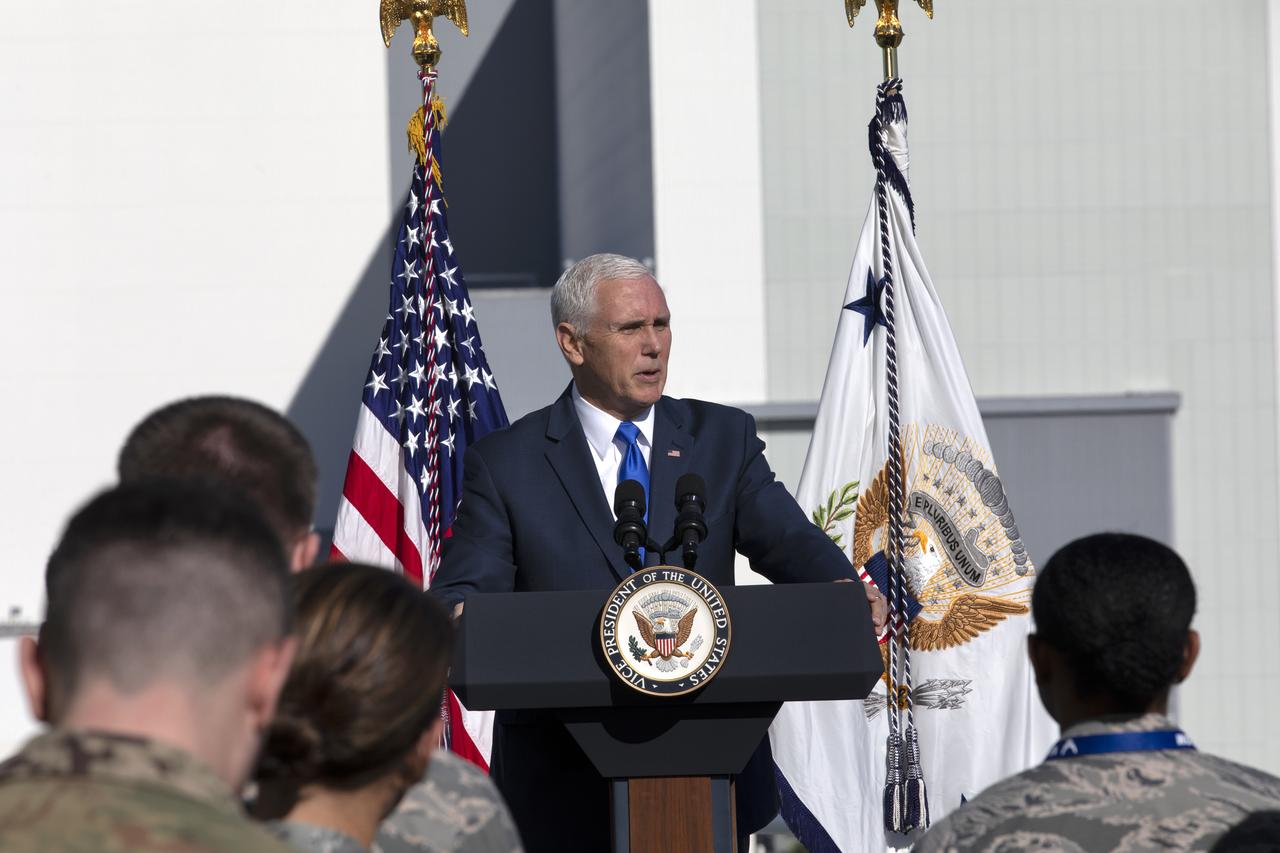
At the Operations and Support Building II at NASA's Kennedy Space Center in Florida, Vice President Mike Pence addresses members of the U.S. Air Force after the scrubbed launch attempt of SpaceX's Falcon 9 rocket carrying the Air Force's GPS III satellite from Space Launch Complex 40 on Cape Canaveral Air Force Station on Dec. 18, 2018.
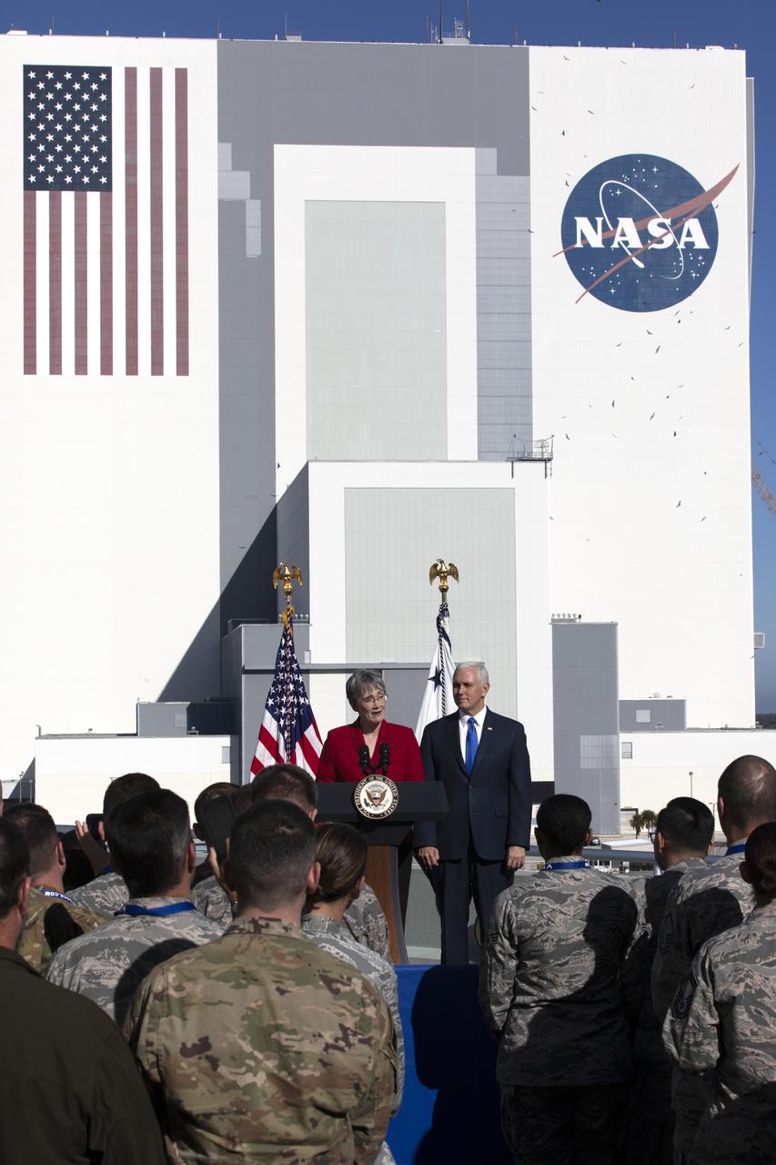
At the Operations and Support Building II at NASA's Kennedy Space Center in Florida, Vice President Mike Pence attends the launch attempt of SpaceX's Falcon 9 rocket carrying the U.S. Air Force's GPS III satellite from Space Launch Complex 40 on Cape Canaveral Air Force Station on Dec. 18, 2018. Speaking at the podium is Secretary of the U.S. Air Force Heather Wilson.

At the Operations and Support Building II at NASA's Kennedy Space Center in Florida, Vice President Mike Pence attends the launch attempt of SpaceX's Falcon 9 rocket carrying the U.S. Air Force's GPS III satellite from Space Launch Complex 40 on Cape Canaveral Air Force Station on Dec. 18, 2018. Speaking at the podium is Secretary of the U.S. Air Force Heather Wilson.
At the Operations and Support Building II at NASA's Kennedy Space Center in Florida, Vice President Mike Pence addresses members of the U.S. Air Force after the scrubbed launch attempt of SpaceX's Falcon 9 rocket carrying the Air Force's GPS III satellite from Space Launch Complex 40 on Cape Canaveral Air Force Station on Dec. 18, 2018.

At the Operations and Support Building II at NASA's Kennedy Space Center in Florida, Vice President Mike Pence addresses members of the U.S. Air Force after the scrubbed launch attempt of SpaceX's Falcon 9 rocket carrying the Air Force's GPS III satellite from Space Launch Complex 40 on Cape Canaveral Air Force Station on Dec. 18, 2018.
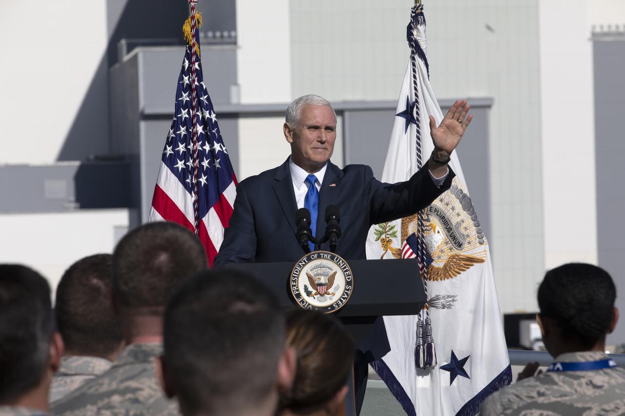
At the Operations and Support Building II at NASA's Kennedy Space Center in Florida, Vice President Mike Pence addresses members of the U.S. Air Force after the scrubbed launch attempt of SpaceX's Falcon 9 rocket carrying the Air Force's GPS III satellite from Space Launch Complex 40 on Cape Canaveral Air Force Station on Dec. 18, 2018.
At the Operations and Support Building II at NASA's Kennedy Space Center in Florida, Vice President Mike Pence addresses members of the U.S. Air Force after the scrubbed launch attempt of SpaceX's Falcon 9 rocket carrying the Air Force's GPS III satellite from Space Launch Complex 40 on Cape Canaveral Air Force Station on Dec. 18, 2018.
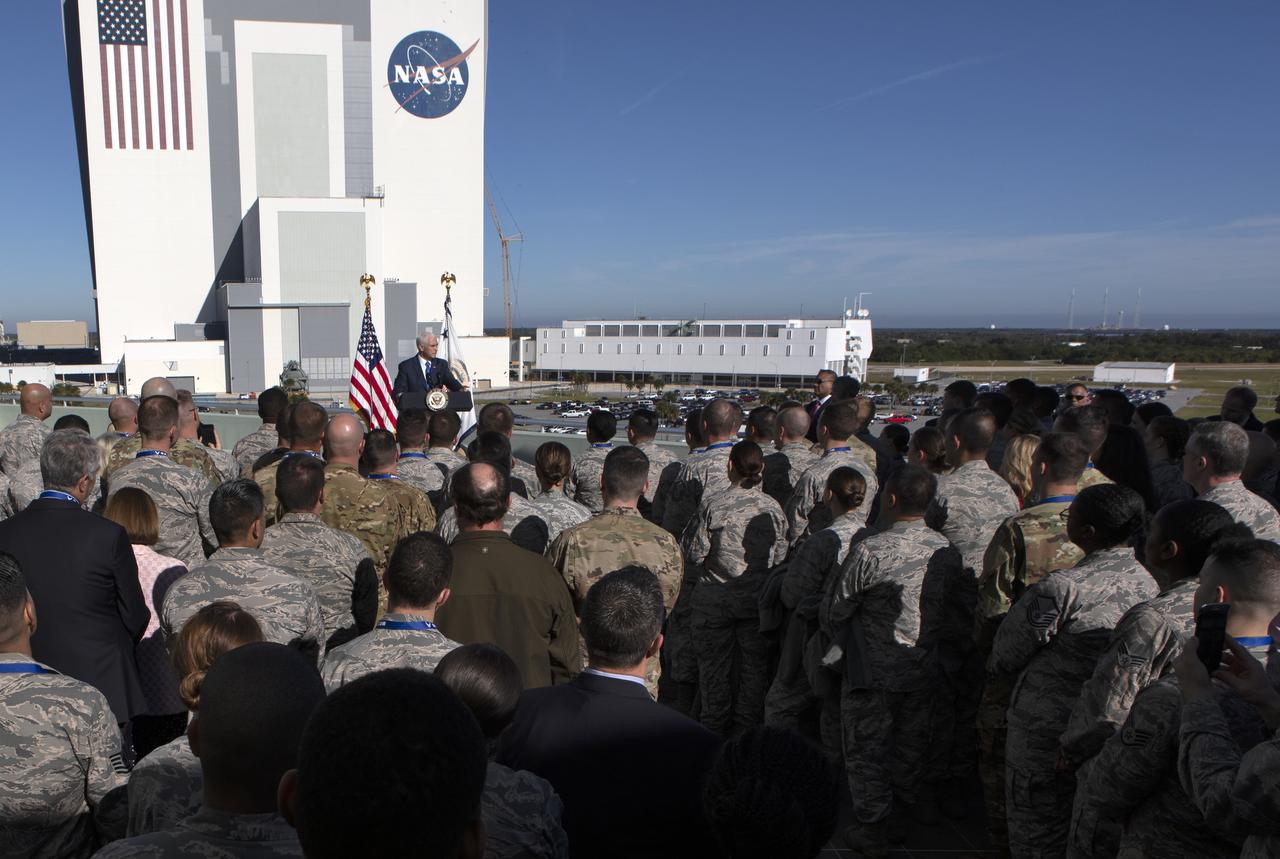
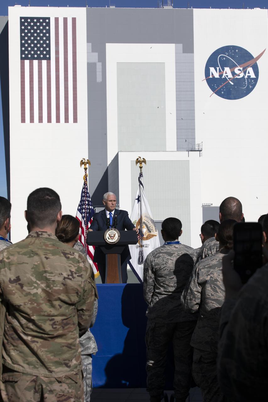
At the Operations and Support Building II at NASA's Kennedy Space Center in Florida, Vice President Mike Pence addresses members of the U.S. Air Force after the scrubbed launch attempt of SpaceX's Falcon 9 rocket carrying the Air Force's GPS III satellite from Space Launch Complex 40 on Cape Canaveral Air Force Station on Dec. 18, 2018. The iconic Vehicle Assembly Building and Launch Control Center are in view in the background.
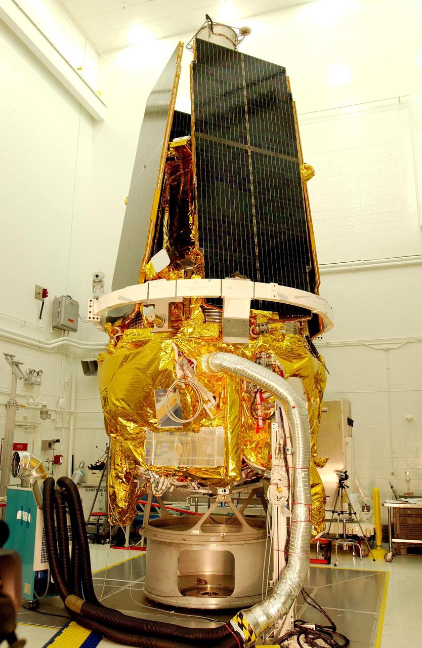
KENNEDY SPACE CENTER, FLA. -- The Gravity Probe B spacecraft is in NASA’s Payload Processing Facility 1610 on North Vandenberg Air Force Base in California after completion of prelaunch processing before going to the pad. The spacecraft will be transported to Space Launch Complex 2 on April 1 and mated to the Boeing Delta II rocket. Gravity Probe B consists of four sophisticated gyroscopes that will provide an almost perfect space-time reference system. The mission will look in a precise manner for tiny changes in the direction of spin. Gravity Probe B will be launched into a 400-nautical-mile-high polar orbit for a 16-month mission. Launch is scheduled for April 17.
KENNEDY SPACE CENTER, FLA. -- The Gravity Probe B spacecraft is in NASA’s Payload Processing Facility 1610 on North Vandenberg Air Force Base in California after completion of prelaunch processing before going to the pad. The spacecraft will be transported to Space Launch Complex 2 on April 1 and mated to the Boeing Delta II rocket. Gravity Probe B consists of four sophisticated gyroscopes that will provide an almost perfect space-time reference system. The mission will look in a precise manner for tiny changes in the direction of spin. Gravity Probe B will be launched into a 400-nautical-mile-high polar orbit for a 16-month mission. Launch is scheduled for April 17.

KENNEDY SPACE CENTER, FLA. -- A closeup of the top of the Gravity Probe B spacecraft in NASA’s Payload Processing Facility 1610 on North Vandenberg Air Force Base in California after completion of prelaunch processing before going to the pad. The spacecraft will be transported to Space Launch Complex 2 on April 1 and mated to the Boeing Delta II rocket. Gravity Probe B consists of four sophisticated gyroscopes that will provide an almost perfect space-time reference system. The mission will look in a precise manner for tiny changes in the direction of spin. Gravity Probe B will be launched into a 400-nautical-mile-high polar orbit for a 16-month mission. Launch is scheduled for April 17.
KENNEDY SPACE CENTER, FLA. -- A closeup of the Gravity Probe B spacecraft in NASA’s Payload Processing Facility 1610 on North Vandenberg Air Force Base in California after completion of prelaunch processing before going to the pad. The spacecraft will be transported to Space Launch Complex 2 on April 1 and mated to the Boeing Delta II rocket. Gravity Probe B consists of four sophisticated gyroscopes that will provide an almost perfect space-time reference system. The mission will look in a precise manner for tiny changes in the direction of spin. Gravity Probe B will be launched into a 400-nautical-mile-high polar orbit for a 16-month mission. Launch is scheduled for April 17.
KENNEDY SPACE CENTER, FLA. -- The Gravity Probe B spacecraft is in NASA’s Payload Processing Facility 1610 on North Vandenberg Air Force Base in California after completion of prelaunch processing before going to the pad. The spacecraft will be transported to Space Launch Complex 2 on April 1 and mated to the Boeing Delta II rocket. Gravity Probe B consists of four sophisticated gyroscopes that will provide an almost perfect space-time reference system. The mission will look in a precise manner for tiny changes in the direction of spin. Gravity Probe B will be launched into a 400-nautical-mile-high polar orbit for a 16-month mission. Launch is scheduled for April 17.
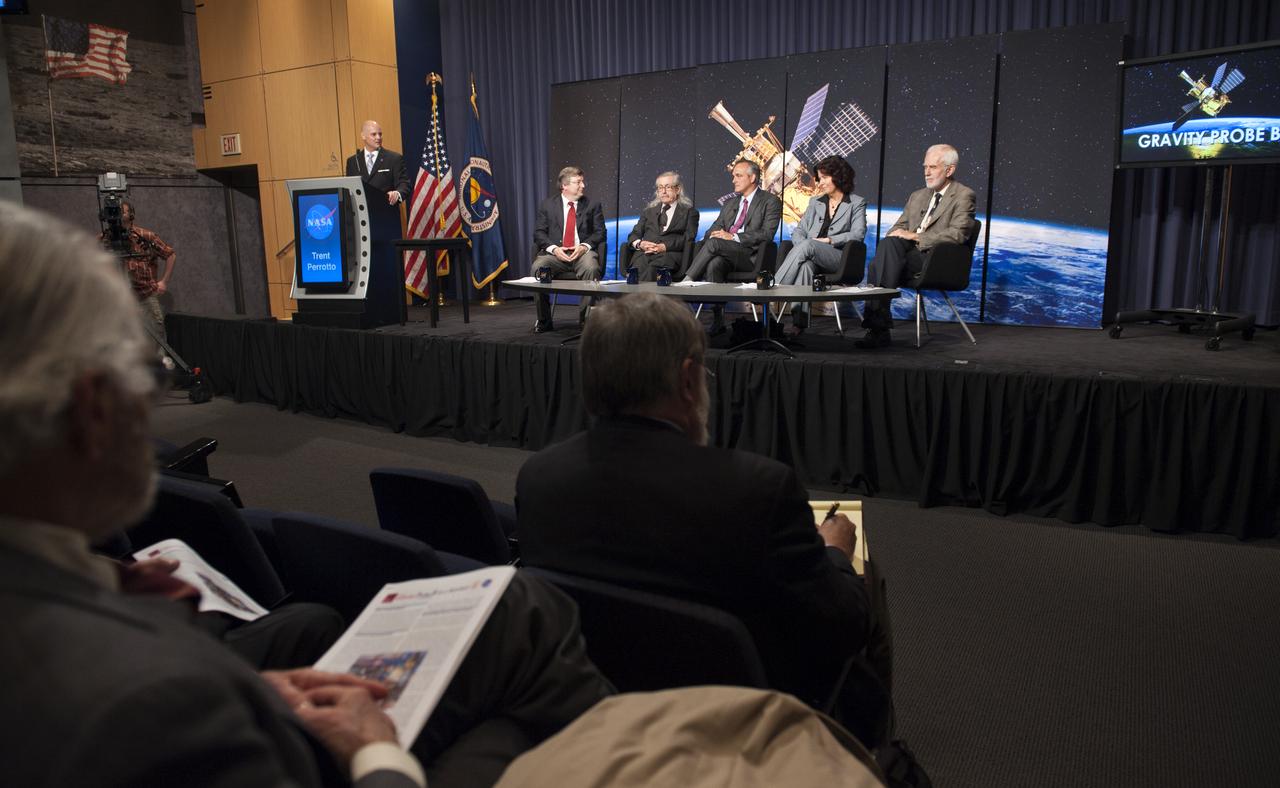
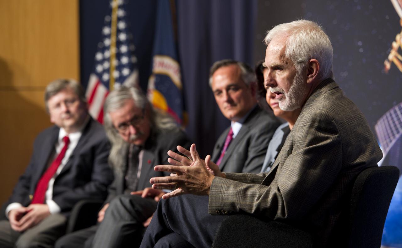
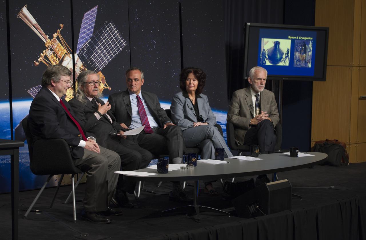
Seated from left, Bill Danchi, Senior Astrophysicist and Program Scientist at NASA Headquarters, Francis Everitt, Principal Investigator for the Gravity Probe B Mission at Stanford University, Rex Geveden, President of Teledyne Brown Engineering, Colleen Hartman, a research professor at George Washington University, and Clifford Will, Professor of Physics at Washington University in St. Louis, Mo., conduct a press conference, Wednesday, May 4, 2011, to discuss NASA's Gravity Probe B (GP-B) mission which has confirmed two key predictions derived from Albert Einstein's general theory of relativity, which the spacecraft was designed to test. at NASA Headquarters in Washington. Photo Credit: (NASA/Paul E. Alers)
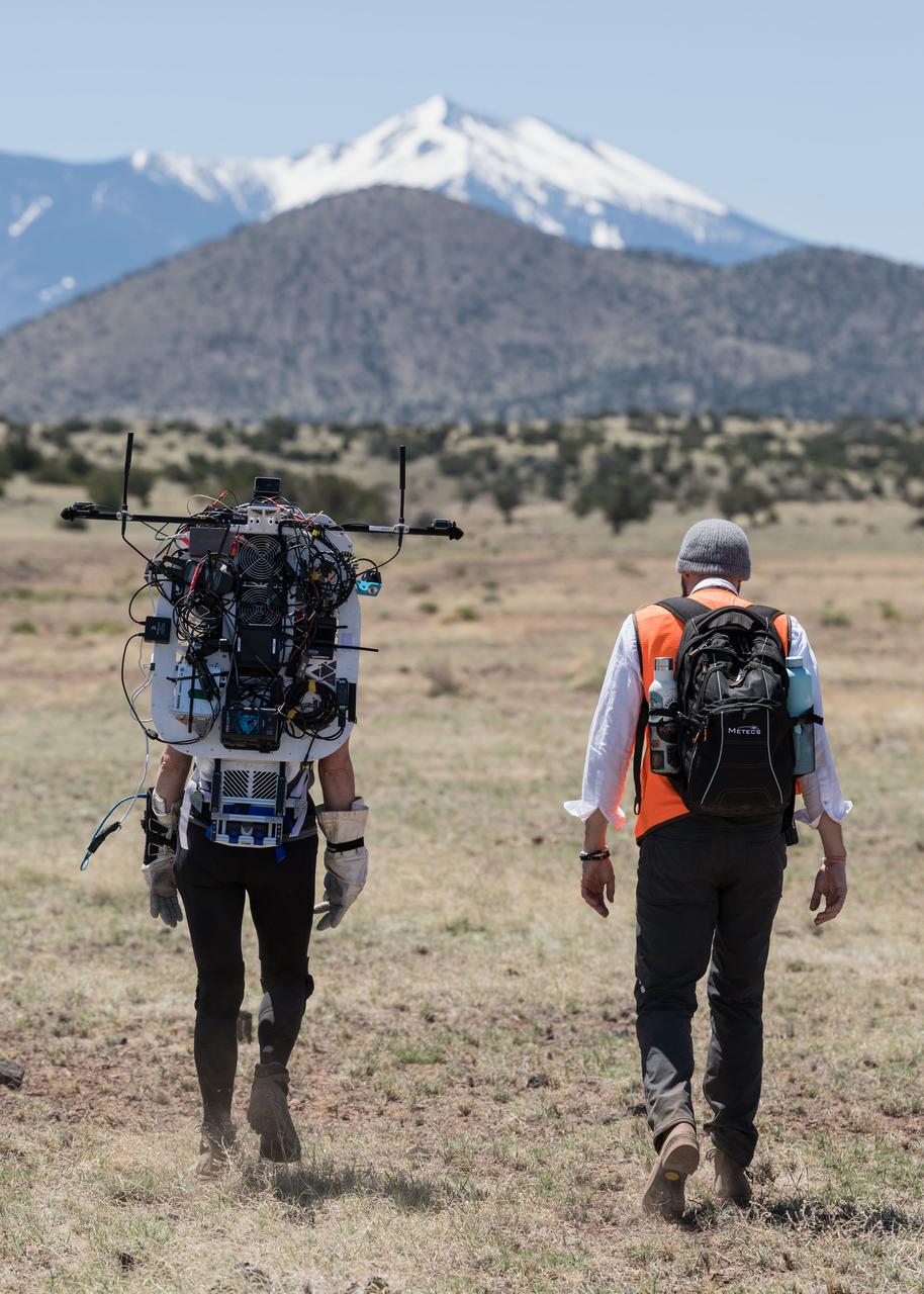
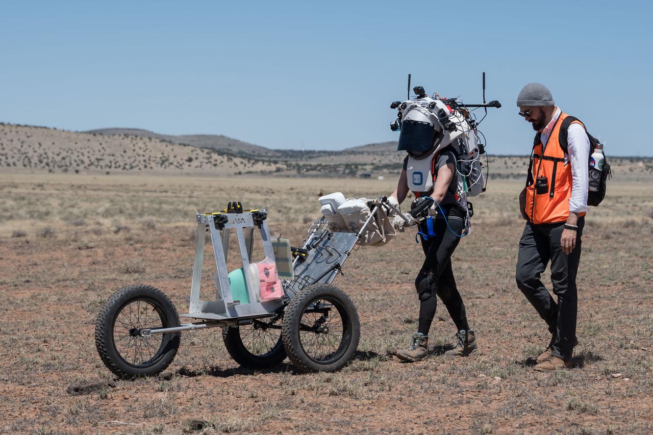
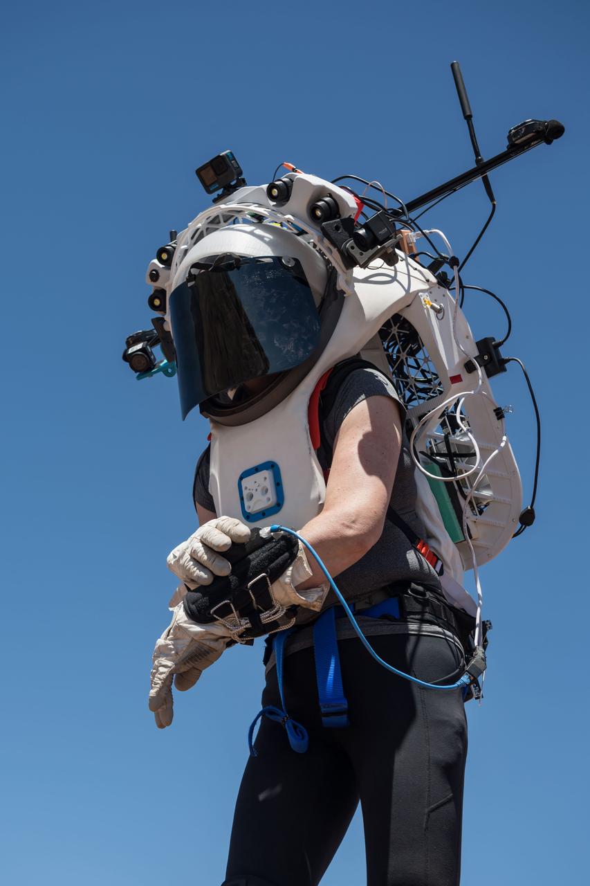
NASA astronaut Kate Rubins walks through the lunar-like landscape wearing the Joint AR (Joint Augmented Reality Visual Informatics System) display during an advanced technology run in the San Francisco Volcanic Field in Northern Arizona on May 19, 2024. The suit display features include navigation, photo capture, graphical format of consumables, procedure viewing, mission control updates, and other augmented reality cues and graphics. The team successfully tested navigation displays using data from four different data streams: GPS (Global Positioning System)/IMU (Inertial Measurement Unit), camera/IMU, LiDAR (Light Detection and Ranging), and static maps. Technology like this may be used for future Artemis missions to augment mission control communication and help guide crew back to the lunar lander. Credit: NASA/Josh Valcarcel
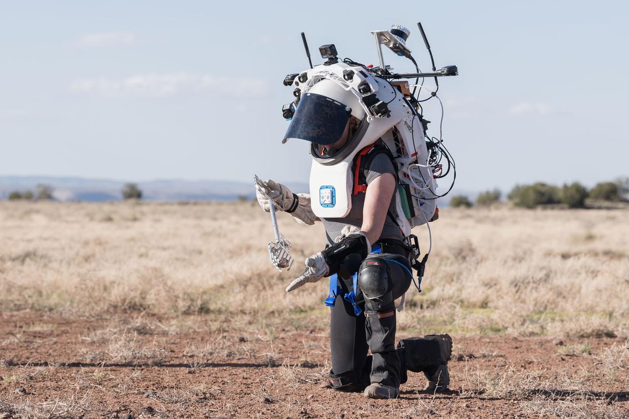
NASA astronaut Kate Rubins uses tongs to pick up a geologic sample while wearing the Joint AR (Joint Augmented Reality Visual Informatics System) display during an advanced technology run in the San Francisco Volcanic Field in Northern Arizona on May 21, 2024. The suit display features include navigation, photo capture, graphical format of consumables, procedure viewing, mission control updates, and other augmented reality cues and graphics. The team successfully tested navigation displays using data from four different data streams: GPS (Global Positioning System)/IMU (Inertial Measurement Unit), camera/IMU, LiDAR (Light Detection and Ranging), and static maps. Technology like this may be used for future Artemis missions to augment mission control communication and help guide crew back to the lunar lander. Credit: NASA/Josh Valcarcel
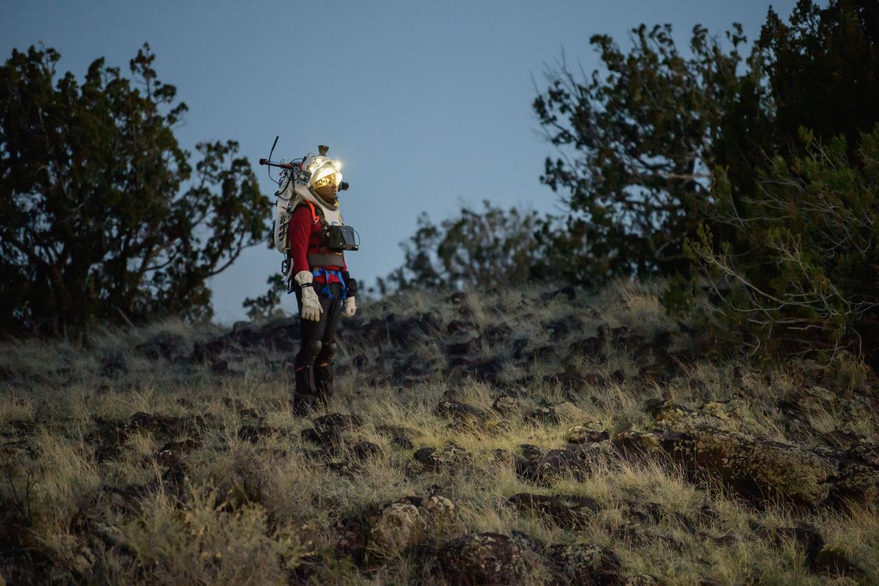
NASA astronaut Andre Douglas views the lunar-like landscape at dusk while wearing the Joint AR (Joint Augmented Reality Visual Informatics System) display during an advanced technology run in the San Francisco Volcanic Field in Northern Arizona on May 21, 2024. The suit display features include navigation, photo capture, graphical format of consumables, procedure viewing, mission control updates, and other augmented reality cues and graphics. The team successfully tested navigation displays using data from four different data streams: GPS (Global Positioning System)/IMU (Inertial Measurement Unit), camera/IMU, LiDAR (Light Detection and Ranging), and static maps. Technology like this may be used for future Artemis missions to augment mission control communication and help guide crew back to the lunar lander. Credit: NASA/Josh Valcarcel
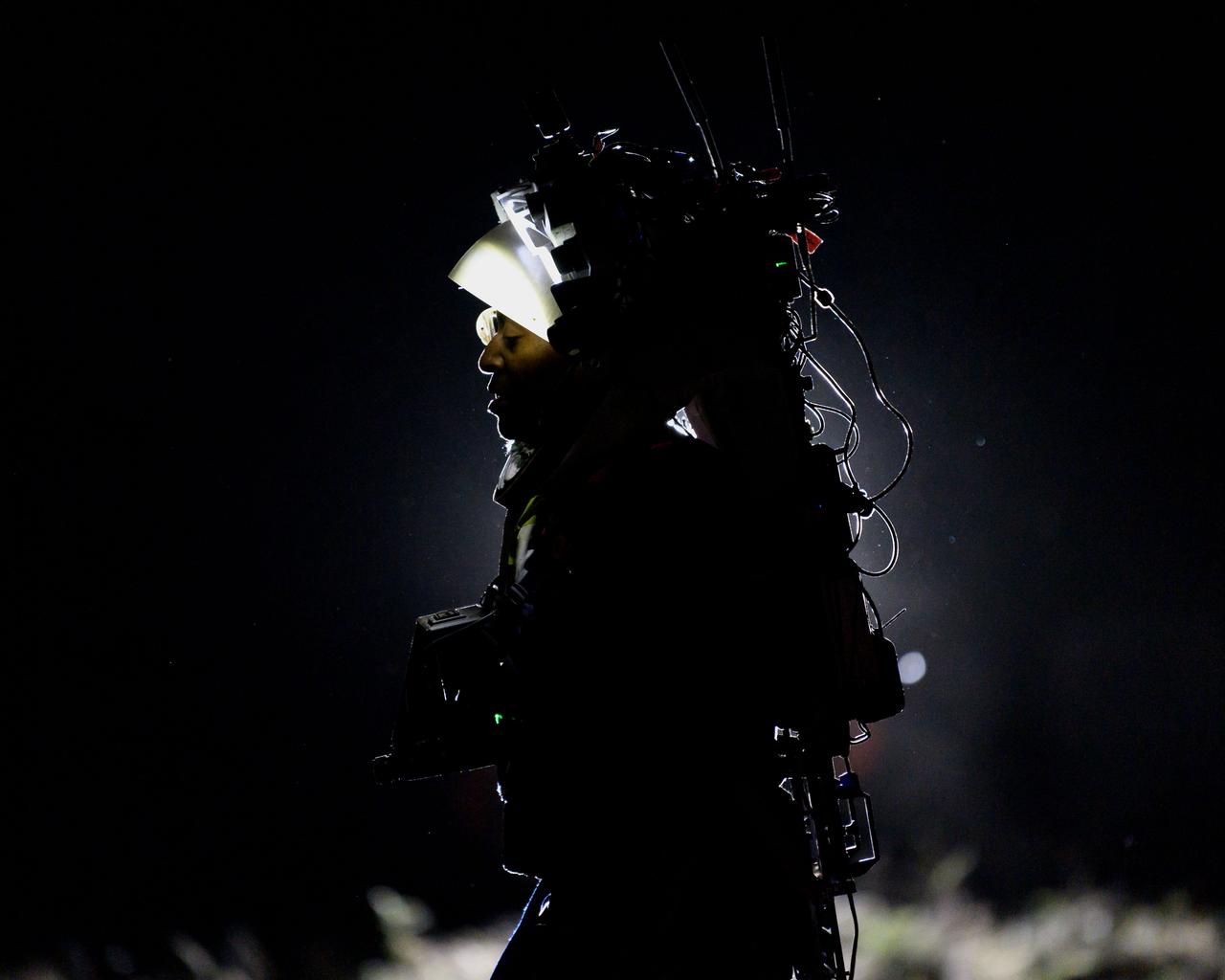
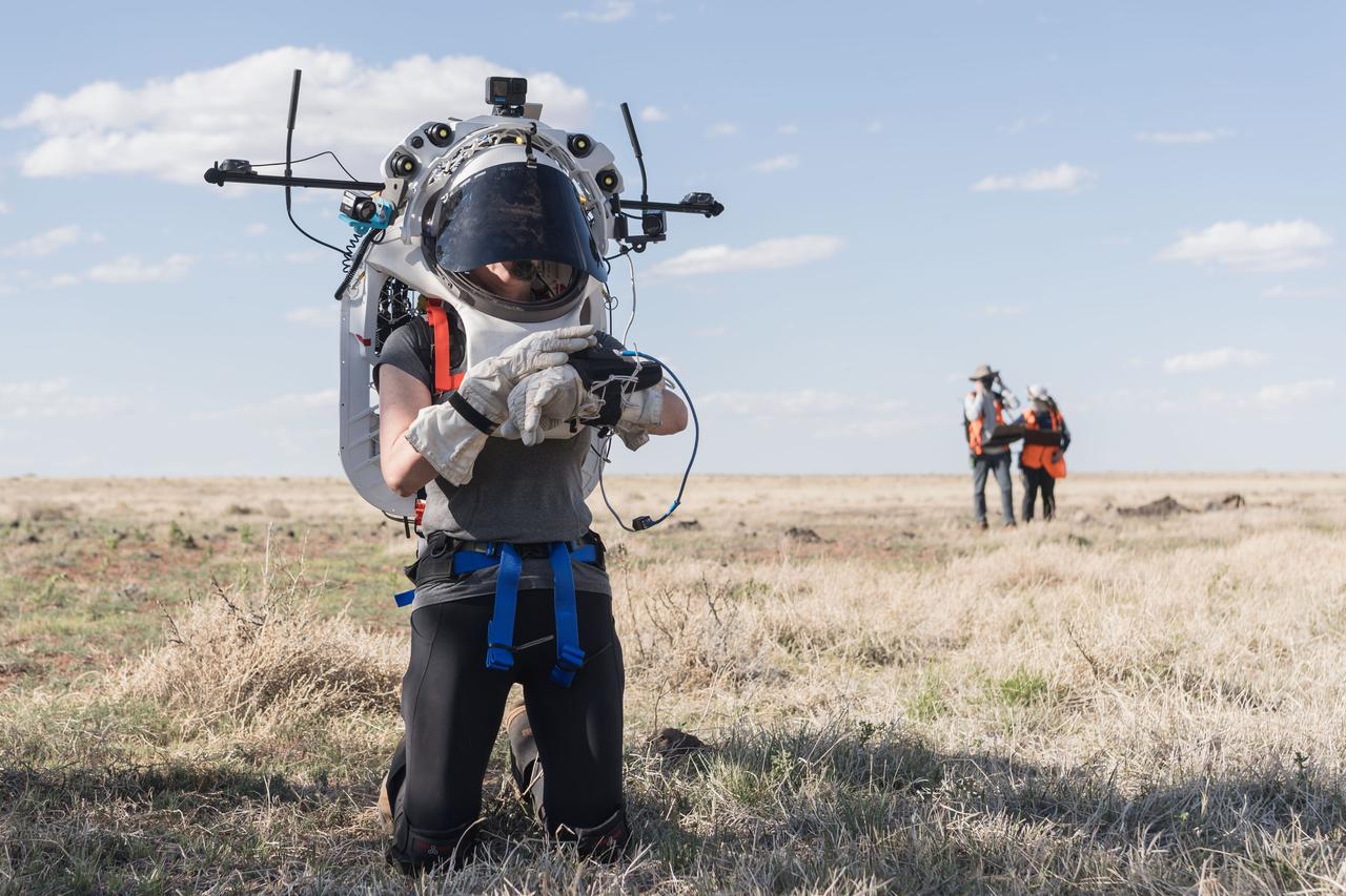
NASA astronaut Andre Douglas wears the Joint AR (Joint Augmented Reality Visual Informatics System) display during a nighttime advanced technology run in the San Francisco Volcanic Field in Northern Arizona on May 21, 2024. The suit display features include navigation, photo capture, graphical format of consumables, procedure viewing, mission control updates, and other augmented reality cues and graphics. The team successfully tested navigation displays using data from four different data streams: GPS (Global Positioning System)/IMU (Inertial Measurement Unit), camera/IMU, LiDAR (Light Detection and Ranging), and static maps. Technology like this may be used for future Artemis missions to augment mission control communication and help guide crew back to the lunar lander. Credit: NASA/Josh Valcarcel
NASA astronaut Kate Rubins pushes a cart through the lunar-like landscape while wearing the Joint AR (Joint Augmented Reality Visual Informatics System) display during an advanced technology run in the San Francisco Volcanic Field in Northern Arizona on May 19, 2024. The suit display features include navigation, photo capture, graphical format of consumables, procedure viewing, mission control updates, and other augmented reality cues and graphics. The team successfully tested navigation displays using data from four different data streams: GPS (Global Positioning System)/IMU (Inertial Measurement Unit), camera/IMU, LiDAR (Light Detection and Ranging), and static maps. Technology like this may be used for future Artemis missions to augment mission control communication and help guide crew back to the lunar lander. Credit: NASA/Josh Valcarcel
NASA astronaut Kate Rubins uses the hand controller on her wrist to display information while wearing the Joint AR (Joint Augmented Reality Visual Informatics System) display during an advanced technology run in the San Francisco Volcanic Field in Northern Arizona on May 21, 2024. The suit display features include navigation, photo capture, graphical format of consumables, procedure viewing, mission control updates, and other augmented reality cues and graphics. The team successfully tested navigation displays using data from four different data streams: GPS (Global Positioning System)/IMU (Inertial Measurement Unit), camera/IMU, LiDAR (Light Detection and Ranging), and static maps. Technology like this may be used for future Artemis missions to augment mission control communication and help guide crew back to the lunar lander. Credit: NASA/Josh Valcarcel
NASA astronauts Andre Douglas and Kate Rubins during a nighttime advanced technology run in the San Francisco Volcanic Field in Northern Arizona on May 21, 2024. Douglas is wearing the Joint AR (Joint Augmented Reality Visual Informatics System) display. The suit display features include navigation, photo capture, graphical format of consumables, procedure viewing, mission control updates, and other augmented reality cues and graphics. The team successfully tested navigation displays using data from four different data streams: GPS (Global Positioning System)/IMU (Inertial Measurement Unit), camera/IMU, LiDAR (Light Detection and Ranging), and static maps. Technology like this may be used for future Artemis missions to augment mission control communication and help guide crew back to the lunar lander. Credit: NASA/Josh Valcarcel
Engineers help NASA astronaut Andre Douglas adjust the Joint AR (Joint Augmented Reality Visual Informatics System) display he’s wearing during a nighttime advanced technology run in the San Francisco Volcanic Field in Northern Arizona on May 21, 2024. The suit display features include navigation, photo capture, graphical format of consumables, procedure viewing, mission control updates, and other augmented reality cues and graphics. The team successfully tested navigation displays using data from four different data streams: GPS (Global Positioning System)/IMU (Inertial Measurement Unit), camera/IMU, LiDAR (Light Detection and Ranging), and static maps. Technology like this may be used for future Artemis missions to augment mission control communication and help guide crew back to the lunar lander. Credit: NASA/Josh Valcarcel
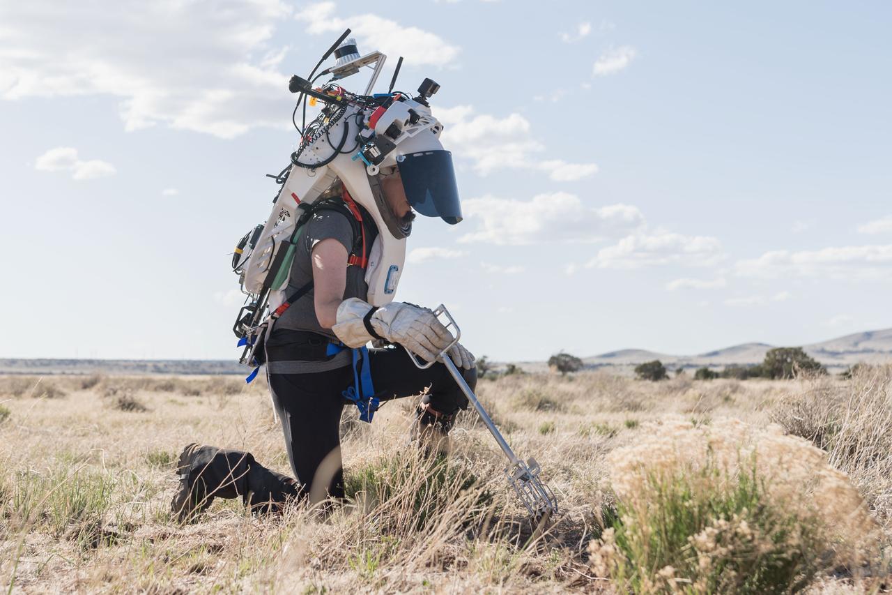
NASA astronaut Kate Rubins uses tongs to collect geologic samples while wearing the Joint AR (Joint Augmented Reality Visual Informatics System) display during an advanced technology run in the San Francisco Volcanic Field in Northern Arizona on May 21, 2024. The suit display features include navigation, photo capture, graphical format of consumables, procedure viewing, mission control updates, and other augmented reality cues and graphics. The team successfully tested navigation displays using data from four different data streams: GPS (Global Positioning System)/IMU (Inertial Measurement Unit), camera/IMU, LiDAR (Light Detection and Ranging), and static maps. Technology like this may be used for future Artemis missions to augment mission control communication and help guide crew back to the lunar lander. Credit: NASA/Josh Valcarcel
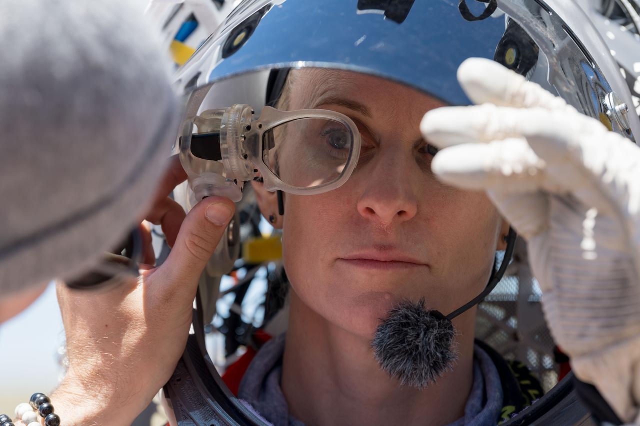
An engineer helps NASA astronaut Kate Rubins adjust the lens on the Joint AR (Joint Augmented Reality Visual Informatics System) display she’s wearing during an advanced technology run in the San Francisco Volcanic Field in Northern Arizona on May 19, 2024. The suit display features include navigation, photo capture, graphical format of consumables, procedure viewing, mission control updates, and other augmented reality cues and graphics. The team successfully tested navigation displays using data from four different data streams: GPS (Global Positioning System)/IMU (Inertial Measurement Unit), camera/IMU, LiDAR (Light Detection and Ranging), and static maps. Technology like this may be used for future Artemis missions to augment mission control communication and help guide crew back to the lunar lander. Credit: NASA/Josh Valcarcel
NASA astronaut Kate Rubins uses the hand controller on her wrist to display information while wearing the Joint AR (Joint Augmented Reality Visual Informatics System) display during an advanced technology run in the San Francisco Volcanic Field in Northern Arizona on May 19, 2024. The suit display features include navigation, photo capture, graphical format of consumables, procedure viewing, mission control updates, and other augmented reality cues and graphics. The team successfully tested navigation displays using data from four different data streams: GPS (Global Positioning System)/IMU (Inertial Measurement Unit), camera/IMU, LiDAR (Light Detection and Ranging), and static maps. Technology like this may be used for future Artemis missions to augment mission control communication and help guide crew back to the lunar lander. Credit: NASA/Josh Valcarcel
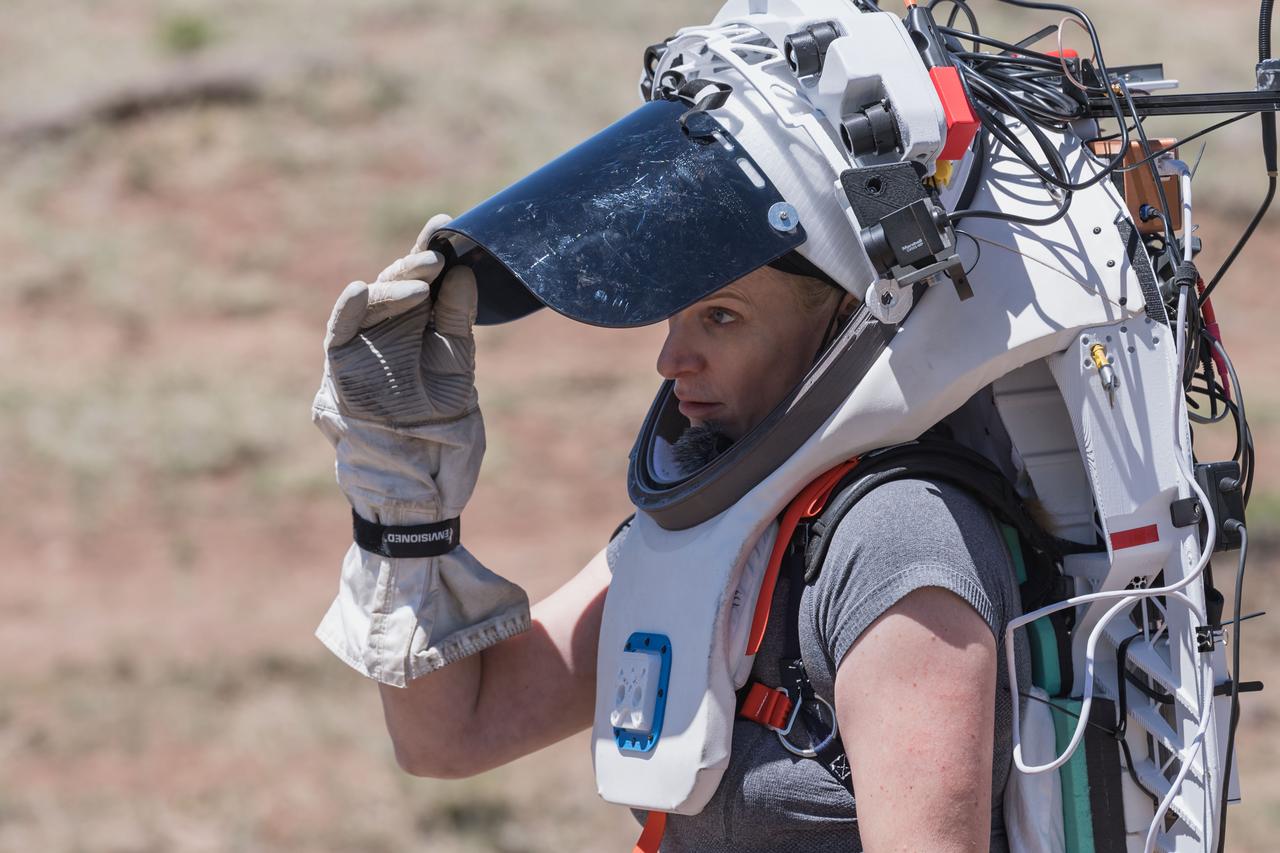
NASA astronaut Kate Rubins opens the sun visor on the Joint AR (Joint Augmented Reality Visual Informatics System) display she’s wearing during an advanced technology run in the San Francisco Volcanic Field in Northern Arizona on May 19, 2024. The suit display features include navigation, photo capture, graphical format of consumables, procedure viewing, mission control updates, and other augmented reality cues and graphics. The team successfully tested navigation displays using data from four different data streams: GPS (Global Positioning System)/IMU (Inertial Measurement Unit), camera/IMU, LiDAR (Light Detection and Ranging), and static maps. Technology like this may be used for future Artemis missions to augment mission control communication and help guide crew back to the lunar lander. Credit: NASA/Josh Valcarcel
NASA astronaut Kate Rubins walks through the lunar-like landscape wearing the Joint AR (Joint Augmented Reality Visual Informatics System) display during an advanced technology run in the San Francisco Volcanic Field in Northern Arizona on May 19, 2024. The suit display features include navigation, photo capture, graphical format of consumables, procedure viewing, mission control updates, and other augmented reality cues and graphics. The team successfully tested navigation displays using data from four different data streams: GPS (Global Positioning System)/IMU (Inertial Measurement Unit), camera/IMU, LiDAR (Light Detection and Ranging), and static maps. Technology like this may be used for future Artemis missions to augment mission control communication and help guide crew back to the lunar lander. Credit: NASA/Josh Valcarcel
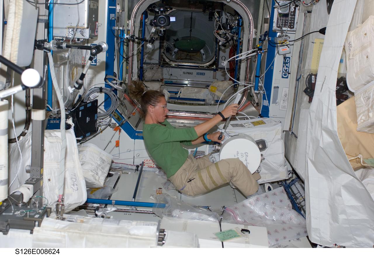
S126-E-008624 (20 Nov. 2008) --- Astronaut Sandra Magnus, Expedition 18 flight engineer, assembles the GPS antenna in the Destiny laboratory of the International Space Station while Space Shuttle Endeavour (STS-126) remains docked with the station. The GPS antenna is scheduled be installed on the Kibo laboratory during the mission's fourth session of extravehicular activity (EVA).
File name :DSC_0028.JPG File size :2.8MB(2950833Bytes) Date taken :2002/02/19 09:49:01 Image size :3008 x 2000 Resolution :300 x 300 dpi Number of bits :8bit/channel Protection attribute :Off Hide Attribute :Off Camera ID :N/A Camera :NIKON D100 Quality mode :N/A Metering mode :Matrix Exposure mode :Shutter priority Speed light :Yes Focal length :24 mm Shutter speed :1/60second Aperture :F3.5 Exposure compensation :0 EV White Balance :N/A Lens :N/A Flash sync mode :N/A Exposure difference :N/A Flexible program :N/A Sensitivity :N/A Sharpening :N/A Image Type :Color Color Mode :N/A Hue adjustment :N/A Saturation Control :N/A Tone compensation :N/A Latitude(GPS) :N/A Longitude(GPS) :N/A Altitude(GPS) :N/A
File name :DSC_0047.JPG File size :2.8MB(2931574Bytes) Date taken :2002/02/24 10:06:57 Image size :3008 x 2000 Resolution :300 x 300 dpi Number of bits :8bit/channel Protection attribute :Off Hide Attribute :Off Camera ID :N/A Camera :NIKON D100 Quality mode :N/A Metering mode :Matrix Exposure mode :Shutter priority Speed light :Yes Focal length :24 mm Shutter speed :1/180second Aperture :F20.0 Exposure compensation :+0.3 EV White Balance :N/A Lens :N/A Flash sync mode :N/A Exposure difference :N/A Flexible program :N/A Sensitivity :N/A Sharpening :N/A Image Type :Color Color Mode :N/A Hue adjustment :N/A Saturation Control :N/A Tone compensation :N/A Latitude(GPS) :N/A Longitude(GPS) :N/A Altitude(GPS) :N/A
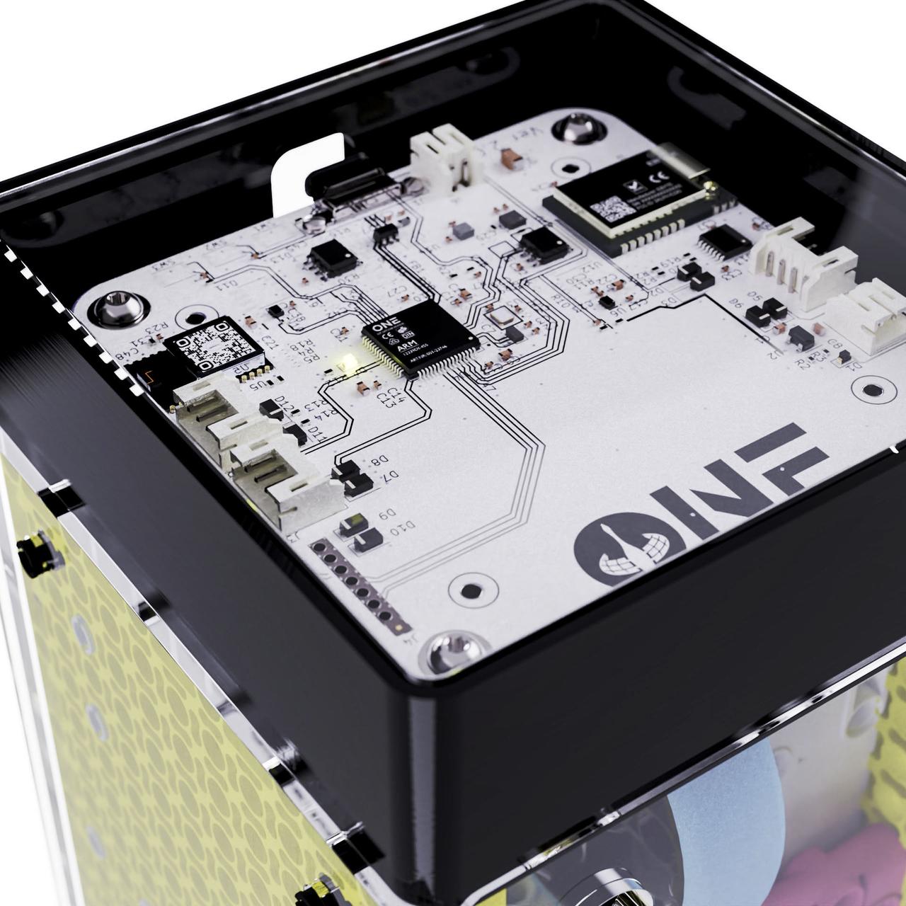
jsc2023e053550 (7/27/2023) --- The denMACH ONE IoT modem complete with inbuilt sensors to measure temperature, humidity, CO2, barometric pressure, compass points, accelerometer, GPS. Image courtesy SpaceTech denMACH.
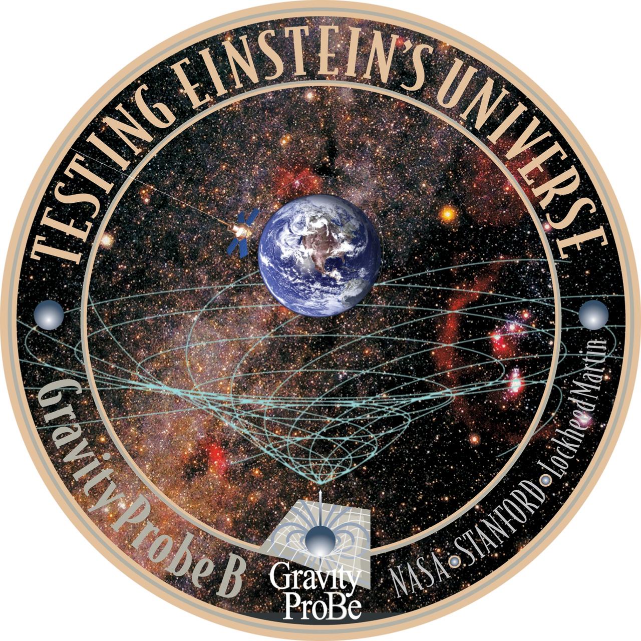
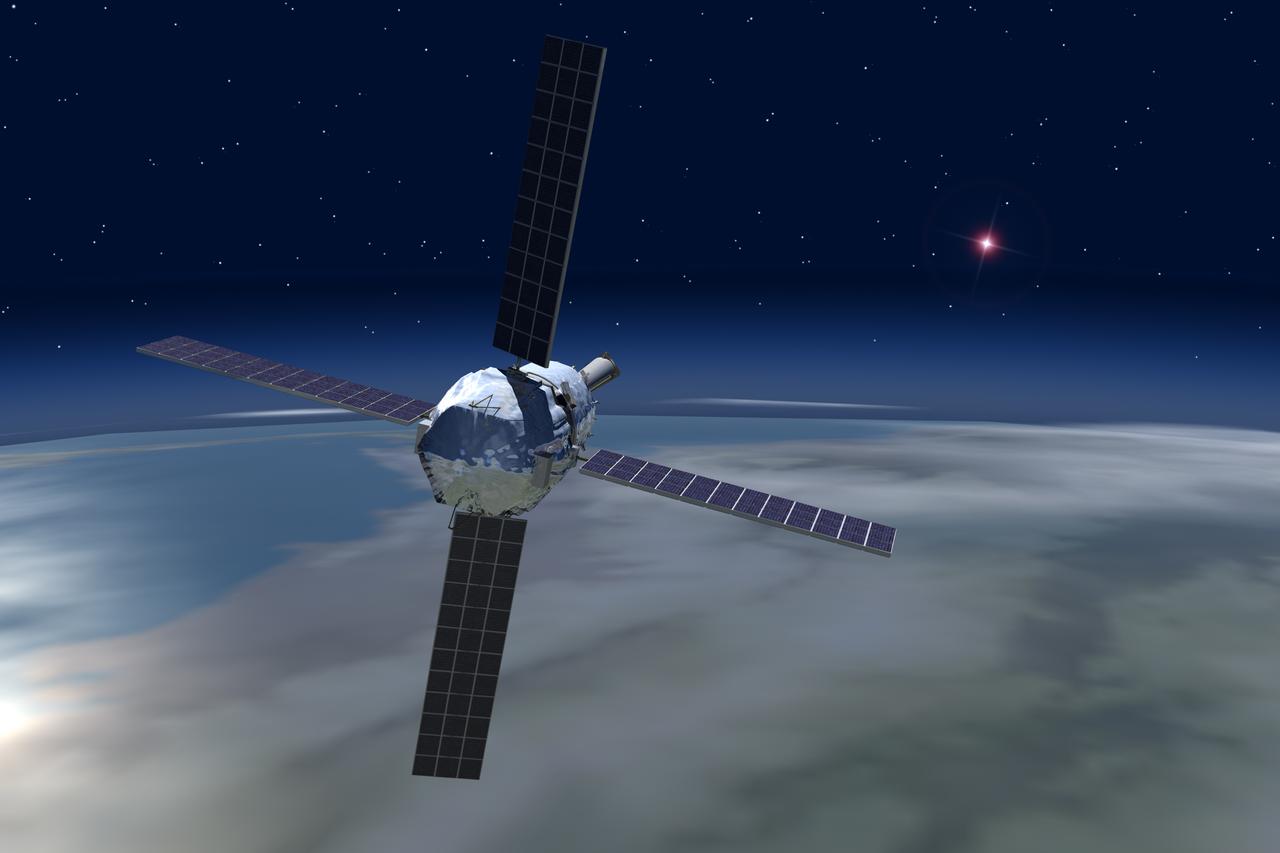
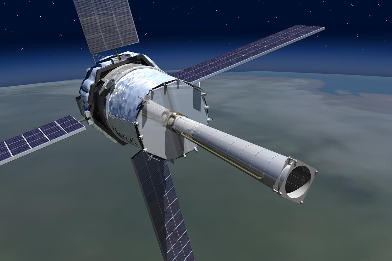
KENNEDY SPACE CENTER, FLA. - This seal illustrates the mission of the Gravity Probe B spacecraft and the organizations who developed the experiment: Stanford University, NASA’s Marshall Space Flight Center and Lockheed Martin. The Gravity Probe B mission will test the theory of curved spacetime and "frame-dragging," depicted graphically in the lower half, that was developed by Einstein and other scientists. Above the graphic is a drawing of GP-B circling the Earth.
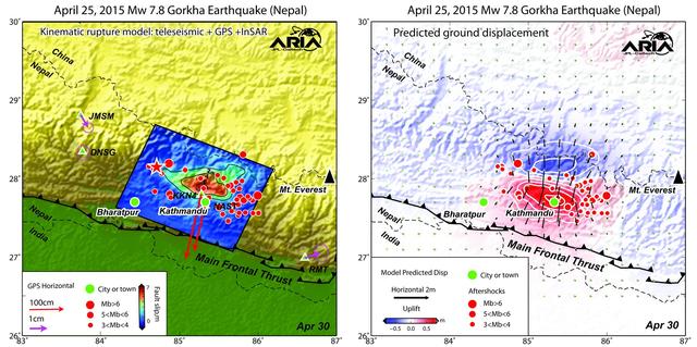
Using a combination of GPS-measured ground motion data, satellite radar data, and seismic observations from instruments distributed around the world, scientists have constructed preliminary estimates of how much the fault responsible for the April 25, 2015, magnitude 7.8 Gorkha earthquake in Nepal moved below Earth's surface (Figure 1). This information is useful for understanding not only what happened in the earthquake but also the potential for future events. It can also be used to infer a map of how Earth's surface moved due to the earthquake over a broader region (Figure 2). The maps created from these data can be viewed at PIA19384. In the first figure, the modeled slip on the fault is shown as viewed from above and indicated by the colors and contours within the rectangle. The peak slip in the fault exceeds 19.7 feet (6 meters). The ground motion measured with GPS is shown by the red and purple arrows and was used to develop the fault slip model. In the second figure, color represents vertical movement and the scaled arrows indicate direction and magnitude of horizontal movement. In both figures, aftershocks are indicated by red dots. Background color and shaded relief reflect regional variations in topography. The barbed lines show where the main fault reaches Earth's surface. The main fault dives northward into the Earth below the Himalaya. http://photojournal.jpl.nasa.gov/catalog/PIA19384
File name :DSC_0749.JPG File size :1.1MB(1174690Bytes) Date taken :2003/03/07 13:51:29 Image size :2000 x 1312 Resolution :300 x 300 dpi Number of bits :8bit/channel Protection attribute :Off Hide Attribute :Off Camera ID :N/A Camera :NIKON D1H Quality mode :FINE Metering mode :Matrix Exposure mode :Shutter priority Speed light :No Focal length :20 mm Shutter speed :1/500second Aperture :F11.0 Exposure compensation :0 EV White Balance :Auto Lens :20 mm F 2.8 Flash sync mode :N/A Exposure difference :0.0 EV Flexible program :No Sensitivity :ISO200 Sharpening :Normal Image Type :Color Color Mode :Mode II(Adobe RGB) Hue adjustment :3 Saturation Control :N/A Tone compensation :Normal Latitude(GPS) :N/A Longitude(GPS) :N/A Altitude(GPS) :N/A
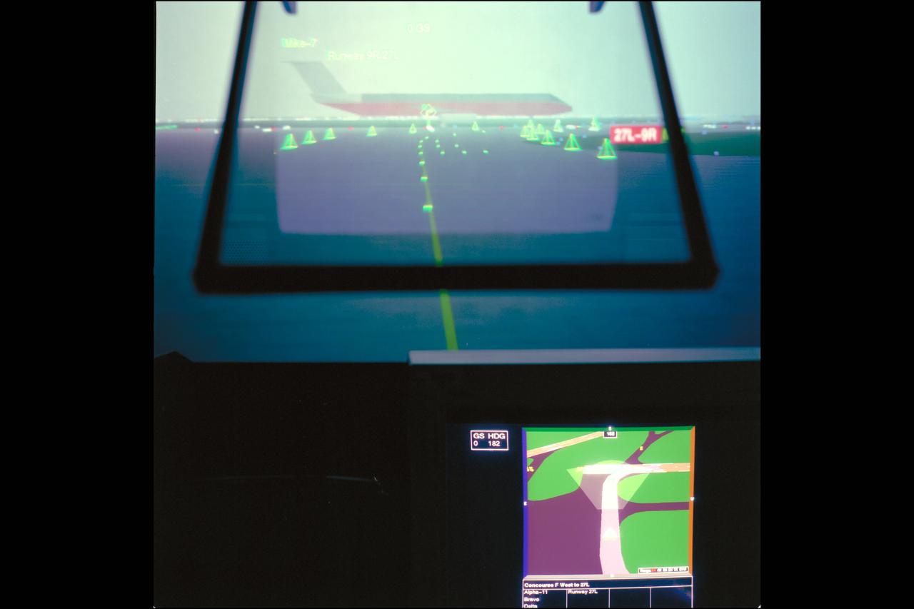
LVLASO (Low Visability Landing and Surface Operations) Project. Taxiway Navigation and Situtation Awareness (TNAS) system will help pilots taxi safely, particularly in low visibility weather conditions using a combination of cockpit displays and the GPS satellite positioning system. HUD SIMULATION DISPLAYS (FOG IN HEADS-UP DISPLAY).
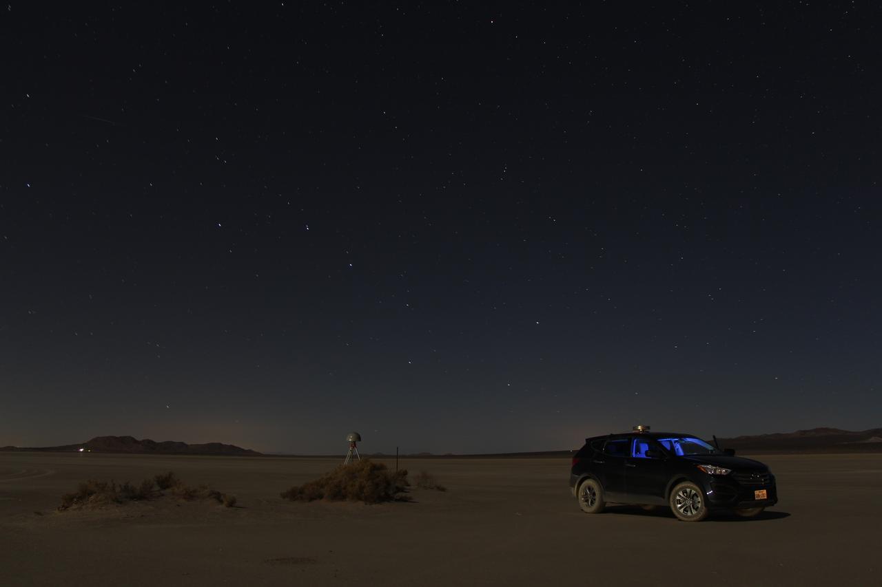
At first glance a dry lake bed in the southern California desert seems like the last place to prepare to study ice. But on Oct. 2, 2014, NASA’s Operation IceBridge carried out a ground-based GPS survey of the El Mirage lake bed in California’s Mojave Desert. Members of the IceBridge team are currently at NASA’s Armstrong Flight Research Center, preparing instruments aboard the DC-8 research aircraft for flights over Antarctica. Part of this preparation involves test flights over the desert, where researchers verify their instruments are working properly. El Mirage serves as a prime location for testing the mission’s laser altimeter, the Airborne Topographic Mapper, because the lake bed has a flat surface and reflects light similarly to snow and ice. This photo, taken shortly after the survey, shows the GPS-equipped survey vehicle and a stationary GPS station (left of the vehicle) on the lake bed with the constellation Ursa Major in the background. By driving the vehicle in parallel back and forth lines over a predefined area and comparing those GPS elevation readings with measurements from the stationary GPS, researchers are able to build an elevation map that will be used to precisely calibrate the laser altimeter for ice measurements. Credit: NASA/John Sonntag Operation IceBridge is scheduled to begin research flights over Antarctica on Oct. 15, 2014. The mission will be based out of Punta Arenas, Chile, until Nov. 23. For more information about IceBridge, visit: <a href="http://www.nasa.gov/icebridge" rel="nofollow">www.nasa.gov/icebridge</a> <b><a href="http://www.nasa.gov/audience/formedia/features/MP_Photo_Guidelines.html" rel="nofollow">NASA image use policy.</a></b> <b><a href="http://www.nasa.gov/centers/goddard/home/index.html" rel="nofollow">NASA Goddard Space Flight Center</a></b> enables NASA’s mission through four scientific endeavors: Earth Science, Heliophysics, Solar System Exploration, and Astrophysics. Goddard plays a leading role in NASA’s accomplishments by contributing compelling scientific knowledge to advance the Agency’s mission. <b>Follow us on <a href="http://twitter.com/NASAGoddardPix" rel="nofollow">Twitter</a></b> <b>Like us on <a href="http://www.facebook.com/pages/Greenbelt-MD/NASA-Goddard/395013845897?ref=tsd" rel="nofollow">Facebook</a></b> <b>Find us on <a href="http://instagram.com/nasagoddard?vm=grid" rel="nofollow">Instagram</a></b>
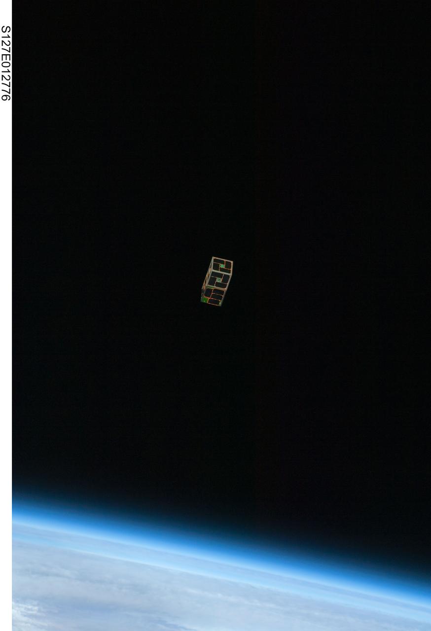
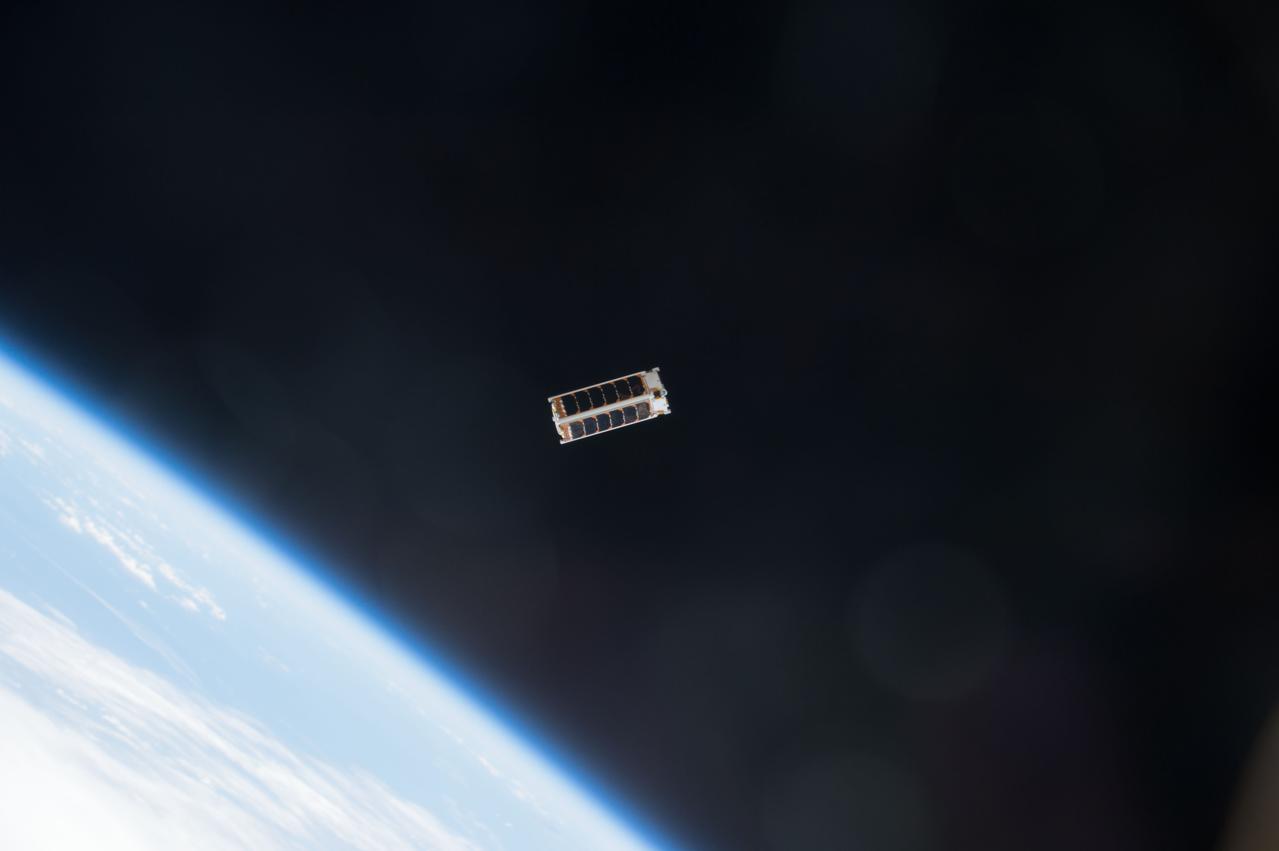
S127-E-012776 (30 July 2009) --- Backdropped by Earth?s horizon and the blackness of space, a Dual RF Astrodynamic GPS Orbital Navigator Satellite (DRAGONSat) is photographed after its release from Space Shuttle Endeavour?s payload bay by STS-127 crew members. DRAGONSat will look at independent rendezvous of spacecraft in orbit using Global Positioning Satellite data. The two satellites were designed and built by students at the University of Texas, Austin, and Texas A&M University, College Station.
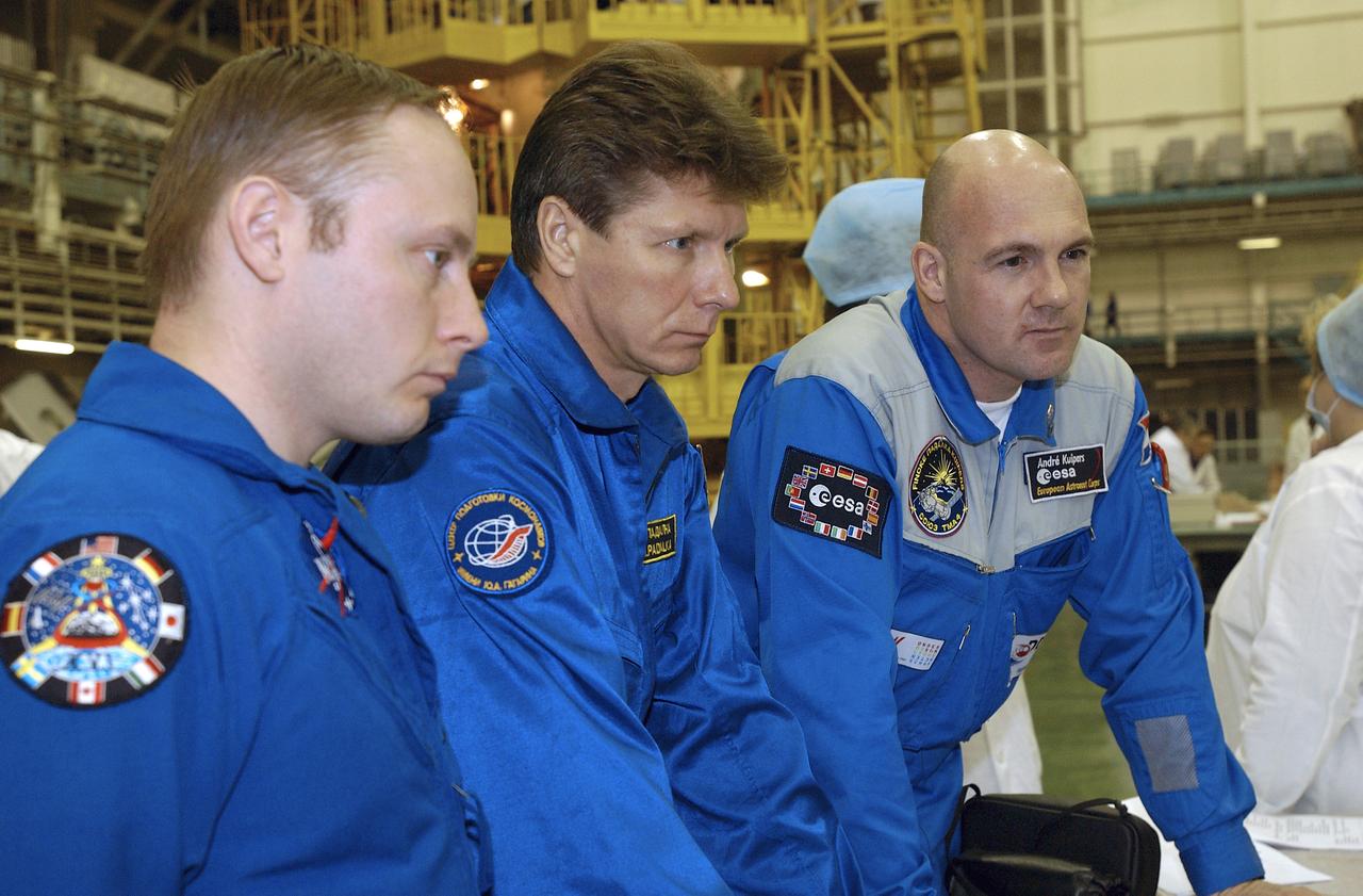
Expedition 9 Science Officer and Flight Engineer Mike Fincke, left, Expedition 9 Commander Gennady Padalka, center and European Space Agency astronaut Andre Kuipers of the Netherlands listen to instructions on satellite phone and GPS use in building 254 at the Baikonur Cosmodrome, Wednesday, April 14, 2004, in Baikonur, Kazakhstan. Photo Credit: (NASA/Bill Ingalls)
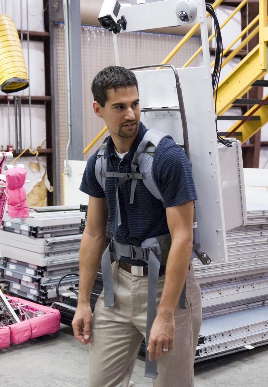
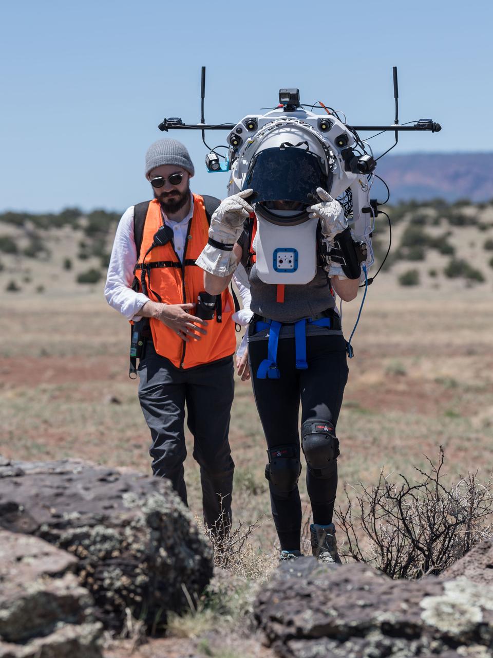
Mike Miller demonstrates one of the backpacks his team designed and built for the Desert Research and Technology Studies project's upcoming field test in Arizona. Miller led the team that developed the backpacks. The backpacks are equipped with GPS antennas, communications components and cameras. They are meant to show researchers what an astronaut might need to explore an alien world and give designers a look at the hardships the equipment could encounter. Photo credit: NASA/Frank Michaux
![iss056e142697 (8/15/2018) --- A view of Cosmonaut in red-striped Orlan suit, as he works to install Payload “ICARUS” on URM-D work station on PI.II of SM [PO] during ISS Extravehicular Activity 45 (EVA 45). ICARUS is a collaborative project between Roscosmos and the German aerospace center (DLR) to study the migratory patterns of small animals tagged on earth with GPS hardware.](https://images-assets.nasa.gov/image/iss056e142697/iss056e142697~medium.jpg)
iss056e142697 (8/15/2018) --- A view of Cosmonaut in red-striped Orlan suit, as he works to install Payload “ICARUS” on URM-D work station on PI.II of SM [PO] during ISS Extravehicular Activity 45 (EVA 45). ICARUS is a collaborative project between Roscosmos and the German aerospace center (DLR) to study the migratory patterns of small animals tagged on earth with GPS hardware.
iss050e031340 (1/16/2017) --- Photo documentation of the Japanese-Small Satellite Orbital Deployer-6 (J-SSOD-6) deployment of the ECG Cubesat. The EGG Satellite (re-Entry satellite with Gossamer aeroshell and GPS/Iridium) developed at the University of Tokyo, demonstrates a deployable aeroshell to first act as a drag device and then protect the satellite during the initial stages of re-entry.
Expedition 9 Science Officer and Flight Engineer Mike Fincke, left, Expedition 9 Commander Gennady Padalka, second from left and Flight Engineer and European Space Agency astronaut Andre Kuipers of the Netherlands listen to instructions on satellite phone and GPS use at building 254 at Baikonur Cosmodrome Wednesday, April 14, 2004, in Baikonur, Kazakhstan. Photo Credit: (NASA/Bill Ingalls)
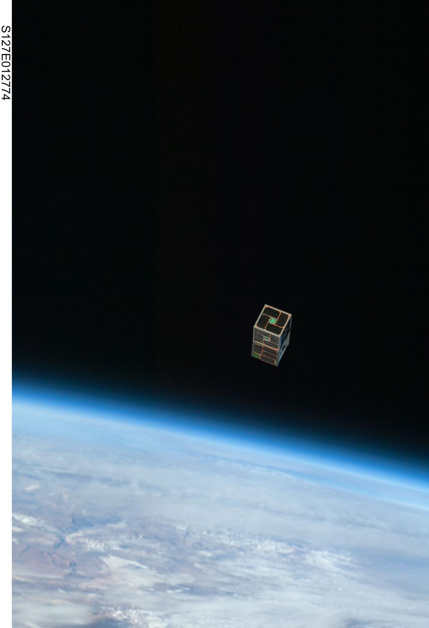
S127-E-012774 (30 July 2009) --- Backdropped by Earth?s horizon and the blackness of space, a Dual RF Astrodynamic GPS Orbital Navigator Satellite (DRAGONSat) is photographed after its release from Space Shuttle Endeavour?s payload bay by STS-127 crew members. DRAGONSat will look at independent rendezvous of spacecraft in orbit using Global Positioning Satellite data. The two satellites were designed and built by students at the University of Texas, Austin, and Texas A&M University, College Station.
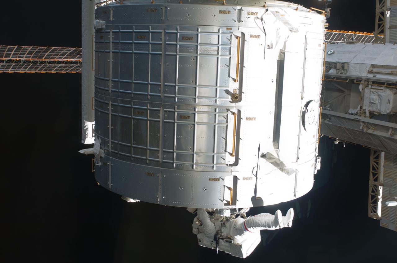
S119-E-006858 (21 March 2009) --- Astronaut Steve Swanson, STS-119 mission specialist, participates in the mission's second scheduled session of extravehicular activity (EVA) as construction and maintenance continue on the International Space Station. During the six-hour, 30-minute spacewalk Swanson and astronaut Joseph Acaba (out of frame), mission specialist, prepared a worksite so the STS-127 spacewalkers can more easily change out the Port 6 truss batteries later this year. On the Japanese Kibo laboratory they installed a second Global Positioning Satellite antenna that will be used for the planned rendezvous of the Japanese HTV cargo ship in September. They photographed areas of radiator panels extended from the Port 1 and Starboard 1 trusses and reconfigured connectors at a patch panel on the Zenith 1 truss that power Control Moment Gyroscopes.
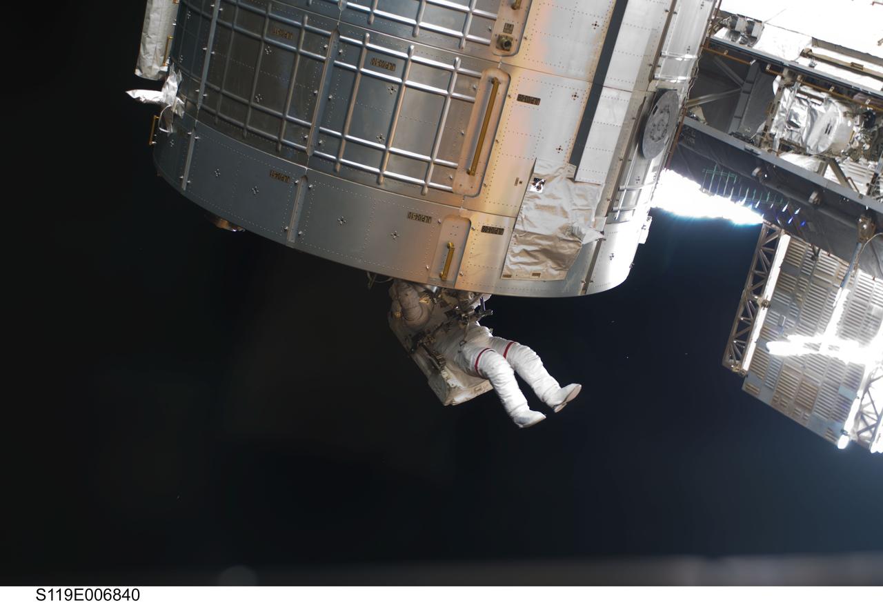
S119-E-006840 (21 March 2009) --- Astronaut Steve Swanson, STS-119 mission specialist, participates in the mission's second scheduled session of extravehicular activity (EVA) as construction and maintenance continue on the International Space Station. During the six-hour, 30-minute spacewalk Swanson and astronaut Joseph Acaba (out of frame), mission specialist, prepared a worksite so the STS-127 spacewalkers can more easily change out the Port 6 truss batteries later this year. On the Japanese Kibo laboratory they installed a second Global Positioning Satellite antenna that will be used for the planned rendezvous of the Japanese HTV cargo ship in September. They photographed areas of radiator panels extended from the Port 1 and Starboard 1 trusses and reconfigured connectors at a patch panel on the Zenith 1 truss that power Control Moment Gyroscopes.
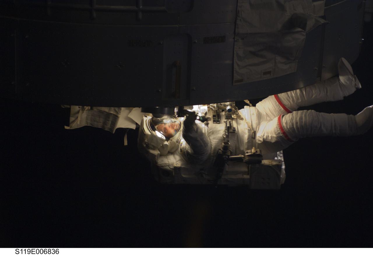
S119-E-006836 (21 March 2009) --- Astronaut Steve Swanson, STS-119 mission specialist, participates in the mission's second scheduled session of extravehicular activity (EVA) as construction and maintenance continue on the International Space Station. During the six-hour, 30-minute spacewalk Swanson and astronaut Joseph Acaba (out of frame), mission specialist, prepared a worksite so the STS-127 spacewalkers can more easily change out the Port 6 truss batteries later this year. On the Japanese Kibo laboratory they installed a second Global Positioning Satellite antenna that will be used for the planned rendezvous of the Japanese HTV cargo ship in September. They photographed areas of radiator panels extended from the Port 1 and Starboard 1 trusses and reconfigured connectors at a patch panel on the Zenith 1 truss that power Control Moment Gyroscopes.
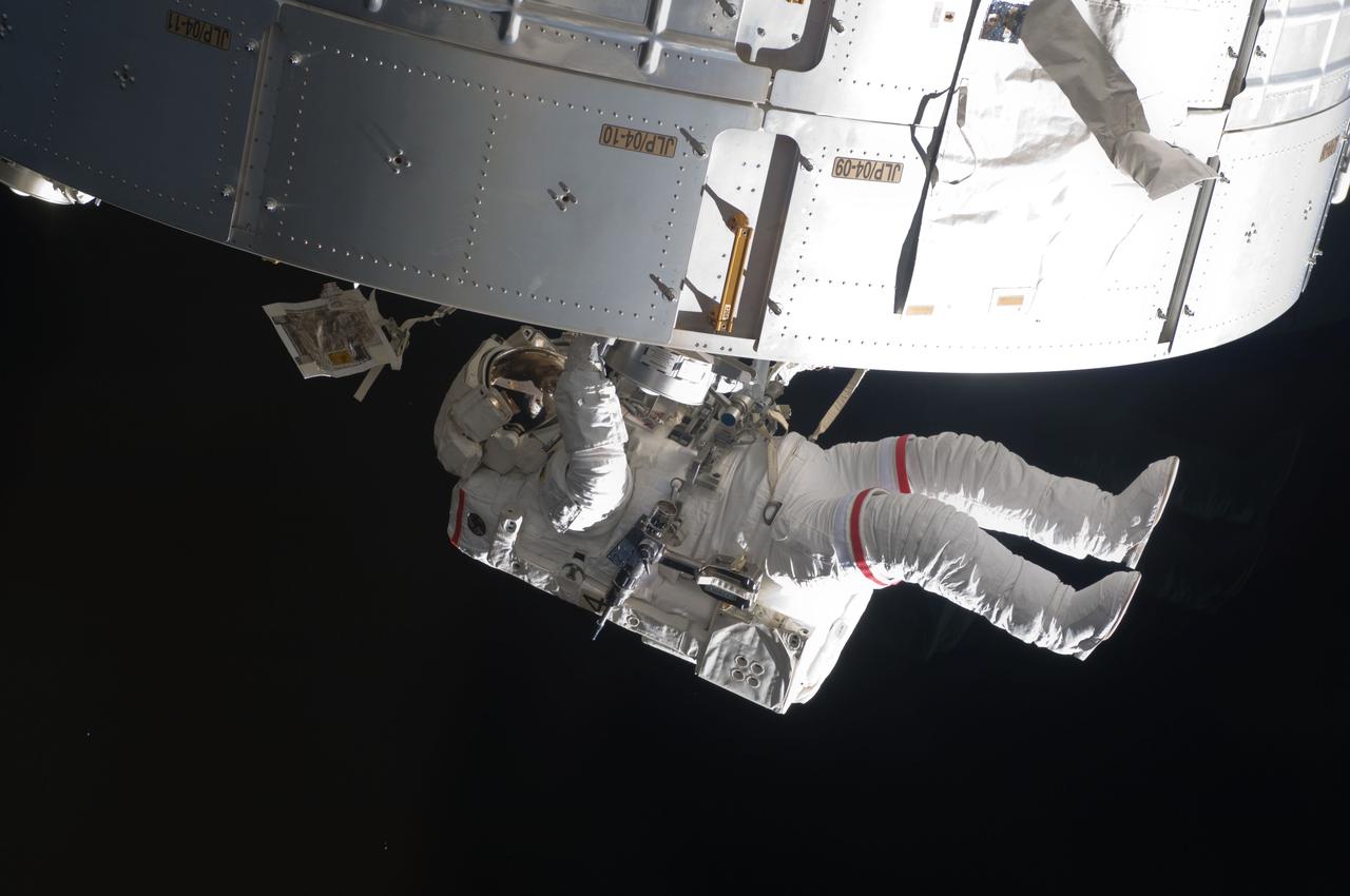
S119-E-006861 (21 March 2009) --- Astronaut Steve Swanson, STS-119 mission specialist, participates in the mission's second scheduled session of extravehicular activity (EVA) as construction and maintenance continue on the International Space Station. During the six-hour, 30-minute spacewalk Swanson and astronaut Joseph Acaba (out of frame), mission specialist, prepared a worksite so the STS-127 spacewalkers can more easily change out the Port 6 truss batteries later this year. On the Japanese Kibo laboratory they installed a second Global Positioning Satellite antenna that will be used for the planned rendezvous of the Japanese HTV cargo ship in September. They photographed areas of radiator panels extended from the Port 1 and Starboard 1 trusses and reconfigured connectors at a patch panel on the Zenith 1 truss that power Control Moment Gyroscopes.
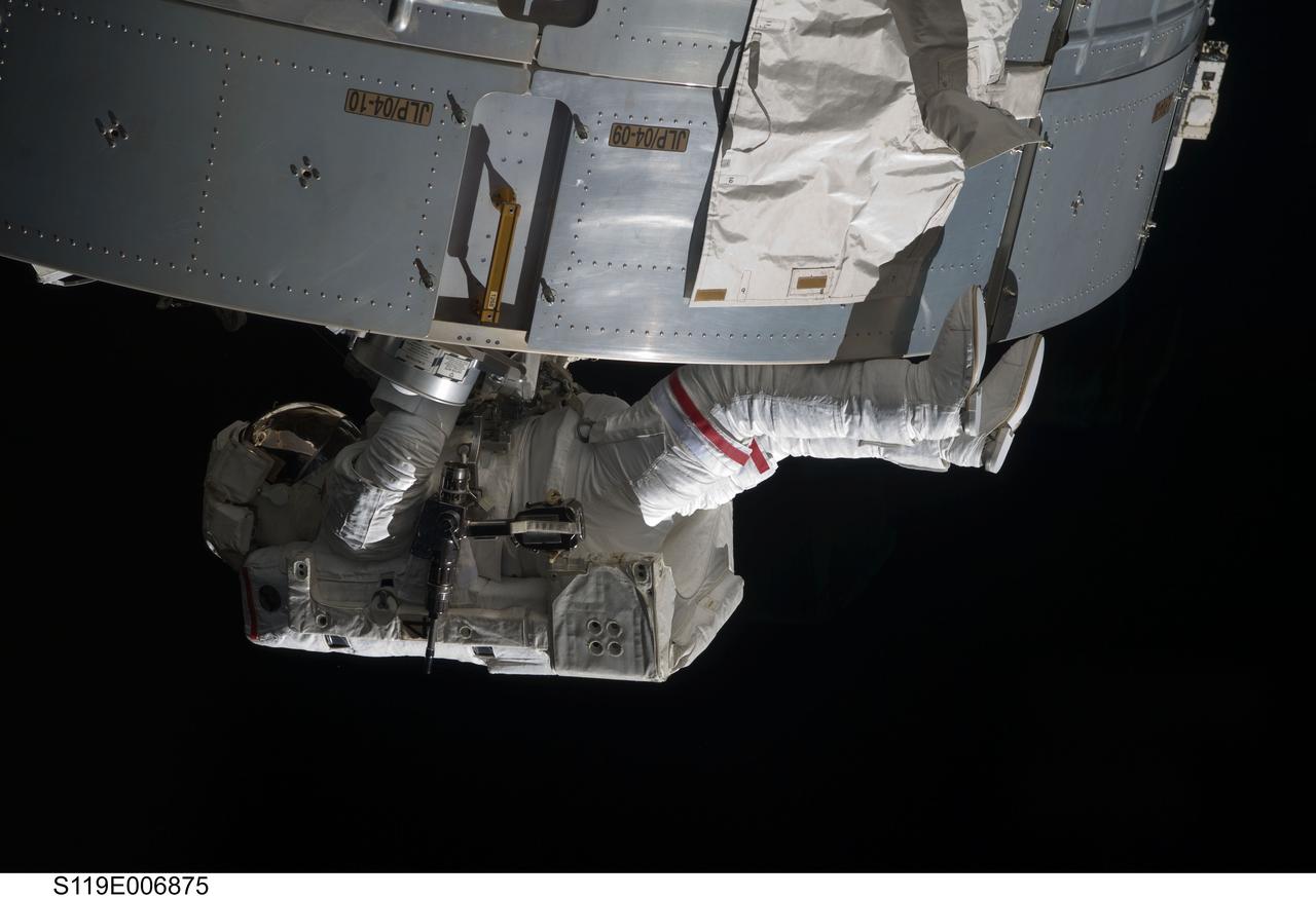
S119-E-006875 (21 March 2009) --- Astronaut Steve Swanson, STS-119 mission specialist, participates in the mission's second scheduled session of extravehicular activity (EVA) as construction and maintenance continue on the International Space Station. During the six-hour, 30-minute spacewalk Swanson and astronaut Joseph Acaba (out of frame), mission specialist, prepared a worksite so the STS-127 spacewalkers can more easily change out the Port 6 truss batteries later this year. On the Japanese Kibo laboratory they installed a second Global Positioning Satellite antenna that will be used for the planned rendezvous of the Japanese HTV cargo ship in September. They photographed areas of radiator panels extended from the Port 1 and Starboard 1 trusses and reconfigured connectors at a patch panel on the Zenith 1 truss that power Control Moment Gyroscopes.
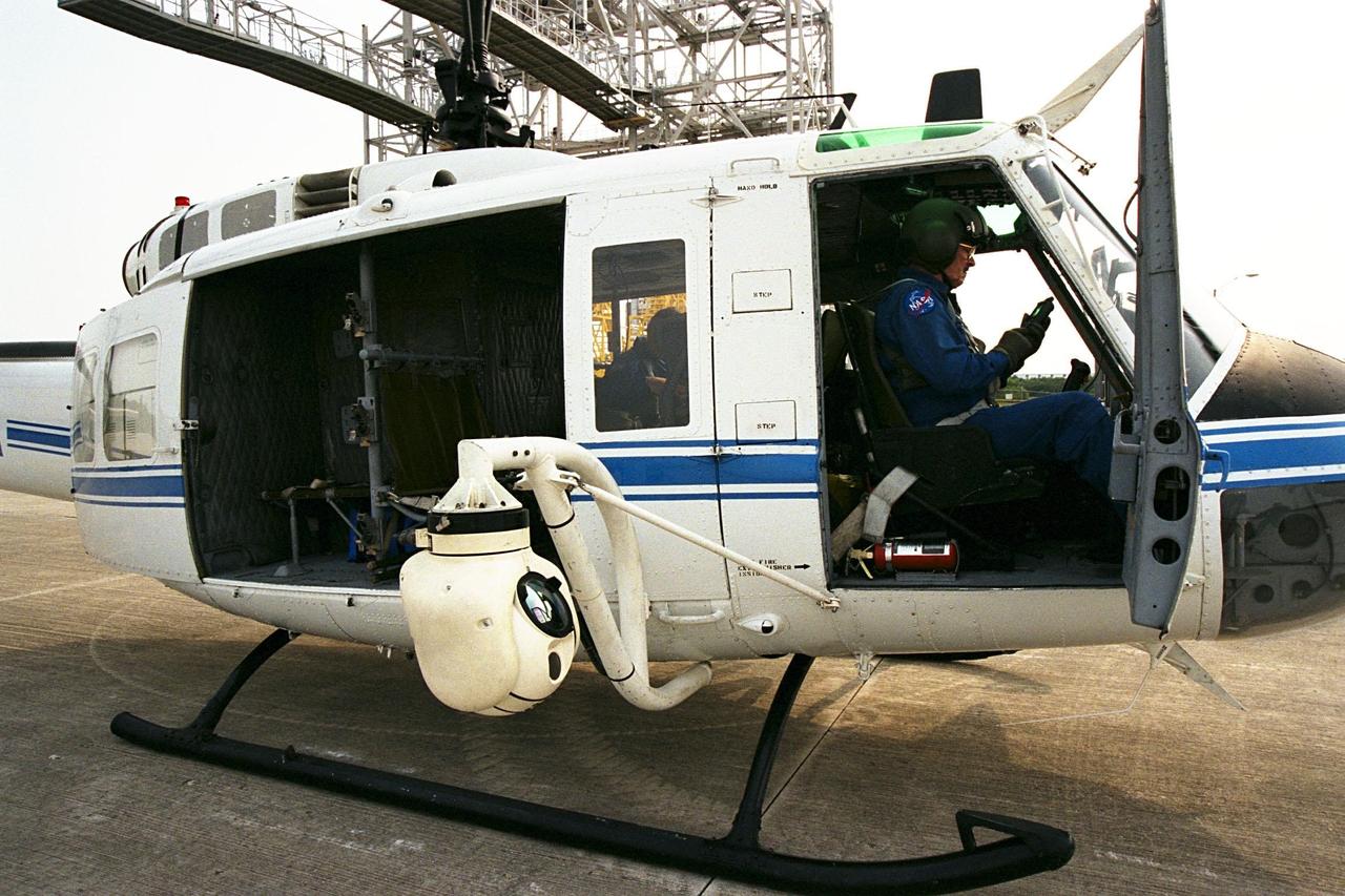
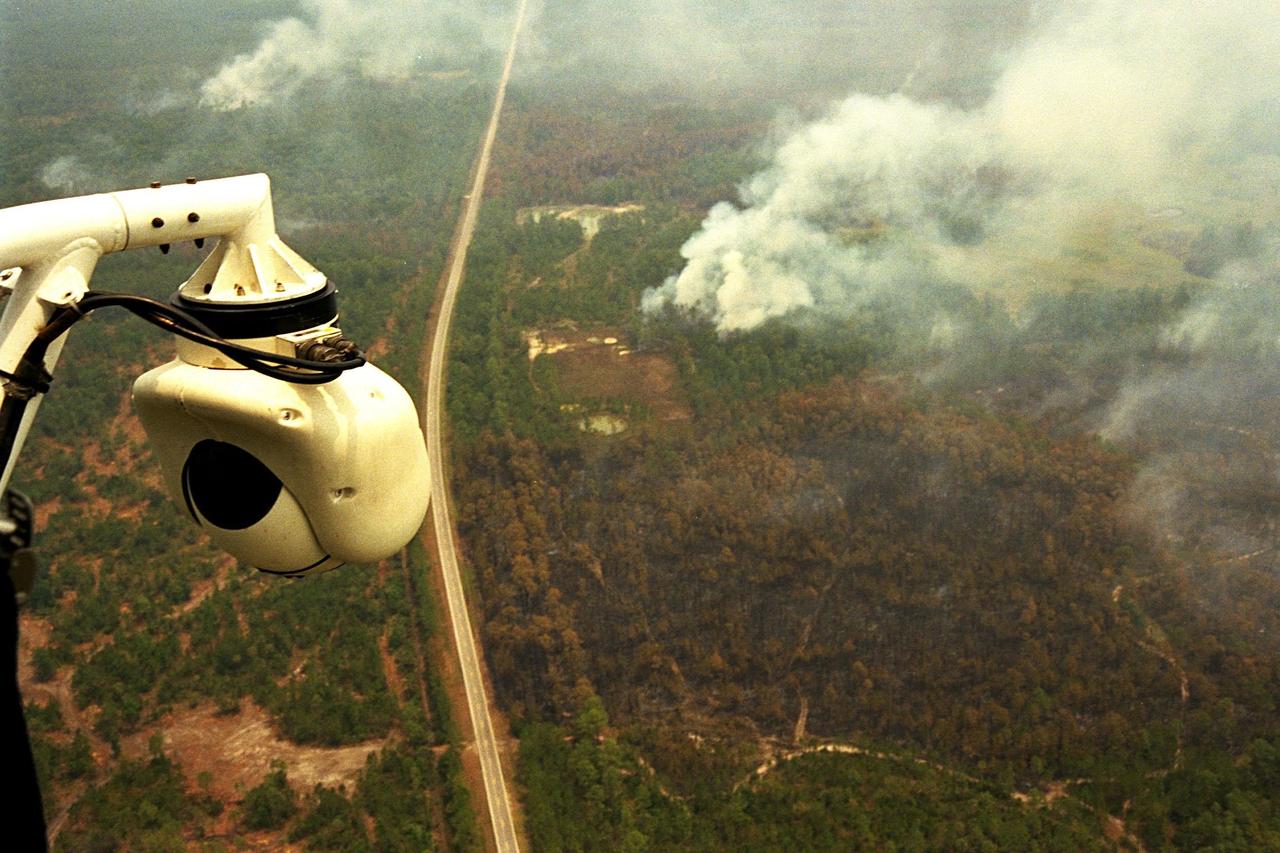
KENNEDY SPACE CENTER, FLA. -- A beach ball-sized infrared camera, part of the Forward Looking Infrared Radar (FLIR), has been mounted on the right siderail of NASA's Huey UH-1 helicopter. A KSC pilot prepares to fly the helicopter, which has also been outfitted with a portable global positioning satellite (GPS) system, to support Florida's Division of Forestry as they fight the brush fires which have been plaguing the state as a result of extremely dry conditions and lightning storms. The FLIR also includes a real-time television monitor and recorder installed inside the helicopter. While the FLIR collects temperature data and images, the GPS system provides the exact coordinates of the fires being observed and transmits the data to the firefighters on the ground. The Kennedy Space Center (KSC) security team routinely uses the FLIR equipment prior to Shuttle launch and landing activities to ensure that the area surrounding the launch pad and runway are clear of unauthorized personnel. KSC's Base Operations Contractor, EG&G Florida, operates the NASA-owned helicopter
KENNEDY SPACE CENTER, FLA. -- A beach ball-sized infrared camera, part of the Forward Looking Infrared Radar (FLIR), has been mounted on the right siderail of NASA's Huey UH-1 helicopter and is being used to search for fires in Volusia County, Florida. The helicopter has also been outfitted with a portable global positioning satellite (GPS) system to support Florida's Division of Forestry as they fight the brush fires which have been plaguing the state as a result of extremely dry conditions and lightning storms. The FLIR also includes a real-time television monitor and recorder installed inside the helicopter. While the FLIR collects temperature data and images, the GPS system provides the exact coordinates of the fires being observed and transmits the data to the firefighters on the ground. The Kennedy Space Center (KSC) security team routinely uses the FLIR equipment prior to Shuttle launch and landing activities to ensure that the area surrounding the launch pad and runway are clear of unauthorized personnel. KSC's Base Operations Contractor, EG&G Florida, operates the NASA-owned helicopter
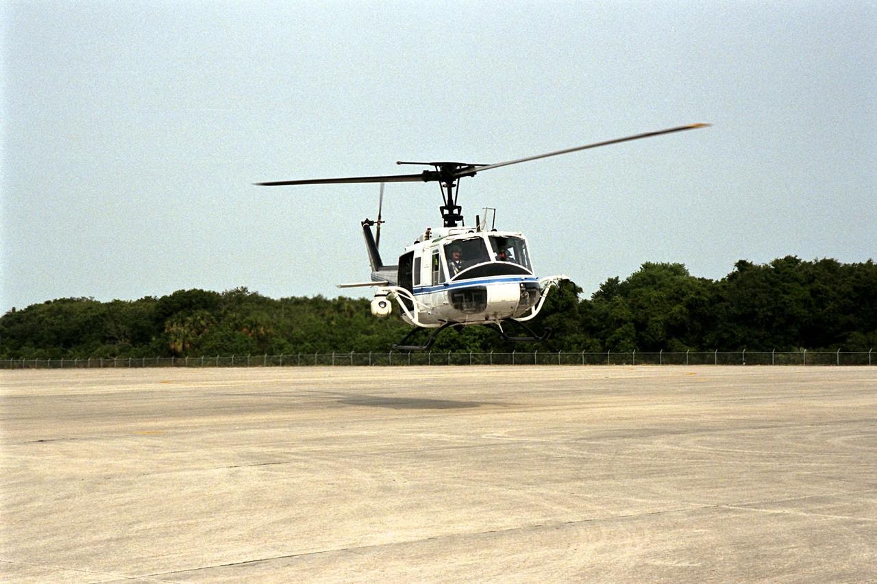
KENNEDY SPACE CENTER, FLA. -- NASA's Huey UH-1 helicopter lands at the Shuttle Landing Facility to pick up Kennedy Space Center (KSC) Security personnel who operate the Forward Looking Infrared Radar (FLIR) installed on board. The helicopter has also been outfitted with a portable global positioning satellite (GPS) system to support Florida's Division of Forestry as they fight the brush fires which have been plaguing the state as a result of extremely dry conditions and lightning storms. The FLIR includes a beach ball-sized infrared camera that is mounted on the helicopter's right siderail and a real-time television monitor and recorder installed inside. While the FLIR collects temperature data and images, the GPS system provides the exact coordinates of the fires being observed and transmits the data to the firefighters on the ground. KSC's security team routinely uses the FLIR equipment prior to Shuttle launch and landing activities to ensure that the area surrounding the launch pad and runway are clear of unauthorized personnel. KSC's Base Operations Contractor, EG&G Florida, operates the NASA-owned helicopter
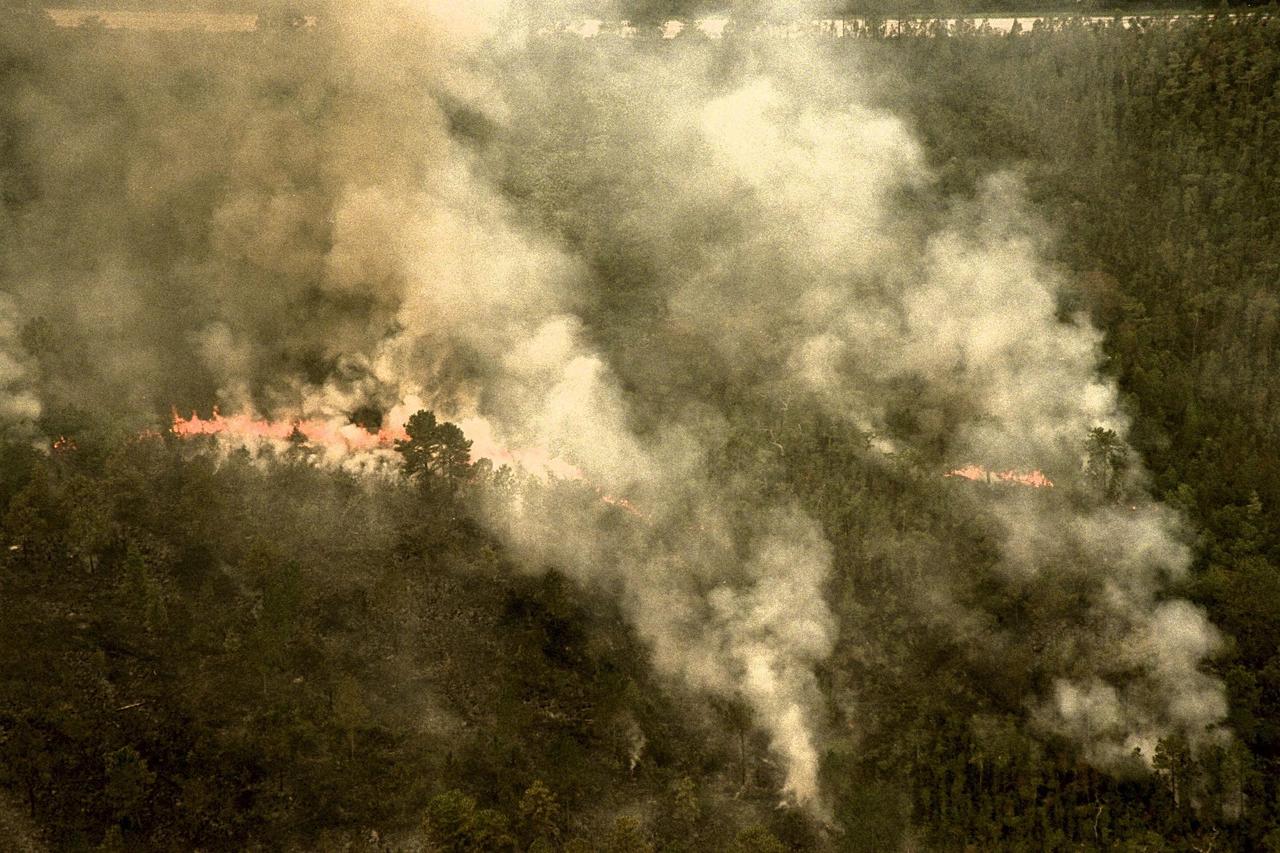
KENNEDY SPACE CENTER, FLA. -- A forest fire burning in Volusia County, Florida, is clearly visible from NASA's Huey UH-1 helicopter. The helicopter has been outfitted with a Forward Looking Infrared Radar (FLIR) and a portable global positioning satellite (GPS) system to support Florida's Division of Forestry as they fight the brush fires which have been plaguing the state as a result of extremely dry conditions and lightning storms. The FLIR includes a beach ball-sized infrared camera that is mounted on the helicopter's right siderail and a real-time television monitor and recorder installed inside. While the FLIR collects temperature data and images, the GPS system provides the exact coordinates of the fires being observed and transmits the data to the firefighters on the ground. The Kennedy Space Center (KSC) security team routinely uses the FLIR equipment prior to Shuttle launch and landing activities to ensure that the area surrounding the launch pad and runway are clear of unauthorized personnel. KSC's Base Operations Contractor, EG&G Florida, operates the NASA-owned helicopter
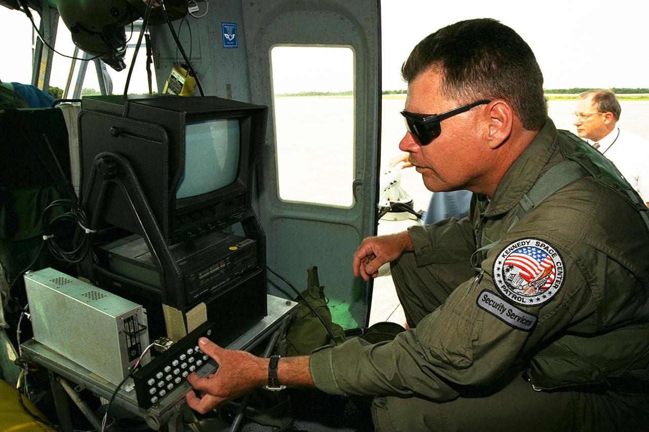
KENNEDY SPACE CENTER, FLA. -- Sgt. Mark Hines, of Kennedy Space Center (KSC) Security, checks out equipment used to operate the Forward Looking Infrared Radar (FLIR) installed on NASA's Huey UH-1 helicopter. The helicopter has also been outfitted with a portable global positioning satellite (GPS) system to support Florida's Division of Forestry as they fight the brush fires which have been plaguing the state as a result of extremely dry conditions and lightning storms. The FLIR includes a beach ball-sized infrared camera that is mounted on the helicopter's right siderail and a real-time television monitor and recorder installed inside. While the FLIR collects temperature data and images, the GPS system provides the exact coordinates of the fires being observed and transmits the data to the firefighters on the ground. KSC's security team routinely uses the FLIR equipment prior to Shuttle launch and landing activities to ensure that the area surrounding the launch pad and runway are clear of unauthorized personnel. KSC's Base Operations Contractor, EG&G Florida, operates the NASA-owned helicopter
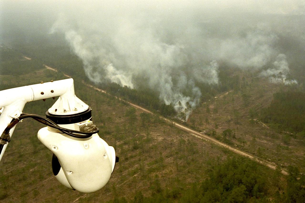
KENNEDY SPACE CENTER, FLA. -- A beach ball-sized infrared camera, part of the Forward Looking Infrared Radar (FLIR), has been mounted on the right siderail of NASA's Huey UH-1 helicopter and is being used to scan a large area of Volusia County, Florida, where a fire burns. The helicopter has also been outfitted with a portable global positioning satellite (GPS) system to support Florida's Division of Forestry as they fight the brush fires which have been plaguing the state as a result of extremely dry conditions and lightning storms. The FLIR also includes a real-time television monitor and recorder installed inside the helicopter. While the FLIR collects temperature data and images, the GPS system provides the exact coordinates of the fires being observed and transmits the data to the firefighters on the ground. The Kennedy Space Center (KSC) security team routinely uses the FLIR equipment prior to Shuttle launch and landing activities to ensure that the area surrounding the launch pad and runway are clear of unauthorized personnel. KSC's Base Operations Contractor, EG&G Florida, operates the NASA-owned helicopter
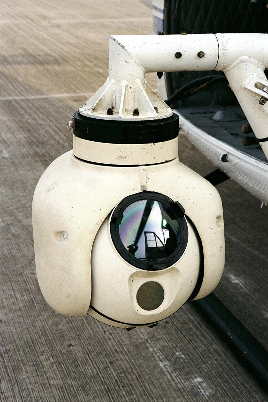
KENNEDY SPACE CENTER, FLA. -- A beach ball-sized infrared camera, part of the Forward Looking Infrared Radar (FLIR), has been mounted on the right siderail of NASA's Huey UH-1 helicopter. The helicopter has also been outfitted with a portable global positioning satellite (GPS) system to support Florida's Division of Forestry as they fight the brush fires which have been plaguing the state as a result of extremely dry conditions and lightning storms. The FLIR also includes a real-time television monitor and recorder installed inside the helicopter. While the FLIR collects temperature data and images, the GPS system provides the exact coordinates of the fires being observed and transmits the data to the firefighters on the ground. The Kennedy Space Center (KSC) security team routinely uses the FLIR equipment prior to Shuttle launch and landing activities to ensure that the area surrounding the launch pad and runway are clear of unauthorized personnel. KSC's Base Operations Contractor, EG&G Florida, operates the NASA-owned helicopter
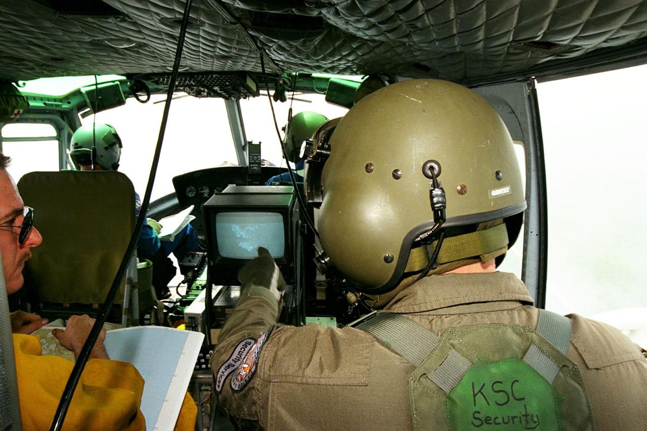
KENNEDY SPACE CENTER, FLA. -- Sgt. Mark Hines, of Kennedy Space Center (KSC) Security, points out a view of a fire on the Forward Looking Infrared Radar (FLIR) video screen to Greg Dunn, of Florida's Division of Forestry, as KSC pilots fly NASA's Huey UH-1 helicopter over fires burning in Volusia County, Florida. The FLIR includes a beach-ball sized infrared camera that is mounted on the helicopter's right siderail and a real-time TV monitor and recorder installed inside. The helicopter has also been outfitted with a portable global positioning satellite (GPS) system to support the Division of Forestry as they fight the brush fires which have been plaguing the state as a result of extremely dry conditions and lightning storms. While the FLIR collects temperature data and images, the GPS system provides the exact coordinates of the fires being observed and transmits the data to the firefighters on the ground. KSC's security team routinely uses the FLIR equipment prior to Shuttle launch and landing activities to ensure that the area surrounding the launch pad and runway are clear of unauthorized personnel. KSC's Base Operations Contractor, EG&G Florida, operates the NASA-owned helicopter.
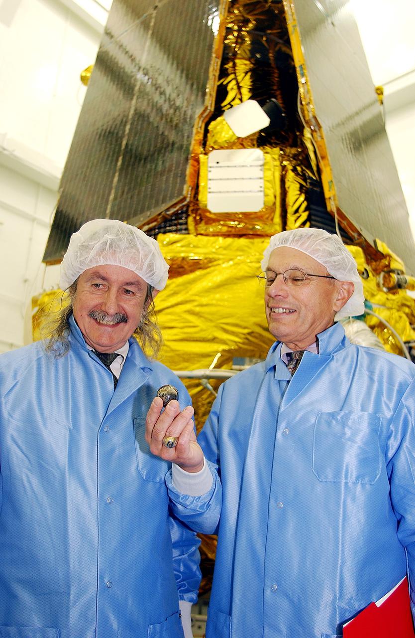
VANDENBERG AFB, CALIF. - In the NASA spacecraft processing facility on North Vandenberg Air Force Base, Dr. Francis Everitt, principal investigator, and Brad Parkinson, co-principal investigator, both from Stanford University, hold one of the small gyroscopes used in the Gravity Probe B spacecraft. The GP-B towers behind them. The Gravity Probe B mission is a relativity experiment developed by NASA’s Marshall Space Flight Center, Stanford University and Lockheed Martin. The spacecraft will test two extraordinary predictions of Albert Einstein’s general theory of relativity that he advanced in 1916: the geodetic effect (how space and time are warped by the presence of the Earth) and frame dragging (how Earth’s rotation drags space and time around with it). Gravity Probe B consists of four sophisticated gyroscopes that will provide an almost perfect space-time reference system. The mission will look in a precision manner for tiny changes in the direction of spin.
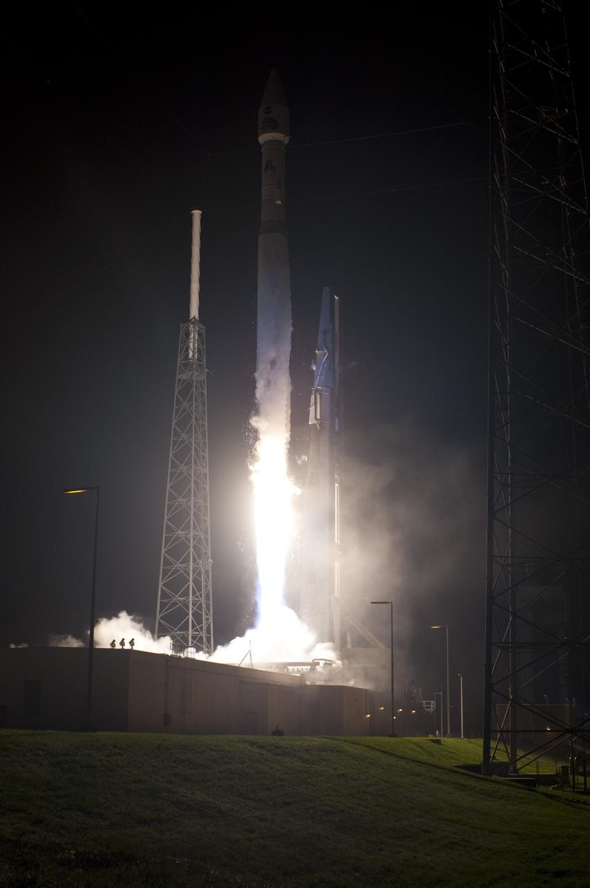
CAPE CANAVERAL, Fla. – The United Launch Alliance Atlas V rocket carrying NASA's Radiation Belt Storm Probes, or RBSP, lifts off Space Launch Complex 41 on Cape Canaveral Air Force Station in Florida at 4:05 a.m. EDT. RBSP will explore changes in Earth's space environment caused by the sun -- known as "space weather" -- that can disable satellites, create power-grid failures and disrupt GPS service. The mission also will provide data on the fundamental radiation and particle acceleration processes throughout the universe. For more information on RBSP, visit http://www.nasa.gov/rbsp. Photo credit: NASA/Tony Gray and Robert Murray
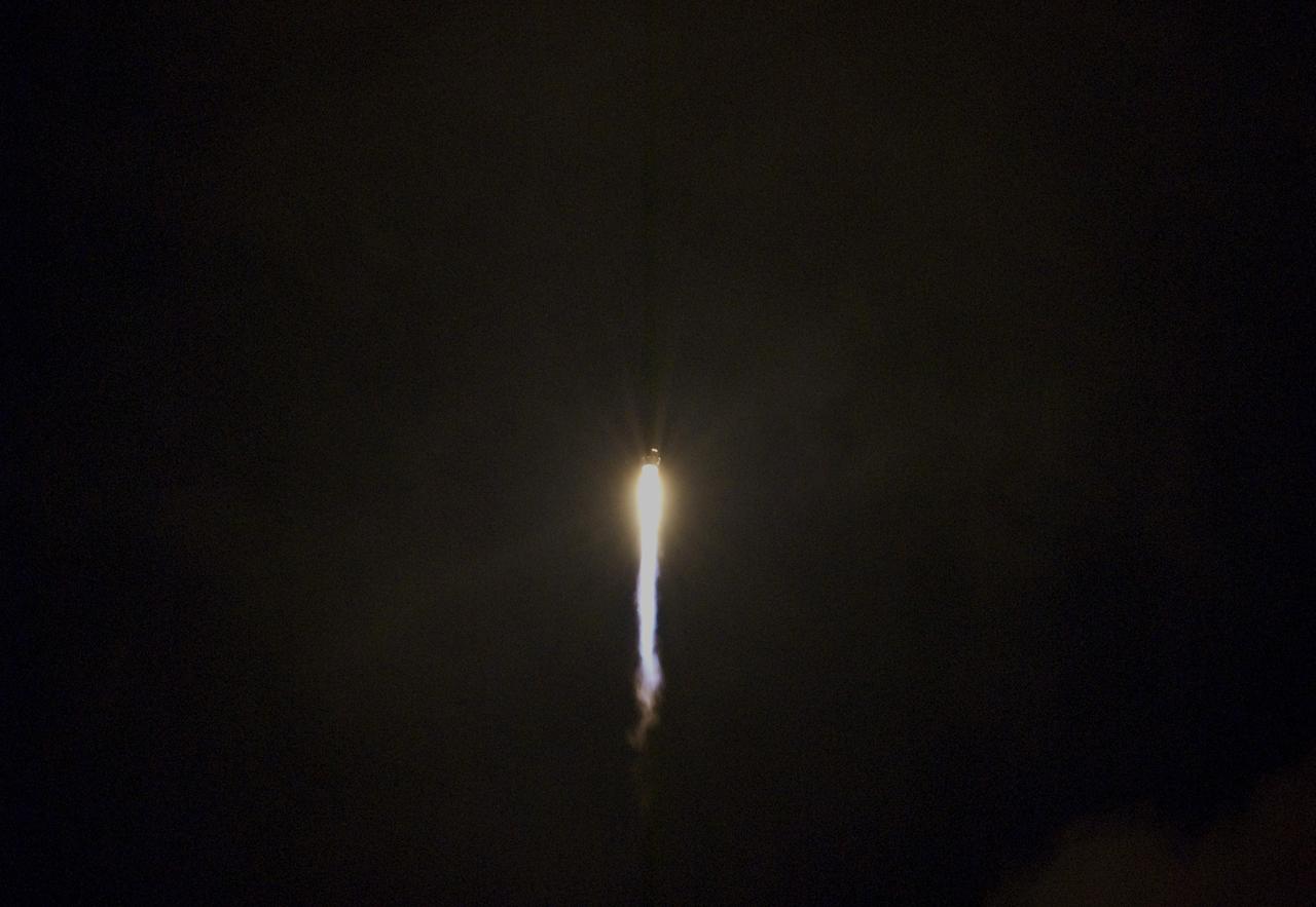
CAPE CANAVERAL, Fla. – The United Launch Alliance Atlas V rocket carrying NASA's Radiation Belt Storm Probes, or RBSP, disappears into the night sky over Space Launch Complex 41 on Cape Canaveral Air Force Station in Florida following liftoff at 4:05 a.m. EDT. RBSP will explore changes in Earth's space environment caused by the sun -- known as "space weather" -- that can disable satellites, create power-grid failures and disrupt GPS service. The mission also will provide data on the fundamental radiation and particle acceleration processes throughout the universe. For more information on RBSP, visit http://www.nasa.gov/rbsp. Photo credit: NASA/Gianni Woods