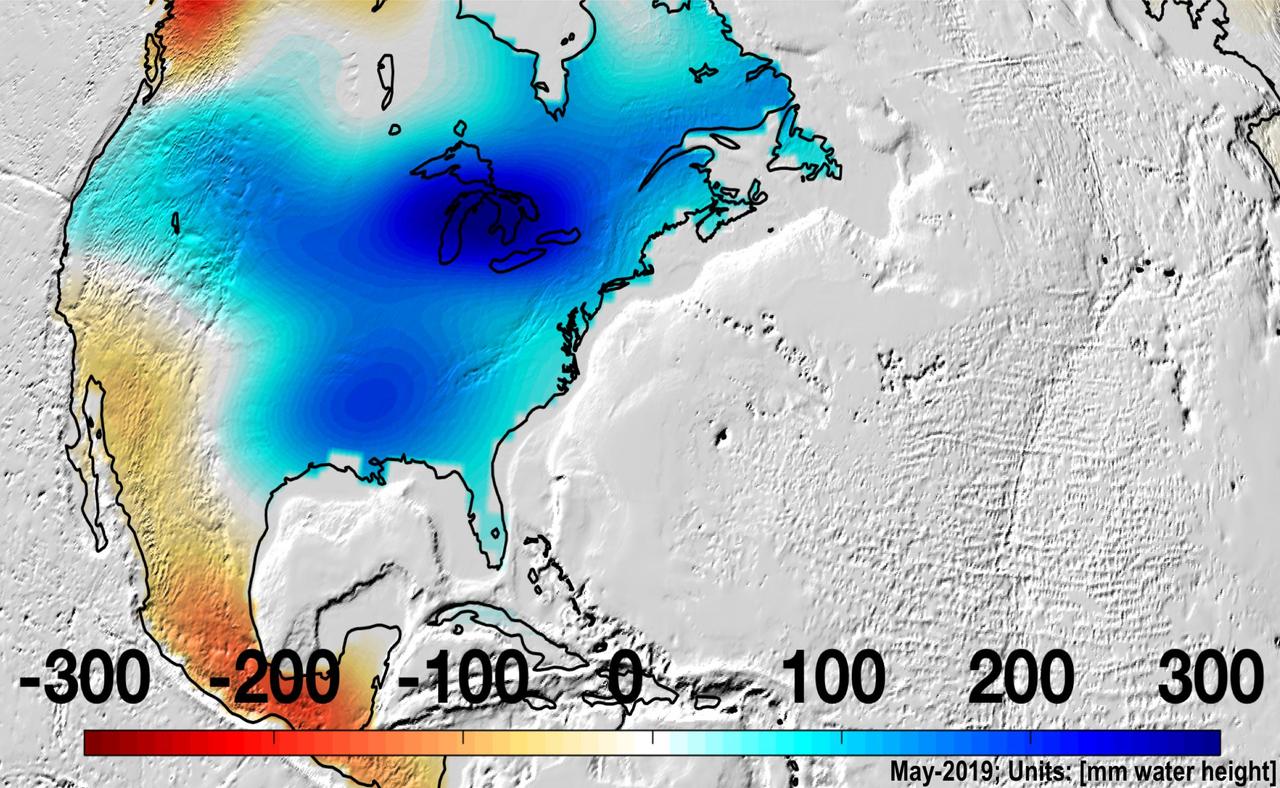
North America was almost entirely above its long-term average in mass in May 2019, due to Midwestern flooding, with the runoff raising the Great Lakes to record levels. https://photojournal.jpl.nasa.gov/catalog/PIA22840
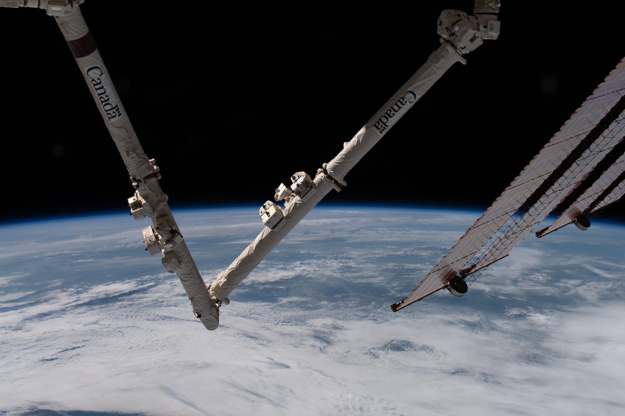
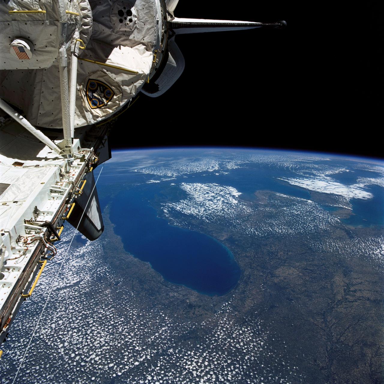
iss059e039713 (May 2, 2019) --- The Earth's limb and portions of the International Space Station's Canadarm2 robotic arm and solar arrays jut into the frame as the orbital complex flew 258 miles above the Great Lakes region of North America.
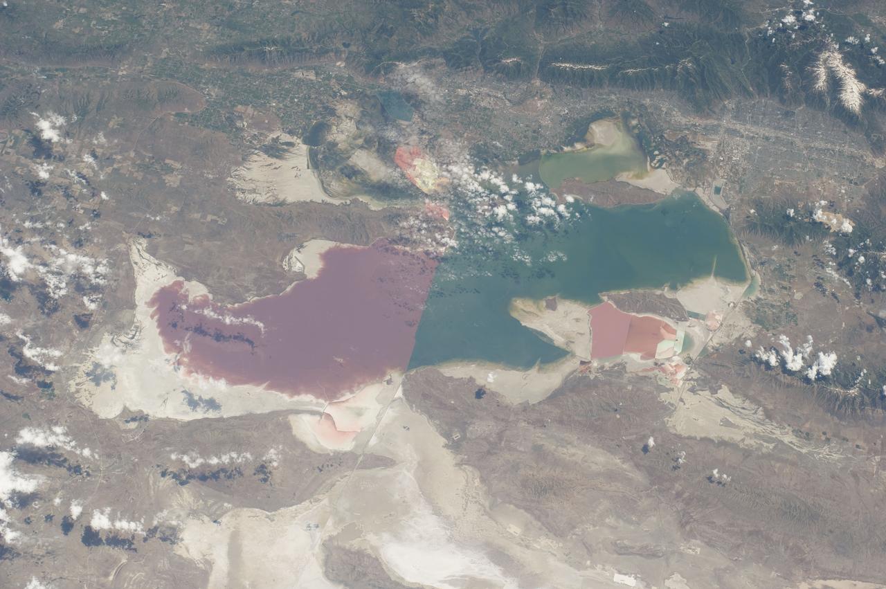
S135-E-006466 (9 July 2011) --- As in the case of many previous space missions, the Great Salt Lake in Utah serves as a striking visual marker for the STS-135 astronauts orbiting over North America in the space shuttle Atlantis. A sharp line across the lake's center is caused by the restriction in water flow from the railroad causeway. The eye-catching colors of the lake stem from the fact that Great Salt Lake is hypersaline, typically 3-5 times saltier than the ocean. Photo credit: NASA
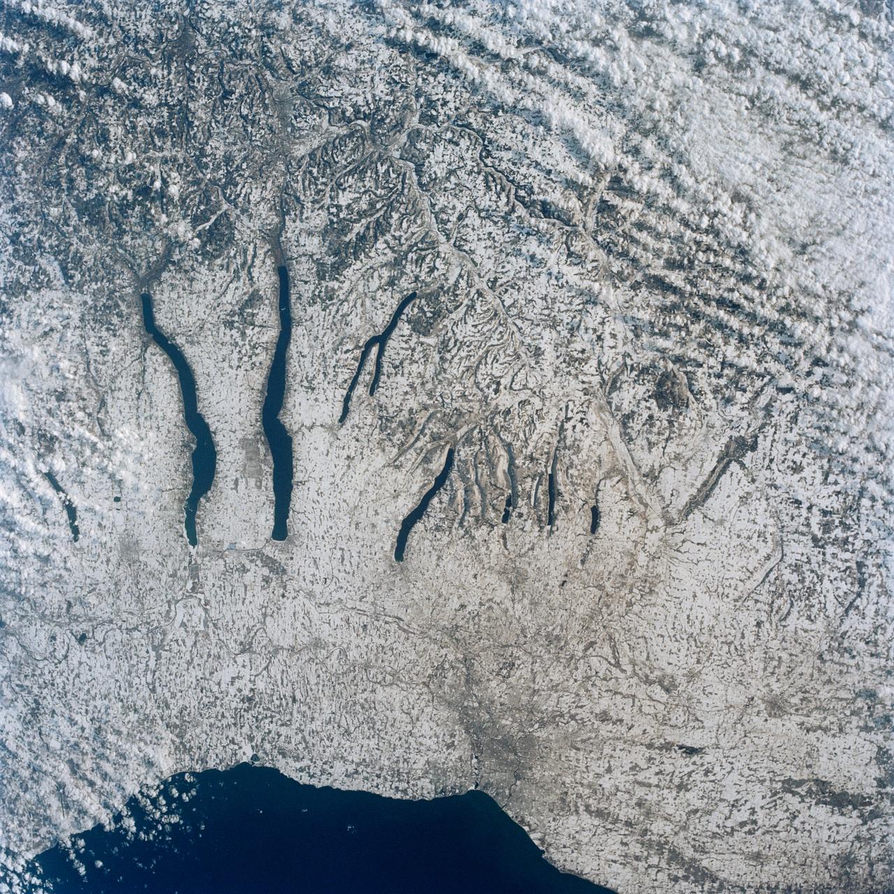
This view of the central portion of upstate New York, centers on the Finger Lakes. The large city on the shore of Lake Ontario, is Rochester. Although the city, being a business, educational and technical center, has no heavy industry, the outline of the city shows fairly well in the snow, but not as well as the outlines of industrial cities elsewhere in the world. The Finger Lakes are large linear lakes carved out by glaciers during the last ice age.
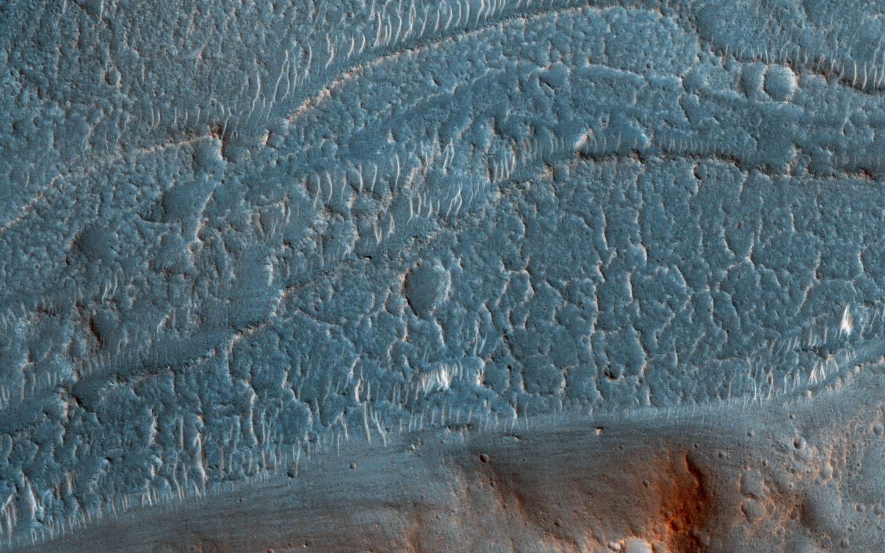
Cataracts are large landforms, and this oblique image from NASA's Mars Reconnaissance Orbiter covers only a small area of the innermost channel. The ridged material on the channel floor may be a lava flow that followed this channel after it was initially carved by giant floods of water.Obviously these are not the kind of cataracts that can develop in the lenses of your eyes, but large erosional scallops that form in river channels, like the Niagara Falls draining the Great Lakes of North America. Obviously these are not the kind of cataracts that can develop in the lenses of your eyes, but large erosional scallops that form in river channels, like the Niagara Falls draining the Great Lakes of North America. https://photojournal.jpl.nasa.gov/catalog/PIA21869
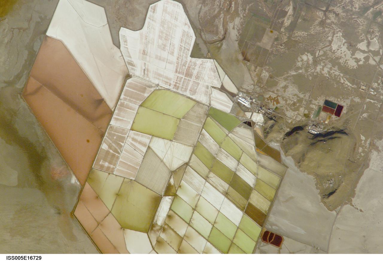
ISS005-E-16729 (7 October 2002) --- Great Salt Lake, Utah, is featured in this image photographed by an Expedition 5 crewmember on the International Space Station (ISS). Great Salt Lake serves as a striking visual marker for crewmembers orbiting over North America. A sharp line across its center is caused by the restriction in water flow from the railroad causeway. The eye-catching colors of the lake stem from the fact that Great Salt Lake is hyper saline, typically 3-5 times saltier than the ocean, and the high salinities support sets of plants and animals that affect the light-absorbing qualities of the water. North of the causeway salinities are higher, and the water turns red from the pigments of halophilic bacteria. In the shallower corner of the lake, earthen dikes mark large salt evaporation works, which take on the jewel tones of turquoise, russet, tamber and pearl white.
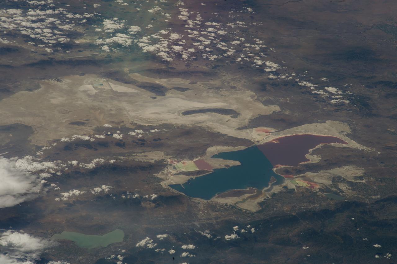
ISS040-E-043231 (6 July 2014) --- As in the case of many previous space missions, the Great Salt Lake in Utah serves as a striking visual marker for the Expedition 40 crew members orbiting 222 nautical miles over North America aboard the International Space Station. A 200mm focal length was used to capture the image. A sharp line across the lake's center is caused by the restriction in water flow from the railroad causeway. The eye-catching colors of the lake stem from the fact that Great Salt Lake is hypersaline, typically 3-5 times saltier than the ocean.
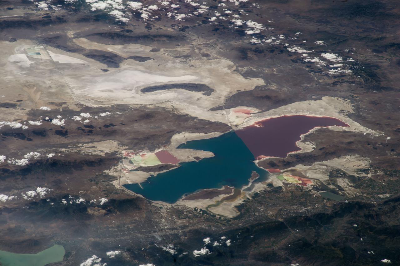
ISS040-E-043230 (6 July 2014) --- As in the case of many previous space missions, the Great Salt Lake in Utah serves as a striking visual marker for the Expedition 40 crew members orbiting 222 nautical miles over North America aboard the International Space Station. A 200mm focal length was used to capture the image. A sharp line across the lake's center is caused by the restriction in water flow from the railroad causeway. The eye-catching colors of the lake stem from the fact that Great Salt Lake is hypersaline, typically 3-5 times saltier than the ocean.
STS040-77-045 (6 June 1991) --- This image, photographed on June 6, 1991, is an oblique view looking north-northeast and shows most of the Great Lakes region. Part of Columbia's cargo bay and the Spacelab Life Sciences (SLS-1) module are in the foreground. In the center of the image is Lake Michigan with Chicago clearly visible along the southwest shore. According to NASA photo experts studying the STS-40 imagery, this image shows several interesting meteorological phenomena. The difference in temperature between the warming land and the cold lake waters is illustrated by the low level clouds. The warming land surface results in rising air and the formation of clouds, while the lake waters are cold and result in the lakes remaining cloud free. Also visible is evidence of lake breezes developing around several of the lakes. This phenomena is also driven by the difference in temperature between the land and the water. Winds blowing off the lakes must travel 25 - 30 miles inland before it warms sufficiently to create clouds.
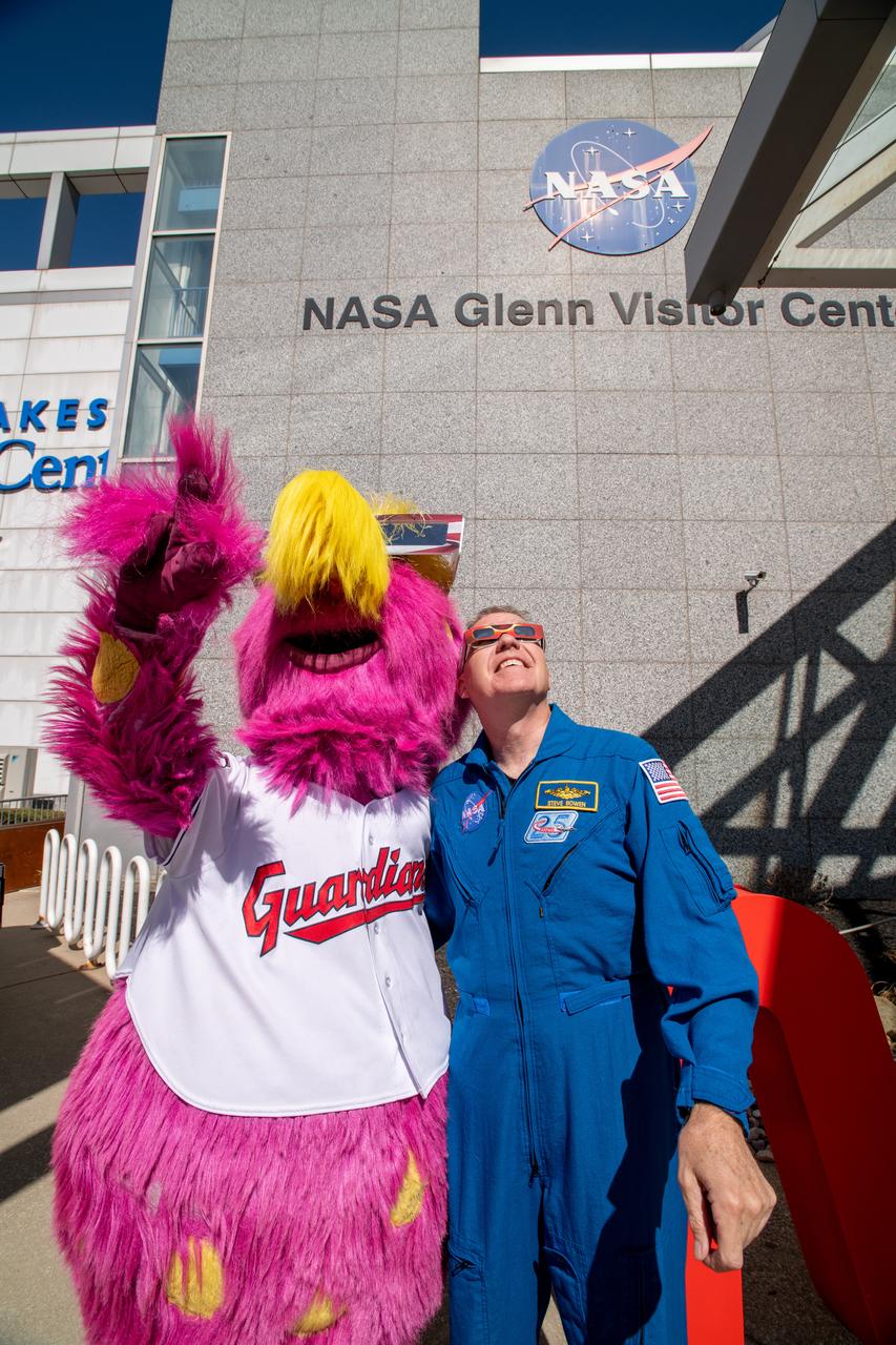
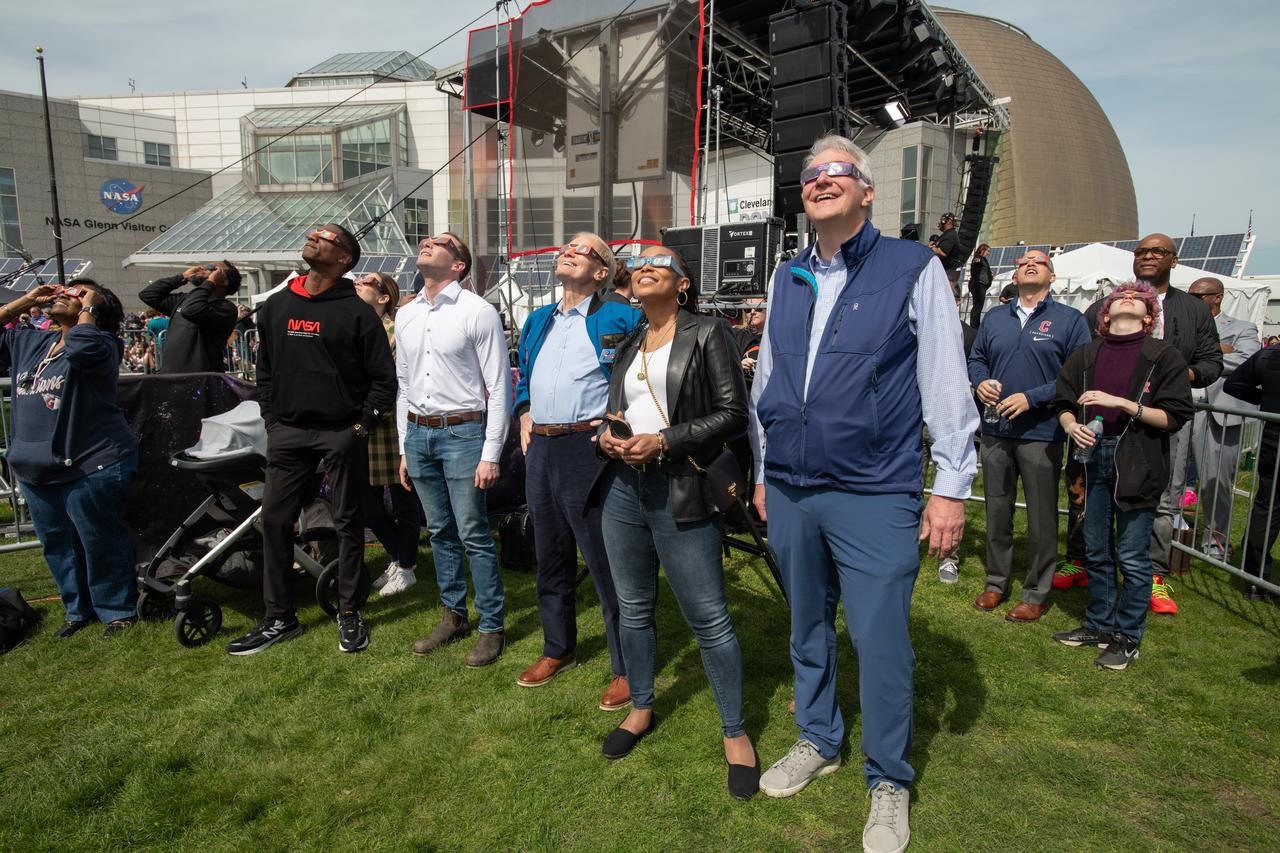
The Cleveland Guardians mascot, Slider and Astronaut Stephen Bowen view the solar eclipse at the Total Solar Eclipse Fest at the Great Lakes Science Center on April 6, 2024. A total solar eclipse swept across a narrow portion of the North American continent from Mexico’s Pacific coast to the Atlantic coast of Newfoundland, Canada. A partial solar eclipse was visible across the entire North American continent along with parts of Central America and Europe.

The Cleveland Guardians mascot, Slider poses with solar eclipse glasses at the Total Solar Eclipse Fest at the Great Lakes Science Center April 6, 2024. A total solar eclipse swept across a narrow portion of the North American continent from Mexico’s Pacific coast to the Atlantic coast of Newfoundland, Canada. A partial solar eclipse was visible across the entire North American continent along with parts of Central America and Europe.
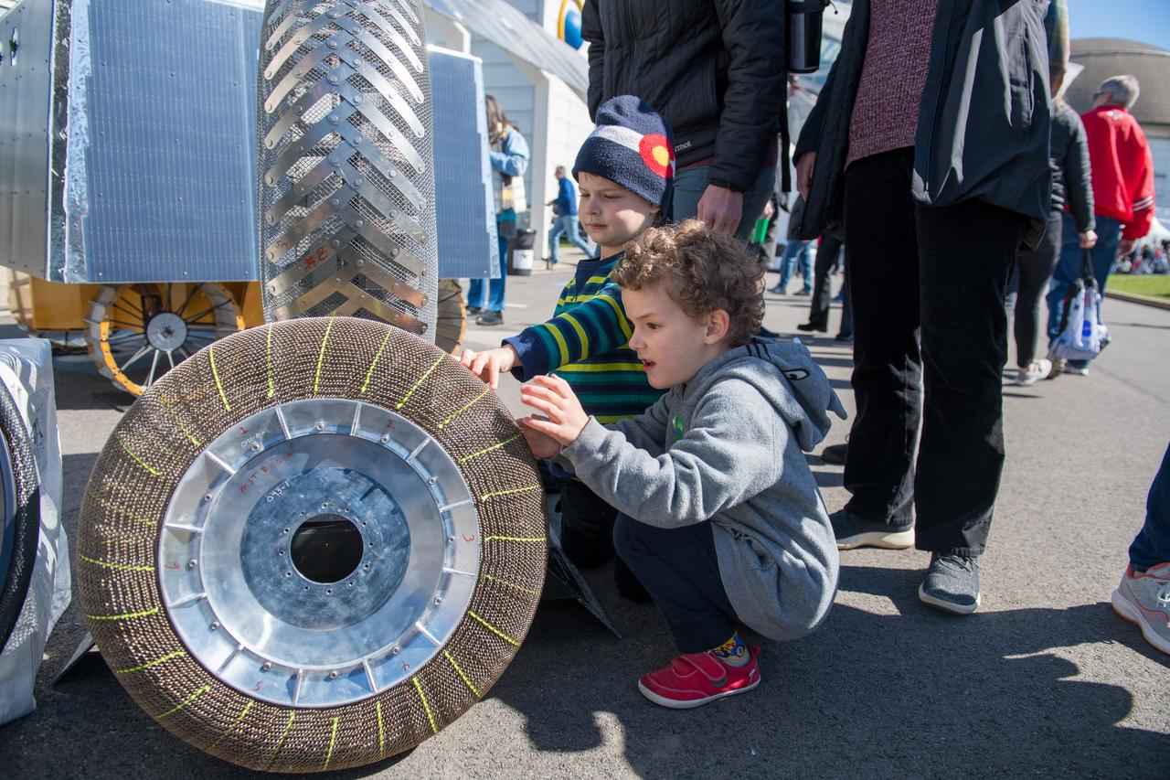
An event attendee checks out a rover tire made with shape memory alloys at the Total Eclipse Fest at the Great Lakes Science Center in Cleveland, OH on April 7, 2024. A total solar eclipse swept across a narrow portion of the North American continent from Mexico’s Pacific coast to the Atlantic coast of Newfoundland, Canada. A partial solar eclipse was visible across the entire North American continent along with parts of Central America and Europe.

An event attendee interacts with a booth science activity at the Total Eclipse Fest at the Great Lakes Science Center in Cleveland, OH on April 7, 2024. A total solar eclipse swept across a narrow portion of the North American continent from Mexico’s Pacific coast to the Atlantic coast of Newfoundland, Canada. A partial solar eclipse was visible across the entire North American continent along with parts of Central America and Europe. Photo Credit: (NASA/Jef Janis)
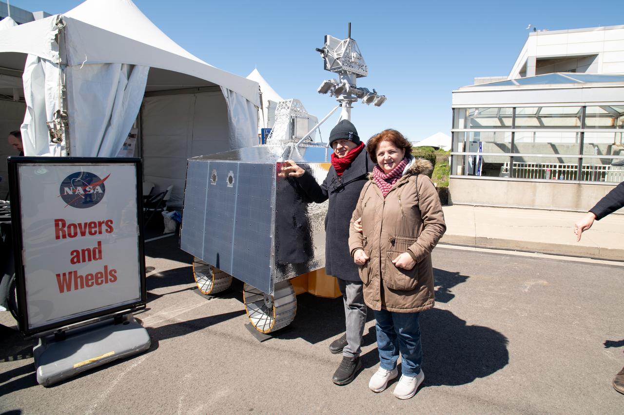
Event Attendees at pose in front of the VIPER model at the Total Eclipse Fest at the Great Lakes Science Center in Cleveland, OH April 6, 2024. A total solar eclipse swept across a narrow portion of the North American continent from Mexico’s Pacific coast to the Atlantic coast of Newfoundland, Canada. A partial solar eclipse was visible across the entire North American continent along with parts of Central America and Europe.

Guests pose for a photo at the Total Solar Eclipse Fest at the Great Lakes Science Center in Cleveland, OH April 6, 2024. A total solar eclipse swept across a narrow portion of the North American continent from Mexico’s Pacific coast to the Atlantic coast of Newfoundland, Canada. A partial solar eclipse was visible across the entire North American continent along with parts of Central America and Europe.

Guests interact with the VIPER exhibit at the Total Solar Eclipse Fest at the Great Lakes Science Center in Cleveland, OH on April 6, 2024. A total solar eclipse swept across a narrow portion of the North American continent from Mexico’s Pacific coast to the Atlantic coast of Newfoundland, Canada. A partial solar eclipse was visible across the entire North American continent along with parts of Central America and Europe. Photo Credit: (NASA/Sara Lowthian-Hanna)
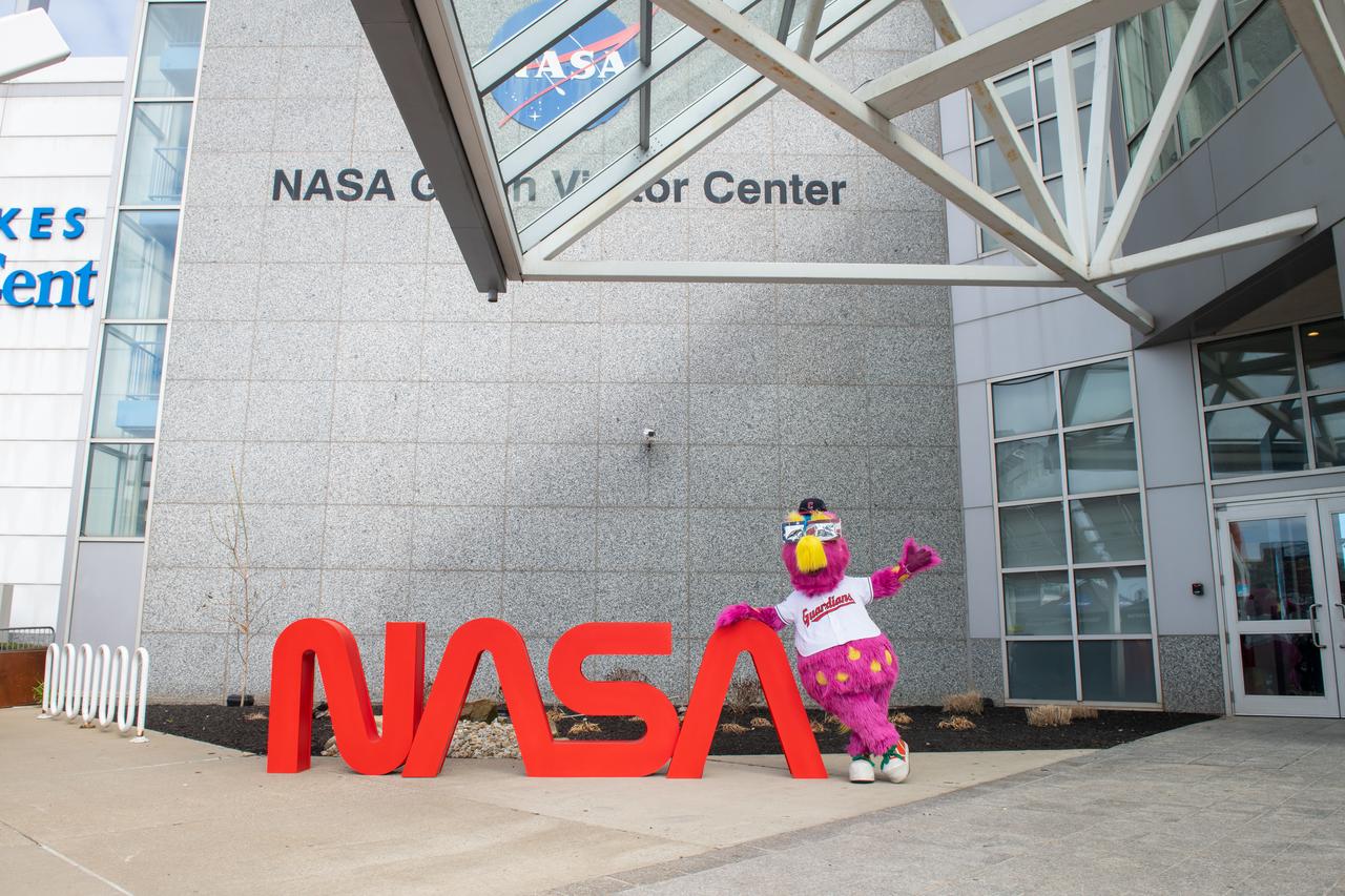
The Cleveland Guardians mascot, Slider poses in front of the NASA sign at the Total Solar Eclipse Fest at the Great Lakes Science Center April 6, 2024. A total solar eclipse swept across a narrow portion of the North American continent from Mexico’s Pacific coast to the Atlantic coast of Newfoundland, Canada. A partial solar eclipse was visible across the entire North American continent along with parts of Central America and Europe.
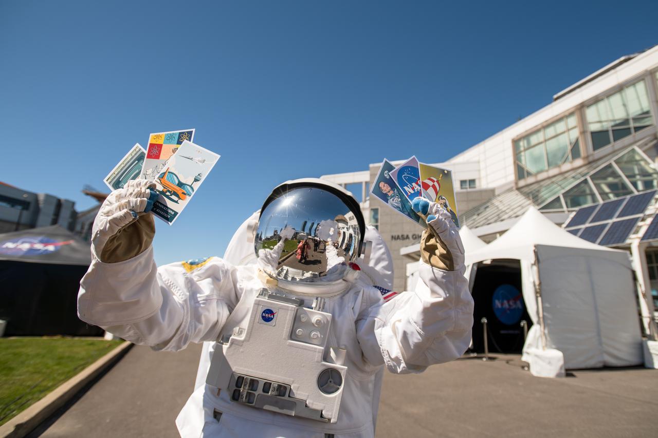
The astronaut mascot holds the 6 collectable postcards designed for the Total Eclipse Fest at the Great Lakes Science Center in Cleveland, OH on April 6, 2024. A total solar eclipse swept across a narrow portion of the North American continent from Mexico’s Pacific coast to the Atlantic coast of Newfoundland, Canada. A partial solar eclipse was visible across the entire North American continent along with parts of Central America and Europe.
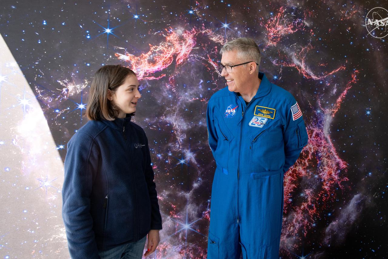
A guest interacts with Astronaut Stephen Bowen during meet and greets at the Total Eclipse Fest at the Great Lakes Science Center in Cleveland, OH on April 6, 2024. A total solar eclipse swept across a narrow portion of the North American continent from Mexico’s Pacific coast to the Atlantic coast of Newfoundland, Canada. A partial solar eclipse was visible across the entire North American continent along with parts of Central America and Europe.
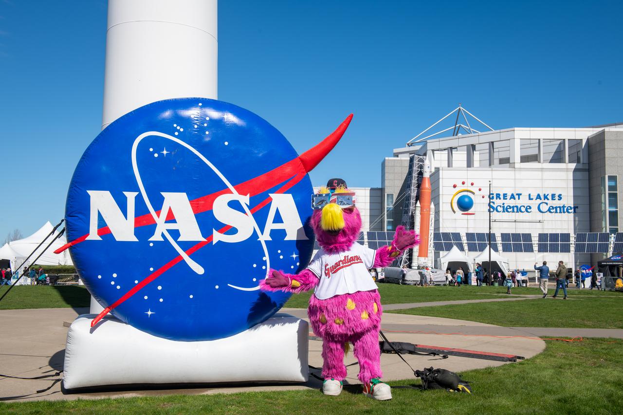
The Cleveland Guardians mascot, Slider poses in front of the NASA sign at the Total Solar Eclipse Fest at the Great Lakes Science Center April 6, 2024. A total solar eclipse swept across a narrow portion of the North American continent from Mexico’s Pacific coast to the Atlantic coast of Newfoundland, Canada. A partial solar eclipse was visible across the entire North American continent along with parts of Central America and Europe.
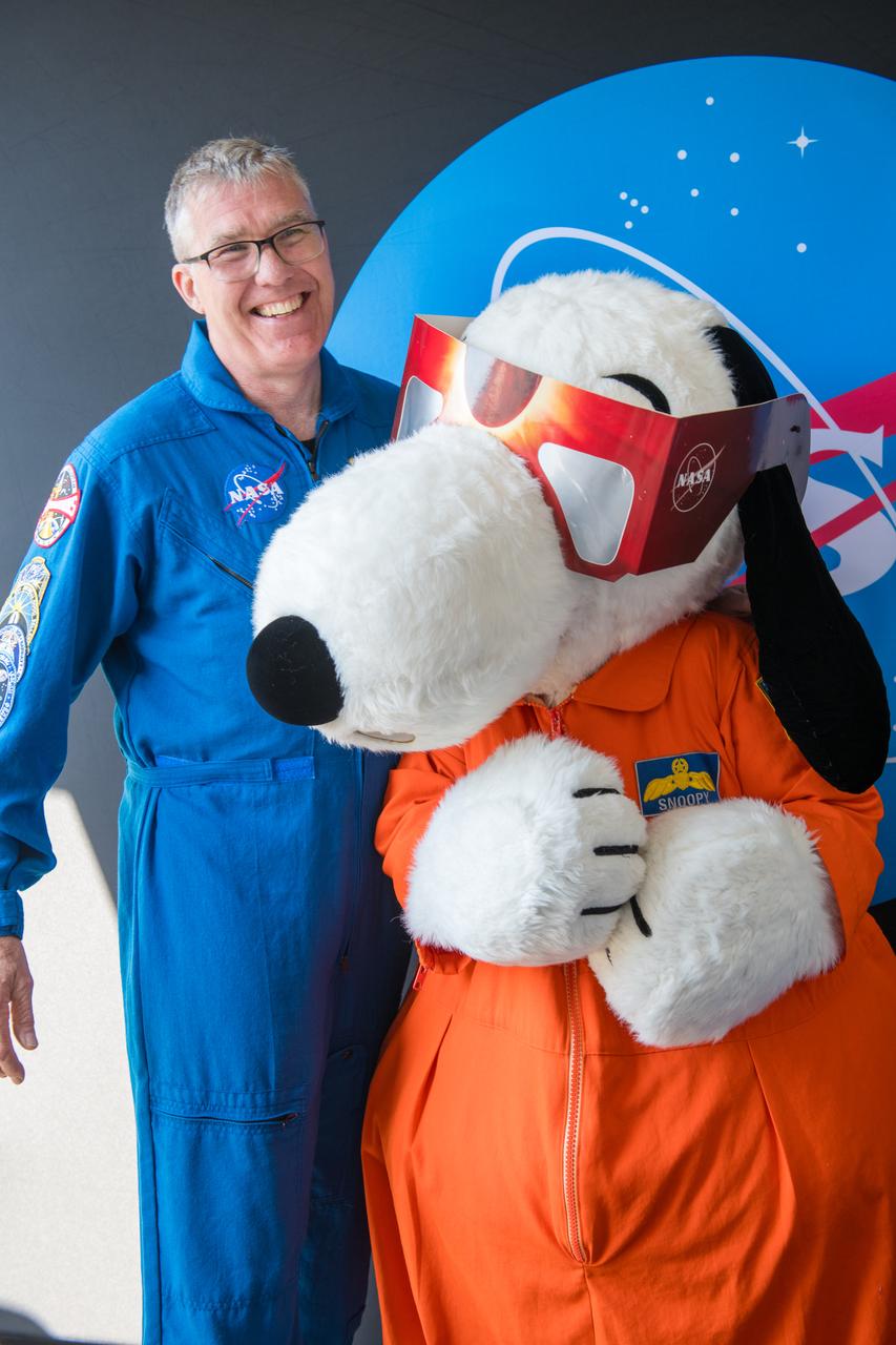
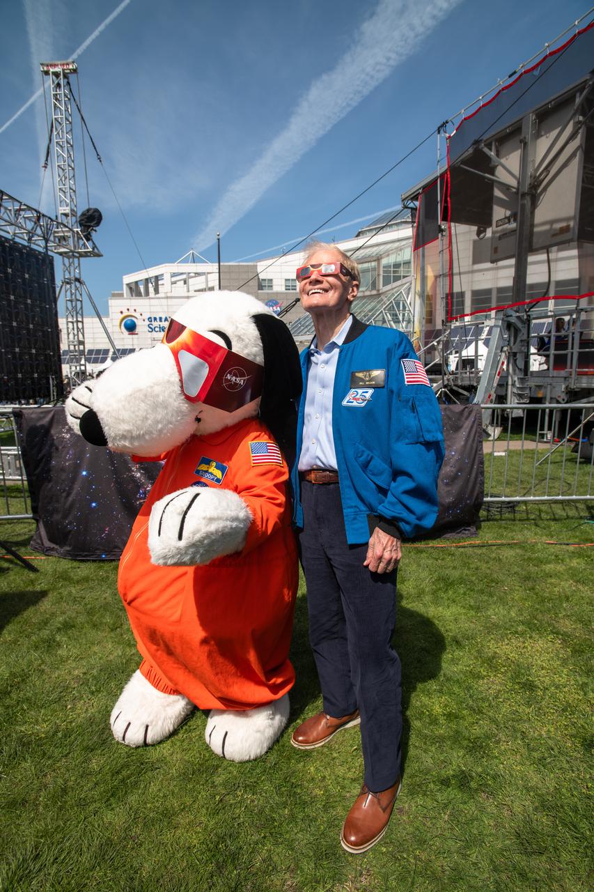
The Cleveland Guardians mascot, Slider and Astronaut Stephen Bowen and Snoopy participate in meet and greets with the public at the Great Lakes Science Center. A total solar eclipse swept across a narrow portion of the North American continent from Mexico’s Pacific coast to the Atlantic coast of Newfoundland, Canada. A partial solar eclipse was visible across the entire North American continent along with parts of Central America and Europe.
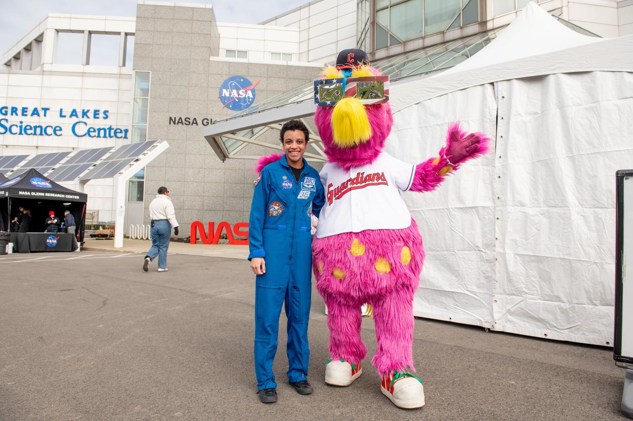
Astronaut Jessica Watkins and the Cleveland Guardians mascot, Slider pose together at Total Solar Eclipse Fest at the Great Lakes Science Center on April 6, 2024. A total solar eclipse swept across a narrow portion of the North American continent from Mexico’s Pacific coast to the Atlantic coast of Newfoundland, Canada. A partial solar eclipse was visible across the entire North American continent along with parts of Central America and Europe.
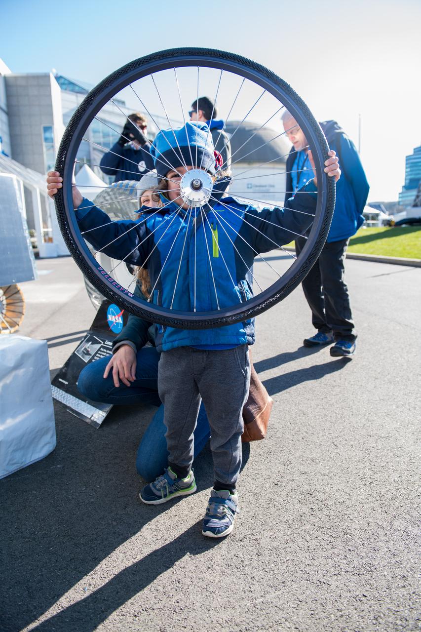
An event attendee holds a bike tire made with shape memory alloys at the Total Eclipse Fest at the Great Lakes Science Center in Cleveland, OH on April 7, 2024. A total solar eclipse swept across a narrow portion of the North American continent from Mexico’s Pacific coast to the Atlantic coast of Newfoundland, Canada. A partial solar eclipse was visible across the entire North American continent along with parts of Central America and Europe. Photo Credit: (NASA/Jef Janis)

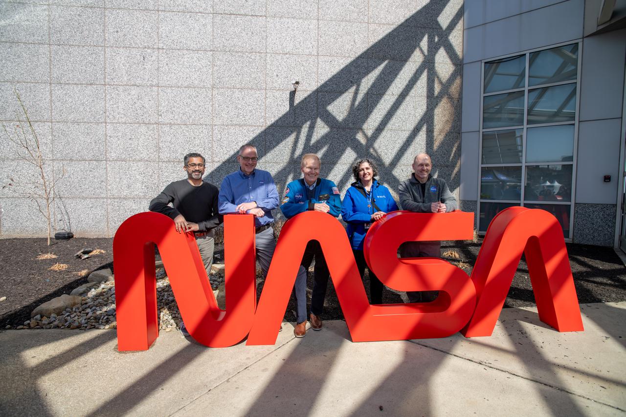
GRC Center Director Jimmy Kenyon, President & CEO of Greater Cleveland Partnership Baiju R. Shah, Representative Shontel Brown, Administrator Bill Nelson, Cuyahoga County Executive Chris Ronayne, Cleveland Mayor Justin Bibb, Great Lakes Science Center President and CEO Kristen Ellenbogen, Represenative Max Miller, pose for a photo together. NASA Glenn Research Center and the Great Lakes Science Center hosted a three-day celestial celebration in downtown Cleveland, OH. This free, outdoor, family-friendly science and arts festival will feature free concerts, performances, speakers, and hands-on science activities with community partners. A total solar eclipse swept across a narrow portion of the North American continent from Mexico’s Pacific coast to the Atlantic coast of Newfoundland, Canada. A partial solar eclipse was visible across the entire North American continent along with parts of Central America and Europe.
President & CEO of Greater Cleveland Partnership Baiju R. Shah, Jim Free, Administrator Bill Nelson, Great Lakes Science Center President and CEO Kristen Ellenbogen, GRC Center Director Jimmy Kenyon pose for a photo together. NASA Glenn Research Center and the Great Lakes Science Center hosted a three-day celestial celebration in downtown Cleveland, OH. This free, outdoor, family-friendly science and arts festival will feature free concerts, performances, speakers, and hands-on science activities with community partners. A total solar eclipse swept across a narrow portion of the North American continent from Mexico’s Pacific coast to the Atlantic coast of Newfoundland, Canada. A partial solar eclipse was visible across the entire North American continent along with parts of Central America and Europe.
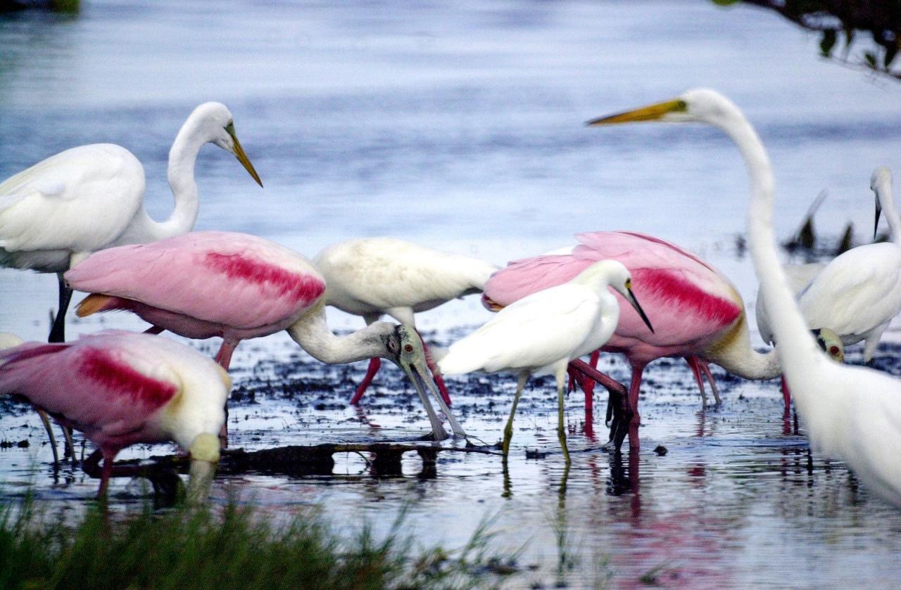
KENNEDY SPACE CENTER, FLA. -- An immature -- therefore white -- Little Blue Heron (center, with black bill) joins Roseate Spoonbills and a pair of Great Egrets in a lake near Kennedy Space Center. The heron ranges along the east coast of the United States, from New York to Texas, inland to Oklahoma. It winters from South Carolina to South America. For habitat the Little Blue Heron prefers freshwater swamps and lagoons in the South, coastal thickets on islands in the North. The species is often observed in large mixed concentrations of herons and egrets
Administrator Bill Nelson and Represenative Max Miller pose for a photo together. NASA Glenn Research Center and the Great Lakes Science Center hosted a three-day celestial celebration in downtown Cleveland, OH. This free, outdoor, family-friendly science and arts festival will feature free concerts, performances, speakers, and hands-on science activities with community partners. A total solar eclipse swept across a narrow portion of the North American continent from Mexico’s Pacific coast to the Atlantic coast of Newfoundland, Canada. A partial solar eclipse was visible across the entire North American continent along with parts of Central America and Europe.
Representative Shontel Brown and Cleveland Mayor Justin Bibb view the eclipse together. NASA Glenn Research Center and the Great Lakes Science Center hosted a three-day celestial celebration in downtown Cleveland, OH. This free, outdoor, family-friendly science and arts festival will feature free concerts, performances, speakers, and hands-on science activities with community partners. A total solar eclipse swept across a narrow portion of the North American continent from Mexico’s Pacific coast to the Atlantic coast of Newfoundland, Canada. A partial solar eclipse was visible across the entire North American continent along with parts of Central America and Europe.

Administrator Bill Nelson, Snoopy and Cleveland Mayor Justin Bibb view the eclipse just before totality. NASA Glenn Research Center and the Great Lakes Science Center hosted a three-day celestial celebration in downtown Cleveland, OH. This free, outdoor, family-friendly science and arts festival will feature free concerts, performances, speakers, and hands-on science activities with community partners. A total solar eclipse swept across a narrow portion of the North American continent from Mexico’s Pacific coast to the Atlantic coast of Newfoundland, Canada. A partial solar eclipse was visible across the entire North American continent along with parts of Central America and Europe.

Representative Shontel Brown and Administrator Bill Nelson pose for a photo together with solar eclipse glasses on. NASA Glenn Research Center and the Great Lakes Science Center hosted a three-day celestial celebration in downtown Cleveland, OH. This free, outdoor, family-friendly science and arts festival will feature free concerts, performances, speakers, and hands-on science activities with community partners. A total solar eclipse swept across a narrow portion of the North American continent from Mexico’s Pacific coast to the Atlantic coast of Newfoundland, Canada. A partial solar eclipse was visible across the entire North American continent along with parts of Central America and Europe.
GRC Center Director Jimmy Kenyon, Senator Sherrod Brown and Administrator Bill Nelson view the eclipse together on April 8th. NASA Glenn Research Center and the Great Lakes Science Center hosted a three-day celestial celebration in downtown Cleveland, OH. This free, outdoor, family-friendly science and arts festival will feature free concerts, performances, speakers, and hands-on science activities with community partners. A total solar eclipse swept across a narrow portion of the North American continent from Mexico’s Pacific coast to the Atlantic coast of Newfoundland, Canada. A partial solar eclipse was visible across the entire North American continent along with parts of Central America and Europe.

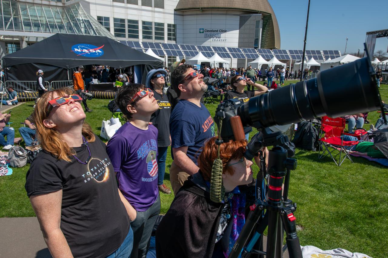
Event attendees view the eclipse. NASA Glenn Research Center and the Great Lakes Science Center hosted a three-day celestial celebration in downtown Cleveland, OH. This free, outdoor, family-friendly science and arts festival will feature free concerts, performances, speakers, and hands-on science activities with community partners. A total solar eclipse swept across a narrow portion of the North American continent from Mexico’s Pacific coast to the Atlantic coast of Newfoundland, Canada. A partial solar eclipse was visible across the entire North American continent along with parts of Central America and Europe.

Event attendees view the eclipse on April 8, 2024. NASA Glenn Research Center and the Great Lakes Science Center hosted a three-day celestial celebration in downtown Cleveland, OH. This free, outdoor, family-friendly science and arts festival will feature free concerts, performances, speakers, and hands-on science activities with community partners. A total solar eclipse swept across a narrow portion of the North American continent from Mexico’s Pacific coast to the Atlantic coast of Newfoundland, Canada. A partial solar eclipse was visible across the entire North American continent along with parts of Central America and Europe. Photo Credit: (NASA/Jef Janis)

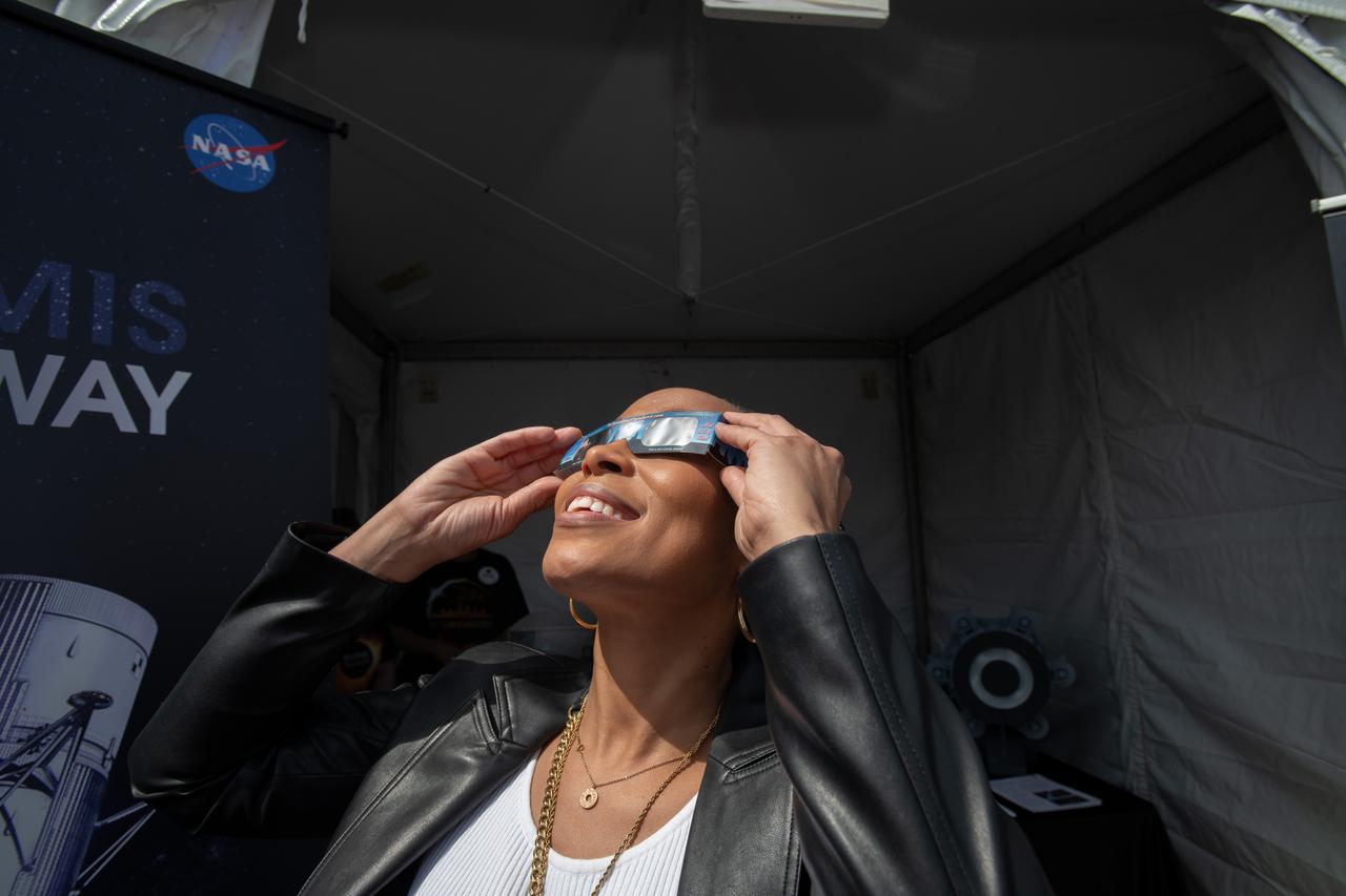
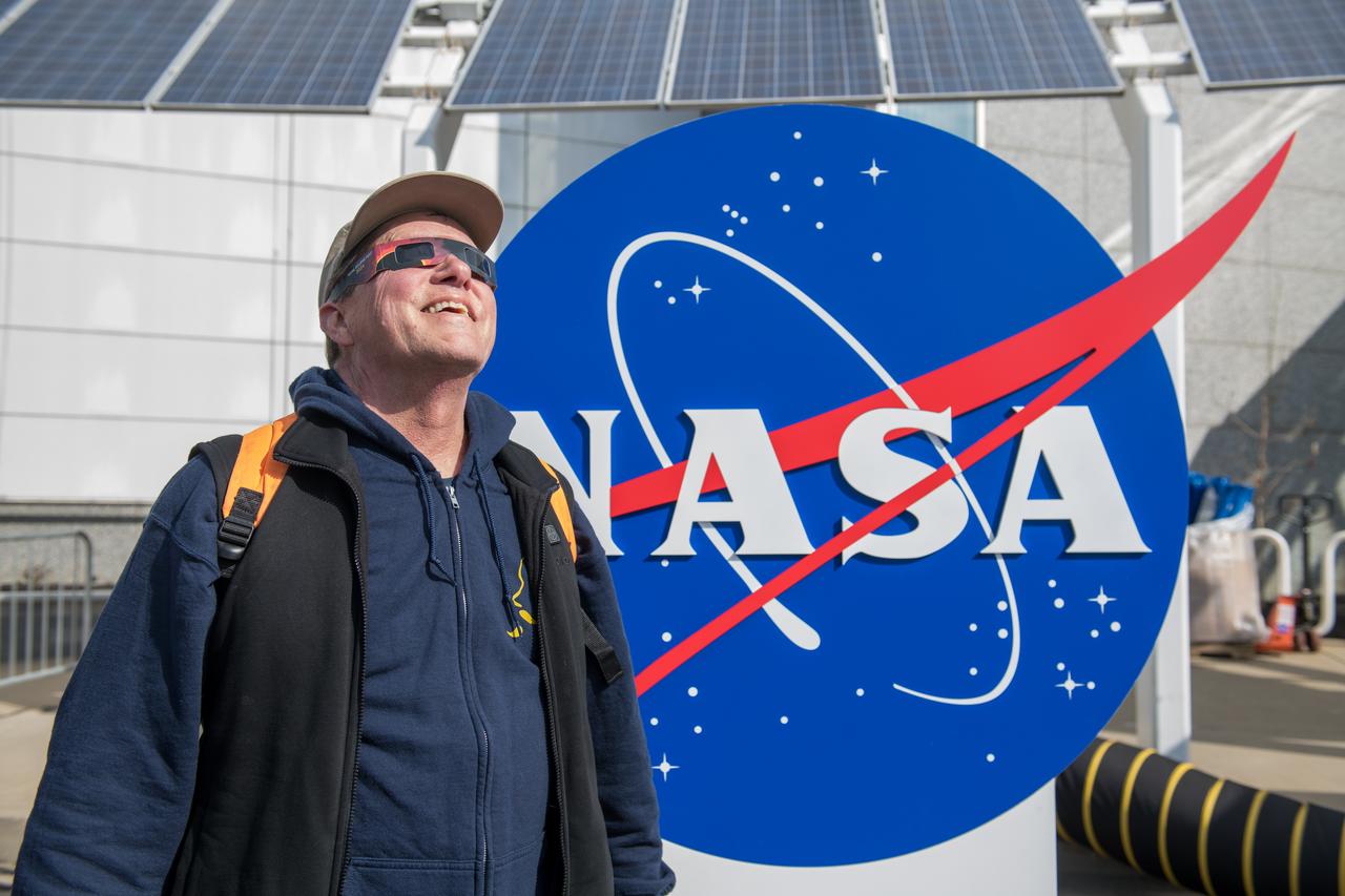
Event attendee views the eclipse. NASA Glenn Research Center and the Great Lakes Science Center hosted a three-day celestial celebration in downtown Cleveland, OH. This free, outdoor, family-friendly science and arts festival will feature free concerts, performances, speakers, and hands-on science activities with community partners. A total solar eclipse swept across a narrow portion of the North American continent from Mexico’s Pacific coast to the Atlantic coast of Newfoundland, Canada. A partial solar eclipse was visible across the entire North American continent along with parts of Central America and Europe.
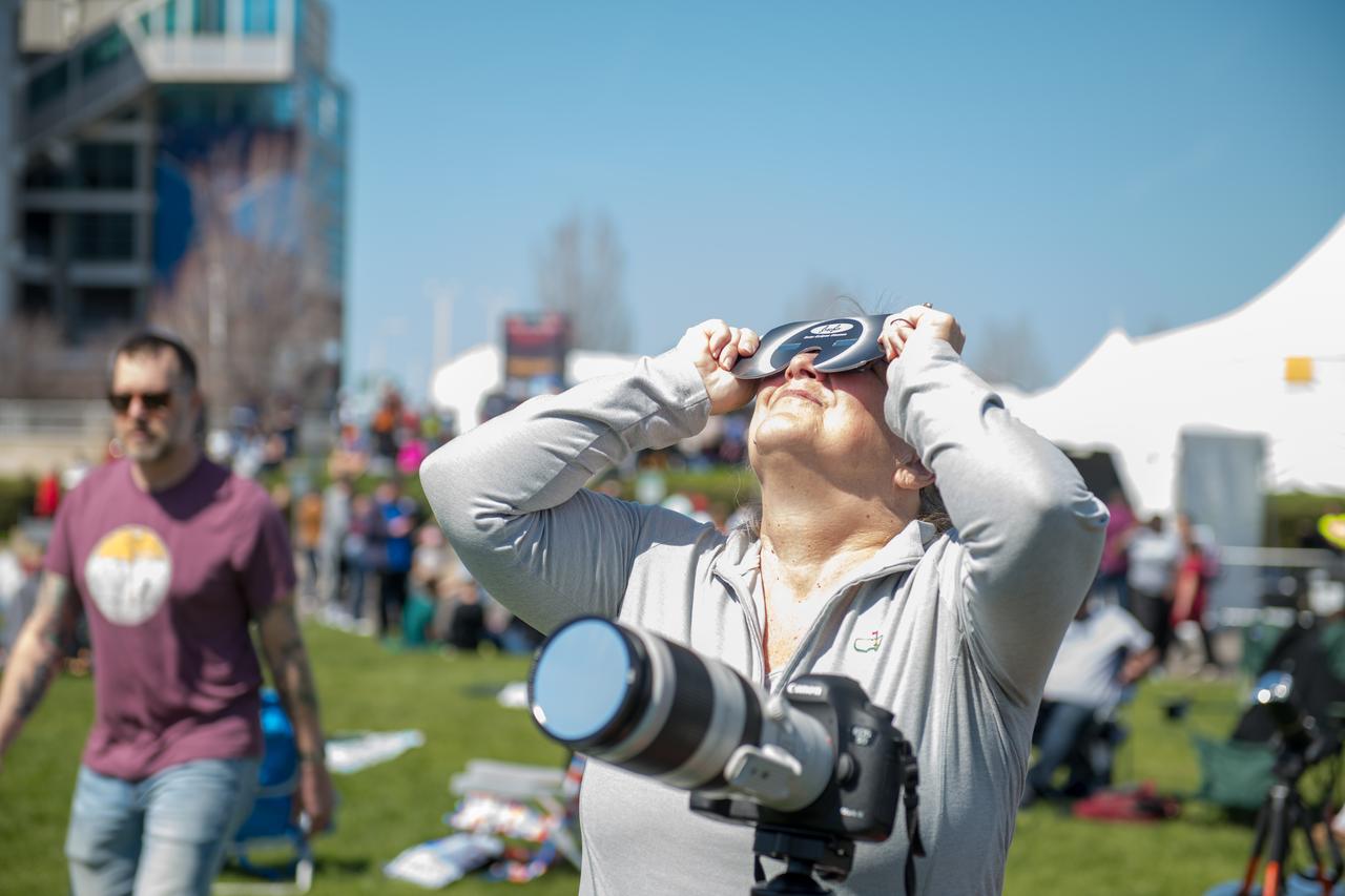
Event attendee views and photographs the eclipse safely. NASA Glenn Research Center and the Great Lakes Science Center hosted a three-day celestial celebration in downtown Cleveland, OH. This free, outdoor, family-friendly science and arts festival will feature free concerts, performances, speakers, and hands-on science activities with community partners. A total solar eclipse swept across a narrow portion of the North American continent from Mexico’s Pacific coast to the Atlantic coast of Newfoundland, Canada. A partial solar eclipse was visible across the entire North American continent along with parts of Central America and Europe. Photo Credit: (NASA/Jef Janis)
Administrator Bill Nelson and Snoopy view the eclipse together. NASA Glenn Research Center and the Great Lakes Science Center hosted a three-day celestial celebration in downtown Cleveland, OH. This free, outdoor, family-friendly science and arts festival will feature free concerts, performances, speakers, and hands-on science activities with community partners. A total solar eclipse swept across a narrow portion of the North American continent from Mexico’s Pacific coast to the Atlantic coast of Newfoundland, Canada. A partial solar eclipse was visible across the entire North American continent along with parts of Central America and Europe.

Event attendees view the eclipse. NASA Glenn Research Center and the Great Lakes Science Center hosted a three-day celestial celebration in downtown Cleveland, OH. This free, outdoor, family-friendly science and arts festival will feature free concerts, performances, speakers, and hands-on science activities with community partners. A total solar eclipse swept across a narrow portion of the North American continent from Mexico’s Pacific coast to the Atlantic coast of Newfoundland, Canada. A partial solar eclipse was visible across the entire North American continent along with parts of Central America and Europe.
Representative Shontel Brown views the eclipse. NASA Glenn Research Center and the Great Lakes Science Center hosted a three-day celestial celebration in downtown Cleveland, OH. This free, outdoor, family-friendly science and arts festival will feature free concerts, performances, speakers, and hands-on science activities with community partners. A total solar eclipse swept across a narrow portion of the North American continent from Mexico’s Pacific coast to the Atlantic coast of Newfoundland, Canada. A partial solar eclipse was visible across the entire North American continent along with parts of Central America and Europe. Photo Credit: (NASA/Sara Lowthian-Hanna)
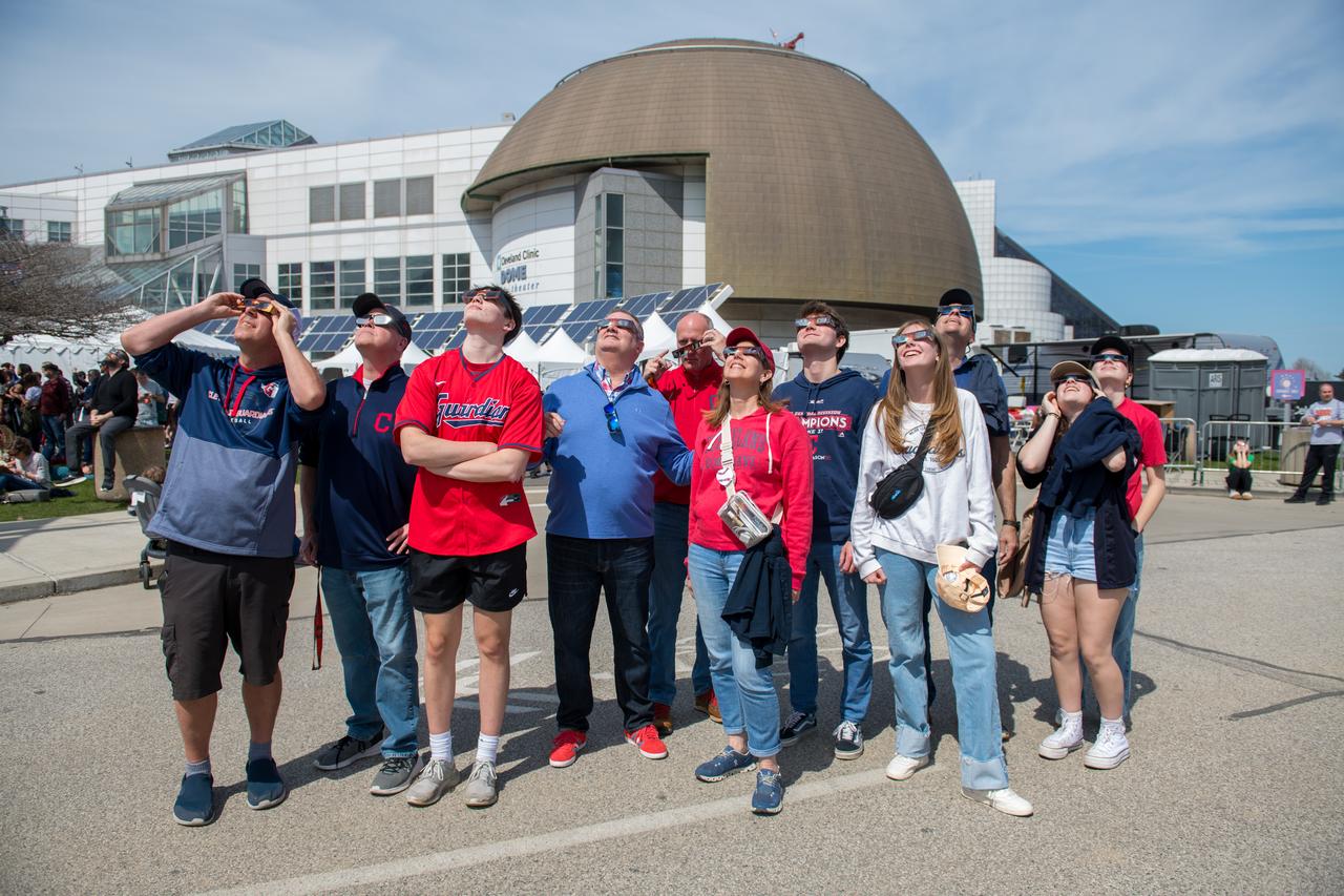
Event attendees view the eclipse. NASA Glenn Research Center and the Great Lakes Science Center hosted a three-day celestial celebration in downtown Cleveland, OH. This free, outdoor, family-friendly science and arts festival will feature free concerts, performances, speakers, and hands-on science activities with community partners. A total solar eclipse swept across a narrow portion of the North American continent from Mexico’s Pacific coast to the Atlantic coast of Newfoundland, Canada. A partial solar eclipse was visible across the entire North American continent along with parts of Central America and Europe.

Event attendees view the eclipse. NASA Glenn Research Center and the Great Lakes Science Center hosted a three-day celestial celebration in downtown Cleveland, OH. This free, outdoor, family-friendly science and arts festival will feature free concerts, performances, speakers, and hands-on science activities with community partners. A total solar eclipse swept across a narrow portion of the North American continent from Mexico’s Pacific coast to the Atlantic coast of Newfoundland, Canada. A partial solar eclipse was visible across the entire North American continent along with parts of Central America and Europe.

Event attendee views the eclipse on April 8, 2024. NASA Glenn Research Center and the Great Lakes Science Center hosted a three-day celestial celebration in downtown Cleveland, OH. This free, outdoor, family-friendly science and arts festival will feature free concerts, performances, speakers, and hands-on science activities with community partners. A total solar eclipse swept across a narrow portion of the North American continent from Mexico’s Pacific coast to the Atlantic coast of Newfoundland, Canada. A partial solar eclipse was visible across the entire North American continent along with parts of Central America and Europe. Photo Credit: (NASA/Jef Janis)
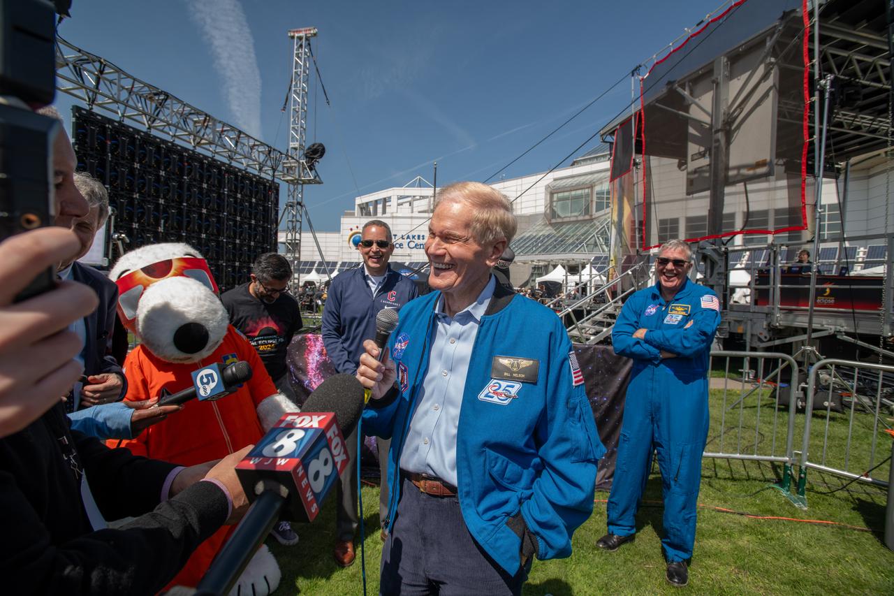
Administrator Bill Nelson, Snoopy and Astronaut Stephen Bowen speak to the media on April 8th. NASA Glenn Research Center and the Great Lakes Science Center hosted a three-day celestial celebration in downtown Cleveland, OH. This free, outdoor, family-friendly science and arts festival will feature free concerts, performances, speakers, and hands-on science activities with community partners. A total solar eclipse swept across a narrow portion of the North American continent from Mexico’s Pacific coast to the Atlantic coast of Newfoundland, Canada. A partial solar eclipse was visible across the entire North American continent along with parts of Central America and Europe.
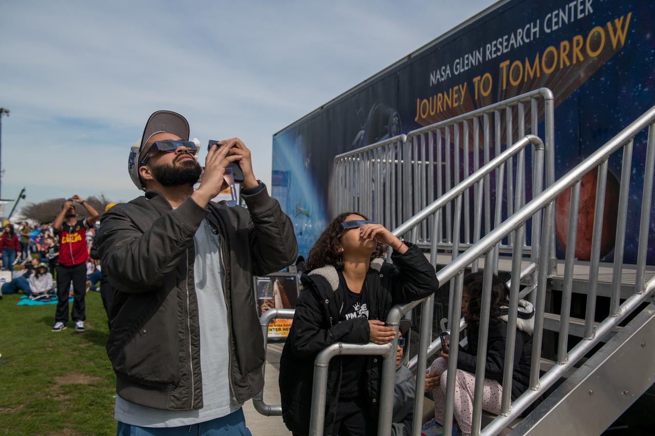
Event attendees view the eclipse on April 8, 2024. NASA Glenn Research Center and the Great Lakes Science Center hosted a three-day celestial celebration in downtown Cleveland, OH. This free, outdoor, family-friendly science and arts festival will feature free concerts, performances, speakers, and hands-on science activities with community partners. A total solar eclipse swept across a narrow portion of the North American continent from Mexico’s Pacific coast to the Atlantic coast of Newfoundland, Canada. A partial solar eclipse was visible across the entire North American continent along with parts of Central America and Europe. Photo Credit: (NASA/Jef Janis)

Event attendees view the eclipse. NASA Glenn Research Center and the Great Lakes Science Center hosted a three-day celestial celebration in downtown Cleveland, OH. This free, outdoor, family-friendly science and arts festival will feature free concerts, performances, speakers, and hands-on science activities with community partners. A total solar eclipse swept across a narrow portion of the North American continent from Mexico’s Pacific coast to the Atlantic coast of Newfoundland, Canada. A partial solar eclipse was visible across the entire North American continent along with parts of Central America and Europe.

Senator Sherrod Brown, Snoopy and Administrator Bill Nelson speak to the media on April 8th. NASA Glenn Research Center and the Great Lakes Science Center hosted a three-day celestial celebration in downtown Cleveland, OH. This free, outdoor, family-friendly science and arts festival will feature free concerts, performances, speakers, and hands-on science activities with community partners. A total solar eclipse swept across a narrow portion of the North American continent from Mexico’s Pacific coast to the Atlantic coast of Newfoundland, Canada. A partial solar eclipse was visible across the entire North American continent along with parts of Central America and Europe.
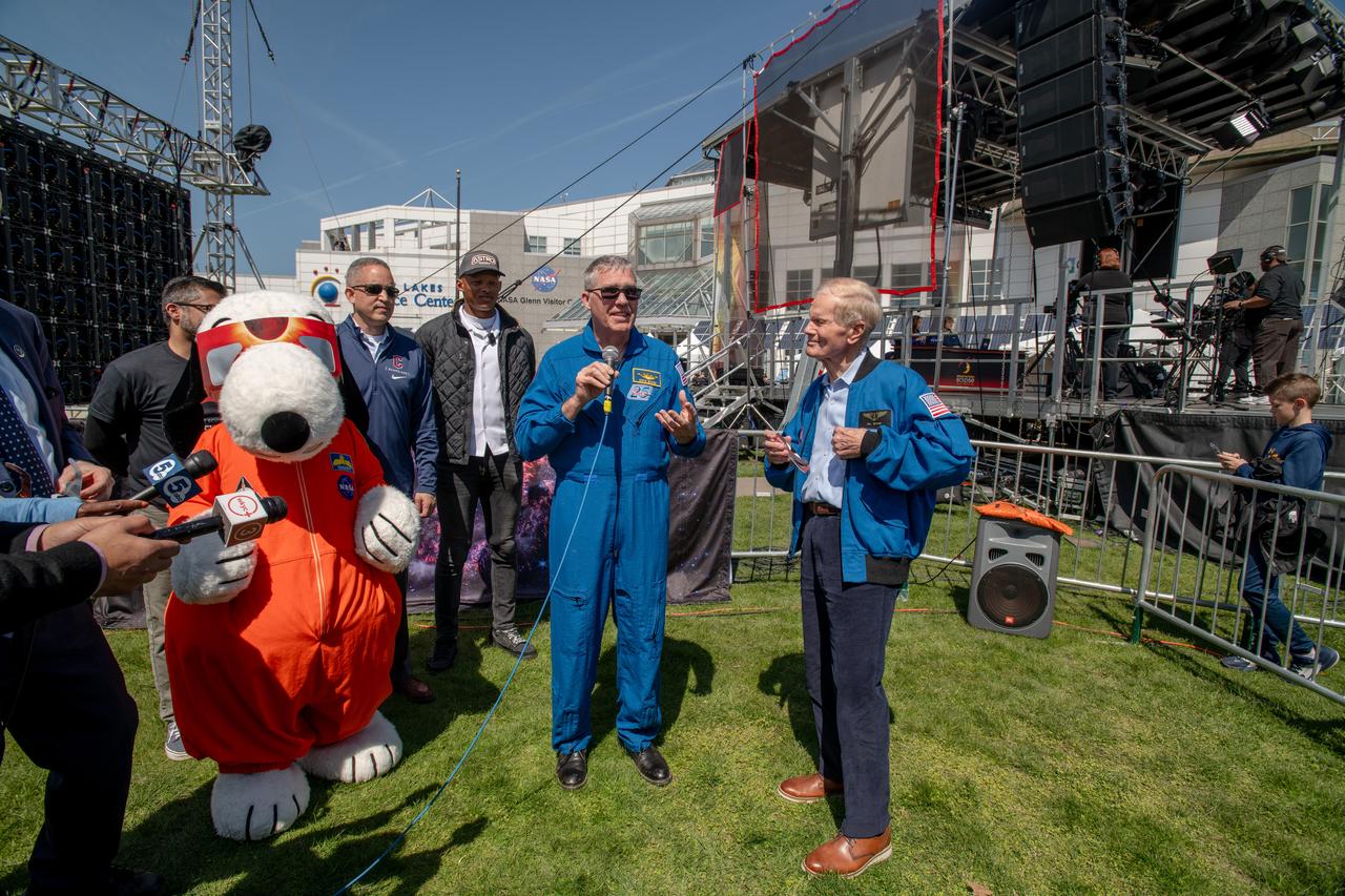
Administrator Bill Nelson, Snoopy and Astronaut Stephen Bowen speak to the media on April 8th. NASA Glenn Research Center and the Great Lakes Science Center hosted a three-day celestial celebration in downtown Cleveland, OH. This free, outdoor, family-friendly science and arts festival will feature free concerts, performances, speakers, and hands-on science activities with community partners. A total solar eclipse swept across a narrow portion of the North American continent from Mexico’s Pacific coast to the Atlantic coast of Newfoundland, Canada. A partial solar eclipse was visible across the entire North American continent along with parts of Central America and Europe.

Event attendees view the eclipse. NASA Glenn Research Center and the Great Lakes Science Center hosted a three-day celestial celebration in downtown Cleveland, OH. This free, outdoor, family-friendly science and arts festival will feature free concerts, performances, speakers, and hands-on science activities with community partners. A total solar eclipse swept across a narrow portion of the North American continent from Mexico’s Pacific coast to the Atlantic coast of Newfoundland, Canada. A partial solar eclipse was visible across the entire North American continent along with parts of Central America and Europe. Photo Credit: (NASA/Jef Janis)
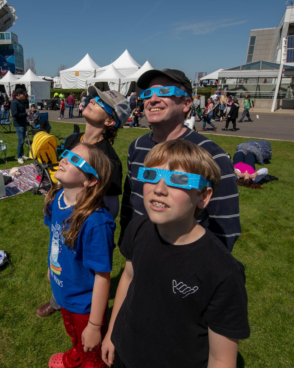
Event attendees view the eclipse. NASA Glenn Research Center and the Great Lakes Science Center hosted a three-day celestial celebration in downtown Cleveland, OH. This free, outdoor, family-friendly science and arts festival will feature free concerts, performances, speakers, and hands-on science activities with community partners. A total solar eclipse swept across a narrow portion of the North American continent from Mexico’s Pacific coast to the Atlantic coast of Newfoundland, Canada. A partial solar eclipse was visible across the entire North American continent along with parts of Central America and Europe.
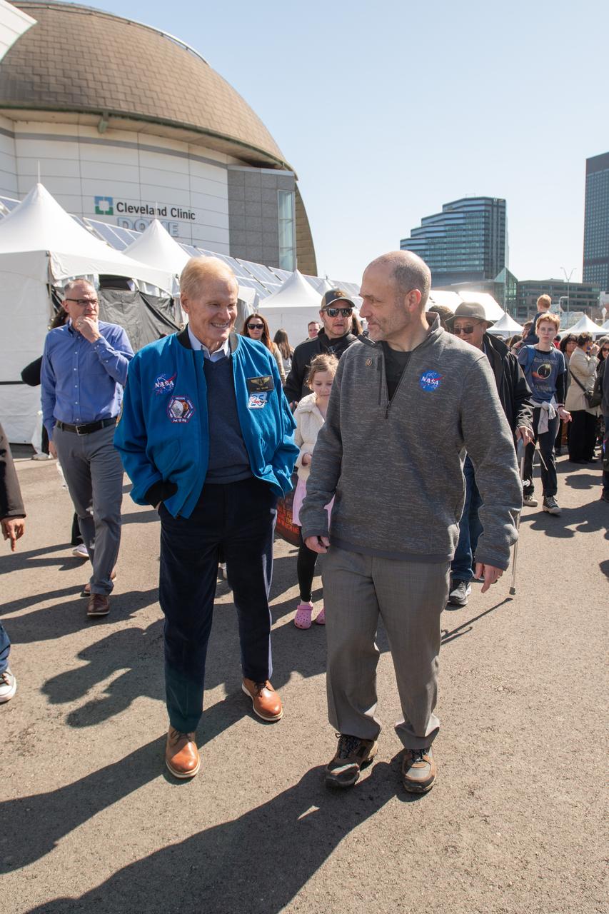
Administrator Bill Nelson and GRC Center director Jimmy walk through NASA village. NASA Glenn Research Center and the Great Lakes Science Center hosted a three-day celestial celebration in downtown Cleveland, OH. This free, outdoor, family-friendly science and arts festival will feature free concerts, performances, speakers, and hands-on science activities with community partners. A total solar eclipse swept across a narrow portion of the North American continent from Mexico’s Pacific coast to the Atlantic coast of Newfoundland, Canada. A partial solar eclipse was visible across the entire North American continent along with parts of Central America and Europe.
Administrator Bill Nelson and Represenative Max Miller and wife pose for a photo together. NASA Glenn Research Center and the Great Lakes Science Center hosted a three-day celestial celebration in downtown Cleveland, OH. This free, outdoor, family-friendly science and arts festival will feature free concerts, performances, speakers, and hands-on science activities with community partners. A total solar eclipse swept across a narrow portion of the North American continent from Mexico’s Pacific coast to the Atlantic coast of Newfoundland, Canada. A partial solar eclipse was visible across the entire North American continent along with parts of Central America and Europe.

Representative Shontel Brown, Administrator Bill Nelson, GRC Center Director Jimmy Kenyon pose for a photo together with solar eclipse glasses on. NASA Glenn Research Center and the Great Lakes Science Center hosted a three-day celestial celebration in downtown Cleveland, OH. This free, outdoor, family-friendly science and arts festival will feature free concerts, performances, speakers, and hands-on science activities with community partners. A total solar eclipse swept across a narrow portion of the North American continent from Mexico’s Pacific coast to the Atlantic coast of Newfoundland, Canada. A partial solar eclipse was visible across the entire North American continent along with parts of Central America and Europe.
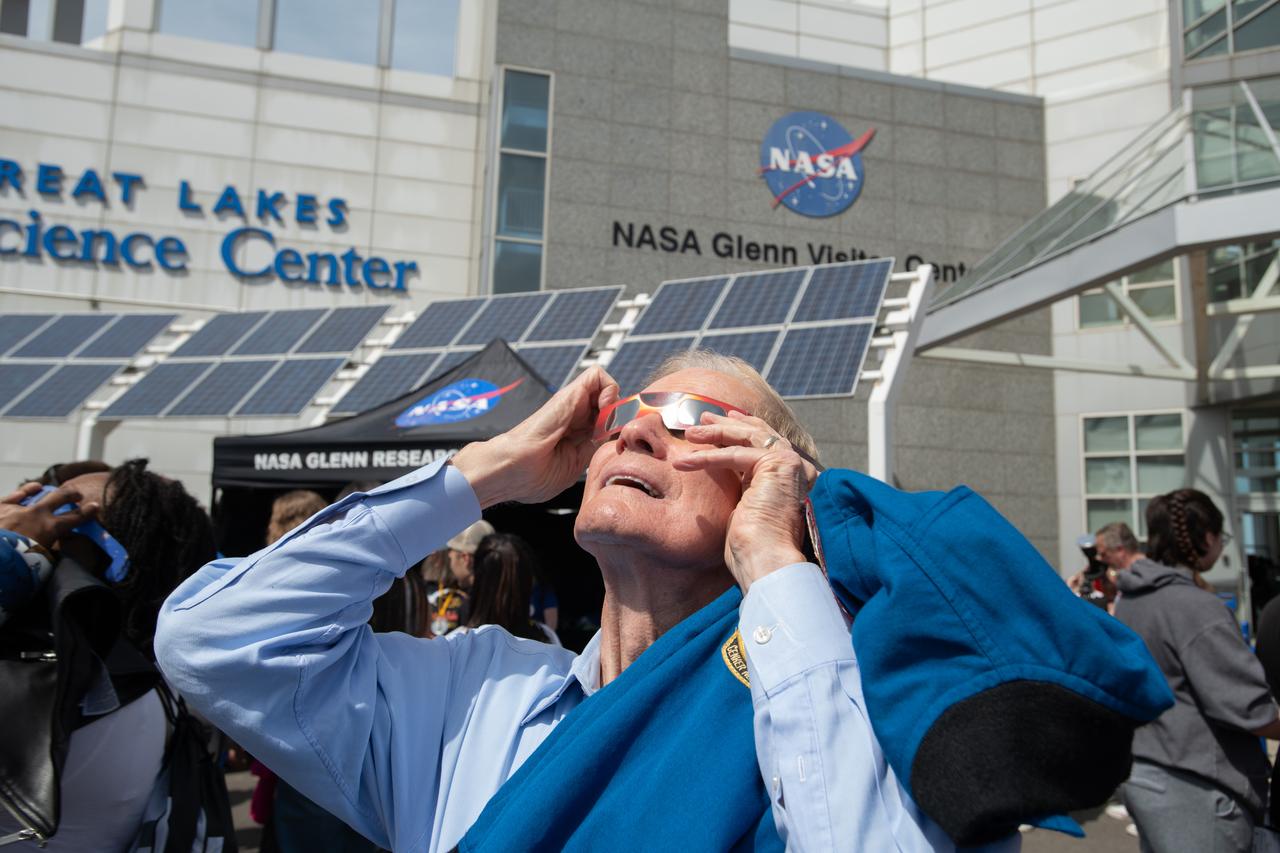
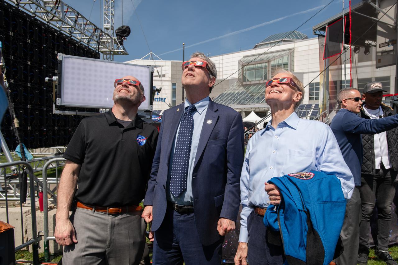
Administrator Bill Nelson views the eclipse safetly with solar eclipse glasses. NASA Glenn Research Center and the Great Lakes Science Center hosted a three-day celestial celebration in downtown Cleveland, OH. This free, outdoor, family-friendly science and arts festival will feature free concerts, performances, speakers, and hands-on science activities with community partners. A total solar eclipse swept across a narrow portion of the North American continent from Mexico’s Pacific coast to the Atlantic coast of Newfoundland, Canada. A partial solar eclipse was visible across the entire North American continent along with parts of Central America and Europe.
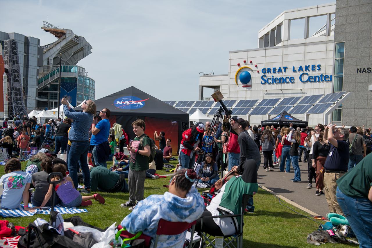
Event attendees view the eclipse. NASA Glenn Research Center and the Great Lakes Science Center hosted a three-day celestial celebration in downtown Cleveland, OH. This free, outdoor, family-friendly science and arts festival will feature free concerts, performances, speakers, and hands-on science activities with community partners. A total solar eclipse swept across a narrow portion of the North American continent from Mexico’s Pacific coast to the Atlantic coast of Newfoundland, Canada. A partial solar eclipse was visible across the entire North American continent along with parts of Central America and Europe.

GRC Center Director Jimmy Kenyon and Cleveland Mayor Justin Bibb pose for a photo together. NASA Glenn Research Center and the Great Lakes Science Center hosted a three-day celestial celebration in downtown Cleveland, OH. This free, outdoor, family-friendly science and arts festival will feature free concerts, performances, speakers, and hands-on science activities with community partners. A total solar eclipse swept across a narrow portion of the North American continent from Mexico’s Pacific coast to the Atlantic coast of Newfoundland, Canada. A partial solar eclipse was visible across the entire North American continent along with parts of Central America and Europe.
Event attendees view the eclipse. NASA Glenn Research Center and the Great Lakes Science Center hosted a three-day celestial celebration in downtown Cleveland, OH. This free, outdoor, family-friendly science and arts festival will feature free concerts, performances, speakers, and hands-on science activities with community partners. A total solar eclipse swept across a narrow portion of the North American continent from Mexico’s Pacific coast to the Atlantic coast of Newfoundland, Canada. A partial solar eclipse was visible across the entire North American continent along with parts of Central America and Europe.

Administrator Bill Nelson and Snoopy view the eclipse just before totality on April 8,2024. NASA Glenn Research Center and the Great Lakes Science Center hosted a three-day celestial celebration in downtown Cleveland, OH. This free, outdoor, family-friendly science and arts festival will feature free concerts, performances, speakers, and hands-on science activities with community partners. A total solar eclipse swept across a narrow portion of the North American continent from Mexico’s Pacific coast to the Atlantic coast of Newfoundland, Canada. A partial solar eclipse was visible across the entire North American continent along with parts of Central America and Europe. Photo Credit: (NASA/Sara Lowthian-Hanna)
An event attendee views the eclipse on April 8, 2024. NASA Glenn Research Center and the Great Lakes Science Center hosted a three-day celestial celebration in downtown Cleveland, OH. This free, outdoor, family-friendly science and arts festival will feature free concerts, performances, speakers, and hands-on science activities with community partners. A total solar eclipse swept across a narrow portion of the North American continent from Mexico’s Pacific coast to the Atlantic coast of Newfoundland, Canada. A partial solar eclipse was visible across the entire North American continent along with parts of Central America and Europe.

Event attendees view the total solar eclipse on April 8, 2024. NASA Glenn Research Center and the Great Lakes Science Center hosted a three-day celestial celebration in downtown Cleveland, OH. This free, outdoor, family-friendly science and arts festival will feature free concerts, performances, speakers, and hands-on science activities with community partners. A total solar eclipse swept across a narrow portion of the North American continent from Mexico’s Pacific coast to the Atlantic coast of Newfoundland, Canada. A partial solar eclipse was visible across the entire North American continent along with parts of Central America and Europe. Photo Credit: (NASA/Jef Janis)
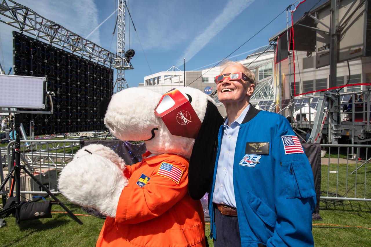
Administrator Bill Nelson and Snoopy view the eclipse together on April 8, 2024. NASA Glenn Research Center and the Great Lakes Science Center hosted a three-day celestial celebration in downtown Cleveland, OH. This free, outdoor, family-friendly science and arts festival will feature free concerts, performances, speakers, and hands-on science activities with community partners. A total solar eclipse swept across a narrow portion of the North American continent from Mexico’s Pacific coast to the Atlantic coast of Newfoundland, Canada. A partial solar eclipse was visible across the entire North American continent along with parts of Central America and Europe. Photo Credit: (NASA/Sara Lowthian-Hanna)
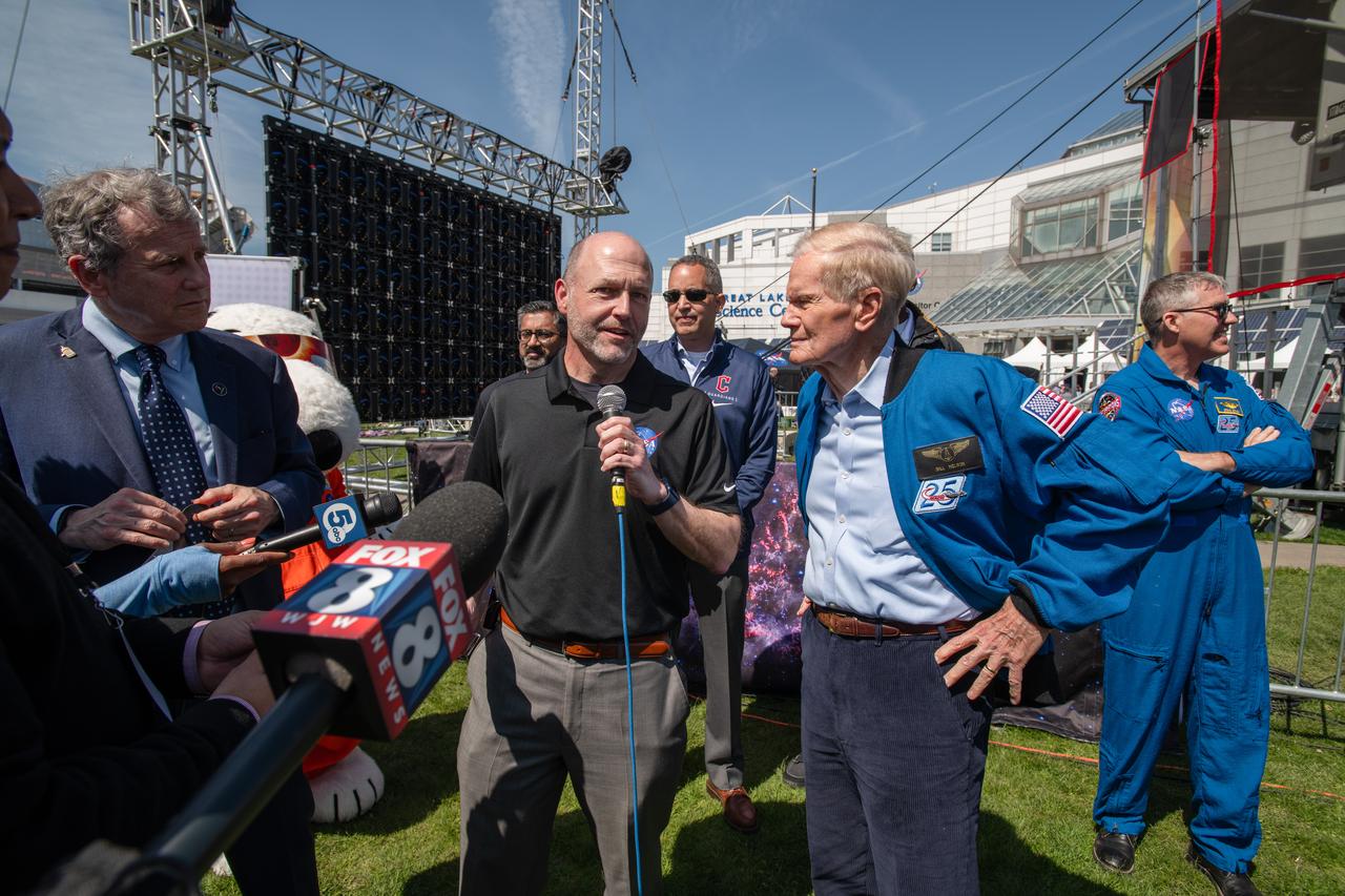
Senator Sherrod Brown, GRC Center Director Jimmy Kenyon and Administrator Bill Nelson speak to the media on April 8th. NASA Glenn Research Center and the Great Lakes Science Center hosted a three-day celestial celebration in downtown Cleveland, OH. This free, outdoor, family-friendly science and arts festival will feature free concerts, performances, speakers, and hands-on science activities with community partners. A total solar eclipse swept across a narrow portion of the North American continent from Mexico’s Pacific coast to the Atlantic coast of Newfoundland, Canada. A partial solar eclipse was visible across the entire North American continent along with parts of Central America and Europe.

ISS010-E-05072 (25 October 2004) --- Ibera Swamp topography in northeast Argentina is featured in this image photographed by an Expedition 10 crewmember on the International Space Station (ISS). The central lake in this image is one of hundreds in the Ibera swamplands that were formed by South America’s second largest river, the Parana. Although this great river now lies 120 kilometers to the north, its channel has swung over a great “inland delta” in the recent geological past, according to NASA scientists studying the Expedition 10 photo collection. This and other lakes were captured in this photograph as the sunglint point passed over this remote but vast swampland in northeast Argentina. The glint pattern shows winds ruffling the water surfaces. The lakes in this image lie within side channels of the Parana formed when it flowed through this region. The central lake in the image is about 2 kilometers long. Forest, swamp and prairie vegetation types outline the low topography which consists of lakes, low swells and depressions.
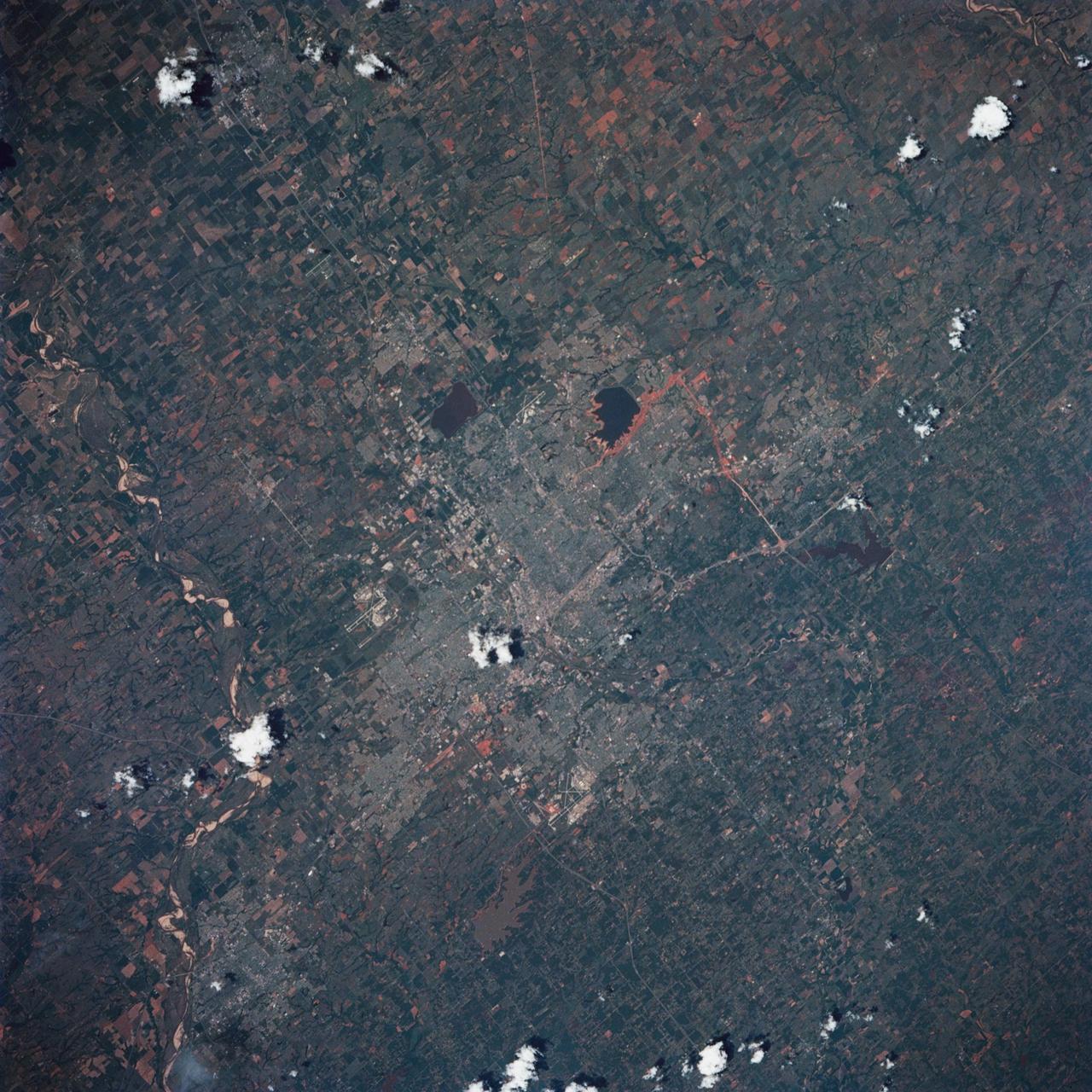
STS039-85-029 (28 April-6 May 1991) --- This 70mm frame is one of the best pictures of the Oklahoma City area from the manned space program, according to NASA photo experts studying STS-39 onboard photography. The central business district is near the center. Several municipalities are visible, along with thousands of acres of farmland. The towns of Norman and Moore and the South Canadian River are in the bottom (south). El Reno and Wiley Post Field off I-40W are just below center in lower left quadrant. Edmond is seen at the top (north). Tinker Field can be seen north of I-40E at right center. Lake Overholser shows recent spring rainfall northwest of the central business district.
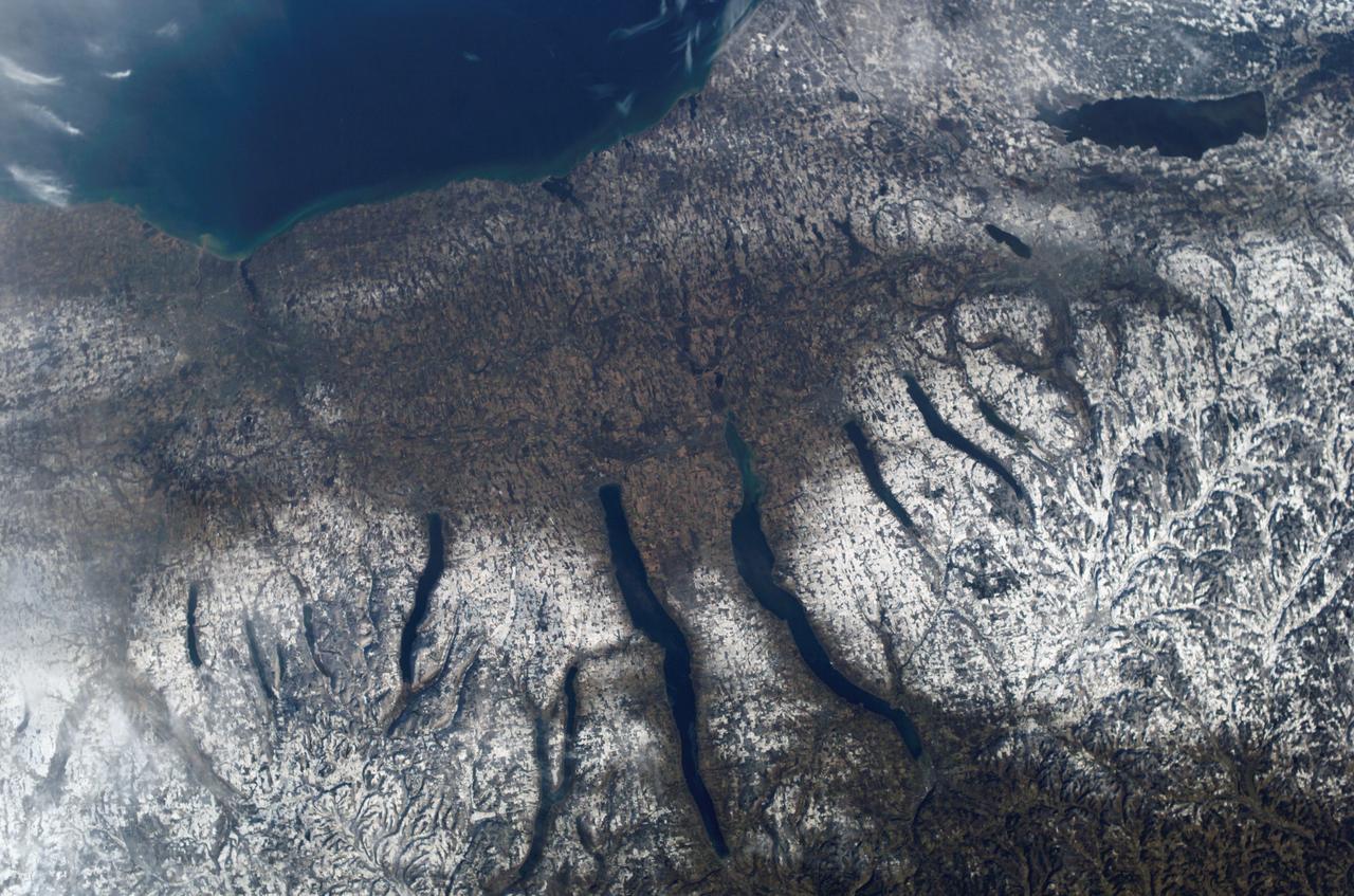
ISS010-E-09366 (4 December 2004) --- New York’s Finger Lakes region is featured in this digital image photographed by an Expedition 10 crewmember on the International Space Station. Shapes of the snow-covered hills are accented by the low sun angles, and contrast with the darker, finger-shaped lakes filling the region’s valleys. Scientists believe the steep, roughly parallel valleys and hills of the Finger Lakes region were shaped by advancing and retreating ice sheets that were as much as 2 miles deep during the last ice age. River valleys were scoured into deep troughs; many are now filled with lakes. The two largest lakes, Seneca and Cayuga, are so deep that the bases of their lakebeds are below sea level. The cities of Rochester, Syracuse and Ithaca are included in this field-of-view, as seen from the Space Station. These three cities enjoy large seasonal snowpacks, thanks to the influence of the Great Lakes producing lake-effect snowstorms. According to NASA scientists studying the Space Station imagery, despite its reputation for long winters, the region is balmy compared with the glacial climate present when the landscape was carved. Scientists believe, at the time of the greatest ice extent, yearly average temperatures over northern North America were several degrees lower than today.
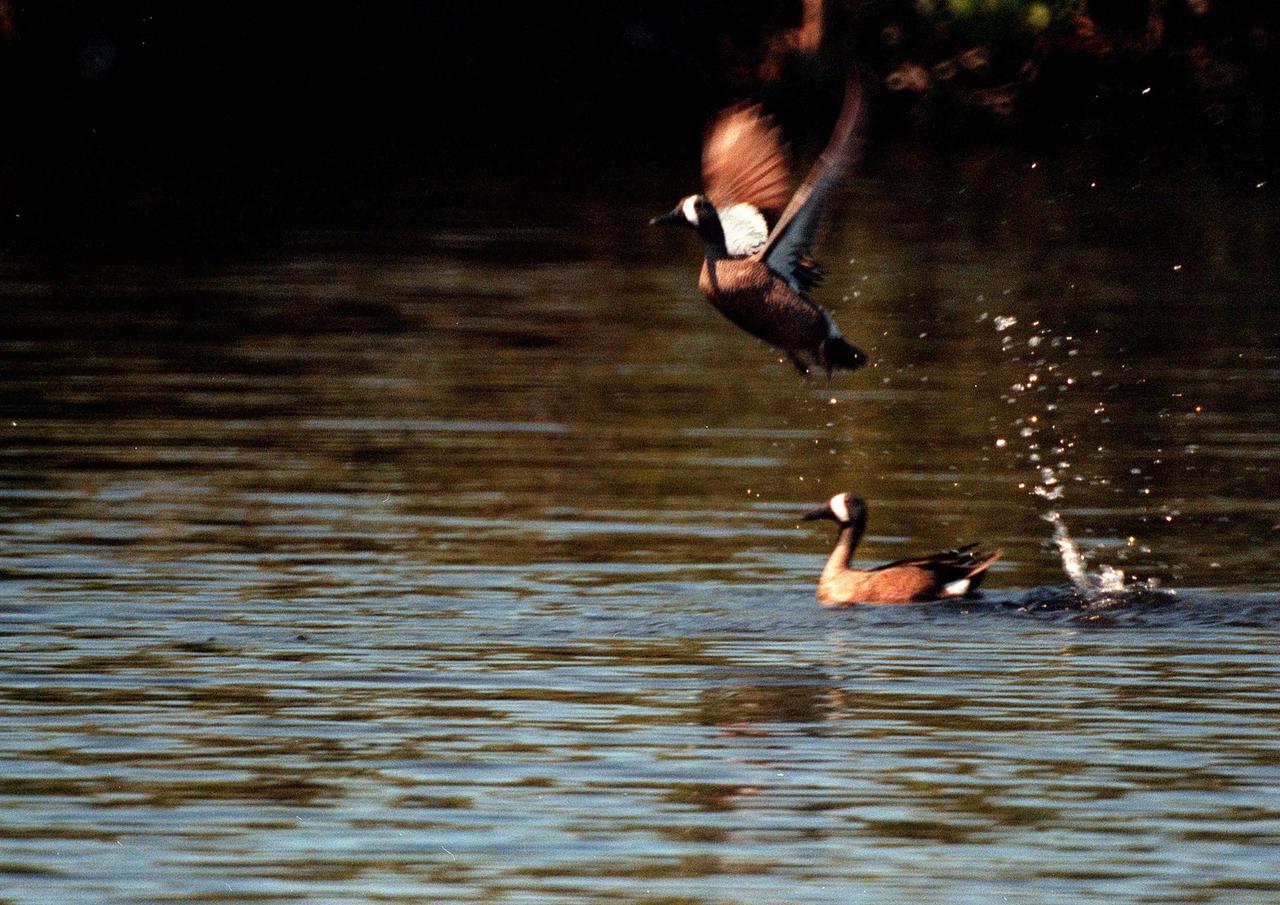
KENNEDY SPACE CENTER, FLA. -- The furious beating wings of a blue-winged teal launch it from the water as another swims calmly beneath it in the Merritt Island National Wildlife Refuge, which shares a boundary with Kennedy Space Center. Inhabiting marshes, shallow ponds and lakes from British Columbia, Quebec and Newfoundland to North Carolina, the Gulf Coast and southern California, the teal winters as far south as South America. The 92,000-acre refuge is a habitat for more than 310 species of birds, 25 mammals, 117 fishes and 65 amphibians and reptiles. The marshes and open water of the refuge also provide wintering areas for 23 species of migratory waterfowl, as well as a year-round home for great blue herons, great egrets, wood storks, cormorants, brown pelicans and other species of marsh and shore birds

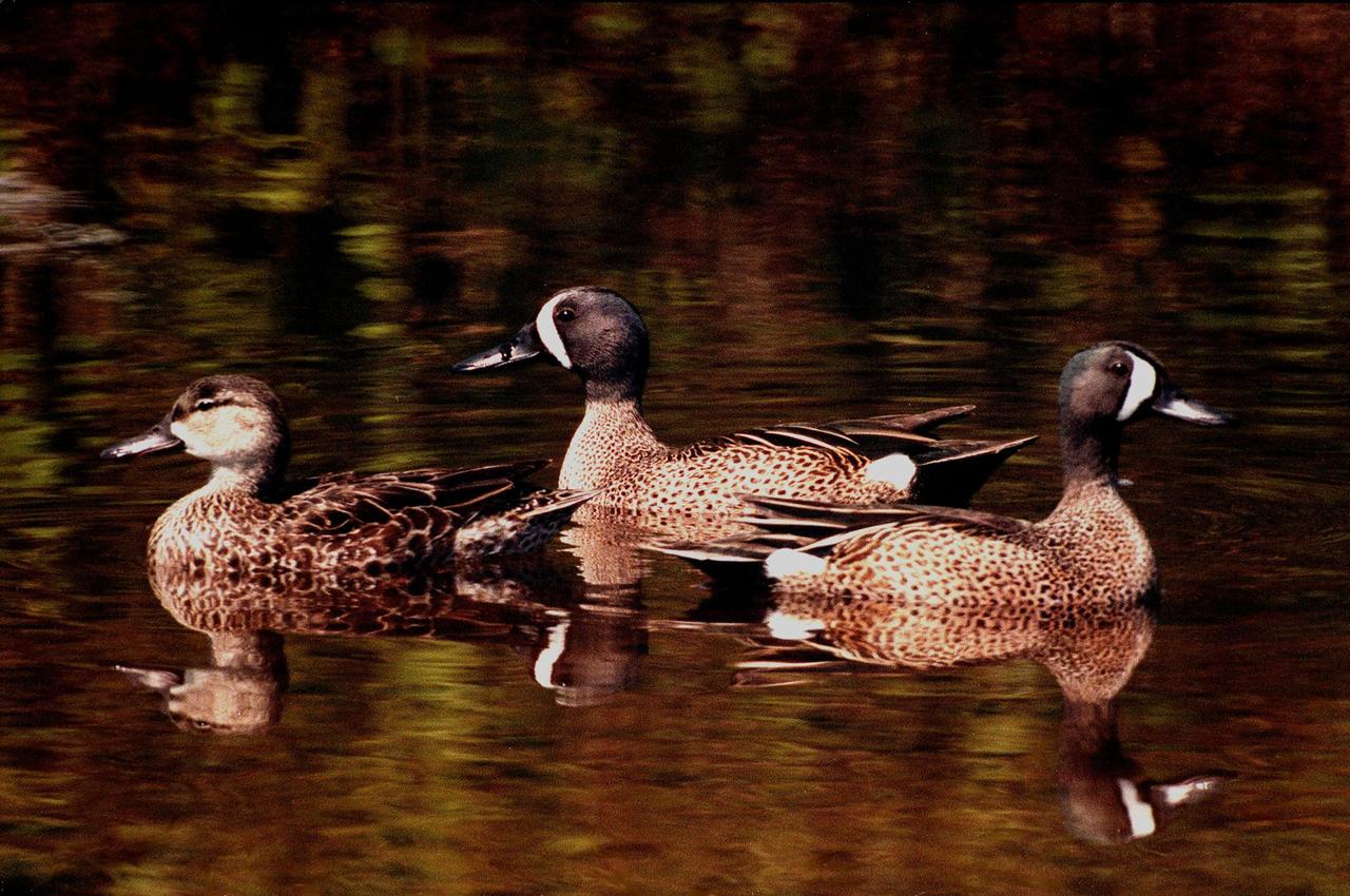
KENNEDY SPACE CENTER, FLA. -- This male blue-winged teal is one of 23 species of migratory waterfowl that winter in the waters of the Merritt Island National Wildlife Refuge at Kennedy Space Center. The male is usually identified with pale blue shoulder patches and a white crescent in front of its eye. The blue-winged teal's normal range is from Canada to North Carolina, the Gulf Coast and southern California, preferring marshes, shallow ponds and lakes. It winters as far as northern South America. The refuge provides wintering areas for 23 species of migratory waterfowl, as well as a year-round home for great blue herons, great egrets, wood storks, cormorants, brown pelicans and other species of marsh and shore birds. The 92,000-acre refuge is also habitat for more than 310 species of birds, 25 mammals, 117 fishes and 65 amphibians and reptiles
KENNEDY SPACE CENTER, FLA. -- Two male blue-winged teals are joined by a female in the waters of the Merritt Island National Wildlife Refuge, which shares a boundary with Kennedy Space Center. The teals inhabit marshes, shallow ponds and lakes from British Columbia, Quebec and Newfoundland to North Carolina, the Gulf Coast and southern California, wintering as far south as South America. The 92,000-acre wildlife refuge is a habitat for more than 310 species of birds, 25 mammals, 117 fishes and 65 amphibians and reptiles. The marshes and open water of the refuge also provide wintering areas for 23 species of migratory waterfowl, as well as a year-round home for great blue herons, great egrets, wood storks, cormorants, brown pelicans and other species of marsh and shore birds

KENNEDY SPACE CENTER, FLA. -- A pair of blue-winged teals glide through the waters of the Merritt Island National Wildlife Refuge, which shares a boundary with Kennedy Space Center. Inhabiting marshes, shallow ponds and lakes from British Columbia, Quebec and Newfoundland to North Carolina, the Gulf Coast and southern California, the teal winters as far south as South America. The 92,000-acre refuge is a habitat for more than 310 species of birds, 25 mammals, 117 fishes and 65 amphibians and reptiles. The marshes and open water of the refuge also provide wintering areas for 23 species of migratory waterfowl, as well as a year-round home for great blue herons, great egrets, wood storks, cormorants, brown pelicans and other species of marsh and shore birds
Cleveland Mayor Justin Bibb, Represenative Max Miller, Administrator Bill Nelson, Representative Shontel Brown, and Cuyahoga County Executive Chris Ronayne view the eclipse together. NASA Glenn Research Center and the Great Lakes Science Center hosted a three-day celestial celebration in downtown Cleveland, OH. This free, outdoor, family-friendly science and arts festival will feature free concerts, performances, speakers, and hands-on science activities with community partners. A total solar eclipse swept across a narrow portion of the North American continent from Mexico’s Pacific coast to the Atlantic coast of Newfoundland, Canada. A partial solar eclipse was visible across the entire North American continent along with parts of Central America and Europe.
ISS018-E-005660 (28 Oct. 2008) --- The Great Divide of the Rocky Mountains in Colorado is featured in this image photographed by an Expedition 18 crewmember on the International Space Station. This view highlights a portion of the Great Divide in the Rocky Mountains approximately 31 kilometers due west of Boulder, Colorado. The Great Divide is one of four continental divides recognized by geographers and hydrologists in North America -- the others being the Northern, Eastern, and Saint Lawrence Seaway Divides -- but it is still generally (and erroneously) known as "the" Continental Divide. The Great Divide is a hydrologic boundary defined by the ultimate destination of precipitation -- rainfall on the western side of the Divide flows to the Pacific Ocean, while rainfall on the eastern side of the Divide flows to the Gulf of Mexico. It is easy to visualize such a boundary traced along the high ridges of the Rocky Mountains, but in regions of less topography more detailed study of the local geomorphology and hydrology are required to map the location of the Divide. This portion of the Rocky Mountains also hosts the Niwot Ridge Long Term Ecological Research (LTER) site. Part of the National Science Foundation LTER program, the Niwot Ridge LTER site studies climate interactions with tundra and alpine ecosystems. Niwot Ridge is visible in this image as a large eastward spur off the central spine of the mountains. The entire Niwot LTER site is located at elevations higher than 3000 m, and includes an active cirque glacier and glacial landforms, tarns (glacial lakes), and permafrost. Lake Granby, located to the west of the Great Divide, is a reservoir on the Colorado River and the second-largest manmade body of water in the state of Colorado. Storage of water began in 1949. Today, the Lake is popular location for fishing, boating and camping.
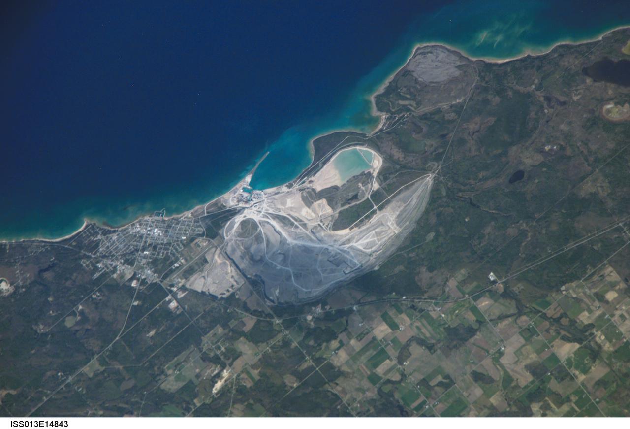
ISS013-E-14843 (6 May 2006) --- Calcite Quarry, Michigan is featured in this image photographed by an Expedition 13 crewmember on the International Space Station. While the Great Lakes region of North America is well known for its importance to shipping between the United States, Canada, and the Atlantic Ocean, it is also the location of an impressive structure in the continent's bedrock -- the Michigan Basin, NASA scientists point out. The Basin looks much like a large bull's-eye defined by the arrangement of exposed rock layers, which all tilt inwards towards the center forming a huge bowl-shaped structure. While this "bowl" is not readily apparent while on the ground, detailed mapping of the rock units on a regional scale revealed the structure to geologists. The outer layers of the Basin include thick deposits of carbonates (limestone and dolomite). These carbonate rocks are mined throughout the Great Lakes region using large open-pit mines. The largest carbonate mine in the world, Calcite Quarry, is depicted in this image. The mine has been active for over 85 years; the worked area (grey region in image center) measures approximately 7 kilometers long by 4 kilometers wide, and is crossed by several access roads (white) into various areas of the mine.
ISS028-E-010162 (29 June 2011) --- Sault Ste Marie, Ontario and Michigan are featured in this image photographed by an Expedition 28 crew member on the International Space Station. The twin cities of Sault Ste Marie are located across the St. Mary?s River that forms part of the international boundary between Canada (Province of Ontario) and the United States (State of Michigan). This photograph highlights the two cities, together with the region of lakes and islands that separates Lakes Huron and Superior, two of the Great Lakes of North America. Smaller lakes include Lake George to the west; the large forested islands of St. Joseph and Drummond are visible at lower left. The Sault Ste Marie urban areas (upper right) have a distinctive gray to white coloration in the image, contrasting with the deep green of forested areas in Ontario and the lighter green of agricultural fields in Michigan. The coloration of water surfaces in the lakes and rivers varies from blue to blue-green to silver, and is likely caused by varying degrees of sediment and sunglint ? light reflecting back to the observer on the space station from the water surface, much as light reflects from a mirror. Prior to formalization of the US/Canada border in 1817, Sault Ste Marie was a single community. Archeological evidence suggests that the region had been occupied by Native Americans at least five hundred years ago. A mission ? the first European settlement in Michigan ? was established there in 1668 by the French Jesuit Father Jacques Marquette. Today, shipping locks and canals in both urban areas are an important part of the Great Lakes shipping traffic system.
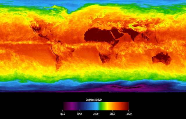
This image shows average temperatures in April, 2003, observed by AIRS at an infrared wavelength that senses either the Earth's surface or any intervening cloud. Similar to a photograph of the planet taken with the camera shutter held open for a month, stationary features are captured while those obscured by moving clouds are blurred. Many continental features stand out boldly, such as our planet's vast deserts, and India, now at the end of its long, clear dry season. Also obvious are the high, cold Tibetan plateau to the north of India, and the mountains of North America. The band of yellow encircling the planet's equator is the Intertropical Convergence Zone (ITCZ), a region of persistent thunderstorms and associated high, cold clouds. The ITCZ merges with the monsoon systems of Africa and South America. Higher latitudes are increasingly obscured by clouds, though some features like the Great Lakes, the British Isles and Korea are apparent. The highest latitudes of Europe and Eurasia are completely obscured by clouds, while Antarctica stands out cold and clear at the bottom of the image. http://photojournal.jpl.nasa.gov/catalog/PIA00427
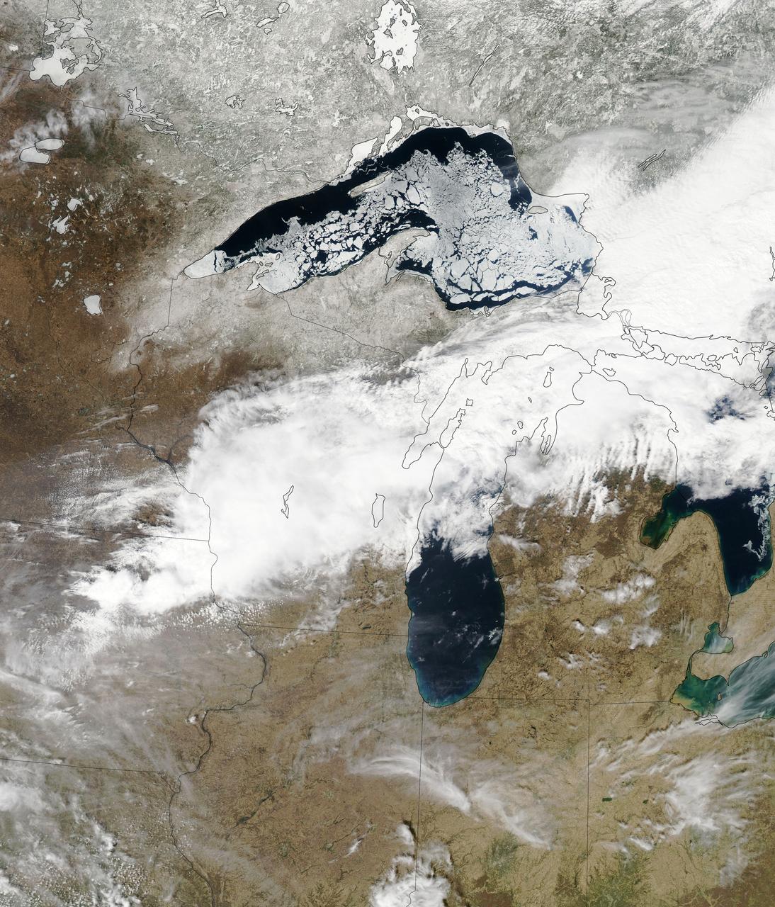
Though North America is a full month into astronomical spring, the Great Lakes have been slow to give up on winter. As of April 22, 2014, the Great Lakes were 33.9 percent ice covered. The lake they call Superior dominated the pack. In the early afternoon on April 20, 2014, the Moderate Resolution Imaging Spectroradiometer (MODIS) on NASA’s Aqua satellite captured this natural-color image of Lake Superior, which straddles the United States–Canada border. At the time Aqua passed over, the lake was 63.5 percent ice covered, according to the NOAA Great Lakes Environmental Research Lab (GLERL). Averaged across Lake Superior, ice was 22.6 centimeters (8.9 inches) thick; it was as much as twice that thickness in some locations. GLERL researcher George Leshkevich affirmed that ice cover this spring is significantly above normal. For comparison, Lake Superior had 3.6 percent ice cover on April 20, 2013; in 2012, ice was completely gone by April 12. In the last winter that ice cover grew so thick on Lake Superior (2009), it reached 93.7 percent on March 2 but was down to 6.7 percent by April 21. Average water temperatures on all of the Great Lakes have been rising over the past 30 to 40 years and ice cover has generally been shrinking. (Lake Superior ice was down about 79 percent since the 1970s.) But chilled by persistent polar air masses throughout the 2013-14 winter, ice cover reached 88.4 percent on February 13 and 92.2 percent on March 6, 2014, the second highest level in four decades of record-keeping. Air temperatures in the Great Lakes region were well below normal for March, and the cool pattern is being reinforced along the coasts because the water is absorbing less sunlight and warming less than in typical spring conditions. The graph below, based on data from Environment Canada, shows the 2014 conditions for all of the Great Lakes in mid-April compared to the past 33 years. Lake Superior ice cover got as high as 95.3 percent on March 19. By April 22, it was reported at 59.9 percent; Lake Huron was nearly 30.4 percent. News outlets noted that as many as 70 ships have been backed up in Lakes Michigan, Huron, and Erie, waiting for passage into ports on Lake Superior. The U.S. Coast Guard has been grouping ships together into small convoys after they pass through locks at Sault Ste. Marie, in order to maximize ice-breaking efficiency and to protect ships from damage. Superior is the world’s largest freshwater lake by area (82,100 square kilometers or 31,700 square miles) and the third largest by volume. The waters average 147 meters (483 feet) in depth, and the basin is believed to hold about 10 percent of the world’s liquid fresh water. NASA image courtesy Jeff Schmaltz LANCE/EOSDIS MODIS Rapid Response Team, GSFC. Caption by Mike Carlowicz. Read more: <a href="http://earthobservatory.nasa.gov/IOTD/view.php?id=83541&eocn=home&eoci=iotd_title" rel="nofollow">earthobservatory.nasa.gov/IOTD/view.php?id=83541&eocn...</a> Credit: <b><a href="http://www.earthobservatory.nasa.gov/" rel="nofollow"> NASA Earth Observatory</a></b> <b><a href="http://www.nasa.gov/audience/formedia/features/MP_Photo_Guidelines.html" rel="nofollow">NASA image use policy.</a></b> <b><a href="http://www.nasa.gov/centers/goddard/home/index.html" rel="nofollow">NASA Goddard Space Flight Center</a></b> enables NASA’s mission through four scientific endeavors: Earth Science, Heliophysics, Solar System Exploration, and Astrophysics. Goddard plays a leading role in NASA’s accomplishments by contributing compelling scientific knowledge to advance the Agency’s mission. <b>Follow us on <a href="http://twitter.com/NASAGoddardPix" rel="nofollow">Twitter</a></b> <b>Like us on <a href="http://www.facebook.com/pages/Greenbelt-MD/NASA-Goddard/395013845897?ref=tsd" rel="nofollow">Facebook</a></b> <b>Find us on <a href="http://instagram.com/nasagoddard?vm=grid" rel="nofollow">Instagram</a></b>
The Eridania basin of southern Mars is believed to have held a sea about 3.7 billion years ago, with seafloor deposits likely resulting from underwater hydrothermal activity. This graphic shows estimated depths of water in that ancient sea. A recent estimate of the total water volume of the ancient Eridania sea is about 50,000 cubic miles (210,000 cubic kilometers), about nine times the total volume of North America's Great Lakes. The map covers an area about 530 miles (850 kilometers) wide. This graphic was included in a 2017 report "Ancient hydrothermal seafloor deposits in Eridania basin on Mars" in Nature Communications. A reference bar indicating color coding of depth, from red, at right, showing depth of about 300 feet (100 meters) to black showing depth more than 10 times that depth. This graphic was included in a 2017 report "Ancient hydrothermal seafloor deposits in Eridania basin on Mars" in Nature Communications. https://photojournal.jpl.nasa.gov/catalog/PIA22059
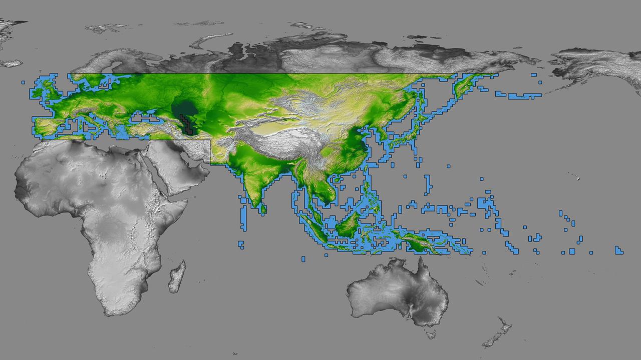
inal Caption Released with Image: The colored regions of this map show the extent of digital elevation data recently released by the Shuttle Radar Topography Mission (SRTM). This release includes data for most of Europe and Asia plus numerous islands in the Indian and Pacific Oceans. SRTM flew on board the Space Shuttle Endeavour in February 2000 and used an interferometric radar system to map the topography of Earth's landmass between latitudes 56 degrees south and 60 degrees north. The data were processed into geographic "tiles," each of which represents one by one degree of latitude and longitude. A degree of latitude measures 111 kilometers (69 miles) north-south, and a degree of longitude measures 111 kilometers or less east-west, decreasing away from the equator. The data are being released to the public on a continent-by-continent basis. This Eurasia segment includes 5,940 tiles, more than a third of the total data set. Previous releases covered North America and South America. Forthcoming releases will include Africa-Arabia and Australia plus an "Islands" release for those islands not included in the continental releases. Together these data releases constitute the world's first high-resolution, near-global elevation model. The resolution of the publicly released data is three arcseconds (1/1,200 of a degree of latitude and longitude), which is about 90 meters (295 feet). European coverage in the current data release stretches eastward from the British Isles and the Iberian Peninsula in the west, across the Alps and Carpathian Mountains, as well as the Northern European Plain, to the Ural and Caucasus Mountains bordering Asia. The Asian coverage includes a great diversity of landforms, including the Tibetan Plateau, Tarin Basin, Mongolian Plateau, and the mountains surrounding Lake Baikal, the world's deepest lake. Mt. Everest in the Himalayas, at 8,848 meters (29,029 feet) is the world's highest mountain. From India's Deccan Plateau, to Southeast Asia, coastal China, and Korea, various landforms place constraints upon land use planning for a great population. Volcanoes in the East Indies, the Philippines, Japan, and the Kamchatka Peninsula form the western part of the "Ring of Fire" around the Pacific Ocean. Many of these regions were previously very poorly mapped due to persistent cloud cover or the inaccessibility of the terrain. Digital elevation data, such as provided by SRTM, are particularly in high demand by scientists studying earthquakes, volcanism, and erosion patterns for use in mapping and modeling hazards to human habitation. But the shape of Earth's surface affects nearly every natural process and human endeavor that occurs there, so elevation data are used in a wide range of applications. In this index map color-coding is directly related to topographic height, with green at the lower elevations, rising through yellow and tan, to white at the highest elevations. The large, very dark green feature in western Asia is the Caspian Sea, which is below sea level. Blue areas on the map represent water within the mapped tiles, each of which includes shorelines or islands. http://photojournal.jpl.nasa.gov/catalog/PIA03398
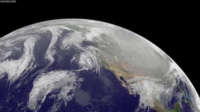
1-9 January 2014. The full-disk images every 3 hours from GOES-WEST capture the sweep of a polar vortex that emerged from the arctic at the beginning of the new year, pushing a blizzard into the northeastern USA on January 3, followed by extensive bitter cold (-20 F, windchill -50 F) around the Great Lakes, and single digit temperatures as far south as Atlanta, Georgia. This western viewpoint displays the persistent flow of arctic air from northern Alaska and Yukon into North America. <b><a href="http://goes.gsfc.nasa.gov/" rel="nofollow">Credit: NOAA/NASA GOES Project</a></b> <b><a href="http://www.nasa.gov/audience/formedia/features/MP_Photo_Guidelines.html" rel="nofollow">NASA image use policy.</a></b> <b><a href="http://www.nasa.gov/centers/goddard/home/index.html" rel="nofollow">NASA Goddard Space Flight Center</a></b> enables NASA’s mission through four scientific endeavors: Earth Science, Heliophysics, Solar System Exploration, and Astrophysics. Goddard plays a leading role in NASA’s accomplishments by contributing compelling scientific knowledge to advance the Agency’s mission. <b>Follow us on <a href="http://twitter.com/NASA_GoddardPix" rel="nofollow">Twitter</a></b> <b>Like us on <a href="http://www.facebook.com/pages/Greenbelt-MD/NASA-Goddard/395013845897?ref=tsd" rel="nofollow">Facebook</a></b> <b>Find us on <a href="http://instagram.com/nasagoddard?vm=grid" rel="nofollow">Instagram</a></b>