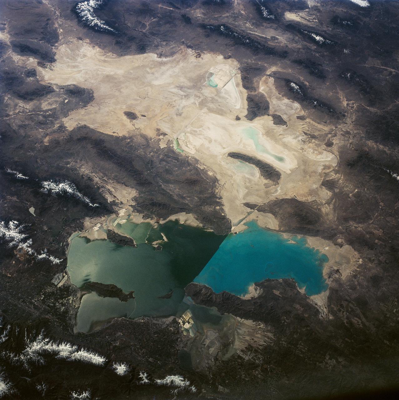
This is a view of the Great Salt Lake and nearby Bonneville Salt Flats, UT, (41.0N, 112.5W). A railroad causeway divides the lake with a stark straight line changing the water level and chemistry of the lake as a result. Fresh water runoff enters from the south adding to the depth and reducing the salinity. The north half receives little frsh water and is more saline and shallow. The Bonnieville Salt Flats is the lakebed of a onetime larger lake.
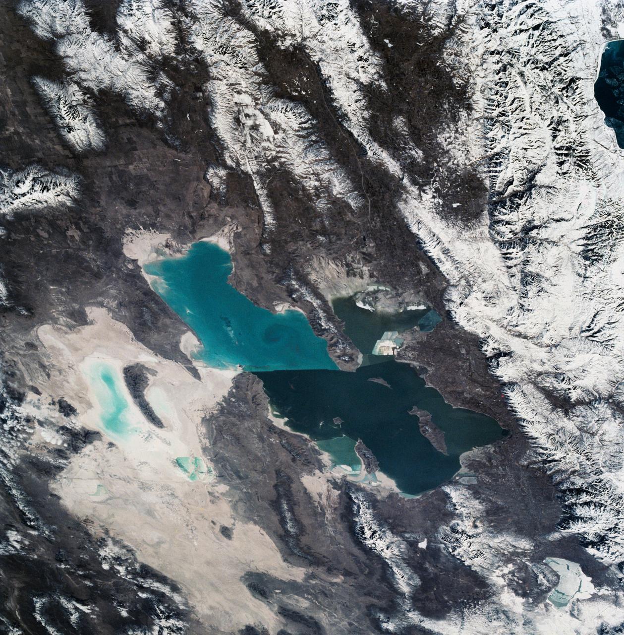
As seen from space, the Great Salt Lake, Utah, USA (41.5N, 112.5W) appears as two separate bodies of water with a narrow divider in the middle. At the turn of the century, a railroad bridge without culverts, was built across the lake and ever since, the water and salinity levels have been uneqal on either side. Fed by snowmelt from the nearby Wasatch Mountains, the lake in recent years has had record high water levels, threatening to flood the local areas.