
The NASA Langley Research Center-based B-200 in Gabon, Africa, was visited by three representatives of the Gabon Ministry of the Numerical Economy (the three women seen in the middle). In the photo from left are Bryan Blair, Rick Yasky, the three Gabon representatives, Alan Barringer and Lola Fatoyinbo.
In Gabon, Africa, the Mondah National Park is one of the field research sites for NASA’s AfriSAR campaign. Gabon is a Central African country slightly smaller than the state of Colorado that features the world’s second largest rainforest. In addition to environmental measurements, the flights were used for calibrating satellites for current and upcoming missions.
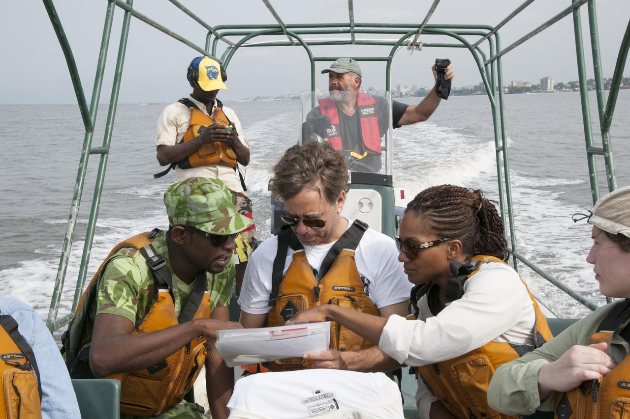
A member of the Gabon National Park Agency Ecoguard discussed the next research destination with Lola Fatoyinbo, Marc Simard and Laura Duncanson.
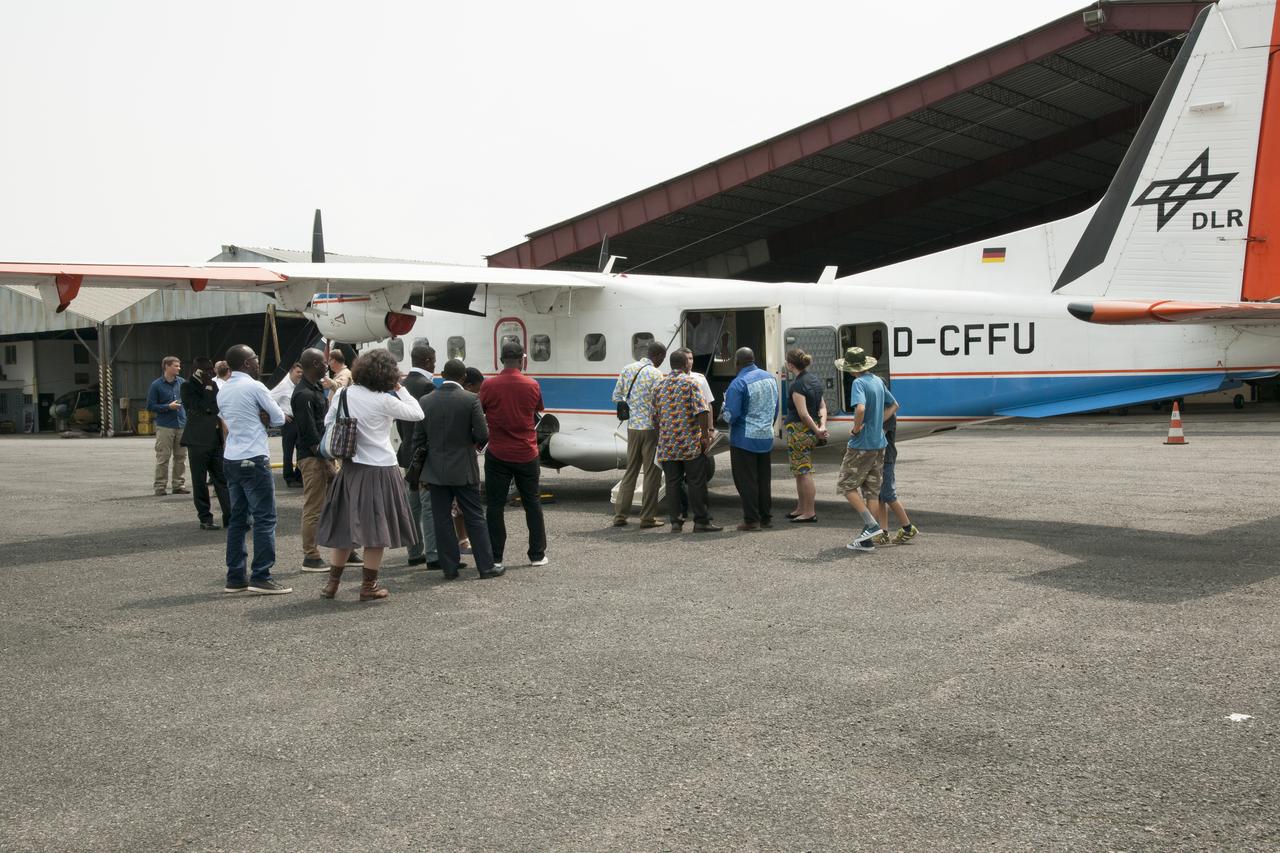
During an education outreach event in Gabon, Africa, students and educators, look at the German Aerospace Center Dornier DO-228 twin-engine turboprop aircraft.
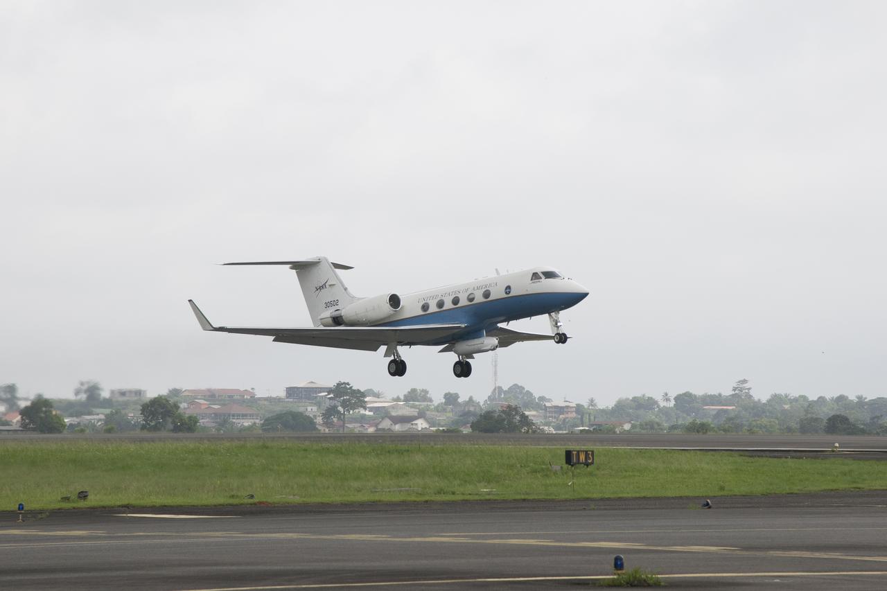
NASA’s C-20A takes off from Libreville International Airport in Gabon, Africa, in support of the AfriSAR  campaign in March 2016. Gabon is a Central African country slightly smaller than the state of Colorado that features the world’s second largest rainforest. In addition to environmental measurements, the flights were used for calibrating satellites for current and upcoming missions.
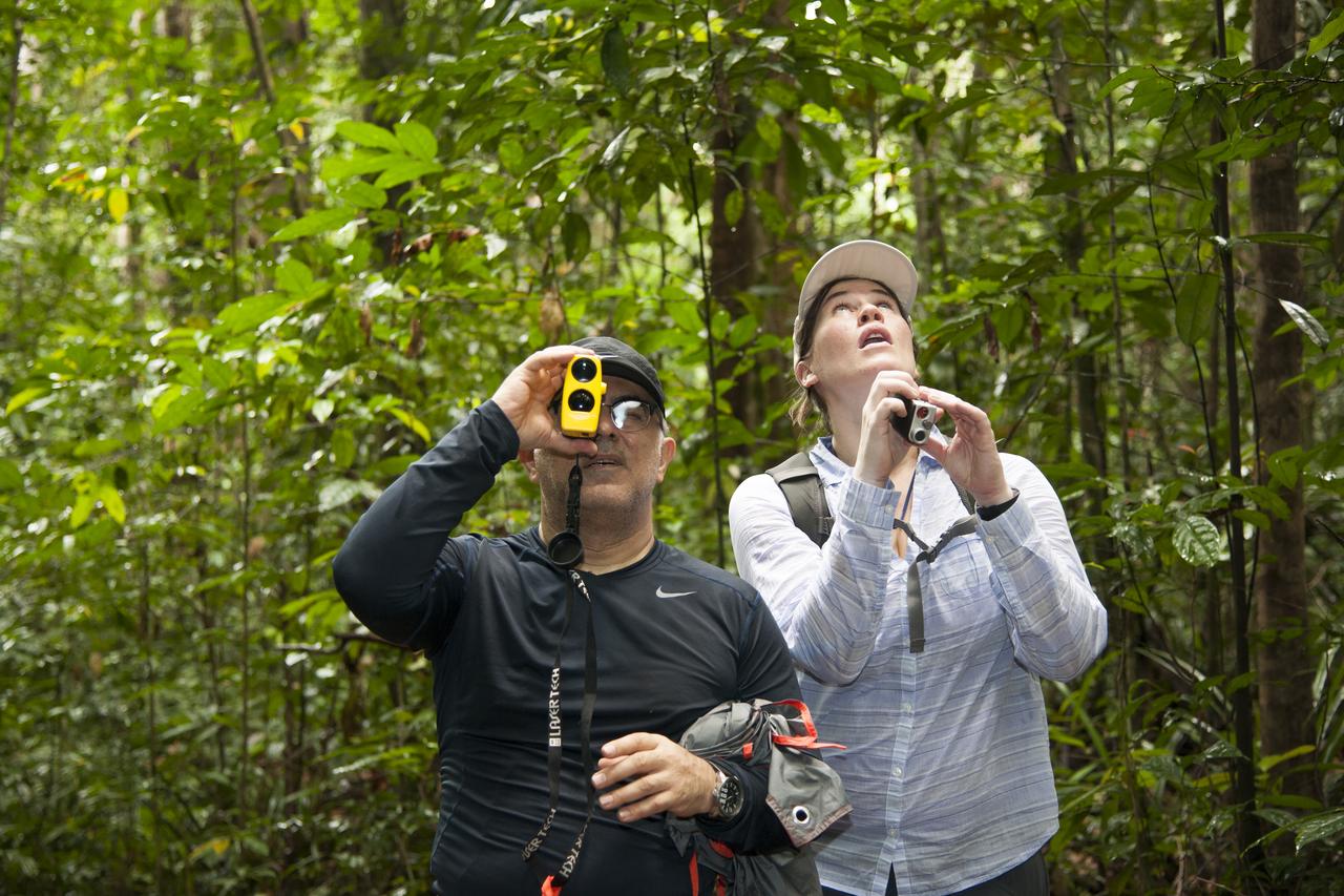
AfriSAR team members Sassan Saatchi (left) from NASA’s Jet Propulsion Laboratory and Laura Duncanson from NASA’s Goddard Space Flight Center take measurements of trees in the rainforest in the Mondah National Park, Gabon, Africa.

Armstrong Pilots David Fedors and Stu Broce are at the controls of the C-20A in March 2016 as it flies a synthetic aperture radar over areas of interest in the AfriSAR mission based in Gabon, Africa. The international campaign included measurements of flora in the country’s rainforests, wetlands, mangrove forests and savanna.

Members of the AfriSAR team standing by the C-20A in Gabon, Africa, which is usually based at NASA Armstrong Flight Research Center in California include, from left, John McGrath, Carlos Meza, Stu Broce, Samuel Choi, David Fedors, Naiara Pinto, Mark Scherer, Marc Simard, Vincent Moreno, Chuck Irving and Kean Tham.
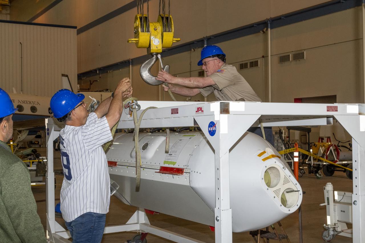
The Uninhabited Aerial Vehicle Synthetic Aperture Radar, UAVSAR, is prepared for installation onto NASA’s C-20A aircraft. THE UAVSAR uses a technique called interferometry to detect and measure very subtle deformations in the Earth’s surface, and the pod is specially designed to be interoperable with unmanned aircraft in the future. It will gather data from Gabon, Africa in September of 2023.
The Uninhabited Aerial Vehicle Synthetic Aperture Radar, UAVSAR, is prepared for installation onto NASA’s C-20A aircraft. THE UAVSAR uses a technique called interferometry to detect and measure very subtle deformations in the Earth’s surface, and the pod is specially designed to be interoperable with unmanned aircraft in the future. It will gather data from Gabon, Africa in September of 2023.
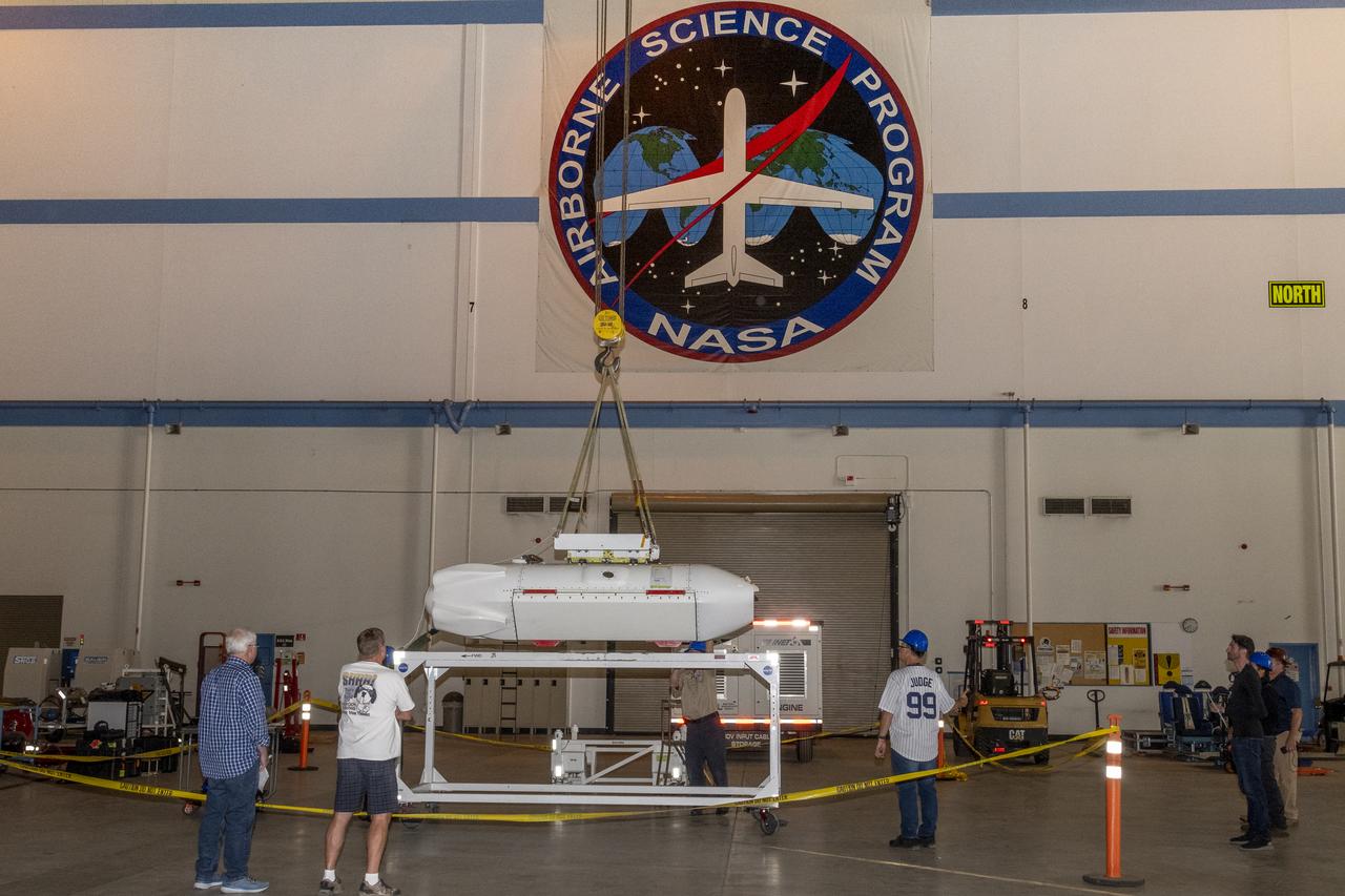
The Uninhabited Aerial Vehicle Synthetic Aperture Radar, UAVSAR, is prepared for installation onto NASA’s C-20A aircraft. THE UAVSAR uses a technique called interferometry to detect and measure very subtle deformations in the Earth’s surface, and the pod is specially designed to be interoperable with unmanned aircraft in the future. It will gather data from Gabon, Africa in September of 2023.

The Uninhabited Aerial Vehicle Synthetic Aperture Radar, UAVSAR, is prepared for installation onto NASA’s C-20A aircraft. THE UAVSAR uses a technique called interferometry to detect and measure very subtle deformations in the Earth’s surface, and the pod is specially designed to be interoperable with unmanned aircraft in the future. It will gather data from Gabon, Africa in September of 2023.
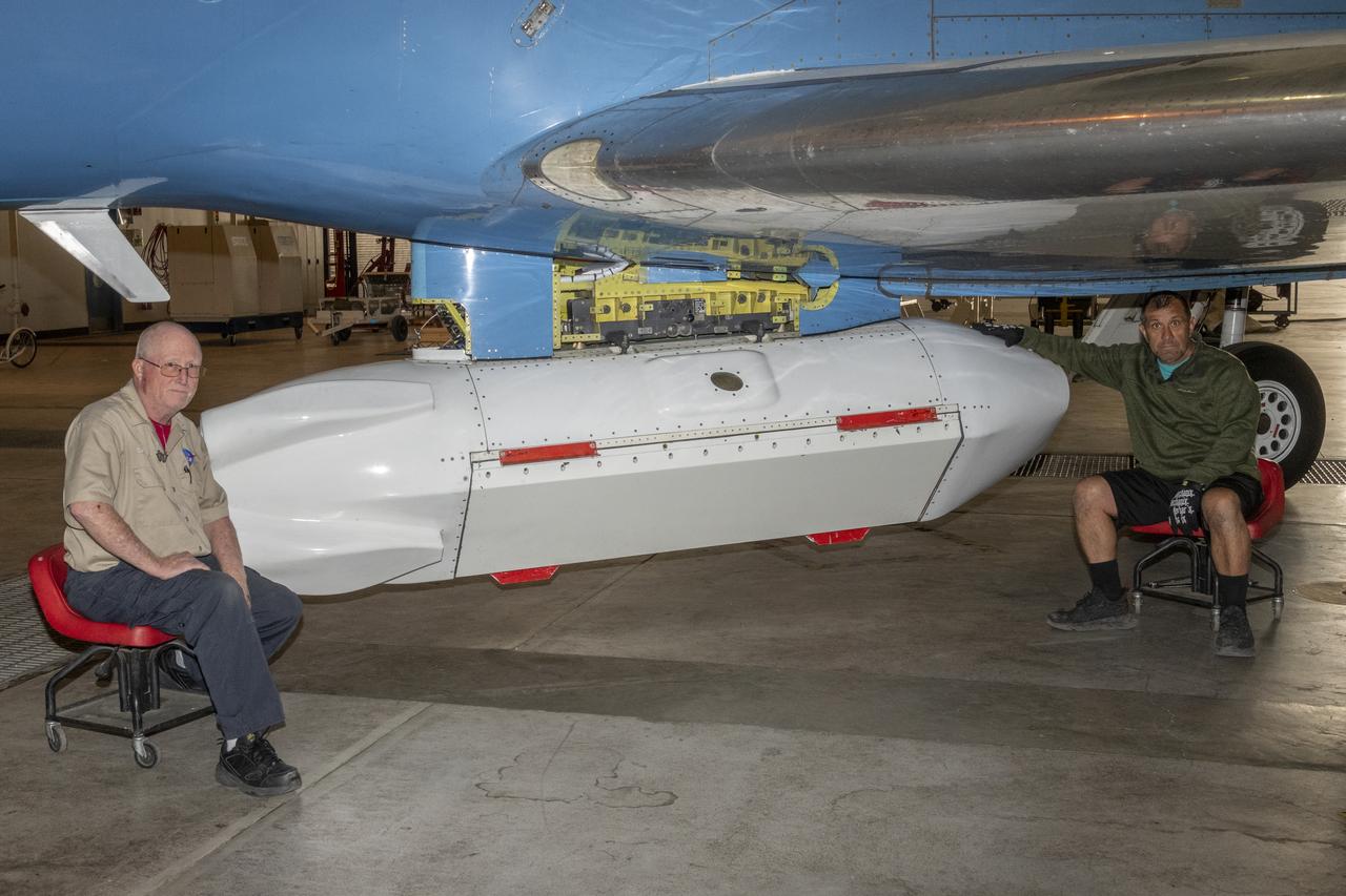
The Uninhabited Aerial Vehicle Synthetic Aperture Radar, UAVSAR, is prepared for installation onto NASA’s C-20A aircraft. THE UAVSAR uses a technique called interferometry to detect and measure very subtle deformations in the Earth’s surface, and the pod is specially designed to be interoperable with unmanned aircraft in the future. It will gather data from Gabon, Africa in September of 2023.

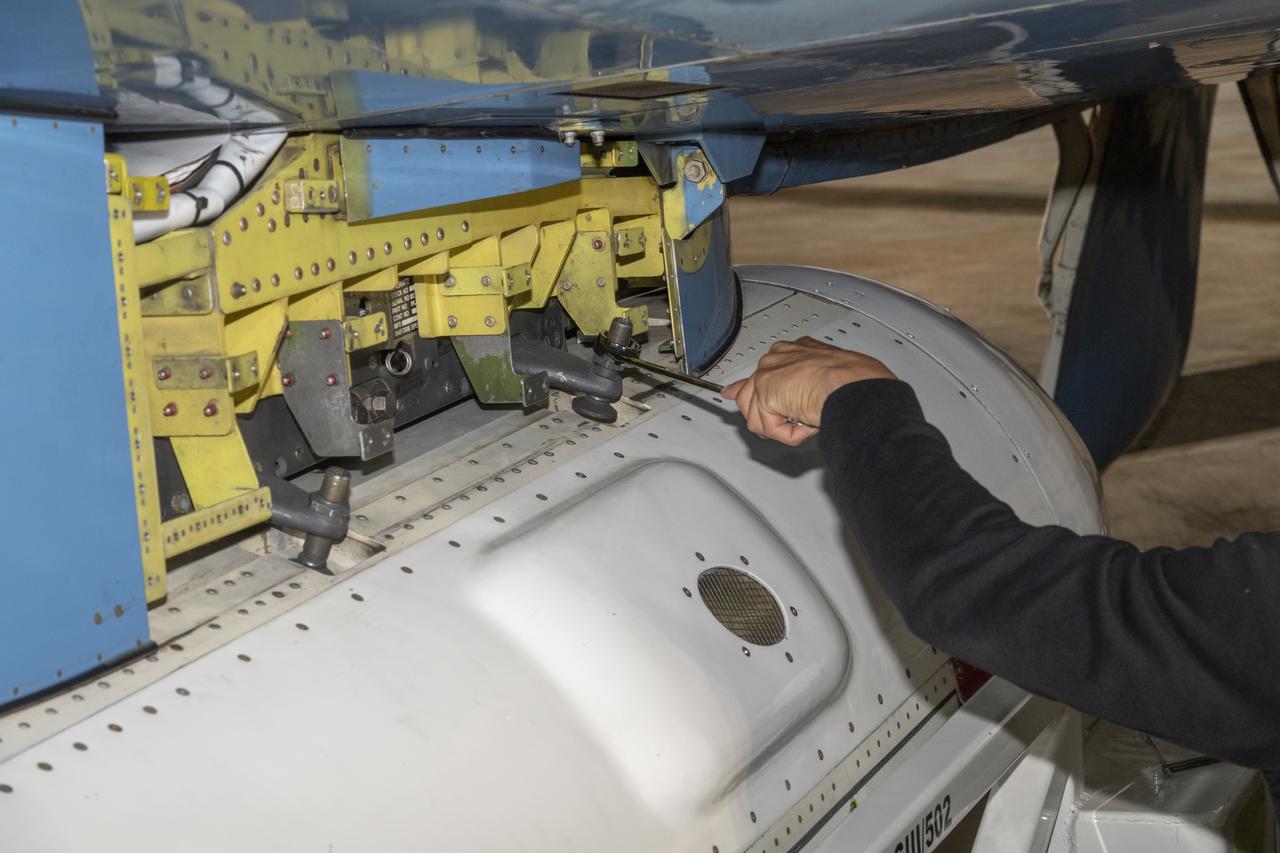
C-20A crew chief Vince Moreno inspects the aircraft.
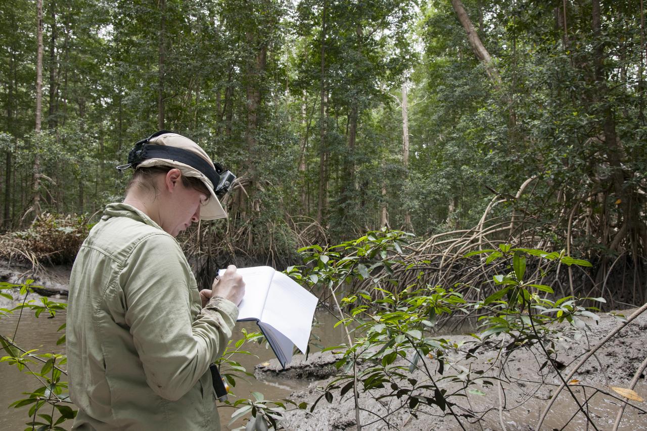
Goddard Space Center’s Laura Duncanson records global positioning satellite coordinates of the Pongara Mangrove and tree heights and diameters.

Tanguay Gahouma Bekale, director general of the Gabonese Space Agency, talks to media about the AfriSAR mission.
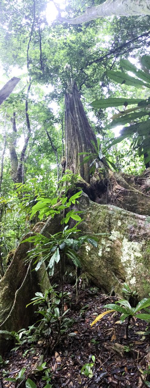
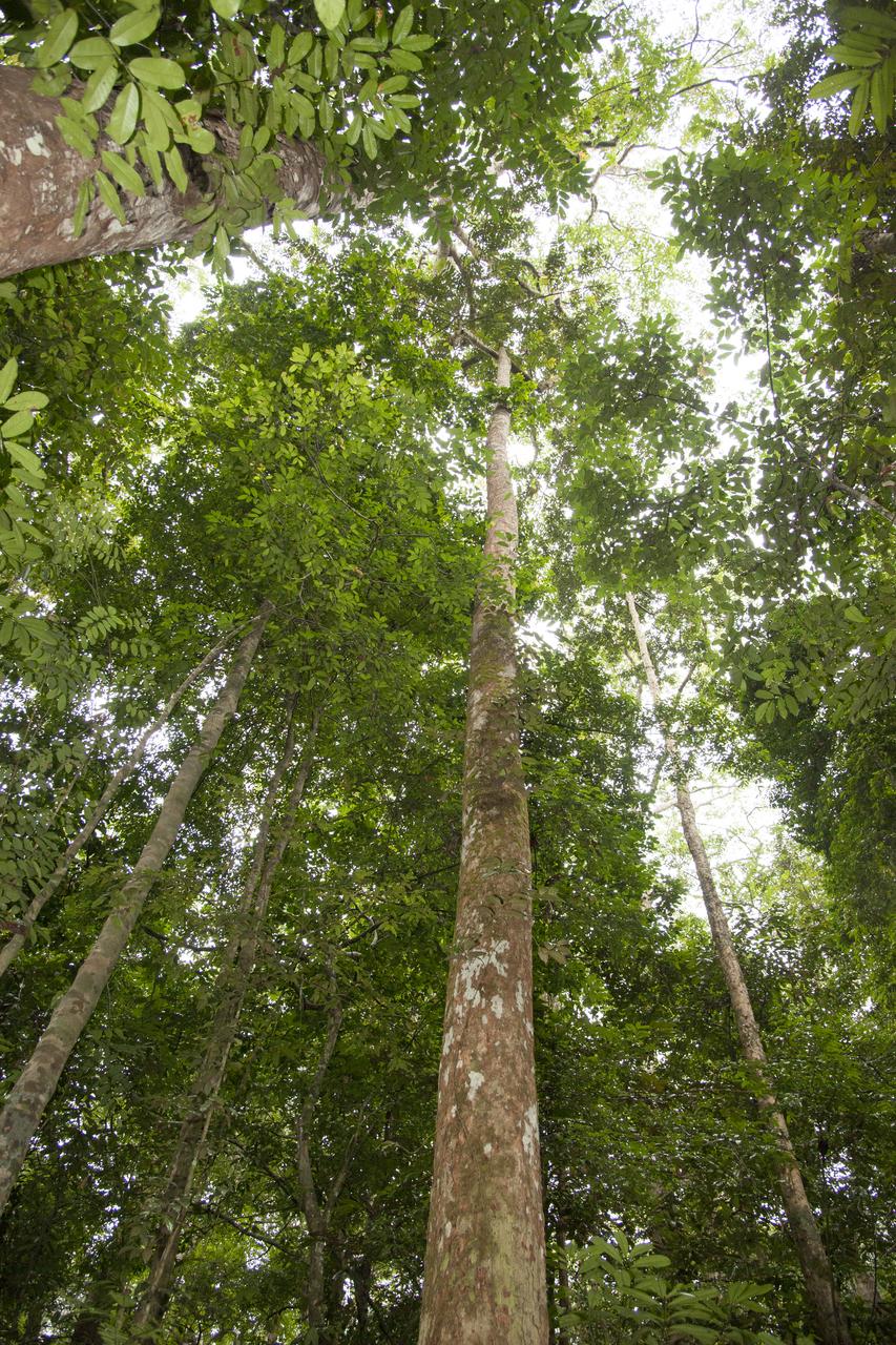
The Okoume’ tree grows tall above the other flora to reach for the suns energy.
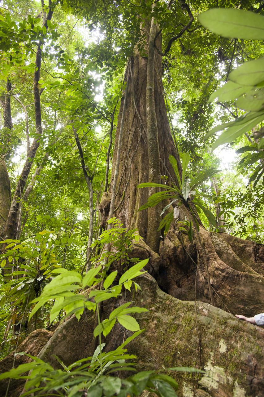
The Okoumé tree is large, as compared to a hand seen in the bottom right portion of the image. The Mondah National Park is one of the field research sites for NASA’s AfriSAR campaign.

Mark Scherer prepares the C-20A for the AfriSAR mission.

Sam Choi and Naiara Pinto observe Google Earth overlaid with in almost real time what the synthetic aperture radar is mapping from the C-20A aircraft. Researchers were in the sky and on the ground to take measurements of plant mass, distribution of trees, shrubs and ground cover and the diversity of plants and how much carbon is absorbed by them.
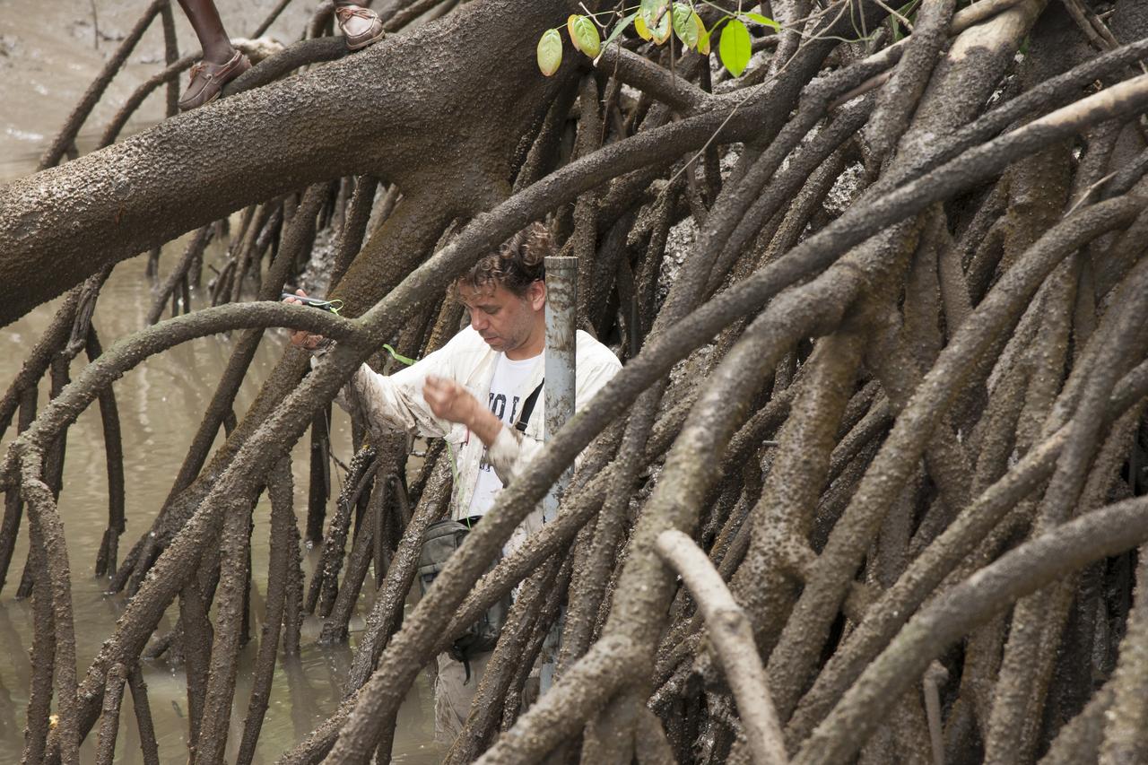
Marc Simard of the Jet Propulsion Laboratory installs a gauge that will record water level changes in the Pongara Mongrove.
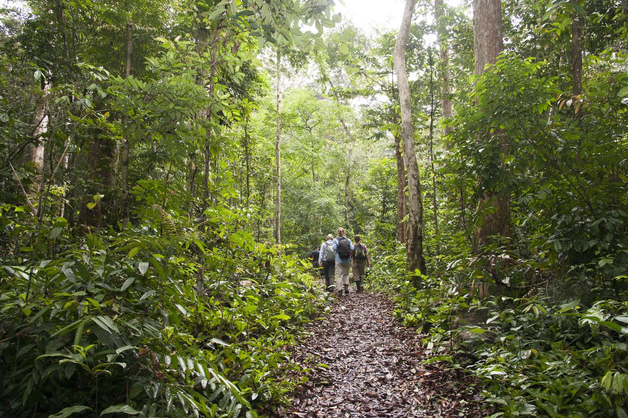
NASA researchers walk through the Mondah rainforest to collect tree and flora measurements and other data as part of the AfriSAR mission.
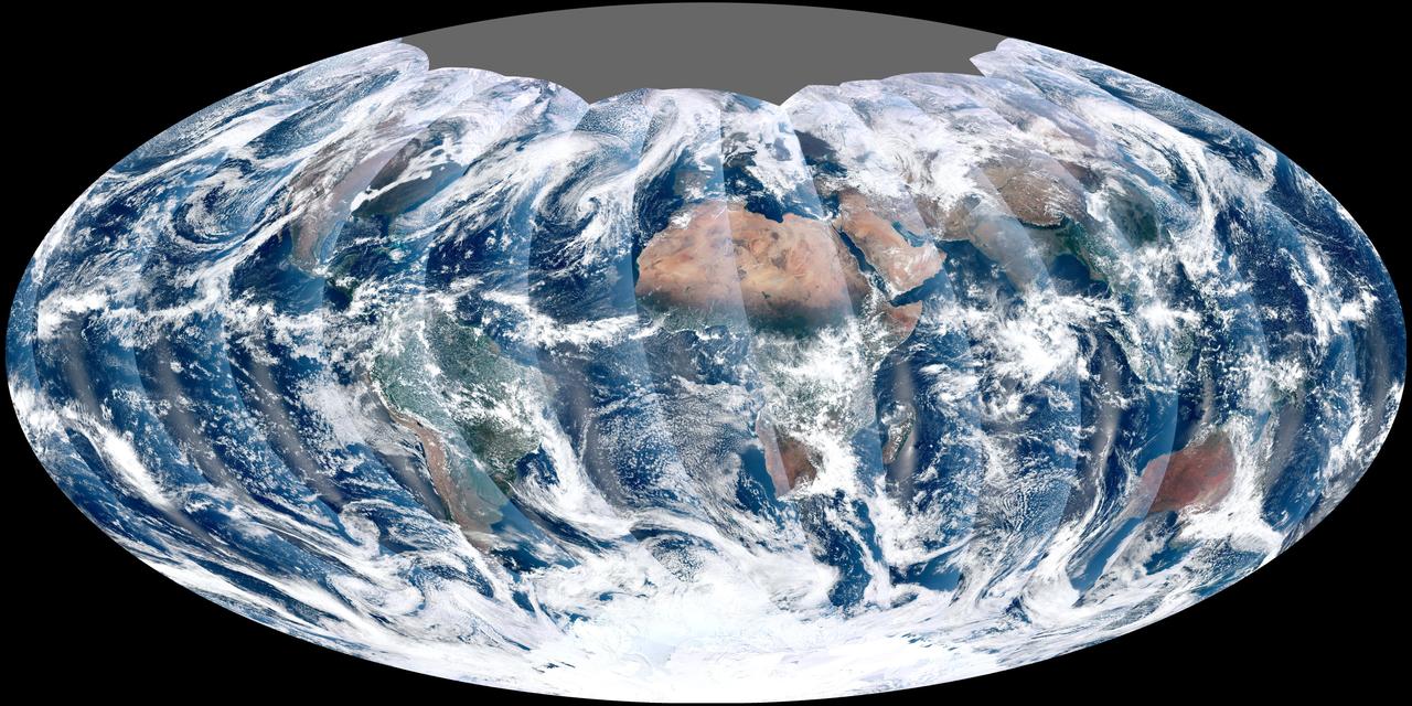
NASA acquired November 24, 2011 From its vantage 824 kilometers (512 miles) above Earth, the Visible Infrared Imager Radiometer Suite (VIIRS) on the NPOESS Preparatory Project (NPP) satellite gets a complete view of our planet every day. This image from November 24, 2011, is the first complete global image from VIIRS. The NPP satellite launched on October 28, 2011, and VIIRS acquired its first measurements on November 21. To date, the images are preliminary, used to gauge the health of the sensor as engineers continue to power it up for full operation. Rising from the south and setting in the north on the daylight side of Earth, VIIRS images the surface in long wedges measuring 3,000 kilometers (1,900 miles) across. The swaths from each successive orbit overlap one another, so that at the end of the day, the sensor has a complete view of the globe. The Arctic is missing because it is too dark to view in visible light during the winter. The NPP satellite was placed in a Sun-synchronous orbit, a unique path that takes the satellite over the equator at the same local (ground) time in every orbit. So, when NPP flies over Kenya, it is about 1:30 p.m. on the ground. When NPP reaches Gabon—about 3,000 kilometers to the west—on the next orbit, it is close to 1:30 p.m. on the ground. This orbit allows the satellite to maintain the same angle between the Earth and the Sun so that all images have similar lighting. The consistent lighting is evident in the daily global image. Stripes of sunlight (sunglint) reflect off the ocean in the same place on the left side of every swath. The consistent angle is important because it allows scientists to compare images from year to year without worrying about extreme changes in shadows and lighting. The image also shows a band of haze along the right side of every orbit swath. When light travels through the atmosphere, it bounces off particles or scatters, making the atmosphere look hazy. The scattering effect is most pronounced along the edge of the swath, where the sensor is looking at an angle through more of the atmosphere. Scientists can correct for this scattering effect, but need measurements from a range of wavelengths to do so. The degree to which light scatters depends partly on the wavelength of the light. Blue light scatters more than red light, for example, which is why the sky is blue. VIIRS measures 22 different wavelengths of light, but not all of the sensor’s detectors are operating at peak performance yet. Those measuring thermal infrared light are not yet cold enough to collect reliable measurements. Once VIIRS begins full operations, it will produce a range of measurements from ocean temperature to clouds to the locations of fires. These measurements will help extend the record from earlier sensors like the Moderate Resolution Imaging Spectroradiometer (MODIS). VIIRS is very similar to MODIS, but flies at a higher altitude to measure the whole planet without gaps. (MODIS daily measurements have gaps at the equator. See the MODIS image from November 24.) VIIRS also sees the Earth in less detail, 375 meters per pixel, compared to 250 meters per pixel for MODIS. Image by NASA’s NPP Land Product Evaluation and Testing Element. Caption by Holli Riebeek. Credit: <b><a href="http://www.earthobservatory.nasa.gov/" rel="nofollow"> NASA Earth Observatory</a></b> <b><a href="http://www.nasa.gov/audience/formedia/features/MP_Photo_Guidelines.html" rel="nofollow">NASA image use policy.</a></b> <b><a href="http://www.nasa.gov/centers/goddard/home/index.html" rel="nofollow">NASA Goddard Space Flight Center</a></b> enables NASA’s mission through four scientific endeavors: Earth Science, Heliophysics, Solar System Exploration, and Astrophysics. Goddard plays a leading role in NASA’s accomplishments by contributing compelling scientific knowledge to advance the Agency’s mission. <b>Follow us on <a href="http://twitter.com/NASA_GoddardPix" rel="nofollow">Twitter</a></b> <b>Like us on <a href="http://www.facebook.com/pages/Greenbelt-MD/NASA-Goddard/395013845897?ref=tsd" rel="nofollow">Facebook</a></b> <b>Find us on <a href="http://instagrid.me/nasagoddard/?vm=grid" rel="nofollow">Instagram</a></b>