![This image shows a layered deposit in Galle Crater, located in the Southern cratered highlands. The geologic history of Galle Crater is not well constrained, and it contains a variety of features that have been interpreted as fluvial, lacustrine or glacial deposits. The deposit pictured here contains multiple unconformities (sudden or irregular changes from one deposit to another), indicating periods of erosion and non deposition. The map is projected here at a scale of 25 centimeters (9.8 inches) per pixel. [The original image scale is 25.7 centimeters (10.1 inches) per pixel (with 1 x 1 binning); objects on the order of 77 centimeters (30.3 inches) across are resolved.] North is up. https://photojournal.jpl.nasa.gov/catalog/PIA21575](https://images-assets.nasa.gov/image/PIA21575/PIA21575~medium.jpg)
This image shows a layered deposit in Galle Crater, located in the Southern cratered highlands. The geologic history of Galle Crater is not well constrained, and it contains a variety of features that have been interpreted as fluvial, lacustrine or glacial deposits. The deposit pictured here contains multiple unconformities (sudden or irregular changes from one deposit to another), indicating periods of erosion and non deposition. The map is projected here at a scale of 25 centimeters (9.8 inches) per pixel. [The original image scale is 25.7 centimeters (10.1 inches) per pixel (with 1 x 1 binning); objects on the order of 77 centimeters (30.3 inches) across are resolved.] North is up. https://photojournal.jpl.nasa.gov/catalog/PIA21575

Galle Crater Scene

Galle Crater Dunes
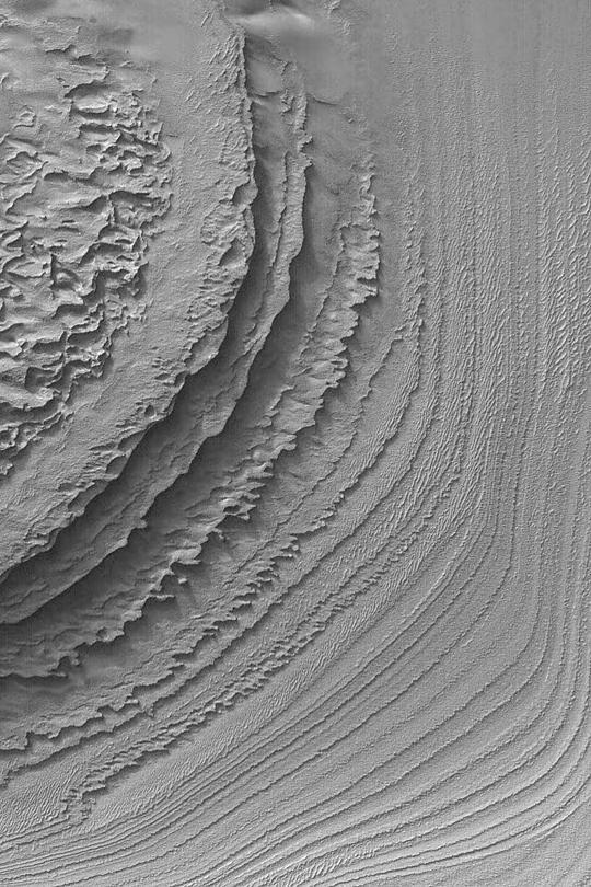
Layers in Galle Crater

Layers in Galle Crater
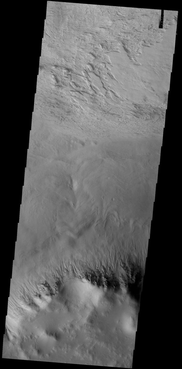
This VIS image shows a small portion of the floor of Galle Crater. This large crater is located on the eastern side of Argyre Planitia. The floor of Galle Crater contains many different features, including fluvial, glacial and aeolian derived products. The steep crater rim is toward the bottom of the image. The incised, flat laying materials at the top of the image are probably eroded layered deposits. Orbit Number: 74804 Latitude: -52.1339 Longitude: 329.267 Instrument: VIS Captured: 2018-10-25 14:28 https://photojournal.jpl.nasa.gov/catalog/PIA22884
This image from NASA Mars Odyssey spacecraft shows part of Galle Crater. It was taken far enough south and late enough into the southern hemisphere fall to observe water ice clouds partially obscuring the surface.
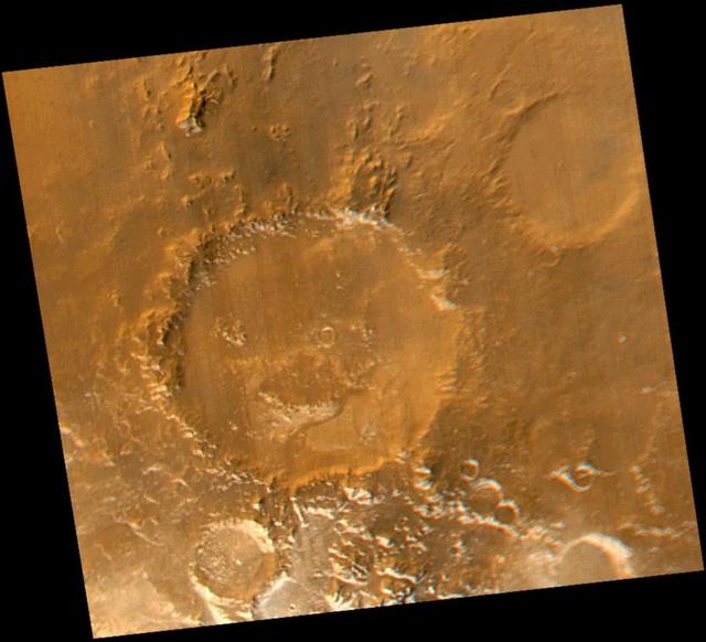
Smile! Spring has sprung in the martian southern hemisphere. With it comes the annual retreat of the winter polar frost cap. This view of "Happy Face Crater"--officially named "Galle Crater"--shows patches of white water ice frost in and around the crater's south-facing slopes. Slopes that face south will retain frost longer than north-facing slopes because they do not receive as much sunlight in early spring. This picture is a composite of images taken by the Mars Global Surveyor Mars Orbiter Camera (MOC) red and blue wide angle cameras. The wide angle cameras were designed to monitor the changing weather, frost, and wind patterns on Mars. Galle Crater is located on the east rim of the Argyre Basin and is about 215 kilometers (134 miles) across. In this picture, illumination is from the upper left and north is up. http://photojournal.jpl.nasa.gov/catalog/PIA02325
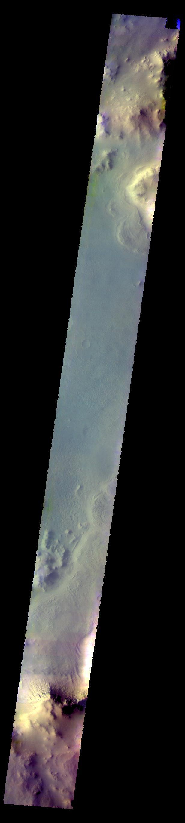
The THEMIS camera contains 5 filters. The data from different filters can be combined in multiple ways to create a false color image. These false color images may reveal subtle variations of the surface not easily identified in a single band image. Today's false color image shows part of Galle Crater. Orbit Number: 59661 Latitude: -50.8727 Longitude: 331.232 Instrument: VIS Captured: 2015-05-27 04:53 https://photojournal.jpl.nasa.gov/catalog/PIA21699

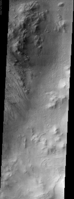
The unusual texture seen in this image of Galle Crater is likely layered deposits that have been eroded. Small dune and windstreak features in this image from NASA 2001 Mars Odyssey spacecraft, indicate that winds are part of the erosive process. Orbit Number: 57733 Latitude: -51.7743 Longitude: 329.135 Instrument: VIS Captured: 2014-12-19 11:13 http://photojournal.jpl.nasa.gov/catalog/PIA19191

These dunes are located on the floor of Galle Crater
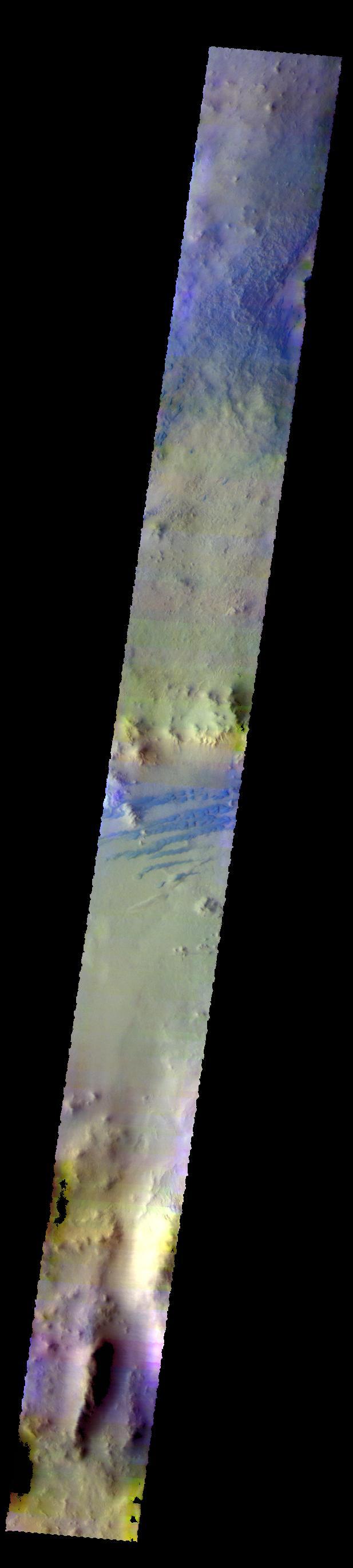
The THEMIS VIS camera contains 5 filters. The data from different filters can be combined in multiple ways to create a false color image. These false color images may reveal subtle variations of the surface not easily identified in a single band image. Today's false color image shows part of the floor of Galle Crater. Dark dunes are visible in the center of the image. The dark blue color typically indicates basaltic sand. Orbit Number: 58800 Latitude: -51.5789 Longitude: 328.788 Instrument: VIS Captured: 2015-03-17 07:20 http://photojournal.jpl.nasa.gov/catalog/PIA20243
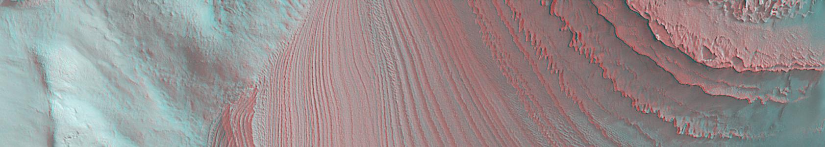
This anaglyph from Mars Global Surveyor MGS shows layers in Galle Crater. 3D glasses are necessary to view this image.

This image was taken of the hills that resulted from uplifted rocks due to an impact that formed the 230-kilometer diameter Galle Crater. These hills form a segment of a circle known as a "peak ring" and this particular formation makes Galle Crater look like a "smiley face" from orbit. Small gullies, visible in the center of this image, have formed on the flanks of these hills and they have eroded back into the bedrock. The crater itself is probably billions of years old, yet these gullies are likely only hundreds of thousands of years old and may even be active today. The small channels in these gullies are easily erased by the wind over long time periods, so we know these gullies must have been active recently. https://photojournal.jpl.nasa.gov/catalog/PIA23078