
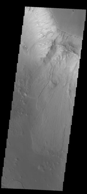
Ganges Chasma

Ganges Chasma

Ganges Chasma

Ganges Chasma
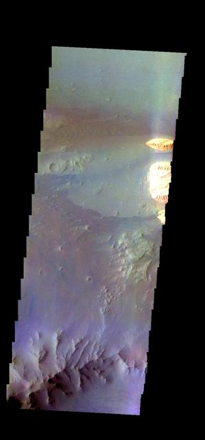
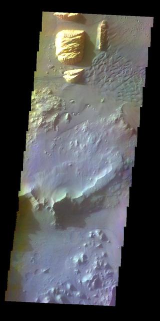
The THEMIS camera contains 5 filters. The data from different filters can be combined in multiple ways to create a false color image. These false color images may reveal subtle variations of the surface not easily identified in a single band image. Today's false color image shows part of Ganges Chasma. Orbit Number: 43282 Latitude: -8.53126 Longitude: 313.149 Instrument: VIS Captured: 2011-09-17 02:06 http://photojournal.jpl.nasa.gov/catalog/PIA20983
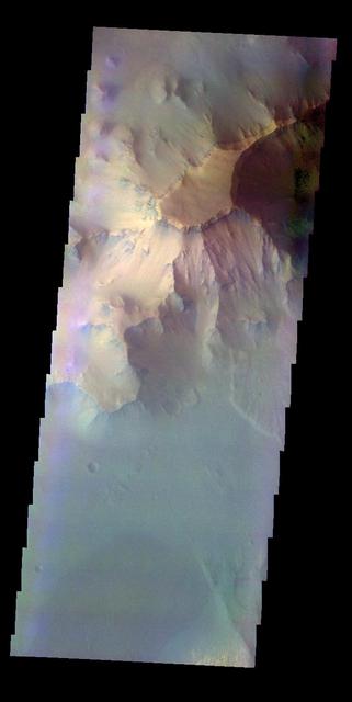
![The THEMIS VIS camera contains 5 filters. The data from different filters can be combined in multiple ways to create a false color image. These false color images may reveal subtle variations of the surface not easily identified in a single band image. Today's false color image shows part of Ganges Chasma. Dunes are visible on the floor of the canyon [bottom right corner]. Orbit Number: 52184 Latitude: -7.21971 Longitude: 314.698 Instrument: VIS Captured: 2013-09-18 17:29 http://photojournal.jpl.nasa.gov/catalog/PIA21511](https://images-assets.nasa.gov/image/PIA21511/PIA21511~small.jpg)
The THEMIS VIS camera contains 5 filters. The data from different filters can be combined in multiple ways to create a false color image. These false color images may reveal subtle variations of the surface not easily identified in a single band image. Today's false color image shows part of Ganges Chasma. Dunes are visible on the floor of the canyon [bottom right corner]. Orbit Number: 52184 Latitude: -7.21971 Longitude: 314.698 Instrument: VIS Captured: 2013-09-18 17:29 http://photojournal.jpl.nasa.gov/catalog/PIA21511
Dunes in Ganges Chasma

Ganges Chasma Sands
Ganges Chasma Sand Sheet
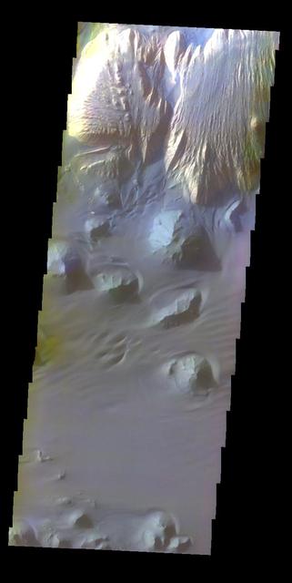
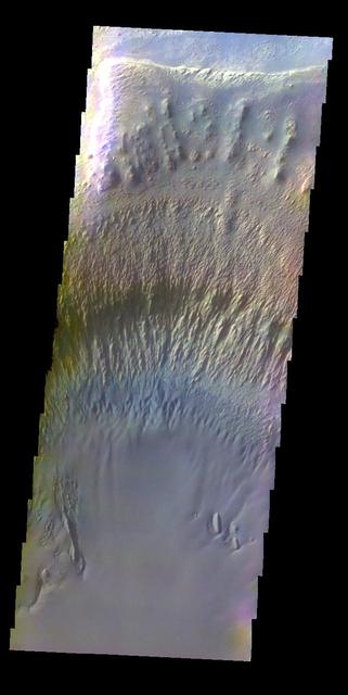
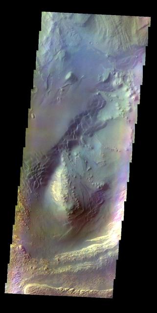
Ganges Chasma in Color
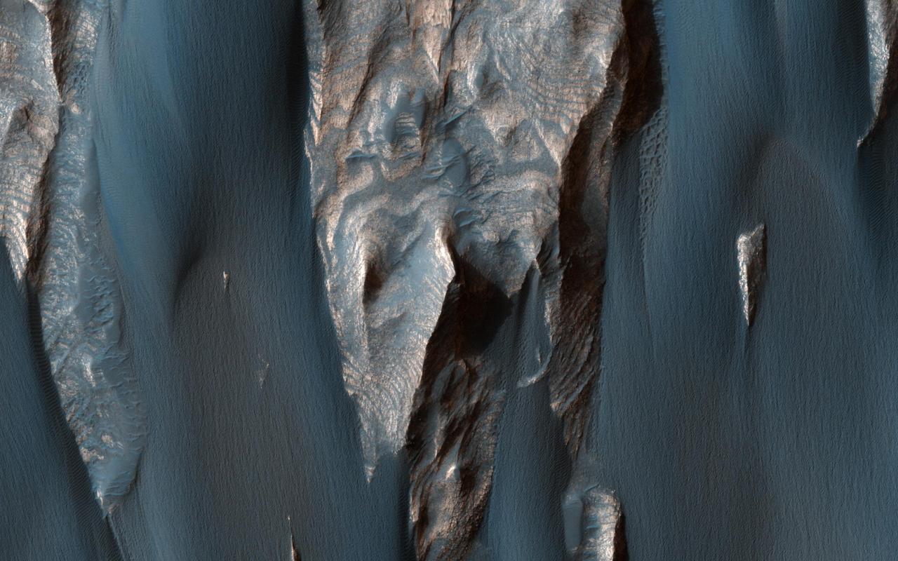
Dark, windblown sand covers intricate sedimentary rock layers in this image captured by NASA's Mars Reconnaissance Orbiter (MRO) from Ganges Chasma, a canyon in the Valles Marineris system. These features are at once familiar and unusual to those familiar with Earth's beaches and deserts. Most sand dunes on Earth are made of silica-rich sand, giving them a light color; these Martian dunes owe their dark color to the iron and magnesium-rich sand found in the region. https://photojournal.jpl.nasa.gov/catalog/PIA21600

This image from NASA 2001 Mars Odyssey shows a portion of the floor of Ganges Chasma. Eroded deposits and sand dune forms are common features of Ganges Chasma.

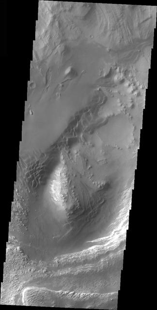
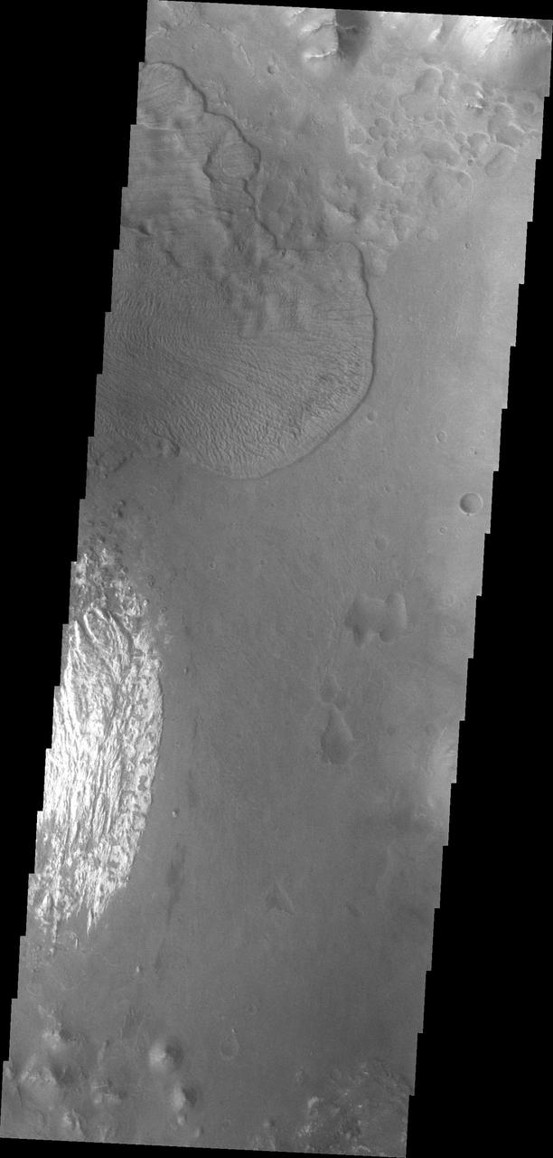
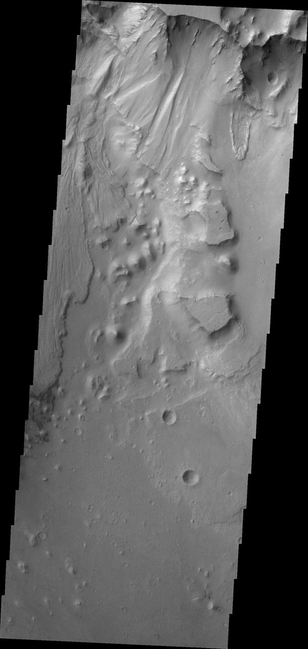
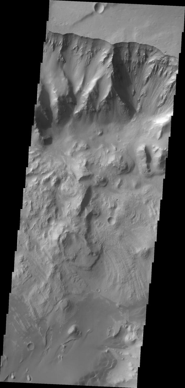
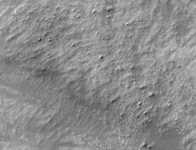
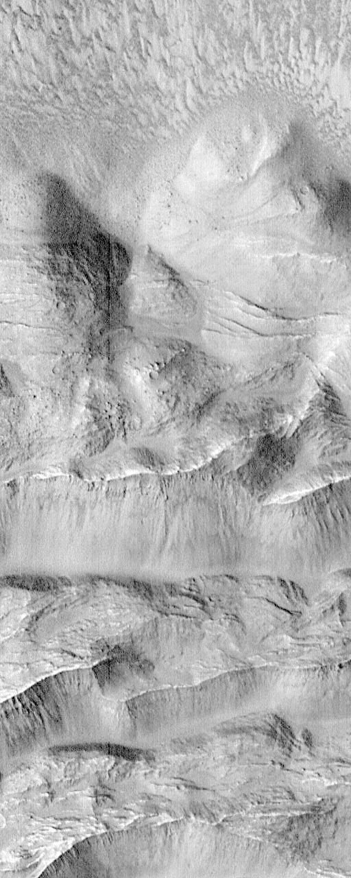
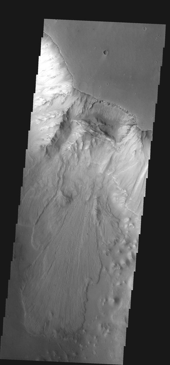
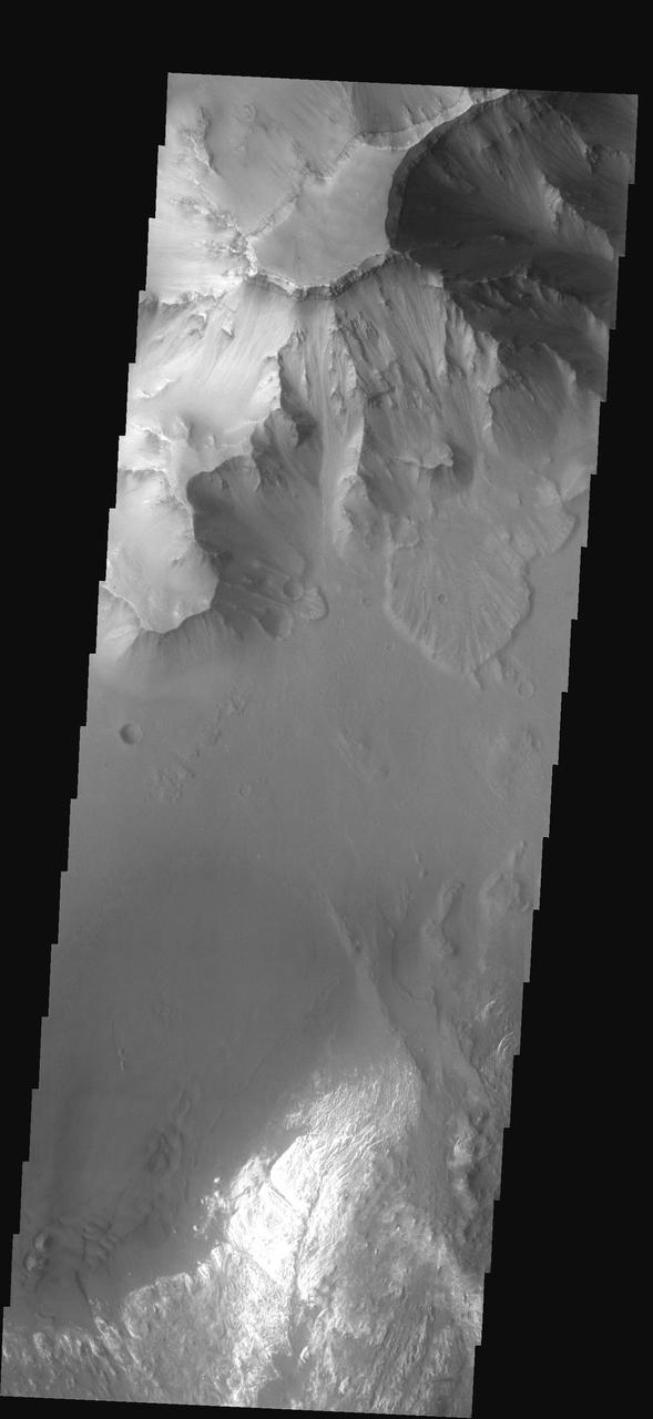
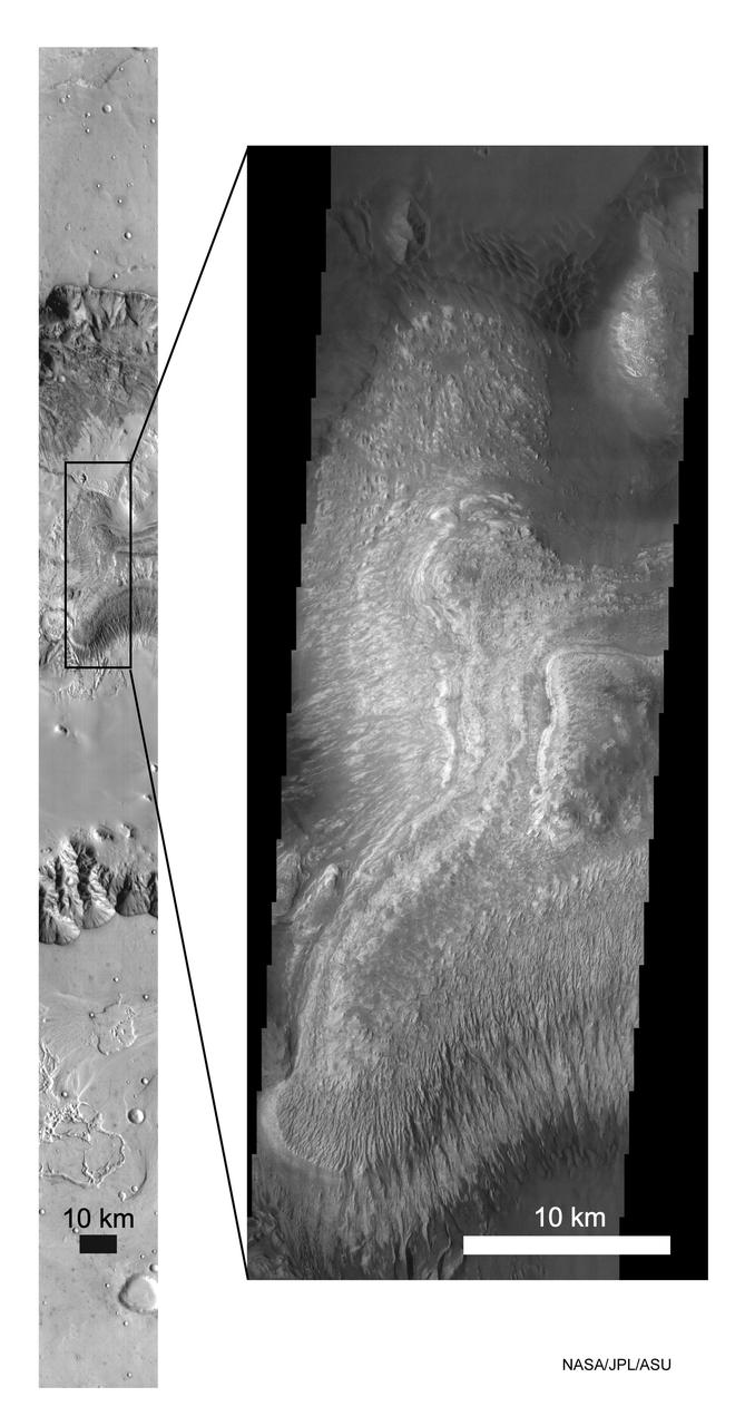
Today's VIS image shows part of Ganges Chasma. A large landslide deposit is visible in the center of the image. The radial grooves on the top of a landslide are a common feature formed by the downslope movement of the landslide materials. Ganges Chasma is part of the Valles Marineris chasma system, but is north of the main section of canyons. Ganges Chasma is 584km (363 miles) long. Orbit Number: 89435 Latitude: -8.15265 Longitude: 315.105 Instrument: VIS Captured: 2022-02-11 09:09 https://photojournal.jpl.nasa.gov/catalog/PIA25375
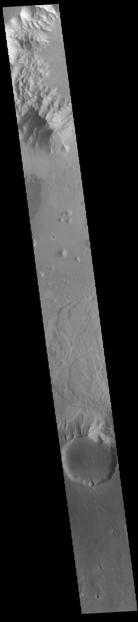
Today's VIS image shows part of Ganges Chasma. A large landslide deposit is visible in the center of the image. The radial grooves on the top of a landslide are a common feature formed by the downslope movement of the landslide materials. Ganges Chasma is part of the Valles Marineris chasma system, but is north of the main section of canyons. Ganges Chasma is 584km (363 miles) long. Orbit Number: 89435 Latitude: -8.15265 Longitude: 315.105 Instrument: VIS Captured: 2022-02-11 09:09 https://photojournal.jpl.nasa.gov/catalog/PIA25371
This image from NASA Mars Odyssey shows multiple landslide deposits within Ganges Chasma.
This image from NASA 2001 Mars Odyssey spacecraft shows part of the floor of Ganges Chasma, including part of a sand sheet.
This image captured by NASA 2001 Mars Odyssey spacecraft shows a landslide deposit in Ganges Chasma.

Multiple landslide deposits are visible in this image of Ganges Chasma captured by NASA 2001 Mars Odyssey spacecraft.
This image captured by NASA 2001 Mars Odyssey spacecraft shows a landslide deposit which flowed towards the floor of Ganges Chasma.
Sand is abundant of this portion of the floor of Ganges Chasma as captured by NASA 2001 Mars Odyssey.
This image from NASA Mars Odyssey of the floor of Ganges Chasma shows eroded fill material and extensive sand deposits.
This image of Ganges Chasma, captured by NASA 2001 Mars Odyssey spacecraft, contains both landslide deposits and dunes.

Layering is evident in this deposit on the floor of Ganges Chasma. This image is from NASA 2001 Mars Odyssey.
Toe of Ganges Chasma Landslide 8.0 S, 44.4W
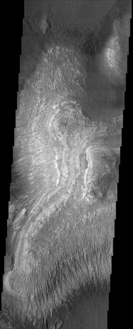
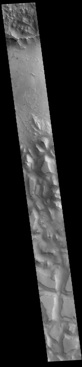
This VIS image shows part of the floor of Ganges Chasma. Deposits of fine surface materials and bright layered deposits are visible in this image. Ganges Chasma is part of the Valles Marineris chasma system, but is north of the main section of canyons. Orbit Number: 82734 Latitude: -7.8794 Longitude: 311.753 Instrument: VIS Captured: 2020-08-08 15:10 https://photojournal.jpl.nasa.gov/catalog/PIA24156
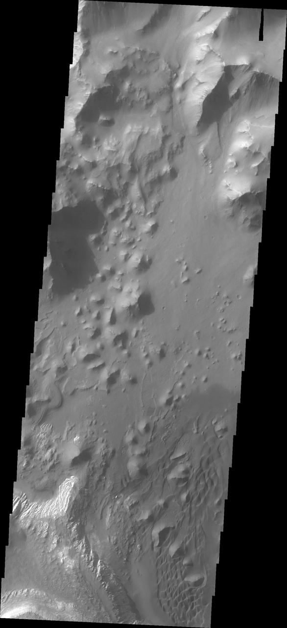
The THEMIS VIS camera contains 5 filters. The data from different filters can be combined in multiple ways to create a false color image. These false color images may reveal subtle variations of the surface not easily identified in a single band image. Today's false color image shows part of Ganges Chasma. A large landslide deposit fills the bottom third of the image, and another landslide deposit is visible near the top of the image. The radial grooves on the top of a landslide are a common feature formed by the downslope movement of the landslide materials. A field of dunes is visible in the center of the image. Ganges Chasma is part of the Valles Marineris chasma system, but is north of the main section of canyons. Ganges Chasma is 584km (363 miles) long. Orbit Number: 70657 Latitude: -7.47135 Longitude: 315.505 Instrument: VIS Captured: 2017-11-18 00:19 https://photojournal.jpl.nasa.gov/catalog/PIA24504
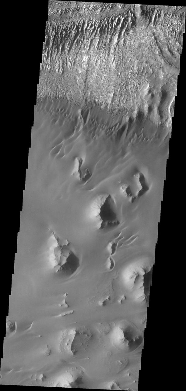
This image captured by shows NASA 2001 Mars Odyssey the northern wall of Ganges Chasma. Dunes and a landslide deposit of visible at the bottom of the image.

This image taken by NASA 2001 Mars Odyssey of Ganges Chasma shows where a large portion of the canyon wall has given way and formed a landslide deposit.
This image from NASA Mars Odyssey shows part of the floor of Ganges Chasma. Deposits of fine surface materials and bright layered deposits are visible in this image.
This false color image from NASA 2001 Mars Odyssey spacecraft shows part of the interior of Ganges Chasma.

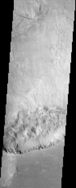
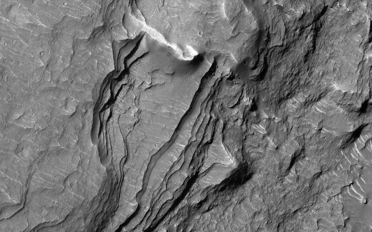
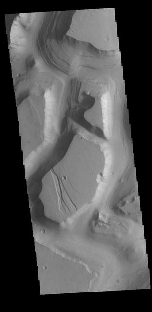
This VIS image is located in central Ganges Chasma. A large landslide deposit fills the top third of the image. The radial grooves on the top of the landslide are a common feature formed by the downslope movement of the landslide materials. The landslide was deflected in some areas by preexisting blocks on the chasma floor. Ganges Chasma is part of the Valles Marineris chasma system, but is north of the main section of canyons. Orbit Number: 72790 Latitude: -7.88588 Longitude: 309.432 Instrument: VIS Captured: 2018-05-12 17:34 https://photojournal.jpl.nasa.gov/catalog/PIA22616
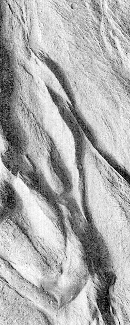
This image, taken by NASA 2001 Mars Odyssey spacecraft, shows part of the floor of Ganges Chasma. Sand dunes and windstreaks indicate long term wind action in the area.

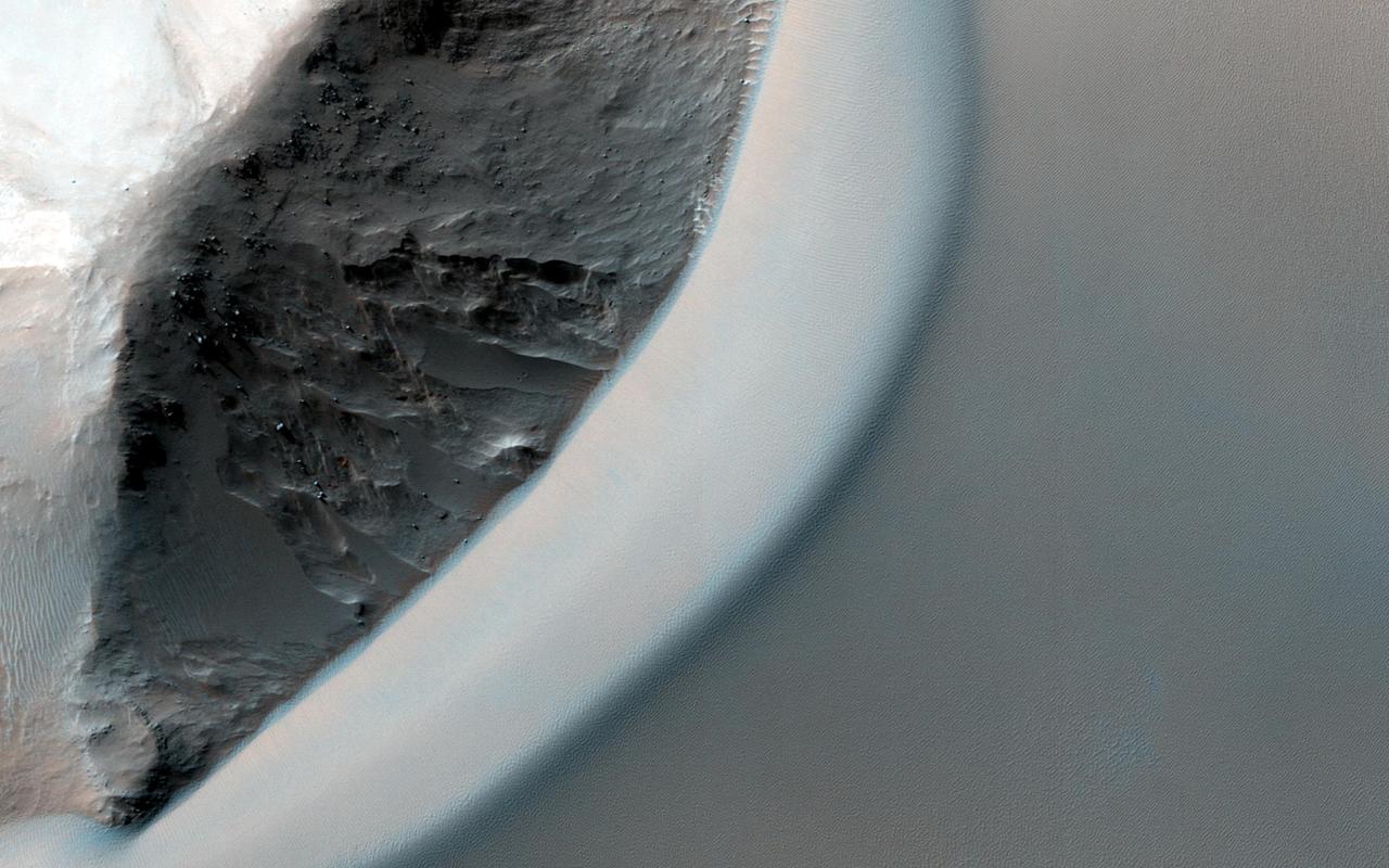
This image, acquired by NASA Mars Reconnaissance Orbiter spacecraft, shows the eastern edge of a very large deposit of wind-blown dust that occupies Ganges Chasma.
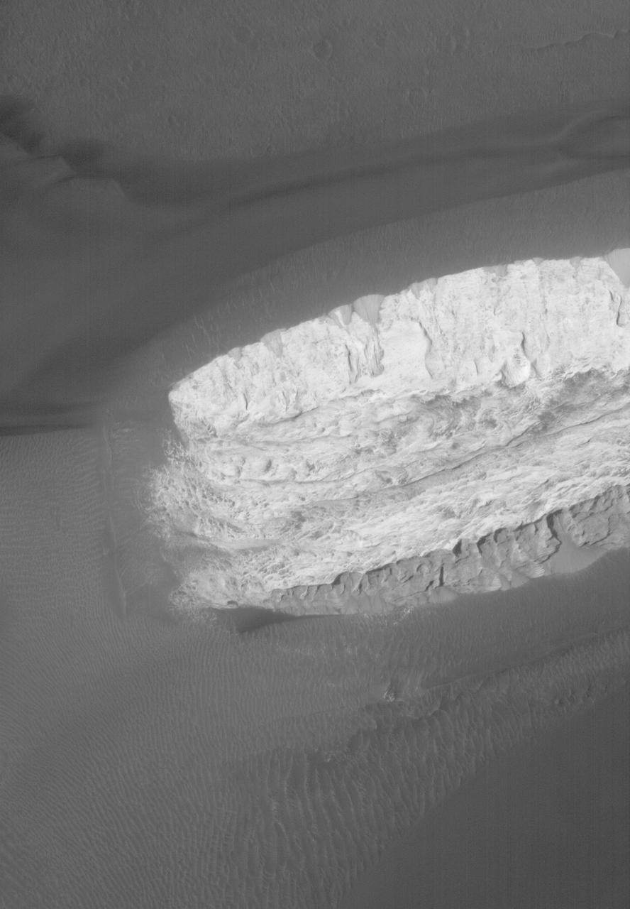
1.5 Meter Per Pixel View of Boulders in Ganges Chasma
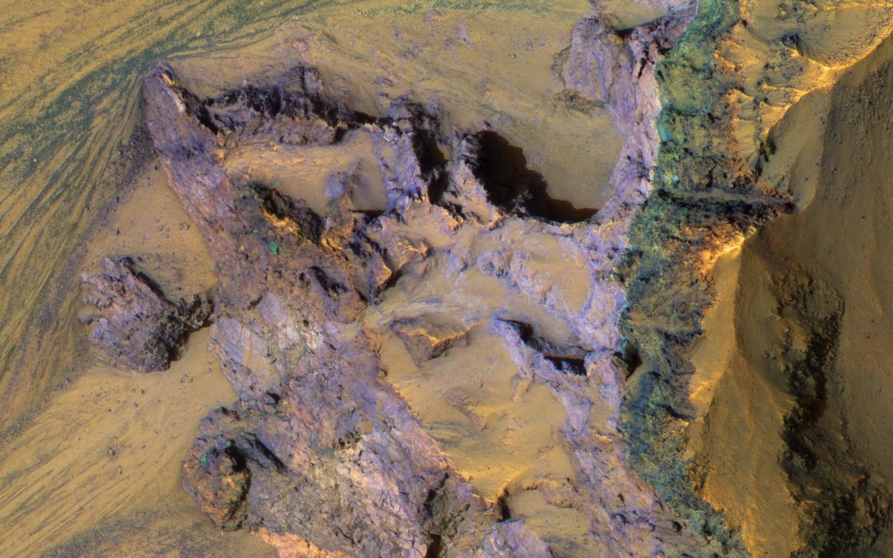
Complex Floor Deposits Within Western Ganges Chasma, Valles Marineris
These layered deposits are located on the floor of a large canyon called Ganges Chasma which is a part of the Valles Marineris in this image captured by NASA 2001 Mars Odyssey spacecraft.
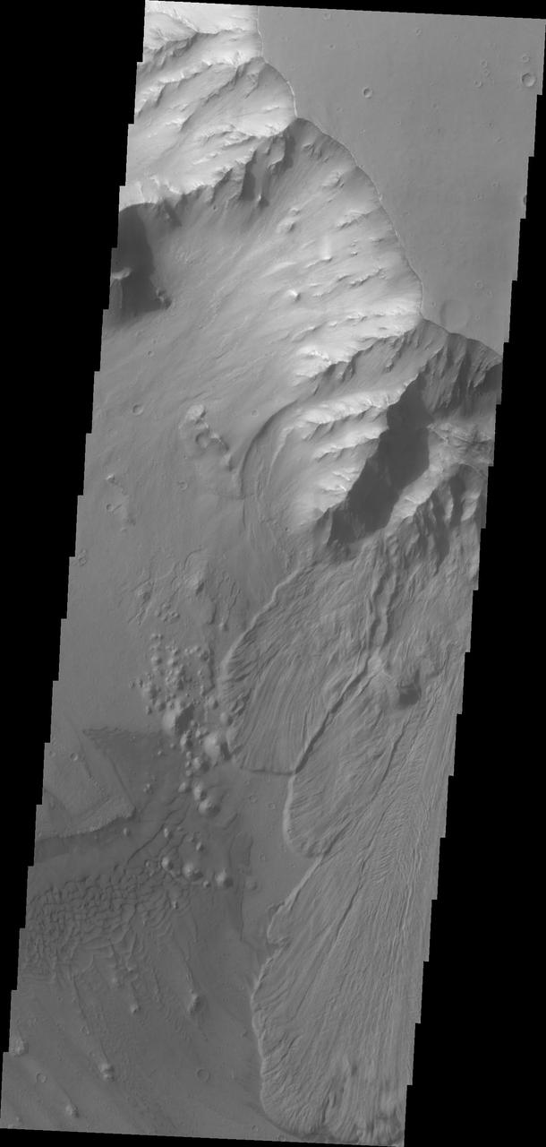
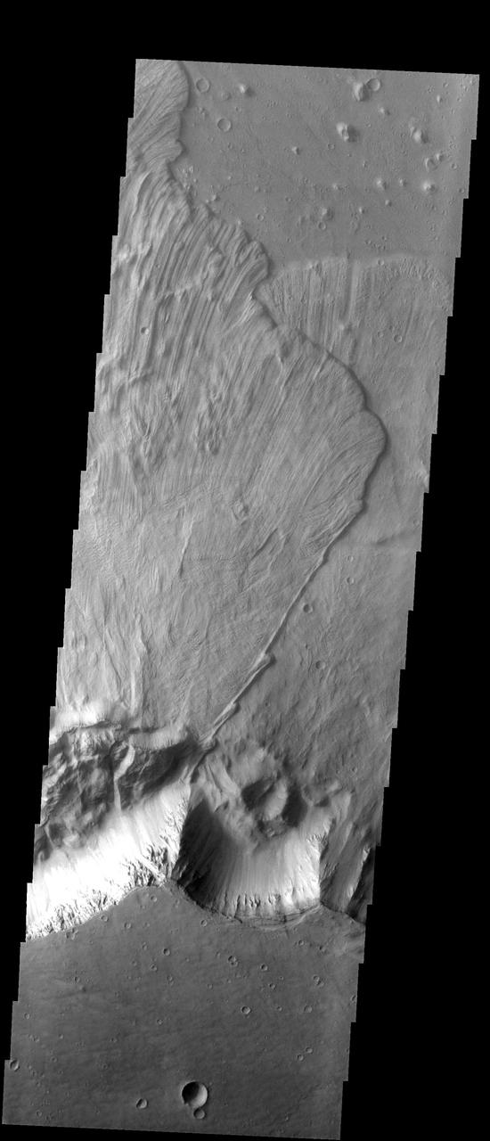
This image from NASA Mars Odyssey spacecraft shows a spectacular landslide along a portion of the southern wall of Ganges Chasma within Valles Marineris. Landslides have very characteristic morphologies on Earth, which they also display on Mars.
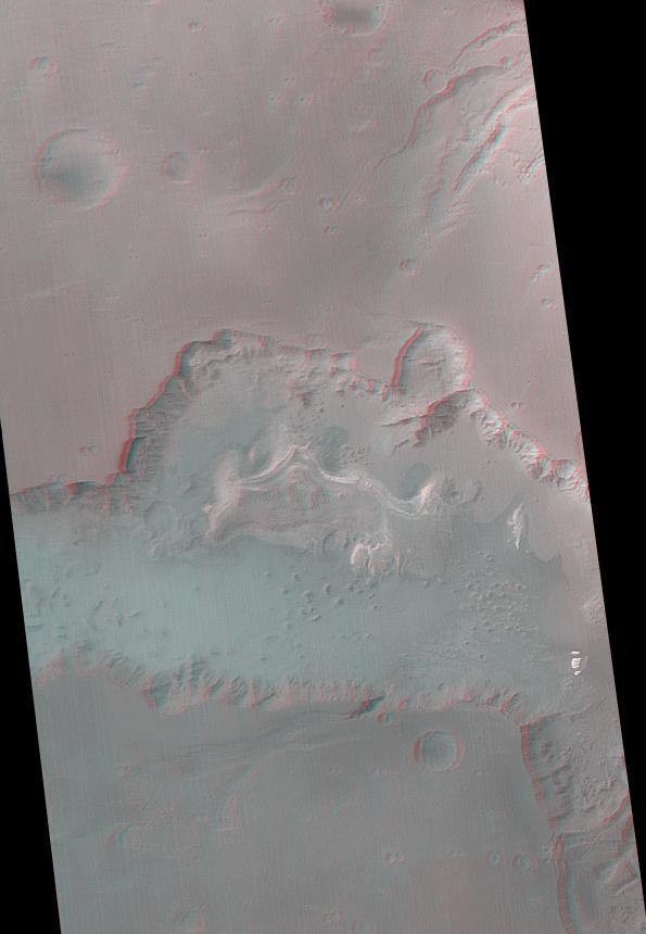
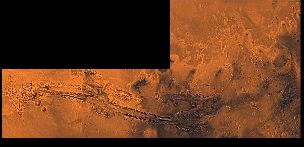
Ganges Chasma is part of the Valles Marineris trough system that stretches nearly 5,000 kilometers 3,000 miles across the western equatorial region of Mars. This stereo anaglyph is from NASA Mars Global Surveyor. 3D glasses are necessary.
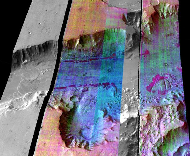
This false-color infrared image was taken by the camera system on the Mars Odyssey spacecraft over part of Ganges Chasma in Valles Marineris (approximately 13 degrees S, 318 degrees E). The infrared image has been draped over topography data obtained by Mars Global Surveyor. The color differences in this image show compositional variations in the rocks exposed in the wall and floor of Ganges (blue and purple) and in the dust and sand on the rim of the canyon (red and orange). The floor of Ganges is covered by rocks and sand composed of basaltic lava that are shown in blue. A layer that is rich in the mineral olivine can be seen as a band of purple in the walls on both sides of the canyon, and is exposed as an eroded layer surrounding a knob on the floor. Olivine is easily destroyed by liquid water, so its presence in these ancient rocks suggests that this region of Mars has been very dry for a very long time. The mosaic was constructed using infrared bands 5, 7, and 8, and covers an area approximately 150 kilometers (90 miles) on each side. This simulated view is toward the north. http://photojournal.jpl.nasa.gov/catalog/PIA04262
The THEMIS VIS camera contains 5 filters. The data from different filters can be combined in multiple ways to create a false color image. This false color image from NASA 2001 Mars Odyssey spacecraft shows part of the interior of Ganges Chasma.
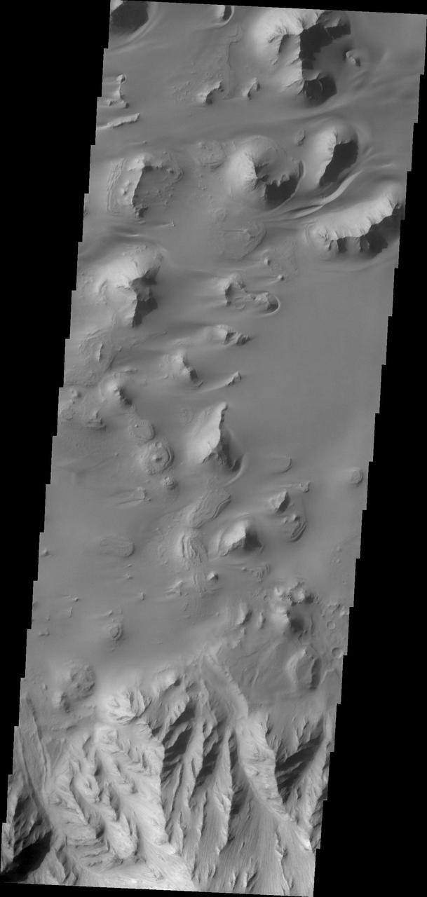
These large landslides are located in Ganges Chasma
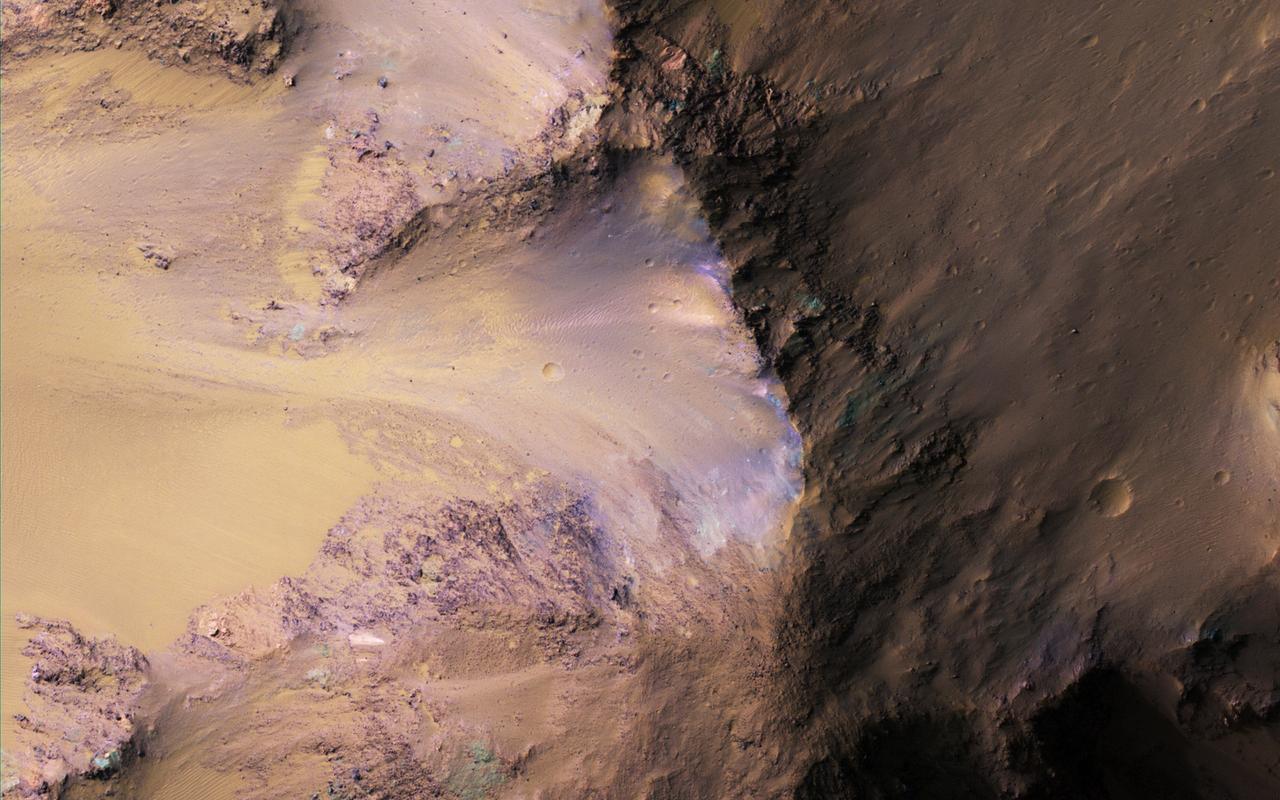
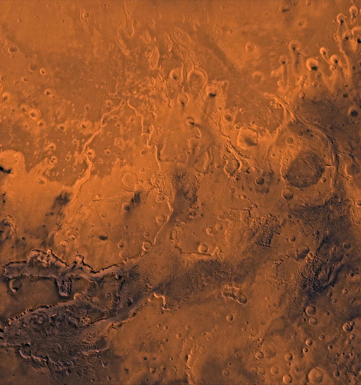
NASA's Mars Reconnaissance Orbiter (MRO) observed this image of Ganges Chasma in the northeast portion of Valles Marineris, and opens into outflow channels that flowed to the north. Scattered hills on the canyon floor may be remnants of chaos terrain that formed from collapse of the canyon. Some of the bedrock has diverse colors. More information is available at https://photojournal.jpl.nasa.gov/catalog/PIA22536

The THEMIS VIS camera contains 5 filters. The data from different filters can be combined in multiple ways to create a false color image. These false color images may reveal subtle variations of the surface not easily identified in a single band image. Today's false color image shows part Ganges Chasma. Orbit Number: 64384 Latitude: -6.67274 Longitude: 310.956 Instrument: VIS Captured: 2016-06-19 04:46 http://photojournal.jpl.nasa.gov/catalog/PIA20787
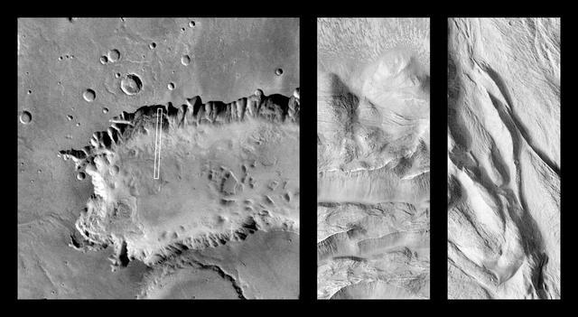
Complex Floor Deposits Within Western Ganges Chasma, Valles Marineris - High Resolution Image
Complex Floor Deposits Within Western Ganges Chasma, Valles Marineris - High Resolution Image
The THEMIS VIS camera contains 5 filters. The data from different filters can be combined in multiple ways to create a false color image. This false color image from NASA 2001 Mars Odyssey spacecraft shows part of Ganges Chasma. Orbit Number: 4434 Latitude: -6.76774 Longitude: 310.838 Instrument: VIS Captured: 2002-12-14 13:03 http://photojournal.jpl.nasa.gov/catalog/PIA19214
The THEMIS VIS camera contains 5 filters. The data from different filters can be combined in multiple ways to create a false color image. This false color image from NASA 2001 Mars Odyssey spacecraft shows part of Ganges Chasma. Orbit Number: 4359 Latitude: -8.7239 Longitude: 313.334 Instrument: VIS Captured: 2002-12-08 08:54 http://photojournal.jpl.nasa.gov/catalog/PIA19210
The THEMIS VIS camera contains 5 filters. The data from different filters can be combined in multiple ways to create a false color image. This image from NASA 2001 Mars Odyssey spacecraft shows part of the northern cliff face of Ganges Chasma. Orbit Number: 7380 Latitude: -6.68954 Longitude: 312.135 Instrument: VIS Captured: 2003-08-14 01:07 http://photojournal.jpl.nasa.gov/catalog/PIA19473
This large landslide is located within Ganges Chasma
This MOC image shows dark-toned, windblown sands and ripples, surrounding a light-toned hill, interpreted to be sedimentary rock, in Ganges Chasma. Ganges Chasma is part of the giant Valles Marineris trough system on Mars

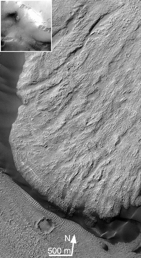
This image from NASA's Mars Reconnaissance Orbiter covers a steep west-facing slope in southwestern Ganges Chasma, north of the larger canyons of Valles Marineris. The spot was targeted both for the bedrock exposures and to look for active slope processes. We see two distinct flow deposits: lobate flows that are relatively bright, sometimes with dark fringes, and very thin brownish lines that resemble recurring slope lineae (or 'RSL'). Both flows emanate from rocky alcoves. The RSL are superimposed on the lobate deposits (perhaps rocky debris flows), so they are younger and more active. The possible role of water in forming the debris flows and RSL are the subjects of continuing debate among scientists. We will acquire more images here to see if the candidate RSL are active. https://photojournal.jpl.nasa.gov/catalog/PIA21651
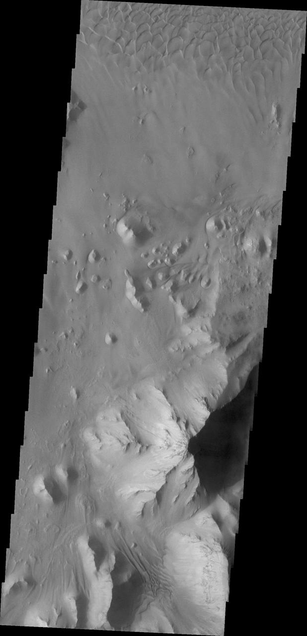
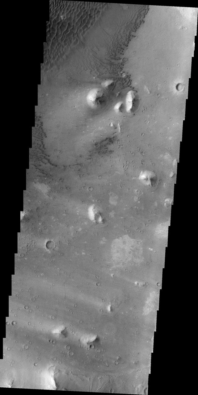
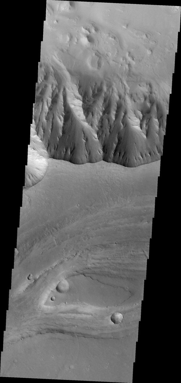
This image shows part of Ganges Chasma. Several landslides occur at the top of the image, while dunes and canyon floor deposits are visible at the bottom of the image
North of Ganges Chasma lies Orson Welles Crater, whose floor contains broken up blocks we call chaotic terrain and which is the source for the major outflow channel Shalbatana Vallis. Between Orson Welles and Ganges Chasma is a region where materials subsided and collapsed over underground cavities that had once held aquifers. This image shows an elongated collapse pit. There is evidence that the pit was once filled with water as the groundwater erupted to the surface. A closer view shows fine sedimentary layers exposed by erosion. https://photojournal.jpl.nasa.gov/catalog/PIA25082
This dramatic image observed by NASA Mars Reconnaissance Orbiter shows dark rippled bodies of sand, sometimes in the form of dunes, streaming through Ganges Chasma. The floor of the canyon is covered by hills and mesas.

Two large landslides dominate this image of part of Ganges Chasma. The eroded surface of an old landslide covers the north half of the image, while a more recent landslide occurs to the south
Elator Vallis, the channel shown in image from NASA Mars Odyssey, runs on the plains of Aurorae Planum. This portion of Elator Vallis parallels Ganges Chasma shown in the top of the image.
These NASA Mars Odyssey images show layered deposits located on the floor of Ganges Chasma, part of the Valles Marineris canyon system, in both infrared left and visible right wavelengths.
This VIS image shows part of Hydraotes Chaos. Hydraotes Chaos measures about 300 kilometers (190 miles) wide by roughly 350 km (220 mi) north-south, and it lies in a valley leading northeast out of Ganges Chasma at the east end of Valles Marineris. Tiu Valles flows northward from Hydraotes Chaos to empty into Chryse Planitia. Orbit Number: 80949 Latitude: 1.53809 Longitude: 326.515 Instrument: VIS Captured: 2020-03-14 15:48 https://photojournal.jpl.nasa.gov/catalog/PIA23906
The steep walls of Valles Marineris sometimes fail, creating giant landslides. This provides a clean exposure of the underlying bedrock. This image of the north wall of Ganges Chasma reveals bedrock with diverse colors and textures, representing different geologic units. http://photojournal.jpl.nasa.gov/catalog/PIA21217
This VIS image shows part of Hydraotes Chaos. Hydraotes Chaos measures about 300 kilometers (190 miles) wide by roughly 350 km (220 mi) north-south. The chaos lies in a valley leading northeast out of Ganges Chasma at the east end of Valles Marineris. Tiu Valles flows northward from Hydraotes Chaos to empty into Chryse Planitia. In planetary nomenclature, the descriptor term chaos means "distinctive area of broken terrain". The general morphology of chaos is steep-sided mesas in close proximity. With time and erosion the valleys widen and the mesas grow smaller. The initial breakup of the land can be due to tectonic forces, but on Mars it is thought that the release of melted, subsurface ice created the terrain. Large channels, like Tiu Valles, usually originate from regions of chaos. Orbit Number: 86003 Latitude: 2.07857 Longitude: 324.563 Instrument: VIS Captured: 2021-05-04 19:05 https://photojournal.jpl.nasa.gov/catalog/PIA24219
A color image of the south Chryse basin Valles Marineris outflow channels on Mars; north toward top. The scene shows on the southwest corner the chaotic terrain of the east part of Valles Marineris and two of its related canyons: Eos and Capri Chasmata (south to north). Ganges Chasma lies directly north. The chaos in the southern part of the image gives rise to several outflow channels, Shalbatana, Simud, Tiu, and Ares Valles (left to right), that drained north into the Chryse basin. The mouth of Ares Valles is the site of the Mars Pathfinder lander. This image is a composite of NASA's Viking medium-resolution images in black and white and low-resolution images in color. The image extends from latitude 20 degrees S. to 20 degrees N. and from longitude 15 degrees to 53 degrees; Mercator projection. http://photojournal.jpl.nasa.gov/catalog/PIA00418
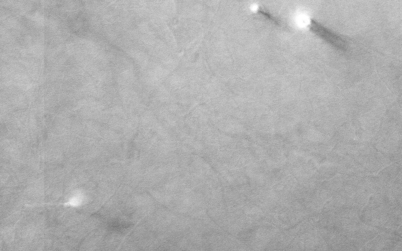
On an early fall afternoon in Ganges Chasma Valles Marineris, NASA Mars Reconnaissance Orbiter spacecraft managed to capture a cluster of eight dust devils, five of them in the enhanced color strip. They're together on a dark sandy surface that tilts slightly to the north, towards the Sun. Both of these factors help warm the surface and generate convection in the air above. The surface is streaked with the faint tracks of earlier dust devils. A pair of dust devils appears together at top right, spaced only 250 meters apart. These two have quite different morphologies. The bigger one (on the right) is about 100 meters in diameter and is shaped like a doughnut with a hole in the middle. Its smaller companion is more compact and plume-like, but it too has a small hole in the center, where the air pressure is lowest. It may be that the smaller dust devil is younger than the larger one. A row of four dust devils are in the middle of the color strip, separated by about 900 meters from one another. This image might answer some interesting questions about the behavior of dust devils. Dust devils are theoretically expected to migrate uphill on a sloping surface, or migrate downwind when there is a breeze. Where they are found close together in pairs, they are expected to rotate in opposite directions. HiRISE color observations can be used to determine the direction of rotation and-for fast moving dust devils-the direction of their travel. This is because the different color observations (infrared, red, and blue) are taken at slightly different times. The differences between the earliest color observation and the last tell us about the changes that took place during that time interval. All this requires careful analysis, but if these dust devils are moving fast enough, and spaced closely enough, these here might display some interesting "social dynamics," possibly marching together and rotating in alternating directions. http://photojournal.jpl.nasa.gov/catalog/PIA20045
A color image of Valles Marineris, the great canyon and the south Chryse basin-Valles Marineris outflow channels of Mars; north toward top. The scene shows the entire Valles Marineris canyon system, over 3,000 km long and averaging 8 km deep, extending from Noctis Labyrinthus, the arcuate system of graben to the west, to the chaotic terrain to the east and related outflow canyons that drain toward the Chryse basin. Eos and Capri Chasmata (south to north) are two canyons connected to Valles Marineris. Ganges Chasma lies directly north. The chaos in the southeast part of the image gives rise to several outflow channels, Shalbatana, Simud, Tiu, and Ares Valles (left to right), that drained north into the Chryse basin. The mouth of Ares Valles is the site of the Mars Pathfinder lander. This image is a composite of Viking medium-resolution images in black and white and low-resolution images in color; Mercator projection. The image roughly extends from latitude 20 degrees S. to 20 degrees N. and from longitude 15 degrees to 102.5 degrees. The connected chasma or valleys of Valles Marineris may have formed from a combination of erosional collapse and structural activity. Layers of material in the eastern canyons might consist of carbonates deposited in ancient lakes, eolian deposits, or volcanic materials. Huge ancient river channels began from Valles Marineris and from adjacent canyons and ran north. Many of the channels flowed north into Chryse Basin. The south Chryse outflow channels are cut an average of 1 km into the cratered highland terrain. This terrain is about 9 km above datum near Valles Marineris and steadily decreases in elevation to 1 km below datum in the Chryse basin. Shalbatana is relatively narrow (10 km wide) but can reach 3 km in depth. The channel begins at a 2- to 3-km-deep circular depression within a large impact crater, whose floor is partly covered by chaotic material, and ends in Simud Valles. Tiu and Simud Valles consist of a complex of connected channel floors and chaotic terrain and extend as far south as and connect to eastern Valles Marineris. Ares Vallis originates from discontinuous patches of chaotic terrain within large craters. In the Chryse basin the Ares channel forks; one branch continues northwest into central Chryse Planitia and the other extends north into eastern Chryse Planitia. http://photojournal.jpl.nasa.gov/catalog/PIA00426