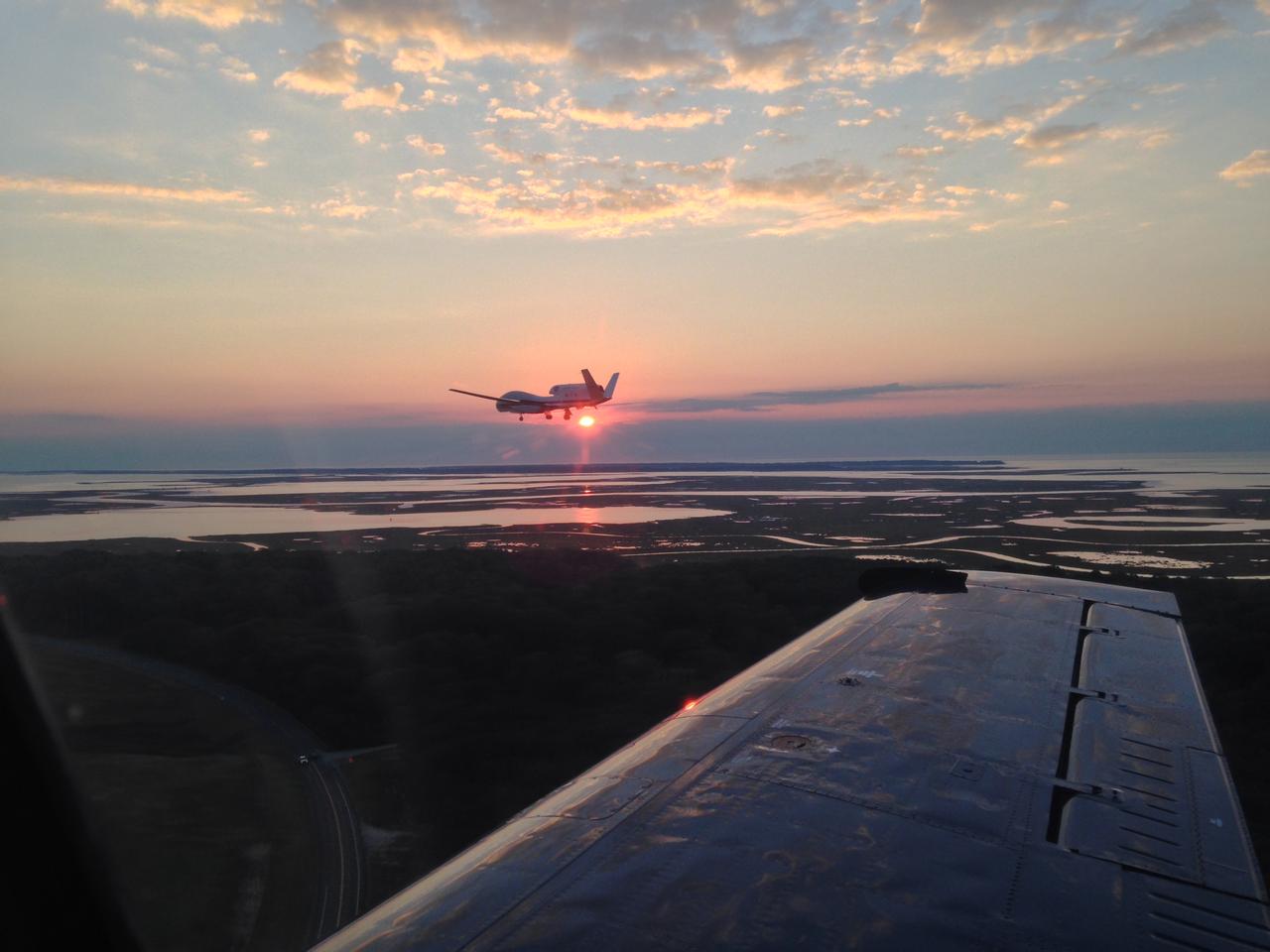
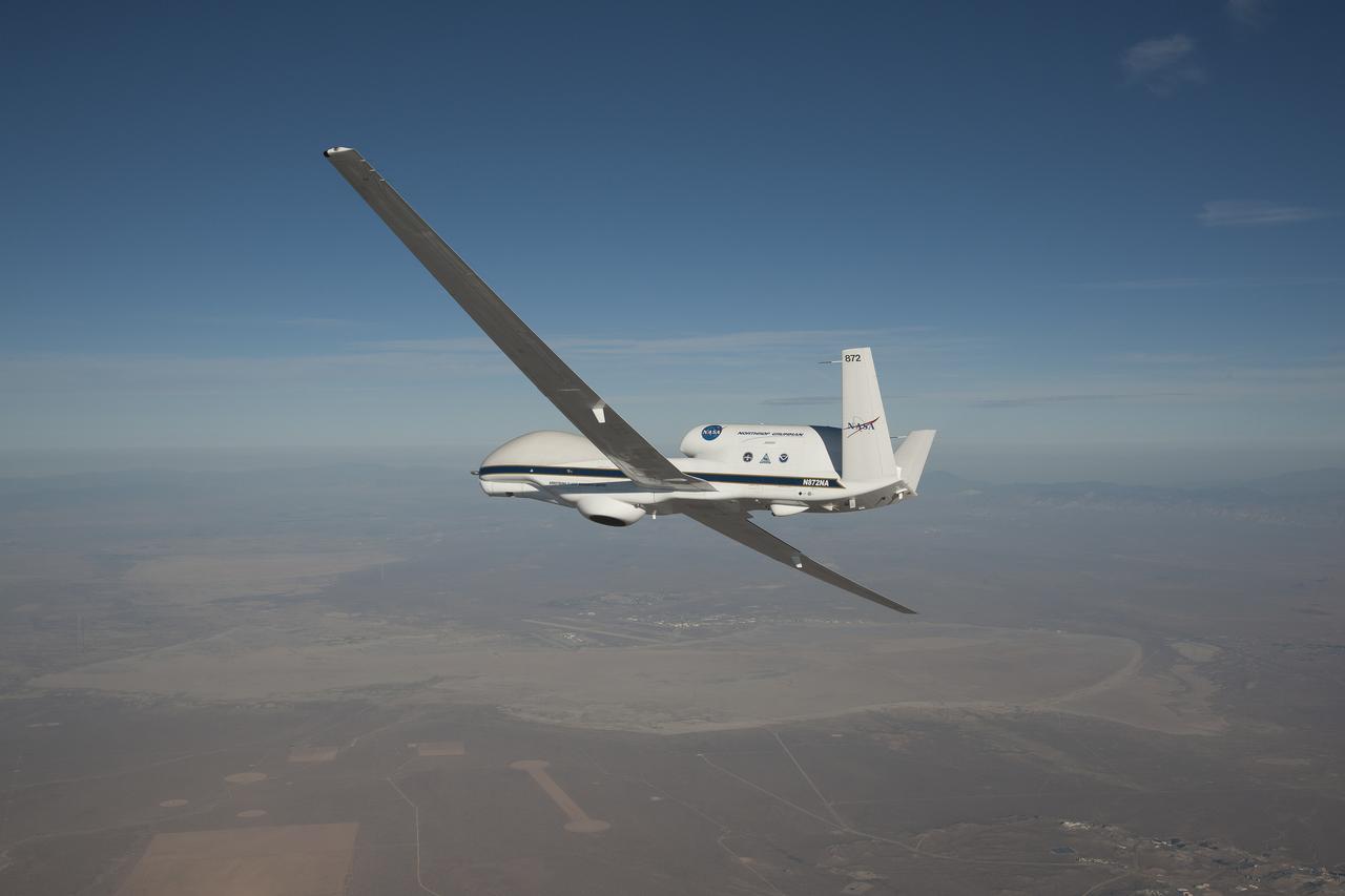
View from a Chase Plane; HS3 Science Flight 8 Wraps Up The chase plane accompanying NASA's Global Hawk No. 872 captured this picture on Sept. 19 after the Global Hawk completed science flight #8 where it gathered data from a weakening Tropical Storm Edouard over the North Atlantic Ocean. Credit: NASA -- The Hurricane and Severe Storm Sentinel (HS3) is a five-year mission specifically targeted to investigate the processes that underlie hurricane formation and intensity change in the Atlantic Ocean basin. HS3 is motivated by hypotheses related to the relative roles of the large-scale environment and storm-scale internal processes. Read more: espo.nasa.gov/missions/hs3/mission-gallery <b><a href="http://www.nasa.gov/audience/formedia/features/MP_Photo_Guidelines.html" rel="nofollow">NASA image use policy.</a></b> <b><a href="http://www.nasa.gov/centers/goddard/home/index.html" rel="nofollow">NASA Goddard Space Flight Center</a></b> enables NASA’s mission through four scientific endeavors: Earth Science, Heliophysics, Solar System Exploration, and Astrophysics. Goddard plays a leading role in NASA’s accomplishments by contributing compelling scientific knowledge to advance the Agency’s mission. <b>Follow us on <a href="http://twitter.com/NASAGoddardPix" rel="nofollow">Twitter</a></b> <b>Like us on <a href="http://www.facebook.com/pages/Greenbelt-MD/NASA-Goddard/395013845897?ref=tsd" rel="nofollow">Facebook</a></b> <b>Find us on <a href="http://instagram.com/nasagoddard?vm=grid" rel="nofollow">Instagram</a></b>
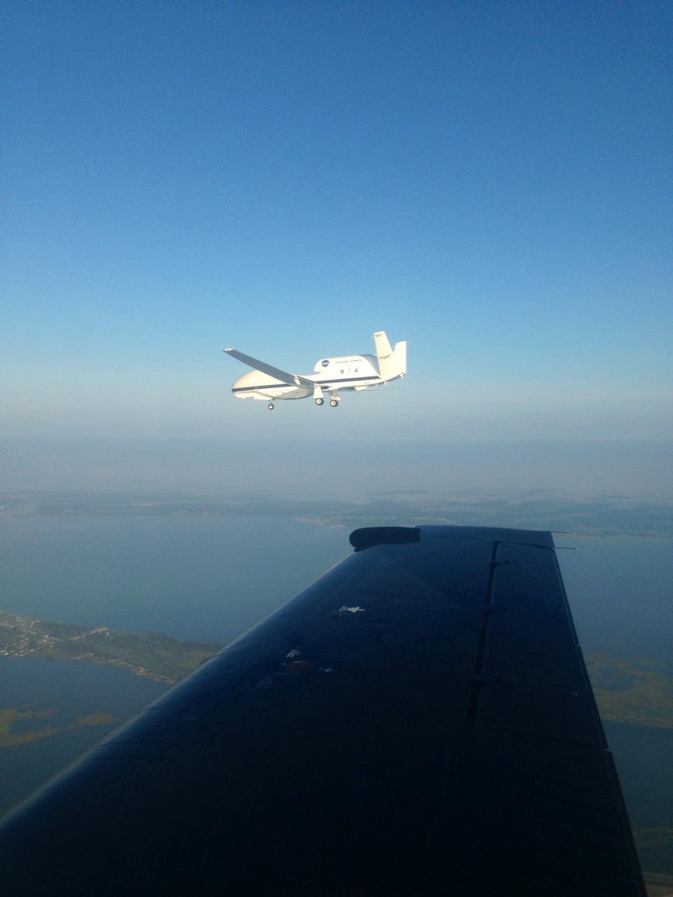
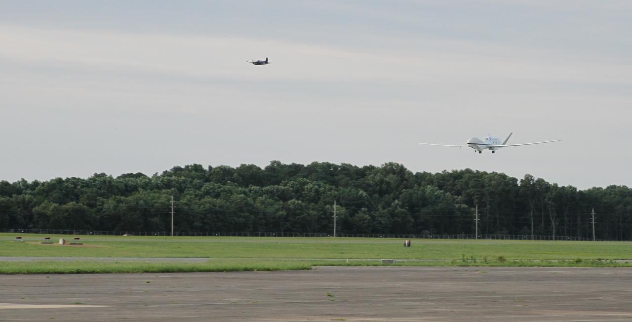
The NASA Wallops T-34 chase aircraft intercepted Global Hawk 872 on its descent to runway 28 at NASA's Wallops Flight Facility in Wallops Island, Va. This photo of the Global Hawk was taken from the chase plane after finishing its third science flight. For more information about NASA's HS3 mission, visit: <a href="http://www.nasa.gov/HS3" rel="nofollow">www.nasa.gov/HS3</a> Credit: NASA/ Brea Reeves <b><a href="http://www.nasa.gov/audience/formedia/features/MP_Photo_Guidelines.html" rel="nofollow">NASA image use policy.</a></b> <b><a href="http://www.nasa.gov/centers/goddard/home/index.html" rel="nofollow">NASA Goddard Space Flight Center</a></b> enables NASA’s mission through four scientific endeavors: Earth Science, Heliophysics, Solar System Exploration, and Astrophysics. Goddard plays a leading role in NASA’s accomplishments by contributing compelling scientific knowledge to advance the Agency’s mission. <b>Follow us on <a href="http://twitter.com/NASA_GoddardPix" rel="nofollow">Twitter</a></b> <b>Like us on <a href="http://www.facebook.com/pages/Greenbelt-MD/NASA-Goddard/395013845897?ref=tsd" rel="nofollow">Facebook</a></b> <b>Find us on <a href="http://instagram.com/nasagoddard?vm=grid" rel="nofollow">Instagram</a></b>
NASA image acquired October 23, 2009. At NASA’s Dryden Research Center in California, a group of engineers, scientists, and aviation technicians have set up camp in a noisy, chilly hangar on Edwards Air Force base. For the past two weeks, they have been working to mount equipment—from HD video cameras to ozone sensors—onto NASA’s Global Hawk, a remote-controlled airplane that can fly for up to 30 hours at altitudes up to 65,000 feet. The team is gearing up for the Global Hawk Pacific campaign, a series of four or five scientific research flights that will take the Global Hawk over the Pacific Ocean and Arctic regions. The 44-foot-long aircraft, with its comically large nose and 116-foot wingspan is pictured in the photograph above, banking for landing over Rogers Dry Lake in California at the end of a test flight on October 23, 2009. The long wings carry the plane’s fuel, and the bulbous nose is one of the payload bays, which house the science instruments. For the Global Hawk Pacific campaign, the robotic aircraft will carry ten science instruments that will sample the chemical composition of air in the troposphere (the atmospheric layer closest to Earth) and the stratosphere (the layer above the troposphere). The mission will also observe clouds and aerosol particles in the troposphere. The primary purpose of the mission is to collect observations that can be used to check the accuracy of simultaneous observations collected by NASA’s Aura satellite. Co-lead scientist Paul Newman from Goddard Space Flight Center is writing about the ground-breaking mission for the Earth Observatory’s Notes from the Field blog. NASA Photograph by Carla Thomas. <b><a href="http://www.nasa.gov/centers/goddard/home/index.html" rel="nofollow">NASA Goddard Space Flight Center</a></b> is home to the nation's largest organization of combined scientists, engineers and technologists that build spacecraft, instruments and new technology to study the Earth, the sun, our solar system, and the universe. To learn more about this image go to: <a href="http://earthobservatory.nasa.gov/IOTD/view.php?id=43291" rel="nofollow">earthobservatory.nasa.gov/IOTD/view.php?id=43291</a>
NASA’s Global Hawk aircraft was deployed to Florida from Armstrong Flight Research Center at Edwards, CA. on Oct. 6 to monitor and take scientific measurements of Hurricane Matthew. The unmanned Global Hawk will gather scientific data in support of NOAA’s Sensing Hazards with Operational Unmanned Technology (SHOUT) mission.
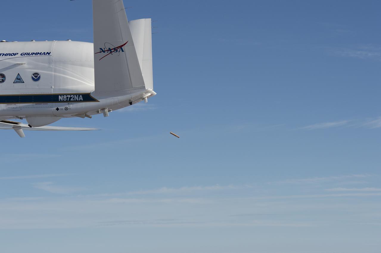
NASA’s Global Hawk aircraft deploys a dropsonde during a test flight over the Dryden Aeronautical Test Range in August 2015. The small, tube-shaped sensor will transmit data on temperature, humidity, and wind speed, which will be used to help improve weather model forecasts
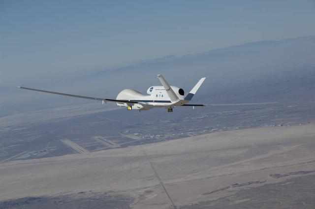
NASA's Global Hawk 872 soared over Rogers Dry Lake at Edwards Air Force Base, CA, during an instrument checkout flight for the 2014 ATTREX mission over the western Pacific Ocean. The aircraft carried 13 science instruments to measure moisture and chemical composition of the stratosphere during the campaign.
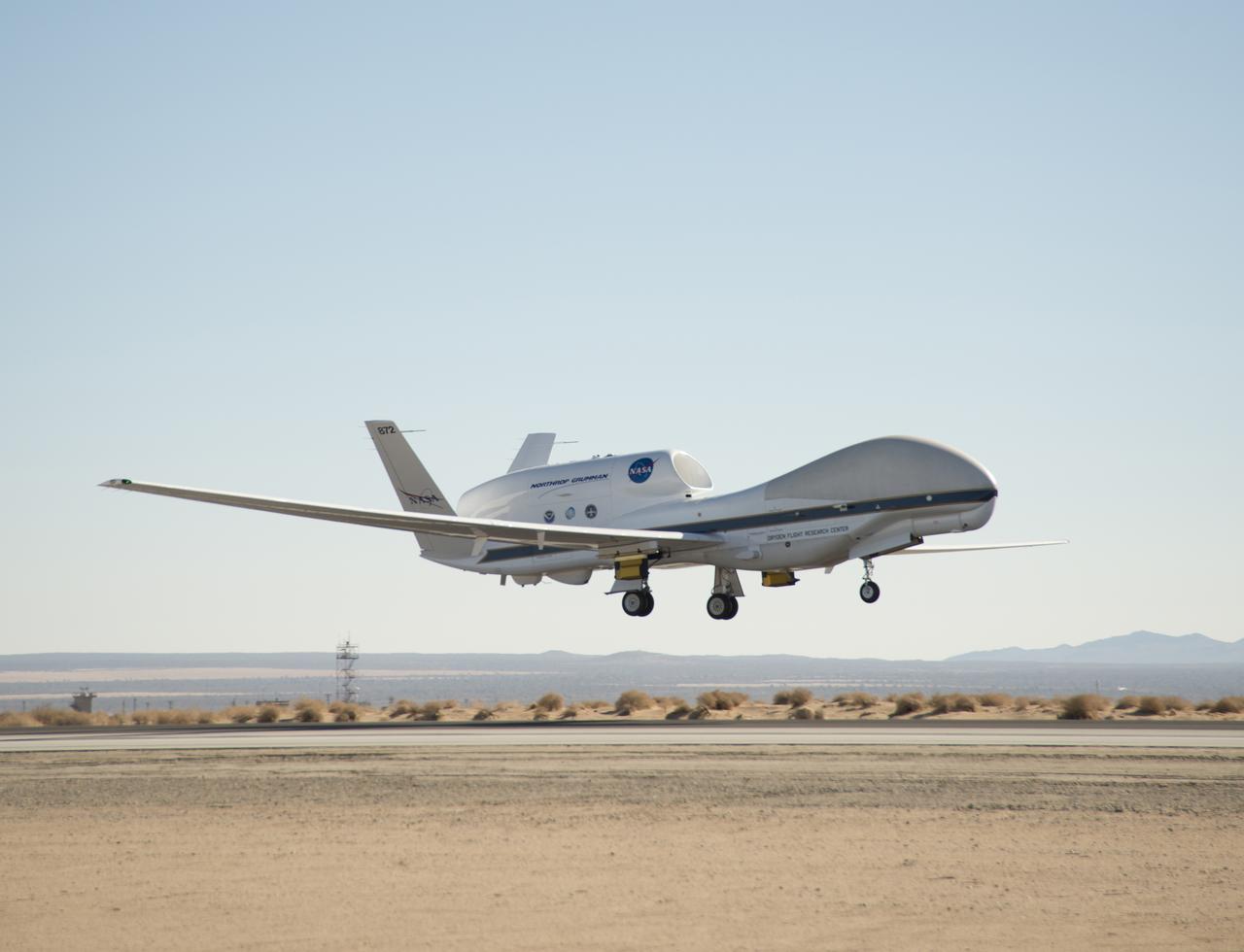
The first of two NASA Global Hawk unmanned aerial vehicles supporting the Hurricane and Severe Storm Sentinel (HS3) mission landed at 7:39 a.m. today, Aug. 14, 2013, at NASA's Wallops Flight Facility, Wallops Island, Va. During August and September, NASA will fly the two Global Hawks over the Atlantic Ocean to study tropical storms and the processes that underlie hurricane formation and intensification. The aircraft are equipped with instruments to survey the overall environment of the storms and peer into the inner core of hurricanes to study their structure and processes. For more information, visit: <a href="http://www.nasa.gov/HS3. " rel="nofollow">www.nasa.gov/HS3. </a> Photo Credit: NASA Wallops Keith Koehler NASA Wallops Flight Facility <b><a href="http://www.nasa.gov/audience/formedia/features/MP_Photo_Guidelines.html" rel="nofollow">NASA image use policy.</a></b> <b><a href="http://www.nasa.gov/centers/goddard/home/index.html" rel="nofollow">NASA Goddard Space Flight Center</a></b> enables NASA’s mission through four scientific endeavors: Earth Science, Heliophysics, Solar System Exploration, and Astrophysics. Goddard plays a leading role in NASA’s accomplishments by contributing compelling scientific knowledge to advance the Agency’s mission. <b>Follow us on <a href="http://twitter.com/NASA_GoddardPix" rel="nofollow">Twitter</a></b> <b>Like us on <a href="http://www.facebook.com/pages/Greenbelt-MD/NASA-Goddard/395013845897?ref=tsd" rel="nofollow">Facebook</a></b> <b>Find us on <a href="http://instagram.com/nasagoddard?vm=grid" rel="nofollow">Instagram</a></b>
NASA's Global Hawk 872 lifted off the runway at Edwards Air Force Base during a checkout flight of instruments for the 2014 ATTREX mission over the western Pacific Ocean. Yellow and black pods housing the Hawkeye cloud particle probe instruments being used during the mission can be seen underneath the wings.
A NASA remotely piloted Global Hawk aircraft completes a flight in February 2015 to support the National Oceanic and Atmospheric Administration’s El Niño Rapid Response field campaign. The mission, called the Sensing Hazards Operational Unmanned Technology, gathered El Niño storm data over the Pacific Ocean. The flight originated from NASA’s Armstrong Flight Research Center in Edwards, California.
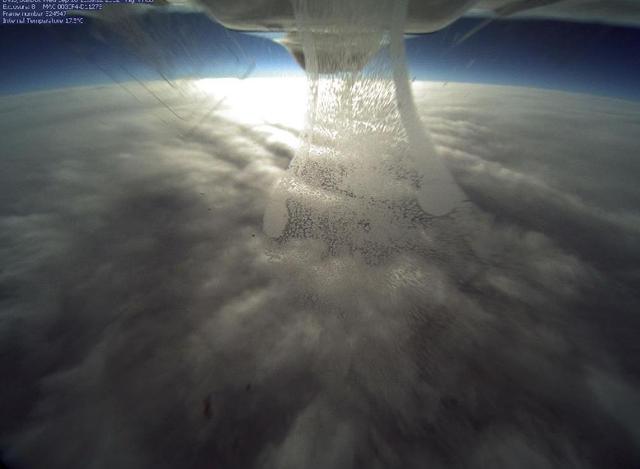
NASA's Global Hawk flew over Tropical Storm Nadine on Sept. 26, 2012 at 3 p.m. EDT and captured this photo from the camera located in the belly if the aircraft as it flew over the northern edge of the storm. Credit: NASA <b><a href="http://www.nasa.gov/audience/formedia/features/MP_Photo_Guidelines.html" rel="nofollow">NASA image use policy.</a></b> <b><a href="http://www.nasa.gov/centers/goddard/home/index.html" rel="nofollow">NASA Goddard Space Flight Center</a></b> enables NASA’s mission through four scientific endeavors: Earth Science, Heliophysics, Solar System Exploration, and Astrophysics. Goddard plays a leading role in NASA’s accomplishments by contributing compelling scientific knowledge to advance the Agency’s mission. <b>Follow us on <a href="http://twitter.com/NASA_GoddardPix" rel="nofollow">Twitter</a></b> <b>Like us on <a href="http://www.facebook.com/pages/Greenbelt-MD/NASA-Goddard/395013845897?ref=tsd" rel="nofollow">Facebook</a></b> <b>Find us on <a href="http://instagrid.me/nasagoddard/?vm=grid" rel="nofollow">Instagram</a></b>
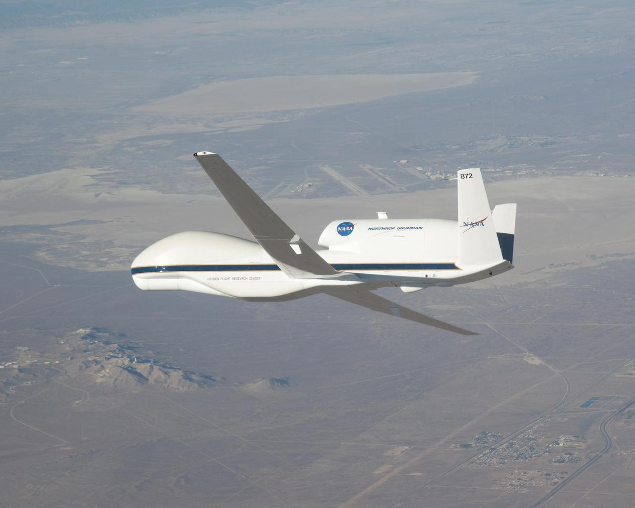
The above-the-fuselage engine and V-tail distinguish one of NASA's two Global Hawk unmanned aircraft parked on the ramp at the Dryden Flight Research Center.
In its new white-and-blue NASA livery, an early development model of the Global Hawk unmanned aircraft rests on the ramp at the Dryden Flight Research Center.
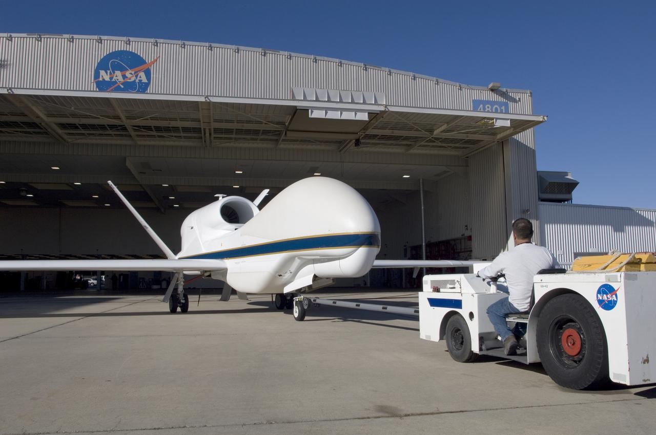
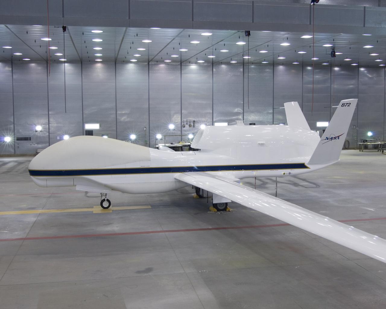
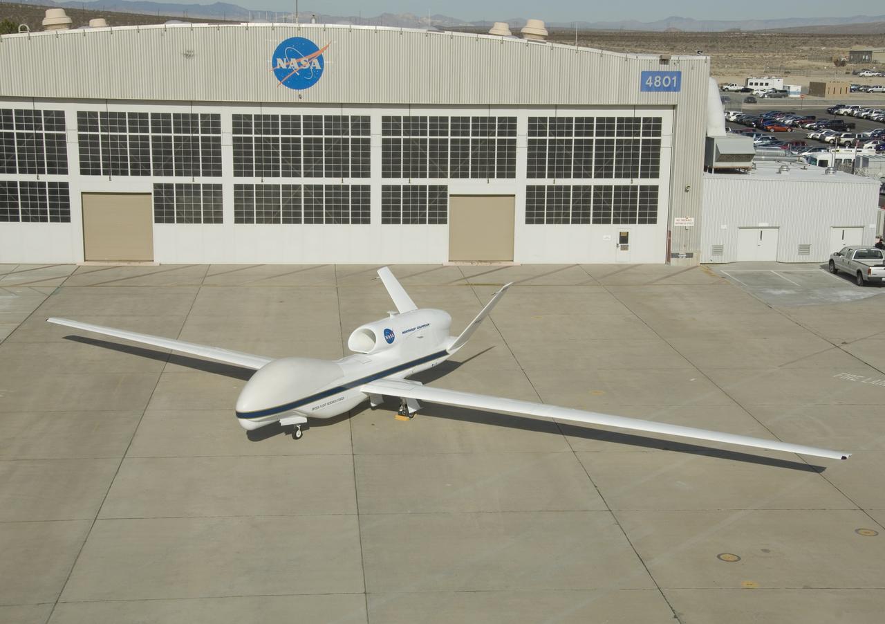
A ground crewman maneuvers one of NASA's Global Hawk unmanned science aircraft into Hangar 4801 at NASA's Dryden Flight Research Center, Edwards, Calif.
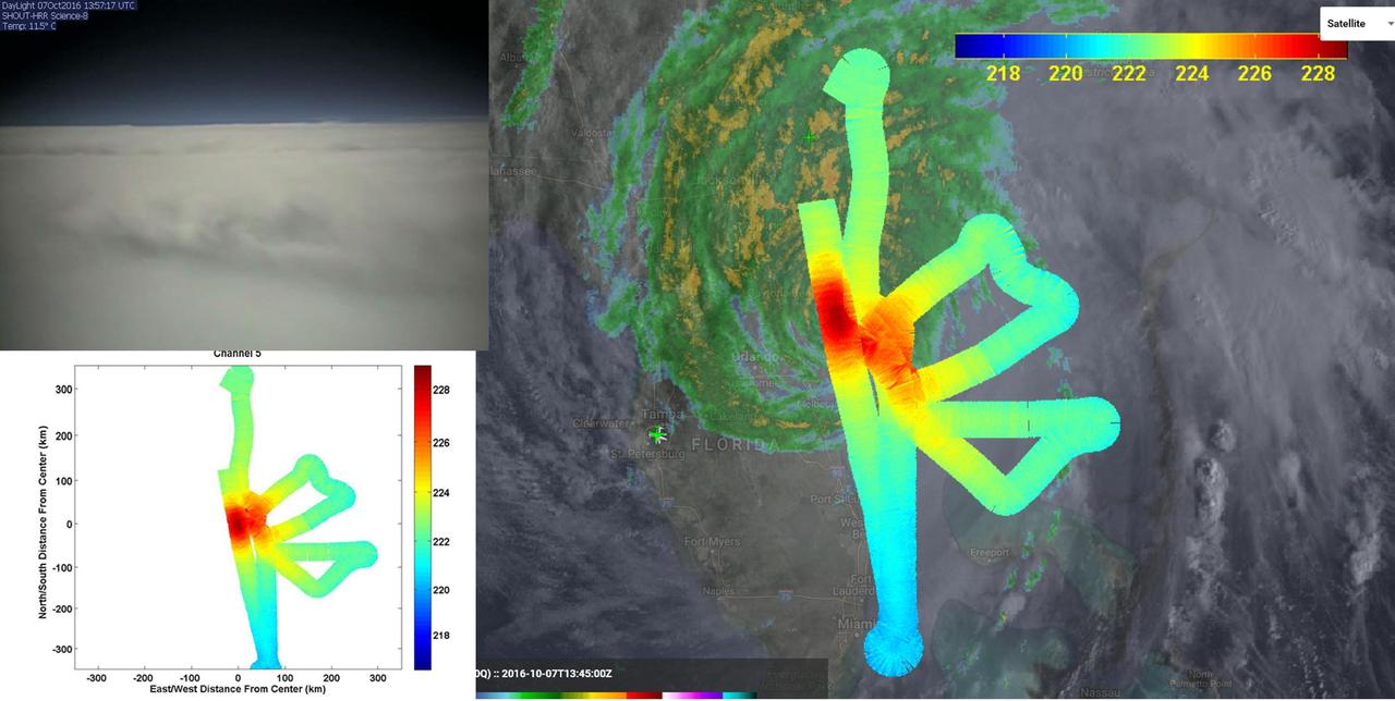
JPL's HAMSR instrument flew above Hurricane Matthew on Oct. 7 aboard a NASA Global Hawk aircraft. Right: atmospheric temperatures overlaid atop ground-based radar and satellite visible images. Reds are areas without clouds; blues show ice and heavy precipitation. Upper left: Global Hawk visible image. http://photojournal.jpl.nasa.gov/catalog/PIA21094
This Global Hawk unmanned aircraft is one of two that are used by NASA for Earth science missions and by Northrop Grumman for follow-on developmental testing.
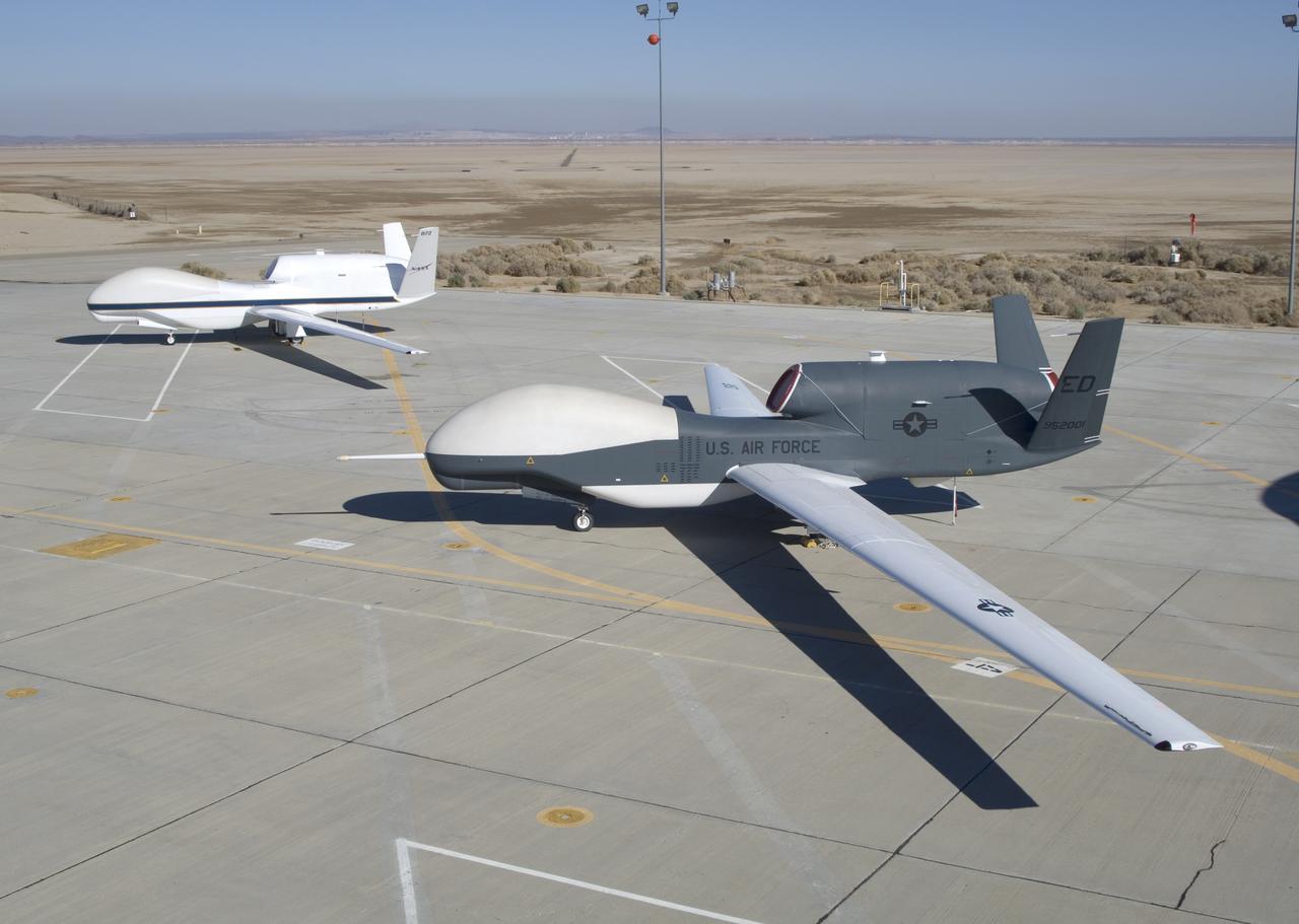
NASA's two Global Hawks, one sporting a NASA paint scheme, the other in its prior Air Force livery, are shown on the ramp at the Dryden Flight Research Center.
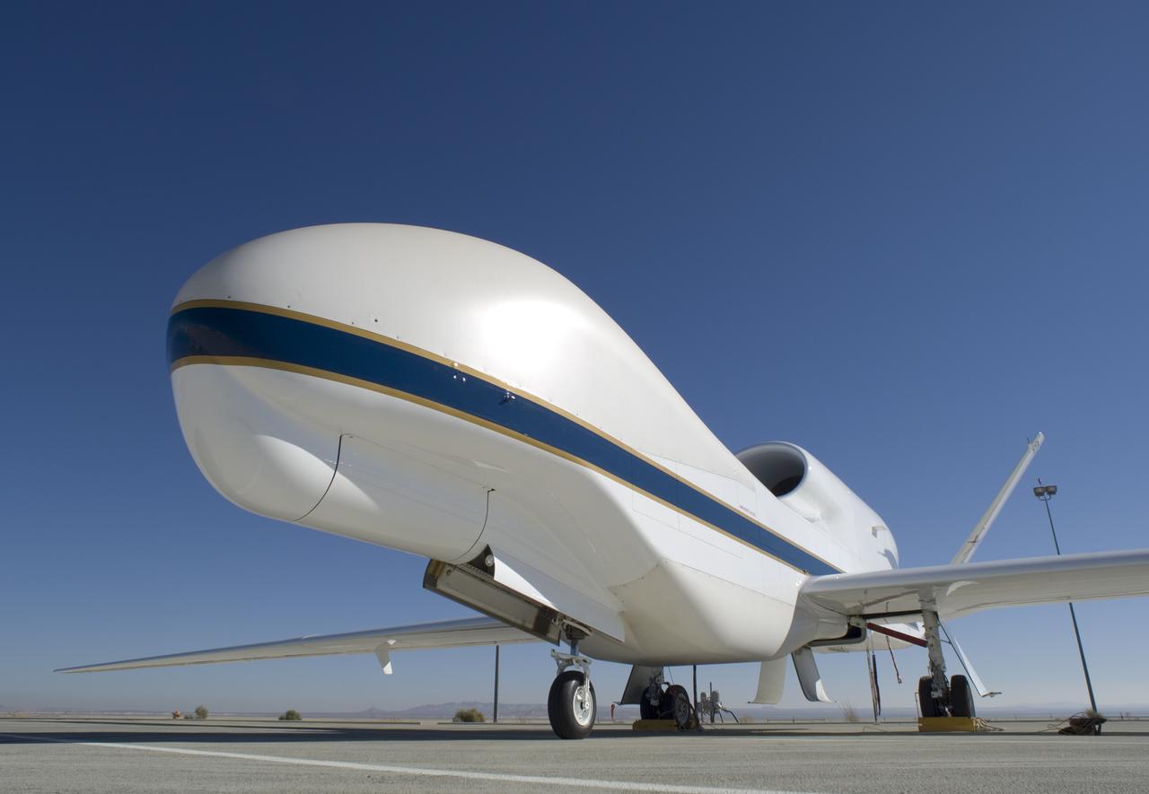
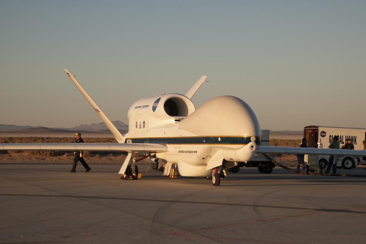
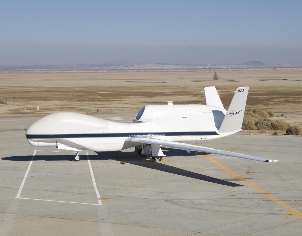
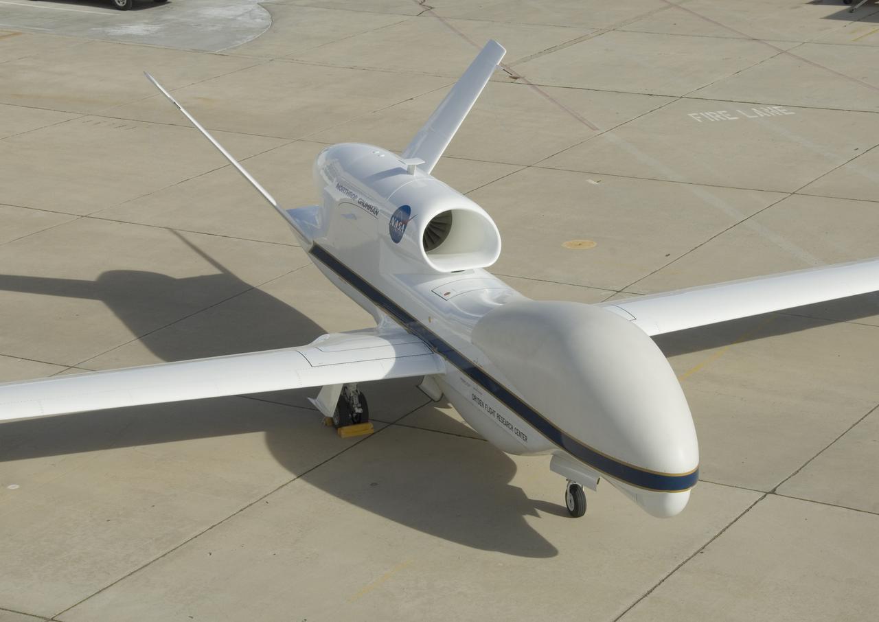
One of NASA's Global Hawk unmanned science aircraft displays its bulbous nose while parked on the ramp at NASA's Dryden Flight Research Center, Edwards, Calif.

The bulbous nose of one of NASA's Global Hawk unmanned aircraft sports a blue-and-white paint scheme after repainting in the Edwards Air Force Base paint shop.
One of NASA's two Global Hawk unmanned aircraft shows off its new blue-and-white livery shortly after being repainted in the Edwards Air Force Base paint hangar.
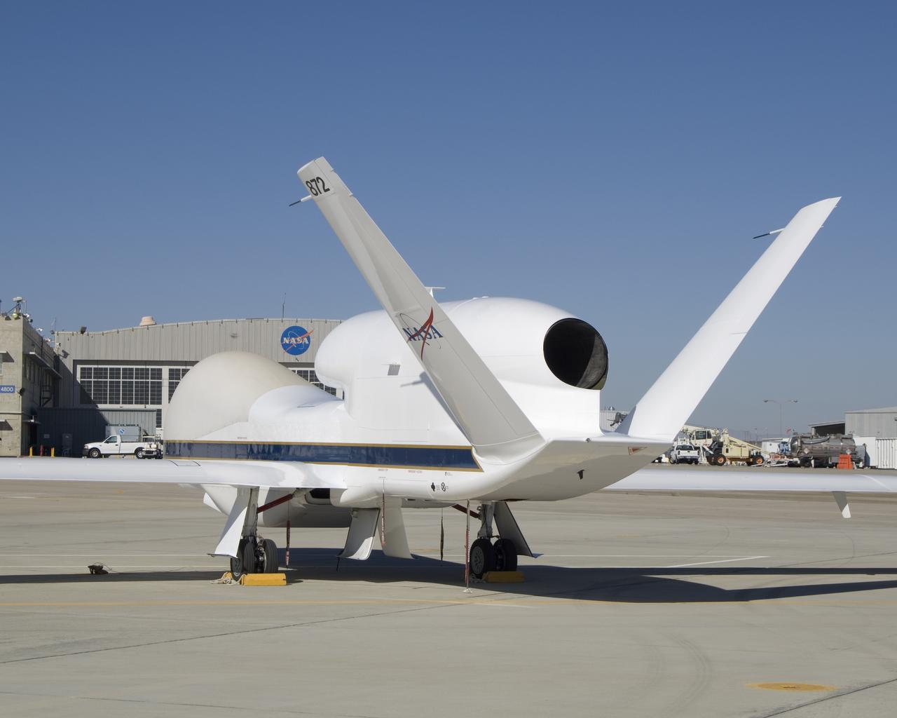
The bulbous nose of one of NASA's two Global Hawk unmanned high-altitude aircraft houses communications and sensor payloads on Earth science missions.
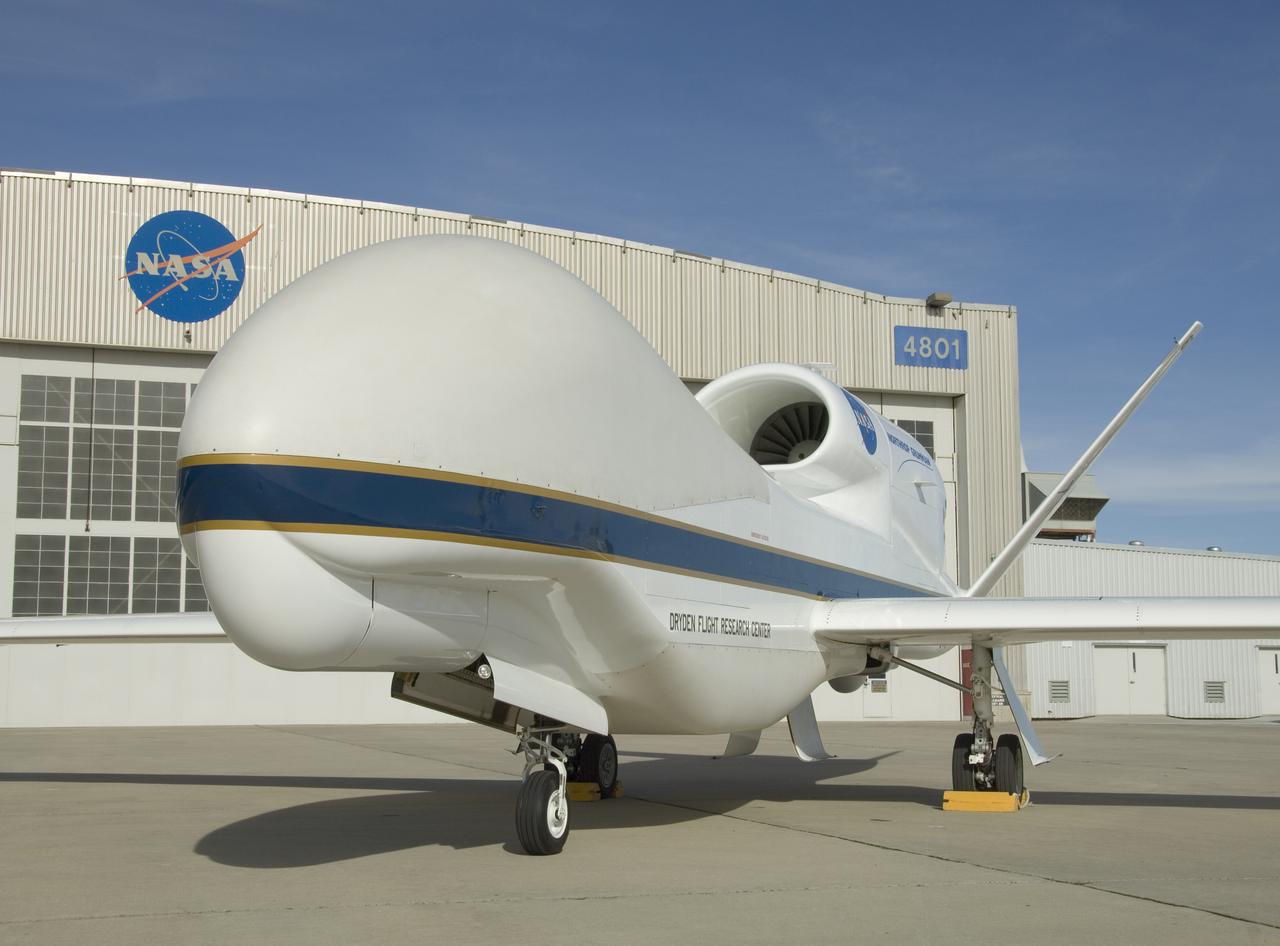
One of NASA's two Global Hawk unmanned high-altitude aircraft shows off its blue-and-white livery in front of its hangar at NASA's Dryden Flight Research Center.
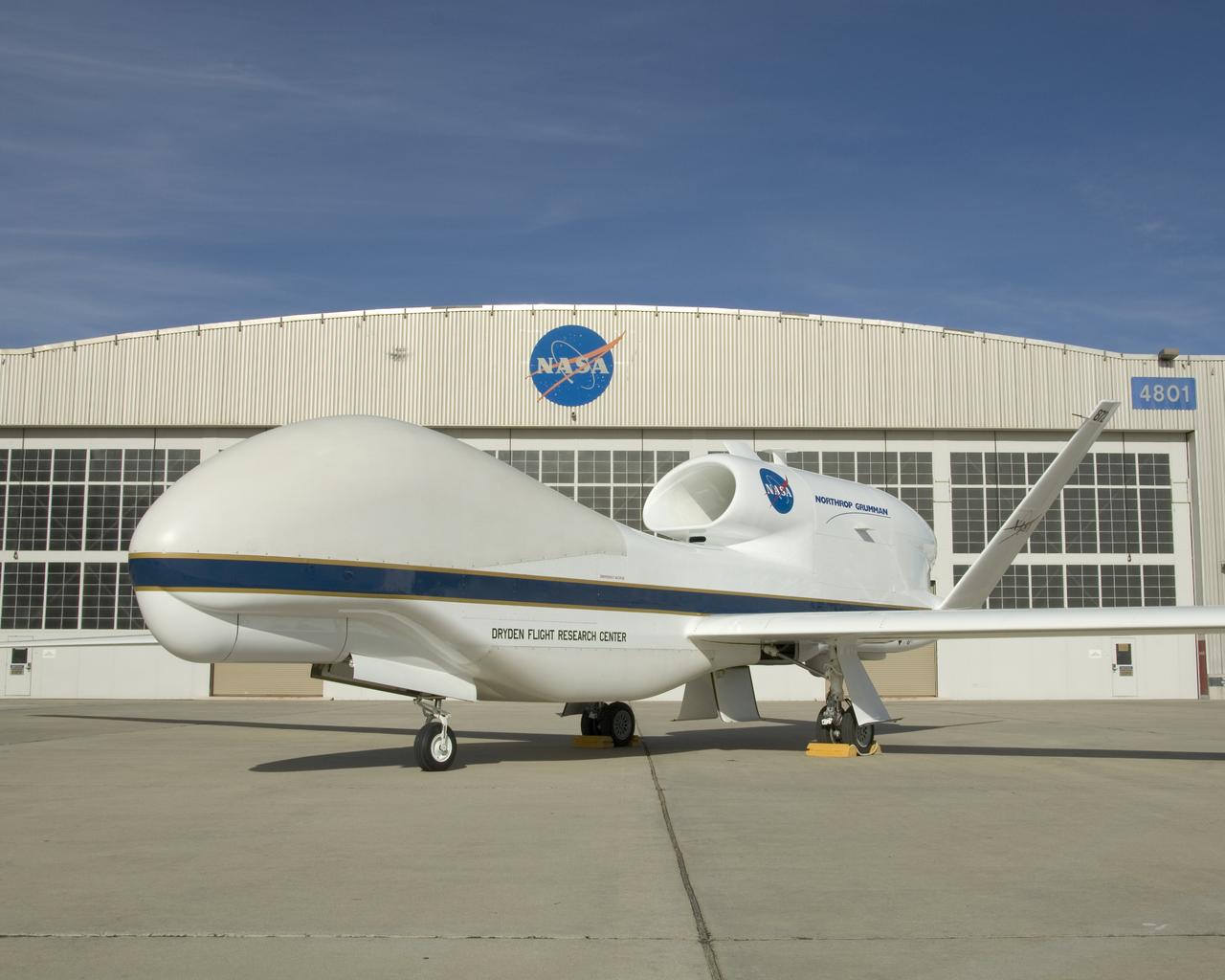
One of NASA's two Global Hawk high-altitude unmanned science aircraft displays its contours outside its hangar at NASA's Dryden Flight Research Center.
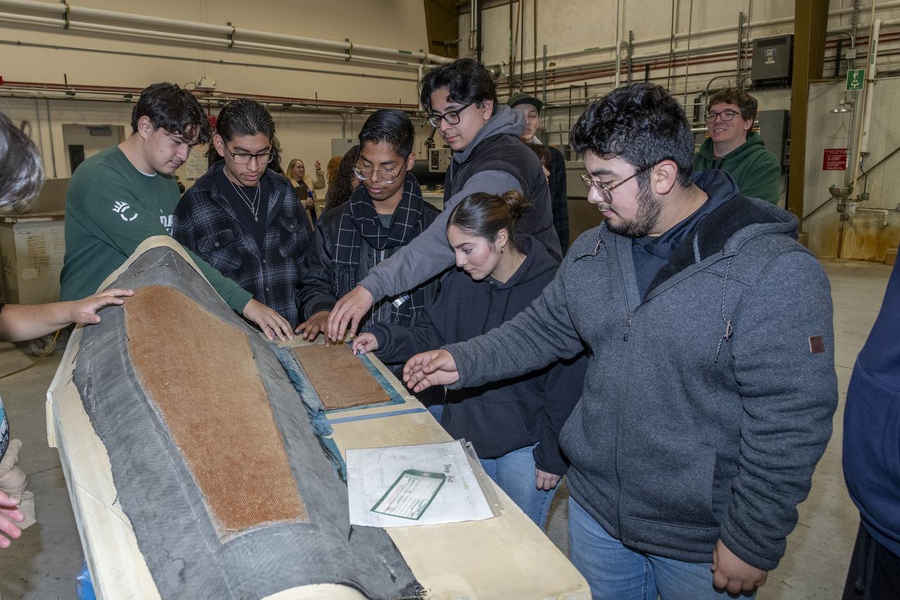
Students examine the Global Hawk Fairing Load Test at the Experimental Fabrication Shop at NASA’s Armstrong Research Flight Center in Edwards, California. The students are from the engineering club from Palmdale High School in Palmdale, California.
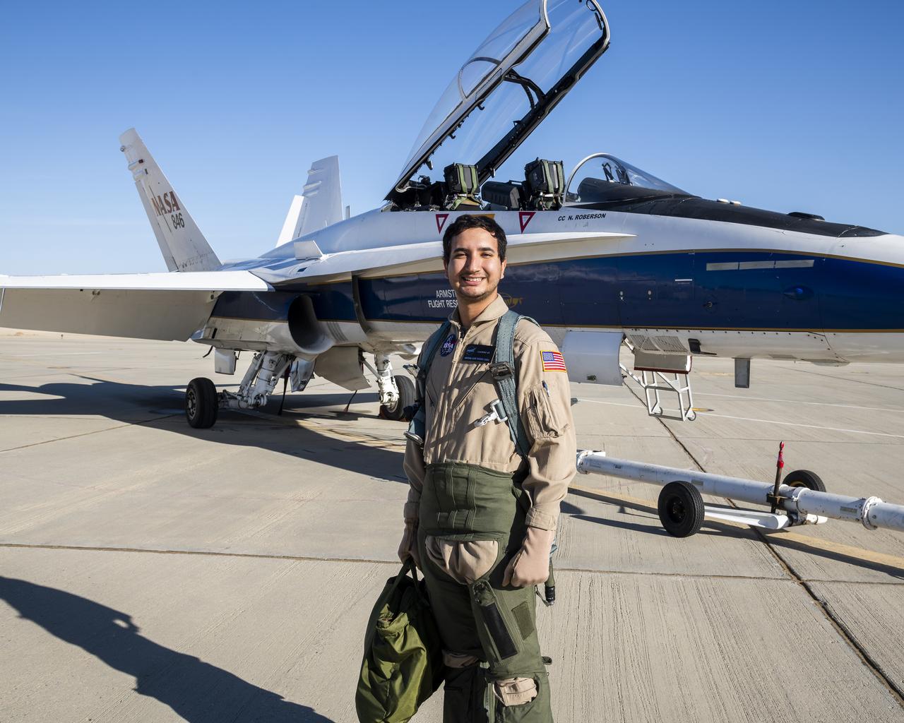
Julio Treviño, lead operations engineer for NASA’s Global Hawk SkyRange project, stands in front of an F/A-18 mission support aircraft at NASA’s Armstrong Flight Research Center in Edwards, California.
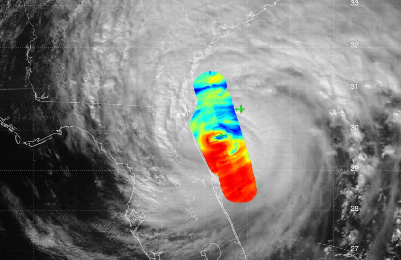
JPL's High-Altitude Monolithic Microwave Integrated Circuit Sounding Radiometer (HAMSR) instrument captured this look inside Hurricane Matthew's spiral clouds on Oct. 7, 2016, flying on a NASA Global Hawk unmanned aircraft. Red colors show cloud bands without precipitation; blues show rain bands. http://photojournal.jpl.nasa.gov/catalog/PIA21093
Photo of the chase plane landing at NASA's Wallops Flight Facility, Wallops Island, Va. at 7:39 a.m. today, Aug. 14, 2013. The chase plane was used during the landing of NASA's Global Hawk unmanned aerial vehicle. The Global Hawk will be used during the Hurricane Severe Storms Sentinel (HS3) mission. For more information, visit: <a href="http://www.nasa.gov/HS3. " rel="nofollow">www.nasa.gov/HS3. </a> Photo Credit: NASA Wallops Text: Keith Koehler/NASA Wallops Flight Facility <b><a href="http://www.nasa.gov/audience/formedia/features/MP_Photo_Guidelines.html" rel="nofollow">NASA image use policy.</a></b> <b><a href="http://www.nasa.gov/centers/goddard/home/index.html" rel="nofollow">NASA Goddard Space Flight Center</a></b> enables NASA’s mission through four scientific endeavors: Earth Science, Heliophysics, Solar System Exploration, and Astrophysics. Goddard plays a leading role in NASA’s accomplishments by contributing compelling scientific knowledge to advance the Agency’s mission. <b>Follow us on <a href="http://twitter.com/NASA_GoddardPix" rel="nofollow">Twitter</a></b> <b>Like us on <a href="http://www.facebook.com/pages/Greenbelt-MD/NASA-Goddard/395013845897?ref=tsd" rel="nofollow">Facebook</a></b> <b>Find us on <a href="http://instagram.com/nasagoddard?vm=grid" rel="nofollow">Instagram</a></b>
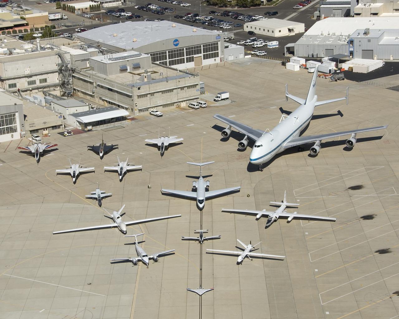
Dryden Flight Research Center - aircraft fleet on ramp
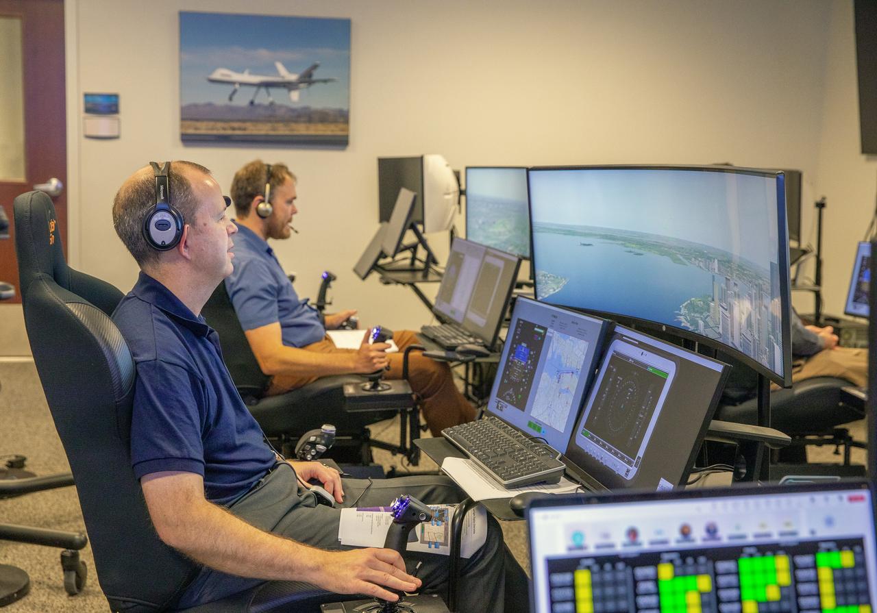
Focus on active photos –Class B Simulation Evaluation in the ATOL Lab at Langley (Also at FAA Tech Center) where team is working with one another in the lab, reviewing data on the monitors. Working the software, adjusting the software systems. Going over the shoulder to show the displays and screens as the software is running. Andy Burroughs (left) and Paul Friz in the roles of air taxi pilots running through air taxi integration simulations focusing on urban air space at NASA’s Langley Research in Hampton, Virginia on Sept. 25, 2024.