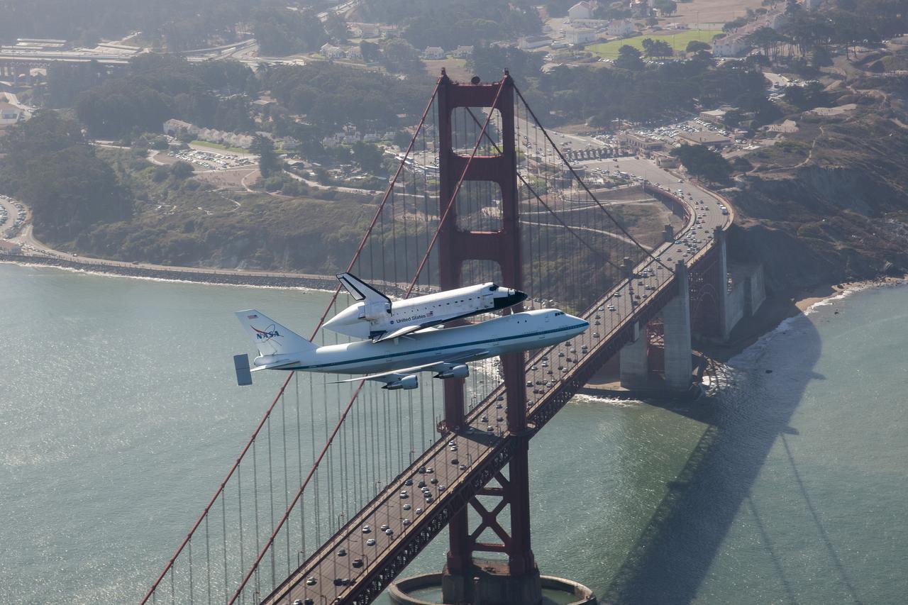
Space shuttle Endeavour and its host NASA 747 Shuttle Carrier Aircraft fly by the Golden Gate Bridge in 2012 on its way to the Los Angeles International Airport and an overland journey to the California Science Center. Californians looked up at the morning sky Sept. 21 to catch a glimpse of Endeavour. The final leg of Endeavour’s flight from NASA’s Kennedy Space Center, Florida, offered many people an opportunity to witness the historic flight. Space shuttle Endeavour and its host NASA 747 Shuttle Carrier Aircraft fly by the Golden Gate Bridge in 2012 on its way to the Los Angeles International Airport and an overland journey to the California Science Center. Californians looked up at the morning sky Sept. 21 to catch a glimpse of Endeavour. The final leg of Endeavour’s flight from NASA’s Kennedy Space Center, Florida, offered many people an opportunity to witness the historic flight.
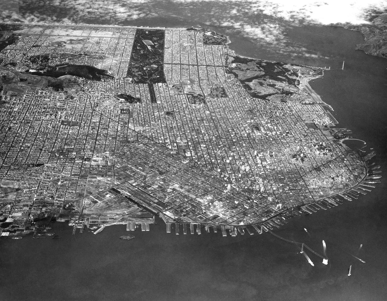
Navy Aerial of San Francisco, California; looking west across South Beach - China Basin to Golden Gate Park, includes Richmond District, Sea Cliff, Presidio, Marina, Fisherman's Wharf, and Telegraph Hill. - Note the beginings of the Golden Gate Bridge in the upper right and the Bay Bridge construction in the lower right of the image.
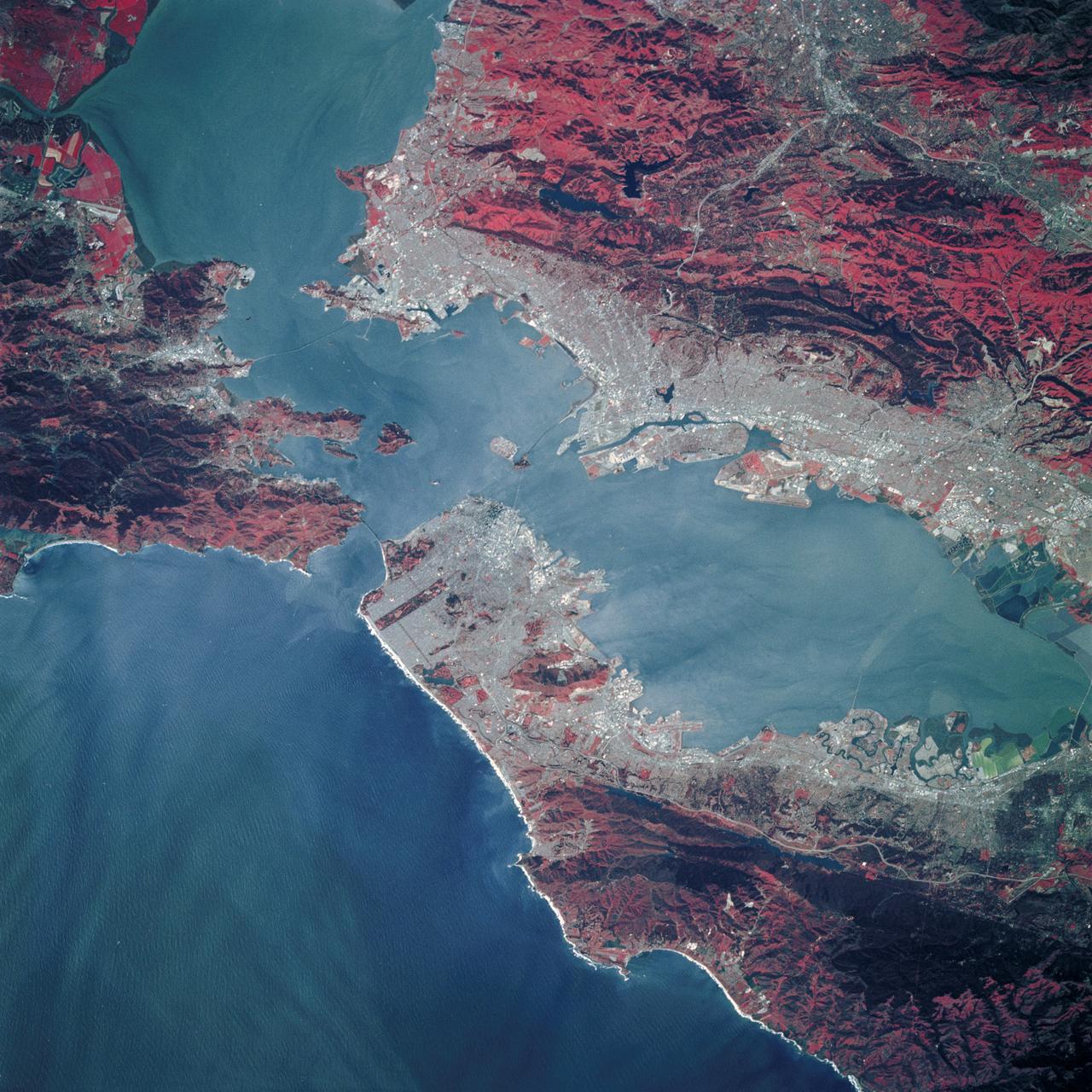
STS039-89-053 (28 April-6 May 1991) --- A 70mm, infrared frame of the city of San Francisco, taken on a clear day. The gray areas represent urban regions, and the red areas are vegetated. Within the city of San Francisco, parks like Golden Gate park and the Presidio at the base of the Golden Gate Bridge easily stand out from the well-developed parts of the city. Major thoroughfares and bridges (Golden Gate and Bay Bridges) are seen as are other landmarks such as Candlestick Park and Alcatraz. The trace of the San Andreas faults show as a straight valley running northerly along the San Francisco peninsula. Good detail is visible in the turbid waters of San Francisco Bay.
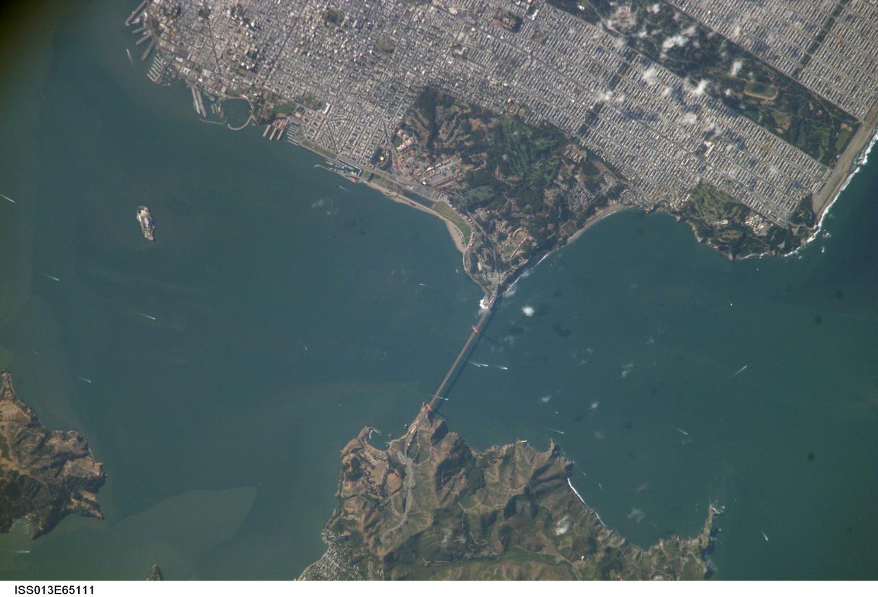
ISS013-E-65111 (6 Aug. 2006) --- Golden Gate, San Francisco, CA is featured in this image photographed by an Expedition 13 crewmember on the International Space Station. The Golden Gate of San Francisco Bay is one of the most recognizable straits in the world due to the Golden Gate Bridge that spans it. This image is a nearly cloud-free view of the northern San Francisco metropolitan area. The gridded pattern of streets, residential neighborhoods, and high-rise commercial blocks is clearly evident in the top half of the image. The twin support towers of the Golden Gate Bridge and its distinctive orange paint scheme can also be distinguished. The vegetated landscape of a portion of the Golden Gate National Recreation Area (green rectangular region at image center) connects the Bridge with steep, less vegetated hill slopes south of the city of Sausalito across the strait. Other features in this view include the former prison of Alcatraz, located on the island of the same name. Numerous boat wakes of commercial and pleasure craft are visible beneath and to the west of the Bridge. The shadow of the roadbed of the Bridge can be seen directly to the west of the Bridge itself. Regions of greenish-brown water visible in San Francisco Bay mark water masses with differing amounts of suspended sediment that are streamlined by the strong tidal currents that flow through the strait.
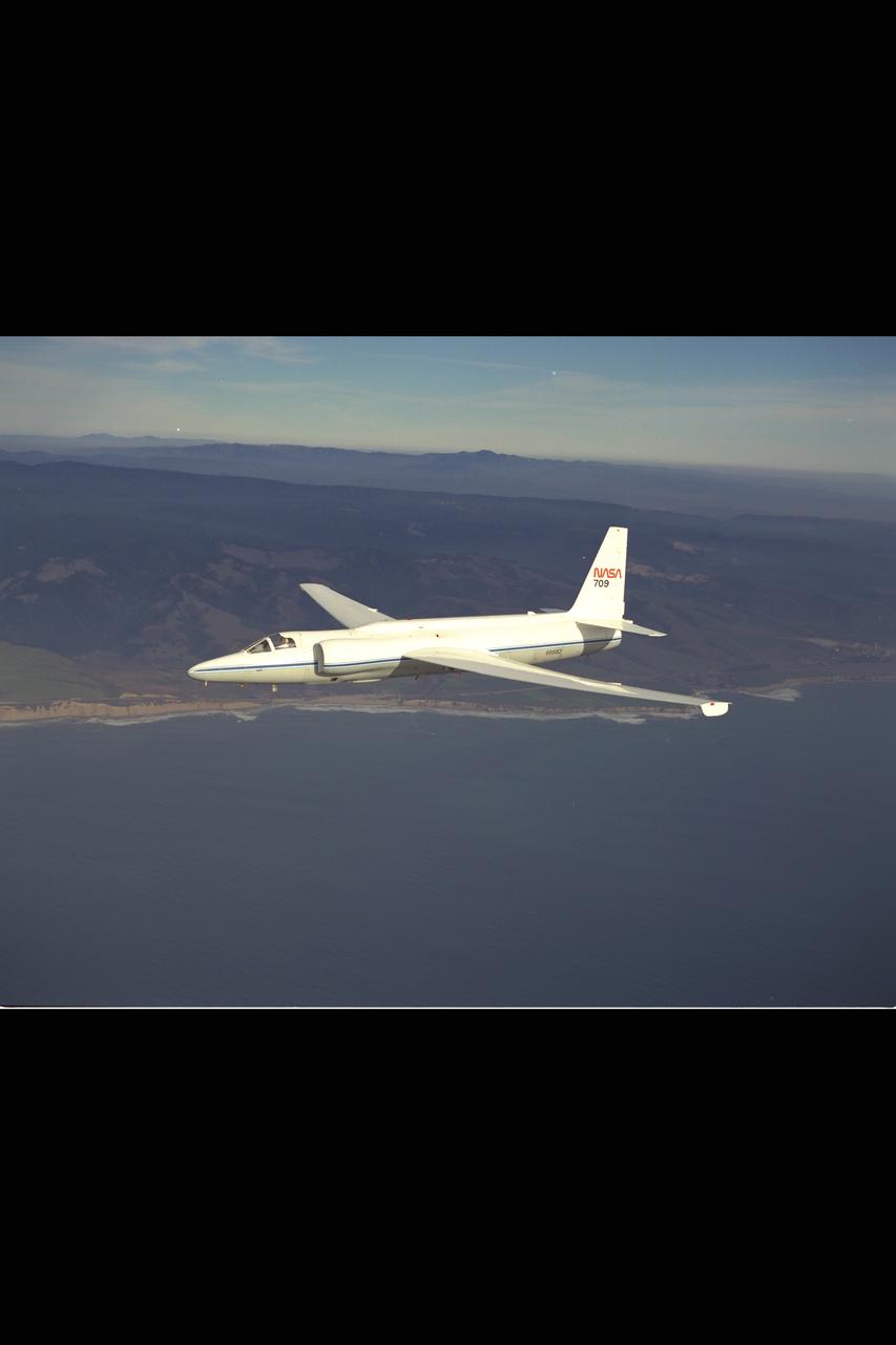
U-2 (NASA 709) in flight over Golden Gate Bridge, San Francisco, CA
iss064e053178 (April 4, 2021) --- The Golden Gate Bridge links San Francisco with the Golden Gate National Recreation Area in northern California. The International Space Station was orbiting 264 miles above the Pacific Ocean just off the coast when this photograph was taken. Credit: Roscosmos
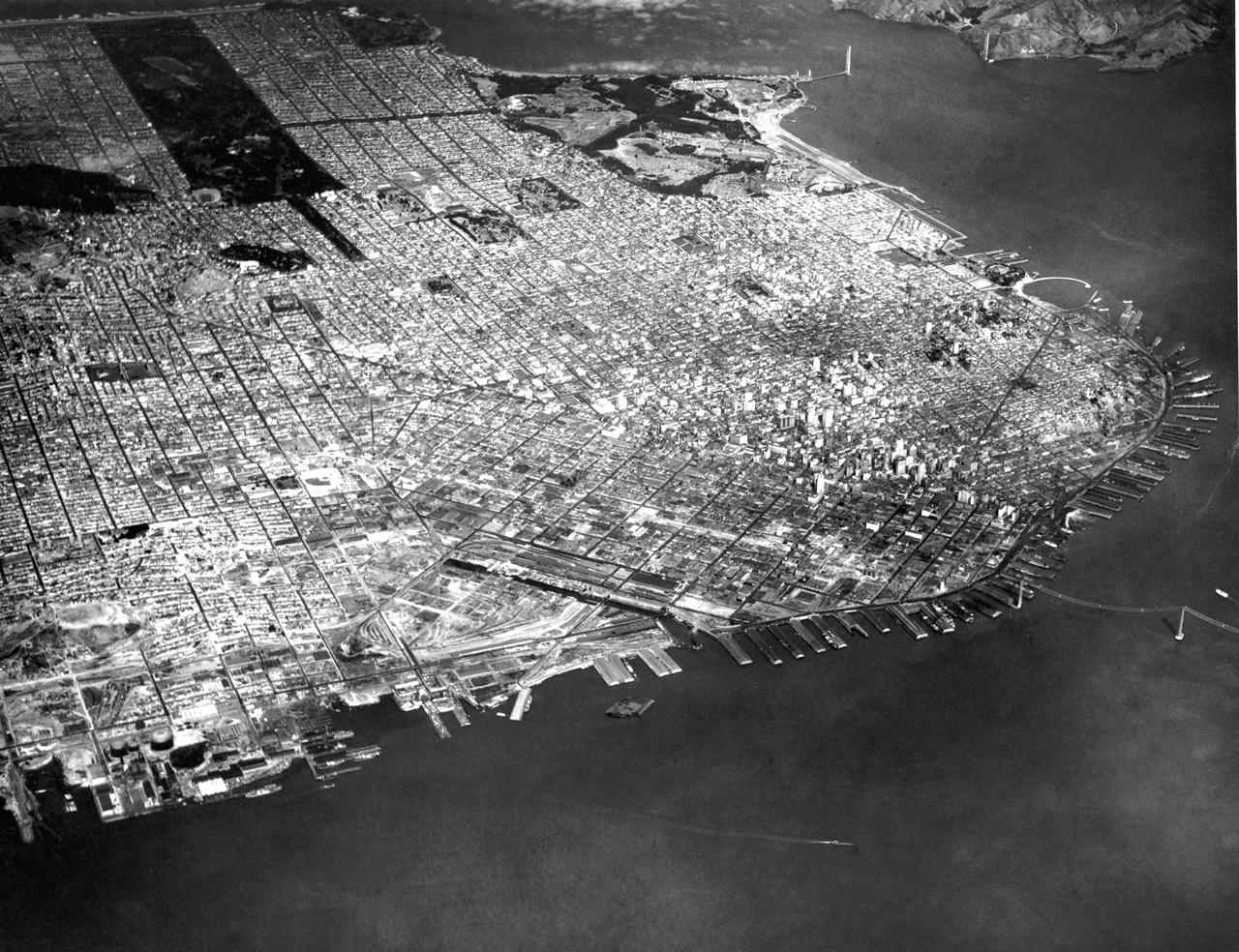
Navy Aerial of San Francisco, California (waterfront - China Basin) Note the beginings of the Golden Gate Bridge in the upper right and the Bay Bridge construction in the middle right of the image.
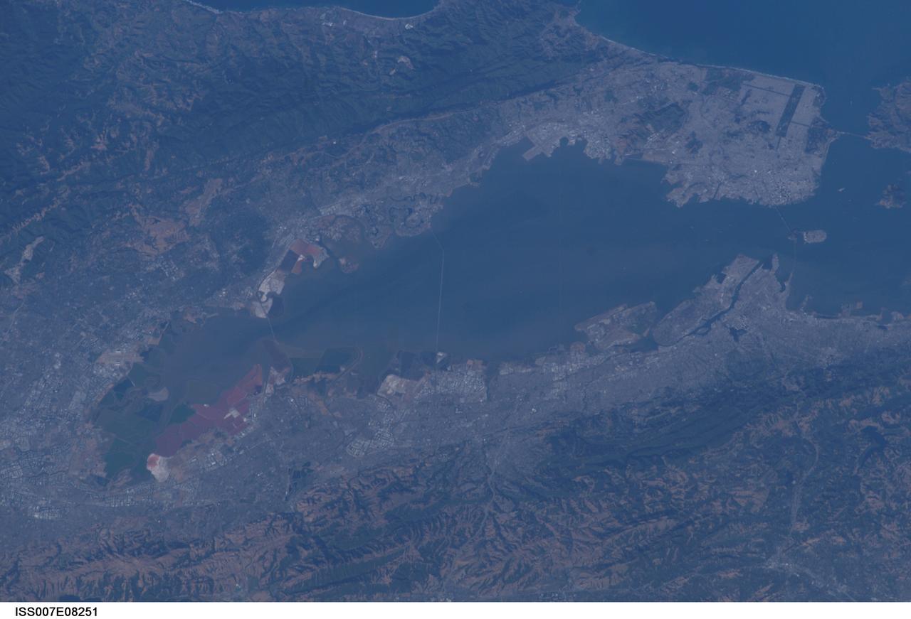
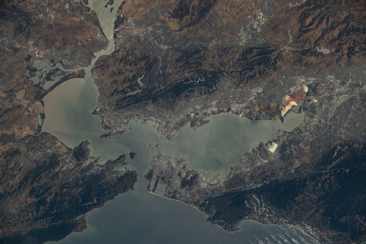
ISS007-E-08251 (25 June 2003) --- This photo featuring the San Francisco Bay area in California was photographed from the International Space Station (ISS) by astronaut Edward T. Lu, Expedition 7 NASA ISS science officer and flight engineer. The San Francisco Bay Bridge, Alcatraz Island, Golden Gate Bridge, and Golden Gate Park are visible at upper right. Stanford University and red salt ponds on the bay near Fremont at lower left.
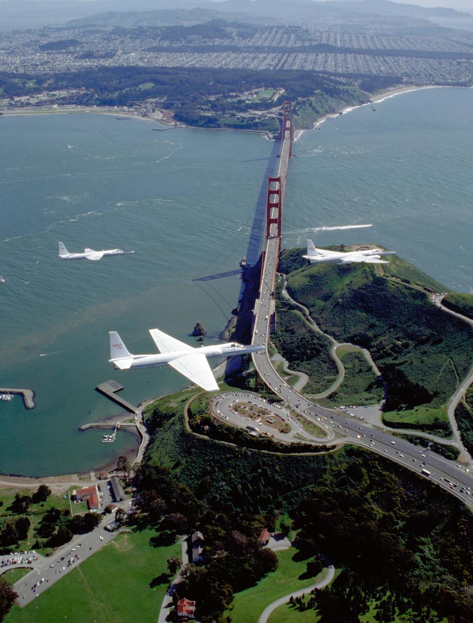
Three ER-2 Aircraft in formation over Golden Gate Bridge, San Francisco, CA on their final flight out of NASA Ames Research Center before redeployment to NASA's Dryden Flight Research Center, CA
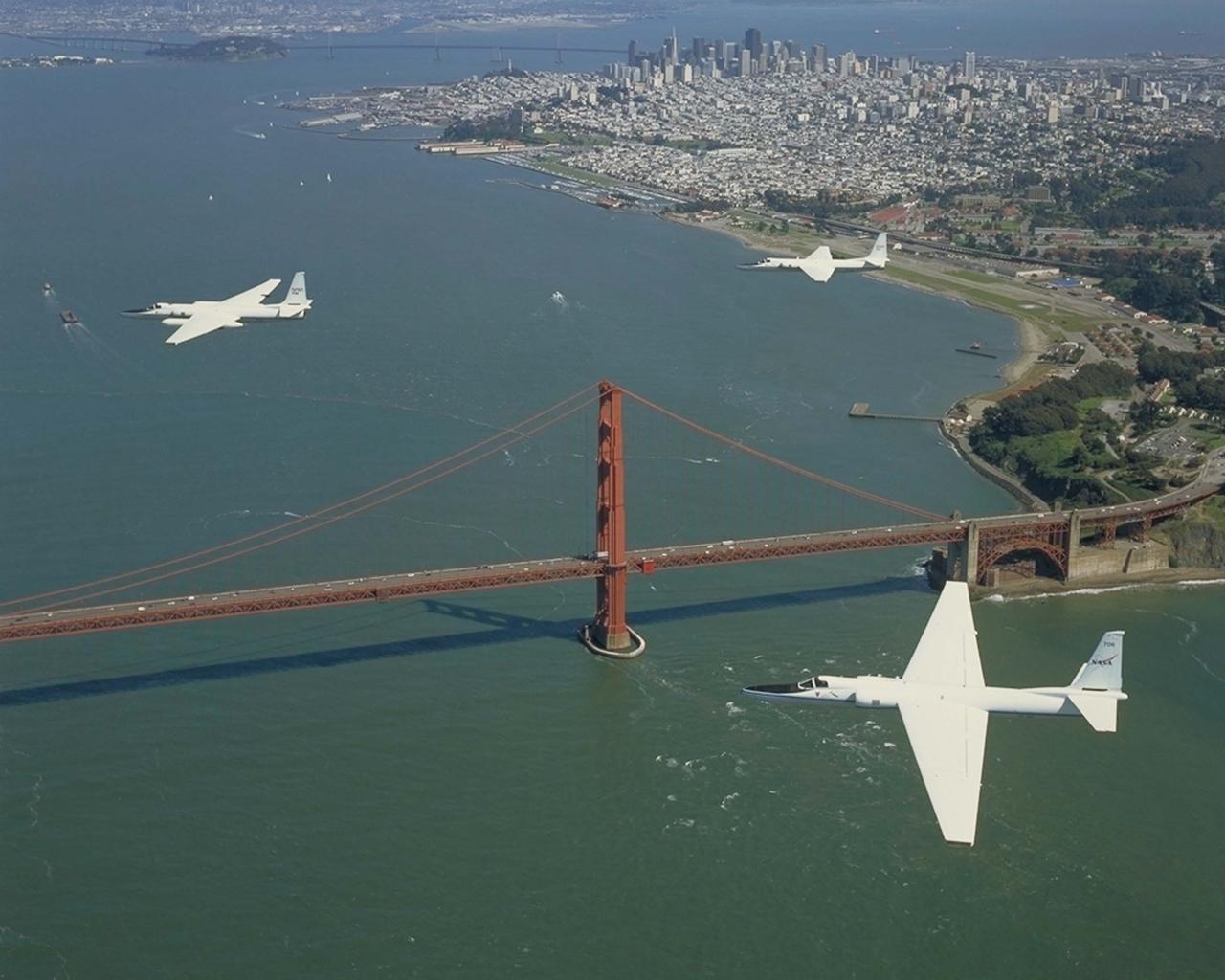
Three ER-2 Aircraft in formation over Golden Gate Bridge, San Francisco, CA on their final flight out of NASA Ames Research Center before redeployment to NASA's Dryden Flight Research Center, CA
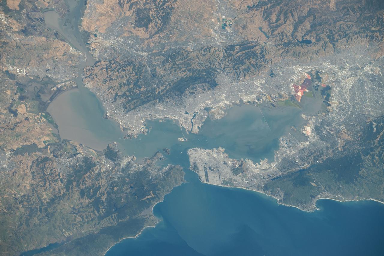
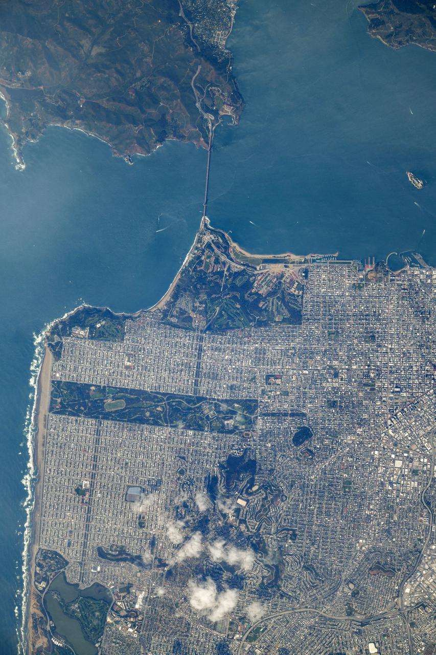
iss071e133353 (May 29, 2024) --- The San Francisco Bay Area in California, home to the Silicon Valley high-tech region and the Golden Gate Bridge, is pictured from the International Space Station as it orbited 262 miles above the Pacific Ocean.
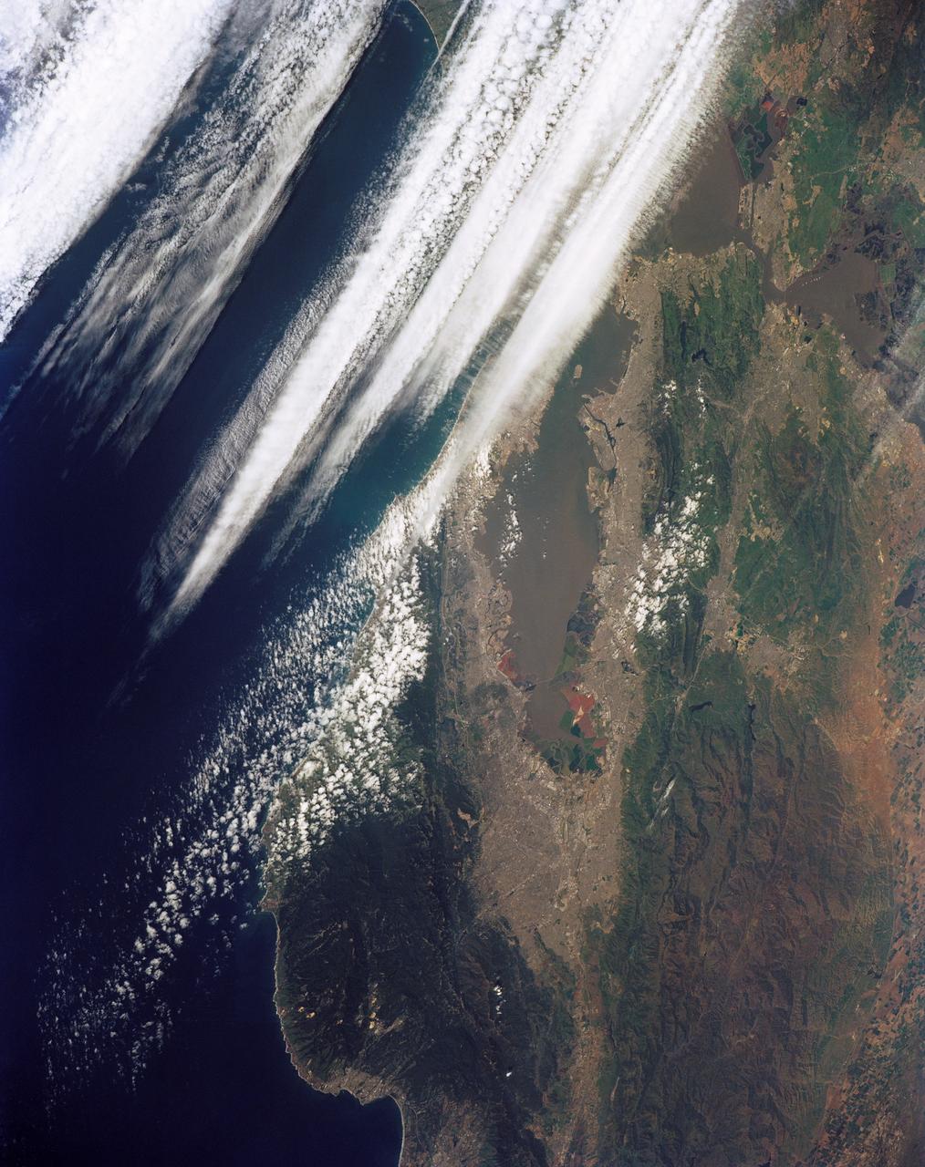
STS039-151-181A (28 April-6 May 1991) --- Large format (five-inch) frame of the San Francisco/Oakland Bay Area of northern California. Stratus clouds at 35,000 feet and cumulus clouds at about 15,000 feet are seen over the Pacific Coast, obscuring the Golden Gate Bridge.
iss073e0420568 (Aug. 3, 2025) --- California's San Francisco Bay Area surrounded by the cities of San Francisico, Oakland, and San Jose, and their suburbs, is pictured from the International Space Station as it orbited 260 miles above the Golden State. Visible landmarks include the Golden Gate Bridge and the Don Edwards San Francisco Bay National Wildlife Refuge.

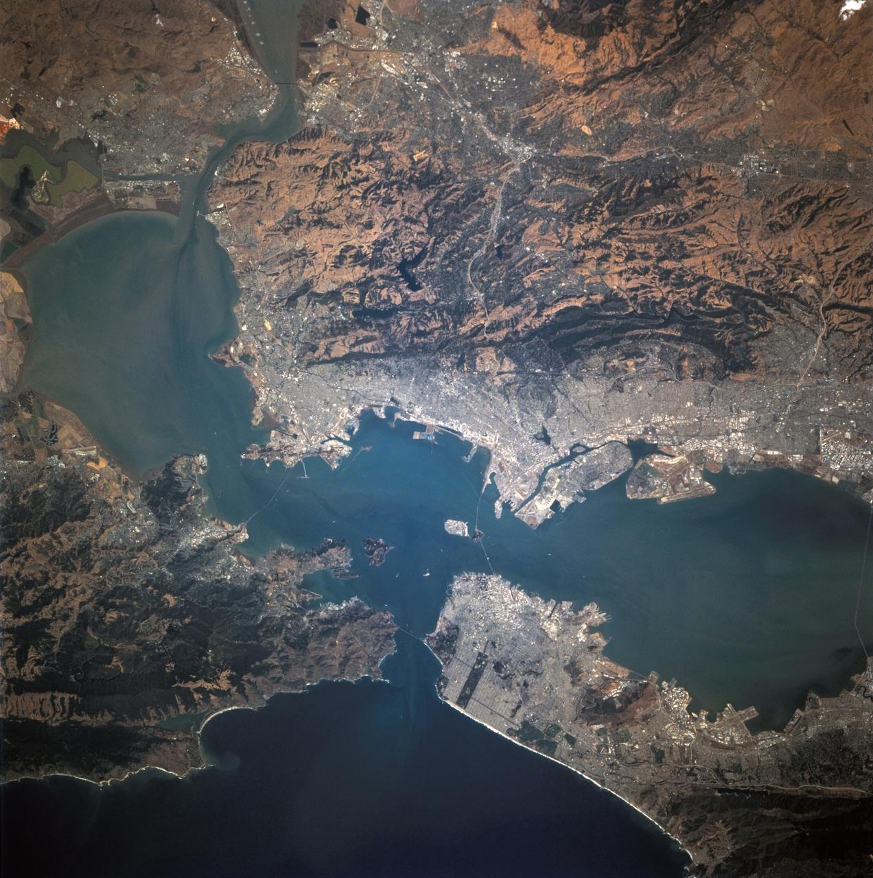
STS073-706-012 (22 October 1995) --- Each of the great bridges spanning San Francisco Bay are captured in this near-nadir photo of the San Francisco and Oakland, California, areas. Starting from the south (left in this photo), Dumbarton, San Mateo, Bay, Golden Gate, and San Rafael bridges are seen. Ribbons of run-off induced sediments color the bay, and multi-colored salt-production pens line the southernmost shore.
STS068-244-022 (30 September-11 October 1994) --- (San Francisco, San Pablo Bay Area) Photographed through the Space Shuttle Endeavour's flight deck windows, the heavily populated bay area is featured in this 70mm frame. The relatively low altitude of Endeavour's orbit (115 nautical miles) and the use of a 250mm lens on the Hasselblad camera allowed for capturing detail in features such as the Berkeley Marina (frame center). The region's topography is well depicted with the lowland areas heavily populated and the hills much more sparsely covered. The Oakland Hills in the right lower center appear to be re-vegetated after a devastating fire. The Golden Gate Recreation Area in the upper left also shows heavy vegetation. The three bridges across the main part of the bay and their connecting roads are prominent. Cultural features such as Golden Gate Park and the Presidio contrast with the gray of the city.
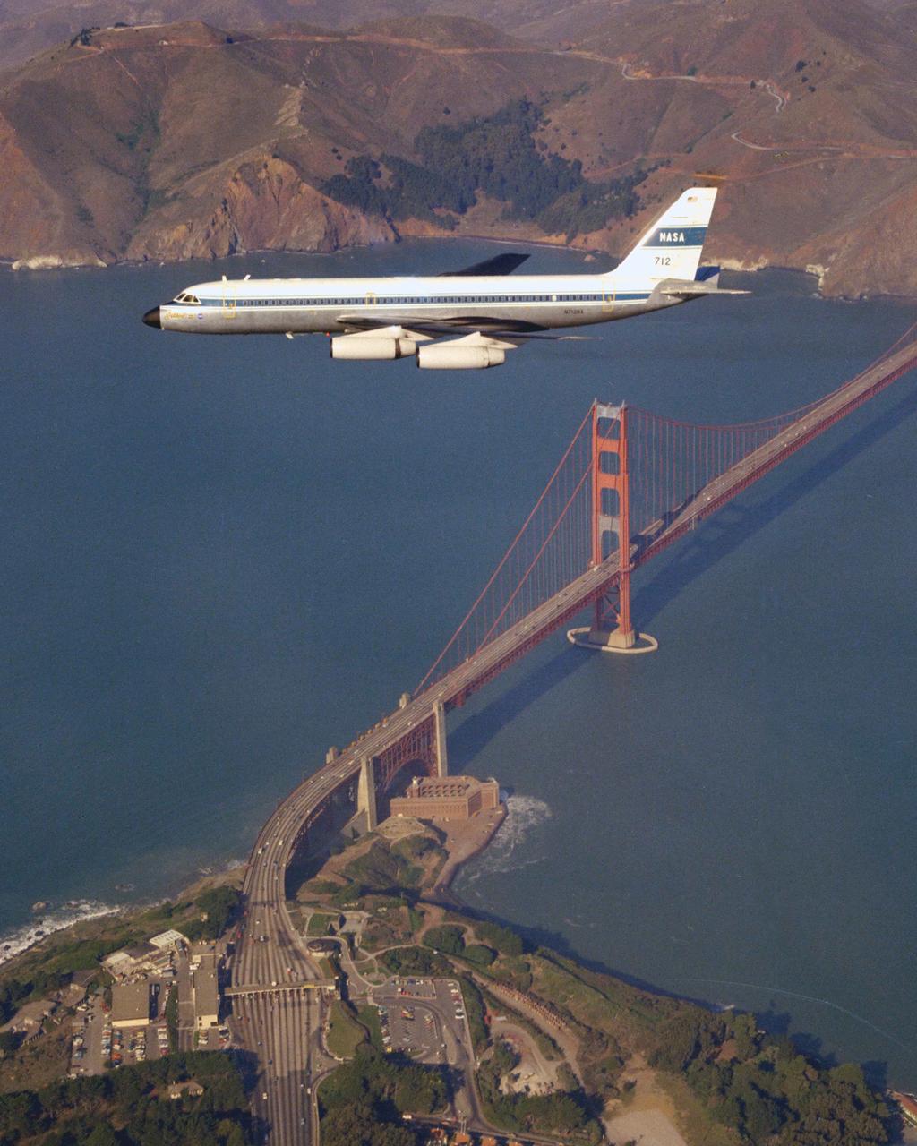
CV-990 (NASA-712) Galileo II aircraft in flight over the San Francisco's Golden Gate Bridge. A digital navigation, guidance and autopilot system tested on Galileo 1 and Galileo II in 1975 looked at the feasibility of energy-management approach concepts for an unpowered vehicle. Flight tests carried out by pilot Fred Drinkwater with technical direction by Fred Edwards and John D Foster along with significant input from Gordon Hardy on the pilot's system interface. Note: Used in publication in Flight Research at Ames; 57 Years of Development and Validation of Aeronautical Technology NASA SP-1998-3300 fig 95 ref 99
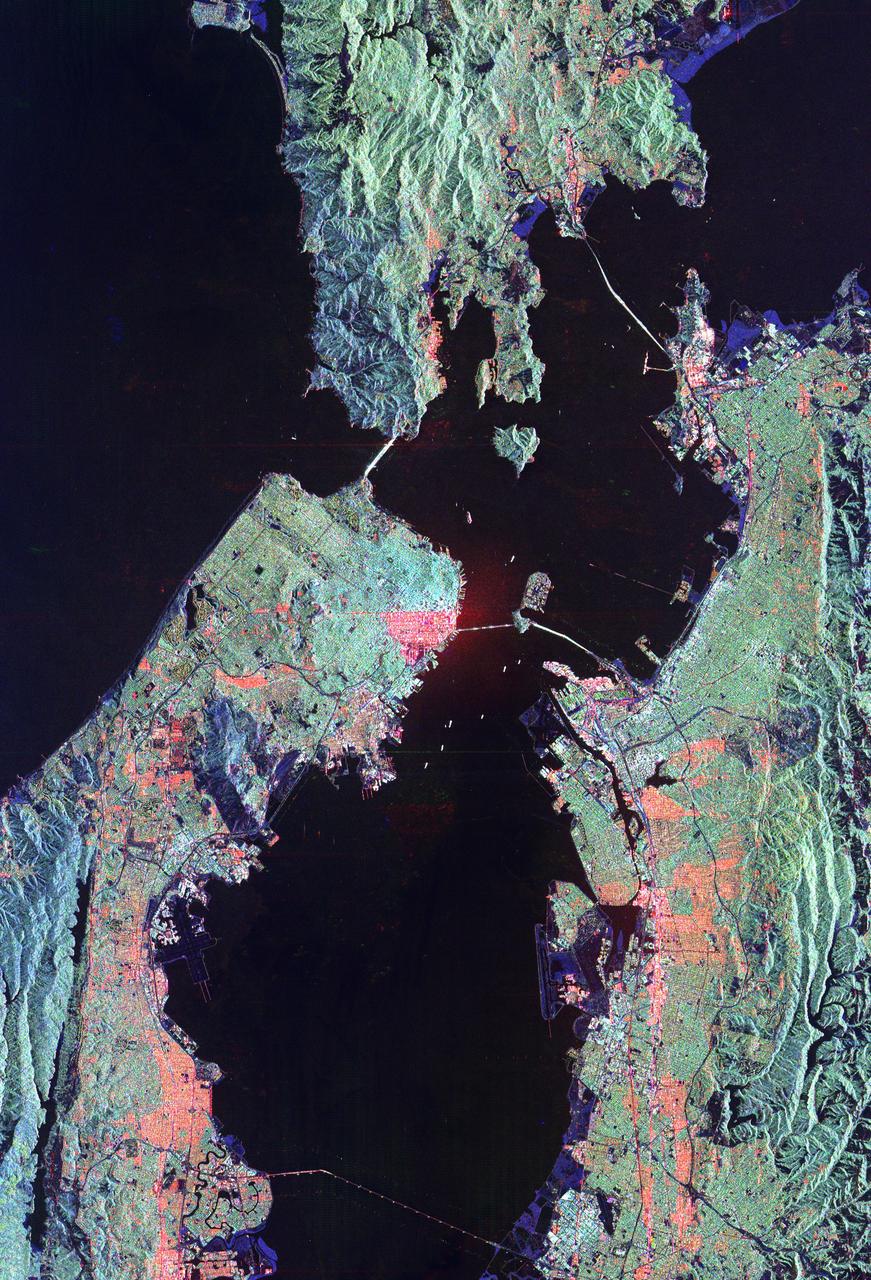
This is a radar image of San Francisco, California, taken on October 3,1994. The image is about 40 kilometers by 55 kilometers (25 miles by 34 miles) with north toward the upper right. Downtown San Francisco is visible in the center of the image with the city of Oakland east (to the right) across San Francisco Bay. Also visible in the image is the Golden Gate Bridge (left center) and the Bay Bridge connecting San Francisco and Oakland. North of the Bay Bridge is Treasure Island. Alcatraz Island appears as a small dot northwest of Treasure Island. This image was acquired by the Spaceborne Imaging Radar-C and X-band Synthetic Aperture Radar (SIR-C/X-SAR) aboard the space shuttle Endeavour on orbit 56. The image is centered at 37 degrees north latitude, 122degrees west longitude. This single-frequency SIR-C image was obtained by the L-band (24 cm) radar channel, horizontally transmitted and received. Portions of the Pacific Ocean visible in this image appear very dark as do other smooth surfaces such as airport runways. Suburban areas, with the low-density housing and tree-lined streets that are typical of San Francisco, appear as lighter gray. Areas with high-rise buildings, such as those seen in the downtown areas, appear in very bright white, showing a higher density of housing and streets which run parallel to the radar flight track. http://photojournal.jpl.nasa.gov/catalog/PIA01751
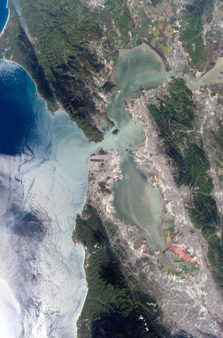
ISS004-E-10288 (21 April 2002) --- This view featuring the San Francisco Bay Area was photographed by an Expedition 4 crewmember onboard the International Space Station (ISS). The gray urban footprint of San Francisco, Oakland, San Jose, and their surrounding suburbs contrasts strongly with the green hillsides. Of particular note are the Pacific Ocean water patterns that are highlighted in the sun glint. Sets of internal waves traveling east impinge on the coastline south of San Francisco. At the same time, fresher bay water flows out from the bay beneath the Golden Gate Bridge, creating a large plume traveling westward. Tidal current channels suggest the tidal flow deep in the bay. Because the ISS orbits are not synchronous with the sun, station crewmembers view Earth with variable solar illumination angles. This allows them to document phenomena such as the sun reflecting differentially off surface waters in a way that outlines complicated water structures.
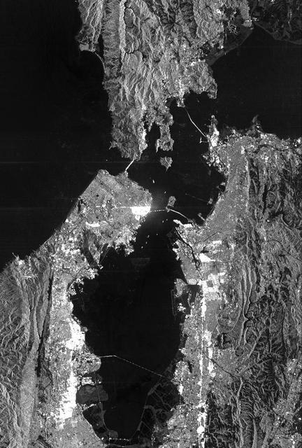
This image of San Francisco, California shows how the radar distinguishes between densely populated urban areas and nearby areas that are relatively unsettled. Downtown San Francisco is at the center and the city of Oakland is at the right across the San Francisco Bay. Some city areas, such as the South of Market, called the SOMA district in San Francisco, appear bright red due to the alignment of streets and buildings to the incoming radar beam. Various bridges in the area are also visible including the Golden Gate Bridge (left center) at the opening of San Francisco Bay, the Bay Bridge (right center) connecting San Francisco and Oakland, and the San Mateo Bridge (bottom center). All the dark areas on the image are relatively smooth water: the Pacific Ocean to the left, San Francisco Bay in the center, and various reservoirs. Two major faults bounding the San Francisco-Oakland urban areas are visible on this image. The San Andreas fault, on the San Francisco peninsula, is seen in the lower left of the image. The fault trace is the straight feature filled with linear reservoirs which appear dark. The Hayward fault is the straight feature on the right side of the image between the urban areas and the hillier terrain to the east. The image is about 42 kilometers by 58 kilometers (26 miles by 36 miles) with north toward the upper right. This area is centered at 37.83 degrees north latitude, 122.38 degrees east longitude. http://photojournal.jpl.nasa.gov/catalog/PIA01791
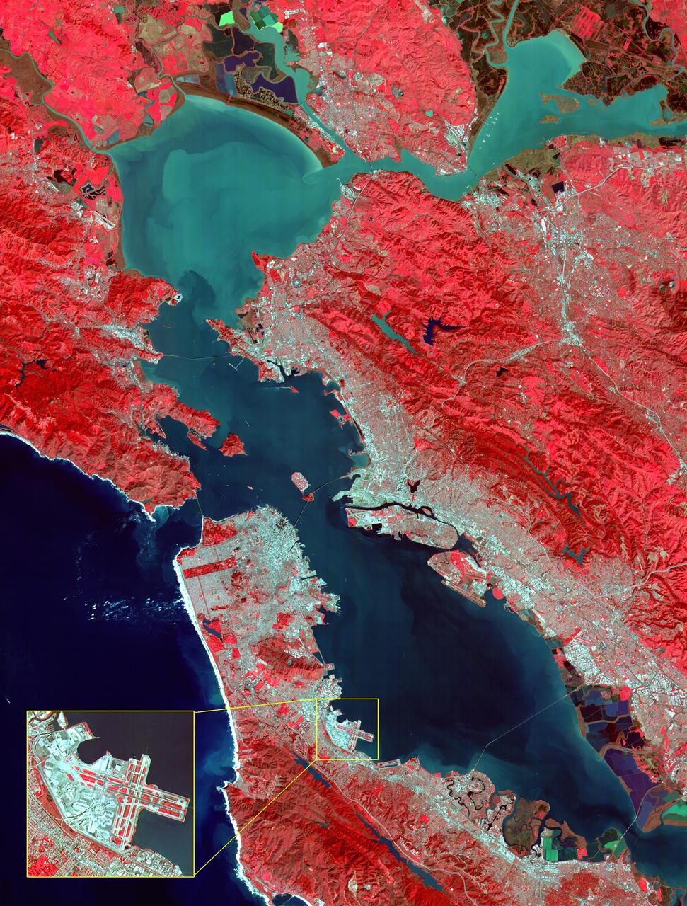
This image of the San Francisco Bay region was acquired on March 3, 2000 by the Advanced Spaceborne Thermal Emission and Reflection Radiometer (ASTER) on NASA's Terra satellite. With its 14 spectral bands from the visible to the thermal infrared wavelength region, and its high spatial resolution of 15 to 90 meters about 50 to 300 feet ), ASTER will image Earth for the next 6 years to map and monitor the changing surface of our planet. Image: This image covers an area 60 kilometers (37 miles) wide and 75 kilometers (47 miles) long in three bands of the reflected visible and infrared wavelength region. The combination of bands portrays vegetation in red, and urban areas in gray. Sediment in the Suisun Bay, San Pablo Bay, San Francisco Bay, and the Pacific Ocean shows up as lighter shades of blue. Along the west coast of the San Francisco Peninsula, strong surf can be seen as a white fringe along the shoreline. A powerful rip tide is visible extending westward from Daly City into the Pacific Ocean. In the lower right corner, the wetlands of the South San Francisco Bay National Wildlife Refuge appear as large dark blue and brown polygons. The high spatial resolution of ASTER allows fine detail to be observed in the scene. The main bridges of the area (San Mateo, San Francisco-Oakland Bay, Golden Gate, Richmond-San Rafael, Benicia-Martinez, and Carquinez) are easily picked out, connecting the different communities in the Bay area. Shadows of the towers along the Bay Bridge can be seen over the adjacent bay water. With enlargement the entire road network can be easily mapped; individual buildings are visible, including the shadows of the high-rises in downtown San Francisco. Inset: This enlargement of the San Francisco Airport highlights the high spatial resolution of ASTER. With further enlargement and careful examination, airplanes can be seen at the terminals. http://photojournal.jpl.nasa.gov/catalog/PIA02606