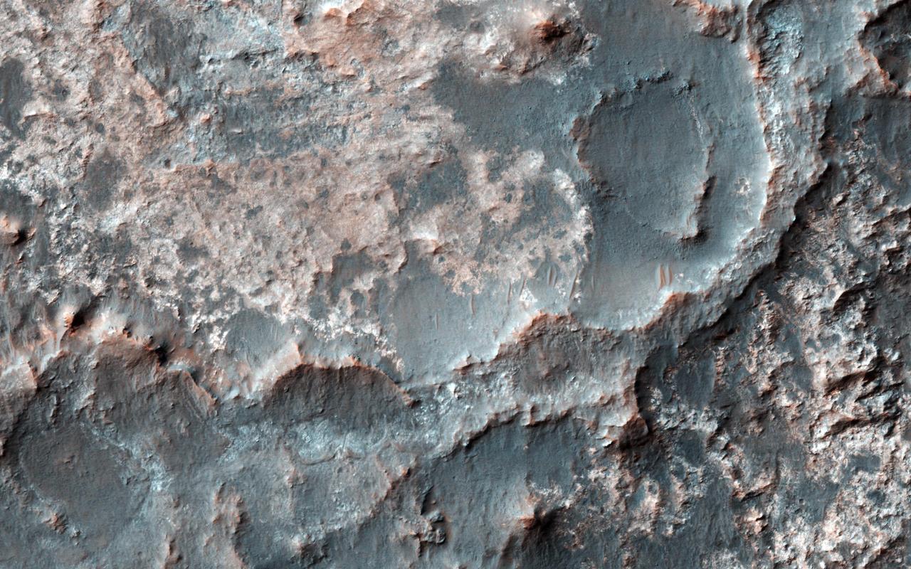
This image from NASA's Mars Reconnaissance Orbiter shows Gorgonum Basin, one of several large basins within the Terra Sirenum region of Mars. Each basin has light-toned mounds, many of which contain clays. Scientists think that Terra Sirenum once had a large lake during an epoch called the Late Noachian/Early Hesperian, and each basin filled with sediments. The water within the lake may have altered these sediments to form the clays we now observe from orbit. Ma'adim Vallis, which drains into Gusev Crater where the Spirit rover landed, drained the water from this ancient lake. Why the basin floors exhibit mounds similar to chaos regions on Mars is unknown, but could be the result of collapse and subsequent erosion within the basins. https://photojournal.jpl.nasa.gov/catalog/PIA21767
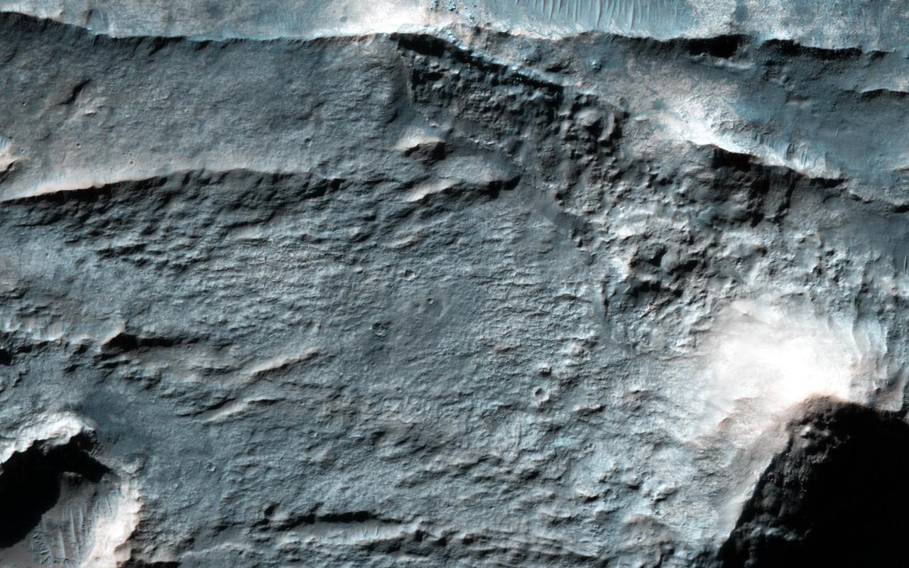
This image shows a transition from depressed to inverted channels in the Gorgonum Basin. In the darker terrain, there are two channels that display depressed topography. As these two channels cross into the underlying brighter terrain, the channels now stand above the surrounding area, indicating they are inverted in topography. This change from depressed to inverted topography is the result of what is called "differential erosion." The channel may contain hardened sediments or have cements that make it more resistant to erosion relative to the darker terrain that once flowed through it. As a result, erosion has removed the less resistant upper darker terrain, leaving behind the more resistant channel standing above the underlying bright terrain. http://photojournal.jpl.nasa.gov/catalog/PIA21103
The Eridania Basin is thought to have once contained a large sea. This image from NASA Mars Reconnaissance Orbiter spacecraft shows the Gorgonum Basin, which lies along the eastern edge of Eridania.
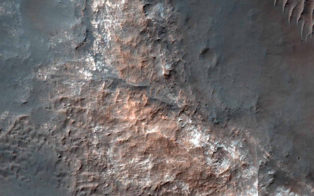
In February 1917, Albert Einstein wrote in a letter: "It is a pity that we do not live on Mars and just observe man's nasty antics by telescope." We do have a telescope at Mars, but we use it to image Mars rather than Earth, such as this image of bizarre landforms in Gorgonum Basin. This basin may have contained an ancient lake, with channels draining into the lake from the sides. After sediments are deposited, they become hardened to varying degrees, then eroded by the wind. More hardened bedrock will remain as high-standing topography following erosion of the weaker materials, perhaps inverting the initial forms. For example, high-standing linear or meandering topography may have been fluvial channels. The enhanced-color cutout shows some of the bedrock as well as dark sand. http://photojournal.jpl.nasa.gov/catalog/PIA20811