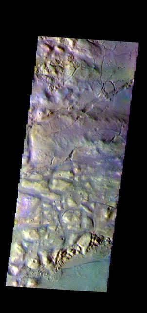
The THEMIS camera contains 5 filters. The data from different filters can be combined in multiple ways to create a false color image. hese false color images may reveal subtle variations of the surface not easily identified in a single band image. This image from NASA 2001 Mars Odyssey spacecraft shows part of Gorgonum Chaos. The linear depression at the bottom of the image are part of Sirenum Fossae. Gorgonum Chaos is located in Terra Sirenum. Orbit Number: 58237 Latitude: -38.0276 Longitude: 188.624 Instrument: VIS Captured: 2015-01-29 23:14 https://photojournal.jpl.nasa.gov/catalog/PIA21545
Gullies on Gorgonum Chaos Mesas
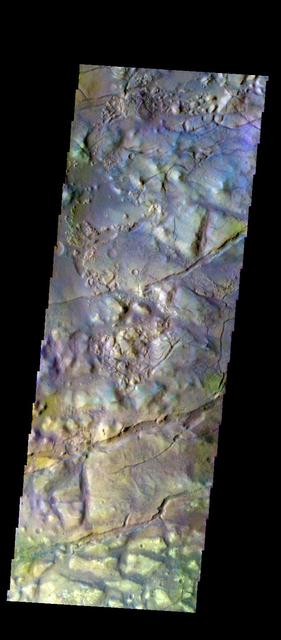
The THEMIS VIS camera contains 5 filters. The data from different filters can be combined in multiple ways to create a false color image. These false color images may reveal subtle variations of the surface not easily identified in a single band image. Today's false color image shows part of Gorgonum Chaos. Orbit Number: 50315 Latitude: -37.785 Longitude: 189.412 Instrument: VIS Captured: 2013-04-17 22:37 http://photojournal.jpl.nasa.gov/catalog/PIA21277
The THEMIS camera contains 5 filters. The data from different filters can be combined in multiple ways to create a false color image. These false color images may reveal subtle variations of the surface not easily identified in a single band image. This image from NASA 2001 Mars Odyssey spacecraft shows part of Gorgonum Chaos. Orbit Number: 58131 Latitude: -38.0727 Longitude: 189.465 Instrument: VIS Captured: 2015-01-21 05:12 https://photojournal.jpl.nasa.gov/catalog/PIA21542
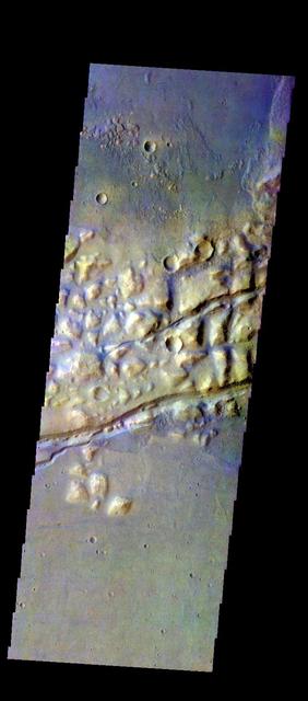
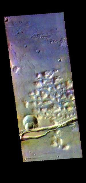
The THEMIS VIS camera contains 5 filters. The data from different filters can be combined in multiple ways to create a false color image. These false color images may reveal subtle variations of the surface not easily identified in a single band image. Today's false color image shows part of Gorgonum Chaos. The linear features are graben that are part of Sirenum Fossae. Orbit Number: 50827 Latitude: -38.1132 Longitude: 188.825 Instrument: VIS Captured: 2013-05-30 01:48 http://photojournal.jpl.nasa.gov/catalog/PIA21279
Gullies in Trough near Gorgonum Chaos
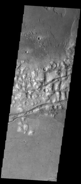
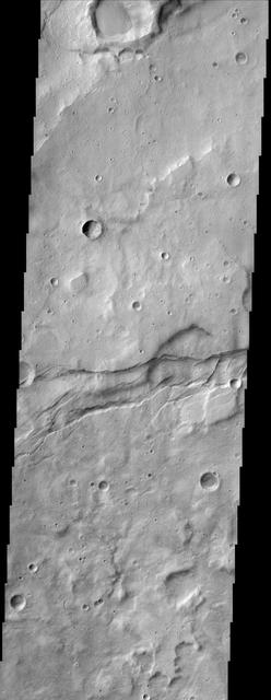
Several fractures cross through Gorgonum Chaos in this image captured by NASA 2001 Mars Odyssey spacecraft.
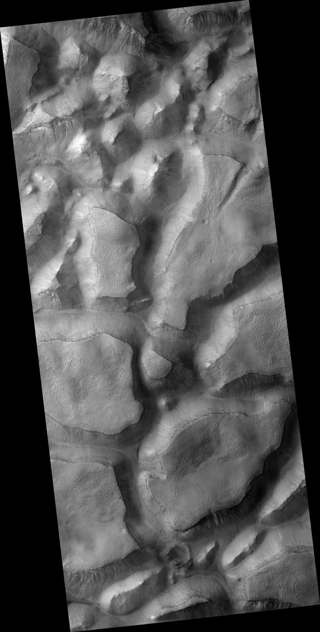
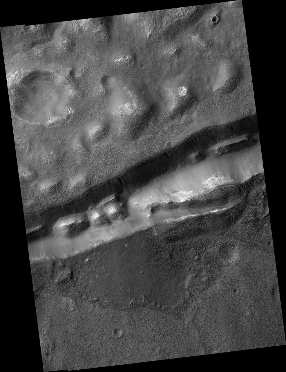
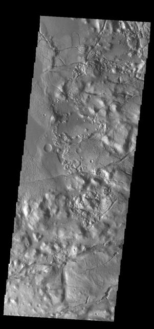
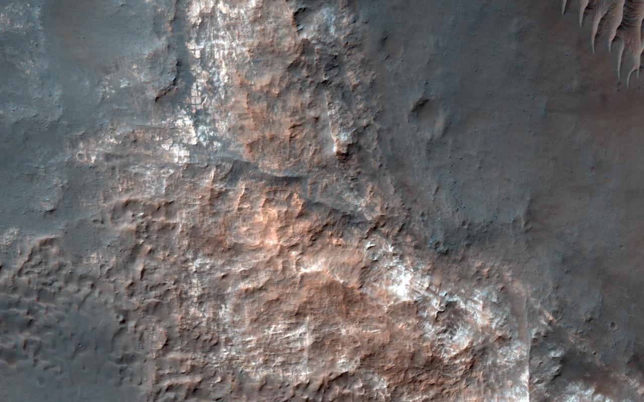
The bottom portion of this VIS image shows part of Gorgonum Chaos. Chaos terrain is typified by regions of blocky, often steep sided, mesas interspersed with deep valleys. With time and erosion the valleys widen and the mesas become smaller. Chaotic regions form when groundwater escapes to the surface, undermining it and causing the ground to collapse. Gorgonum Chaos is located in Terra Sirenum. Orbit Number: 93127 Latitude: -36.2057 Longitude: 190.355 Instrument: VIS Captured: 2022-12-12 08:25 https://photojournal.jpl.nasa.gov/catalog/PIA25820
This VIS image shows part of Gorgonum Chaos. Chaotic regions form when groundwater escapes to the surface, undermining it and causing the ground to collapse. The linear depressions at the bottom of the image are part of Sirenum Fossae. Gorgonum Chaos is located in Terra Sirenum. Orbit Number: 84080 Latitude: -37.7334 Longitude: 189.356 Instrument: VIS Captured: 2020-11-27 10:17 https://photojournal.jpl.nasa.gov/catalog/PIA24369
This VIS image shows part of Gorgonum Chaos. Chaos terrain is typified by regions of blocky, often steep sided, mesas interspersed with deep valleys. With time and erosion the valleys widen and the mesas become smaller. Chaotic regions form when groundwater escapes to the surface, undermining it and causing the ground to collapse. The linear depressions at the bottom of the image are part of Sirenum Fossae. Gorgonum Chaos is located in Terra Sirenum. Orbit Number: 92266 Latitude: -36.8519 Longitude: 189.676 Instrument: VIS Captured: 2022-10-02 10:57 https://photojournal.jpl.nasa.gov/catalog/PIA25754
This observation from NASA Mars Reconnaissance Orbiter shows part of Gorgonum Chaos, a large cluster of chaotic terrain found in the southern hemisphere.
Evidence for Recent Liquid Water on Mars: Gullies in Gorgonum Chaos
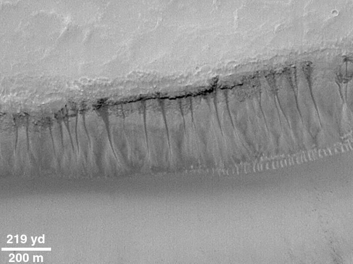
Evidence for Recent Liquid Water on Mars:Weeping Layer in Gorgonum Chaos
The fractured surface shown in this image from NASA Mars Odyssey spacecraft belongs to a portion of a region called Gorgonum Chaos located in the southern hemisphere of Mars.
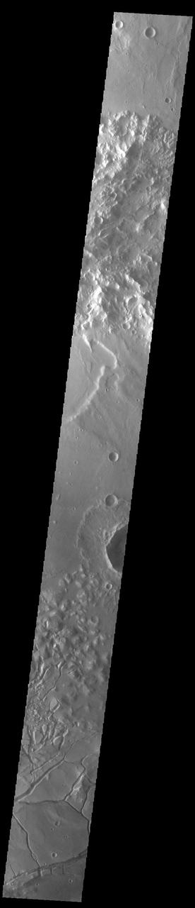
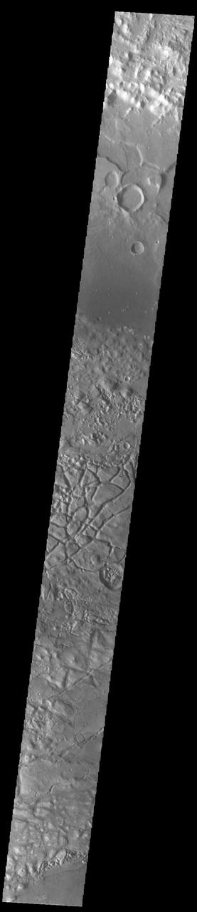
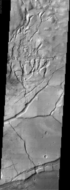
This image from NASA Mars Odyssey spacecraft shows the cratered highlands of Terra Sirenum in Mars southern hemisphere. Near the center of the image running from left to right one can see long parallel to semi-parallel troughs called graben.
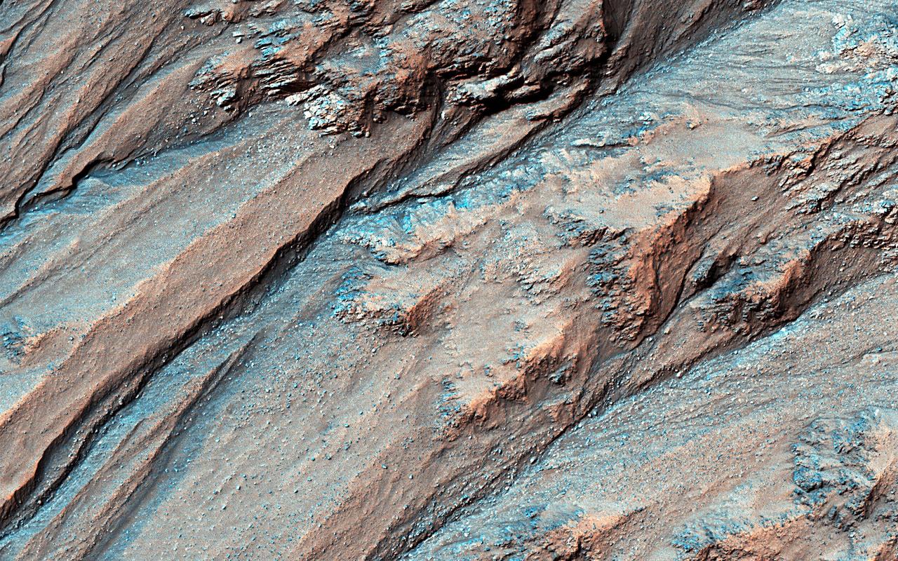
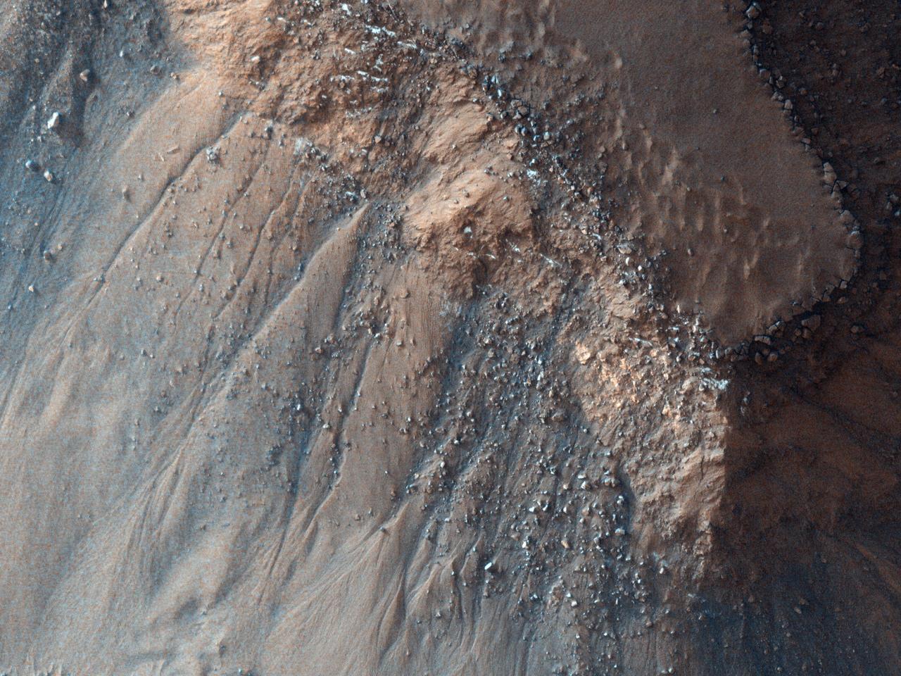
Gullies lying on the northeast slopes of Triolet Crater (about 11.6 km in diameter ), are located in the Southern Highlands just east of Gorgonum Chaos. Some gullies have eroded through resistant layers up to the crater rim. At the downslope are fans of debris that overlap with those of nearby gully systems, suggesting that there were multiple periods of gully activity in this region. Just south of the gullies is a large fracture that cuts through the crater rim. This fracture is part of the Sirenum Fossae system that slices across the region for over 1,000 kilometers from the northeast to the southwest. Because this fracture (or "fossae") cuts through the rim and ejecta blanket of Triolet Crater, this means that the crater is older than the fracture. This is known as a cross-cutting relationship and demonstrates a basic principle in geology known as the "law of superposition." https://photojournal.jpl.nasa.gov/catalog/PIA25708
This image from NASA's Mars Reconnaissance Orbiter shows Gorgonum Basin, one of several large basins within the Terra Sirenum region of Mars. Each basin has light-toned mounds, many of which contain clays. Scientists think that Terra Sirenum once had a large lake during an epoch called the Late Noachian/Early Hesperian, and each basin filled with sediments. The water within the lake may have altered these sediments to form the clays we now observe from orbit. Ma'adim Vallis, which drains into Gusev Crater where the Spirit rover landed, drained the water from this ancient lake. Why the basin floors exhibit mounds similar to chaos regions on Mars is unknown, but could be the result of collapse and subsequent erosion within the basins. https://photojournal.jpl.nasa.gov/catalog/PIA21767