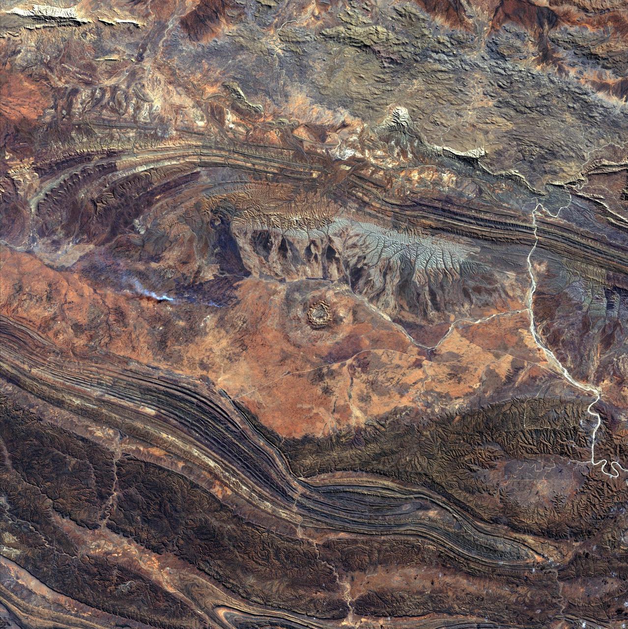
August 14th, 2002: Description: 142 million years ago, an asteroid or comet slammed into what is now the Missionary Plains in Australia’s Northern Territory, forming a crater 24 kilometers in diameter and 5 kilometers deep. Today, like a bull’s eye, the circular ring of hills that defines Gosses Bluff stands as a stark reminder of the event. Source: Landsat 7 To learn more about the Landsat satellite go to: <a href="http://landsat.gsfc.nasa.gov/" rel="nofollow">landsat.gsfc.nasa.gov/</a>
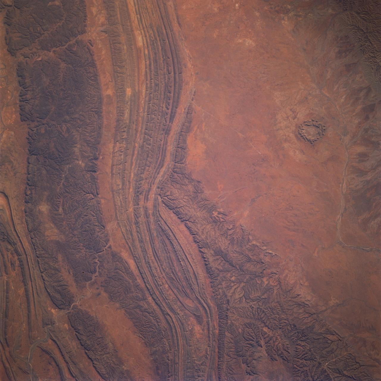
STS077-737-096 (19-29 May 1996) --- The Palmer River emerging from the left corner of the photograph separates the Gardener Range to the right from the James Ranges on the left. To the bottom and off the photograph is the MacDonnell Ranges. The circular feature at bottom right is a highly eroded impact crater located on Missionary Plain. Gosses Bluff is a complex crater about 22 kilometers in diameter and is estimated to be about 142 million years old.
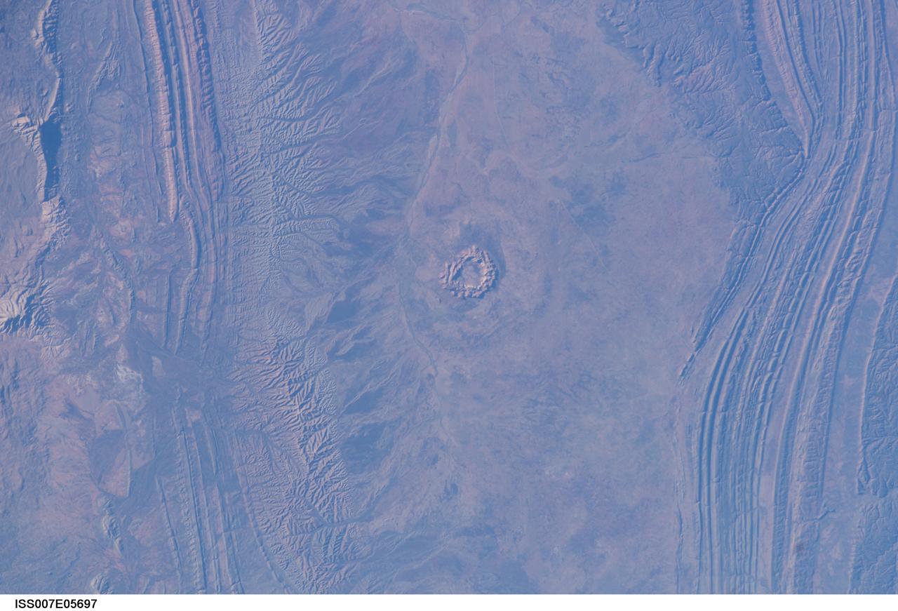
ISS007-E-05697 (20 May 2003) --- This image, photographed by an Expedition 7 crewmember onboard the International Space Station (ISS), shows Gosses Bluff, an impact crater sandwiched between the MacDonnell Range to the north and the James Range to the south in Australia’s Northern Territory – it is about 160 kilometers west of Alice Springs. It is one of the most studied of the Australian impact craters. The impactor, an asteroid or comet, was, according to scientists, probably about 1 kilometer in diameter and crashed into the Earth about 142 million years ago. The isolated circular feature within the crater consists of a central ring of hills about 4.5 kilometers in diameter. The grayish feature surrounding the inner ring probably marks the original boundary of the outer rim.