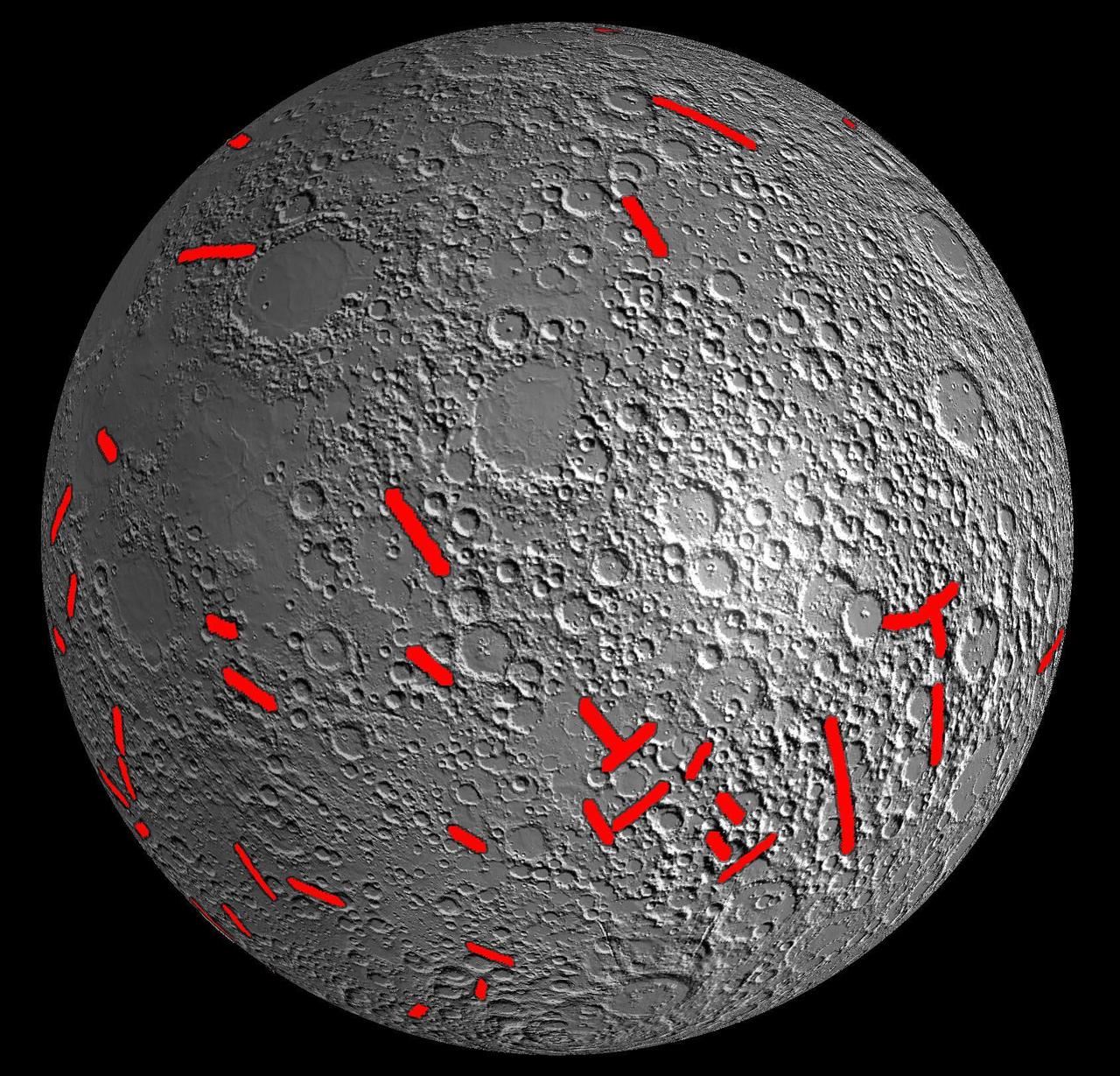
This map of one side of the moon shows the location of some of the giant dikes identified by NASA GRAIL mission.
A linear gravity anomaly intersecting the Crisium basin on the nearside of the moon has been revealed by NASA GRAIL mission. The GRAIL gravity gradient data are shown at left, with the location of the anomaly indicated.
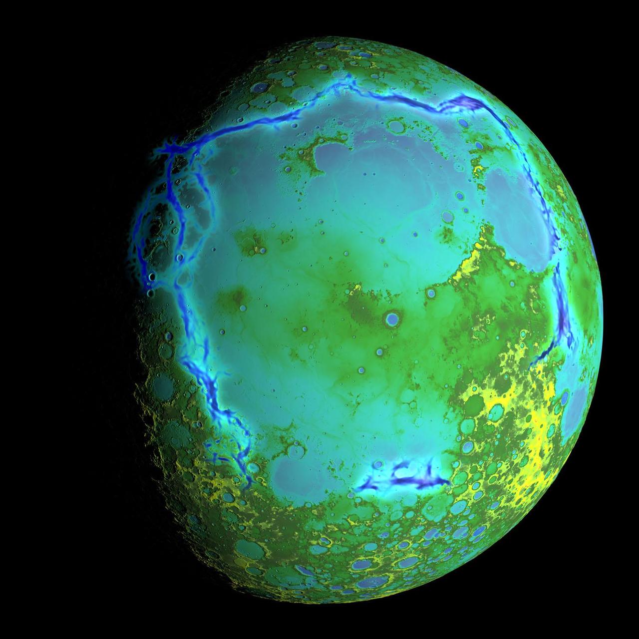
Topography of Earth moon generated from data NASA LRO, with the gravity anomalies bordering the Procellarum region superimposed in blue. The border structures are shown using gravity gradients calculated with data from NASA GRAIL mission.
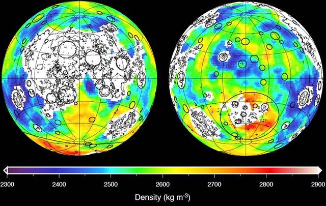
This graphic depicting the bulk density of the lunar highlands on the near and far sides of the moon was generated using gravity data from NASA GRAIL mission and topography data from NASA Lunar Reconnaissance Orbiter.
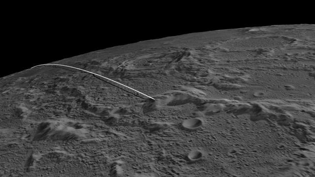
This image shows the final flight path for NASA twin Gravity Recovery and Interior Laboratory GRAIL mission spacecraft, which will impact the moon on Dec. 17, 2012, around 2:28 p.m. PST.

These side-by-side, 3-D comparisons depict the unnamed lunar mountain targeted by the NASA Gravity Recovery and Interior Laboratory GRAIL mission for controlled impact of the Ebb and Flow spacecraft.
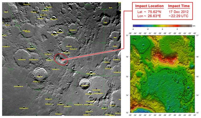
These maps of Earth moon highlight the region where the twin spacecraft of NASA Gravity Recovery and Interior Laboratory GRAIL mission will impact on Dec. 17, marking the end of its successful endeavor to map the moon gravity.
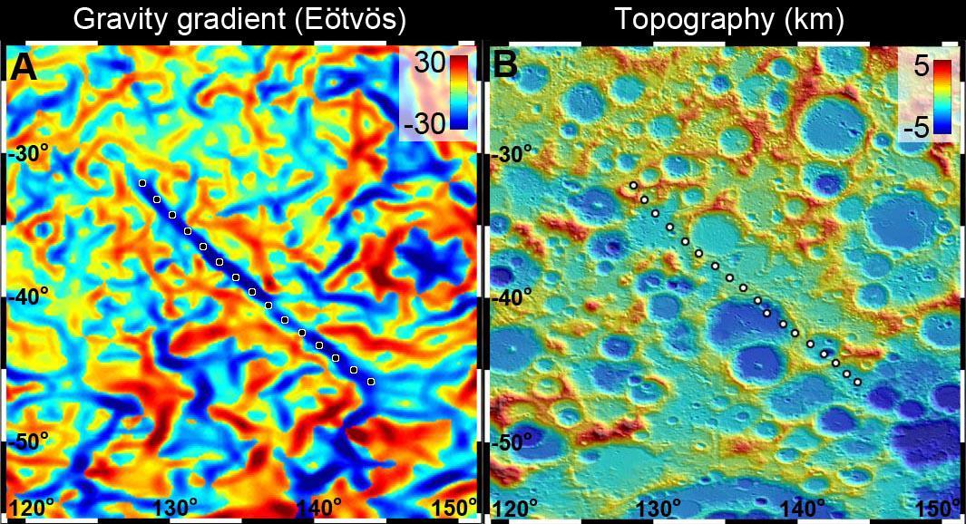
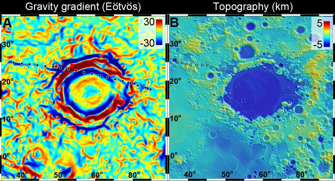
A 300-mile-long linear gravity anomaly on the far side of the moon has been revealed by gravity gradients measured by NASA GRAIL mission. GRAIL data are shown on the left, with red and blue corresponding to stronger gravity gradients.
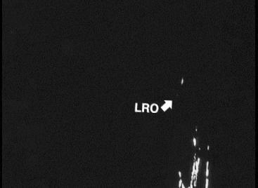
This is the first footage of one orbiting robotic spacecraft taken by another orbiting robotic spacecraft at Earth moon. Flow, one of two satellites making up NASA GRAIL mission, captured this video of NASA LRO as it flew by.
This graphic depicting the bulk density of the lunar highlands on the near and far sides of the moon was generated using gravity data from NASA GRAIL mission and topography data from NASA Lunar Reconnaissance Orbiter.