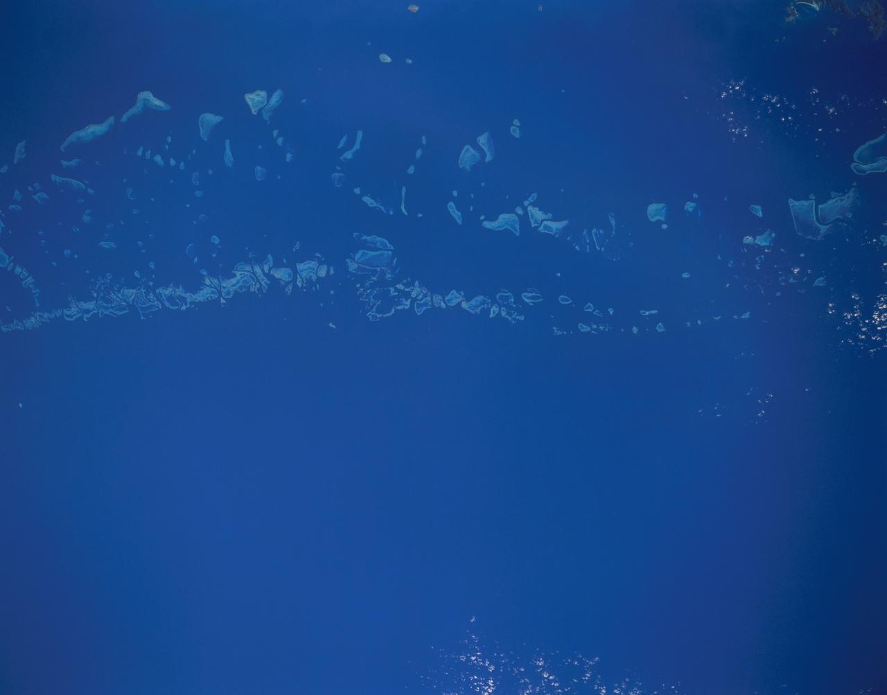
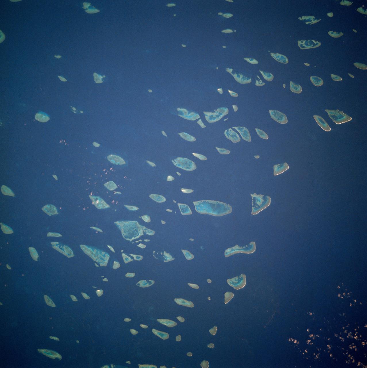
STS048-151-250 (12-18 Sept. 1991) --- The Great Barrier Reef extends for roughly 2,000 kilometers along the northeast coast of Australia. The great Barrier Reef is made up of thousands of individual reefs which define the edge of the continental shelf. The southern part of the feature, called Swain Reef, is seen here. Water depths around the reefs are quite shallow (less than 1 meter to about 36 meters in depth), but only a few kilometers offshore, water depths are roughly 1,000 meters.
Great Barrier Reef - August 8th, 1999 Description: What might be mistaken for dinosaur bones being unearthed at a paleontological dig are some of the individual reefs that make up the Great Barrier Reef, the world's largest tropical coral reef system. The reef stretches more than 2,000 kilometers (1,240 miles) along the coast of Queensland, Australia. It supports astoundingly complex and diverse communities of marine life and is the largest structure on the planet built by living organisms. Credit: USGS/NASA/Landsat 7 To learn more about the Landsat satellite go to: <a href="http://landsat.gsfc.nasa.gov/" rel="nofollow">landsat.gsfc.nasa.gov/</a> <b><a href="http://www.nasa.gov/centers/goddard/home/index.html" rel="nofollow">NASA Goddard Space Flight Center</a></b> enables NASA’s mission through four scientific endeavors: Earth Science, Heliophysics, Solar System Exploration, and Astrophysics. Goddard plays a leading role in NASA’s accomplishments by contributing compelling scientific knowledge to advance the Agency’s mission. <b>Follow us on <a href="http://twitter.com/NASA_GoddardPix" rel="nofollow">Twitter</a></b> <b>Join us on <a href="http://www.facebook.com/pages/Greenbelt-MD/NASA-Goddard/395013845897?ref=tsd" rel="nofollow">Facebook</a></b>
The Great Barrier Reef extends for 2,000 kilometers along the northeastern coast of Australia. It is not a single reef, but a vast maze of reefs, passages, and coral cays islands that are part of the reef.

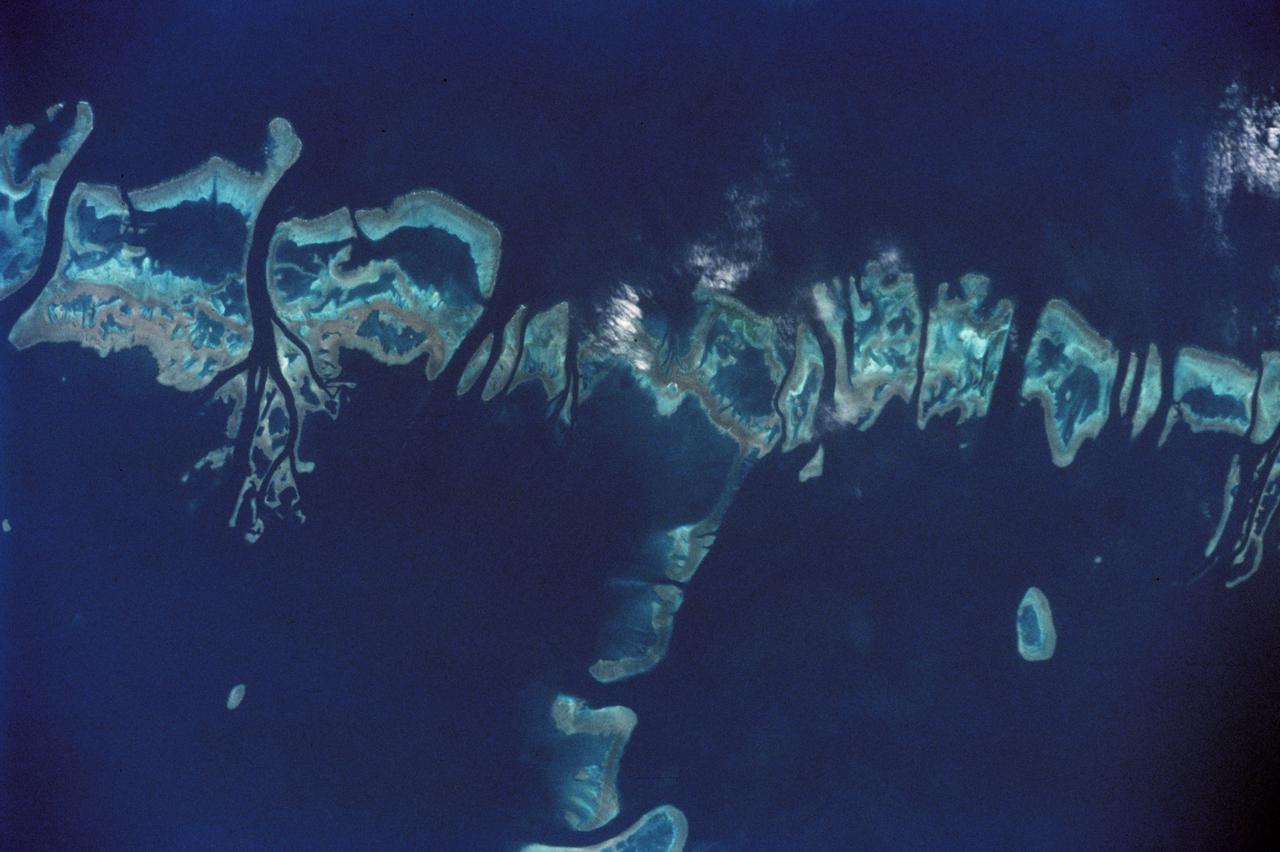
STS072-727-085 (11-20 Jan. 1996) --- The northern third of the Great Barrier Reef stretches 650 kilometers (km) along the coast of Queensland from south of Cairns to past Princess Charlotte Bay at the base of the Cape York Peninsula. The predominant westerly waves of the ocean create shallower (lighter-colored) convex-eastward rims to coral atolls along the outer edge of the barrier reef. In contrast, islands within the lagoon show the effect of predominant southerly, more-or-less offshore winds. Arcuate clouds suggest that winds were offshore at the time the photograph was taken.
STS032-520-014 (9-20 Jan. 1990) --- STS-32 astronauts took this 70mm scene showing phytoplankton oralgal bloom in the northwest Coral Sea. The Western Coral Sea and the Great Barrier Reef waters offshore Queensland, Australia are the sites of some of the larger concentrations or "blooms" of phytoplankton and algae in the open ocean. In the instance illustrated here, the leading edge of a probable concentration of algae or phytoplankton is seen as a light irregular line and sheen between the offshore Great Barrier Reef and the Queensland coast. Previous phytoplankton concentrations in this area have been reported by ships at sea as having formed floating mats as thick as two meters. This picture was used by the STS-32 astronauts at their Jan. 30, 1990 post-flight press conference.
STS009-46-1856 (28 Nov-8 Dec 1983) --- East of the Australian state of Queensland lies the worlds largest reef. The Great Barrier Reef. A portion of the reef is seen. Although beautiful from space, coral reefs, channels, etc?, has long confounded navigators, mapmakers, and oceanographers.
Heron Island is located in Queensland, Australia, approximately 45 miles (72 kilometers) off the Australian mainland, to the northeast of Gladstone. Part of Australia's Great Barrier Reef, the island is an evergreen coral cay surrounded by Wistari coral reef. Although just 42 acres in size, the island is home to a large resort and the University of Queensland's Heron Island Research Station. The island is famous for diving and snorkeling and is a World Heritage-Listed Marine National Park. It is one of two locations on the Great Barrier Reef that are serving as bases for in-water validation activities for NASA's Coral Reef Airborne Laboratory (CORAL) mission, which is studying the condition and function of the Great Barrier Reef and selected reef systems worldwide using NASA's airborne Portable Remote Imaging Spectrometer (PRISM) instrument from an altitude of 28,000 feet (8,500 meters). The Advanced Spaceborne Thermal Emission and Reflection Radiometer (ASTER) instrument on NASA's Terra spacecraft acquired this image of Heron Island and its surroundings on December 22, 2001. The island appears at the left of the reef (Heron Reef) in the center of the image. Vegetation is red on the image. The image covers an area of 10.3 by 18.6 miles (16.5 by 30.0 kilometers), and is located at 23.5 degrees south, 151.9 degrees east. http://photojournal.jpl.nasa.gov/catalog/PIA20900
iss068e004262 (Sept. 30, 2022) --- The eastern coast of Queensland, Australia, on the Great Barrier Reef is pictured from the International Space Station as it orbited 261 miles above the island continent.
iss070e025882 (Nov. 15, 2023) --- Looking southwest over the Far North region of Queensland, Australia, is the Great Barrier Reef in the Coral Sea and the Gulf of Carpentaria on the other side of the Far North.
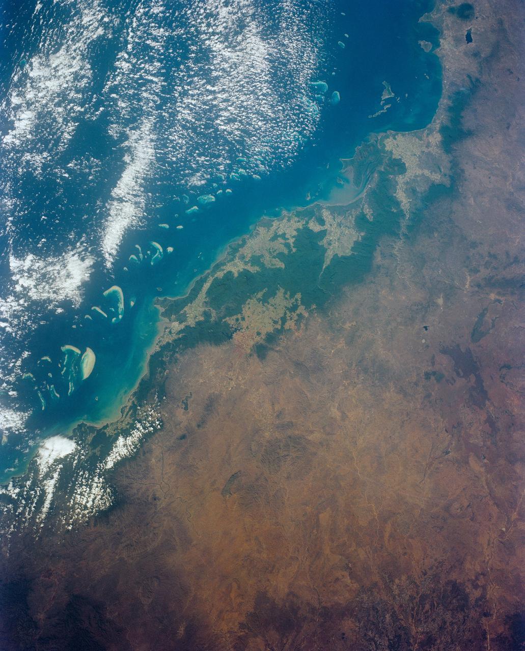
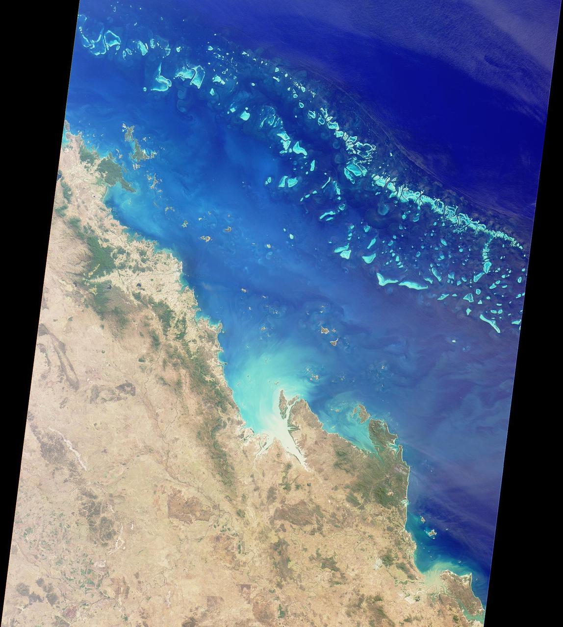
Cairns and Townsville area, on the northeast coast of Queensland, Australia (17.0S, 146.0E) is one of the best sport diving localities in the world where divers can explore the rich and varied flora and fauna of the nearby Great Barrier Reef. Onshore, the timbered foothills of the Great Dividing Range, seen as dark green areas, separate the semi arid interior of Queensland.
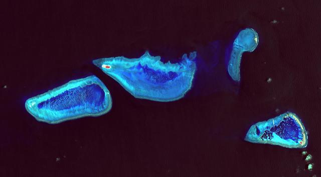
STS111-368-036 (5-19 June 2002) --- This photo, giving detail of the Pompey Island Group in the Southern Great Barrier Reef off Australia, was taken by the STS-111 crewmembers aboard the Space Shuttle Endeavour. Ocean flow between the islands has produced unique wash features in the structures of the island banks. The Gateway to Astronaut Photography of Earth (link to http://eol.jsc.nasa.gov/sseop/) provides searchable access to other photographs of Earth taken by astronauts.
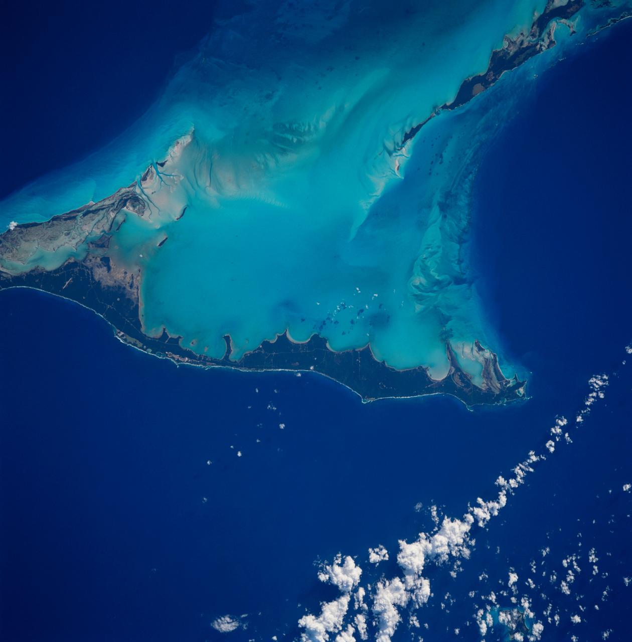
STS083-712-063 (4-8 April 1997) --- Northern half of Long Island, Bahamas. The vivid blues of the Bahamas stand out from space. Long Island and Great Exuma Island, which extends from the west north west into the photo, is on the eastern side of the Great Bahama Bank and form the borders of Exuma Sound. This photograph provides a rare opportunity to observe a natural chemical laboratory at work. Limestone of quite a different sort from that forming the Great Barrier Reef is actually in the process of formation. Long Island itself is little more than a sandbar rising just a few meters (about 30 to 50 meters) above sea level but it separates the deep, dark blue waters of the Atlantic on the right from the 10-meter (33 feet) shallows of the Great Bahama Bank (left). Details of the topography of the bank are visible through the clear waters. The shallow waters are warm and become extremely salty. Crystals of aragonite, a calcium carbonate mineral, are precipitated and formed into spherical sand-sized oolites as the tidal currents swirl back and forth. Lithification of the carbonate sands produces an oolithic limestone. Although the water is warm and clear, corals do not live in the shallows, probably because of the elevated salt content. Although chemically similar, the oolithic limestone forming Long Island is very different from coral reef limestone. An airfield is visible at the northern and central (bottom of photo) part of the island.
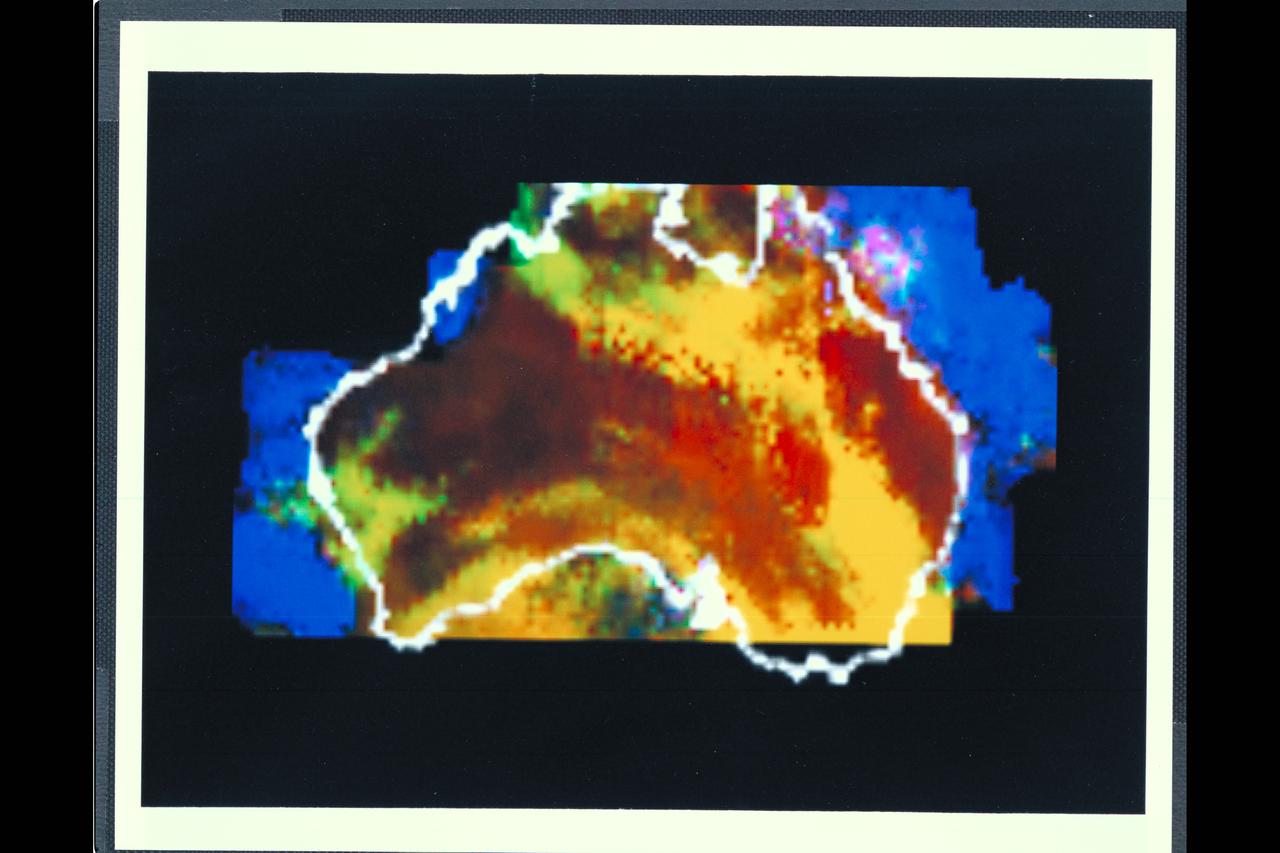
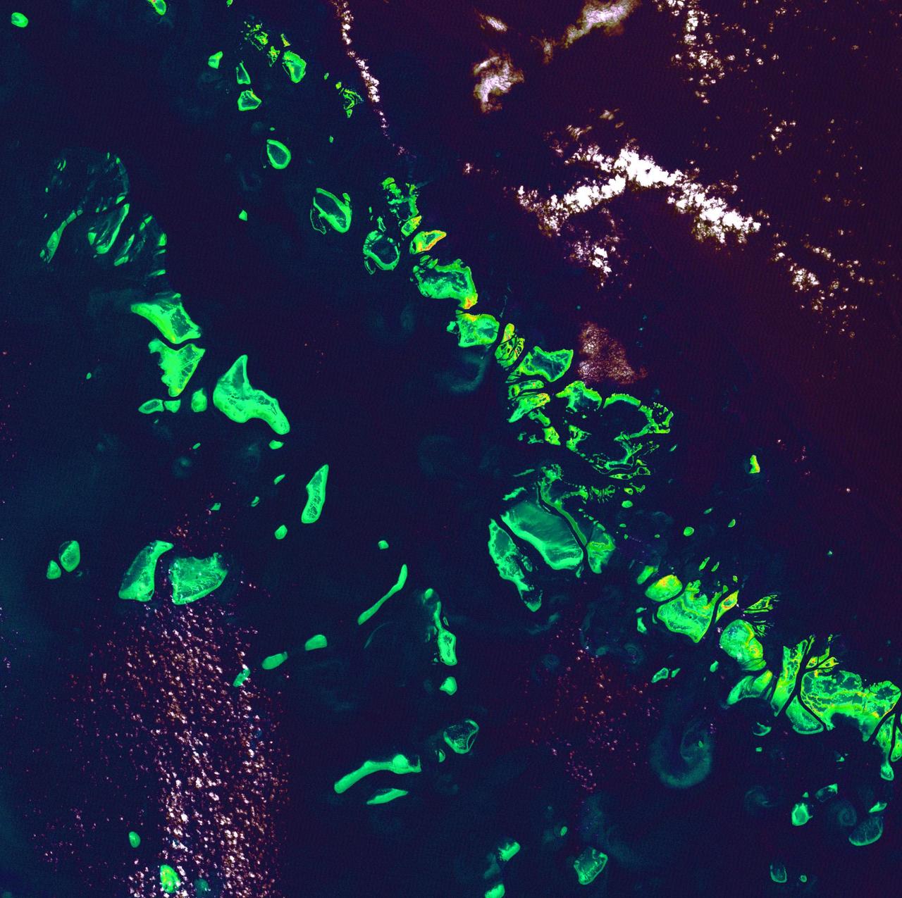
Range : 50,000 miles This multispectral map of Australia, and surrounding seas was obtained by the Galileo spacecraft's Near Infrared Mapping Spectrometer shortly after closest approach. The image shows various ocean, land and atmospheric cloud features as they appear in three of the 408 infrared colors or wavelengths sensed by the instrument. The wavelength of 0.873 micron, represented as blue in the photo, shows regions of enhanced liquid water absorption, i.e. the Pacific and Indian oceans. The 0.984-micron band, represented as red, shows areas of enhanced ground reflection as on the Australian continent. This wavelength is also s ensitive to the reflectivity of relatively thick clouds. The 0.939-micron wavelength, shown as green, is a strong water-vapor-absorbing band, and is used to accentuate clouds lying above the strongly absorbing lower atmosphere. When mixed with the red indicator of cloud reflection, the green produces a yellowish hue; this indicates thick clouds. The distinctive purplish color off the northeast coast marks the unusually shallow waters of the Great Barrier Reef and the Coral Sea. Here the blue denoting water absorption combines with the red denoting reflection from coral and surface marine organisms to produce thiss unusual color. The Near Infrared Mapping Spectrometer (NIMS) on the Galileo spacecraft is a combines mapping (imaging) and spectral instrument. It can sense 408 contiguous wavelengths from 0.7 micron (deep red) to 5.2 microns, and can construct a map or image by mechanical scanning. It can spectroscopically analyze atmospheres and surfaces and construct thermal and chemical maps.