Leading Hemisphere
Leading Hemisphere
Southern Hemisphere in Ultraviolet
Europa Jupiter-Facing Hemisphere
Color Mapping the Southern Hemisphere
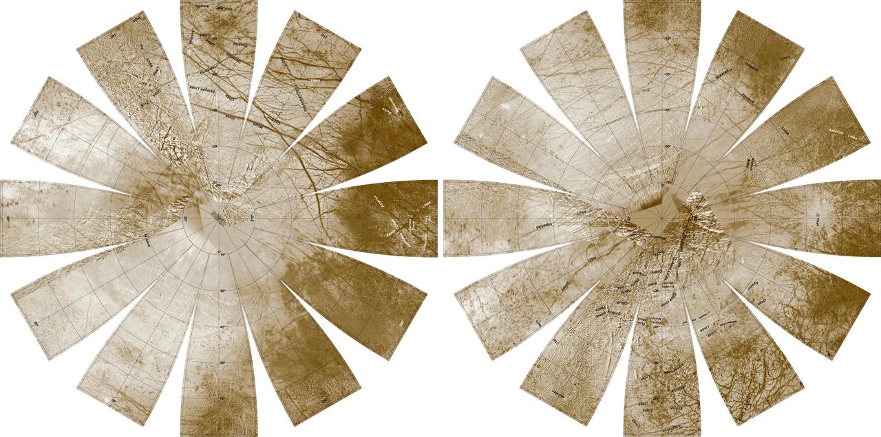
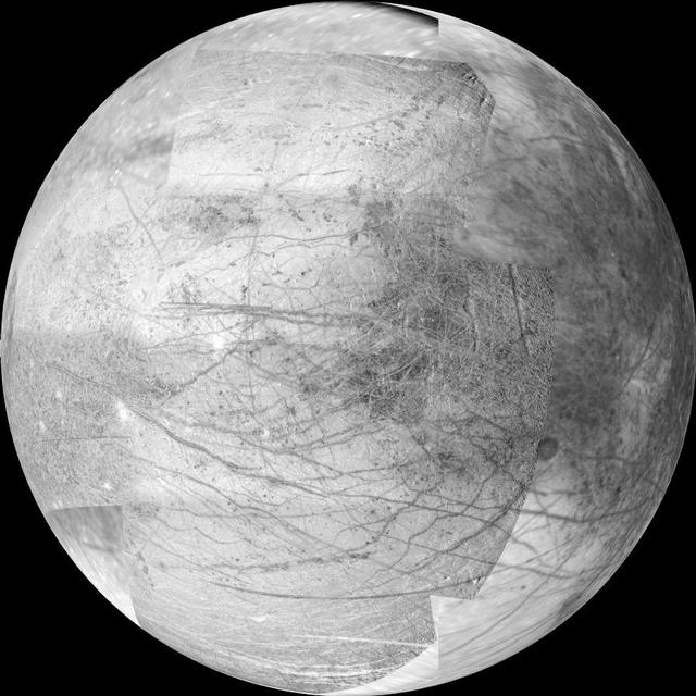
Europa Hemispherical Globes
A Southern Hemisphere Overview
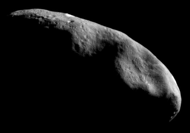
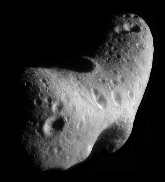
Mosaic of Eros Northern Hemisphere
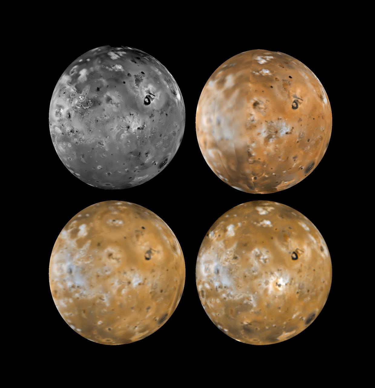
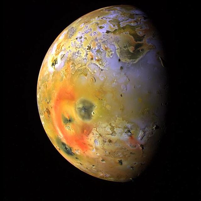
Io Kanehekili Hemisphere
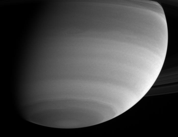
Saturn Northern Hemisphere
The Southern Hemisphere of Enceladus
Mosaic of Eros Northern Hemisphere
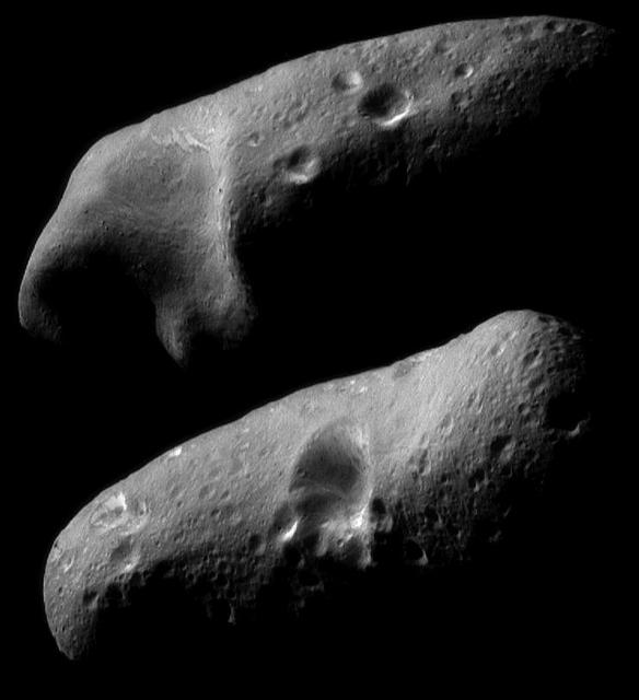
Eros Eastern and Western Hemispheres
Europa Leading Hemisphere
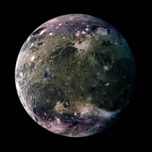
Ganymede Trailing Hemisphere
Io - Southern Hemisphere
Io Pele Hemisphere
Io Pele Hemisphere
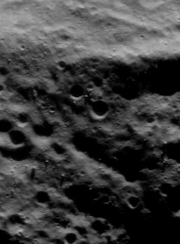
Two Southern Hemisphere Craters
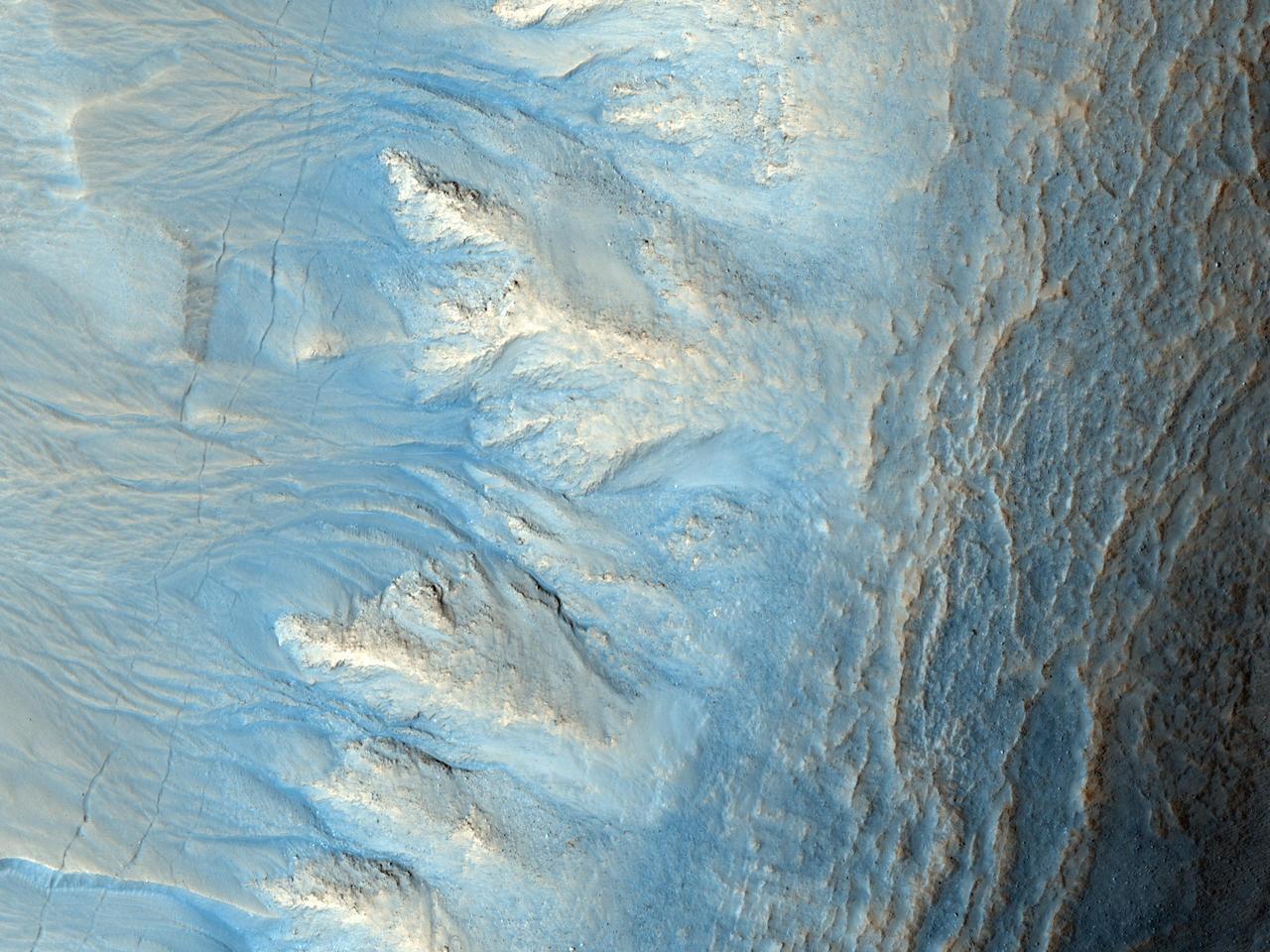
Northern Hemisphere Gullies with Layers
South Hemisphere Gullies
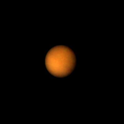
Titan Brighter Southern Hemisphere
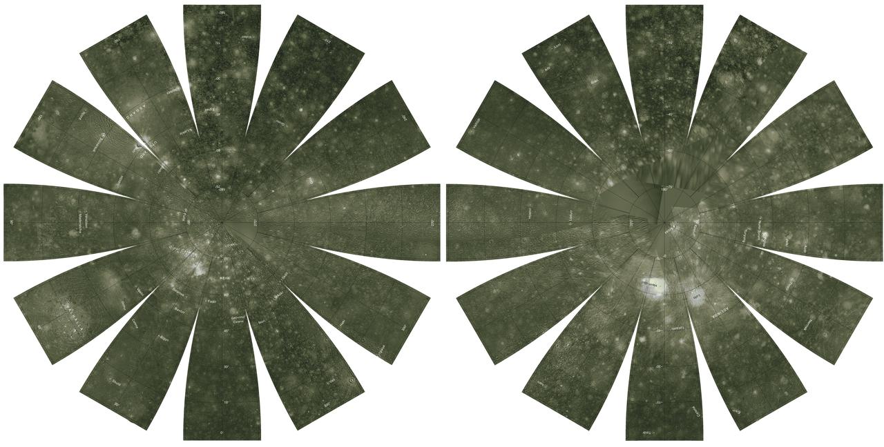
Callisto Hemispherical Globes
Northern Hemisphere of Saturn
Ganymede Northern Hemisphere  http://photojournal.jpl.nasa.gov/catalog/PIA00356
Ganymede Northern Hemisphere
Resurfacing of the Jupiter-facing hemisphere of Io
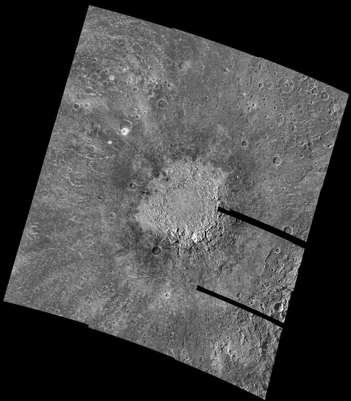
Large impact on Callisto Southern Hemisphere
Southern Hemisphere Polygonal Patterned Ground
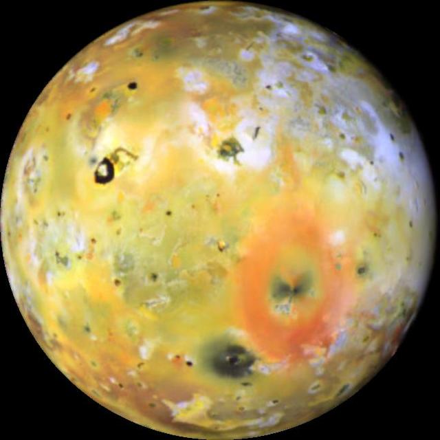
Changes on Io Loki-Pele hemisphere
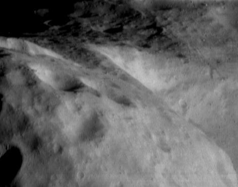
Looking Along the Southern Hemisphere of Eros
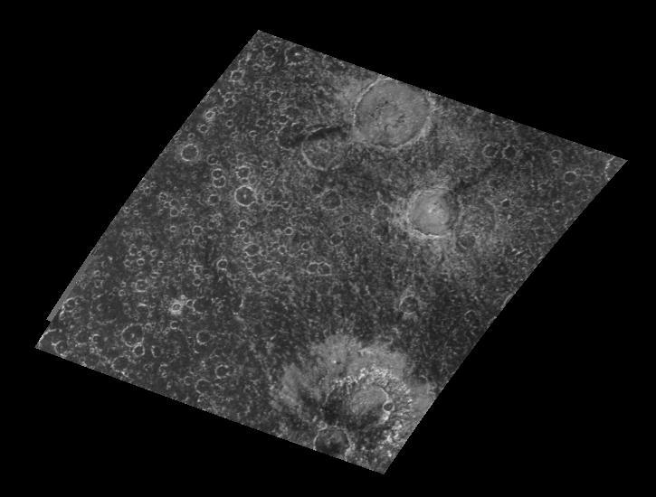
Large Craters in Callisto Southern Hemisphere
Clouds and Hazes of Jupiter Southern Hemisphere
MSIP: Multinational Research in the Southern Hemisphere
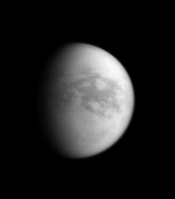
Saturn View of Titan Trailing Hemisphere
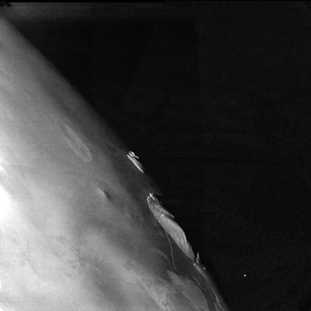
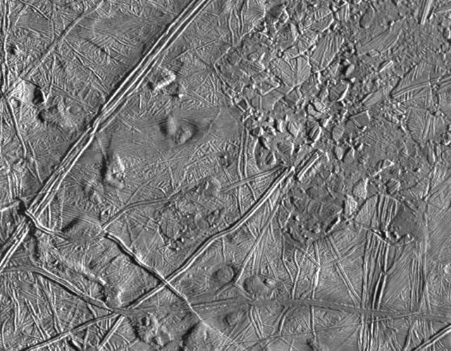
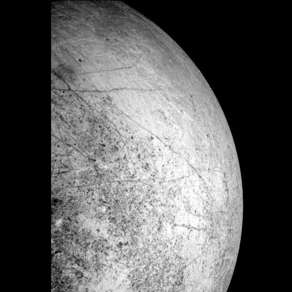
Close-up of Europa Trailing Hemisphere
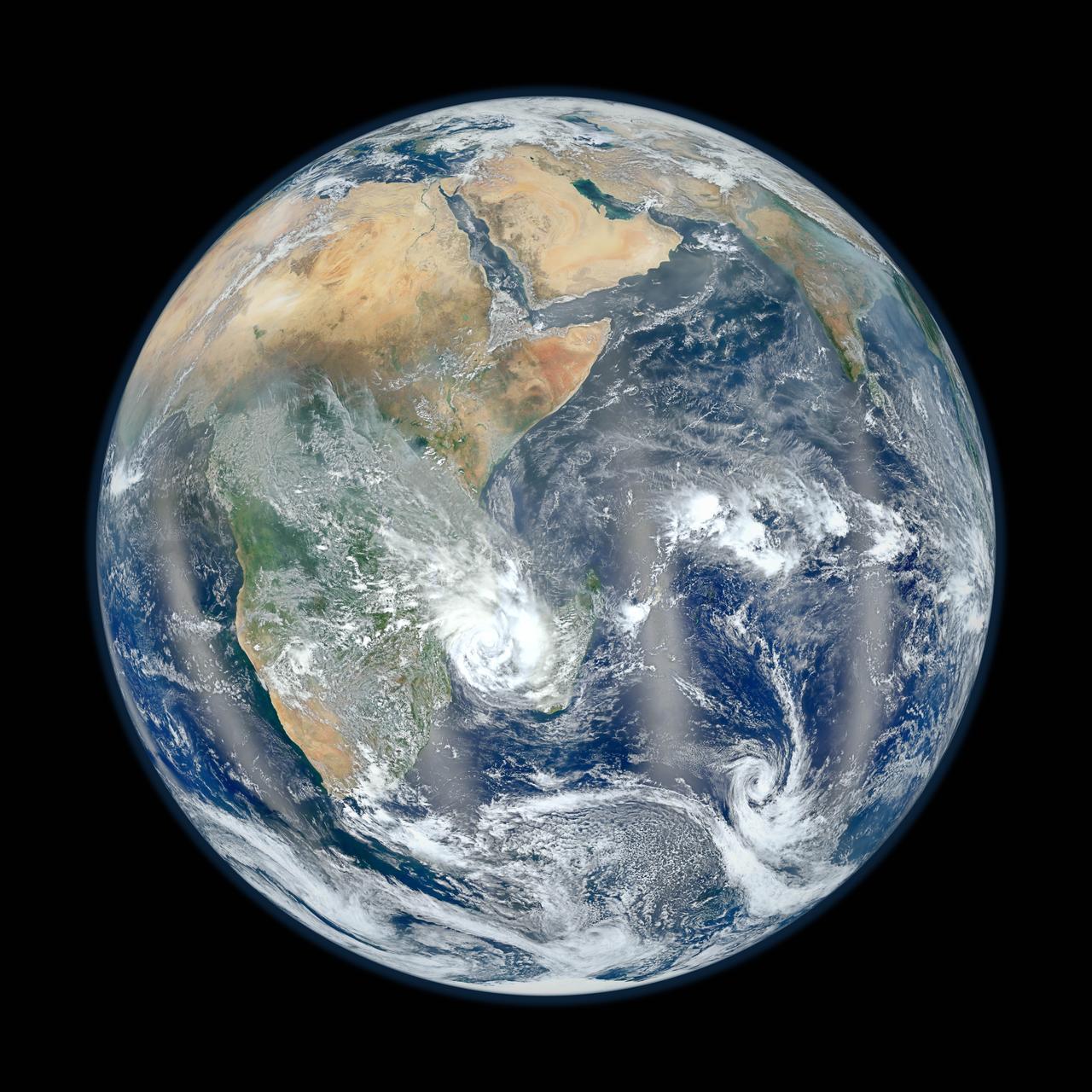
February 2, 2012  <b>Go here to view an image that explains how composite images like these are created: <a href="http://www.flickr.com/photos/gsfc/6803619953">www.flickr.com/photos/gsfc/6803619953</a></b>  Responding to public demand, NASA scientists created a companion image to the wildly popular 'Blue Marble' released last week (January 25, 2012). <a href="http://www.flickr.com/photos/gsfc/6760135001">www.flickr.com/photos/gsfc/6760135001</a>     The new image is a composite of six separate orbits taken on January 23, 2012 by the Suomi National Polar-orbiting Partnership satellite. Both of these new 'Blue Marble' images are images taken by a new instrument flying aboard Suomi NPP, the Visible Infrared Imaging Radiometer Suite (VIIRS).  Compiled by NASA Goddard scientist Norman Kuring, this image has the perspective of a viewer looking down from 7,918 miles (about 12,742 kilometers) above the Earth's surface from a viewpoint of 10 degrees South by 45 degrees East. The four vertical lines of 'haze' visible in this image shows the reflection of sunlight off the ocean, or 'glint,' that VIIRS captured as it orbited the globe. Suomi NPP is the result of a partnership between NASA, NOAA and the Department of Defense.  Credit: NASA/NOAA  For more information about Suomi NPP go to: <a href="http://www.nasa.gov/npp" rel="nofollow">www.nasa.gov/npp</a>  <b><a href="http://www.nasa.gov/audience/formedia/features/MP_Photo_Guidelines.html" rel="nofollow">NASA image use policy.</a></b>  <b><a href="http://www.nasa.gov/centers/goddard/home/index.html" rel="nofollow">NASA Goddard Space Flight Center</a></b> enables NASA’s mission through four scientific endeavors: Earth Science, Heliophysics, Solar System Exploration, and Astrophysics. Goddard plays a leading role in NASA’s accomplishments by contributing compelling scientific knowledge to advance the Agency’s mission.  <b>Follow us on <a href="http://twitter.com/NASA_GoddardPix" rel="nofollow">Twitter</a></b>  <b>Like us on <a href="http://www.facebook.com/pages/Greenbelt-MD/NASA-Goddard/395013845897?ref=tsd" rel="nofollow">Facebook</a></b>  <b>Find us on <a href="http://instagrid.me/nasagoddard/?vm=grid" rel="nofollow">Instagram</a></b>
Eastern Hemisphere - Blue Marble 2012
This visualization shows the Moon's phase and libration at hourly intervals throughout 2015, as viewed from the northern hemisphere. Each frame represents one hour.  Lunar Reconnaissance Orbiter (LRO) has been in orbit around the Moon since the summer of 2009. Its laser altimeter (LOLA) and camera (LROC) are recording the rugged, airless lunar terrain in exceptional detail, making it possible to visualize the Moon with unprecedented fidelity. This is especially evident in the long shadows cast near the terminator, or day-night line. The pummeled, craggy landscape thrown into high relief at the terminator would be impossible to recreate in the computer without global terrain maps like those from LRO.  To download, learn more about this visualization, or to see what the Moon will look like at any hour in 2015, visit <a href="http://svs.gsfc.nasa.gov/goto?4236" rel="nofollow">svs.gsfc.nasa.gov/goto?4236</a>  <b><a href="http://www.nasa.gov/audience/formedia/features/MP_Photo_Guidelines.html" rel="nofollow">NASA image use policy.</a></b>  <b><a href="http://www.nasa.gov/centers/goddard/home/index.html" rel="nofollow">NASA Goddard Space Flight Center</a></b> enables NASA’s mission through four scientific endeavors: Earth Science, Heliophysics, Solar System Exploration, and Astrophysics. Goddard plays a leading role in NASA’s accomplishments by contributing compelling scientific knowledge to advance the Agency’s mission. <b>Follow us on <a href="http://twitter.com/NASAGoddardPix" rel="nofollow">Twitter</a></b> <b>Like us on <a href="http://www.facebook.com/pages/Greenbelt-MD/NASA-Goddard/395013845897?ref=tsd" rel="nofollow">Facebook</a></b> <b>Find us on <a href="http://instagram.com/nasagoddard?vm=grid" rel="nofollow">Instagram</a></b>
Moon Phases 2015, Northern Hemisphere
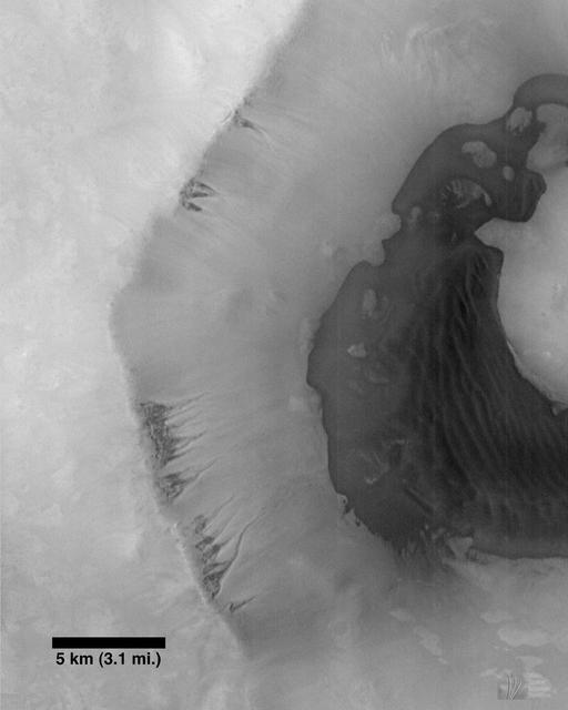
Frost Patch and Dunes in a Northern Hemisphere Crater
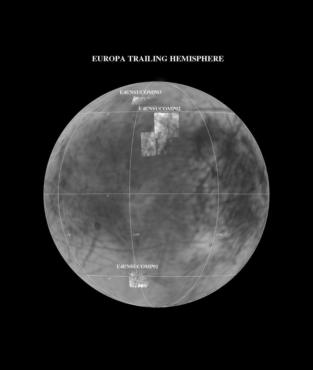
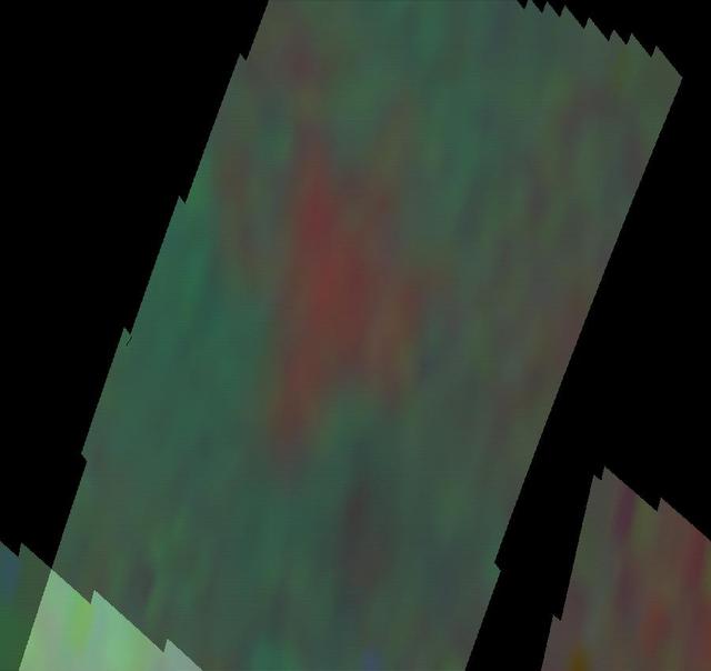
NIMS E4 Observations of Europa Trailing Hemisphere
Seepage and Ponding within a Southern Hemisphere Crater
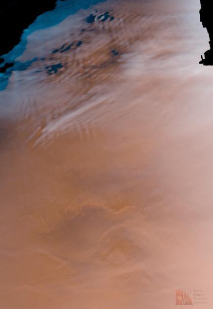
Detailed Cloud Patterns in Martian Northern Hemisphere
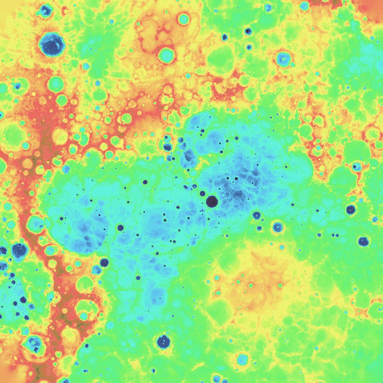
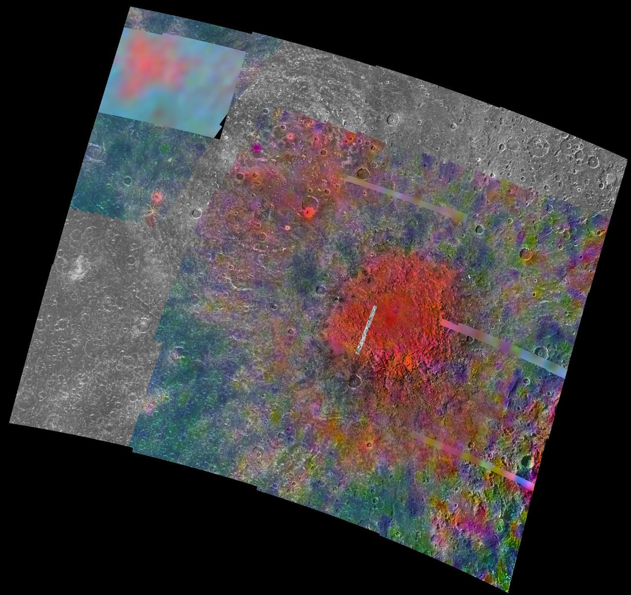
Digital Elevation Model of Mercury Northern Hemisphere
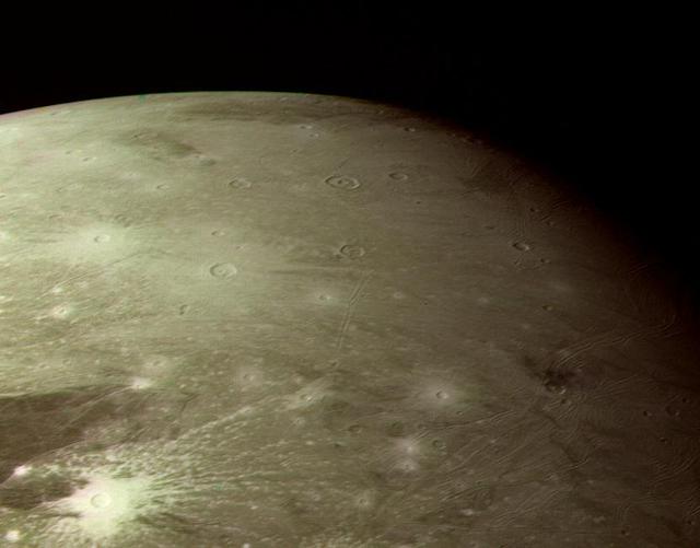
Bright Ray Craters in Ganymede Northern Hemisphere
Io Pele Hemisphere After Pillan Changes
Voyager-to-Galileo Changes, Io Anti-Jove Hemisphere
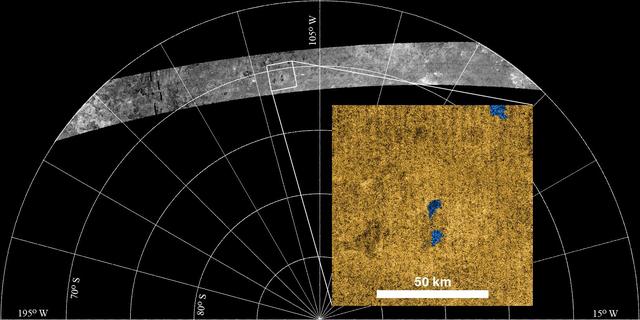
Radar Sees Lakes in Titan Southern Hemisphere
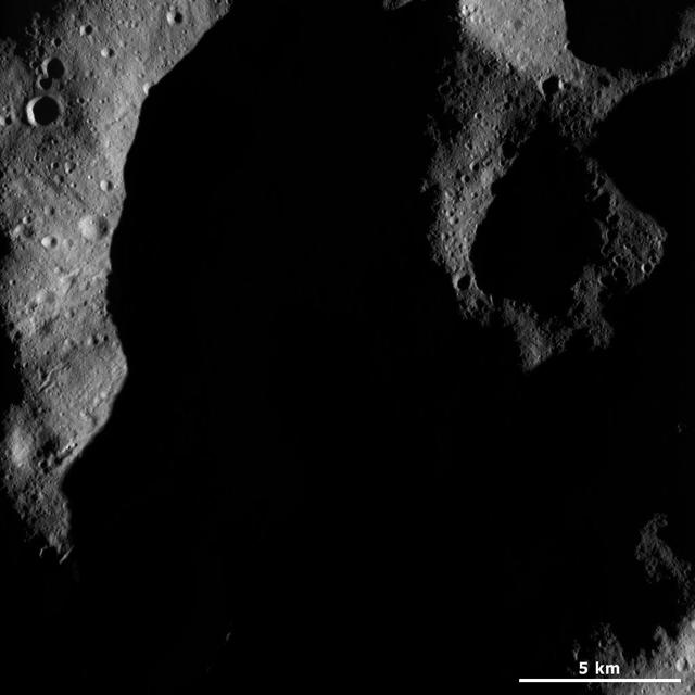
This image from NASA Dawn spacecraft shows a very shadowed region in Vesta northern hemisphere. Roughly the upper one third of asteroid Vesta northern hemisphere is currently in shadow.
A Part of Vesta Shadowed Northern Hemisphere
This image, from NASA Mariner 10 spacecraft which launched in 1974, is of the southern hemisphere of Mercury.
Mercury Southern Hemisphere
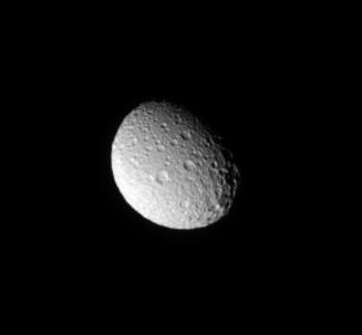
The Cassini spacecraft looks down on the north pole of Mimas and sees the moon cratered trailing hemisphere.
Trailing Hemisphere Craters
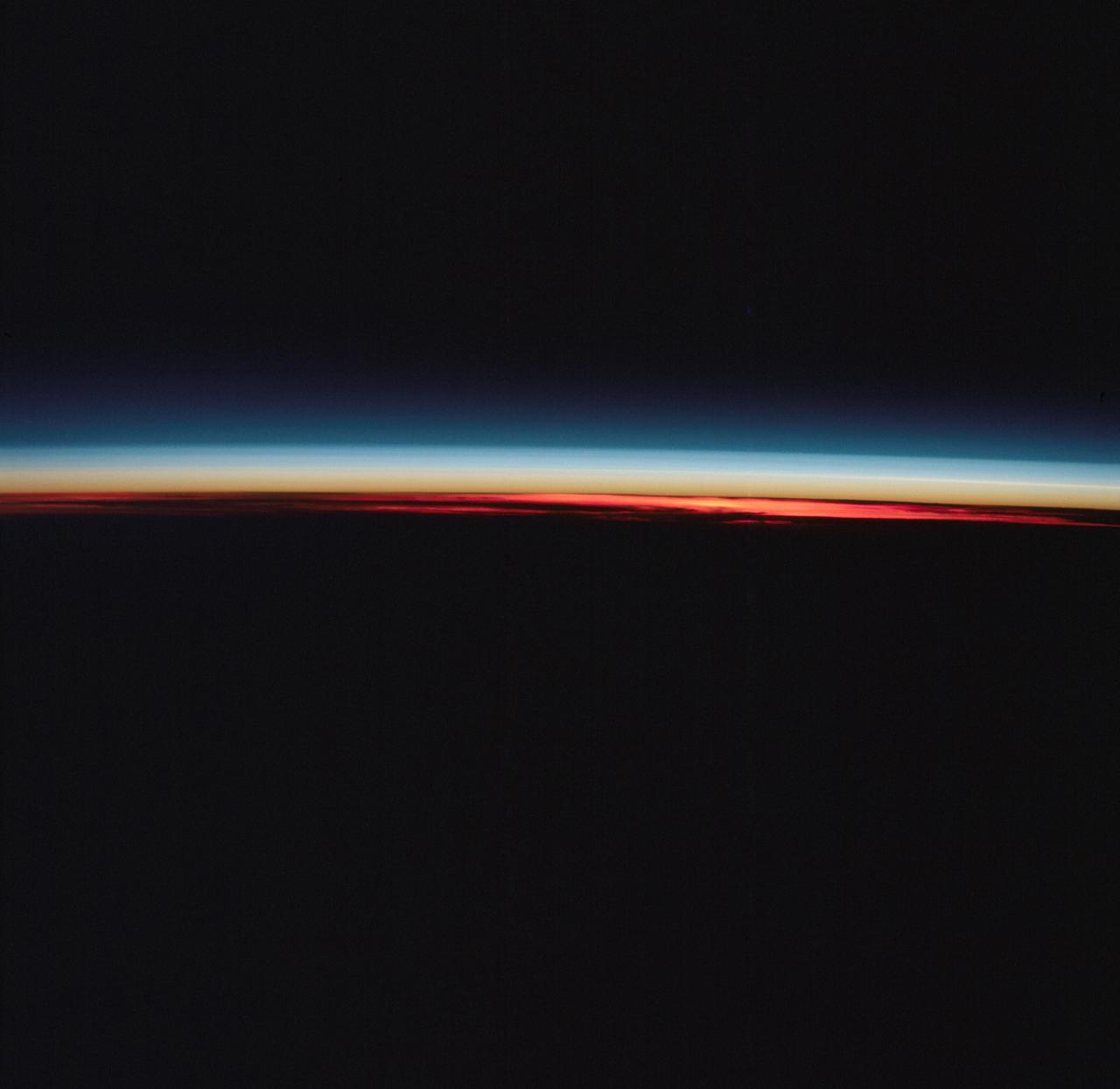
AST-27-2339 (20 July 1975) --- The Earth’s limb at sunrise and cloud silhouettes in the Southern Hemisphere, as photographed from the Apollo spacecraft during the joint U.S.-USSR Apollo-Soyuz Test Project mission. The photograph was taken at an altitude of 230 kilometers (143 statute miles) with a 70mm Hasselblad camera using medium-speed Ektachrome QX-807 type film.
Earth's limb and cloud silhouette in Southern Hemisphere
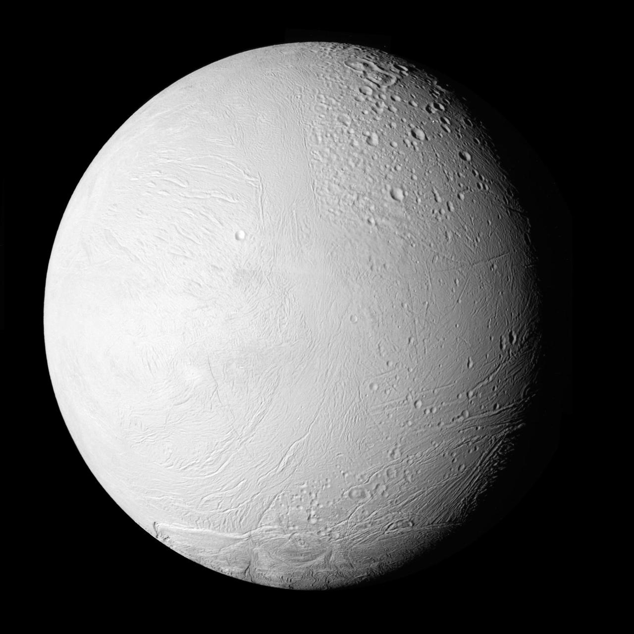
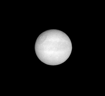
NASA Cassini spacecraft shows a new view of Saturn moon Enceladus in a whole-disk mosaic of the geologically active moon leading, or western, hemisphere.
Enceladus Leading Hemisphere
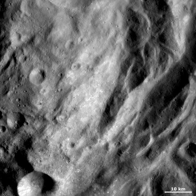
This image from NASA Dawn spacecraft shows some of the undulating terrain in asteroid Vesta southern hemisphere.
Undulating Terrain in Vesta Southern Hemisphere
True-color (left) and false-color (right) mosaics of Jupiter's northern hemisphere between 10 and 50 degrees latitude. Jupiter's atmospheric motions are controlled by alternating eastward and westward bands of air between Jupiter's equator and polar regions. The direction and speed of these bands influences the color and texture of the clouds seen in this mosaic. The high and thin clouds are represented by light blue, deep clouds are reddish, and high and thick clouds are white. A high haze overlying a clear, deep atmosphere is represented by dark purple. This image was taken by NASA's Galileo spacecraft on April 3, 1997 at a distance of 1.4 million kilometers (.86 million miles).   http://photojournal.jpl.nasa.gov/catalog/PIA03000
Atmospheric Motion in Jupiter Northern Hemisphere
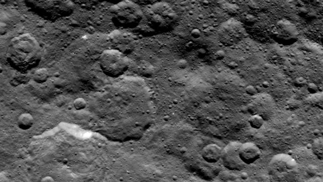
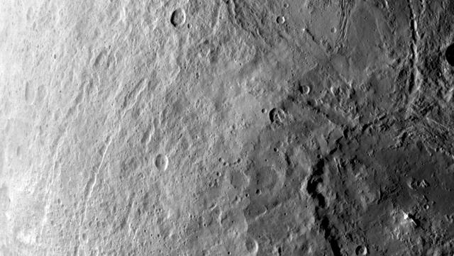
Craters in the northern hemisphere of dwarf planet Ceres are seen in this image taken by NASA's Dawn spacecraft on June 6, 2015.  This is among the first snapshots from Dawn's second mapping orbit, which is 2,700 miles (4,400 kilometers) in altitude. The resolution is 1,400 feet (410 meters) per pixel.  http://photojournal.jpl.nasa.gov/catalog/PIA19570
Ceres Northern Hemisphere in Survey
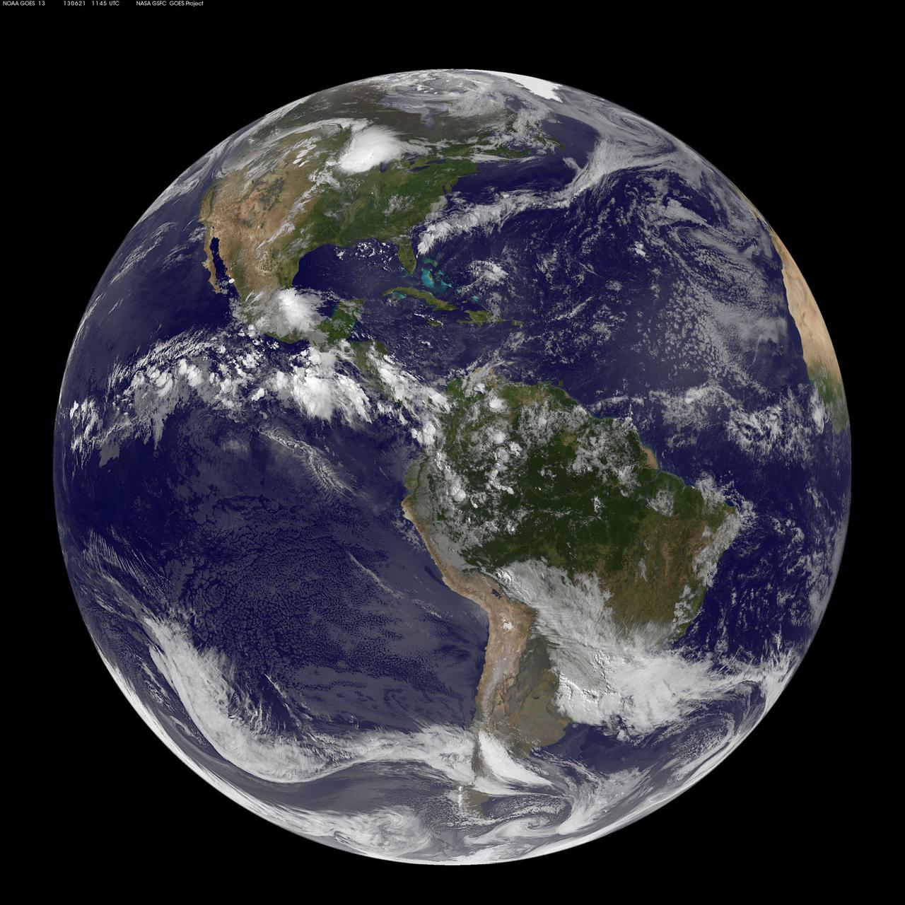
This full-disk image from NOAA’s GOES-13 satellite was captured at 11:45 UTC (7:45 a.m. EDT) and shows the Americas on June 21, 2012. This date marks the start of astronomical summer in the northern hemisphere, making it the longest day of the year!  <b><a href="http://www.nasa.gov/audience/formedia/features/MP_Photo_Guidelines.html" rel="nofollow">NASA image use policy.</a></b>  <b><a href="http://www.nasa.gov/centers/goddard/home/index.html" rel="nofollow">NASA Goddard Space Flight Center</a></b> enables NASA’s mission through four scientific endeavors: Earth Science, Heliophysics, Solar System Exploration, and Astrophysics. Goddard plays a leading role in NASA’s accomplishments by contributing compelling scientific knowledge to advance the Agency’s mission.  <b>Follow us on <a href="http://twitter.com/NASA_GoddardPix" rel="nofollow">Twitter</a></b>  <b>Like us on <a href="http://www.facebook.com/pages/Greenbelt-MD/NASA-Goddard/395013845897?ref=tsd" rel="nofollow">Facebook</a></b>  <b>Find us on <a href="http://instagram.com/nasagoddard?vm=grid" rel="nofollow">Instagram</a></b>
Happy Summer Solstice Northern Hemisphere
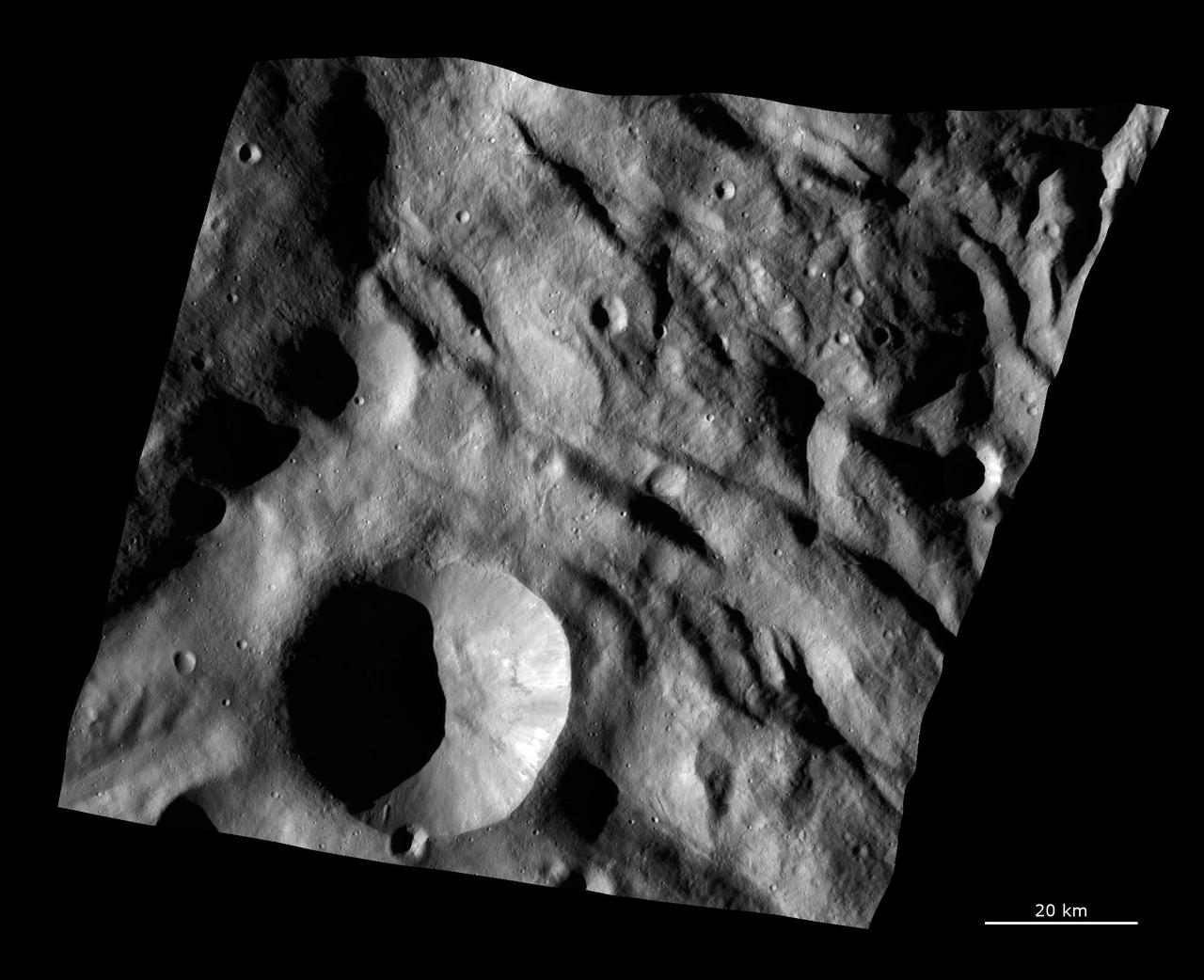
This image from NASA Dawn spacecraft shows undulating terrain, located only in asteroid Vesta southern hemisphere, in and around the Rheasilvia impact basin.
Undulating Terrain in Vesta Southern Hemisphere
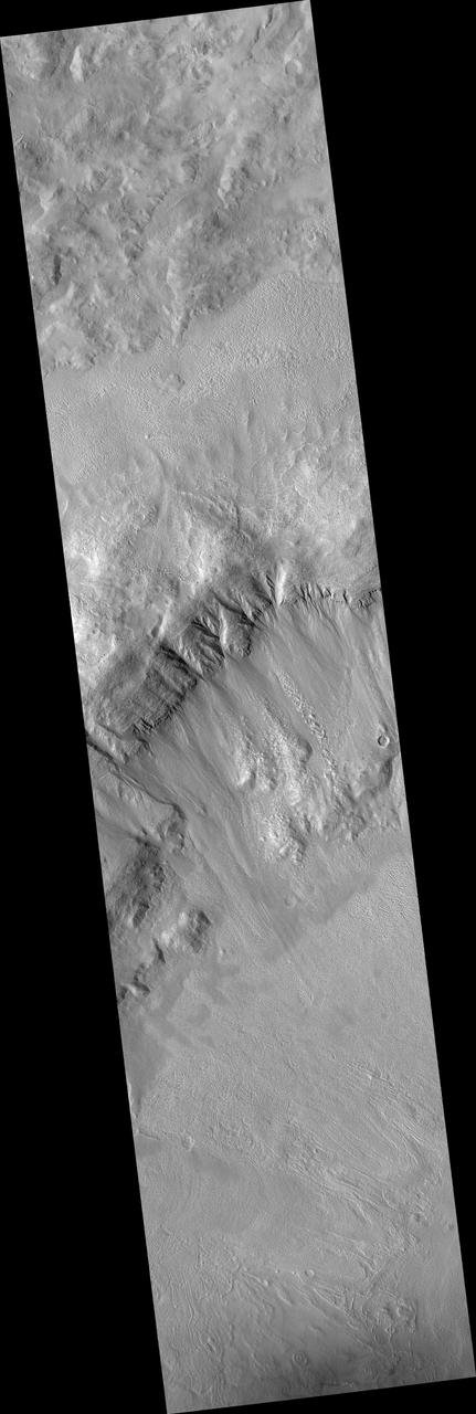
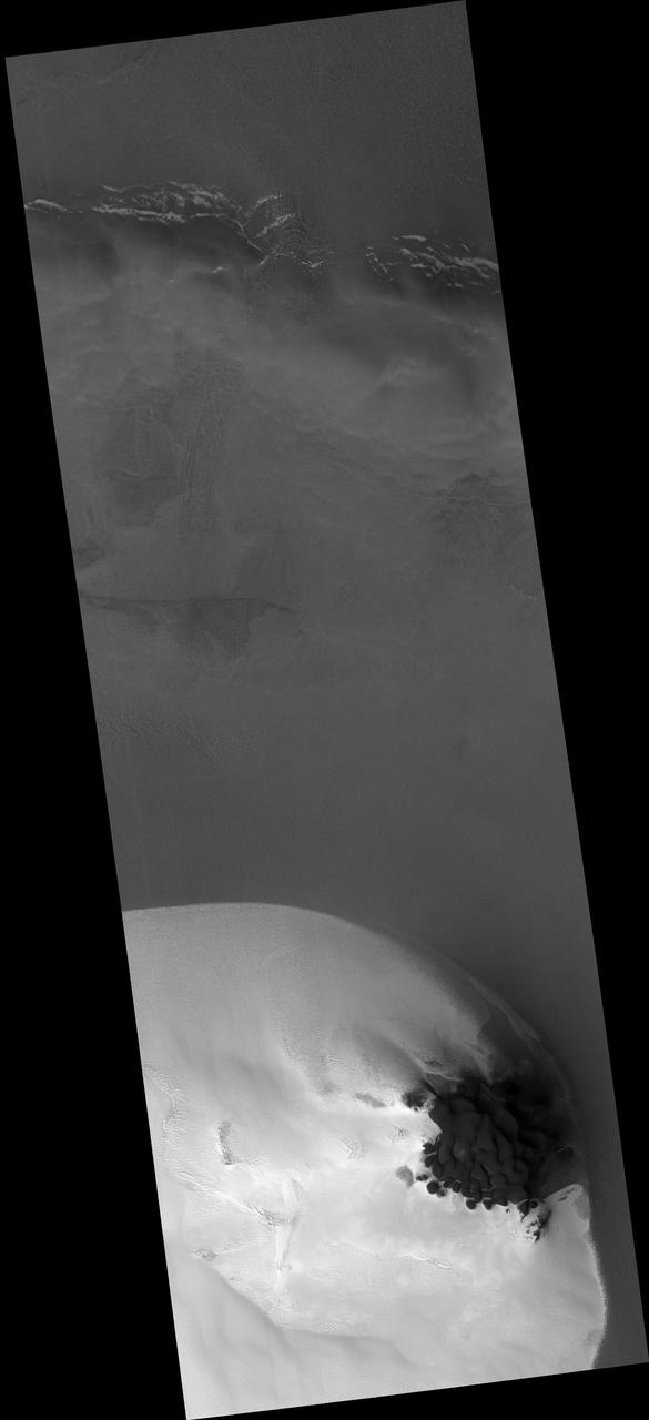
This observation from NASA Mars Reconnaissance Orbiter shows a Southern hemisphere crater with gullies, dunes, periglacial modification, bright rock deposits, and dust devil tracks.
Southern Hemisphere Crater with Dune Field
Jupiter Northern Hemisphere in False Color Time Set 1
Jupiter Northern Hemisphere in True Color Time Set 1
Jupiter Northern Hemisphere in True Color Time Set 3
Jupiter Northern Hemisphere in False Color Time Set 2
Jupiter Southern Hemisphere in the Near-Infrared Time Set 3
MGS Mars Orbiter Laser MOLA Surface Topography of Northern Hemisphere
Jupiter Northern Hemisphere in True Color Time Set 2
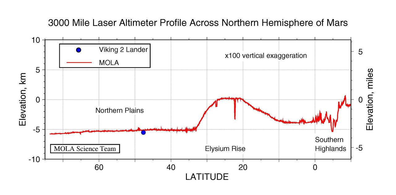
3000 Mile Laser Altimeter Profile Across Northern Hemisphere of Mars
Jupiter Southern Hemisphere in the Near-Infrared Time Set 2
Jupiter Northern Hemisphere in False Color Time Set 3
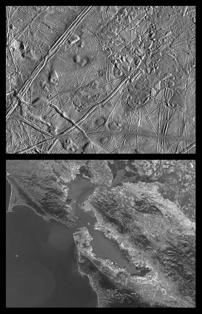
Close-up of Europa Trailing Hemisphere and similar scales on Earth
Jupiter Southern Hemisphere in the Near-Infrared Time Set 1
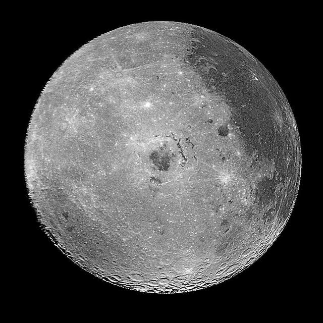
This image of the western hemisphere of the Moon was taken through a green filter by NASA's Galileo spacecraft at 9:35 a.m. PST Dec. 9 at a range of about 350,000 miles. In the center is the Orientale Basin.  http://photojournal.jpl.nasa.gov/catalog/PIA00120
Moon - Western Hemisphere
This photograph of Neptune southern hemisphere was taken by the narrow-angle camera on NASA Voyager 2 when the spacecraft was 4.2 million km 2.6 million miles from the planet.  http://photojournal.jpl.nasa.gov/catalog/PIA00050
Neptune Southern Hemisphere
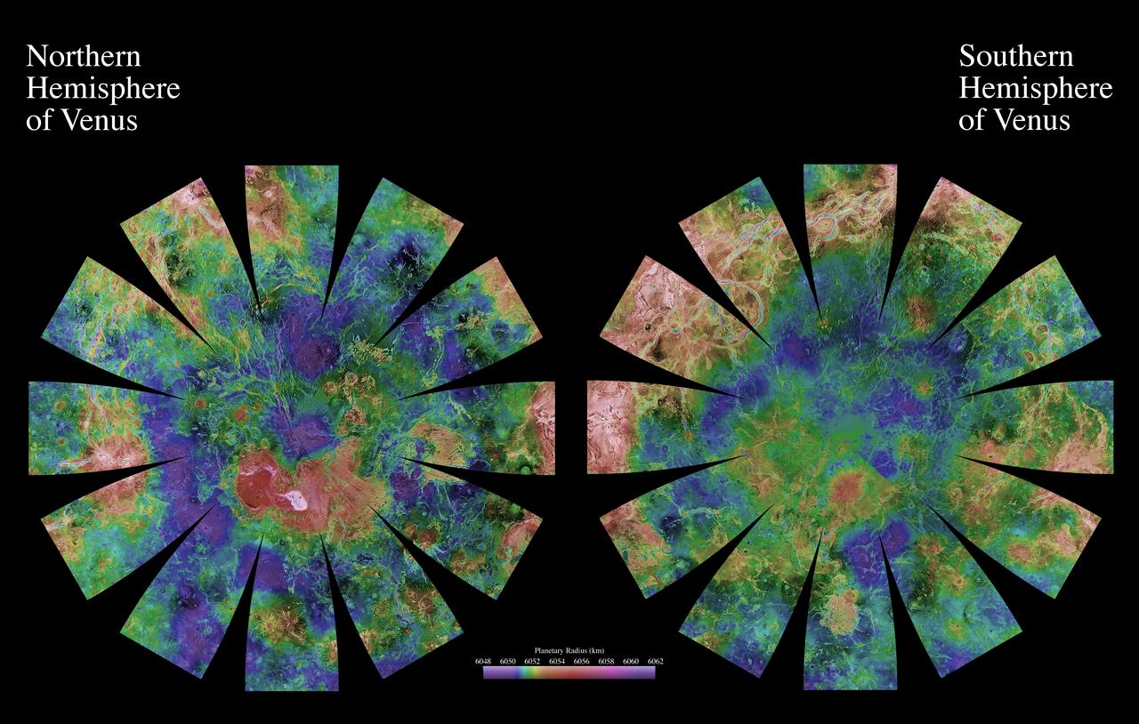
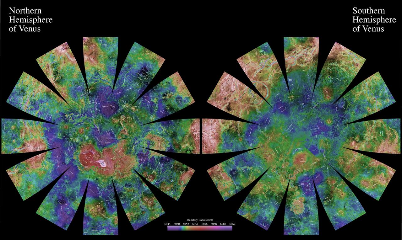
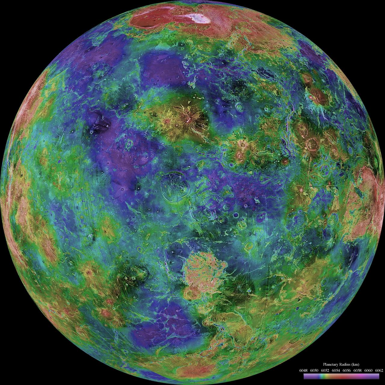
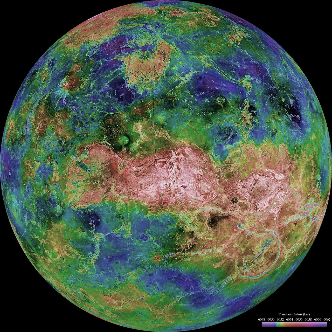
The images used for the base of this globe show the northern and southern hemispheres of Venus as revealed by more than a decade of radar investigations culminating in the 1990-1994 NASA Magellan mission.
Venus Hemispherical Globes
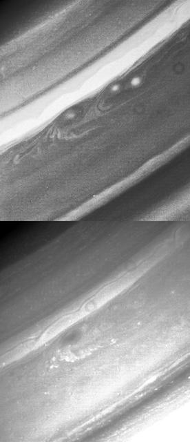
This image is a still frame, created from images taken by NASA Cassini spacecraft, shows white oval storms in Jupiter southern hemisphere that rotate counterclockwise, similar to the larger Great Red Spot.
Southern Hemisphere Storms
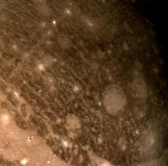
These views of Callisto southern hemisphere were taken by NASA Galileo spacecraft on May 6, 1997. The upper left view contains Buri, a crater with a diameter of about 60 km.
Callisto Southern Hemisphere
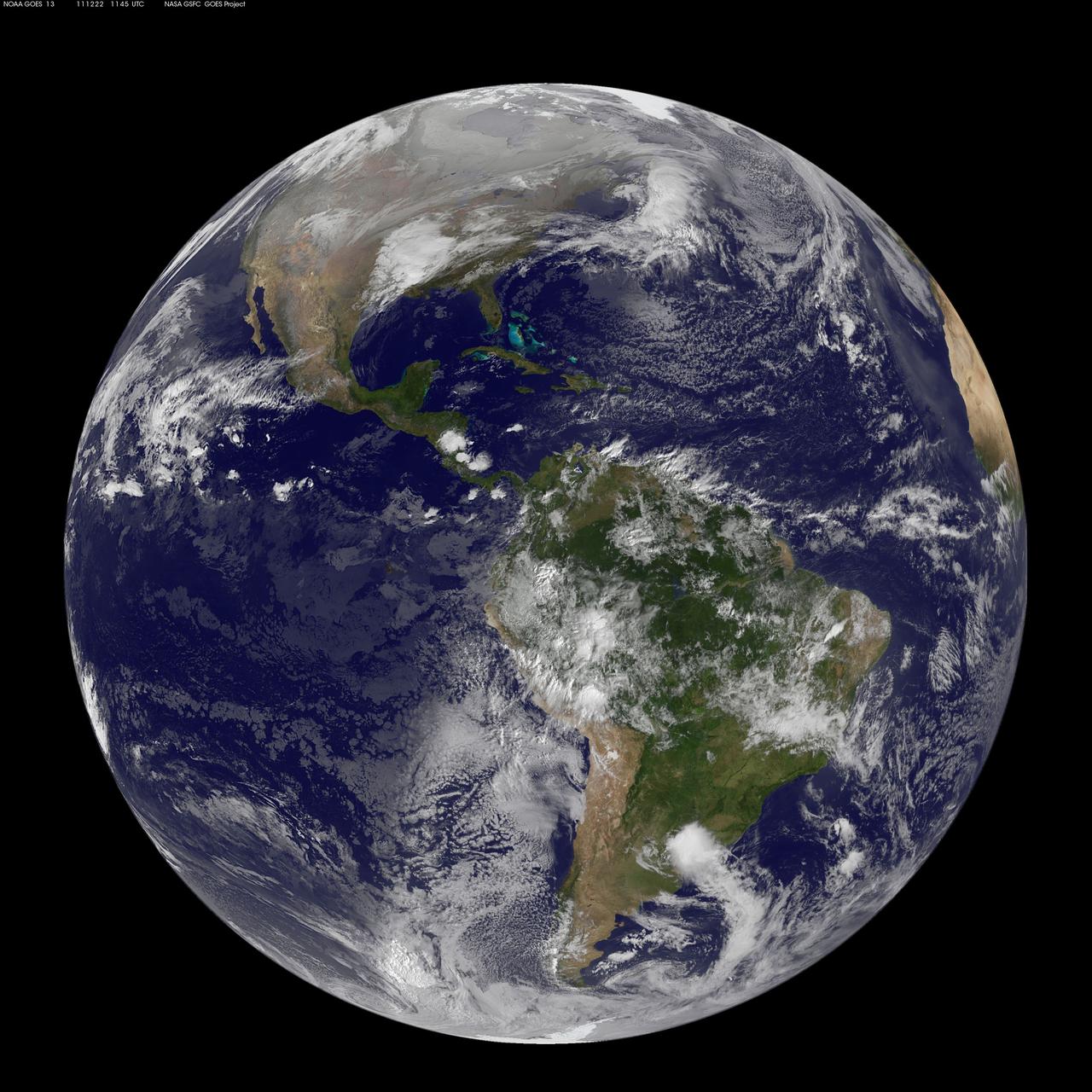
Image acquired December 22, 2011  NOAA's GOES-13 satellite captured this image of Earth on the first day of  the winter solstice, December 22, 2011 at 11:45 UTC. The GOES-13 cloud images are overlaid on a true-color NASA/MODIS map by the NASA/NOAA GOES Project at NASA's Goddard Space Flight Center in Greenbelt, Md.   <b><a href="http://goes.gsfc.nasa.gov/" rel="nofollow">Credit: NOAA/NASA GOES Project</a></b>  <b><a href="http://www.nasa.gov/audience/formedia/features/MP_Photo_Guidelines.html" rel="nofollow">NASA image use policy.</a></b>  <b><a href="http://www.nasa.gov/centers/goddard/home/index.html" rel="nofollow">NASA Goddard Space Flight Center</a></b> enables NASA’s mission through four scientific endeavors: Earth Science, Heliophysics, Solar System Exploration, and Astrophysics. Goddard plays a leading role in NASA’s accomplishments by contributing compelling scientific knowledge to advance the Agency’s mission.  <b>Follow us on <a href="http://twitter.com/NASA_GoddardPix" rel="nofollow">Twitter</a></b>  <b>Like us on <a href="http://www.facebook.com/pages/Greenbelt-MD/NASA-Goddard/395013845897?ref=tsd" rel="nofollow">Facebook</a></b>  <b>Find us on <a href="http://instagrid.me/nasagoddard/?vm=grid" rel="nofollow">Instagram</a></b>
Winter Solstice Arrives in Northern Hemisphere
Taken in 1997, NASA Hubble Space Telescope, using visible light, detected clouds in the northern hemisphere of Uranus.
Hubble Spots Northern Hemispheric Clouds on Uranus
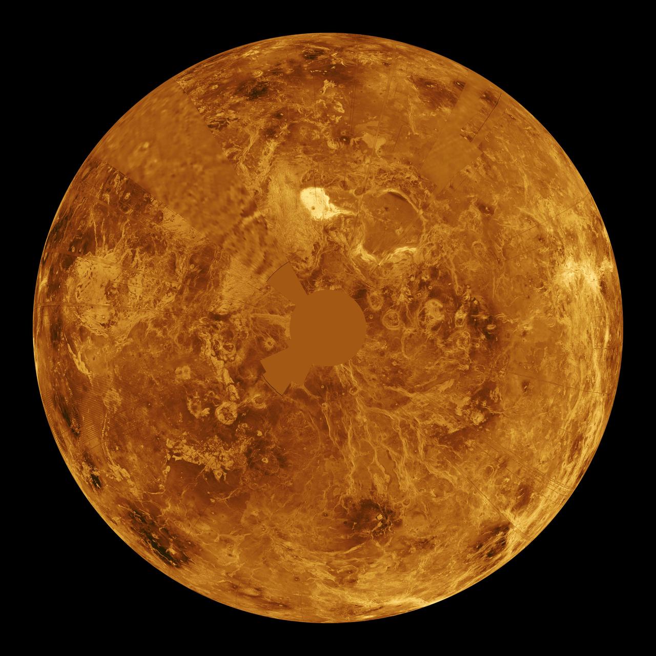
The northern hemisphere is displayed in this global view of the surface of Venus as seen by NASA Magellan spacecraft.  http://photojournal.jpl.nasa.gov/catalog/PIA00271
Venus - Computer Simulated Global View of the Northern Hemisphere
A large crater in the southern hemisphere of dwarf planet Ceres is seen in this image taken by NASA's Dawn spacecraft on June 6, 2015. This image shows many different surface structures associated with impacts.  This is among the first snapshots from Dawn's second mapping orbit, which is 2,700 miles (4,400 kilometers) in altitude. The resolution is 1,400 feet (410 meters) per pixel.  http://photojournal.jpl.nasa.gov/catalog/PIA19569
Ceres Southern Hemisphere in Survey
Two brown ovals, at right, some 10,000 km 6,000 miles across, were found at approximately 40 latitude in Saturn northern hemisphere by NASA Voyager 1. The photo was taken on November 7, 1980.
Saturn - Brown Ovals in Northern Hemisphere
The images used for the base of this globe show the northern and southern hemispheres of Venus as revealed by more than a decade of radar investigations culminating in the 1990-1994 NASA Magellan mission.
Venus Hemispherical Globes with place names
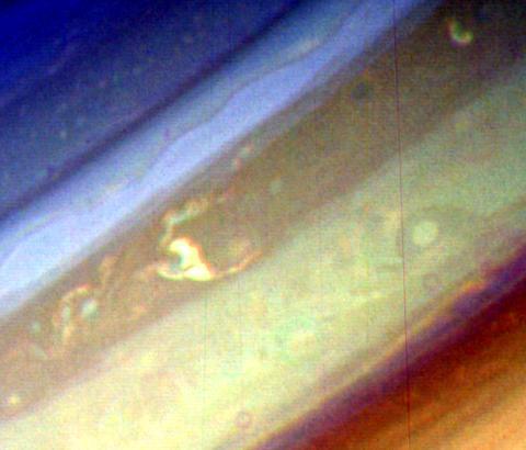
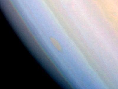
This false-color image of Saturn southern hemisphere taken by NASA Voyager 1 on Nov. 6, 1980, shows the unique red oval cloud feature located at 55 degrees south latitude.
Saturn - False Color of Southern Hemisphere
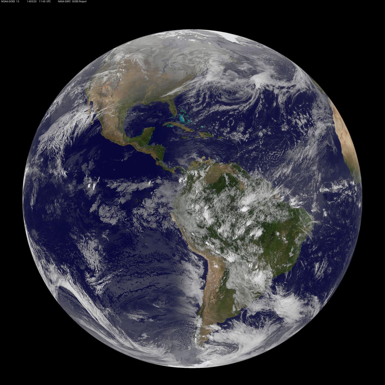
This full-disk image from NOAA’s GOES-13 satellite was captured at 11:45 UTC (7:45 a.m. EDT) and shows the Americas on March 20, 2014. This date marks the start of astronomical spring in the northern hemisphere.  <b><a href="http://goes.gsfc.nasa.gov/" rel="nofollow">Credit: NOAA/NASA GOES Project</a></b>  <b><a href="http://www.nasa.gov/audience/formedia/features/MP_Photo_Guidelines.html" rel="nofollow">NASA image use policy.</a></b>  <b><a href="http://www.nasa.gov/centers/goddard/home/index.html" rel="nofollow">NASA Goddard Space Flight Center</a></b> enables NASA’s mission through four scientific endeavors: Earth Science, Heliophysics, Solar System Exploration, and Astrophysics. Goddard plays a leading role in NASA’s accomplishments by contributing compelling scientific knowledge to advance the Agency’s mission.  <b>Follow us on <a href="http://twitter.com/NASAGoddardPix" rel="nofollow">Twitter</a></b>  <b>Like us on <a href="http://www.facebook.com/pages/Greenbelt-MD/NASA-Goddard/395013845897?ref=tsd" rel="nofollow">Facebook</a></b>  <b>Find us on <a href="http://instagram.com/nasagoddard?vm=grid" rel="nofollow">Instagram</a></b>
GOES Full Disk Shows First Day of Spring in the Northern Hemisphere
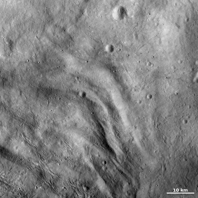
This image from NASA Dawn spacecraft shows the texture of the surface in a part of asteroid Vesta southern hemisphere. This region is just north of the main Rheasilvia structure.
Complex Surface Texture in Vesta Southern Hemisphere
Of all the planets NASA has explored, none have matched the dynamic complexity of our own. Earth is constantly changing, and NASA are working constantly to explore and understand the planet on scales from local to global.  Though Earth science has been a key part of NASA’s mission since the agency was founded in 1958, this year has been one of the peaks. Two new Earth-observing satellites have already been launched and put to work: the Global Precipitation Measurement (GPM) and the Orbiting Carbon Observatory 2 (OCO-2). Three more missions are set to take off in the next six months: the wind-measuring ISS-RapidScat, the ISS Cloud-Aerosol Transport System (CATS), and the Soil Moisture Active Passive (SMAP). And research planes have been flying over polar ice, hurricanes, boreal forests, and pollution plumes.  All of these new efforts complement an existing fleet of Earth-observing satellites. In visible light and many invisible wavelengths, NASA and its science partners are observing the entire planet every day. The image above was captured on March 30, 2014, by the Visible Infrared Imaging Radiometer Suite (VIIRS) on the Suomi NPP satellite. The composite image of the eastern hemisphere was compiled from eight orbits of the satellite and ten imaging channels, then stitched together to blend the edges of each satellite pass.  Read more: <a href="http://earthobservatory.nasa.gov/IOTD/view.php?id=84214&amp;eocn=home&amp;eoci=iotd_title" rel="nofollow">earthobservatory.nasa.gov/IOTD/view.php?id=84214&amp;eocn...</a>  NASA Earth Observatory image by Robert Simmon, using Suomi NPP VIIRS imagery from NOAA's Environmental Visualization Laboratory. Suomi NPP is the result of a partnership between NASA, NOAA and the Department of Defense. Caption by Mike Carlowicz.  Credit: <b><a href="http://www.earthobservatory.nasa.gov/" rel="nofollow"> NASA Earth Observatory</a></b>  <b><a href="http://www.nasa.gov/audience/formedia/features/MP_Photo_Guidelines.html" rel="nofollow">NASA image use policy.</a></b>  <b><a href="http://www.nasa.gov/centers/goddard/home/index.html" rel="nofollow">NASA Goddard Space Flight Center</a></b> enables NASA’s mission through four scientific endeavors: Earth Science, Heliophysics, Solar System Exploration, and Astrophysics. Goddard plays a leading role in NASA’s accomplishments by contributing compelling scientific knowledge to advance the Agency’s mission. <b>Follow us on <a href="http://twitter.com/NASAGoddardPix" rel="nofollow">Twitter</a></b> <b>Like us on <a href="http://www.facebook.com/pages/Greenbelt-MD/NASA-Goddard/395013845897?ref=tsd" rel="nofollow">Facebook</a></b> <b>Find us on <a href="http://instagram.com/nasagoddard?vm=grid" rel="nofollow">Instagram</a></b>
Blue Marble, Eastern Hemisphere March 2014
NASA Mars Odyssey spacecraft produced this high-energy neutron detector map of neutrons in Mars southern hemisphere. The blue region around the south pole indicates a high content of hydrogen in the upper 2 to 3 meters 7 to 10 feet of the surface.
Southern Hemisphere Neutron Map
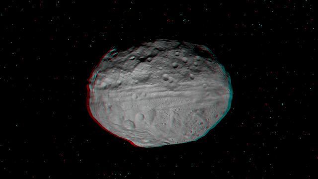
This anaglyph shows the topography of Vesta eastern hemisphere; equatorial troughs are visible around asteroid Vesta equator and north of these troughs there are a number of highly degraded, old, large craters. You need 3-D glasses to view this image.
3-D Image of Vesta Eastern Hemisphere
Callisto southern hemisphere was imaged by both the Near Infrared Mapping Spectrometer NIMS and the Solid State Imaging SSI instrument during NASA Galileo eighth orbit of Jupiter. This is a mosaic combining both views.
Callisto Southern Hemisphere as Viewed by NIMS & SSI
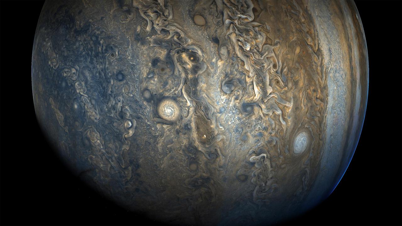
See Jupiter's southern hemisphere in beautiful detail in this new image taken by NASA's Juno spacecraft. The color-enhanced view captures one of the white ovals in the "String of Pearls," one of eight massive rotating storms at 40 degrees south latitude on the gas giant planet. The image was taken on Oct. 24, 2017 at 11:11 a.m. PDT (2:11 p.m. EDT), as Juno performed its ninth close flyby of Jupiter. At the time the image was taken, the spacecraft was 20,577 miles (33,115 kilometers) from the tops of the clouds of the planet at a latitude of minus 52.96 degrees. The spatial scale in this image is 13.86 miles/pixel (22.3 kilometers/pixel). Citizen scientists Gerald Eichstädt and Seán Doran processed this image using data from the JunoCam imager. https://photojournal.jpl.nasa.gov/catalog/PIA21970
Jupiter's Stunning Southern Hemisphere
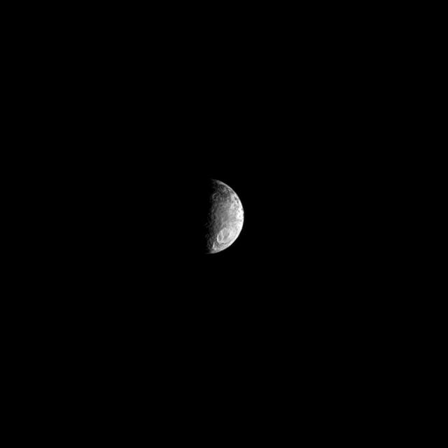
A large crater can be seen in the southern hemisphere of Saturn two-tone moon Iapetus. Lit terrain seen here is on the trailing hemisphere while the leading hemisphere is extremely dark and whose trailing hemisphere is as white as snow.
Big Crater Down South
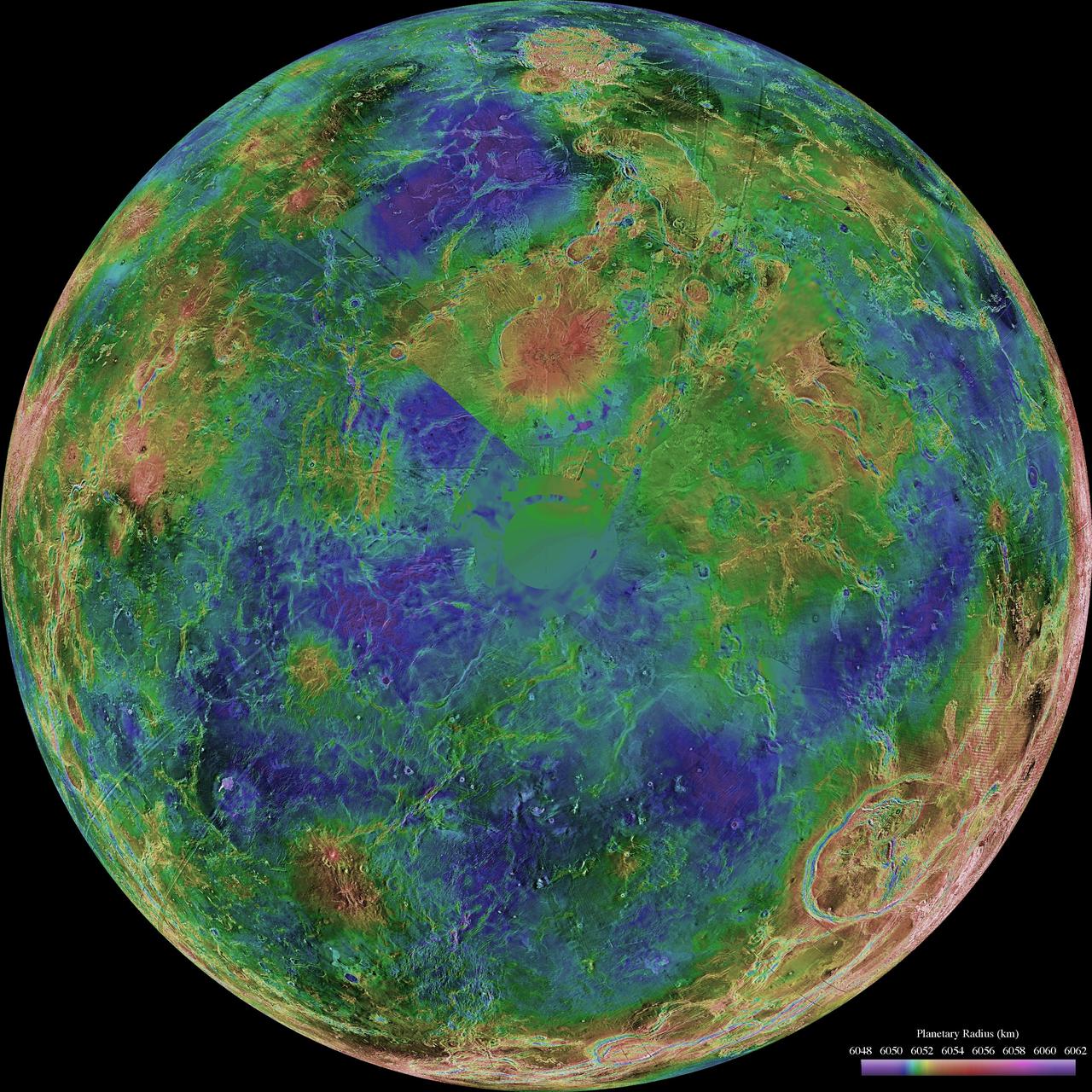
This hemispheric view of Venus, as revealed by more than a decade of radar investigations culminating in the 1990-1994 Magellan mission, is centered on the North Pole. NASA Magellan spacecraft imaged more than 98% of Venus.  http://photojournal.jpl.nasa.gov/catalog/PIA00008
Hemispheric View of Venus Centered at the South Pole
The northern hemisphere is displayed in this global view of the surface of Venus. NASA Magellan synthetic aperture radar mosaics from the first cycle of Magellan mapping were mapped onto a computer-simulated globe to create this image.  http://photojournal.jpl.nasa.gov/catalog/PIA00252
Venus - Computer Simulated Global View of Northern Hemisphere
The hemispheric view of Venus, as revealed by more than a decade of radar investigations culminating in NASA's 1990-1994 Magellan mission, is centered at 0 degrees east longitude.  http://photojournal.jpl.nasa.gov/catalog/PIA00157
Hemispheric View of Venus Centered at 0 Degrees East Longitude
The hemispheric view of Venus, as revealed by more than a decade of radar investigations culminating in NASA's 1990-1994 Magellan mission, is centered at 90 degrees east longitude.  http://photojournal.jpl.nasa.gov/catalog/PIA00159
Hemispheric View of Venus Centered at 90 Degrees East Longitude
This polar projection from NASA Voyager 2 of Triton southern hemisphere provides a view of the southern polar cap and bright equatorial fringe. The margin of the cap is scalloped and ranges in latitude from +10 degrees to -30 degrees. The bright fringe is closely associated with the cap's margin; from it, diffuse bright rays extend north-northeast for hundreds of kilometers. The bright fringe probably consists of very fresh nitrogen frost or snow, and the rays consist of bright-fringe materials that were redistributed by north-moving Coriolis-deflected winds.   http://photojournal.jpl.nasa.gov/catalog/PIA00423
Triton Southern Hemisphere
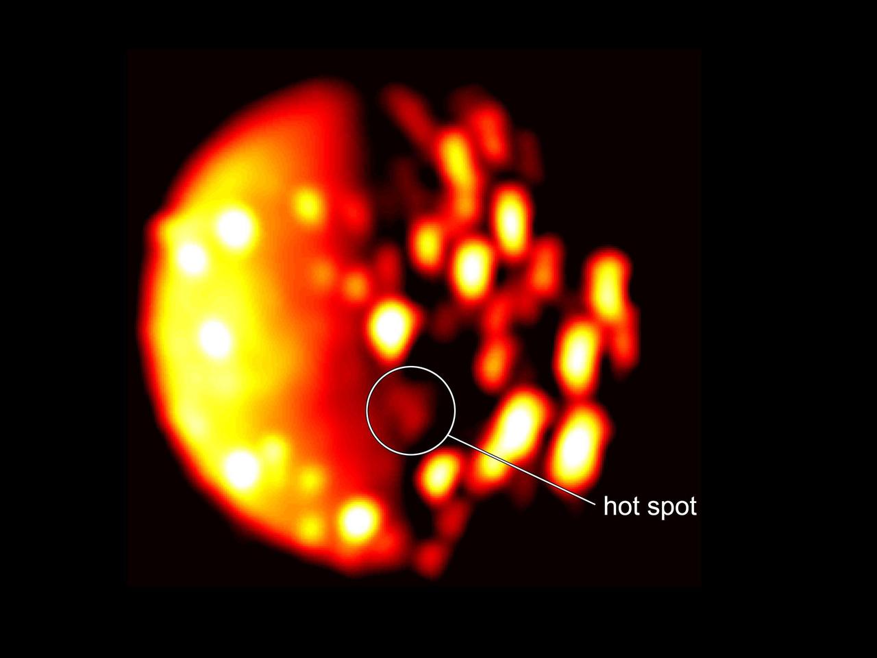
This annotated image highlights the location of the new heat source in the southern hemisphere of the Jupiter moon Io. The image was generated from data collected on Dec. 16, 2017, by the Jovian Infrared Auroral Mapper (JIRAM) instrument aboard NASA's Juno mission when the spacecraft was about 290,000 miles (470,000 kilometers) from the Jovian moon. In this infrared image, the brighter the color the higher the temperature recorded by JIRAM.   An animation is available at https://photojournal.jpl.nasa.gov/catalog/PIA22600
Io's New Southern Hemisphere Hotspot
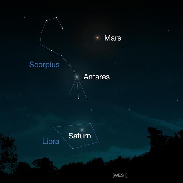
Comet Siding Spring will have a close approach to Mars on Oct. 19, 2014. This artist concept shows people in the Southern Hemisphere where to look for Mars in the night sky. Mars and the comet may be visible with binoculars.
View of Comet Siding Spring from Southern Hemisphere Artist Concept
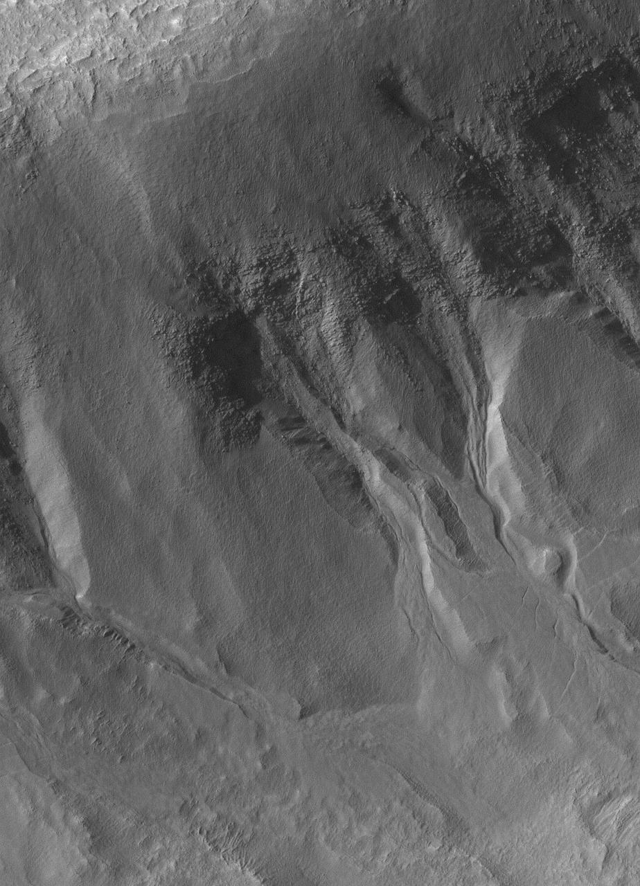
This image from NASA Mars Reconnaissance Orbiter shows the west-facing side of an impact crater in the mid-latitudes of Mars northern hemisphere. This crater has gullies along its walls that are composed of alcoves, channels and debris aprons.
Northern Hemisphere Gullies on West-Facing Crater Slope, Mars
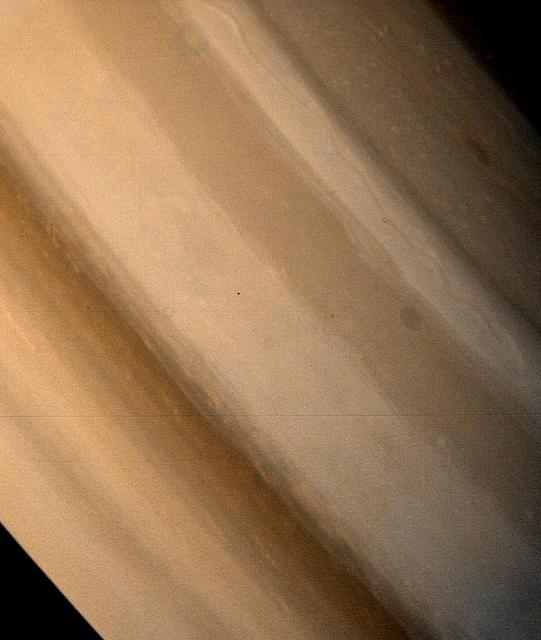
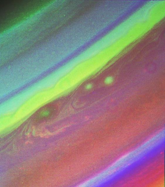
This false color picture of Saturn’s northern hemisphere was assembled from ultraviolet, violet and green images obtained Aug. 19 by Voyager 2 from a range of 7.1 million kilometers (4.4 million miles). The several weather patterns evident include three spots flowing westward at about 15 meters-per-second (33 mph). Although the cloud system associated with the western-most spot is part of this flow, the spot itself moves eastward at about 30 meters-per-second (65 mph). Their joint flow shows the anti-cyclonic rotation of the spot, which is about 3,000 km. (1,900 mi.) in diameter. The ribbon- like feature to the north marks a high-speed jet where wind speeds approach 150 meters-per-second (330 mph).  http://photojournal.jpl.nasa.gov/catalog/PIA01365
Saturn Northern Hemisphere
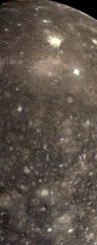
False color view of a portion of the leading hemisphere of Jupiter's moon Callisto as seen through the infrared filters of the Solid State Imaging (CCD) system aboard NASA's Galileo spacecraft. North is to the top of the picture and the sun illuminates the surface from the east. More recent impacts have excavated bright, relatively clean ice from beneath Callisto's battered surface. Callisto's dark mottled appearance may be due to contamination by non-ice components contributed by impactors or concentrated in a residue as ice is removed. This color composite image is centered on longitude 139 West and encompasses an area about 1000 miles (1600 kilometers) by 2470 miles (4000 kilometers). The images were obtained on November 3rd, 1996.  http://photojournal.jpl.nasa.gov/catalog/PIA01100
The Asgard Hemisphere of Callisto
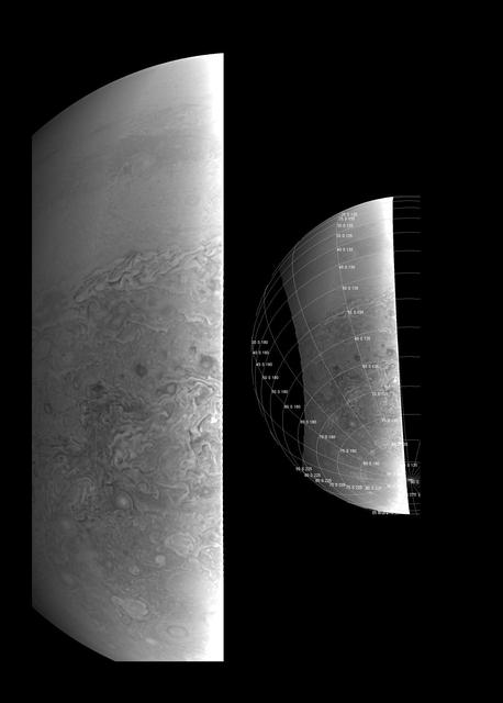
This image provides a close-up view of Jupiter's southern hemisphere, as seen by NASA's Juno spacecraft on August 27, 2016. The JunoCam instrument captured this image with its red spectral filter when the spacecraft was about 23,600 miles (38,000 kilometers) above the cloud tops.  The image covers an area from close to the south pole to 20 degrees south of the equator, centered on a longitude at about 140 degrees west. The transition between the banded structures near the equator and the more chaotic polar region (south of about 65 degrees south latitude) can be clearly seen.  The smaller version at right of this image shows the same view with a latitude/longitude grid overlaid.  This image has been processed to remove shading effects near the terminator -- the dividing line between day and night -- caused by Juno's orbit.  http://photojournal.jpl.nasa.gov/catalog/PIA21035
Southern Hemisphere Close-Up
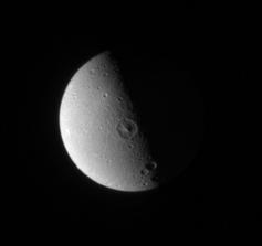
Dione leading hemisphere appears relatively smooth and placid here, compared to the fractured landscape on its trailing hemisphere
The Quiet Side
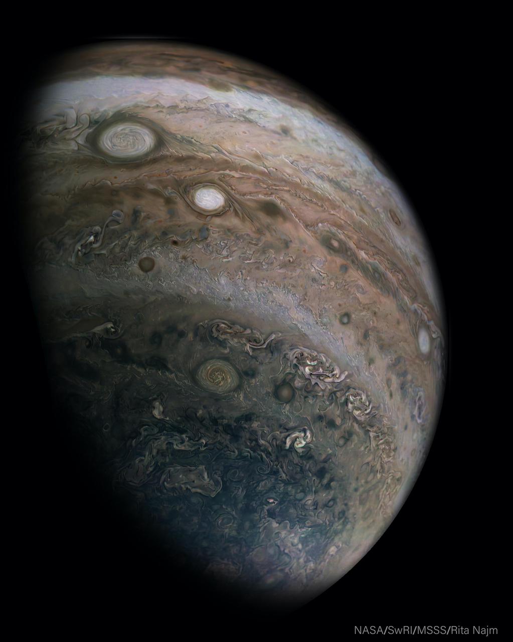
This image was captured by the JunoCam imager aboard NASA's Juno spacecraft on April 10, 2020, during the mission's 25th science pass of Jupiter. Oval BA, a large muddy circle of clouds near the upper-left of picture, is a storm approximately the same size as Earth. The bright storm below and to the right of Oval BA is one of Jupiter's "string of pearls" — massive counterclockwise rotating storms that appear as white ovals in the gas giant's southern hemisphere.  The original JunoCam image used to produce this view was taken from an altitude of about 400,000 miles (64,500 kilometers) above Jupiter's cloud tops. Citizen scientist Rita Najm processed the images to enhance the color and contrast.  Juno's elliptical orbit around Jupiter is evolving gradually as the perijove (closest approach) point moves farther north on each pass. Shorter closer views in the north are accompanied by a longer duration, more distant perspective, for viewing the southern hemisphere. These changes in perspective give us ever new views of this beautiful giant and its huge storms.  https://photojournal.jpl.nasa.gov/catalog/PIA24234
Southern Hemisphere Views