Acquired by NASA Terra spacecraft, this image shows the eastern end of the Gulf of Fonseca, in Honduras, originally the site of extensive wetlands ecosystem, dominated by six species of mangroves.
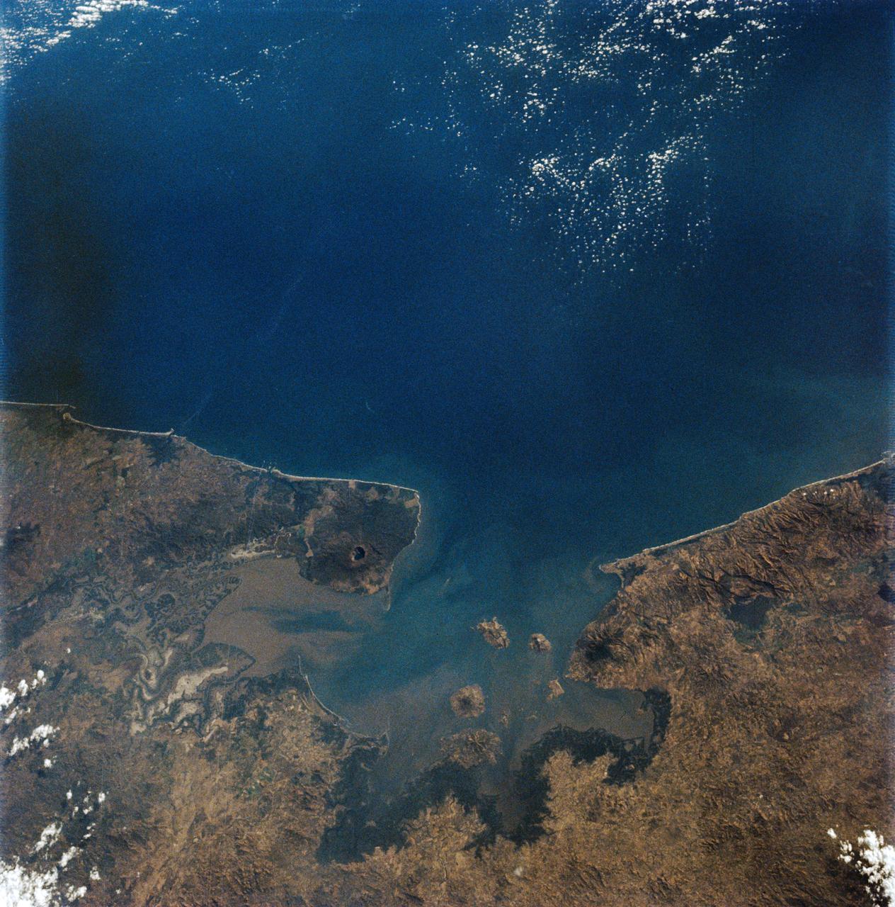
AS09-19-3019 (3-13 March 1969) --- Gulf of Fonseca, on the Pacific coast of Central America, as photographed from the Apollo 9 spacecraft during its Earth-orbital mission. The gulf is shared by the nations of El Salvador, Honduras, and Nicaragua. The prominent volcano on the peninsula in Nicaragua is Volcan Cosiguina.
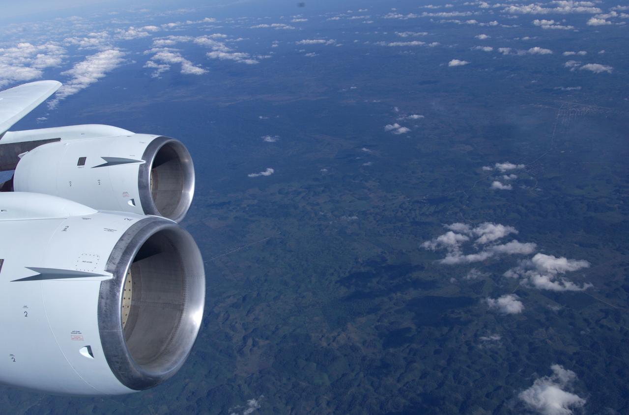
This is a photograph from the left side of the aircraft as NASA's DC-8 does an AirSAR 2004 research "line" over Honduras. AirSAR 2004 is a three-week expedition by an international team of scientists that will use an all-weather imaging tool, called the Airborne Synthetic Aperture Radar (AirSAR), in a mission ranging from the tropical rain forests of Central America to frigid Antarctica.
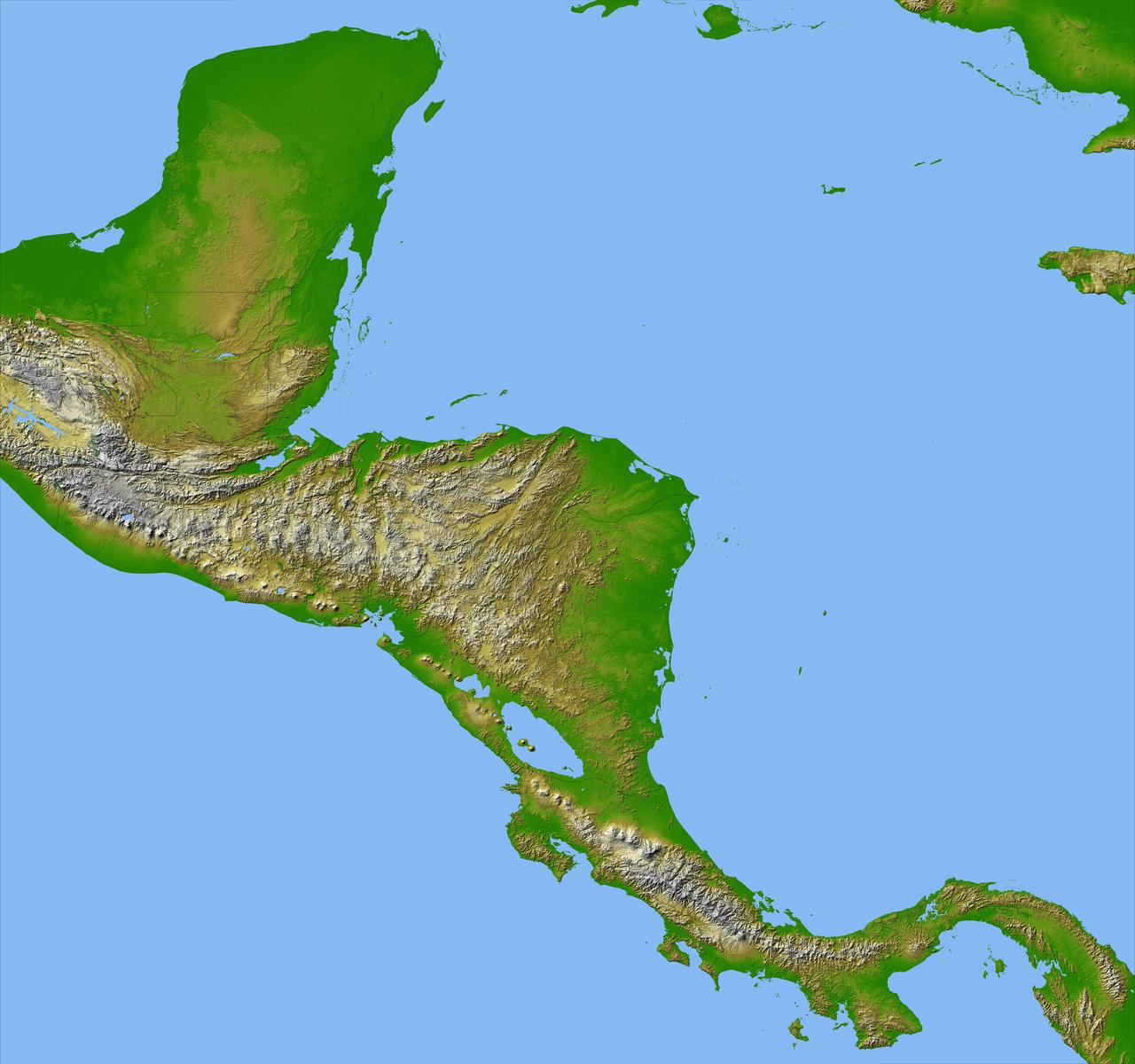
Panama, Costa Rica, Nicaragua, El Salvador, Honduras, Guatemala, Belize, southern Mexico and parts of Cuba and Jamaica are all seen in this image from NASA Shuttle Radar Topography Mission.
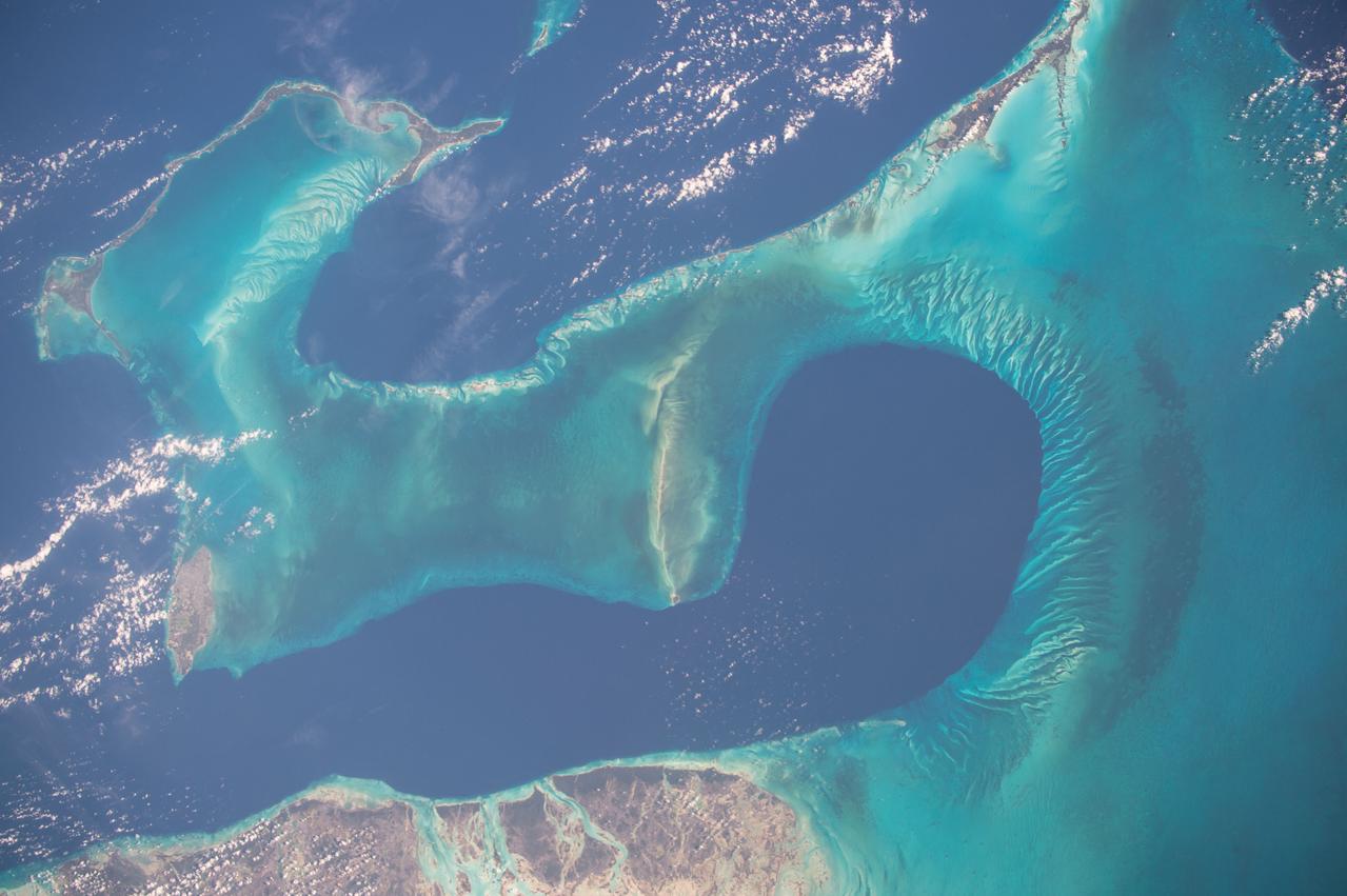
ISS042E070886 (12/23/2014) --- ESA astronaut Samantha Cristoforetti on the International Space Station captured this warm water image of the aquamarine and turquoise waters around the Bahamas down to the central American countries of Honduras and Nicaragua.
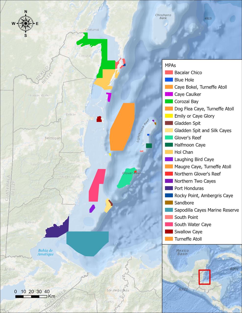
In a paper published in November 2022 in Frontiers in Remote Sensing, researchers at NASA's Jet Propulsion Laboratory, with colleagues in Belize, used data from the Moderate Resolution Imaging Spectroradiometer (MODIS) instrument aboard NASA's Aqua satellite to rank 24 protected marine areas off the Belizean coast based on the risks coral face from murky water and rising temperatures. All the areas are part of the 185-mile-long (298-kilometer-long) Belize Barrier Reef Reserve System, which encompasses a vibrant network of marine environments that supports thousands of animal and plant species and drives the Central American country's largest industry, tourism. The system is one of about 1,200 UNESCO World Heritage sites around the world. Analyzing imagery from 2002 to 2022, researchers developed a coral vulnerability index – a score between 2 and 12 that characterizes the risk to coral, with higher scores signifying greater risk. Their findings could help management authorities protect the reefs from human impacts such as development, overfishing, pollution, and climate change. Port Honduras Marine Reserve, a 156-square-mile (40,000-hectare) protected area in southern Belize, showed the highest coral vulnerability score: 10 out of 12. Based on the index, the study flags Port Honduras, Swallow Caye Wildlife Sanctuary, Sapodilla Cayes Marine Reserve, and Corozal Bay Wildlife Sanctuary as areas for concern. https://photojournal.jpl.nasa.gov/catalog/PIA25862
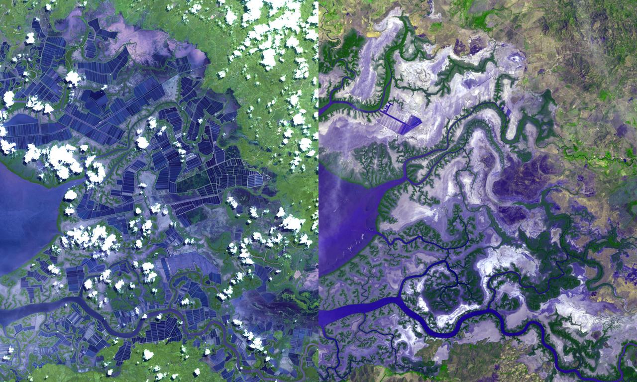
iss070e098305 (Feb. 23, 2023) --- This waterway, comprised of the Bahía de La Unión, Bahía de Chismuyo, Bahía de San Lorenzo, and the Gulf of Fonseca, is surrounded by the Latin American nations of El Salvador, Honduras, and Nicaragua. The International Space Station was orbiting off the coast of Nicaragua and 259 miles above the Pacific Ocean at the time of the photograph.
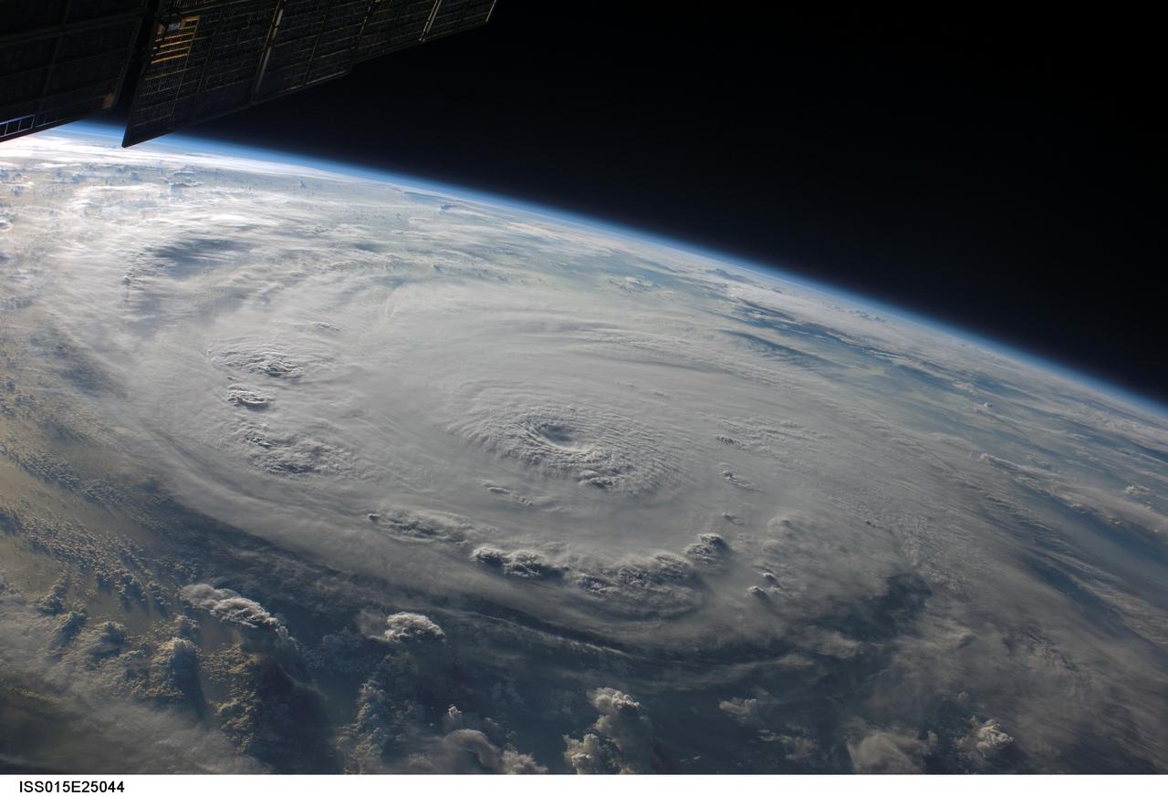
ISS015-E-25044 (3 Sept. 2007) --- This view of Hurricane Felix was taken from the Earth-orbiting International Space Station (ISS) by an Expedition 15 crewmember using a digital still camera equipped with a 28-70 mm lens set at 28 mm focal length on Sept. 3, 2007 at 11:38:29 GMT. The ISS was located at the nadir point of 16.0 degrees north latitude and 84.0 degrees west longitude nearly over the coast of eastern Honduras when this image was taken. At approximately noon GMT, Hurricane Felix was near 14.2 degrees north latitude and 76.9 degrees west longitude, about 260 miles (425 kilometers) south of Kingston Jamaica, and 425 miles (685 kilometers) east of Cabo Gracias a Dios on the Nicaragua/Honduras border, moving west at 21 miles per hour (33 kilometers per hour). The sustained winds were 165 miles per hour with higher gusts making it a category 5 on the Saffir-Simpson scale.

L59-1497-6 Maxime A. Faget was born in British Honduras in 1921, the son of an honored physician of the U.S. Public Health Service. In 1943 he earned a B.S. in mechanical engineering from Louisiana State University. After service as a navy submarine officer, he joined the Langley staff in 1946 as a member of the Pilotless Aircraft Research Division. His early work for PARD involved the invention of choking inlets for ramjets and a flight Mach meter. Photograph published in Engineer in Charge: A History of the Langley Aeronautical Laboratory, 1917-1958 by James R. Hansen. Page 379.
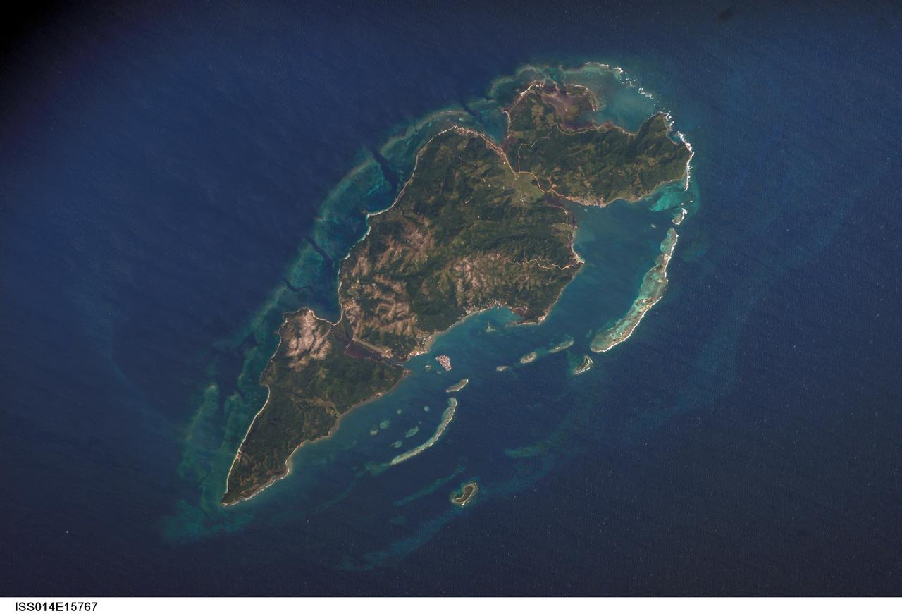
ISS014-E-15767 (1 March 2007) --- Guanaja Island, Honduras is featured in this image photographed by an Expedition 14 crewmember on the International Space Station. Guanaja Island is located along the southwestern margin of the Gulf of Mexico, approximately 60 kilometers north of mainland Honduras. The island is situated near the western edge of the Cayman Ridge, a topographic feature comprised of rock types indicative of ancient volcanic islands, sedimentary layers, and ocean crust. The Ridge formed as a result of tectonic interactions between the North American, South American, and Caribbean Plates. Guanaja and the nearby islands of Roatan and Utila (not shown) comprise the only portions of the western Cayman Ridge currently exposed above water. The island is also notable for its largely undeveloped character -- the exception being highly concentrated development on Bonacca Cay, a small island (roughly 0.5 kilometers by 0.3 kilometers) located along the southeastern coastline of the main island. The main island has little in the way of roads or other infrastructure -- a canal is the major means of traversing the island - making it an attractive destination for hikers and eco-tourists. The clear waters and reefs that almost completely encircle Guanaja also attract divers. In 1998, hurricane Mitch destroyed almost all (97 percent) of the island's mangrove forests, impacting coastal habitats and resulting in soil erosion. Regeneration of mangroves is slow and active reseeding efforts have been suggested as the only means to restore the forests.
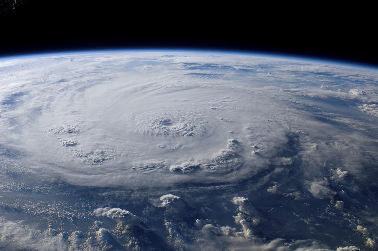
ISS015-E-25049 (3 Sept. 2007) --- This view of Hurricane Felix was taken from the Earth-orbiting International Space Station (ISS) by an Expedition 15 crewmember using a digital still camera equipped with a 28-70 mm lens set at 28 mm focal length on Sept. 3, 2007 at 11:38:46 GMT. The ISS was located at the nadir point of 16.9 degrees north latitude and 83.3 degrees west longitude, over the waters southwest of Grand Cayman Island. At approximately noon GMT, Hurricane Felix was near 14.2 degrees north latitude and 76.9 west longitude, about 260 miles (425 kilometers) south of Kingston Jamaica, and 425 miles (685 kilometers) east of Cabo Gracias a Dios on the Nicaragua/Honduras border, moving west at 21 miles per hour (33 kilometers per hour). The sustained winds were 165 miles per hour with higher gusts making it a category 5 on the Saffir-Simpson scale.
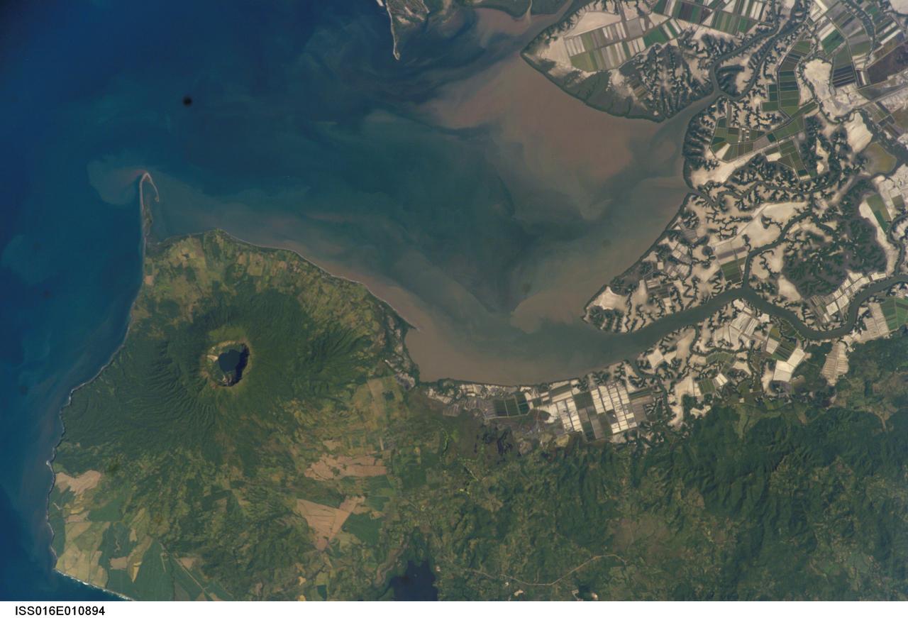
ISS016-E-010894 (17 Nov. 2007) --- Cosiguina Volcano, Nicaragua is featured in this image photographed by an Expedition 16 crewmember on the International Space Station. Three Central American countries (El Salvador, Honduras, and Nicaragua) include coastline along the Gulf of Fonseca that opens into the Pacific Ocean. The southern boundary of the Gulf is a peninsula formed by the Cosiguina volcano illustrated in this view. Cosiguina is a stratovolcano, typically tall cone-shaped structures formed by alternating layers of solidified lava and volcanic rocks (ash, pyroclastic flows, breccias) produced by explosive eruptions. The summit crater is filled with a lake (Laguna Cosiguina). The volcano last erupted in 1859, but its most famous activity occurred in 1835 when it produced the largest historical eruption in Nicaragua. Ash from the 1835 eruption has been found in Mexico, Costa Rica, and Jamaica. The volcano has been quiet since 1859, only an instant in terms of geological time. An earthquake swarm was measured near Cosiguina in 2002, indicating that tectonic forces are still active in the region although the volcano is somewhat isolated from the line of more recently active Central American volcanoes to the northwest and southeast. Intermittently observed gas bubbles in Laguna Cosiguina, and a hot spring along the eastern flank of the volcano are the only indicators of hydrothermal activity at the volcano. The fairly uniform vegetation cover (green) on the volcano's sides also attest to a general lack of gas emissions or "hot spots" on the 872 meter high cone, according to NASA scientists who study the photos downlinked from the orbital outpost.