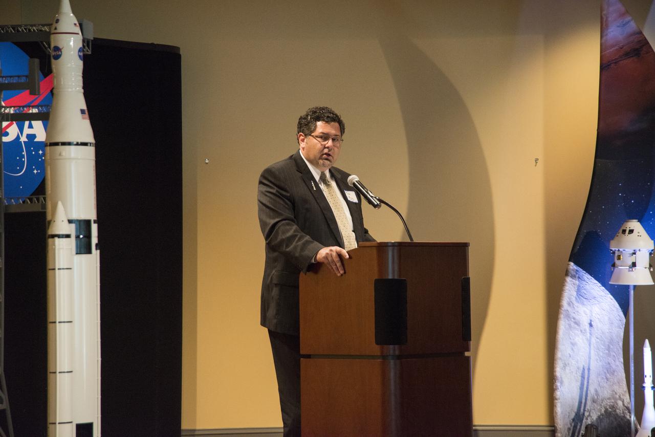
ROY MALONE, DIRECTOR, NASA MICHOUD ASSEMBLY FACILITY, ADDRESSES THE SMBA ESD-HUB ZONE EVENT AT THE HUNTSVILLE MUSEUM OF ART
DAVID BROCK, SMALL BUSINESS SPECIALIST AT MSFC, ADDRESSES THE ATTENDEES AT THE SMBA ESD-HUB ZONE EVENT AT THE HUNTSVILLE MUSEUM OF ART.
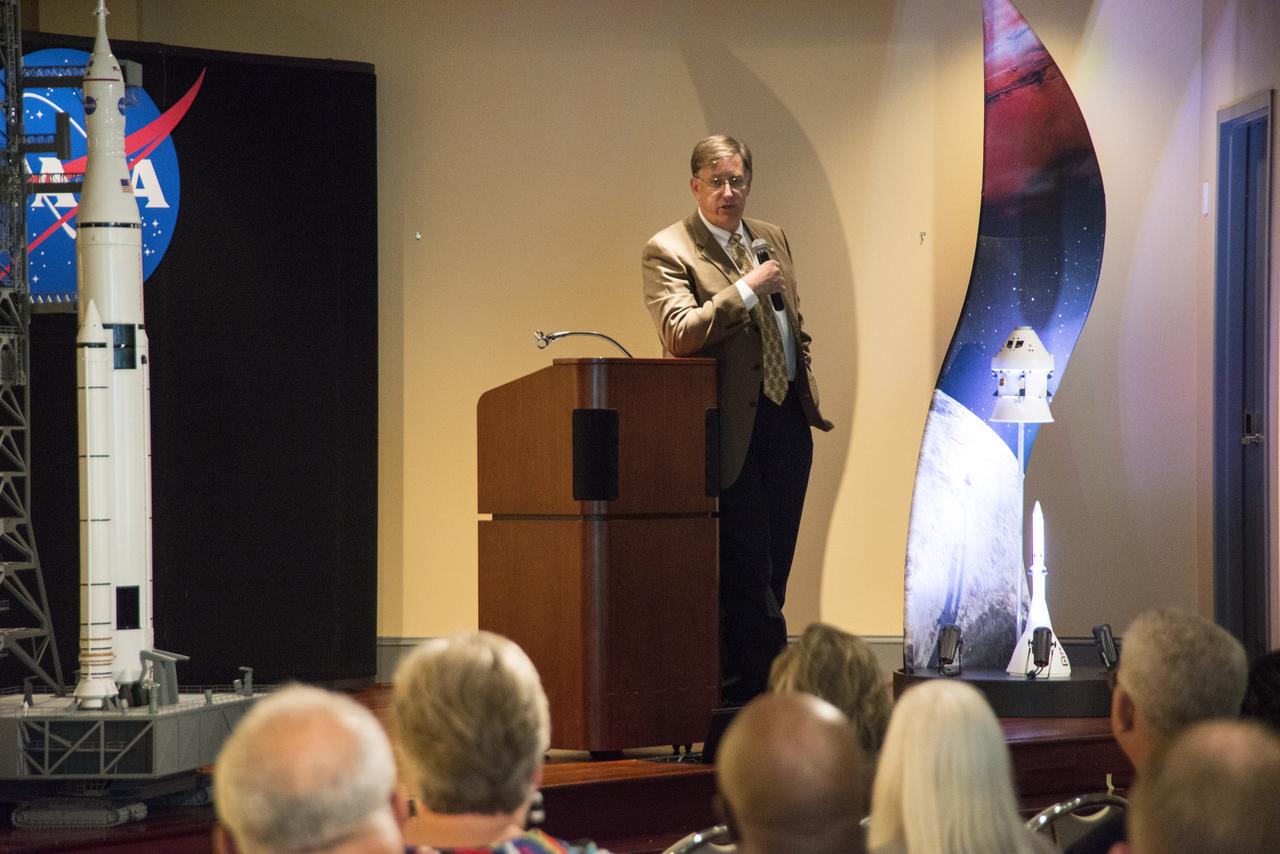
DAN DUMBACHER, DEPUTY ASSOCIATE ADMINISTRATOR FOR EXPLORATION SYSTEMS DEVELOPMENT, ADDRESSES THE SMBA ESD-HUB ZONE EVENT AT THE HUNTSVILLE MUSEUM OF ART.

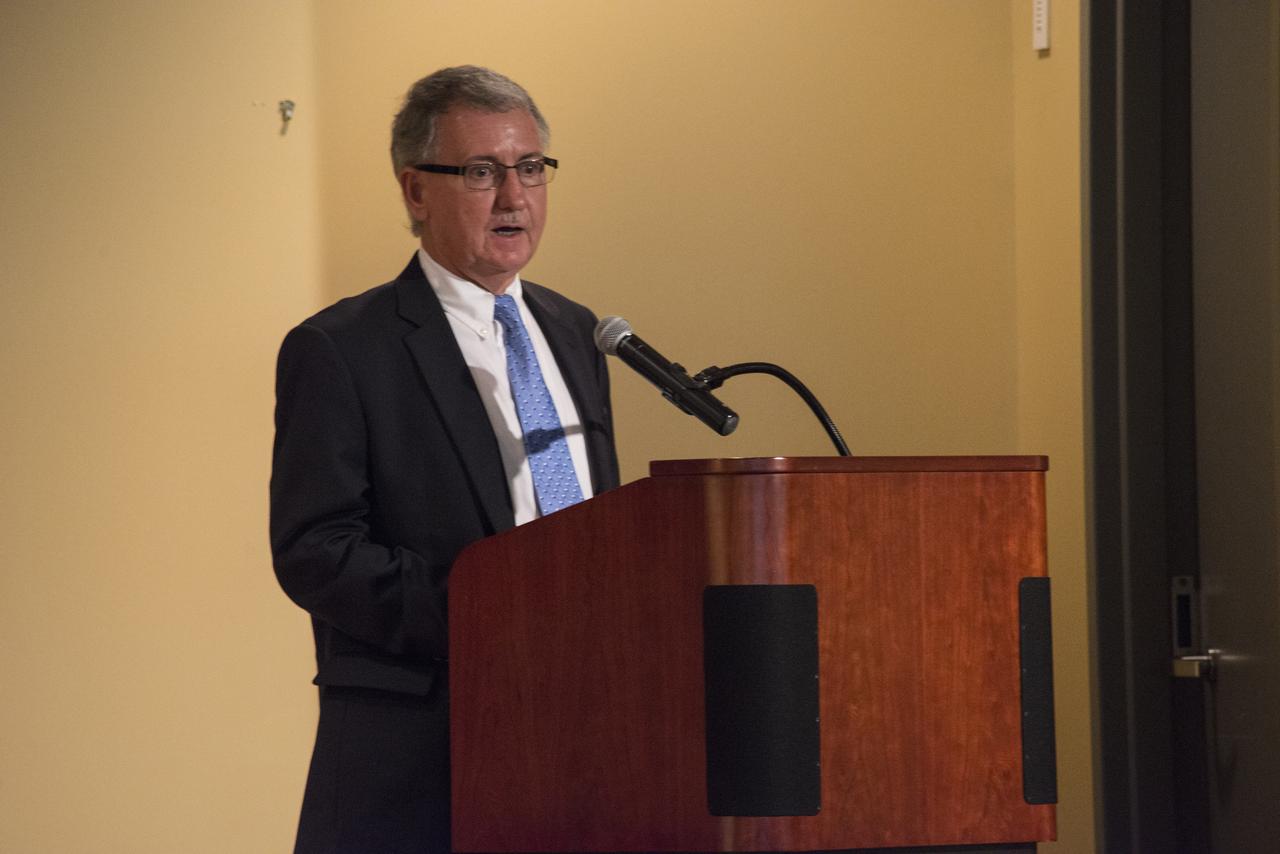
GLENN DELGADO, ASSOCIATE ADMINISTRATOR OFFICE OF SMALL BUSINESS PROGRAMS, NASA HQ, ADDRESSES THE ATTENDEES AT THE SMBA ESD-HUB ZONE EVENT AT THE HUNTSVILLE MUSEUM OF ART.

GLENN DELGADO, ASSOCIATE ADMINISTRATOR OFFICE OF SMALL BUSINESS PROGRAMS, NASA HQ, ADDRESSES THE ATTENDEES AT THE SMBA ESD-HUB ZONE EVENT AT THE HUNTSVILLE MUSEUM OF ART.
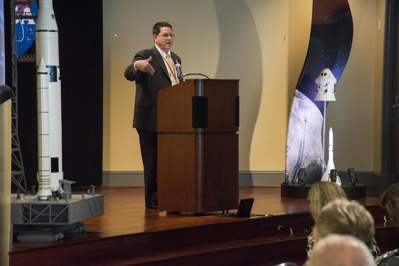
TODD MAY, PROGRAM MANAGER, SPACE LAUNCH SYSTEMS AT NASA, ADDRESSES THE SMBA ESD-HUB ZONE EVENT AT THE HUNTSVILLE MUSEUM OF ART.
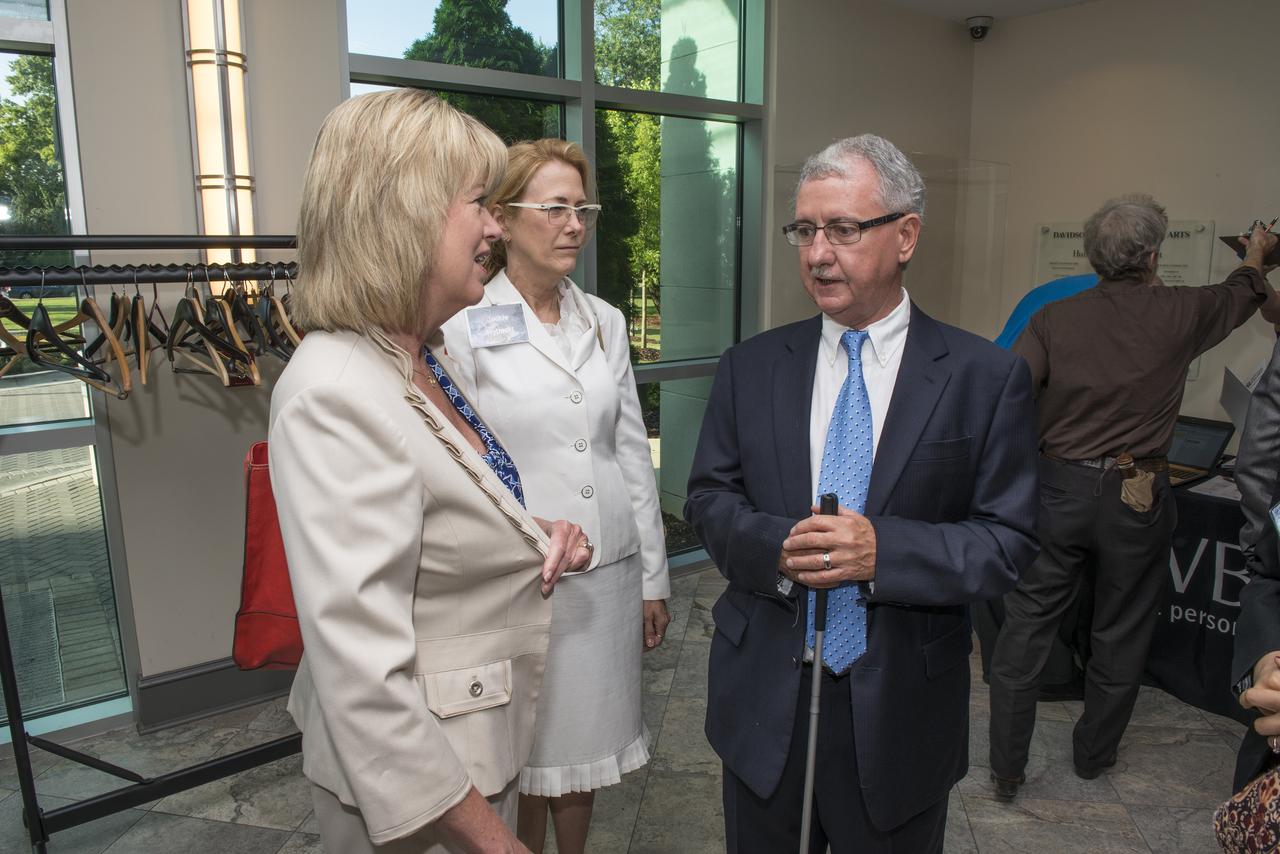
DAVID BROCK, SMALL BUSINESS SPECIALIST AT MSFC, TALKS WITH TERESA VANHOOSER AND JACKIE RYBACKI, AT THE SMBA ESD-HUB ZONE EVENT AT THE HUNTSVILLE MUSEUM OF ART.
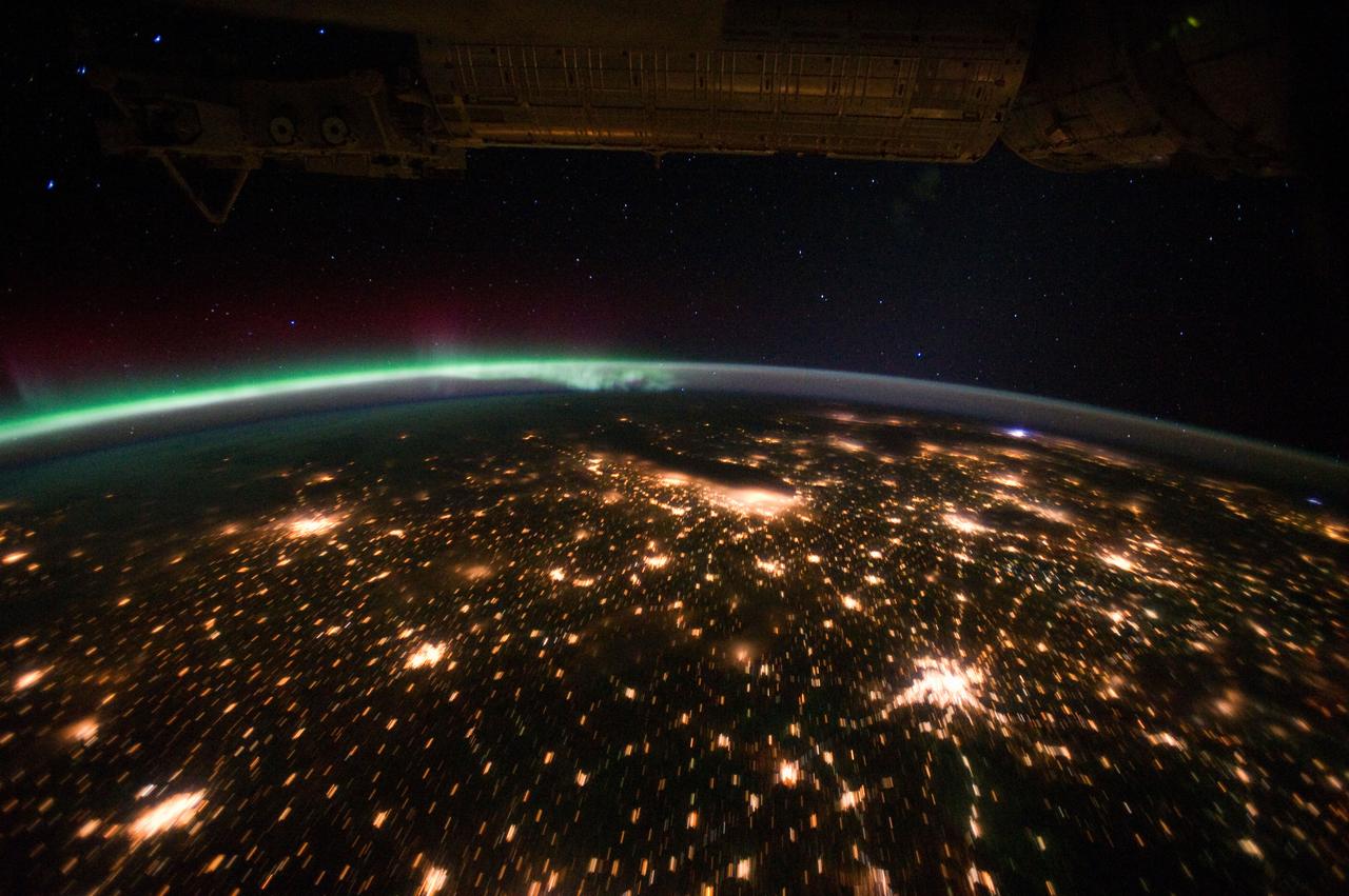
ISS029-E-012564 (29 Sept. 2011) --- The Midwestern United States at night with Aurora Borealis is featured in this image photographed by an Expedition 29 crew member on the International Space Station. The night skies viewed from the space station are illuminated with light from many sources. For example, the Midwestern United States presents a night-time appearance not unlike a patchwork quilt when viewed from orbit. The artificial light from human settlements appears everywhere with a characteristic yellow tinge in this photograph. But green light of the Aurora Borealis also appears strongly in this view (top left)—even seeming to be reflected off Earth’s surface—in Canada—beneath the aurora. A small white patch of light is almost certainly lightning from a storm on the East coast (top right). Part of the International Space Station appears across the top of the image. This photograph highlights the Chicago, IL, metropolitan area as the largest cluster of lights at center, next to the dark patch of Lake Michigan. The other largest metropolitan areas include St. Louis, MO (lower right), Minneapolis–St. Paul, MN (left) and the Omaha–Council Bluffs region on the Nebraska–Iowa border (lower left). City light clusters give an immediate sense of relative city size; demographers have used night time satellite imagery to make estimates of city populations, especially in the developing world where city growth can be very rapid. The U.S. northeast seaboard lies in the most oblique (meaning viewed at an angle) part of the image at top right, just beyond the Appalachian Mts., a dark winding zone without major cities. Scales change significantly in oblique views: Omaha is only 200 kilometers from Des Moines, but appears roughly the same distance from Minneapolis—which is actually 375 kilometers to the north of Des Moines. In addition to the major metropolitan areas, the rectangular NS/EW-oriented pattern of townships is clearly visible in the rural, lower left part of the image. This pattern instantly gives the sense of north orientation (toward the top left corner) and is a distinctive characteristic of the United States, so that ISS crew members can quickly know which continent they are flying over even at night. In contrast to the regular township pattern, interstate highways converge on St. Louis (e.g. Hwy 44), Chicago and other large cities, much like wheel spokes around a central hub. Rivers—major visual features in daylight—become almost invisible at night. The course of the Mississippi River appears as a slightly meandering zone from Minneapolis through St. Louis (dashed line)—the river course continues out of the lower right corner of the image.
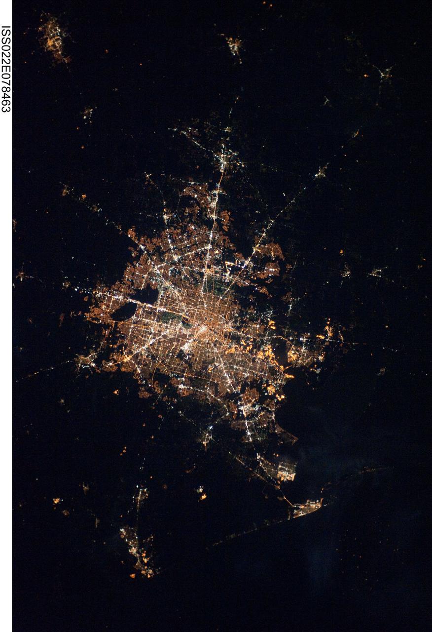
ISS022-E-078463 (28 Feb. 2010) ---The Houston metropolitan area at night is featured in this image photographed by an Expedition 22 crew member on the International Space Station. Houston, Texas has been called the ?energy capital of the world? due to its role as a major hub of the petroleum and other energy resource industries. The image is oriented with north toward the top. The Houston metropolitan area covers almost 2,331,000 hectares (approximately 9,000 square miles) along the southeast Texas coastline, with an average elevation of 13 meters (approximately 43 feet) above sea level and a population of over 5 million (2006 US Census estimate). The Houston metropolitan area is also noteworthy as being the largest in the US without formal zoning restrictions. This has lead to a highly diverse pattern of land use at the neighborhood scale; nevertheless, more general spatial patterns of land use can be recognized in remotely sensed data. This is particularly evident in night time photography of the urban area taken by crew members onboard the space station. The image depicts the roughly 100 kilometers (approximately 62 miles) east-west extent of the Houston metropolitan area. Houston proper is at center, indicated by a ?bull?s-eye? of elliptical white to orange-lighted beltways and brightly lit white freeways radiating outwards from the central downtown area. Suburban and primarily residential urban land use is indicated by both reddish-brown and gray-green lighted regions that reflect a higher proportion of tree cover and lower light density. Petroleum refineries along the Houston Ship Channel are recognized by densely lit areas of golden yellow light. Rural and undeveloped land circles the metropolitan area, and Galveston Bay to the southeast (lower right) provides access to the Gulf of Mexico. Both types of non-urban surface appear dark in the image.

In January 2013, a new Earth-observing instrument was installed on the International Space Station (ISS). ISERV Pathfinder consists of a commercial camera, a telescope, and a pointing system, all positioned to look through the Earth-facing window of ISS’s Destiny module. ISERV Pathfinder is intended as an engineering exercise, with the long-term goal of developing a system for providing imagery to developing nations as they monitor natural disasters and environmental concerns. The image above is the “first light” from the new ISERV camera system, taken at 1:44 p.m. local time on February 16, 2013. It shows the Rio San Pablo as it empties into the Golfo de Montijo in Veraguas, Panama. It is an ecological transition zone, changing from agriculture and pastures to mangrove forests, swamps, and estuary systems. The area has been designated a protected area by the National Environmental Authority (ANAM) of Panama and is listed as a “wetland of international importance” under the Ramsar Convention. (Note that the image is rotated so that north is to the upper right.) “ISERV’s full potential is yet to be seen, but we hope it will really make a difference in people’s lives,” said principal investigator Burgess Howell of NASA’s Marshall Space Flight Center. “For example, if an earthen dam gives way in Bhutan, we want to be able to show officials where the bridge is out or where a road is washed out or a power substation is inundated. This kind of information is critical to focus and speed rescue efforts.” The instrument will be controlled from NASA Marshall in Huntsville, Alabama, in collaboration with researchers at hubs in Central America, East Africa, and the Hindu Kush–Himalaya region. They will rely on positioning software to know where the space station is at each moment and to calculate the next chance to view a particular area on the ground. If there's a good viewing opportunity, the SERVIR team will instruct the camera to take high-resolution photographs at 3 to 7 frames per second, totaling as many as 100 images per pass. With a resolution down to 3.2 meters (10 feet), it will be possible to spot fairly small details and objects. The current mission will test the limitations of Pathfinder and identify measures for improvements in a more permanent system. For instance, the engineering team is working to determine how the geometry of the ISS window affects the imagery; how much sunlight is needed to capture clear images; and how the atmosphere affects that clarity. This characterization phase will last several weeks to a few months. Eventually, ISERV should be made available to the natural hazards community and to basic research scientists. ISERV is short for ISS SERVIR Environmental Research and Visualization system. Together with the U.S. Agency for International Development, NASA runs the SERVIR program to provide satellite data, maps, and other tools to environmental decisionmakers in developing countries. (Servir is a Spanish word meaning “to serve.”) Learn more about the SERVIR program by clicking here: <a href="https://servirglobal.net/Global.aspx" rel="nofollow">servirglobal.net/Global.aspx</a> NASA image by Burgess Howell, SERVIR Global program. Caption by Dauna Coulter, NASA Marshall Space Flight Center, and Mike Carlowicz, NASA Earth Observatory. Instrument: ISS - ISERV Pathfinder Credit: <b><a href="http://www.earthobservatory.nasa.gov/" rel="nofollow"> NASA Earth Observatory</a></b> - <a href="http://1.usa.gov/12Aqmg9" rel="nofollow">1.usa.gov/12Aqmg9</a> <b><a href="http://www.nasa.gov/audience/formedia/features/MP_Photo_Guidelines.html" rel="nofollow">NASA image use policy.</a></b> <b><a href="http://www.nasa.gov/centers/goddard/home/index.html" rel="nofollow">NASA Goddard Space Flight Center</a></b> enables NASA’s mission through four scientific endeavors: Earth Science, Heliophysics, Solar System Exploration, and Astrophysics. Goddard plays a leading role in NASA’s accomplishments by contributing compelling scientific knowledge to advance the Agency’s mission. <b>Follow us on <a href="http://twitter.com/NASA_GoddardPix" rel="nofollow">Twitter</a></b> <b>Like us on <a href="http://www.facebook.com/pages/Greenbelt-MD/NASA-Goddard/395013845897?ref=tsd" rel="nofollow">Facebook</a></b> <b>Find us on <a href="http://instagram.com/nasagoddard?vm=grid" rel="nofollow">Instagram</a></b>