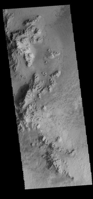
This image captured by NASA 2001 Mars Odyssey spacecraft shows part of the floor of Hale Crater. The mountains in the image are part of the elongated central peak of the crater.It is believed that Hale Crater was formed by an oblique impact, which caused it's more oval form and central peak elongation. Orbit Number: 66105 Latitude: -35.5732 Longitude: 323.646 Instrument: VIS Captured: 2016-11-07 23:04 http://photojournal.jpl.nasa.gov/catalog/PIA21192
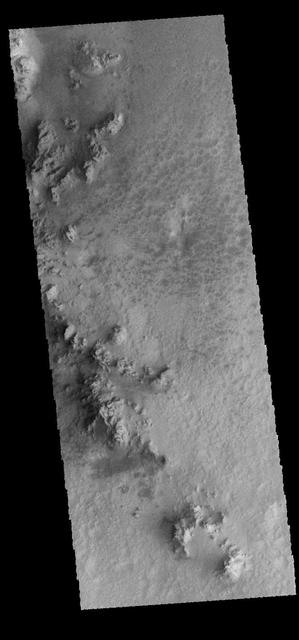
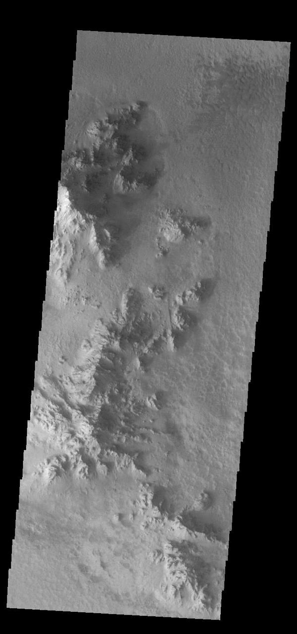
Rather than a central peak, Hale Crater contains a complex ridge of peaks. This image captured by NASA 2001 Mars Odyssey spacecraft shows a portion of the ridge. Orbit Number: 67402 Latitude: -35.7295 Longitude: 323.763 Instrument: VIS Captured: 2017-02-22 19:41 https://photojournal.jpl.nasa.gov/catalog/PIA21656
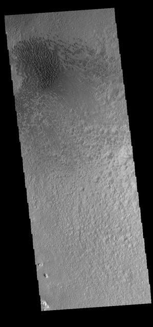
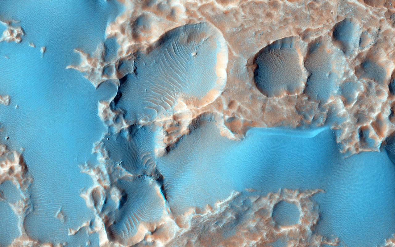
This image captured by NASA 2001 Mars Odyssey spacecraft shows a field of sand dunes on the floor of Hale Crater. Orbit Number: 66554 Latitude: -35.7883 Longitude: 323.039 Instrument: VIS Captured: 2016-12-14 22:52 http://photojournal.jpl.nasa.gov/catalog/PIA21301
Autumn Afternoon in Hale Crater
MSIP: Hale Crater

The THEMIS VIS camera contains 5 filters. The data from different filters can be combined in multiple ways to create a false color image. These false color images may reveal subtle variations of the surface not easily identified in a single band image. Today's false color image shows part of the interior of Hale Crater. Orbit Number: 51172 Latitude: -35.4704 Longitude: 323.425 Instrument: VIS Captured: 2013-06-27 11:08 http://photojournal.jpl.nasa.gov/catalog/PIA21292
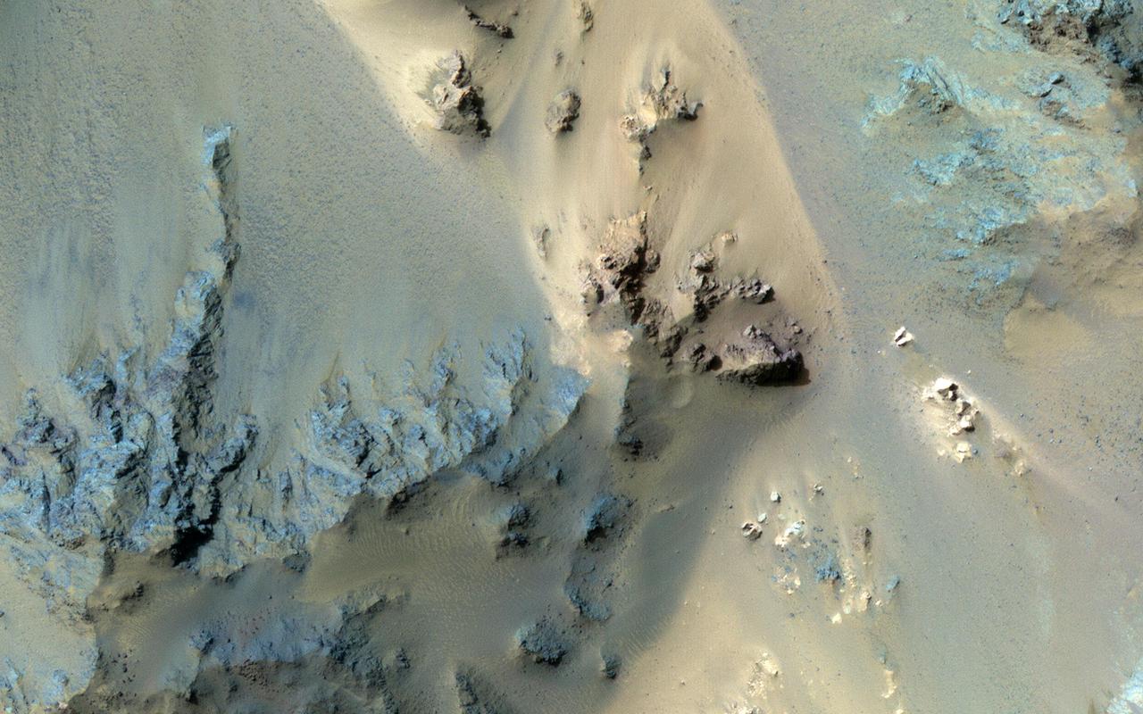
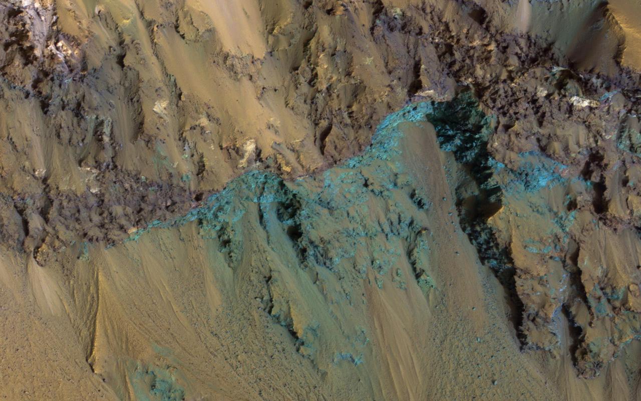
![Color from the High Resolution Imaging Science Experiment (HiRISE) instrument onboard NASA's Mars Reconnaissance Orbiter can show mineralogical differences due to the near-infrared filter. The sources of channels on the north rim of Hale Crater show fresh blue, green, purple and light toned exposures under the the overlying reddish dust. The causes and timing of activity in channels and gullies on Mars remains an active area of research. Geologists infer the timing of different events based on what are called "superposition relationships" between different landforms. Areas like this are a puzzle. The map is projected here at a scale of 25 centimeters (9.8 inches) per pixel. [The original image scale is 25.2 centimeters (9.9 inches) per pixel (with 1 x 1 binning); objects on the order of 76 centimeters (29.9 inches) across are resolved.] North is up. https://photojournal.jpl.nasa.gov/catalog/PIA21586](https://images-assets.nasa.gov/image/PIA21586/PIA21586~medium.jpg)
Color from the High Resolution Imaging Science Experiment (HiRISE) instrument onboard NASA's Mars Reconnaissance Orbiter can show mineralogical differences due to the near-infrared filter. The sources of channels on the north rim of Hale Crater show fresh blue, green, purple and light toned exposures under the the overlying reddish dust. The causes and timing of activity in channels and gullies on Mars remains an active area of research. Geologists infer the timing of different events based on what are called "superposition relationships" between different landforms. Areas like this are a puzzle. The map is projected here at a scale of 25 centimeters (9.8 inches) per pixel. [The original image scale is 25.2 centimeters (9.9 inches) per pixel (with 1 x 1 binning); objects on the order of 76 centimeters (29.9 inches) across are resolved.] North is up. https://photojournal.jpl.nasa.gov/catalog/PIA21586
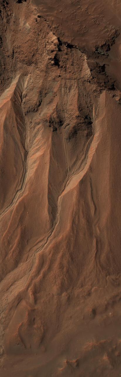
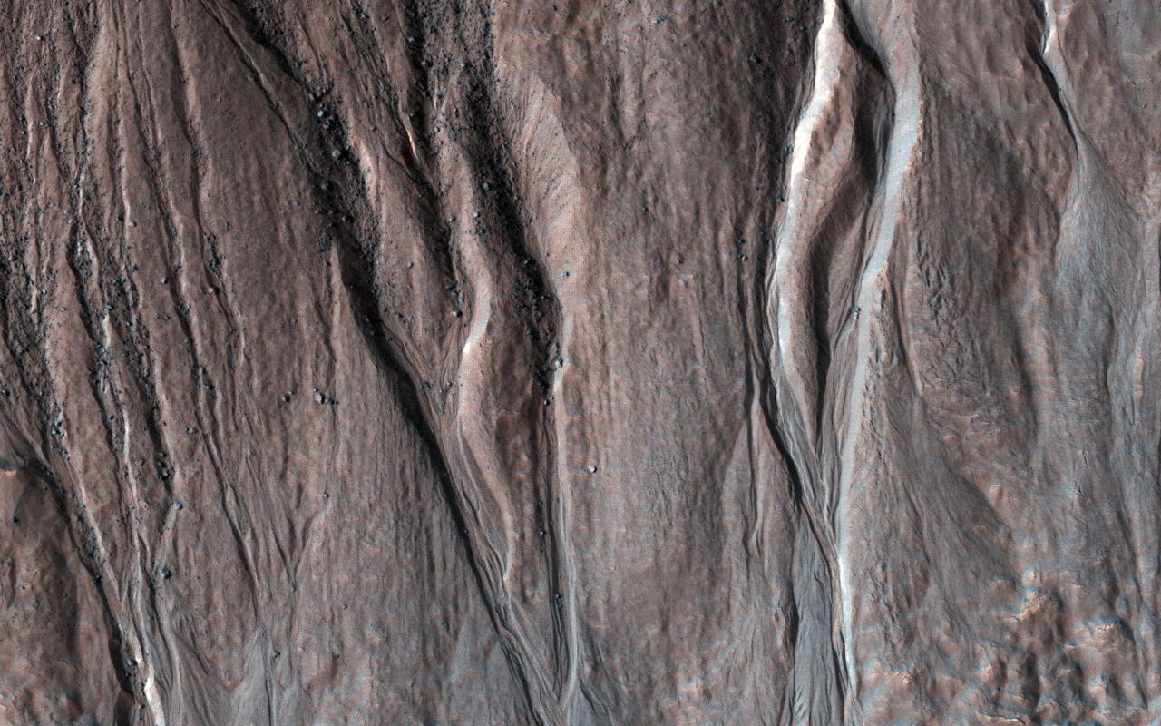
This image from the High Resolution Imaging Science Experiment (HiRISE) camera on NASA's Mars Reconnaissance Orbiter shows gullies near the edge of Hale crater on southern Mars. The view covers an area about 1 kilometer (0.6 mile) across and was taken on Aug. 3, 2009. Martian gullies carved into hill slopes and the walls of impact craters were discovered several years ago. Scientists are excited to study these features because, on Earth, they usually form through the action of liquid water -- long thought to be absent on the Martian surface. Whether liquid water carves gullies under today's cold and dry conditions on Mars is a major question that planetary scientists are trying to answer. The gullies pictured here are examples of what a typical Martian gully looks like. You can see wide V-shaped channels running downhill (from top to bottom) where the material that carved the gully flowed. At the bottom of the channel this material empties out onto a fan-shaped mound. The fans from each gully overlap one other in complicated ways. At the tops of the channels, large amphitheater-shaped alcoves are carved in the rock. The material removed from these alcoves likely flowed downhill to the aprons through the gullies. The terrain in this image is at 36.5 degrees south latitude, 322.7 degrees east longitude. Gullies at this site are especially interesting because scientists recently discovered actively changing examples at similar locations. Images separated by several years showed changes in the appearance of some of these gullies. Today, planetary scientists are using the HiRISE camera to examine gullies such as the one in this image for change that might provide a clue about whether liquid water occurs on the surface of Mars. http://photojournal.jpl.nasa.gov/catalog/PIA12194

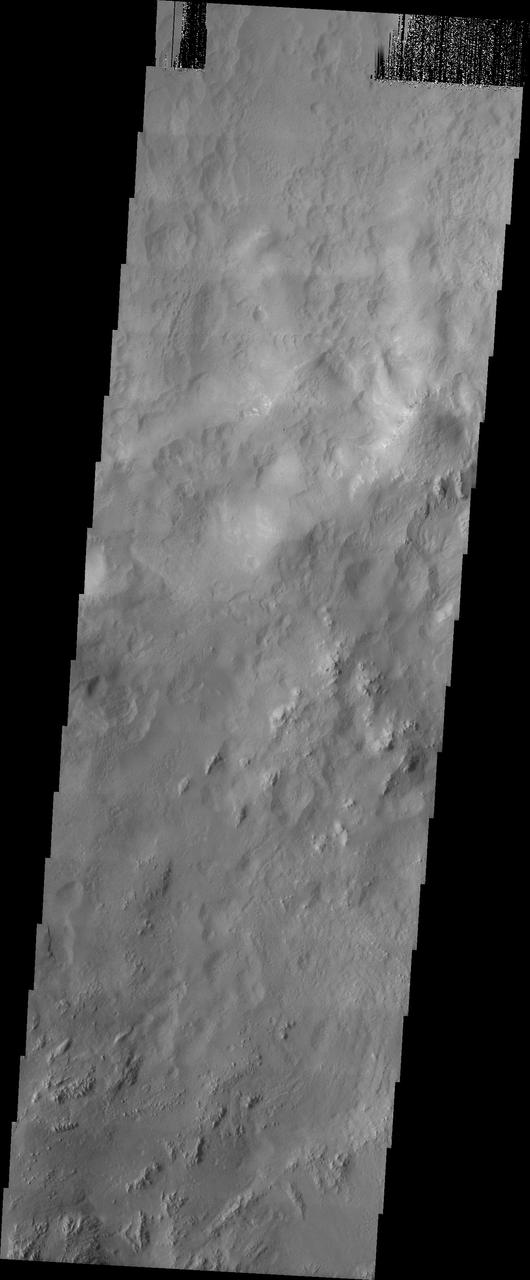
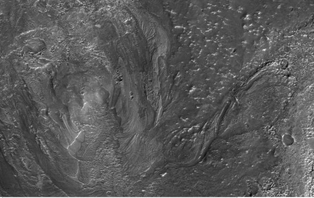
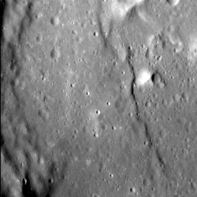
Today's VIS image shows part of the floor of Hale Crater and the elongate axis of the central peak mountains. Hale Crater is an example of an oblique impact crater. The mountain chain trends from the southeast towards the northwest, increasing in height towards the northwest. The incoming meteor struck the surface along this trend, forming an oval crater and displacing the impact energy forward to create the central mountain range. Hale Crater is located near the northern part of Argye Plainitia. Orbit Number: 74954 Latitude: -35.5134 Longitude: 323.598 Instrument: VIS Captured: 2018-11-06 22:53 https://photojournal.jpl.nasa.gov/catalog/PIA22994
Today's VIS image shows part of the floor of Hale Crater and the elongate axis of the central peak mountains. Hale Crater is an example of an oblique impact crater. The mountain chain trends from the southeast towards the northwest, increasing in height towards the northwest. The incoming meteor struck the surface along this trend, forming an oval crater and displacing the impact energy forward to create the central mountain range. Hale Crater is located near the northern part of Argye Plainitia. Orbit Number: 91600 Latitude: -35.5357 Longitude: 323.628 Instrument: VIS Captured: 2022-08-08 14:50 https://photojournal.jpl.nasa.gov/catalog/PIA25609
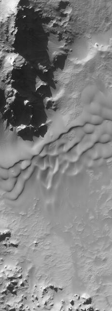
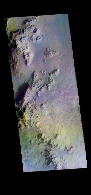
This long image is entirely over the extensive central peak complex of Hale Crater. Of particular interest are bedrock outcrops and associated fine-grained sediments with different colors. This 153-kilometer diameter crater was named after American astronomer George Ellery Hale. https://photojournal.jpl.nasa.gov/catalog/PIA23101
This image from NASA Mars Reconnaissance Orbiter, shows channels to the southeast of Hale crater on southern Mars. Channels associated with impact craters were once thought to be quite rare.
This false color image shows part of the floor of Hale Crater and the elongate axis of the central peak mountains. Hale Crater is an example of an oblique impact crater. The mountain chain trends from the southeast towards the northwest, increasing in height towards the northwest. The incoming meteor struck the surface along this trend, forming an oval crater and displacing the impact energy forward to create the central mountain range. Hale Crater is 150 km x 125 km in diameter (93 miles x 77 miles) and is located near the northern part of Argye Plainitia. The THEMIS VIS camera contains 5 filters. The data from different filters can be combined in multiple ways to create a false color image. These false color images may reveal subtle variations of the surface not easily identified in a single band image. Orbit Number: 66105 Latitude: -35.5732 Longitude: 323.646 Instrument: VIS Captured: 2016-11-07 23:04 https://photojournal.jpl.nasa.gov/catalog/PIA23626
The pits visible in this image from NASA Mars Reconnaissance Orbiter arent impact craters. The material they are embedded into is ejecta stuff thrown out of an impact crater when it forms from a large crater called Hale not seen in this image. Substances called "volatiles" -- which can explode as gases when they're quickly warmed by the immense heat of an impact-exploded out of the ejecta and caused these pits. Unrelated sand dunes near the top of the image have since blown over portions of the pits. http://photojournal.jpl.nasa.gov/catalog/PIA19289
NASA Mars Reconnaissance Orbiter observes the southeast rim of Hale Crater, about 150 kilometers 90 miles in diameter and located in the mid-southern latitudes just north of the massive Argyre basin. RSL are often found on northwest-facing slopes, and they occur in the central peak of Hale. During the season when we know RSL appear, this observation at high resolution might help us see if they occur elsewhere. http://photojournal.jpl.nasa.gov/catalog/PIA19176
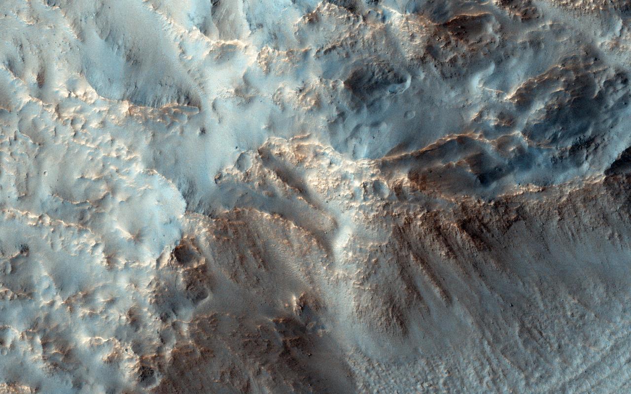
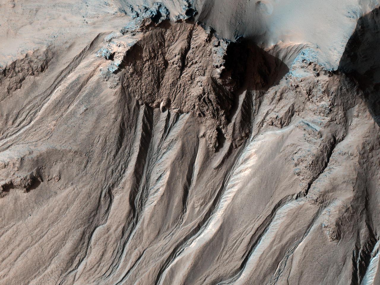
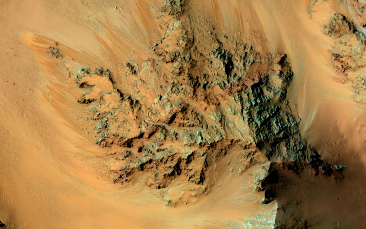
This observation from NASA Mars Reconnaissance Orbiter shows the central hills in Hale Crater with thousands of seasonal flows on steep slopes below bedrock outcrops.
This image from NASA's Mars Reconnaissance Orbiter (MRO) shows Hale Crater, a large impact crater (more than 100 kilometers) with a suite of interesting features such as active gullies, active recurring slope lineae, and extensive icy ejecta flows. There are also exposed diverse (colorful) bedrock units. https://photojournal.jpl.nasa.gov/catalog/PIA22465
This image from NASA Mars Reconnaissance Orbiter shows the southern latitude Hale Crater, a rather large, pristine elliptical crater possessing sharp features, impact melt bodies ponded throughout the structure and few overprinting impact craters.
This false color image shows sand dunes on the floor of Hale Crater. This 150 km x 125 km (93 miles x 77 miles) crater is located north of Argyre Planitia. Dark blue in this false color combination usually indicates basaltic sand. The THEMIS VIS camera contains 5 filters. The data from different filters can be combined in multiple ways to create a false color image. These false color images may reveal subtle variations of the surface not easily identified in a single band image. Orbit Number: 66554 Latitude: -35.7883 Longitude: 323.039 Instrument: VIS Captured: 2016-12-14 22:52 https://photojournal.jpl.nasa.gov/catalog/PIA23629
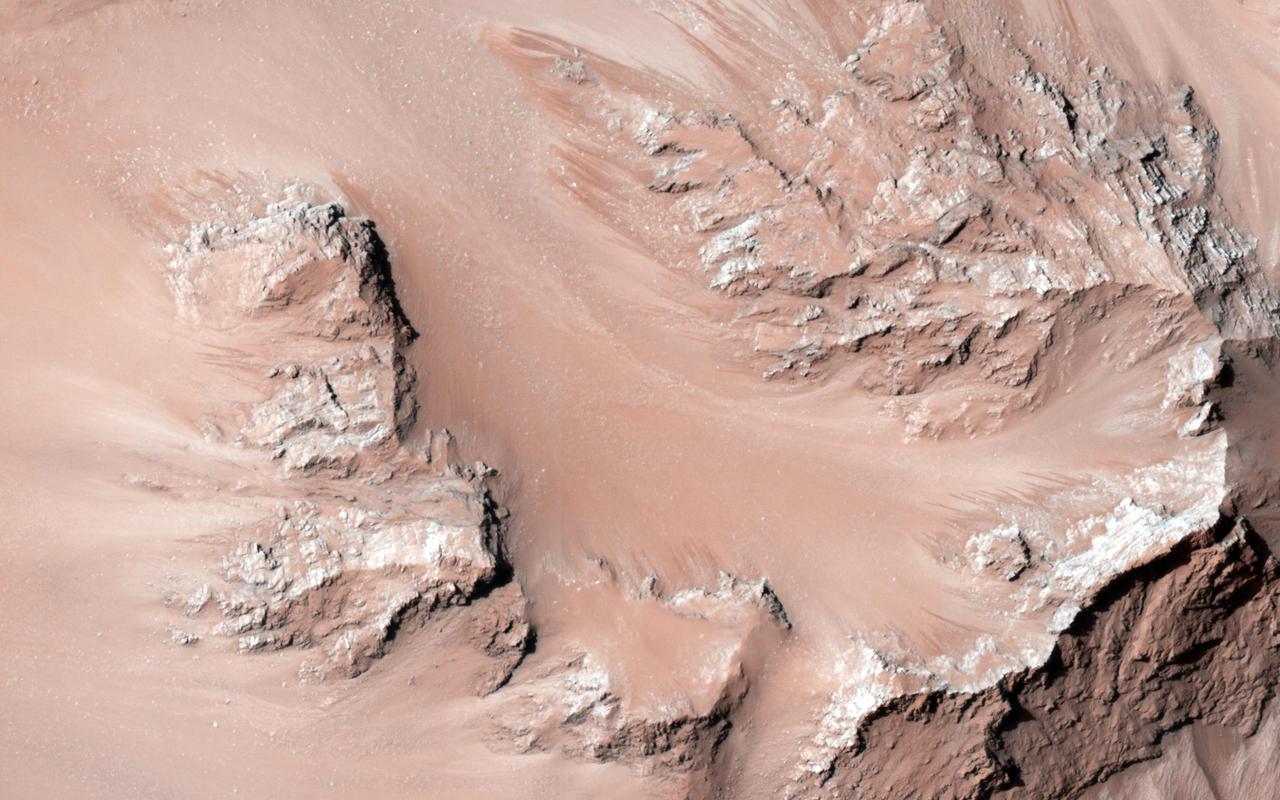
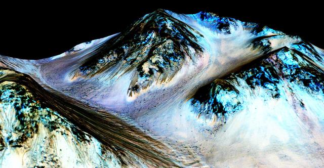
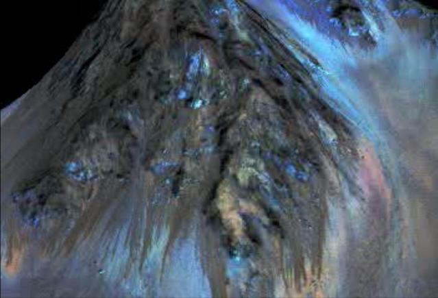
Recurring slope lineae are active flows on warm Martian slopes that might be caused by seeping water. One of the most active sites known is in the central peaks of Hale Crater as seen by NASA Mars Reconnaissance Orbiter. This image shows RSL extending downhill from bedrock cliffs, mostly towards the northwest (upper left). This image was acquired in middle summer when RSL are most active in the southern mid latitudes. The RSL in Hale have an unusually "reddish" color compared to most RSL, perhaps due to oxidized iron compounds, like rust. Since HiRISE color is shifted to infra-red wavelengths, they are actually especially bright the near-infrared just beyond the range of human vision. The Hale RSL are also unusual because they began activity much earlier than most RSL sites in the middle southern latitudes, and were well-developed in the early spring (see ESP_038073_1440). If seeping water causes RSL in Hale crater, it must be rich in salts to lower its freezing point significantly below the freezing point of pure water. http://photojournal.jpl.nasa.gov/catalog/PIA19359
Dark, narrow streaks on Martian slopes such as these at Hale Crater are inferred to be formed by seasonal flow of water on contemporary Mars. The streaks are roughly the length of a football field. The imaging and topographical information in this processed, false-color view come from the High Resolution Imaging Science Experiment (HiRISE) camera on NASA's Mars Reconnaissance Orbiter. These dark features on the slopes are called "recurring slope lineae" or RSL. Planetary scientists using observations with the Compact Reconnaissance Imaging Spectrometer on the same orbiter detected hydrated salts on these slopes at Hale Crater, corroborating the hypothesis that the streaks are formed by briny liquid water. The image was produced by first creating a 3-D computer model (a digital terrain map) of the area based on stereo information from two HiRISE observations, and then draping a false-color image over the land-shape model. The vertical dimension is exaggerated by a factor of 1.5 compared to horizontal dimensions. The camera records brightness in three wavelength bands: infrared, red and blue-green. The draped image is one product from HiRISE observation ESP_03070_1440. http://photojournal.jpl.nasa.gov/catalog/PIA19916
This image shows material almost completely filling an impact crater to the northeast of Hale Crater, perhaps water-rich ejecta from Hale itself. There is a pattern of fractures at two scales and many small cones. There are lots of strange terrains surrounding Hale Crater, perhaps the youngest impact crater on Mars larger than 100 kilometers in diameter. The body that hit Mars, creating Hale, may have impacted ice-rich ground. https://photojournal.jpl.nasa.gov/catalog/PIA24618
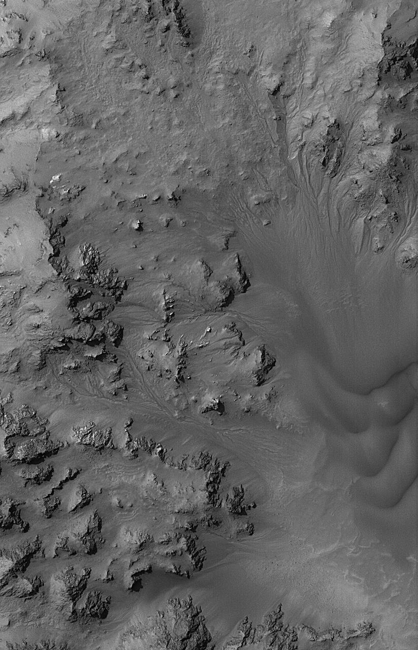
This MOC image shows dried streambeds -- martian gullies -- in the mountainous central peak region of Hale Crater
This observation from NASA Mars Reconnaissance Orbiter shows the central hills in Hale Crater with thousands of seasonal flows on steep slopes below bedrock outcrops.
This frame from an animation simulates a fly-around look at one of the places on Mars where dark streaks advance down slopes during warm seasons, possibly involving liquid water. The streaks are roughly the length of a football field. The imaging and topographical information used in this false-color animation come from the High Resolution Imaging Science Experiment (HiRISE) camera on NASA's Mars Reconnaissance Orbiter. These dark features on the slopes are called "recurring slope lineae" or RSL. Planetary scientists using observations with the Compact Reconnaissance Imaging Spectrometer on the same orbiter detected hydrated salts on these slopes at Hale Crater, corroborating the hypothesis that the streaks are formed by briny liquid water. The image was produced by first creating a 3-D computer model (a digital terrain map) of the area based on stereo information from two HiRISE observations, and then draping a false-color image over the land-shape model. The vertical dimension is exaggerated by a factor of 1.5 compared to horizontal dimensions. http://photojournal.jpl.nasa.gov/catalog/PIA19919
This image shows (part of) a 6-kilometer crater located on the northern slope of Bond Crater. Pole-facing gullies have eroded the northern slope of this small crater, located just west of where Uzboi Valles emanates from Bond and continues in a northerly direction. However, Hale Crater to the south has numerous gullies on its slopes and even on its central peak region. Researchers have analyzed both Bond and Hale Craters to try to determine why Bond has no gullies on its slopes, except for a small 7-km crater on the floor in its central area. (Reiss et al., 2009, PSS). The gullies in this observation have eroded into bedrock layers forming tributaries in the upper slope region and distributary channels further downslope on the debris fans. Research attributes these features to fluvial processes. (Gulick et al., 2018, Geol. Soc. London.) https://photojournal.jpl.nasa.gov/catalog/PIA25504

The THEMIS VIS camera contains 5 filters. The data from different filters can be combined in multiple ways to create a false color image. These false color images may reveal subtle variations of the surface not easily identified in a single band image. Today's false color image shows the plains between Hale Crater and Argyre Planitia. Orbit Number: 8815 Latitude: -37.2509 Longitude: 323.023 Instrument: VIS Captured: 2003-12-10 04:12 http://photojournal.jpl.nasa.gov/catalog/PIA19737
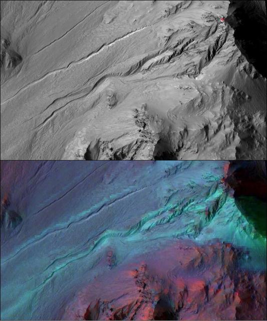
The highly incised Martian gullies seen in the top image resemble gullies on Earth that are carved by liquid water. However, when the gullies are observed with the addition of mineralogical information (bottom), no evidence for alteration by water appears. The pictured area spans about 2 miles (3 kilometers) on the eastern rim of Hale Crater. The High Resolution Imaging Science Experiment (HiRISE) camera on NASA's Mars Reconnaissance Orbiter took the visible-light image. Color-coded compositional information added in the lower version comes from the same orbiter's Compact Reconnaissance Imaging Spectrometer for Mars (CRISM). Color coding in light blue corresponds to surface composition of unaltered mafic material, of volcanic origin. Mafic material from the crater rim is carved and transported downslope along the gully channels. No hydrated minerals are observed within the gullies, in the data from CRISM, indicating limited interaction or no interaction of the mafic material with liquid water. These findings and related observations at about 100 other gully sites on Mars suggest that a mechanism not requiring liquid water may be responsible for carving these gullies on Mars. (Gullies on Mars are a different type of feature than seasonal dark streaks called recurring slope lineae or RSL; water in the form of hydrated salt has been identified at RSL sites.) The HiRISE image is a portion of HiRISE observation PSP_002932_1445. The lower image is from the same HiRISE observation, with a CRISM mineral map overlaid. http://photojournal.jpl.nasa.gov/catalog/PIA20763