Hebrus Valles
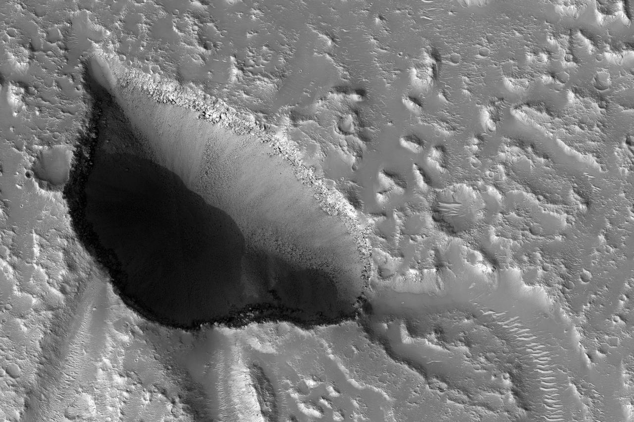
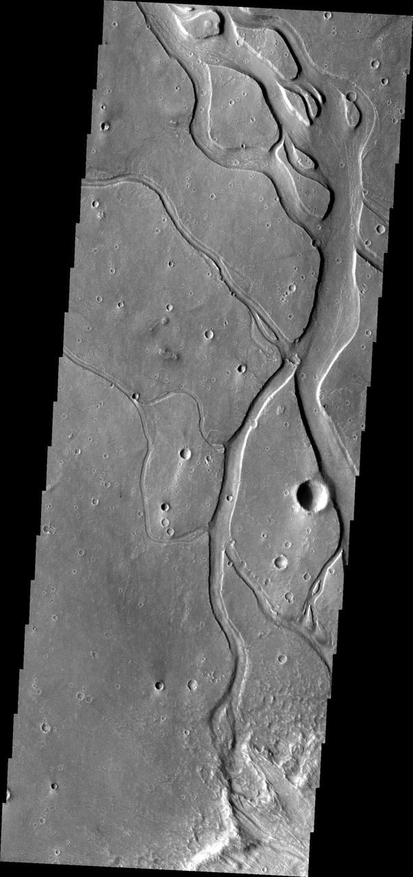
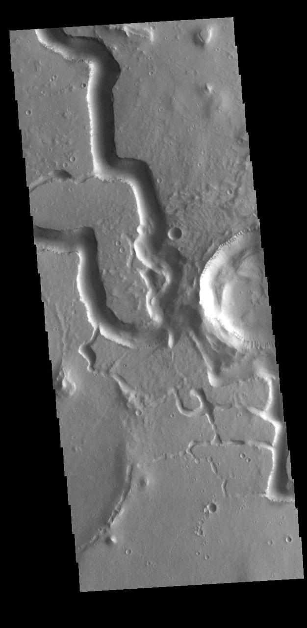
The drainages in this image are part of Hebrus Valles, an outflow channel system likely formed by catastrophic floods. Hebrus Valles is located in the plains of the Northern lowlands, just west of the Elysium volcanic region. Individual channels range from several hundred meters to several kilometers wide and form multi-threaded (anastamosing) patterns. Separating the channels are streamlined forms, whose tails point downstream and indicate that channel flow is to the north. The channels seemingly terminate in an elongated pit that is approximately 1875 meters long and 1125 meters wide. Using the shadow that the wall has cast on the floor of the pit, we can estimate that the pit is nearly 500 meters deep. The pit, which formed after the channels, exposes a bouldery layer below the dusty surface mantle and is underlain by sediments. Boulders several meters in diameter litter the slopes down into the pit. Pits such as these are of interest as possible candidate landing sites for human exploration because they might retain subsurface water ice (Schulze-Makuch et al. 2016, 6th Mars Polar Conf.) that could be utilized by future long-term human settlements. http://photojournal.jpl.nasa.gov/catalog/PIA11704
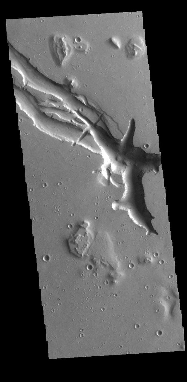
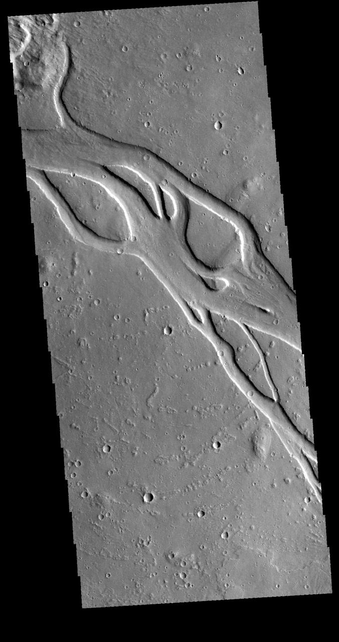
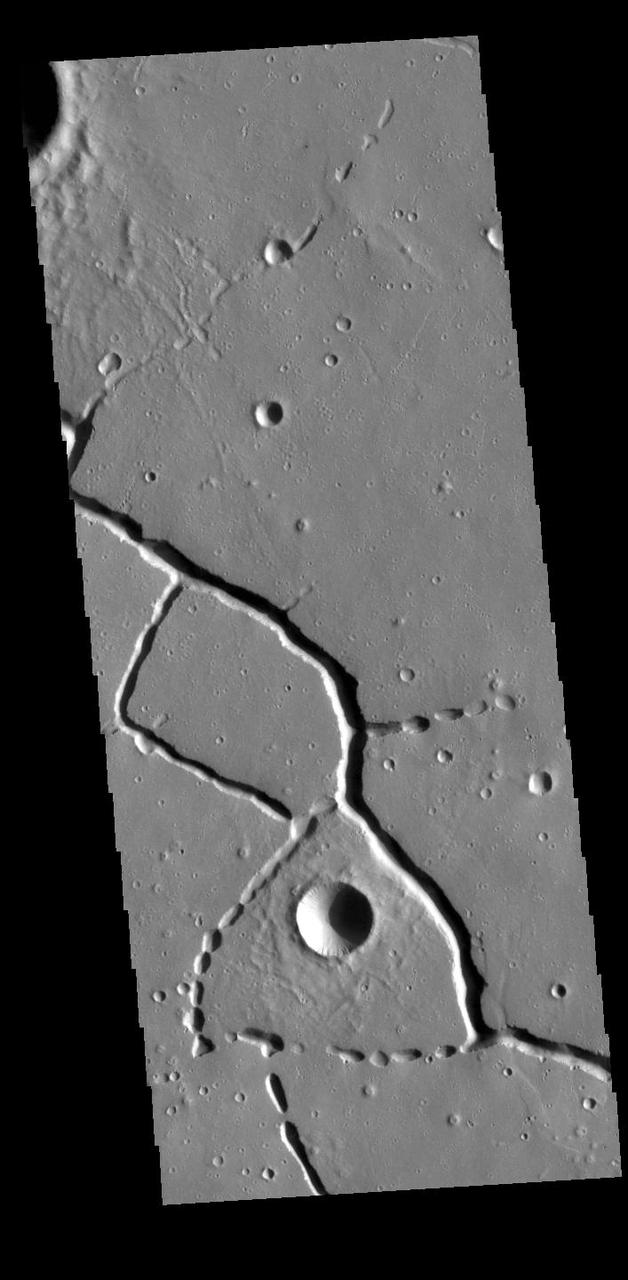
Located west of the Elysium Volcanic complex, Hebrus Valles is a complex channel system that flowed to the north. The start of the channel is visible in this image. There are fluid created channels and tectonic formed depressions in this image, while in other portions of the valles, there are pits and collapse features which appear to have formed by material falling into subsurface voids. These are common features in regions of volcanic activity where lava tubes run below the surface. Both water and lava contributed to the formation of Hebrus Valles. Hebrus Valles is 325km (202 miles) long. Orbit Number: 94308 Latitude: 17.8126 Longitude: 128.079 Instrument: VIS Captured: 2023-03-19 15:06 https://photojournal.jpl.nasa.gov/catalog/PIA26001
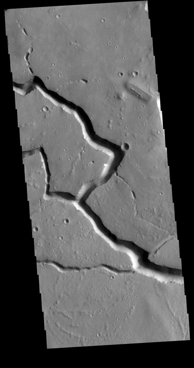
The channels in this image captured by NASA 2001 Mars Odyssey spacecraft are part of Hebrus Valles.
This image captured by NASA 2001 Mars Odyssey spacecraft shows a portion of Hebrus Valles.
Located west of the Elysium Volcanic complex, Hebrus Valles is a channel system that flowed to the north. This VIS image shows the complex region at the start of the channel. The process that formed the channel system is unknown. Some of the channel features have the appearance of being formed by liquid flow. In other portions of the valles, there are pits and collapse features which appear to have formed by material falling into subsurface voids. This is a common feature in regions of volcanic activity where lava tubes run below the surface. Both water and lava probably contributed to the formation of Hebrus Valles. Hebrus Valles is located in southern Utopia Planitia and is 325km (202 miles) long. Orbit Number: 86147 Latitude: 17.8139 Longitude: 128.204 Instrument: VIS Captured: 2021-05-16 15:44 https://photojournal.jpl.nasa.gov/catalog/PIA24225
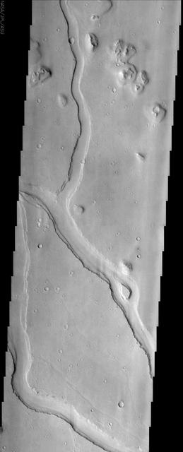
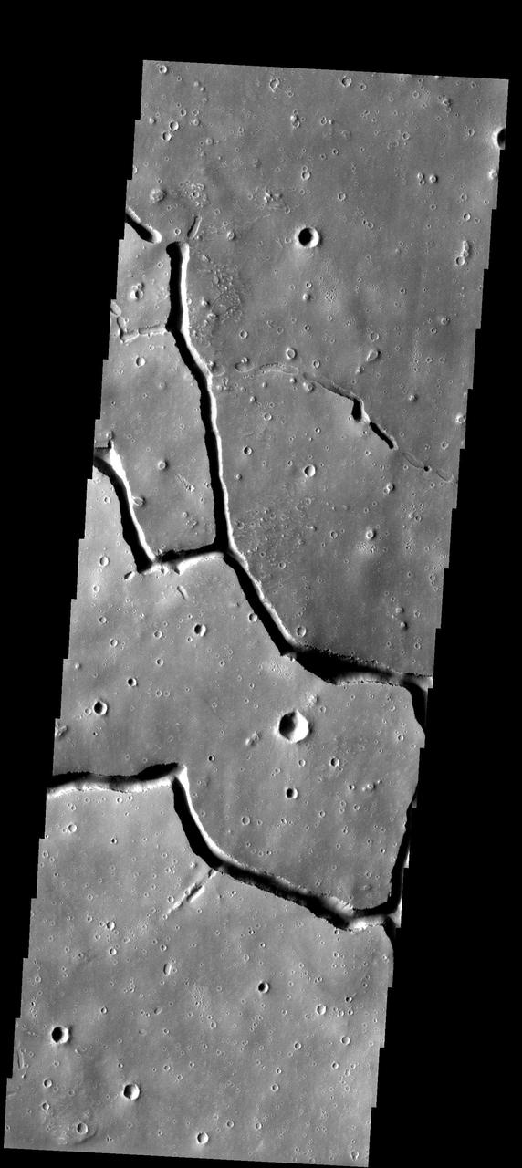
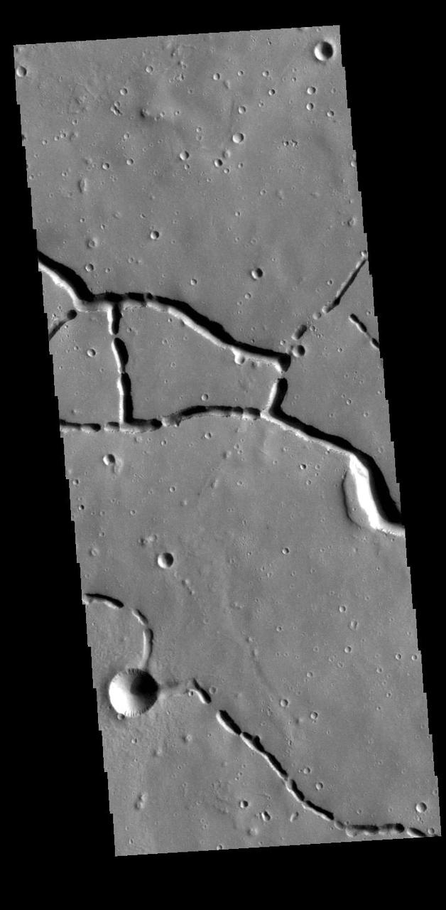
Located west of the Elysium Volcanic complex, Hebrus Valles is a complex channel system that flowed to the north. In this VIS image the there are fluid created channels and tectonic formed depressions. In other portions of the valles, there are pits and collapse features which appear to have formed by material falling into subsurface voids. This is a common feature in regions of volcanic activity where lava tubes run below the surface. Both water and lava contributed to the formation of Hebrus Valles. Orbit Number: 78248 Latitude: 17.8704 Longitude: 128.118 Instrument: VIS Captured: 2019-08-05 06:11 https://photojournal.jpl.nasa.gov/catalog/PIA23458
Located west of the Elysium Volcanic complex, Hebrus Valles is a complex channel system that flowed to the north. In this VIS image the channel features have the appearance of a channel formed by liquid flow. In other portions of the valles, there are pits and collapse features which appear to have formed by material falling into subsurface voids. This is a common feature in regions of volcanic activity where lava tubes run below the surface. Both water and lava probably contributed to the formation of Hebrus Valles. Orbit Number: 71499 Latitude: 17.8884 Longitude: 127.923 Instrument: VIS Captured: 2018-01-26 09:17 https://photojournal.jpl.nasa.gov/catalog/PIA22398

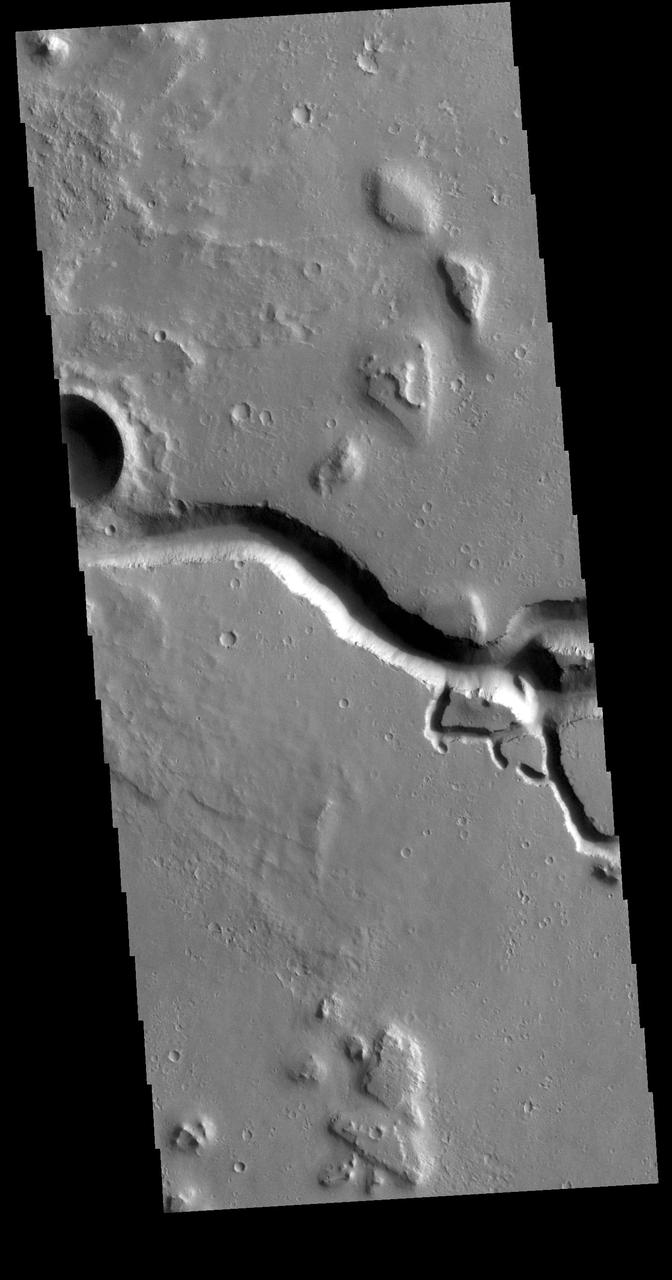
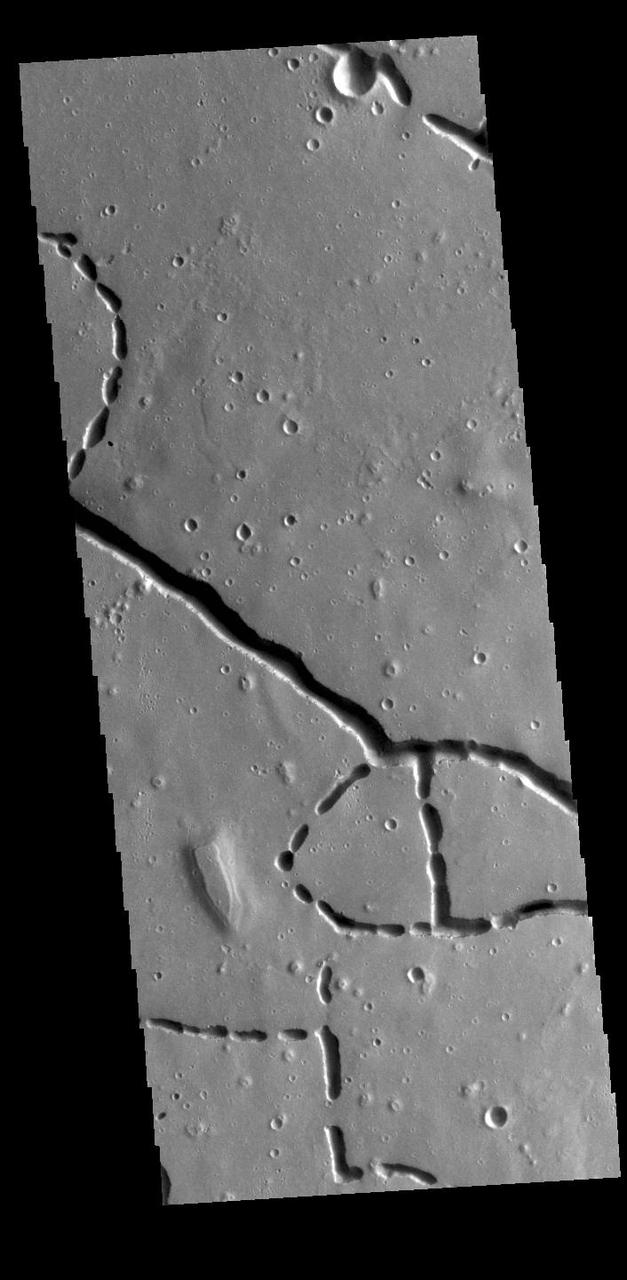
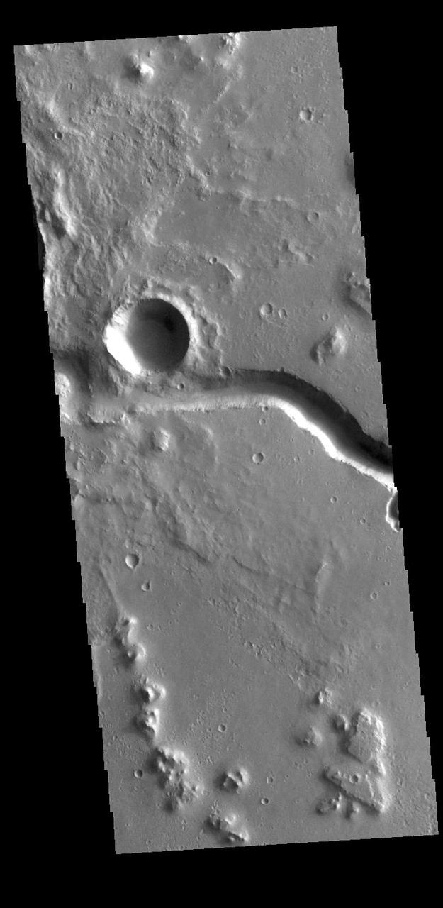
This image captured by NASA 2001 Mars Odyssey spacecraft shows a portion of Hebrus Valles. The flow of liquid water or lava is from the bottom of the image into the circular feature, which was likely filled by the material from the channel.
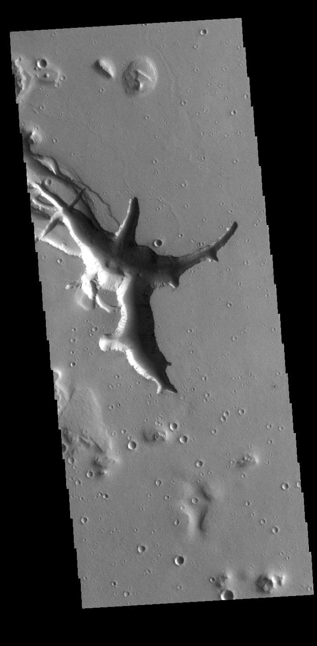
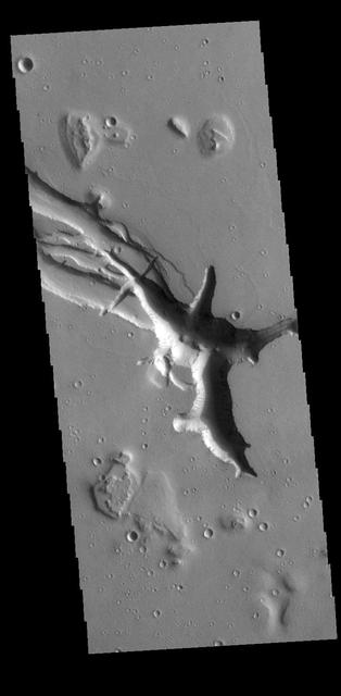
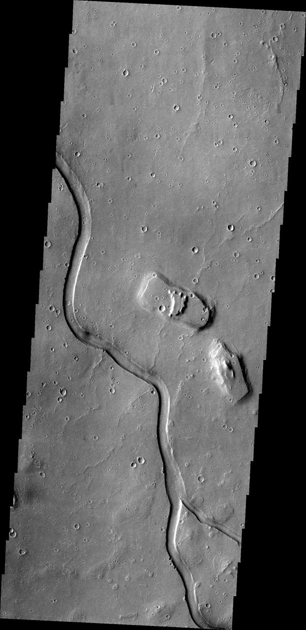
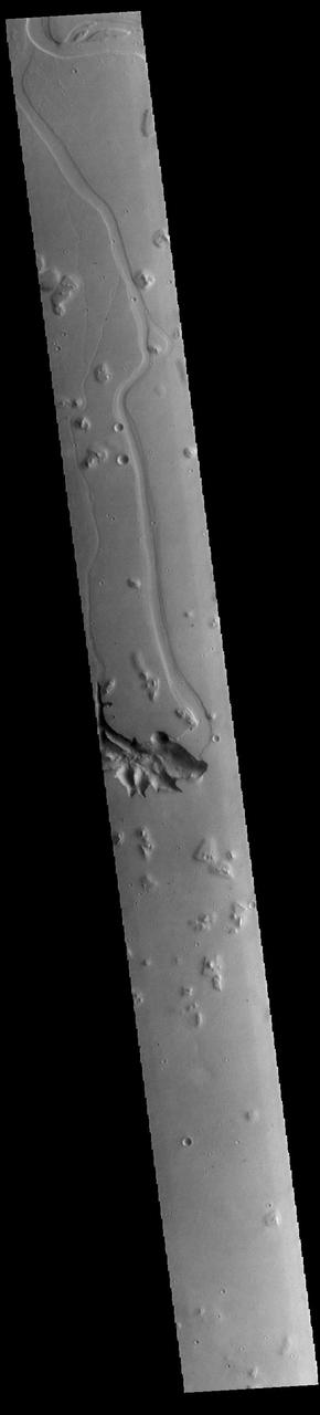
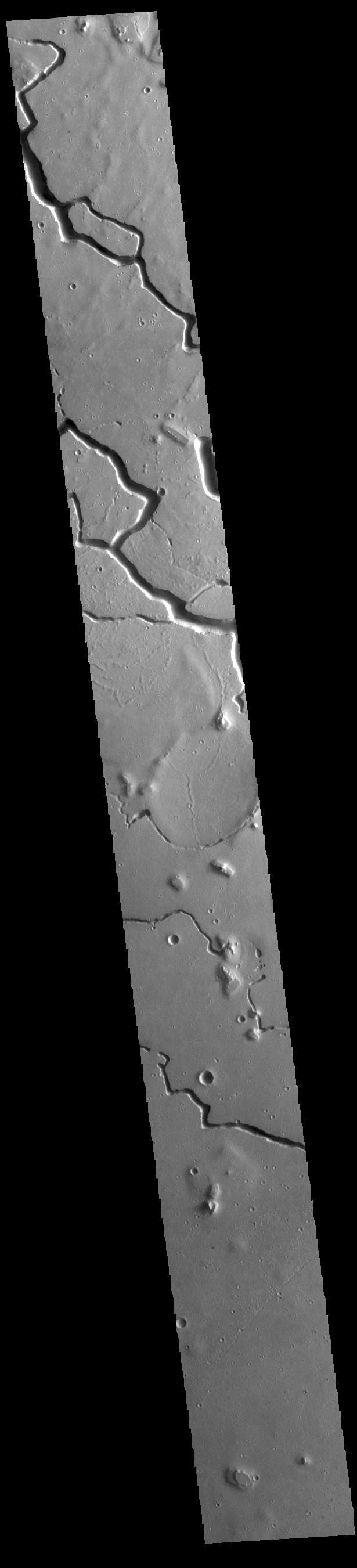
Hebrus Valles is located in the Elysium Planitia region of the northern lowlands of Mars. This image from NASA Mars Odyssey spacecraft shows three sinuous tributaries of the channel system which carved up the surrounding plains.
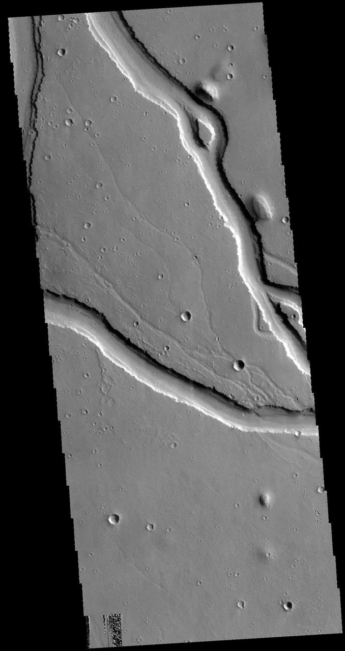
This image captured by NASA 2001 Mars Odyssey spacecraft shows a portion of Hebrus Valles. This channel system was formed by liquid flow of either water or lava, or a combination of both. There is a streamlined island in this image and channels at several different elevations. Orbit Number: 61733 Latitude: 17.9819 Longitude: 127.921 Instrument: VIS Captured: 2015-11-13 20:40 http://photojournal.jpl.nasa.gov/catalog/PIA20234
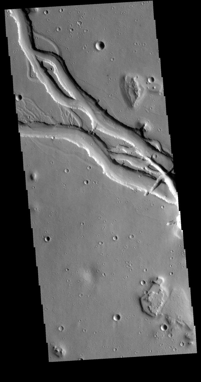
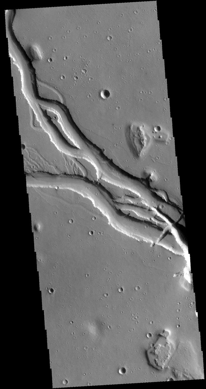
Hebrus Valles are a complex set of channels in the northern lowlands of Mars just to the west of the Elysium volcanic region. The channel segments to the north of this image display a variety of features, including streamlined forms and terracing that are suggestive of catastrophic flooding. However, this observation shows channels of uniform width suggesting more persistent flows eroding into and around two impact craters, each about two hundred meters in diameter. This complex geology may be the result of formation in volcanic terrains as fluid flows erode into basalt and interbedded ash or sediment layers. The channel system is thought to be early Amazonian in age (as far back as 3 billion years ago), which is younger than many of the other outflow channels on Mars. https://photojournal.jpl.nasa.gov/catalog/PIA25359

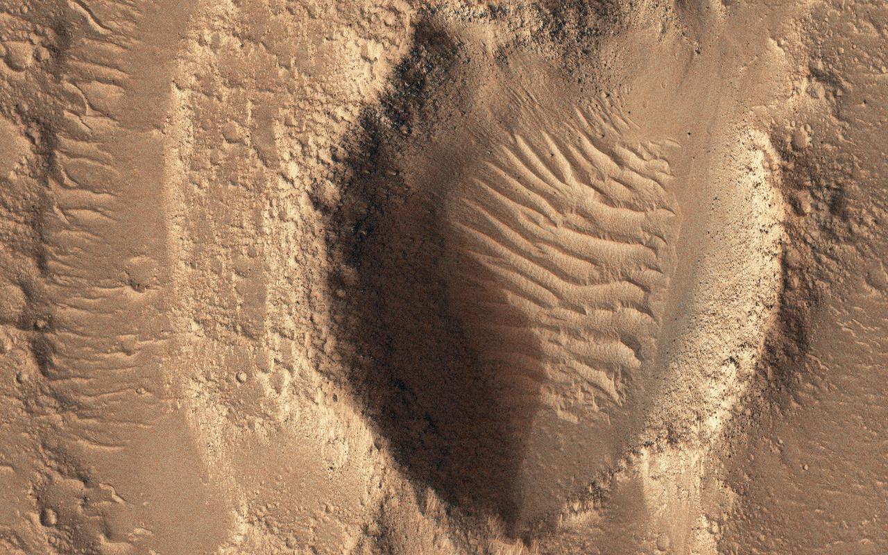
This MOC image shows a plain southeast of Hebrus Valles that is cut by a network of intersecting troughs. Large, windblown -- and perhaps wind-eroded -- ripples occur on the trough floors
The channel in this image from NASA 2001 Mars Odyssey spacecraft is part of Hebrus Vallis, located on the western margin of the Elysium volcanic complex.
In this image from NASA Mars Odyssey spacecraft showing a location about 1,000 km 620 miles west of the massive Elysium volcanic complex, a system of branching troughs shows a continuum of features that provides clues to its origin.
This VIS image is located in Utopia Planitia and shows part of Hephaestus Fossae. Hephaestus Fossae is a complex channel system. It has been proposed that the channel formed by the release of melted subsurface ice during an impact event. Additionally, the nearby Elysium volcanic center created subsurface heating that may have played a part in creating both Hephaestus Fossae and Hebrus Valles to the north. Orbit Number: 85286 Latitude: 17.535 Longitude: 127.087 Instrument: VIS Captured: 2021-03-06 18:17 https://photojournal.jpl.nasa.gov/catalog/PIA24823
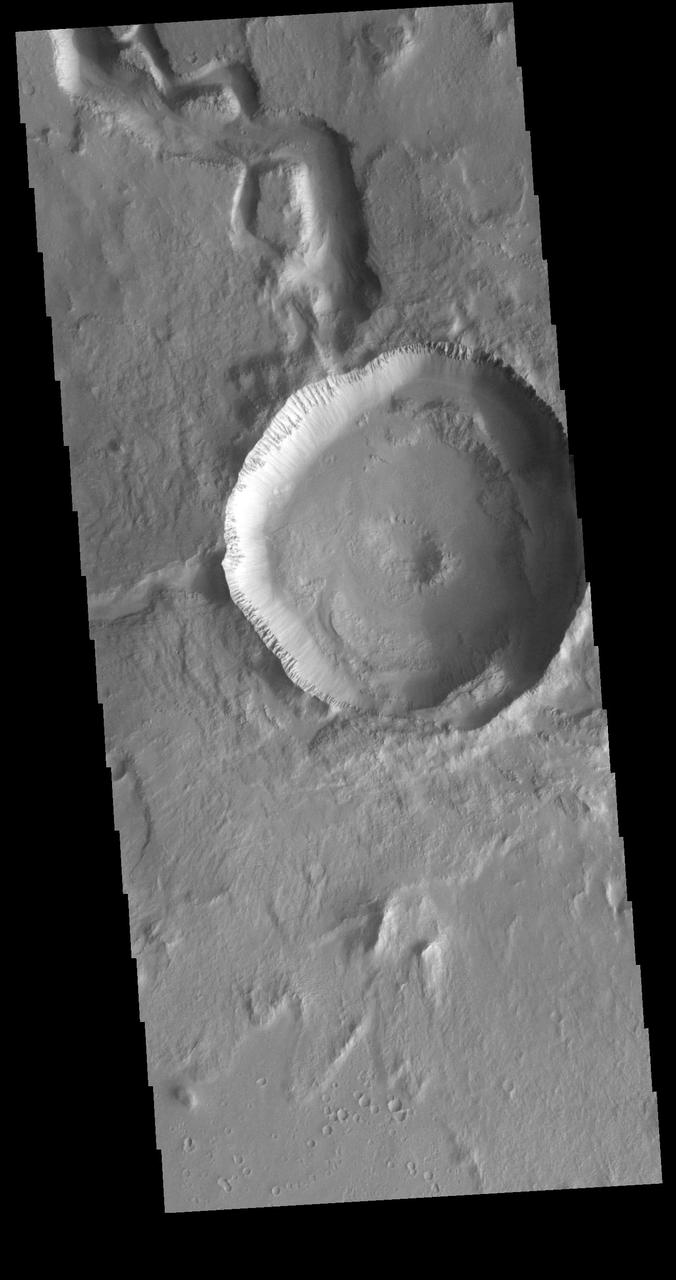
This VIS image is located in Utopia Planitia and shows part of Hephaestus Fossae. Hephaestus Fossae is a complex channel system. It has been proposed that the channel formed by the release of melted subsurface ice during the impact event that created a large crater in the center of this image. Additionally, the nearby Elysium volcanic center created subsurface heating that may have played a part in creating both Hephaestus Fossae and Hebrus Valles to the north. Orbit Number: 81767 Latitude: 17.6969 Longitude: 125.709 Instrument: VIS Captured: 2020-05-21 00:22 https://photojournal.jpl.nasa.gov/catalog/PIA24014
This VIS image is located in the central portion of Hephaestus Fossae. Hephaestus Fossae is a complex channel system in Utopia Planitia near Elysium Mons. It has been proposed that the channel formed by the release of melted subsurface ice during the impact event that created the crater in this image. Additionally, the nearby Elysium volcanic center created subsurface heating that may have played a part in creating both Hephaestus Fossae and Hebrus Valles to the north. Orbit Number: 81193 Latitude: 18.8168 Longitude: 124.985 Instrument: VIS Captured: 2020-04-03 18:04 https://photojournal.jpl.nasa.gov/catalog/PIA23938
This VIS image is located in Utopia Planitia and shows part of Hephaestus Fossae. Hephaestus Fossae is a complex channel system. It has been proposed that the channel formed by the release of melted subsurface ice during an impact event that created a large crater south of this image. Additionally, the nearby Elysium volcanic center created subsurface heating that may have played a part in creating both Hephaestus Fossae and Hebrus Valles to the north. Orbit Number: 85623 Latitude: 19.0345 Longitude: 124.821 Instrument: VIS Captured: 2021-04-03 12:15 https://photojournal.jpl.nasa.gov/catalog/PIA24858
This VIS image is located in the central portion of Hephaestus Fossae. Hephaestus Fossae is a complex channel system in Utopia Planitia near Elysium Mons. It has been proposed that the channel formed by the release of melted subsurface ice during the impact event that created a large crater south of this image. Additionally, the nearby Elysium volcanic center created subsurface heating that may have played a part in creating both Hephaestus Fossae and Hebrus Valles to the north. Orbit Number: 79159 Latitude: 19.0493 Longitude: 124.534 Instrument: VIS Captured: 2019-10-19 06:34 https://photojournal.jpl.nasa.gov/catalog/PIA23579
This VIS image is located in the southeastern portion of Hephaestus Fossae. Hephaestus Fossae is a complex channel system in Utopia Planitia near Elysium Mons. It has been proposed that the channel formed by the release of melted subsurface ice during the impact event that created a large crater west of this image. Additionally, the nearby Elysium volcanic center created subsurface heating that may have played a part in creating both Hephaestus Fossae and Hebrus Valles to the north. Hephaestus Fossae are over 600km long (373 miles). Orbit Number: 78847 Latitude: 17.5748 Longitude: 126.158 Instrument: VIS Captured: 2019-09-23 13:59 https://photojournal.jpl.nasa.gov/catalog/PIA23507
This VIS image is located in the central portion of Hephaestus Fossae. Hephaestus Fossae is a complex channel system in Utopia Planitia near Elysium Mons. It has been proposed that the channel formed by the release of melted subsurface ice during the impact event that created a large crater southeast of this image. Additionally, the nearby Elysium volcanic center created subsurface heating that may have played a part in creating both Hephaestus Fossae and Hebrus Valles to the north. Orbit Number: 82079 Latitude: 18.8004 Longitude: 124.5724 Instrument: VIS Captured: 2020-06-15 16:56 https://photojournal.jpl.nasa.gov/catalog/PIA24122
This VIS image is located in the central portion of Hephaestus Fossae. Hephaestus Fossae is a complex channel system in Utopia Planitia near Elysium Mons. It has been proposed that the channel formed by the release of melted subsurface ice during the impact event that created a large crater south of this image. Additionally, the nearby Elysium volcanic center created subsurface heating that may have played a part in creating both Hephaestus Fossae and Hebrus Valles to the north. Orbit Number: 77487 Latitude: 18.8111 Longitude: 124.593 Instrument: VIS Captured: 2019-06-03 14:10 https://photojournal.jpl.nasa.gov/catalog/PIA23335
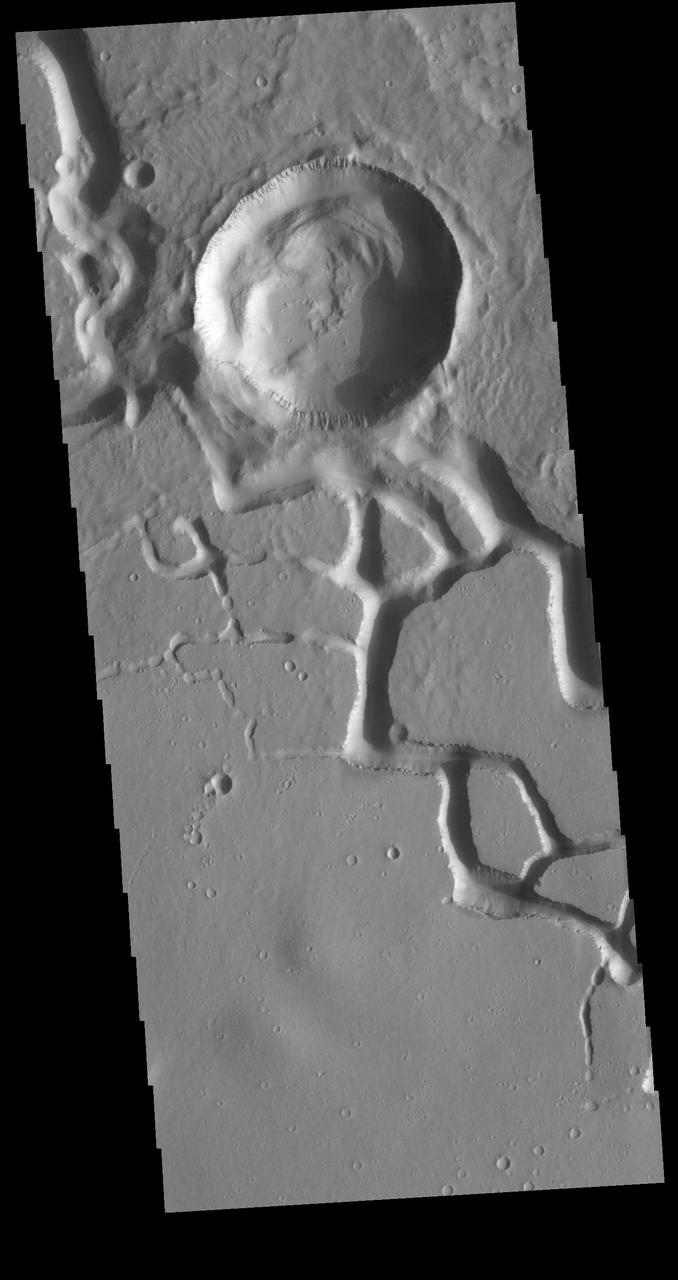
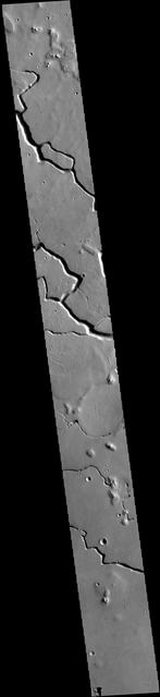
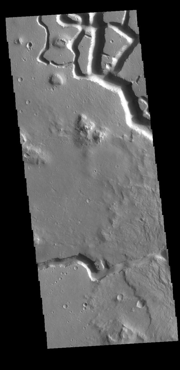
This VIS image is located in the northern portion of Hephaestus Fossae. Hephaestus Fossae is a complex channel system in Utopia Planitia near Elysium Mons. It has been proposed that the channels formed by the release of melted subsurface ice during the impact event that created a large crater southeast of this image. Additionally, the nearby Elysium volcanic center created subsurface heating that may have played a part in creating both Hephaestus Fossae and Hebrus Valles to the north. The right angle intersections indicate there is some tectonic activity in the region, and the circular depressions indicate surface collapse into subsurface voids. Hephaestus Fossae is a very complex set of features. Orbit Number: 88618 Latitude: 22.2991 Longitude: 121.441 Instrument: VIS Captured: 2021-12-06 02:47 https://photojournal.jpl.nasa.gov/catalog/PIA25199
This VIS image is located in the northern portion of Hephaestus Fossae. Hephaestus Fossae is a complex channel system in Utopia Planitia near Elysium Mons. It has been proposed that the channels formed by the release of melted subsurface ice during the impact event that created a large crater southeast of this image. Additionally, the nearby Elysium volcanic center created subsurface heating that may have played a part in creating both Hephaestus Fossae and Hebrus Valles to the north. The right angle intersections indicate there is some tectonic activity in the region, and the circular depressions indicate surface collapse into subsurface voids. Hephaestus Fossae is a very complex set of features. Orbit Number: 85960 Latitude: 21.3916 Longitude: 122.454 Instrument: VIS Captured: 2021-05-01 06:13 https://photojournal.jpl.nasa.gov/catalog/PIA24212
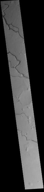
This VIS image is located in the central portion of Hephaestus Fossae. Hephaestus Fossae is a complex channel system in Utopia Planitia near Elysium Mons. It has been proposed that the channel formed by the release of melted subsurface ice during the impact event that created a large crater south of this image. Additionally, the nearby Elysium volcanic center created subsurface heating that may have played a part in creating both Hephaestus Fossae and Hebrus Valles to the north. Since many of the channels have right angle intersections, tectonic forces may also have played a part in the formation of this system. In fact, the entire feature is called a 'fossae' rather than a 'vallis', recognizing the dual forces of tectonic stresses and fluid flow. The entire system is approximately 605km long (375 miles). Orbit Number: 79446 Latitude: 19.3029 Longitude: 124.484 Instrument: VIS Captured: 2019-11-11 21:45 https://photojournal.jpl.nasa.gov/catalog/PIA23661
This VIS image is located in the northern portion of Hephaestus Fossae. Hephaestus Fossae is a complex channel system in Utopia Planitia near Elysium Mons. It has been proposed that the channels formed by the release of melted subsurface ice during the impact event that created a large crater southeast of this image. Additionally, the nearby Elysium volcanic center created subsurface heating that may have played a part in creating both Hephaestus Fossae and Hebrus Valles to the north. The right angle intersections indicate there is some tectonic activity in the region, and the circular depressions indicate surface collapse into subsurface voids. Hephaestus Fossae is a very complex set of features. Orbit Number: 88019 Latitude: 21.1587 Longitude: 122.646 Instrument: VIS Captured: 2021-10-17 19:02 https://photojournal.jpl.nasa.gov/catalog/PIA25111
This VIS image shows part of Hephaestus Fossae. Hephaestus Fossae is a complex channel system in Utopia Planitia near Elysium Mons. It has been proposed that the channel formed by the release of melted subsurface ice during the impact event that created the crater just off the left side of the image – only the ejecta is seen in this image. The crater is fairly young, as there is only minimal modification of the crater floor. While it appears that the crater sits of top of the channel, the creation of the crater may have also created the channel. The impact event would have caused subsurface heating, melting any subsurface ice in the region which would have created surface flow to form the channel. Additionally, the nearby Elysium volcanic center created subsurface heating that may have played a part in creating both Hephaestus Fossae and Hebrus Valles to the north. Orbit Number: 94645 Latitude: 17.6141 Longitude: 126.055 Instrument: VIS Captured: 2023-04-16 09:02 https://photojournal.jpl.nasa.gov/catalog/PIA26040
This VIS image shows part of Hephaestus Fossae. Hephaestus Fossae is a complex channel system in Utopia Planitia near Elysium Mons. It has been proposed that the channel formed by the release of melted subsurface ice during the impact event that created the crater just off the bottom right of the image – only the ejecta is seen in this image. The crater is fairly young, as there is only minimal modification of the crater floor. While it appears that the crater sits of top of the channel, the creation of the crater may have also created the channel. The impact event would have caused subsurface heating, melting any subsurface ice in the region which would have created surface flow to form the channel. Additionally, the nearby Elysium volcanic center created subsurface heating that may have played a part in creating both Hephaestus Fossae and Hebrus Valles to the north. The THEMIS VIS camera is capable of capturing color images of the Martian surface using five different color filters. In this mode of operation, the spatial resolution and coverage of the image must be reduced to accommodate the additional data volume produced from using multiple filters. To make a color image, three of the five filter images (each in grayscale) are selected. Each is contrast enhanced and then converted to a red, green, or blue intensity image. These three images are then combined to produce a full color, single image. Because the THEMIS color filters don't span the full range of colors seen by the human eye, a color THEMIS image does not represent true color. Also, because each single-filter image is contrast enhanced before inclusion in the three-color image, the apparent color variation of the scene is exaggerated. Nevertheless, the color variation that does appear is representative of some change in color, however subtle, in the actual scene. Note that the long edges of THEMIS color images typically contain color artifacts that do not represent surface variation. Orbit Number: 86796 Latitude: 17.9392 Longitude: 125.437 Instrument: VIS Captured: 2021-07-09 02:13 https://photojournal.jpl.nasa.gov/catalog/PIA24995