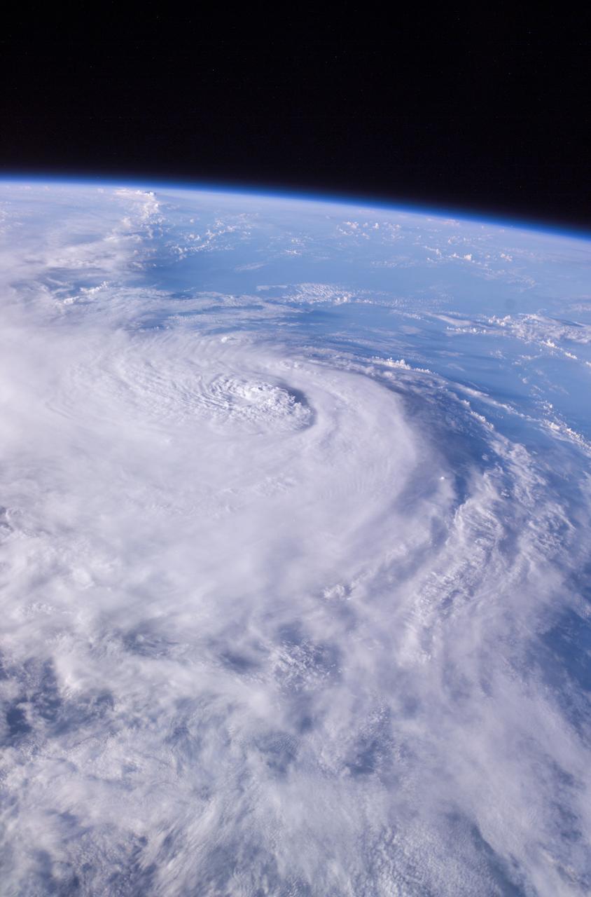
This panoramic view of Hurricane Charley was photographed by the Expedition 9 crew aboard the International Space Station (ISS) on August 13, 2004, at a vantage point just north of Tampa, Florida. The small eye was not visible in this view, but the raised cloud tops near the center coincide roughly with the time that the storm began to rapidly strengthen. The category 2 hurricane was moving north-northwest at 18 mph packing winds of 105 mph. Crew Earth Observations record Earth surface changes over time, as well as more fleeting events such as storms, floods, fires, and volcanic eruptions.
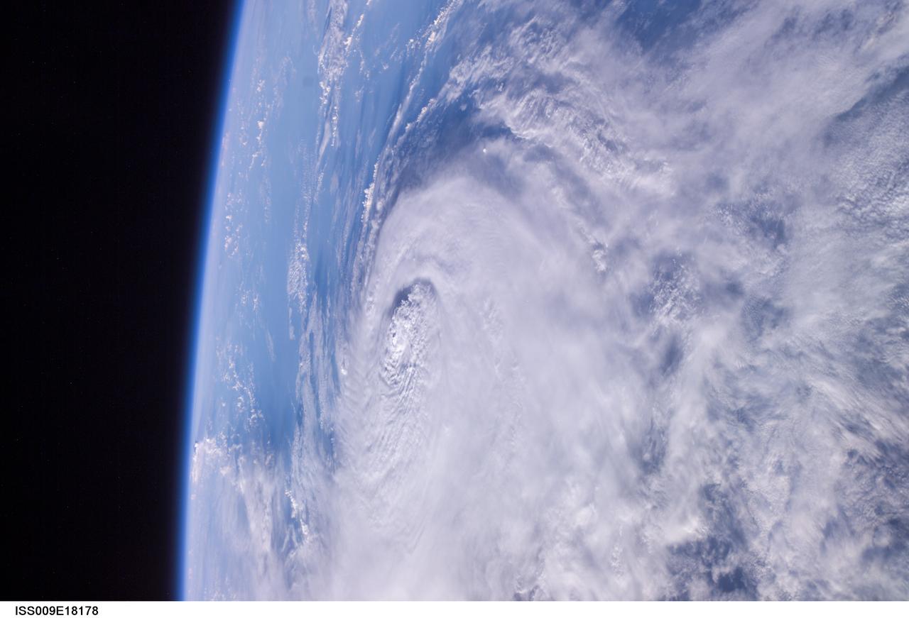
ISS009-E-18178 (11:58:05 GMT, 13 August 2004 ) --- This panoramic view of Hurricane Charley was photographed by the Expedition 9 crew of the International Space Station earlier this morning at a vantage point just north of Tampa, Florida looking southward. At 9 a.m. (EDT), about an hour after this photo was taken, Charley was reported to be about 75 west of Key West, moving north at 18 mph. Peak winds were estimated to be 110 mph. The small eye was not visible in this view, but the raised cloud tops near the center coincide roughly with the time that the storm began to rapidly strengthen today.
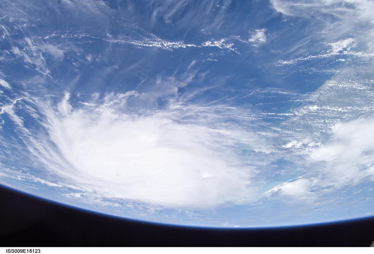
ISS009-E-18123 (21:08:33 GMT, 12 August 2004) --- This panoramic view of Hurricane Charley was taken by the Expedition 9 crew of the International Space Station just after 5PM (EDT), August 12, 2004. The Category Two Hurricane was in the northwest Caribbean Sea, 140 miles south-southeast of Havana, Cuba moving north-northwest at 18mph packing winds of 105mph. In this view looking southeast, the newly formed eye of the storm is just visible and the west coast of Florida from Naples to Tampa Bay may be seen on the right.
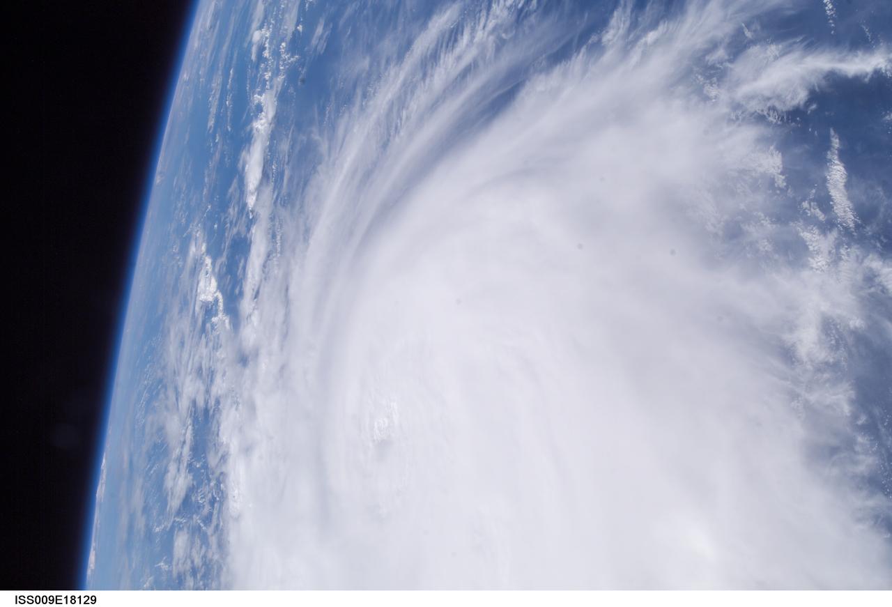
ISS009-E-18129 (21:08:57 GMT, 12 August 2004) --- Less than a minute after ISS009-E-18123, the Expedition 9 crew captured this more detailed view of Hurricane Charley looking southward. The small eye is visible, but not cloud-free yet. Spiraling streaks of high cirrus clouds around the south southern and western edges of the storm indicate the pronounced outflow of air above the storm.
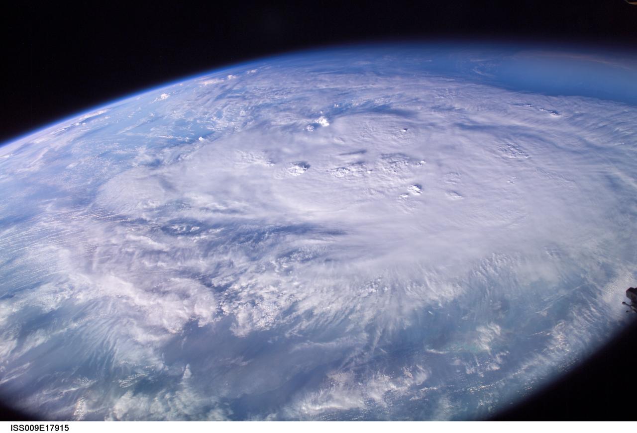
ISS009-E-17915 (12 August 2004) --- This is an early morning view (6:29 a.m., CDT) from the International Space Station, which shows Hurricane Charley centered south of western Cuba over the Cayman Islands in the northwest Caribbean Sea. At the time of this image the storm was reported to be near 19.2N 80.5W with winds of 85 miles per hour as it moved northwest at 16 miles per hour. The north coast of Cuba is barely visible near the bottom of the image, which was taken by astronaut Mike Fincke looking to the south as the spacecraft flew on a track north of Cuba and the storm.