NASA's CloudSat satellite flew over Hurricane Irma on Sept. 6, 2017 at 1:45 p.m. EDT (17:45 UTC) as the storm was approaching Puerto Rico in the Atlantic Ocean. Hurricane Irma contained estimated maximum sustained winds of 185 miles per hour (160 knots) with a minimum pressure of 918 millibars. CloudSat transected the eastern edge of Hurricane Irma's eyewall, revealing details of the storm's cloud structure beneath its thick canopy of cirrus clouds. The CloudSat Cloud Profiling Radar excels in detecting the organization and placement of cloud layers beneath a storm's cirrus canopy, which are not readily detected by other satellite sensors. The CloudSat overpass reveals the inner details beneath the cloud tops of this large system; intense areas of convection with moderate to heavy rainfall (deep red and pink colors), cloud-free areas (moats) in between the inner and outer cloud bands of Hurricane Irma and cloud top heights averaging around 9 to 10 miles (15 to 16 kilometers). Lower values of reflectivity (areas of green and blue) denote smaller-sized ice and water particle sizes typically located at the top of a storm system (in the anvil area). The Cloud Profiling Radar loses signal at around 3 miles (5 kilometers) in height (in the melting layer) due to water (ice) particles larger than 0.12 inches (3 millimeters) in diameter. Moderate to heavy rainfall occurs in these areas where signal weakening is detectable. Smaller cumulus and cumulonimbus cloud types are evident as CloudSat moves farther south, beneath the thick cirrus canopy. An animation is available at https://photojournal.jpl.nasa.gov/catalog/PIA21947
The large-scale structure of clouds in and around Hurricane Irma is seen in this animation and still image created with data from the Atmospheric Infrared Sounder (AIRS) instrument on NASA's Aqua satellite. The clouds are typical of tropical areas both nearby and away from tropical cyclones. Observations were taken at 1 p.m. EDT (5 p.m. UTC) on Tuesday, Sept. 5, 2017, as Irma approached the Caribbean islands and was just becoming a powerful Category 5 storm. Each cylinder represents a volume of cloud detected by AIRS. The oval cylinder ends represent a region viewed by AIRS, with the oval sizes adjusted to reflect the proportion of clouds filling the area viewed. The largest ovals are about 30 miles (45 kilometers) across. The height of the cylinders indicates the cloud thickness, with thickest clouds reaching down to the surface. The vertical scale is exaggerated 15 times. Colors represent temperatures at the tops of the clouds. The perspective views the storm diagonally from above with an initial view toward the north-northwest, with the perspective rotating clockwise for a full circle. The area depicted is about 1,000 miles by 800 miles across (1,600 by 1,300 kilometers). At the start of the loop, North America is seen at the top of the image, and coastal Venezuela at the lower right. In the initial perspective, cirrus clouds (thin and blue), associated with flow outward from the top of the hurricane, overlie warmer (pink and red) shallow clouds. About five seconds into the loop, the deep clouds in the middle of Irma are easily seen. The most dangerous parts of Irma are within the region of high and cold (blue), thick clouds surrounding the central eye. The clouds are cold because they are carried to high, cold altitudes by vigorous thunderstorms within the hurricane. The eye itself is nearly cloud free, but the few clouds within it are low and warm. As the perspective shift toward the south-southeast around seven seconds into the loop, another storm system well north of Irma can be seen. It contains high, thick clouds, with more cirrus carried outward over shallow clouds. At about nine seconds, more outflow from Irma is seen, with high, thin clouds over shallow clouds once again apparent. Shortly afterward when the view is toward the southwest, yet more deep clouds and their outflowing cirrus clouds are apparent. This image depicts many of the clouds typical of the tropics even when cyclones are not present: high, cold thunderstorms pushing cirrus clouds over nearby regions containing many warm, shallow clouds. The animation also shows the structure typical of tropical cyclones around the world: very strong thunderstorms lifting clouds into cold parts of the atmosphere, with strong outflow at upper levels carrying cirrus clouds away from the storm center, and the storm organized symmetrically around a central eye. https://photojournal.jpl.nasa.gov/catalog/PIA21950
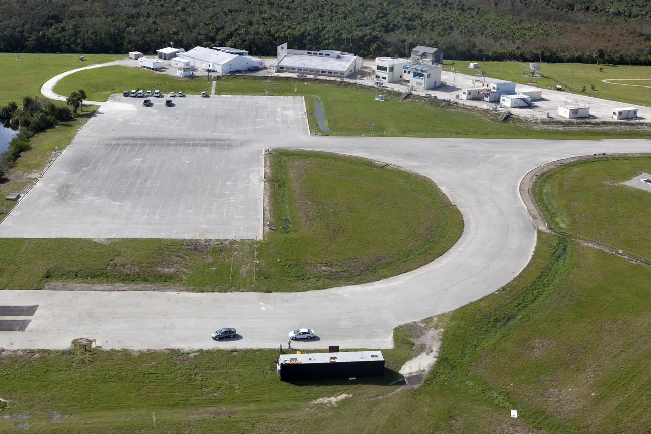
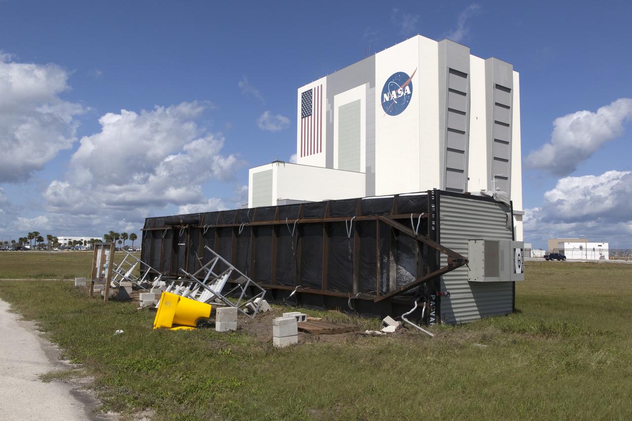
The Central Campus construction site is seen during an aerial survey of NASA's Kennedy Space Center in Florida on September 12, 2017. The survey was performed to identify structures and facilities that may have sustained damage from Hurricane Irma as the storm passed Kennedy on September 10, 2017. NASA closed the center ahead of the storm’s onset and only a small team of specialists known as the Rideout Team was on the center as the storm approached and passed.
The Central Campus construction site is seen during an aerial survey of NASA's Kennedy Space Center in Florida on September 12, 2017. The survey was performed to identify structures and facilities that may have sustained damage from Hurricane Irma as the storm passed Kennedy on September 10, 2017. NASA closed the center ahead of the storm’s onset and only a small team of specialists known as the Rideout Team was on the center as the storm approached and passed.
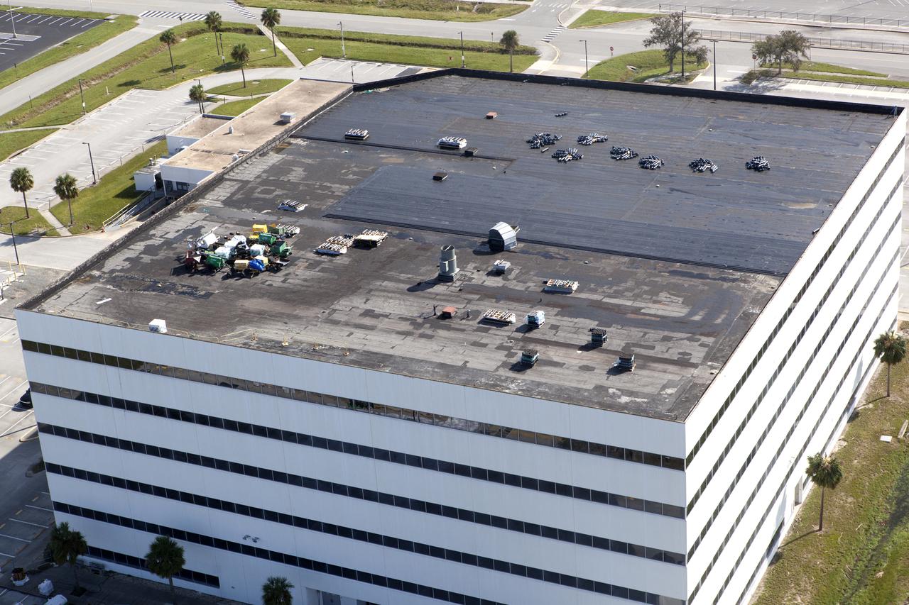
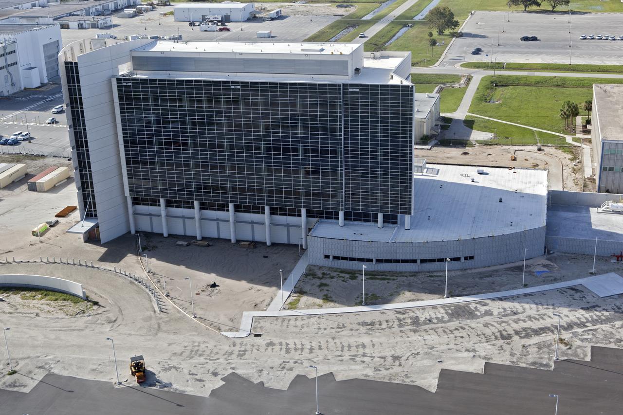
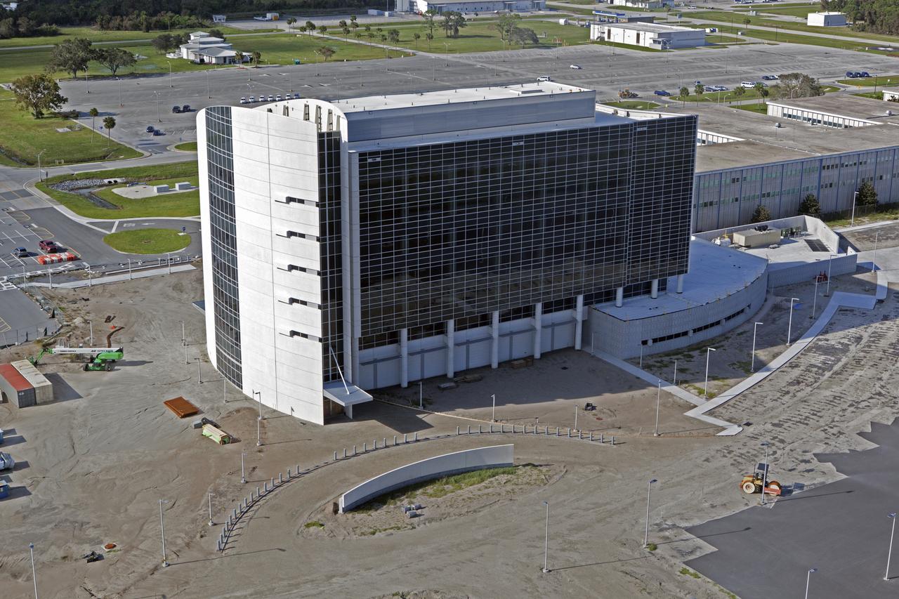
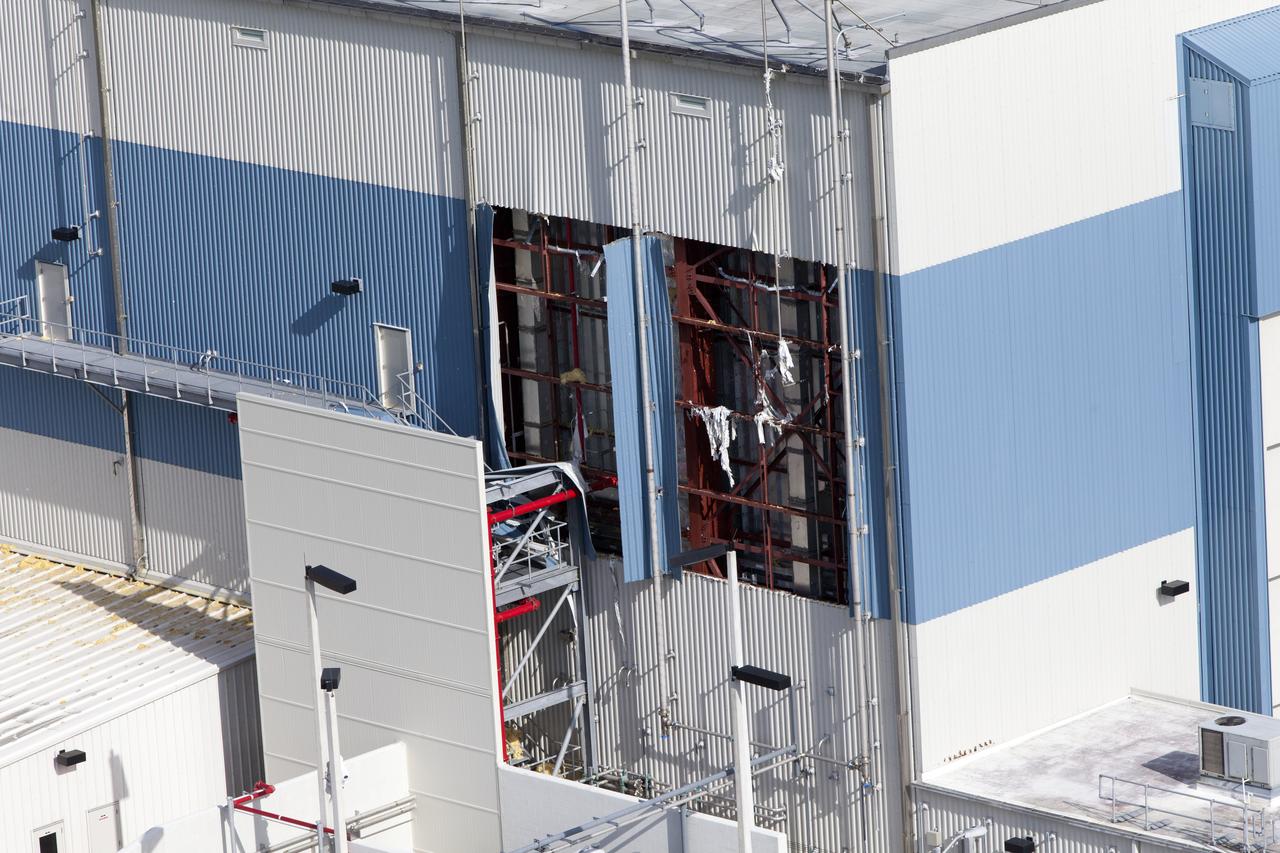
The Operations Support Building I (OSB I) is seen during an aerial survey of NASA's Kennedy Space Center in Florida on September 12, 2017. The roof of the building is currently undergoing repair from Hurricane Matthew. The survey was performed to identify structures and facilities that may have sustained damage from Hurricane Irma as the storm passed Kennedy on September 10, 2017. NASA closed the center ahead of the storm's onset and only a small team of specialists known as the Rideout Team was on the center as the storm approached and passed.
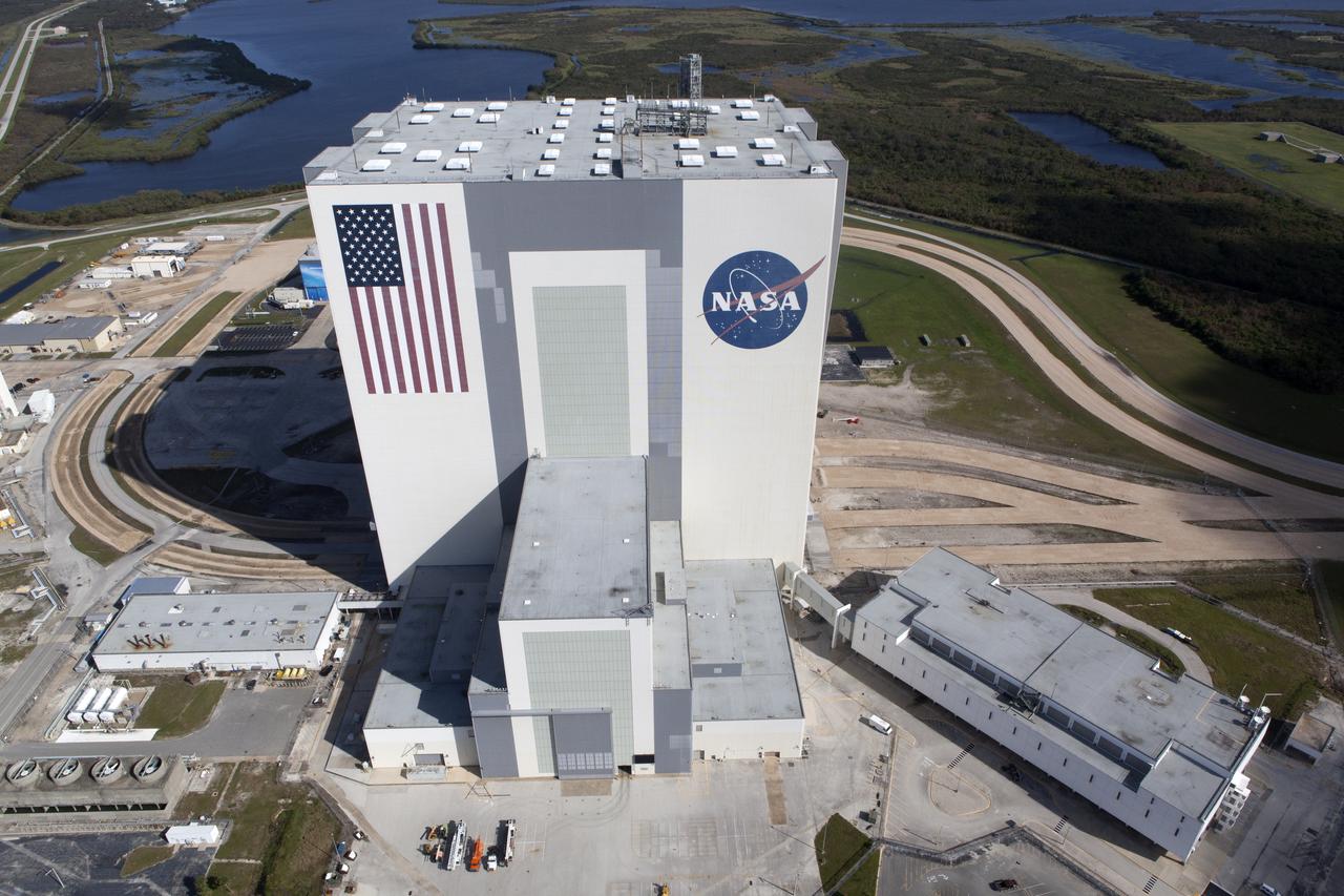
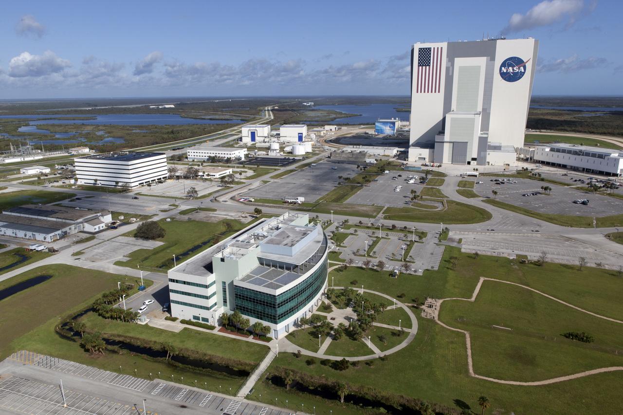
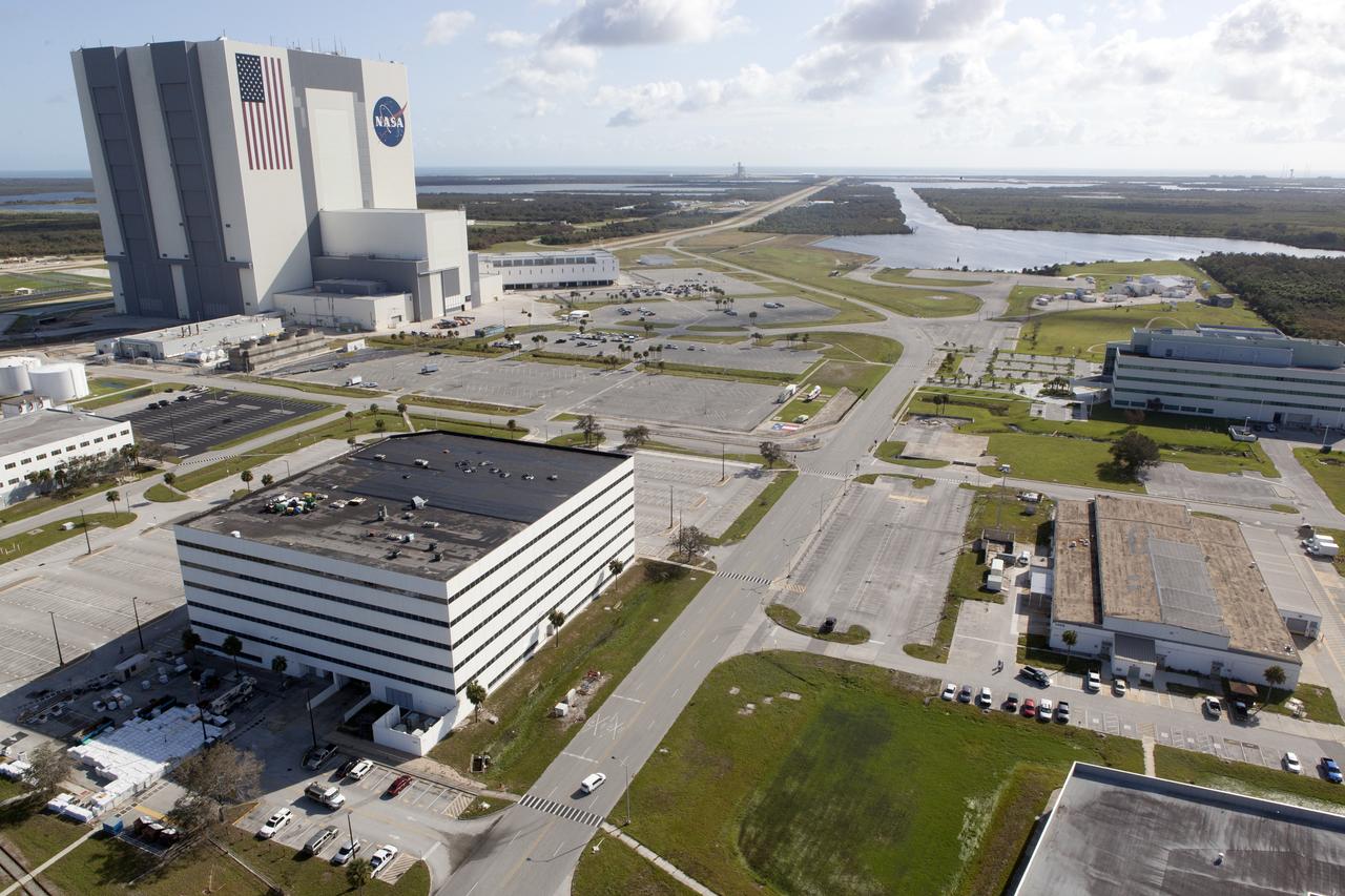
The Vehicle Assembly Building (VAB), Launch Control Center (LCC), and Launch Complex 39 surrounding areas are seen during an aerial survey of NASA's Kennedy Space Center in Florida on September 12, 2017. The survey was performed to identify structures and facilities that may have sustained damage from Hurricane Irma as the storm passed Kennedy on September 10, 2017. NASA closed the center ahead of the storm's onset and only a small team of specialists known as the Rideout Team was on the center as the storm approached and passed.
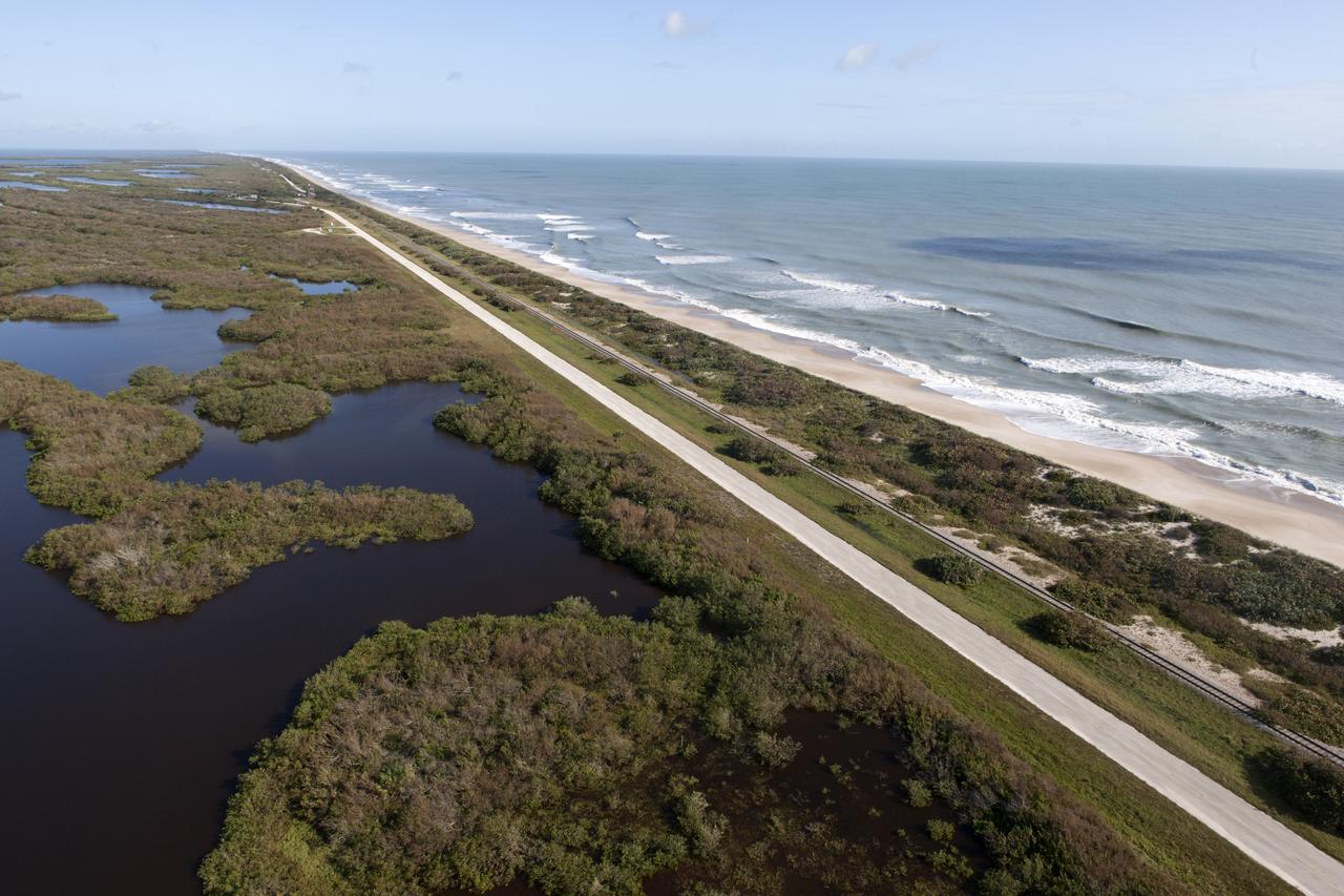
The shoreline is seen during an aerial survey of NASA's Kennedy Space Center in Florida on September 12, 2017. The survey was performed to identify structures and facilities that may have sustained damage from Hurricane Irma as the storm passed Kennedy on September 10, 2017. NASA closed the center ahead of the storm's onset and only a small team of specialists known as the Rideout Team was on the center as the storm approached and passed.
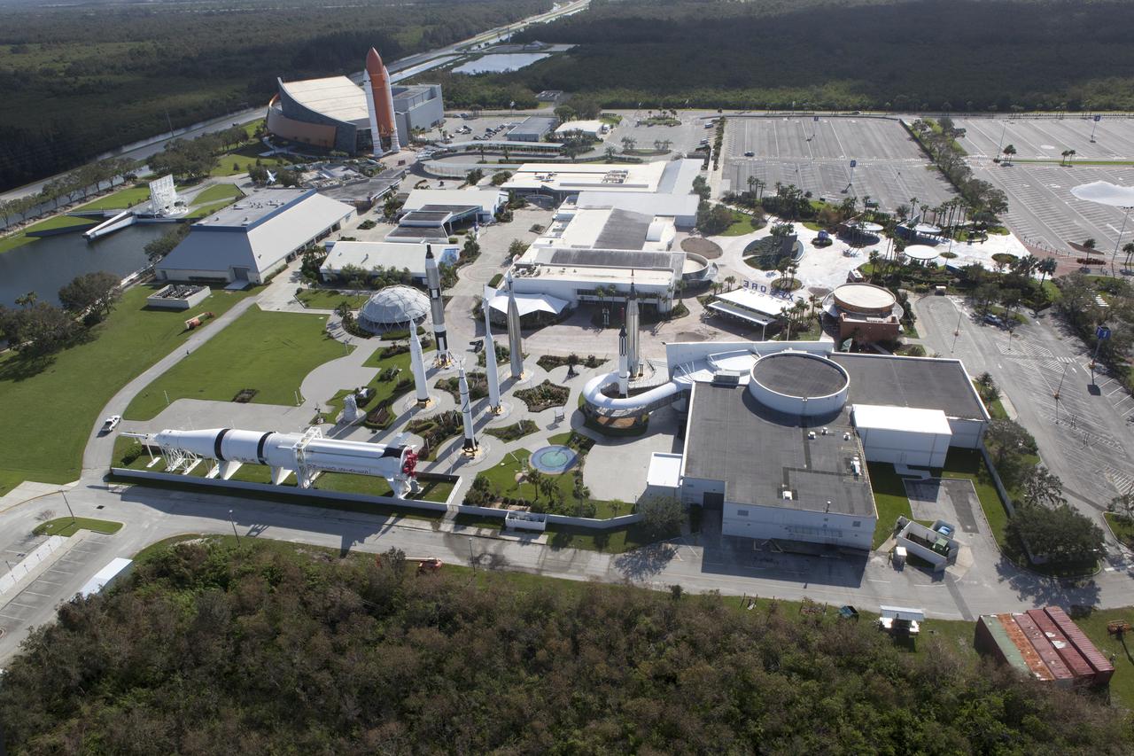
The Kennedy Space Center Visitor Complex is seen during an aerial survey of NASA's Kennedy Space Center in Florida on September 12, 2017. The survey was performed to identify structures and facilities that may have sustained damage from Hurricane Irma as the storm passed Kennedy on September 10, 2017. NASA closed the center ahead of the storm's onset and only a small team of specialists known as the Rideout Team was on the center as the storm approached and passed.
The Launch Complex 39 Press Site is seen during an aerial survey of NASA's Kennedy Space Center in Florida on September 12, 2017. The survey was performed to identify structures and facilities that may have sustained damage from Hurricane Irma as the storm passed Kennedy on September 10, 2017. NASA closed the center ahead of the storm's onset and only a small team of specialists known as the Rideout Team was on the center as the storm approached and passed.
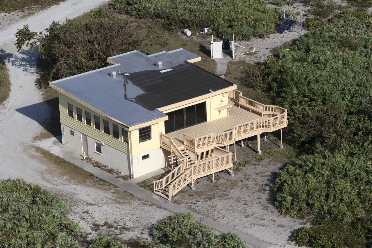
The Beach House is seen during an aerial survey of NASA's Kennedy Space Center in Florida on September 12, 2017. The survey was performed to identify structures and facilities that may have sustained damage from Hurricane Irma as the storm passed Kennedy on September 10, 2017. NASA closed the center ahead of the storm's onset and only a small team of specialists known as the Rideout Team was on the center as the storm approached and passed.
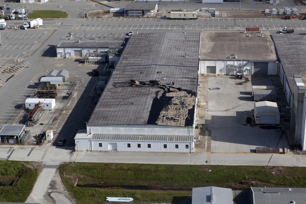
An industrial building behind the Space Station Processing Facility (SSPF) is seen during an aerial survey of NASA's Kennedy Space Center in Florida on September 12, 2017. The survey was performed to identify structures and facilities that may have sustained damage from Hurricane Irma as the storm passed Kennedy on September 10, 2017. NASA closed the center ahead of the storm's onset and only a small team of specialists known as the Rideout Team was on the center as the storm approached and passed.
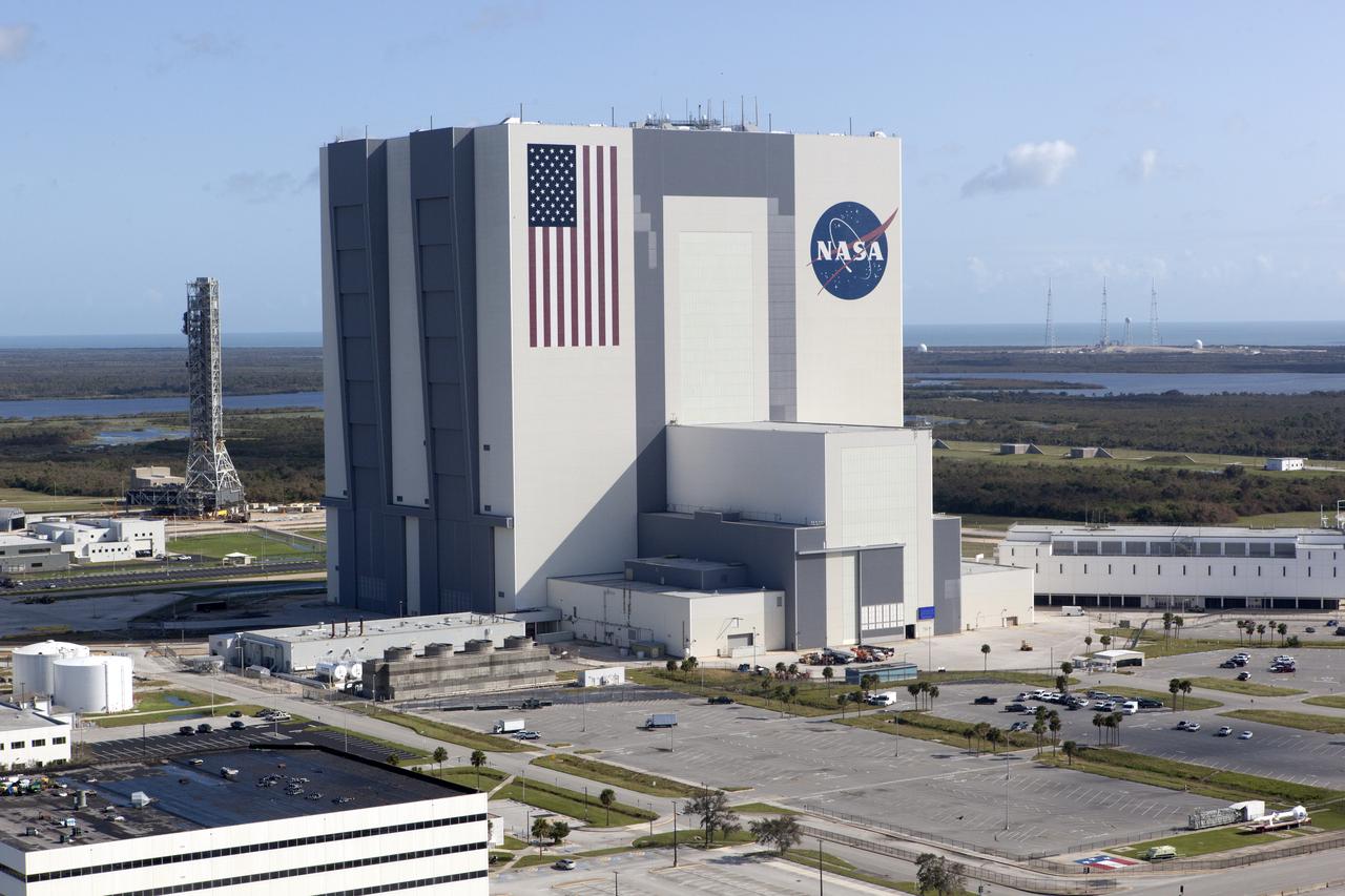
The Mobile Launcher (ML), Vehicle Assembly Building (VAB), Launch Control Center (LCC), and Launch Complex 39 surrounding areas are seen during an aerial survey of NASA's Kennedy Space Center in Florida on September 12, 2017. The survey was performed to identify structures and facilities that may have sustained damage from Hurricane Irma as the storm passed Kennedy on September 10, 2017. NASA closed the center ahead of the storm's onset and only a small team of specialists known as the Rideout Team was on the center as the storm approached and passed.
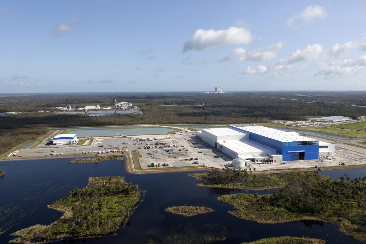
The Blue Origin construction site at Exploration Park is seen during an aerial survey of NASA's Kennedy Space Center in Florida on September 12, 2017. The survey was performed to identify structures and facilities that may have sustained damage from Hurricane Irma as the storm passed Kennedy on September 10, 2017. NASA closed the center ahead of the storm's onset and only a small team of specialists known as the Rideout Team was on the center as the storm approached and passed.
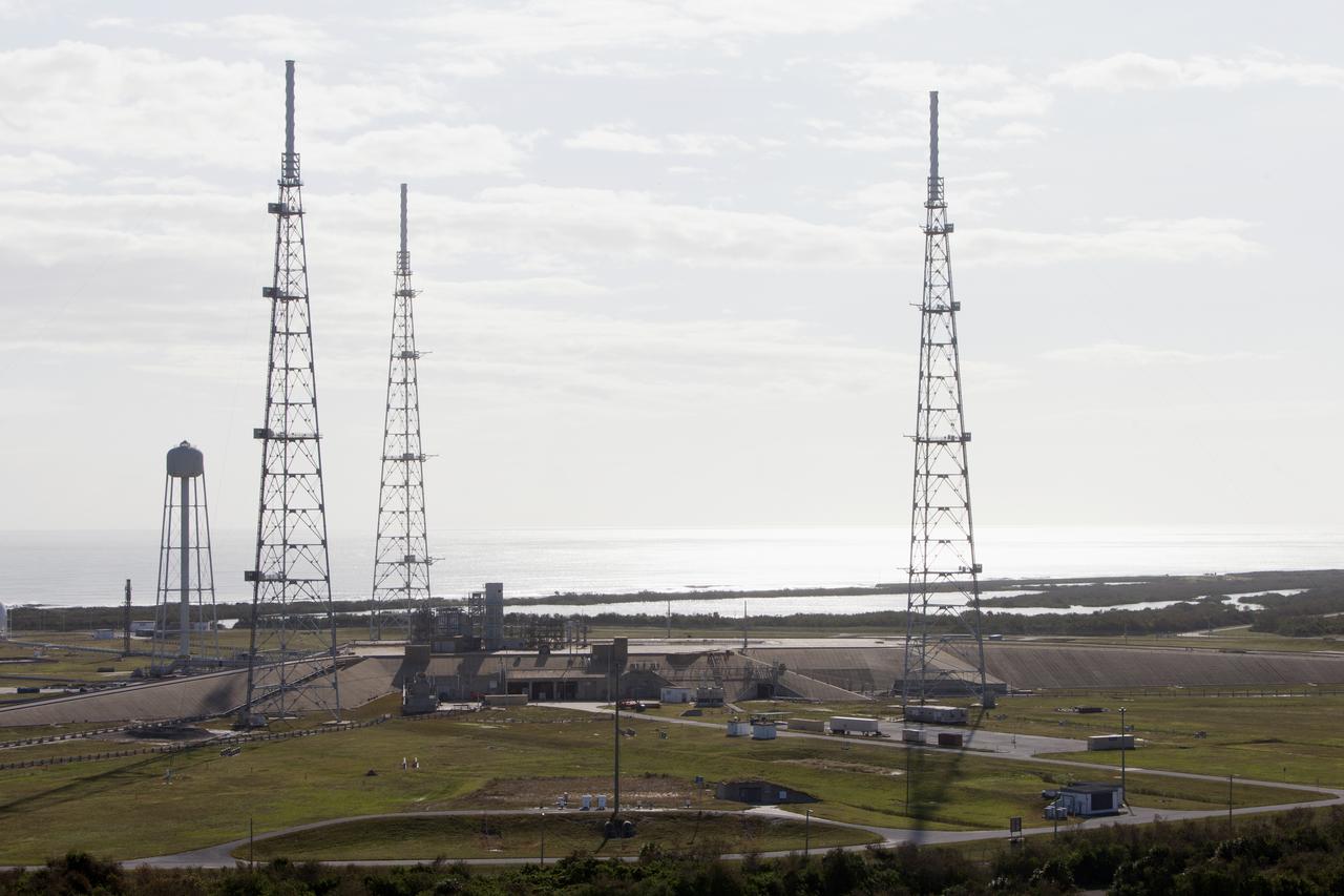
Launch Complex 39 surrounding areas are seen during an aerial survey of NASA's Kennedy Space Center in Florida on September 12, 2017. The survey was performed to identify structures and facilities that may have sustained damage from Hurricane Irma as the storm passed Kennedy on September 10, 2017. NASA closed the center ahead of the storm's onset and only a small team of specialists known as the Rideout Team was on the center as the storm approached and passed.
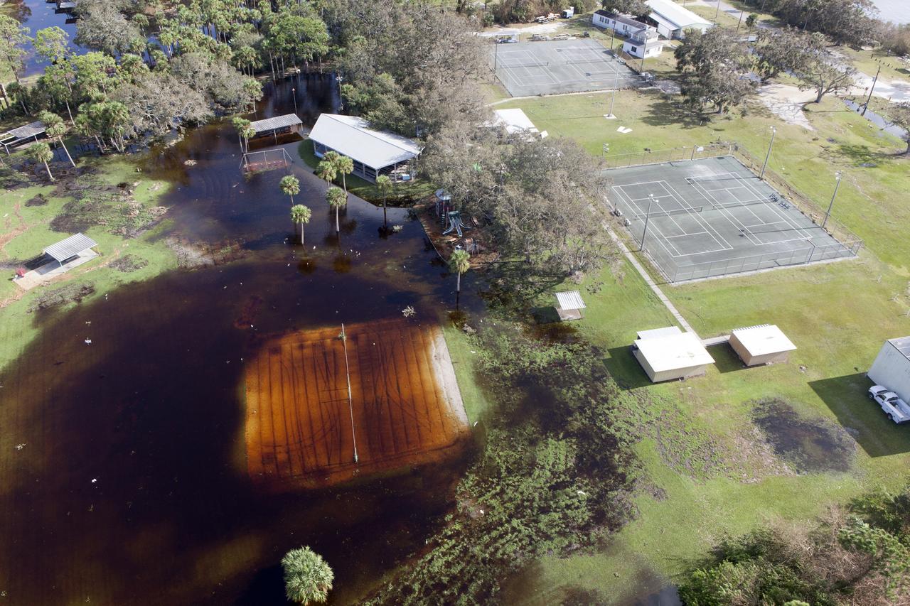
Kars Park I is seen during an aerial survey of NASA's Kennedy Space Center in Florida on September 12, 2017. The survey was performed to identify structures and facilities that may have sustained damage from Hurricane Irma as the storm passed Kennedy on September 10, 2017. NASA closed the center ahead of the storm's onset and only a small team of specialists known as the Rideout Team was on the center as the storm approached and passed.
Launch Complex 39B is seen during an aerial survey of NASA's Kennedy Space Center in Florida on September 12, 2017. The survey was performed to identify structures and facilities that may have sustained damage from Hurricane Irma as the storm passed Kennedy on September 10, 2017. NASA closed the center ahead of the storm's onset and only a small team of specialists known as the Rideout Team was on the center as the storm approached and passed.
Kars Park I is seen during an aerial survey of NASA's Kennedy Space Center in Florida on September 12, 2017. The survey was performed to identify structures and facilities that may have sustained damage from Hurricane Irma as the storm passed Kennedy on September 10, 2017. NASA closed the center ahead of the storm's onset and only a small team of specialists known as the Rideout Team was on the center as the storm approached and passed.
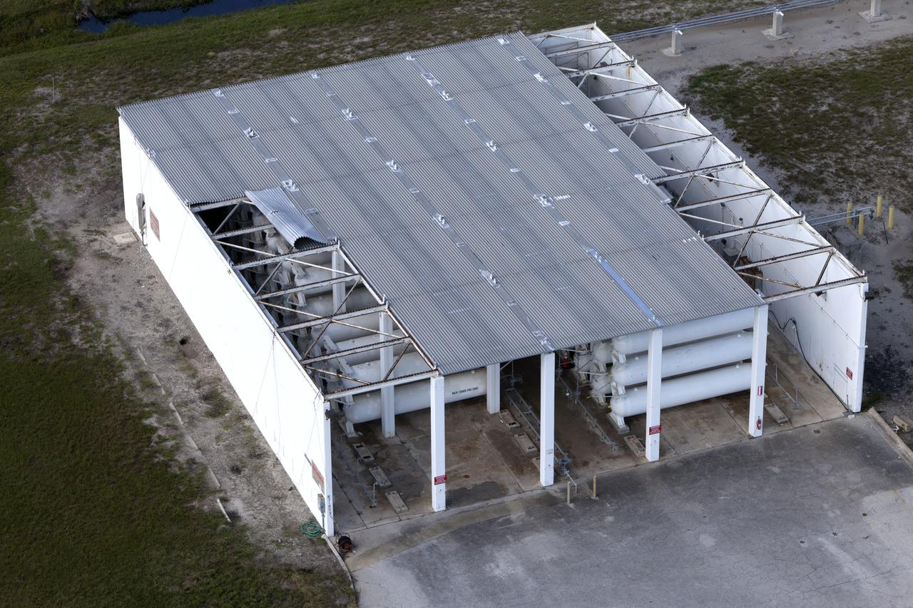
A tank stroage unit near Launch Complex 39 is seen during an aerial survey of NASA's Kennedy Space Center in Florida on September 12, 2017. The survey was performed to identify structures and facilities that may have sustained damage from Hurricane Irma as the storm passed Kennedy on September 10, 2017. NASA closed the center ahead of the storm's onset and only a small team of specialists known as the Rideout Team was on the center as the storm approached and passed.
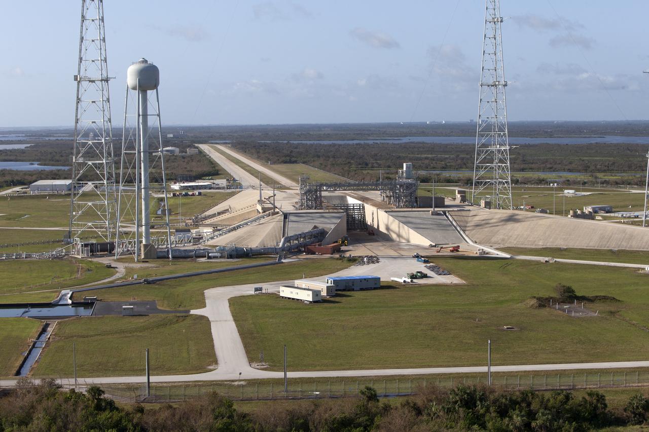
Launch Complex 39B is seen during an aerial survey of NASA's Kennedy Space Center in Florida on September 12, 2017. The survey was performed to identify structures and facilities that may have sustained damage from Hurricane Irma as the storm passed Kennedy on September 10, 2017. NASA closed the center ahead of the storm's onset and only a small team of specialists known as the Rideout Team was on the center as the storm approached and passed.
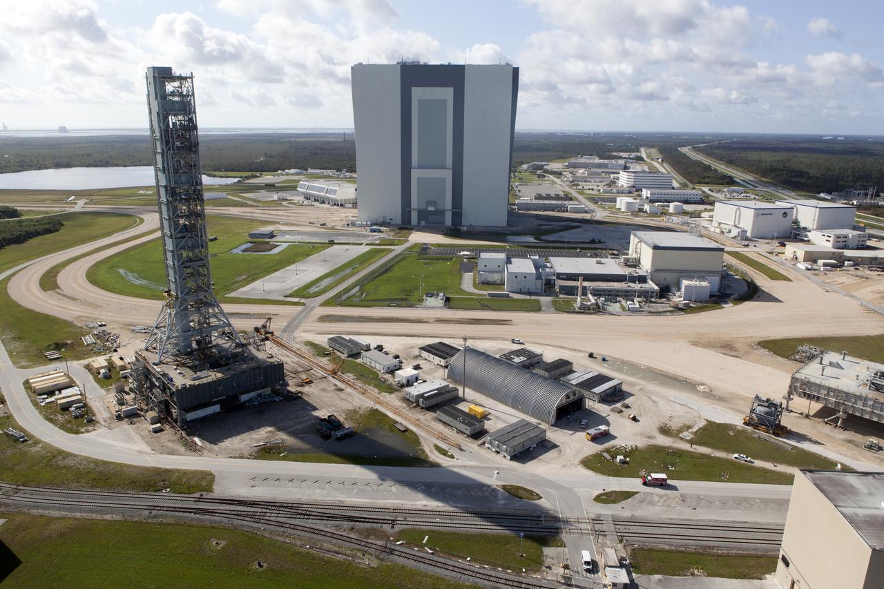
The Mobile Launcher (ML), Launch Control Center (LCC), Vehicle Assembly Building (VAB), and Launch Complex 39 surrounding areas are seen during an aerial survey of NASA's Kennedy Space Center in Florida on September 12, 2017. The survey was performed to identify structures and facilities that may have sustained damage from Hurricane Irma as the storm passed Kennedy on September 10, 2017. NASA closed the center ahead of the storm's onset and only a small team of specialists known as the Rideout Team was on the center as the storm approached and passed.
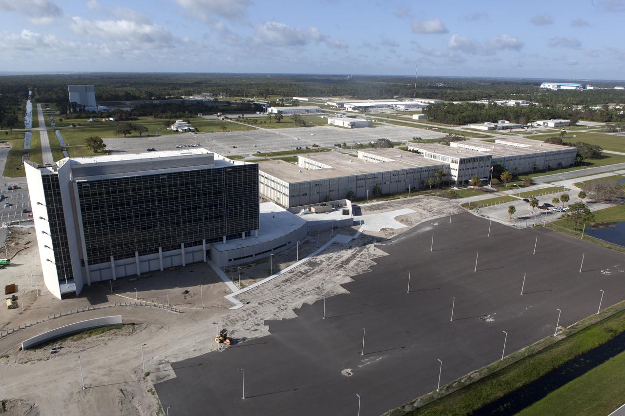
The Central Campus construction site and Headquarters building are seen during an aerial survey of NASA's Kennedy Space Center in Florida on September 12, 2017. The survey was performed to identify structures and facilities that may have sustained damage from Hurricane Irma as the storm passed Kennedy on September 10, 2017. NASA closed the center ahead of the storm's onset and only a small team of specialists known as the Rideout Team was on the center as the storm approached and passed.
Launch Complex 39 surrounding areas are seen during an aerial survey of NASA's Kennedy Space Center in Florida on September 12, 2017. The survey was performed to identify structures and facilities that may have sustained damage from Hurricane Irma as the storm passed Kennedy on September 10, 2017. NASA closed the center ahead of the storm's onset and only a small team of specialists known as the Rideout Team was on the center as the storm approached and passed.
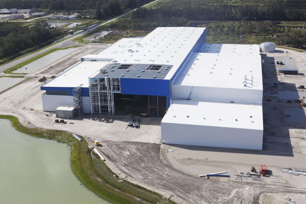
The Blue Origin construction site at Exploration Park is seen during an aerial survey of NASA's Kennedy Space Center in Florida on September 12, 2017. The survey was performed to identify structures and facilities that may have sustained damage from Hurricane Irma as the storm passed Kennedy on September 10, 2017. NASA closed the center ahead of the storm's onset and only a small team of specialists known as the Rideout Team was on the center as the storm approached and passed.
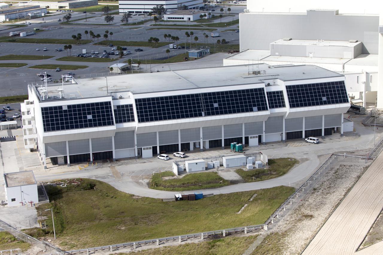
The Multi-Payload Processing Facility (MPPF) is seen during an aerial survey of NASA's Kennedy Space Center in Florida on September 12, 2017. The survey was performed to identify structures and facilities that may have sustained damage from Hurricane Irma as the storm passed Kennedy on September 10, 2017. NASA closed the center ahead of the storm's onset and only a small team of specialists known as the Rideout Team was on the center as the storm approached and passed.
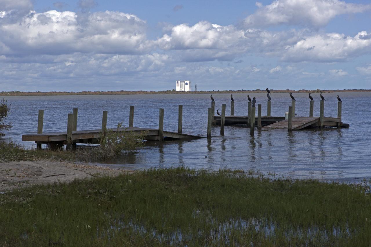
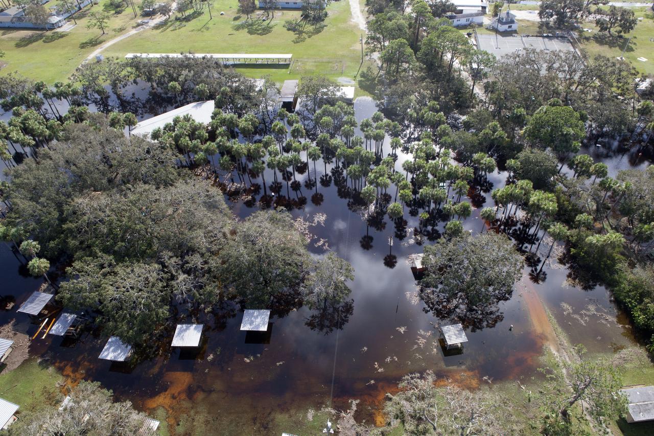
A boat dock torn apart is seen during a survey of NASA's Kennedy Space Center in Florida on September 12, 2017. The survey was performed to identify structures and facilities that may have sustained damage from Hurricane Irma as the storm passed Kennedy on September 10, 2017. NASA closed the center ahead of the storm's onset and only a small team of specialists known as the Rideout Team was on the center as the storm approached and passed.
A trailer flipped on it's side at the Turn Basin is seen during a survey of NASA's Kennedy Space Center in Florida on September 12, 2017. The survey was performed to identify structures and facilities that may have sustained damage from Hurricane Irma as the storm passed Kennedy on September 10, 2017. NASA closed the center ahead of the storm's onset and only a small team of specialists known as the Rideout Team was on the center as the storm approached and passed.
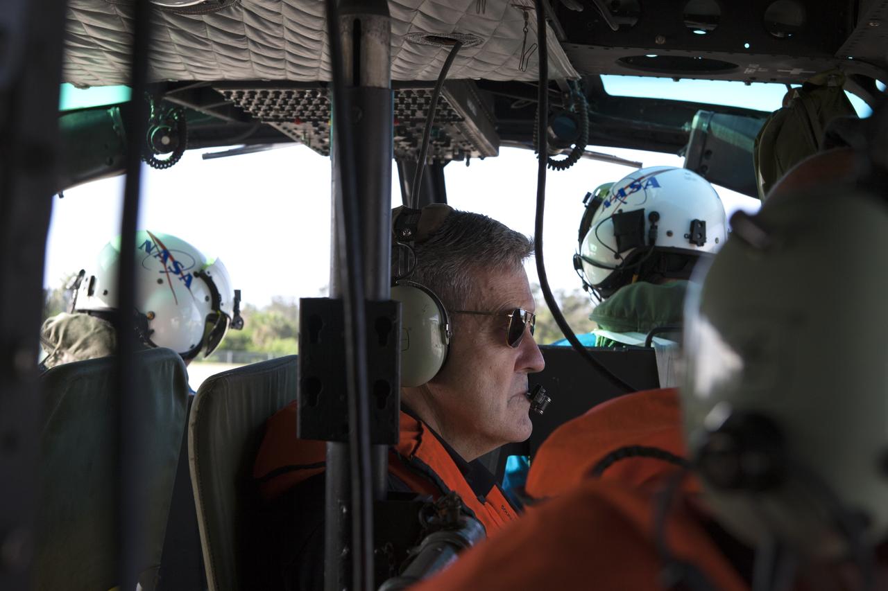
Center Director, Robert Cabana, conducts an aerial survey of NASA's Kennedy Space Center in Florida on September 12, 2017. The survey was performed to identify structures and facilities that may have sustained damage from Hurricane Irma as the storm passed Kennedy on September 10, 2017. NASA closed the center ahead of the storm's onset and only a small team of specialists known as the Rideout Team was on the center as the storm approached and passed.
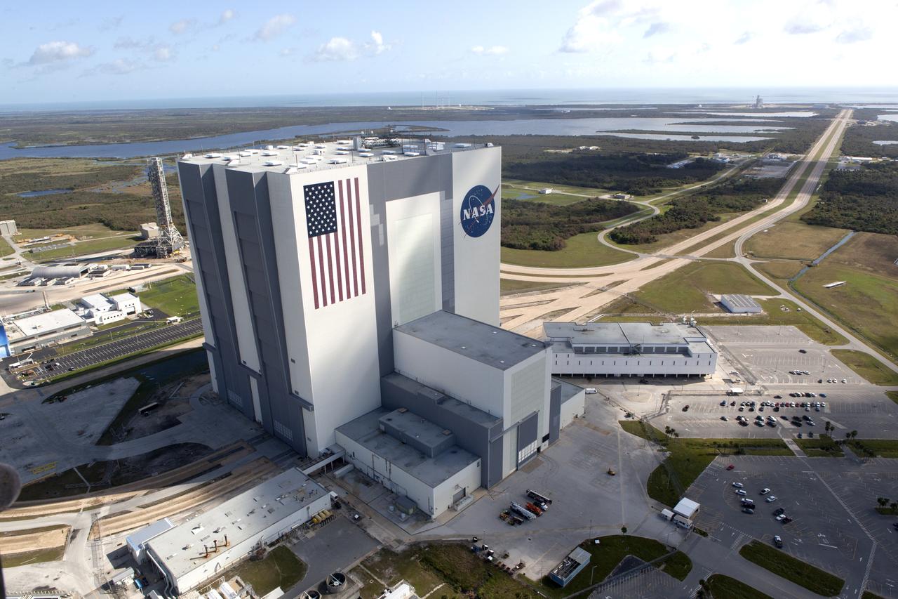
The Mobile Launcher (ML), Vehicle Assembly Building (VAB), Launch Control Center (LCC), and Launch Complex 39 surrounding areas are seen during an aerial survey of NASA's Kennedy Space Center in Florida on September 12, 2017. The survey was performed to identify structures and facilities that may have sustained damage from Hurricane Irma as the storm passed Kennedy on September 10, 2017. NASA closed the center ahead of the storm's onset and only a small team of specialists known as the Rideout Team was on the center as the storm approached and passed.
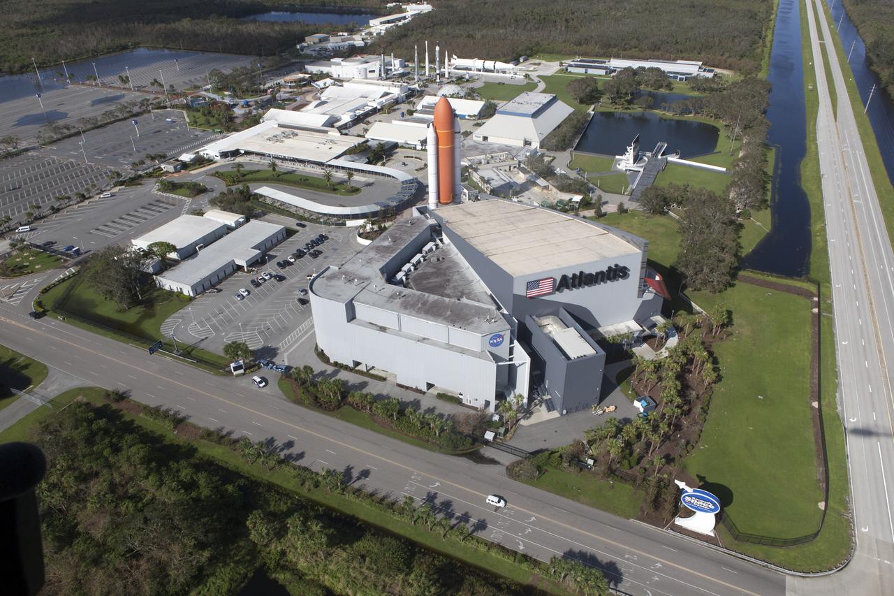
The Kennedy Space Center Visitor Complex is seen during an aerial survey of NASA's Kennedy Space Center in Florida on September 12, 2017. The survey was performed to identify structures and facilities that may have sustained damage from Hurricane Irma as the storm passed Kennedy on September 10, 2017. NASA closed the center ahead of the storm's onset and only a small team of specialists known as the Rideout Team was on the center as the storm approached and passed.
The Launch Control Center (LCC) is seen during an aerial survey of NASA's Kennedy Space Center in Florida on September 12, 2017. The survey was performed to identify structures and facilities that may have sustained damage from Hurricane Irma as the storm passed Kennedy on September 10, 2017. NASA closed the center ahead of the storm's onset and only a small team of specialists known as the Rideout Team was on the center as the storm approached and passed.
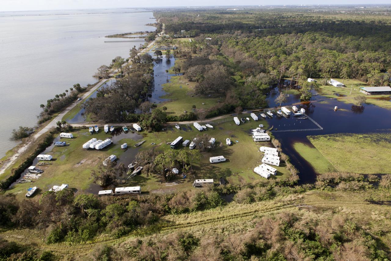
Kars Park I is seen during an aerial survey of NASA's Kennedy Space Center in Florida on September 12, 2017. The survey was performed to identify structures and facilities that may have sustained damage from Hurricane Irma as the storm passed Kennedy on September 10, 2017. NASA closed the center ahead of the storm's onset and only a small team of specialists known as the Rideout Team was on the center as the storm approached and passed.
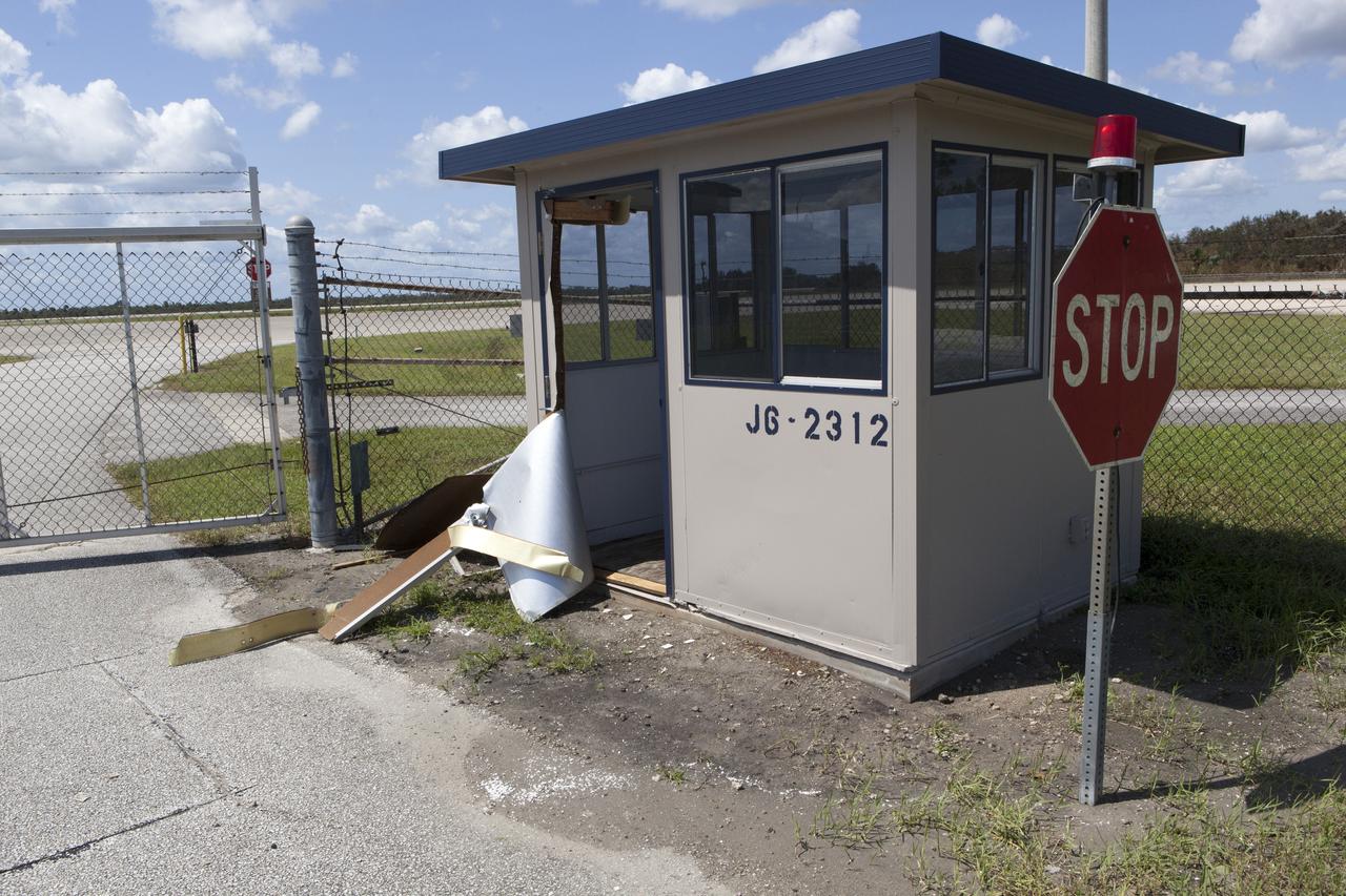
A guard shack at the Shuttle Landing Facility, operated by Space Florida, is seen during a survey of NASA's Kennedy Space Center in Florida on September 12, 2017. The survey was performed to identify structures and facilities that may have sustained damage from Hurricane Irma as the storm passed Kennedy on September 10, 2017. NASA closed the center ahead of the storm's onset and only a small team of specialists known as the Rideout Team was on the center as the storm approached and passed.
The Multi-Payload Processing Facility (MPPF) is seen during an aerial survey of NASA's Kennedy Space Center in Florida on September 12, 2017. The survey was performed to identify structures and facilities that may have sustained damage from Hurricane Irma as the storm passed Kennedy on September 10, 2017. NASA closed the center ahead of the storm's onset and only a small team of specialists known as the Rideout Team was on the center as the storm approached and passed.
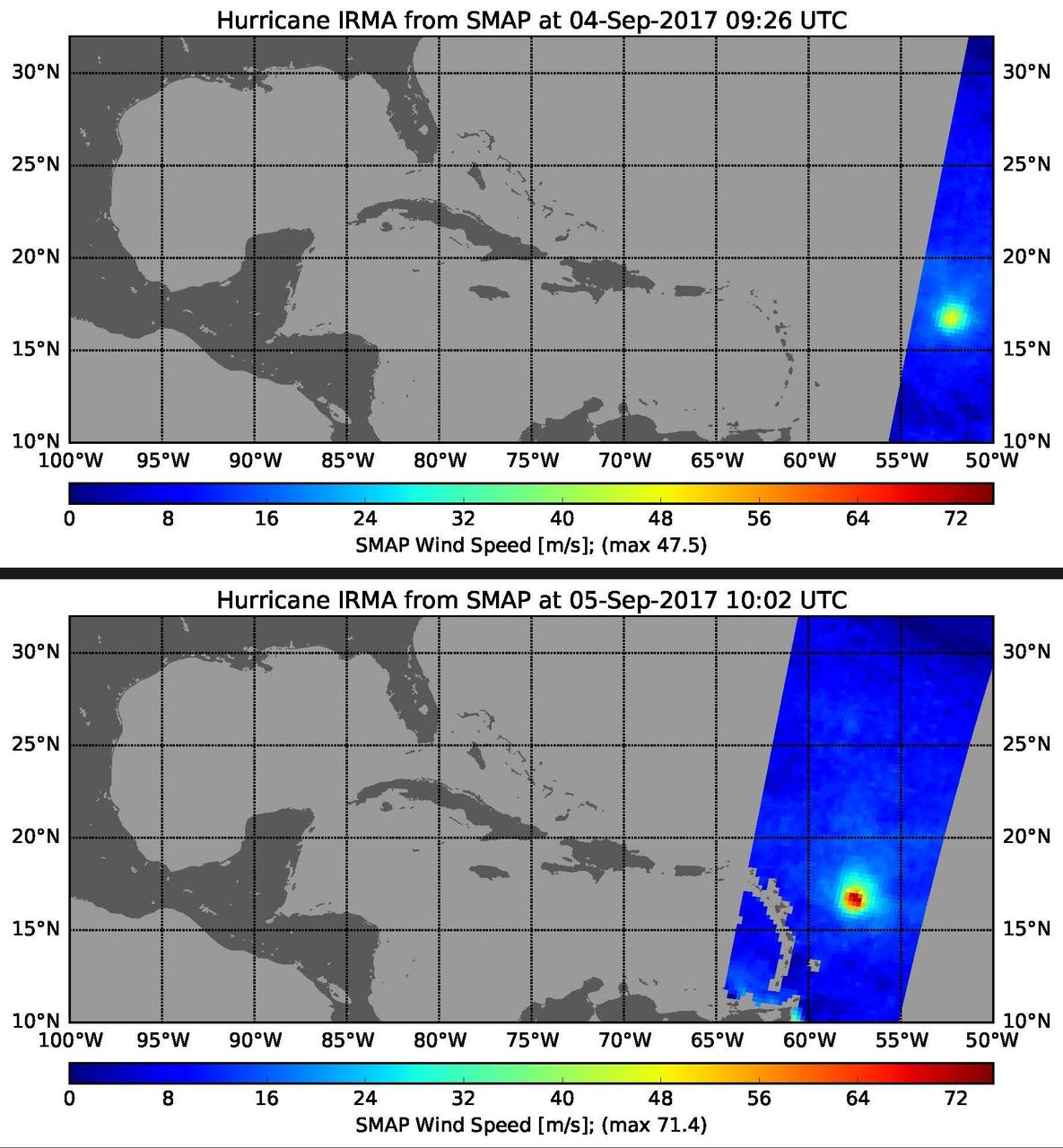
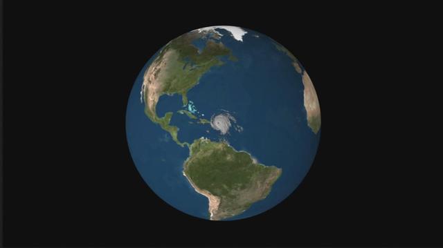
This pair of images shows ocean surface wind speeds for Hurricane Irma as observed at 5:26 a.m. EDT on Sept. 4, 2017 (top) and 24.5 hours later at 6:02 a.m. EDT on September 5th (bottom) by the radiometer instrument on NASA's Soil Moisture Active Passive (SMAP) satellite. Color indicates wind speed, with red being highest and blue lowest. Irma intensified from a Category 2 hurricane on Sept. 4 with observed wind speed of 106 miles per hour (47.5 meters per second) to a Category 5 hurricane on Sept. 5 with a maximum observed wind speed of 160 miles per hour (71.4 meters per second). https://photojournal.jpl.nasa.gov/catalog/PIA21939
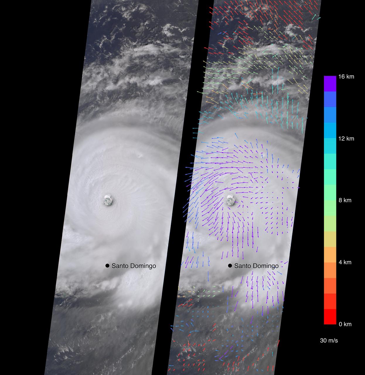
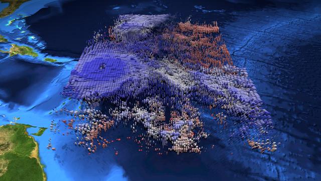
On Sept. 7, the Multi-angle Imaging SpectroRadiometer (MISR) instrument on NASA's Terra satellite passed over Hurricane Irma at approximately 11:20 a.m. local time. The MISR instrument comprises nine cameras that view the Earth at different angles, and since it takes roughly seven minutes for all nine cameras to capture the same location, the motion of the clouds between images allows scientists to calculate the wind speed at the cloud tops. The animated GIF shows Irma's motion over the seven minutes of the MISR imagery. North is toward the top of the image. This composite image shows Hurricane Irma as viewed by the central, downward-looking camera (left), as well as the wind speeds (right) superimposed on the image. The length of the arrows is proportional to the wind speed, while their color shows the altitude at which the winds were calculated. At the time the image was acquired, Irma's eye was located approximately 60 miles (100 kilometers) north of the Dominican Republic and 140 miles (230 kilometers) north of its capital, Santo Domingo. Irma was a powerful Category 5 hurricane, with wind speeds at the ocean surface up to 185 miles (300 kilometers) per hour, according to the National Oceanic and Atmospheric Administration. The MISR data show that at cloud top, winds near the eye wall (the most destructive part of the storm) were approximately 90 miles per hour (145 kilometers per hour), and the maximum cloud-top wind speed throughout the storm calculated by MISR was 135 miles per hour (220 kilometers per hour). While the hurricane's dominant rotation direction is counter-clockwise, winds near the eye wall are consistently pointing outward from it. This is an indication of outflow, the process by which a hurricane draws in warm, moist air at the surface and ejects cool, dry air at its cloud tops. These data were captured during Terra orbit 94267. An animation is available at https://photojournal.jpl.nasa.gov/catalog/PIA21946
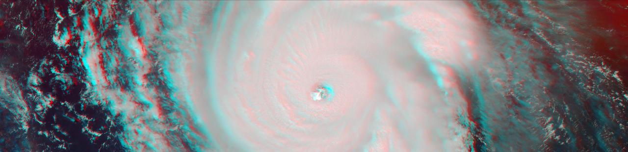
On Sept. 7, the Multi-angle Imaging SpectroRadiometer (MISR) instrument on NASA's Terra satellite passed over Hurricane Irma at approximately 11:20 am local time. The MISR instrument comprises nine cameras that view the Earth at different angles, and since it takes roughly seven minutes for all nine cameras to capture the same location, the motion of the clouds between images allows scientists to calculate the wind speed at the cloud tops. This stereo anaglyph combines two of the MISR angles to show a three-dimensional view of Irma. You will need red-blue glasses to view the anaglyph; place the red lens over your left eye. At this time, Irma's eye was located approximately 60 miles (100 kilometers) north of the Dominican Republic and 140 miles (230 kilometers) north of its capital, Santo Domingo. Irma was a powerful Category 5 hurricane, with wind speeds at the ocean surface up to 185 miles (300 kilometers) per hour. The MISR data show that at cloud top, winds near the eye wall (the most destructive part of the storm) were approximately 90 miles per hour (145 kilometers per hour), and the maximum cloud-top wind speed throughout the storm calculated by MISR was 135 miles per hour (220 kilometers per hour). While the hurricane's dominant rotation direction is counter-clockwise, winds near the eye wall are consistently pointing outward from it. This is an indication of outflow, the process by which a hurricane draws in warm, moist air at the surface and ejects cool, dry air at its cloud tops. https://photojournal.jpl.nasa.gov/catalog/PIA21945
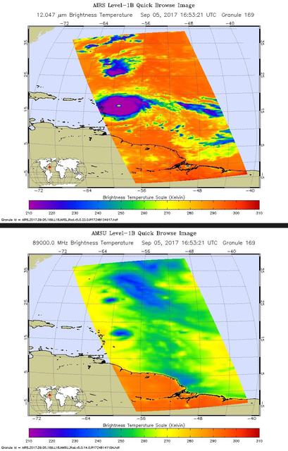
Hurricane Irma is the strongest hurricane ever recorded outside the Caribbean Sea and Gulf of Mexico. These two images from the Atmospheric Infrared Sounder (AIRS) instrument aboard NASA's Aqua satellite show what Hurricane Irma looked like when Aqua passed overhead just before 1 p.m. local time (10 a.m. PDT) on Sept. 5, 2017. Forecasts at the National Hurricane Center have Irma passing near the major islands to its west before turning northward near Florida this weekend. The first image (top) is an infrared snapshot from AIRS (see Figure 1 for larger image). In orange and red areas, the ocean surface shines through, while blue and purple areas represent cold, high clouds that obscure what lies below. Typical of well-developed hurricanes, Irma is nearly circular with a well-defined eye at its center. The eye is about 25 miles (40 kilometers) in diameter. Careful scrutiny shows a red pixel in the center of the eye, which means that AIRS achieved a bulls-eye with one of its "looks" and was able to see to the ocean between the dense clouds in the eye wall. The second image (bottom) shows the view through AIRS' microwave-colored "lenses" (see Figure 2 for larger image). Here the ocean surface looks yellow, while green represents various degrees of cloudiness. Blue shows areas where it is raining heavily. The eye is not apparent in this image because the "pixel size" of the microwave sounder, about 30 miles (50 kilometers), is larger than the eye and therefore cannot "thread the needle." The infrared sounder, on the other hand, has a pixel size of only 10 miles (16.5 kilometers) and can distinguish the small eye. https://photojournal.jpl.nasa.gov/catalog/PIA21941
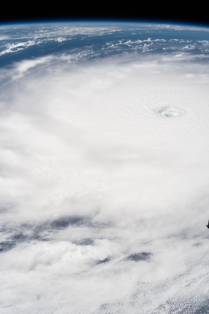
iss053e002408 (Sept, 5, 2017) --- The eye of Hurricane Irma is clearly visible from the International Space Station as it orbited over the Category 5 storm on Sept. 5, 2017.
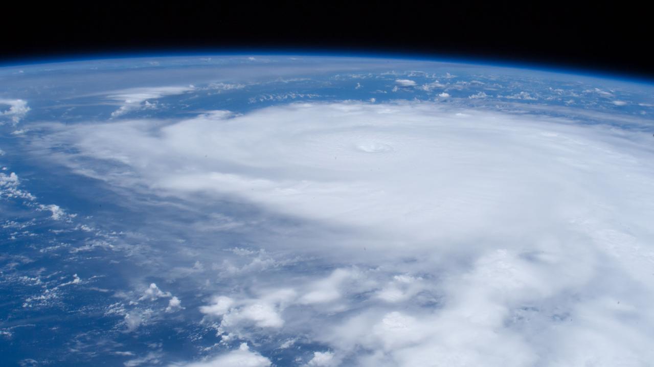
iss053e007343 (Sept. 8, 2017) --- Hurricane Irma was pictured as a Category 4 storm between Cuba and the Turks and Caicos Islands.