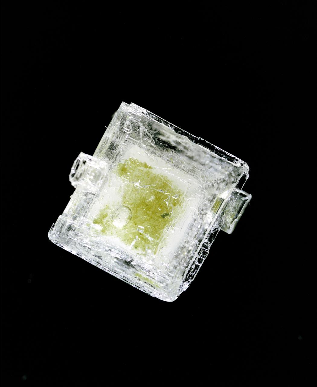
Hypersaline Cyanobacterial salt crystal
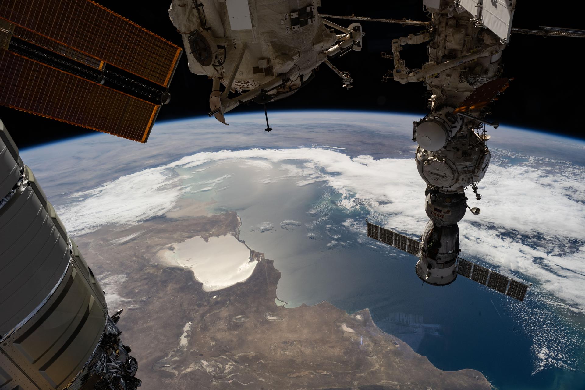
iss073e0819909 (Oct. 2, 2025) --- The Caspian Sea and the hypersaline Garabogazköl Basin (center left) are visible below the International Space Station as it orbited 263 miles above western Kazakhstan. In the right foreground, the Soyuz MS-27 crew spacecraft is docked to the Prichal module. At the top center, the lower portion of the Rassvet module is visible, while the left side of the frame shows part of the Northrop Grumman Cygnus XL cargo spacecraft.
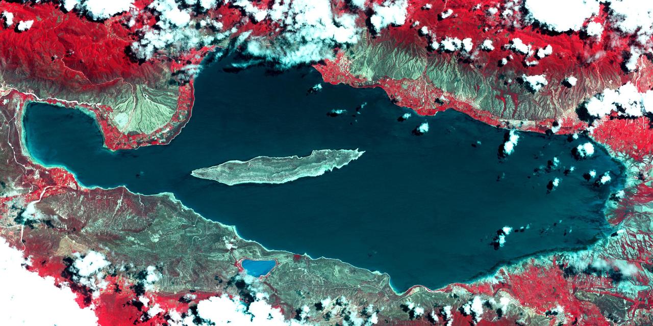
Lake Afrera is a hypersaline lake located in the Danakil Depression in northern Ethiopia where rock salt has been mined for centuries. This image was acquired by NASA Terra spacecraft.
Lake Enriquillo is a hypersaline lake in the Dominican Republic. In 2004, the lake covered an area of 164 square kilometers; by 2011, it had doubled in size and grown to 350 km2, inundating farmland and homes. Various reasons for the flooding include increases in rainfall; increase of sediments going into the lake, raising the lakebed; and milder temperatures, reducing surface evaporation. The lake is home to the largest population of American crocodiles in the Caribbean. The images were acquired October 26, 2003 and June 10, 2017, cover an area of 22.7 by 45.4 km, and are located at 18.5 degrees north, 71.6 degrees west. An image of Lake Enriquillo taken in 2003 is available at https://photojournal.jpl.nasa.gov/catalog/PIA21815
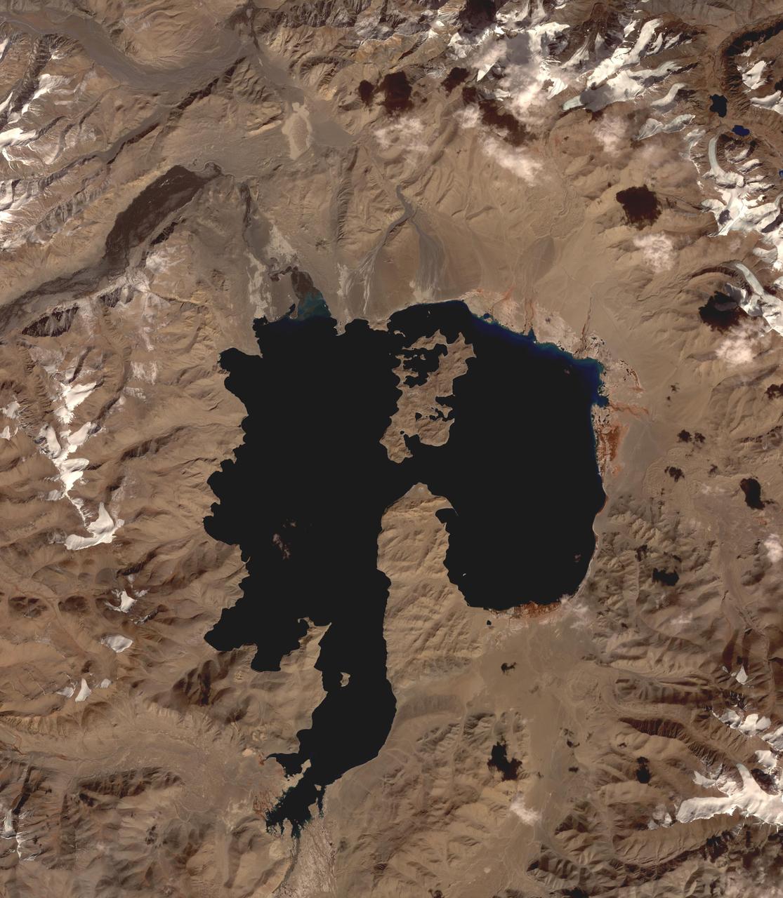
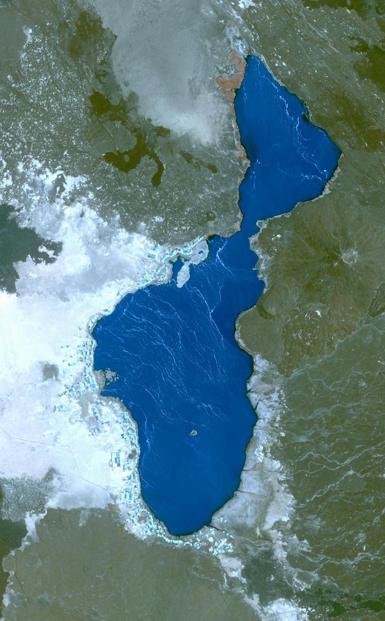
Lake Karakul in northeast Tajikistan is a hypersaline lake with no external drainage, receiving less than 3 cm precipitation per year. It is on the highest part of the fabled Pamir highway at 3900 m. In the local Kyrgyz language, the lake is called "The Black Lake". Recently, Russian scientists have suggested that the lake occupies a 200 million year old meteor impact crater. The image was acquired October 16, 2016, covers an area of 48 by 55 km, and is located at 39 degrees north, 73.4 degrees east. https://photojournal.jpl.nasa.gov/catalog/PIA23102
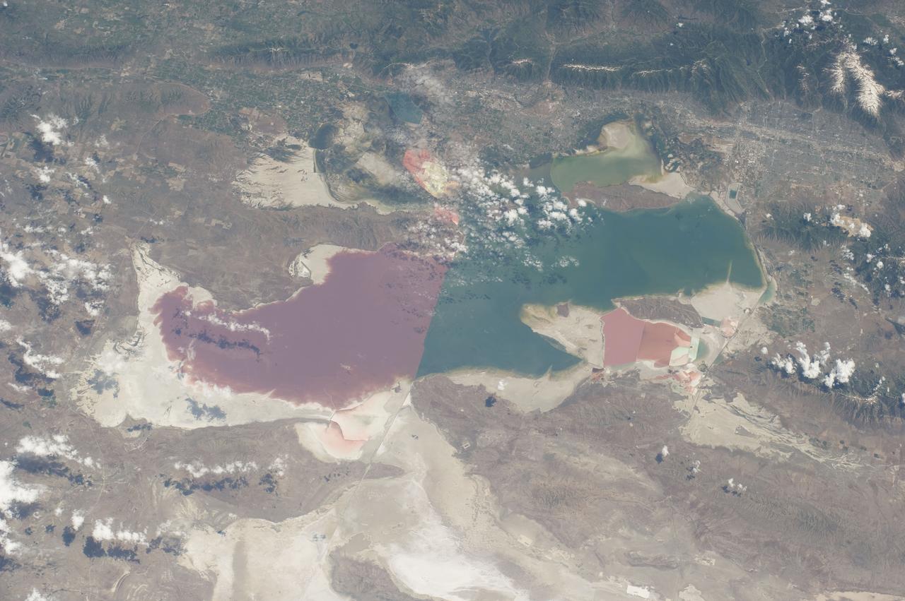
S135-E-006466 (9 July 2011) --- As in the case of many previous space missions, the Great Salt Lake in Utah serves as a striking visual marker for the STS-135 astronauts orbiting over North America in the space shuttle Atlantis. A sharp line across the lake's center is caused by the restriction in water flow from the railroad causeway. The eye-catching colors of the lake stem from the fact that Great Salt Lake is hypersaline, typically 3-5 times saltier than the ocean. Photo credit: NASA
ISS030-E-034228 (14 Jan. 2012) --- The Great Salt Lake in Utah serves as a striking visual marker for the Expedition 30 crew members orbiting over the western states aboard the International Space Station. A sharp line across the lake's center is caused by the restriction in water flow from the railroad causeway. The eye-catching colors of the lake stem from the fact that Great Salt Lake is hypersaline, typically 3-5 times saltier than the ocean.
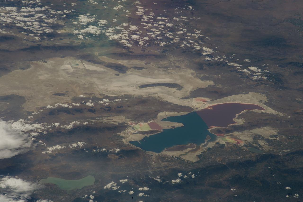
ISS040-E-043231 (6 July 2014) --- As in the case of many previous space missions, the Great Salt Lake in Utah serves as a striking visual marker for the Expedition 40 crew members orbiting 222 nautical miles over North America aboard the International Space Station. A 200mm focal length was used to capture the image. A sharp line across the lake's center is caused by the restriction in water flow from the railroad causeway. The eye-catching colors of the lake stem from the fact that Great Salt Lake is hypersaline, typically 3-5 times saltier than the ocean.
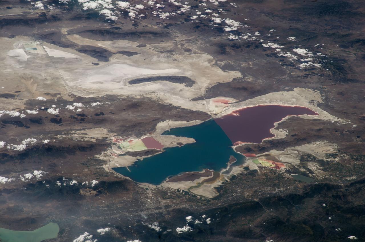
ISS040-E-043230 (6 July 2014) --- As in the case of many previous space missions, the Great Salt Lake in Utah serves as a striking visual marker for the Expedition 40 crew members orbiting 222 nautical miles over North America aboard the International Space Station. A 200mm focal length was used to capture the image. A sharp line across the lake's center is caused by the restriction in water flow from the railroad causeway. The eye-catching colors of the lake stem from the fact that Great Salt Lake is hypersaline, typically 3-5 times saltier than the ocean.

ISS035-E-025019 (20 April 2013) --- One of the Expedition 35 crew members aboard the Earth-orbiting International Space Station used a 400 millimeter lens to record this photograph highlighting water of different color within sub basins of the Laguna (lake) Verde in the high Andes of northwest Argentina. The lake floor as a local low point lies at 4095 meters (13,438 feet) above sea level, whereas the peak of the local volcano west of the lake (not shown) reaches almost 3000 meters higher (or about 6818 meters, 22,368 feet). Laguna Verde (58 kilo meters wide, 36 kilometers long) often appears green, giving rise to its formal name. The image shows the turquoise tint in the central sub basin (image center), with a yellow to black tinge to water in the southern sub basin at image left (also known locally as Laguna Negra). The northernmost basin at image right appears quite black, and the large gray zone comprising much of the rest of Laguna Verde is likely a combination of shallow water, only inches deep, and sunglint reflecting off the water surface. The reason for the color differences lays in the fact the many different families of salt-loving organisms occupy hypersaline lakes such as Laguna Verde. These appear as different colors ? often bright -- depending on the salinities and temperatures of each water body or sub basin. The rest of the lake floor is dry and appears white from the build-up of thick salt deposits. Parallel lines around the southern sub basin (Laguna Negro) indicate prior shorelines of this shrinking water body ? evaporation removes water but leaves ephemeral shorelines marked with white salt.