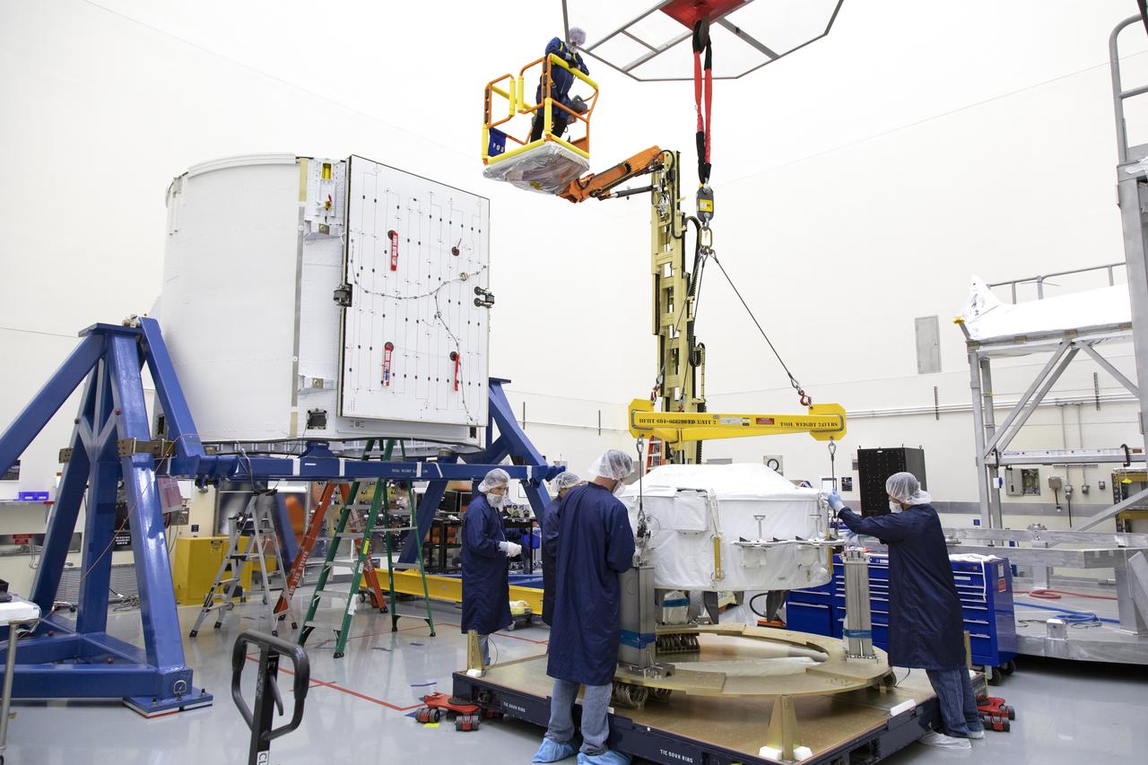
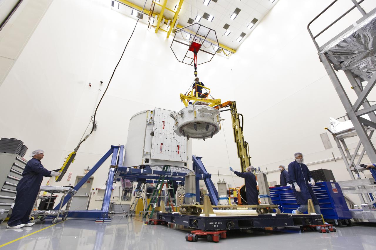
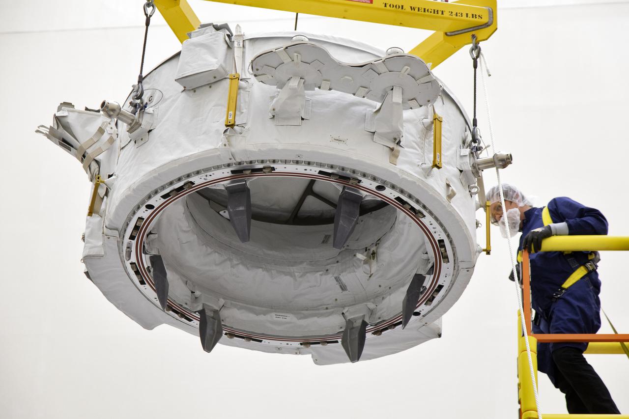
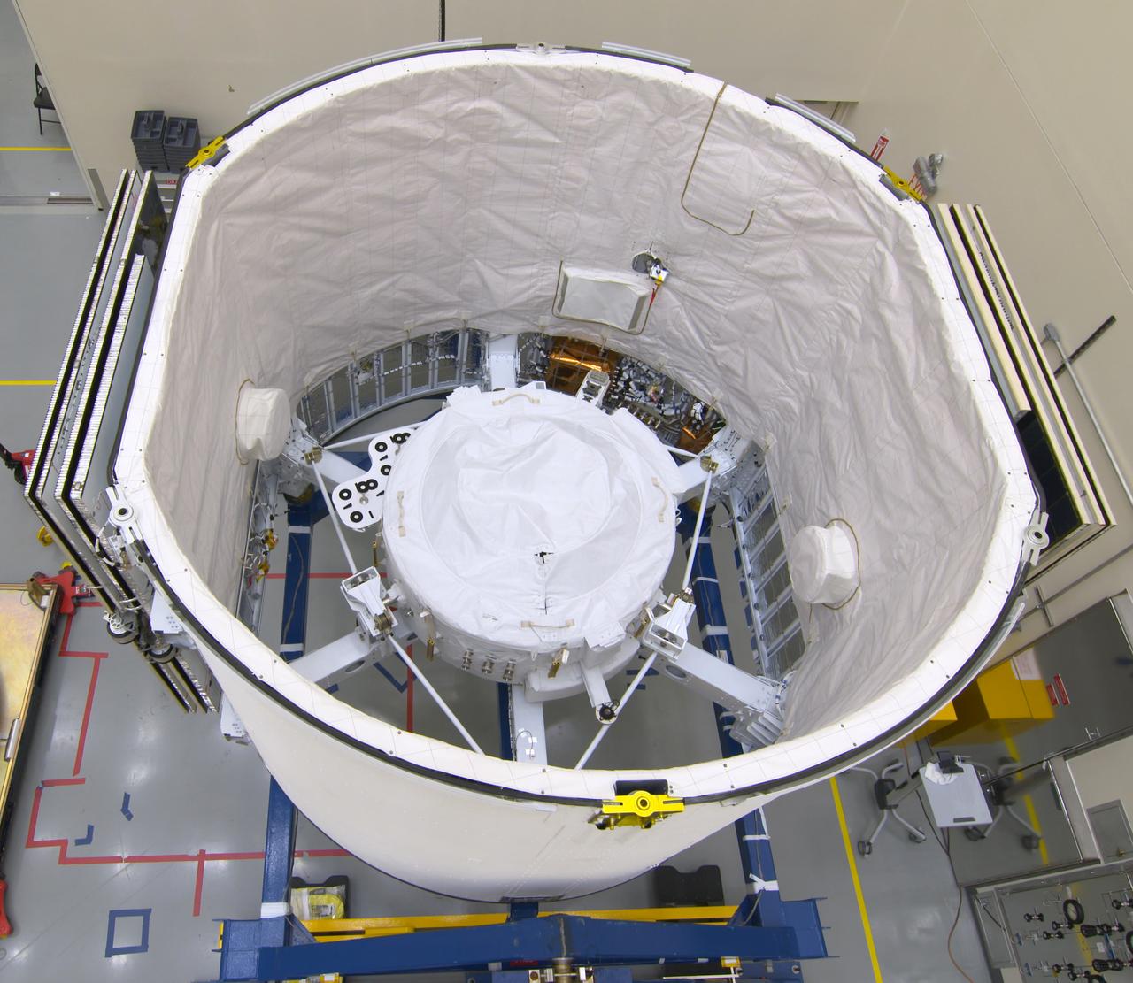
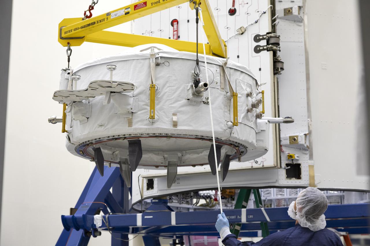
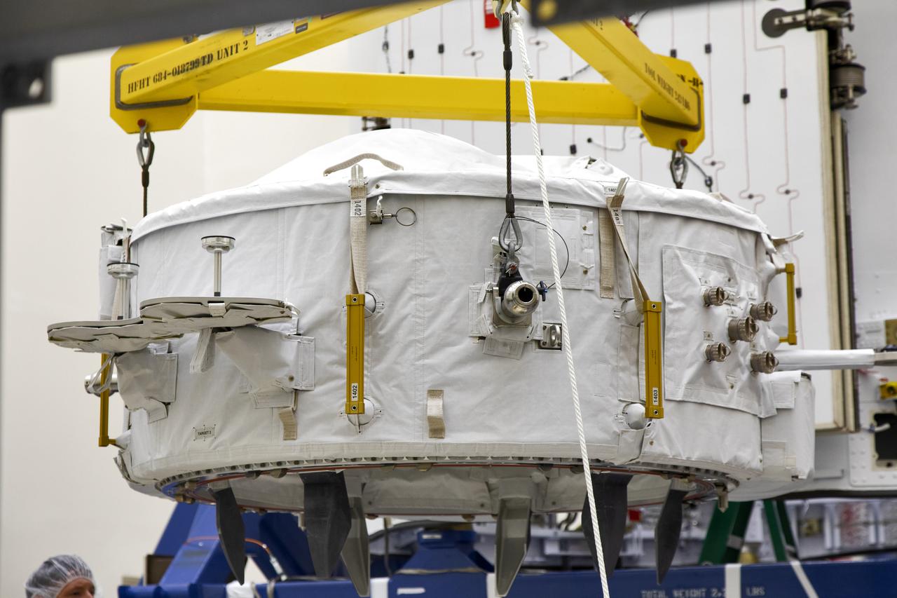
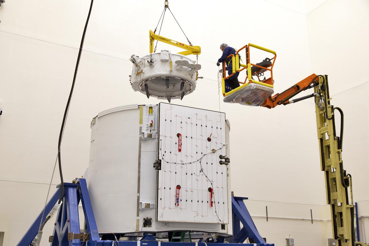
The International Docking Adapter 3, a critical component for future crewed missions to the International Space Station, is carefully packed away in the unpressurized “trunk” section of the SpaceX Dragon spacecraft at the SpaceX facility on Cape Canaveral Air Force Station in Florida on June 19. It will launch to the orbiting laboratory in July on the company’s 18th commercial resupply mission. The adapter will support future U.S. crewed vehicles visiting the station.
The International Docking Adapter 3, a critical component for future crewed missions to the International Space Station, is carefully packed away in the unpressurized “trunk” section of the SpaceX Dragon spacecraft at the SpaceX facility on Cape Canaveral Air Force Station in Florida on June 19. It will launch to the orbiting laboratory in July on the company’s 18th commercial resupply mission. The adapter will support future U.S. crewed vehicles visiting the station.
The International Docking Adapter 3, a critical component for future crewed missions to the International Space Station, is carefully packed away in the unpressurized “trunk” section of the SpaceX Dragon spacecraft at the SpaceX facility on Cape Canaveral Air Force Station in Florida on June 19. It will launch to the orbiting laboratory in July on the company’s 18th commercial resupply mission. The adapter will support future U.S. crewed vehicles visiting the station.
The International Docking Adapter 3, a critical component for future crewed missions to the International Space Station, is carefully packed away in the unpressurized “trunk” section of the SpaceX Dragon spacecraft at the SpaceX facility on Cape Canaveral Air Force Station in Florida on June 19. It will launch to the orbiting laboratory in July on the company’s 18th commercial resupply mission. The adapter will support future U.S. crewed vehicles visiting the station.
The International Docking Adapter 3, a critical component for future crewed missions to the International Space Station, is carefully packed away in the unpressurized “trunk” section of the SpaceX Dragon spacecraft at the SpaceX facility on Cape Canaveral Air Force Station in Florida on June 19. It will launch to the orbiting laboratory in July on the company’s 18th commercial resupply mission. The adapter will support future U.S. crewed vehicles visiting the station.
The International Docking Adapter 3, a critical component for future crewed missions to the International Space Station, is carefully packed away in the unpressurized “trunk” section of the SpaceX Dragon spacecraft at the SpaceX facility on Cape Canaveral Air Force Station in Florida on June 19. It will launch to the orbiting laboratory in July on the company’s 18th commercial resupply mission. The adapter will support future U.S. crewed vehicles visiting the station.
The International Docking Adapter 3, a critical component for future crewed missions to the International Space Station, is carefully packed away in the unpressurized “trunk” section of the SpaceX Dragon spacecraft at the SpaceX facility on Cape Canaveral Air Force Station in Florida on June 19. It will launch to the orbiting laboratory in July on the company’s 18th commercial resupply mission. The adapter will support future U.S. crewed vehicles visiting the station.
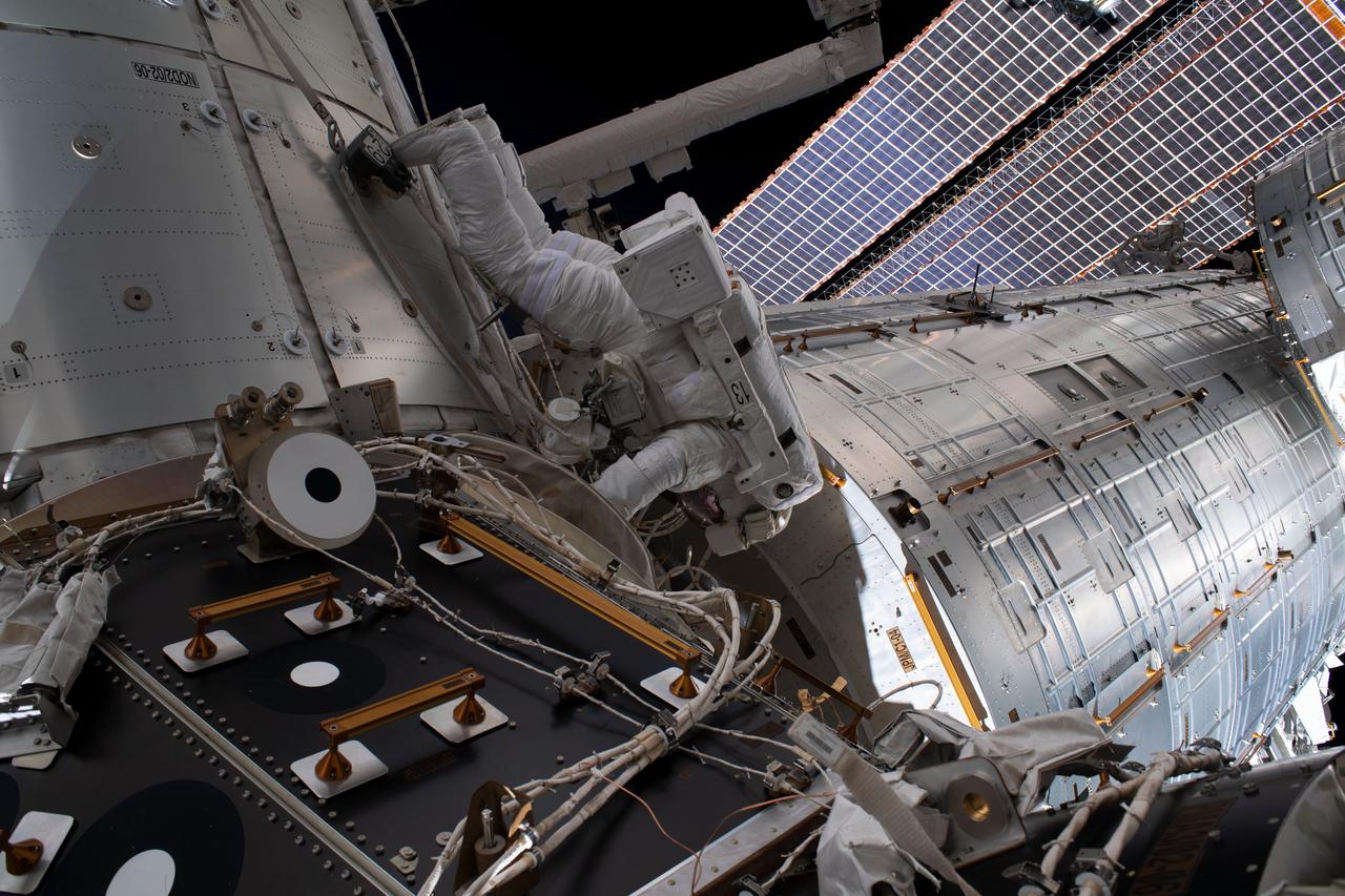
iss060e043181 (Aug. 21, 2019) --- NASA astronaut Andrew Morgan is pictured working outside the International Space Station during a six-hour and 32-minute spacewalk to install the orbiting lab’s second commercial crew vehicle docking port, the International Docking Adapter-3 (IDA-3). The IDA-3 will accommodate the future arrivals of Boeing CST-100 Starliner and SpaceX Crew Dragon commercial crew spacecraft.
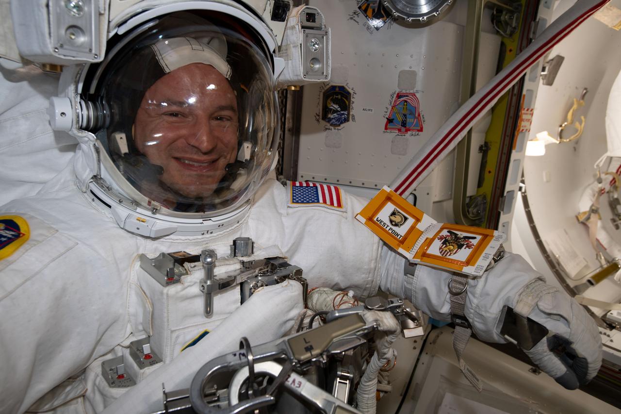
iss060e038222 (Aug. 21, 2019) --- NASA astronaut Andrew Morgan is pictured in his U.S. spacesuit inside the International Space Station's Quest airlock preparing to begin a six-hour and 32-minute spacewalk to install the orbiting lab’s second commercial crew vehicle docking port, the International Docking Adapter-3 (IDA-3). The IDA-3 will accommodate the future arrivals of Boeing CST-100 Starliner and SpaceX Crew Dragon commercial crew spacecraft.

iss060e038215 (Aug. 21, 2019) --- NASA astronaut Christina Koch poses for a portrait with Andrew Morgan and Nick Hague in their U.S. spacesuits before beginning a six-hour and 32-minute spacewalk to install the orbiting lab’s second commercial crew vehicle docking port, the International Docking Adapter-3 (IDA-3). The IDA-3 will accommodate the future arrivals of Boeing CST-100 Starliner and SpaceX Crew Dragon commercial crew spacecraft.
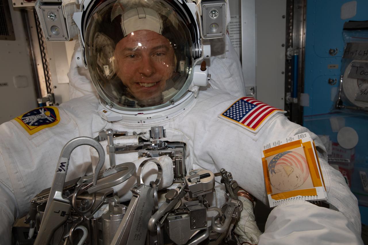
iss060e038228 (Aug. 21, 2019) --- NASA astronaut Nick Hague is pictured in his U.S. spacesuit inside the International Space Station's Quest airlock preparing to begin a six-hour and 32-minute spacewalk to install the orbiting lab’s second commercial crew vehicle docking port, the International Docking Adapter-3 (IDA-3). The IDA-3 will accommodate the future arrivals of Boeing CST-100 Starliner and SpaceX Crew Dragon commercial crew spacecraft.

iss060e043180 (Aug. 21, 2019) --- NASA astronaut Nick Hague takes an out-of-this-world "space-selfie" during a spacewalk to install the International Space Station’s second commercial crew vehicle docking port, the International Docking Adapter-3 (IDA-3).
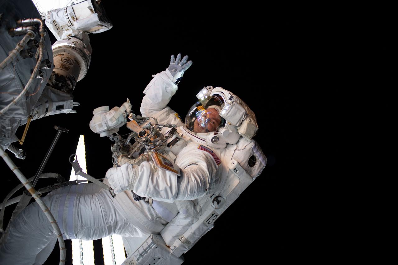
iss060e043194 (Aug. 21, 2019) --- NASA astronaut Andrew Morgan waves as he is photographed during a spacewalk to install the International Space Station’s second commercial crew vehicle docking port, the International Docking Adapter-3 (IDA-3).

iss060e043273 (Aug. 21, 2019) --- NASA astronaut Nick Hague is pictured tethered to the forward end of the International Space Station during a spacewalk to install the orbiting lab's second commercial crew vehicle docking port, the International Docking Adapter-3 (IDA-3).

An oil slick in the Gulf of Mexico following Hurricane Ida – a high-end Category 4 when it made landfall near Port Fourchon, Louisiana, on Aug. 29, 2021 – appears as a green trail in the inset false-color graphic provided by NASA's Delta-X project, while the surrounding seawater appears orange. The National Oceanic and Atmospheric Administration (NOAA) regularly monitors U.S. coastal waters for potential spills and noticed slicks that appeared just off the coast after the hurricane. They were able to use this information from Delta-X to corroborate other data they had about oil slicks in the area (satellite image in the second inset picture). The blue-green swath crossing from the Gulf of Mexico over the Louisiana coast denotes the flight path of the Delta-X radar instrument on Sept. 1, just before 11:30 a.m. CDT. Charged with studying the Mississippi River Delta, Delta-X was gearing up to collect data on Louisiana's coastal wetlands when Hurricane Ida barreled ashore in late August. The storm damaged buildings and infrastructure alike, resulting in power outages, flooding, and oil slicks in the Gulf of Mexico. Oil tends to smooth out the bumps on the ocean's surface, which results in a distinct radar signal that the Delta-X mission was able to pick out of their data. Delta-X added flight paths to their planned schedule – with the support of NASA's Applied Science Disaster Program – in order to collect information over the gulf in areas of interest to NOAA. Delta-X is studying two wetlands – the Atchafalaya and Terrebonne Basins – by land, boat, and air to quantify water and sediment flow as well as vegetation growth. While the Atchafalaya Basin has been gaining land through sediment accumulation, Terrebonne Basin, which is right next to the Atchafalaya, has been rapidly losing land. The data collected by the project will be applied to models used to forecast which areas of the delta are likely to gain or lose land under various sea level rise, river flow, and watershed management scenarios. The mission uses several instruments to collect its data. Affixed to the bottom of a Gulfstream-III airplane, one of those instruments, the all-weather Uninhabited Aerial Vehicle Synthetic Aperture Radar (UAVSAR), bounces radar signals off of Earth's surface, forming a kind of image of a particular area. Repeated images of the same regions, captured at different times, enable researchers to detect changes in those areas, such as fluctuating water levels beneath the vegetation as the tides move in and out of these wetlands. In addition to radar measurements, teams from Caltech, Louisiana State University, Florida International University, and other collaborating institutions gather water and vegetation samples – among other data – by boat, other airborne sensors, and from instruments on the ground. Funded by NASA's Earth Venture Suborbital (EVS-3) program, Delta-X is managed by the agency's Jet Propulsion Laboratory. Caltech in Pasadena, California, manages JPL for NASA. Fall 2021 was Delta-X's last scheduled field campaign, although the five-year mission will run through the end of 2023. https://photojournal.jpl.nasa.gov/catalog/PIA24540
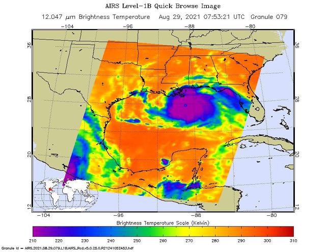
NASA's Atmospheric Infrared Sounder (AIRS), aboard the Aqua satellite, caught views of Hurricane Ida as the high-end Category 4 storm swept ashore around noon local time on Aug. 29, 2021, near Port Fourchon, Louisiana. One snapshot showed the hurricane around 3 a.m. that day while it was still over the Gulf of Mexico. The second view (Figure 1) caught the storm around 1:45 p.m. local time. In the infrared AIRS imagery, purple areas indicate very cold clouds carried high into the atmosphere by towering thunderstorms. These regions are also associated with heavy rainfall. Blue and green indicate warmer areas with shallower rain clouds. The orange and red areas represent mostly cloud-free air. The eye of the hurricane is seen just over the Louisiana coast as a small blue-green area in the middle of the large patch of purple in the after-landfall image. AIRS, in conjunction with the Advanced Microwave Sounding Unit (AMSU), senses emitted infrared and microwave radiation from Earth to provide a three-dimensional look at the planet's weather and climate. Working in tandem, the two instruments make simultaneous observations down to Earth's surface. With more than 2,000 channels sensing different regions of the atmosphere, the system creates a global, three-dimensional map of atmospheric temperature and humidity, cloud amounts and heights, greenhouse gas concentrations, and many other atmospheric phenomena. Launched into Earth orbit in 2002 aboard NASA's Aqua spacecraft, the AIRS and AMSU instruments are managed by NASA's Jet Propulsion Laboratory in Southern California, under contract to NASA. JPL is a division of Caltech. https://photojournal.jpl.nasa.gov/catalog/PIA24538