A Question of Interpretation
Interpreted Lava Fountains on Io
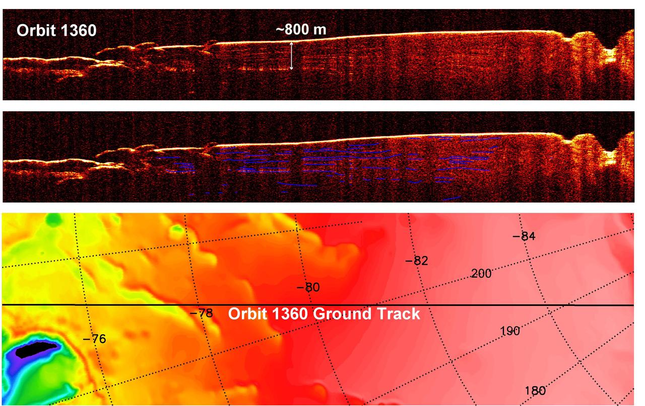
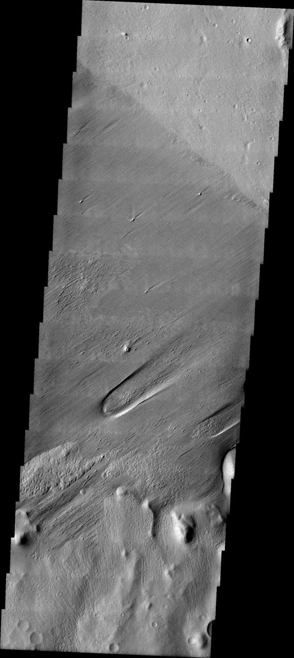
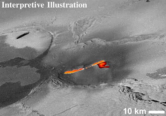
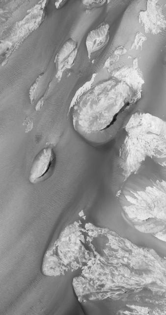
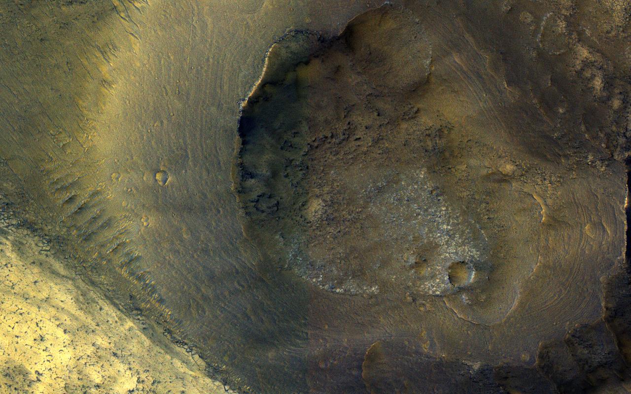
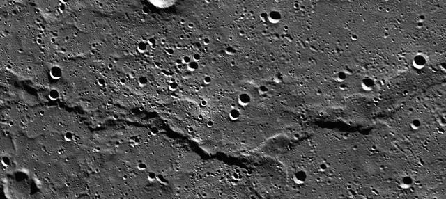
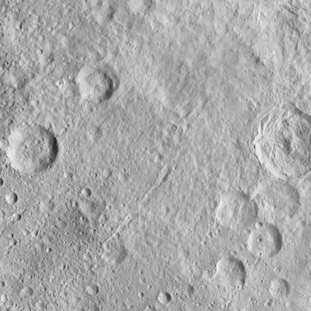
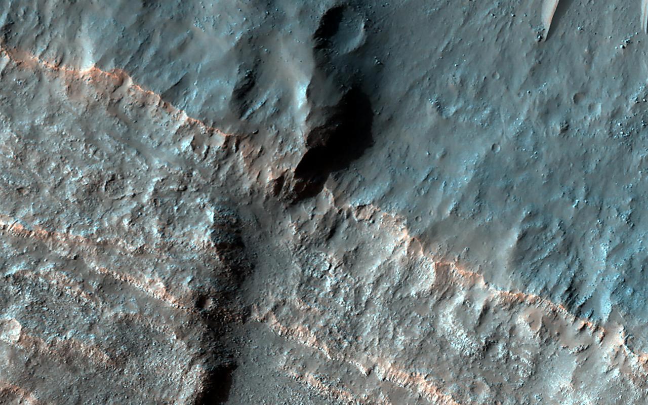
Interpreting Radar View near Mars South Pole, Orbit 1360
Interpreting Radar View near Mars South Pole, Orbit 1334
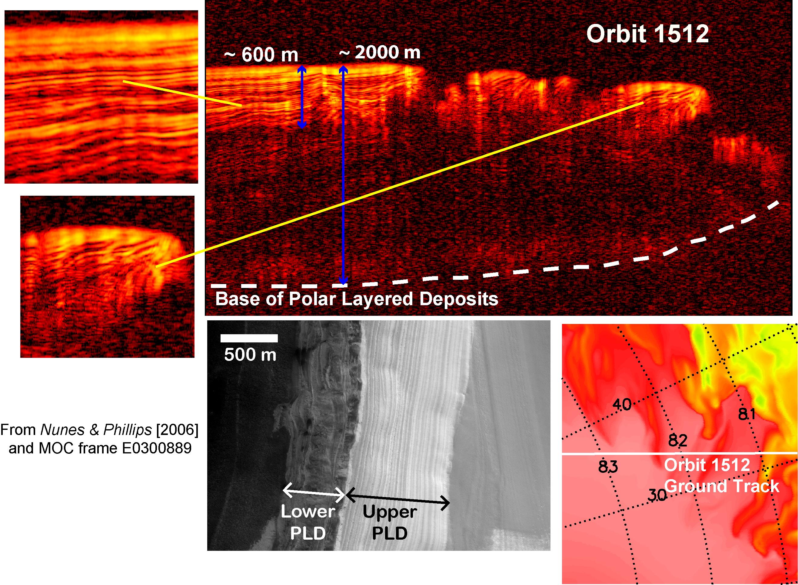
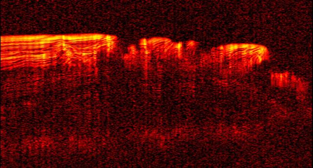
Interpreting Radar View near Mars North Pole, Orbit 1512
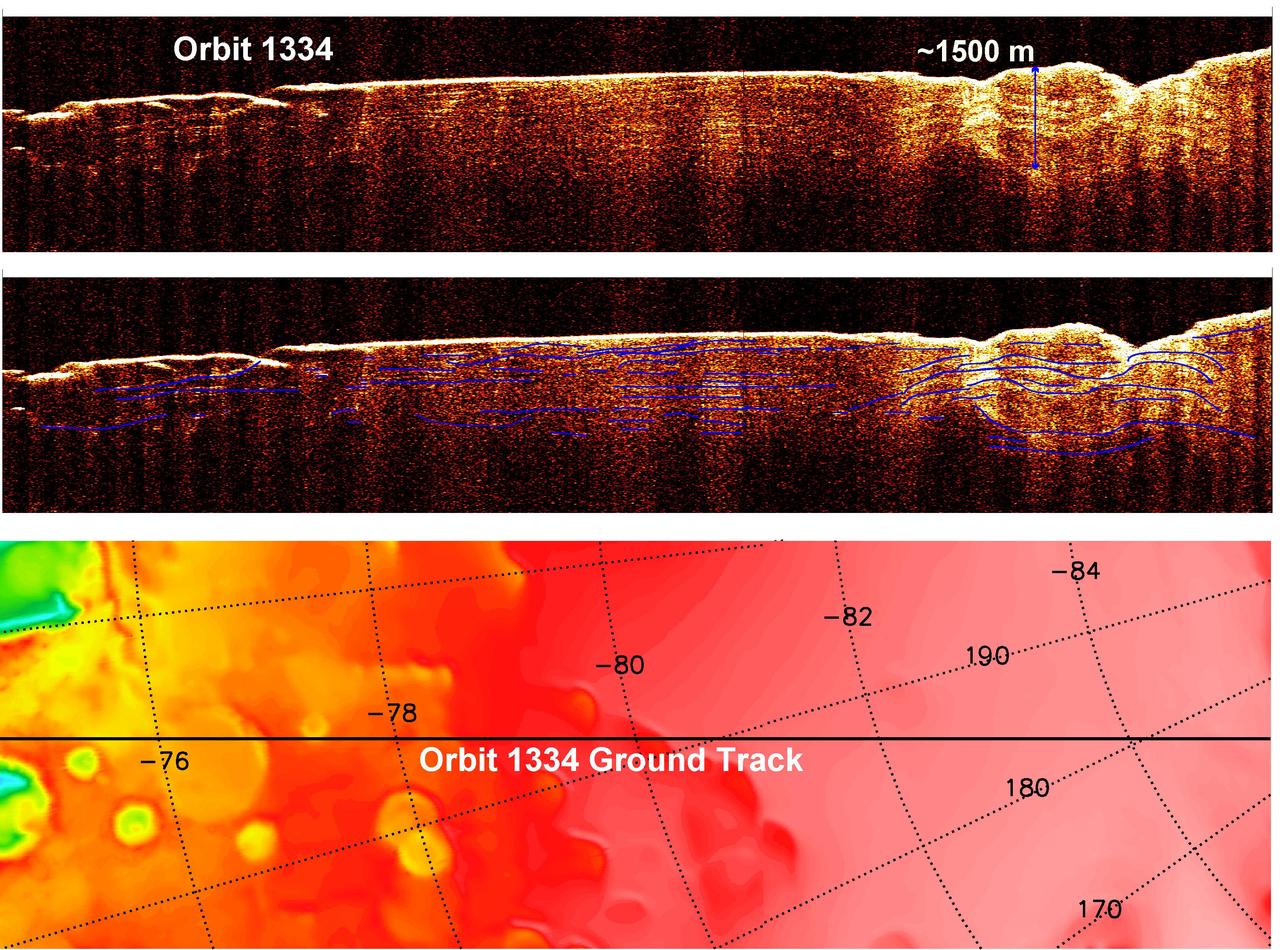
Interpreting Radar View near Mars South Pole, Orbit 1334
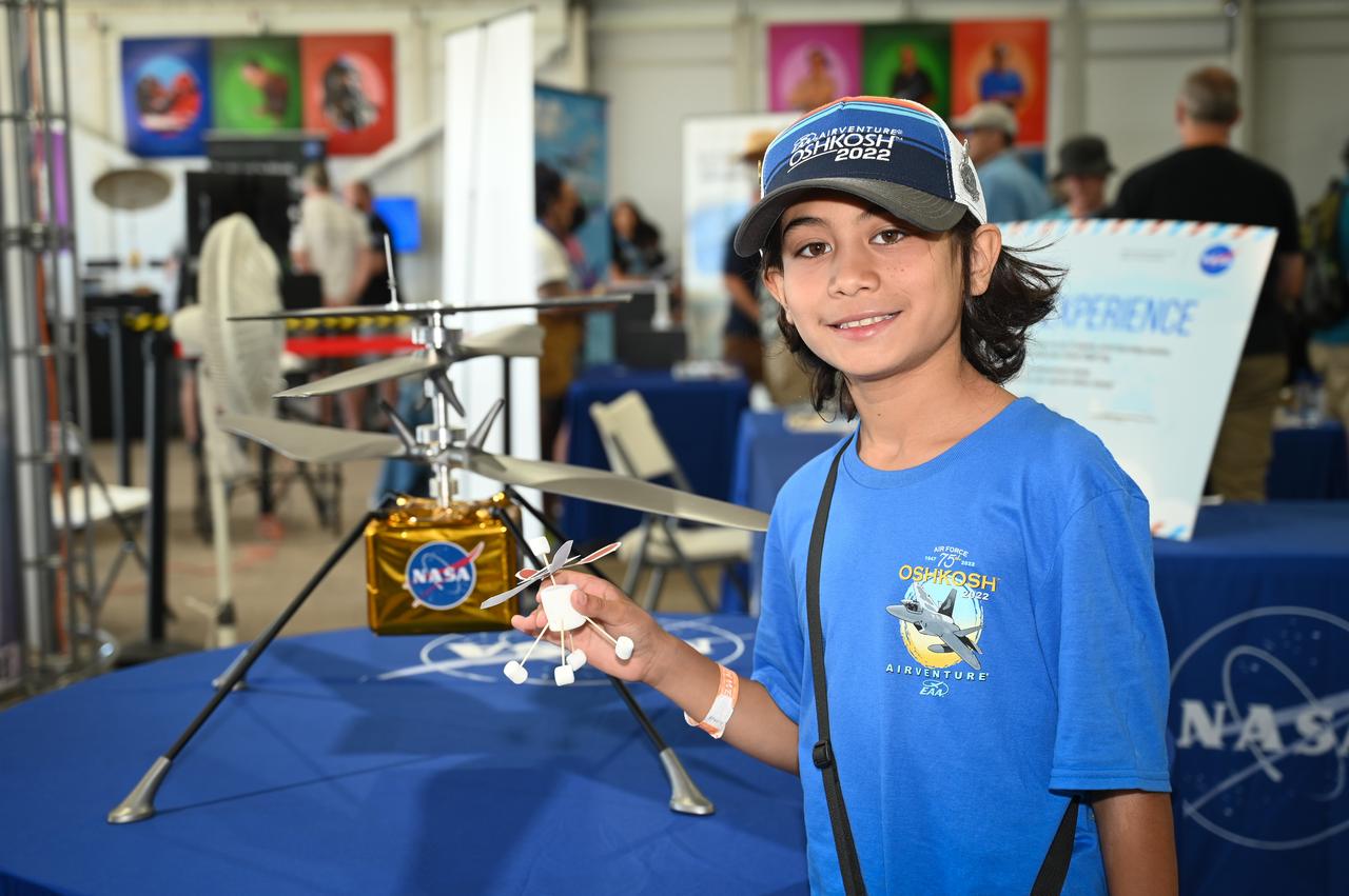
Ioannis Allan Torounidis shows off his interpretation of the Ingenuity Mars Helicopter on Wednesday, July 27, 2022 at AirVenture at Oshkosh.

This cross-section graphic provides an interpretation of the geologic relationship between the Murray Formation, the crater floor sediments, and the hematite ridge.
This image contributed to an interpretation by NASA Mars rover Curiosity science team that some of the bright particles on the ground near the rover are native Martian material.
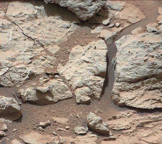
This image of an outcrop at the Sheepbed locality, taken by NASA Curiosity Mars rover shows well-defined veins filled with whitish minerals, interpreted as calcium sulfate.
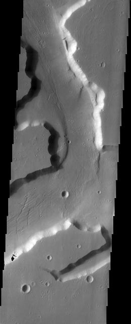
This image from NASA Mars Odyssey spacecraft shows grooves within channels of Kasei Valles that can be interpreted as evidence for fluvial activity.
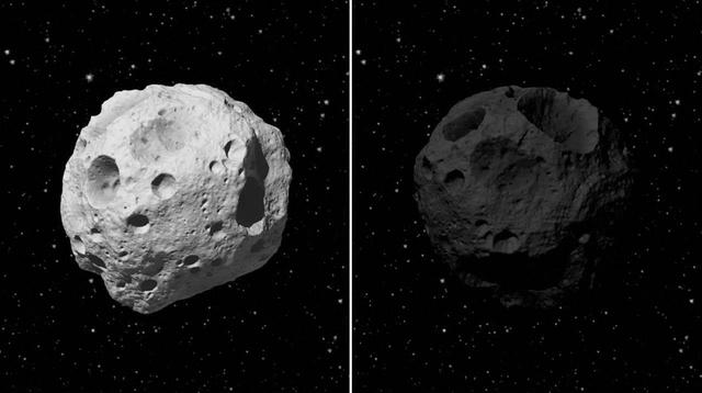
This frame from an animation illustrates the benefits of observing asteroids in infrared light. It begins by showing two artistic interpretations of asteroids up close.
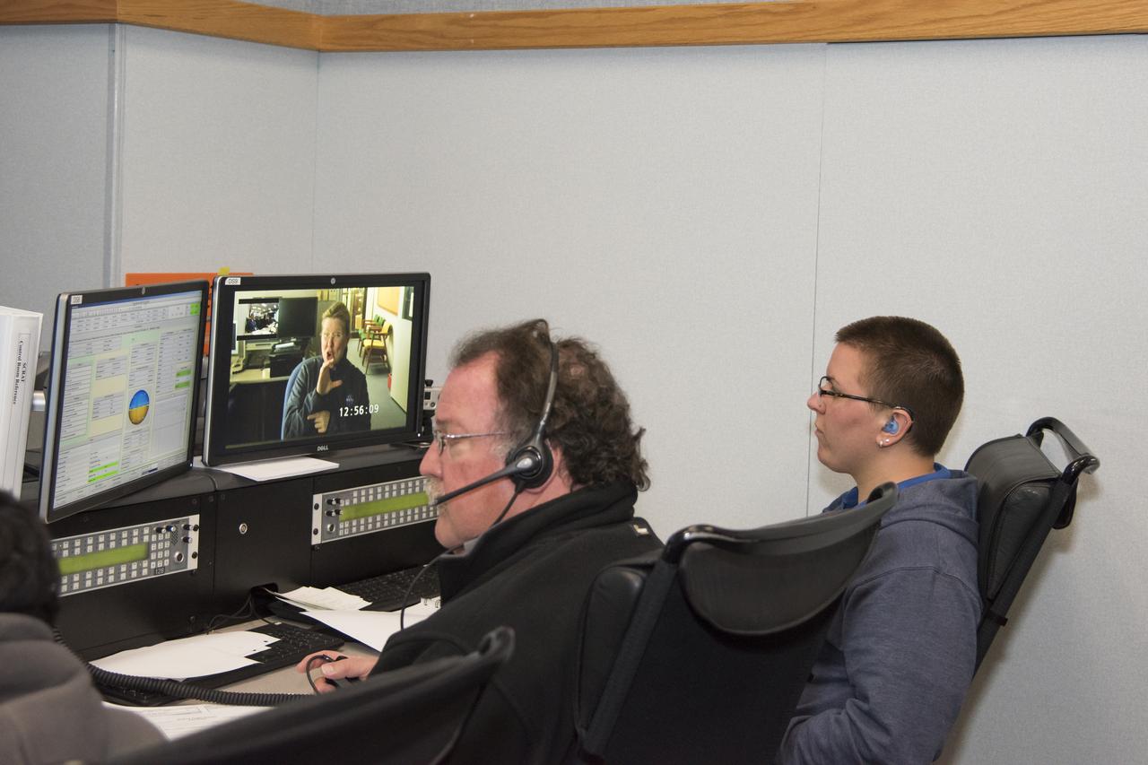
Johanna Lucht, observing data from the Mission Control Center at NASA’s Armstrong Flight Research Center in California, received flight communications from an interpreter, seen on Lucht’s monitor, through American Sign Language. Two-way visual communication was established between Lucht and the interpreter, located at NASA’s Langley Research Center in Virginia, for the flight. Interpreting technical terminology often requires cooperation to develop specific signs to ease communication. Using a familiar interpreter who is adept or practiced in the technical terminology of a NASA flight was beneficial, Lucht says.
This MOC image shows outcrops of light-toned rock, interpreted to be sedimentary in origin, in east Candor Chasma. The exposures of light-toned rock are separated by areas of windblown ripples and dark sand
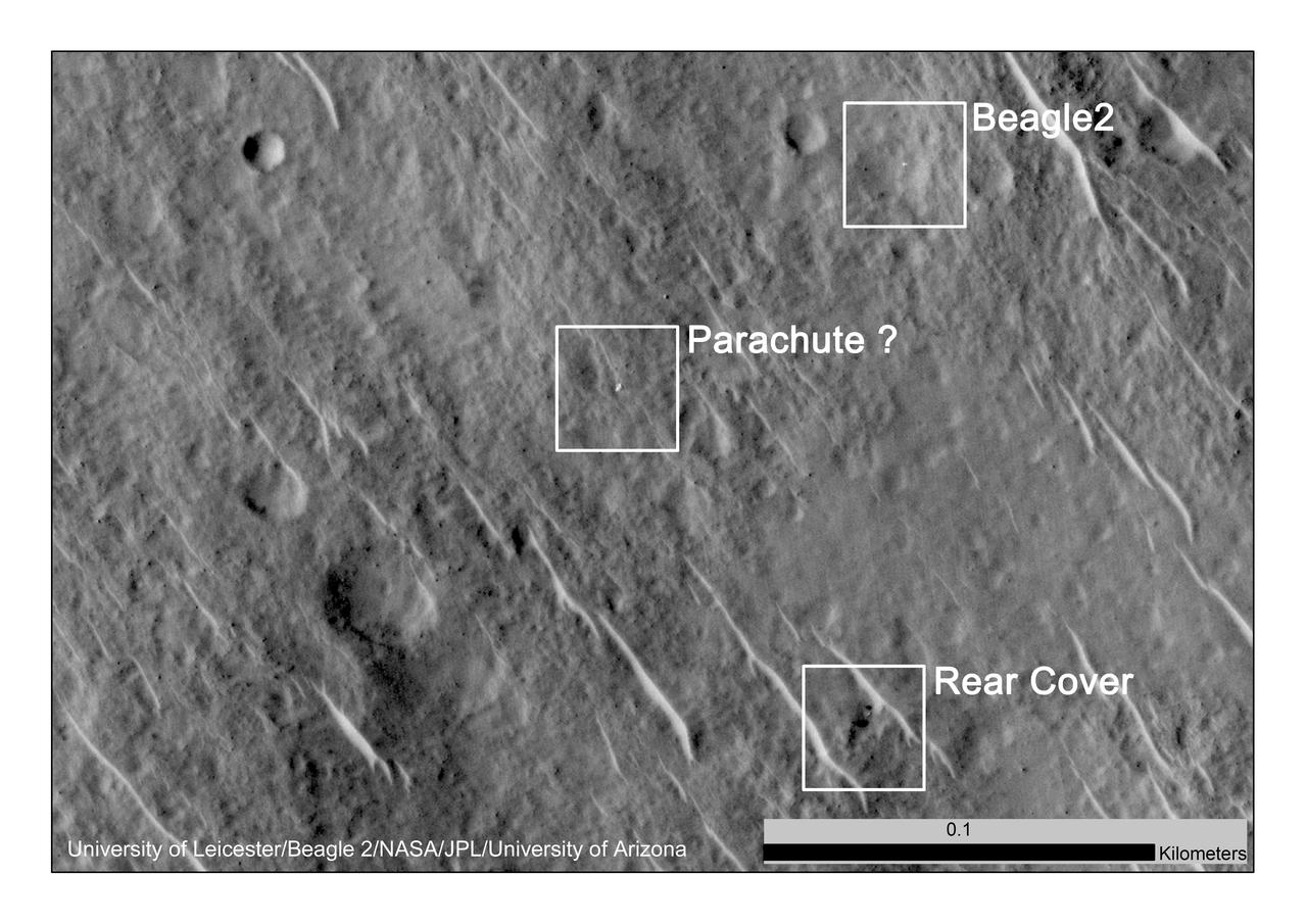
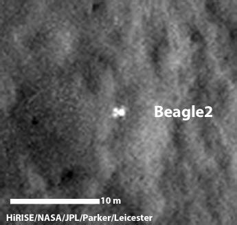
This annotated image, taken in 2014, shows where features seen in an observation by NASA Mars Reconnaissance Orbiter have been interpreted as hardware from the Dec. 25, 2003, arrival at Mars of the United Kingdom Beagle 2 Lander.
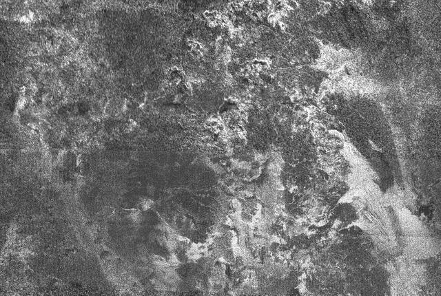
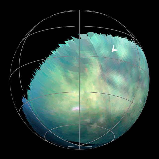
This radar image of Titan shows Ganesa Macula, interpreted as a cryovolcano ice volcano, and its surroundings. Cryovolcanism is thought to have been an important process on Titan and may still be happening today

NASA Mars Reconnaissance Orbiter took these images of an area near Mars south pole where coalescing or elongated pits are interpreted as signs of an underlying deposit of frozen carbon dioxide, or dry ice.
NASA Dawn spacecraft captured this view of a region in the mid-southern latitudes of Ceres. The largest crater in the scene is Fluusa. Fluusa has a densely cratered floor and therefore is interpreted as an old impact feature.
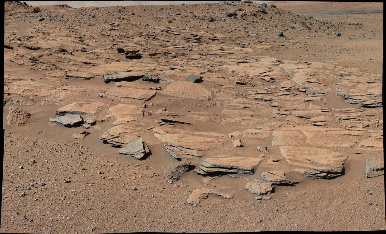
This image from Curiosity Mastcam shows inclined beds of sandstone interpreted as the deposits of small deltas fed by rivers flowing down from the Gale Crater rim and building out into a lake where Mount Sharp is now.
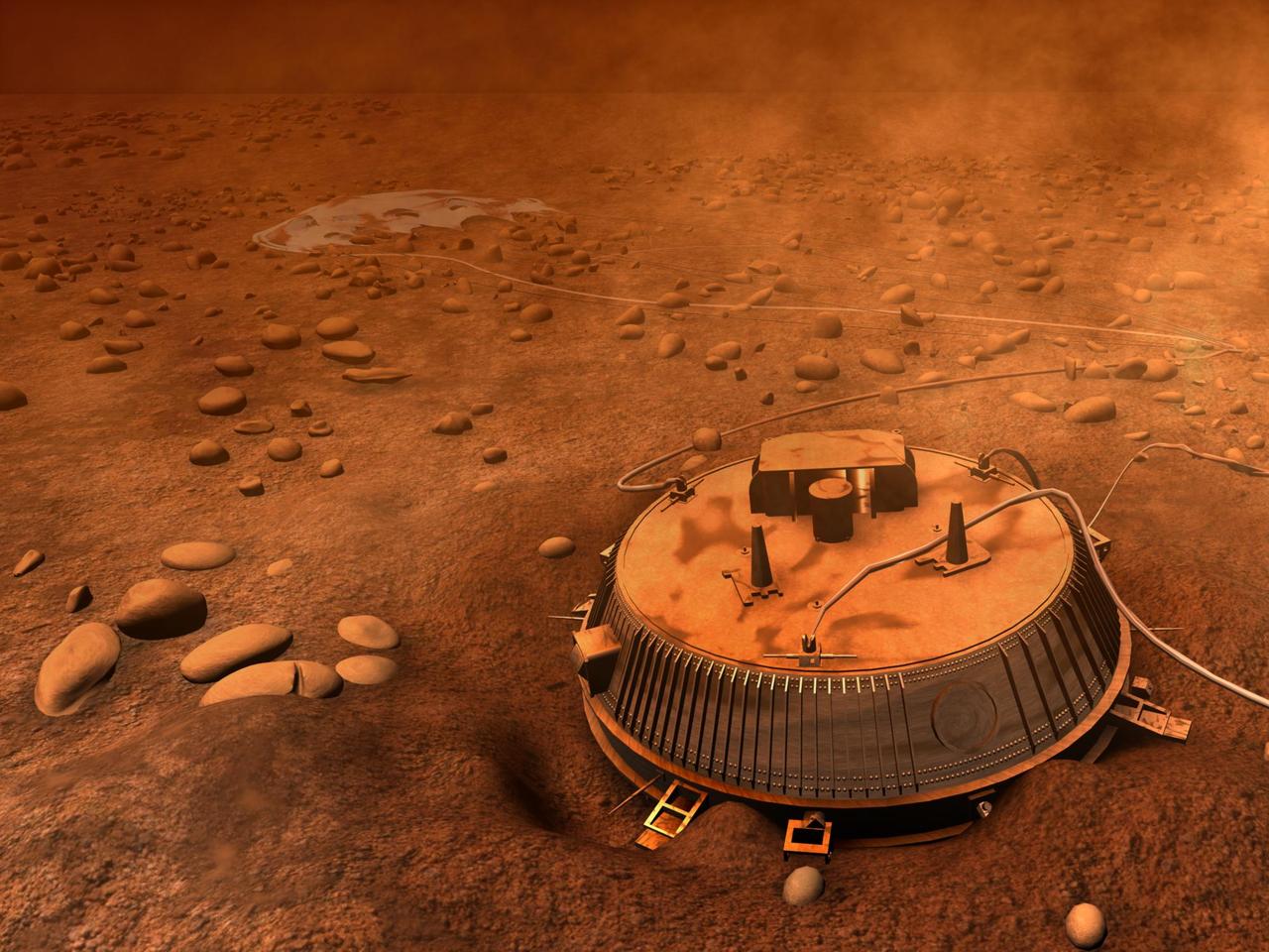
This is an artist interpretation of the area surrounding Huygens landing site, based on images and data returned Jan. 14, 2005. The Cassini-Huygens mission is a cooperative project of NASA, the European Space Agency and the Italian Space Agency.
This image, from NASA Mariner 10 spacecraft which launched in 1974, shows that several west-facing lobate scarps occur in the hummocky plains interpreted as Caloris ejecta.

This area seen by NASA Mars Reconnaissance Orbiter is known as the Deuteronilus contact of the Isidis Basin; it has been interpreted as a possible ancient shoreline. There are also suggestions that this contact is of volcanic origin.
Saturn storms observed by NASA Voyager, Aug. 5, 2004. Voyager 1 and 2 observed radio signals from lightning which were interpreted as being from a persistent, low-latitude storm system.
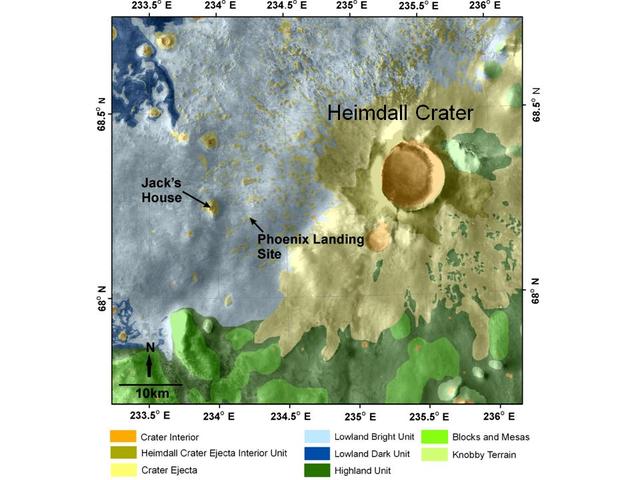
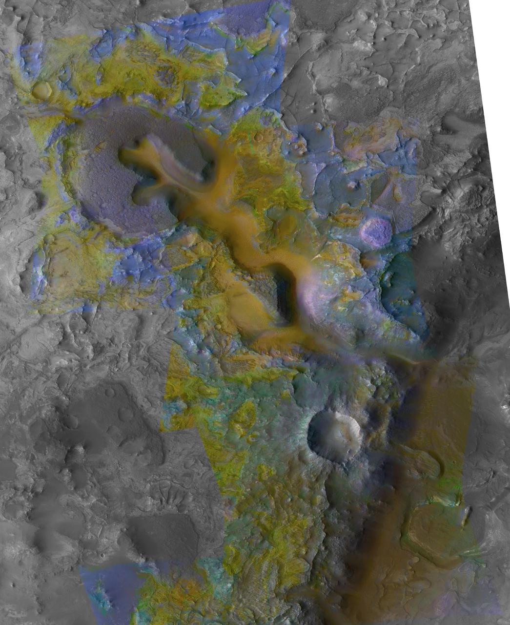
This map shows a color-coded interpretation of geomorphic units -- categories based on surface textures and contour -- in the region where NASA Phoenix Mars Lander has studied an arctic Martian plain.
The smooth plains of Elysium embay the blocky broken up highlands of Aeolis in this image from NASA Mars Odyssey spacecraft. The plains have been interpreted by researchers to be possibly mudflows or lava flows.
A configuration interpreted as the United Kingdom Beagle 2 Lander, with solar panels at least partially deployed, is indicated in this composite of two images from NASA Mars Reconnaissance Orbiter.
This MOC image shows dark-toned, windblown sands and ripples, surrounding a light-toned hill, interpreted to be sedimentary rock, in Ganges Chasma. Ganges Chasma is part of the giant Valles Marineris trough system on Mars
This view of layers around the edge of a low plateau called Home Plate inside Mars Gusev Crater includes a feature that may be what geologists call a bomb sag and interpret as evidence of an explosive event, such as a volcanic eruption
The color coding on this CRISM composite image of an area on Mars is based on infrared spectral information interpreted as evidence of various minerals present. Carbonate, which is indicative of a wet and non-acidic history, occurs in very small patches.
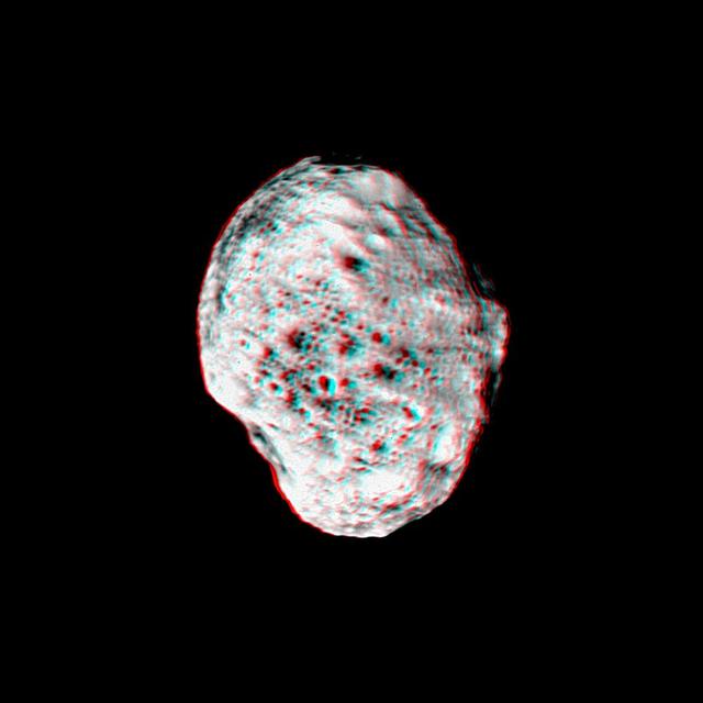
Saturn moon Hyperion pops into view in this stereo anaglyph created from NASA Cassini images; differing views are helpful in interpreting the moon irregular shape. 3D glasses are necessary to view this image.
This MOC image shows dark sand dunes superposed on layered, light-toned outcrops -- interpreted to be sedimentary rocks -- in Melas Chasma. Melas Chasma is part of the enormous Valles Marineris trough system
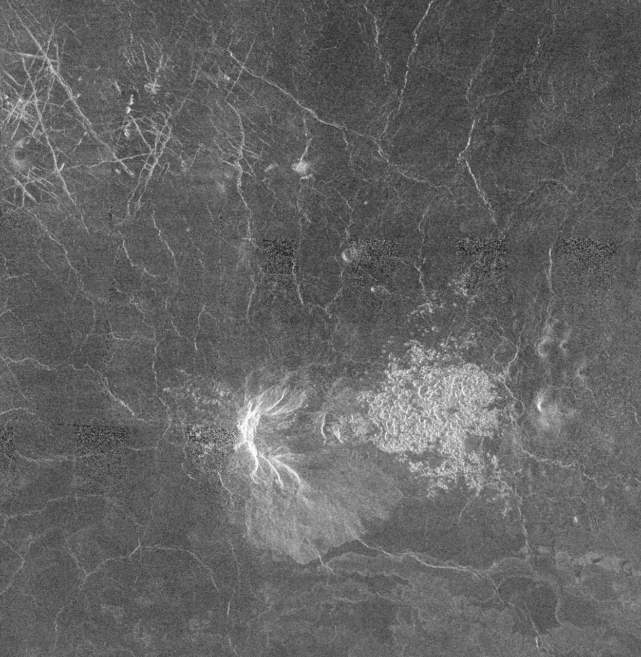
This is full-resolution mosaic from NASA Magellan spacecraft. The bright feature, slightly south of center is interpreted to be a volcano with a large apron of blocky debris to its right and some smaller aprons to its left. http://photojournal.jpl.nasa.gov/catalog/PIA00264
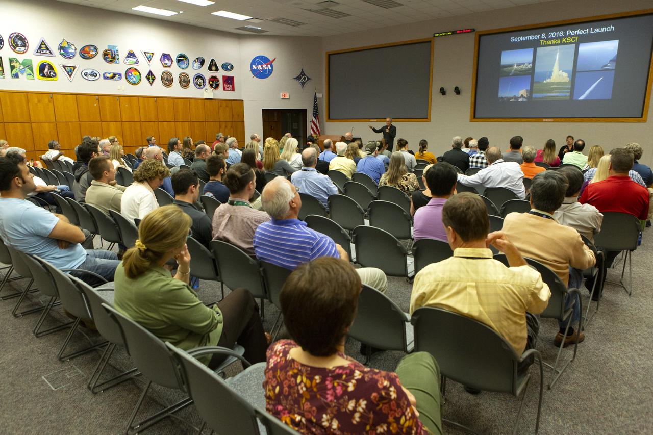
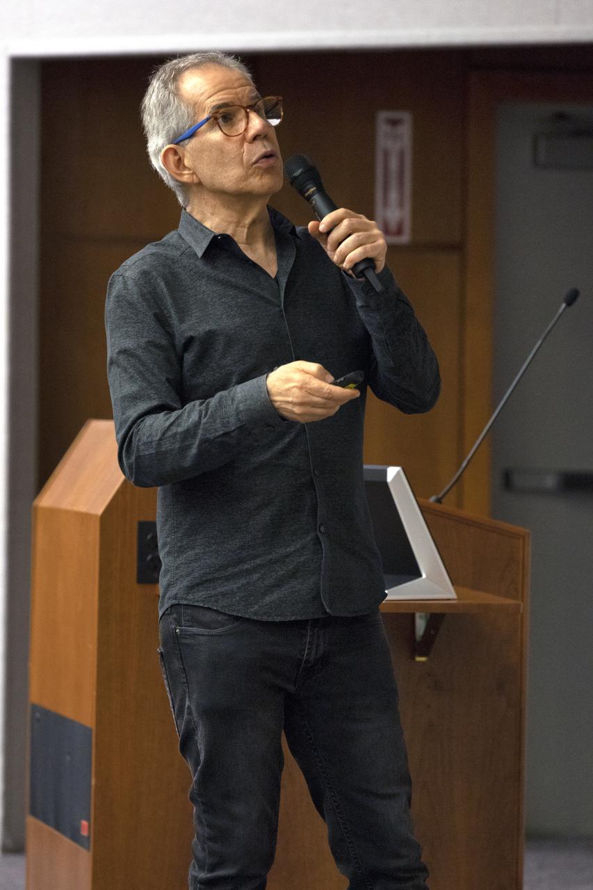
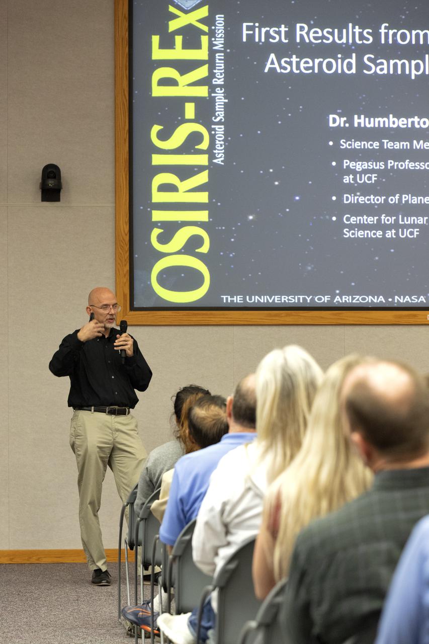
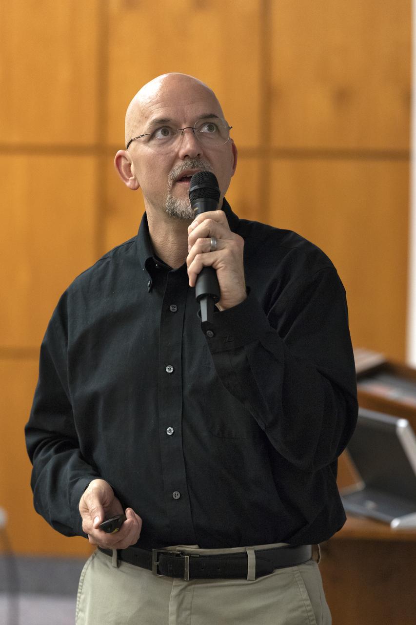
Dr. Humberto Campins from the University of Central Florida speaks to Kennedy Space Center employees in the Florida spaceport’s Neil Armstrong O&C Mission Briefing Room on April 16, 2019, to give a status update on NASA’s Origins, Spectral Interpretation, Resource Identification, Security-Regolith Explorer (OSIRIS-REx). The first U.S. mission to sample an asteroid, OSIRIS-REx launched from Cape Canaveral Air Force Station on Sept. 8, 2016 aboard a United Launch Alliance Atlas V rocket. Management of the launch service for OSIRIS-REx was the responsibility of NASA’s Launch Services Program, based at Kennedy.
Dr. Humberto Campins from the University of Central Florida speaks to Kennedy Space Center employees in the Florida spaceport’s Neil Armstrong O&C Mission Briefing Room on April 16, 2019, to give a status update on NASA’s Origins, Spectral Interpretation, Resource Identification, Security-Regolith Explorer (OSIRIS-REx). The first U.S. mission to sample an asteroid, OSIRIS-REx launched from Cape Canaveral Air Force Station on Sept. 8, 2016 aboard a United Launch Alliance Atlas V rocket. Management of the launch service for OSIRIS-REx was the responsibility of NASA’s Launch Services Program, based at Kennedy.
Dr. Humberto Campins from the University of Central Florida speaks to Kennedy Space Center employees in the Florida spaceport’s Neil Armstrong O&C Mission Briefing Room on April 16, 2019, to give a status update on NASA’s Origins, Spectral Interpretation, Resource Identification, Security-Regolith Explorer (OSIRIS-REx). The first U.S. mission to sample an asteroid, OSIRIS-REx launched from Cape Canaveral Air Force Station on Sept. 8, 2016 aboard a United Launch Alliance Atlas V rocket. Management of the launch service for OSIRIS-REx was the responsibility of NASA’s Launch Services Program, based at Kennedy.
Kennedy Space Center employees gather in the Florida spaceport’s Neil Armstrong O&C Mission Briefing Room on April 16, 2019, to hear Dr. Humberto Campins from the University of Central Florida give a status update on NASA’s Origins, Spectral Interpretation, Resource Identification, Security-Regolith Explorer (OSIRIS-REx). The first U.S. mission to sample an asteroid, OSIRIS-REx launched from Cape Canaveral Air Force Station on Sept. 8, 2016 aboard a United Launch Alliance Atlas V rocket. Management of the launch service for OSIRIS-REx was the responsibility of NASA’s Launch Services Program, based at Kennedy.
Dr. Humberto Campins from the University of Central Florida speaks to Kennedy Space Center employees in the Florida spaceport’s Neil Armstrong O&C Mission Briefing Room on April 16, 2019, to give a status update on NASA’s Origins, Spectral Interpretation, Resource Identification, Security-Regolith Explorer (OSIRIS-REx). The first U.S. mission to sample an asteroid, OSIRIS-REx launched from Cape Canaveral Air Force Station on Sept. 8, 2016 aboard a United Launch Alliance Atlas V rocket. Management of the launch service for OSIRIS-REx was the responsibility of NASA’s Launch Services Program, based at Kennedy.
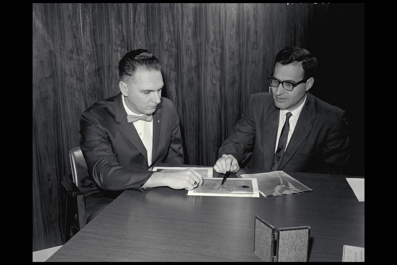
David Reese and Alvin Seiff interpret the results from tests designed to study spacecraft configuration and performance in a particular atmosphere
This image from NASA's Mars Reconnaissance Orbiter (MRO) shows a hill with a central crater. Such features have been interpreted as both mud volcanoes (really a sedimentary structure) and as actual volcanoes (the erupting lava kind). They occur on the floor of Valles Marineris below a closed topographic contour that could have held a lake, and the compaction of wet sediments may have created mud volcanoes. The fracture pattern of the bright flow unit surrounding the hill resembles mud cracks. However, there have also been observations from the CRISM instrument interpreted as high-temperature minerals, suggesting actual volcanism, although not necessarily at this location. Fine layers in the hill are consistent with either volcanism or mud flows. Either way, this activity is relatively recent in geologic time and may mark habitable subsurface environments. https://photojournal.jpl.nasa.gov/catalog/PIA22514
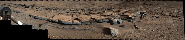
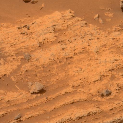
On March 25, 2014, view from the Mastcam on NASA Curiosity Mars rover looks southward at the Kimberley waypoint. Multiple sandstone beds show systematic inclination to the south suggesting progressive build-out of delta sediments.
Seeing small areas of the Moon at 50 cm per pixel often presents unexpected views, and sometimes it is hard to interpret the geology at first glance, much less what is up and what is down, as evidenced by NASA Lunar Reconnaissance Orbiter.
This image, from NASA Mariner 10 spacecraft which launched in 1974, is located about 500 km east of the Caloris basin and shows hummocky plains interpreted as Caloris ejecta in the upper half of the picture and smooth plains in the lower half.
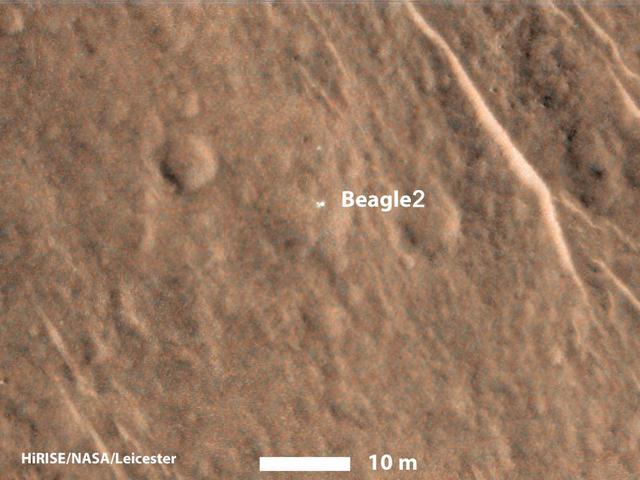
This annotated image taken on Dec. 15, 2014 by NASA Mars Reconnaissance Orbiter shows a bright feature interpreted as the United Kingdom Beagle 2 Lander, which was never heard from after its expected Dec. 25, 2003, landing.
This frame from an animation -- based on images captured by the Visual and Infrared Mapping Spectrometer on NASA's Cassini mission during several Titan flybys in 2009 and 2010 -- shows clear bright spots appearing close to the equator around the equinox that have been interpreted as evidence of dust storms. The brightenings were visible only for a short period of time -- between 11 hours to five Earth weeks -- and cannot be seen in previous or subsequent images. The Cassini spacecraft ended its mission on Sept. 15, 2017. The animation is available at https://photojournal.jpl.nasa.gov/catalog/PIA22483

A paper collage interpreting the craters and ridged planes of Mars and the Viking 2 as it passed over Mar's surface on 2 November 1982, prior to landing.
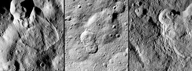
NASA's Dawn spacecraft has revealed many landslides on Ceres, which researchers interpret to have been shaped by a significant amount of water ice. A 2017 study in the journal Nature Geoscience classifies three types of these debris flows. Image 1 (left in the montage) shows an example of "Type I" flow features, which are relatively round and large, have thick "toes" at their ends. They look similar to rock glaciers and icy landslides on Earth. Type I landslides are mostly found at high latitudes, which is also where the most ice is thought to reside near Ceres' surface. Image 2 (center) shows an example of a "Type II" flow feature. Type II features are often thinner and longer than Type I, and are the most common type of landslide on Ceres. They appear more like the avalanches seen on Earth. Image 3 (right) shows an example of a "Type III" flow feature at Datan Crater. The study authors interpret Ceres' Type III landslides to involve melted ice, although scientists do not know if they actually contain liquid water. The authors think Type III landslides are related to impact craters, and may have formed during impact events into the ice on Ceres. The features resemble fluid material ejected from craters in the icy regions of Mars and Jupiter's moon Ganymede. https://photojournal.jpl.nasa.gov/catalog/PIA21471
Dane Drefke, United Launch Alliance (ULA) lead engineer for Atlas V mechanical operations, speaks in Kennedy Space Center’s Neil Armstrong O&C Mission Briefing Room on April 16, 2019, during an employee event in which Dr. Humberto Campins from the University of Central Florida gave a status update on NASA’s Origins, Spectral Interpretation, Resource Identification, Security-Regolith Explorer (OSIRIS-REx). The first U.S. mission to sample an asteroid, OSIRIS-REx launched from Cape Canaveral Air Force Station on Sept. 8, 2016 aboard a United Launch Alliance Atlas V rocket. Management of the launch service for OSIRIS-REx was the responsibility of NASA’s Launch Services Program, based at Kennedy.
Dane Drefke, United Launch Alliance (ULA) lead engineer for Atlas V mechanical operations, speaks in Kennedy Space Center’s Neil Armstrong O&C Mission Briefing Room on April 16, 2019, during an employee event in which Dr. Humberto Campins from the University of Central Florida gave a status update on NASA’s Origins, Spectral Interpretation, Resource Identification, Security-Regolith Explorer (OSIRIS-REx). The first U.S. mission to sample an asteroid, OSIRIS-REx launched from Cape Canaveral Air Force Station on Sept. 8, 2016 aboard a United Launch Alliance Atlas V rocket. Management of the launch service for OSIRIS-REx was the responsibility of NASA’s Launch Services Program, based at Kennedy.
This image mosaic from NASA MESSENGER spacecraft shows an unnamed ridge in the northern volcanic plains of Mercury. Wrinkle ridges like this are interpreted to be tectonic in origin and are usually only found in volcanic plains. Six individual MDIS images are part of this mosaic. Instruments: Mercury Dual Imaging System (MDIS) Latitude: 79° Longitude: 118° E Scale: The ridge is approximately 140 kilometers (87 miles) long http://photojournal.jpl.nasa.gov/catalog/PIA19413

In the Kennedy Space Center’s Press Site auditorium, members of the media participated with NASA and industry leaders in a prelaunch news conference for the agency’s Origins, Spectral Interpretation, Resource Identification, Security-Regolith Explorer, or OSIRIS-REx spacecraft.
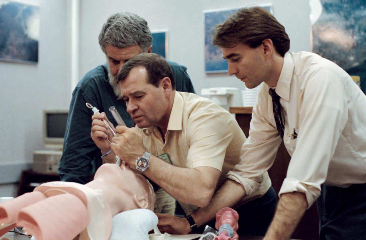
Mir 18 crewmember Gennadiy M. Strekalov, center, practicies an emergency medical procedure to maintain a patient airway during training at JSC. Looking on are Dave E. Ward (right), a JSC medical doctor, and an unidentified interpreter.
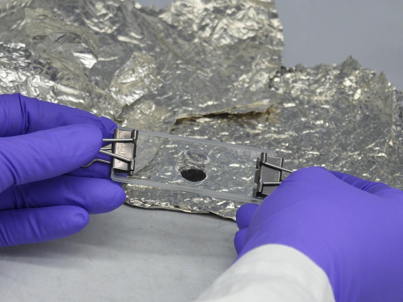
A portion of the asteroid Bennu sample delivered to Earth by NASA's OSIRIS-REx (Origins, Spectral Interpretation, Resource Identification, and Security – Regolith Explorer) mission, set into a microscope slide at the agency's Goddard Space Flight Center in Greenbelt, Maryland.

S75-24114 (8-10 Feb. 1975) --- Two Walt Disney comic cartoon characters, Donald Duck and Pluto, were on hand to greet a group of Apollo-Soyuz Test Project (ASTP) crewmen on their arrival at Disney World near Orlando. From left, are interpreter K. S. Samofal, interpreter Nicholas Timacheff, cosmonaut Vladimir A. Shatalov, astronaut Vance D. Brand, astronaut Donald K. Slayton, cosmonaut Aleksey A. Leonov (squeezing Pluto's nose) and astronaut Thomas P. Stafford. The astronauts and cosmonauts were in Florida for a three-day inspection tour of NASA's Kennedy Space Center where they looked over ASTP launch facilities and flight hardware.
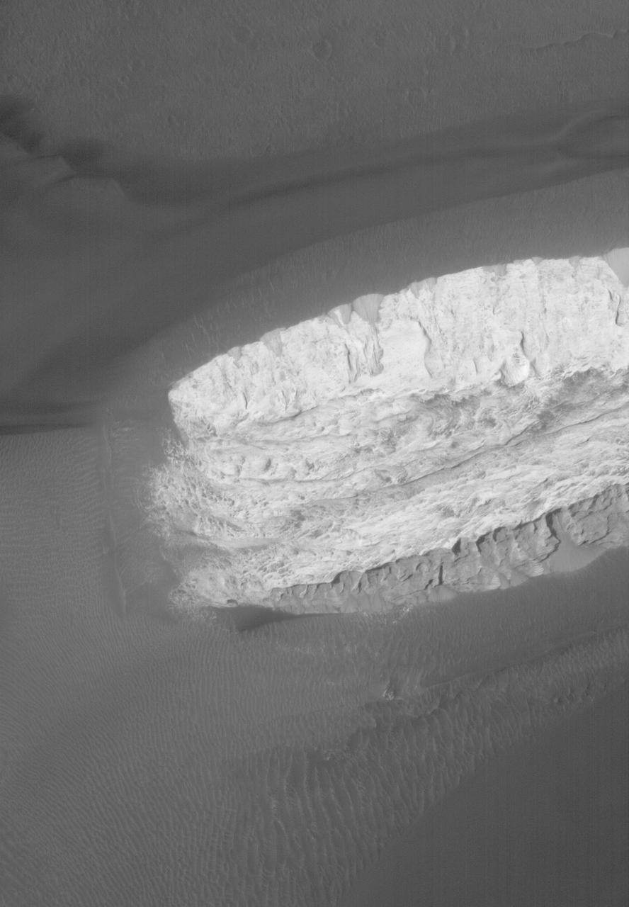
This image taken by NASA's Mars Reconnaissance Orbiter (MRO) shows ice sheets at Mars' south pole. The spacecraft detected clays near this ice; scientists have proposed such clays are the source of radar reflections that have been previously interpreted as liquid water using data from the ESA (European Space Agency) Mars Express orbiter. Flying 186 miles (300 kilometers) above the Martian surface, MRO used its High-Resolution Imaging Science Experiment (HiRISE) camera to study the ice sheets while using its Compact Reconnaissance Imaging Spectrometer (CRISM) to map out clay minerals near the ice. https://photojournal.jpl.nasa.gov/catalog/PIA24763
This image, taken by NASA's Dawn spacecraft, displays a linear structure trending from northeast to southwest (lower left to upper right). The graben -- what geologists call a linear feature where terrain has dropped -- might be interpreted as a chain of collapsed pits or secondary craters. The crater at center right displays terraced walls, a common feature among the impact sites of Ceres. The image was taken on Oct. 6, 2015, from an altitude of 915 miles (1,470 kilometers). It has a resolution of 450 feet (140 meters) per pixel. The image is located at 31 degrees north latitude, 120 degrees east longitude. http://photojournal.jpl.nasa.gov/catalog/PIA20123
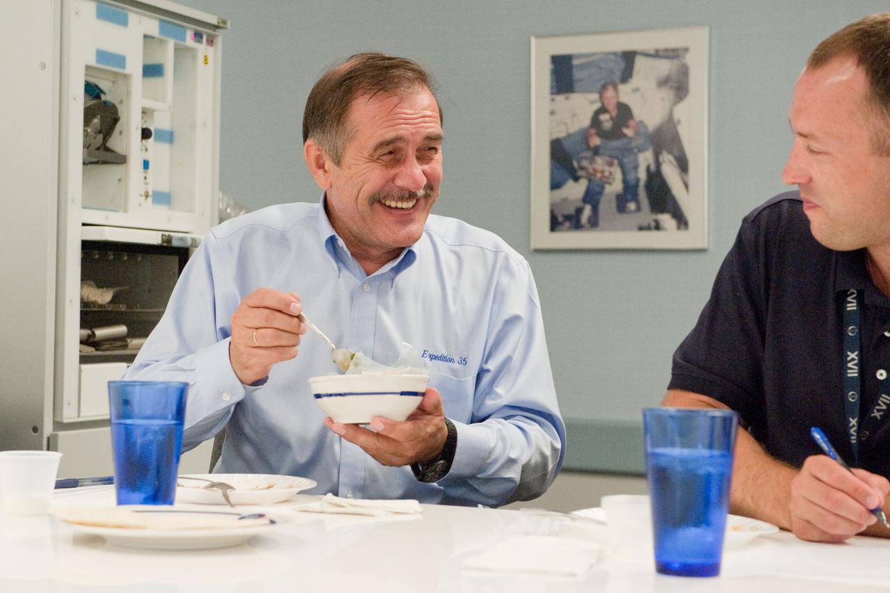
PHOTO DATE: 01 August 2012 LOCATION: Bldg. 17 - JSC Food Lab SUBJECT: Expedition 35/36 Russian cosmonauts during food tasting in JSC Food Lab. Vinogradov, Yurchikin and Misurkin with Russian interpreter. PHOTOGRAPHER: Mark Sowa

Jamanese Industry Officials and Academia visit. Visitor include Nabukazu Yoshioka, Associate Profesor at the Japanese National Institute of Informatics NIN; Shigetoshi Yoloyama, professor (by special appointment) at NIN; Yuriko Shimamoto, independent conference interpreter; and Kenji Motohashi, senior research engineer, NTT DATA AnileNet L.L.C. with Chris Kemp, Ames CIO
In the Kennedy Space Center’s Press Site auditorium, Daniella DellaGiustina, OSIRIS-REx lead image processing scientist at the University of Arizona, Tucson, speaks to members of the media during a briefing on science experiments involved in NASA’s Origins, Spectral Interpretation, Resource Identification, Security-Regolith Explorer, or OSIRIS-REx spacecraft.
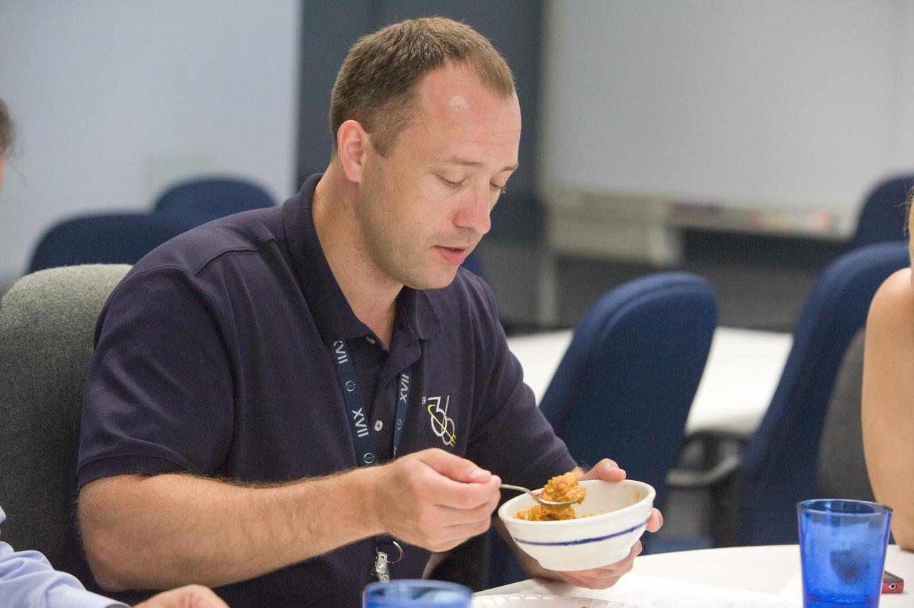
PHOTO DATE: 01 August 2012 LOCATION: Bldg. 17 - JSC Food Lab SUBJECT: Expedition 35/36 Russian cosmonauts during food tasting in JSC Food Lab. Vinogradov, Yurchikin and Misurkin with Russian interpreter. PHOTOGRAPHER: Mark Sowa
NASA Armstrong’s ER-2 aircraft deploys for its ALOFT mission. The ER-2 will fly at high altitudes above the Floridian coastline to collect data about the energetic characteristics and behavior of lightning and thunderclouds. A NASA pilot will operate the aircraft while scientists from the University of Bergen, Norway will interpret the data from the ground.
NASA Armstrong’s ER-2 aircraft deploys for its ALOFT mission. The ER-2 will fly at high altitudes above the Floridian coastline to collect data about the energetic characteristics and behavior of lightning and thunderclouds. A NASA pilot will operate the aircraft while scientists from the University of Bergen, Norway will interpret the data from the ground.

NASA Armstrong’s ER-2 aircraft deploys for its ALOFT mission. The ER-2 will fly at high altitudes above the Floridian coastline to collect data about the energetic characteristics and behavior of lightning and thunderclouds. A NASA pilot will operate the aircraft while scientists from the University of Bergen, Norway will interpret the data from the ground.
JSC2006-E-46700 (26 Oct. 2006) --- Cosmonaut Pavel V. Vinogradov (right), Expedition 13 commander representing Russia's Federal Space Agency, assisted by interpreter Irina Yashkova, speaks from the lectern in the ballroom of the Gilruth Center at Johnson Space Center during the welcome home ceremony for the Expedition 13 crewmembers.
This photograph shows a solar prominence in action, one of Skylab's many splendorous views. It was taken on August 21, 1973. Interpretation of the rich store of Skylab ultraviolet solar data was facilitated by computerized color enhancement of the original black-and-white images, highlighting subtle but important brightness differences.

Jason Dworkin, project scientist for NASA's OSIRIS-REx (Origins, Spectral Interpretation, Resource Identification, and Security – Regolith Explorer) mission, examines a portion of the asteroid Bennu sample delivered to Earth in a laboratory at the agency's Goddard Space Flight Center in Greenbelt, Maryland.
PHOTO DATE: 01 August 2012 LOCATION: Bldg. 17 - JSC Food Lab SUBJECT: Expedition 35/36 Russian cosmonauts during food tasting in JSC Food Lab. Vinogradov, Yurchikin and Misurkin with Russian interpreter. PHOTOGRAPHER: Mark Sowa
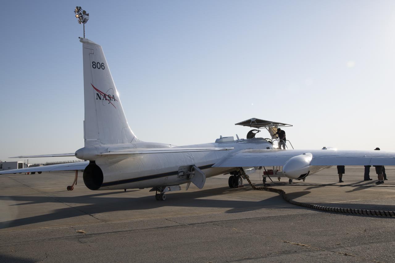
NASA Armstrong’s ER-2 aircraft deploys for its ALOFT mission. The ER-2 will fly at high altitudes above the Floridian coastline to collect data about the energetic characteristics and behavior of lightning and thunderclouds. A NASA pilot will operate the aircraft while scientists from the University of Bergen, Norway will interpret the data from the ground.

In the Kennedy Space Center’s Press Site auditorium, Scott Messer, program manager for NASA missions at United Launch Alliance in Centennial, Colorado, speaks to members of the media at a prelaunch news conference for the agency’s Origins, Spectral Interpretation, Resource Identification, Security-Regolith Explorer, or OSIRIS-REx spacecraft.
In the Kennedy Space Center’s Press Site auditorium, Geoffrey Yoder, acting associate administrator of NASA’s Science Mission Directorate in Washington, speaks to members of the media at a prelaunch news conference for the agency’s Origins, Spectral Interpretation, Resource Identification, Security-Regolith Explorer, or OSIRIS-REx spacecraft.
PETEN, GUATEMALA -- NASA's Deputy Administrator Shana Dale and NASA Research Scientist Dr. William Saturno investigate the San Bartolo Maya archaeological site in Peten, Guatemala, on Dec. 11. NASA's remote sensing data were used to locate and interpret the remains of the ancient Maya civilization. Photo credit: NASA/Bill Ingalls
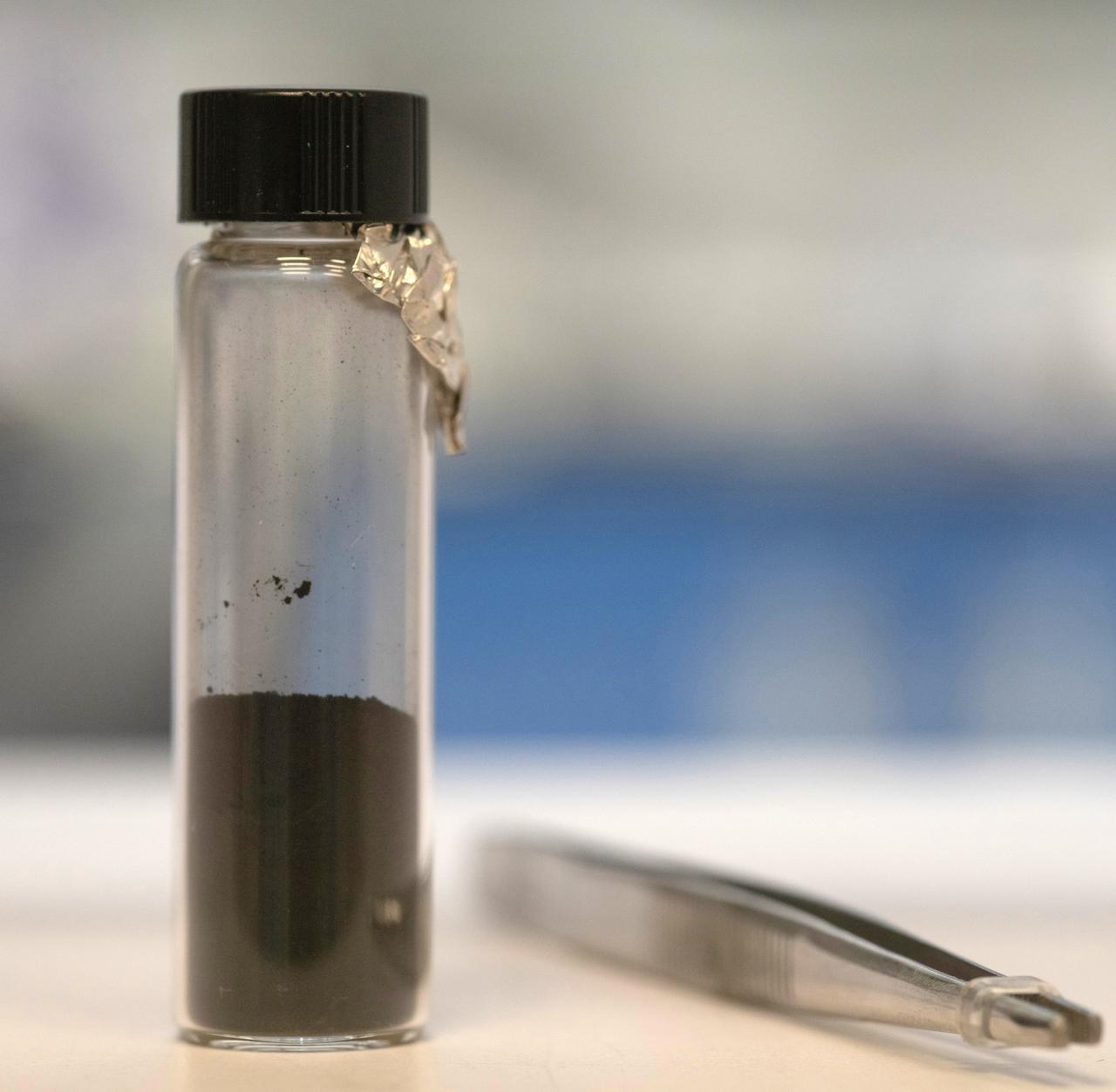
Photographed inside a laboratory at NASA's Goddard Space Flight Center in Greenbetl, Maryland, this vial contains a portion of the asteroid Bennu sample delivered to Earth by the agency's OSIRIS-REx (Origins, Spectral Interpretation, Resource Identification, and Security – Regolith Explorer) mission.
PHOTO DATE: 01 August 2012 LOCATION: Bldg. 17 - JSC Food Lab SUBJECT: Expedition 35/36 Russian cosmonauts during food tasting in JSC Food Lab. Vinogradov, Yurchikin and Misurkin with Russian interpreter. PHOTOGRAPHER: Mark Sowa
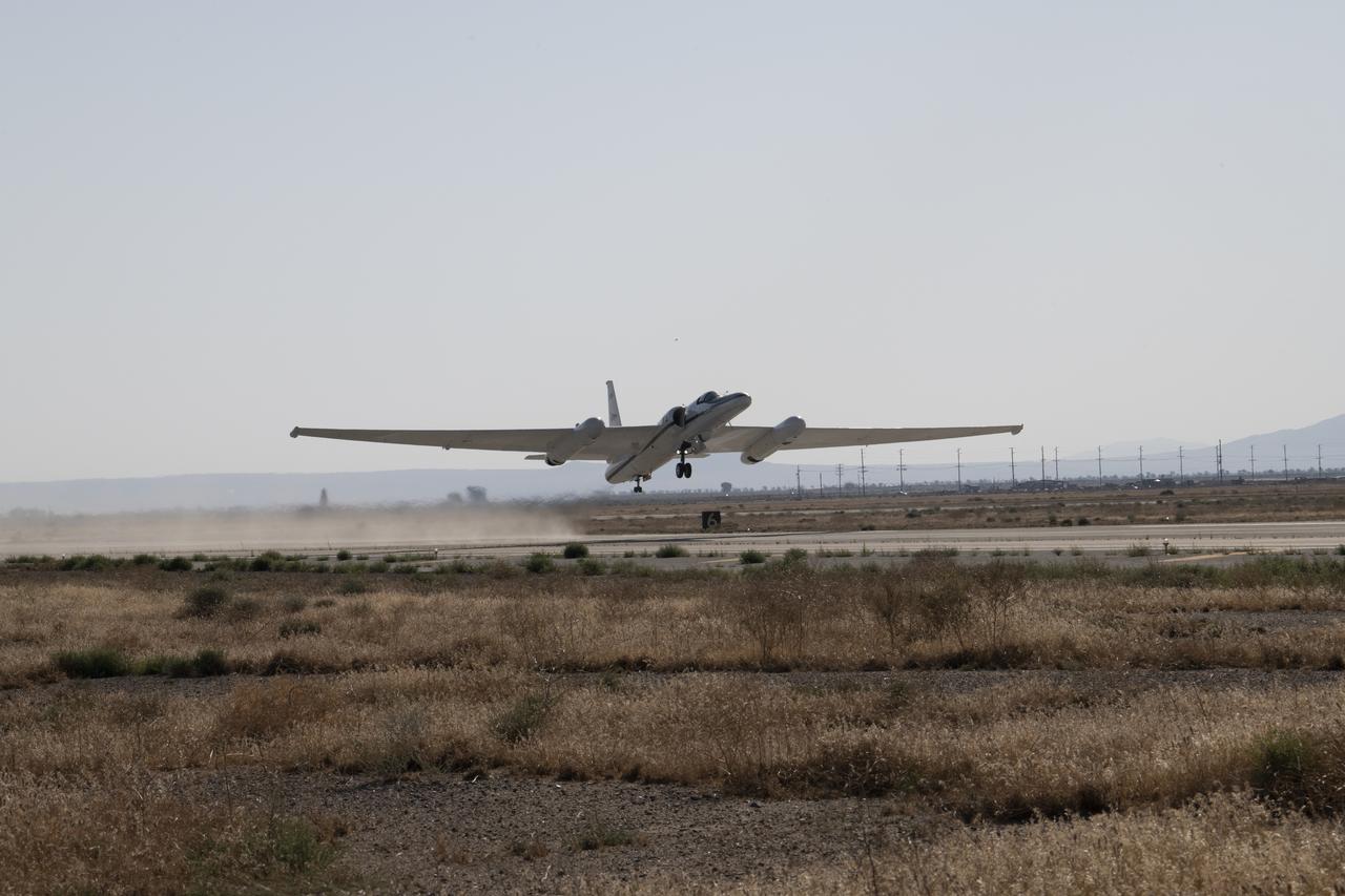
NASA Armstrong’s ER-2 aircraft deploys for its ALOFT mission. The ER-2 will fly at high altitudes above the Floridian coastline to collect data about the energetic characteristics and behavior of lightning and thunderclouds. A NASA pilot will operate the aircraft while scientists from the University of Bergen, Norway will interpret the data from the ground.
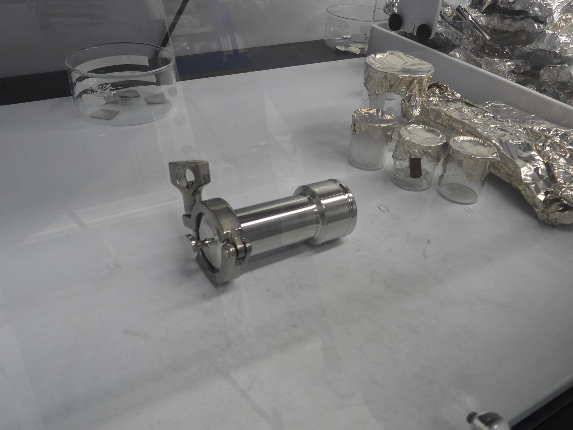
Photographed inside a laboratory at NASA's Goddard Space Flight Center in Greenbelt, Maryland, this cannister contains a portion of the asteroid Bennu sample delivered to Earth by the agency's OSIRIS-REx (Origins, Spectral Interpretation, Resource Identification, and Security – Regolith Explorer) mission.
In this video frame, Jason Dworkin holds up a vial that contains part of the sample from asteroid Bennu delivered to Earth by NASA's OSIRIS-REx (Origins, Spectral Interpretation, Resource Identification, and Security – Regolith Explorer) mission in 2023. Dworkin is the mission's project scientist at NASA's Goddard Space Flight Center in Greenbelt, Maryland.
Norfolk State University Associate Professor Rasha Morsi showcases a phone operated, 3D-printed robot sign language interpreter to NASA Chief Technologist Douglas Terrier during a tour of the university’s Creative Gaming Simulation lab on February 6, 2018. (Credit: NASA)

NASA's Deputy Administrator Shana Dale and NASA Research Scientist Dr. William Saturno investigate the San Bartolo Maya archaeological site in Peten, Guatemala, Tuesday Dec. 11, 2007. NASA's remote sensing data were used to locate and interpret the remains of the ancient Maya civilization. Photo Credit: (NASA/Bill Ingalls)

NASA Armstrong’s ER-2 aircraft deploys for its ALOFT mission. The ER-2 will fly at high altitudes above the Floridian coastline to collect data about the energetic characteristics and behavior of lightning and thunderclouds. A NASA pilot will operate the aircraft while scientists from the University of Bergen, Norway will interpret the data from the ground.
/nasa-goddard-astrobio (2)~medium.jpg)
Researchers at NASA's Goddard Space Flight Center in Greenbelt, Maryland, who had a hand in studying the asteroid Bennu sample delivered to Earth by the agency's OSIRIS-REx (Origins, Spectral Interpretation, Resource Identification, and Security – Regolith Explorer) mission.

In the Kennedy Space Center’s Press Site auditorium, Dante Lauretta, OSIRIS-REx principal investigator at the University of Arizona, Tucson, speaks to members of the media at a prelaunch news conference for the agency’s Origins, Spectral Interpretation, Resource Identification, Security-Regolith Explorer, or OSIRIS-REx spacecraft.
PHOTO DATE: 01 August 2012 LOCATION: Bldg. 17 - JSC Food Lab SUBJECT: Expedition 35/36 Russian cosmonauts during food tasting in JSC Food Lab. Vinogradov, Yurchikin and Misurkin with Russian interpreter. PHOTOGRAPHER: Mark Sowa
NASA Armstrong’s ER-2 aircraft deploys for its ALOFT mission. The ER-2 will fly at high altitudes above the Floridian coastline to collect data about the energetic characteristics and behavior of lightning and thunderclouds. A NASA pilot will operate the aircraft while scientists from the University of Bergen, Norway will interpret the data from the ground.

PHOTO DATE: 01 August 2012 LOCATION: Bldg. 17 - JSC Food Lab SUBJECT: Expedition 35/36 Russian cosmonauts during food tasting in JSC Food Lab. Vinogradov, Yurchikin and Misurkin with Russian interpreter. PHOTOGRAPHER: Mark Sowa
STS041-02-028 (6-20 Oct 1990) --- Astronaut Bruce E. Melnick, STS-41 mission specialist, participates in a voice command system (VCS) test on Discovery's aft flight deck. Melnick's voice is interpreted into a command that is able to control a video camera.

Jamanese Industry Officials and Academia visit. Visitor include Nabukazu Yoshioka, Associate Profesor at the Japanese National Institute of Informatics NIN; Shigetoshi Yoloyama, professor (by special appointment) at NIN; Yuriko Shimamoto, independent conference interpreter; and Kenji Motohashi, senior research engineer, NTT DATA AnileNet L.L.C. with L. Braxton III
/nasa-goddard-astrobio (1)~medium.jpg)
Researchers at NASA's Goddard Space Flight Center in Greenbelt, Maryland, who had a hand in studying the asteroid Bennu sample delivered to Earth by the agency's OSIRIS-REx (Origins, Spectral Interpretation, Resource Identification, and Security – Regolith Explorer) mission.
In the Kennedy Space Center’s Press Site auditorium, Tim Dunn, NASA launch manager at Kennedy, speaks to members of the media at a prelaunch news conference for the agency’s Origins, Spectral Interpretation, Resource Identification, Security-Regolith Explorer, or OSIRIS-REx spacecraft.

NASA's Deputy Administrator Shana Dale and NASA Research Scientist Dr. William Saturno investigate the San Bartolo Maya archaeological site in Peten, Guatemala, Tuesday Dec. 11, 2007. NASA's remote sensing data were used to locate and interpret the remains of the ancient Maya civilization. Photo Credit: (NASA/Bill Ingalls)

PHOTO DATE: 01 August 2012 LOCATION: Bldg. 17 - JSC Food Lab SUBJECT: Expedition 35/36 Russian cosmonauts during food tasting in JSC Food Lab. Vinogradov, Yurchikin and Misurkin with Russian interpreter. PHOTOGRAPHER: Mark Sowa
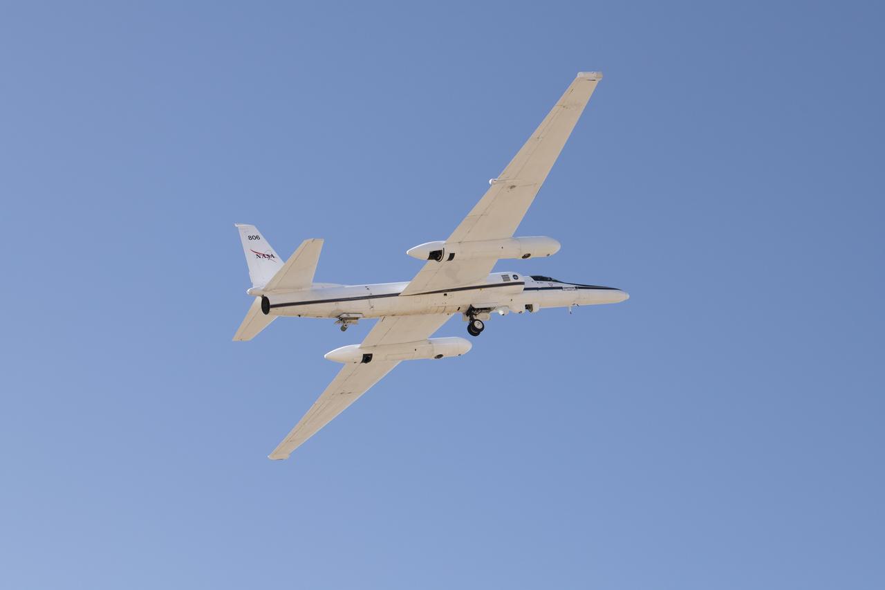
NASA Armstrong’s ER-2 aircraft deploys for its ALOFT mission. The ER-2 will fly at high altitudes above the Floridian coastline to collect data about the energetic characteristics and behavior of lightning and thunderclouds. A NASA pilot will operate the aircraft while scientists from the University of Bergen, Norway will interpret the data from the ground.
In the Kennedy Space Center’s Press Site auditorium, Michael Donnelly, OSIRIS-REx project manager at NASA’s Goddard Space Flight Center in Greenbelt, Maryland, speaks to members of the media at a prelaunch news conference for the agency’s Origins, Spectral Interpretation, Resource Identification, Security-Regolith Explorer, or OSIRIS-REx spacecraft.
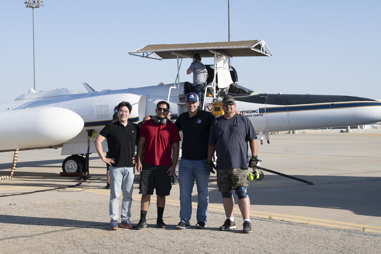
NASA Armstrong’s ER-2 aircraft deploys for its ALOFT mission. The ER-2 will fly at high altitudes above the Floridian coastline to collect data about the energetic characteristics and behavior of lightning and thunderclouds. A NASA pilot will operate the aircraft while scientists from the University of Bergen, Norway will interpret the data from the ground.
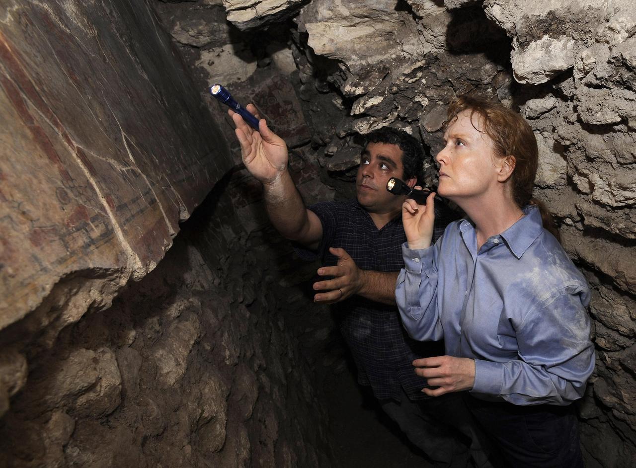
PETEN, GUATEMALA -- NASA's Deputy Administrator Shana Dale and NASA Research Scientist Dr. William Saturno investigate the San Bartolo Maya archaeological site in Peten, Guatemala, on Dec. 11. NASA's remote sensing data were used to locate and interpret the remains of the ancient Maya civilization. Photo credit: NASA/Bill Ingalls

PHOTO DATE: 01 August 2012 LOCATION: Bldg. 17 - JSC Food Lab SUBJECT: Expedition 35/36 Russian cosmonauts during food tasting in JSC Food Lab. Vinogradov, Yurchikin and Misurkin with Russian interpreter. PHOTOGRAPHER: Mark Sowa

PHOTO DATE: 01 August 2012 LOCATION: Bldg. 17 - JSC Food Lab SUBJECT: Expedition 35/36 Russian cosmonauts during food tasting in JSC Food Lab. Vinogradov, Yurchikin and Misurkin with Russian interpreter. PHOTOGRAPHER: Mark Sowa

In the Kennedy Space Center’s Press Site auditorium, Christina Richey, OSIRIS-REx deputy program scientist at NASA Headquarters in Washington, speaks to members of the media during a briefing on science experiments involved in NASA’s Origins, Spectral Interpretation, Resource Identification, Security-Regolith Explorer, or OSIRIS-REx spacecraft.

In the Kennedy Space Center’s Press Site auditorium, Nancy Neal-Jones of NASA Communications at the Goddard Space Flight Center in Greenbelt, Maryland, moderates a media briefing on science experiments involved in NASA’s Origins, Spectral Interpretation, Resource Identification, Security-Regolith Explorer, or OSIRIS-REx spacecraft.
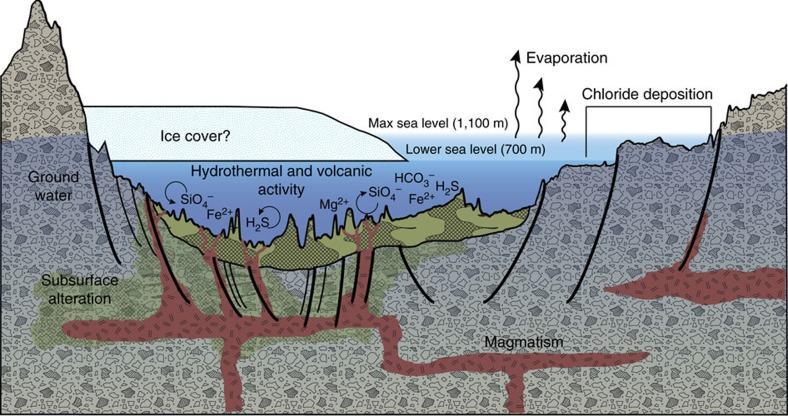
This diagram illustrates an interpretation for the origin of some deposits in the Eridania basin of southern Mars as resulting from seafloor hydrothermal activity more than 3 billion years ago. The ground level depicted is an exaggerated topography of a transect about 280 miles (450 kilometers) long. Blue portions of the diagram depict water-depth estimates and the possibility of ice covering the ancient sea. Thick, clay-rich deposits (green) formed through hydrothermal alteration of volcanic materials in deep water, by this model. Notations indicate deep-water reactions of iron and magnesium ions with silicates, sulfides and carbonates. Deep-seated structural discontinuities could have facilitated the ascent of magma from a mantle source. Chloride deposits formed from evaporation of seawater at higher elevations in the basin. https://photojournal.jpl.nasa.gov/catalog/PIA22060
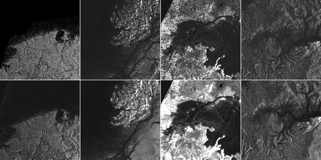
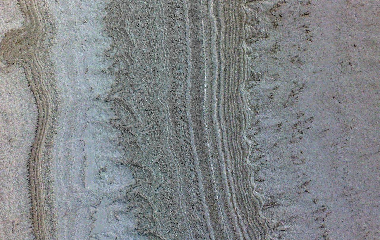
This montage of Cassini Synthetic Aperture Radar (SAR) images of the surface of Titan shows four examples of how a newly developed technique for handling noise results in clearer, easier to interpret views. The top row of images was produced in the manner used since the mission arrived in the Saturn system a decade ago; the row at bottom was produced using the new technique. The three leftmost image pairs show bays and spits of land in Ligea Mare, one of Titan's large hydrocarbon seas. The rightmost pair shows a valley network along Jingpo Lacus, one of Titan's larger northern lakes. North is toward the left in these images. Each thumbnail represents an area 70 miles (112 kilometers) wide. http://photojournal.jpl.nasa.gov/catalog/PIA19053
Many craters in the mid-latitudes of Mars are partially filled with deposits that have been interpreted to be ice-rich. We expect the deposits to have formed at an earlier (but relatively recent) time when Mars' orbital parameters were different and allowed ice to condense and deposit in these locations. The ice is covered by dust layers protecting it from sublimating away. The ice deposits are probably no older than a few million years, which is recent in geological terms. However, we can observe that these deposits have been affected by even more recent movement of the crust (the curving trough) that clearly post-dates the ice deposits because it is cutting through them. A wider view allows us to trace this crustal movement or "fault," and we can see it is also affecting the crater wall and the area surrounding it. This observation indicates that Mars' interior is still (or at least until recently was) warm enough to sustain such activity. https://photojournal.jpl.nasa.gov/catalog/PIA26323