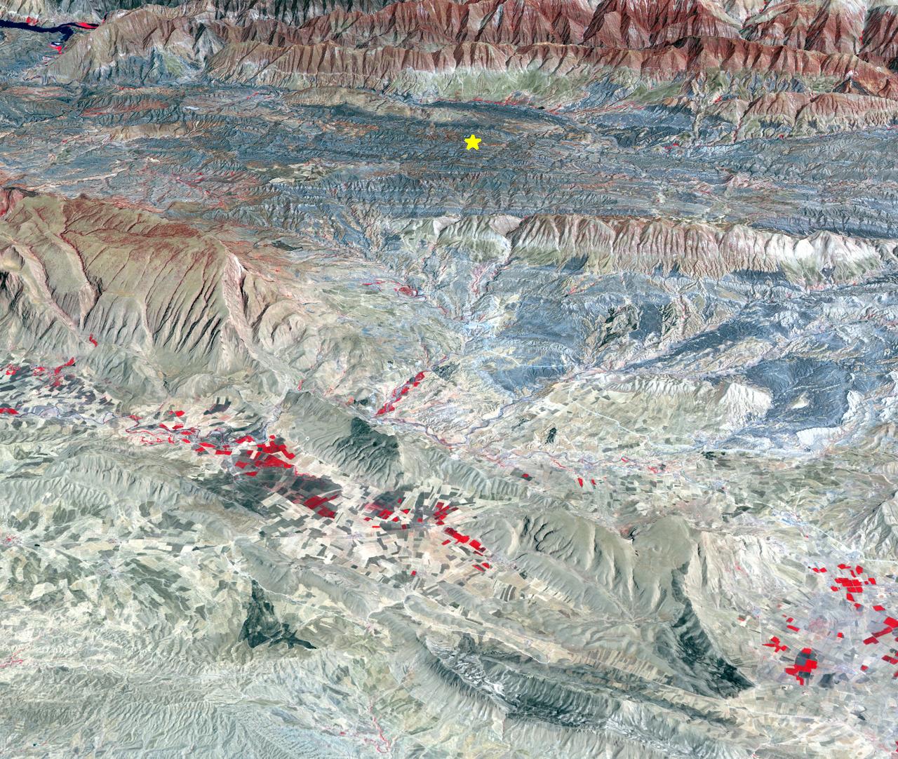
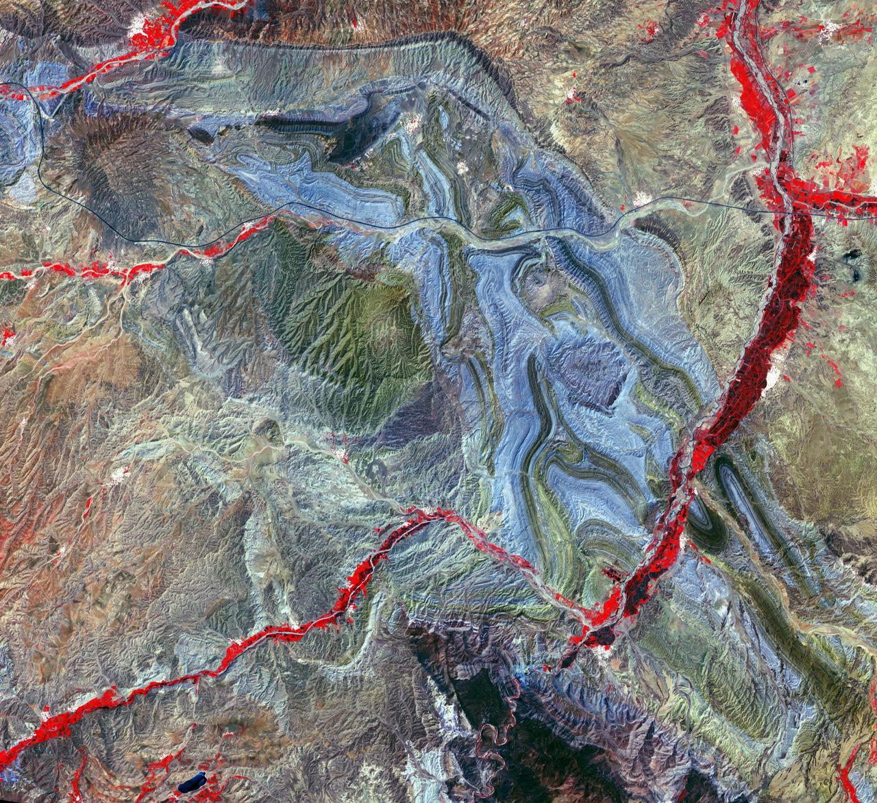
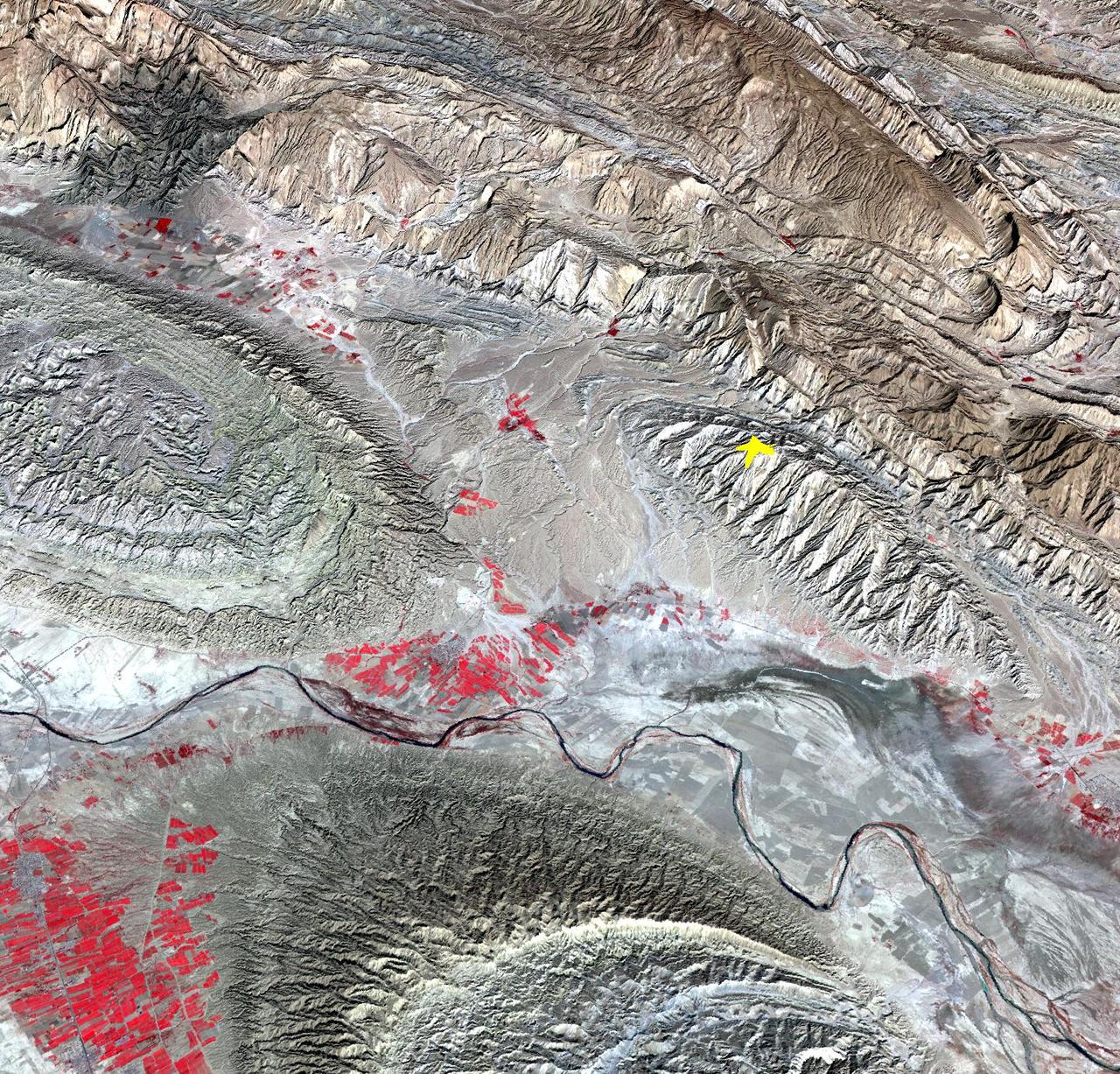
On Sunday, Nov. 12, 2017, a magnitude 7.3 earthquake struck along the Iran-Iraq border near Halabjah, Iraq. The earthquake was felt as far away as Kuwait, Qatar, Turkey, Lebanon and Israel. Extensive damage and numerous casualties were reported in the area near the epicenter (yellow star on image). The earthquake occurred along the boundary between the Arabian and Eurasian tectonic plates. This is an earthquake-prone area, and has experienced many deadly earthquakes in the past. In this perspective-view image, bright red areas are crops in fields, pale red on mountain ridges are shrubs and trees, dark gray areas are traces of earlier brush fires, and gray and tan colors are different rock types. The image was acquired Sept. 8, 2017, and the star marks the earthquake epicenter at 34.9 degrees north, 45.9 degrees east. https://photojournal.jpl.nasa.gov/catalog/PIA22112
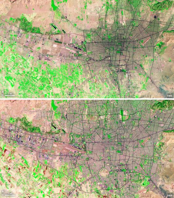
Between 1985 and 2009, the population of Tehran, Iran, grew from six million to just over seven million. The city's growth was spurred largely by migration from other parts of the country. In addition to being the hub of government and associated public sector jobs, Tehran houses more than half of Iran's industry. Landsat 5 acquired these false-color images of Tehran on August 2, 1985, and July 19, 2009. The city is a web of dark purple lines, vegetation is green and bare ground is pink and tan. The images were created using both infrared and visible light (band combination 7, 4, and 2) to distinguish urban areas from the surrounding desert. ---- NASA and the U.S. Department of the Interior through the U.S. Geological Survey (USGS) jointly manage Landsat, and the USGS preserves a 40-year archive of Landsat images that is freely available over the Internet. The next Landsat satellite, now known as the Landsat Data Continuity Mission (LDCM) and later to be called Landsat 8, is scheduled for launch in 2013. In honor of Landsat’s 40th anniversary in July 2012, the USGS released the LandsatLook viewer – a quick, simple way to go forward and backward in time, pulling images of anywhere in the world out of the Landsat archive. <b><a href="http://www.nasa.gov/audience/formedia/features/MP_Photo_Guidelines.html" rel="nofollow">NASA image use policy.</a></b> <b><a href="http://www.nasa.gov/centers/goddard/home/index.html" rel="nofollow">NASA Goddard Space Flight Center</a></b> enables NASA’s mission through four scientific endeavors: Earth Science, Heliophysics, Solar System Exploration, and Astrophysics. Goddard plays a leading role in NASA’s accomplishments by contributing compelling scientific knowledge to advance the Agency’s mission. <b>Follow us on <a href="http://twitter.com/NASA_GoddardPix" rel="nofollow">Twitter</a></b> <b>Like us on <a href="http://www.facebook.com/pages/Greenbelt-MD/NASA-Goddard/395013845897?ref=tsd" rel="nofollow">Facebook</a></b> <b>Find us on <a href="http://instagrid.me/nasagoddard/?vm=grid" rel="nofollow">Instagram</a></b>
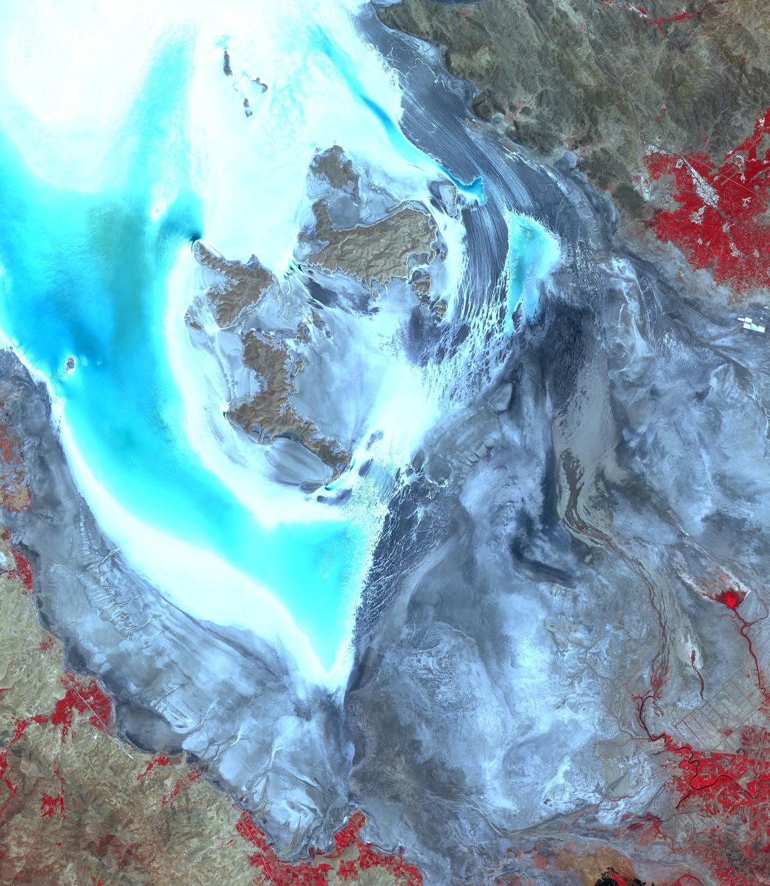
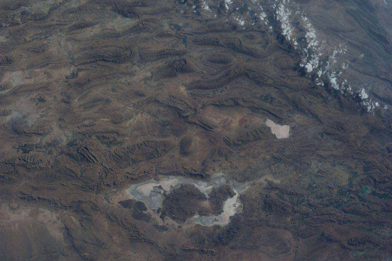
This image from NASA Terra spacecraft shows Lake Urmia, a saline lake in northwestern Iran.
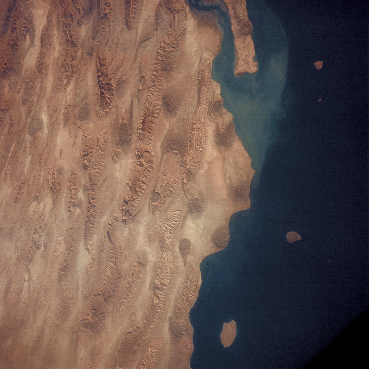
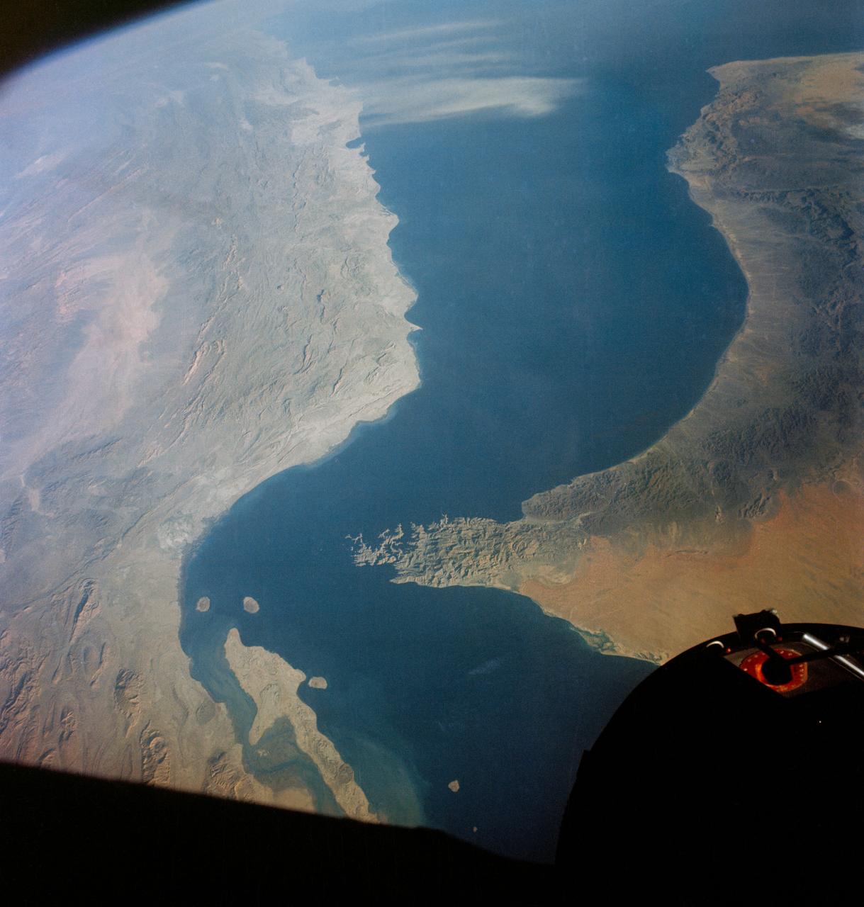
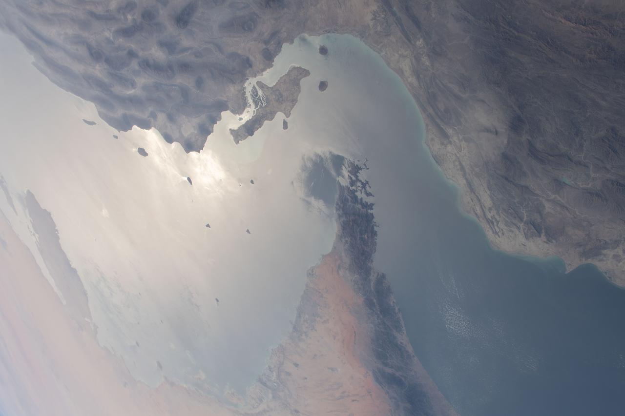
AS7-05-1615 (12 Oct. 1968) --- Persian Gulf coastal area of Iran, Qeshm Island, as seen from the Apollo 7 spacecraft during its 24th revolution of Earth. Photographed from an altitude of approximately 130 nautical miles, at ground elapsed time of 37 hours and 23 minutes.
In Iran, near the southwest shore of the Caspian Sea, folded sedimentary rocks are part of the Greater Caucasus Mountain Belt. In false color infrared, the blue colored rocks are white sediments, greenish-toned rocks are redbeds. The vegetated river channel is bright red. The black line going across the image from east to west is Iran Highway 2 that starts in Teheran and ends in Tabriz. The image was acquired June 22, 2020, covers an area of 37.6 by 40.9 km, and is located at 37.1 degrees north, 47.6 degrees east. https://photojournal.jpl.nasa.gov/catalog/PIA25946
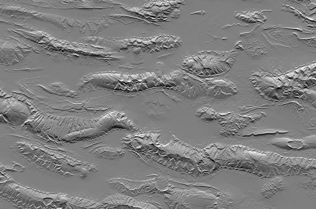
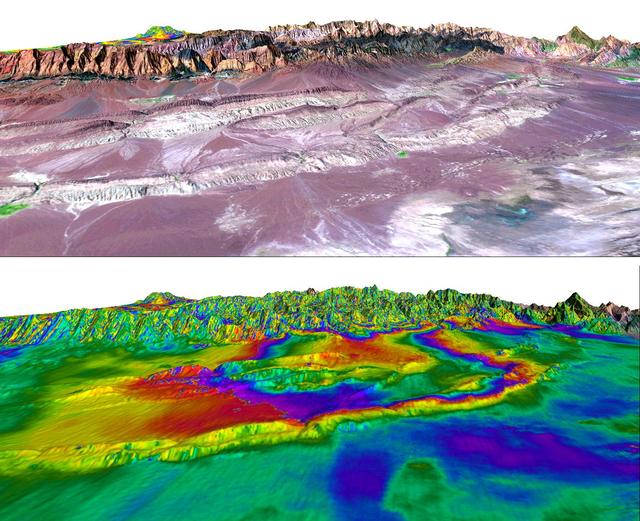
The Zagros Mountains in Iran offer a visually stunning topographic display of geologic structure in layered sedimentary rocks.
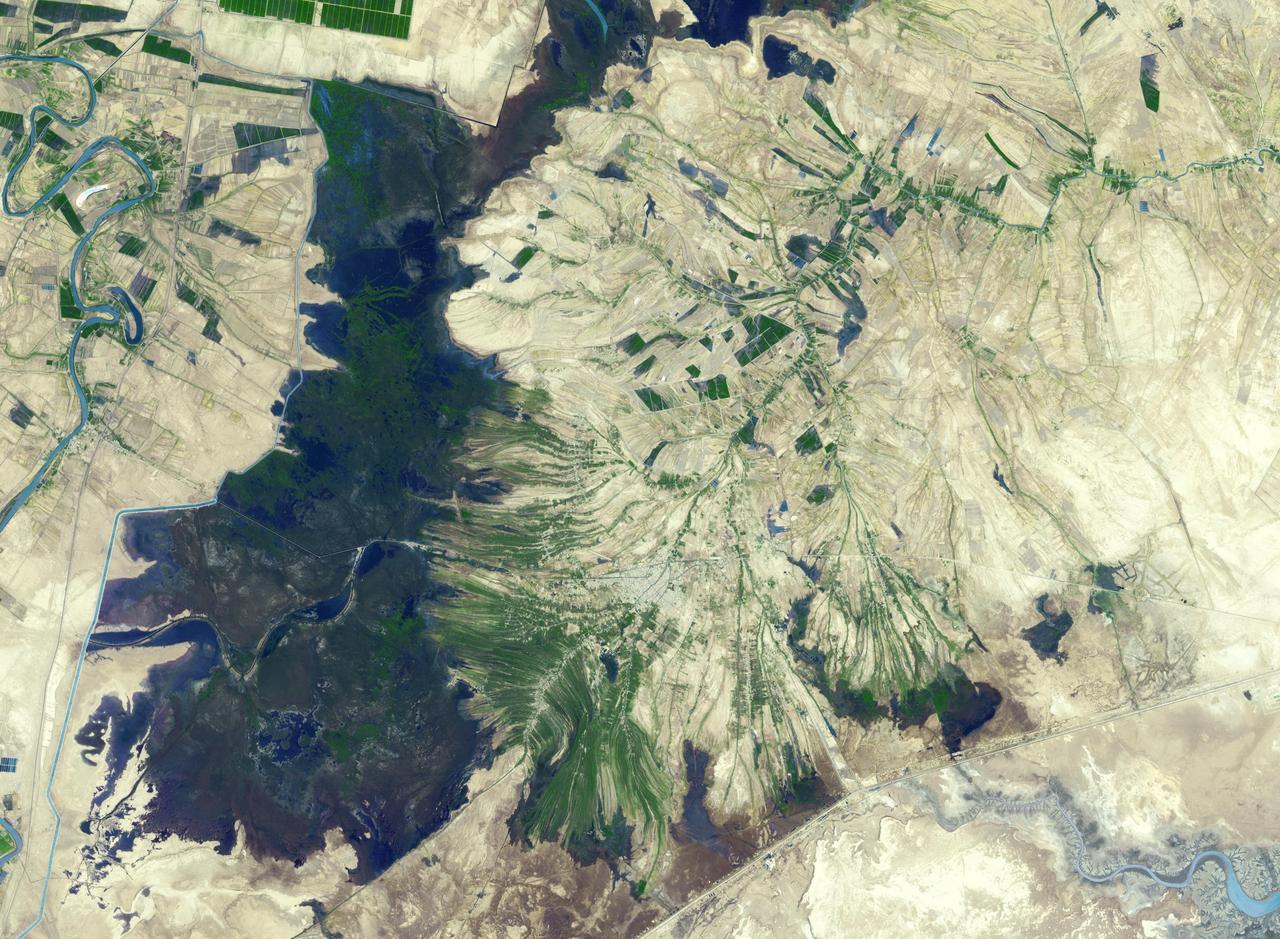
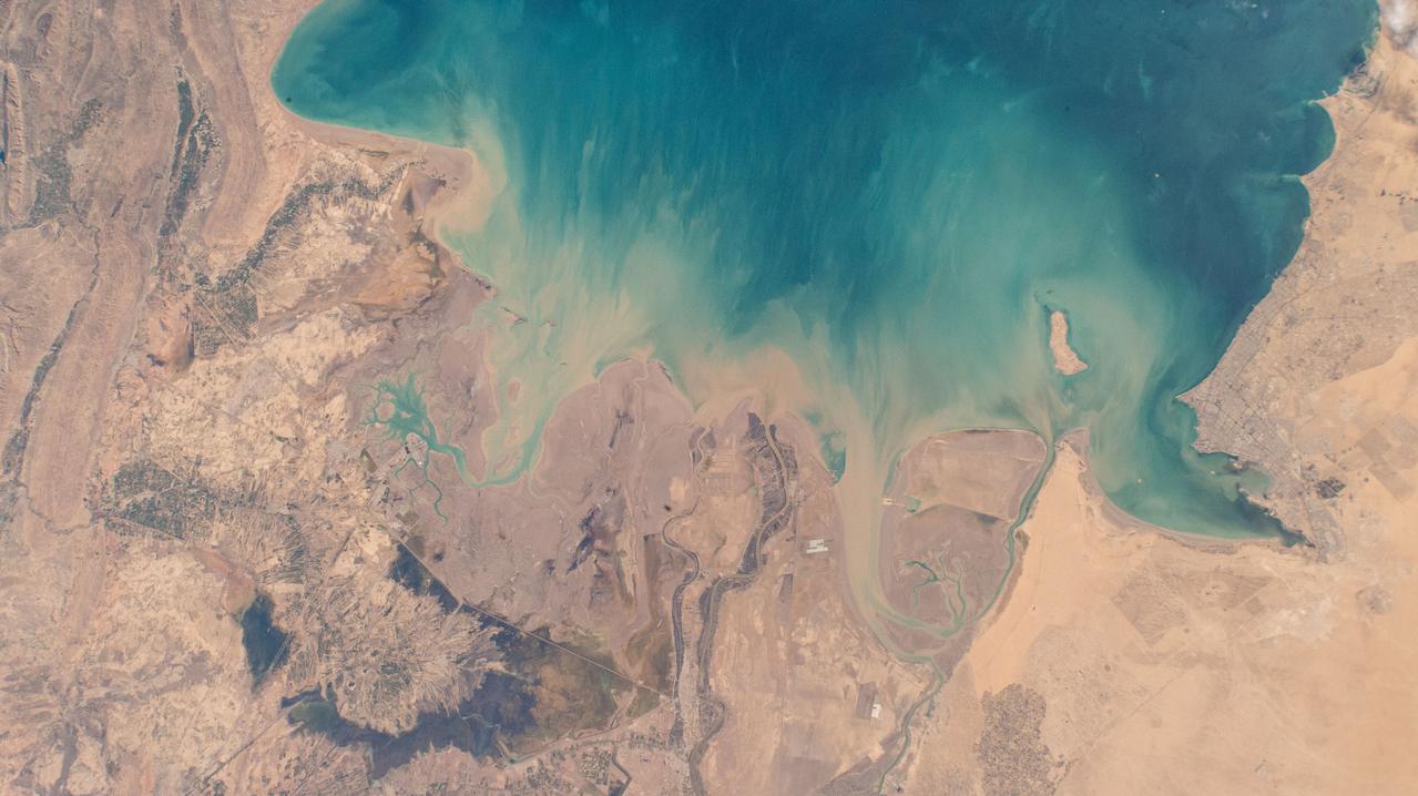
The town of Shadegan, Iran is northeast of where the Tigris and Euphrates Rivers enter the Persian Gulf. It sits near a wetland and upon land that was once part of an inland river delta. The long, linear orchards follow the topography created by the delta. The image was acquired September 3, 2012, covers an area of 40.6 by 55.3 km, and is located at 30.6 degrees north, 48.6 degrees east. http://photojournal.jpl.nasa.gov/catalog/PIA21170
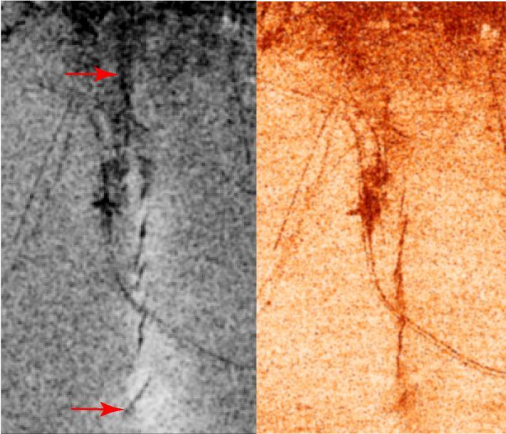
A magnitude 6.5 earthquake devastated the small city of Bam in southeast Iran on December 26, 2003. The two images from ESA Envisat show similar measures of the radar interferometric correlation in grayscale on the left and in false colors on the right.
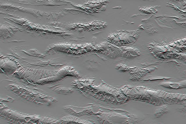
The Zagros Mountains in Iran offer a visually stunning topographic display of geologic structure in layered sedimentary rocks in this anaglyph from NASA Shuttle Radar Topography Mission. 3D glasses are necessary to view this image.
A magnitude 6.6 earthquake struck a sparsely inhabited area of southeast Iran on March 14, 1998, at 11:10 p.m. local time.

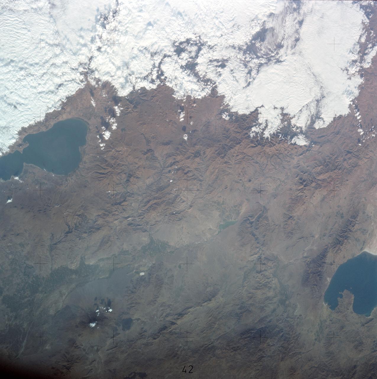
STS058-95-028 (18 Oct-1Nov 1993) --- Lake Urmia (Orumiyeh) in the high desert plateau of northwest Iran dominates the center of this northeast-looking view. The left edge of the view cuts Lake Van in eastern Turkey. The Caucasus Mountains in war-torn Georgia appear just beyond. Mount Ararat, of biblical fame, is a major peak north of Lake Van. The Caspian Sea, an international body of water, stretches across the top right of the view. Countries bordering the Caspian are Iran in the south, Kazakhstan in the west, and Russia and Azerbaijan in the west.
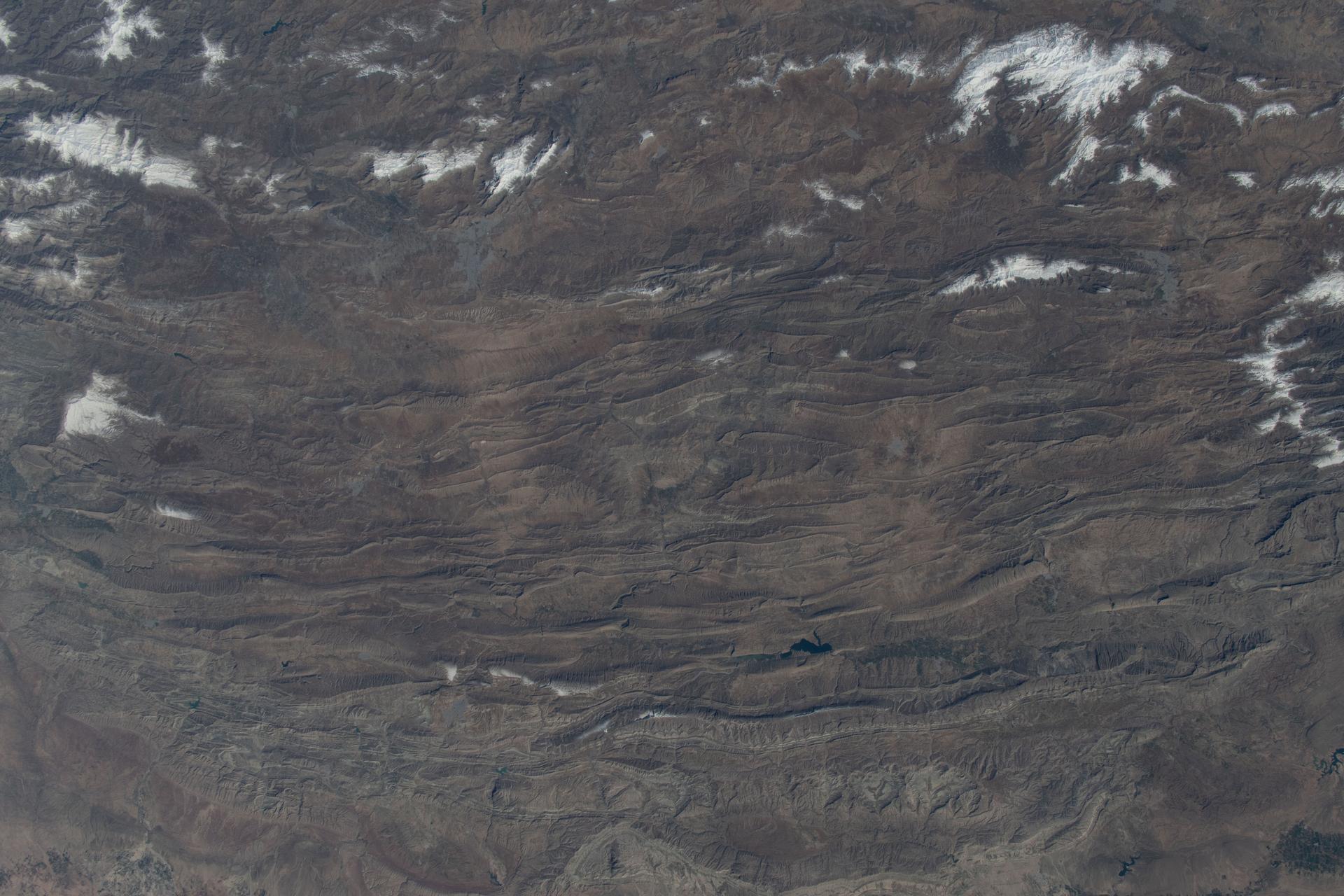
iss074e0315889 (Feb. 16, 2026) --- A portion of the rugged Zagros Mountain range, featuring narrow valleys and rocky outcrops in the semi-arid region of western Iran, is pictured from the International Space Station as it orbited 259 miles above Earth. Credit: NASA/Chris Williams
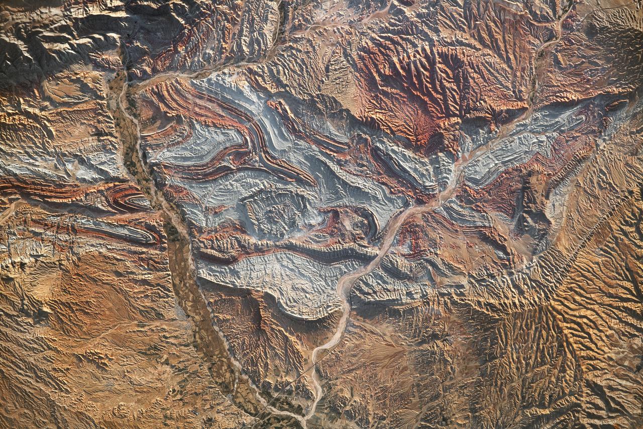
iss069-e-089946_lrg (09/19/2023) --- An astronaut aboard the International Space Station took this photograph of the rugged landscape of the Aladaghlar Mountains in northwestern Iran. Ridges cast shadows in the valleys and other low elevation areas, creating a three-dimensional appearance. Human alterations to the landscape are most evident in riverbeds, where the even topography is easier to build on and navigate. Natural processes over millions of years have folded rock layers of various compositions and colors into the curved patterns seen here. These folds are produced by tectonic forces operating along the convergent plate boundary of the Arabia and Eurasia plates. The convergence of these tectonic plates causes uplift, folding, and deformation of the colorful rock layers, and subsequent erosion exposes them. On the left side of this photo, the Qezel Ozan River, a major river in northern Iran, cuts across the landscape. Agricultural fields are visible along the riverbanks tucked between the mountains. The Qezel Ozan also intersects the Zanjan-Tabriz freeway (Freeway 2), a major thoroughfare built on a dried riverbed connecting the cities of Tehran and Tabriz. Astronaut photograph ISS069-E-89946 was acquired on September 19, 2023, with a Nikon D5 digital camera using a focal length of 400 millimeters. The image was provided by the ISS Crew Earth Observations Facility and the Earth Science and Remote Sensing Unit at Johnson Space Center. The image was taken by a member of the Expedition 69 crew. It has been cropped and enhanced to improve contrast, and lens artifacts have been removed. The International Space Station Program supports the laboratory as part of the ISS National Lab to help astronauts take pictures of Earth that will be of the greatest value to scientists and the public and to make those images freely available on the Internet. Additional images taken by astronauts and cosmonauts can be viewed at the NASA/JSC Gateway to Astronaut Photography of Earth. Caption by Sara Schmidt, GeoControl Systems, JETS II Contract at NASA-JSC and Andrea Wenzel, Jacobs-JETS II Contract at NASA-JSC.

S66-63485 (13 Nov. 1966) --- Iran, Trucial Coast, Oman, Zagros Mountains, and Qishm Island (large island at lower left), as seen from the Gemini-12 spacecraft during its 25th revolution of Earth. Gulf of Oman is at lower left edge and the Persian Gulf is large body of water in upper half of photo. Photo credit: NASA
S66-63486 (13 Nov. 1966) --- Iran, Trucial Coast, Oman, Zagros Mountains, and Qishm Island (large island at lower right), as seen from the Gemini-12 spacecraft during its 25th revolution of Earth. Gulf of Oman is large body of water at left and the Persian Gulf is body of water at right. View is looking east. Photo credit: NASA

S63-06443 (15-16 May 1963) --- A northwest-looking view across Pakistan, eastern Iran and Afghanistan as photographed from the Mercury-Atlas 9 (MA-9) capsule by astronaut L. Gordon Cooper Jr., during his 22-orbit MA-9 spaceflight. Photo credit: NASA
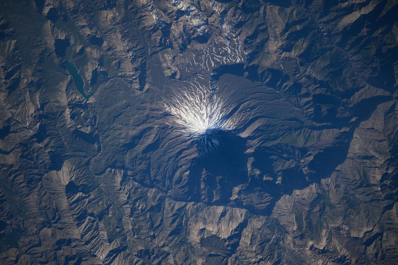
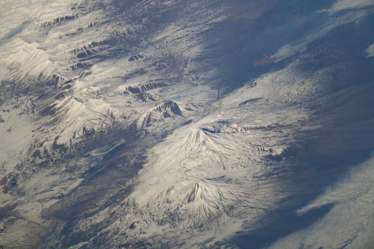
iss073e0118994 (May 17, 2025) --- The snow-capped Mount Damavand, a dormant stratovolcano and Iran's highest peak less than 50 miles from the nation's capital of Tehran, is pictiured from the International Space Station as it orbited 261 miles above the Caspian Sea.
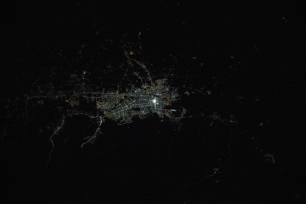
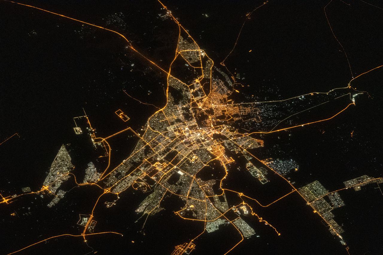
iss072e793149 (March 17, 2025) --- Mashhad, the second-most populous city in Iran with approximately 3.62 million residents near the border with Turkmenistan, is pictured at 11:47 p.m. local time from the International Space Station as it orbited 261 miles above.

On April 9, 2013 at 11:52 GMT, this image acquired by NASA Terra spacecraft, shows the location of a magnitude 6.3 earthquake hit southwestern Iran Bushehr province near the town of Kaki.
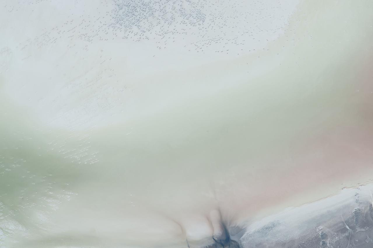
ISS044E002419 (06/20/2015) --- This Earth observation of Iran was taken by members of Expedition 44 on the International Space Station on June 20, 2015. Described as "Earth Art" it is the western shore of Lake Urmia near Gülmanxana, Iran (~36.6N, 45.3E).

iss067e169952 (July 1, 2022) --- The Arvand Roud (center) is a river that separates the southern borders of Iraq and Iran on the Persian Gulf coast. At right, is the Bahmanshir River in Iran that drains into the Persian Gulf. The International Space Station was orbiting 262 miles above Saudi Arabia near the island nation of Bahrain at the time this photograph was taken.
STS-35 Earth observation taken aboard Columbia, Orbiter Vehicle (OV) 102, is of the Persian Gulf area. Major cities and oilfields of the countries of Saudi Arabia (foreground), Iraq (top left), Iran (top center and top right), Kuwait, Bahrain, Qatar, and a portion of the United Arab Emirates are visible in this scene. The cities are the large whitish areas of city lights. Flares characteristic of the Mid-East oil field practices are visible both onshore and offshore throughout the scene. Major cities identifiable are in Iraq - Baghdad, Basra, and Faw; in Qatar - Ab Dawhah; in Kuwait - Kuwait City; in Saudi Arabia - Riyadh, Al Jubayl, Dharan, Al Huf, Ad Dilam and Al Hariq; and Bahrain and its associated causeway to the mainland.
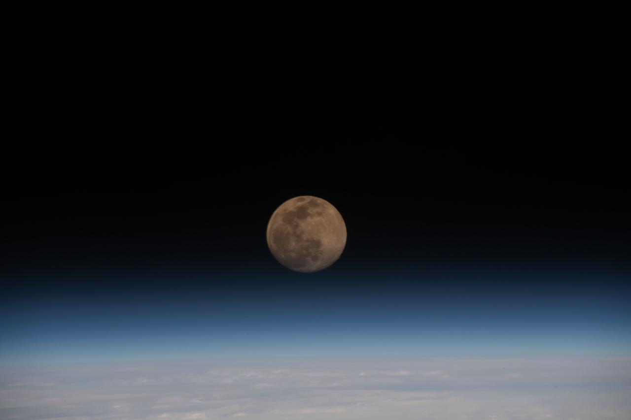
iss064e048197 (March 27, 2021) --- A Full Moon is pictured above the Earth's horizon as the International Space Station orbited 262 miles above Iran.
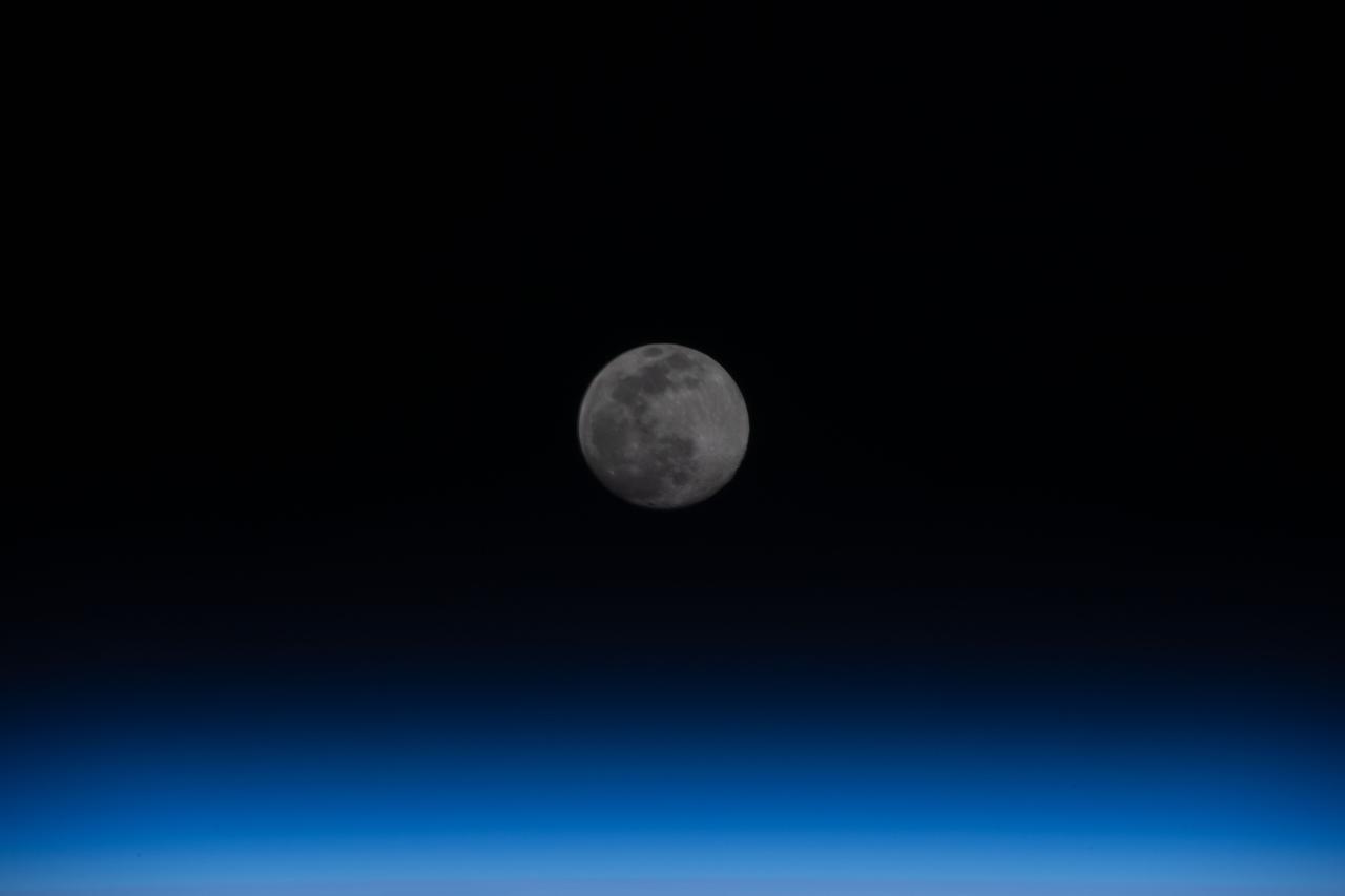
iss064e048201 (March 27, 2021) --- A Full Moon is pictured above the Earth's horizon as the International Space Station orbited 262 miles over eastern Iran.
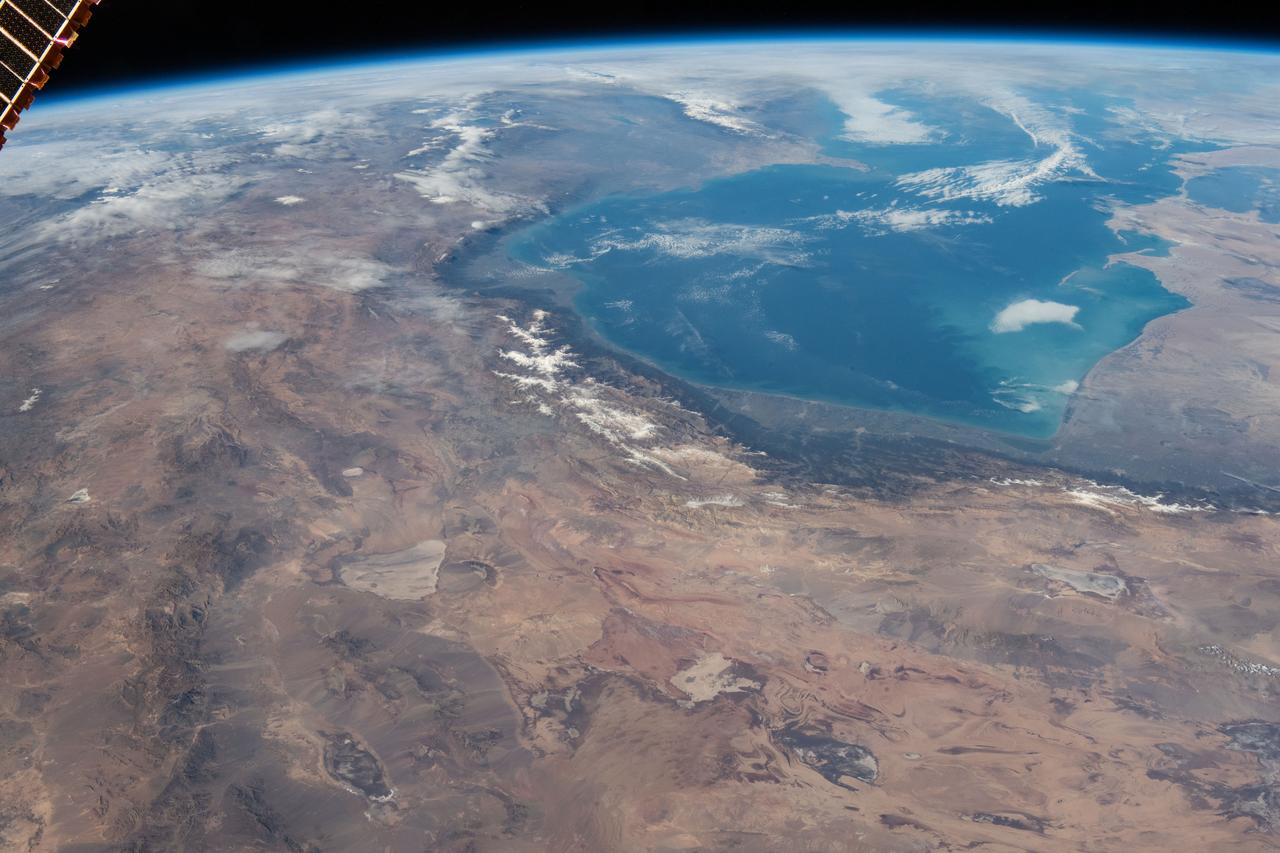
iss070e002303 (Oct. 6, 2023) --- The Caspian Sea and cities and towns on the coast of northern Iran are pictured from the International Space Station as it orbited 259 miles above.
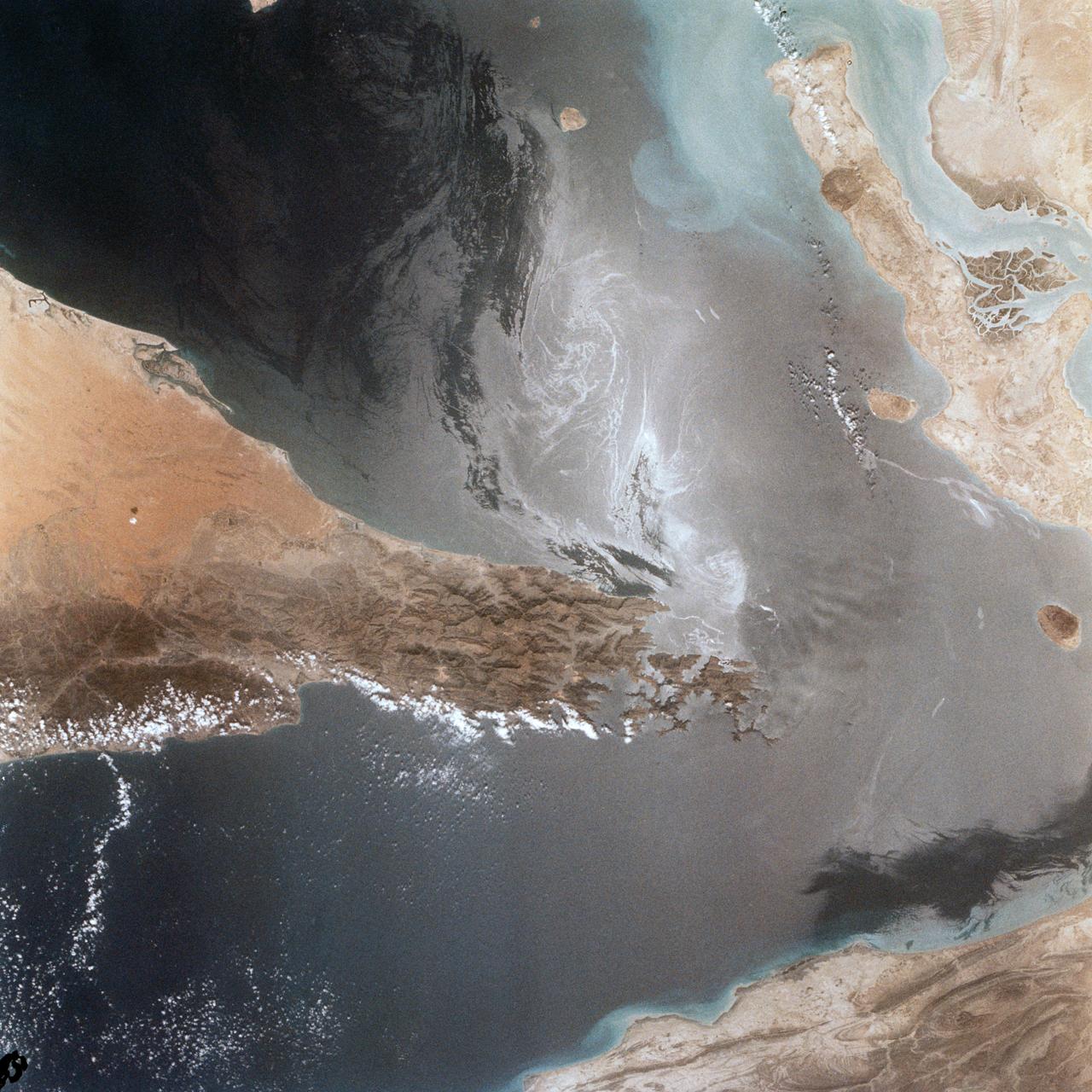
Portions of Oman, The United Arab Emirates and Iran are seen at the Strait of Hormuz (26.0N, 56.0E) in this view. A number of ship wakes can be seen in the area of the strait. Sunglint in the Persian Gulf to the northwest, accentuates the complex currents and oil slicks, seen as dark toned blue streaks on the surface. Qeshm Island, just off the coast of Iran, can be seen on the edge of the photo.
SL3-122-2562 (July-September 1973) --- A near vertical view of the border area of Turkey-Iran?Union of Soviet Socialist Republics as seen from the Skylab space station in Earth orbit. This picture was taken by one of the Skylab 3 crewmen using a hand-held 70mm Hasselblad camera. THE PICTURE SHOULD BE HELD WITH THE MASS OF WHITE CLOUDS ON THE RIGHT SIDE. The lake at the top center edge is Ozero (Lake) Sevan in the USSR?s Armenian Soviet Socialist Republic. The other body of water is Iran?s Lake Urmia. The major feature in this photograph can be seen in the upper left corner. Mount Ararat is in Turkey only a few miles from Iran and USSR borders. Yerevan, the capital of Armenian SSR, is located north-northwest of Mount Ararat. Photo credit: NASA
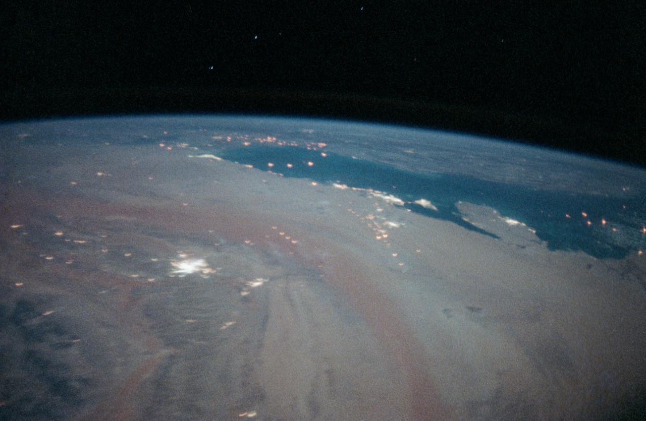
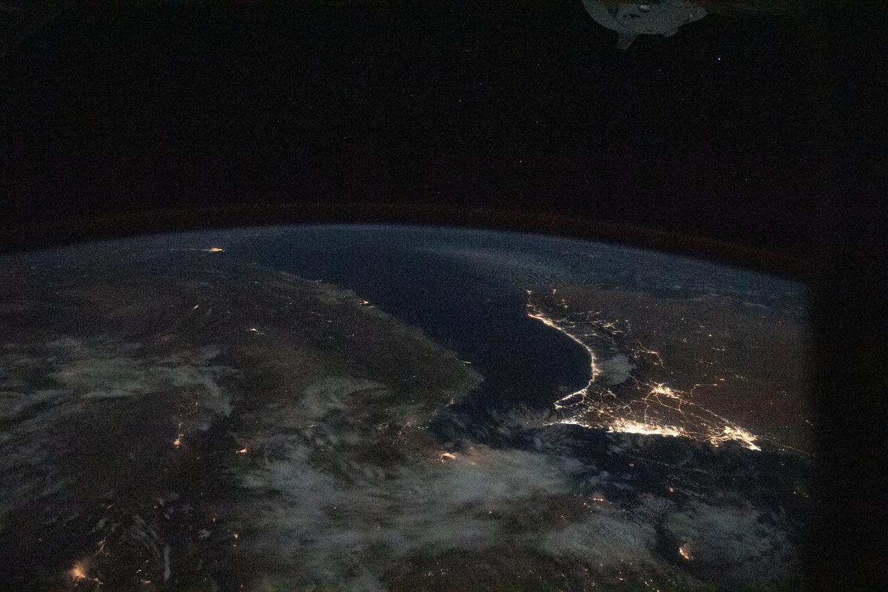
iss063e081362 (Aug. 31, 2020) --- The well-lit Middle Eastern cities along the Persian Gulf coast of the Arabian Peninsula to the north of Iran were photographed from the International Space Station during an orbital night pass.
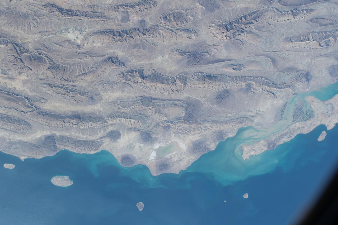
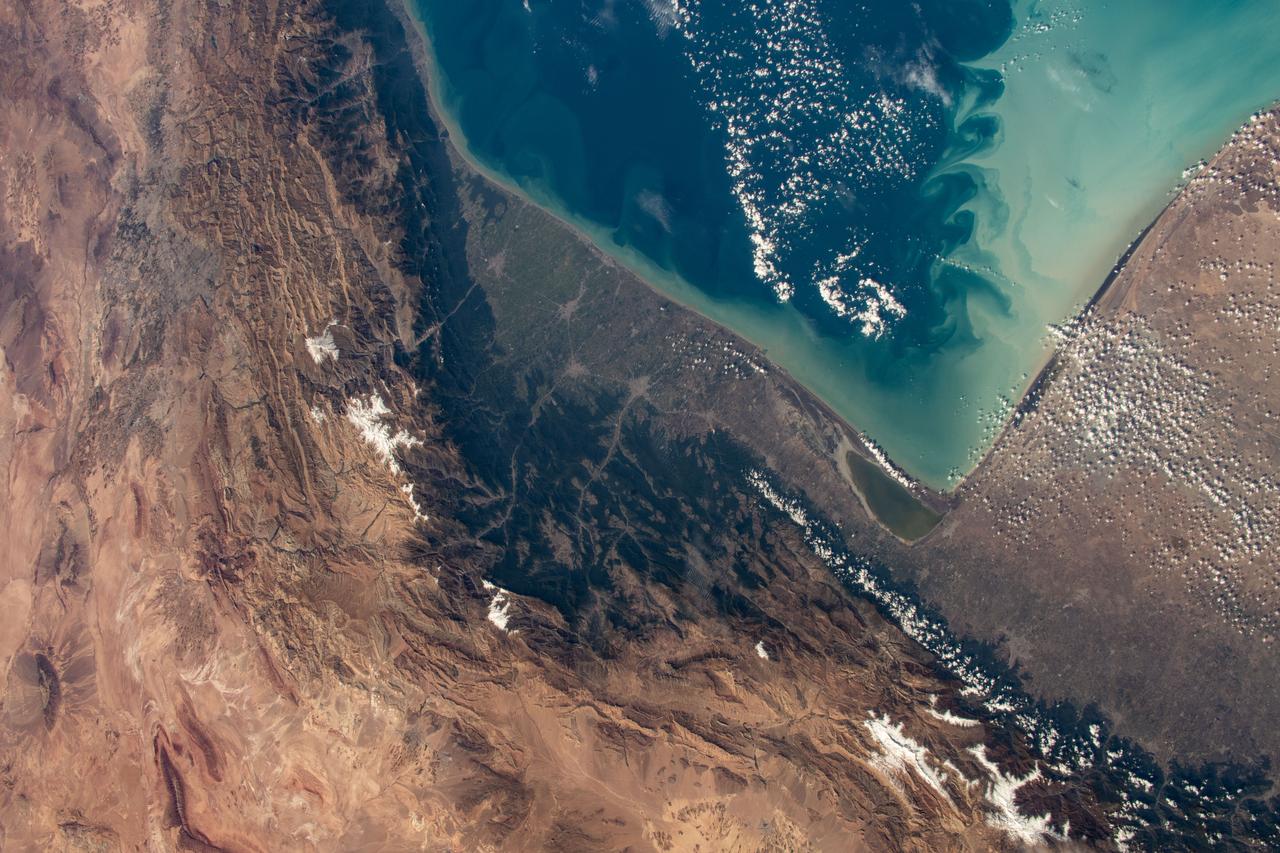
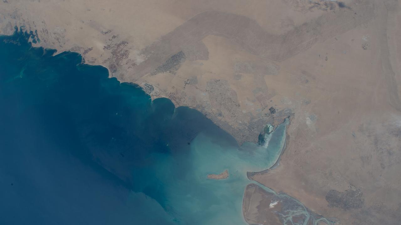
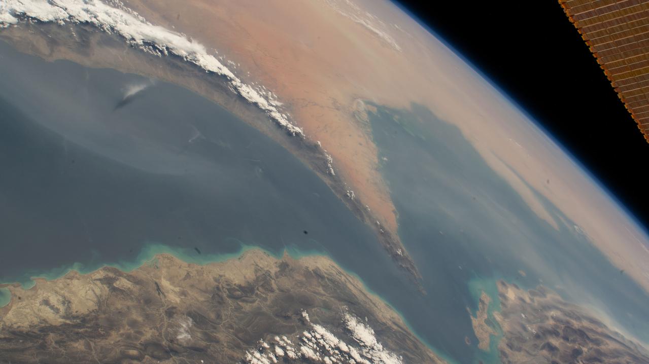
iss066e126129 (Jan. 26, 2022) --- The semi-desert, southern coast of Iran on the Persian Gulf is pictured from the International Space Station as it orbited 258 miles above the Middle Eastern nation.
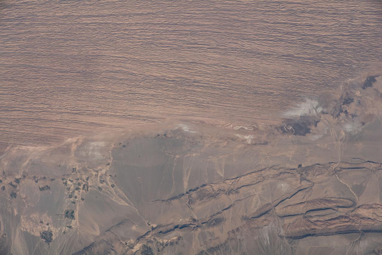
iss066e144029 (Feb. 15, 2022) --- The hot and arid desert geography of Kerman Province in central Iran is pictured from the International Space Station as it orbited 258 miles above.
iss067e284429 (Aug. 20, 2022) --- Kuwait City, on the south shore of Kuwait Bay on the Persian Gulf, is pictured from the International Space Station as it orbited 257 miles above western Iran.
iss069e032977 (July 18, 2023) --- The city lights of the oasis city of Al Ain in the United Arab Emirates are pictured from the International Space Station as it orbited 260 miles above southern Iran near the coast of the Strait of Hormuz.
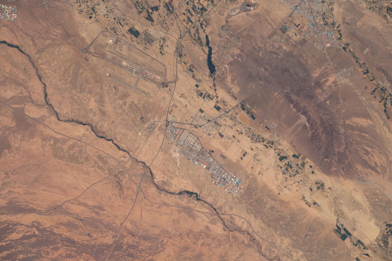
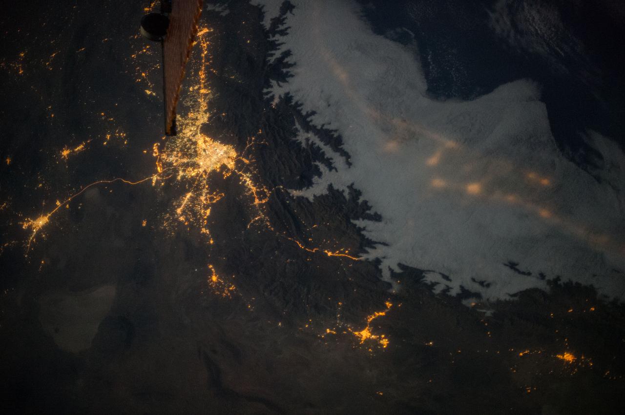
iss067e239241 (Aug. 4, 2022) --- Imam Khomeini International Airport and Shamsabad Industrial City are seen south of Tehran, Iran, as the International Space Station orbited 258 miles above the Middle Eastern nation south of the Caspian Sea.
Earth observation taken during a day pass by an Expedition 36 crew member on board the International Space Station (ISS). Per Twitter message: Tashk and Bakhtegan Lakes, Iran.
iss066e144020 (Feb. 15, 2022) --- The hot and arid desert geography of Semnan Province southeast of Tehran, Iran, is pictured from the International Space Station as it orbited 258 miles above.
iss070e033711 (Nov. 30, 2023) --- The Caspian Sea is surrounded by the nations of Iran to the south, Azerbaijan to the west, and Turkmenistan and Kazakhstan to the east in this photograph from the Interational Space Station as it orbited 260 miles above.

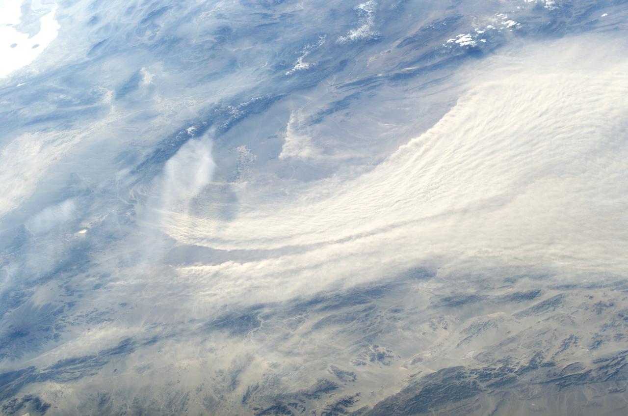
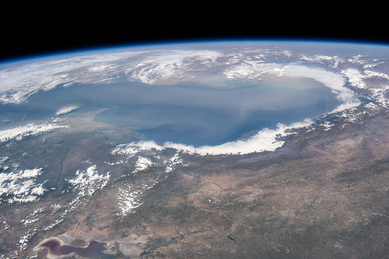
iss055e013731 (April 7, 2018) --- An Expedition 55 crew member aboard the International Space Station photographed a cloud formation over the Caspian Sea surrounded by the countries of Azerbaijan, Iran and Turkmenistan.
ISS008-E-16328 (15 February 2004) --- A major dust storm in the Kerman Desert, just east of the city of Bam in Southeastern Iran, was featured in this image photographed by an Expedition 8 crewmember onboard the International Space Station (ISS).

iss065e000674 (April 19, 2021) --- The north coast of the island nation of Bahrain in the Persian Gulf is pictured from the International Space Station as it orbited 262 miles above western Iran.
iss064e029480 (Feb. 8, 2021) --- This oblique view of Mount Ararat in eastern Turkey was taken from the International Space Station as it orbited 262 miles above Iran just south of the Caspian Sea. Credit: Roscosmos

iss061e110462 (Dec. 29, 2019) --- Stars glitter in the night sky above an atmospheric glow that blankets the city lights as the International Space Station orbited 260 miles above northern Iran as it was about to cross the Caspian Sea.
iss064e046338 (March 24, 2021) --- The strategically important shipping route of the Strait of Hormuz is pictured separating the nations of the United Arab Emirates and Iran. It also separates the main water bodies of the Persian Gulf and the Gulf of Oman.
iss064e029028 (Feb. 2, 2021) --- The northern coast of the Persian Gulf, pictured from the International Space Station at an altitude of 262 miles, leads to the Middle Eastern nations of Kuwait, Iraq and Iran.

iss070e002199 (Oct. 4, 2023) --- The Soyuz MS-24 crew ship is featured prominently in this photograph from the International Space Station as it soared into an orbital sunrise 259 miles above the Iran-Pakistan border. The city lights below highlight the United Arab Emirates on the Persian Gulf and Oman on the Gulf of Oman.
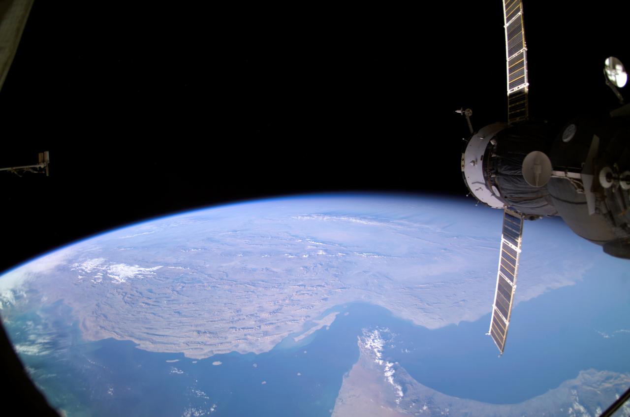
ISS008-E-12570 (22 January 2004) --- Backdropped by Earth’s horizon and the blackness of space, an unpiloted Progress supply vehicle docked to the International Space Station (ISS) was photographed by one of the Expedition 8 crewmembers. Parts of Iran, the United Arab Emirates, Oman, Strait of Hormuz and the Persian Gulf are also visible.
iss064e007913 (Nov. 28, 2020) --- This image from International Space Station as it was flying 261 miles over Iran looks southeast across the Persian Gulf and the Gulf of Oman. The well-lit areas along the coast are cities located in the nations of Oman and the United Arab Emirates.

iss069e056918 (Aug. 14, 2023) --- The Strait of Hormuz (bottom left) connects the Gulf of Oman with the Persian Gulf in this photograph from the International Space Station as it orbited 262 miles above southwestern Iran. In the right foreground, is the Northrop Grumman Cygnus space freighter and one of its cymbal-shaped UltraFlex solar arrays.
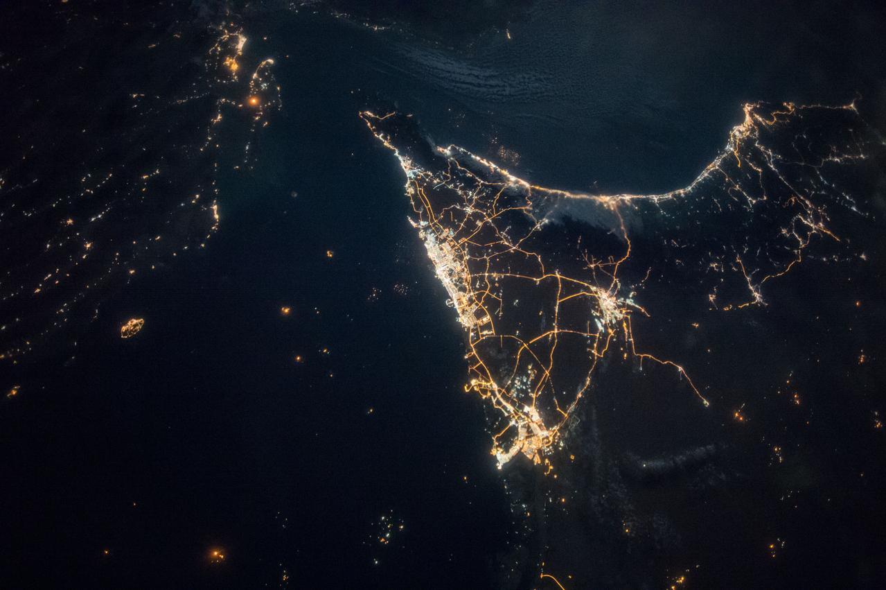
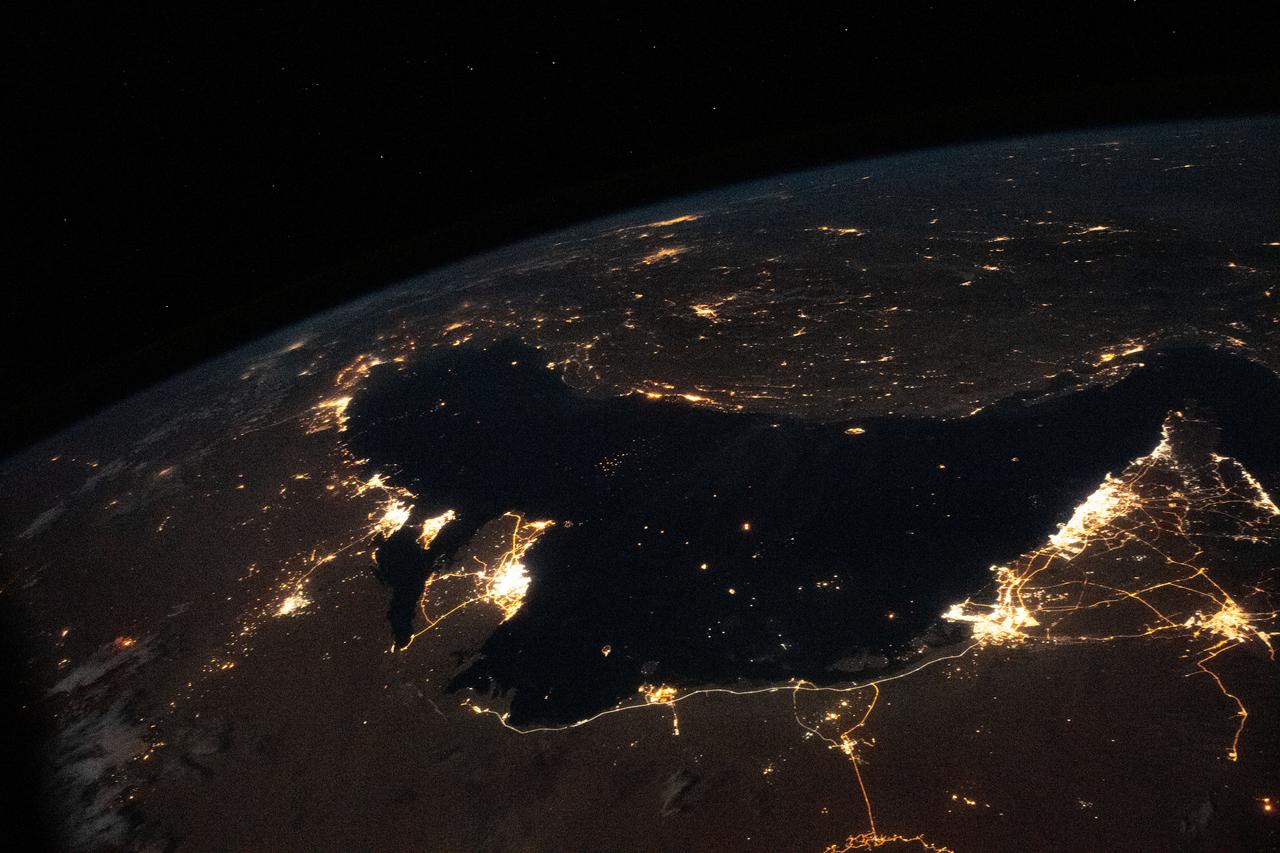
iss049e007067 (09/19/2016) --- Night views of the Earth from the International Space Station. This image is the southern Persian Gulf at night centered on Dubai and Abu Dhabi; east is at the top of the image with the coast of Iran to upper left and Muscat, Oman upper right.
Earth observation taken during night pass by an Expedition 36 crew member on board the International Space Station (ISS). Per Twitter message this is labeled as : Tehran, Iran. Lights along the coast of the Caspian Sea visible through clouds. July 21.
iss071e139662 (May 27, 2024) --- The world's largest inland body of water, the Caspian Sea rests in between Europe and Asia and is bordered by the nations of Russia, Kazakhstan, Turkmenistan, Iran, and Azerbaijan. The International Space Station was orbiting 262 miles above Erbil, Iraq, at the time of this photograph.
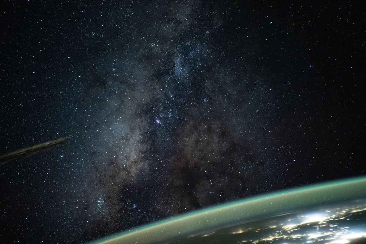
iss073e0516005 (Aug. 23, 2025) --- The Milky Way appears above Earth's bright atmospheric glow in this photograph from the International Space Station as it soared 261 miles above southern Iran at approximately 12:54 a.m. local time. The camera was configured for low light and long duration settings.
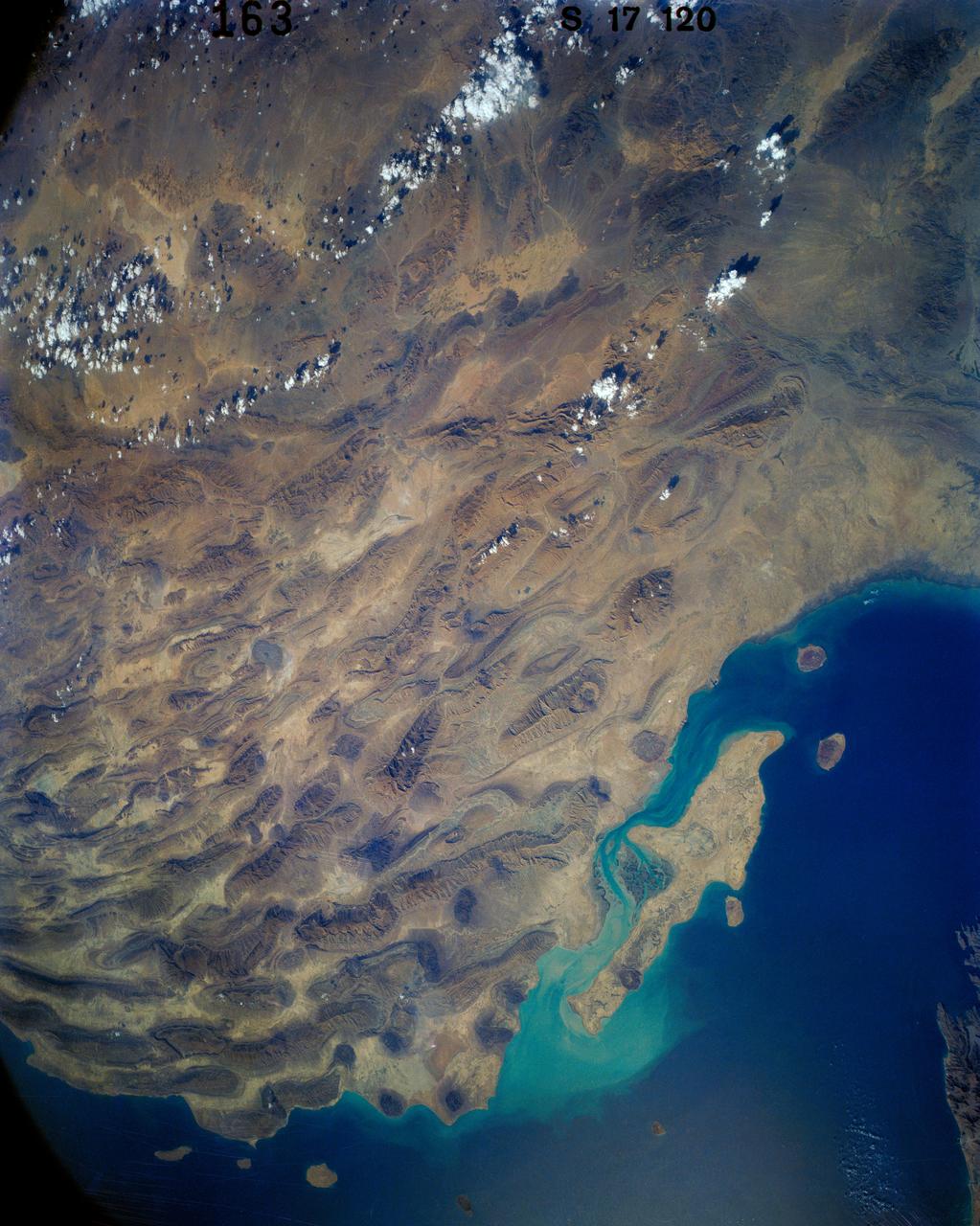
41G-120-163 (5-13 Oct 1984) --- The long, linear parallel ridges of the Zagros Mountains of southwestern Iran. Dark, round salt domes intrude from deep beneath the earth to produce oil, much of which has yet to be exploited in this area.
iss067e270600 (Aug. 18, 2022) --- The Strait of Hormuz connects the Gulf of Oman (left) with the Persian Gulf (right). The waterway also separates the Middle Eastern nation of Iran (bottom) from the Arabian Peninsula nations of Oman, United Arab Emirates, and Qatar (top left to right).
iss063e081388 (Aug. 31, 2020) --- This nighttime photograph from the International Space Station looks north across Turkmenistan and Uzbekistan with the Caspian Sea at left towards the Earth's horizon. At bottom left, is the populated oasis area of Turkmenistan near the border with Iran.

iss069e031703 (July 16, 2023) --- At left, the Soyuz MS-23 crew ship is docked to the Prichal docking module which is itself attached to the Nauka science module. The International Space Station was orbiting 260 miles above southern Iran at the time of this photograph.
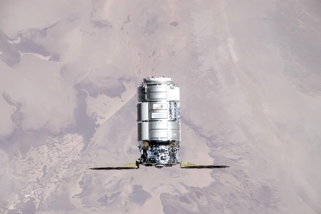
iss071e416716 (Aug. 6, 2024) --- Northrop Grumman's Cygnus cargo craft, carrying 8,200 pounds of science and supplies, approaches the International Space Station for a capture with the Canadarm2 robotic arm commanded by Expedition 71 Flight Engineer Matthew Dominick of NASA. The maneuver marked the 50th free-flying capture for the Canadarm2 robotic arm. The orbital outpost was soaring 262 miles above central Iran at the time of this photograph.
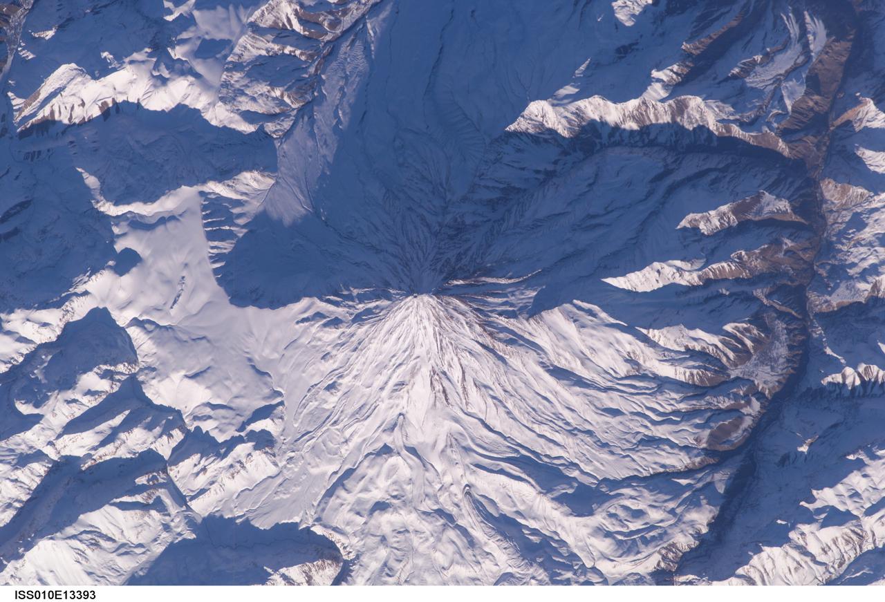
ISS010-E-13393 (15 January 2005) --- Mt. Damavand, Iran is featured in this image photographed by an Expedition 10 crewmember on the International Space Station (ISS). Located approximately 50 kilometers to the northeast of Tehran, Mt. Damavand is an impressive stratovolcano that reaches 5,670 meters (18,598 feet) in elevation. Damavand, which is part of the Alborz mountain range that borders the Caspian Sea to the north, is believed by scientists to be a young volcano that has mostly formed during the Holocene Epoch (over approximately the last 10,000 years). The western flank of the volcano includes solidified lava flows with flow levees – “walls” formed as the side edges of flowing lava cooled rapidly, forming a chute that channeled the hotter interior lava. Two such flows with well-defined levees are highlighted by snow on the mountainside (center). Damavand is the highest peak in Iran and the highest volcano in the Middle East.
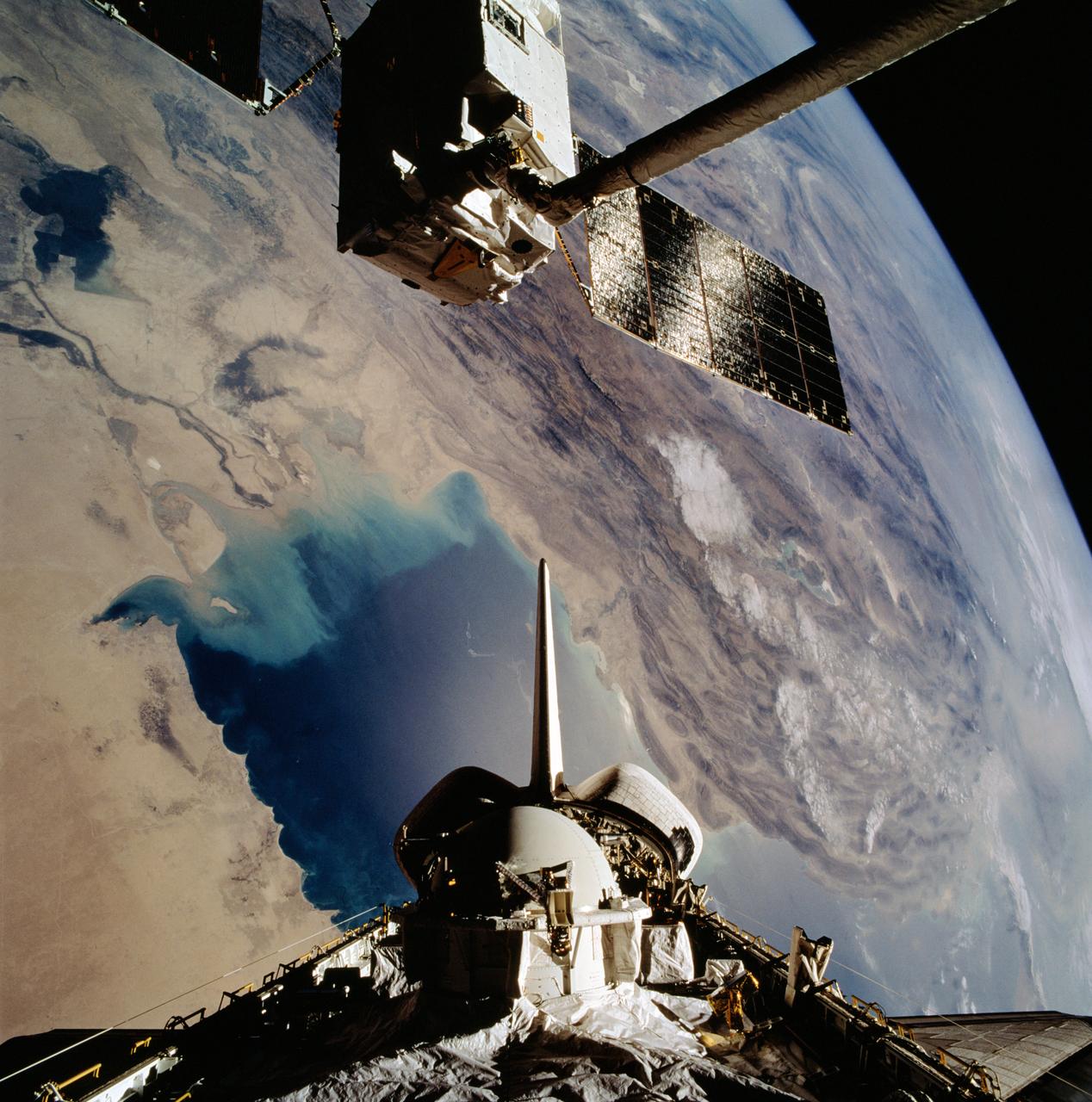
STS046-102-021 (1 Aug 1992) --- The European Space Agency's (ESA) EURECA satellite remains in the grasp of the Space Shuttle Atlantis' Remote Manipulator System (RMS) as the Space Shuttle passes over the Persian Gulf. Most of the theater of the recent war is visible in the frame. Parts of Kuwait, Iraq, Iran and Saudi Arabia can be delineated. The Tethered Satellite System (TSS) remains stowed in the aft cargo bay of Atlantis.

ISS040-E-008307 (7 June 2014) --- One of the members of the Expedition 40 crew aboard the International Space Station aimed a camera "around" the docked Russian Soyuz vehicle to record this night image of the United Arab Emirates. Dubai (center) and Abu Dhabi (left) are easily identified. The Straits of Hormuz are at right and the coast of Iran is barely visible in upper right.

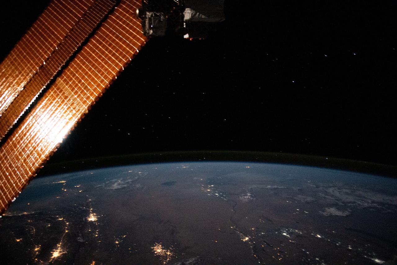
iss073e0982720 (Oct. 25, 2025) --- The Persian Gulf region—from Oman to the United Arab Emirates, with Iran's southwest coast visible across the geographically important waterway—is illuminated beneath a bright yellow-green airglow. This long-exposure photograph, taken at approximately 11:40 p.m. local time from the International Space Station as it orbited 259 miles above northwestern India, also captures the starry expanse of the night sky.
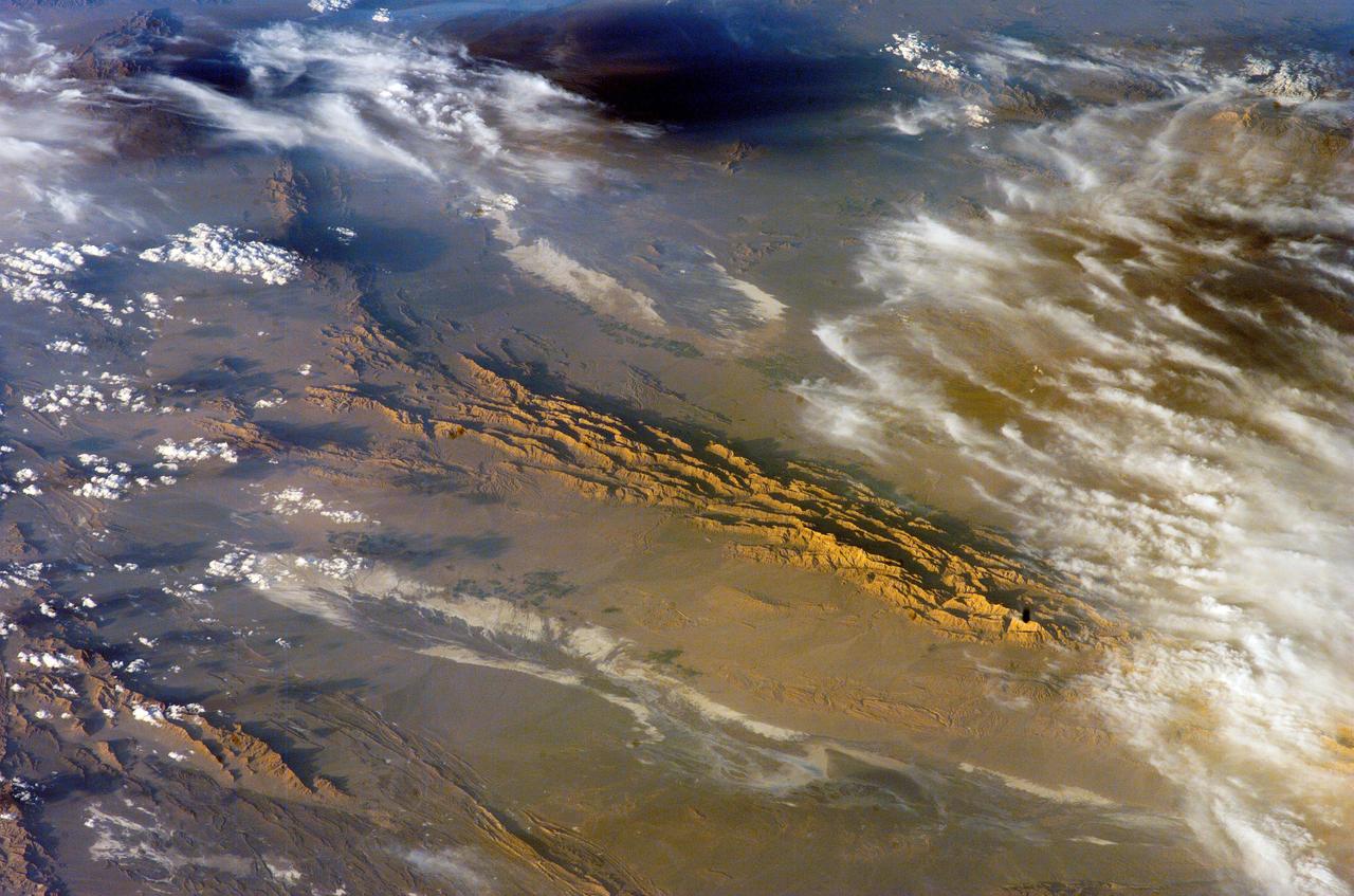
ISS012-E-18779 (28 Feb. 2006) --- Winter in the Dasht-e-Lut Desert, eastern Iran is featured in this image photographed by an Expedition 12 crew member on the International Space Station. The image takes advantage of the low angle of illumination to reveal linear geological structures of the Iranian mountain range bordering the western edge of the basin known as Dasht-e-Lut. The range rises 1818 meters (6000 feet) above sea level and lies 750 kilometers (466 miles) north of the Persian Gulf. The convoluted appearance results from erosion of folded and faulted rocks – softer rocks erode away quickly, leaving more resistant rock to form linear ridges perpendicular to the direction of compression. While not a major oil producing region like the Zagros Fold Belt to the southwest, the mountains of east-central Iran contain economically important deposits of copper and other metals. Little vegetation is visible from space in the arid interior basin of the Dasht-e-Lut. Iran is climatically part of the Afro-Asian belt of deserts that stretch from the Cape Verde islands off West Africa all the way to Mongolia near Beijing. The patchy, elongated, light-colored feature in the foreground (parallel to the mountain range) is the northernmost of the Dasht dry lakes that stretch southward 300 kilometers (186 miles). High country is the source of precipitation-derived water in all near-tropical deserts. Agricultural fields (small dark patches in the image) that depend on this precipitation are located down slope near the margin of the dry, salty soils of the lake.
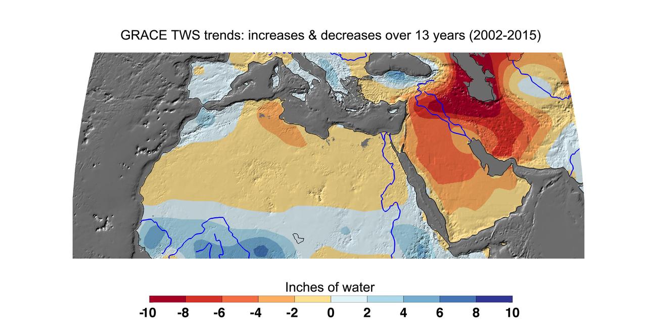
Cumulative total freshwater losses in North Africa and the Middle East from 2002 to 2015 (in inches) observed by NASA's Gravity Recovery and Climate Experiment (GRACE) mission. Total water refers to all of the snow, surface water, soil water and groundwater combined. Groundwater depletion in Turkey, Syria, Iraq and Iran, and along the Arabian Peninsula, are leading to large changes in total water storage in the region. Likewise, drought and groundwater pumping is contributing to the drying of the Caspian Sea Region. The Northwest Sahara Aquifer System, which underlies Tunisia and Libya, is also experiencing increasing water stress as shown in the map. Image updated from Voss et al., 2013. Citation of Record: Voss, K. A., J. S. Famiglietti, M. Lo, C. R. de Linage, M. Rodell and S. C. Swenson, Groundwater depletion in the Middle East from GRACE with Implications for Transboundary Water Management in the Tigris-Euphrates-Western Iran Region, Wat. Resour. Res., 49(2), 904-914, DOI: 10.1002/wrcr.20078. http://photojournal.jpl.nasa.gov/catalog/PIA20207

This image from NASA EarthKAM is of the northern end of the Persian Gulf and the broad delta complex of the Tigris, Euphrates, Shatt al Arab, and Karun rivers has captured the arid-looking wetlands of northeast Kuwait Bubiyan Island,
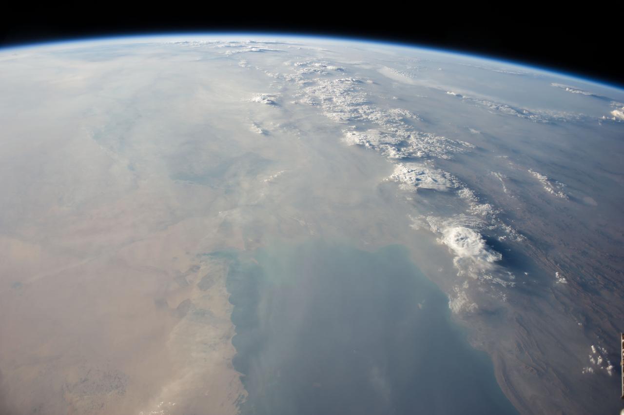
ISS040-E-113700 (31 Aug. 2014) --- This panorama view, photographed by an Expedition 40 crew member on the International Space Station, shows tan-colored dust of a major dust storm obscuring the Persian Gulf and the its northern shoreline. Strong north winds often blow in summer, churning up dust from the entire length of the desert surfaces of the Tigris and Euphrates valleys (top left). Dust partly obscures the hundreds of kilometers of Iraq’s light-green agricultural lands along these rivers (left). A line of thunderstorms is being set off by the Zagros Mountains of Iran (right), with the setting sun casting long shadows from the thunderheads. Space station crews see sixteen sunrises and sunsets every day from low Earth orbit. Here the crew captured dusk in a darkening Iranian landscape (right).
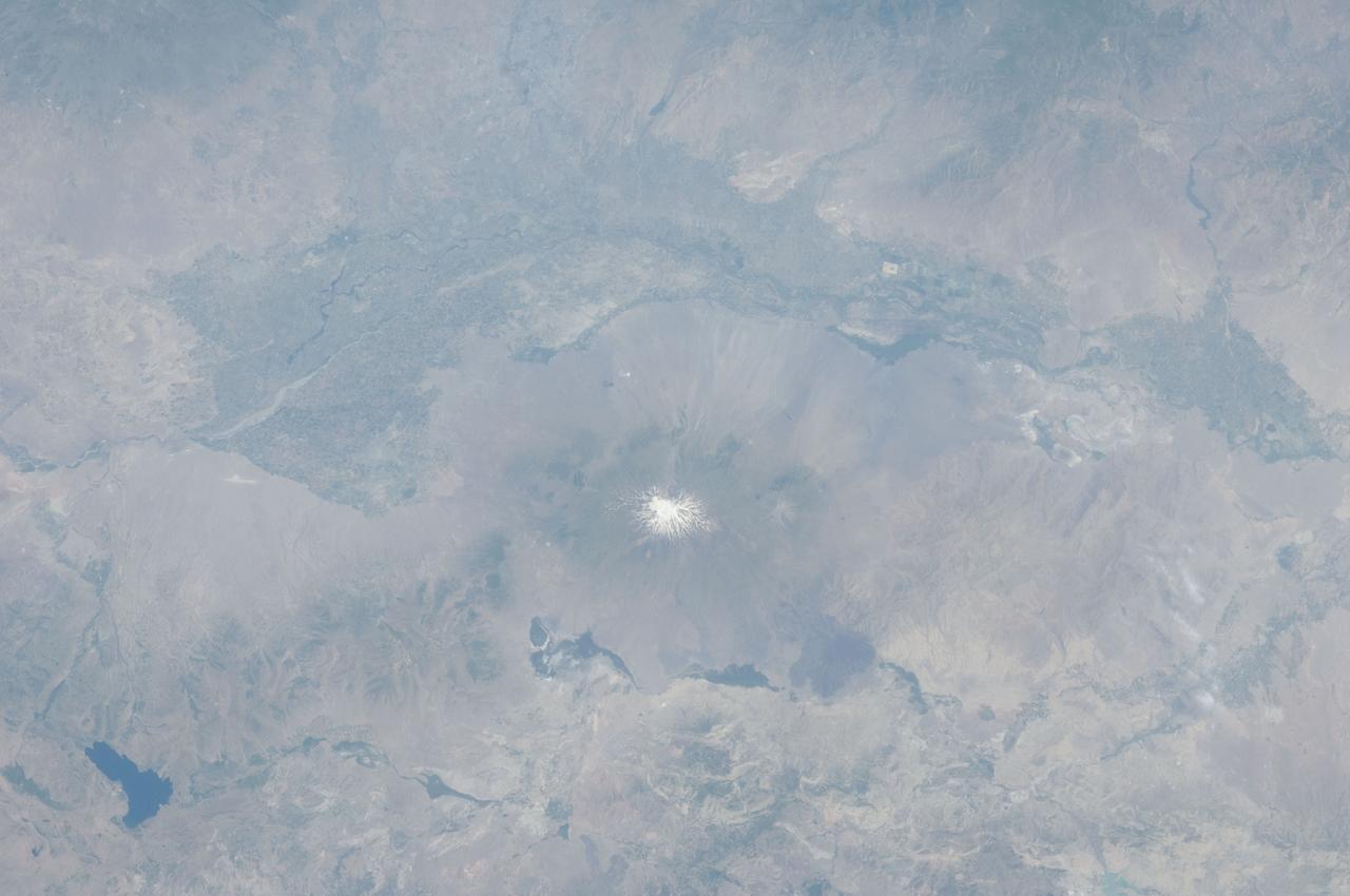
ISS028-E-015023 (8 July 2011) --- The Aras River and Turkey-Armenia-Iran border region are featured in this image photographed by an Expedition 28 crew member on the International Space Station. This photograph highlights a segment of the international border between Turkey to the south-southwest and Armenia to the north-northeast. The Aras River is the physical expression of the closed border between the two countries. Extensive green agricultural fields are common on both sides of the river (top), as well as a number of gray to tan urban areas including Artashat and Armavir in Armenia and Igdir in Turkey. While there have been efforts to normalize diplomatic relations between the two countries in recent years, the Armenia-Turkey border remains officially closed. The dominant geographic feature in the region is Mt. Ararat, also known as Agri Dagi. The peak of Ararat, a large stratovolcano that last erupted in 1840 according to historical records, is located approximately 40 kilometers to the south of the Armenia-Turkey border. A lower peak to the east, known as Lesser or Little Ararat, is also volcanic in origin. Dark gray lava flows to the south of Mt. Ararat are located near the Turkish border with Iran. While this border is also closed along much of its length, official crossing points allow relatively easy travel between the two countries. The white, glacier-clad peak of Mt. Ararat is evident at center; dark green areas on the lower slopes indicate where vegetation cover is abundant. A large lake, Balik Golu or Fish Lake, is visible to the west (lower left).

AS17-148-22718 (7-19 Dec. 1972) --- This excellent view of Saudi Arabia and the north eastern portion of the African continent was photographed by the Apollo 17 astronauts with a hand-held camera on their trans-lunar coast toward man's last lunar visit. Egypt, Sudan, Ethiopia are some of the African nations are visible. Iran, Iraq, Jordan are not so clearly visible because of cloud cover and their particular location in the picture. India is dimly visible at right of frame. The Red Sea is seen entirely in this one single frame, a rare occurrence in Apollo photography or any photography taken from manned spacecraft. The Gulf of Suez, the Dead Sea, Gulf of Aden, Persian Gulf and Gulf of Oman are also visible. This frame is one of 169 frames on film magazine NN carried aboard Apollo 17, all of which are SO368 (color) film. A 250mm lens on a 70mm Hasselblad camera recorded the image, one of 92 taken during the trans-lunar coast. Note AS17-148-22727 (also magazine NN) for an excellent full Earth picture showing the entire African continent.
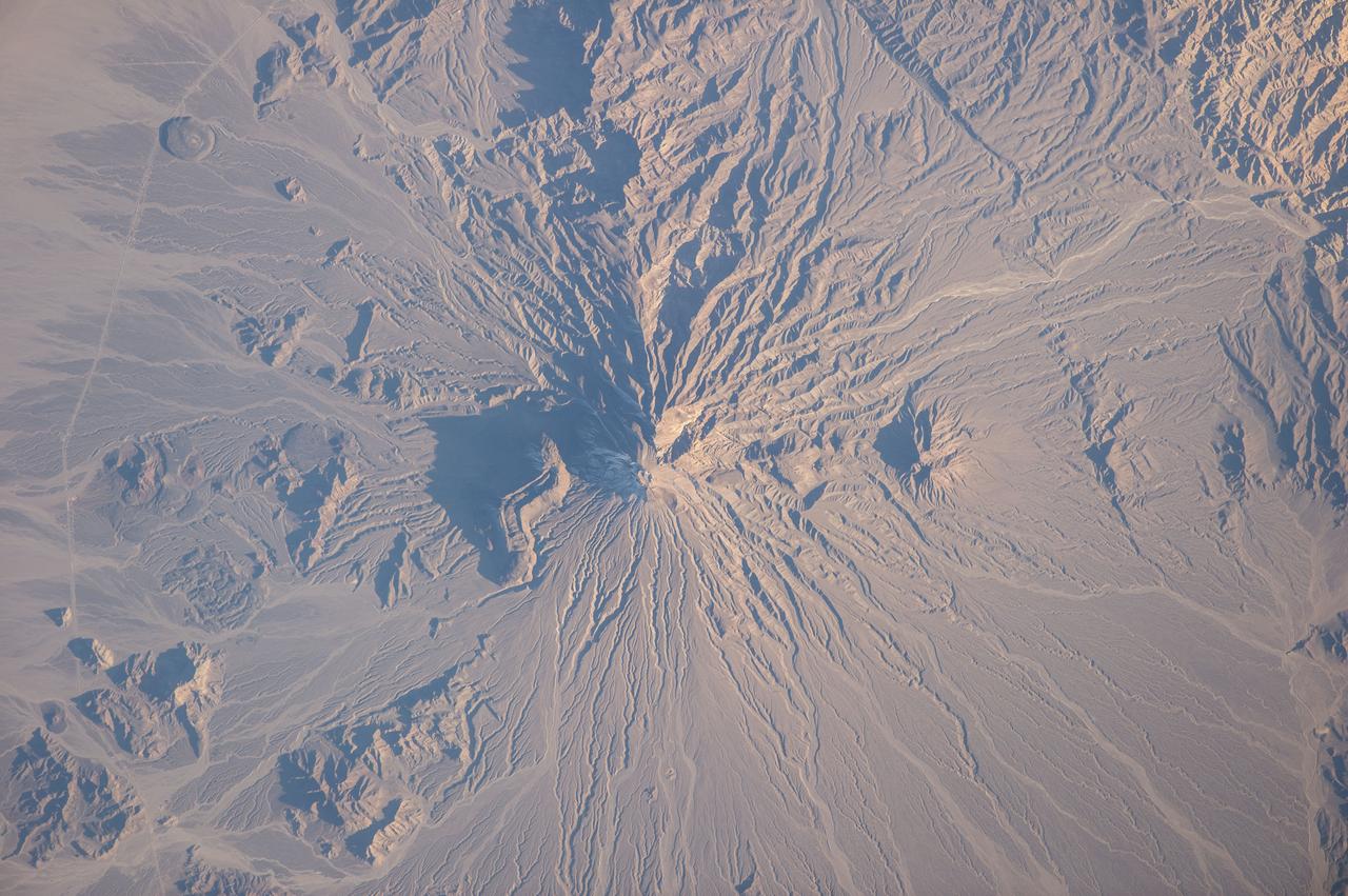
ISS038-E-025895 (5 Jan. 2014) --- Bazman volcano in Iran is featured in this image photographed by an Expedition 38 crew member on the International Space Station. Bazman volcano is located in a remote southern region within the Bazman Protected Area of Sistan and Baluchestan Provinces. While the volcano has the classic cone shape associated with stratovolcanoes, it is also heavily dissected by channels that extend downwards from the 3,490-meter-above-sea-level summit. This radial drainage pattern - looking similar to the spokes of a bicycle wheel - is readily observed in this photograph. Such patterns can form around high, symmetric peaks when water runoff and erosion is not constrained by the resistance of geologic materials or barriers to flow, leading to essentially even distribution of water runoff channels around the central peak. While there is no historical record of volcanism at Bazman, and no geologic record of eruptive activity within the past 10,000 years, some fumarolic activity - gas and steam emissions - have been reported, according to the Smithsonian Institution National Museum of Natural History's Global Volcanism Program. The summit of the volcano is marked by a well-formed explosion crater, and lava cones formed on the flanks of the main volcano are associated with well-preserved lava flows-a particularly striking example is visible on the north flank of Bazman at center. Together, these observations and features are suggestive that Bazman may be a dormant, rather than extinct, volcano.
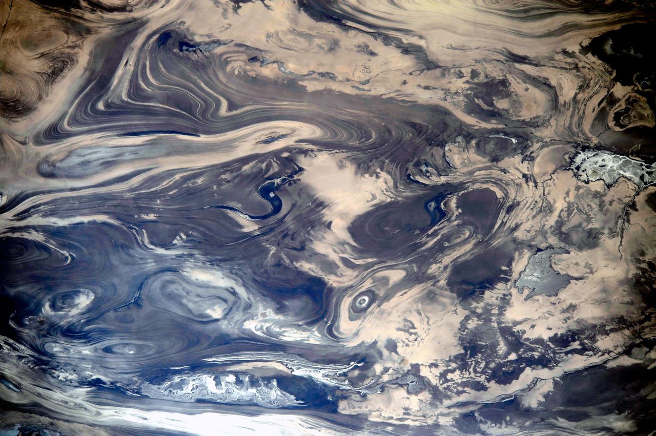
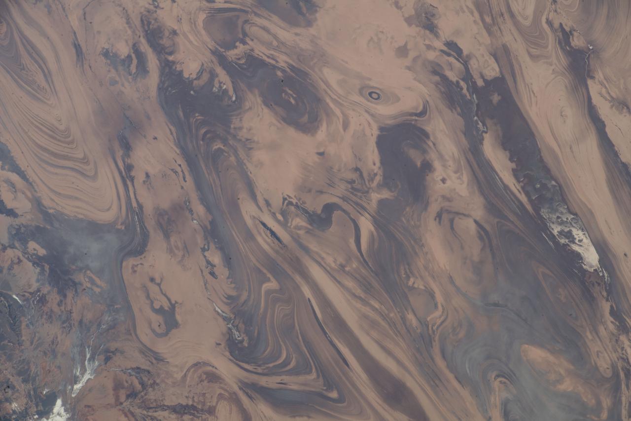
ISS038-E-047388 (14 Feb. 2014) --- As the International Space Station passed over the deserts of central Iran, including Kavir, one of the Expedition 38 crew members used a digital camera equipped with a 200mm lens to record this image featuring an unusual pattern of numerous parallel lines and sweeping curves. The lack of soil and vegetation allows the geological structure of the rocks to appear quite clearly. According to geologists, the patterns result from the gentle folding of numerous, thin, light and dark layers of rock. Later erosion by wind and water, say the scientists, cut a flat surface across the folds, not only exposing hundreds of layers but also showing the shapes of the folds. The dark water of a lake (image center) occupies a depression in a more easily eroded, S-shaped layer of rock. The irregular light-toned patch just left of the lake is a sand sheet thin enough to allow the underlying rock layers to be detected. A small river snakes across the bottom of the image. In this desert landscape there are no fields or roads to give a sense of scale. In fact, the image width represents a distance of 65 kilometers.
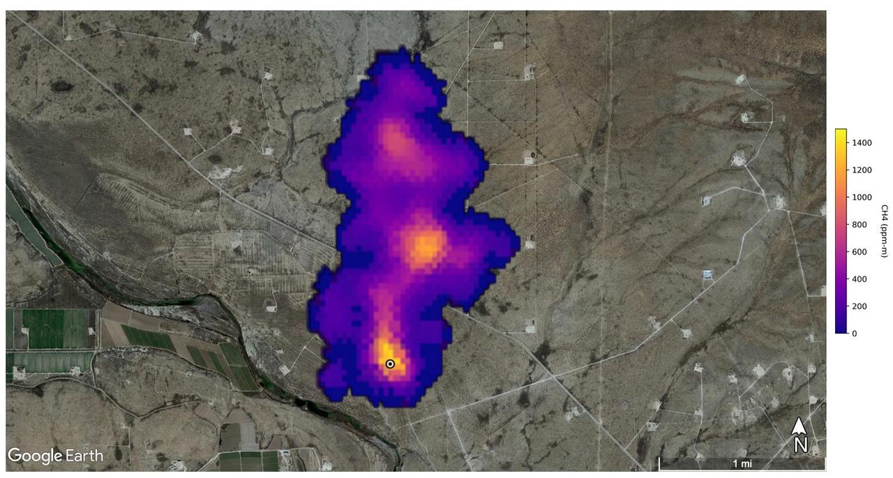
A plume of methane – a potent greenhouse gas about 80 times more effective at trapping heat in the atmosphere than carbon dioxide – is detected flowing from an area southeast of Carlsbad, New Mexico, in an image that uses data from NASA's Earth Surface Mineral Dust Source Investigation (EMIT) mission. The 2-mile (3.3-kilometer) long plume originates in an area known as the Permian Basin, which spans parts of southeastern New Mexico and western Texas and is one of the largest oilfields in the world. EMIT uses an imaging spectrometer to detect the unique pattern of reflected and absorbed light – called a spectral fingerprint – from various materials on Earth's surface and in its atmosphere. Perched on the International Space Station, EMIT was originally intended to map the prevalence of minerals in Earth's arid regions, such as the deserts of Africa and Australia. Scientists verified that EMIT could also detect methane and carbon dioxide when they were checking the accuracy of the image spectrometer's mineral data. The data for these images was collected by EMIT in August 2022. Scientists estimate flow rates of 20.2 tons (18.3 metric tons) per hour at the Permian site, 55.6 tons (50.4 metric tons) per hour in total for the Turkmenistan sources, and 9.4 tons (8.5 metric tons) per hour at the Iran site. While quite large, these emission rates are broadly consistent with previous studies of locations like the Permian Basin, as well as emission source types like landfills. The Turkmenistan example has a similar magnitude to the 2015 Aliso Canyon Blowout. https://photojournal.jpl.nasa.gov/catalog/PIA25592
On April 9, 2013 at 11:52 GMT, a magnitude 6.3 earthquake hit southwestern Iran's Bushehr province near the town of Kaki. Preliminary information is that several villages have been destroyed and many people have died, as reported by BBC News. This perspective view of the region was acquired Nov. 17, 2012, by the Advanced Spaceborne Thermal Emission and Reflection Radiometer (ASTER) instrument on NASA's Terra spacecraft. The location of the earthquake's epicenter is marked with a yellow star. Vegetation is displayed in red; the vertical exaggeration of the topography is 2X. The image is centered near 28.5 degrees north latitude, 51.6 degrees east longitude. With its 14 spectral bands from the visible to the thermal infrared wavelength region and its high spatial resolution of 15 to 90 meters (about 50 to 300 feet), ASTER images Earth to map and monitor the changing surface of our planet. ASTER is one of five Earth-observing instruments launched Dec. 18, 1999, on Terra. The instrument was built by Japan's Ministry of Economy, Trade and Industry. A joint U.S./Japan science team is responsible for validation and calibration of the instrument and data products. The broad spectral coverage and high spectral resolution of ASTER provides scientists in numerous disciplines with critical information for surface mapping and monitoring of dynamic conditions and temporal change. Example applications are: monitoring glacial advances and retreats; monitoring potentially active volcanoes; identifying crop stress; determining cloud morphology and physical properties; wetlands evaluation; thermal pollution monitoring; coral reef degradation; surface temperature mapping of soils and geology; and measuring surface heat balance. The U.S. science team is located at NASA's Jet Propulsion Laboratory, Pasadena, Calif. The Terra mission is part of NASA's Science Mission Directorate, Washington, D.C. More information about ASTER is available at <a href="http://asterweb.jpl.nasa.gov/" rel="nofollow">asterweb.jpl.nasa.gov/</a>. Image Credit: NASA/GSFC/METI/ERSDAC/JAROS, and U.S./Japan ASTER Science Team Image Addition Date: 2013-04-10 <b><a href="http://www.nasa.gov/audience/formedia/features/MP_Photo_Guidelines.html" rel="nofollow">NASA image use policy.</a></b> <b><a href="http://www.nasa.gov/centers/goddard/home/index.html" rel="nofollow">NASA Goddard Space Flight Center</a></b> enables NASA’s mission through four scientific endeavors: Earth Science, Heliophysics, Solar System Exploration, and Astrophysics. Goddard plays a leading role in NASA’s accomplishments by contributing compelling scientific knowledge to advance the Agency’s mission. <b>Follow us on <a href="http://twitter.com/NASA_GoddardPix" rel="nofollow">Twitter</a></b> <b>Like us on <a href="http://www.facebook.com/pages/Greenbelt-MD/NASA-Goddard/395013845897?ref=tsd" rel="nofollow">Facebook</a></b> <b>Find us on <a href="http://instagram.com/nasagoddard?vm=grid" rel="nofollow">Instagram</a></b>