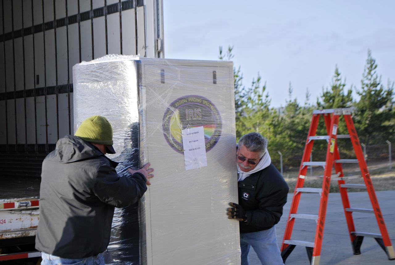
VANDENBERG AFB, Calif. – Technicians offload ground support equipment slated for NASA's IRIS mission. NASA’s Interface Region Imaging Spectrograph, or IRIS, satellite will improve our understanding of how heat and energy move through the deepest levels of the sun’s atmosphere, thereby increasing our ability to forecast space weather. On launch day, deployment of the Pegasus from Orbital’s L-1011 carrier aircraft will occur at a location over the Pacific Ocean about 100 miles northwest of Vandenberg off the central coast of California south of Big Sur. Photo credit: VAFB_Randy Beaudoin
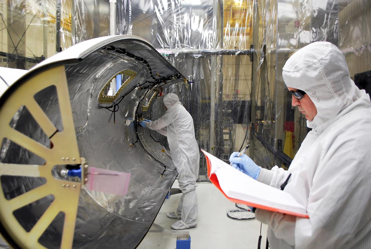
VANDENBERG AFB, Calif. – Technicians work on the payload fairing that will protect NASA's IRIS spacecraft during launch aboard an Orbital Sciences Pegasus XL rocket. NASA’s Interface Region Imaging Spectrograph, or IRIS, satellite will improve our understanding of how heat and energy move through the deepest levels of the sun’s atmosphere, thereby increasing our ability to forecast space weather. On launch day, deployment of the Pegasus from Orbital’s L-1011 carrier aircraft will occur at a location over the Pacific Ocean about 100 miles northwest of Vandenberg off the central coast of California south of Big Sur. Photo credit: VAFB_Randy Beaudoin
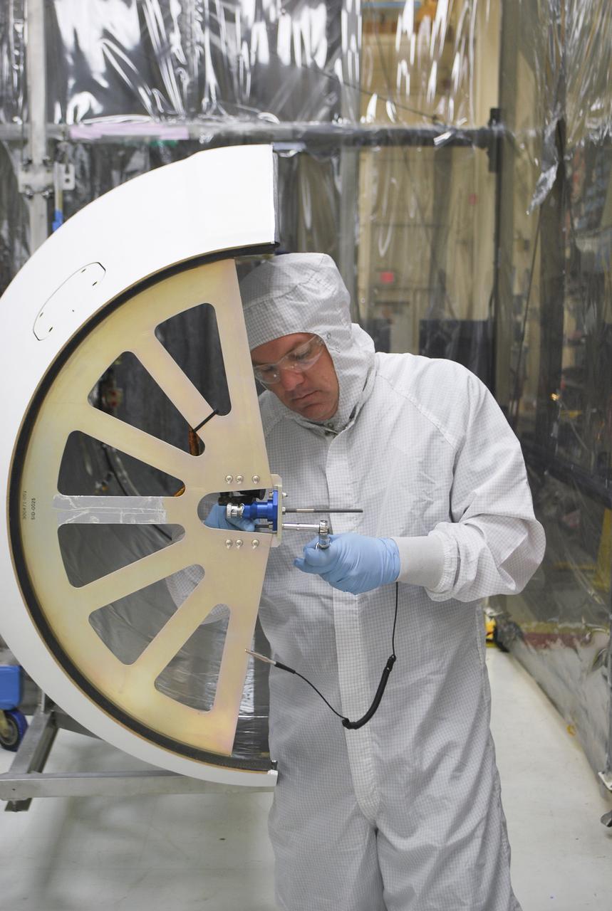
VANDENBERG AFB, Calif. – A technician works on the payload fairing that will protect NASA's IRIS spacecraft during launch aboard an Orbital Sciences Pegasus XL rocket. NASA’s Interface Region Imaging Spectrograph, or IRIS, satellite will improve our understanding of how heat and energy move through the deepest levels of the sun’s atmosphere, thereby increasing our ability to forecast space weather. On launch day, deployment of the Pegasus from Orbital’s L-1011 carrier aircraft will occur at a location over the Pacific Ocean about 100 miles northwest of Vandenberg off the central coast of California south of Big Sur. Photo credit: VAFB_Randy Beaudoin
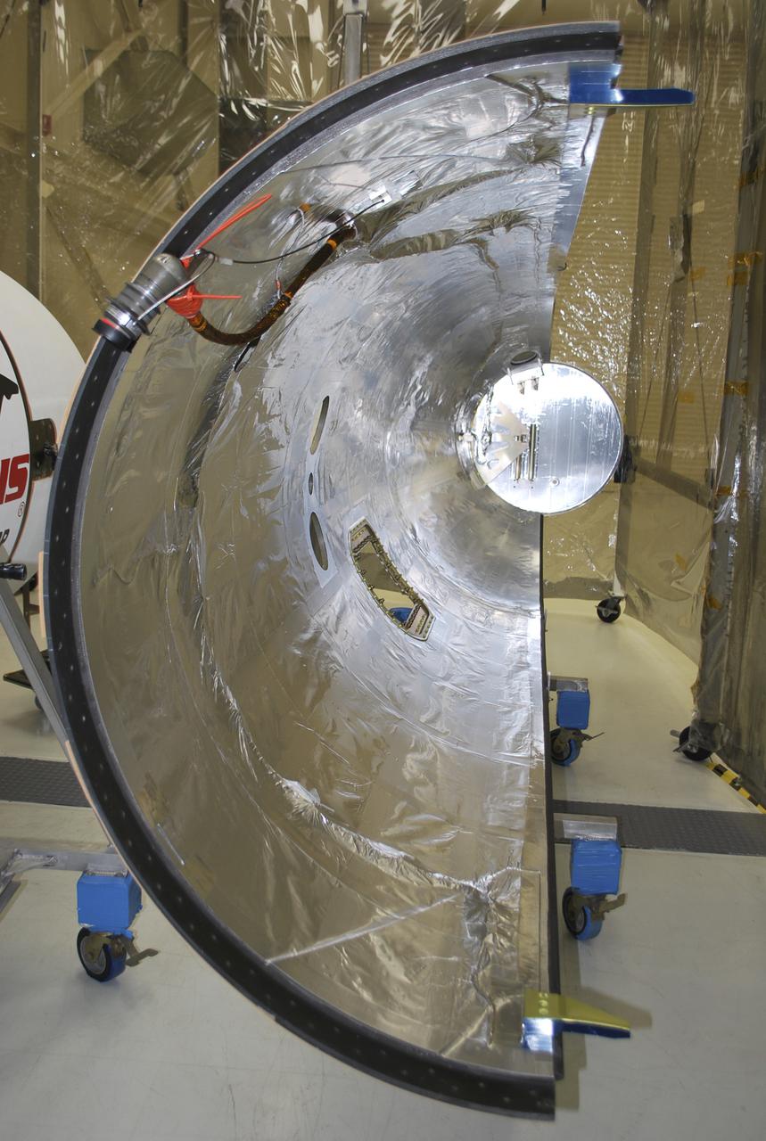
VANDENBERG AFB, Calif. – Half of the payload fairing that will protect NASA's IRIS spacecraft during launch aboard an Orbital Sciences Pegasus XL rocket as it is readied for launch. NASA’s Interface Region Imaging Spectrograph, or IRIS, satellite will improve our understanding of how heat and energy move through the deepest levels of the sun’s atmosphere, thereby increasing our ability to forecast space weather. On launch day, deployment of the Pegasus from Orbital’s L-1011 carrier aircraft will occur at a location over the Pacific Ocean about 100 miles northwest of Vandenberg off the central coast of California south of Big Sur.Photo credit: VAFB_Randy Beaudoin
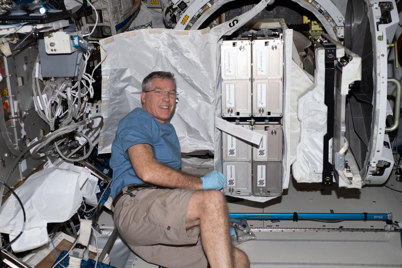
iss069e025742 (June 28, 2023) --- NASA astronaut and Expedition 69 Flight Engineer Stephen Bowen with CubeSats to be deployed from the space station for the 26th NanoRacks CubeSat Deployer (NRCSD-26) mission. The satellites included Nanoracks-RADSAT-SK, which tests a radiation detection system; Nanoracks-SC-ODIN that captures data on dust in storms in Argentina and Namibia; Nanoracks-ESSENCE, to monitor solar storms, arctic ice, permafrost thaw, and forests in the Canadian Arctic region; Nanoracks-Iris, an observation of space weathering of geological samples; and Nanoracks-Ukpik-1, which uses a VR camera to capture 360-degree images and video of Northern Canada.
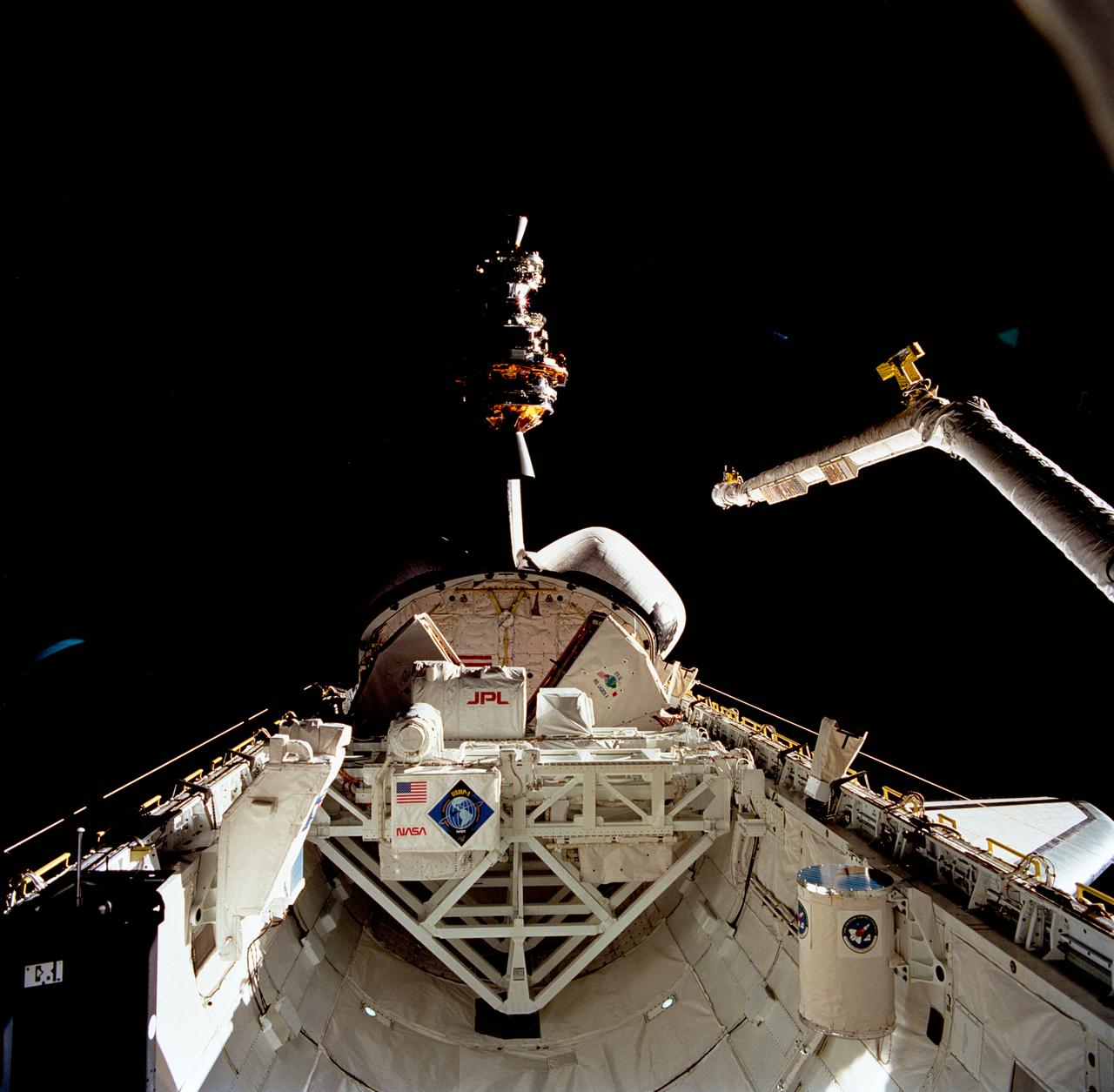
STS052-80-030 (23 Oct 1992) --- One of a series of three views of the deployment of the Laser Geodynamic Satellite (LAGEOS). The photograph was taken with a 70mm handheld camera aimed through the aft flight deck windows of the Earth-orbiting Space Shuttle Columbia. A crew of five NASA astronauts and a Canadian payload specialist spent ten days aboard Columbia for the STS-52 mission.
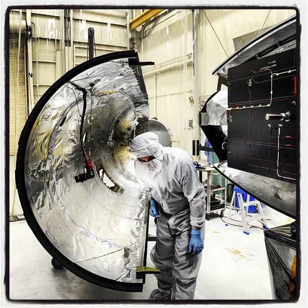
Orbital Sciences team members move the second half of the payload fairing before it is placed over NASA's IRIS (Interface Region Imaging Spectrograph) spacecraft. The fairing connects to the nose of the Orbital Sciences Pegasus XL rocket that will lift the solar observatory into orbit. The work is taking place in a hangar at Vandenberg Air Force Base, where IRIS is being prepared for launch on a Pegasus XL rocket. Scheduled for launch from Vandenberg on June 26, 2013, IRIS will open a new window of discovery by tracing the flow of energy and plasma through the chromospheres and transition region into the sun's corona using spectrometry and imaging. IRIS fills a crucial gap in our ability to advance studies of the sun-to-Earth connection by tracing the flow of energy and plasma through the foundation of the corona and the region around the sun known as the heliosphere. High res file available here: <a href="http://1.usa.gov/11yal3w" rel="nofollow">1.usa.gov/11yal3w</a> Photo Credit: NASA/Tony Vauclin <b><a href="http://www.nasa.gov/audience/formedia/features/MP_Photo_Guidelines.html" rel="nofollow">NASA image use policy.</a></b> <b><a href="http://www.nasa.gov/centers/goddard/home/index.html" rel="nofollow">NASA Goddard Space Flight Center</a></b> enables NASA’s mission through four scientific endeavors: Earth Science, Heliophysics, Solar System Exploration, and Astrophysics. Goddard plays a leading role in NASA’s accomplishments by contributing compelling scientific knowledge to advance the Agency’s mission. <b>Follow us on <a href="http://twitter.com/NASA_GoddardPix" rel="nofollow">Twitter</a></b> <b>Like us on <a href="http://www.facebook.com/pages/Greenbelt-MD/NASA-Goddard/395013845897?ref=tsd" rel="nofollow">Facebook</a></b> <b>Find us on <a href="http://instagram.com/nasagoddard?vm=grid" rel="nofollow">Instagram</a></b>