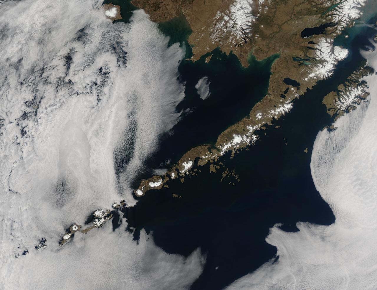
Remote, rugged and extraordinarily beautiful, Alaska’s Aleutian Islands are best known for wildlife reserves, military bases, fishing, furs and fog. The sprawling volcanic archipelago was brought into the spotlight by the Russian-supported expedition of Alexey Chirikov and Vitus Bering in 1741, and soon became controlled by the Russian-American Fur Company. In 1867 the United States purchased Alaska, including the Aleutian Islands, from Russia. By 1900 the port in Unalaska was well established as a shipping port for Alaska gold. The archipelago sweeps about 1,200 miles (1,800 km) from the tip of the Alaskan Peninsula to Attu, the most westward island. Four major island groups hold 14 large islands, about 55 smaller islands, and a large number of islets, adding up to roughly 150 islands/islets in total. This chain separates the Bering Sea (north) from the Pacific Ocean (south) and the islands are connected by the Marine Highway Ferry – at least as far as Unalaska. For the most remote islands, such as birding paradise of Attu, the western-most Aleutian Island, travel becomes trickier and relies primarily on custom charter. The Moderate Resolution Imaging Spectroradiometer (MODIS) flew over the region and captured this spectacular true-color image of the eastern Aleutian Islands on May 15, 2014. In this image, the Alaskan Peninsula protrudes from the mainland and sweeps to the southwest. The first set of islands are called the Fox Island group. Unalaska Island is part of this group and can be identified, with some imagination, as an island formed in the shape of a flying cherub, with two arms (peninsulas) outstretched towards the northeast, seemingly reaching for the round “balls” of Akutan and Akun Islands. The smallest islands in the west of the image belong to the group known as the Islands of Four Mountains. The Aleutians continue far to the west of this image. Fog surrounds the Aleutians, stretching from just off the southwestern Alaska mainland to the western Fox Islands group, then further southwest across the Pacific Ocean. It appears to give way to marine stratocumulus clouds in the west. Fog is common in the area, and can be a hazard to shipping. Credit: NASA/GSFC/Jeff Schmaltz/MODIS Land Rapid Response Team <b><a href="http://www.nasa.gov/audience/formedia/features/MP_Photo_Guidelines.html" rel="nofollow">NASA image use policy.</a></b> <b><a href="http://www.nasa.gov/centers/goddard/home/index.html" rel="nofollow">NASA Goddard Space Flight Center</a></b> enables NASA’s mission through four scientific endeavors: Earth Science, Heliophysics, Solar System Exploration, and Astrophysics. Goddard plays a leading role in NASA’s accomplishments by contributing compelling scientific knowledge to advance the Agency’s mission. <b>Follow us on <a href="http://twitter.com/NASAGoddardPix" rel="nofollow">Twitter</a></b> <b>Like us on <a href="http://www.facebook.com/pages/Greenbelt-MD/NASA-Goddard/395013845897?ref=tsd" rel="nofollow">Facebook</a></b> <b>Find us on <a href="http://instagram.com/nasagoddard?vm=grid" rel="nofollow">Instagram</a></b>
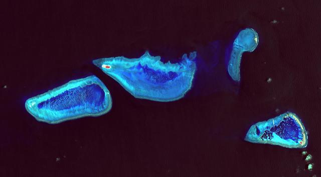
Heron Island is located in Queensland, Australia, approximately 45 miles (72 kilometers) off the Australian mainland, to the northeast of Gladstone. Part of Australia's Great Barrier Reef, the island is an evergreen coral cay surrounded by Wistari coral reef. Although just 42 acres in size, the island is home to a large resort and the University of Queensland's Heron Island Research Station. The island is famous for diving and snorkeling and is a World Heritage-Listed Marine National Park. It is one of two locations on the Great Barrier Reef that are serving as bases for in-water validation activities for NASA's Coral Reef Airborne Laboratory (CORAL) mission, which is studying the condition and function of the Great Barrier Reef and selected reef systems worldwide using NASA's airborne Portable Remote Imaging Spectrometer (PRISM) instrument from an altitude of 28,000 feet (8,500 meters). The Advanced Spaceborne Thermal Emission and Reflection Radiometer (ASTER) instrument on NASA's Terra spacecraft acquired this image of Heron Island and its surroundings on December 22, 2001. The island appears at the left of the reef (Heron Reef) in the center of the image. Vegetation is red on the image. The image covers an area of 10.3 by 18.6 miles (16.5 by 30.0 kilometers), and is located at 23.5 degrees south, 151.9 degrees east. http://photojournal.jpl.nasa.gov/catalog/PIA20900
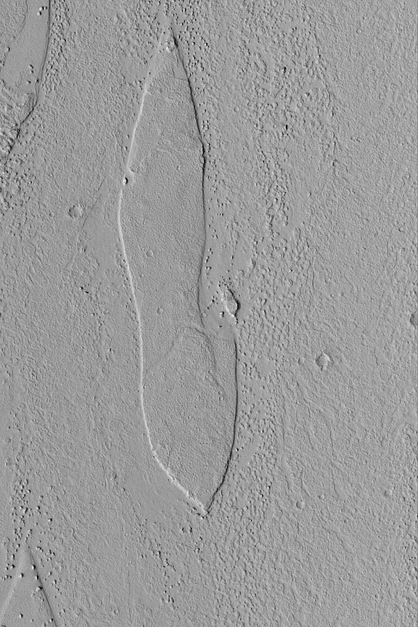
Streamlined Island
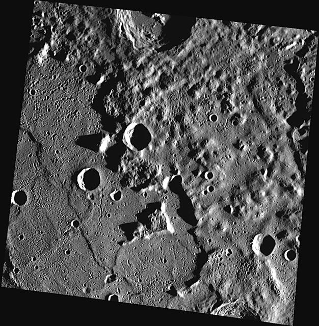
Islands in the Stream
Crater Island
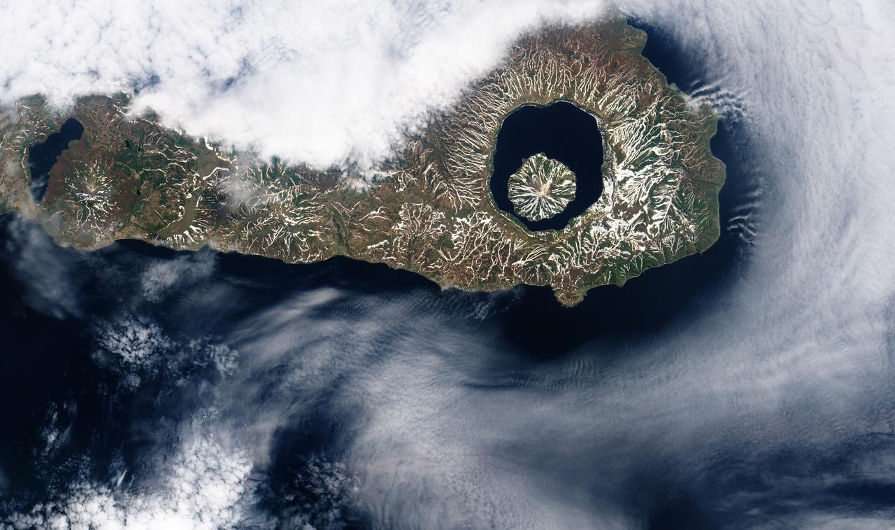
More than 9,000 years ago, a catastrophic volcanic eruption created a huge caldera on the southern end of Onekotan Island, one of the Kuril Islands, located off the southern tip of Russia’s Kamchatka Peninsula. Today, the ancient Tao-Rusyr Caldera is filled by the deep blue waters of Kal’tsevoe Lake. The Advanced Land Imager (ALI) on NASA’s Earth Observing-1 (EO-1) satellite acquired this true-color image of southern Onekotan on June 10, 2009. In this late-spring shot, snow or ice lingers on the land, forming white streaks on a brown-and-green land surface. In the northwest quadrant of the caldera is Krenitzyn Peak, which rises to a height of 1,325 meters (4,347 feet). Like the other Kuril Islands, Onekotan lies along the Pacific “Ring of Fire.” The Kuril Island volcanoes are fueled by magma generated by the subduction of the Pacific Plate under the Eurasian Plate, which takes place along a deep trench about 200 kilometers (120 miles) to the islands’ east. The only historical eruption at Krenitzyn Peak occurred in 1952, a week after a magnitude 9.0 earthquake along the subduction fault. NASA Earth Observatory image created by Robert Simmon, using EO-1 ALI data provided courtesy of the NASA EO-1 team. Caption by Michon Scott and Rebecca Lindsey. <b><a href="http://www.nasa.gov/audience/formedia/features/MP_Photo_Guidelines.html" rel="nofollow">NASA image use policy.</a></b> <b><a href="http://www.nasa.gov/centers/goddard/home/index.html" rel="nofollow">NASA Goddard Space Flight Center</a></b> enables NASA’s mission through four scientific endeavors: Earth Science, Heliophysics, Solar System Exploration, and Astrophysics. Goddard plays a leading role in NASA’s accomplishments by contributing compelling scientific knowledge to advance the Agency’s mission. <b>Follow us on <a href="http://twitter.com/NASAGoddardPix" rel="nofollow">Twitter</a></b> <b>Like us on <a href="http://www.facebook.com/pages/Greenbelt-MD/NASA-Goddard/395013845897?ref=tsd" rel="nofollow">Facebook</a></b> <b>Find us on <a href="http://instagrid.me/nasagoddard/?vm=grid" rel="nofollow">Instagram</a></b>
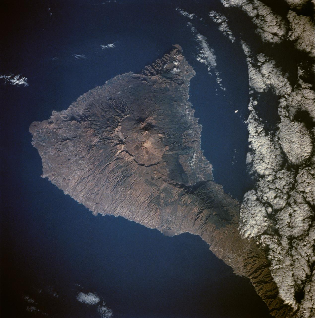
Tenarife Island is one of the most volcanically active of the Canary Island archipelago, Atlantic Ocean, just off the NW coast of Africa, (28.5N, 16.5W). The old central caldera, nearly filled in by successive volcanic activity culminating in two stratocones. From those two peaks, a line of smaller cinder cones extend to the point of the island. Extensive gullies dissect the west side of the island and some forests still remain on the east side.
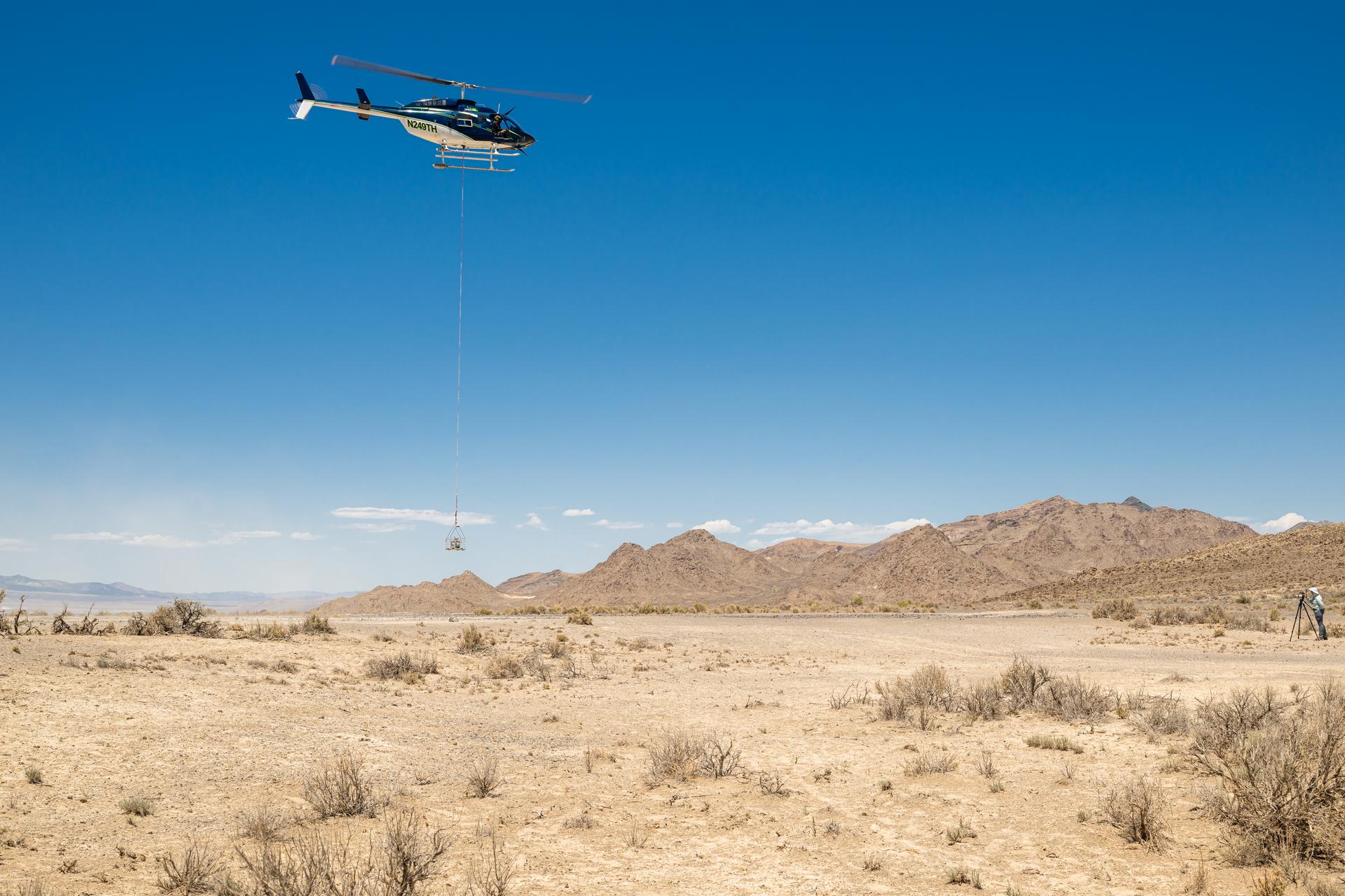
Timberland Helicopter flying the DAVINCI VADIX payload lifts off from Crater Island, Utah, June 23, 2026. NASA/Mike Guinto
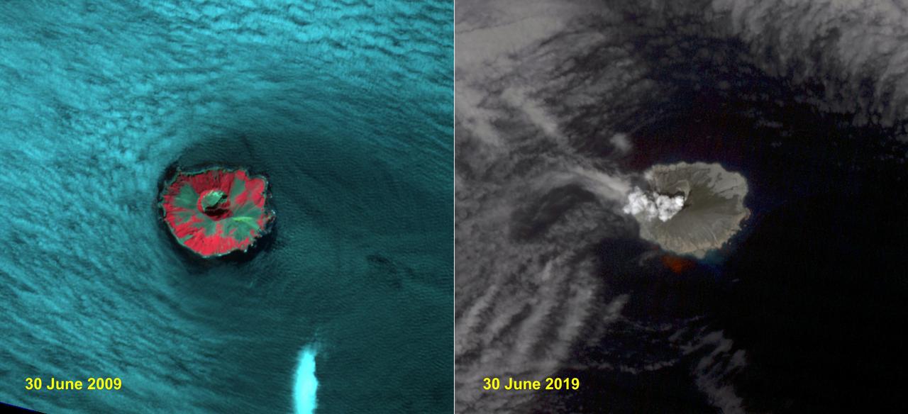
Raikoke volcanic island is near the center of the Kuril Islands in the Sea of Okhotsk in the northwest Pacific Ocean. The island is roughly circular with dimensions of 2.0 by 2.5 kilometers. On June 22, the volcano erupted with a gas and ash plume reaching 17 kilometers. The two ASTER images, acquired exactly 10 years apart on June 30, dramatically depict the changes to the island. In 2009, vegetation (red) covered most of the island. The 2019 image shows an ash and steam plume rising from the caldera. There is no trace of any vegetation, ash deposits having buried everything. The images are located at 48.3 degrees north, 153.2 degrees east. https://photojournal.jpl.nasa.gov/catalog/PIA23326
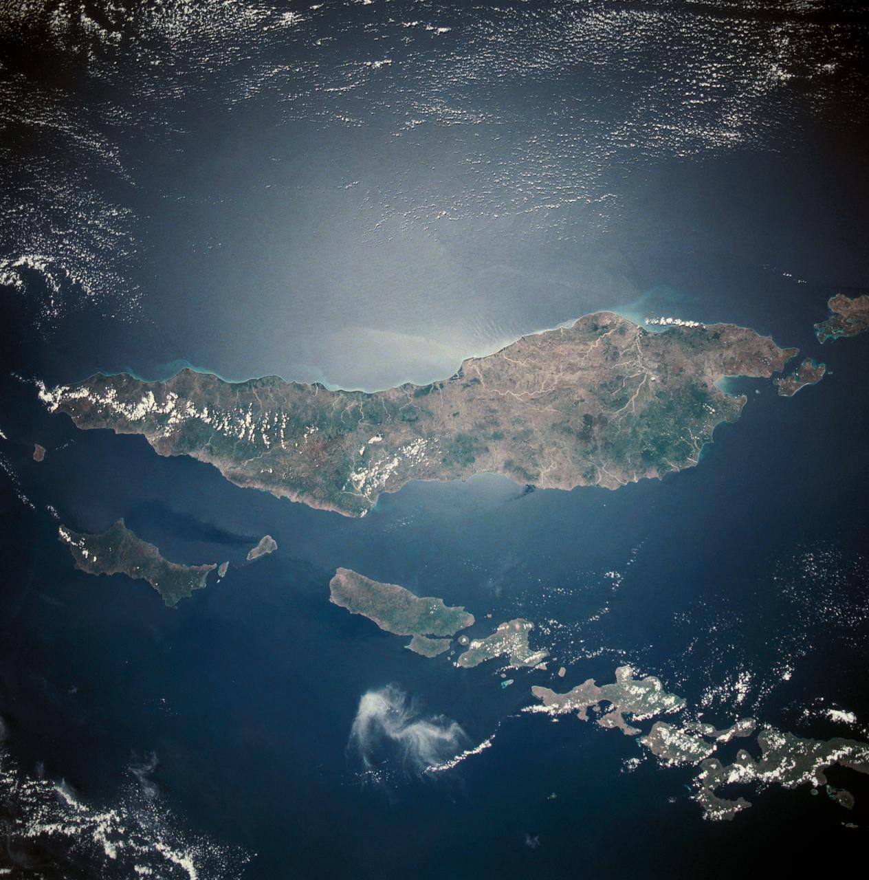
This almost totally cloud free, photo of the island of Timor, Indonesia (9.0S, 125.0E) illustrates the volcanic origin of the over 1500 islands of Indonesia. Close examination of the photo reveals several eroded volcanoes on the Island of Timor and several of the adjacent islands. The linear alignment of the volcanoes, as seen from space, indicates the edges of the tectonic plates of the Earth's crust where volcanic activity is most common.
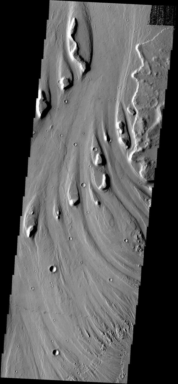
These streamlined islands are located in Mangala Vallis
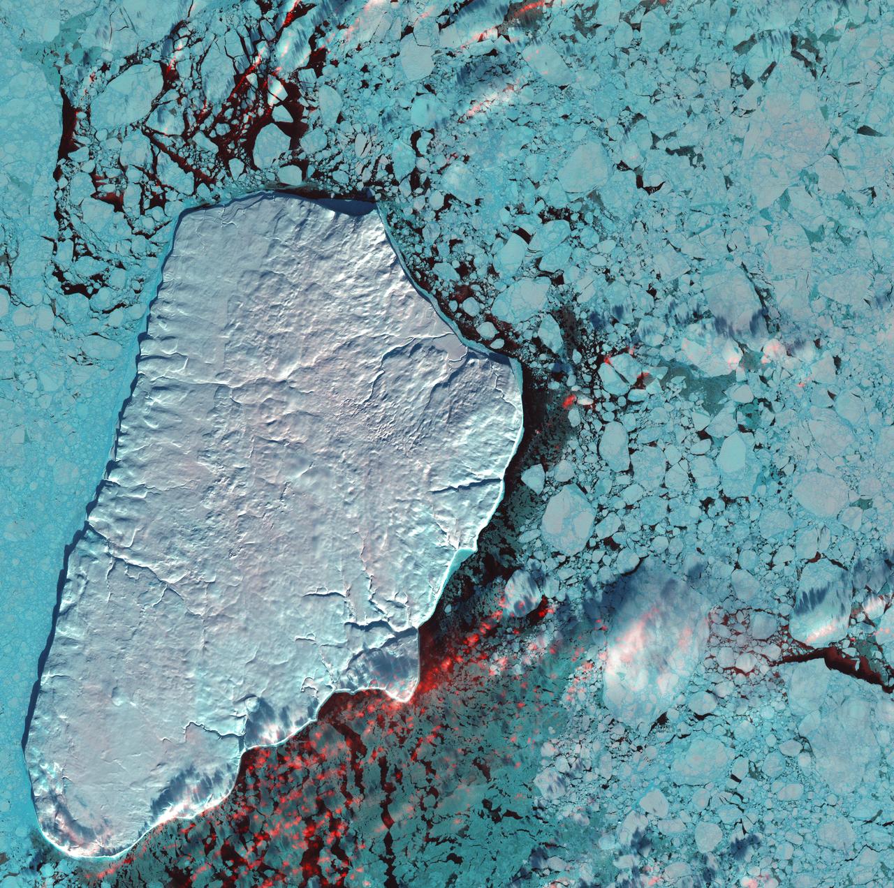
January 1st, 2001: Description: Akpatok Island lies in Ungava Bay in northern Quebec, Canada. Accessible only by air, Akpatok Island rises out of the water as sheer cliffs that soar 500 to 800 feet (150 to 243m) above the sea surface. The island is an important sanctuary for cliff-nesting seabirds. Numerous ice floes around the island attract walrus and whales, making Akpatok a traditional hunting ground for native Inuit people. Source: Landsat 7 To learn more about the Landsat satellite go to: <a href="http://landsat.gsfc.nasa.gov/" rel="nofollow">landsat.gsfc.nasa.gov/</a>
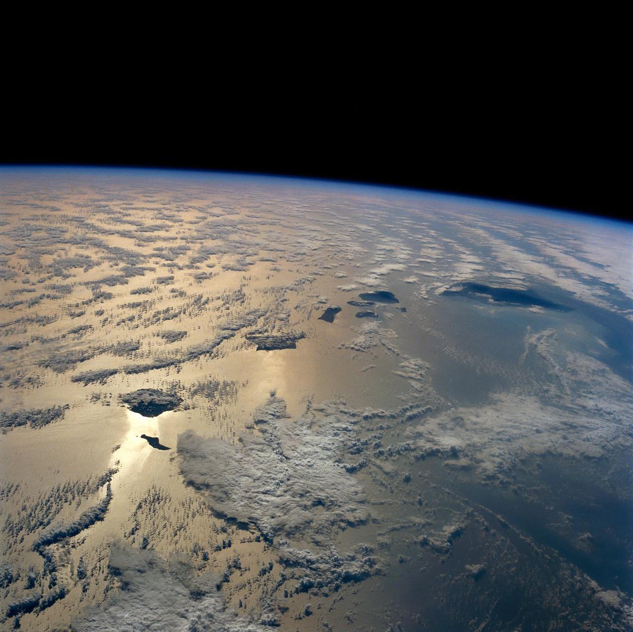
The entire Hawaiian Island Archipelago (21.5N, 158.0W) is seen in this single view. The islands are a favorite international resort and tourist attraction drawing visitors from all over the world to enjoy the tropical climate, year round beaches and lush island flora. Being volcanic in origin, the islands' offer a rugged landscape and on the big island of Hawaii, there is still an occasional volcanic eruption of lava flows and steam vents.
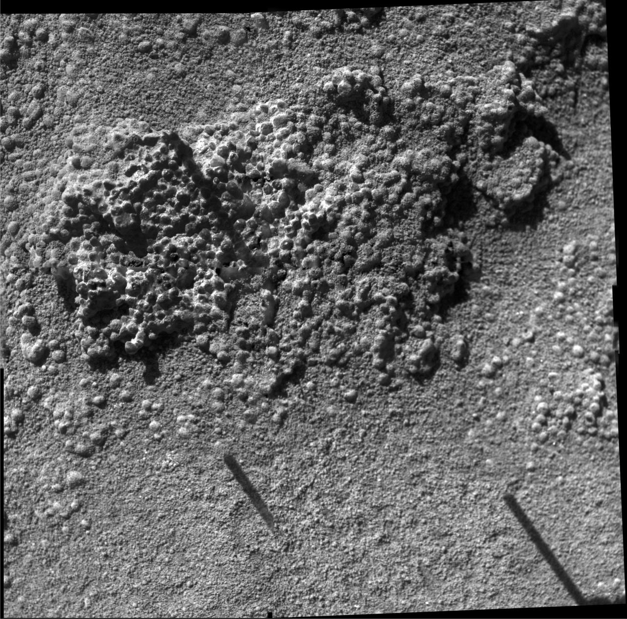
King George Island Brushed
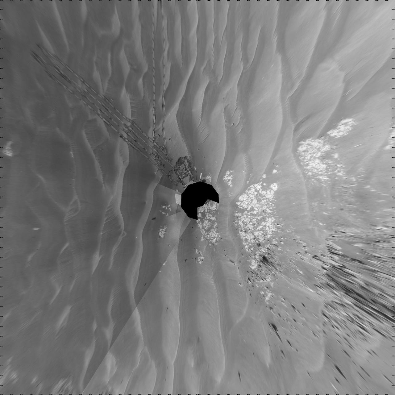
Opportunity at Cook Islands Vertical
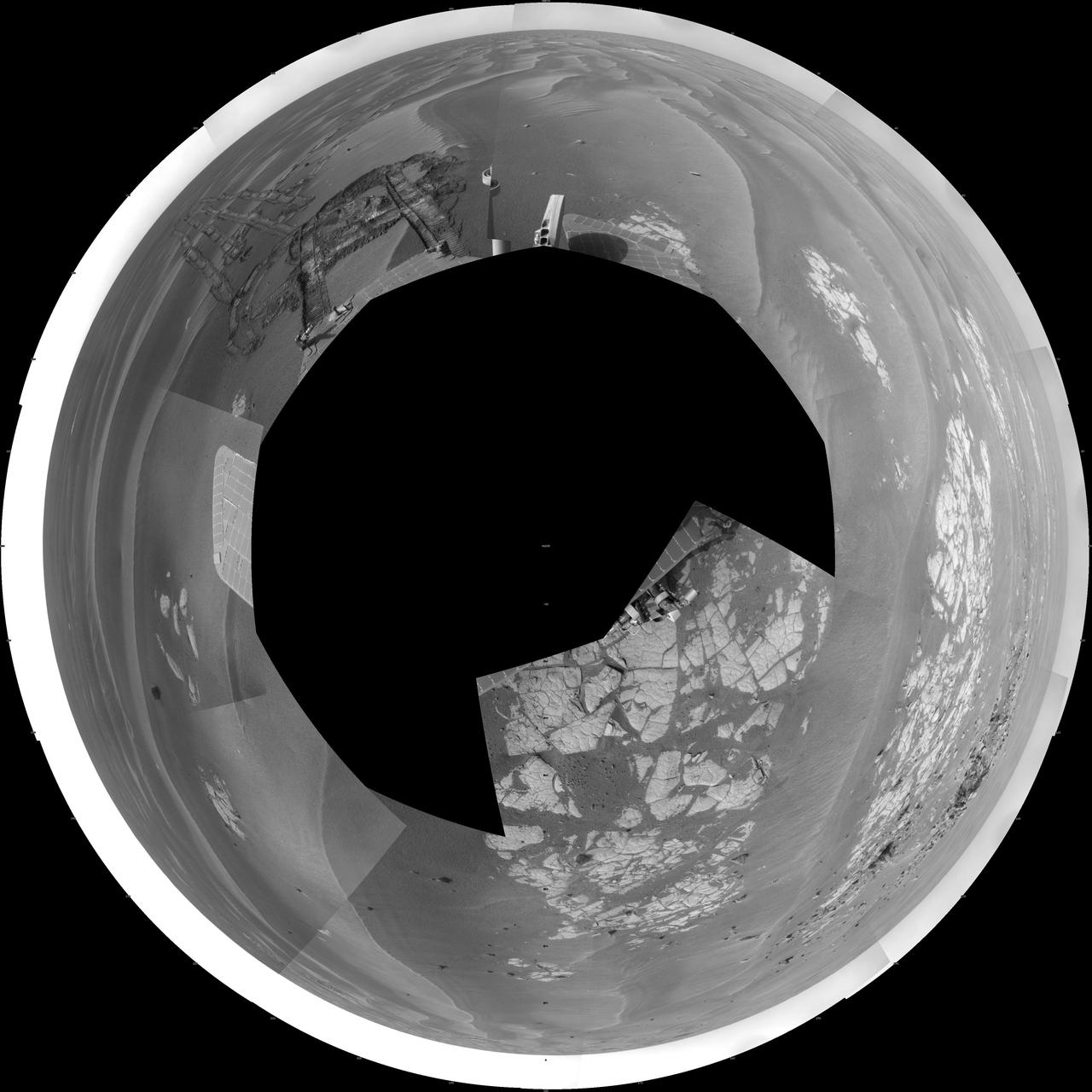
Opportunity at Cook Islands Polar
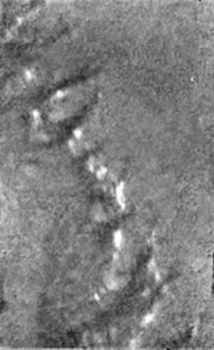
Islands on a Dark Plain

Islands in Kasei Vallis
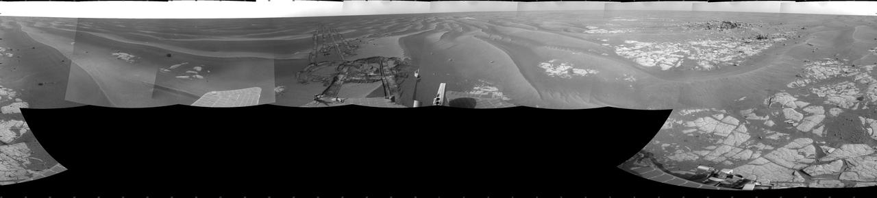
Opportunity at Cook Islands
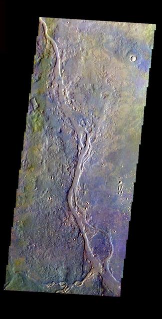
Channel with Island in False Color
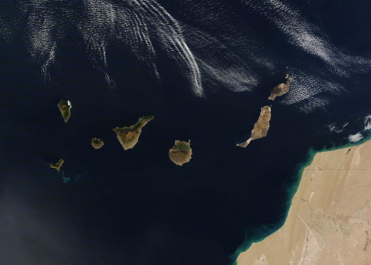
NASA image acquired December 21, 2011 The rugged landscape of the Canary Islands stood out in sharp contrast to the smooth blue waters of the Atlantic Ocean and the flat tan land of northwestern Africa on December 21, 2011, when the Moderate Resolution Imaging Spectroradiometer (MODIS) aboard the Terra satellite captured this true-color image. The Canary Islands are a group of seven large islands and several smaller islets, all volcanic in origin. The eastern edge of the chain lies only 100 kilometers from the coasts of Morocco and Western Sahara, and the chain stretches for about 500 kilometers across the Atlantic. All the islands are mountainous, and Tenerife, the central island in this image is home to Pico de Teinde, the highest peak, which rises 12,198 feet (3,718 meters) above sea level. From east to west, the islands are named Lanzarote, Fuerteventura, Gran Canaria, Tenerife, La Gomera, La Palmera and El Hierro. A bright swirl of peacock blue marks the ocean south of El Hierro, a stain on the sea from an ongoing eruption of a volcano under the waters. Credit: NASA/GSFC/Jeff Schmaltz/MODIS Land Rapid Response Team <b><a href="http://www.nasa.gov/audience/formedia/features/MP_Photo_Guidelines.html" rel="nofollow">NASA image use policy.</a></b> <b><a href="http://www.nasa.gov/centers/goddard/home/index.html" rel="nofollow">NASA Goddard Space Flight Center</a></b> enables NASA’s mission through four scientific endeavors: Earth Science, Heliophysics, Solar System Exploration, and Astrophysics. Goddard plays a leading role in NASA’s accomplishments by contributing compelling scientific knowledge to advance the Agency’s mission. <b>Follow us on <a href="http://twitter.com/NASA_GoddardPix" rel="nofollow">Twitter</a></b> <b>Like us on <a href="http://www.facebook.com/pages/Greenbelt-MD/NASA-Goddard/395013845897?ref=tsd" rel="nofollow">Facebook</a></b> <b>Find us on <a href="http://instagrid.me/nasagoddard/?vm=grid" rel="nofollow">Instagram</a></b>
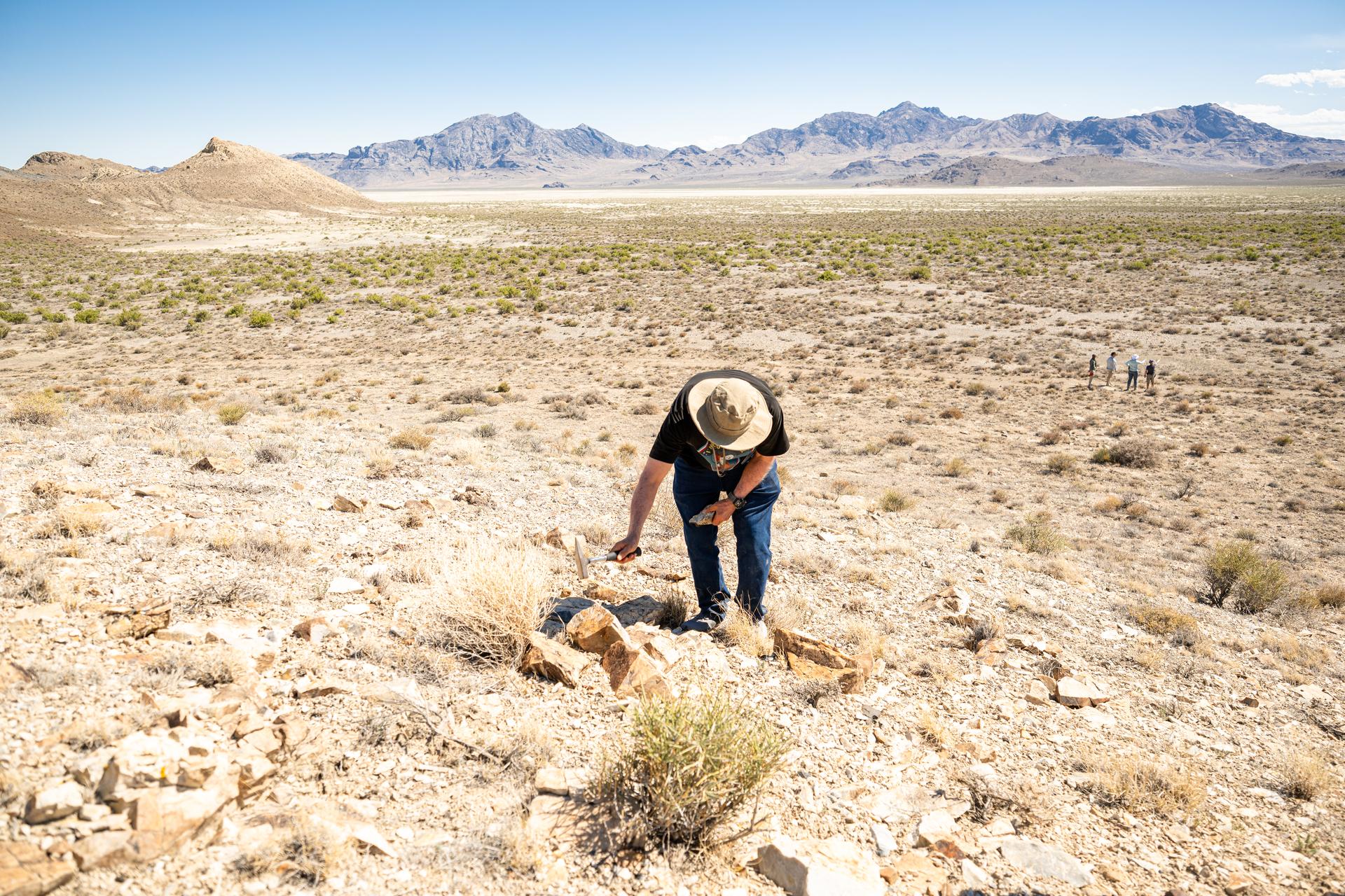
Dr. Jim Garvin, mission principal investigator,collect samples of rocks found at Crater Island, Utah on June 23, 2026. These samples become the "ground truth" for the measurements from the VADIX prototype camera system which flew over the crater island site, taking photos and measurements from the air. NASA/Mike Guinto
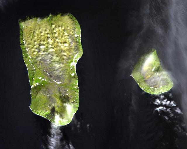
The Diomede Islands consisting of the western island Big Diomede, and the eastern island Little Diomede are two rocky islands located in the middle of the Bering Strait between Russia and Alaska. This image was acquired by NASA Terra satellite.
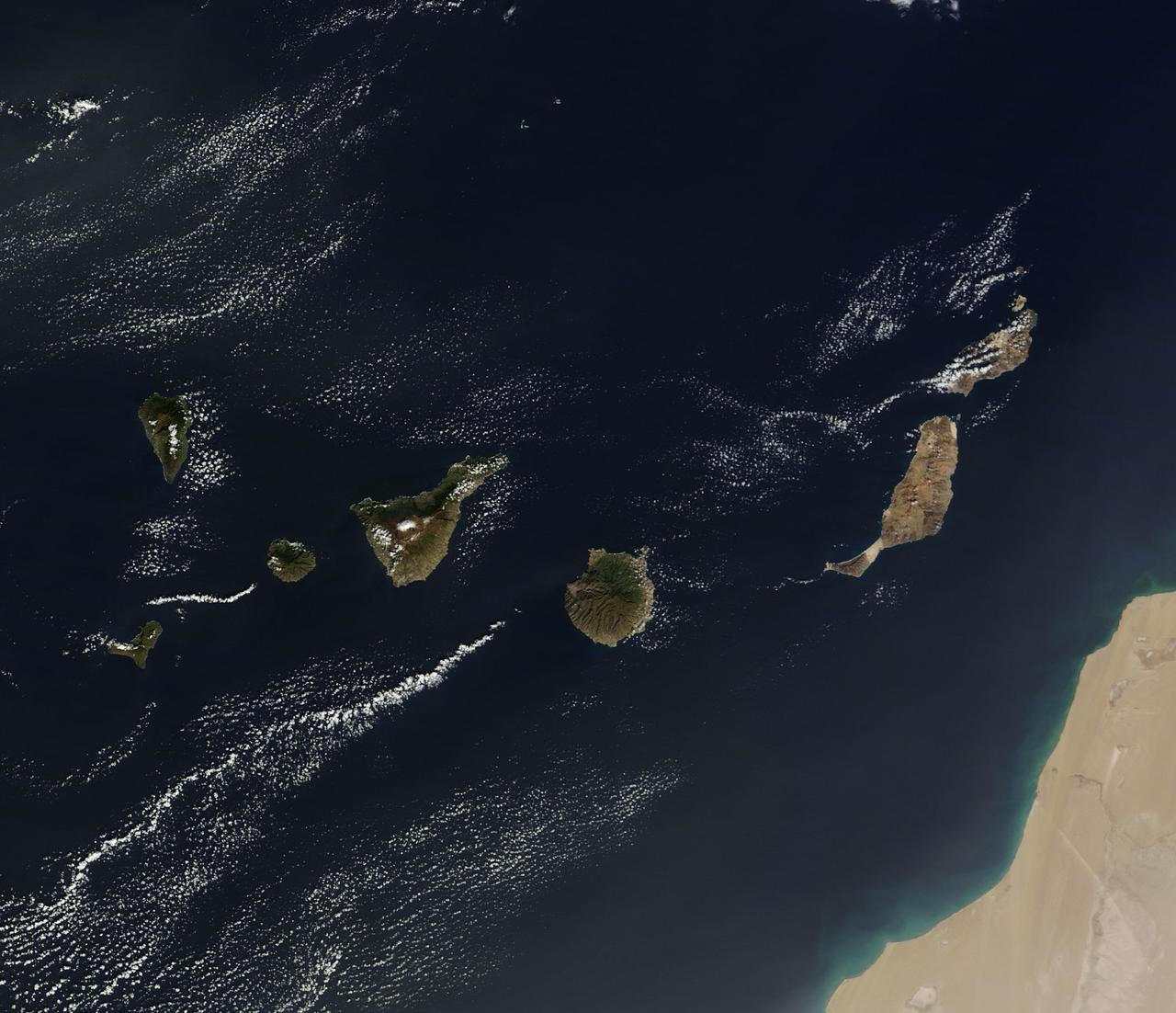
On December 10, 2013 the Moderate Resolution Imaging Spectroradiometer (MODIS) aboard NASA’s Terra satellite flew across the central Atlantic Ocean and captured a true-color image of the Canary Islands. Lying off of the coast of Western Sahara and Morocco, the islands were created by successive submarine volcanic eruptions which raised the ocean floor vertically until some of land rose above sea level. The oldest islands lie in the east and the youngest in the west. From east to west, the major islands seen in this image are: Lanzarote, Fuerteventura, Gran Canaria, Tenerife, La Gomera, La Palmera and El Hierro. While the creation of the islands began in the Late Cretaceous Period (70 – 80 million years ago), active volcanic activity continues. In 2011, a spectacular submarine eruption occurred just off the shore of El Hierro. The volcano became quiet again, but very recently increasing earthquakes and changing height of El Hierro suggested the volcano may again be entering an active eruptive phase. On December 27 the island’s volcano monitoring agency had raised the volcanic eruption risk for El Hierro to “yellow” – a code that means increasing activity but no eruption imminent. That afternoon a magnitude 5.1 earthquake struck offshore at El Hierro. The epicenter was 9 miles (15 km) deep, and it was one of the largest quakes ever recorded at the island. Credit: NASA/GSFC/Jeff Schmaltz/MODIS Land Rapid Response Team <b><a href="http://www.nasa.gov/audience/formedia/features/MP_Photo_Guidelines.html" rel="nofollow">NASA image use policy.</a></b> <b><a href="http://www.nasa.gov/centers/goddard/home/index.html" rel="nofollow">NASA Goddard Space Flight Center</a></b> enables NASA’s mission through four scientific endeavors: Earth Science, Heliophysics, Solar System Exploration, and Astrophysics. Goddard plays a leading role in NASA’s accomplishments by contributing compelling scientific knowledge to advance the Agency’s mission. <b>Follow us on <a href="http://twitter.com/NASA_GoddardPix" rel="nofollow">Twitter</a></b> <b>Like us on <a href="http://www.facebook.com/pages/Greenbelt-MD/NASA-Goddard/395013845897?ref=tsd" rel="nofollow">Facebook</a></b> <b>Find us on <a href="http://instagram.com/nasagoddard?vm=grid" rel="nofollow">Instagram</a></b>
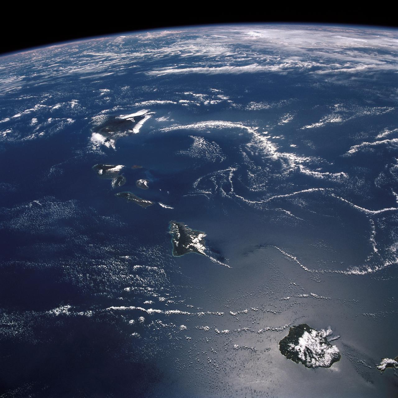
STS026-43-082 (29 Sept. - 3 Oct. 1988) --- This 70mm northerly oriented frame over the Pacific Ocean features the Hawaiian Islands chain. The islands perturb the prevailing northeasterly winds producing extensive cloud wakes in the lee of the islands. Photo experts feel that atmospheric haze in the Hawaii wake is probably a result of the continuing eruptions of Kilauea volcano on the southeast coast. From the lower right corner in a diagonal directed upward to the north are the islands of Nihau, Kauai, Oahu, Molokai, Lanai, Maui, Kahoolawe, and Hawaii. This photo was shown during the post-flight press conference on October 11, 1988 by the STS-26 astronauts, who at one time during the flight wore Hawaiian attire to pay tribute to the working staff of the Hawaii tracking station.
This image from NASA Terra spacecraft shows the Kerguelen Islands also known as the Desolation Islands, which are part of the French Southern and Antarctic lands. The islands are among the most isolated places on Earth.

Belcher Islands - September 21st, 2001 Description: Like sweeping brushstrokes of pink and green, the Belcher Islands meander across the deep blue of Canada's Hudson Bay. The islands' only inhabitants live in the small town of Sanikiluaq, near the upper end of the middle island. Despite the green hues in this image, these rocky islands are too cold to sustain more than a smattering of low-growing vegetation. Credit: USGS/NASA/Landsat 5 To learn more about the Landsat satellite go to: <a href="http://landsat.gsfc.nasa.gov/" rel="nofollow">landsat.gsfc.nasa.gov/</a> <b><a href="http://www.nasa.gov/centers/goddard/home/index.html" rel="nofollow">NASA Goddard Space Flight Center</a></b> enables NASA’s mission through four scientific endeavors: Earth Science, Heliophysics, Solar System Exploration, and Astrophysics. Goddard plays a leading role in NASA’s accomplishments by contributing compelling scientific knowledge to advance the Agency’s mission. <b>Follow us on <a href="http://twitter.com/NASA_GoddardPix" rel="nofollow">Twitter</a></b> <b>Join us on <a href="http://www.facebook.com/pages/Greenbelt-MD/NASA-Goddard/395013845897?ref=tsd" rel="nofollow">Facebook</a></b>
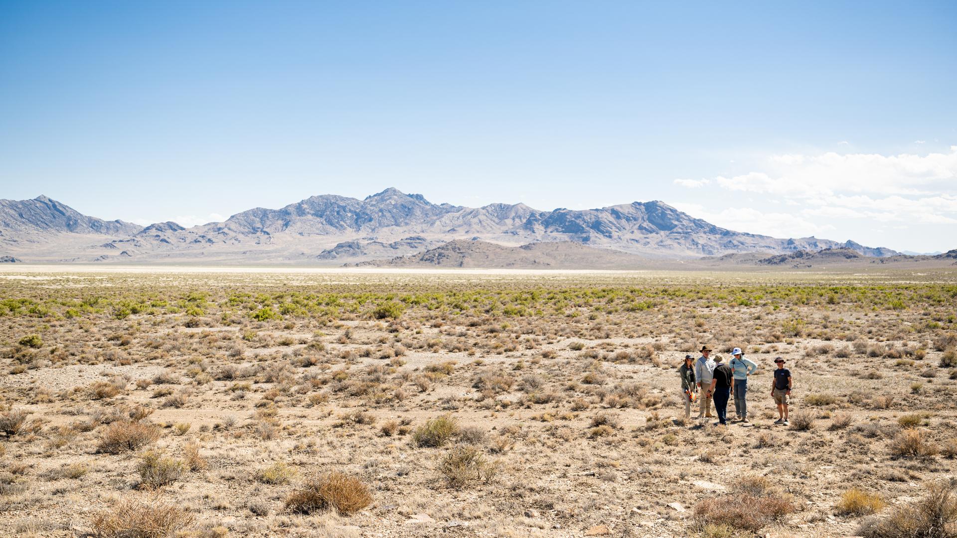
DAVINCI VADIX team members discuss observations at Crater Island, Utah, June 23, 2026. NASA/Mike Guinto

Little Joe on launcher at Wallops Island.
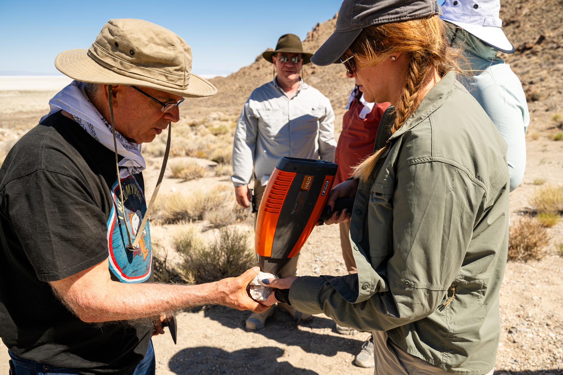
Dr. Jim Garvin, mission principal investigator, left, and Dr. Erika Kohler, acting deputy principal investigator, right, take measurements of rock samples found at Crater Island, Utah on June 23, 2026. These samples become the "ground truth" for the measurements from the VADIX prototype camera system which flew over the crater island site, taking photos and measurements from the air. NASA/Mike Guinto
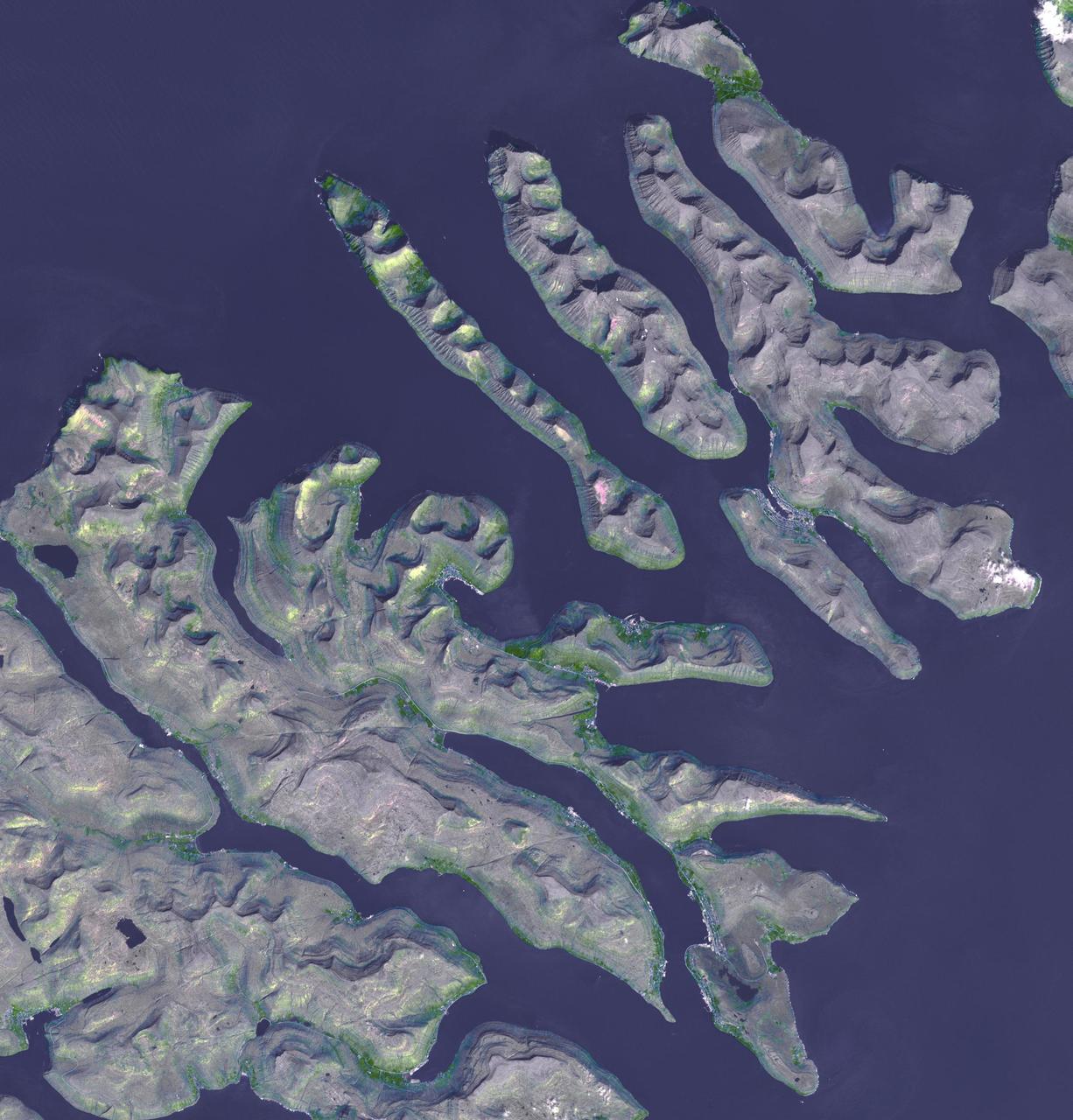
This image from NASA Terra spacecraft shows the Faroe Islands, an archipelago and autonomous country within the Kingdom of Denmark, comprising 18 major islands.
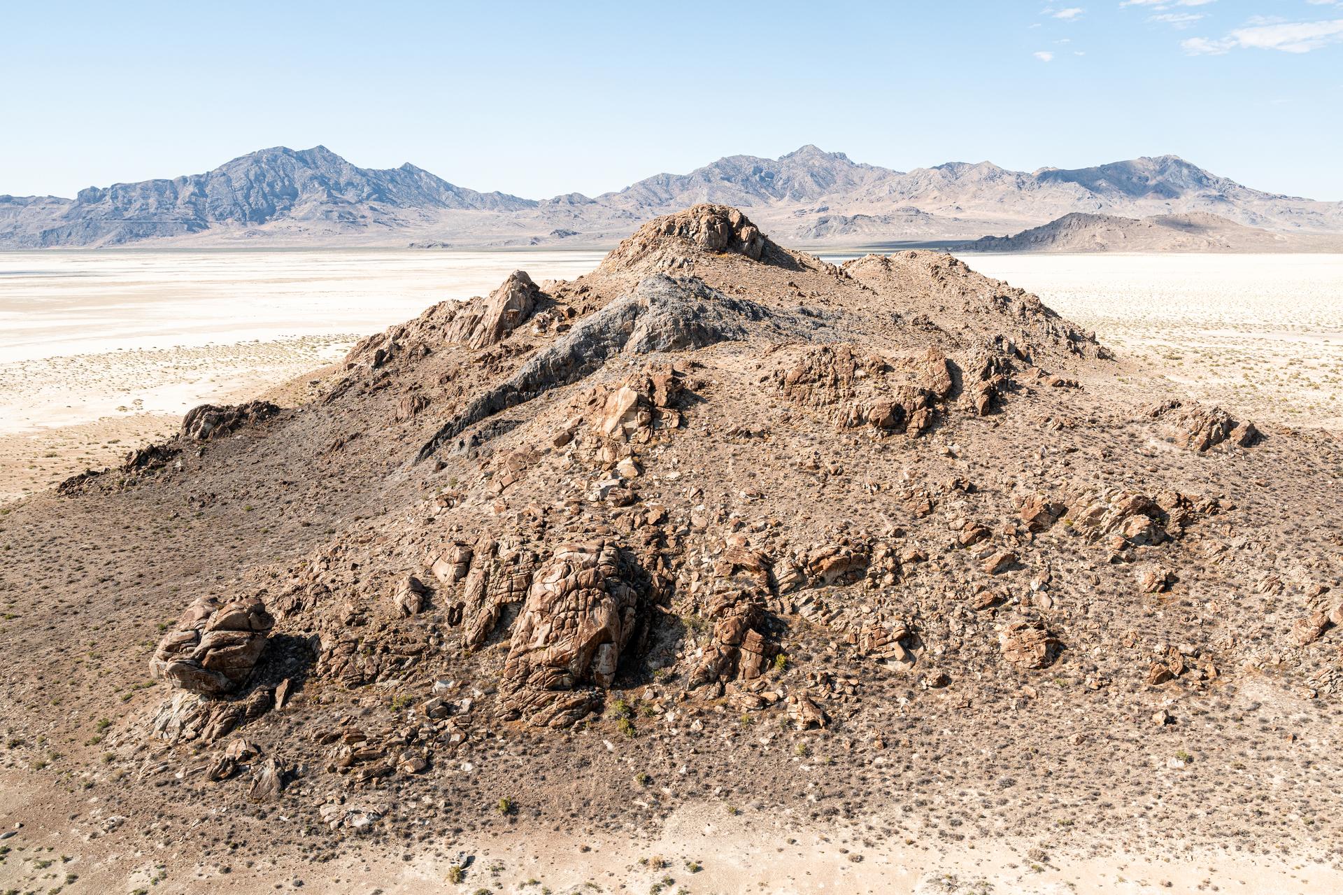
Detailed view of a rock outcrop at Crater Island, Utah on June 23, 2026. This outcropping was one of the points of interest to NASA's DAVINCI VADIX Mission for its distinct geologic properties. NASA/Mike Guinto
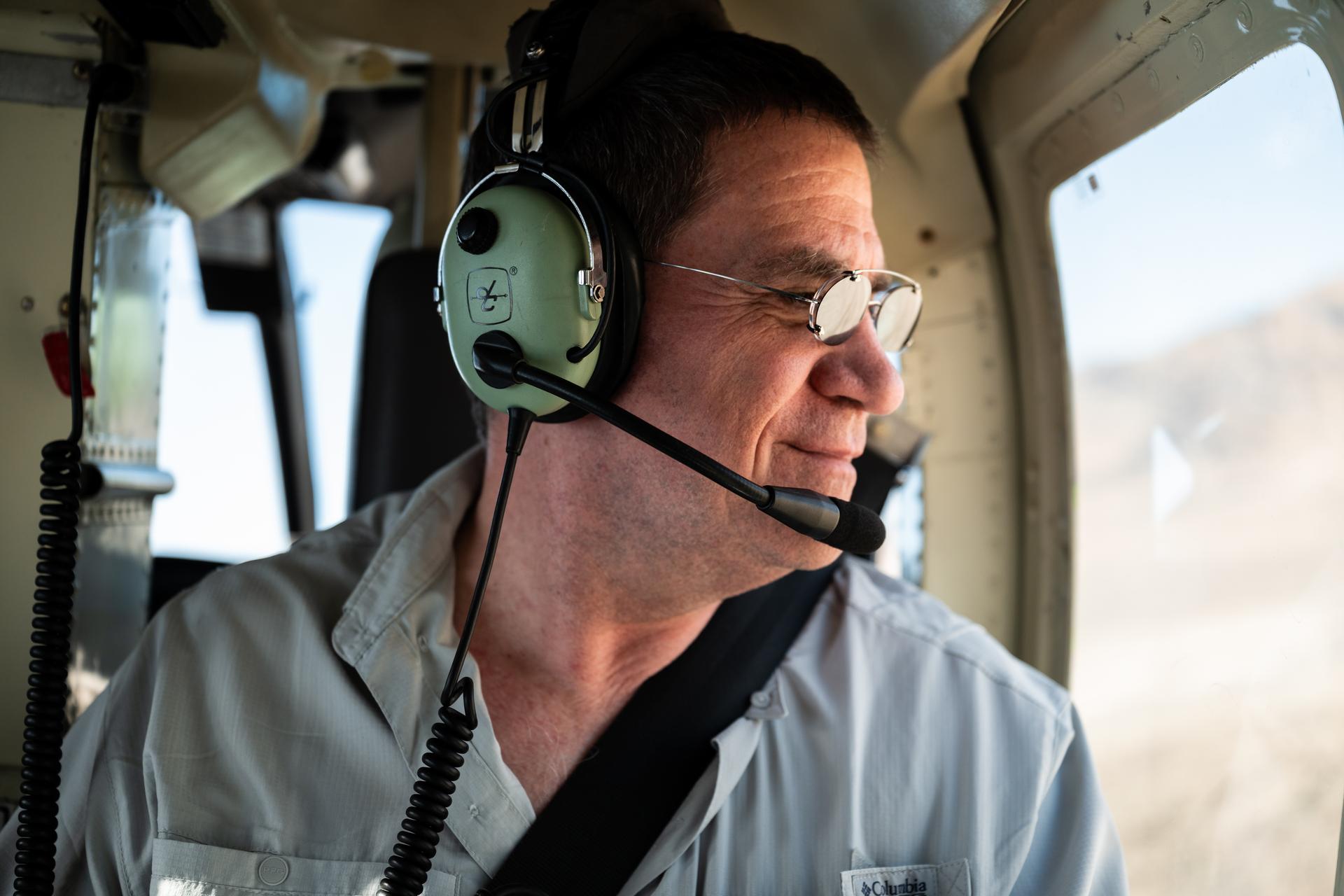
Mike Ravine observes out the helicopter window while in flight over Crater Island, Utah as part of the DAVINCI VADIX experiment, June 23, 2026. NASA/Mike Guinto
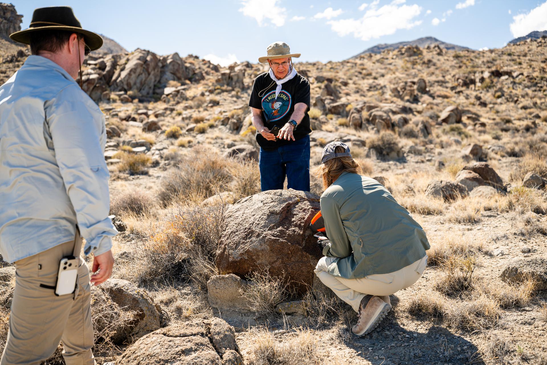
Mike Ravine, left, Jim Garvin, and Erika Kohler, take direct measurements of rocks observed at Crater Island, Utah as part of the DAVINCI VADIX experiment, June 23, 2026. NASA/Mike Guinto
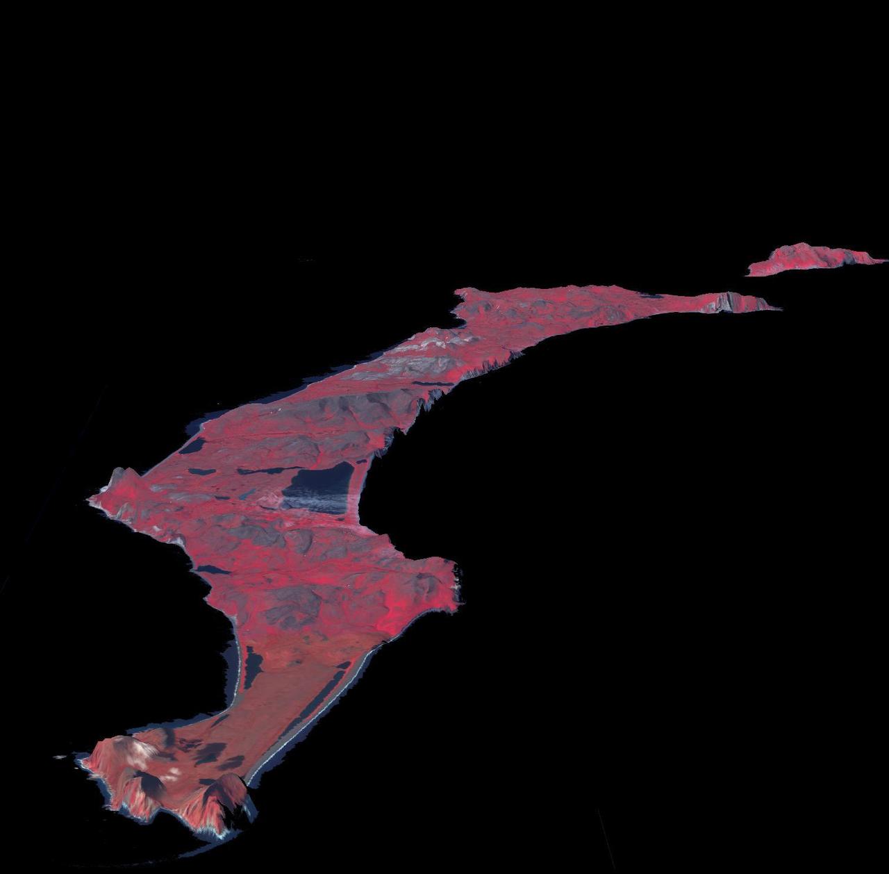
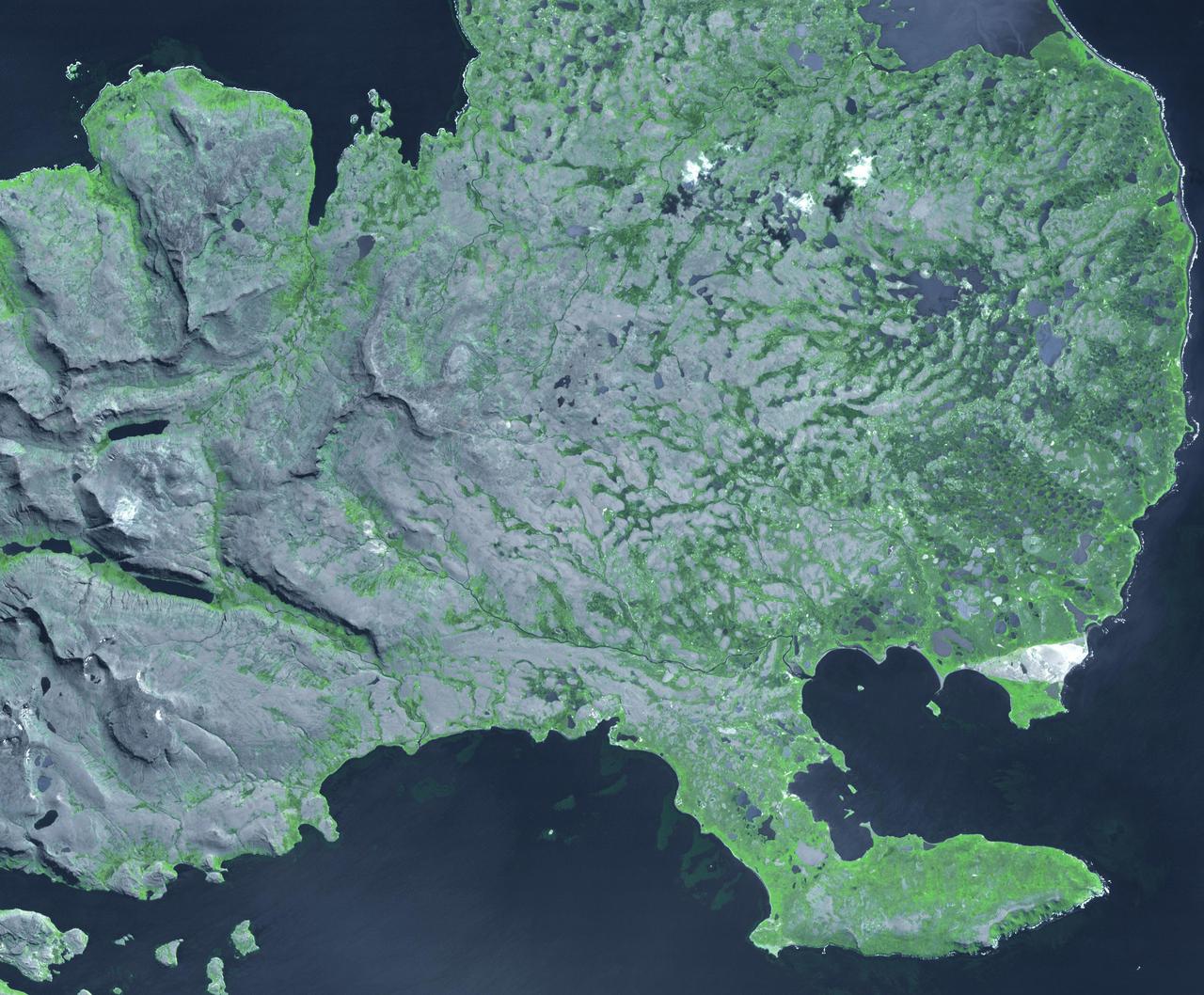
This image from NASA Terra spacecraft shows St. Matthew Island, a remote island in the Bering Sea in Alaska.
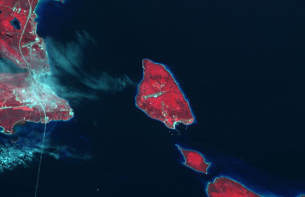
Mackinac Island, Michigan, is a small island off the northern coast of Lake Huron. What makes it special is that all cars and motor vehicles were banned in 1900 from the 3.8-sq-island, home to 600 year-round residents. Each year over 1 million tourists visit the island to enjoy its peace and tranquility. The scene was acquired August 9, 2021 , covers an area of 13.8 by 21.3 km, and is located at 45.8 degrees north, 84.6 degrees west. https://photojournal.jpl.nasa.gov/catalog/PIA26621
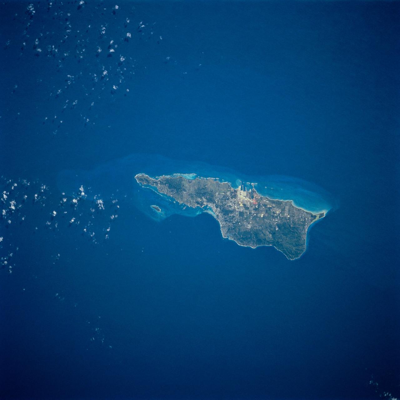
STS054-74-049 (13-19 Jan. 1993) --- St. Croix is the largest, and most industrial of the U.S. Virgin Islands. This photograph captures St. Croix's features in great detail. The large industrial complex in the middle of the southern shore is the world's largest petroleum refinery. The main city, Christiansted, can be seen across the island on the north shore. The reefs around the eastern end of St. Croix are preserved as a submarine national park -- Buck Island Reef National Park -- around the small island off the north shore of the eastern end of St. Croix.

Grand Turk Island is an island in the Turks and Caicos Islands in the Caribbean, and contains the territory capital, Cockburn Town. NASA Terra spacecraft acquired this image on September 18, 2001.
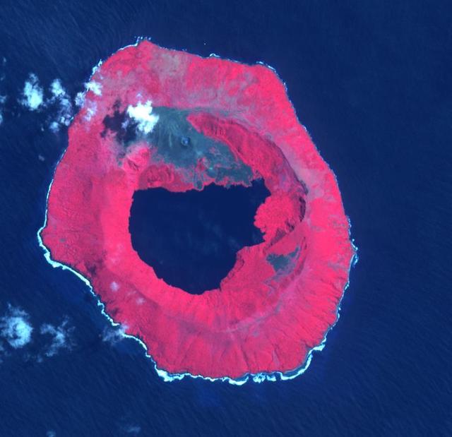
Tofua Island in the central part of the Tonga Islands group is the summit of a large stratovolcano that contains a 5-km-wide caldera. Three post-caldera cones were constructed at the northern end of a caldera lake. The easternmost cone produced lava flows, some of which have traveled into the caldera lake. The current eruption period began in October 2015 and has more recently consisted of thermal activity. The image was acquired October 10, 2023, covers an area of 11.6 by 12 km, and is located at 19.7 degrees south, 175.1 degrees west. https://photojournal.jpl.nasa.gov/catalog/PIA26393
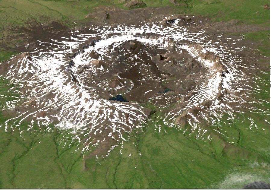
This image is a perspective view acquired by NASA Airborne Synthetic Aperture Radar AIRSAR in 2001, is of Umnak Island, one of Alaska Aleutian Islands. The active Okmok volcano appears in the center of the island.
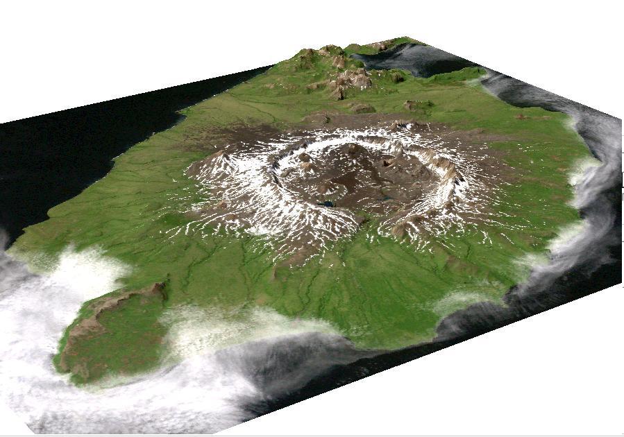
This image is a perspective view acquired by NASA Airborne Synthetic Aperture Radar AIRSAR in 2001, is of Umnak Island, one of Alaska Aleutian Islands. The active Okmok volcano appears in the center of the island.
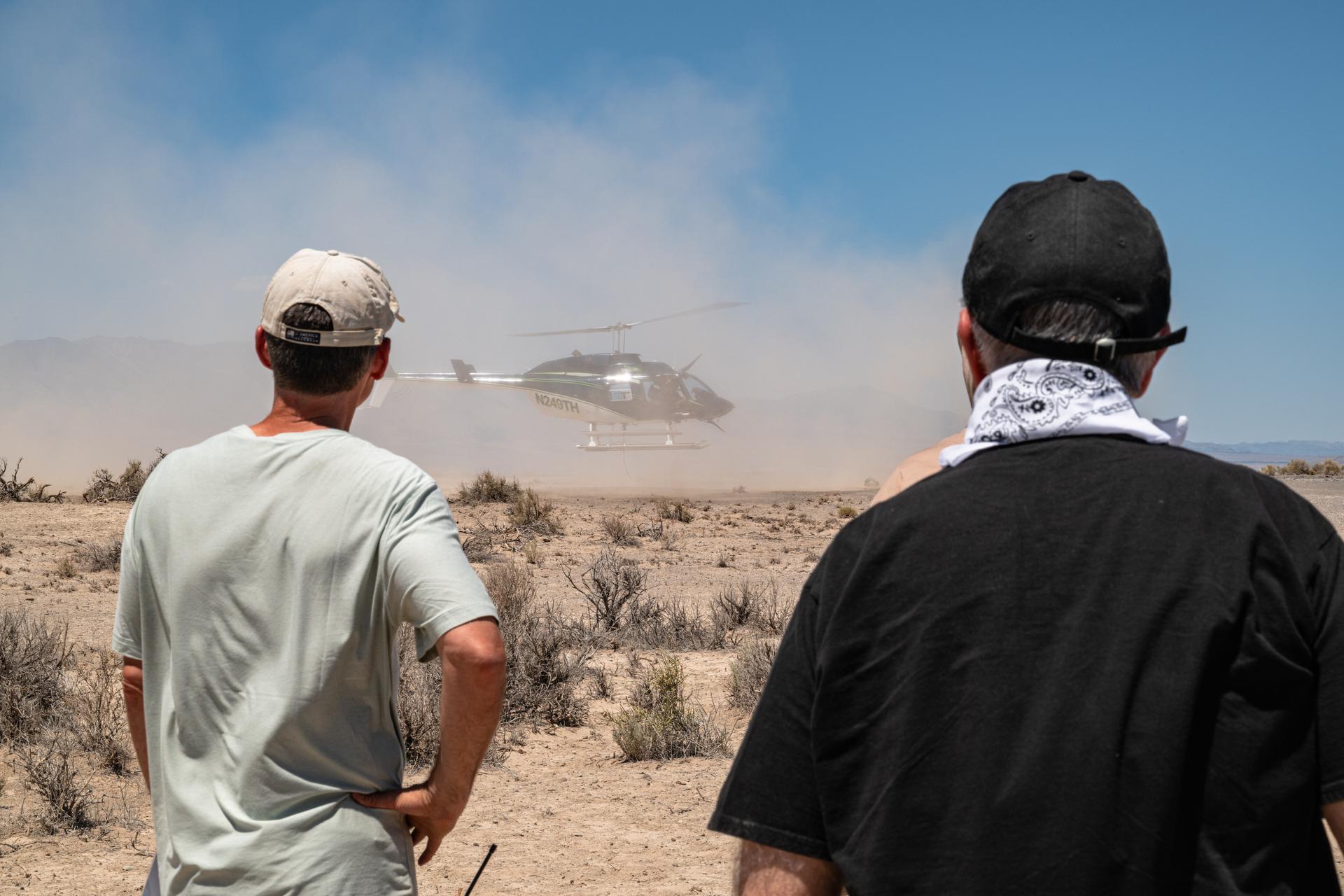
Brent Bos, left, and Jim Garvin, right, watch the helicopter carrying the VADIX payload lift off from Crater Island, Utah, June 23, 2026. VADIX is a test of the camera system that will one day fly aboard NASA’s DAVINCI mission probe to Venus. NASA/Mike Guinto
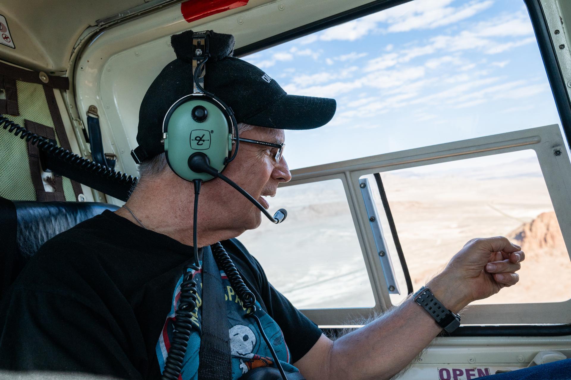
Dr. Jim Garvin makes observations from the window of a helicopter while flying from Wendover Utah to Crater Island, June 23, 2026. The flight was in coordination with the VADIX mission, a preliminary experiment which will demonstrate a prototype camera system that will one day fly on the DAVINCI probe to Venus. NASA/Mike Guinto
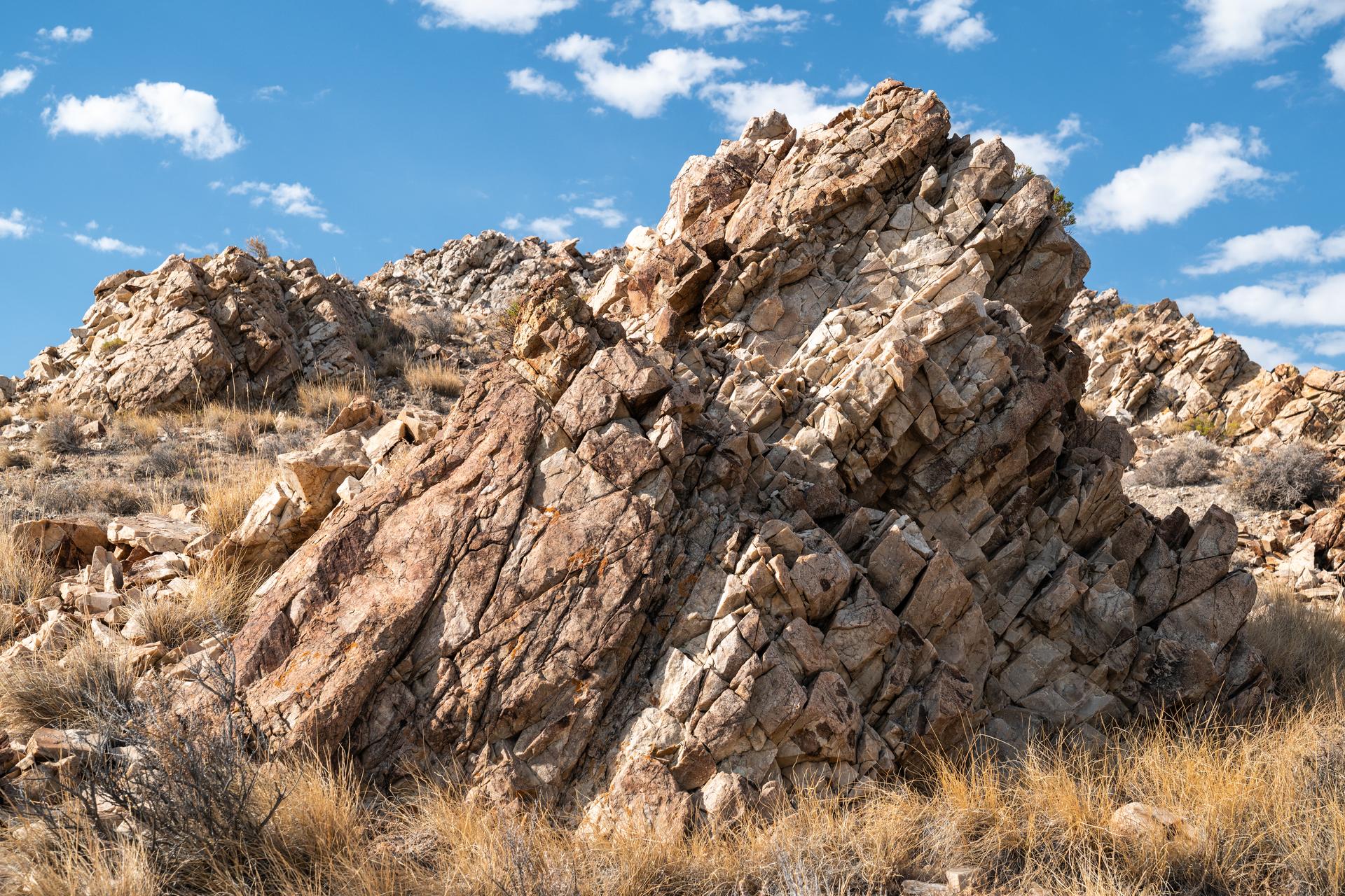
Detailed view of a granite outcrop at Crater Island, Utah on June 23, 2026. This outcropping was one of the points of interest to NASA's DAVINCI VADIX Mission for its distinct geologic properties. NASA/Mike Guinto
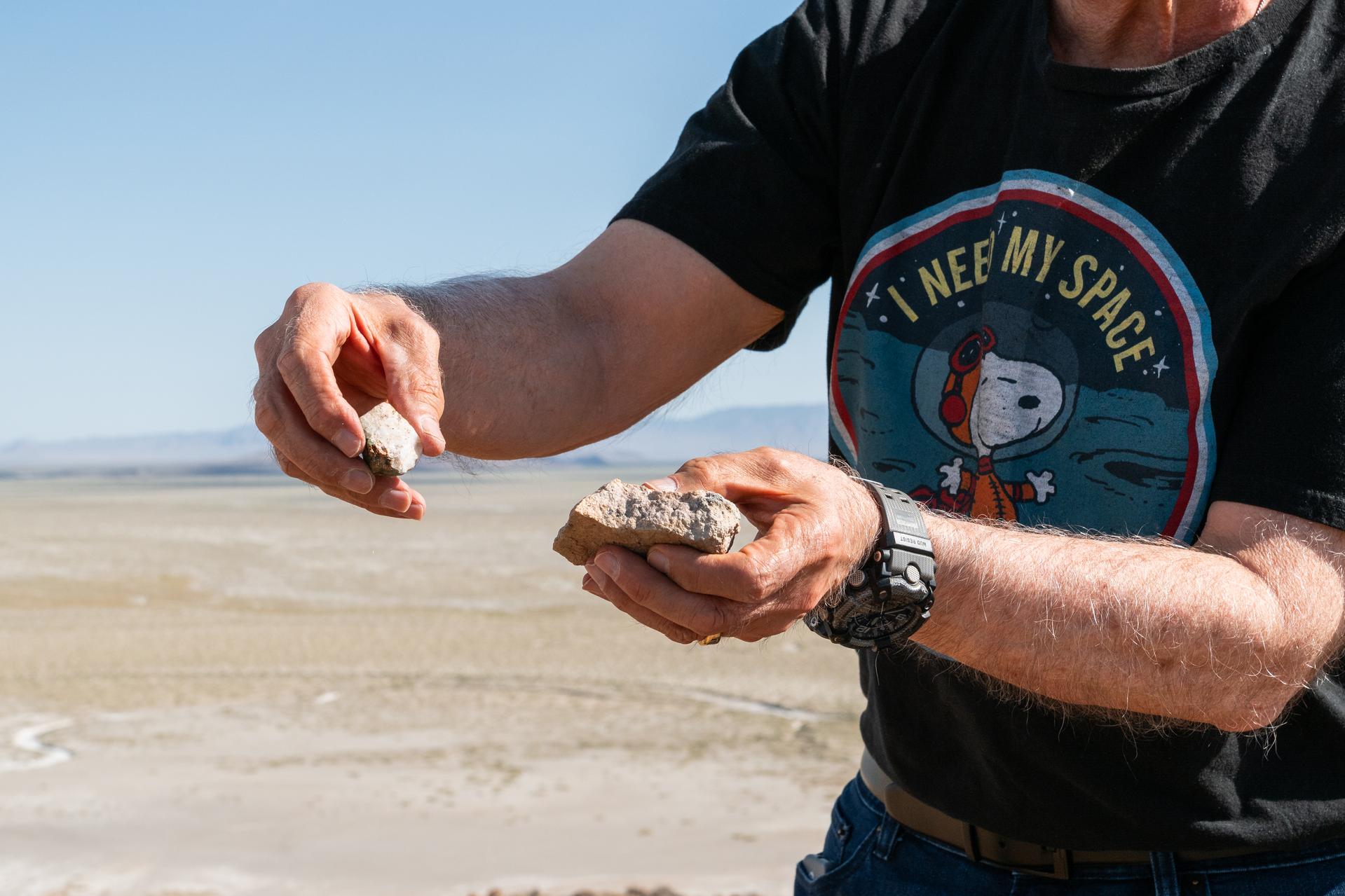
Dr. Jim Garvin presents rock samples found at Crater Island, Utah on June 23, 2026. Dr. Garvin is the principal investigator for NASA's DAVINCI probe which will one day be making discoveries on Venus.
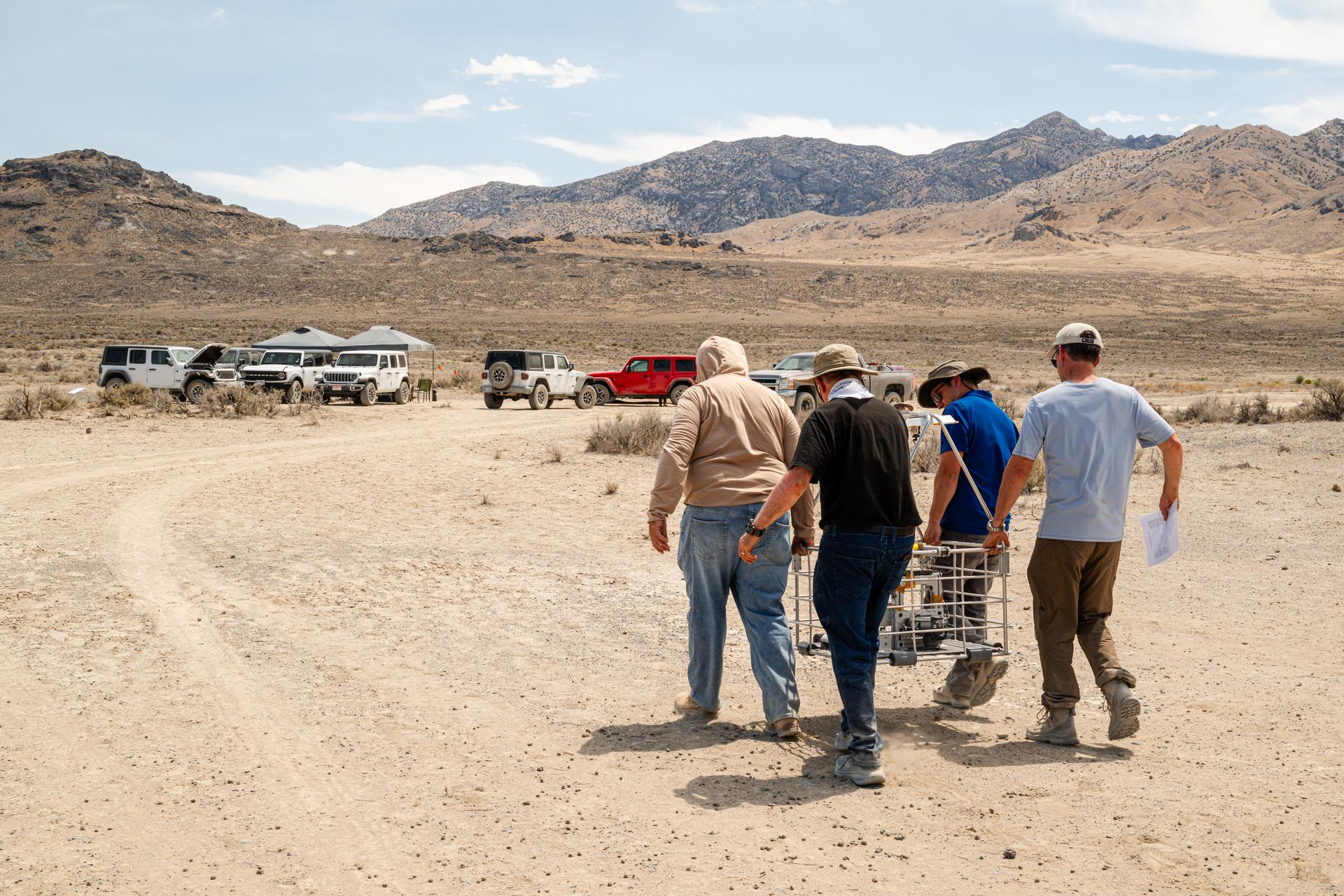
DAVINCI VADIX team carries the VADIX payload from the helicopter back to basecamp so they can retrieve flight data and get the payload back onto the helicopter for the next test flight at Crater Island, Utah, June 24, 2026. NASA/Mike Guinto

BO THAO-URABE, A MEMBER OF PRESIDENT BARACK OBAMA’S COMMISSION ON ASIAN AMERICANS AND PACIFIC ISLANDERS, SPOKE TO TEAM MEMBERS OF NASA’S MARSHALL SPACE FLIGHT CENTER DURING AN ASIAN AMERICANS AND PACIFIC ISLANDERS MONTH CELEBRATION EVENT MAY 31.
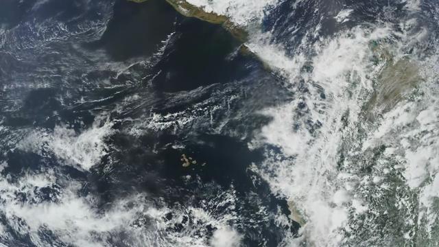
Completed: 07-16-2009 Straddling the equator approximately 1000 kilometers to the west of the South American mainland, the Galapagos Islands lie within the heart of the equatorial current system. Rising from the sea floor, the volcanic islands of the Galapagos are set on top of a large submarine platform. The main portion of the Galapagos platform is relatively flat and less than 1000 meters in depth. The steepest slopes are found along the western and southern flanks of the platform with a gradual slope towards the east. The interactions of the Galapagos and the oceanic currents create vastly different environmental regimes which not only isolates one part of the Archipelago from the other but allows penguins to live along the equator on the western part of the Archipelago and tropical corals around the islands to the north. The islands are relatively new in geologic terms with the youngest islands in the west still exhibiting periodic eruptions from their massive volcanic craters. Please give credit for this item to: NASA/Goddard Space Flight Center, The SeaWiFS Project and GeoEye, Scientific Visualization Studio. NOTE: All SeaWiFS images and data presented on this web site are for research and educational use only. All commercial use of SeaWiFS data must be coordinated with GeoEye (http://www.geoeye.com). To download this video go to: <a href="http://svs.gsfc.nasa.gov/goto?3628" rel="nofollow">svs.gsfc.nasa.gov/goto?3628</a> <b><a href="http://www.nasa.gov/centers/goddard/home/index.html" rel="nofollow">NASA Goddard Space Flight Center</a></b> is home to the nation's largest organization of combined scientists, engineers and technologists that build spacecraft, instruments and new technology to study the Earth, the sun, our solar system, and the universe.
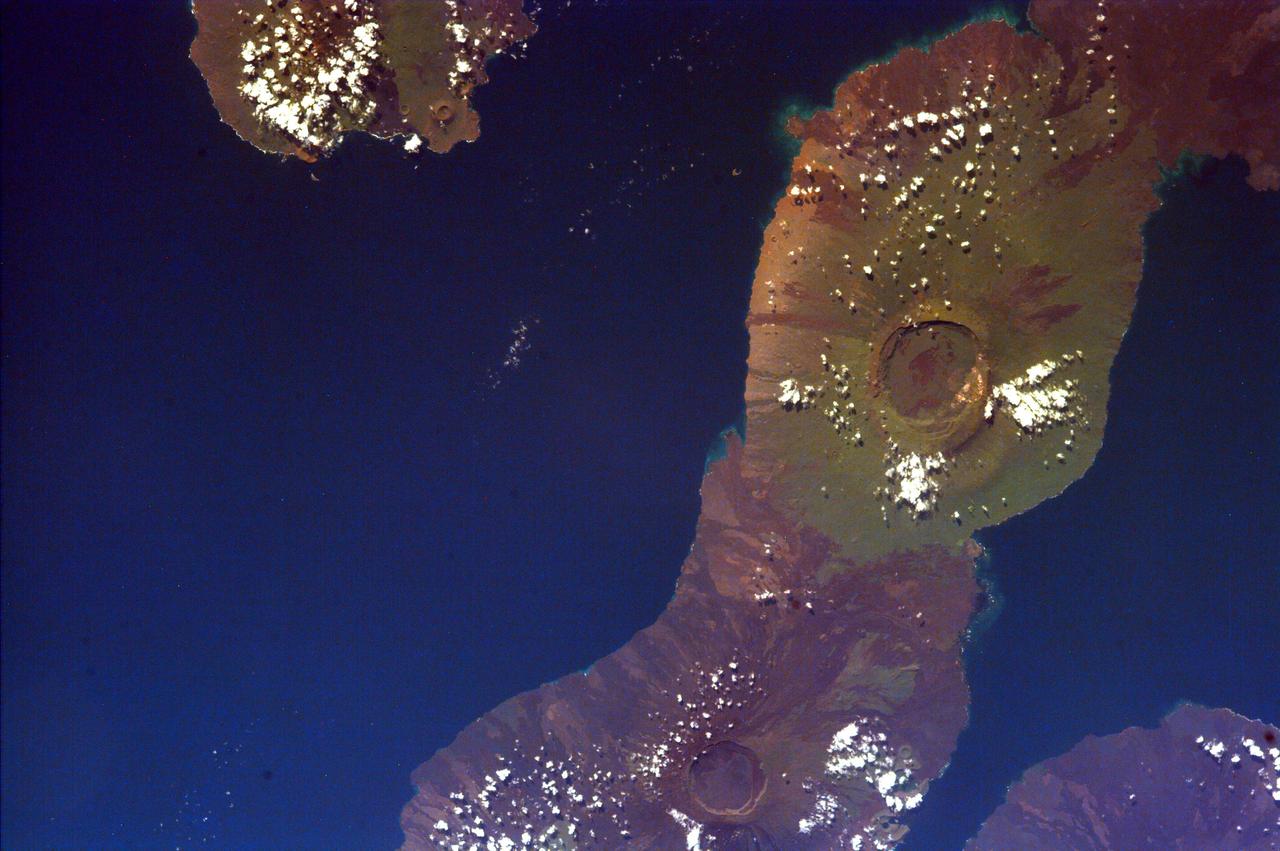
This image of the Galapagos Islands captures two large shield volcanoes on Isla Isabella, the largest and least inhabited island in the Galapagos chain. This image is from NASA EarthKAM.
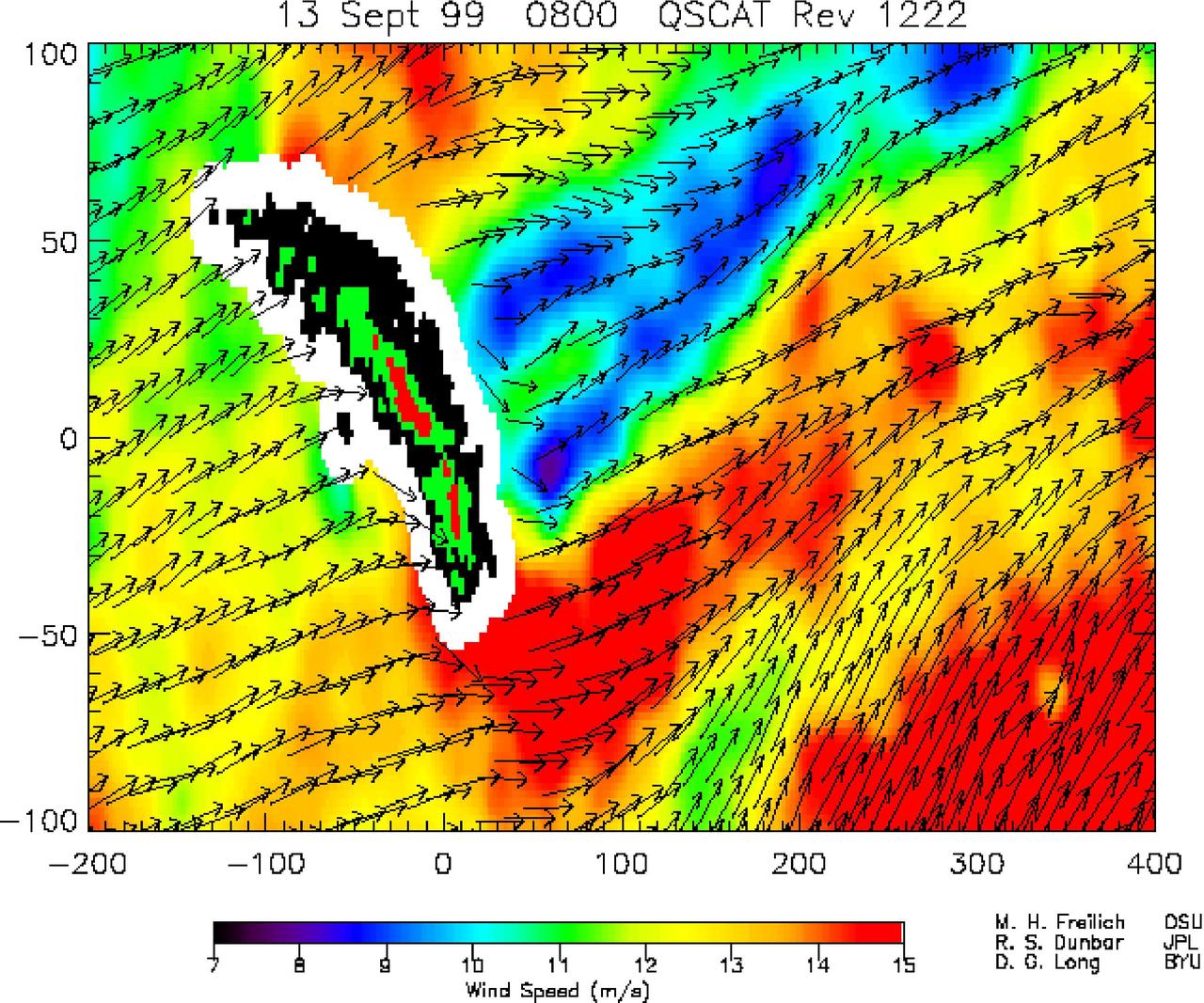
NASA SeaWinds instrument on the QuikScat satellite shows winds are blocked by an island mountain barrier on South Georgia Island, in the South Atlantic Ocean in the year 2000.
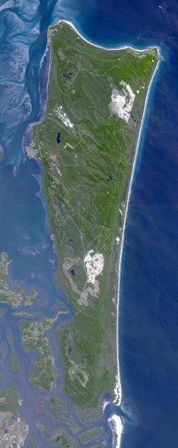
This image from NASA Terra spacecraft shows North Stradbroke Island, 30 km southeast of Brisbane, Australia, one of the largest sand islands in the world.
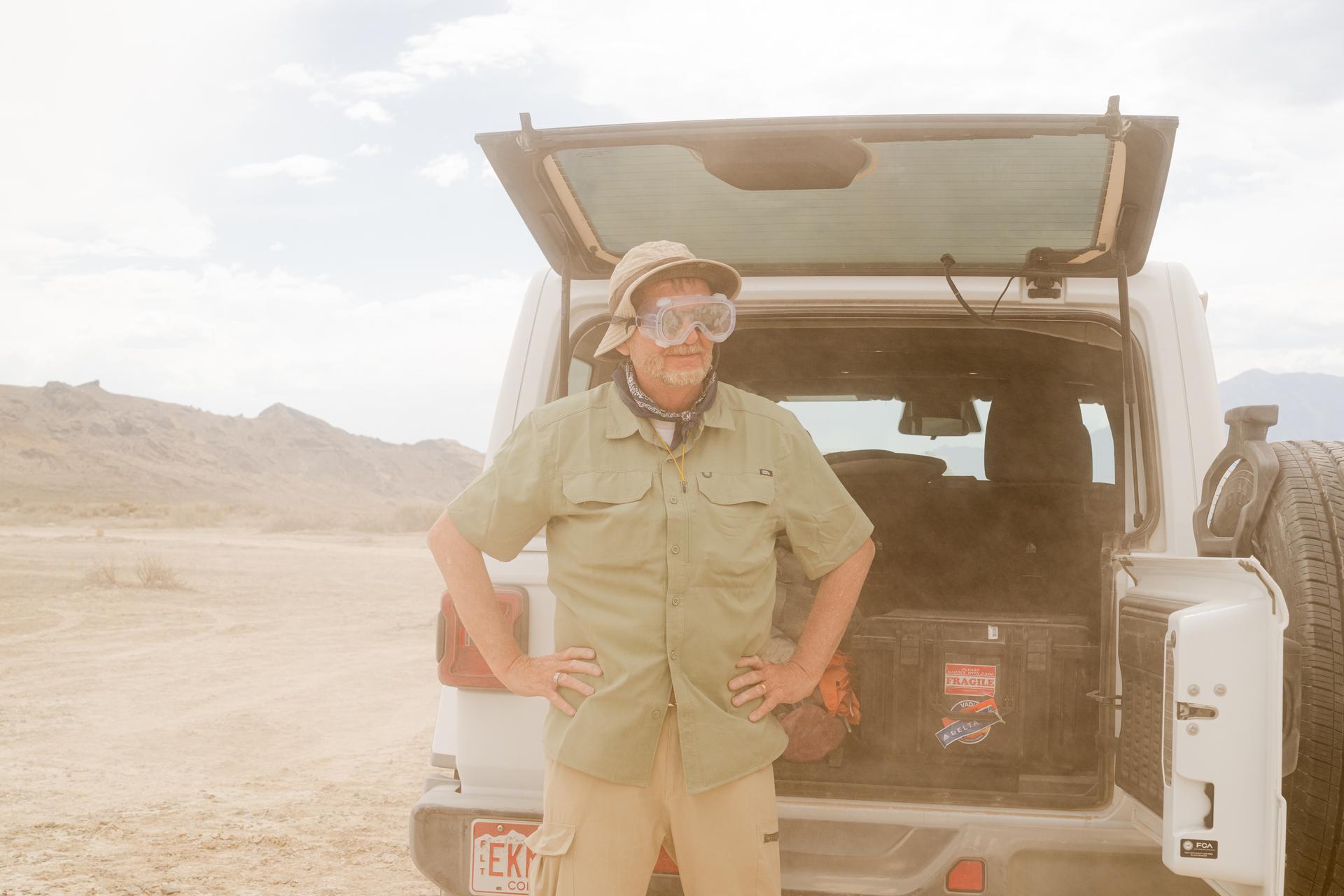
Bob Podgurski wears goggles during a dust event at the DAVINCI VADIX basecamp, Crater Island, Utah, June 24, 2026. This area was the site of a series of tests (June 23-25, 2026) of the camera system that will one day fly aboard NASA’s DAVINCI mission to Venus. NASA/Mike Guinto
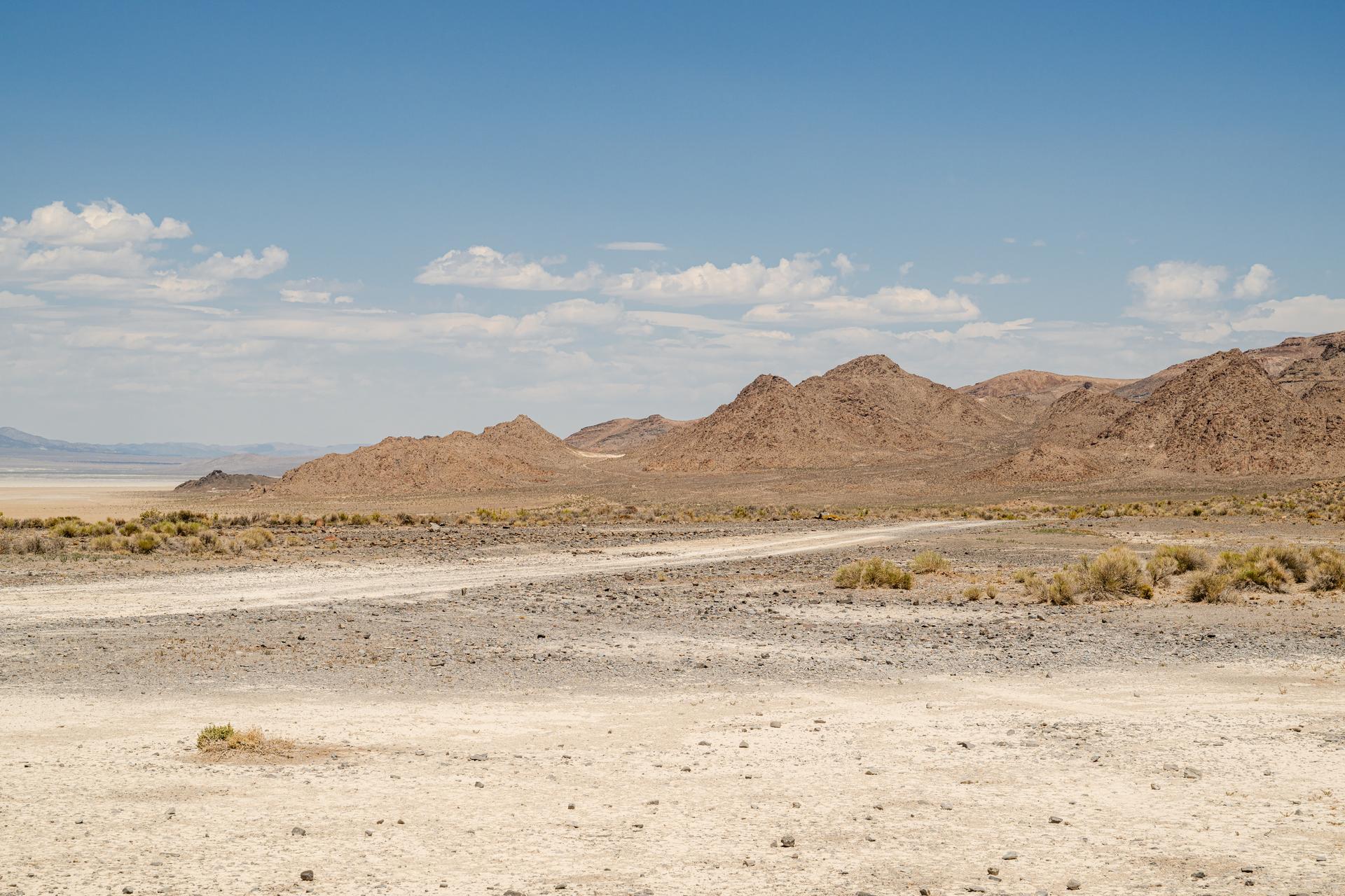
A view of Crater Island from the VADIX Basecamp, Crater Island, Utah June 24, 2026. This area was the site of a series of tests (June 23-25, 2026) of the camera system that will one day fly aboard NASA’s DAVINCI mission to Venus. NASA/Mike Guinto
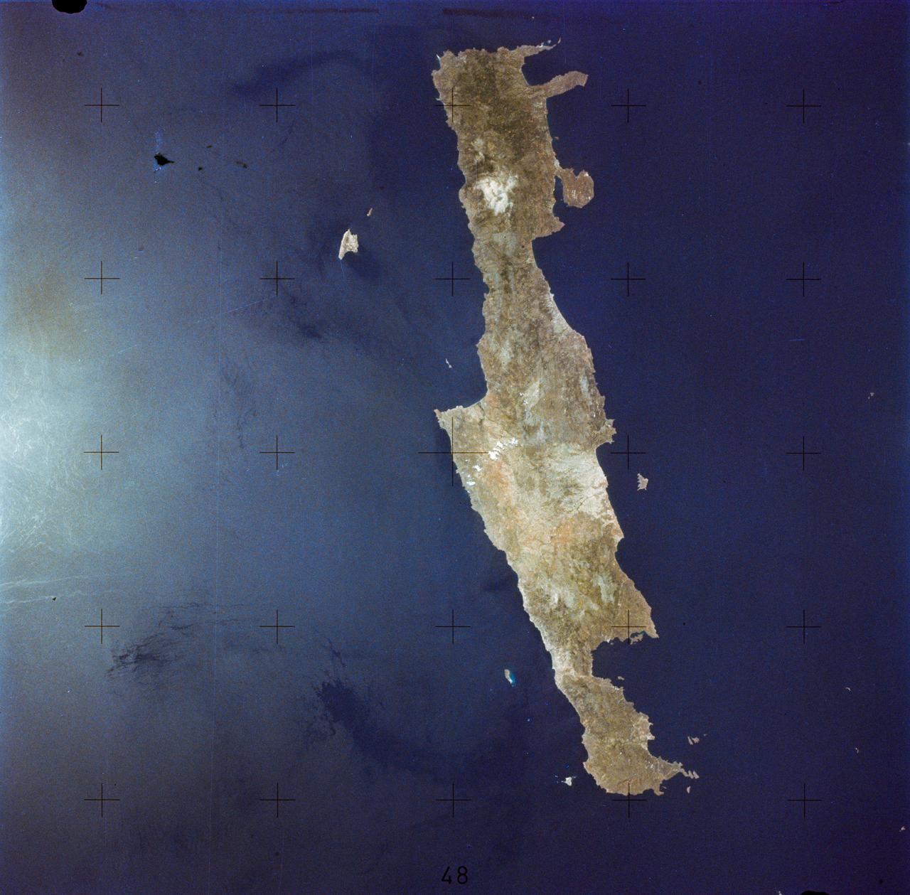
SL2-05-364 (22 June 1973) --- Lying in the eastern Mediterranean Sea, the entire Island of Crete (35.0N, 25.0E) can be seen in great detail in this cloud free view. The volcanic origins of this island can also be observed in the many sharp and angular ridgelines and rugged coastal features. Photo credit: NASA
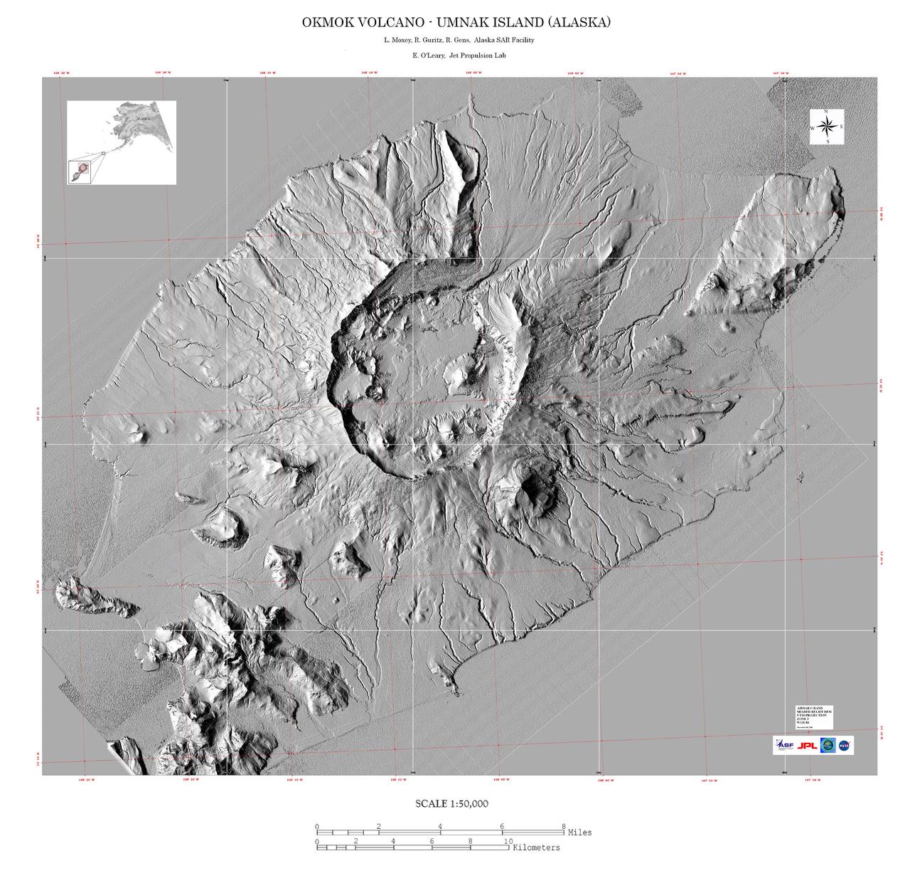
This image is a shaded relief mosaic of Umnak Island in Alaska Aleutian Islands acquired by NASA Airborne Synthetic Aperture Radar AIRSAR in 2001.
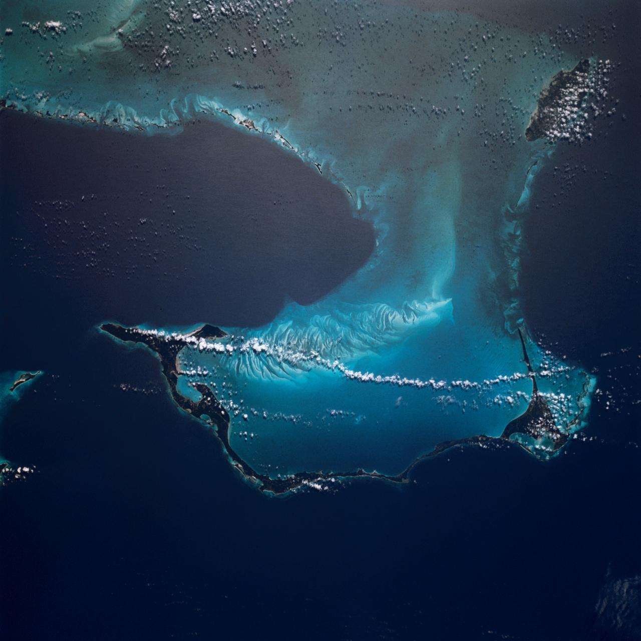
STS006-45-097 (4-9 April 1983) --- This photograph was taken with a handheld 70mm camera aimed through the “ceiling” windows of the Earth-orbiting space shuttle Challenger during its five-day STS-6 mission. A beautiful photo shows the contrast between the islands, clouds, shallow water and deep water. Islands of the Bahamas seen are New Providence (upper left) and Eleuthera (right). Northeast Providence Channel is at the upper edge and Exuma Sound is at the lower left with the open Atlantic along the right edge. The wind, from the south, causes a long cloud to develop downwind from Eleuthera Point. Photo credit: NASA
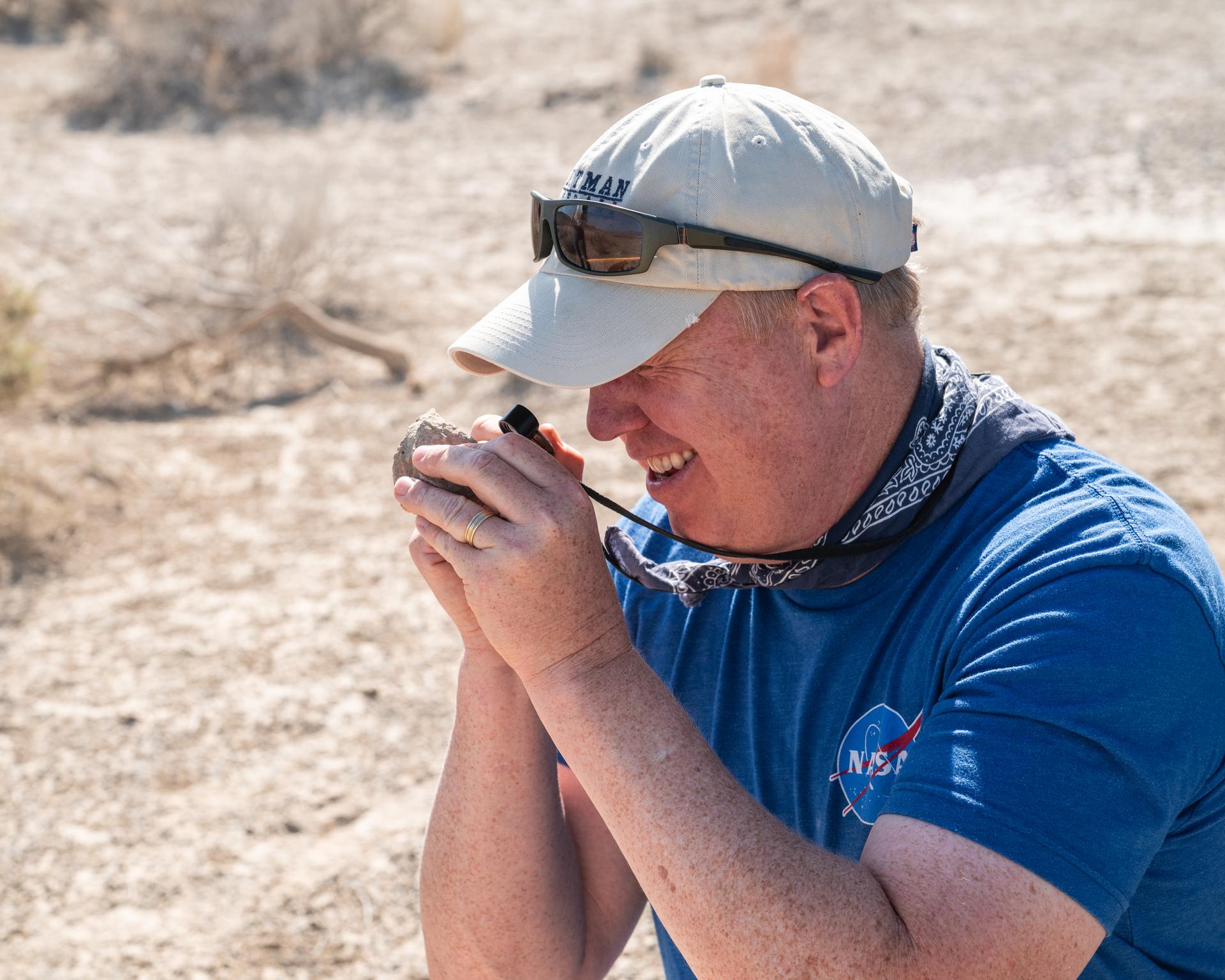
Nick Lang, DAVINCI Science Program Manager at Headquarters NASA, inspects a rock found at Crater Island, Utah during the DAVINCI VADIX experiment, June 23, 2026. NASA/Mike Guinto
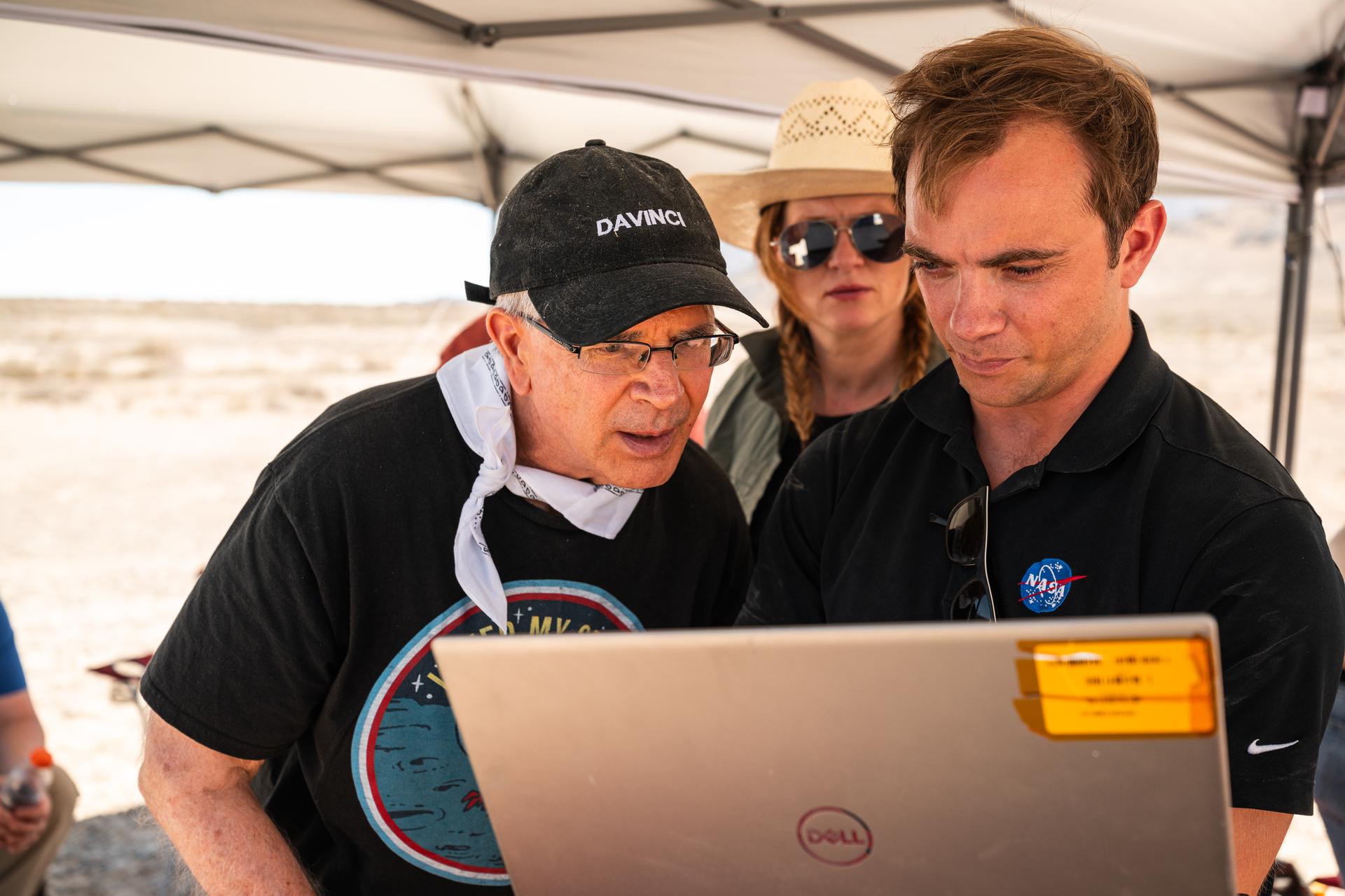
Pictured are DAVINCI’s (left to right) Jim Garvin, mission principal investigator; Erika Kohler, acting deputy principal investigator; and Matthew Mullin, space laser engineer, evaluating flight data in real-time to adapt their future tests to the lessons learned from each flight. The researchers are standing in an area of Crater Island, Utah, which was the site of a series of tests (June 23-25, 2026) of the camera system that will one day fly aboard NASA’s DAVINCI mission probe to Venus.
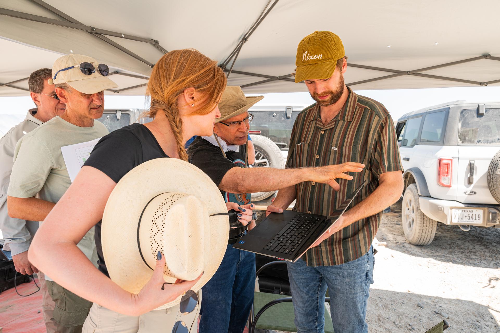
Pictured are DAVINCI’s (left to right) Mike Ravine, Brent Bos, Erika Kohler, Jim Garvin, and Christian Tate, evaluating flight data in real-time to adapt their future tests to the lessons learned from each flight. The researchers are standing in an area of Crater Island, Utah, which was the site of a series of tests (June 23-25, 2026) of the camera system that will one day fly aboard NASA’s DAVINCI mission probe to Venus. NASA/Mike Guinto
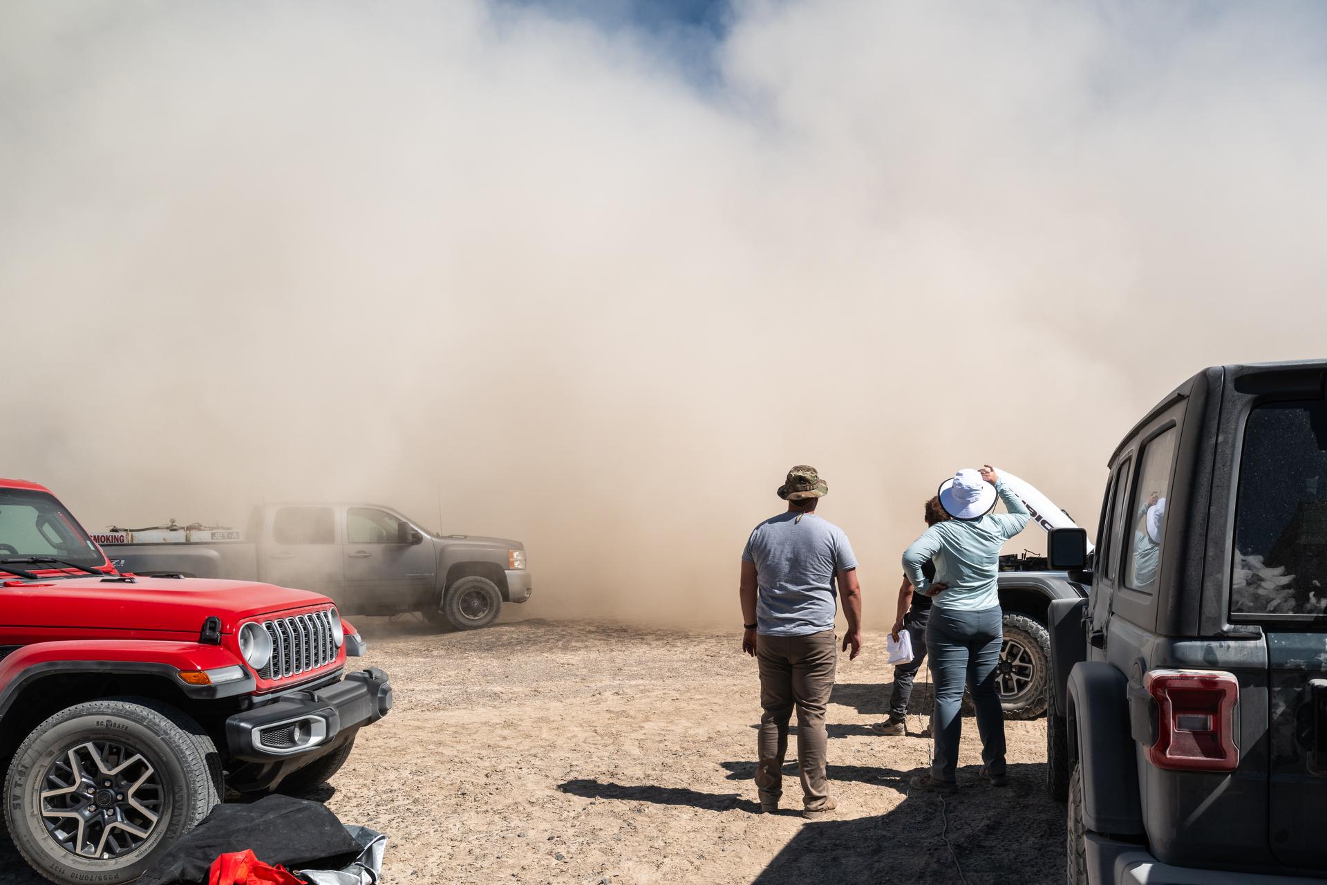
Jason Burt, Lacey Young, and Matt Mullin watch as a helicopter takes off from a test site at Crater Island, June 23, 2026. As the helicopter takes off, it kicks up dust from the ground, reffered to as "roto wash" the dust cloud quickly rises up into a wall of dust before it is blown away by the wind. NASA/Mike Guinto
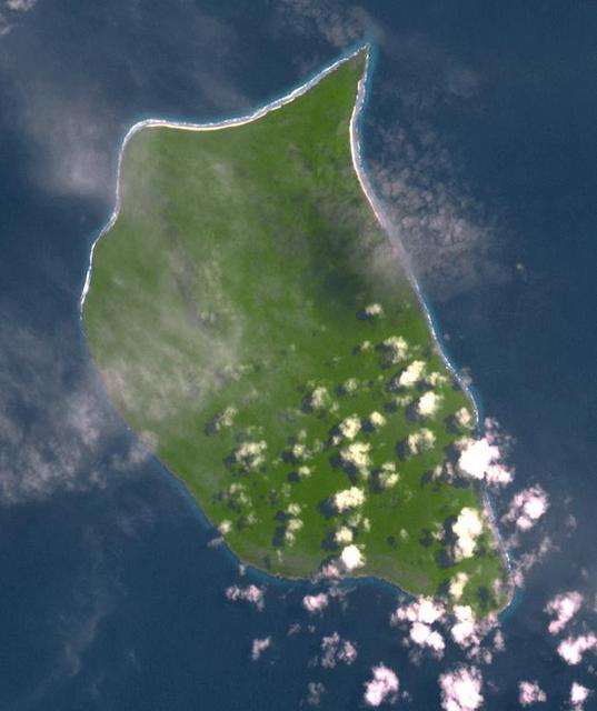
Uninhabited Henderson Island is part of the United Kingdom's Pitcairn Islands group in the South Pacific. According to a study by the University of Tasmania published in the Proceedings of the National Academy of Science, the island has the highest density of plastic waste anywhere in the world, an estimated 38 million pieces of rubbish. The island is near the center of an ocean current, so it collects rubbish from boats and South America. The image was acquired February 7, 2012, covers an area of 10.3 by 12.3 km, and is located at 24.3 degrees south, 128.3 degrees west. https://photojournal.jpl.nasa.gov/catalog/PIA21691
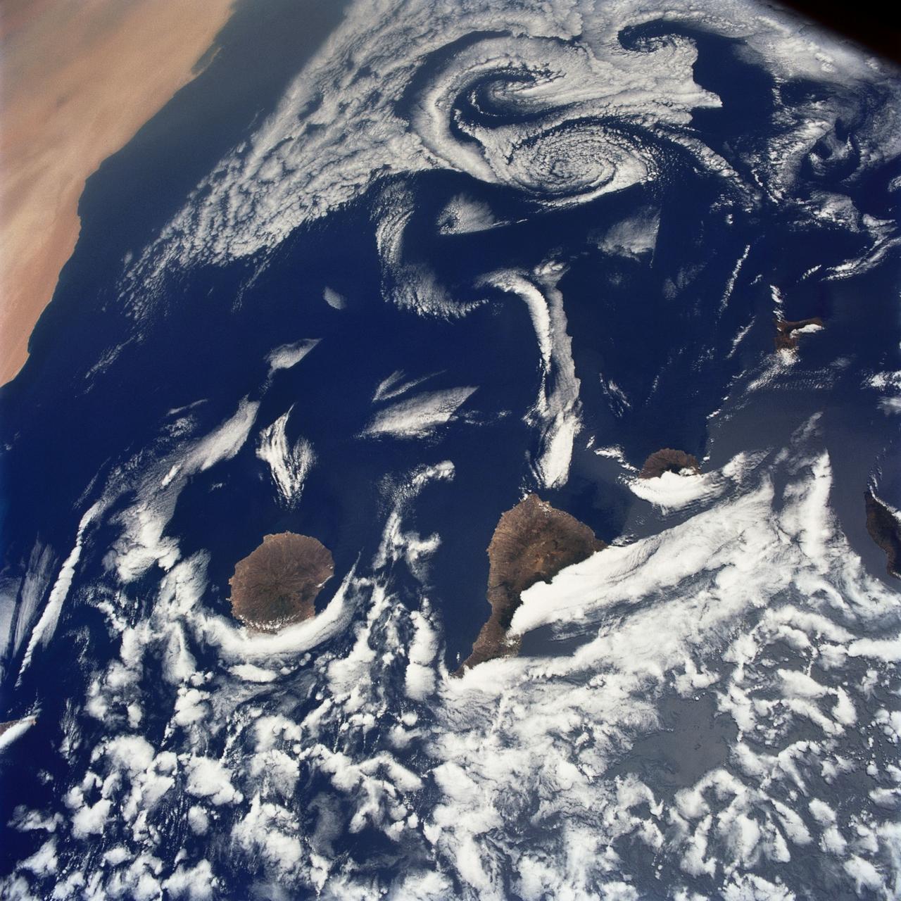
STS040-75-003 (5-14 June 1991) --- This image shows several of the Canary Islands, located in the North Atlantic Ocean just west of Africa. Low level stratus clouds often form here (and along the west coast of continents at these latitudes) are trapped in vertical movement due to an overlying atmospheric temperature inversion. The islands are generating disturbances in the low-level wind flow which is generally from the north-northeast or from top to bottom in the image. These disturbances travel downstream from the islands and manifest themselves as cloud swirls which are called von Karman vortices. The northern extent of a large dust storm moving off the coast of Africa is apparent at the lower right of the image. The dust, extended across the Atlantic Ocean as far west as the Dominican Republic later in the mission.
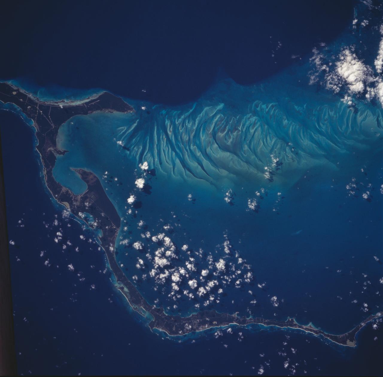
The striking views provided by the Bahama Islands lend insights into the important problems of limestone (CaCO3) production and transport. This photograph includes the southern part of Eleuthera Island in the northern Bahamas. The hook-shaped island encloses a relatively shallow platform (light blue) which is surrounded by deep water (dark blue). The feathery pattern along the western edge of Eleuthera's platform are sand bars and sand channels created by tidal currents sweeping on and off the platform. The channels serve to funnel large amounts of CaCO3 off the platform and into the deeper water.
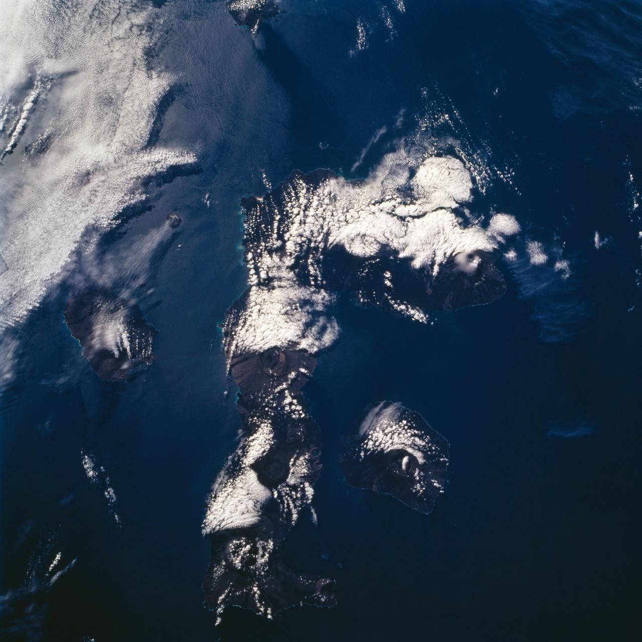
STS072-732-072 (11-20 Jan. 1996) --- Three of the nineteen Galapagos Islands are visible in this image, photographed from the Earth-orbiting Space Shuttle Endeavour. The Galapagos Islands are located 600 miles (1,000 kilometers) to the west of Ecuador. The largest of the islands, Isabela, is at center (north is toward the upper right corner). The numerous circular features on the island, highlighted by clouds, are volcanoes. The Galapagos Islands owe their existence to a hot spot, or persistent heat source in the mantle, which also is located over a rift, or place where plates are separating and new crust is being created. The rift is located between the Cocos and Nazca Plates. The dark linear features on the islands are lava flows from past eruptions. The island to the left of Isabela is Fernandina, while the island to the right is San Salvador. The Galapagos Islands were visited by the English naturalist Charles Darwin in 1835.
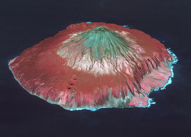
Tristan da Cunha is both a remote group of volcanic islands in the south Atlantic, and the main island. It is the most remote inhabited island group in the world, 2400 km from the nearest inhabited land. Tristan has a population of about 250 inhabitants, and is part of the British overseas territory of Saint Helena, Ascension and Tristan da Cunha. In 1961 the eruption of Queen Mary's Peak forced the evacuation of the entire population for two years. The image was acquired October 7, 2017, and is located at 37.1 degrees south, 12.3 degrees west. https://photojournal.jpl.nasa.gov/catalog/PIA22506
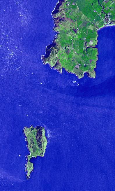
Lying 3 km off the Llyn peninsula of Wales, the Bardsey Island is known as the Island of 20,000 saints. While today's permanent population numbers only four, the island was once an important religious site, with a 6th century monastery. It is the legendary burial site of King Arthur. Another legend holds that anyone who died on the island would not go to hell. The image was acquired April 4, 2006, covers an area of 6 by 10 km, and is located at 52.7 degrees north, 4.8 degrees west. http://photojournal.jpl.nasa.gov/catalog/PIA21182
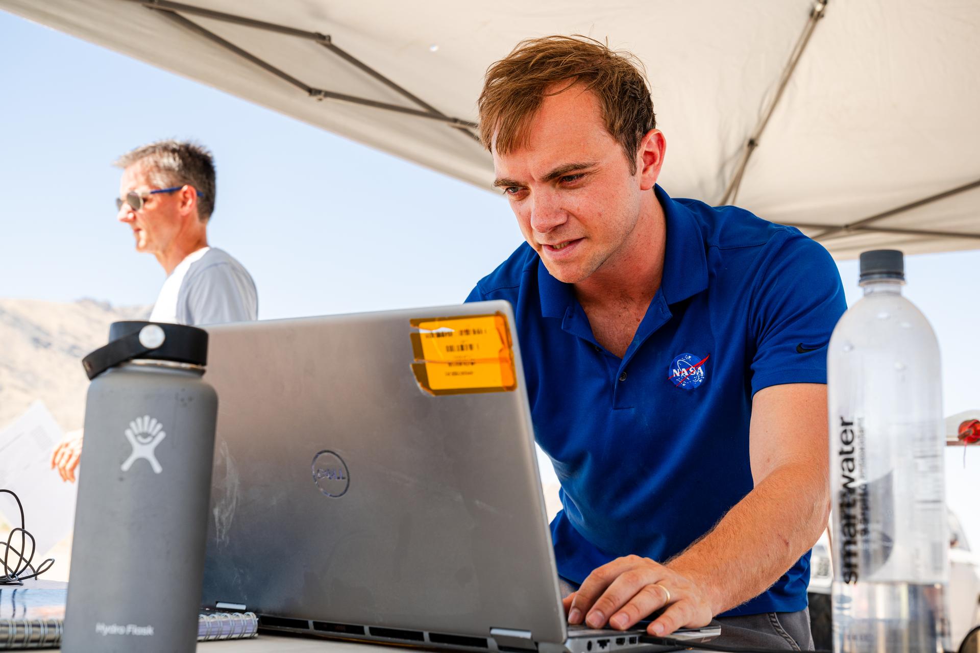
DAVINCI's Matthew Mullin, space laser engineer, reviews data in between test flights at Crater Island, Utah June 24, 2026. NASA/Mike Guinto
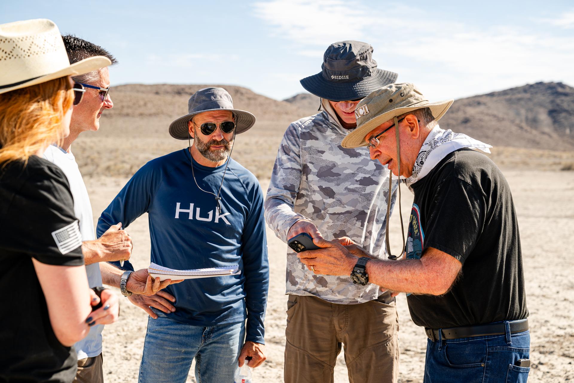
Dr. Jim Garvin, right, discusses flight plans with the pilots in between test flights at Crater Island, Utah, June 24, 2026. NASA/Mike Guinto
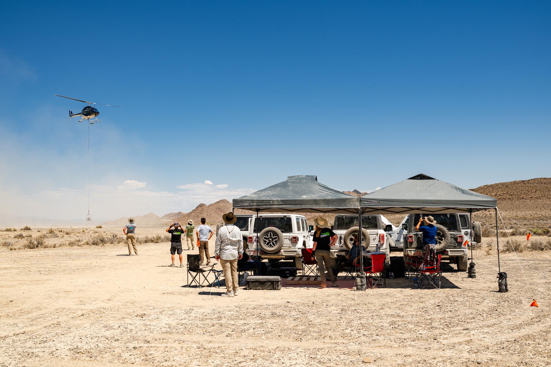
Helicopter carrying the VADIX payload flies past the DAVINCI VADIX base camp in crater island, Utah on June 24, 2026. NASA/Mike Guinto
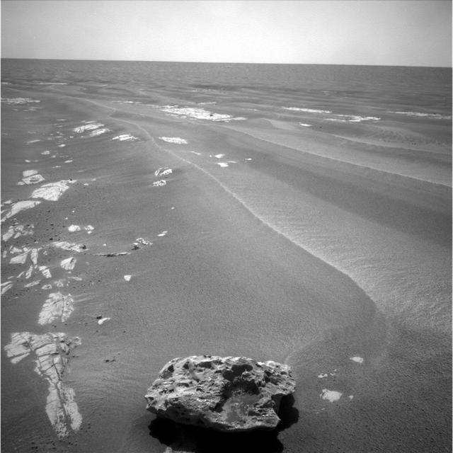
This is a picture of Block Island an odd-shaped, dark rock, which may be a meteorite.
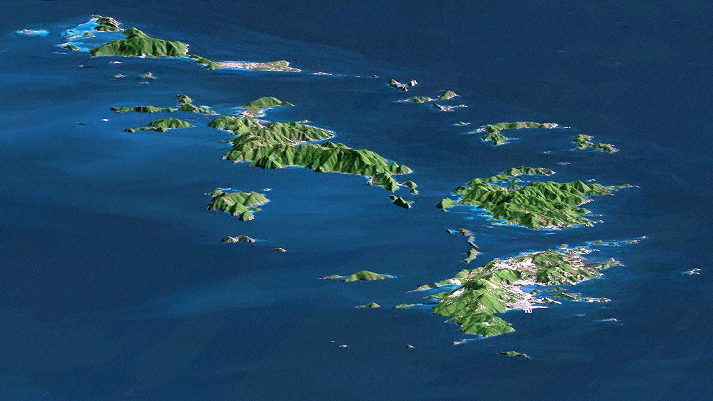
St. Thomas, St. John, Tortola, and Virgin Gorda are the four main islands front to back of this east-looking view of the U.S. Virgin Islands and British Virgin Islands, along the northeast perimeter of the Caribbean Sea.

This image from NASA Terra spacecraft shows Prince Patrick Island, which is located in the Canadian Arctic Archipelago, and is the westernmost Elizabeth Island in the Northwest Territories of Canada. The island is underlain by sedimentary rocks, cut by still-active faults. The streams follow a dendritic drainage system: there are many contributing streams (analogous to the twigs of a tree), which are then joined together into the tributaries of the main river (the branches and the trunk of the tree, respectively). They develop where the river channel follows the slope of the terrain. The image covers an area of 22 by 27 km, was acquired July 2, 2011, and is located at 76.9 degrees north, 118.9 degrees west. http://photojournal.jpl.nasa.gov/catalog/PIA19222

March 23, 2010 - Clouds off the Aleutian Islands Interesting cloud patterns were visible over the Aleutian Islands in this image, captured by the MODIS on the Aqua satellite on March 14, 2010. Turbulence, caused by the wind passing over the highest points of the islands, is producing the pronounced eddies that swirl the clouds into a pattern called a vortex "street". In this image, the clouds have also aligned in parallel rows or streets. Cloud streets form when low-level winds move between and over obstacles causing the clouds to line up into rows (much like streets) that match the direction of the winds. At the point where the clouds first form streets, they're very narrow and well-defined. But as they age, they lose their definition, and begin to spread out and rejoin each other into a larger cloud mass. The Aleutians are a chain of islands that extend from Alaska toward the Kamchatka Peninsula in Russia. For more information related to this image go to: <a href="http://modis.gsfc.nasa.gov/gallery/individual.php?db_date=2010-03-23" rel="nofollow">modis.gsfc.nasa.gov/gallery/individual.php?db_date=2010-0...</a> For more information about Goddard Space Flight Center go here: <a href="http://www.nasa.gov/centers/goddard/home/index.html" rel="nofollow">www.nasa.gov/centers/goddard/home/index.html</a>
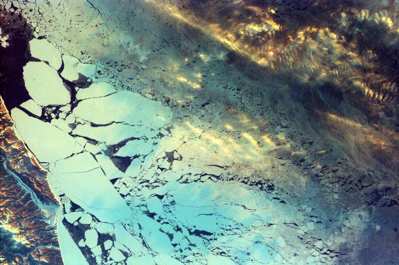
This image from NASA EarthKAM is of Sakhalin Island, located just north of Japan and east of the Khabarovski and Primorski Krai of the Russian Far East. With the Kuril Islands, it forms Sakhalin Province.
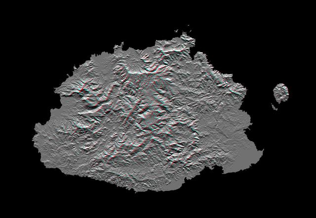
This anaglyph, from NASA Shuttle Radar Topography Mission, shows Viti Levu, the largest island in the group some 332 islands commonly known as Fiji. 3D glasses are necessary to view this image.
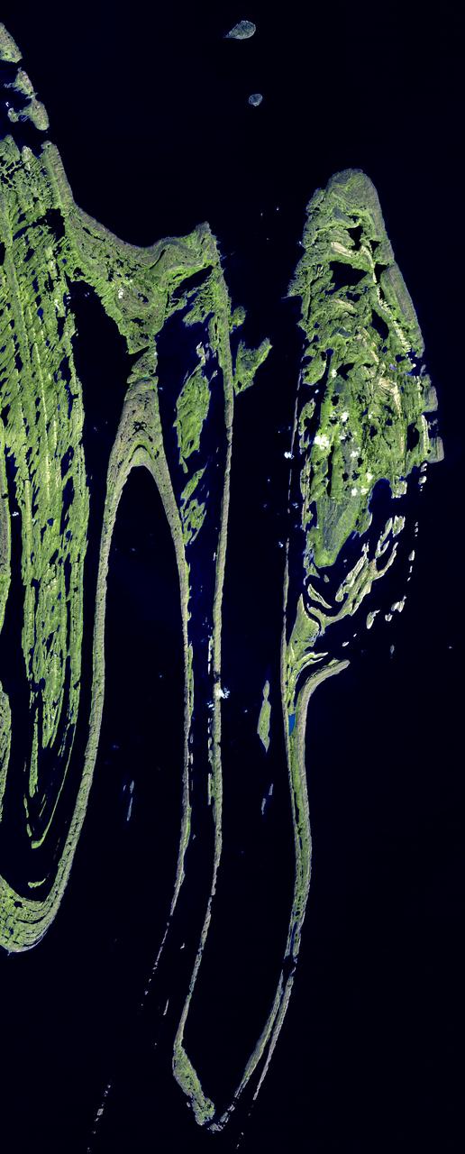
The Belcher Islands are an archipelago in Hudson Bay in Canada, belonging to the territory of Nunavit. The hamlet of Sanikiluaq is on the north coast of Flaherty Island. This image was acquired by NASA Terra satellite on 18 September 2006.
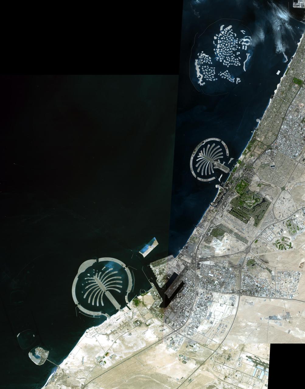
The Palm Islands are artificial islands in Dubai, United Arab emirates on which major commercial and residential structures are being built. NASA Terra spacecraft acquired this image on November 17 and December 10, 2008.
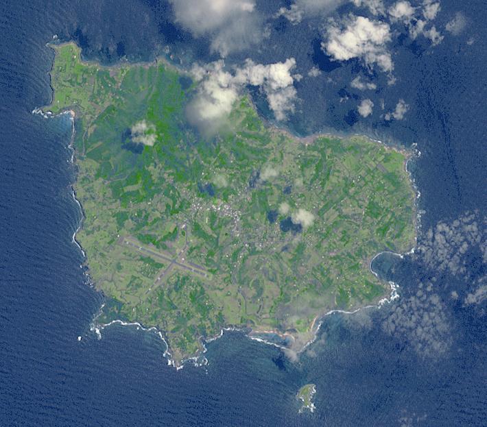
Situated 1670 km northeast of Sydney, Norfolk Island is an Australian Territory. It was permanently settled in 1856 by Pitcairn Islanders who were descendants of Tahitians and HMS Bounty mutineers. In 1979 Norfolk was granted limited self-government: the island elects a government that runs most of the island's affairs. In March, a local council replaced the local government, and the island was given closer financial ties to Australia. The image was acquired November 12, 2009, covers an area of 9 x 11 km, and is located at 29 degrees south, 168 degrees east. http://photojournal.jpl.nasa.gov/catalog/PIA19463
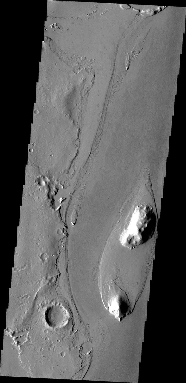
The streamlined island in this image captured by NASA 2001 Mars Odyssey spacecraft is located in the channel of Marte Vallis.
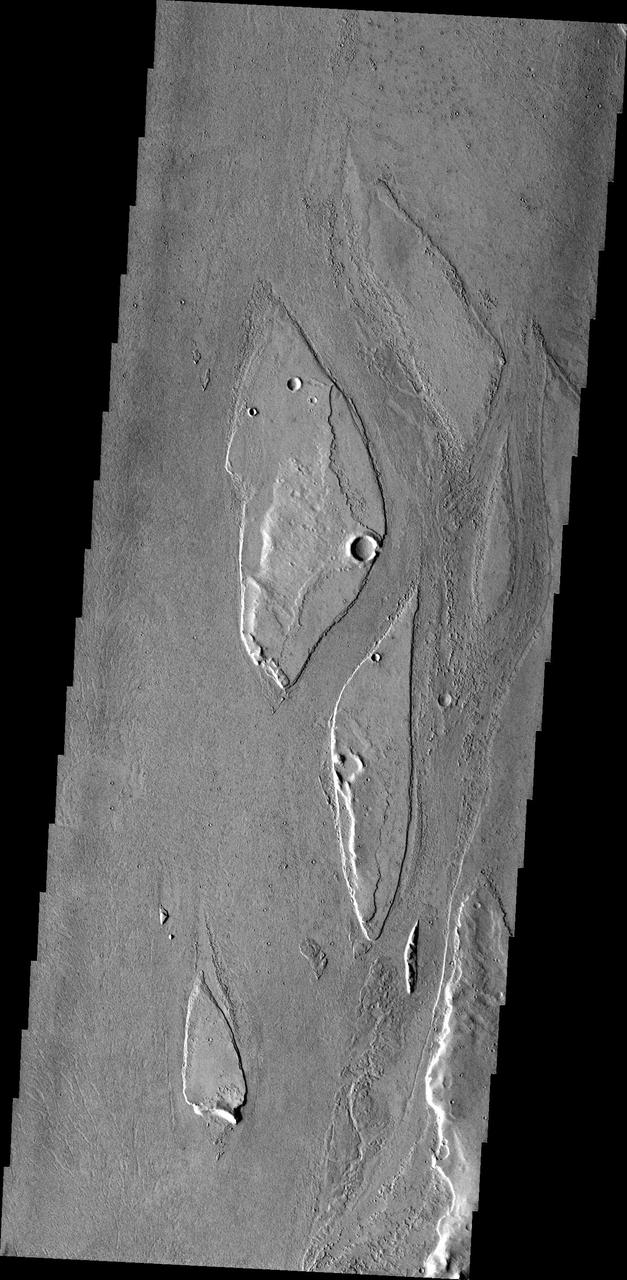
The streamlined islands in this image from NASA 2001 Mars Odyssey spacecraft are located in the channel of Marte Vallis.
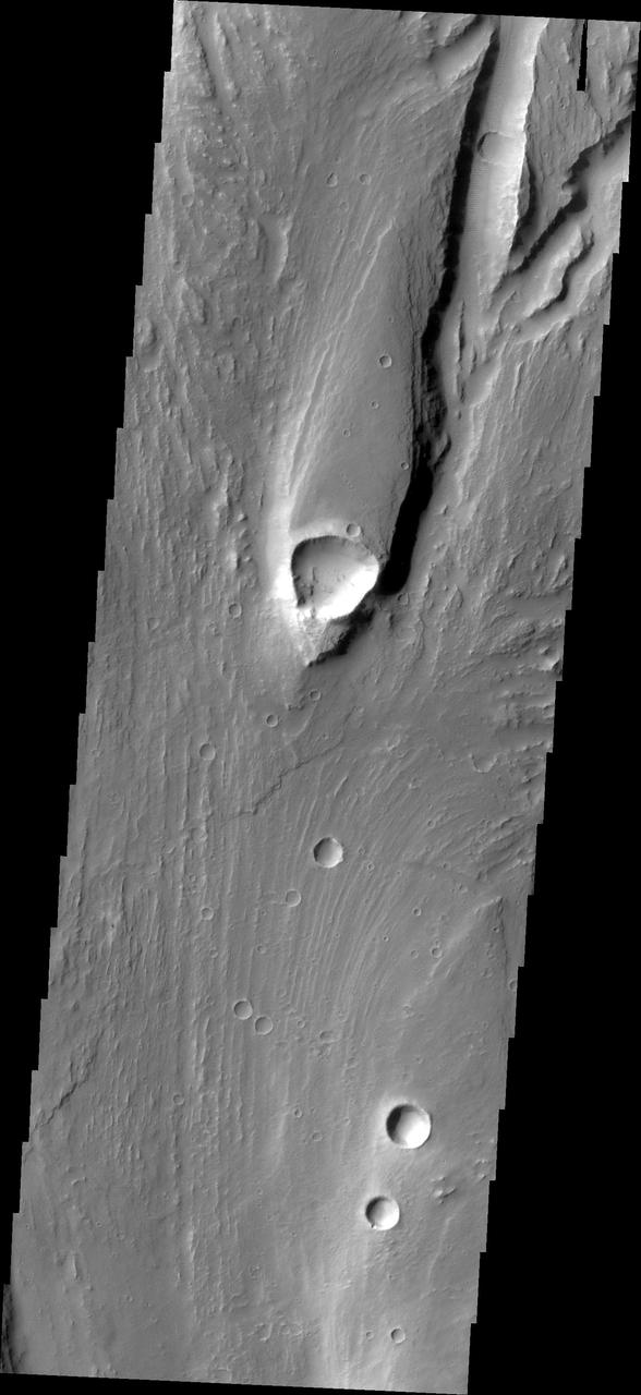
This streamlined island is located within Maja Valles was captured by NASA Mars Odyssey on July 1, 2010.

Dr. Jim Garvin, left, and Mike Ravine review flight data inbetween test flights over Crater Island, Utah as part of the DAVINCI VADIX experiment, June 24, 2026. NASA/Mike Guinto

Aside from native flora, fauna and the Langley rocket-research complex, there was not much on Wallops Island. Pictured is a 1960 photo of Launch area Number Three, used principally for Scout rocket firings. -- Photograph published in Winds of Change, 75th Anniversary NASA publication (page 73), by James Schultz.
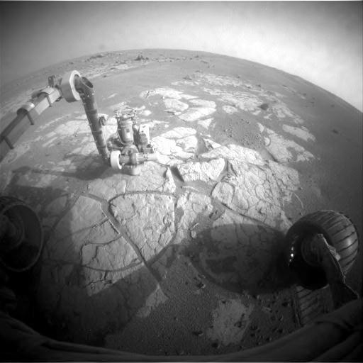
Opportunity Examining Composition of Cook Islands Outcrop

BRIAN BAE, EV41, AND JOHN EARL BROWN, U.S. ARMY, CONDUCT KENDO DEMONSTRATION AT ASIAN AMERICANS AND PACIFIC ISLANDERS MONTH CELEBRATION EVENT MAY 31.
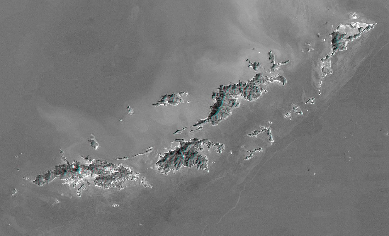
St. Thomas, St. John, Tortola, and Virgin Gorda are the four main islands lower left to upper right of this map-view anaglyph of the U.S. Virgin Islands and British Virgin Islands from NASA Shuttle Radar Topography Mission. 3D glasses are necessary.
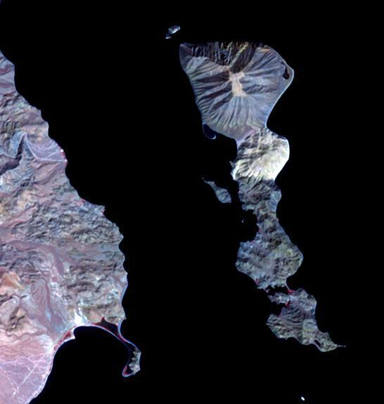
Located in the Gulf of California, Smith Island sits just off the eastern shore of Mexico's Baja Peninsula. The 7 kilometers long island is dominated by Volcan Coronado on the northern end. The uninhabited island is a refuge for a rich marine assemblage, including sea lion colonies. The image was acquired September 23, 2023, covers an area of 8.2 by 9.5 km, and is located at 29.1 degrees north, 113.5 degrees west. https://photojournal.jpl.nasa.gov/catalog/PIA26284
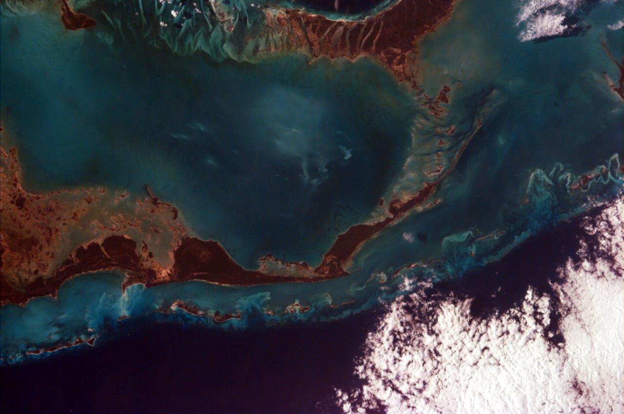
This image from NASA EarthKAM captures the tropical beauty of the major islands of the Little Bahama Bank, the most northerly of the island groups that comprise the Bahamas.
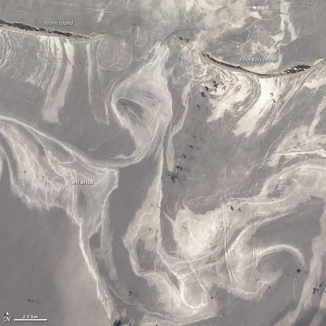
NASA image acquired June 26, 2010 As of June 27, 2010, the entire gulf-facing beachfront of several barrier islands in eastern Mississippi (offshore of Pascagoula) had received a designation of at least “lightly oiled” by the interagency Shoreline Cleanup Assessment Team that is responding to the disaster in the Gulf of Mexico. A few small stretches of Petit Bois Island had been labeled heavily or moderately oiled. (To view this image without a description go to: This high-resolution image shows Petit Bois Island (top right) and the eastern end of Horn Island (top left) on June 26. In general, oil-covered waters are silvery and cleaner waters are blue-gray. This pattern is especially consistent farther from the islands. The intensely bright patches of water directly offshore of the barrier islands, however, may be from a combination of factors, including sediment and organic material, coastal currents and surf, and oil. The islands provide a sense of scale for the ribbons of oil swirling into the area from the south. Petit Bois Island is about 10 kilometers (6 miles) long. It is one of seven barrier islands that, along with some mainland areas of Mississippi and Florida, make up the Gulf Islands National Seashore. According to the National Park Service Gulf Islands National Seashore Website, all the islands remained open to the public as of June 28, 2010, and clean-up crews were on hand to respond to any oil coming ashore. The large version of this image, which was captured by the Advanced Land Imager on NASA’s Earth Observing-1 (EO-1) satellite, shows a larger area, including the Mississippi Sound and parts of mainland Mississippi. Although oil has been observed in the Sound, it is unlikely that all the bright patches of water in that area are thickly oil-covered. Differences in brightness in coastal area waters may be due to other factors, including freshwater runoff, strong currents, and water depth and clarity. NASA Earth Observatory image created by Jesse Allen and Robert Simmon, using EO-1 ALI data provided courtesy of the NASA EO-1 team. Caption by Rebecca Lindsey. Instrument: EO-1 - ALI To see more images go to: <a href="http://earthobservatory.nasa.gov/" rel="nofollow">earthobservatory.nasa.gov/</a> <b><a href="http://www.nasa.gov/centers/goddard/home/index.html" rel="nofollow">NASA Goddard Space Flight Center</a></b> is home to the nation's largest organization of combined scientists, engineers and technologists that build spacecraft, instruments and new technology to study the Earth, the sun, our solar system, and the universe.
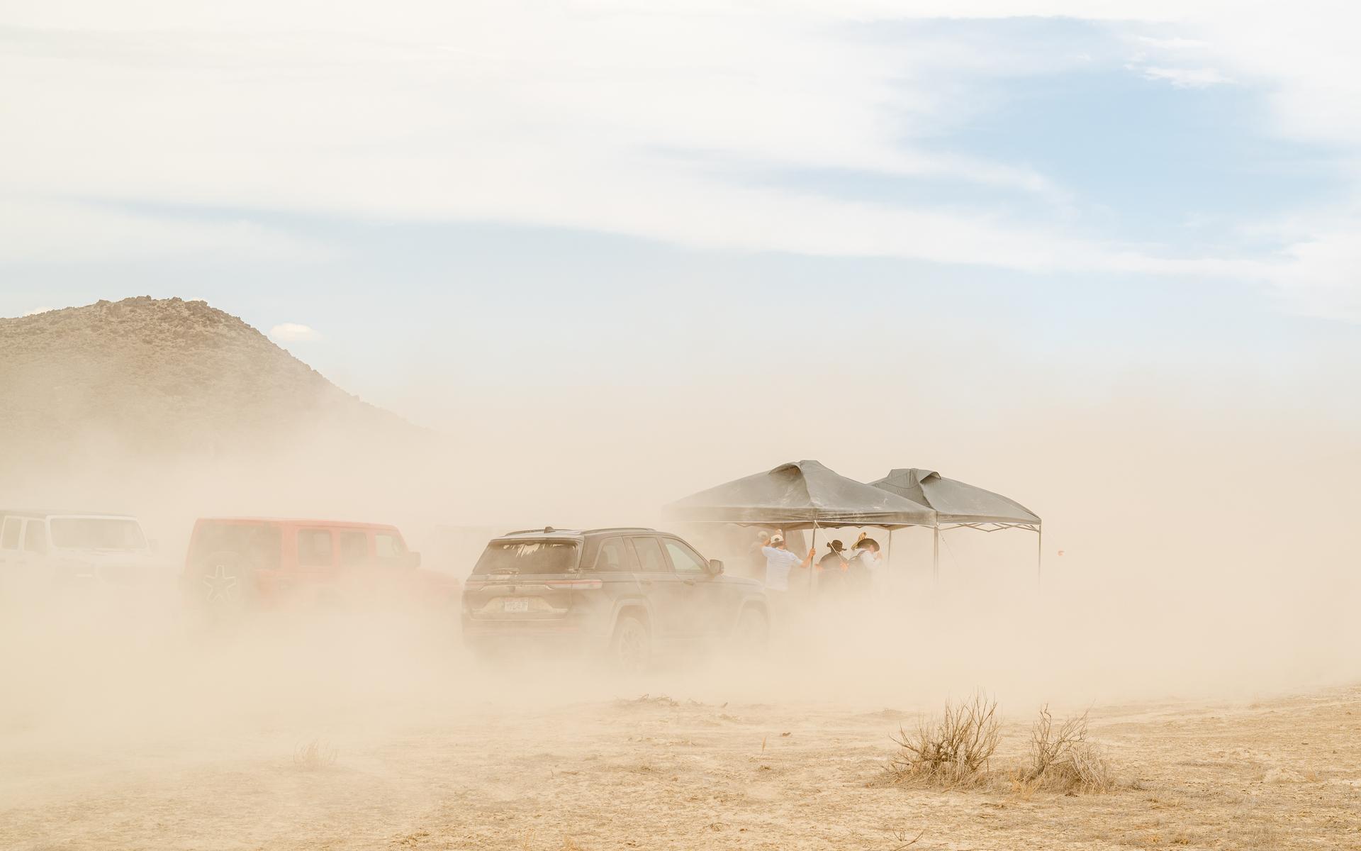
A strong wind kicks up a lot of dirt around the DAVINCI VADIX basecamp at Crater Island, Utah, June 24, 2026. This area was the site of a series of tests (June 23-25, 2026) of the camera system that will one day fly aboard NASA’s DAVINCI mission to Venus. NASA/Mike Guinto
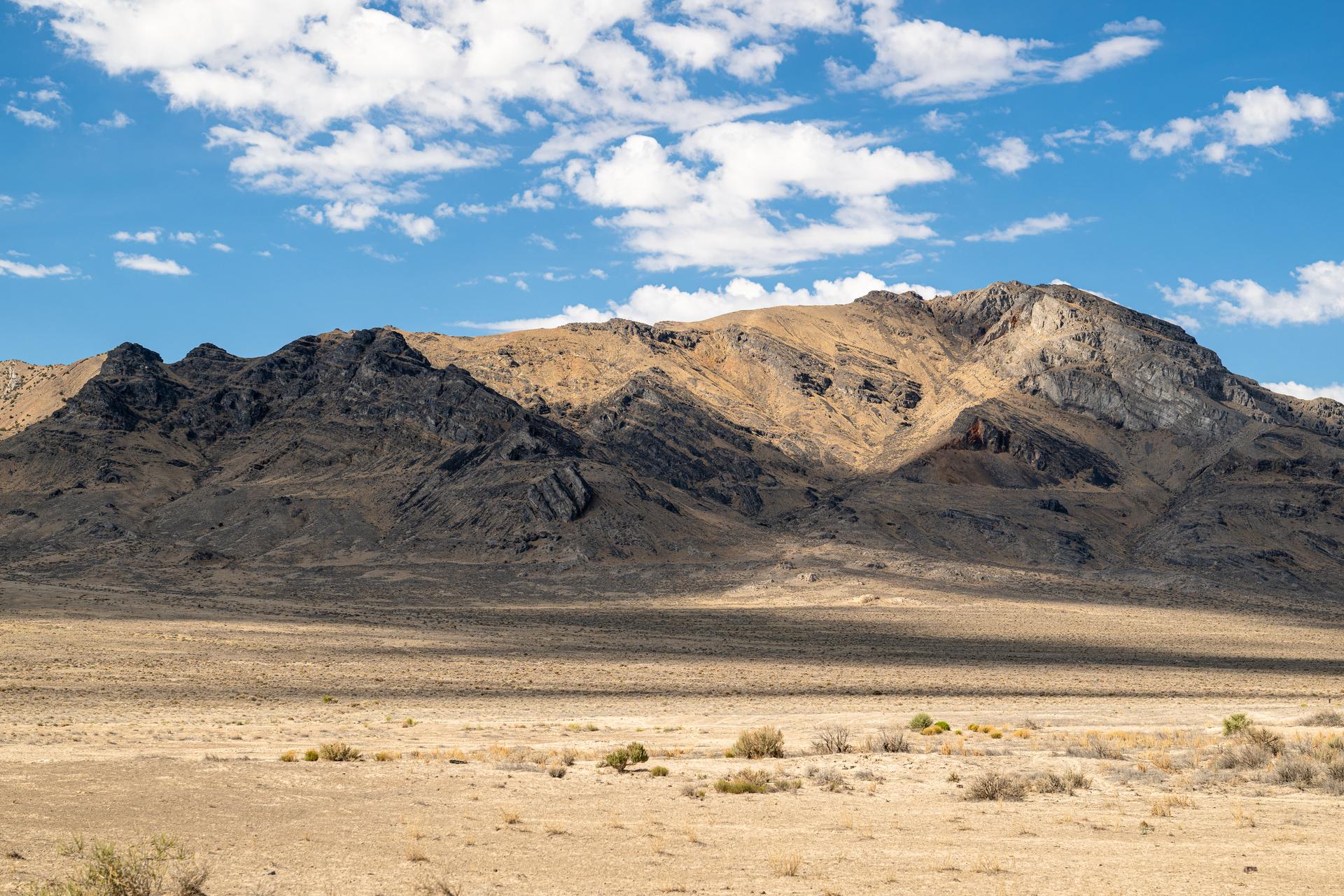
A view from the DAVINCI VADIX Basecamp near Crater Island, Utah, June 25, 2026. This area was the site of a series of tests (June 23-25, 2026) of the camera system that will one day fly aboard NASA’s DAVINCI mission to Venus. NASA/Mike Guinto
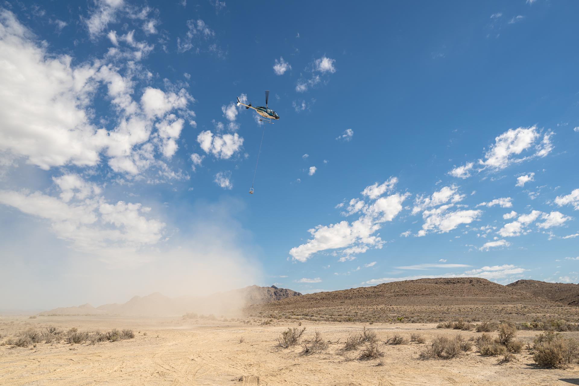
A helicopter flying in U.S. Air Force restricted space over Crater Island, Utah, carrying a basket of nine instruments during a series of tests (June 23-25, 2026) of a prototype of the camera system that will one day fly aboard NASA’s DAVINCI probe to Venus. NASA/Mike Guinto
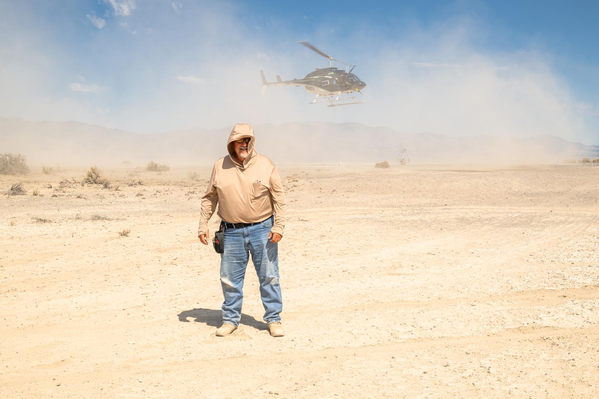
Mike Vitulio, a NASA mechanical integration engineering technician and machinist working on the DAVINCI project poses stands with his back to the helicopter as it takes off to shield himself from the roto-wash at Crater Island, Utah, June 25, 2026. NASA/Mike Guinto
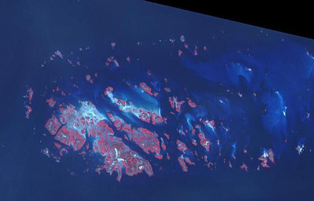
Chausey is a group of small islands and islets off the coast of Normandy and is part of the French Channel Islands. Chausey bounced back and forth between England and France for 800 years before finally officially belonging to France in the 19th century. The archipelago comprises 365 islands at low tide (2019 image), compared to only 52 islands at high tide (2018 image). The images were acquired July 7, 2018 and September 10, 2019, cover an area of 6.7 by 10.5 km, and are located at 48.9 degrees north, 1.8 degrees west. With its 14 spectral bands from the visible to the thermal infrared wavelength region and its high spatial resolution of about 50 to 300 feet (15 to 90 meters), ASTER images Earth to map and monitor the changing surface of our planet. ASTER is one of five Earth-observing instruments launched Dec. 18, 1999, on Terra. The instrument was built by Japan's Ministry of Economy, Trade and Industry. A joint U.S./Japan science team is responsible for validation and calibration of the instrument and data products. The broad spectral coverage and high spectral resolution of ASTER provides scientists in numerous disciplines with critical information for surface mapping and monitoring of dynamic conditions and temporal change. Example applications are monitoring glacial advances and retreats; monitoring potentially active volcanoes; identifying crop stress; determining cloud morphology and physical properties; wetlands evaluation; thermal pollution monitoring; coral reef degradation; surface temperature mapping of soils and geology; and measuring surface heat balance. https://photojournal.jpl.nasa.gov/catalog/PIA25800
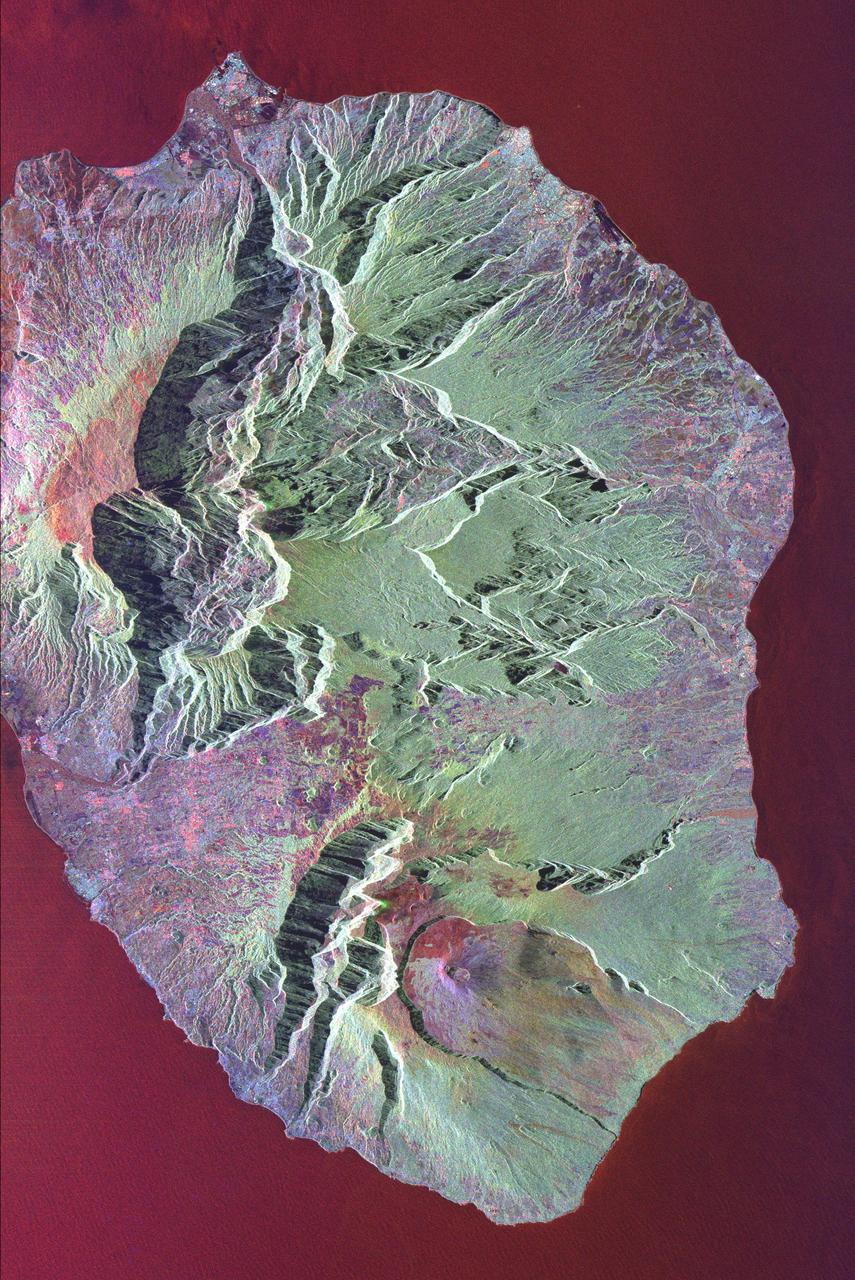
This radar image shows the volcanic island of Reunion, about 700 km 434 miles east of Madagascar in the southwest Indian Ocean. The southern half of the island is dominated by the active volcano, Piton de la Fournaise.
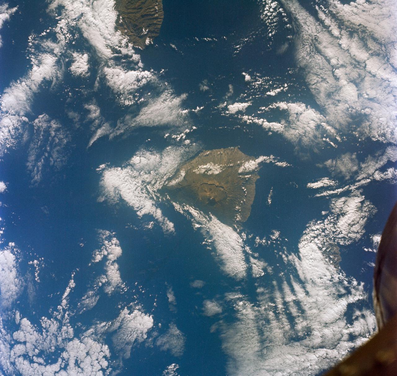
S65-63150 (16 Dec. 1965) --- Eddies in stratocumulus clouds over the Canary Islands as seen from the Gemini-6 spacecraft during its 14th revolution of Earth. Photo credit: NASA or National Aeronautics and Space Administration

The Thurston Island calving front off of western Antarctica as seen from the window of NASA's DC-8 on Nov. 5, 2014. Image Credit: NASA/Jim Yungel NASA’s Operation IceBridge collected some rare images on a flight out of Punta Arenas, Chile on Nov. 5, 2014, on a science flight over western Antarctica dubbed Ferrigno-Alison-Abbott 01. The crew snapped a few shots of a calving front of the Antarctic ice sheet. This particular flight plan was designed to collect data on changes in ice elevation along the coast near the Ferrigno and Alison ice streams, on the Abbot Ice Shelf, and grounded ice along the Eights Coast.

Snow is blown off of the Thurston Island calving front off of western Antarctica as seen on the IceBridge flight on Nov. 5, 2014. Image Credit: NASA/Jim Yungel NASA’s Operation IceBridge collected some rare images on a flight out of Punta Arenas, Chile on Nov. 5, 2014, on a science flight over western Antarctica dubbed Ferrigno-Alison-Abbott 01. The crew snapped a few shots of a calving front of the Antarctic ice sheet. This particular flight plan was designed to collect data on changes in ice elevation along the coast near the Ferrigno and Alison ice streams, on the Abbot Ice Shelf, and grounded ice along the Eights Coast.
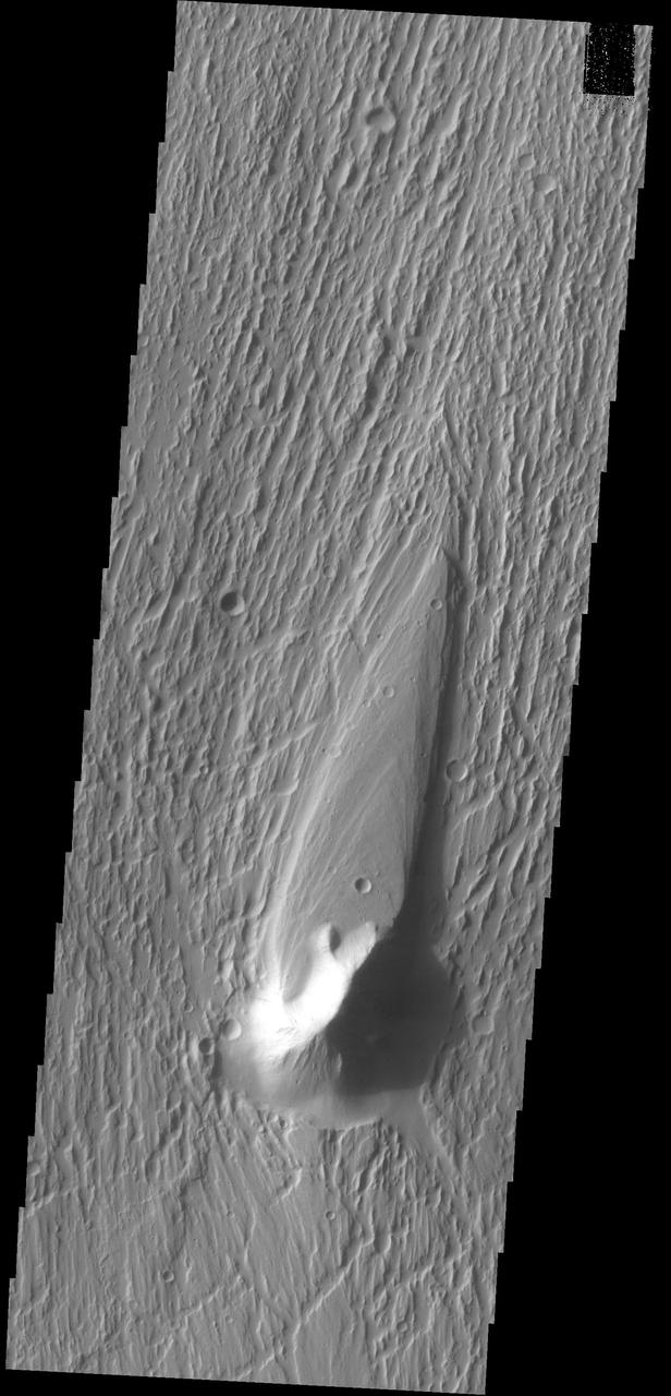
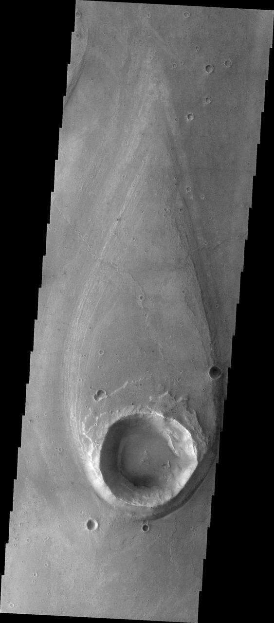
This image captured by NASA 2001 Mars Odyssey spacecraft shows a streamlined island in Kasei Valles. The teardrop shape indicates that flow was from the bottom to the top of the image.
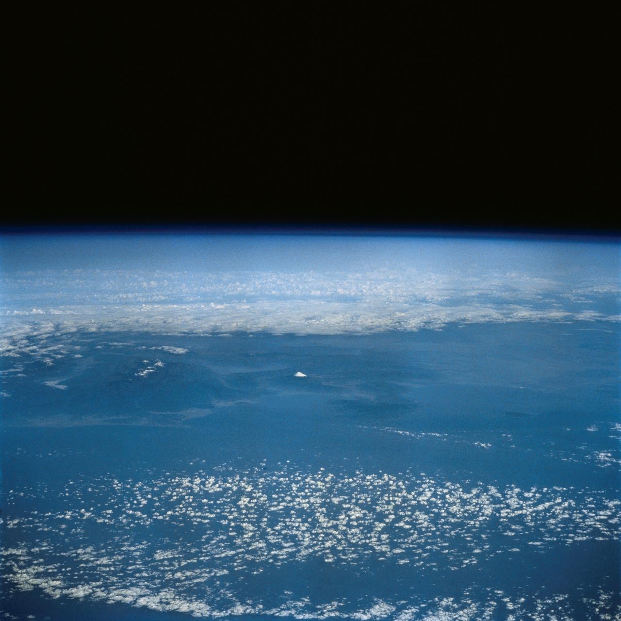
This distant view of Mt. Fuji, on the main home island of Honshu, Japan (34.0N, 139.0E) was taken from about 450 miles to the south. Evan at that great distance, the majestic and inspiring Mt. Fuji is still plainly visible and easily recognized as a world renowned symbol of Japan. The snow capped extinct volcano lies just a few miles south of Tokyo.