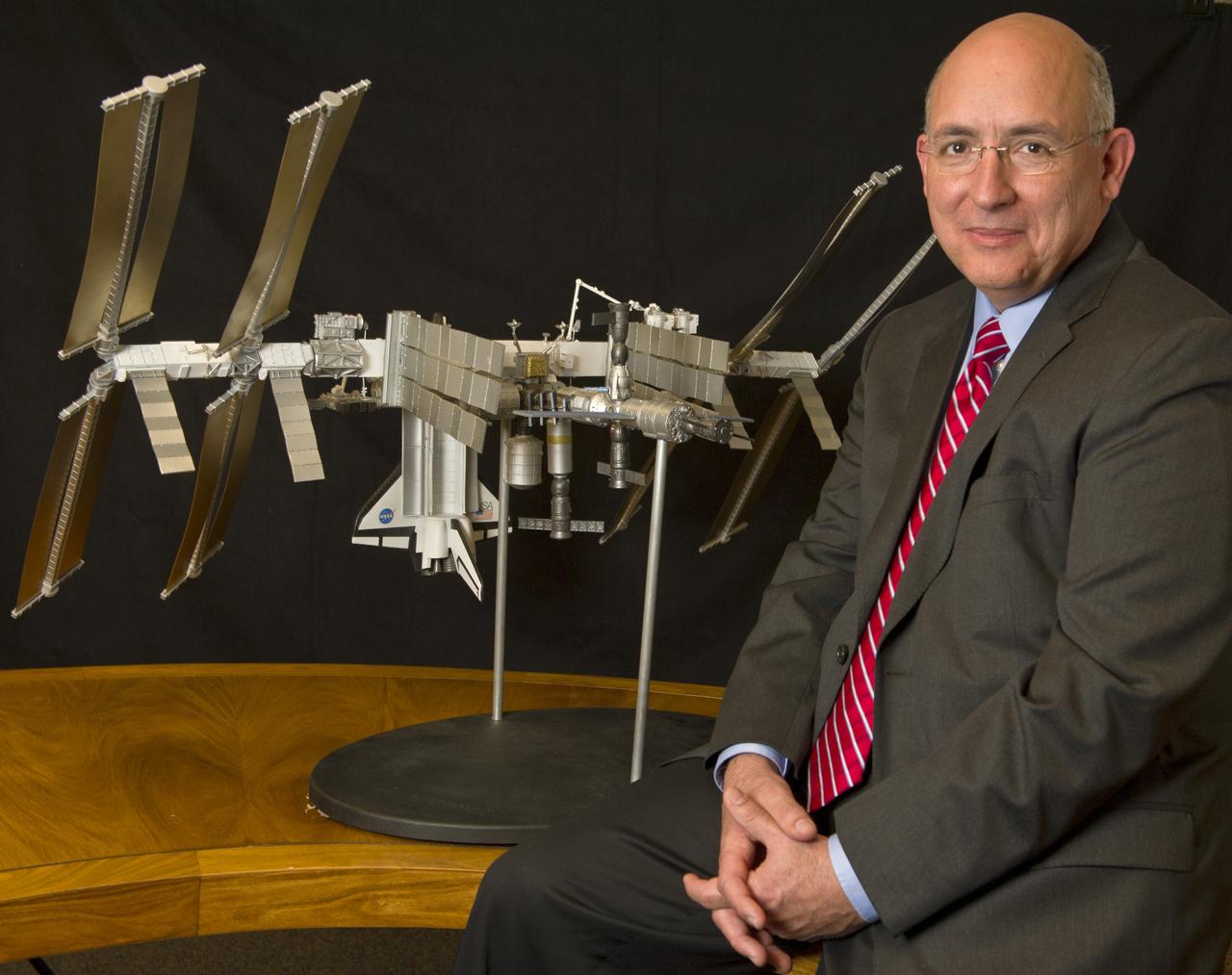
Michael Suffredini, Manager, International Space Station (ISS) Program, is seen with a scale model of the International Space Station at NASA Headquarters in Washington, Friday, Jan. 14, 2011, . Photo Credit: (NASA/Paul E. Alers)
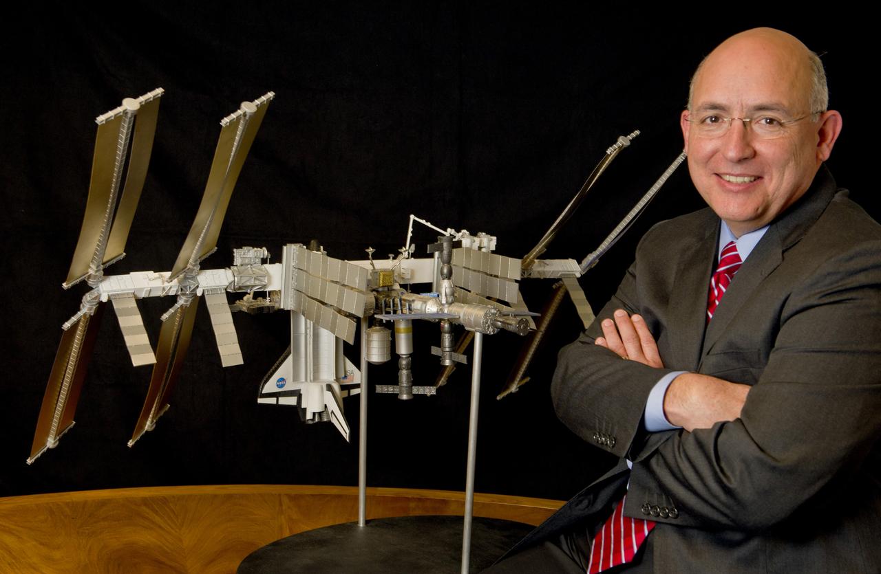
Michael Suffredini, Manager, International Space Station (ISS) Program, is seen, Friday, Jan. 14, 2011, with a scale model of the International Space Station at NASA Headquarters in Washington. Photo Credit: (NASA/Paul E. Alers)
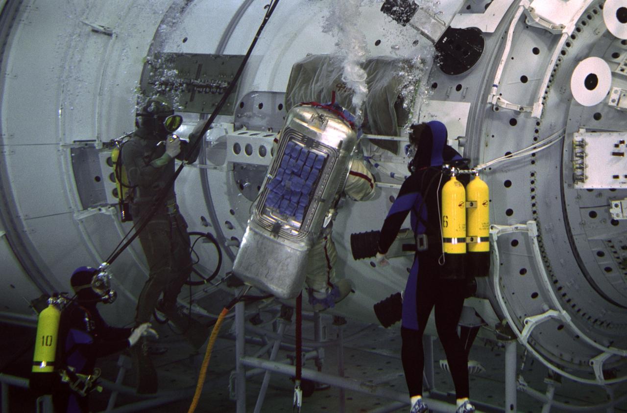
JSC2000-05367 (7 June 2000) --- Astronaut William Shepherd, ISS Expedition One commander, rehearses an extravehicular activity (EVA) with a full scale training model of the Zvezda Service Module in the Hydrolab facility at the Gagarin Cosmonaut Training Center in Russia. SCUBA-equipped divers assist in the spacewalk rehearsal.
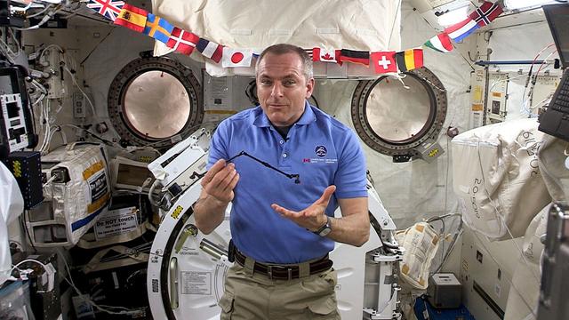
jsc2019e052832 (5/15/2019) — Canadian Space Agency (CSA) astronaut David Saint-Jacques speaks to students about space robotics, using a 1:50 scale model of Canadarm2 aboard the International Space Station (ISS). Image courtesy of: CSA
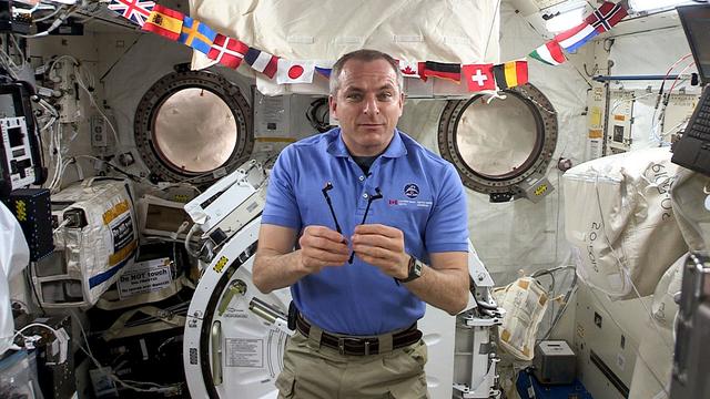
jsc2019e052833 (5/15/2019) — Canadian Space Agency (CSA) astronaut David Saint-Jacques speaks to students about space robotics, using a 1:50 scale model of Canadarm2 aboard the International Space Station (ISS). Image courtesy of: CSA
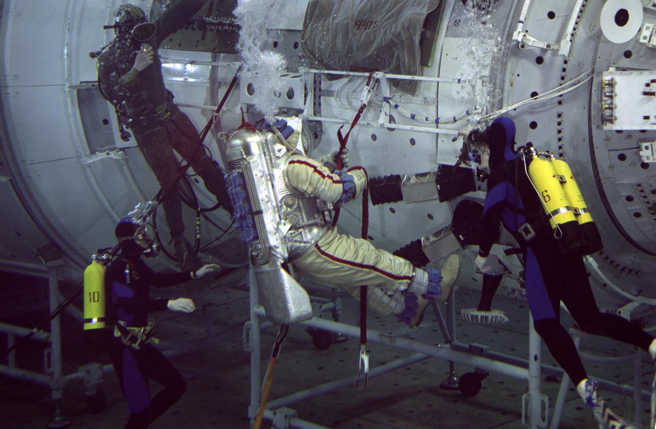
JSC2000-05368 (7 June 2000) --- Astronaut William Shepherd, ISS Expedition One commander, rehearses an extravehicular activity (EVA) with a full scale training model of the Zvezda Service Module in the Hydrolab facility at the Gagarin Cosmonaut Training Center in Russia. SCUBA-equipped divers assist in the spacewalk rehearsal, which also included cosmonaut Yuri Gidzenko, Soyuz commander, who is out of frame here.
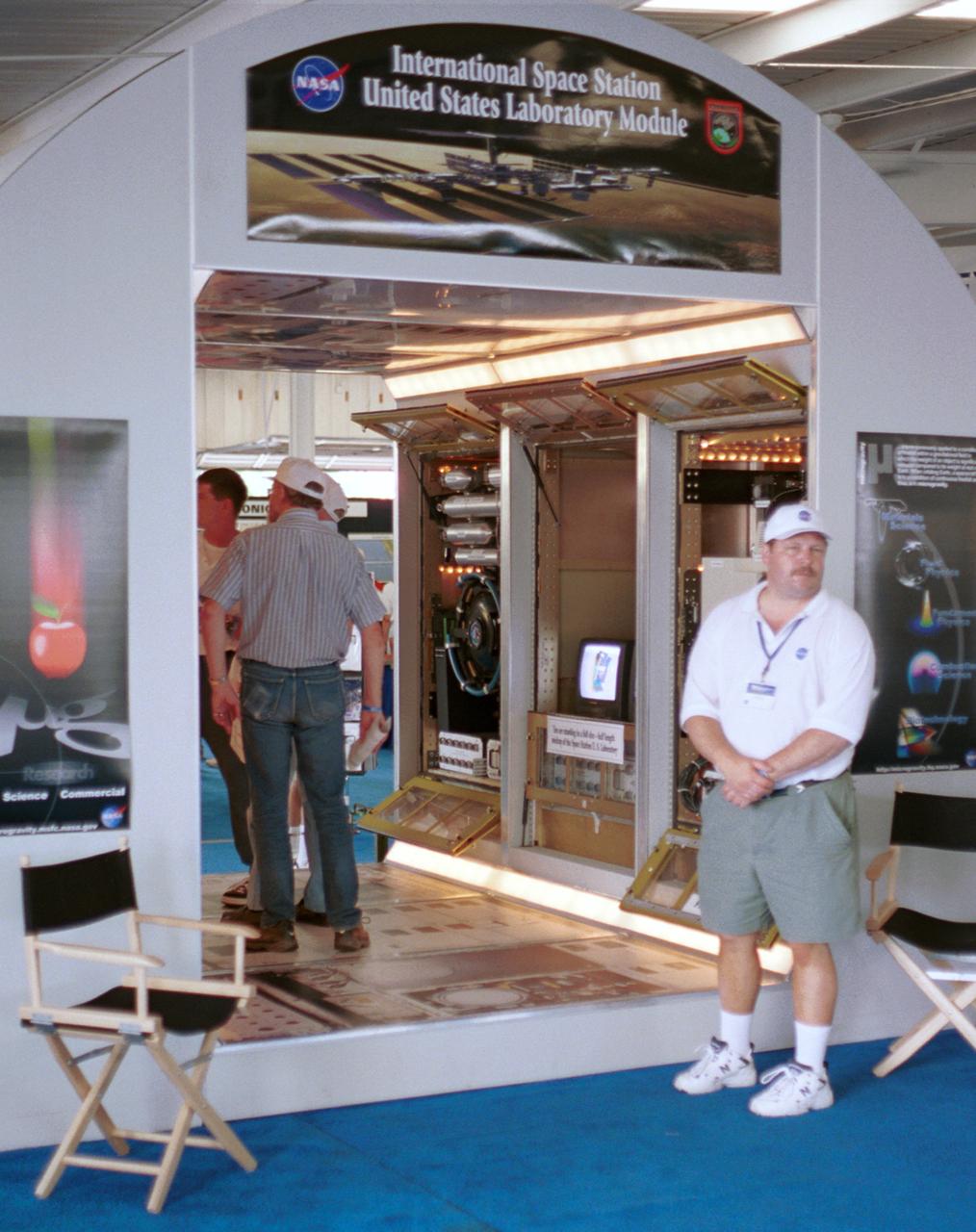
Thomas Turk, an engineer with NASA's Glenn Research Center, waits for more visitors at a mockup of part of Destiny, the U.S. laboratory module that will be attached to the International Space Station (ISS) in Year 2001. Visible behind Turk are engineering models of the three racks that will make up the Fluids and Combustion Facility (FCF) in the module. The mockup is full scale, although Destiny will be twice as long to accomodate six experiment racks along each side. The exhibit was part of the NASA outreach activity at AirVenture 2000 sponsored by the Expeprimental Aircraft Association in Oshkosh, WI.
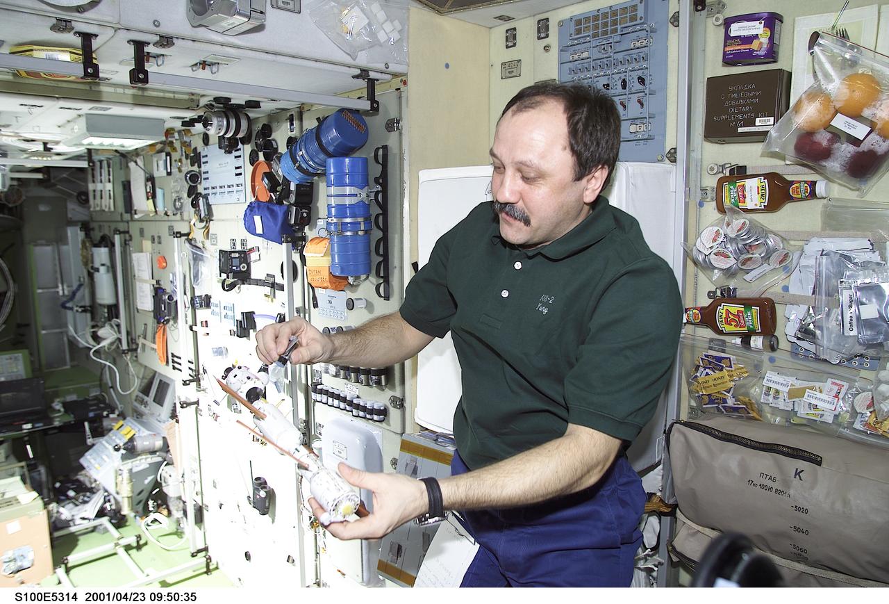
S100-E-5314 (23 April 2001) --- Cosmonaut Yury V. Usachev, Expedition Two commander, holds a small-scale model of the International Space Station (ISS) that crewmembers use for planning purposes. A representative of Rosaviakosmos, Usachev is joined by two astronauts for the second occupancy of the orbital outpost. This scene in the Zvezda Service Module was recorded with a digital still camera by one of the STS-100 crew members who are visiting the station to accomplish a large variety of additions and improvements.
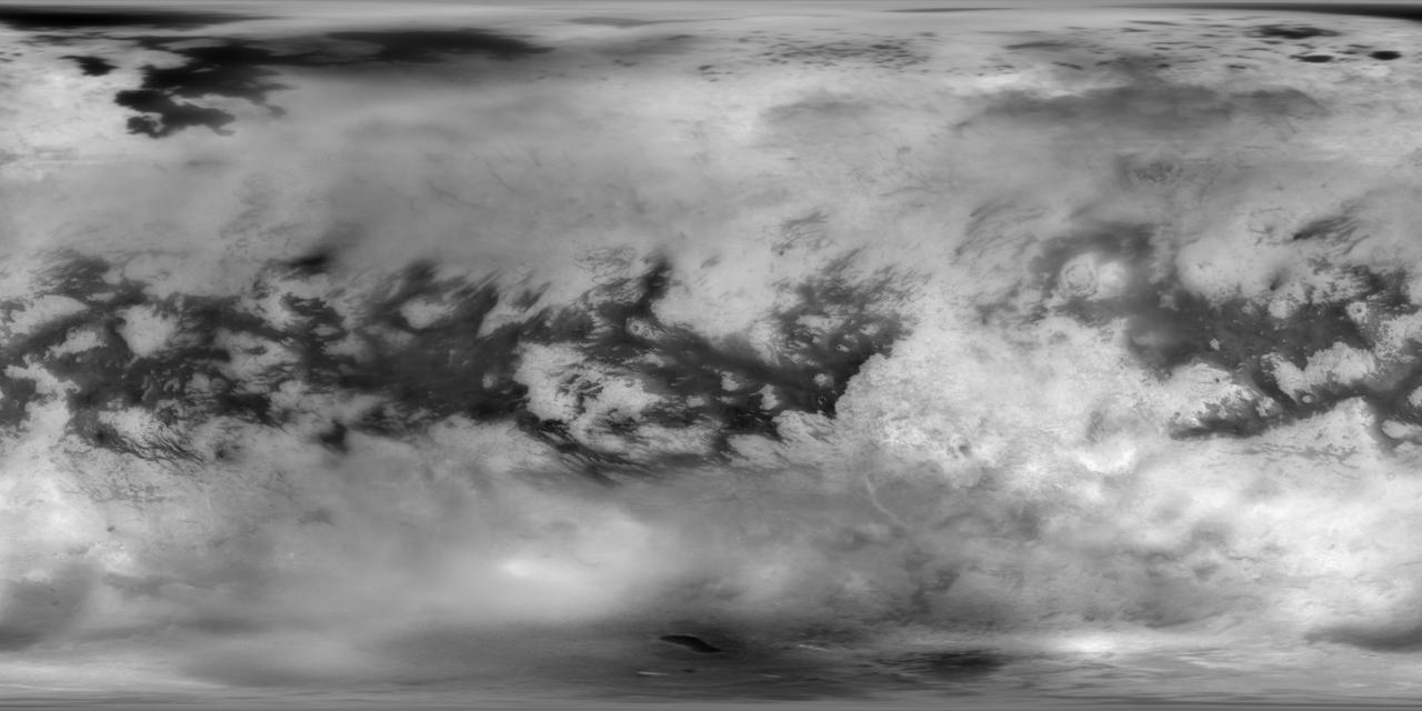
This Cassini Imaging Science Subsystem (ISS) global mosaic of Titan's surface brightness in the near-infrared at 938 nm wavelength shows the distribution of Titan's wide variety of landforms, from the vast equatorial sand seas to the high-latitude lakes and seas of liquid hydrocarbons. To generate this mosaic, 9,873 separate ISS images taken over more than 13 years of NASA's Cassini spacecraft operations at Saturn have been combined. Averaging such a large number of images dramatically improves how well surface features can be seen. A new photometric analysis method, with more accurate radiative transfer models of Titan's haze, allows spatial and temporal atmospheric and instrumental variations to be accounted for. This technique makes it possible to generate a mosaic without image seams that provides calibrated normal albedos. The image scale is 16 pixels per degree or 2.8 km in latitude. The new image is an update to the previous version of the ISS imaging map of Titan. The most recent version was published in 2015. https://photojournal.jpl.nasa.gov/catalog/PIA22770
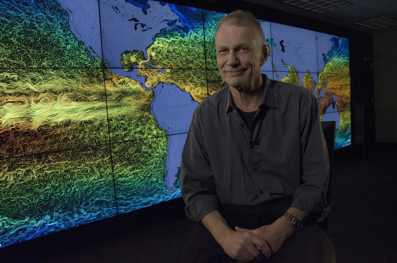
Piers Sellers is currently Deputy Director of the Sciences and Exploration Directorate and Acting Director of the Earth Sciences Division at NASA/GSFC. He was born and educated in the United Kingdom and moved to the U.S. in 1982 to carry out climate research at NASA/GSFC. From 1982 to 1996, he worked on global climate problems, particularly those involving interactions between the biosphere and the atmosphere, and was involved in constructing computer models of the global climate system, satellite data interpretation and conducting large-scale field experiments in the USA, Canada, Africa, and Brazil. He served as project scientist for the first large Earth Observing System platform, Terra, launched in 1998. He joined the NASA astronaut corps in 1996 and flew to the International Space Station (ISS) in 2002, 2006, and 2010, carrying out six spacewalks and working on ISS assembly tasks. He returned to Goddard Space Flight Center in June, 2011. Credit: NASA/Goddard/Rebecca Roth <b><a href="http://www.nasa.gov/audience/formedia/features/MP_Photo_Guidelines.html" rel="nofollow">NASA image use policy.</a></b> <b><a href="http://www.nasa.gov/centers/goddard/home/index.html" rel="nofollow">NASA Goddard Space Flight Center</a></b> enables NASA’s mission through four scientific endeavors: Earth Science, Heliophysics, Solar System Exploration, and Astrophysics. Goddard plays a leading role in NASA’s accomplishments by contributing compelling scientific knowledge to advance the Agency’s mission. <b>Follow us on <a href="http://twitter.com/NASAGoddardPix" rel="nofollow">Twitter</a></b> <b>Like us on <a href="http://www.facebook.com/pages/Greenbelt-MD/NASA-Goddard/395013845897?ref=tsd" rel="nofollow">Facebook</a></b> <b>Find us on <a href="http://instagrid.me/nasagoddard/?vm=grid" rel="nofollow">Instagram</a></b>
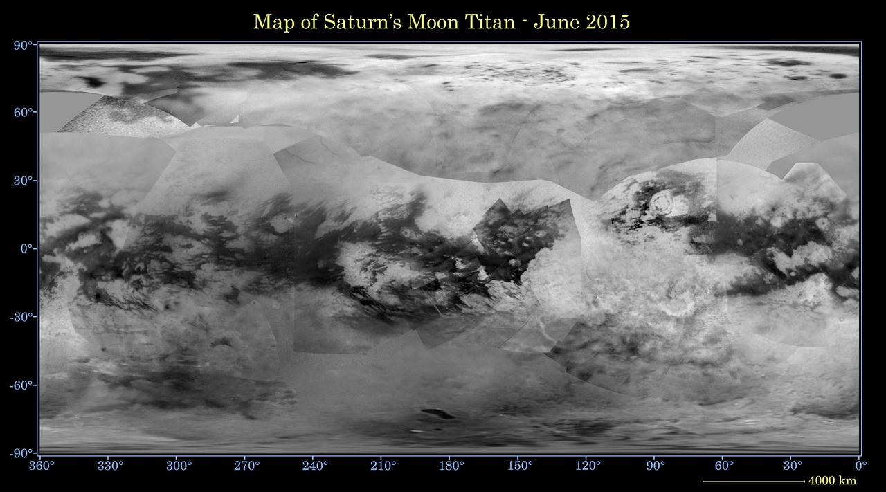
This global digital map of Saturn's moon Titan was created using images taken by NASA's Cassini spacecraft's imaging science subsystem (ISS). The map was produced in June 2015 using data collected through Cassini's flyby on April 7, 2014, known as "T100." The images were taken using a filter centered at 938 nanometers, allowing researchers to examine variations in albedo (or inherent brightness) across the surface of Titan. Because of the scattering of light by Titan's dense atmosphere, no topographic shading is visible in these images. The map is an equidistant projection and has a scale of 2.5 miles (4 kilometers) per pixel. Actual resolution varies greatly across the map, with the best coverage (close to the map scale) along the equator near the center of the map at 180 degrees west longitude. The lowest resolution coverage can be seen in the northern mid-latitudes on the sub-Saturn hemisphere. Mapping coverage in the northern polar region has greatly improved since the previous version of this map in 2011 (see PIA14908). Large dark areas, now known to be liquid-hydrocarbon-filled lakes and seas, have since been documented at high latitudes. Titan's north pole was not well illuminated early in Cassini's mission, because it was winter in the northern hemisphere when the spacecraft arrived at Saturn. Cassini has been better able to observe northern latitudes in more recent years due to seasonal changes in solar illumination. This map is an update to the previous versions released in April 2011 and February 2009 (see PIA11149). Data from the past four years (the most recent data in the map is from April 2014) has completely filled in missing data in the north polar region and replaces the earlier imagery of the Xanadu region with higher quality data. A data gap of about 3 to 5 percent of Titan's surface still remains, located in the northern mid-latitudes on the sub-Saturn hemisphere of Titan. The uniform gray area in the northern hemisphere indicates a gap in the imaging coverage of Titan's surface, to date. The missing data will be imaged by Cassini during flybys on December 15, 2016 and March 5, 2017. The mean radius of Titan used for projection of this map is 1,600 miles (2,575 kilometers). Titan is assumed to be spherical until a control network -- a model of the moon's shape based on multiple images tied together at defined points on the surface -- is created at some point in the future. http://photojournal.jpl.nasa.gov/catalog/PIA19658