Iani Chaos
Iani Chaos
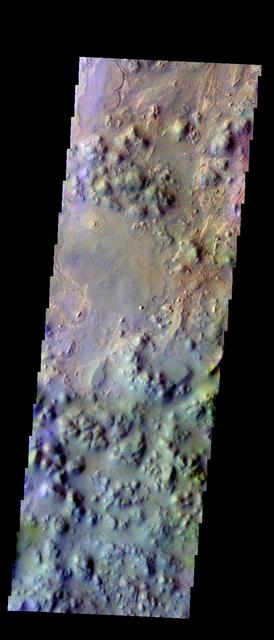
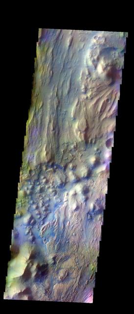
The THEMIS VIS camera contains 5 filters. The data from different filters can be combined in multiple ways to create a false color image. These false color images may reveal subtle variations of the surface not easily identified in a single band image. Today's false color image shows part of Iani Chaos. Orbit Number: 44854 Latitude: -0.717905 Longitude: 342.194 Instrument: VIS Captured: 2012-01-24 11:21 http://photojournal.jpl.nasa.gov/catalog/PIA21165
Aram and Iani Chaos
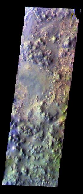
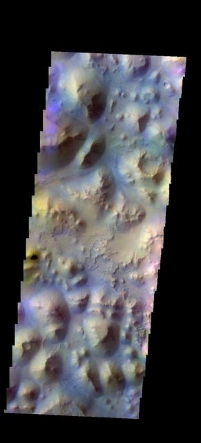
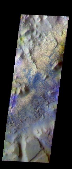
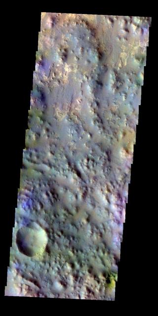
Iani Chaos in False Color
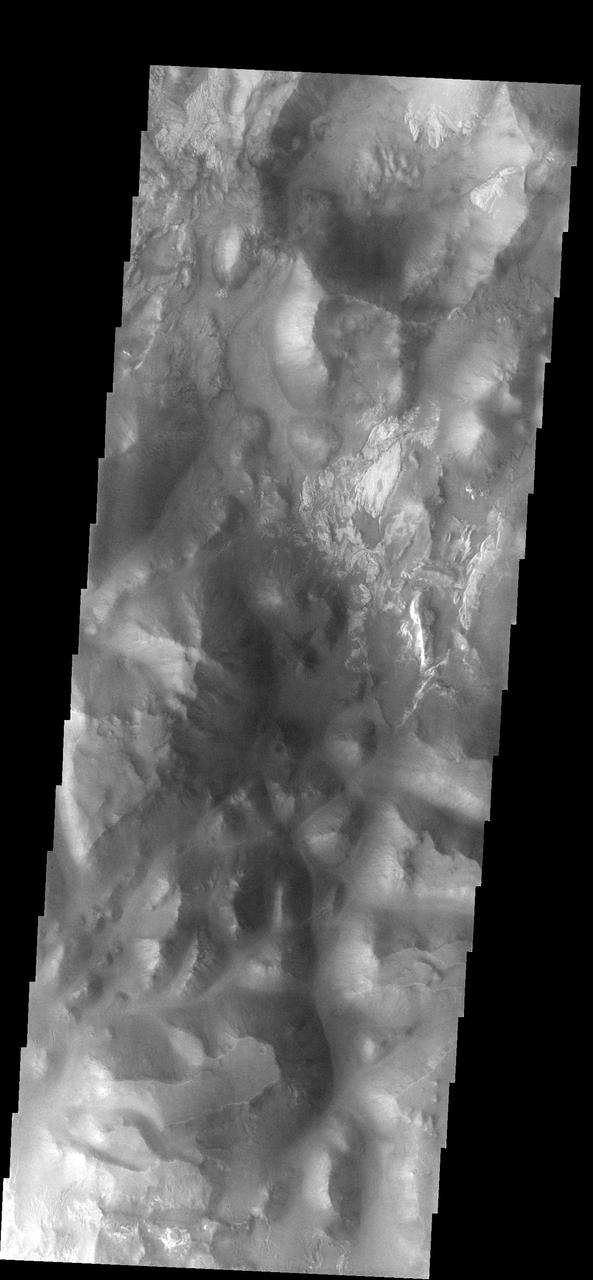
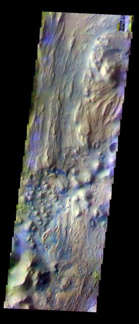
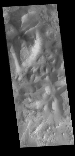
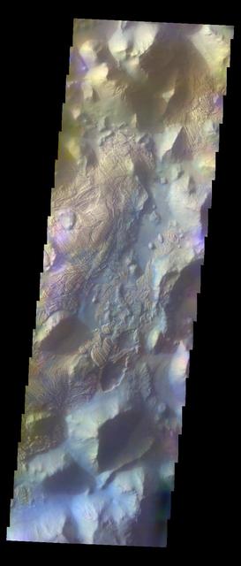
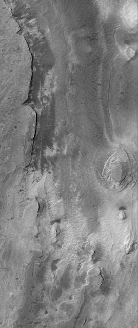
Continuing Through Iani Chaos
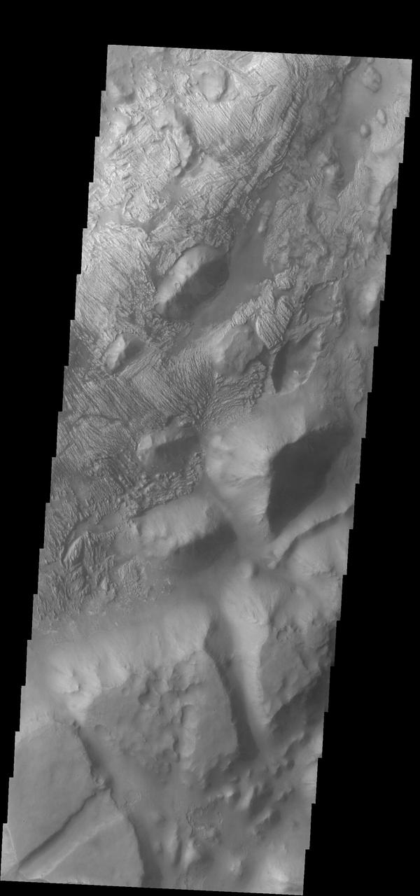
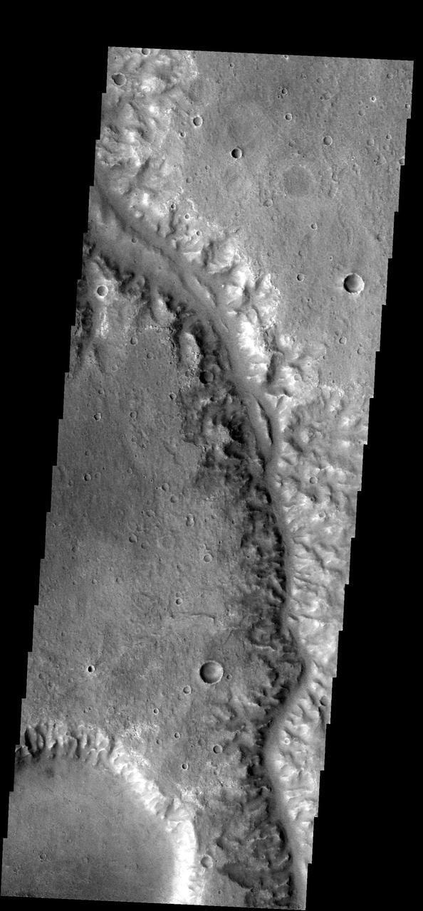
Ares Vallis/Iani Chaos Border
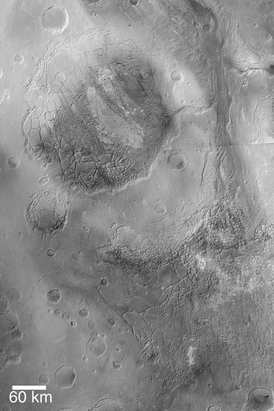
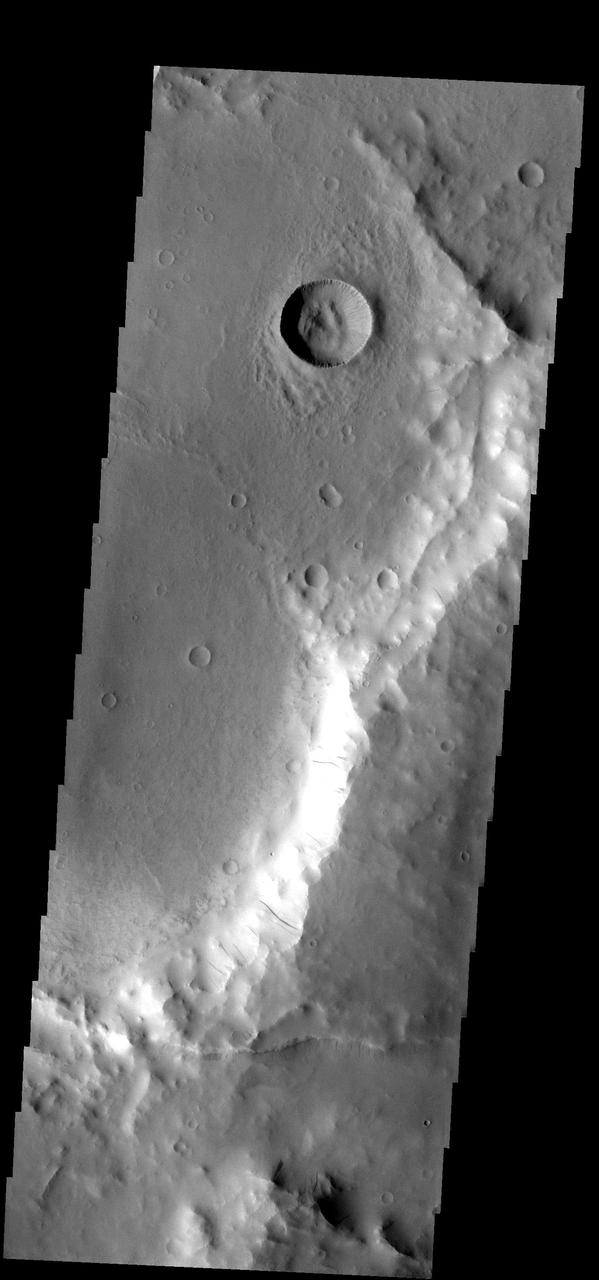
This image captured by NASA 2001 Mars Odyssey shows a portion of Iani Chaos.
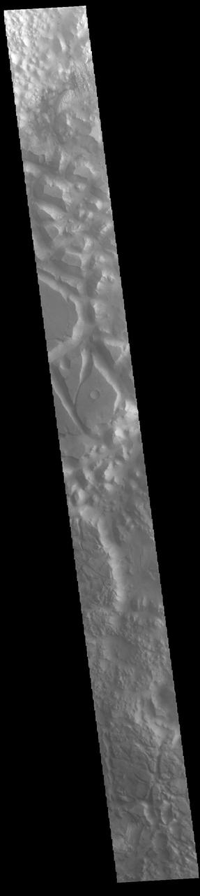
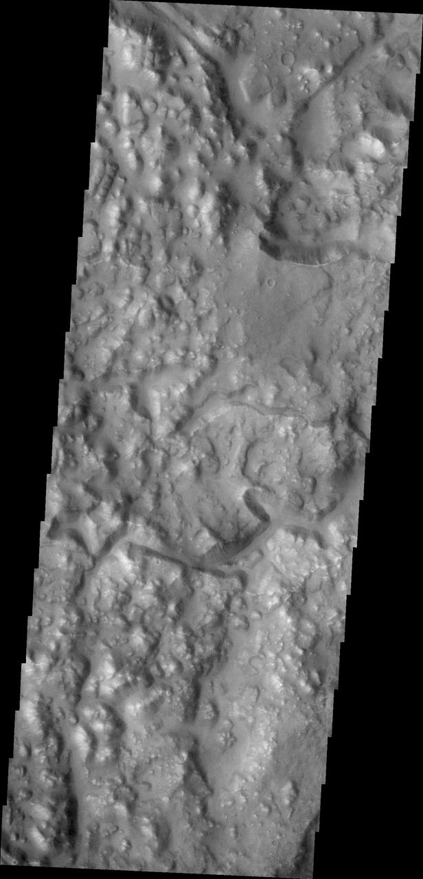
Today's VIS image shows part of Iani Chaos. Chaos terrain is typified by mesas and valleys. The initial breakup of the land is due to tectonic forces. With time and erosion the valleys widen and the mesas grow smaller. This image shows a cross section of Iani Chaos and the different scales of the mesas are readily visible. Orbit Number: 85965 Latitude: -2.34566 Longitude: 341.408 Instrument: VIS Captured: 2021-05-01 15:58 https://photojournal.jpl.nasa.gov/catalog/PIA24213
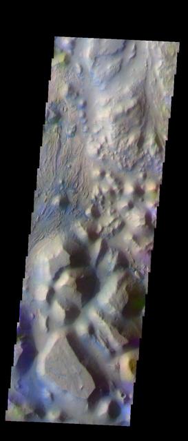
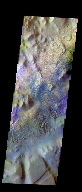
Iani Chaos - Another View In False Color
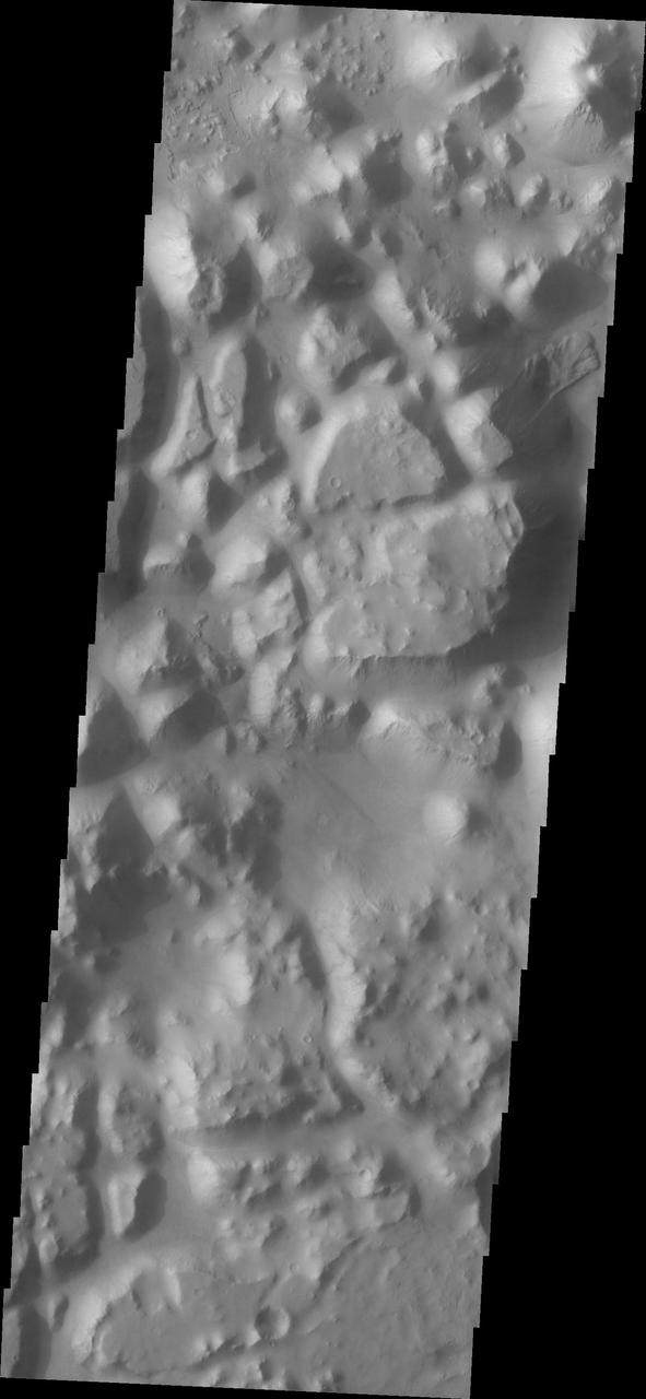
Several different surface textures are present on the lower elevations of Iani Chaos in this image from NASA 2001 Mars Odyssey spacecraft.
This image captured by NASA 2001 Mars Odyssey spacecraft shows a small portion of Iani Chaos. The brighter floor material is being covered by sand, probably eroded from the mesas of the Chaos.
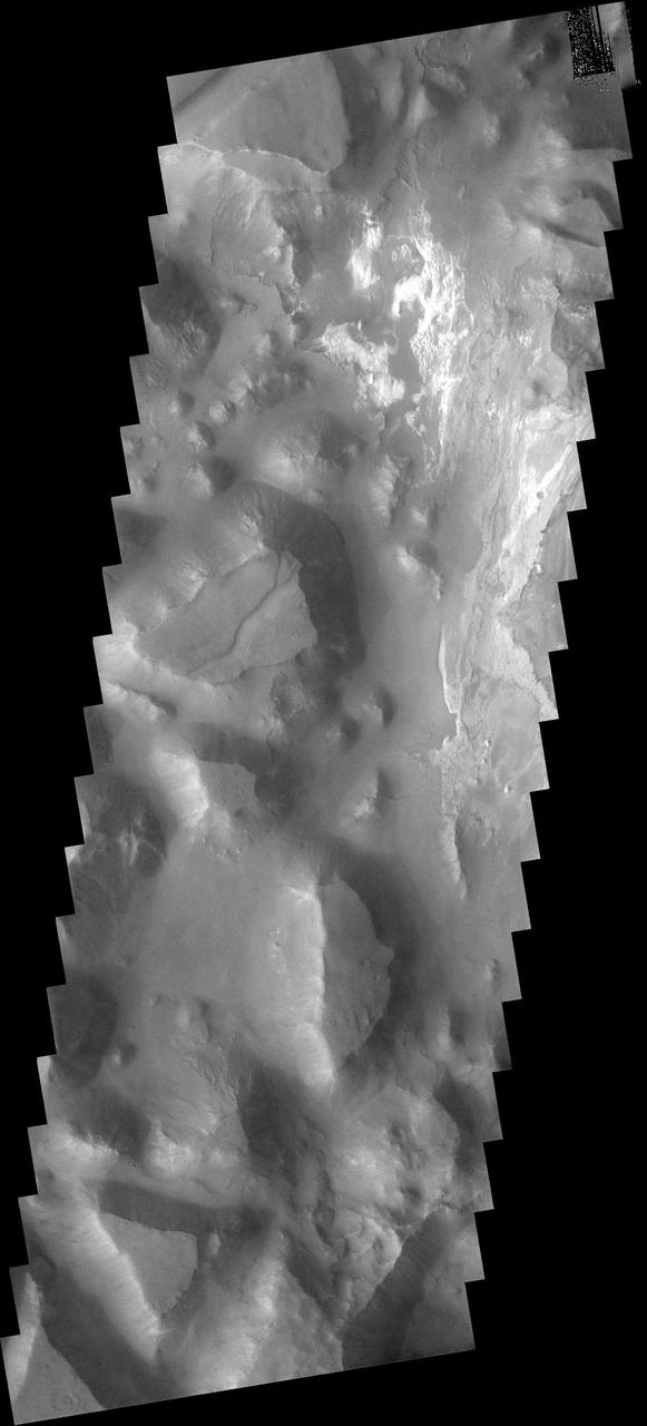
Today's VIS image shows part of Iani Chaos. Chaos terrain is typified by mesas and valleys. The initial breakup of the land is due to tectonic forces. With time and erosion the valleys widen and the mesas grow smaller. Layers of material are visible at the bottom of the image, the source of the material is likely the erosion of the nearby mesas. Orbit Number: 82109 Latitude: -1.1598 Longitude: 341.797 Instrument: VIS Captured: 2020-06-18 04:07 https://photojournal.jpl.nasa.gov/catalog/PIA24124
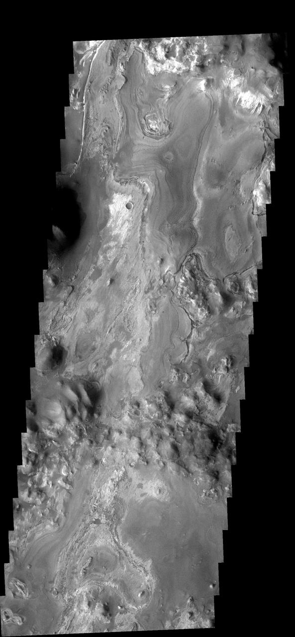
This VIS image captured by NASA 2001 Mars Odyssey spacecraft of Iani Chaos shows the layered deposit that occurs on the floor. It appears that the layers were deposited after the chaos was formed. Image information: VIS instrument. Latitude 2.3S, Longitude 342.3E. 17 meter/pixel resolution. http://photojournal.jpl.nasa.gov/catalog/PIA03200
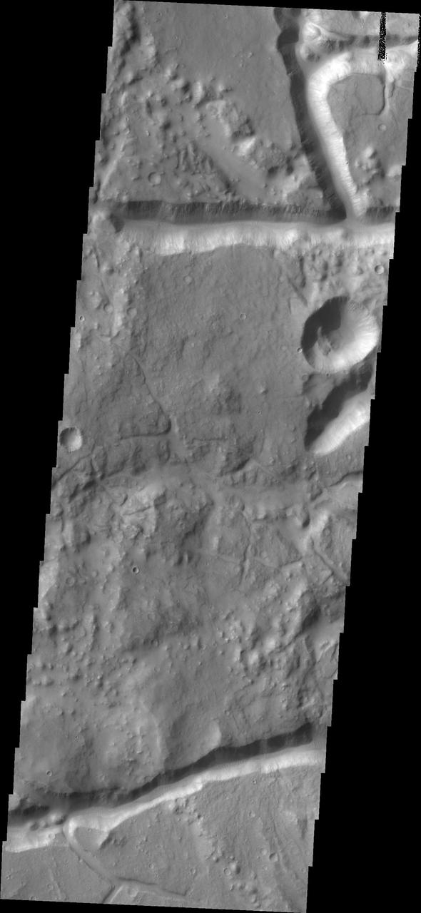
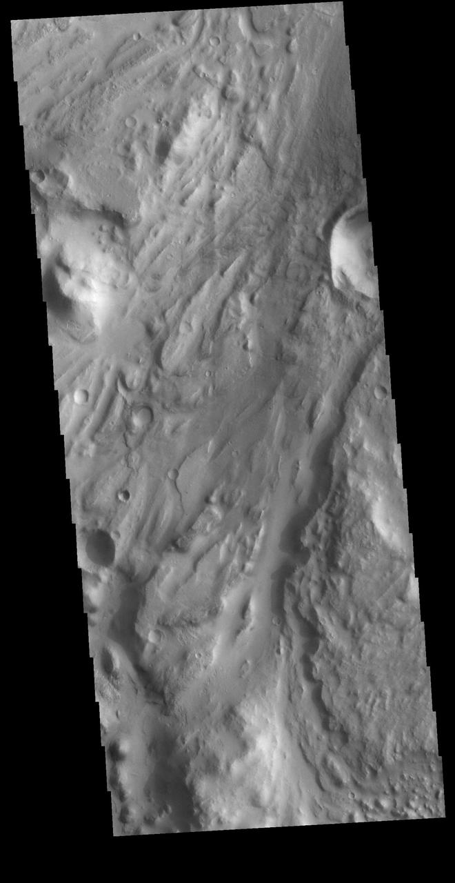
The channel-like features in image captured by NASA 2001 Mars Odyssey spacecraft are fracture sets related to the formation of Iani Chaos, which occurs directly north of the image.
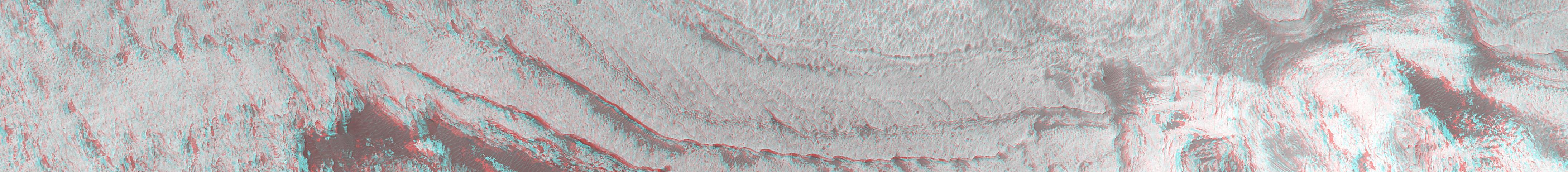
This anaglyph from NASA Mars Global Surveyor shows eroded, pitted, light-toned layer outcrops in Iani Chaos. 3D glasses are necessary to view this image.
This channel is located south of Iani Chaos
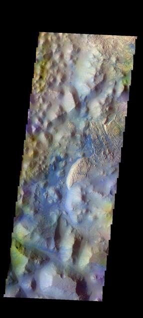
The THEMIS camera contains 5 filters. The data from different filters can be combined in multiple ways to create a false color image. These false color images may reveal subtle variations of the surface not easily identified in a single band image. Today's false color image shows part of Iani Chaos. The "dark blue" material is likely basaltic sand. Orbit Number: 18037 Latitude: -1.05225 Longitude: 341.26 Instrument: VIS Captured: 2006-01-07 10:45. http://photojournal.jpl.nasa.gov/catalog/PIA20228
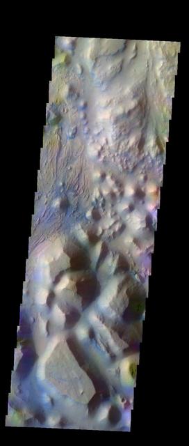
The THEMIS VIS camera contains 5 filters. The data from different filters can be combined in multiple ways to create a false color image. These false color images may reveal subtle variations of the surface not easily identified in a single band image. Today's false color image shows part of Iani Chaos. Orbit Number: 10336 Latitude: -0.097308 Longitude: 342.604 Instrument: VIS Captured: 2004-04-13 11:31 http://photojournal.jpl.nasa.gov/catalog/PIA19768
The THEMIS VIS camera contains 5 filters. The data from different filters can be combined in multiple ways to create a false color image. These false color images may reveal subtle variations of the surface not easily identified in a single band image. Today's false color image shows part of Iani Chaos. Orbit Number: 10025 Latitude: -2.65344 Longitude: 342.424 Instrument: VIS Captured: 2004-03-18 19:01 http://photojournal.jpl.nasa.gov/catalog/PIA19752
The THEMIS VIS camera contains 5 filters. The data from different filters can be combined in multiple ways to create a false color image. These false color images may reveal subtle variations of the surface not easily identified in a single band image. Today's false color image shows part of Iani Chaos. Orbit Number: 8465 Latitude: -2.8754 Longitude: 342.708 Instrument: VIS Captured: 2003-11-11 08:31 http://photojournal.jpl.nasa.gov/catalog/PIA19733
The THEMIS VIS camera contains 5 filters. The data from different filters can be combined in multiple ways to create a false color image. These false color images may reveal subtle variations of the surface not easily identified in a single band image. Today's false color image shows part of Iani Chaos. Orbit Number: 12808 Latitude: -0.595538 Longitude: 341.755 Instrument: VIS Captured: 2004-11-02 22:13 http://photojournal.jpl.nasa.gov/catalog/PIA20080
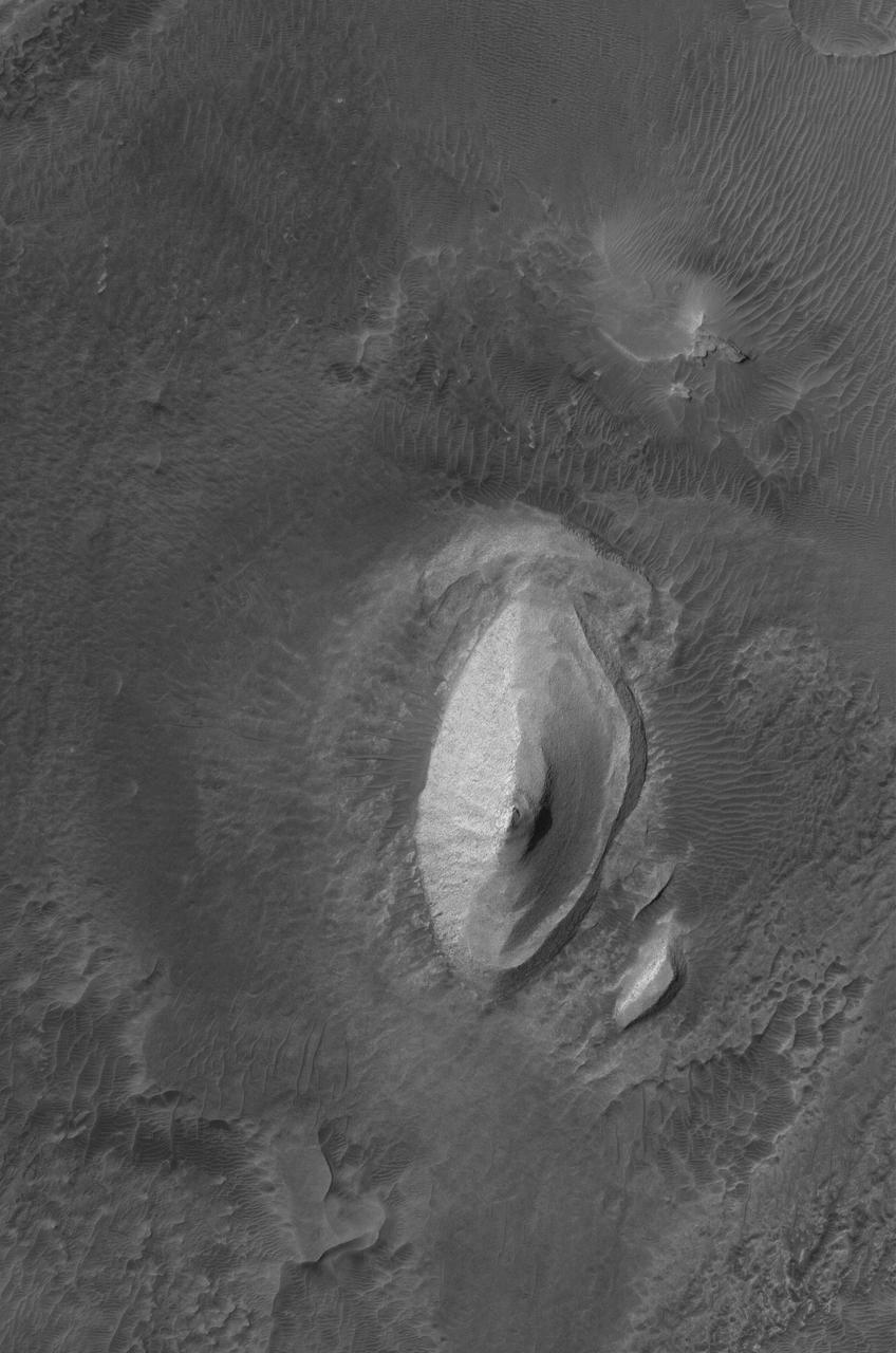
These dust avalanches occur in a crater within Iani Chaos
The THEMIS VIS camera contains 5 filters. The data from different filters can be combined in multiple ways to create a false color image. These false color images may reveal subtle variations of the surface not easily identified in a single band image. Today's false color image shows Iani Chaos. The material appearing as dark blue is likely sand that has been caught in the surface furrows. Orbit Number: 10050 Latitude: -0.796182 Longitude: 341.51 Instrument: VIS Captured: 2004-03-20 20:24 http://photojournal.jpl.nasa.gov/catalog/PIA19753
This MOC image shows layered, light-toned exposures of probable sedimentary rock in Iani Chaos
This MOC image shows a flow knob of light-toned, layered rock exposed by erosion in the Iani Chaos region of Mars
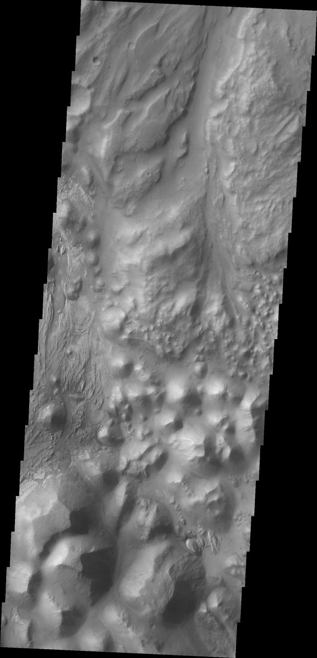
This image captured by NASA 2001 Mars Odyssey spacecraft shows where Ares Vallis starts top of image from Iani Chaos bottom of image.
Today's VIS image shows a section of Ares Vallis. Ares Vallis is a large channel that arises in Iani Chaos, passes through Margaritifer Terra, and then empties into Chryse Planitia. Orbit Number: 80624 Latitude: 0.445959 Longitude: 342.666 Instrument: VIS Captured: 2020-02-16 21:33 https://photojournal.jpl.nasa.gov/catalog/PIA23843
The THEMIS VIS camera contains 5 filters. The data from different filters can be combined in multiple ways to create a false color image. This image from NASA 2001 Mars Odyssey spacecraft shows the beginning of Ares Vallis at the edge of Iani Chaos.
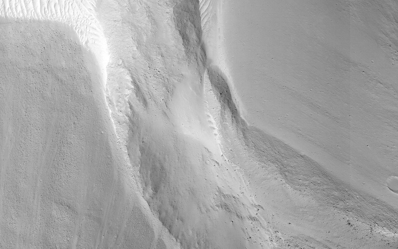
This image shows a small landslide in Iani Chaos. Landslides are common on Mars where there are steep slopes, including this area where there are numerous mounds and hills. What is unusual about this landslide is that it carved a path downslope as it moved, similar to a snow plow pushing away snow as it moves forward. This image is part of a stereo pair so that scientists will examine the landslide in 3D to understand its formation mechanism. https://photojournal.jpl.nasa.gov/catalog/PIA23232