
NASA Glenn’s Propulsion Systems Lab (PSL) is conducting research to characterize ice crystal clouds that can create a hazard to aircraft engines under certain conditions. The isokinetic probe (in gold) samples particles and another series of probes can measure everything from humidity to air pressure.
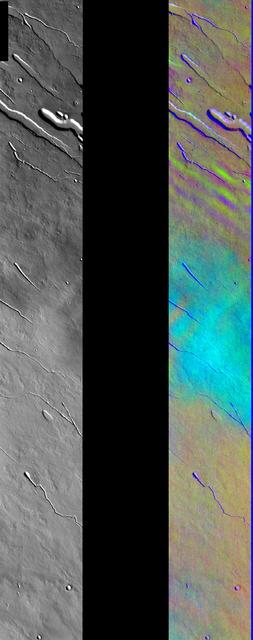
Ice Clouds in Color IR
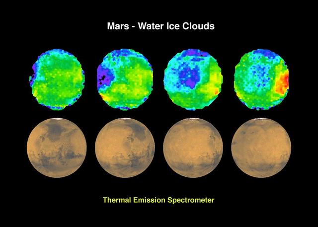
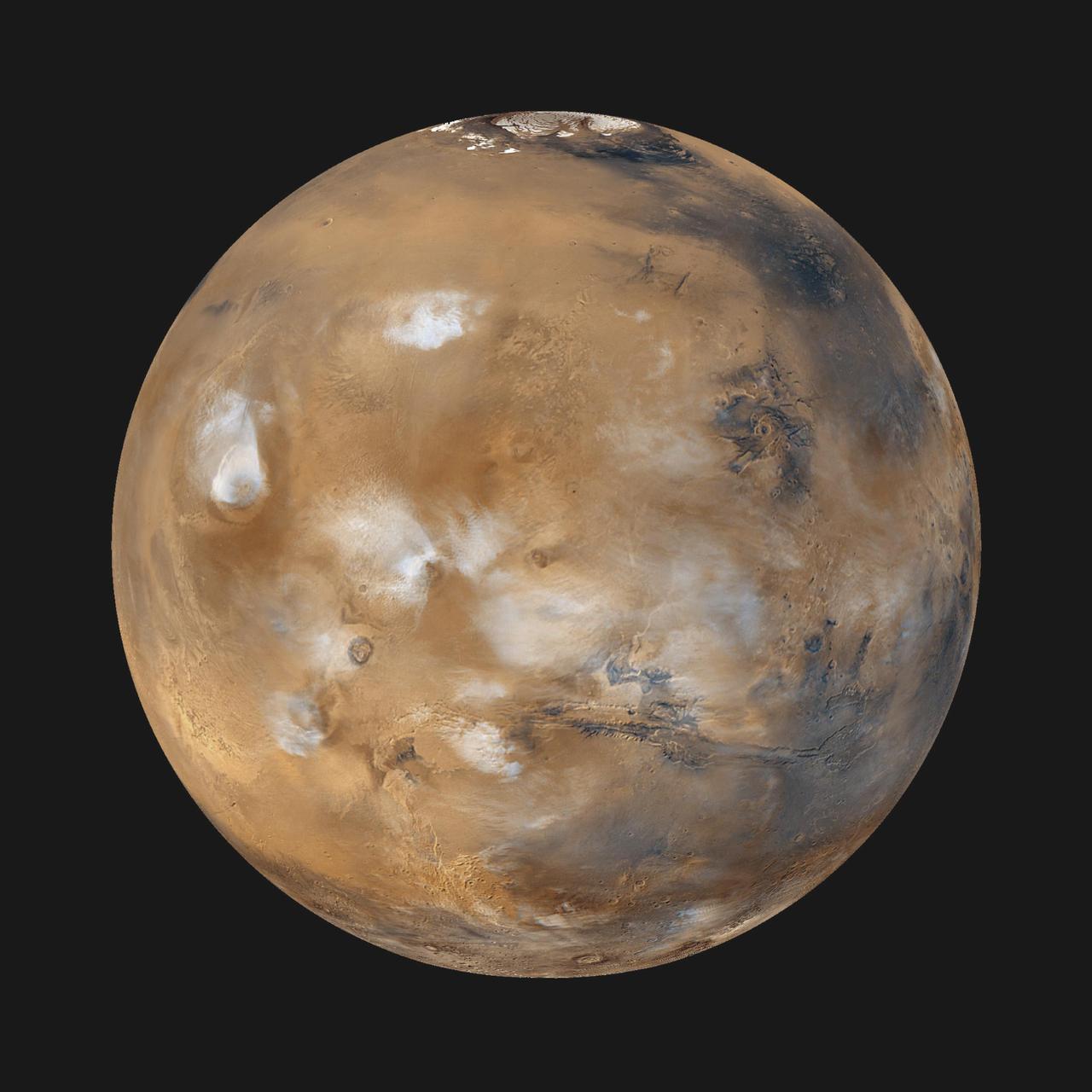
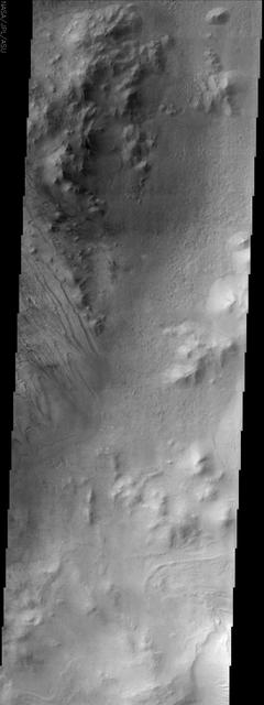
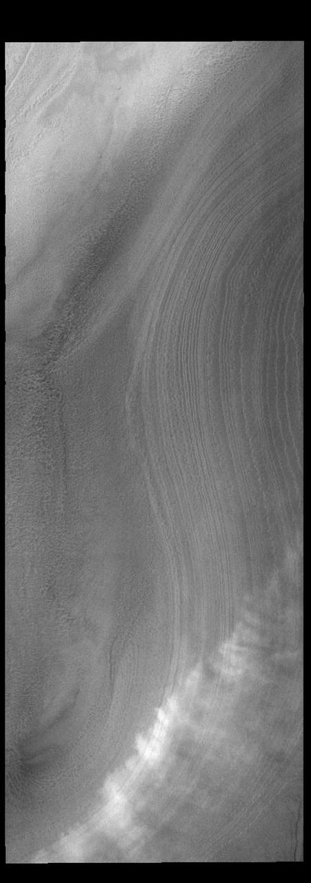
Mars - Water Ice Clouds
Heavy water ice clouds almost completely obscure the surface in Vastitas Borealis, as seen in this image from NASA Mars Odyssey spacecraft.

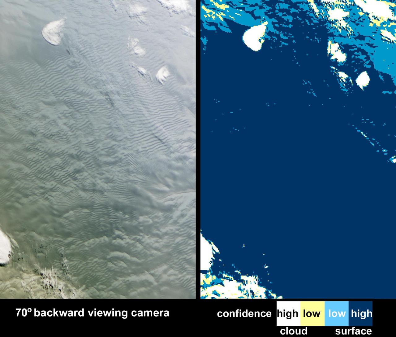
Low-lying clouds over sea ice on the Bellingshausen Sea. Credit: NASA / Maria-Jose Vinas NASA's Operation IceBridge is an airborne science mission to study Earth's polar ice. For more information about IceBridge, visit: <a href="http://www.nasa.gov/icebridge" rel="nofollow">www.nasa.gov/icebridge</a> <b><a href="http://www.nasa.gov/audience/formedia/features/MP_Photo_Guidelines.html" rel="nofollow">NASA image use policy.</a></b> <b><a href="http://www.nasa.gov/centers/goddard/home/index.html" rel="nofollow">NASA Goddard Space Flight Center</a></b> enables NASA’s mission through four scientific endeavors: Earth Science, Heliophysics, Solar System Exploration, and Astrophysics. Goddard plays a leading role in NASA’s accomplishments by contributing compelling scientific knowledge to advance the Agency’s mission. <b>Follow us on <a href="http://twitter.com/NASA_GoddardPix" rel="nofollow">Twitter</a></b> <b>Like us on <a href="http://www.facebook.com/pages/Greenbelt-MD/NASA-Goddard/395013845897?ref=tsd" rel="nofollow">Facebook</a></b> <b>Find us on <a href="http://instagrid.me/nasagoddard/?vm=grid" rel="nofollow">Instagram</a></b>
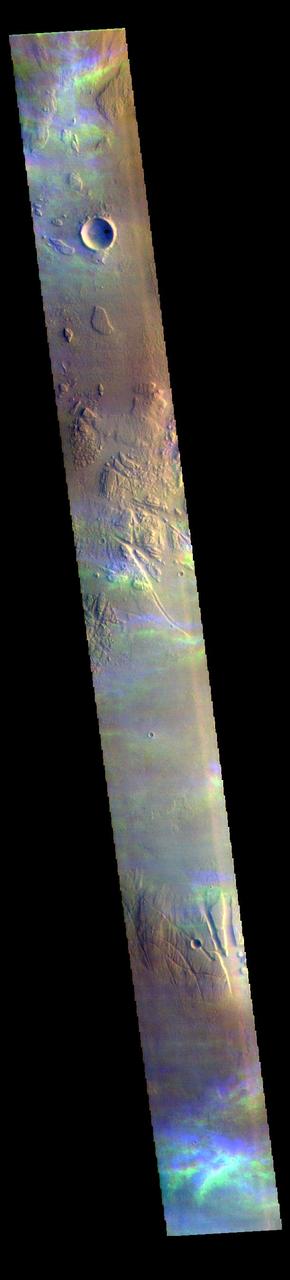
The THEMIS VIS camera contains 5 filters. The data from different filters can be combined in multiple ways to create a false color image. These false color images may reveal subtle variations of the surface not easily identified in a single band image. Today's false color image shows high altitude ice clouds. The blue and yellow bands in this image are not image artifacts, but are the traces of ice rich clouds. Each framelet of the image is collected at slightly different times. For the unchanging surface, this works fine. Optically thick dust clouds are usually close to the surface so any motion of the clouds is not dramatic as seen from the altitude of the Odyssey spacecraft. Transparent, and high altitude clouds are harder to discern in single band images – but are easy to discern in false color images – the clouds are in slightly different positions as each filter is collected. The clouds in this image are in the Tharsis region. Clouds are common there in the northern spring season. As clouds are a transient process, they can not be targeted, but are a 'surprise' when they are captured in an image. The THEMIS VIS camera is capable of capturing color images of the Martian surface using five different color filters. In this mode of operation, the spatial resolution and coverage of the image must be reduced to accommodate the additional data volume produced from using multiple filters. To make a color image, three of the five filter images (each in grayscale) are selected. Each is contrast enhanced and then converted to a red, green, or blue intensity image. These three images are then combined to produce a full color, single image. Because the THEMIS color filters don't span the full range of colors seen by the human eye, a color THEMIS image does not represent true color. Also, because each single-filter image is contrast enhanced before inclusion in the three-color image, the apparent color variation of the scene is exaggerated. Nevertheless, the color variation that does appear is representative of some change in color, however subtle, in the actual scene. Note that the long edges of THEMIS color images typically contain color artifacts that do not represent surface variation. Orbit Number: 94128 Latitude: 14.3145 Longitude: 281.365 Instrument: VIS Captured: 2023-03-04 19:22 https://photojournal.jpl.nasa.gov/catalog/PIA26126
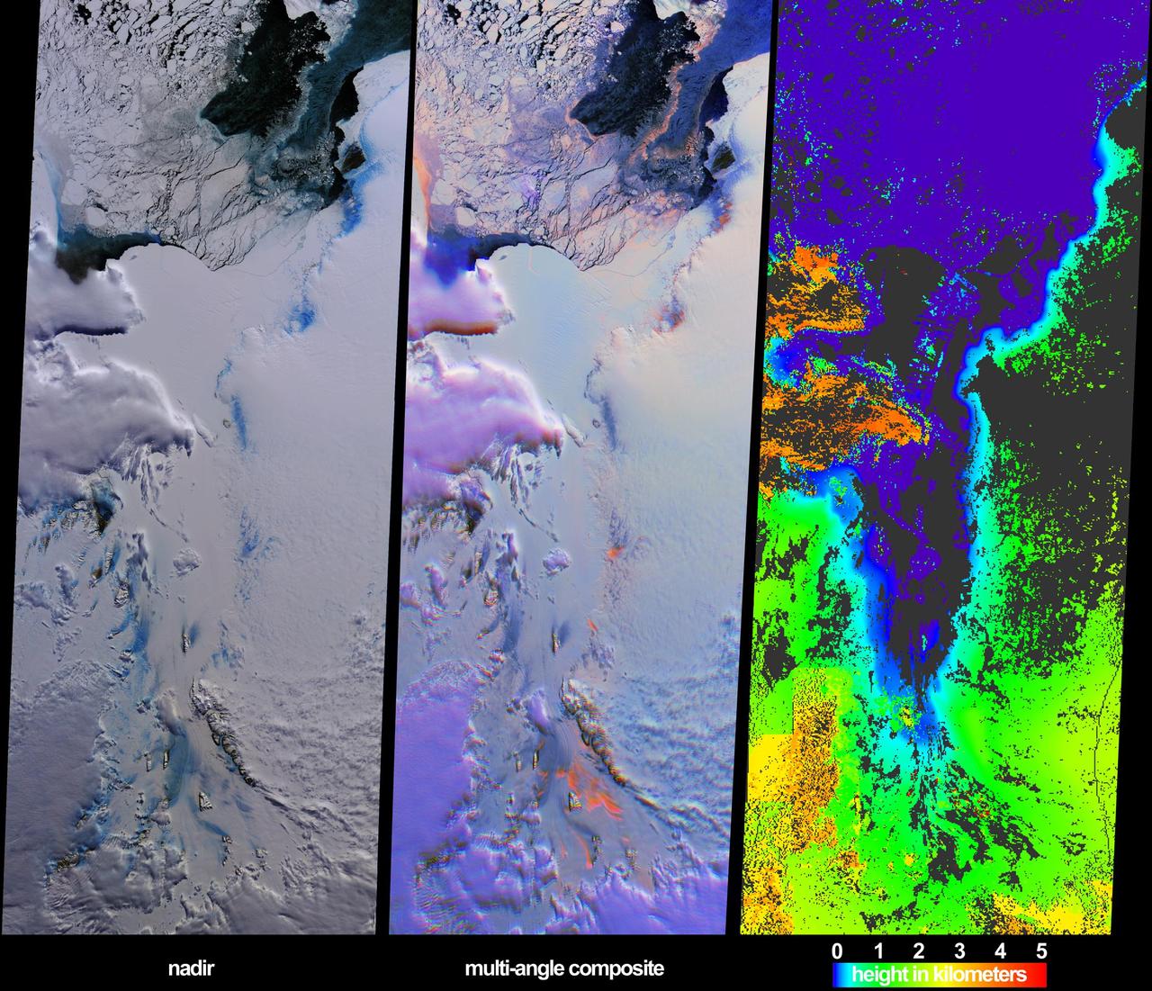
These views from NASA Terra spacecraft illustrate ice surface textures and cloud-top heights over the Amery Ice Shelf/Lambert Glacier system in East Antarctica on October 25, 2002.
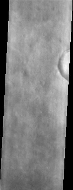
Splotchy water ice clouds obscure the northern lowland plains in the region where NASA Viking 2 spacecraft landed in this image by NASA Mars Odyssey spacecraft.
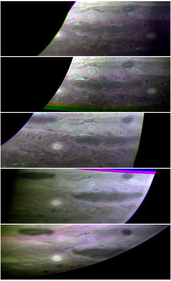
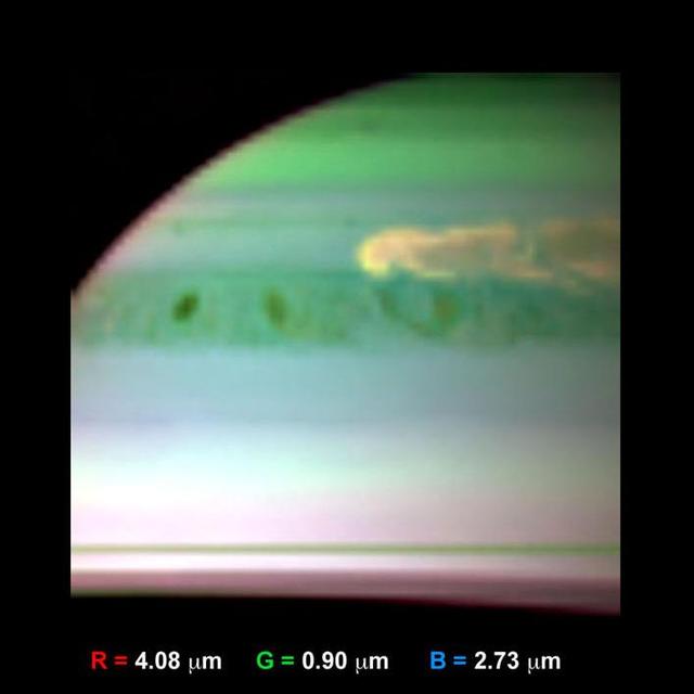
The top cloud layer on Jupiter is thought to consist of ammonia ice, but most of that ammonia hides from spectrometers. It does not absorb light in the same way ammonia does.
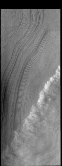
The THEMIS VIS camera contains 5 filters. The data from different filters can be combined in multiple ways to create a false color image. These false color images may reveal subtle variations of the surface not easily identified in a single band image. The 5 filters are collected with a short delay between them. In creating false color images of the surface, the surface is stable and each filter image is overlaid and "connected" based of the location of identical surface features. However, when there is movement occurring during the delay, the filters don't overlay well. In this case the movement is seen as bands of blue and yellow. These are ice rich clouds over the summit of Arsia Mons. The altitude of the clouds and speed they are blown by the wind is enough that there is significant difference in cloud locations between the short delay separating the filters. Imaging transient clouds allows for study of the atmosphere of Mars. Orbit Number: 60706 Latitude: -9.2731 Longitude: 239.942 Instrument: VIS Captured: 2015-08-21 06:46 https://photojournal.jpl.nasa.gov/catalog/PIA22713
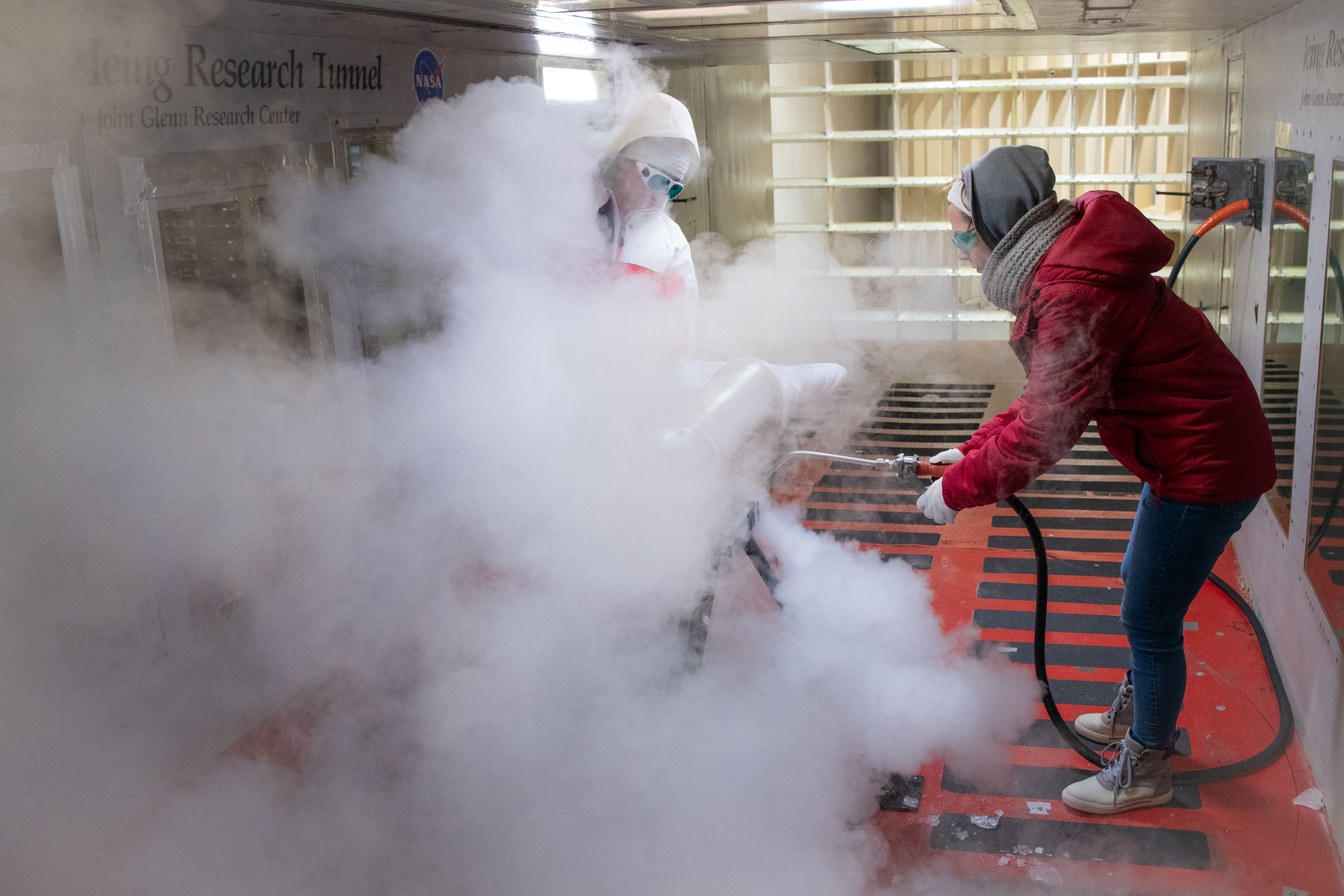
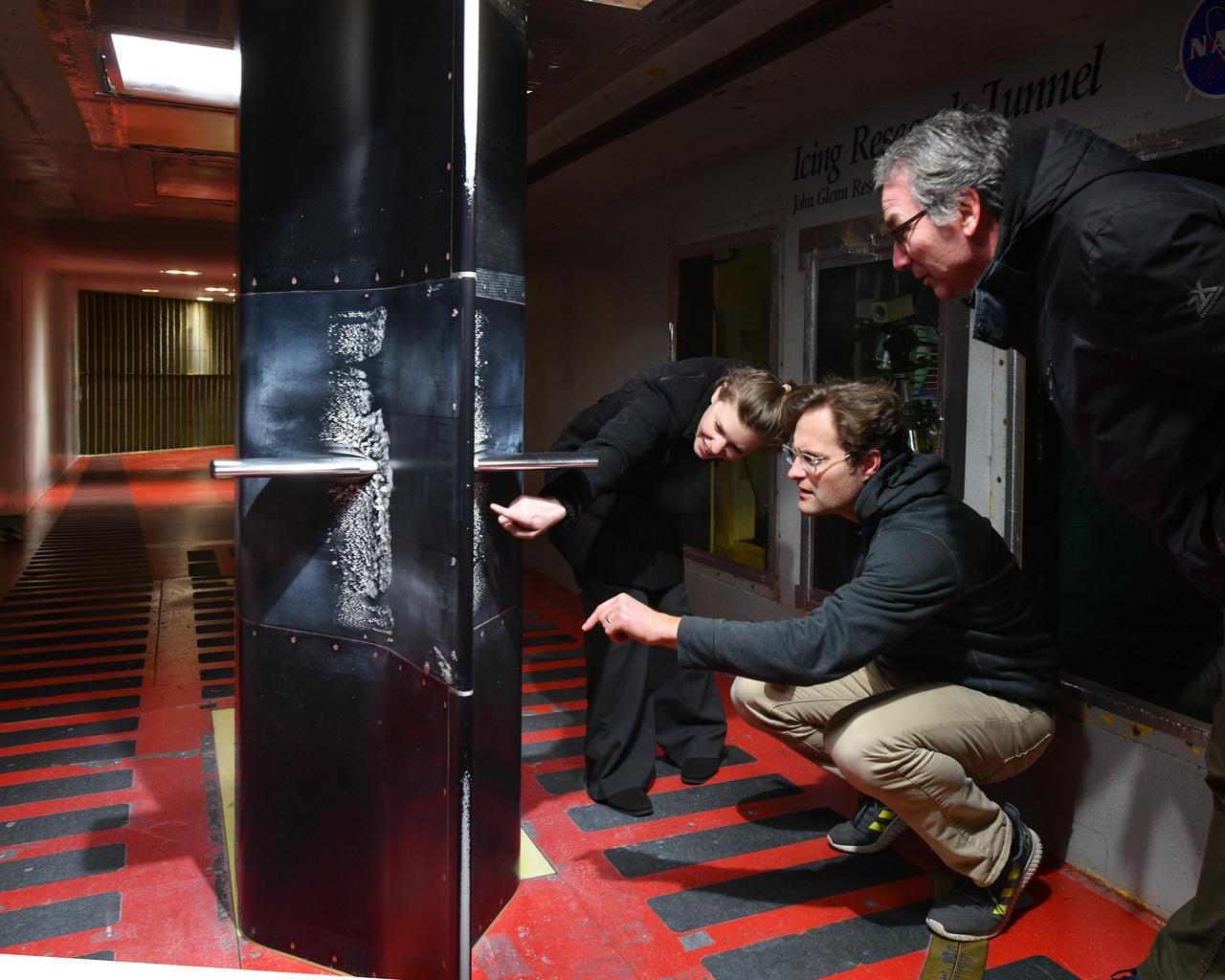
Test engineers clean the ice cloud detection probe in the Icing Research Tunnel in between test runs. Steam is used to melt the accumulated ice on the detection probe. The test engineers need to wear goggles to protect them from the laser light that the probe emits. The laser detects water content and ice particles in the cloud that the wind tunnel produces. This process is done to calibrate the tunnel for research by characterizing the cloud flow.
The Icing Research Tunnel (IRT) is the longest running, icing facility in the world and has been in operation since 1944. Most ice protection technologies in use today were largely developed at this facility. In this facility, natural icing conditions, such as the clouds being created here, are produced to test the effects of icing conditions on aircraft components such as wings tails and engine inlets.
These clouds formed in the south polar region. The faintness of the cloud system likely indicates that these are mainly ice clouds, with relatively little dust content
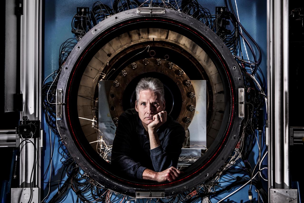
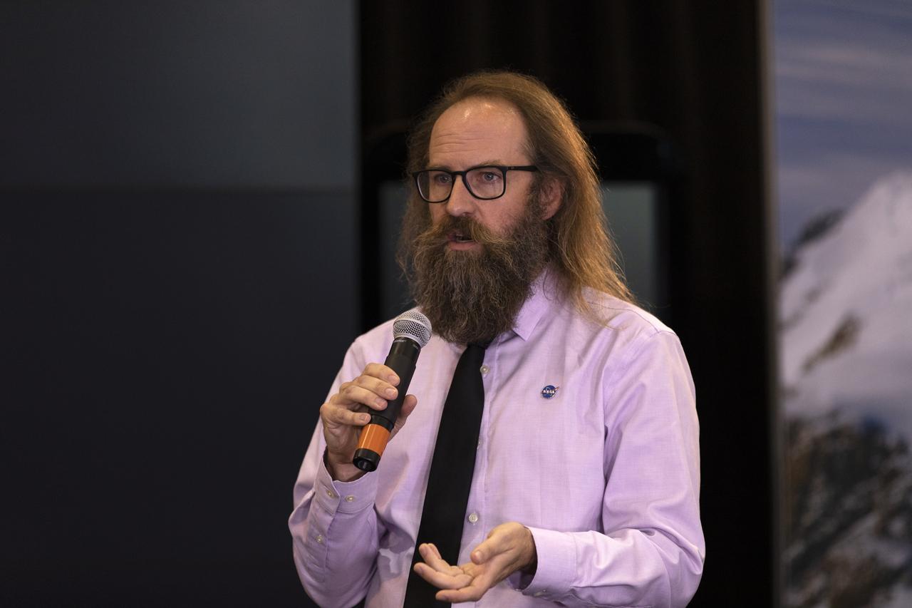
How do you measure a cloud? Tim Bencic does it with lasers. The NASA Glenn engineer invented a tomography system for our Propulsion Systems Lab to help understand the dangers of ice crystal icing on airplanes. Bencic’s system, affectionally called “Tim-ography” is like a CAT Scan. The laser light within its circular geometry bounces off the surface of ice particles in the cloud and fiber optic detectors map out its properties. This tool is helping NASA’s researchers make aircraft safer in challenging weather conditions.
This artist concept shows NASA CloudSat spacecraft and its Cloud Profiling Radar using microwave energy to observe cloud particles and determine the mass of water and ice within clouds.
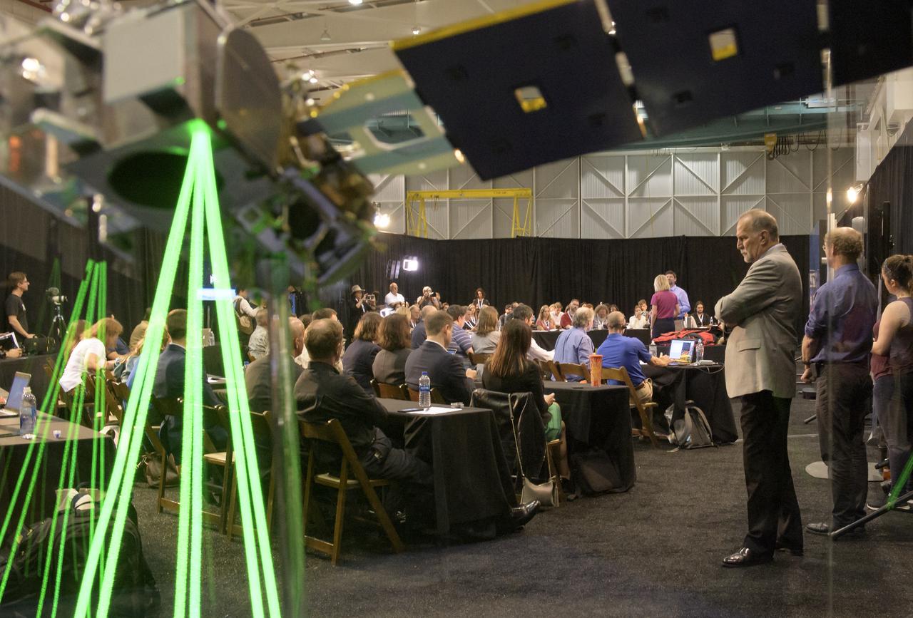
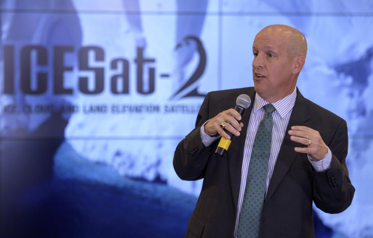
Prelaunch briefing for the NASA Ice, Cloud and land Elevation Satellite-2 (ICESat-2), Thursday, Sept. 13, 2018, at Vandenberg Air Force Base in California. The ICESat-2 mission will measure the changing height of Earth's ice. Photo Credit: (NASA/Bill Ingalls)
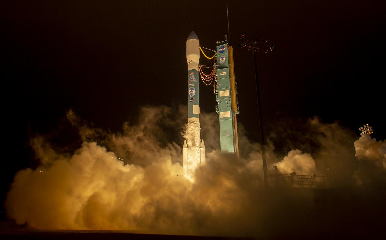
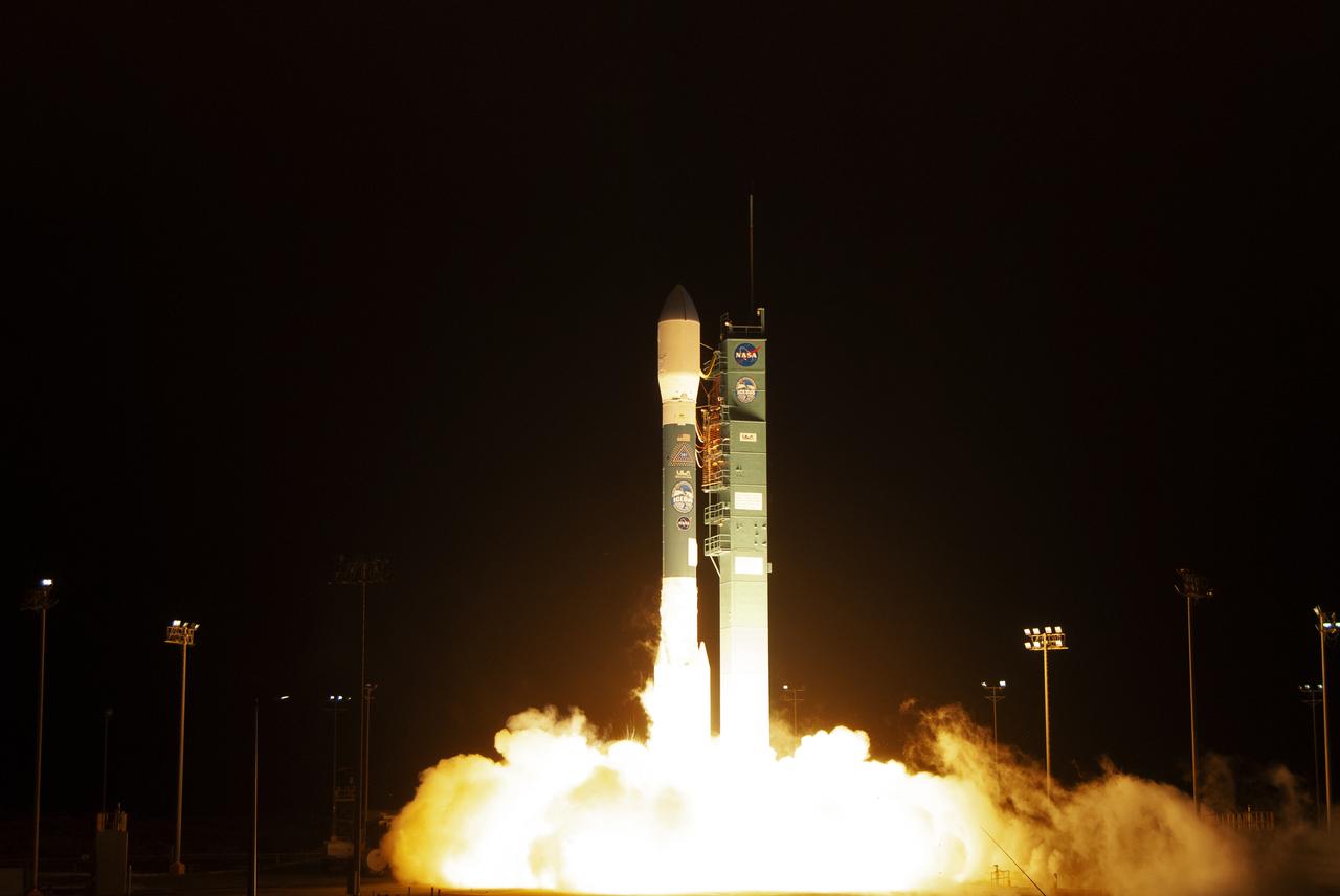
The United Launch Alliance (ULA) Delta II rocket with the NASA Ice, Cloud and land Elevation Satellite-2 (ICESat-2) onboard, Thursday, Sept. 13, 2018, Vandenberg Air Force Base in California. The ICESat-2 mission will measure the changing height of Earth's ice. Photo Credit: (NASA/Bill Ingalls)

Wonders in the Antarctic Sea and Sky NASA aircraft and scientists have returned to the United States after a short ice-surveying mission to #Antarctica. Despite having only a week of flying time, the team returned with crucial scientific data and a trove of spectacular aerial photographs. The flights over Antarctica were part of Operation #IceBridge, a multi-year mission to monitor conditions in Antarctica and the Arctic until a new ice-monitoring satellite, ICESat-2, launches in 2016. ICESat-1 was decommissioned in 2009, and IceBridge aircraft have been flying ever since. Laser altimeter and radar data are the primary products of the mission, but IceBridge project scientist Michael Studinger almost always has his digital camera ready as well. On November 24, 2013, he took this photograph of a multi-layered lenticular cloud hovering near Mount Discovery, a volcano about 70 kilometers (44 miles) southwest of McMurdo. Lenticular #clouds are a type of wave cloud. They usually form when a layer of air near the surface encounters a topographic barrier, gets pushed upward, and flows over it as a series of atmospheric gravity waves. Lenticular clouds form at the crest of the waves, where the air is coolest and water vapor is most likely to condense into cloud droplets. The bulging sea ice in the foreground is a pressure ridge, which formed when separate ice floes collided and piled up on each other. Read more: <a href="http://1.usa.gov/18lXIQS" rel="nofollow">1.usa.gov/18lXIQS</a> Photograph courtesy of Michael Studinger. Caption by Adam Voiland of NASA's Earth Observatory. <b><a href="http://www.nasa.gov/audience/formedia/features/MP_Photo_Guidelines.html" rel="nofollow">NASA image use policy.</a></b> <b><a href="http://www.nasa.gov/centers/goddard/home/index.html" rel="nofollow">NASA Goddard Space Flight Center</a></b> enables NASA’s mission through four scientific endeavors: Earth Science, Heliophysics, Solar System Exploration, and Astrophysics. Goddard plays a leading role in NASA’s accomplishments by contributing compelling scientific knowledge to advance the Agency’s mission. <b>Follow us on <a href="http://twitter.com/NASA_GoddardPix" rel="nofollow">Twitter</a></b> <b>Like us on <a href="http://www.facebook.com/pages/Greenbelt-MD/NASA-Goddard/395013845897?ref=tsd" rel="nofollow">Facebook</a></b> <b>Find us on <a href="http://instagram.com/nasagoddard?vm=grid" rel="nofollow">Instagram</a></b>
This image from NASA 2001 Mars Odyssey spacecraft shows a system of clouds just off the margin of the South Polar cap. Taken during the summer season, these clouds contain both water-ice and dust.
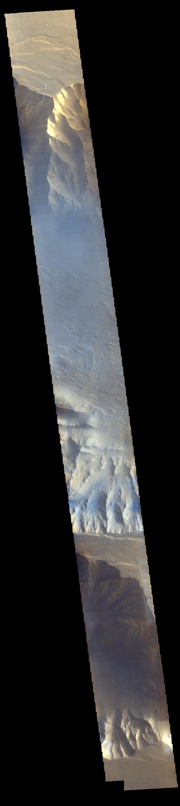
Light blue clouds fill Coprates Chasma on Mars, part of Valles Marineris, the vast Grand Canyon of Mars. The clouds are mostly ice crystals and they appear blue in color in this image from NASA Mars Odyssey.
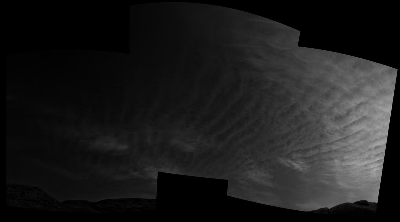
This line of clouds is located over the ice of the south polar cap. At the time of year when this VIS image was collected, clouds are a common occurrence. Orbit Number: 74942 Latitude: -86.1443 Longitude: 178.096 Instrument: VIS Captured: 2018-11-05 23:28 https://photojournal.jpl.nasa.gov/catalog/PIA22972
The United Launch Alliance (ULA) Delta II rocket with the NASA Ice, Cloud and land Elevation Satellite-2 (ICESat-2) onboard is seen shortly after the mobile service tower at SLC-2 was rolled back, Saturday, Sept. 15, 2018, at Vandenberg Air Force Base in California. The ICESat-2 mission will measure the changing height of Earth's ice. Photo Credit: (NASA/Bill Ingalls)
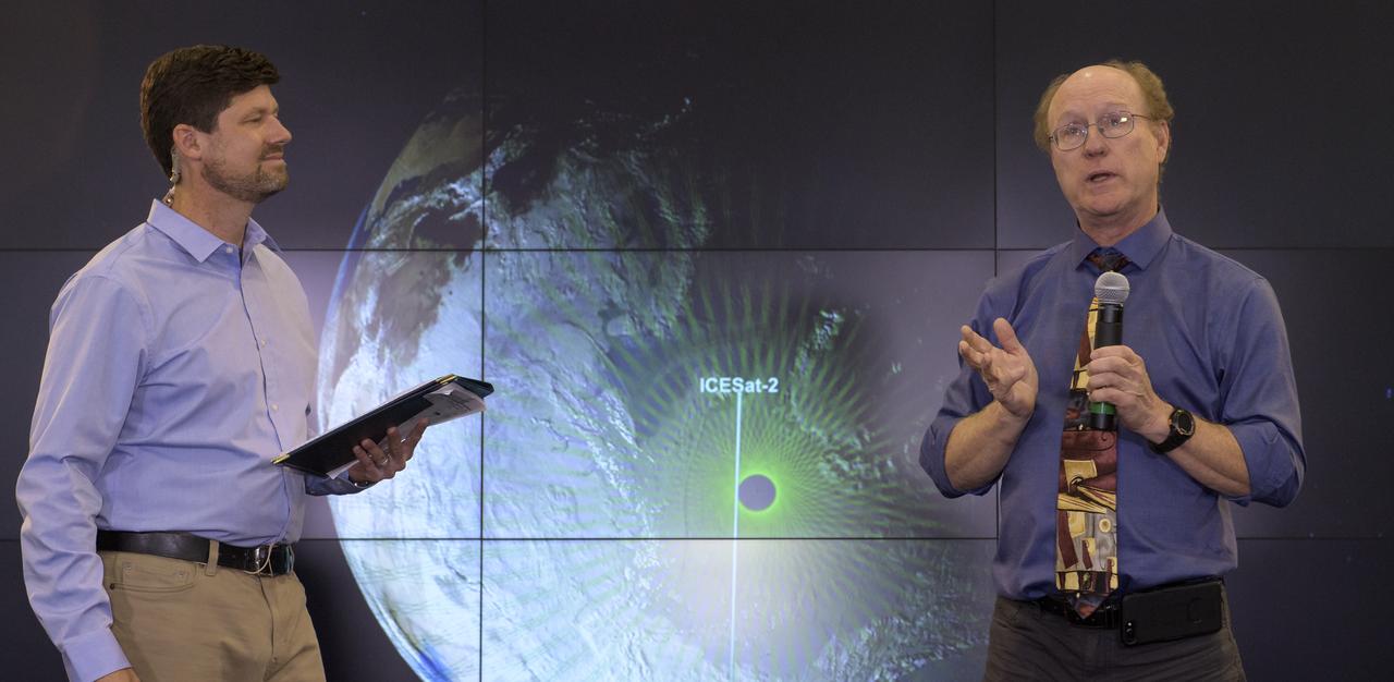
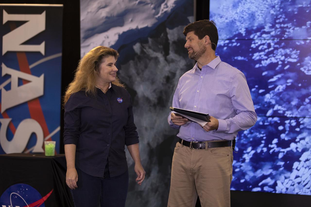
NASA Scientist Michelle Thaller and Tom Wagner, ICESat-2 Program Scientist, NASA Headquarters are seen during a NASA Ice, Cloud and land Elevation Satellite-2 (ICESat-2) prelaunch briefing, Thursday, Sept. 13, 2018, at Vandenberg Air Force Base in California. The ICESat-2 mission will measure the changing height of Earth's ice. Photo Credit: (NASA/Bill Ingalls)
Tim Dunn, Launch Director, NASA's Kennedy Space Center, is seen during a NASA Ice, Cloud and land Elevation Satellite-2 (ICESat-2) prelaunch briefing, Thursday, Sept. 13, 2018, at Vandenberg Air Force Base in California. The ICESat-2 mission will measure the changing height of Earth's ice. Photo Credit: (NASA/Bill Ingalls)
The United Launch Alliance (ULA) Delta II rocket with the NASA Ice, Cloud and land Elevation Satellite-2 (ICESat-2) onboard is seen shortly after the mobile service tower at SLC-2 was rolled back, Saturday, Sept. 15, 2018, at Vandenberg Air Force Base in California. The ICESat-2 mission will measure the changing height of Earth's ice. Photo Credit: (NASA/Bill Ingalls)
The United Launch Alliance (ULA) Delta II rocket launches with the NASA Ice, Cloud and land Elevation Satellite-2 (ICESat-2) onboard, Saturday, Sept. 15, 2018, from Vandenberg Air Force Base in California. The ICESat-2 mission will measure the changing height of Earth's ice. Photo Credit: (NASA/Bill Ingalls)
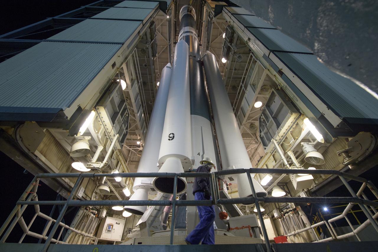
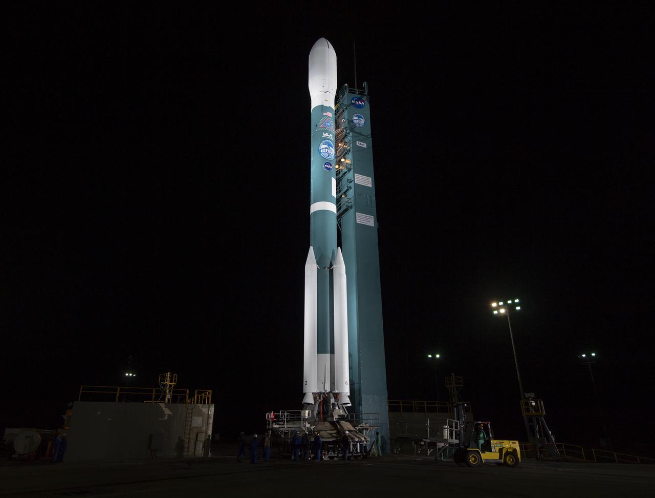
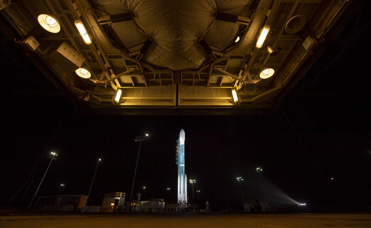
Workers prepare the United Launch Alliance (ULA) Delta II rocket, with the NASA Ice, Cloud and land Elevation Satellite-2 (ICESat-2) onboard, for launch, Friday, Sept. 14, 2018, at Vandenberg Air Force Base in California. The ICESat-2 mission will measure the changing height of Earth's ice. Photo Credit: (NASA/Bill Ingalls)
The United Launch Alliance (ULA) Delta II rocket launches with the NASA Ice, Cloud and land Elevation Satellite-2 (ICESat-2) onboard, Saturday, Sept. 15, 2018, from Vandenberg Air Force Base in California. The ICESat-2 mission will measure the changing height of Earth's ice. Photo Credit: (NASA/Bill Ingalls)

The United Launch Alliance (ULA) Delta II rocket launches with the NASA Ice, Cloud and land Elevation Satellite-2 (ICESat-2) onboard, Saturday, Sept. 15, 2018, from Vandenberg Air Force Base in California. The ICESat-2 mission will measure the changing height of Earth's ice. Photo Credit: (NASA/Bill Ingalls)
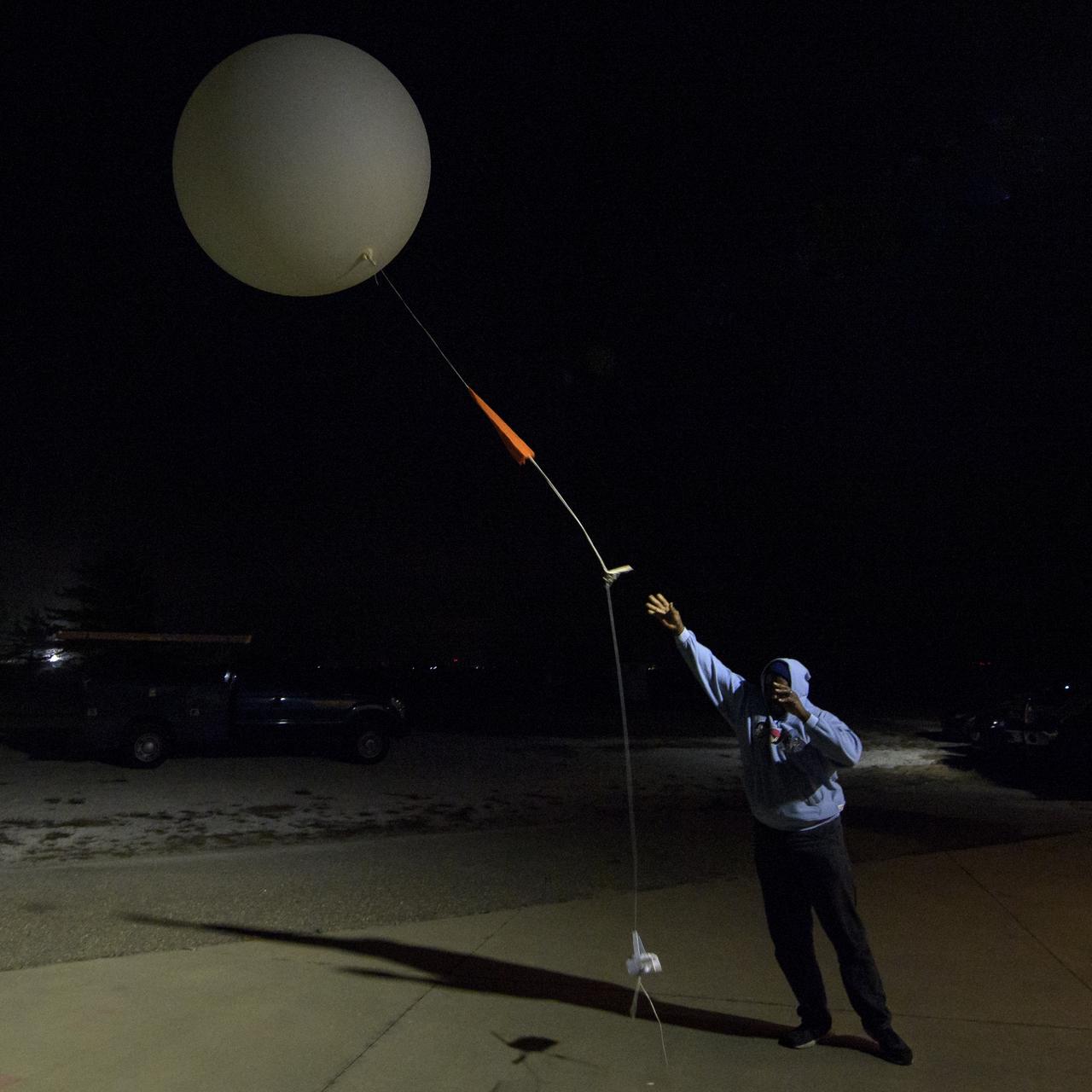
Isiah Toran releases a weather balloon to help measure atmospheric conditions ahead of the launch of the NASA Ice, Cloud and land Elevation Satellite-2 (ICESat-2), Saturday, Sept. 15, 2018, Vandenberg Air Force Base in California. The ICESat-2 mission will measure the changing height of Earth's ice. Photo Credit: (NASA/Bill Ingalls)
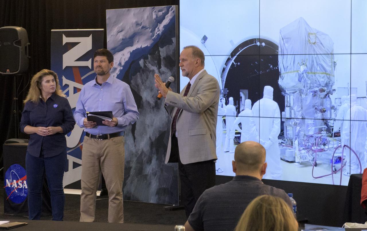
NASA Scientist Michelle Thaller, Tom Wagner, ICESat-2 Program Scientist, NASA Headquarters, center, and Bill Barnhart, ICESat-2 Program Manager, Northrop Grumman, are seen during a NASA Ice, Cloud and land Elevation Satellite-2 (ICESat-2) prelaunch briefing, Thursday, Sept. 13, 2018, at Vandenberg Air Force Base in California. The ICESat-2 mission will measure the changing height of Earth's ice. Photo Credit: (NASA/Bill Ingalls)
The United Launch Alliance (ULA) Delta II rocket with the NASA Ice, Cloud and land Elevation Satellite-2 (ICESat-2) onboard is seen shortly after the mobile service tower at SLC-2 was rolled back, Saturday, Sept. 15, 2018, at Vandenberg Air Force Base in California. The ICESat-2 mission will measure the changing height of Earth's ice. Photo Credit: (NASA/Bill Ingalls)
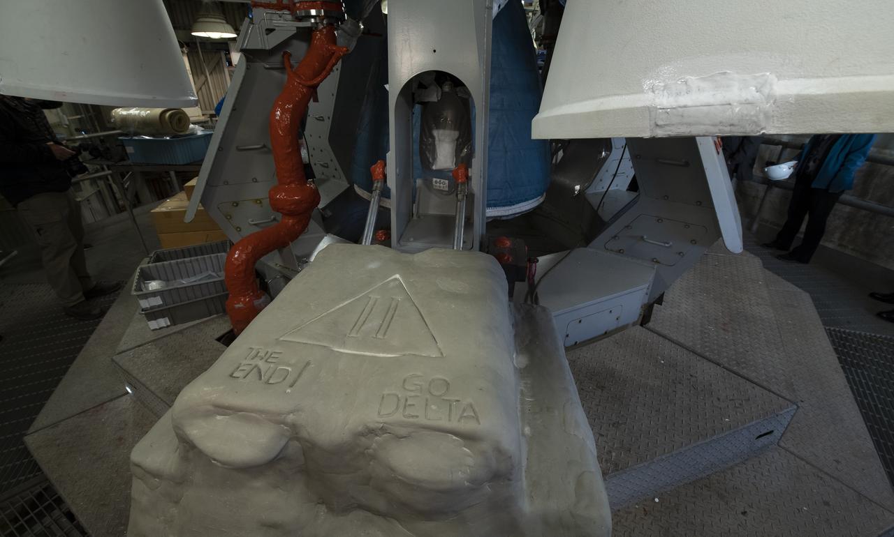
Base of the SLC-2 launch pad is embossed with well wishes for the final launch of the United Launch Alliance Delta II rocket, Thursday, Sept. 13, 2018, at Vandenberg Air Force Base in California. ULA launched NASA's Ice, Cloud and land Elevation Satellite-2 (ICESat-2) on Saturday, Sept. 15, 2018. The ICESat-2 mission will measure the changing height of Earth's ice. Photo Credit: (NASA/Bill Ingalls)
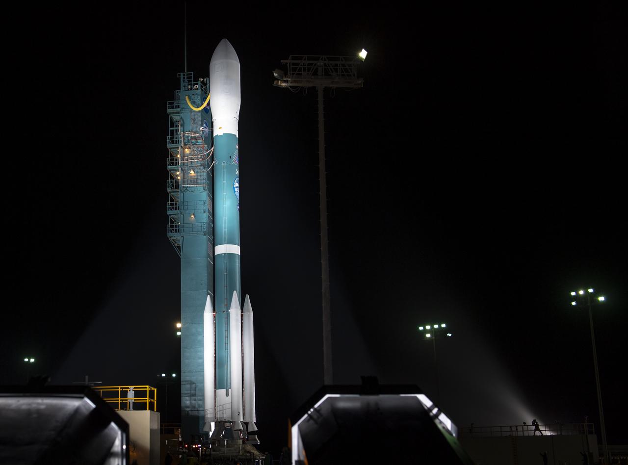
The United Launch Alliance (ULA) Delta II rocket with the NASA Ice, Cloud and land Elevation Satellite-2 (ICESat-2) onboard is seen shortly after the mobile service tower at SLC-2 was rolled back, Saturday, Sept. 15, 2018, at Vandenberg Air Force Base in California. The ICESat-2 mission will measure the changing height of Earth's ice. Photo Credit: (NASA/Bill Ingalls)
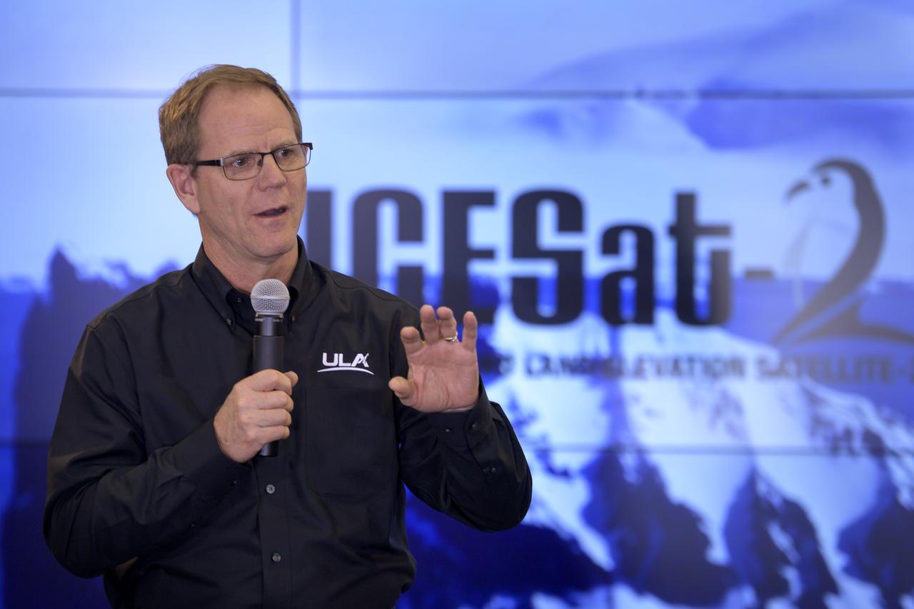
Scott Messer, Program Manager, United Launch Alliance, is seen during a NASA Ice, Cloud and land Elevation Satellite-2 (ICESat-2) prelaunch briefing, Thursday, Sept. 13, 2018, at Vandenberg Air Force Base in California. The ICESat-2 mission will measure the changing height of Earth's ice. Photo Credit: (NASA/Bill Ingalls)

NASA Scientist Michelle Thaller and Tom Wagner, ICESat-2 Program Scientist, NASA Headquarters are seen during a NASA Ice, Cloud and land Elevation Satellite-2 (ICESat-2) prelaunch briefing, Thursday, Sept. 13, 2018, at Vandenberg Air Force Base in California. The ICESat-2 mission will measure the changing height of Earth's ice. Photo Credit: (NASA/Bill Ingalls)
Doug McLennan, ICESat-2 Project Manager, NASA's Goddard Space Flight Center, is seen during a NASA Ice, Cloud and land Elevation Satellite-2 (ICESat-2) prelaunch briefing, Thursday, Sept. 13, 2018, at Vandenberg Air Force Base in California. The ICESat-2 mission will measure the changing height of Earth's ice. Photo Credit: (NASA/Bill Ingalls)

Artist and NASA social media attendee Maria Coryell-Martin captures a prelaunch briefing for the NASA Ice, Cloud and land Elevation Satellite-2 (ICESat-2), Thursday, Sept. 13, 2018, at Vandenberg Air Force Base in California. The ICESat-2 mission will measure the changing height of Earth's ice. Photo Credit: (NASA/Bill Ingalls)
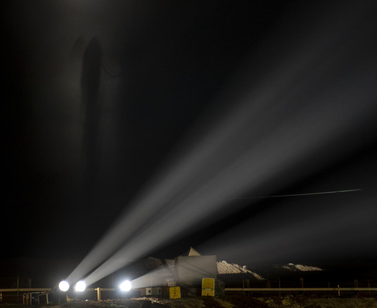
The silhouette of the United Launch Alliance (ULA) Delta II rocket, with the NASA Ice, Cloud and land Elevation Satellite-2 (ICESat-2) onboard, is seen in the fog shortly after the mobile service tower at SLC-2 was rolled back, Saturday, Sept. 15, 2018, at Vandenberg Air Force Base in California. The ICESat-2 mission will measure the changing height of Earth's ice. Photo Credit: (NASA/Bill Ingalls)
The United Launch Alliance (ULA) Delta II rocket with the NASA Ice, Cloud and land Elevation Satellite-2 (ICESat-2) onboard is seen shortly after the mobile service tower at SLC-2 was rolled back, Saturday, Sept. 15, 2018, at Vandenberg Air Force Base in California. The ICESat-2 mission will measure the changing height of Earth's ice. Photo Credit: (NASA/Bill Ingalls)
The United Launch Alliance (ULA) Delta II rocket launches with the NASA Ice, Cloud and land Elevation Satellite-2 (ICESat-2) onboard, Saturday, Sept. 15, 2018, from Vandenberg Air Force Base in California. The ICESat-2 mission will measure the changing height of Earth's ice. Photo Credit: (NASA/Bill Ingalls)

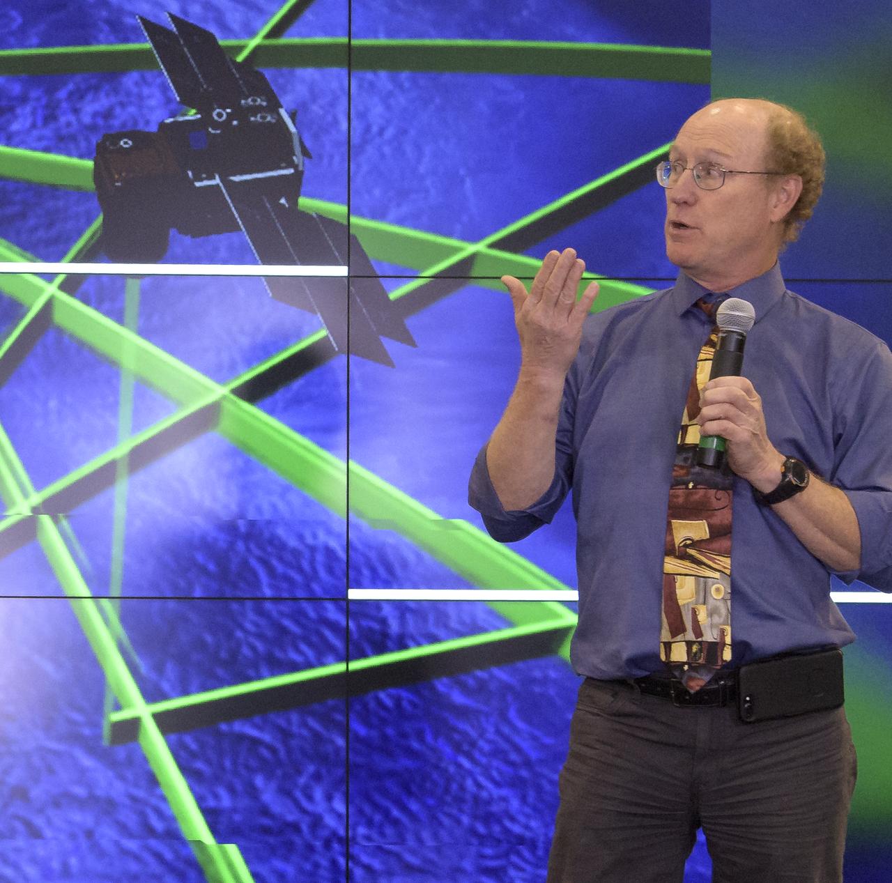
Tom Neumann, ICESat-2 Deputy Project Scientist, NASA's Goddard Space Flight Center, is seen during a NASA Ice, Cloud and land Elevation Satellite-2 (ICESat-2) prelaunch briefing, Thursday, Sept. 13, 2018, at Vandenberg Air Force Base in California. The ICESat-2 mission will measure the changing height of Earth's ice. Photo Credit: (NASA/Bill Ingalls)
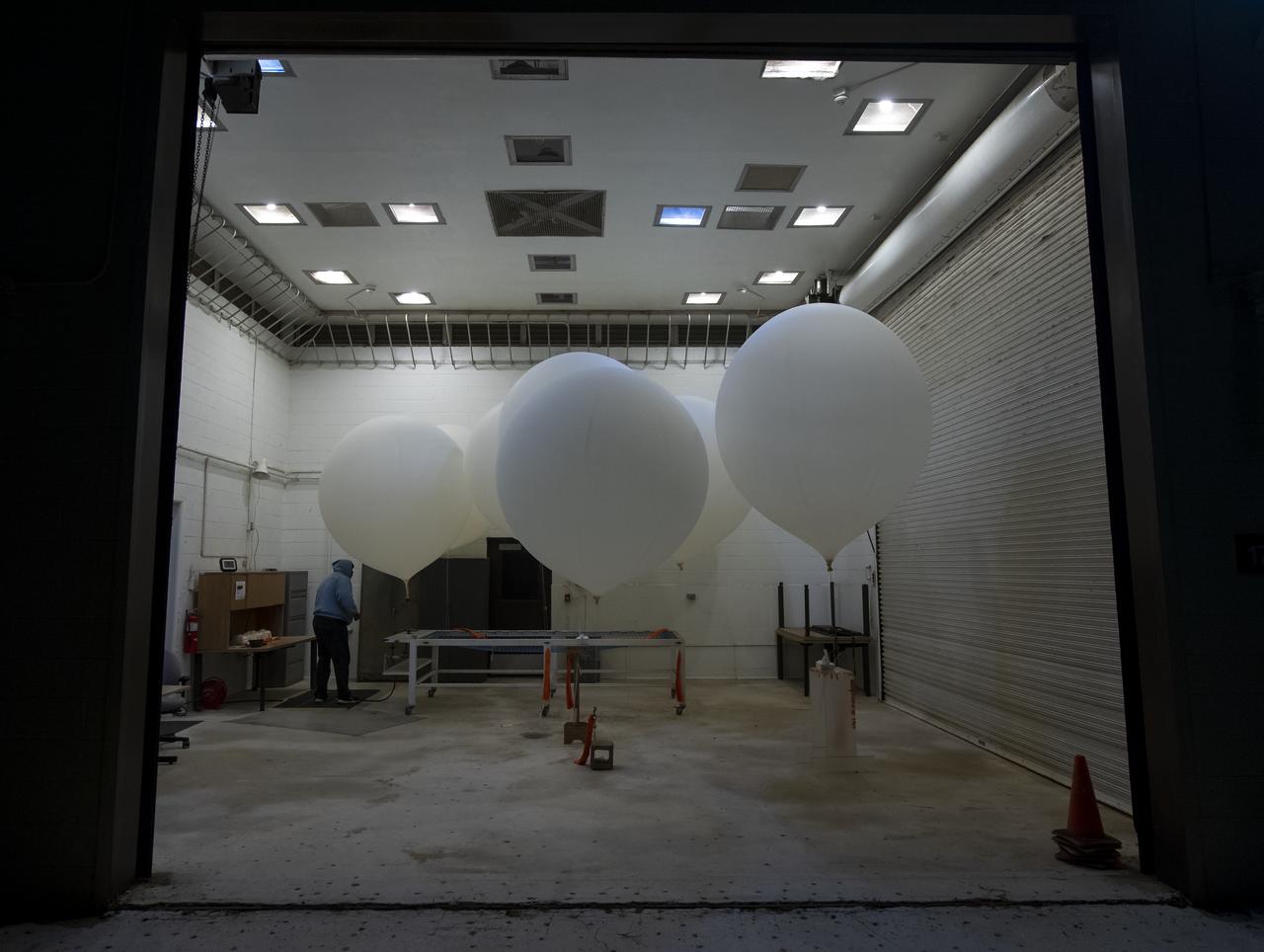
Weather balloons are prepared for release to help measure atmospheric conditions ahead of the launch of the NASA Ice, Cloud and land Elevation Satellite-2 (ICESat-2), Saturday, Sept. 15, 2018, Vandenberg Air Force Base in California. The ICESat-2 mission will measure the changing height of Earth's ice. Photo Credit: (NASA/Bill Ingalls)

Cathy Richardson, Deputy Program Manager, Earth Science Projects Division, NASA's Goddard Space Flight Center, is seen during a NASA Ice, Cloud and land Elevation Satellite-2 (ICESat-2) prelaunch briefing, Thursday, Sept. 13, 2018, at Vandenberg Air Force Base in California. The ICESat-2 mission will measure the changing height of Earth's ice. Photo Credit: (NASA/Bill Ingalls)
The United Launch Alliance (ULA) Delta II rocket launches with the NASA Ice, Cloud and land Elevation Satellite-2 (ICESat-2) onboard, Saturday, Sept. 15, 2018, from Vandenberg Air Force Base in California. The ICESat-2 mission will measure the changing height of Earth's ice. Photo Credit: (NASA/Bill Ingalls)
The United Launch Alliance (ULA) Delta II rocket launches with the NASA Ice, Cloud and land Elevation Satellite-2 (ICESat-2) onboard, Saturday, Sept. 15, 2018, from Vandenberg Air Force Base in California. The ICESat-2 mission will measure the changing height of Earth's ice. Photo Credit: (NASA/Bill Ingalls)
Tom Wagner, ICESat-2 Program Scientist, NASA Headquarters, left, and Doug McLennan, ICESat-2 Project Manager, NASA's Goddard Space Flight Center, are seen during a NASA Ice, Cloud and land Elevation Satellite-2 (ICESat-2) prelaunch briefing, Thursday, Sept. 13, 2018, at Vandenberg Air Force Base in California. The ICESat-2 mission will measure the changing height of Earth's ice. Photo Credit: (NASA/Bill Ingalls)
The United Launch Alliance (ULA) Delta II rocket launches with the NASA Ice, Cloud and land Elevation Satellite-2 (ICESat-2) onboard, Saturday, Sept. 15, 2018, from Vandenberg Air Force Base in California. The ICESat-2 mission will measure the changing height of Earth's ice. Photo Credit: (NASA/Bill Ingalls)

Lori Magruder, ICESat-2 Science Definition Team Lead, University of Texas, is seen during a NASA Ice, Cloud and land Elevation Satellite-2 (ICESat-2) prelaunch briefing, Thursday, Sept. 13, 2018, at Vandenberg Air Force Base in California. The ICESat-2 mission will measure the changing height of Earth's ice. Photo Credit: (NASA/Bill Ingalls)

The United Launch Alliance (ULA) Delta II rocket launches with the NASA Ice, Cloud and land Elevation Satellite-2 (ICESat-2) onboard, Saturday, Sept. 15, 2018, from Vandenberg Air Force Base in California. The ICESat-2 mission will measure the changing height of Earth's ice. Photo Credit: (NASA/Bill Ingalls)
The United Launch Alliance (ULA) Delta II rocket launches with the NASA Ice, Cloud and land Elevation Satellite-2 (ICESat-2) onboard, Saturday, Sept. 15, 2018, from Vandenberg Air Force Base in California. The ICESat-2 mission will measure the changing height of Earth's ice. Photo Credit: (NASA/Bill Ingalls)
The United Launch Alliance (ULA) Delta II rocket with the NASA Ice, Cloud and land Elevation Satellite-2 (ICESat-2) onboard is seen shortly after the mobile service tower at SLC-2 was rolled back, Saturday, Sept. 15, 2018, at Vandenberg Air Force Base in California. The ICESat-2 mission will measure the changing height of Earth's ice. Photo Credit: (NASA/Bill Ingalls)

Helen Fricker, ICESat-2 Science Definition Team Member, Scripps Institution of Oceanography, is seen during a NASA Ice, Cloud and land Elevation Satellite-2 (ICESat-2) prelaunch briefing, Thursday, Sept. 13, 2018, at Vandenberg Air Force Base in California. The ICESat-2 mission will measure the changing height of Earth's ice. Photo Credit: (NASA/Bill Ingalls)
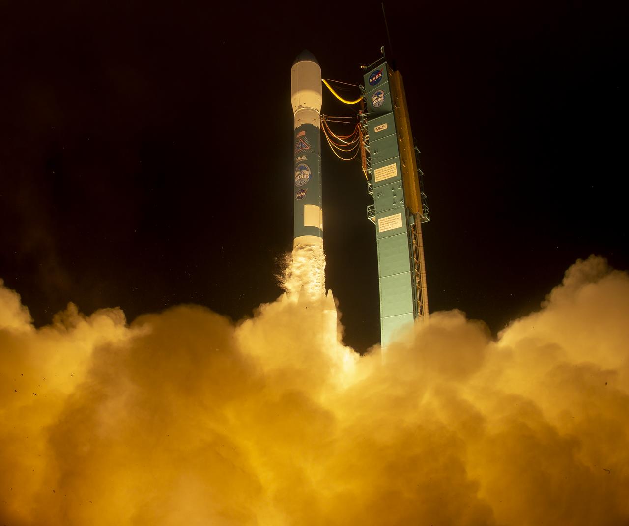
The United Launch Alliance (ULA) Delta II rocket launches with the NASA Ice, Cloud and land Elevation Satellite-2 (ICESat-2) onboard, Saturday, Sept. 15, 2018, from Vandenberg Air Force Base in California. The ICESat-2 mission will measure the changing height of Earth's ice. Photo Credit: (NASA/Bill Ingalls)
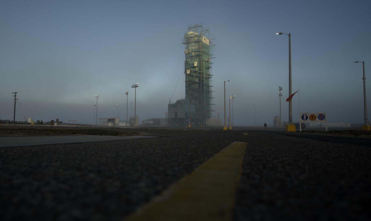
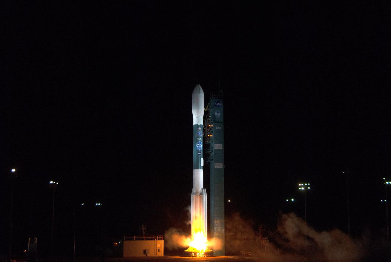
A thin fog covers the mobile service tower and the United Launch Alliance (ULA) Delta II rocket with the NASA Ice, Cloud and land Elevation Satellite-2 (ICESat-2) onboard, Thursday, Sept. 13, 2018, Vandenberg Air Force Base in California. The ICESat-2 mission will measure the changing height of Earth's ice. Photo Credit: (NASA/Bill Ingalls)
1st Lt. Daniel Smith, Weather Officer, 30th Space Wing, Vandenberg Air Force Base, is seen during a NASA Ice, Cloud and land Elevation Satellite-2 (ICESat-2) prelaunch briefing, Thursday, Sept. 13, 2018, at Vandenberg Air Force Base in California. The ICESat-2 mission will measure the changing height of Earth's ice. Photo Credit: (NASA/Bill Ingalls)
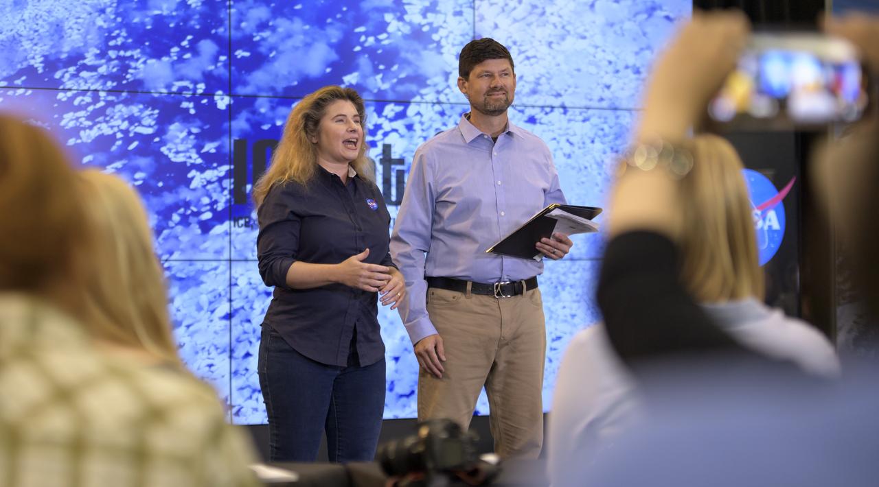
NASA Scientist Michelle Thaller and Tom Wagner, ICESat-2 Program Scientist, NASA Headquarters are seen during a NASA Ice, Cloud and land Elevation Satellite-2 (ICESat-2) prelaunch briefing, Thursday, Sept. 13, 2018, at Vandenberg Air Force Base in California. The ICESat-2 mission will measure the changing height of Earth's ice. Photo Credit: (NASA/Bill Ingalls)
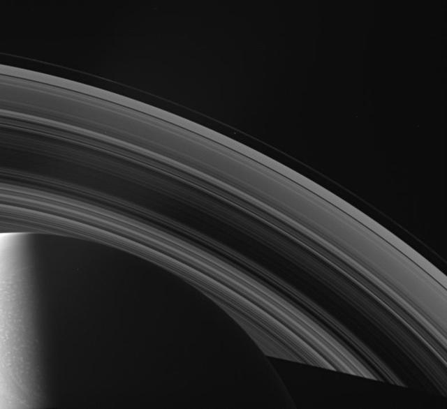
The Cassini spacecraft looks across Saturn cloud-dotted north and shadowed pole, and out across the lanes of ice that compose its rings
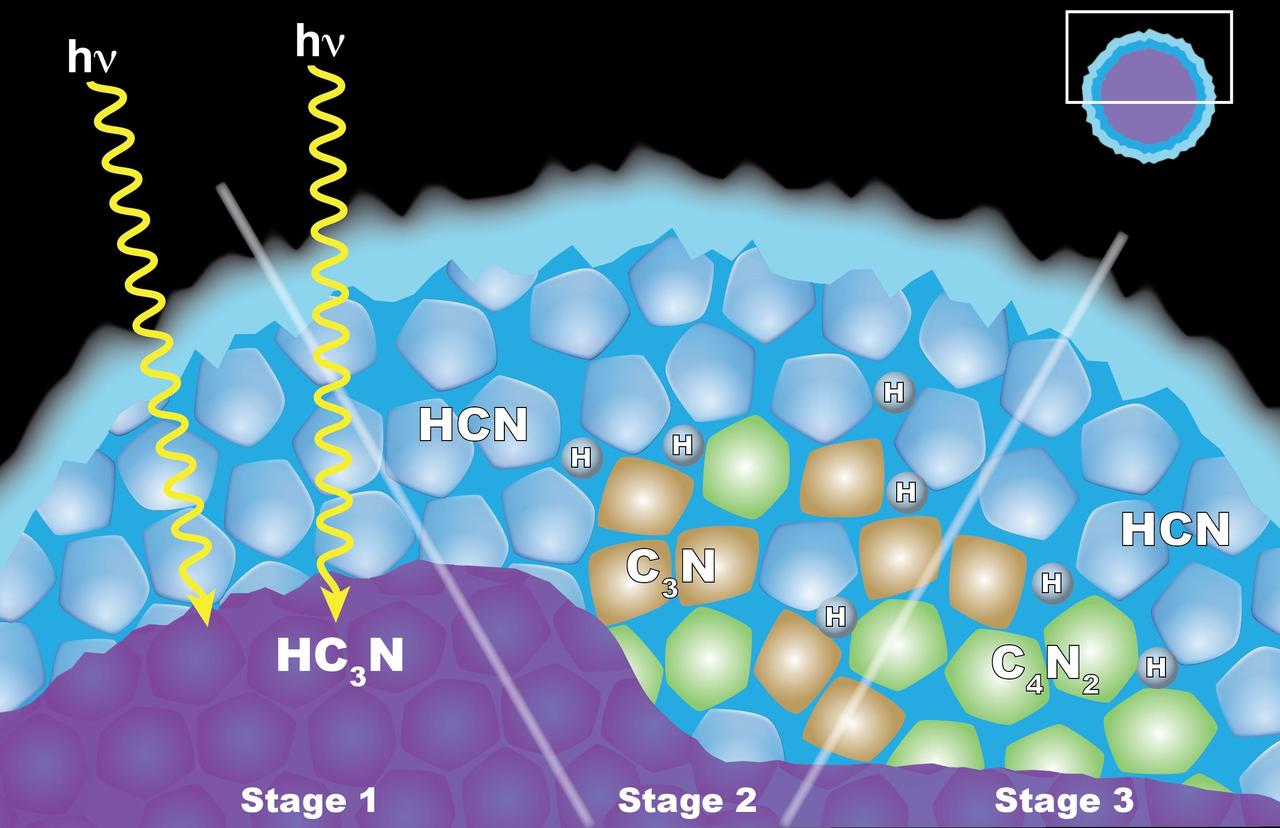
Scientists from NASA's Cassini mission suggested in a 2016 paper that the appearance of a cloud of dicyanoacetylene (C4N2) ice in Titan's stratosphere may be explained by "solid-state" chemistry taking place inside ice particles. The particles have an inner layer of cyanoacetylene (HC3N) ice coated with an outer layer of hydrogen cyanide (HCN) ice. Left: When a photon of light penetrates the outer shell, it can interact with the HC3N, producing C3N and H. Center: The C3N then reacts with HCN to yield C4N2 and H (shown at right). Another reaction that also yields C4N2 ice and H also is possible, but the researchers think it is less likely. http://photojournal.jpl.nasa.gov/catalog/PIA20715
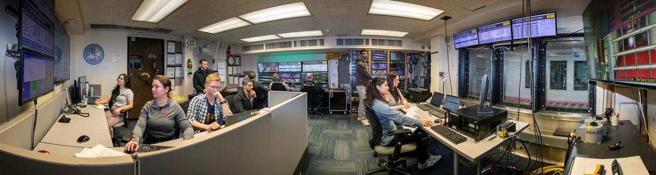
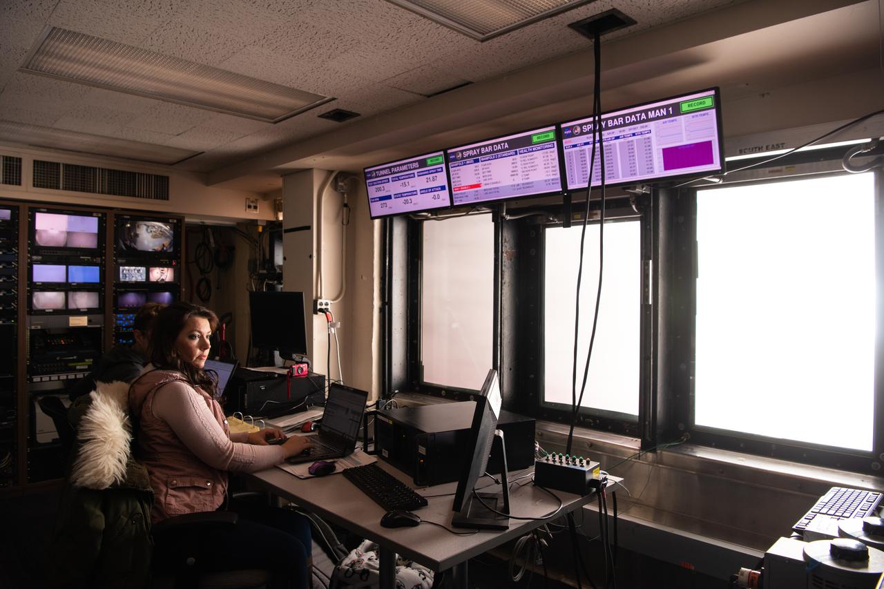
Panorama of the IRT engineering and ice cloud calibration team in the control room. Shown on the left are the data and system engineers. In the center with their backs to the camera are the wind tunnel operators who control the wind speed and super cooled water flow. In the center right of the photo is the video recording system and the test engineers. On the right side the test section can be see though the wind and the TV screen shows the pray bars that create the icing cloud.
Bill Barnhart, ICESat-2 Program Manager, Northrop Grumman, left, Doug McLennan, ICESat-2 Project Manager, NASA's Goddard Space Flight Center, center, and Cathy Richardson, Deputy Program Manager, Earth Science Projects Division, NASA's Goddard Space Flight Center, are seen during a NASA Ice, Cloud and land Elevation Satellite-2 (ICESat-2) prelaunch briefing, Thursday, Sept. 13, 2018, at Vandenberg Air Force Base in California. The ICESat-2 mission will measure the changing height of Earth's ice. Photo Credit: (NASA/Bill Ingalls)
Lori Magruder, ICESat-2 Science Definition Team Lead, University of Texas, left, Tom Neumann, ICESat-2 Deputy Project Scientist, NASA's Goddard Space Flight Center, and Helen Fricker, ICESat-2 Science Definition Team Member, Scripps Institution of Oceanography, are seen during a NASA Ice, Cloud and land Elevation Satellite-2 (ICESat-2) prelaunch briefing, Thursday, Sept. 13, 2018, at Vandenberg Air Force Base in California. The ICESat-2 mission will measure the changing height of Earth's ice. Photo Credit: (NASA/Bill Ingalls)
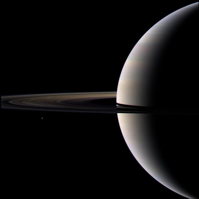
Looking cool and serene, Saturn shares its soft glow with NASA Cassini Orbiter.
As it passed over Antarctica on December 16, 2004, NASA Terra satellite captured this image showing a wavy pattern in a field of white.
Pictured is a model to study the ice collection on struts in jet engines during flight. Researchers inspect the ice after the model encounters a simulated icing cloud during testing. Super cooled water created from the icing cloud that flows though the wind tunnel. The super cooled water forms ice on contact with the test model. Researchers then inspect the ice formation before laser scanning of the ice formation for further research and analysis.
This false-color infrared image, obtained by NASA Cassini spacecraft, shows clouds of large ammonia ice particles dredged up by a powerful storm in Saturn northern hemisphere.
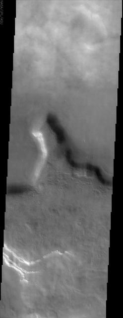
This image by NASA Mars Odyssey spacecraft shows a region of northern Tempe Terra. Patchy water-ice clouds cover portions of the low-lying canyon at the top north of this image.
Splotchy water ice clouds obscure the surface in this image from NASA Mars Odyssey spacecraft, however, most of Mars was in a relatively clear period when this image was acquired.
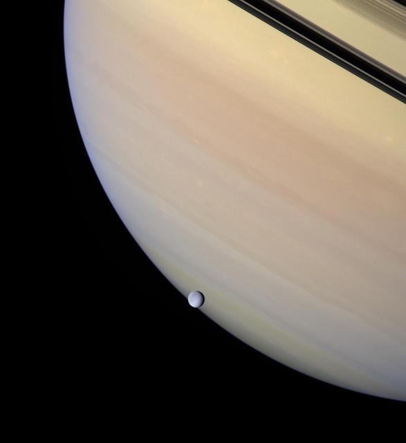
A serene orb of ice is set against the gentle pastel clouds of giant Saturn. Rhea transits the face of the gas giant, whose darkened rings and their planet-hugging shadows appear near upper right
Twelve orbits a day provide NASA Mars Global Surveyor MOC wide angle cameras a global napshot of weather patterns across the planet. Here, bluish-white water ice clouds hang above the Tharsis volcanoes.
Clouds of dust and ice swirl past the Surface Stereo Imager SSI camera on NASA Phoenix Mars Lander in this frame from a series of images taken on the 132nd Martian day of the mission Oct. 7, 2008.
This image from NASA Mars Odyssey spacecraft shows part of Galle Crater. It was taken far enough south and late enough into the southern hemisphere fall to observe water ice clouds partially obscuring the surface.

The Mars Climate Sounder instrument on NASA Mars Reconnaissance Orbiter maps the vertical distribution of temperatures, dust, water vapor and ice clouds in the Martian atmosphere as the orbiter flies a near-polar orbit.
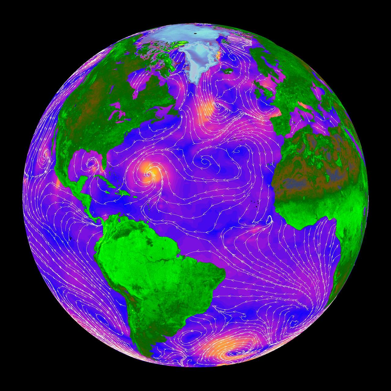
The SeaWinds scatterometer on NASA QuikScat satellite makes global radar measurements day and night, in clear sky and through clouds. Greenland and the polar ice cap are shown here on September 20, 1999.
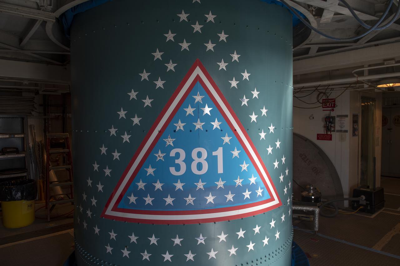
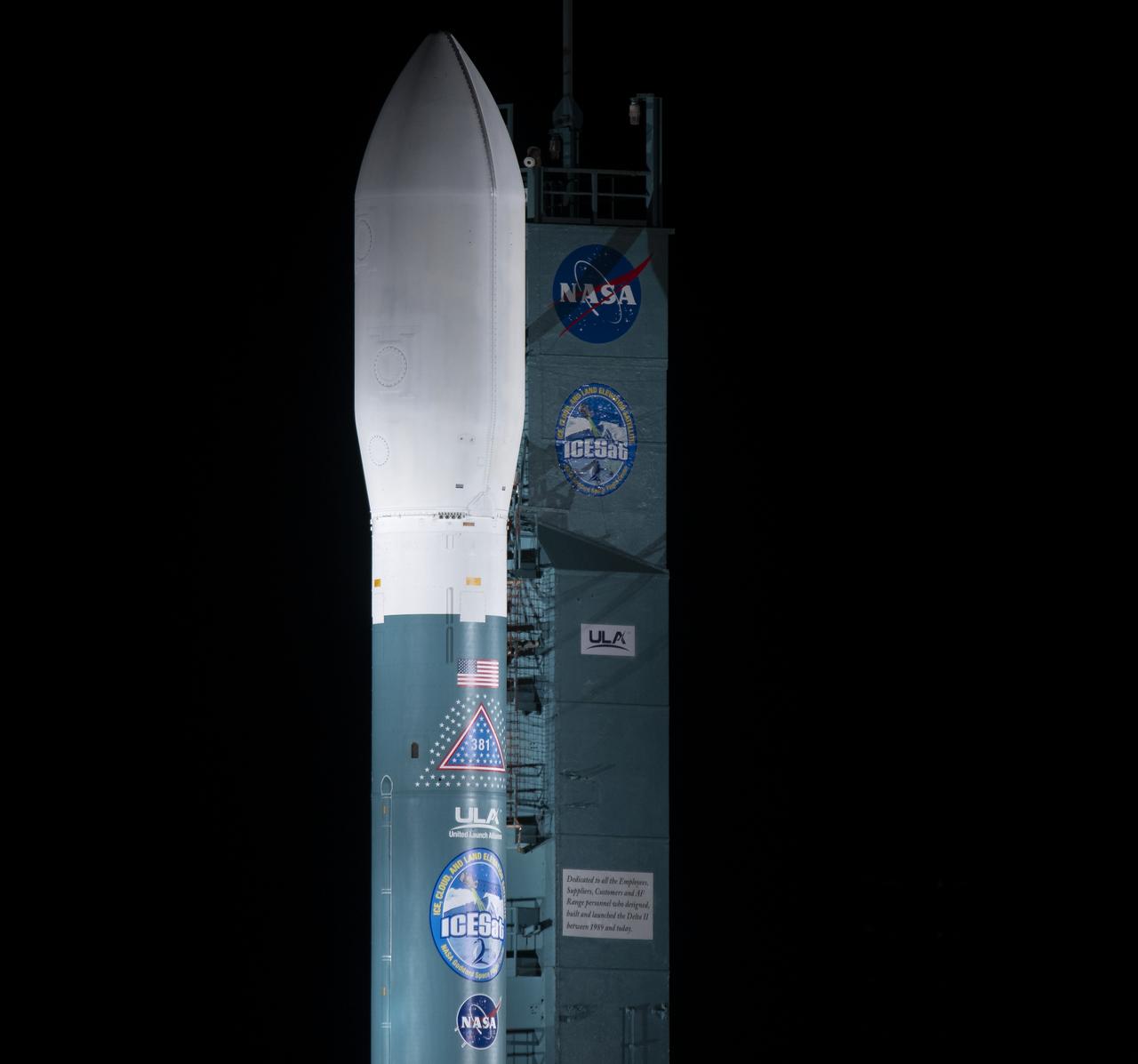
An emblem signifying the 381st flight of the United Launch Alliance Delta family is seen on the Delta II rocket, with the NASA Ice, Cloud and land Elevation Satellite-2 (ICESat-2) onboard, Wednesday, Sept. 12, 2018, at Vandenberg Air Force Base in California. The first Delta I was launched in May 1960. A star traditionally was placed on the rocket to recognize each mission. For the final Delta II, stars were sent to team members and partners throughout the nation. This rocket boasts more than 150 stars with over 800 signatures of people who have been part of the Delta II program. The ICESat-2 mission will measure the changing height of Earth's ice. Photo Credit: (NASA/Bill Ingalls)
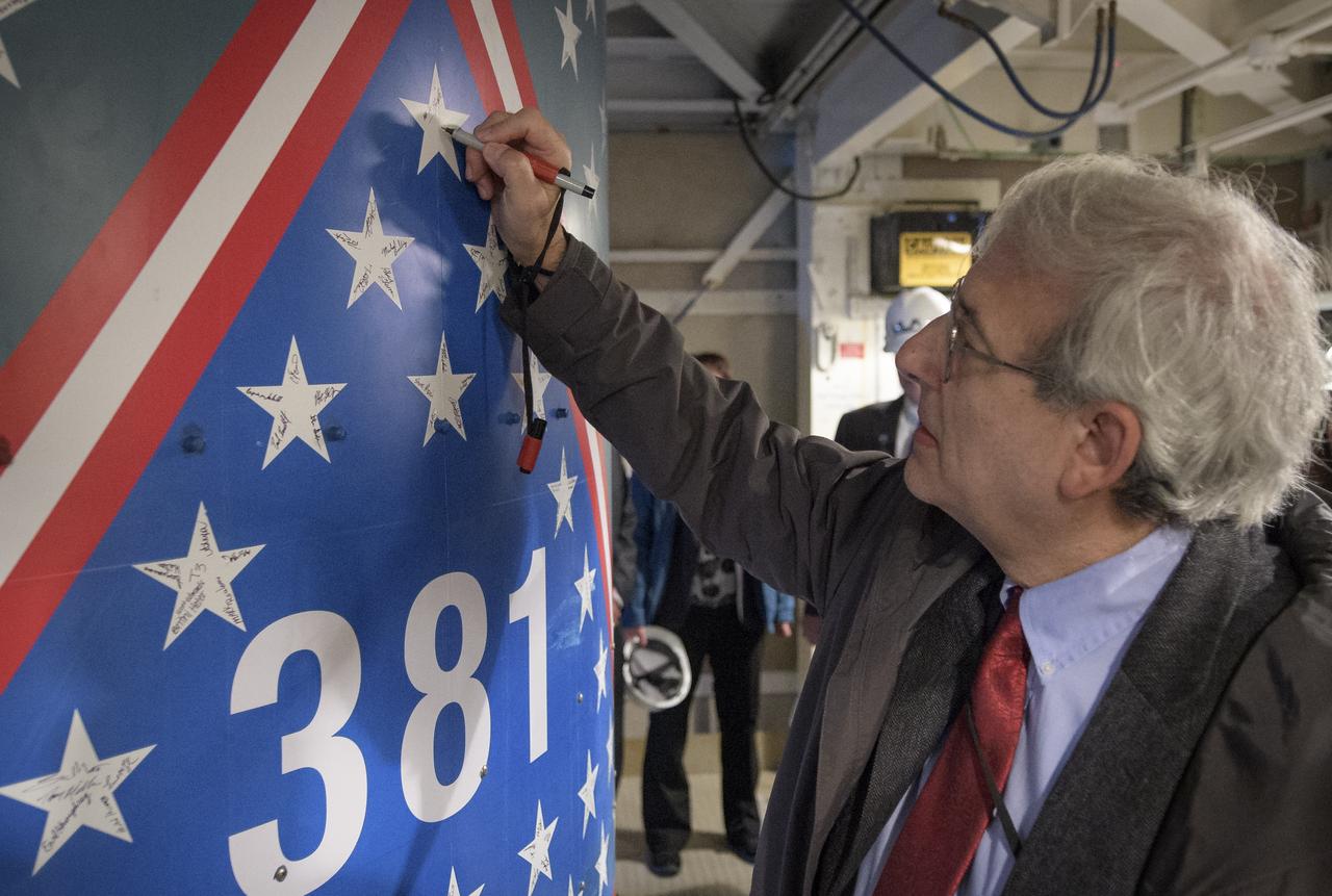
Michael Freilich, director of NASA’s Earth Science Division, NASA Headquarters, signs a star on the United Launch Alliance Delta II with the NASA Ice, Cloud and land Elevation Satellite-2 (ICESat-2) onboard, Thursday, Sept. 13, 2018, at Vandenberg Air Force Base in California. This will be the final launch of a Delta II rocket. The “381” on the rocket signifies that this is the 381st flight in the Delta family. The first Delta I was launched in May 1960. A star traditionally was placed on the rocket to recognize each mission. For the final Delta II, stars were sent to team members and partners throughout the nation. This rocket boasts more than 150 stars with over 800 signatures of people who have been part of the Delta II program. The ICESat-2 mission will measure the changing height of Earth's ice. Photo Credit: (NASA/Bill Ingalls)
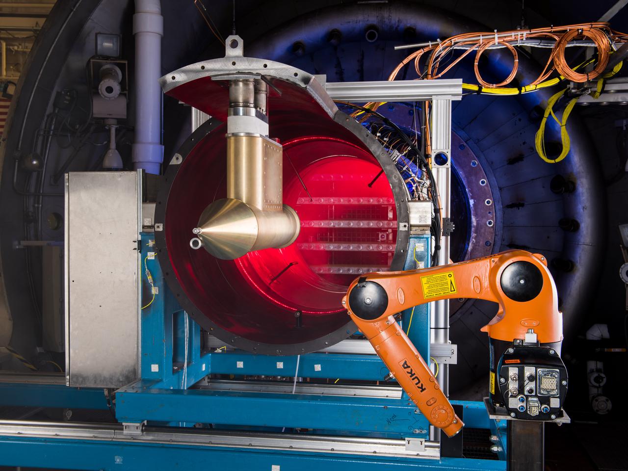
NASA Glenn’s Propulsion Systems Lab (PSL) is conducting research to characterize ice crystal clouds that can create a hazard to aircraft engines in certain conditions. With specialized equipment, scientists can create a simulated ice crystal cloud with the set of bars in the back spraying out a mist. The red area includes lasers, which measure the intensity of the cloud and a series of probes to measure everything from humidity to air pressure. The isokinetic probe (in gold) samples particles and the robotic arm (in orange) has a test tube on the end that catches ice particles for further measuring. NASA Glenn’s PSL is the only place in the world which can create these kind of ice crystal cloud conditions.
Arctic Ozone Expedition Stavanger Norway These clouds in the polar regions north of Stravanger, Norway are representative of what are called 'Type 1' and Type 2' polar stratospheric clouds. Type 1 are seen in the lower portion and consist of cloud particles comprised of nitrogen trihydrates. Seen edge-on as in this view, they appear as a thin dark orange or brown layer. Multiple layering can be seen. The Type 2 clouds are above and consist mostly of water molecules frozen as ice. The size of the particles in Type 2 clouds, the water-ice clouds, are much larger than the particle size of the Type 1 clouds - which are on the order of the wavelength of light.
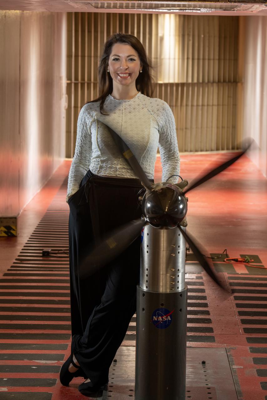
Emily Timko, featured in a Faces of NASA article, poses in the IRT (Icing Research Tunnel) where she works as a “cloud engineer”. She is a Mechanical Test Engineer and works to create unique water spray conditions that simulate icing clouds in the natural aircraft flight environment. Shown in the photo is a test article of a rotating propeller configuration that the IRT researchers are investigating ice accretion with.
These are more wispy blue clouds from Sol 39 as seen by the Imager for Mars Pathfinder. The bright clouds near the bottom are about 30 degrees above the horizon. The clouds are believed to be at an altitude of 10 to 15 km, and are thought to be made of small water ice particles. The picture was taken about 35 minutes before sunrise. Sojourner spent 83 days of a planned seven-day mission exploring the Martian terrain, acquiring images, and taking chemical, atmospheric and other measurements. The final data transmission received from Pathfinder was at 10:23 UTC on September 27, 1997. Although mission managers tried to restore full communications during the following five months, the successful mission was terminated on March 10, 1998. http://photojournal.jpl.nasa.gov/catalog/PIA00919
Today's VIS image shows a line of clouds over the south polar cap. These clouds are at an altitude above the surface where they are not directly interacting with the surface topography of the ice. During seasonal changes surface winds will sweep along the cap and create clouds where the winds dip into the troughs of the ice. Orbit Number: 91751 Latitude: -86.915 Longitude: 182.233 Instrument: VIS Captured: 2022-08-21 01:31 https://photojournal.jpl.nasa.gov/catalog/PIA25634
Using the navigation cameras on its mast, NASA's Curiosity Mars rover took these images of clouds just after sunset on March 31, 2021, the 3,075th so, or Martian day, of the mission. These noctilucent, or twilight clouds, are made of water ice; ice crystals reflect the setting sun, allowing the detail in each cloud to be seen more easily. Movie available at https://photojournal.jpl.nasa.gov/catalog/PIA24645
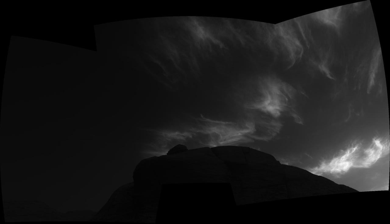
Using the navigation cameras on its mast, NASA's Curiosity Mars rover took these images of clouds just after sunset on March 28, 2021, the 3,072nd so, or Martian day, of the mission. These noctilucent, or twilight clouds, are made of water ice; ice crystals reflect the setting sun, allowing the detail in each cloud to be seen more easily. Movie available at https://photojournal.jpl.nasa.gov/catalog/PIA24646
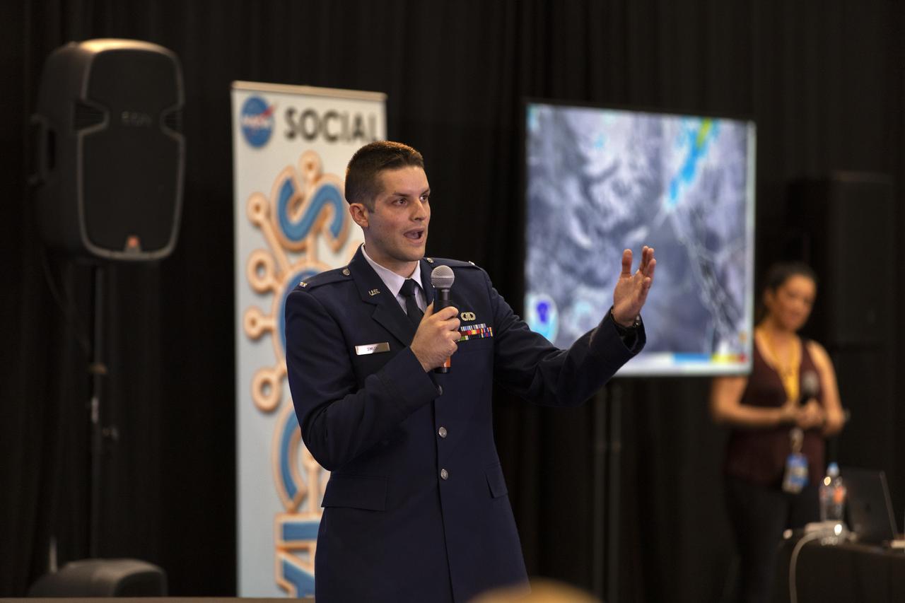
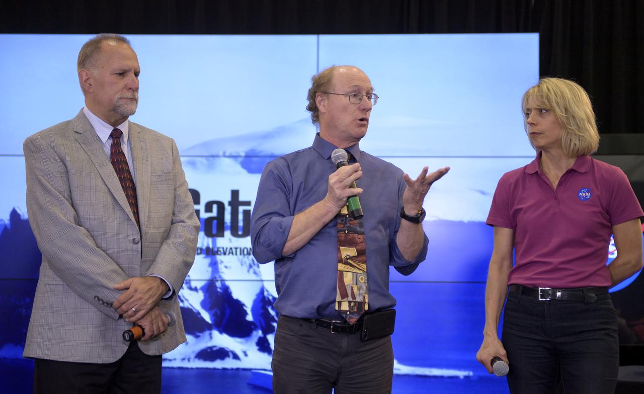
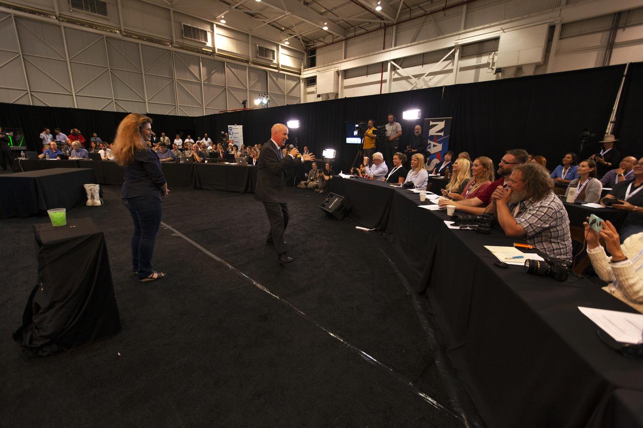
1st Lt. Daniel Smith, launch weather officer, 30th Space Wing, Vandenberg Air Force Base, speaks to members of the news media and social media participants during a prelaunch mission briefing for NASA's Ice, Cloud and land Elevation Satellite-2 (ICESat-2), a mission to measure the changing height of Earth's ice, on Sept. 13, 2018 at Vandenberg Air Force Base (VAFB) in California. ICESat-2 will launch aboard a United Launch Alliance Delta II, the rocket’s final mission, from Space Launch Complex 2 at VAFB. Launch is scheduled for 8:46 a.m. EDT (5:46 a.m. PDT).
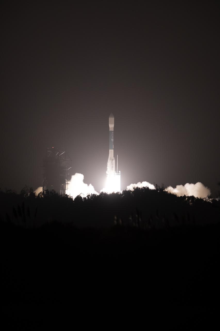
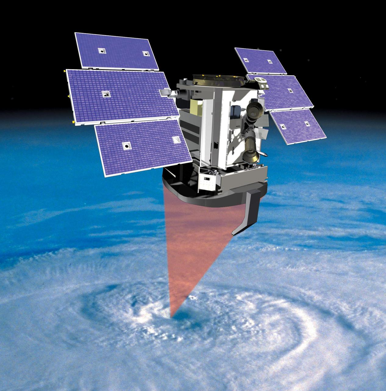
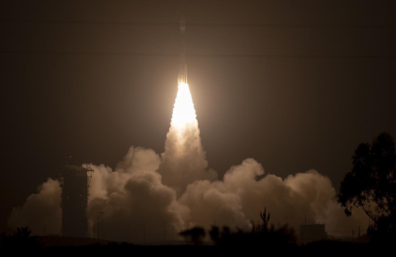
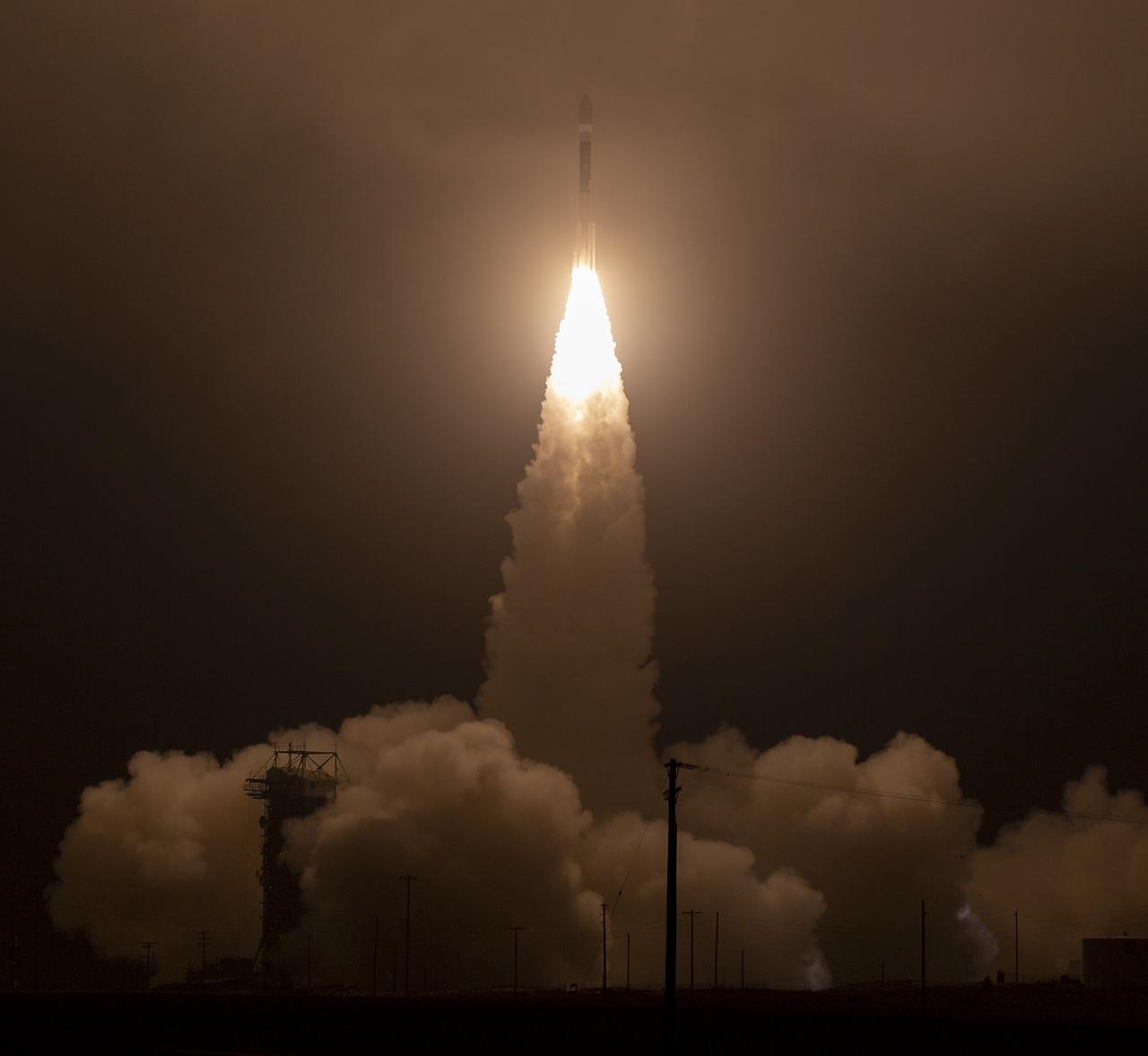
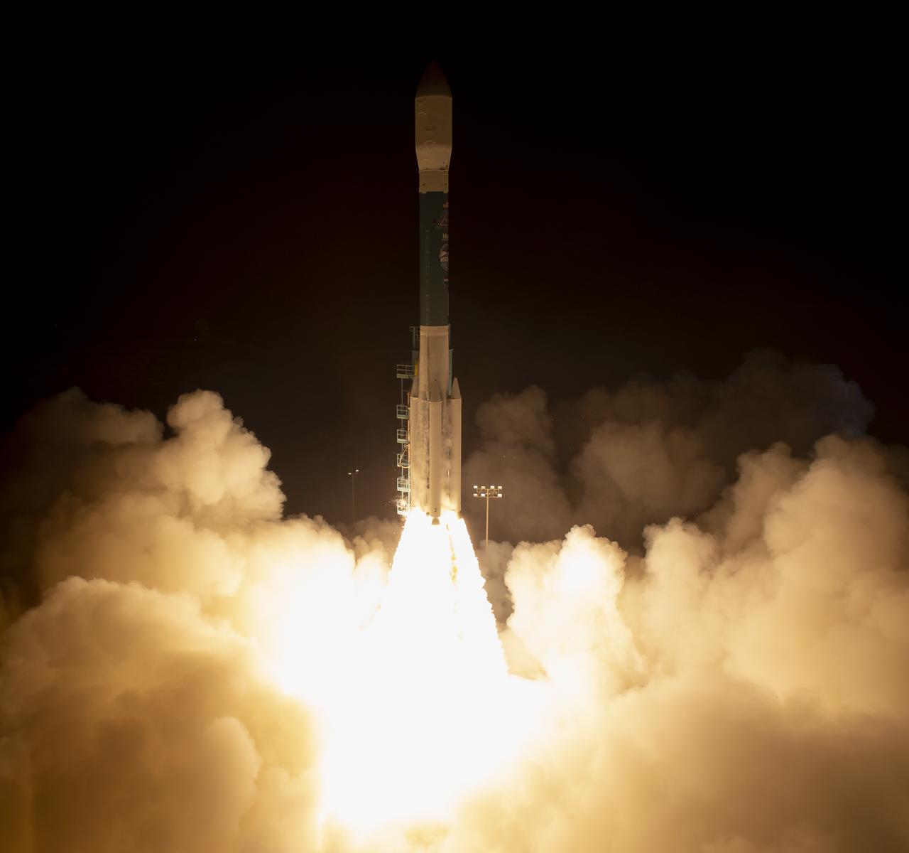
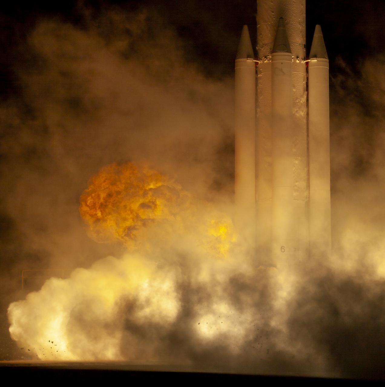
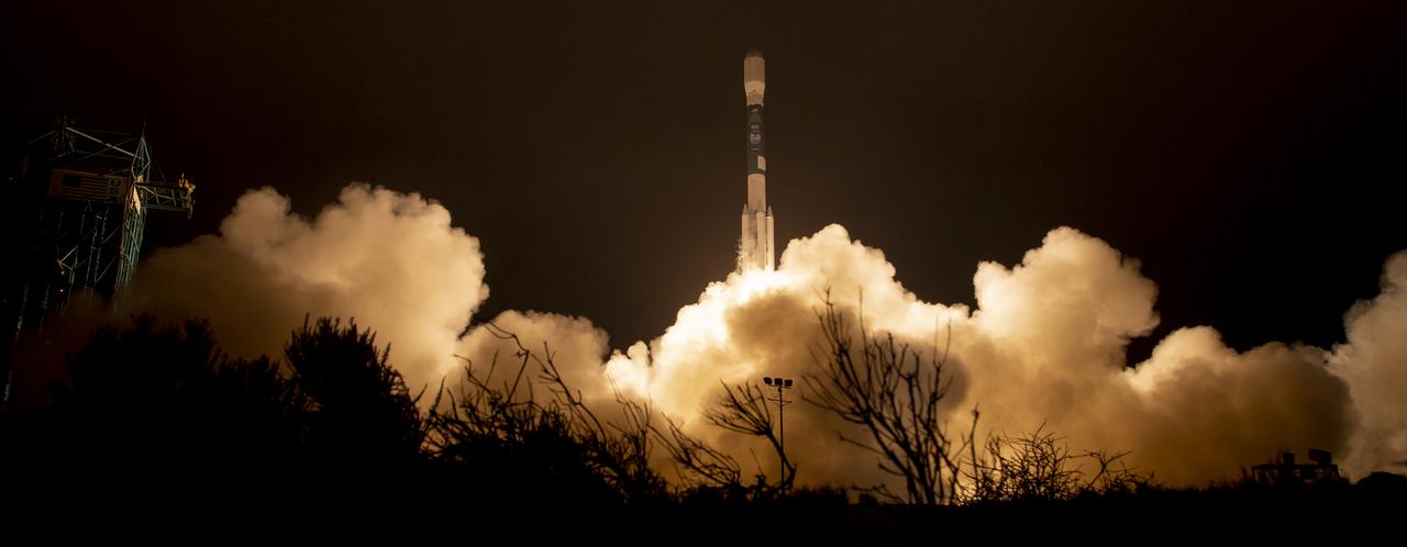
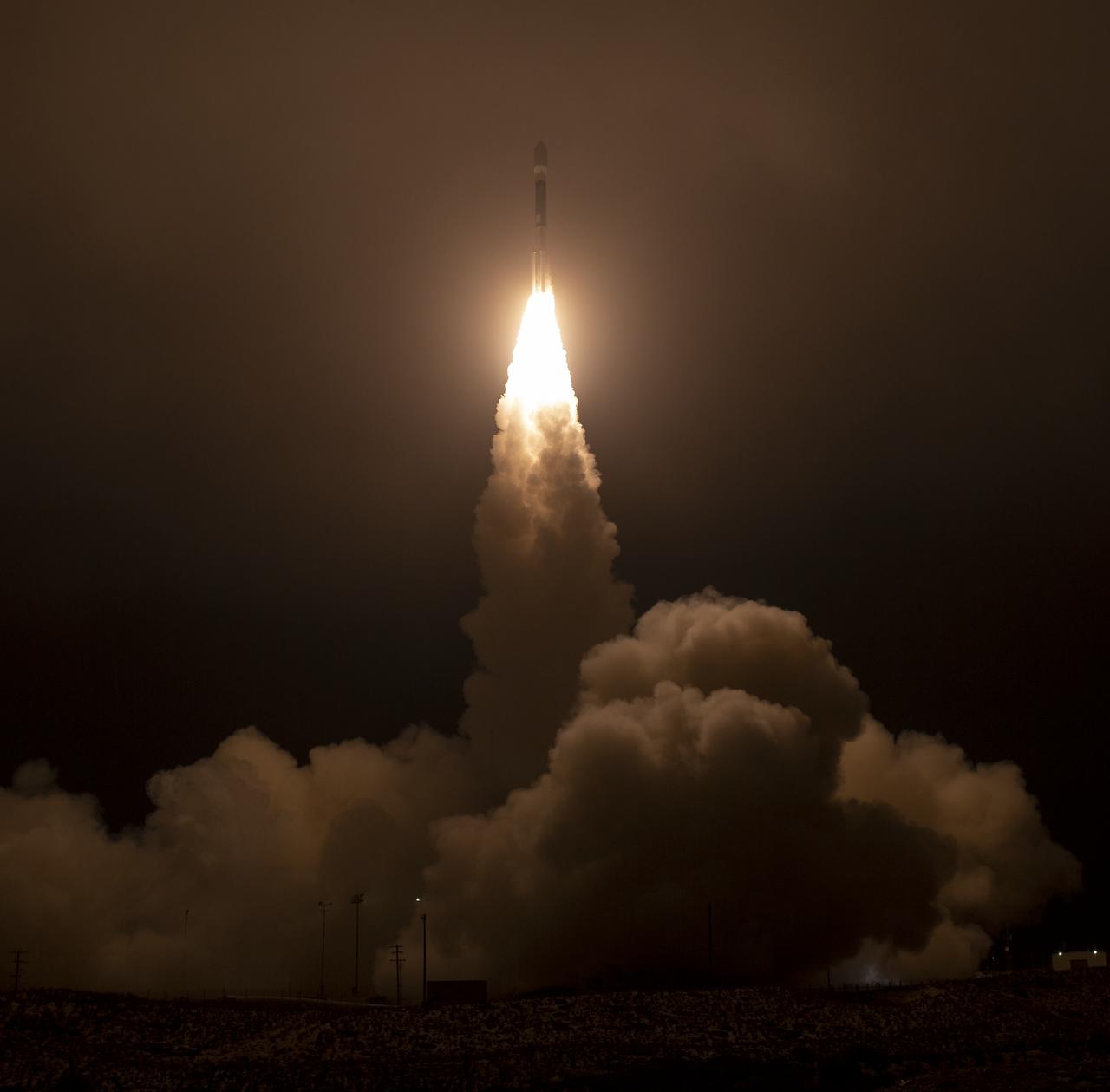
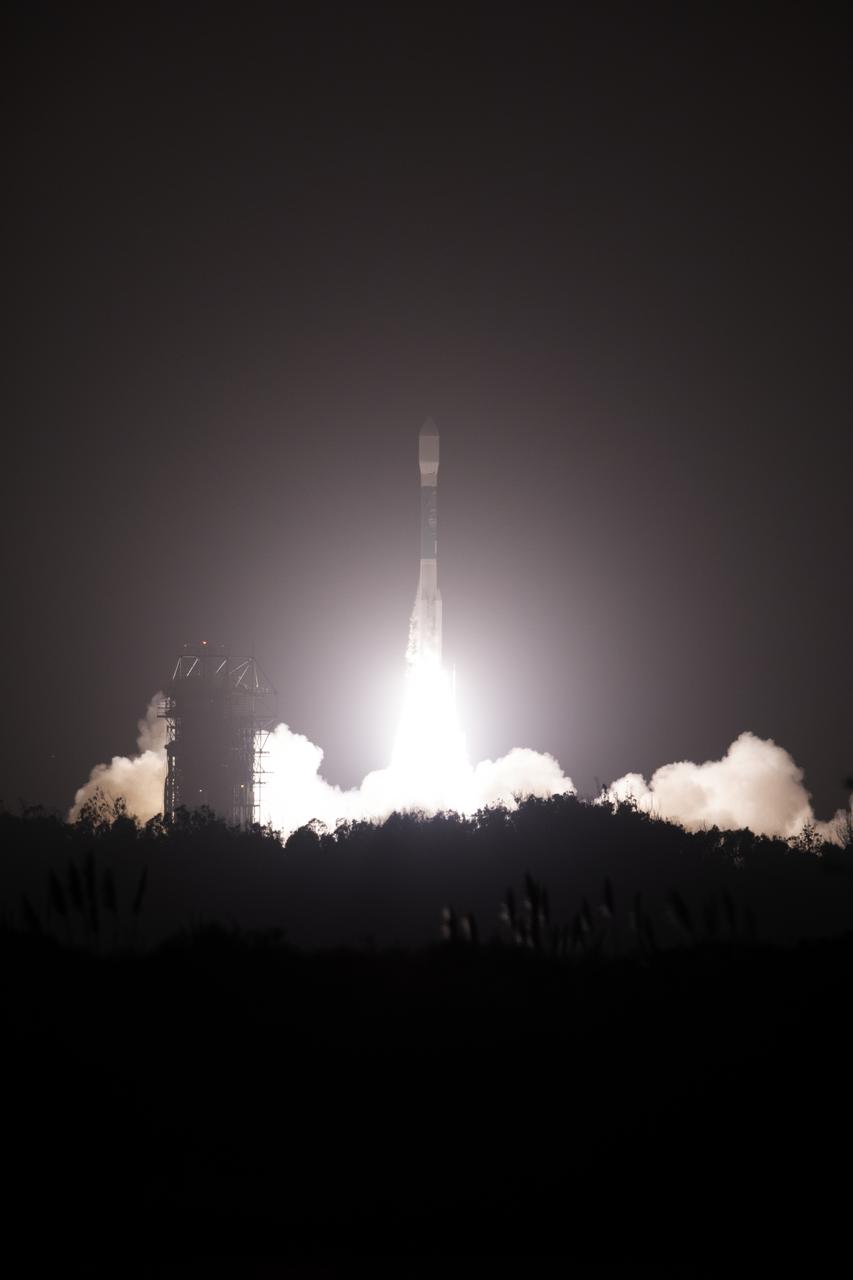
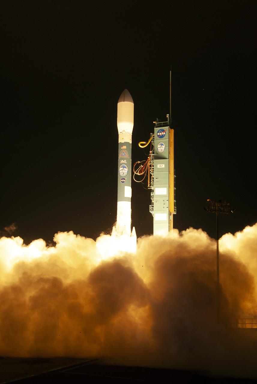
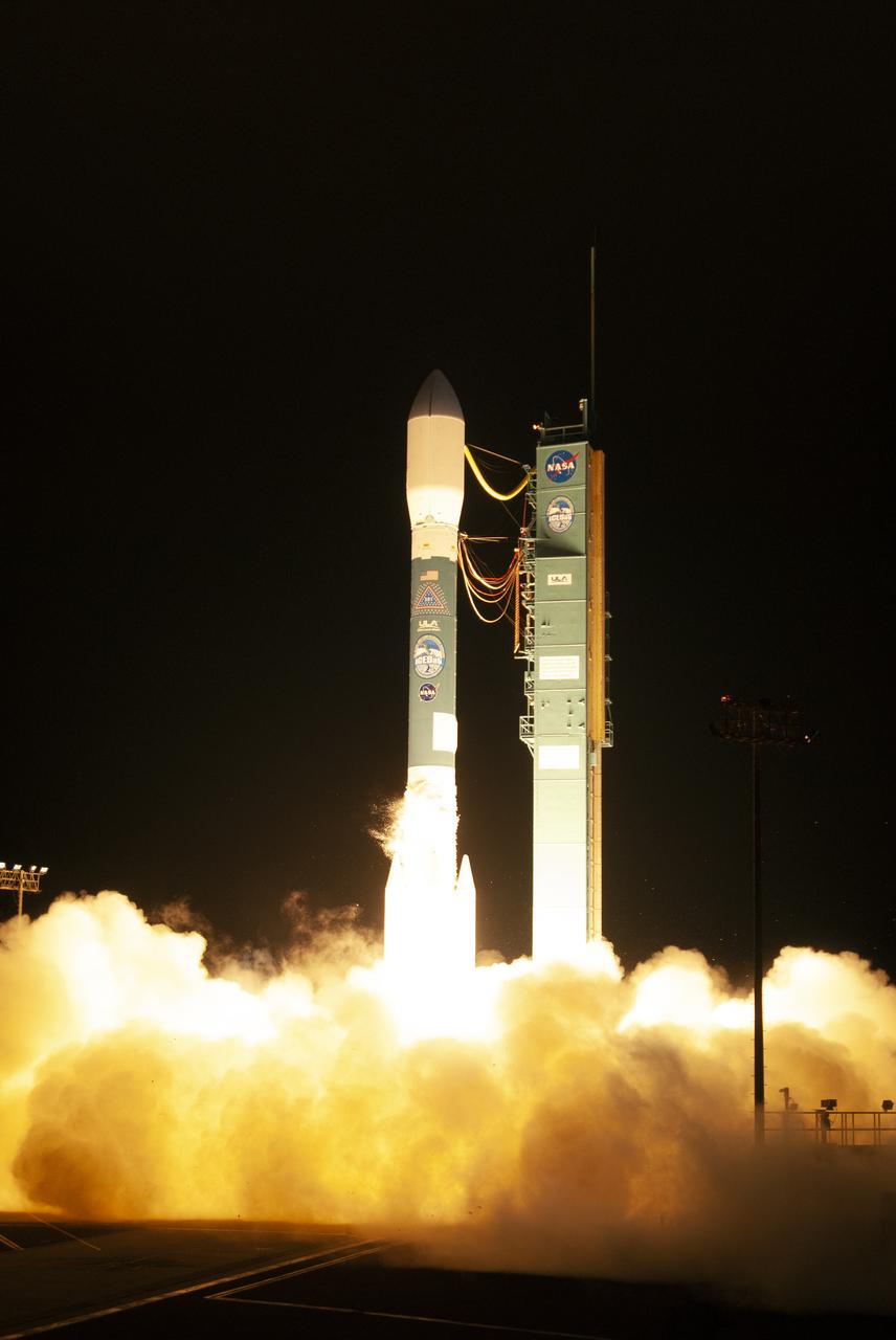
The final United Launch Alliance Delta II rocket lifts off from Space Launch Complex 2 at Vandenberg Air Force Base in California, on Sept. 15, 2018, carrying NASA's Ice, Cloud and land Elevation Satellite-2 (ICESat-2). Liftoff was at 9:02 a.m. EDT (6:02 a.m. PDT). The satellite will measure the height of our changing Earth, one laser pulse at a time, 10,000 laser pulses per second. ICESat-2 will provide scientists with height measurements that create a global portrait of Earth's third dimension, gathering date that can precisely track changes of terrain, including glaciers, sea ice and forests.

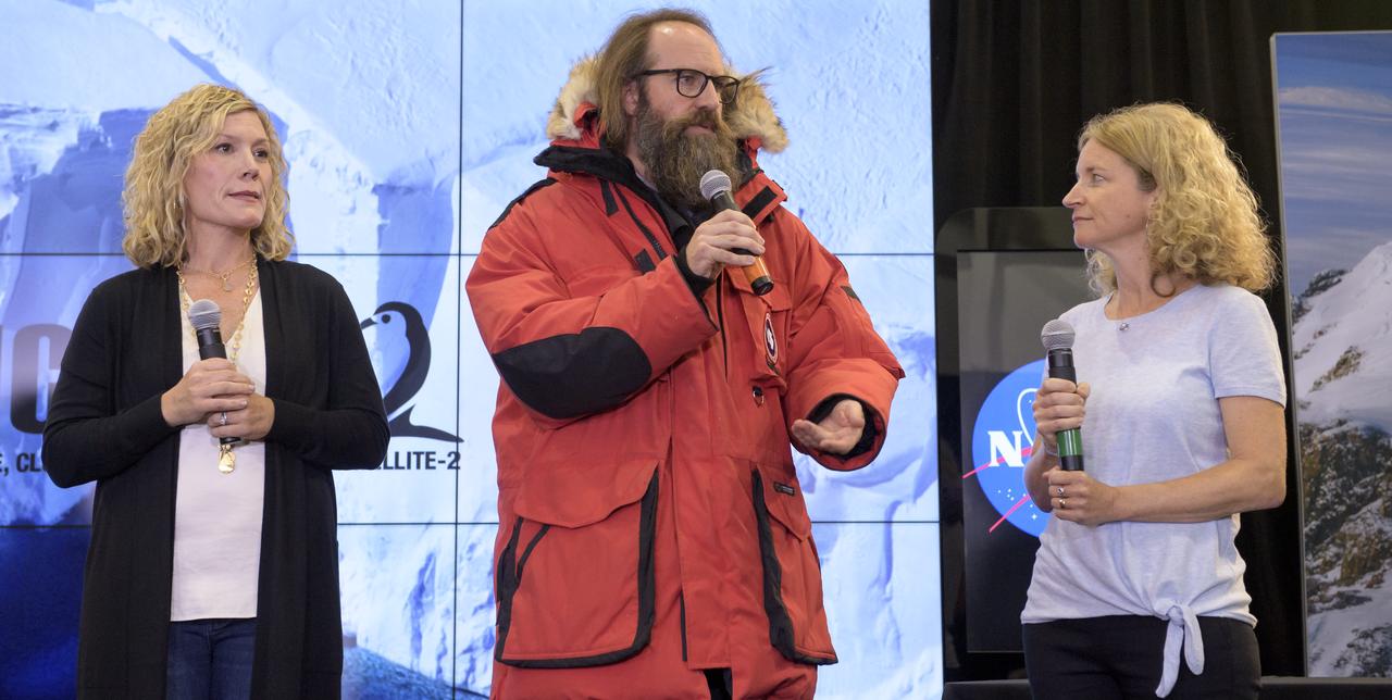
Helen Fricker, Scripps Institution of Oceanography, La Jolla, California, ICESat-2 science definition team member, speaks to members of the news media and social media participants during a prelaunch mission briefing for NASA's Ice, Cloud and land Elevation Satellite-2 (ICESat-2), a mission to measure the changing height of Earth's ice, on Sept. 13, 2018 at Vandenberg Air Force Base (VAFB) in California. ICESat-2 will launch aboard a United Launch Alliance Delta II, the rocket’s final mission, from Space Launch Complex 2 at VAFB. Launch is scheduled for 8:46 a.m. EDT (5:46 a.m. PDT).
The final United Launch Alliance Delta II rocket lifts off from Space Launch Complex 2 at Vandenberg Air Force Base in California, on Sept. 15, 2018, carrying NASA's Ice, Cloud and land Elevation Satellite-2 (ICESat-2). Liftoff was at 9:02 a.m. EDT (6:02 a.m. PDT). The satellite will measure the height of our changing Earth, one laser pulse at a time, 10,000 laser pulses per second. ICESat-2 will provide scientists with height measurements that create a global portrait of Earth's third dimension, gathering date that can precisely track changes of terrain, including glaciers, sea ice and forests.

Tim Dunn, launch director, NASA's Kennedy Space Center in Florida, speaks to members of the news media and social media participants during a prelaunch mission briefing for NASA's Ice, Cloud and land Elevation Satellite-2 (ICESat-2), a mission to measure the changing height of Earth's ice, on Sept. 13, 2018 at Vandenberg Air Force Base (VAFB) in California. ICESat-2 will launch aboard a United Launch Alliance Delta II, the rocket’s final mission, from Space Launch Complex 2 at VAFB. Launch is scheduled for 8:46 a.m. EDT (5:46 a.m. PDT).
The final United Launch Alliance Delta II rocket lifts off from Space Launch Complex 2 at Vandenberg Air Force Base in California, on Sept. 15, 2018, carrying NASA's Ice, Cloud and land Elevation Satellite-2 (ICESat-2). Liftoff was at 9:02 a.m. EDT (6:02 a.m. PDT). The satellite will measure the height of our changing Earth, one laser pulse at a time, 10,000 laser pulses per second. ICESat-2 will provide scientists with height measurements that create a global portrait of Earth's third dimension, gathering date that can precisely track changes of terrain, including glaciers, sea ice and forests.
The final United Launch Alliance Delta II rocket lifts off from Space Launch Complex 2 at Vandenberg Air Force Base in California, on Sept. 15, 2018, carrying NASA's Ice, Cloud and land Elevation Satellite-2 (ICESat-2). Liftoff was at 9:02 a.m. EDT (6:02 a.m. PDT). The satellite will measure the height of our changing Earth, one laser pulse at a time, 10,000 laser pulses per second. ICESat-2 will provide scientists with height measurements that create a global portrait of Earth's third dimension, gathering date that can precisely track changes of terrain, including glaciers, sea ice and forests.
Tim Dunn, launch director, NASA's Kennedy Space Center in Florida, speaks to members of the news media and social media participants during a prelaunch mission briefing for NASA's Ice, Cloud and land Elevation Satellite-2 (ICESat-2), a mission to measure the changing height of Earth's ice, on Sept. 13, 2018 at Vandenberg Air Force Base (VAFB) in California. ICESat-2 will launch aboard a United Launch Alliance Delta II, the rocket’s final mission, from Space Launch Complex 2 at VAFB. Launch is scheduled for 8:46 a.m. EDT (5:46 a.m. PDT).
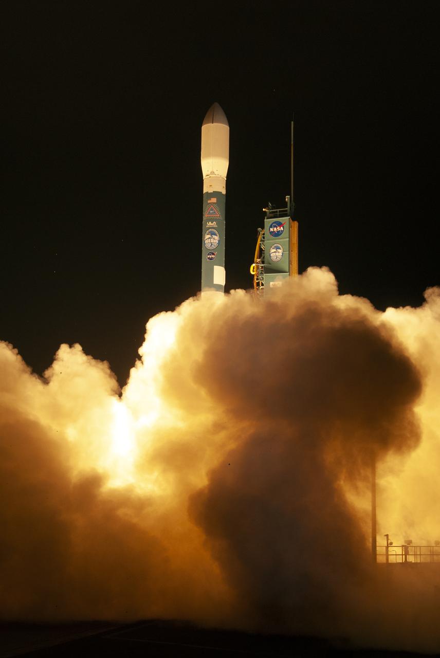
The final United Launch Alliance Delta II rocket lifts off from Space Launch Complex 2 at Vandenberg Air Force Base in California, on Sept. 15, 2018, carrying NASA's Ice, Cloud and land Elevation Satellite-2 (ICESat-2). Liftoff was at 9:02 a.m. EDT (6:02 a.m. PDT). The satellite will measure the height of our changing Earth, one laser pulse at a time, 10,000 laser pulses per second. ICESat-2 will provide scientists with height measurements that create a global portrait of Earth's third dimension, gathering date that can precisely track changes of terrain, including glaciers, sea ice and forests.
Cathy Richardson, Deputy Program Manager, Earth Science Projects Division, NASA Goddard Space Flight Center, speaks to members of the news media and social media participants during a prelaunch mission briefing for NASA's Ice, Cloud and land Elevation Satellite-2 (ICESat-2), a mission to measure the changing height of Earth's ice, on Sept. 13, 2018 at Vandenberg Air Force Base (VAFB) in California. ICESat-2 will launch aboard a United Launch Alliance Delta II, the rocket’s final mission, from Space Launch Complex 2 at VAFB. Launch is scheduled for 8:46 a.m. EDT (5:46 a.m. PDT).
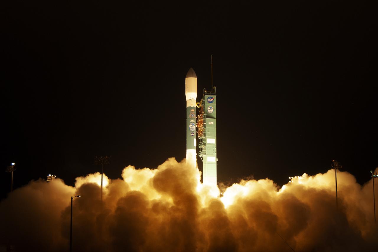
The final United Launch Alliance Delta II rocket lifts off from Space Launch Complex 2 at Vandenberg Air Force Base in California, on Sept. 15, 2018, carrying NASA's Ice, Cloud and land Elevation Satellite-2 (ICESat-2). Liftoff was at 9:02 a.m. EDT (6:02 a.m. PDT). The satellite will measure the height of our changing Earth, one laser pulse at a time, 10,000 laser pulses per second. ICESat-2 will provide scientists with height measurements that create a global portrait of Earth's third dimension, gathering date that can precisely track changes of terrain, including glaciers, sea ice and forests.
The final United Launch Alliance Delta II rocket lifts off from Space Launch Complex 2 at Vandenberg Air Force Base in California, on Sept. 15, 2018, carrying NASA's Ice, Cloud and land Elevation Satellite-2 (ICESat-2). Liftoff was at 9:02 a.m. EDT (6:02 a.m. PDT). The satellite will measure the height of our changing Earth, one laser pulse at a time, 10,000 laser pulses per second. ICESat-2 will provide scientists with height measurements that create a global portrait of Earth's third dimension, gathering date that can precisely track changes of terrain, including glaciers, sea ice and forests.
Lori Magruder, University of Texas at Austin, ICESat-2 science definition team lead, speaks to members of the news media and social media participants during a prelaunch mission briefing for NASA's Ice, Cloud and land Elevation Satellite-2 (ICESat-2), a mission to measure the changing height of Earth's ice, on Sept. 13, 2018 at Vandenberg Air Force Base (VAFB) in California. ICESat-2 will launch aboard a United Launch Alliance Delta II, the rocket’s final mission, from Space Launch Complex 2 at VAFB. Launch is scheduled for 8:46 a.m. EDT (5:46 a.m. PDT).

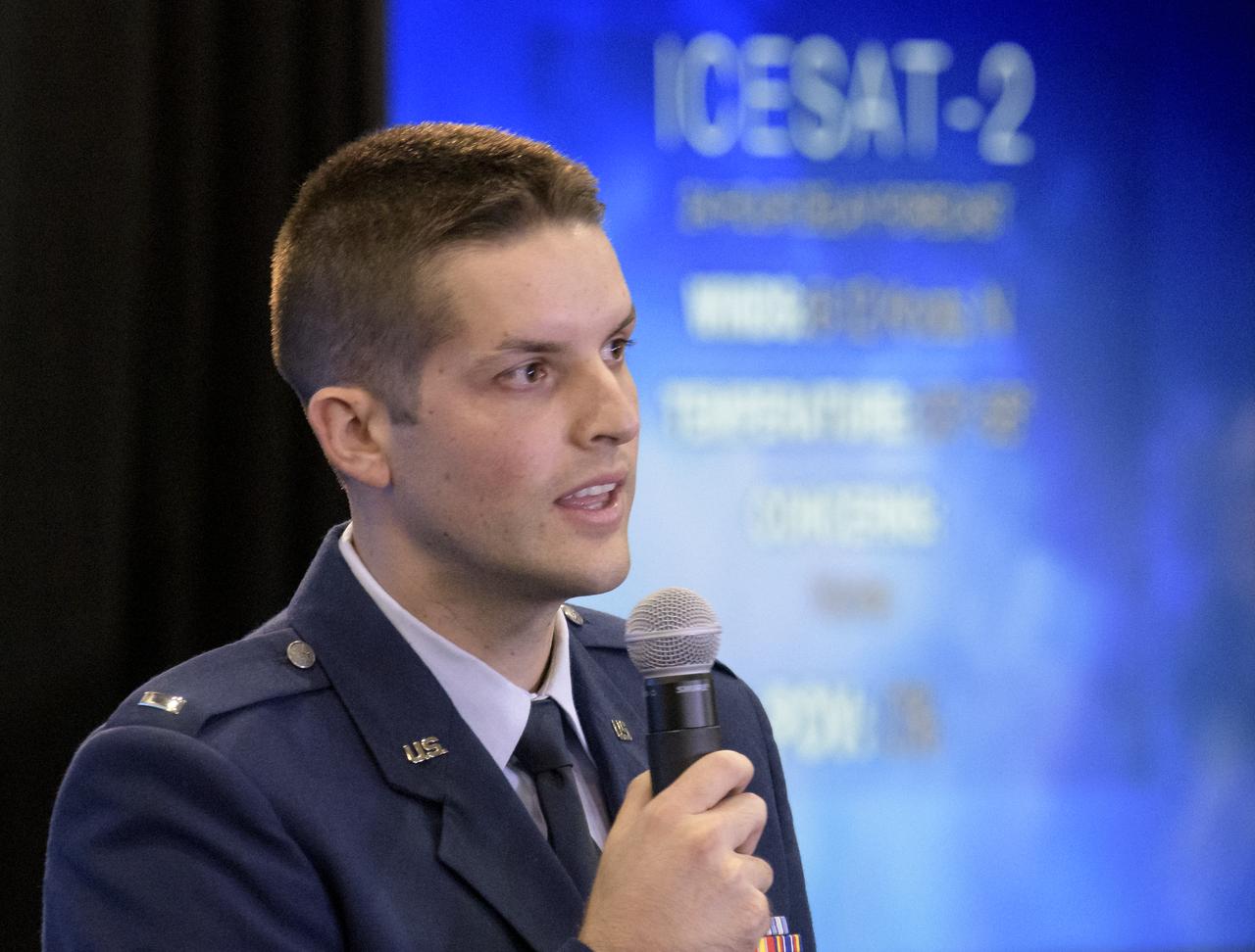
Tom Neumann, ICESat-2 deputy project scientist, NASA's Goddard Space Flight Center, speaks to members of the news media and social media participants during a prelaunch mission briefing for NASA's Ice, Cloud and land Elevation Satellite-2 (ICESat-2), a mission to measure the changing height of Earth's ice, on Sept. 13, 2018 at Vandenberg Air Force Base (VAFB) in California. ICESat-2 will launch aboard a United Launch Alliance Delta II, the rocket’s final mission, from Space Launch Complex 2 at VAFB. Launch is scheduled for 8:46 a.m. EDT (5:46 a.m. PDT).
The final United Launch Alliance Delta II rocket lifts off from Space Launch Complex 2 at Vandenberg Air Force Base in California, on Sept. 15, 2018, carrying NASA's Ice, Cloud and land Elevation Satellite-2 (ICESat-2). Liftoff was at 9:02 a.m. EDT (6:02 a.m. PDT). The satellite will measure the height of our changing Earth, one laser pulse at a time, 10,000 laser pulses per second. ICESat-2 will provide scientists with height measurements that create a global portrait of Earth's third dimension, gathering date that can precisely track changes of terrain, including glaciers, sea ice and forests.
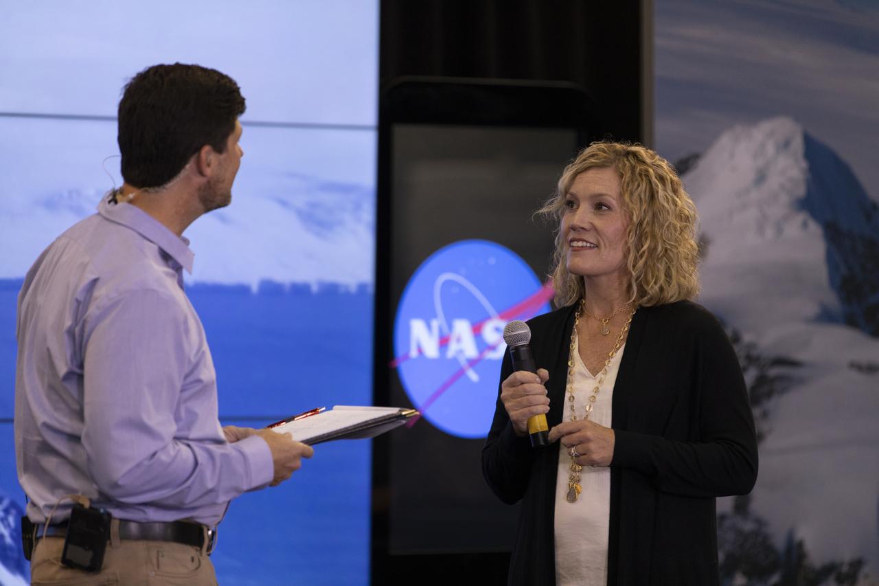
Michelle Thaller, NASA Communications (left), and Tom Wagner, ICESat-2 program scientist, NASA Headquarters (right) speaks to members of the news media and social media participants during a prelaunch mission briefing for NASA's Ice, Cloud and land Elevation Satellite-2 (ICESat-2), a mission to measure the changing height of Earth's ice, on Sept. 13, 2018 at Vandenberg Air Force Base (VAFB) in California. ICESat-2 will launch aboard a United Launch Alliance Delta II, the rocket’s final mission, from Space Launch Complex 2 at VAFB. Launch is scheduled for 8:46 a.m. EDT (5:46 a.m. PDT).
Tom Neumann, ICESat-2 deputy project scientist, NASA's Goddard Space Flight Center, speaks to members of the news media and social media participants during a prelaunch mission briefing for NASA's Ice, Cloud and land Elevation Satellite-2 (ICESat-2), a mission to measure the changing height of Earth's ice, on Sept. 13, 2018 at Vandenberg Air Force Base (VAFB) in California. ICESat-2 will launch aboard a United Launch Alliance Delta II, the rocket’s final mission, from Space Launch Complex 2 at VAFB. Launch is scheduled for 8:46 a.m. EDT (5:46 a.m. PDT).