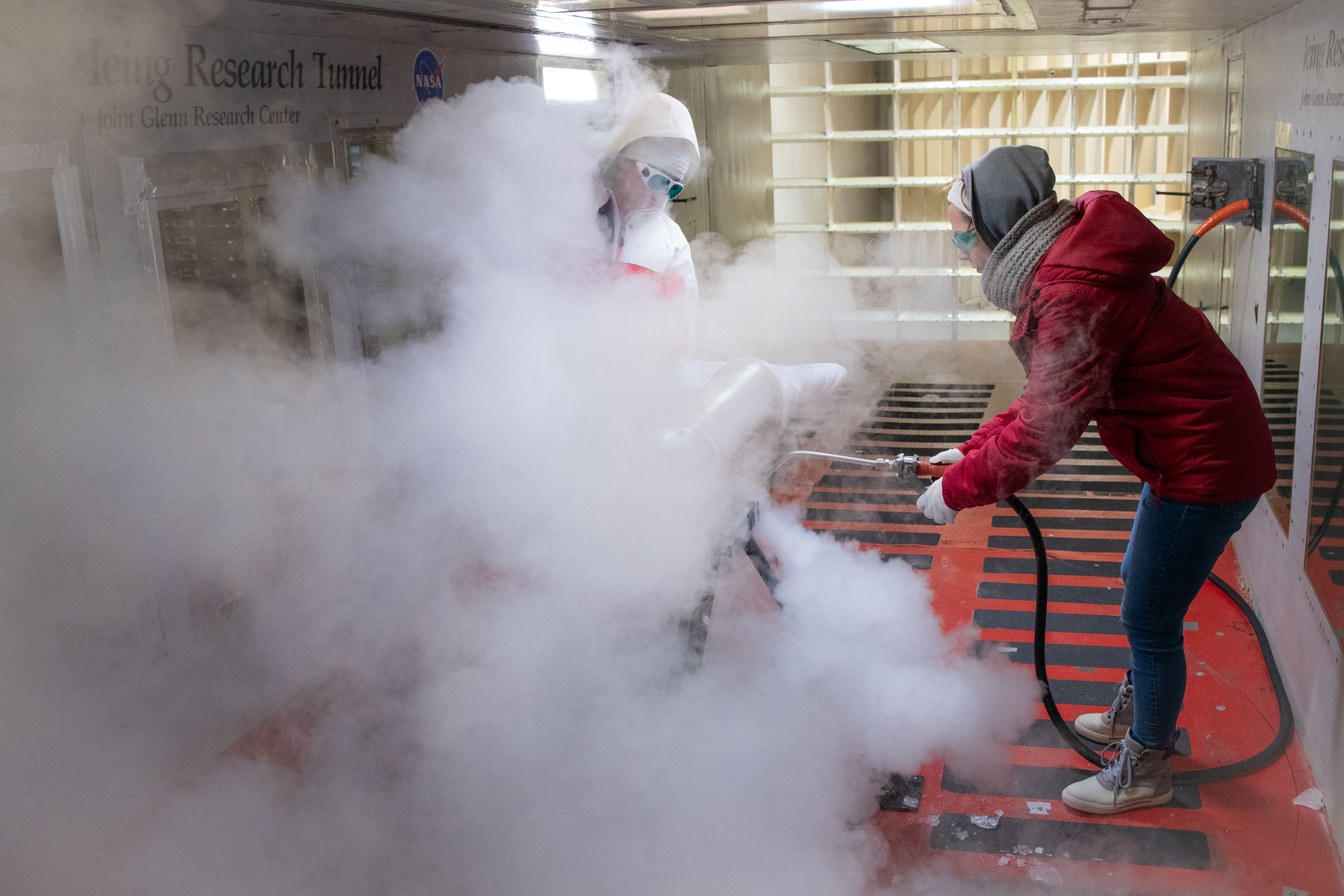
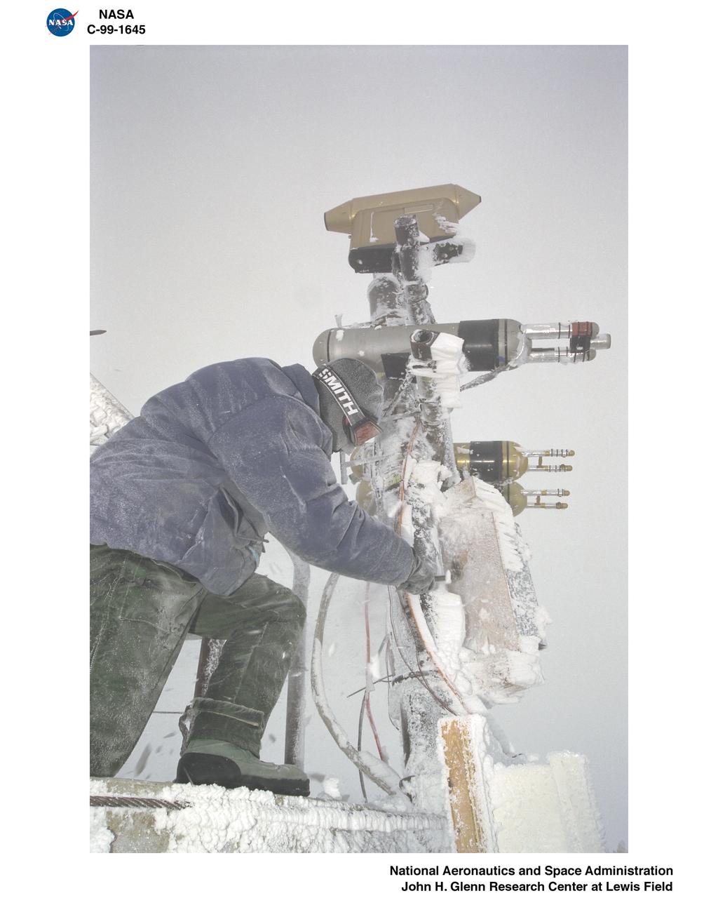
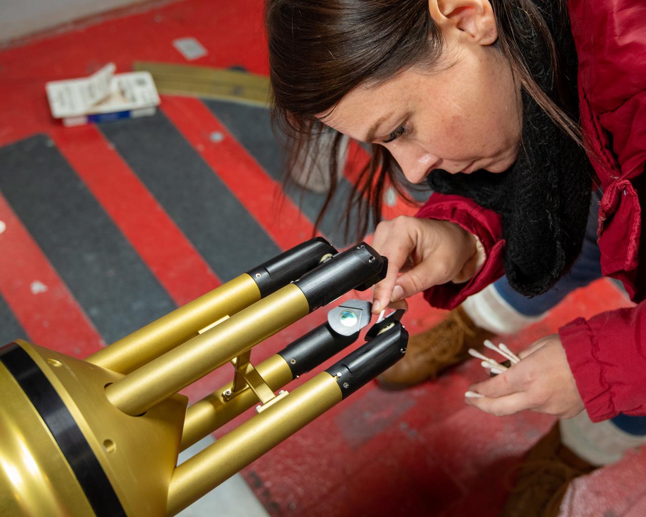
Test engineers clean the ice cloud detection probe in the Icing Research Tunnel in between test runs. Steam is used to melt the accumulated ice on the detection probe. The test engineers need to wear goggles to protect them from the laser light that the probe emits. The laser detects water content and ice particles in the cloud that the wind tunnel produces. This process is done to calibrate the tunnel for research by characterizing the cloud flow.

This map shows the thickness of the south polar layered deposits of Mars, an ice-rich geologic unit that was probed by the Mars Advanced Radar for Subsurface and Ionospheric Sounding MARSIS
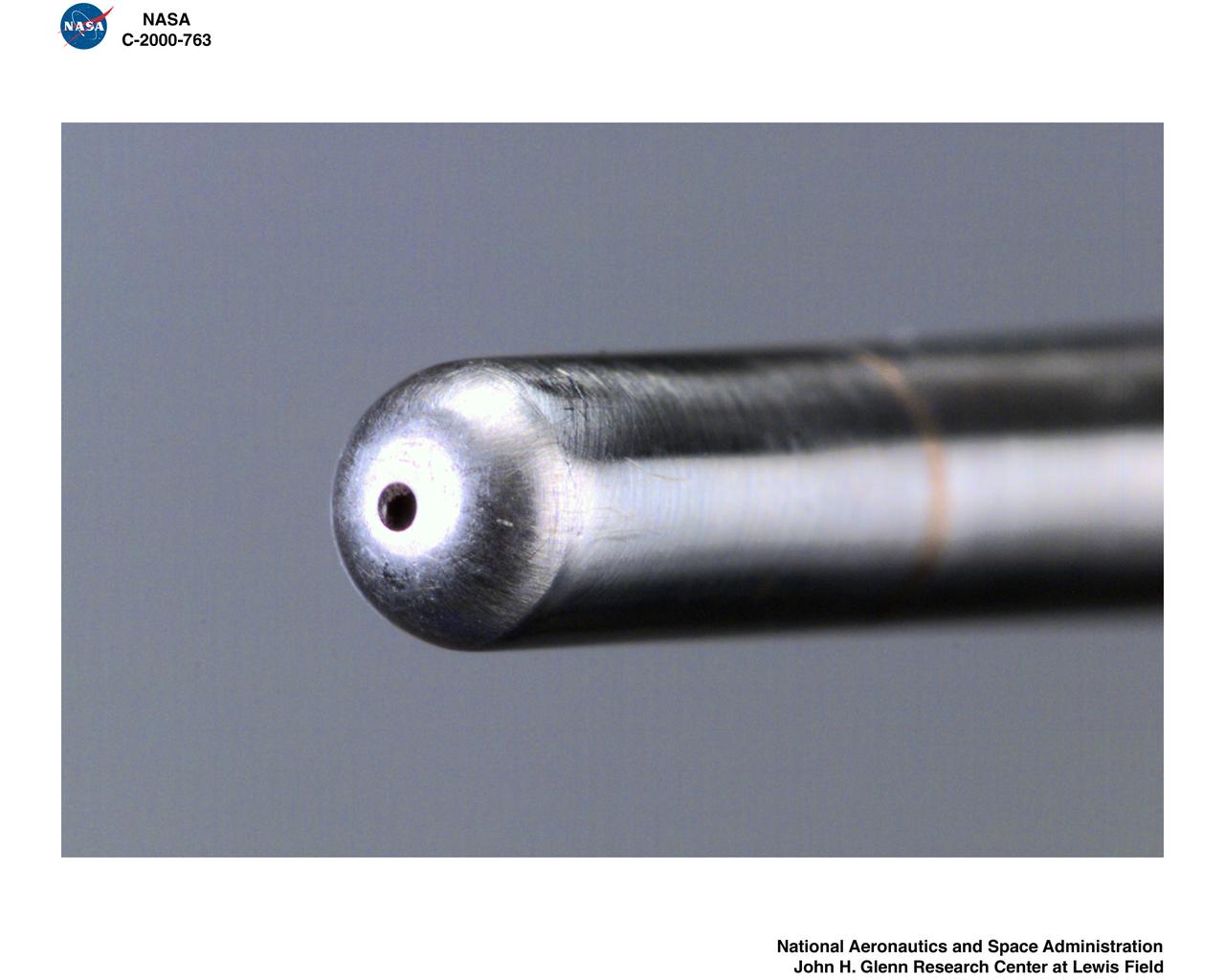
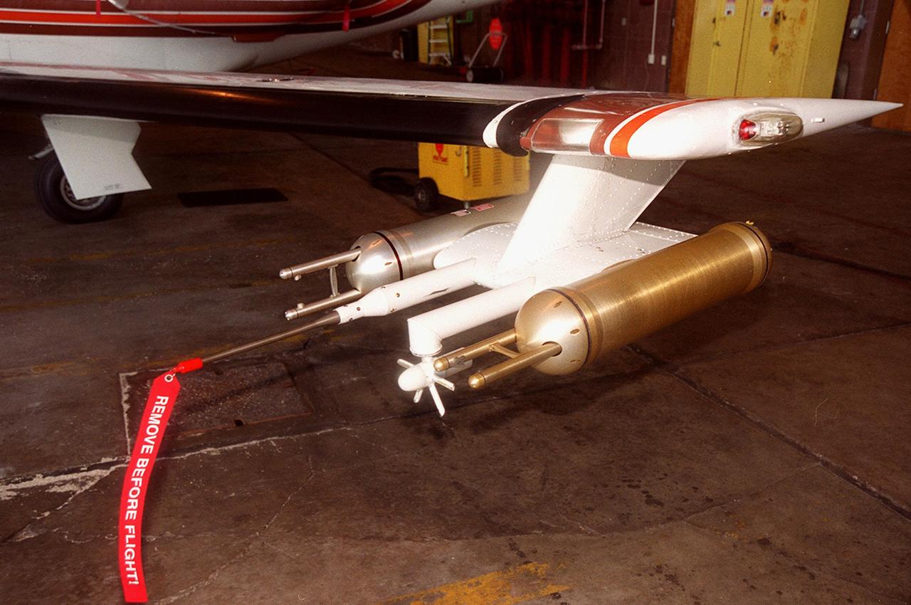
IRT - ICING RESEARCH TUNNEL WAKE SURVEY PROBE
Isokinetic and Multi Wire Probes in the Icing Research Tunnel, IRT, Test Section
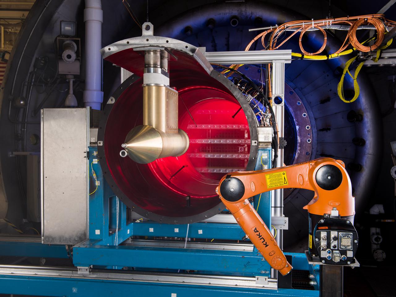
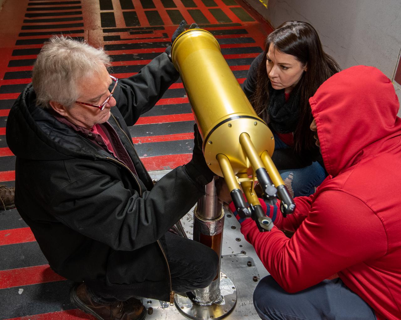
NASA Glenn’s Propulsion Systems Lab (PSL) is conducting research to characterize ice crystal clouds that can create a hazard to aircraft engines in certain conditions. With specialized equipment, scientists can create a simulated ice crystal cloud with the set of bars in the back spraying out a mist. The red area includes lasers, which measure the intensity of the cloud and a series of probes to measure everything from humidity to air pressure. The isokinetic probe (in gold) samples particles and the robotic arm (in orange) has a test tube on the end that catches ice particles for further measuring. NASA Glenn’s PSL is the only place in the world which can create these kind of ice crystal cloud conditions.
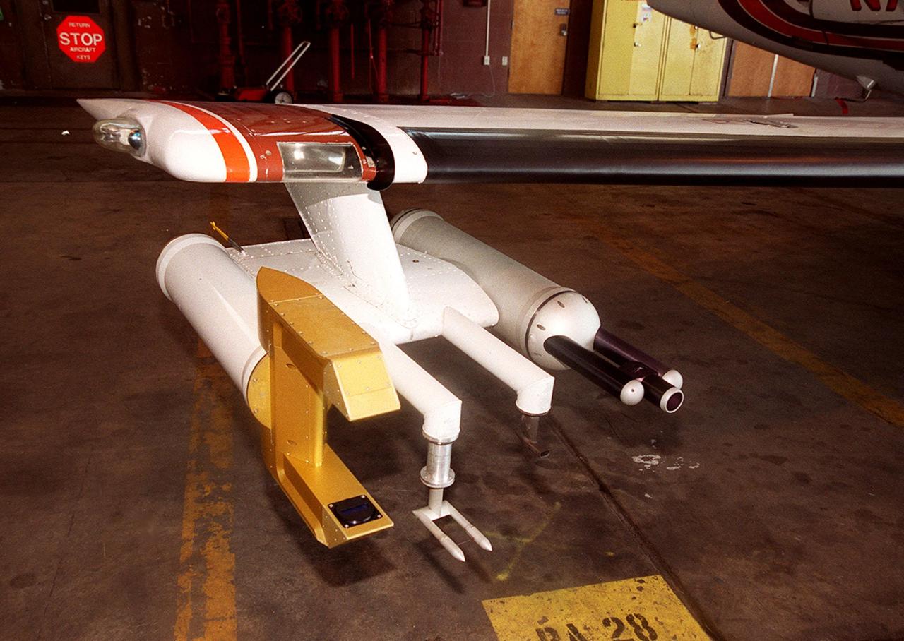
MWISP - MT WASHINGTON ICING SENSORS PROJECT - CRREL - COLD REGIONS RESEARCH AND ENGINEERING LABORATORY - AND SPEC - STATTON PARK ENGINEERING CORPORATION PROBES

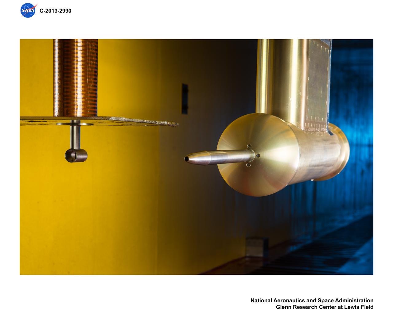
NASA Glenn’s Propulsion Systems Lab (PSL) is conducting research to characterize ice crystal clouds that can create a hazard to aircraft engines under certain conditions. The isokinetic probe (in gold) samples particles and another series of probes can measure everything from humidity to air pressure.
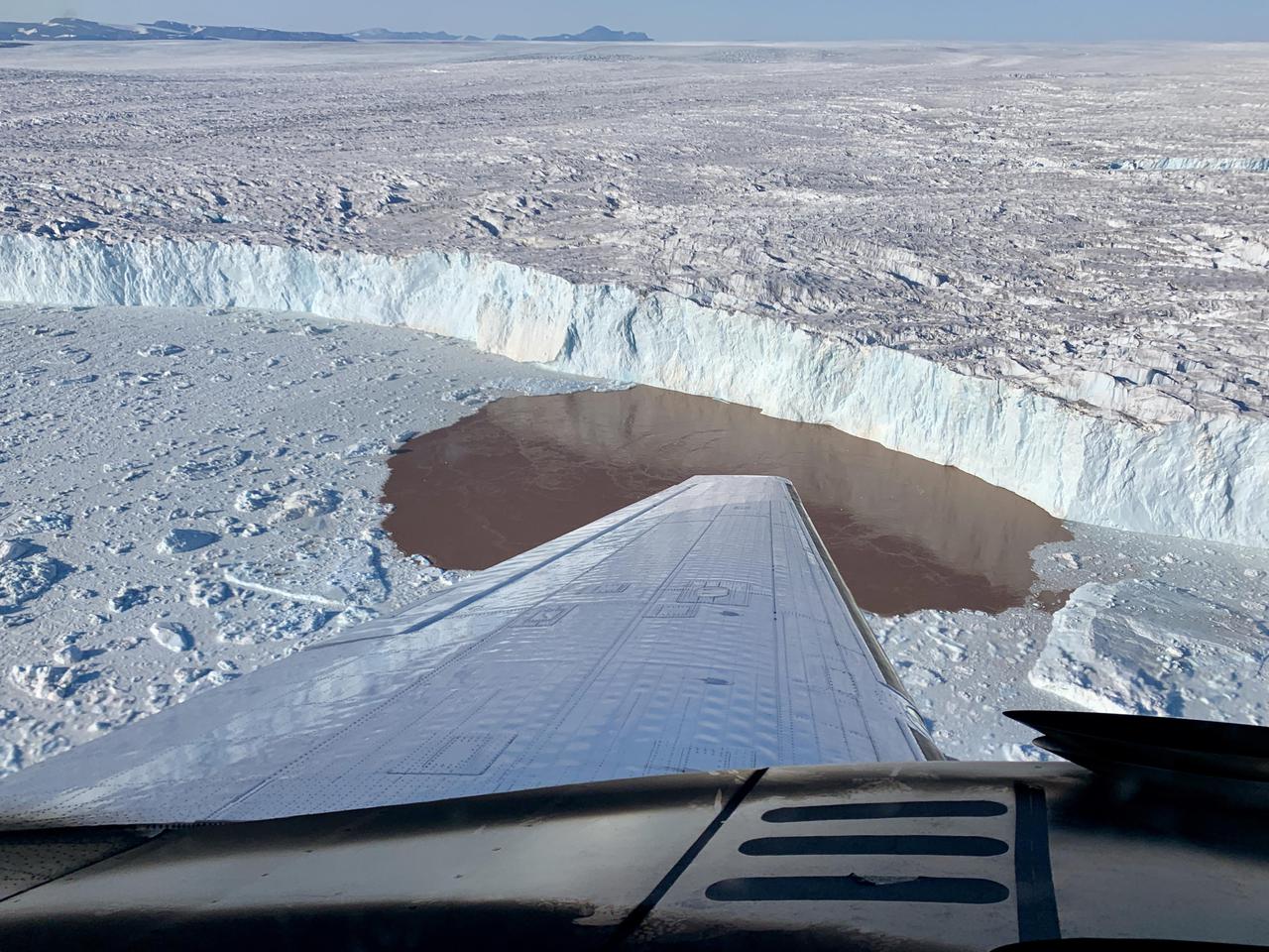
In this aerial view, a glacier along Greenland's craggy coastline is actively undergoing undercutting, a process in which meltwater flowing out from the bottom of the glacier enters the fjord. The brown water in front of the glacier is caused by sediment being dredged up from the base of the glacier by meltwater plumes reaching the surface of the fjord. Because the meltwater contains no salt, it is lighter and rises through the saltier ocean water, dragging the warm ocean water into contact with the ice at the glacier's base. The result is increased melting at the bottom of the glacier, which creates and overhanging layer of ice that breaks off (or calves) as icebergs. As the climate warms, the ocean water temperature and the amount of meltwater both increase, combining to hasten this undercutting process and speed up the ice loss from Greenland's Ice Sheet. The image was taken on Aug. 25, 2019 by a probe-dropping airplane as part of the Oceans Melting Greenland (OMG) mission. OMG has been studying glaciers that plunge into Greenland's steep-sided inlets, or fjords, for the past five years, gathering precise measurements of fjord depth and water salinity from probes dropped by plane, supplemented by measurements made by boat. The aim is to better understand how the warming ocean water around Greenland is hastening ice melt and calving of these marine-terminating glaciers. https://photojournal.jpl.nasa.gov/catalog/PIA24162
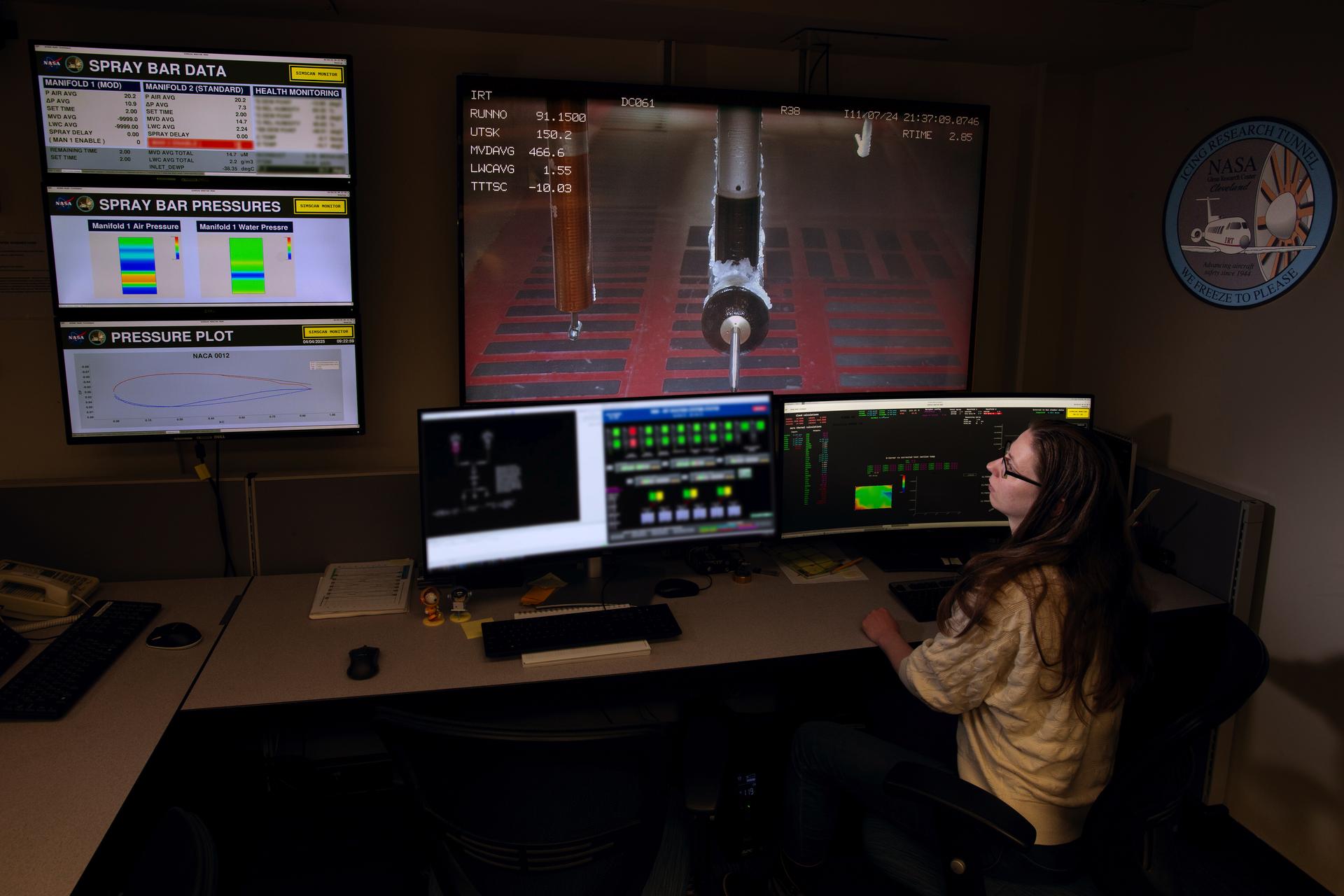
Carolyn Thiemann works on the Cobra data system in the IRT control room

Images from the European Space Agency's Huygens probe descent imager/spectral radiometer side-looking imager and from the medium resolution imager, acquired after landing, were merged to produce this image. The horizon's position implies a pitch of the imager/spectral radiometer, nose-upward, by 1 to 2 degrees with no measurable roll. "Stones" in the foreground are 4 to 6 inches (10 to 15 centimeters) in size, presumably made of water ice, and these lie on a darker, finer-grained substrate. A region with a relatively low number of rocks lies between clusters of rocks in the foreground and the background and matches the general orientation of channel-like features in the panorama of PIA06439). The scene evokes the possibility of a dry lakebed. The Huygens probe was delivered to Saturn's moon Titan by the Cassini spacecraft, which is managed by NASA's Jet Propulsion Laboratory, Pasadena, Calif. NASA supplied two instruments on the probe, the descent imager/spectral radiometer and the gas chromatograph mass spectrometer. http://photojournal.jpl.nasa.gov/catalog/PIA06440
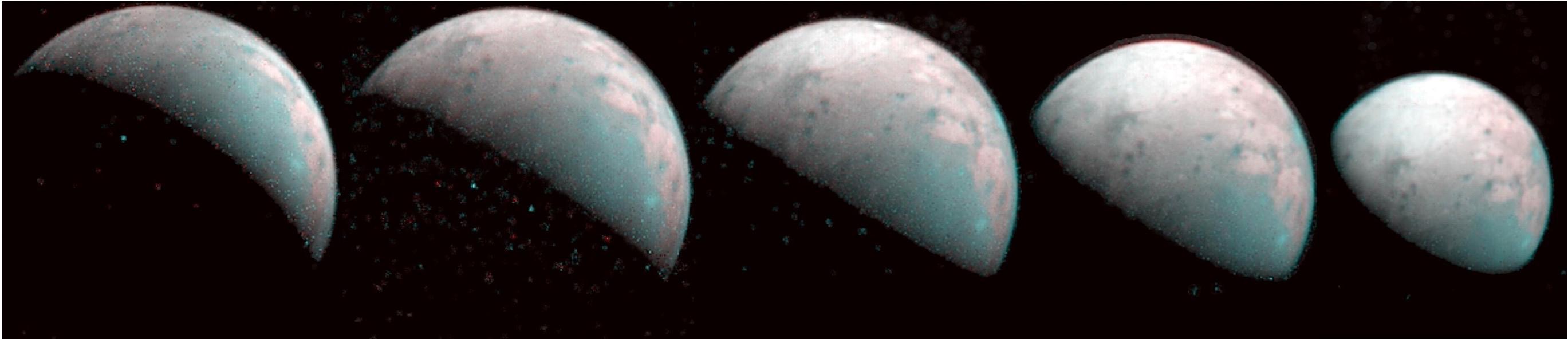
The north pole of Jupiter's giant moon Ganymede can be seen in this composite image of infrared data from the Jovian Infrared Auroral Mapper (JIRAM) instrument aboard NASA's Juno spacecraft. Five infrared images were taken every 20 minutes, beginning at time of closest approach (far left) on Dec. 26, 2019, when Juno was about 62,000 miles (100,000 kilometers) distant. The infrared imagery provides the first infrared mapping of the massive moon's northern frontier. As Ganymede has no atmosphere to impede the progress of charged particles from the Sun, the surface at its poles is constantly being bombarded by plasma from Jupiter's gigantic magnetosphere. The bombardment has a dramatic effect on Ganymede's ice. Frozen water molecules detected at both poles have no appreciable order to their arrangement, and the amorphous ice has a different infrared signature than the crystalline ice found at Ganymede's equator. JIRAM was designed to capture the infrared light emerging from deep inside Jupiter, probing the weather layer down to 30 to 45 miles (50 to 70 kilometers) below Jupiter's cloud tops. https://photojournal.jpl.nasa.gov/catalog/PIA23988
Attached to the wing of a Cessna Citation aircraft are cloud physics probes that measure the size, shape and number of ice and water particles in clouds. The plane is also equipped with field mills, used to measure electric fields. The plane is being flown into anvil clouds in the KSC area as part of a study to review and possibly modify lightning launch commit criteria. The weather study could lead to improved lightning avoidance rules and fewer launch scrubs for the Space Shuttle and other launch vehicles on the Eastern and Western ranges.; More information about the study can be found in <a href="http://www-pao.ksc.nasa.gov/kscpao/release/2000/56-00.htm">Release No. 56-00</a>
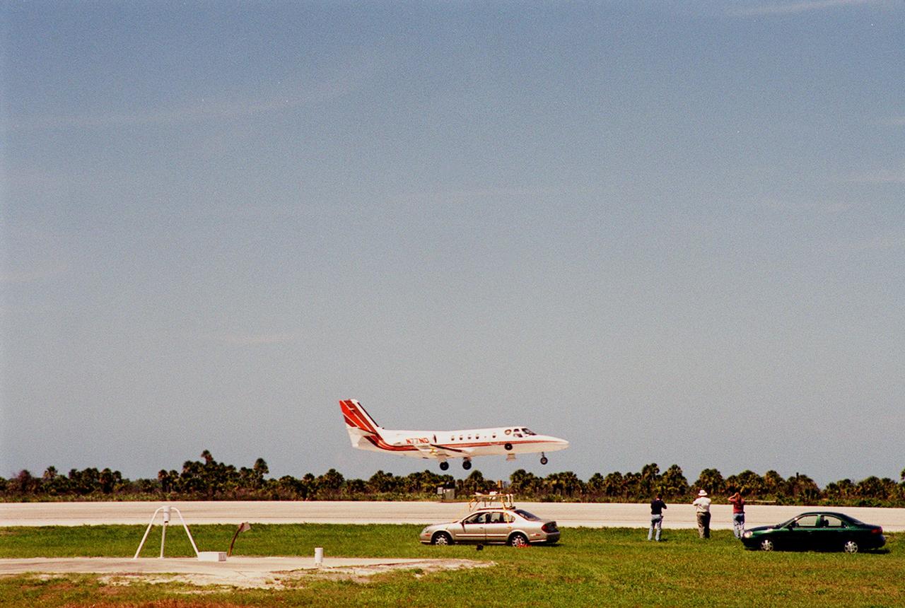
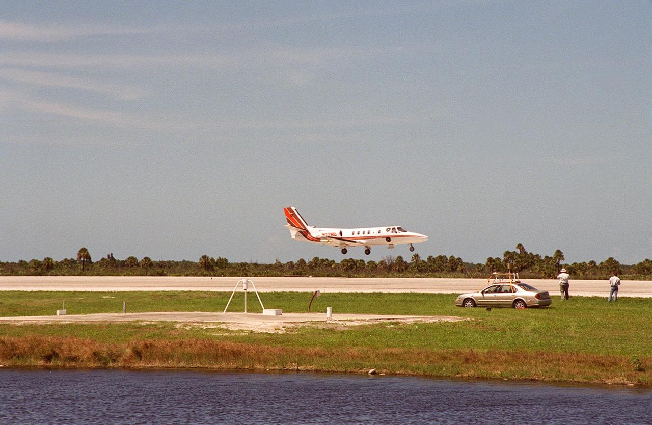
KENNEDY SPACE CENTER, FLA. -- At KSC's Shuttle Landing Facility, a specially equipped Cessna Citation aircraft flies over the runway to calibrate the Cesna's field mills with field mills on the ground (on the tripod at left) and on the car parked nearby (at center). Field mills measure electric fields. The aircraft is also equipped with cloud physics probes that measure the size, shape and number of ice and water particles in clouds. The plane is being flown into anvil clouds in the KSC area as part of a study to review and possibly modify lightning launch commit criteria. The weather study could lead to improved lightning avoidance rules and fewer launch scrubs for the Space Shuttle and other launch vehicles on the Eastern and Western ranges.
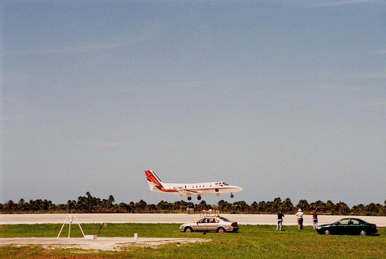
KENNEDY SPACE CENTER, FLA. -- At KSC's Shuttle Landing Facility, a specially equipped Cessna Citation aircraft flies over the runway to calibrate the Cesna's field mills with field mills on the ground (on the tripod at left) and on the car parked nearby (at center). Field mills measure electric fields. The aircraft is also equipped with cloud physics probes that measure the size, shape and number of ice and water particles in clouds. The plane is being flown into anvil clouds in the KSC area as part of a study to review and possibly modify lightning launch commit criteria. The weather study could lead to improved lightning avoidance rules and fewer launch scrubs for the Space Shuttle and other launch vehicles on the Eastern and Western ranges.
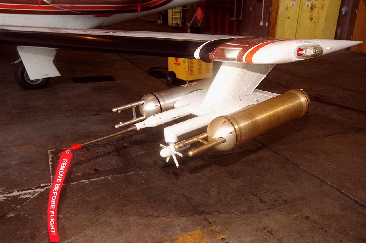
Attached to the wing of a Cessna Citation aircraft are cloud physics probes that measure the size, shape and number of ice and water particles in clouds. The plane is also equipped with field mills, used to measure electric fields. The plane is being flown into anvil clouds in the KSC area as part of a study to review and possibly modify lightning launch commit criteria. The weather study could lead to improved lightning avoidance rules and fewer launch scrubs for the Space Shuttle and other launch vehicles on the Eastern and Western ranges.; More information about the study can be found in <a href="http://www-pao.ksc.nasa.gov/kscpao/release/2000/56-00.htm">Release No. 56-00</a>
Attached to the wing of a Cessna Citation aircraft are cloud physics probes that measure the size, shape and number of ice and water particles in clouds. The plane is also equipped with field mills, used to measure electric fields. The plane is being flown into anvil clouds in the KSC area as part of a study to review and possibly modify lightning launch commit criteria. The weather study could lead to improved lightning avoidance rules and fewer launch scrubs for the Space Shuttle and other launch vehicles on the Eastern and Western ranges.; More information about the study can be found in <a href="http://www-pao.ksc.nasa.gov/kscpao/release/2000/56-00.htm">Release No. 56-00</a>
Attached to the wing of a Cessna Citation aircraft are cloud physics probes that measure the size, shape and number of ice and water particles in clouds. The plane is also equipped with field mills, used to measure electric fields. The plane is being flown into anvil clouds in the KSC area as part of a study to review and possibly modify lightning launch commit criteria. The weather study could lead to improved lightning avoidance rules and fewer launch scrubs for the Space Shuttle and other launch vehicles on the Eastern and Western ranges.; More information about the study can be found in <a href="http://www-pao.ksc.nasa.gov/kscpao/release/2000/56-00.htm">Release No. 56-00</a>
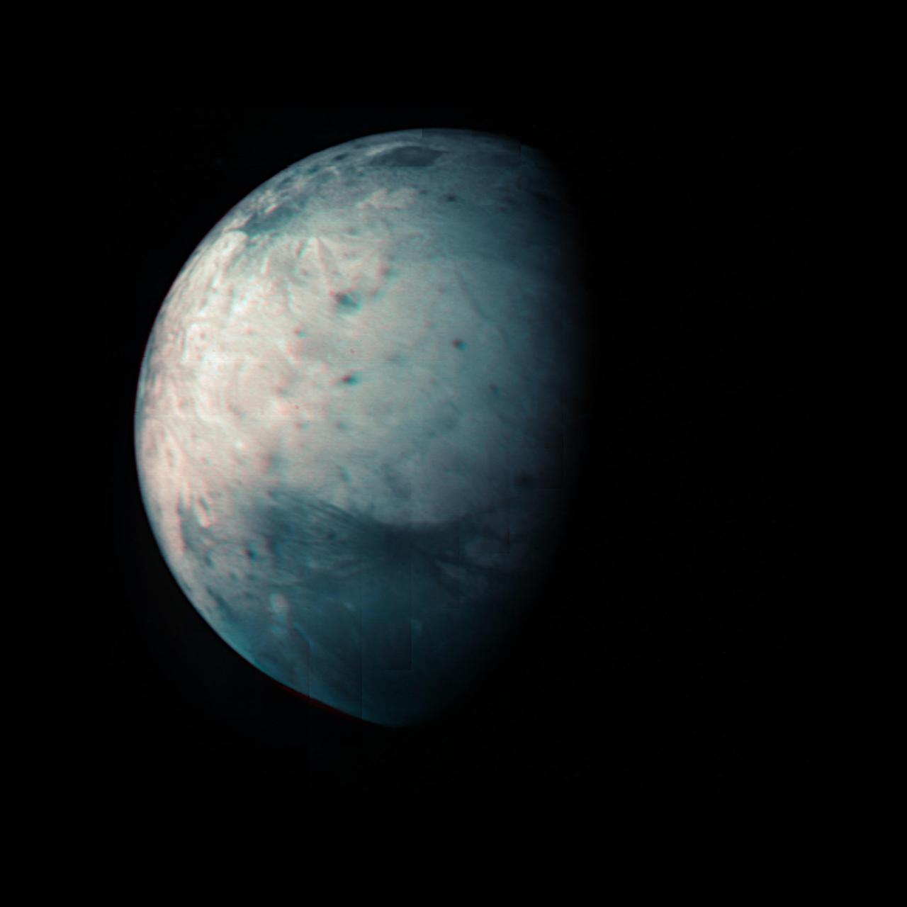
This infrared view of Ganymede was obtained by the Jovian Infrared Auroral Mapper (JIRAM) instrument aboard NASA's Juno spacecraft during its July 20th, 2021, flyby. JIRAM "sees" in infrared light not visible to the human eye, providing information on Ganymede's icy shell and the composition of the ocean of liquid water beneath. It was designed to capture the infrared light emerging from deep inside Jupiter, probing the weather layer down to 30 to 45 miles (50 to 70 kilometers) below Jupiter's cloud tops. During the flyby, Juno came within 31,136 miles (50,109 kilometers) of the icy orb. Together with the previous observational geometries provided, this data gives the opportunity for JIRAM to see different regions for the first time, as well as to compare the diversity in composition between the low and high latitudes. Because Ganymede has no atmosphere to impede the solar wind, or progress of charged particles from the Sun, the surface at its poles is constantly being bombarded by plasma from Jupiter's gigantic magnetosphere. The bombardment has a dramatic effect on Ganymede's ice: Ice is crystallized by heating at the equator and amorphized by particle radiation at the polar regions. https://photojournal.jpl.nasa.gov/catalog/PIA24791
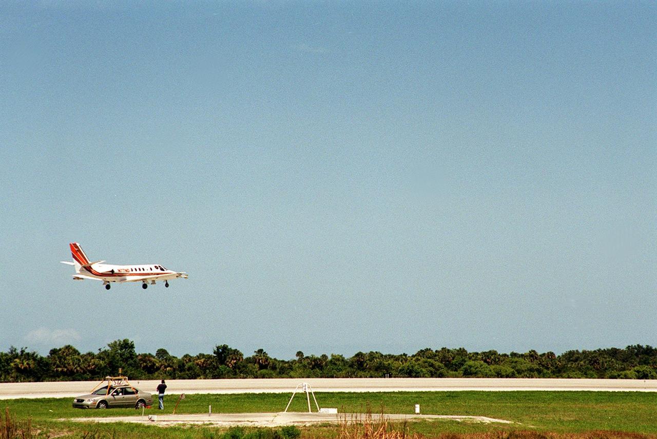
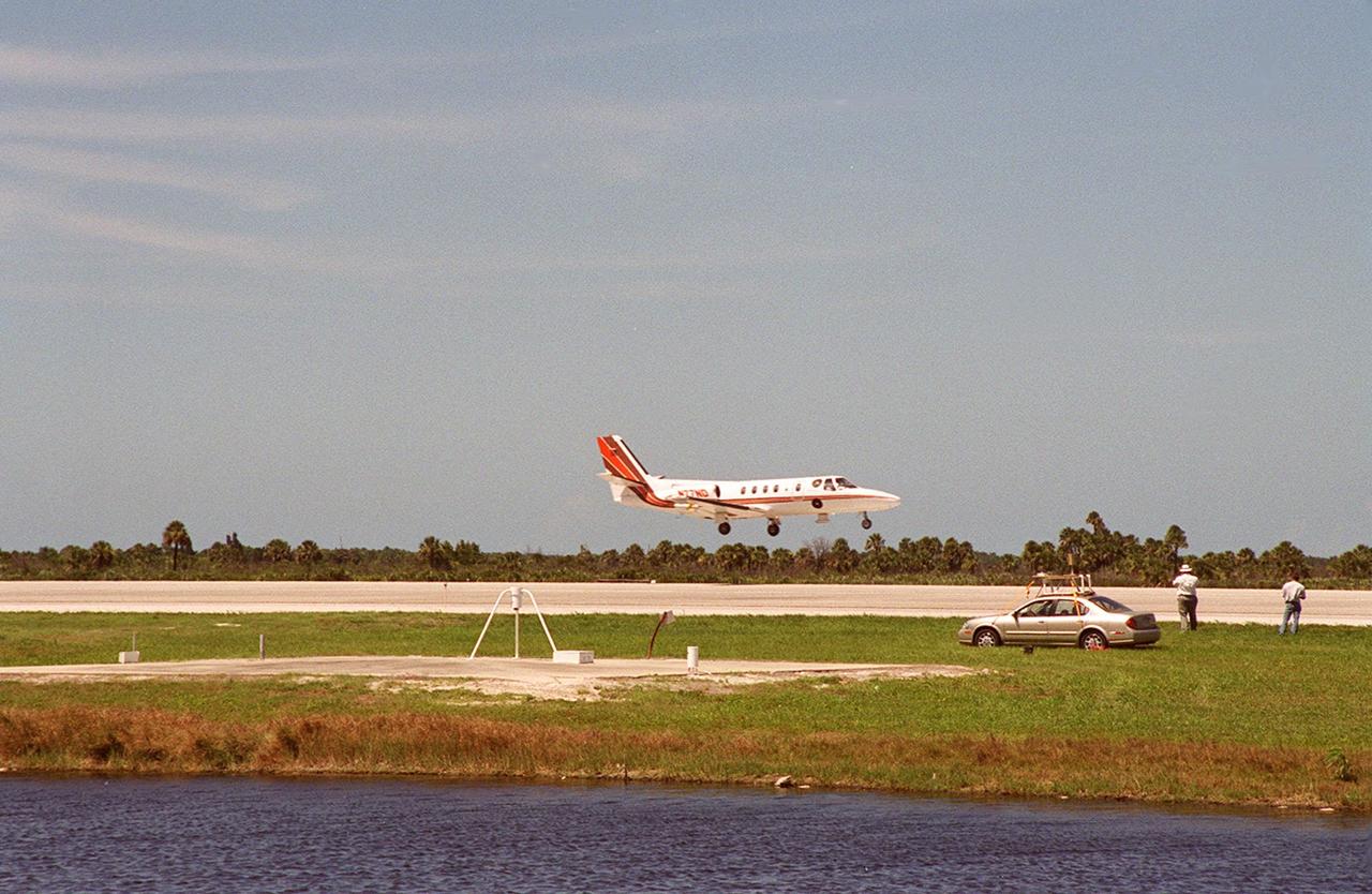
At KSC’s Shuttle Landing Facility, a specially equipped Cessna Citation aircraft approaches the runway to calibrate the Cessna’s field mills with field mills on the ground (on the tripod at left) and on the car parked nearby (at right). Field mills measure electric fields. The aircraft is also equipped with cloud physics probes that measure the size, shape and number of ice and water particles in clouds. The plane is being flown into anvil clouds in the KSC area as part of a study to review and possibly modify lightning launch commit criteria. The weather study could lead to improved lightning avoidance rules and fewer launch scrubs for the Space Shuttle and other launch vehicles on the Eastern and Western ranges.; More information on this study can be found in <a href="http://www-pao.ksc.nasa.gov/kscpao/release/2000/56-00.htm">Release No. 56-00</a>
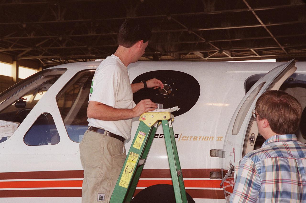
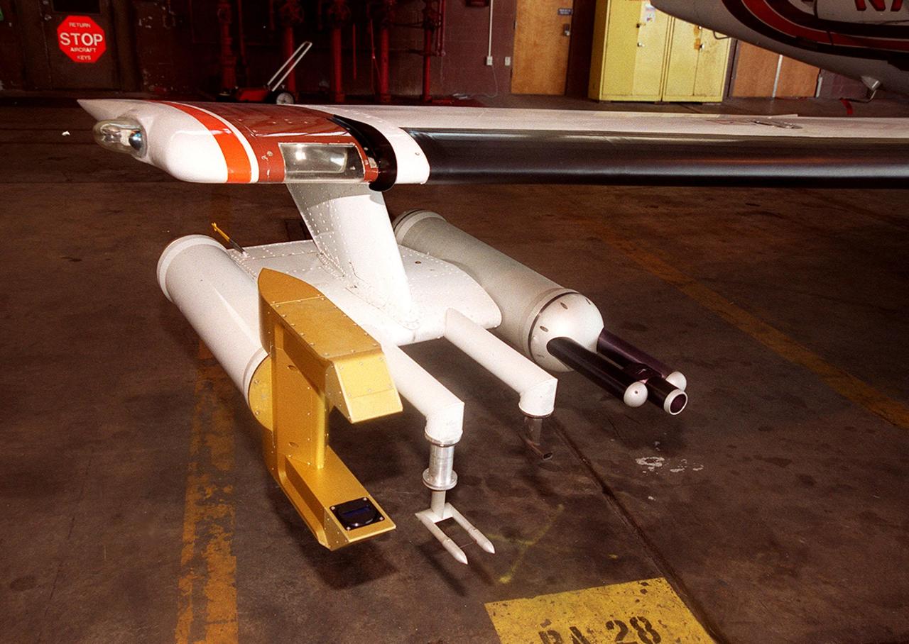
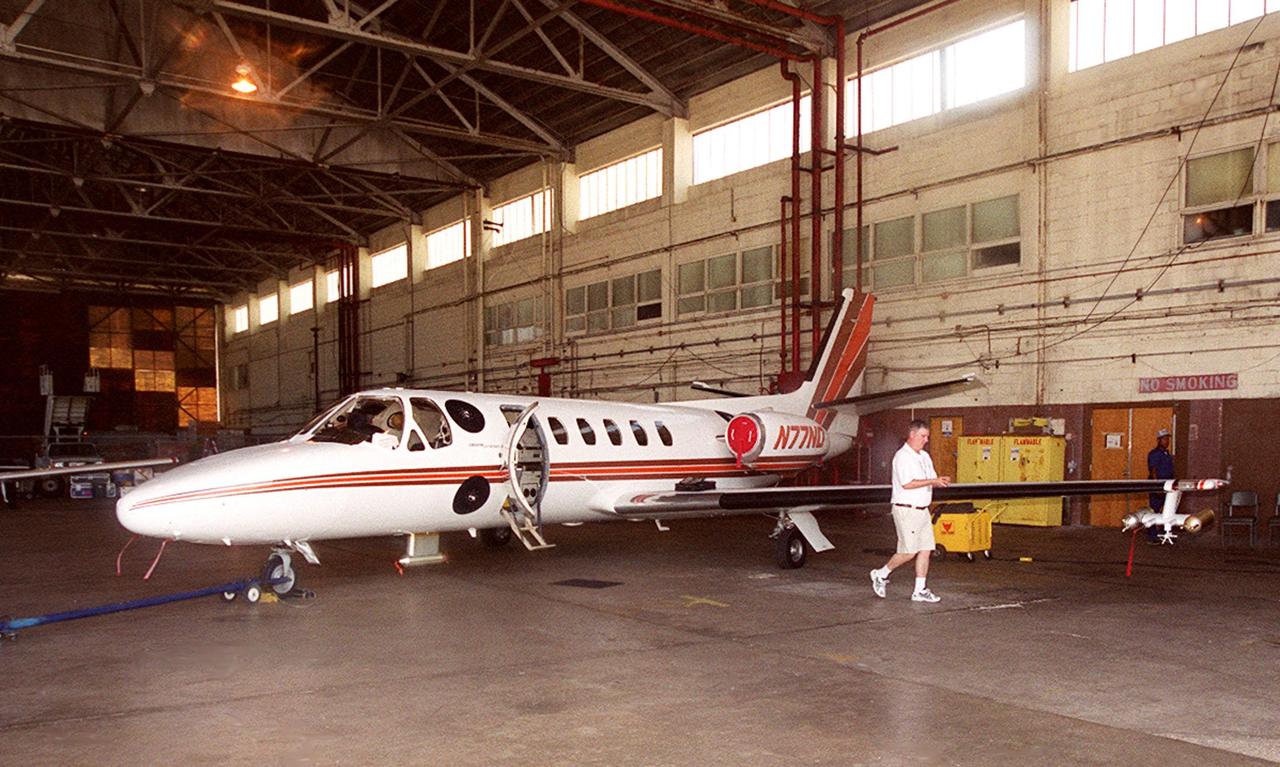
In a hangar at Cape Canaveral Air Force Station, a weather researcher checks a field mill measuring device on the Cessna Citation. The aircraft is being used for NASA’s airborne field mill study. The plane also carries cloud physics probes (under the body and wings) that measure the size, shape and number of ice and water particles in clouds. The plane is being flown into anvil clouds in the KSC area as part of a study to review and possibly modify lightning launch commit criteria. The weather study could lead to improved lightning avoidance rules and fewer launch scrubs for the Space Shuttle and other launch vehicles on the Eastern and Western ranges.; More information about the study can be found in <a href="http://www-pao.ksc.nasa.gov/kscpao/release/2000/56-00.htm">Release No. 56-00</a>
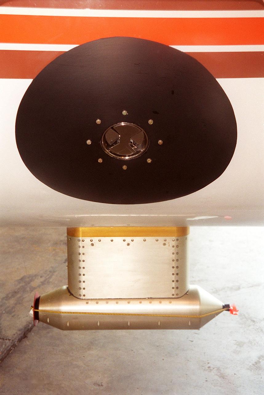
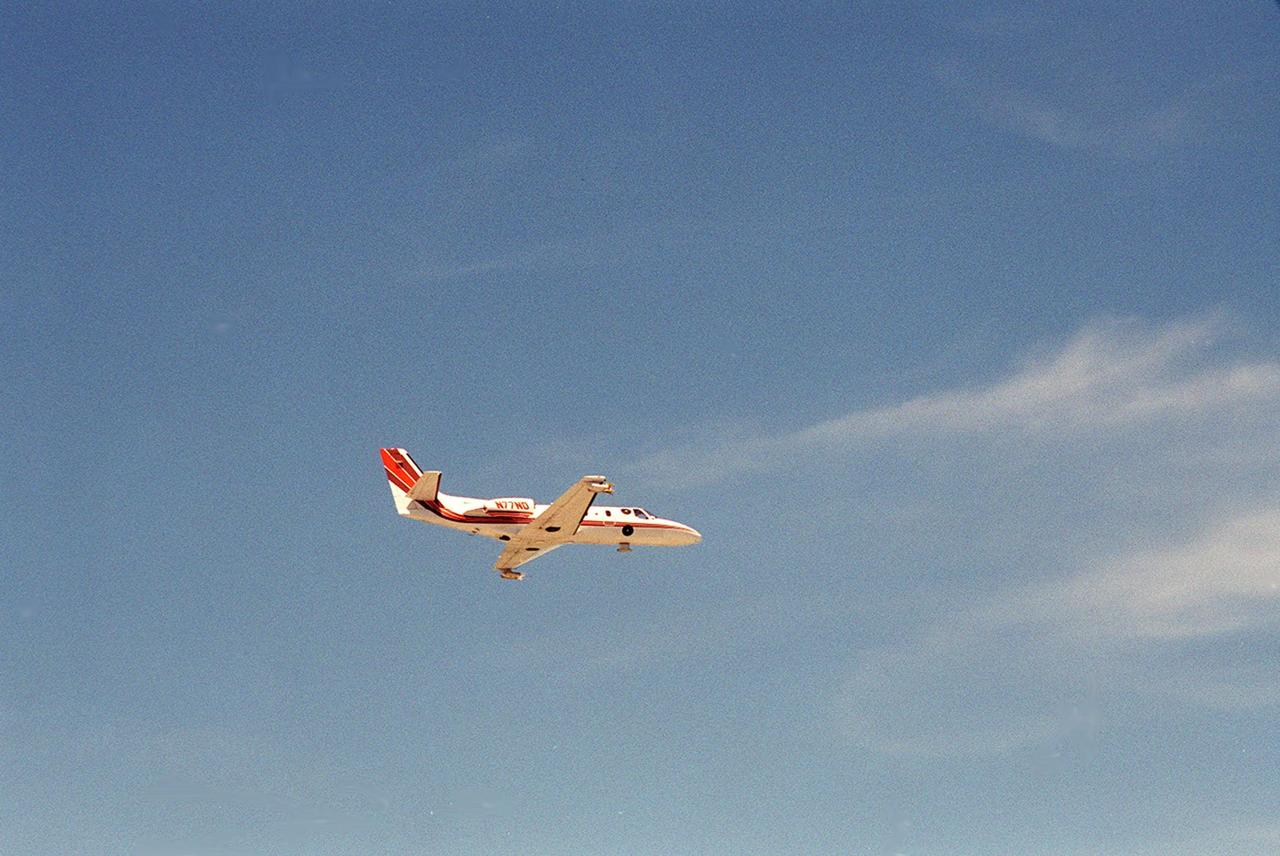
Lightning field study devices are visible on a Cessna Citation aircraft during flight over Central Florida. The center of the black circle contains one of six field mills, used to measure electric fields, located on the body of the plane. Below the circle is one of several cloud physics probes attached to the plane that measure the size, shape and number of ice and water particles in clouds. The Cessna is being flown into anvil clouds in the KSC area as part of a study to review and possibly modify lightning launch commit criteria. The weather study could lead to improved lightning avoidance rules and fewer launch scrubs for the Space Shuttle and other launch vehicles on the Eastern and Western ranges.; More information about the study can be found in <a href="http://www-pao.ksc.nasa.gov/kscpao/release/2000/56-00.htm">Release No. 56-00</a>
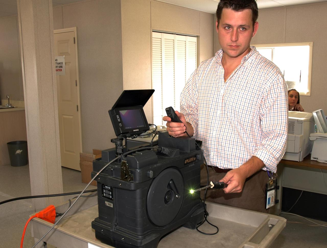
KENNEDY SPACE CENTER, FLA. - In the Press Site at NASA's Kennedy Space Center, Charles Wassen, with the United Space Alliance Micro Inspection Team, demonstrates the boroscope camera probe, with the light glowing, that was used to verify the condition of the foam on Space Shuttle Discovery's external tank. On July 2, a crack formed on a piece of insulation on a strut that attaches the liquid oxygen feedline to External Tank-119, being used to launch space shuttle mission STS-121. It was recovered by the Ice Team from the mobile launch platform at Pad 39B. The camera was used to get a closeup of the area for the mission management team to examine and evaluate if the launch attempt should proceed on July 4. Photo credit: NASA/Carl Winebarger
At KSC’s Shuttle Landing Facility, a specially equipped Cessna Citation aircraft flies over the runway to calibrate the Cessna’s field mills with field mills on the ground (on the tripod at left) and on the car parked nearby (at right). Field mills measure electric fields. The aircraft is also equipped with cloud physics probes that measure the size, shape and number of ice and water particles in clouds. The plane is being flown into anvil clouds in the KSC area as part of a study to review and possibly modify lightning launch commit criteria. The weather study could lead to improved lightning avoidance rules and fewer launch scrubs for the Space Shuttle and other launch vehicles on the Eastern and Western ranges.; More information about this study can be found in <a href="http://www-pao.ksc.nasa.gov/kscpao/release/2000/56-00.htm">Release No. 56-00</a>

At KSC’s Shuttle Landing Facility, a specially equipped Cessna Citation aircraft approaches the runway to calibrate the Cessna’s field mills with field mills on the ground (on the tripod at left) and on the car parked nearby (at right). Field mills measure electric fields. The aircraft is also equipped with cloud physics probes that measure the size, shape and number of ice and water particles in clouds. The plane is being flown into anvil clouds in the KSC area as part of a study to review and possibly modify lightning launch commit criteria. The weather study could lead to improved lightning avoidance rules and fewer launch scrubs for the Space Shuttle and other launch vehicles on the Eastern and Western ranges.; More information on this study can be found in <a href="http://www-pao.ksc.nasa.gov/kscpao/release/2000/56-00.htm">Release No. 56-00</a>
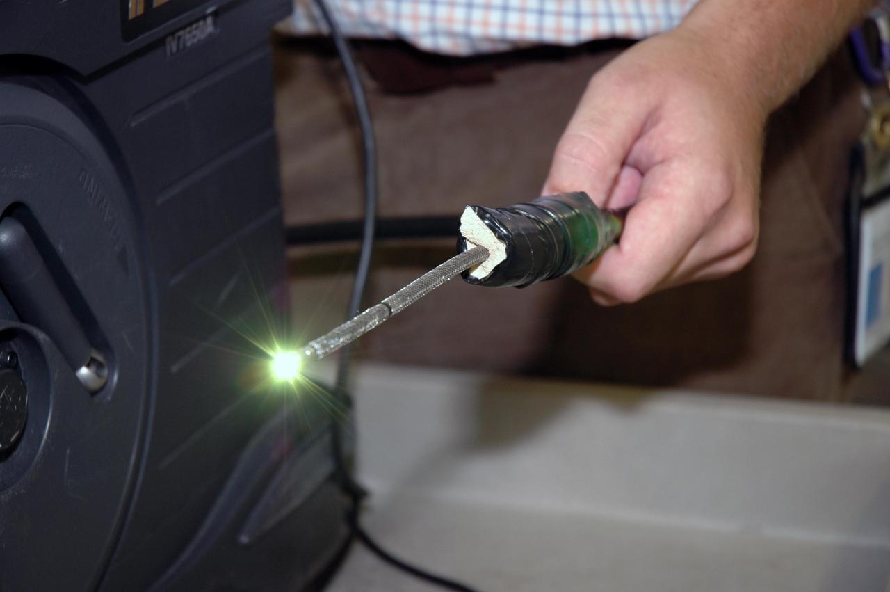
KENNEDY SPACE CENTER, FLA. - In the Press Site at NASA's Kennedy Space Center, Charles Wassen, with the United Space Alliance Micro Inspection Team, holds the boroscope camera probe, with the light glowing, that was used to verify the condition of the foam on Space Shuttle Discovery's external tank. On July 2, a crack formed on a piece of insulation on a strut that attaches the liquid oxygen feedline to External Tank-119, being used to launch space shuttle mission STS-121. It was recovered by the Ice Team from the mobile launch platform at Pad 39B. The camera was used to get a closeup of the area for the mission management team to examine and evaluate if the launch attempt should proceed on July 4. Photo credit: NASA/Carl Winebarger
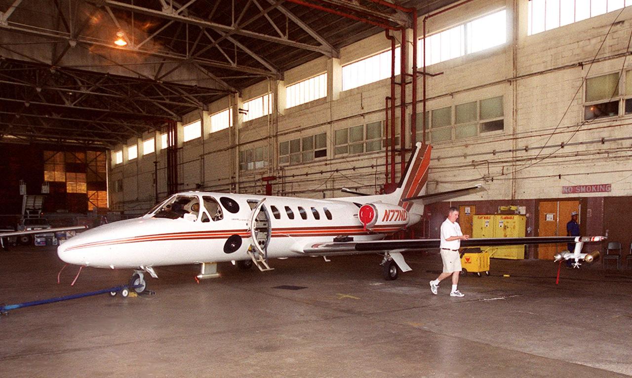
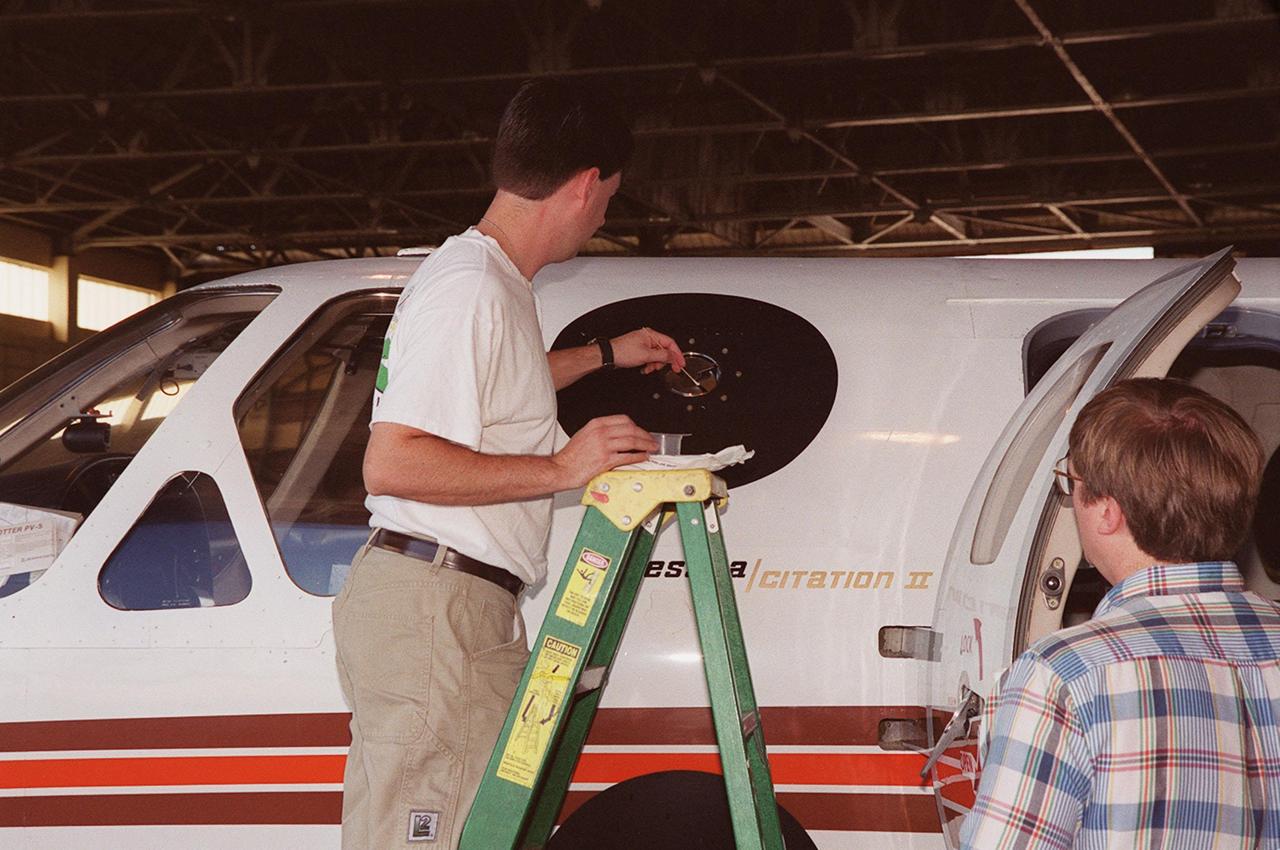
In a hangar at Cape Canaveral Air Force Station, a Cessna Citation aircraft has been fitted on the wings with devices that measure electric fields (black circles shown behind the open door) and with cloud physics probes (under the body and wings) that measure the size, shape and number of ice and water particles in clouds. The plane is being flown into anvil clouds in the KSC area as part of a study to review and possibly modify lightning launch commit criteria. The weather study could lead to improved lightning avoidance rules and fewer launch scrubs for the Space Shuttle and other launch vehicles on the Eastern and Western ranges.; More information about the study can be found in <a href="http://www-pao.ksc.nasa.gov/kscpao/release/2000/56-00.htm">Release No. 56-00</a>

A specially equipped Cessna Citation aircraft flies over KSC during a calibration test of field mills used to measure electric fields. The aircraft is also equipped with cloud physics probes that measure the size, shape and number of ice and water particles in clouds. The plane is being flown into anvil clouds in the KSC area as part of a study to review and possibly modify lightning launch commit criteria. The weather study could lead to improved lightning avoidance rules and fewer launch scrubs for the Space Shuttle and other launch vehicles on the Eastern and Western ranges.; More information on this study can be found in <a href="http://www-pao.ksc.nasa.gov/kscpao/release/2000/56-00.htm">Release No. 56-00</a>
In a hangar at Cape Canaveral Air Force Station, a weather researcher checks a field mill measuring device on the Cessna Citation. The aircraft is being used for NASA’s airborne field mill study. The plane also carries cloud physics probes (under the body and wings) that measure the size, shape and number of ice and water particles in clouds. The plane is being flown into anvil clouds in the KSC area as part of a study to review and possibly modify lightning launch commit criteria. The weather study could lead to improved lightning avoidance rules and fewer launch scrubs for the Space Shuttle and other launch vehicles on the Eastern and Western ranges.; More information about the study can be found in <a href="http://www-pao.ksc.nasa.gov/kscpao/release/2000/56-00.htm">Release No. 56-00</a>
In a hangar at Cape Canaveral Air Force Station, a Cessna Citation aircraft has been fitted on the wings with devices that measure electric fields (black circles shown behind the open door) and with cloud physics probes (under the body and wings) that measure the size, shape and number of ice and water particles in clouds. The plane is being flown into anvil clouds in the KSC area as part of a study to review and possibly modify lightning launch commit criteria. The weather study could lead to improved lightning avoidance rules and fewer launch scrubs for the Space Shuttle and other launch vehicles on the Eastern and Western ranges.; More information about the study can be found in <a href="http://www-pao.ksc.nasa.gov/kscpao/release/2000/56-00.htm">Release No. 56-00</a>
A specially equipped Cessna Citation aircraft flies over KSC during a calibration test of field mills used to measure electric fields. The aircraft is also equipped with cloud physics probes that measure the size, shape and number of ice and water particles in clouds. The plane is being flown into anvil clouds in the KSC area as part of a study to review and possibly modify lightning launch commit criteria. The weather study could lead to improved lightning avoidance rules and fewer launch scrubs for the Space Shuttle and other launch vehicles on the Eastern and Western ranges.; More information on this study can be found in <a href="http://www-pao.ksc.nasa.gov/kscpao/release/2000/56-00.htm">Release No. 56-00</a>
At KSC’s Shuttle Landing Facility, a specially equipped Cessna Citation aircraft flies over the runway to calibrate the Cessna’s field mills with field mills on the ground (on the tripod at left) and on the car parked nearby (at right). Field mills measure electric fields. The aircraft is also equipped with cloud physics probes that measure the size, shape and number of ice and water particles in clouds. The plane is being flown into anvil clouds in the KSC area as part of a study to review and possibly modify lightning launch commit criteria. The weather study could lead to improved lightning avoidance rules and fewer launch scrubs for the Space Shuttle and other launch vehicles on the Eastern and Western ranges.; More information about this study can be found in <a href="http://www-pao.ksc.nasa.gov/kscpao/release/2000/56-00.htm">Release No. 56-00</a>
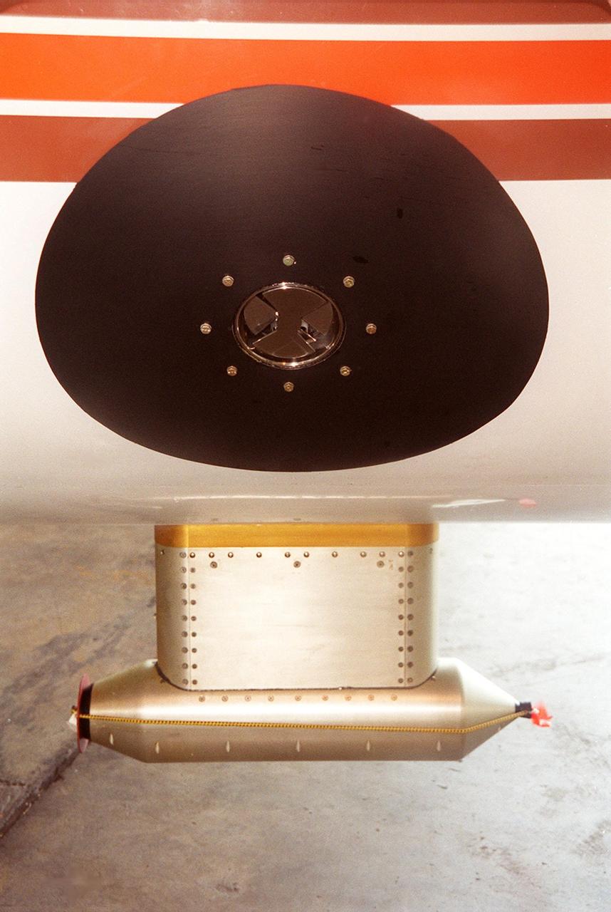
Lightning field study devices are visible on a Cessna Citation aircraft during flight over Central Florida. The center of the black circle contains one of six field mills, used to measure electric fields, located on the body of the plane. Below the circle is one of several cloud physics probes attached to the plane that measure the size, shape and number of ice and water particles in clouds. The Cessna is being flown into anvil clouds in the KSC area as part of a study to review and possibly modify lightning launch commit criteria. The weather study could lead to improved lightning avoidance rules and fewer launch scrubs for the Space Shuttle and other launch vehicles on the Eastern and Western ranges.; More information about the study can be found in <a href="http://www-pao.ksc.nasa.gov/kscpao/release/2000/56-00.htm">Release No. 56-00</a>
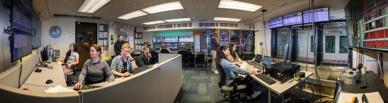
Panorama of the IRT engineering and ice cloud calibration team in the control room. Shown on the left are the data and system engineers. In the center with their backs to the camera are the wind tunnel operators who control the wind speed and super cooled water flow. In the center right of the photo is the video recording system and the test engineers. On the right side the test section can be see though the wind and the TV screen shows the pray bars that create the icing cloud.

This artist's concept represents the "Follow the Water" theme of NASA's Mars Reconnaissance Orbiter mission. The orbiter's science instruments monitor the present water cycle in the Mars atmosphere and the associated deposition and sublimation of water ice on the surface, while probing the subsurface to see how deep the water-ice reservoir detected by Mars Odyssey extends. At the same time, Mars Reconnaissance Orbiter will search for surface features and minerals (such as carbonates and sulfates) that record the extended presence of liquid water on the surface earlier in the planet's history. The instruments involved are the Shallow Subsurface Radar, the Compact Reconnaissance Imaging Spectrometer for Mars, the Mars Color Imager, the High Resolution Imaging Science Experiment, the Context Camera and the Mars Climate Sounder. To the far left, the radar antenna beams down and "sees" into the first few hundred feet (up to 1 kilometer) of Mars' crust. Just to the right of that, the next beam highlights the data received from the imaging spectrometer, which identifies minerals on the surface. The next beam represents the high-resolution camera, which can "zoom in" on local targets, providing the highest-resolution orbital images yet of features such as craters and gullies and rocks. The beam that shines almost horizontally is that of the Mars Climate Sounder. This instrument is critical to analyzing the current climate of Mars since it observes the temperature, humidity, and dust content of the martian atmosphere, and their seasonal and year-to-year variations. Meanwhile, the Mars Color Imager observes ice clouds, dust clouds and hazes, and the ozone distribution, producing daily global maps in multiple colors to monitor daily weather and seasonal changes. The electromagnetic spectrum is represented on the top right and individual instruments are placed where their capability lies. http://photojournal.jpl.nasa.gov/catalog/PIA07241
Installation of the 2D-S (2-Dimensional Stereo) optical array probe made by Stratton Park Engineering Company (SPEC)
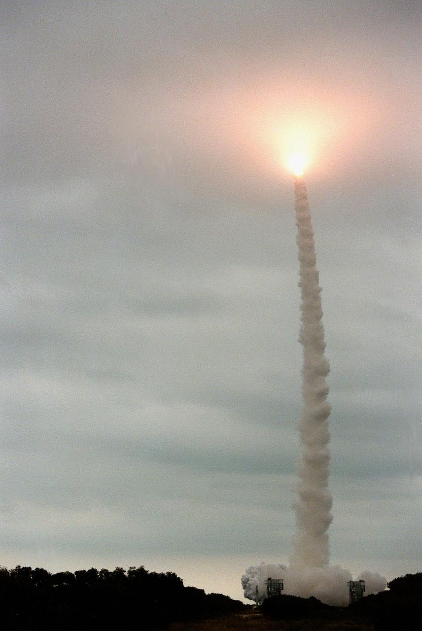
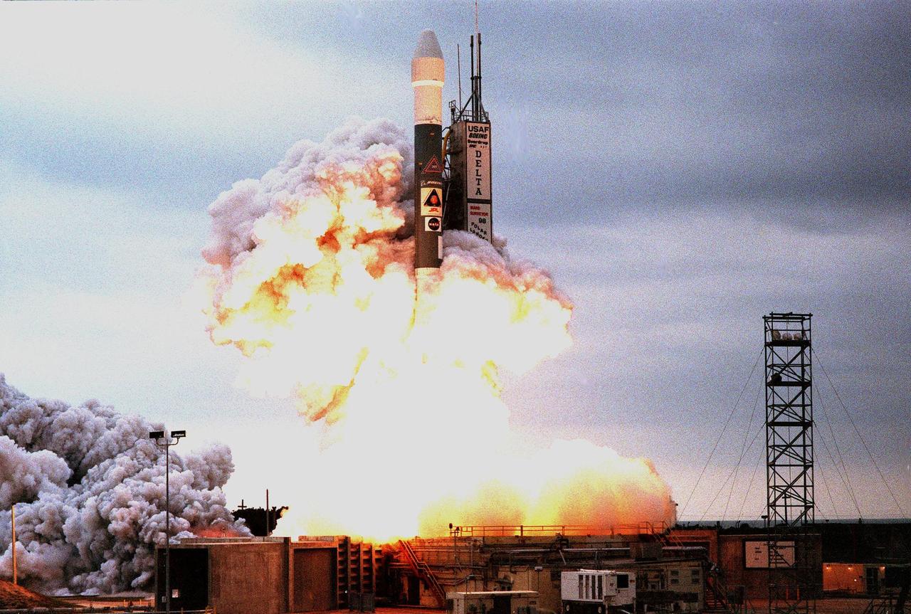
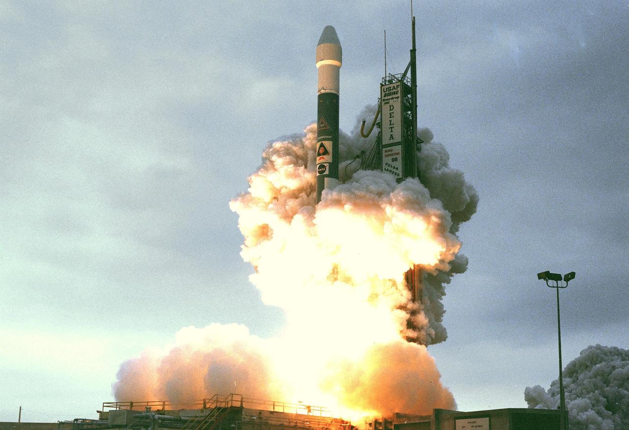
KENNEDY SPACE CENTER, FLA. -- Looking like a Roman candle, the exhaust from the Boeing Delta II rocket with the Mars Polar Lander aboard lights up the clouds as it hurtles skyward. The rocket was launched at 3:21:10 p.m. EST from Launch Complex 17B, Cape Canaveral Air Station. The lander is a solar-powered spacecraft designed to touch down on the Martian surface near the northern-most boundary of the south polar cap, which consists of carbon dioxide ice. The lander will study the polar water cycle, frosts, water vapor, condensates and dust in the Martian atmosphere. It is equipped with a robotic arm to dig beneath the layered terrain. In addition, Deep Space 2 microprobes, developed by NASA's New Millennium Program, are installed on the lander's cruise stage. After crashing into the planet's surface, they will conduct two days of soil and water experiments up to 1 meter (3 feet) below the Martian surface, testing new technologies for future planetary descent probes. The lander is the second spacecraft to be launched in a pair of Mars Surveyor '98 missions. The first is the Mars Climate Orbiter, which was launched aboard a Delta II rocket from Launch Complex 17A on Dec. 11, 1998.
KENNEDY SPACE CENTER, FLA. -- Amid clouds of exhaust and into a gray-clouded sky , a Boeing Delta II expendable launch vehicle lifts off with NASA's Mars Polar Lander at 3:21:10 p.m. EST from Launch Complex 17B, Cape Canaveral Air Station. The lander is a solar-powered spacecraft designed to touch down on the Martian surface near the northern-most boundary of the south polar cap, which consists of carbon dioxide ice. The lander will study the polar water cycle, frosts, water vapor, condensates and dust in the Martian atmosphere. It is equipped with a robotic arm to dig beneath the layered terrain at the polar cap. In addition, Deep Space 2 microprobes, developed by NASA's New Millennium Program, are installed on the lander's cruise stage. After crashing into the planet's surface, they will conduct two days of soil and water experiments up to 1 meter (3 feet) below the Martian surface, testing new technologies for future planetary descent probes. The lander is the second spacecraft to be launched in a pair of Mars Surveyor '98 missions. The first is the Mars Climate Orbiter, which was launched aboard a Delta II rocket from Launch Complex 17A on Dec. 11, 1998.

KENNEDY SPACE CENTER, FLA. -- Silhouetted against the gray sky, a Boeing Delta II expendable launch vehicle with NASA's Mars Polar Lander lifts off from Launch Complex 17B, Cape Canaveral Air Station, at 3:21:10 p.m. EST. The lander is a solar-powered spacecraft designed to touch down on the Martian surface near the northern-most boundary of the south polar cap, which consists of carbon dioxide ice. The lander will study the polar water cycle, frosts, water vapor, condensates and dust in the Martian atmosphere. It is equipped with a robotic arm to dig beneath the layered terrain at the polar cap. In addition, Deep Space 2 microprobes, developed by NASA's New Millennium Program, are installed on the lander's cruise stage. After crashing into the planet's surface, they will conduct two days of soil and water experiments up to 1 meter (3 feet) below the Martian surface, testing new technologies for future planetary descent probes. The lander is the second spacecraft to be launched in a pair of Mars Surveyor '98 missions. The first is the Mars Climate Orbiter, which was launched aboard a Delta II rocket from Launch Complex 17A on Dec. 11, 1998.
KENNEDY SPACE CENTER, FLA. -- Amid clouds of exhaust, a Boeing Delta II expendable launch vehicle with NASA's Mars Polar Lander clears Launch Complex 17B, Cape Canaveral Air Station, after launch at 3:21:10 p.m. EST. The lander is a solar-powered spacecraft designed to touch down on the Martian surface near the northern-most boundary of the south polar cap, which consists of carbon dioxide ice. The lander will study the polar water cycle, frosts, water vapor, condensates and dust in the Martian atmosphere. It is equipped with a robotic arm to dig beneath the layered terrain at the polar cap. In addition, Deep Space 2 microprobes, developed by NASA's New Millennium Program, are installed on the lander's cruise stage. After crashing into the planet's surface, they will conduct two days of soil and water experiments up to 1 meter (3 feet) below the Martian surface, testing new technologies for future planetary descent probes. The lander is the second spacecraft to be launched in a pair of Mars Surveyor '98 missions. The first is the Mars Climate Orbiter, which was launched aboard a Delta II rocket from Launch Complex 17A on Dec. 11, 1998.
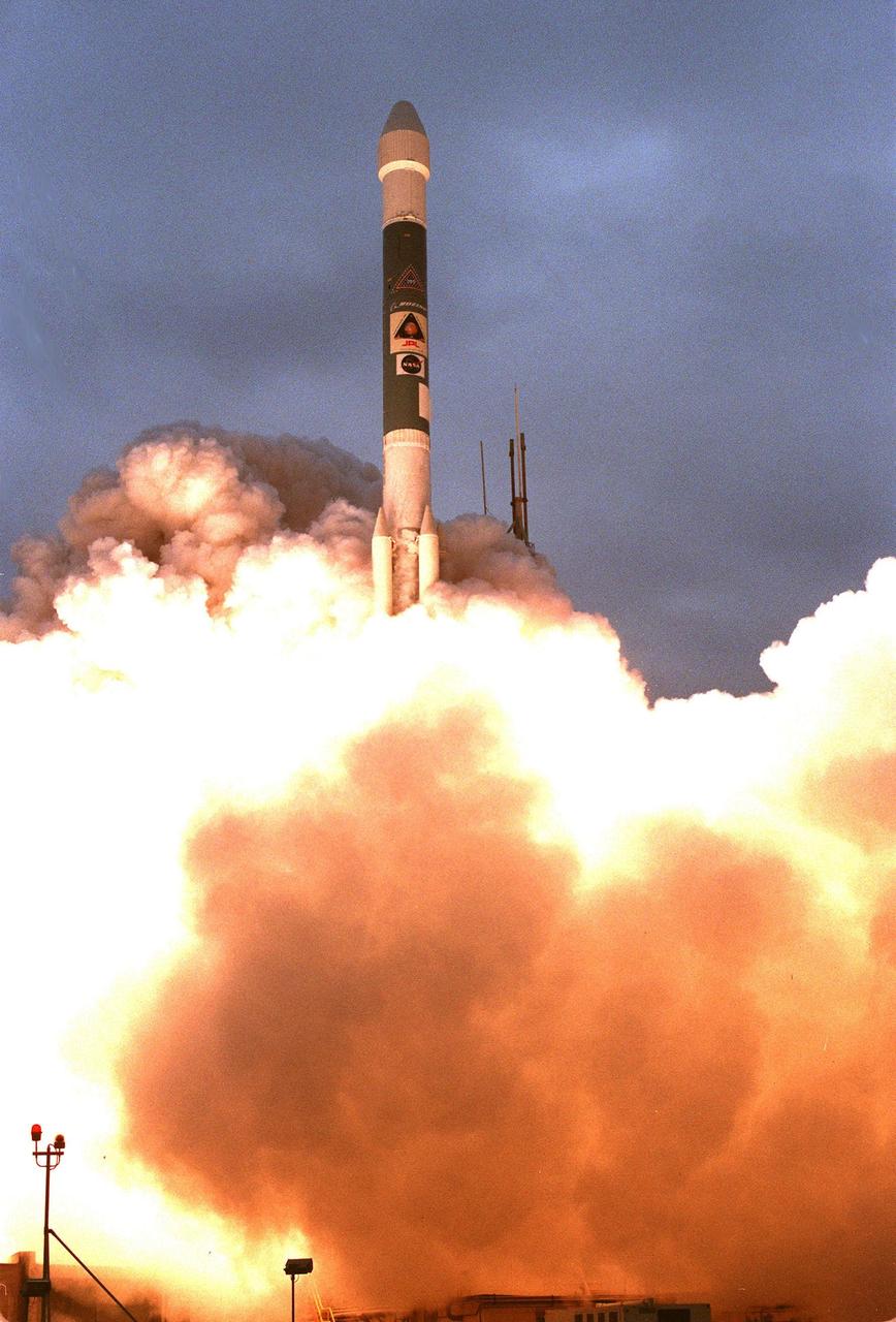
KENNEDY SPACE CENTER, FLA. -- A Boeing Delta II expendable launch vehicle lifts off with NASA's Mars Polar Lander into a cloud-covered sky at 3:21:10 p.m. EST from Launch Complex 17B, Cape Canaveral Air Station. The lander is a solar-powered spacecraft designed to touch down on the Martian surface near the northern-most boundary of the south polar cap, which consists of carbon dioxide ice. The lander will study the polar water cycle, frosts, water vapor, condensates and dust in the Martian atmosphere. It is equipped with a robotic arm to dig beneath the layered terrain at the polar cap. In addition, Deep Space 2 microprobes, developed by NASA's New Millennium Program, are installed on the lander's cruise stage. After crashing into the planet's surface, they will conduct two days of soil and water experiments up to 1 meter (3 feet) below the Martian surface, testing new technologies for future planetary descent probes. The lander is the second spacecraft to be launched in a pair of Mars Surveyor '98 missions. The first is the Mars Climate Orbiter, which was launched aboard a Delta II rocket from Launch Complex 17A on Dec. 11, 1998.
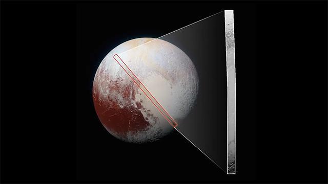
This frame from a movie, which extends across the hemisphere that faced New Horizons spacecraft as it flew past Pluto on July 14, 2015, includes all of the highest-resolution images taken by the NASA probe. With a resolution of about 260 feet (80 meters) per pixel, the movie affords New Horizons scientists and the public the best opportunity to examine the fine details of the various types of terrain the mosaic covers, and determine the processes that formed and shaped them. The view extends from the "limb" of Pluto at the top of the strip, almost to the "terminator" (or day/night line) in the southeast of the encounter hemisphere, seen at the bottom of the strip. The width of the strip ranges from more than 55 miles (90 kilometers) at its northern end to about 45 miles (75 kilometers) at its southern end. The perspective changes greatly along the strip: at its northern end, the view looks out horizontally across the surface, while at its southern end, the view looks straight down onto the surface. This movie pans down the mosaic from top to bottom, offering new views of many of Pluto's distinct landscapes along the way. Starting with hummocky, cratered uplands at top, the view crosses over parallel ridges of the "washboard" terrain; chaotic and angular mountain ranges; the craterless, cellular plains; coarsely "pitted" areas of sublimating nitrogen ice; zones of thin nitrogen ice draped over the topography below; and rugged, dark, mountainous highlands scarred by deep pits. The frames in the movie were obtained by New Horizons' Long Range Reconnaissance Imager (LORRI) approximately 9,850 miles (15,850 kilometers) from Pluto, about 23 minutes before New Horizons' closest approach. LORRI is only capable of obtaining black-and-white images; all color images are made by the Ralph instrument, which has somewhat lower resolution than LORRI. Movies are available at http://photojournal.jpl.nasa.gov/catalog/PIA14457