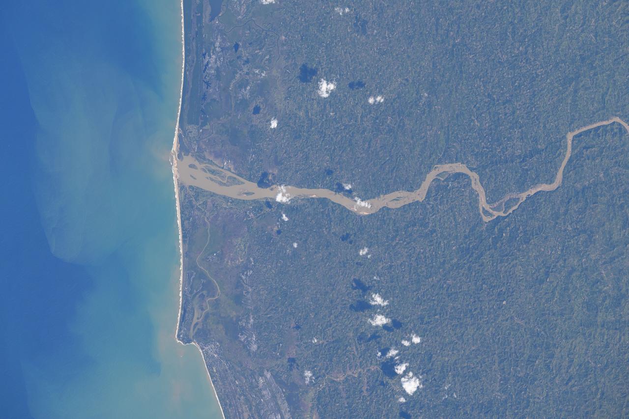
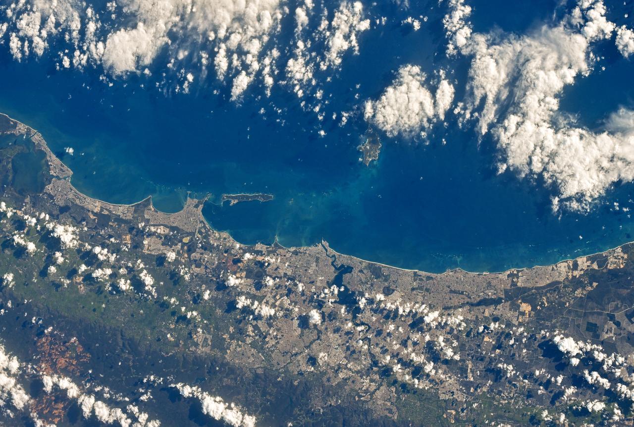
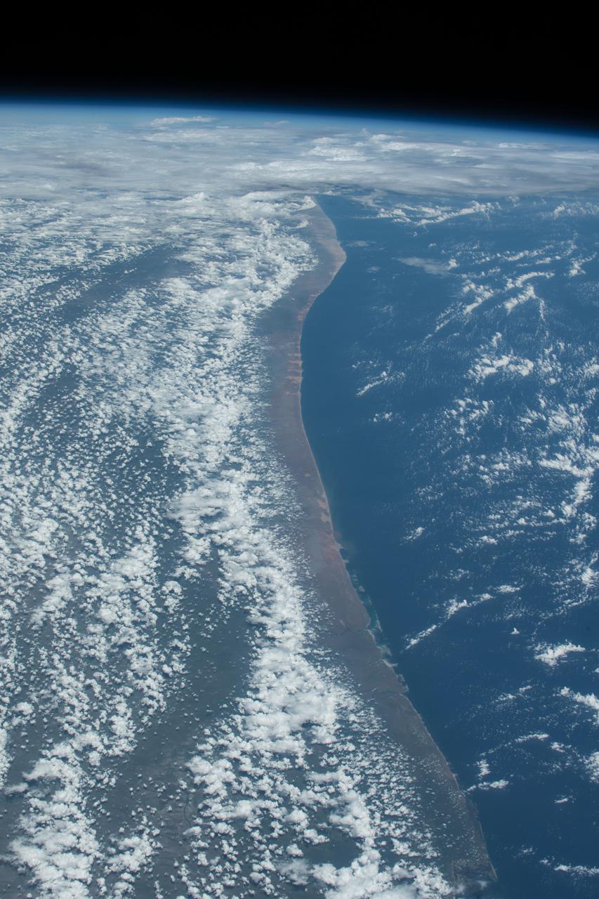
Mangoro River on Madagascar's east coast leads to the Indian Ocean in this photograph from the Indian Ocean as it orbited 263 miles above
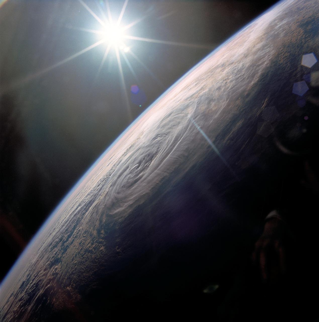
STS032-80-036 (9-20 Jan. 1990) --- This oblique view of Tropical Storm Sam in the eastern Indian Ocean off the western coast of Australia was photographed with a 70mm camera by the astronauts. Tropical Storm Sam (known as Willy-Willy in Australia) was born in the eastern Indian Ocean near the islands of Timor and Sumba in Indonesia. The storm tracked southwestward attaining sustained winds in excess of 60 knots (70 miles per hour). Other than on Christmas Island and the Cocos (Keeling) Islands south of Java, and for strong swells along the western Australia coast, the storm had little impact on land areas. At the time this photograph was taken, the storm was beginning to dissipate in the south Indian Ocean. The eye of the storm is still visible near center, with the swirling bands of the storm propagating in a clockwise direction toward the center. Winds aloft have begun to shear the tops of thunderstorms associated with the storm, forming a high cirrus cloud cover over the center portions of the storm. This picture was used by the crew at their January 30, 1990 Post-Flight Press Conference (PFPC).
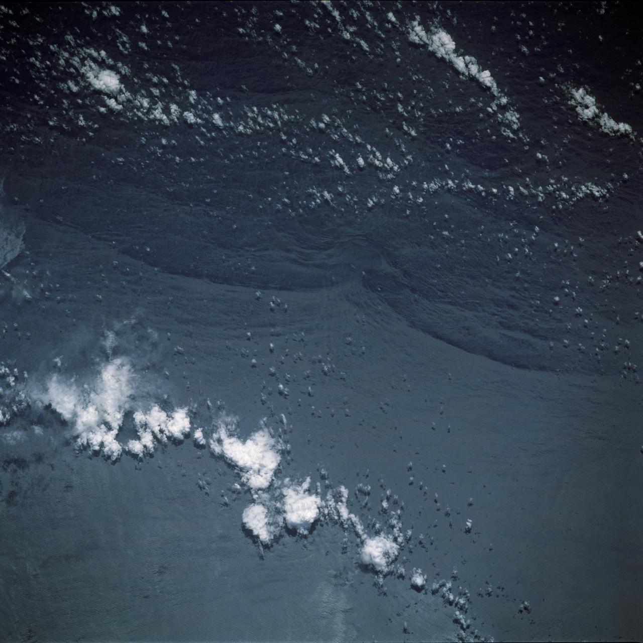
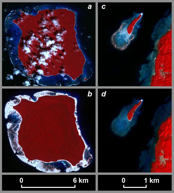
STS044-79-077 (24 Nov.-1 Dec. 1991) --- This photograph, captured from the Earth-orbiting Space Shuttle Atlantis, shows sunglint pattern in the western tropical Indian Ocean. Several large internal waves reflect around a shallow area on the sea floor. NASA scientists studying the STS-44 photography believe the shallow area to be a sediment (a submerged mountain) on top of the Mascarene Plateau, located northeast of Madagascar at approximately 5.6 degrees south latitude and 55.7 degrees east longitude. Internal waves are similar to surface ocean waves, except that they travel inside the water column along the boundary between water layers of different density. At the surface, their passage is marked on the sea surface by bands of smooth and rough water. These bands appear in the sunglint pattern as areas of brighter or darker water. NASA scientists point out that, when the waves encounter an obstacle, such as a near-surface seamount, they bend or refract around the obstacle in the same manner as surface waves bend around an island or headland.
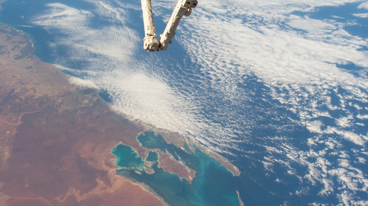
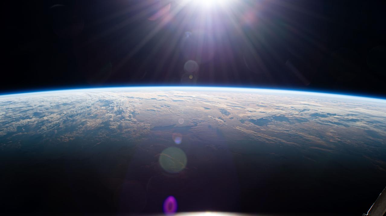
iss058e002638 (Jan. 14, 2019) --- Australia's Shark Bay, the Indian Ocean and the elbow of the Canadarm2 robotic arm are pictured as the International Space Station orbited nearly 256 miles above the state of Western Australia.

Tropical Cyclone Glenda took a five day tour of the Southern Indian Ocean in late February, 2015. The storm formed from a low pressure system, System 90S on February 24, when maximum sustained winds reached 40 mph (64 km/h). The Moderate Resolution Imaging Spectroradiometer (MODIS) aboard NASA’s Aqua satellite captured this true-color image of Tropical Storm Glenda on February 25 at 08:55 UTC (3:55 a.m. EST). At that time bands of thunderstorms wrapped into the low-level center of circulation. An eye was beginning to form. At 0900 UTC (4 a.m. EST) on February 25, Glenda's maximum sustained winds were near 63.2 mph (102 km/h). It was centered near 17.6 south latitude and 69.1 east longitude, about 760 miles (1,224 km) south-southwest of Diego Garcia. Glenda was moving to the west-southwest at 8 mph (13 km/h). At that time, the Joint Typhoon Warning Center expect Glenda to strengthen to near 109 mph (176 km/h) before beginning to weaken. However, strong wind shear began to affect the storm. By the afternoon of February 26 Tropical Cyclone Glenda’s winds had dropped to about 58 mph (93 km/h), and by February 28 the storm had transitioned to an extra-tropical storm. Credit: NASA/GSFC/Jeff Schmaltz/MODIS Land Rapid Response Team <b><a href="http://www.nasa.gov/audience/formedia/features/MP_Photo_Guidelines.html" rel="nofollow">NASA image use policy.</a></b> <b><a href="http://www.nasa.gov/centers/goddard/home/index.html" rel="nofollow">NASA Goddard Space Flight Center</a></b> enables NASA’s mission through four scientific endeavors: Earth Science, Heliophysics, Solar System Exploration, and Astrophysics. Goddard plays a leading role in NASA’s accomplishments by contributing compelling scientific knowledge to advance the Agency’s mission. <b>Follow us on <a href="http://twitter.com/NASAGoddardPix" rel="nofollow">Twitter</a></b> <b>Like us on <a href="http://www.facebook.com/pages/Greenbelt-MD/NASA-Goddard/395013845897?ref=tsd" rel="nofollow">Facebook</a></b> <b>Find us on <a href="http://instagram.com/nasagoddard?vm=grid" rel="nofollow">Instagram</a></b>

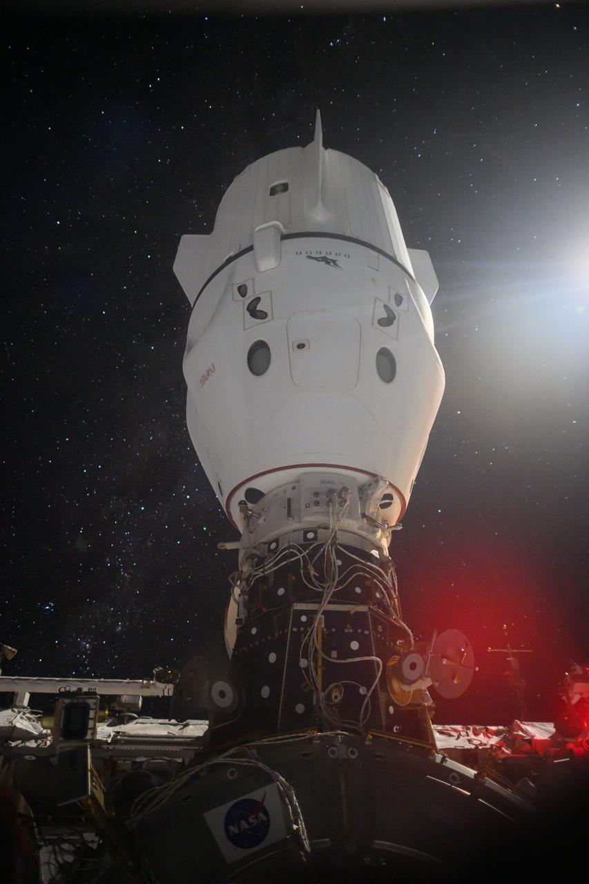
iss058e002592 (Jan. 9, 2019) --- The SpaceX Dragon cargo craft is pictured attached to the International Space Station's Harmony module as the orbital complex flew 258 miles above the Indian Ocean off the eastern coast of South Africa.
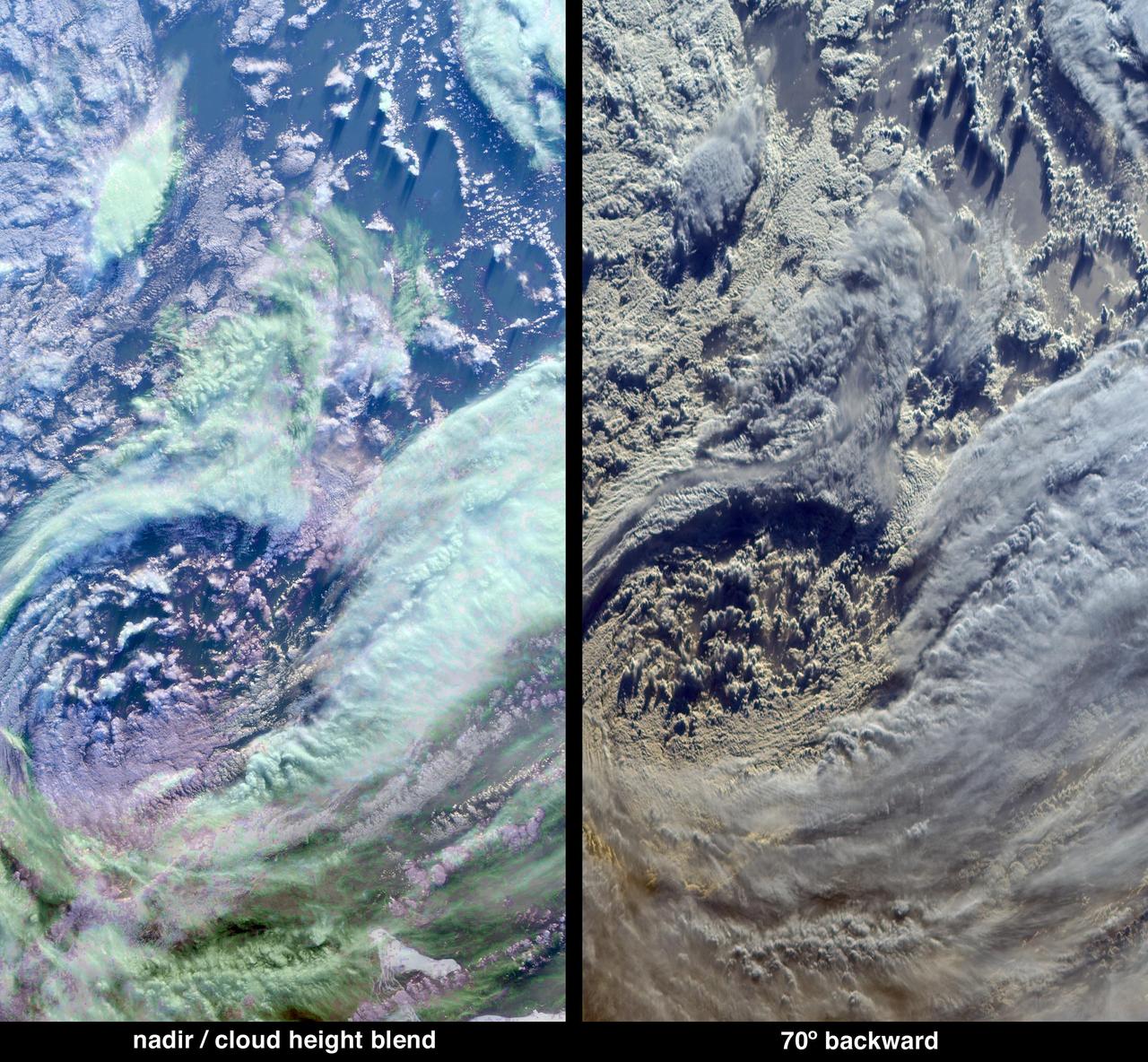
The complex structure and beauty of polar clouds are highlighted by these images acquired by NASA Terra spacecraft on April 23, 2003. These clouds occur at multiple altitudes and exhibit a noticeable cyclonic circulation over the Southern Indian Ocean,
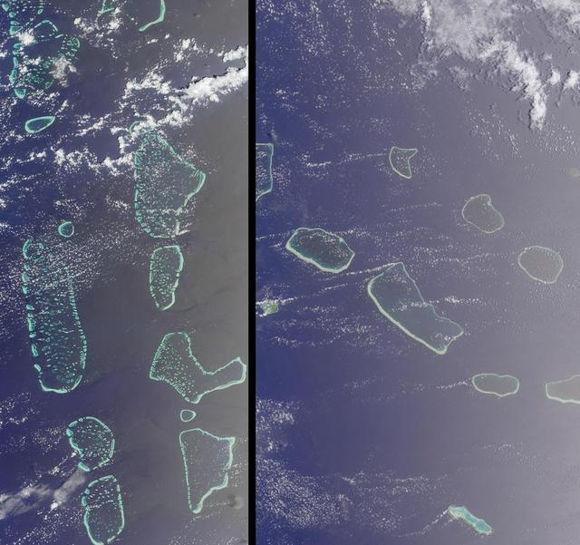
Maldives in the Indian Ocean and Tuamotu, French Polynesia is shown in this MISR Mystery Quiz #16 captured by NASA Terra spacecraft.
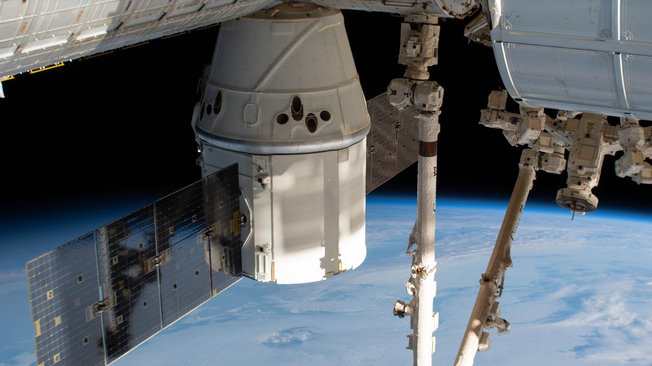
iss058e002241 (Jan. 7, 2019) --- The SpaceX Dragon cargo craft is pictured attached to the International Space Station's Harmony module as the orbital complex orbited 261 miles above the Indian Ocean southeast of the continent of Africa. The Canadarm2 robotic arm vertically splits the frame prior to grappling the spacecraft ahead of planned departure activities.
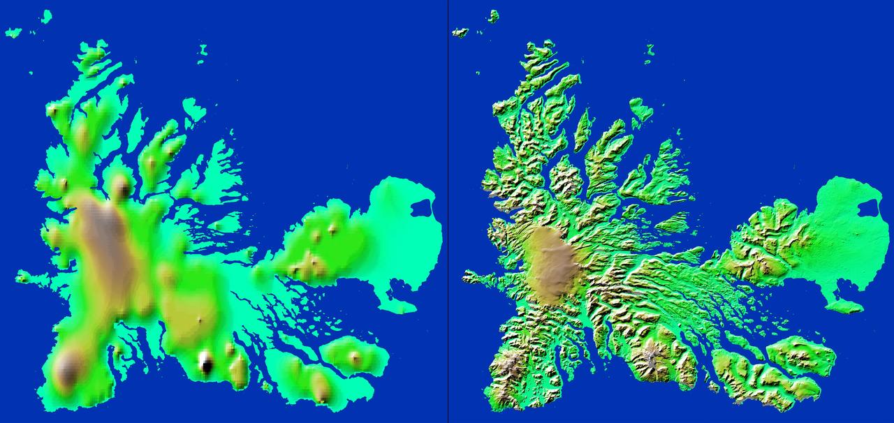
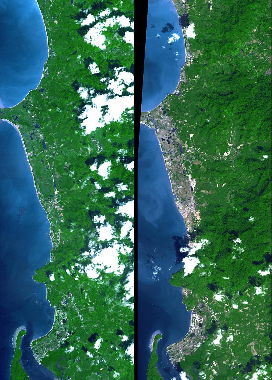
These two images show exactly the same area, Kerguelen Island in the southern Indian Ocean. The image on the left was created using the best global topographic data set previously available, the U.S. Geological Survey GTOPO30.
iss072e769023 (March 10, 2025) --- A cloudy Indian Ocean southwest of Perth, Australia, is pictured from the International Space Station as it orbited 268 miles above.
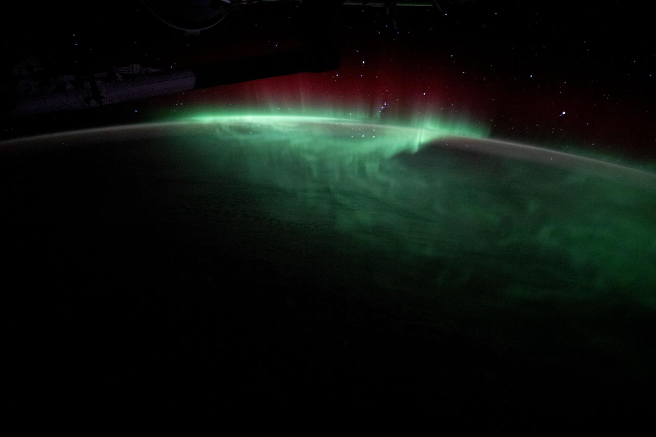
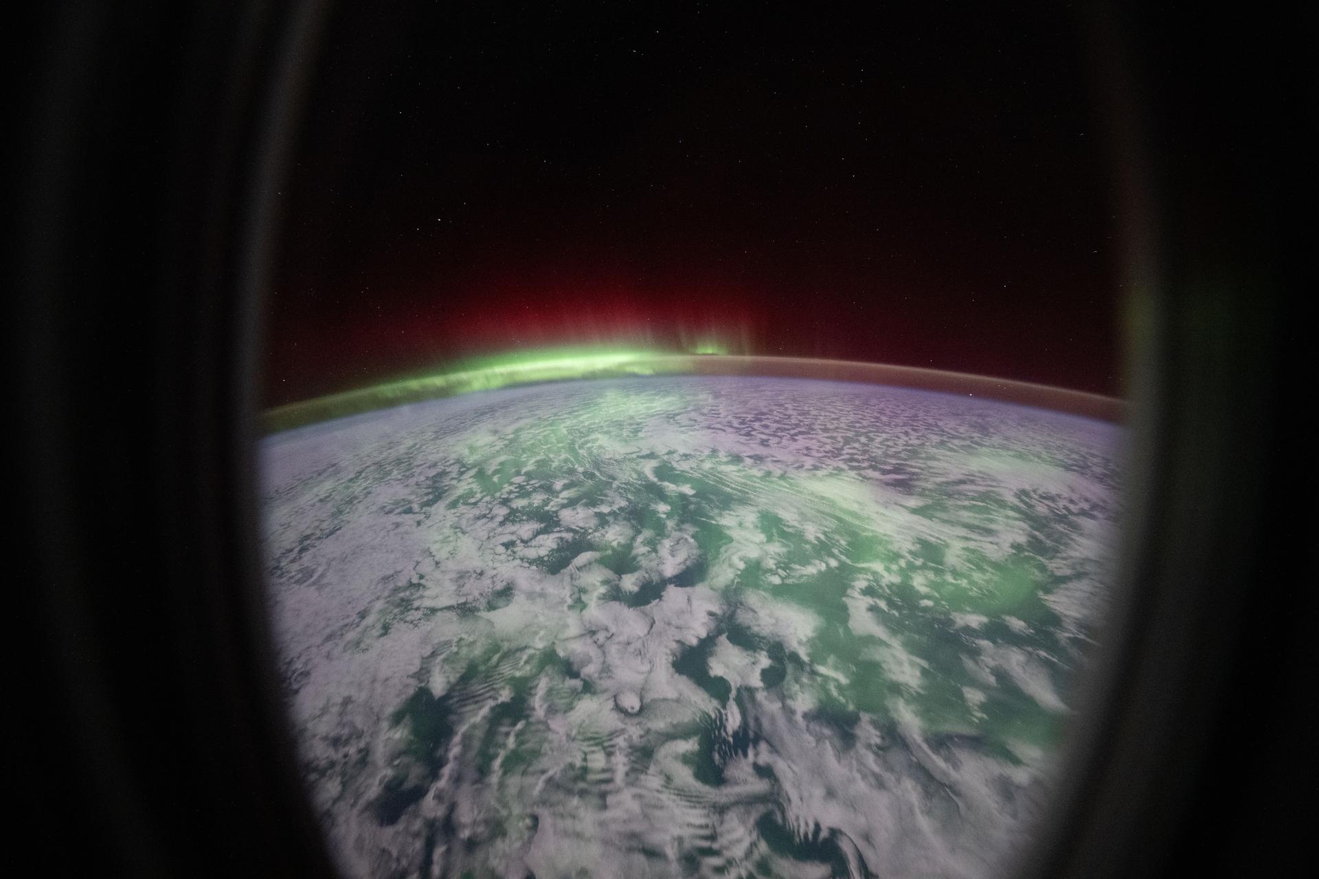
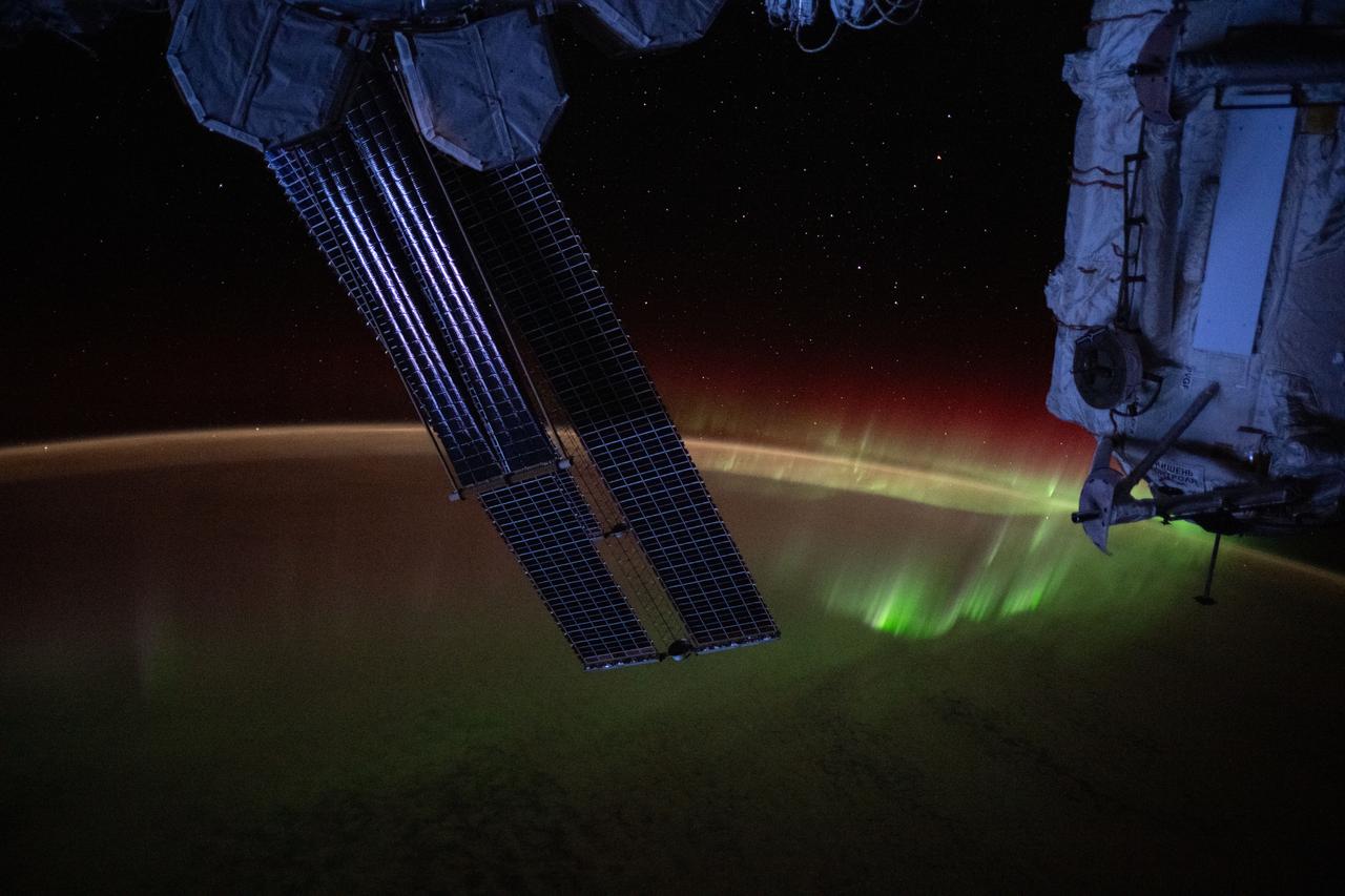
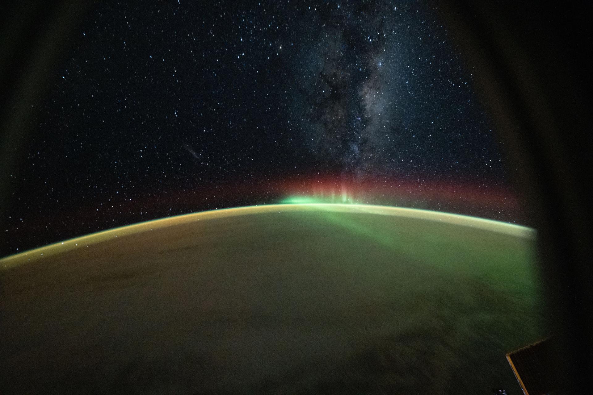
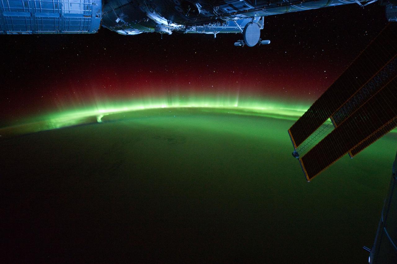
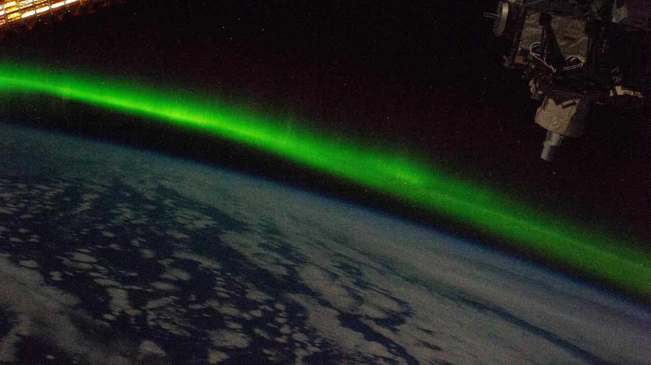
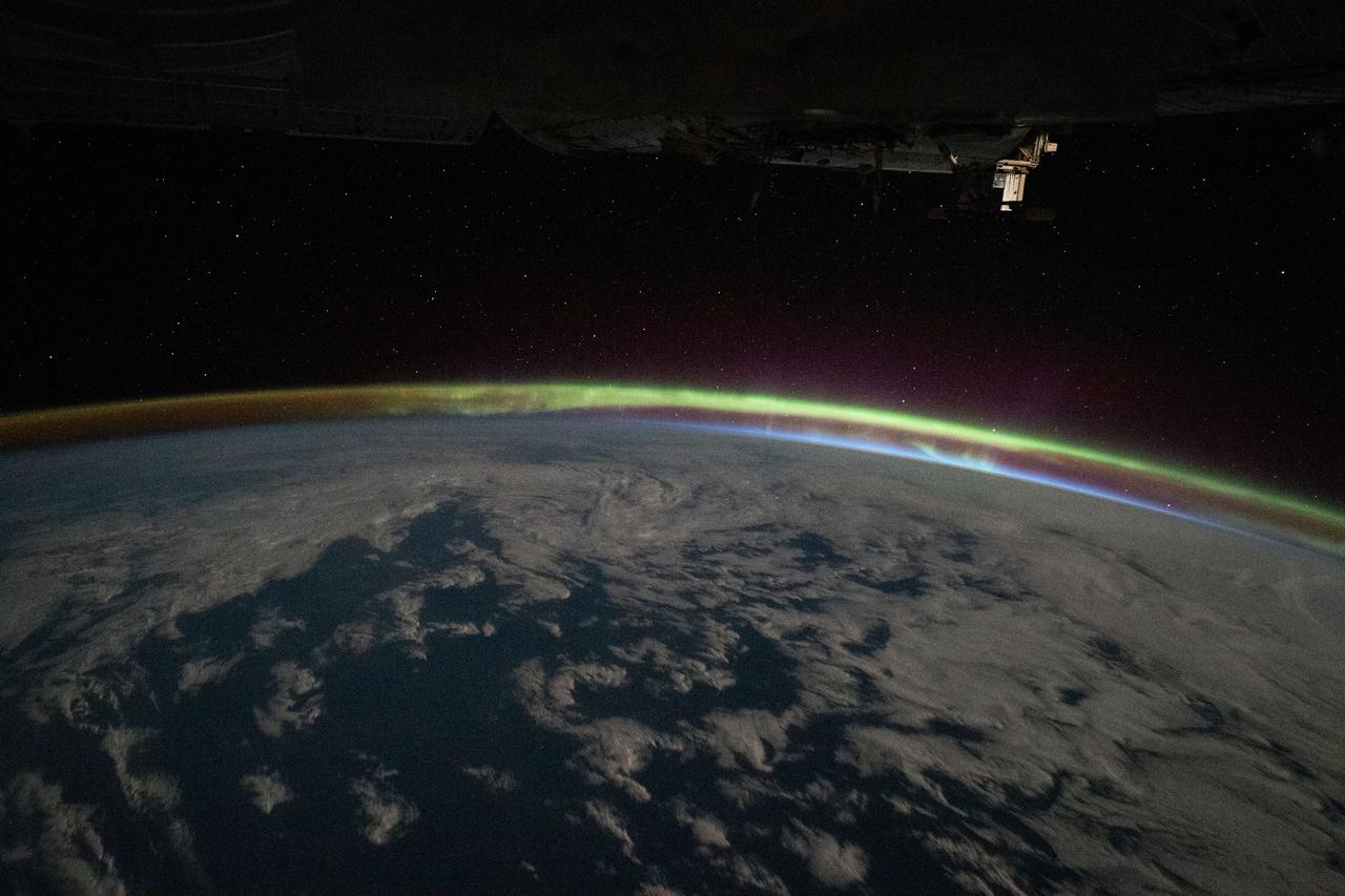
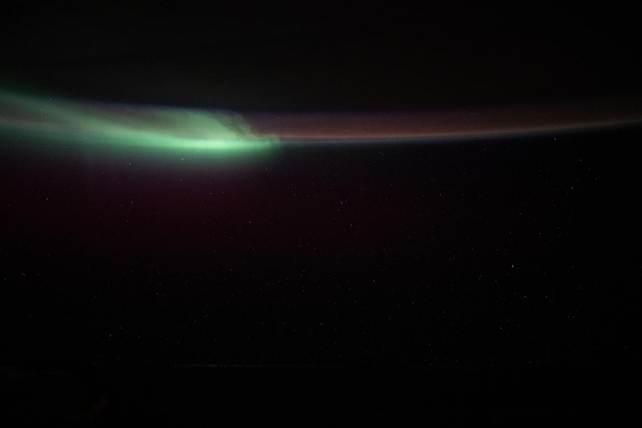
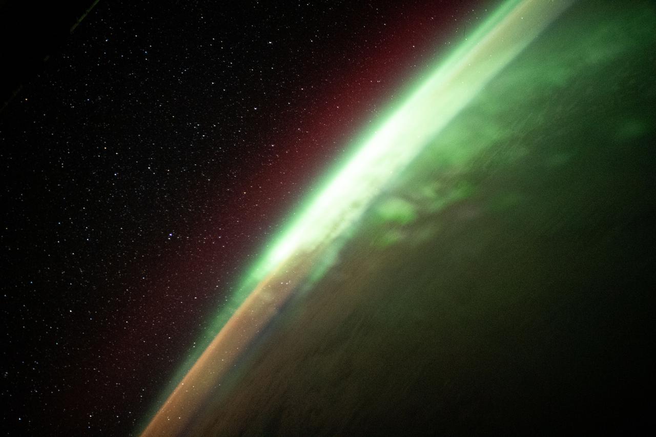
iss071e570863 (Aug. 10, 2024) -- Green aurora burst throughout Earth's nighttime atmosphere as the International Space Station orbited 270 miles above the Indian Ocean.

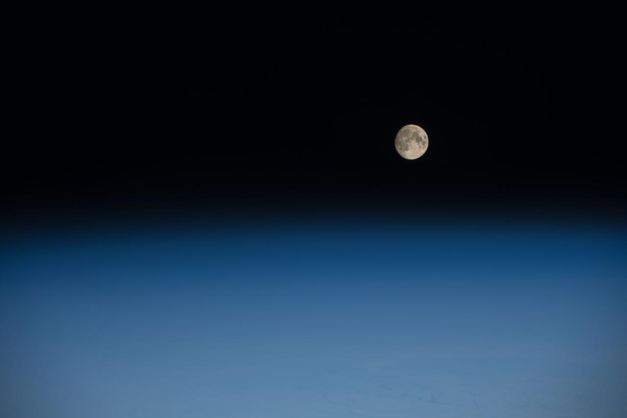
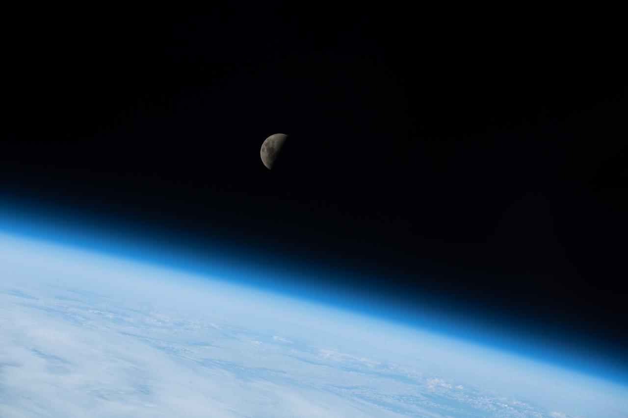
iss071e206291 (June 20, 2024) -- A waxing gibbous moon rises over the Indian Ocean as the International Space Station orbited 266 miles above.
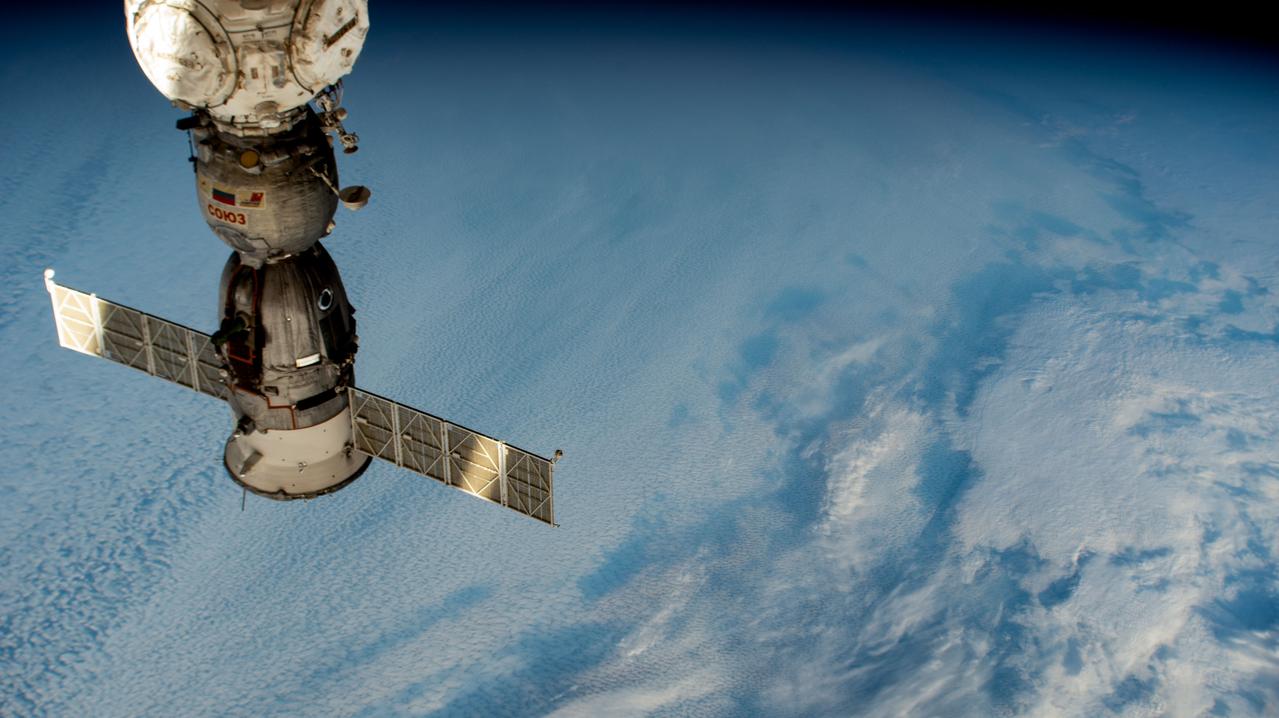
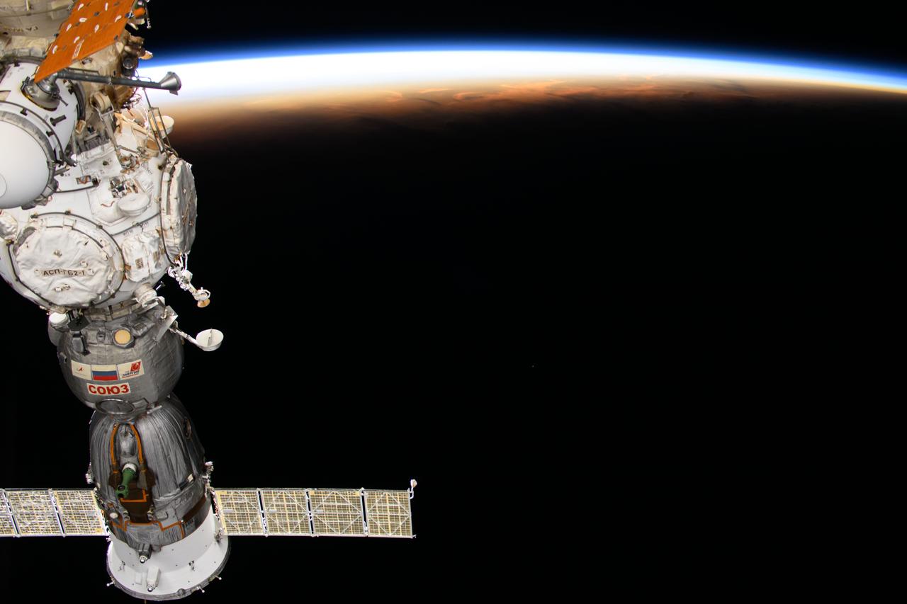
iss071e364343 (July 18, 2024) --- The Soyuz MS-25 crew ship is pictured docked to the International Space Station's Prichal docking module, where it has remained since March 25, 2024, as it soared 274 miles above a cloudy Indian Ocean.
STS035-607-024 (2-10 Dec. 1990) --- This is one of 25 visuals used by the STS-35 crew at its Dec. 20, 1990 post-flight press conference. Space Shuttle Columbia's flight of almost nine days duration (launched December 2 from Kennedy Space Center (KSC) and landed December 10 at Edwards Air Force Base) carried the Astro-1 payload and was dedicated to astrophysics. The mission involved a seven-man crew. Crew members were astronauts Vance D. Brand, Guy S. Gardner, Jeffrey A. Hoffman, Robert A.R. Parker and John M. (Mike) Lounge; and payload specialists Samuel T. Durrance and Ronald A. Parise. Thunderstorm systems over the Pacific Ocean, with heavy sunglint, as photographed with a handheld Rolleiflex camera aimed through Columbia's aft flight deck windows.
iss073e0285020 (July 14, 2025) --- Perth, Australia, with a population of about 2.3 million on the island continent's Indian Ocean coast, is pictured from the International Space Station as it orbited 263 miles above. Credit: Roscosmos
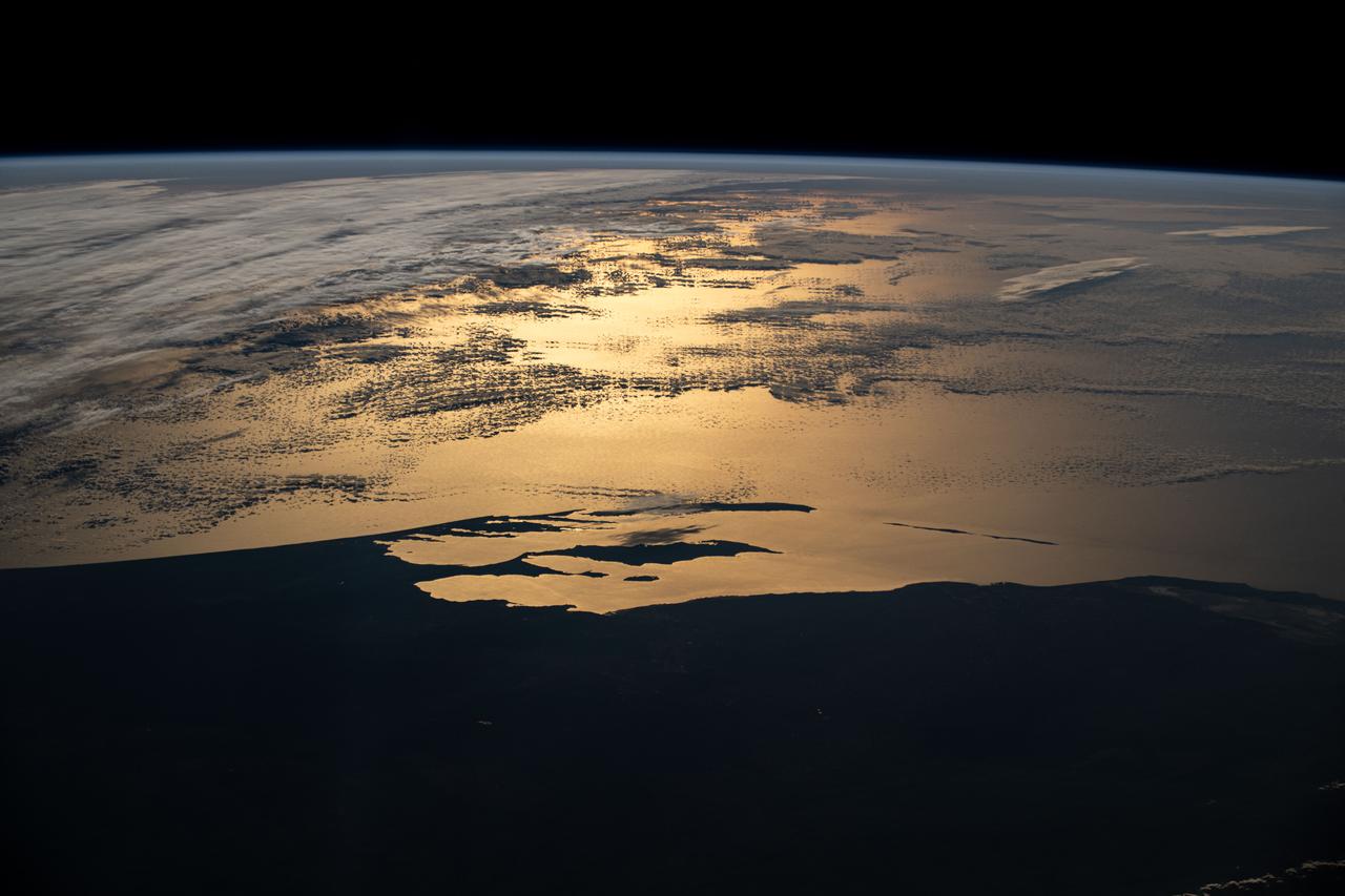
iss072e145182 (Nov. 5, 2024) --- Western Australia's silhouetted coastline contrasts with the sun's golden-hued glint beaming off a partly cloudy Indian Ocean in this photograph from the International Space Station as it orbited 265 miles above the island continent during an orbital sunset.
iss074e0436787 (April 3, 2026) --- This view from a window aboard the SpaceX Dragon spacecraft shows the aurora australis glowing above Earth’s atmosphere as the International Space Station soared 270 miles over the Indian Ocean, just southwest of the French Southern and Antarctic Lands. Credit: NASA/Chris Williams

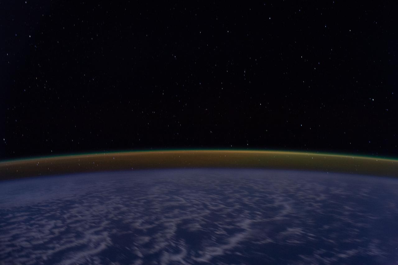
iss073e0379986 (July 16, 2025) --- In this long duration photograph taken from the International Space Station clouds streak across the Indian Ocean, a dim atmospheric glow crowns Earth's horizon, and stars trail above the planet's horizon. The orbital outpost was soaring 261 miles above the Indian Ocean southwest of Indonesia at approximately 3:14 a.m. local time.
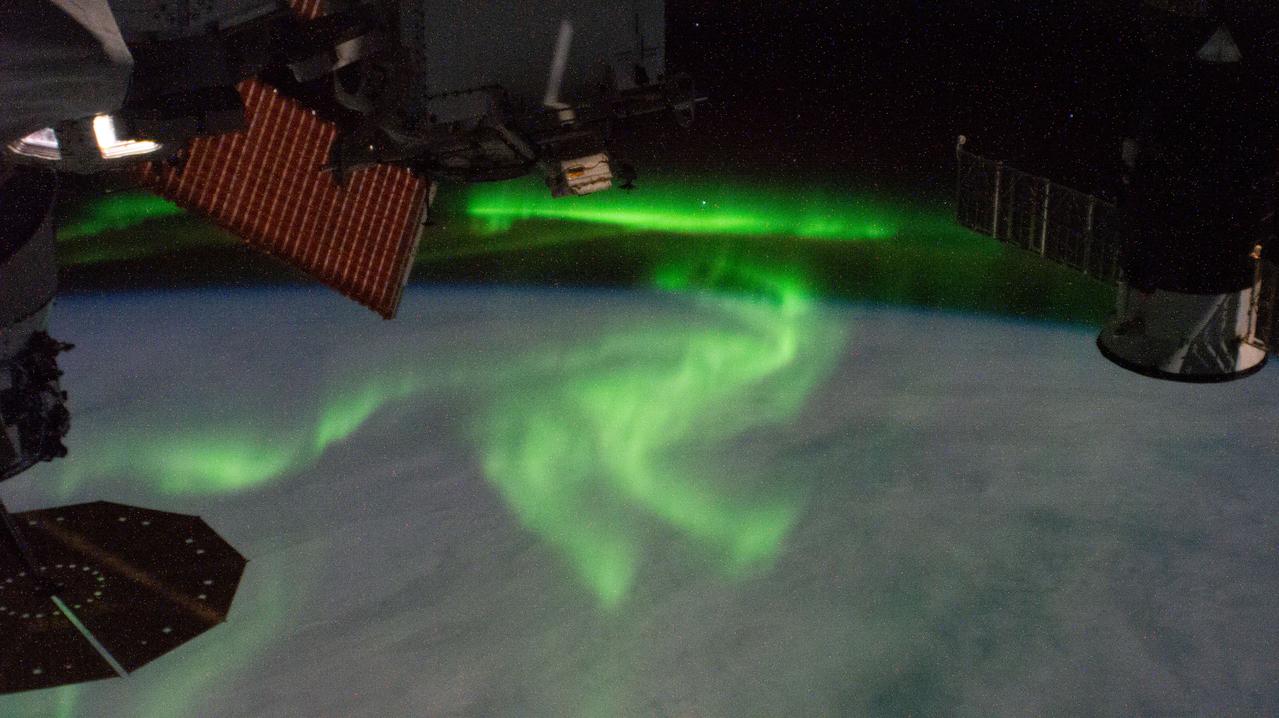
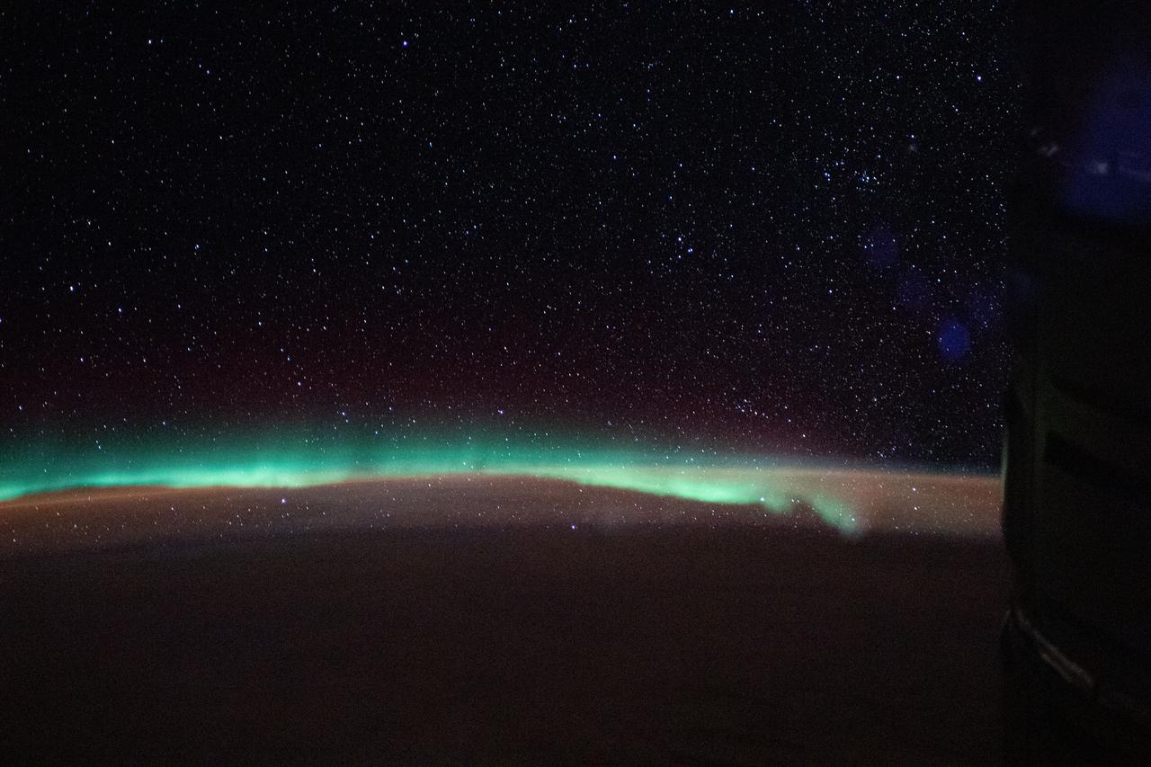
iss073e0247726 (June 12, 2025) --- The aurora australis arcs above a partly cloudy Indian Ocean in this photograph from the International Space Station as it orbited 269 miles above in between Australia and Antarctica.
iss073e0107413 (May 17, 2025) --- The Sun's glint beams off a partly cloudy Indian Ocean in this photograph from the International Space Station as it orbited 271 miles above and south of Australia's island state of Tasmania.
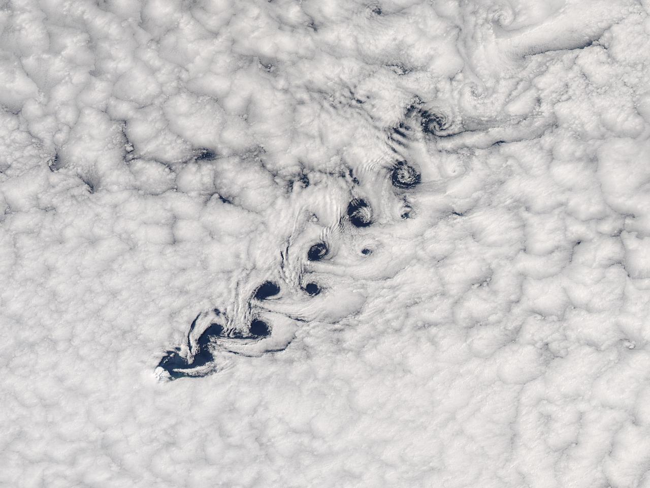
Cloud vortices off Heard Island, south Indian Ocean. The Moderate Resolution Imaging Spectroradiometer (MODIS) aboard NASA’s Aqua satellite captured this true-color image of sea ice off Heard Island on Nov 2, 2015 at 5:02 AM EST (09:20 UTC). Credit: NASA/GSFC/Jeff Schmaltz/MODIS Land Rapid Response Team
iss073e0695491 (Sept. 1, 2025) --- The Canadarm2 robotic arm with Dextre, its fine-tuned robotic hand attached, is pictured extending from the International Space Station as it orbited 258 miles above the Indian Ocean southwest of the Indonesian island of Sumatra. The Earth's horizon is highlighted by the atmospheric glow with a set of the orbital outpost's main solar arrays and a partially obscured SpaceX Dragon cargo spacecraft in the foreground.
iss073e0384743 (July 22, 2025) --- A wispy aurora spikes across the Indian Ocean with a set of the International Space Station's main solar arrays (augmented by its rollout solar arrays) draping the foreground. At right, is the unoccupied Rassvet module that hosts visiting spacecraft from Roscosmos. The orbital outpost was soaring 270 miles above Earth southwest of Australia at the time of this photograph.
Mayotte is a volcanic island in the Comoros archipelago between the eastern coast of Africa and the northern tip of Madagascar. It is a French Overseas Territory in the Indian Ocean. On December 14, the island was hit by devastating category-4 hurricane Chido, causing widespread damage and loss of life. The image was acquired June 7, 2016, covers an area of 42 by 58.5 km, and is located at 12.8 degrees south, 45.1 degrees east. https://photojournal.jpl.nasa.gov/catalog/PIA26503
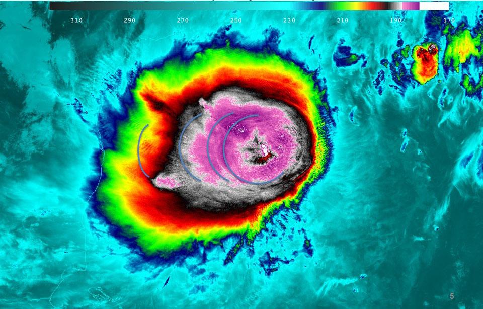
The first tropical cyclone in the Northern Indian Ocean this season has been getting better organized as seen in NASA satellite imagery. Tropical Cyclone Mahasen is projected to track north through the Bay of Bengal and make landfall later this week. On May 13, NASA-NOAA's Suomi NPP satellite captured various night-time and day-time imagery that showed Mesospheric Gravity Waves, lightning, and heavy rainfall in false-colored imagery. For more information and updates on Cyclone Mahasen, visit NASA's Hurricane page at <a href="http://www.nasa.gov/hurricane" rel="nofollow">www.nasa.gov/hurricane</a>. Image Credit: UWM-CIMSS/William Straka III/NASA/NOAA Text Credit: NASA Goddard/Rob Gutro <b><a href="http://www.nasa.gov/audience/formedia/features/MP_Photo_Guidelines.html" rel="nofollow">NASA image use policy.</a></b> <b><a href="http://www.nasa.gov/centers/goddard/home/index.html" rel="nofollow">NASA Goddard Space Flight Center</a></b> enables NASA’s mission through four scientific endeavors: Earth Science, Heliophysics, Solar System Exploration, and Astrophysics. Goddard plays a leading role in NASA’s accomplishments by contributing compelling scientific knowledge to advance the Agency’s mission. <b>Follow us on <a href="http://twitter.com/NASA_GoddardPix" rel="nofollow">Twitter</a></b> <b>Like us on <a href="http://www.facebook.com/pages/Greenbelt-MD/NASA-Goddard/395013845897?ref=tsd" rel="nofollow">Facebook</a></b> <b>Find us on <a href="http://instagram.com/nasagoddard?vm=grid" rel="nofollow">Instagram</a></b>
iss074e0409626 (March 23, 2026) --- This long-duration photograph, with an exposure of 90 seconds, highlights star trails and an orbital sunrise as the International Space Station soared 268 miles above the southern Indian Ocean at approximately 3:45 a.m. local time. Credit: NASA/Chris Williams
iss073e0426077 (July 26, 2025) --- The aurora australis appears to lap over the Earth like a tide washing ashore in this photograph taken at approximately 3:45 a.m. local time from the International Space Station as it orbited 269 miles above the Indian Ocean southwest of Australia.

iss073e0247649 (June 10, 2025) --- The aurora australis arcs back and forth above a partly cloudy Indian Ocean in this photograph from the International Space Station as it orbited 270 miles above in between Australia and Antarctica. At center top, is the Rassvet module, at lower right, is the Soyuz MS-27 crew ship docked to the Prichal module.
iss072e838362 (March 26, 2025) --- Sunrise above Earth's horizon begins illuminating a cloudy Indian Ocean and reveals the terminator, the dividing line between night and day, in this photograph from the International Space Station as it orbited 271 miles above.
iss074e0491096 (April 17, 2026) --- A wispy aurora australis arcs across the Indian Ocean as the Milky Way protrudes above Earth’s atmosphere in this photograph taken at approximately 8:55 p.m. local time from the International Space Station as it orbited 270 miles above the planet. Credit: NASA/Chris Williams
iss074e0462550 (April 4, 2026) --- The aurora australis arcs across the Indian Ocean south of Perth, Australia, in this photograph taken at approximately 2:19 a.m. local time from the International Space Station as it orbited 270 miles above Earth. Credit: NASA/Jessica Meir
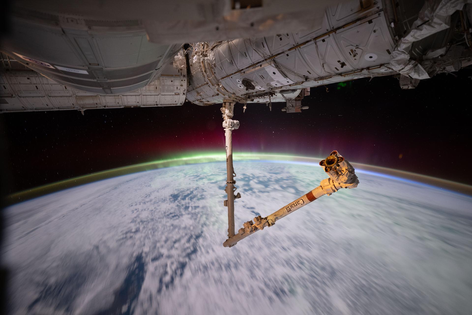
iss074e0433177 (April 3, 2026) --- The aurora australis crowns Earth’s atmosphere in this photograph taken at approximately 3:13 a.m. local time from the International Space Station as it orbited 269 miles above the Indian Ocean east of the French Southern and Antarctic Lands. In the foreground, the Canadarm2 robotic arm extends from a power and data grapple fixture attached to the Harmony module. Credit: NASA/Chris Williams
NASA Terra spacecraft acquired this image of the Republic of Seychelles, an island country with an archipelago of 115 islands in the Indian Ocean.
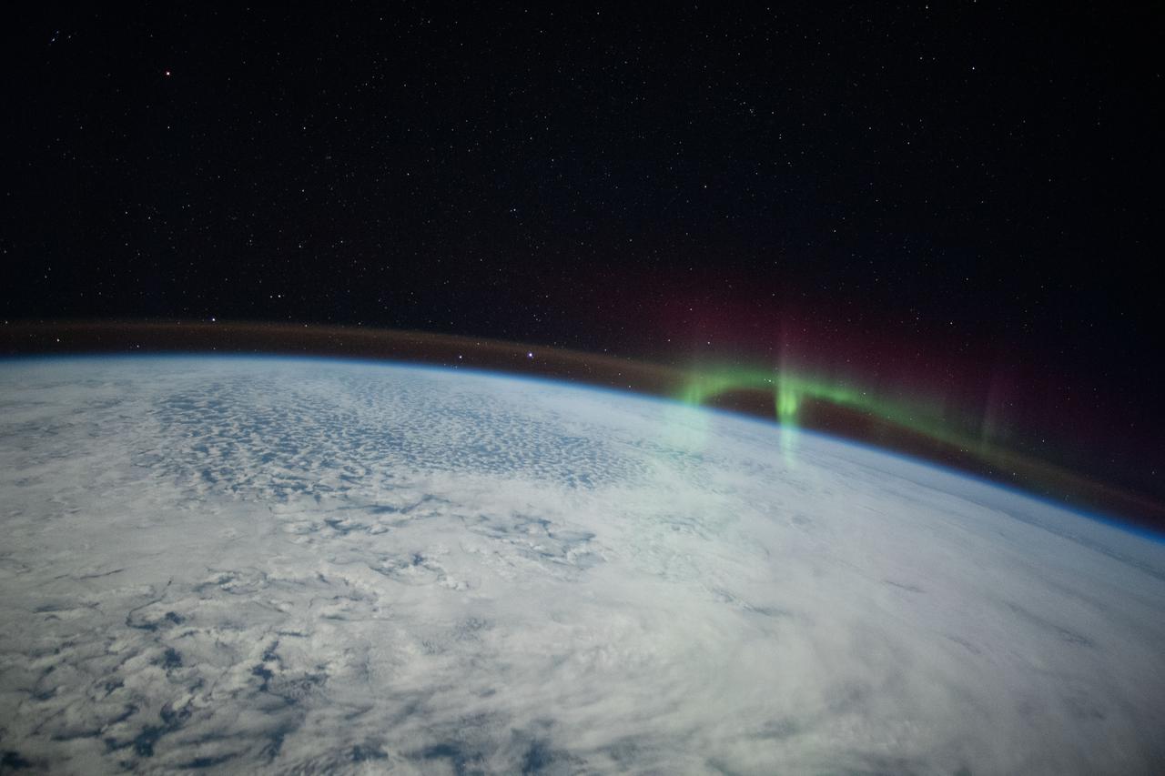
ISS029-E-005904 (17 Sept. 2011) --- This is one of a series of night time images photographed by one of the Expedition 29 crew members from the International Space Station. It features Aurora Australis over the southern Indian ocean. Nadir coordinates are 50.16 south latitude and 48.11 degrees east longitude.
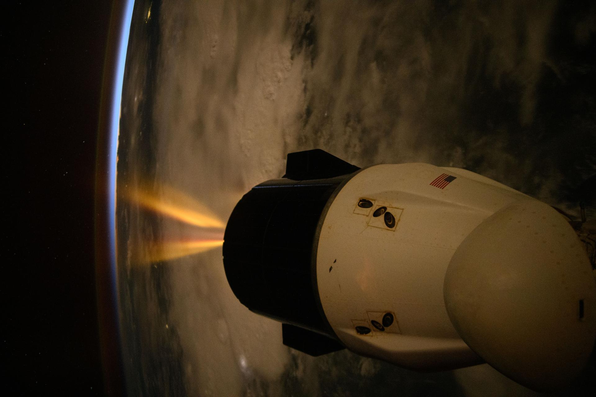
iss074e0103137 (Dec. 29, 2025) --- A SpaceX Dragon spacecraft fires its Draco engines, an independent propellant system located in the spacecraft’s trunk, for a regularly scheduled orbital reboost of the International Space Station. The orbital outpost was soaring into a sunset 259 miles above the Indian Ocean off the coast of Tanzania on the African continent at approximately 9:09 p.m. local time.
The island of Java (8.0S, 112.0E), perhaps better than any other, illustrates the volcanic origin of Pacific Island groups. Seen in this single view are at least a dozen once active volcano craters. Alignment of the craters even defines the linear fault line of Java as well as the other some 1500 islands of the Indonesian Archipelago. Deep blue water of the Indian Ocean to the south contrasts to the sediment laden waters of the Java Sea to the north.
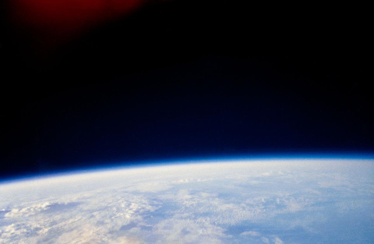
S62-06021 (20 Feb. 1962) --- A view of clouds over the Indian Ocean as photographed by astronaut John H. Glenn Jr. aboard the "Friendship 7" spacecraft during his Mercury Atlas 6 (MA-6) spaceflight on Feb. 20, 1962. The cloud panorama illustrates the visibility of different cloud types and weather patterns. Shadows produced by the rising sun aid in the determination of relative cloud heights. Photo credit: NASA

iss074e0342635 (Feb. 22, 2026) --- A dim airglow blankets Earth’s horizon as a faint Moon sets above a dark and vast Indian Ocean in this photograph from the International Space Station, which was orbiting 264 miles above the Maldives—an Asian archipelago nation southwest of India—at approximately 12:11 a.m. local time. Credit: NASA/Chris Williams

iss074e0342246 (Feb. 22, 2026) --- A dim airglow blankets Earth’s horizon as a faint Moon sets above a dark and vast Indian Ocean. The International Space Station was orbiting 265 miles above the Seychelles—an East African archipelago nation of 115 islands—at approximately 11:08 p.m. local time when this photograph was taken. Credit: NASA/Chris Williams
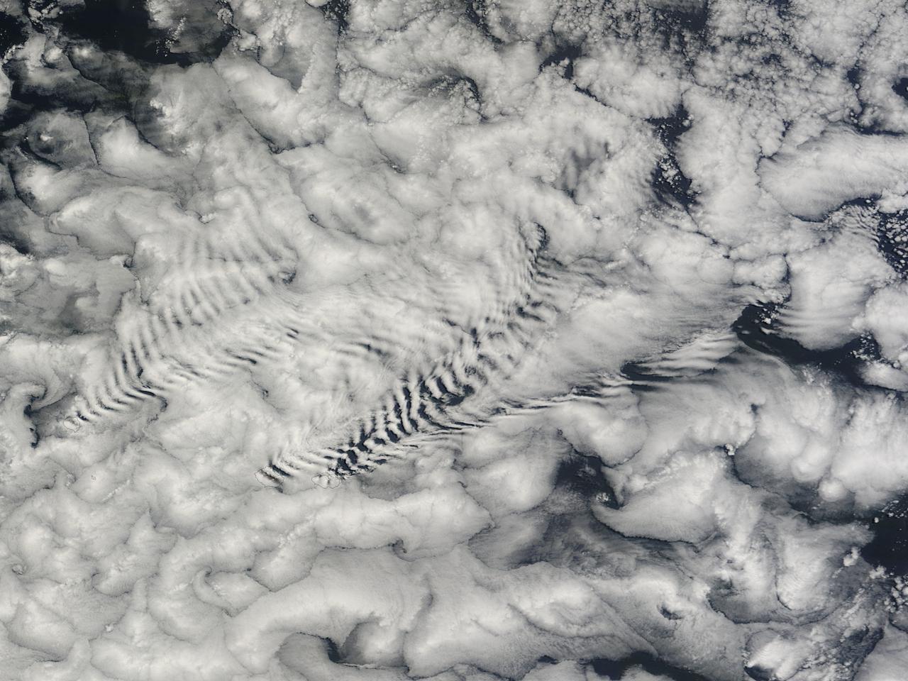
There are special places on Earth that sometimes write their personal signature in the clouds. The Crozet Islands are one such place, thanks to the tall volcanic peaks that grace the islands. When air flows around these tall peaks, it gets pushed around the islands as well as up and over the peak. The net effect of the flowing air flowing around the solid, tall peaks is much like the solid bow of a ship cutting through standing water. In each case v-shaped waves are formed behind the motion. In liquid, this is called a wake; in the atmosphere, when clouds are present or created, they are known as ship-wave-shaped clouds. The Moderate Resolution Imaging Spectroradiometer (MODIS) aboard NASA’s Terra satellite captured this true-color image as it passed over the Crozet Islands on November 26, 2014. Three distinct waves are seen behind the three largest islands. From west to east these are Pig Island, Possession Island and East Island. Credit: NASA/GSFC/Jeff Schmaltz/MODIS Land Rapid Response Team <b><a href="http://www.nasa.gov/audience/formedia/features/MP_Photo_Guidelines.html" rel="nofollow">NASA image use policy.</a></b> <b><a href="http://www.nasa.gov/centers/goddard/home/index.html" rel="nofollow">NASA Goddard Space Flight Center</a></b> enables NASA’s mission through four scientific endeavors: Earth Science, Heliophysics, Solar System Exploration, and Astrophysics. Goddard plays a leading role in NASA’s accomplishments by contributing compelling scientific knowledge to advance the Agency’s mission. <b>Follow us on <a href="http://twitter.com/NASAGoddardPix" rel="nofollow">Twitter</a></b> <b>Like us on <a href="http://www.facebook.com/pages/Greenbelt-MD/NASA-Goddard/395013845897?ref=tsd" rel="nofollow">Facebook</a></b> <b>Find us on <a href="http://instagram.com/nasagoddard?vm=grid" rel="nofollow">Instagram</a></b>
The magnitude 9.2 Indian Ocean earthquake of December 26, 2004, produced broad regions of uplift and subsidence. In order to define the lateral extent and the downdip limit of rupture. This image is from NASA Terra spacecraft.
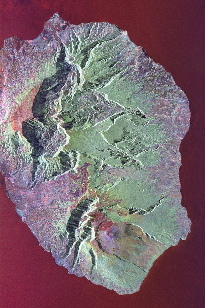
This radar image shows the volcanic island of Reunion, about 700 km 434 miles east of Madagascar in the southwest Indian Ocean. The southern half of the island is dominated by the active volcano, Piton de la Fournaise.
iss071e378517 (July 21, 2024) --- Mount Kilimanjaro, surrounded by clouds and the highest mountian in Africa, is pictured from the International Space Station as it orbited 261 miles above the Indian Ocean off the coast of Tanzania.
This image from NASA Terra spacecraft shows the Indian Ocean coastline north of Phuket, Thailand is a major tourist destination that was in the path of the tsunami produced by a giant offshore earthquake on December 26, 2004.
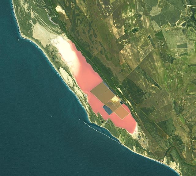
Hutt Lagoon is an elongate lake, located in a dune swale adjacent to the coast of the Indian Ocean, in the mid west region of Western Australia. Port Gregory is located between the ocean and the lake's southern shore. Hutt Lagoon is a pink lake, due to the presence of an algae that produces beta-carotene. A microalgae production plant is the world's largest. The image was acquired September 30, 2012, covers an area of 16.5 by 18.3 km, and is locate at 28.1 degrees south, 114.2 degrees east. https://photojournal.jpl.nasa.gov/catalog/PIA26510
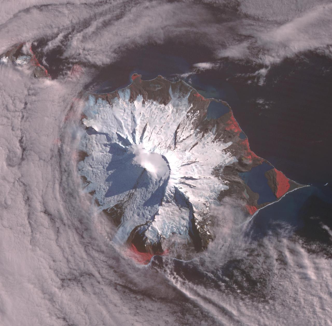
Heard, a remote volcanic island located in the southern Indian Ocean, is an Australian Territory. It consists of two volcanic structures: Big Ben and the smaller Mt. Dixon. The active Mawson Peak is located within a 5-6 km-wide caldera breached to the SW side of Big Ben. Intermittent eruptions have occurred since 1910; the latest in May 2023. The image was acquired March 18, 2025, covers an area of 39.7 by 40.4 km, and is located at 53 degrees south, 73.5 degrees east. https://photojournal.jpl.nasa.gov/catalog/PIA26509

iss070e060613 )Jan. 9, 2024) --- Perth, the capital of Western Australia with a population of 2.2 million on the coast of the Indian Ocean, is pictured from the International Space Station orbited 263 miles above. The Canning River merges with the Swan River before exiting into the Indian Ocean.
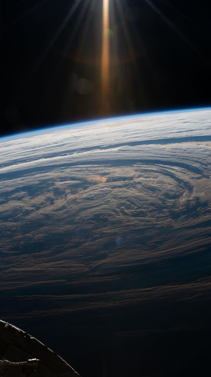
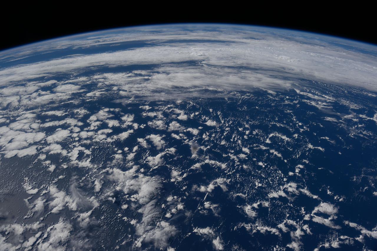
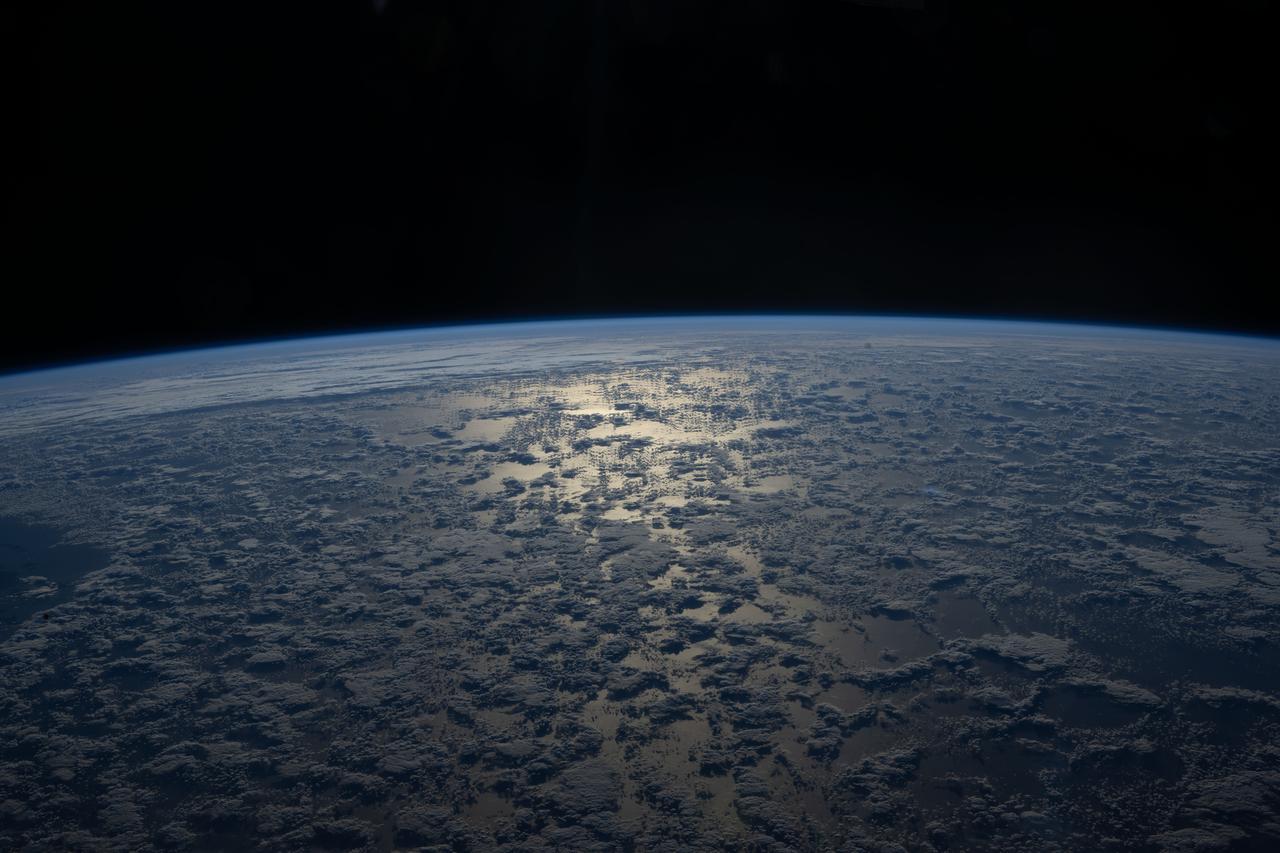
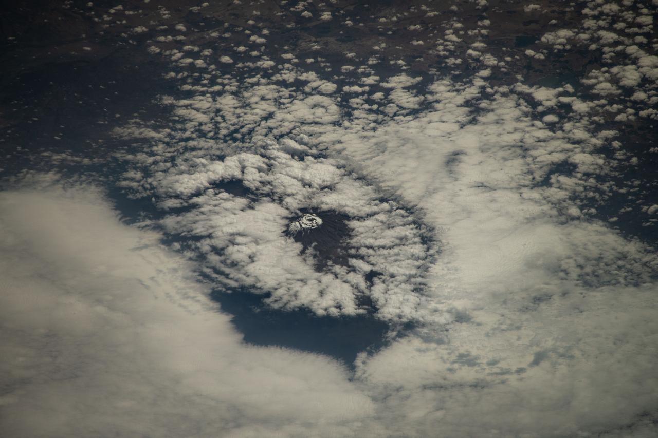
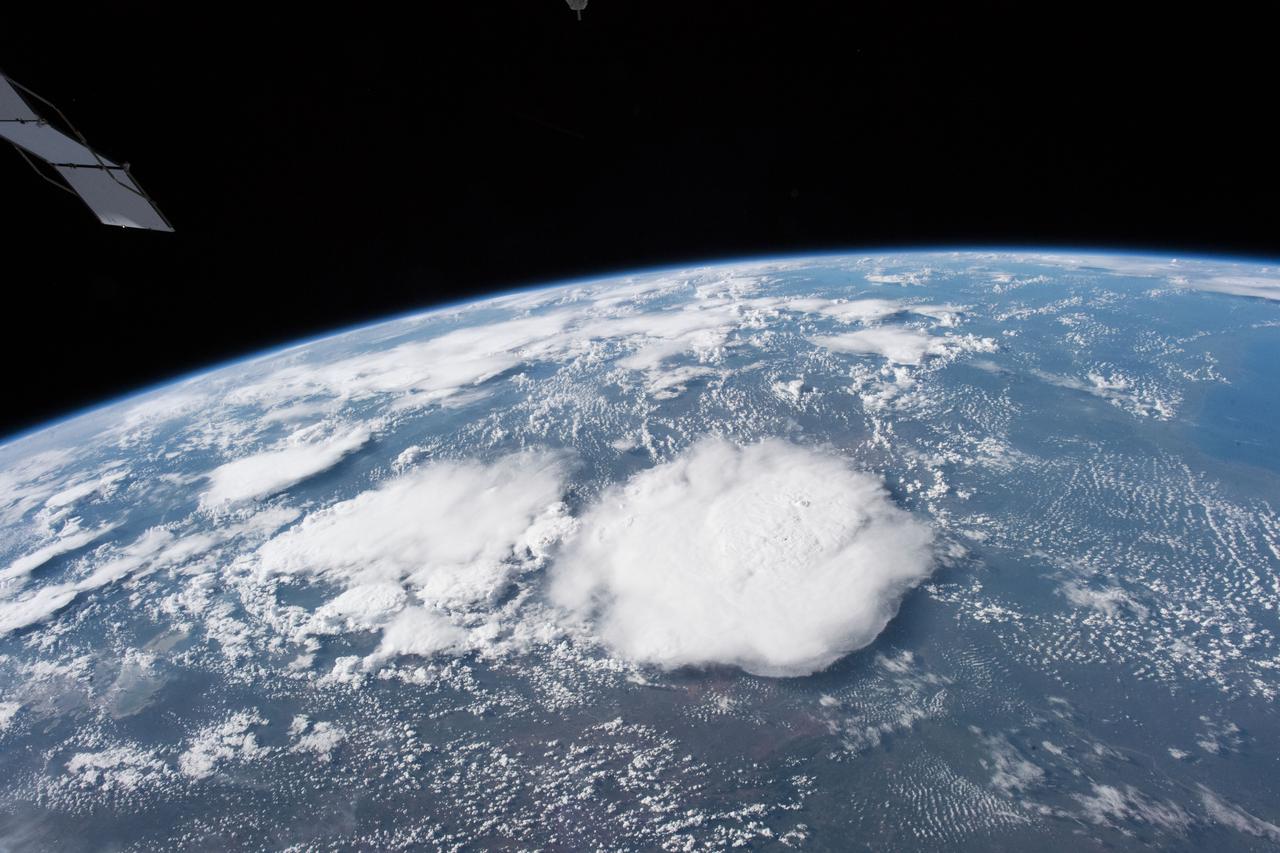
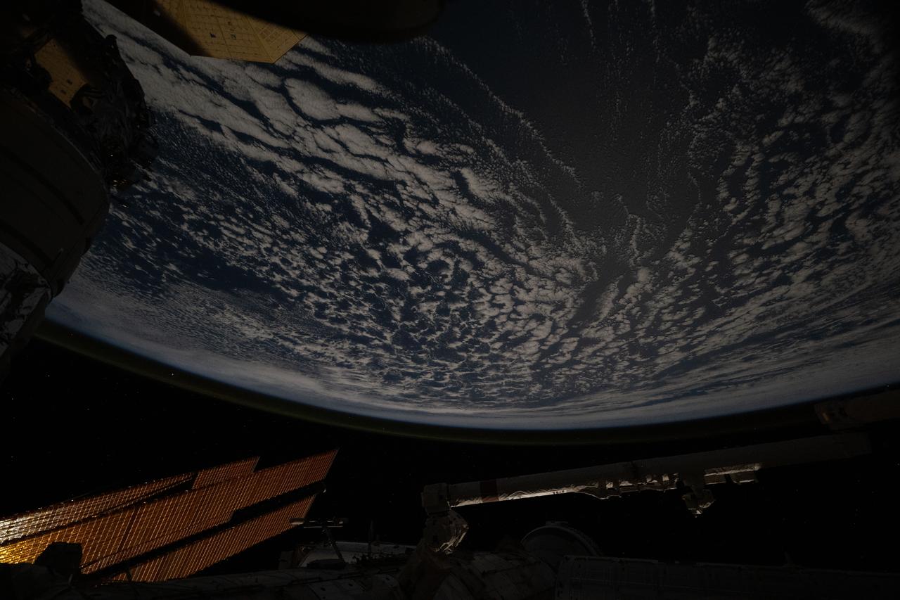
iss059e006522 (March 30, 2019) --- The International Space Station flew 265 miles above this cloudy formation in the south Indian Ocean.
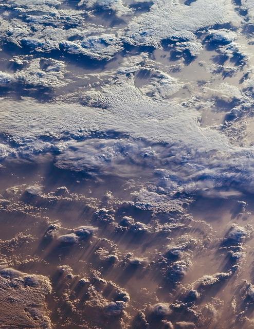
This image of clouds over the southern Indian Ocean was acquired on July 23, 2007 was acquired by NASA polar-orbiting Terra spacecraft.
iss062e148363 (April 13, 2020) --- The Earth's glow mingles with the "aurora australis" as the International Space Station orbits over the Indian Ocean.
iss056e098149 (July 23, 2108) --- The Indian Ocean and the north coast of Western Australia are pictured as the International Space Station began an orbital trek southwest to northeast across the Pacific Ocean.
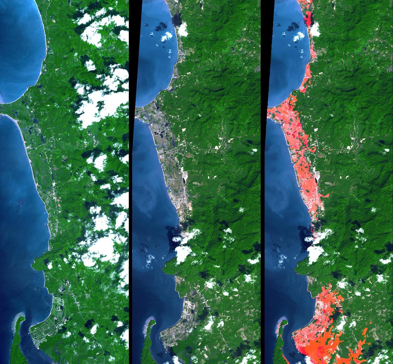
The island of Phuket on the Indian Ocean coast of Thailand is a major tourist destination and was also in the path of the tsunami that washed ashore on December 26, 2004. These simulated natural color ASTER images show a 27 kilometer (17-mile) long stretch of coast north of the Phuket airport on December 31 (right), along with an image acquired two years earlier (left). The changes along the coast are obvious where the vegetation has been stripped away. http://photojournal.jpl.nasa.gov/catalog/PIA07227
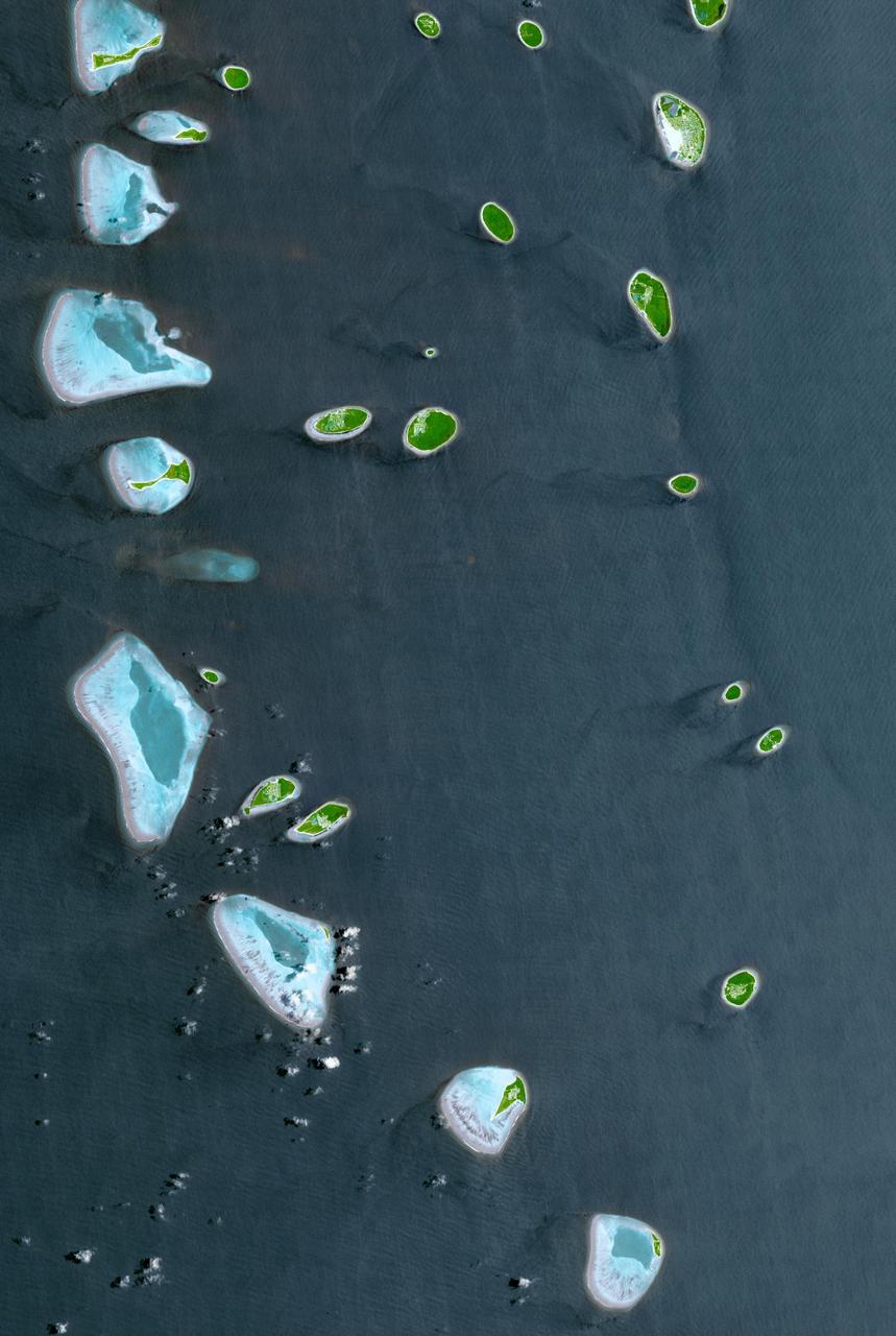
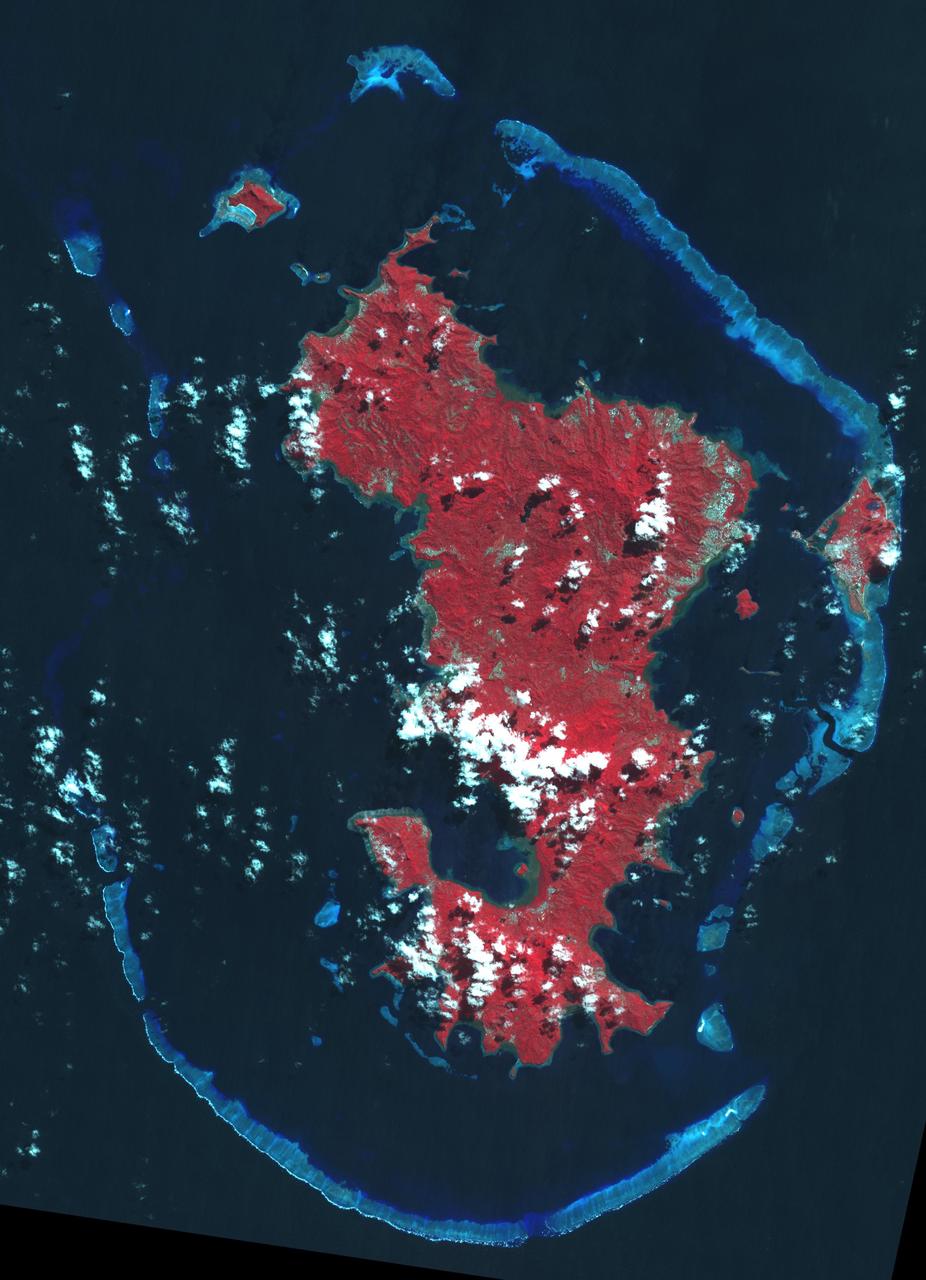
The Republic of Maldives is a country located in the Indian Ocean, southwest of India. It comprises twenty-six atolls, and 1192 coral islands, with an average ground elevation of 1.5 m. Tourism and fishing account for more than half of the country's GDP. Kulhudhuffushi, seen in the upper right corner, is the capital of Haa Dhaalu Atoll administrative division in the north of the Maldives. The image was acquired April 3, 2013, covers an area of 30.3 by 45.2 km, and is located at 6.5 degrees north, 73 degrees east. http://photojournal.jpl.nasa.gov/catalog/PIA21166
iss065e005888 (April 26, 2021) --- The "Super Moon" is pictured from the International Space Station as it was orbiting 267 miles above the southern Indian Ocean.
iss065e086377 (June 3, 2021) --- The sun's glint beams off the Indian Ocean as the International Space Station orbited 269 miles above south of Western Australia.
iss055e004922 (March 24, 2018) --- Storm clouds blanket an area of South Africa just inland from its eastern coast on the Indian Ocean.
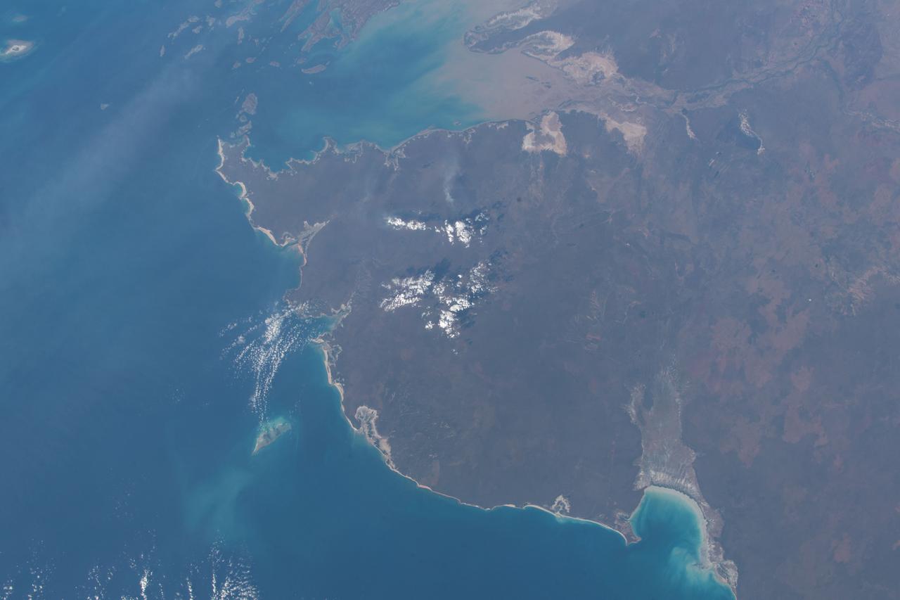
iss064e003722 (Nov. 7, 2020) --- Shark Bay on the coast of Western Australia is pictured from the International Space Station as it orbited 264 miles above the Indian Ocean.
iss066e161293 (March 11, 2022) --- The southwest coast of Australia is pictured from the International Space Station as it orbited 263 miles above the Indian Ocean.
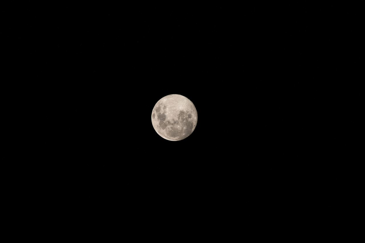
iss068e039237 (Jan. 12, 2023) --- The Full Moon is pictured from the International Space Station as it orbited 262 miles above the Indian Ocean off the coast of Madagascar.
iss062e148372 (April 13, 2020) --- The Earth's glow blankets the horizon as the International Space Station was nearing Perth, Australia over the Indian Ocean.
iss065e046534 (May 14, 2021) --- A portion of Western Australia off the coast of the Indian Ocean is pictured from the International Space Station as it orbited 265 miles above.
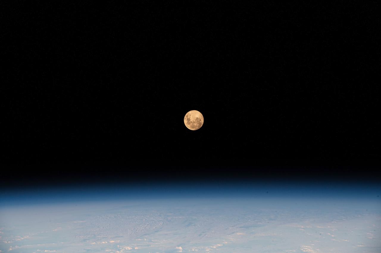
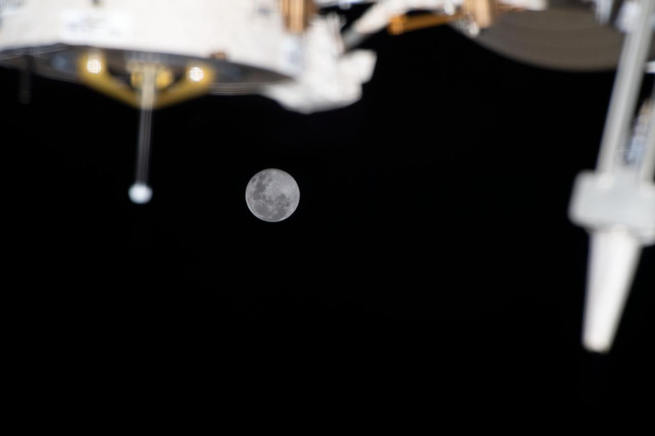
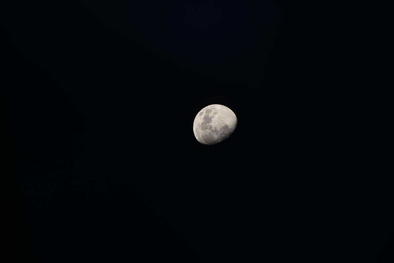
iss065e133389 (June 21, 2021) --- The waxing gibbous Moon is pictured from the International Space Station as it orbited 261 miles above the Indian Ocean south of India.
iss065e046509 (May 14, 2021) --- A portion of Western Australia off the coast of the Indian Ocean is pictured from the International Space Station as it orbited 265 miles above.
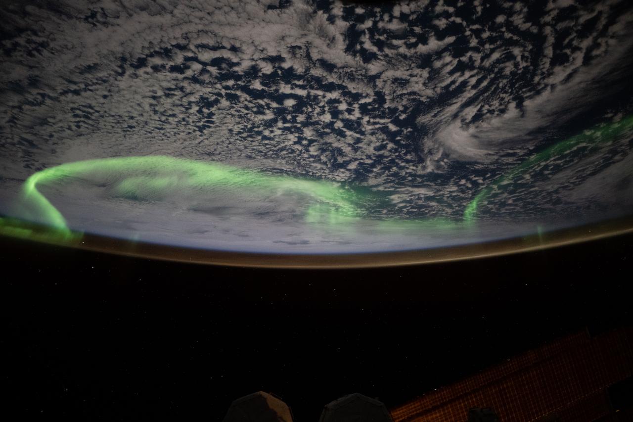
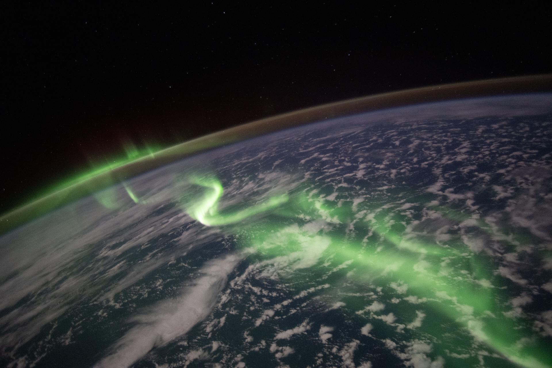
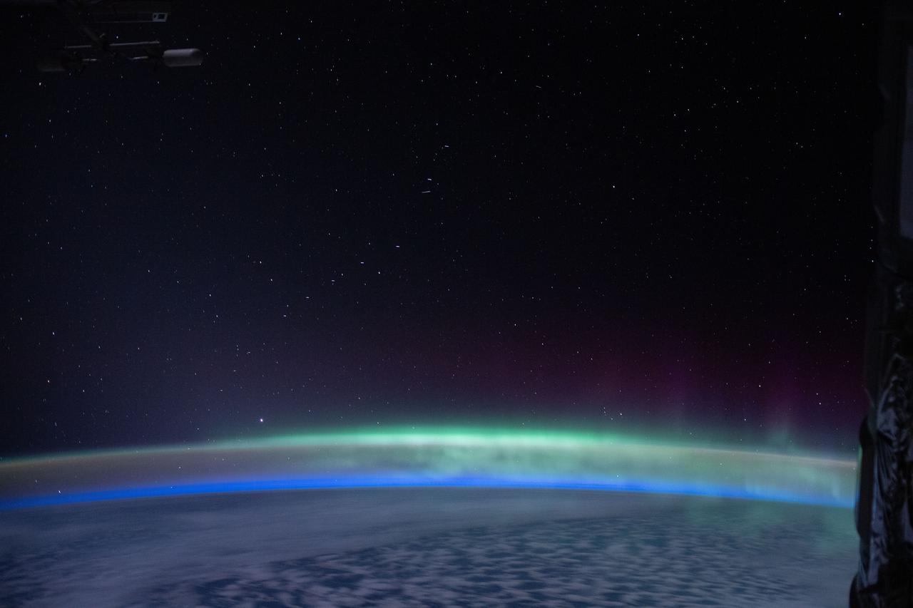
iss066e146457 (Feb. 18, 2022) --- The aurora australis streams above the Indian Ocean in this picture from the International Space Station as it orbited 270 miles above the Earth.

iss053e028974 (Sept. 21, 2017) --- NASA astronaut Joe Acaba works inside the cupola as the space station orbits above the Indian Ocean near Australia.
iss062e140329 (April 8, 2020) --- The "aurora australis" is pictured near the southern-most point of the International Space Station's orbital trek above the Indian Ocean.
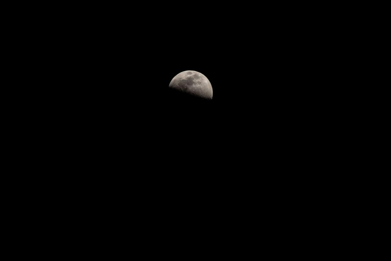
iss068e036313 (Jan. 2, 2023) --- The Waxing Gibbous Moon is pictured from the International Space Station as it orbited 269 miles above the southern Indian Ocean.
iss057e106506 (Nov. 30, 2018) --- The Indian Ocean coastline of Kenya and Somalia is pictured as the International Space Station orbited 253 miles above the African continent.
iss068e029662 (Dec. 14, 2022) --- The waning gibbous Moon is photographed from the International Space Station as it orbited 270 miles above the Indian Ocean.
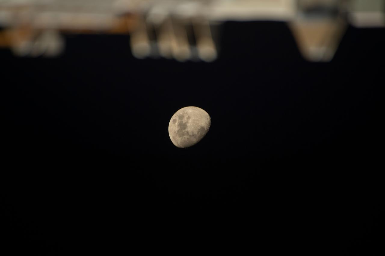
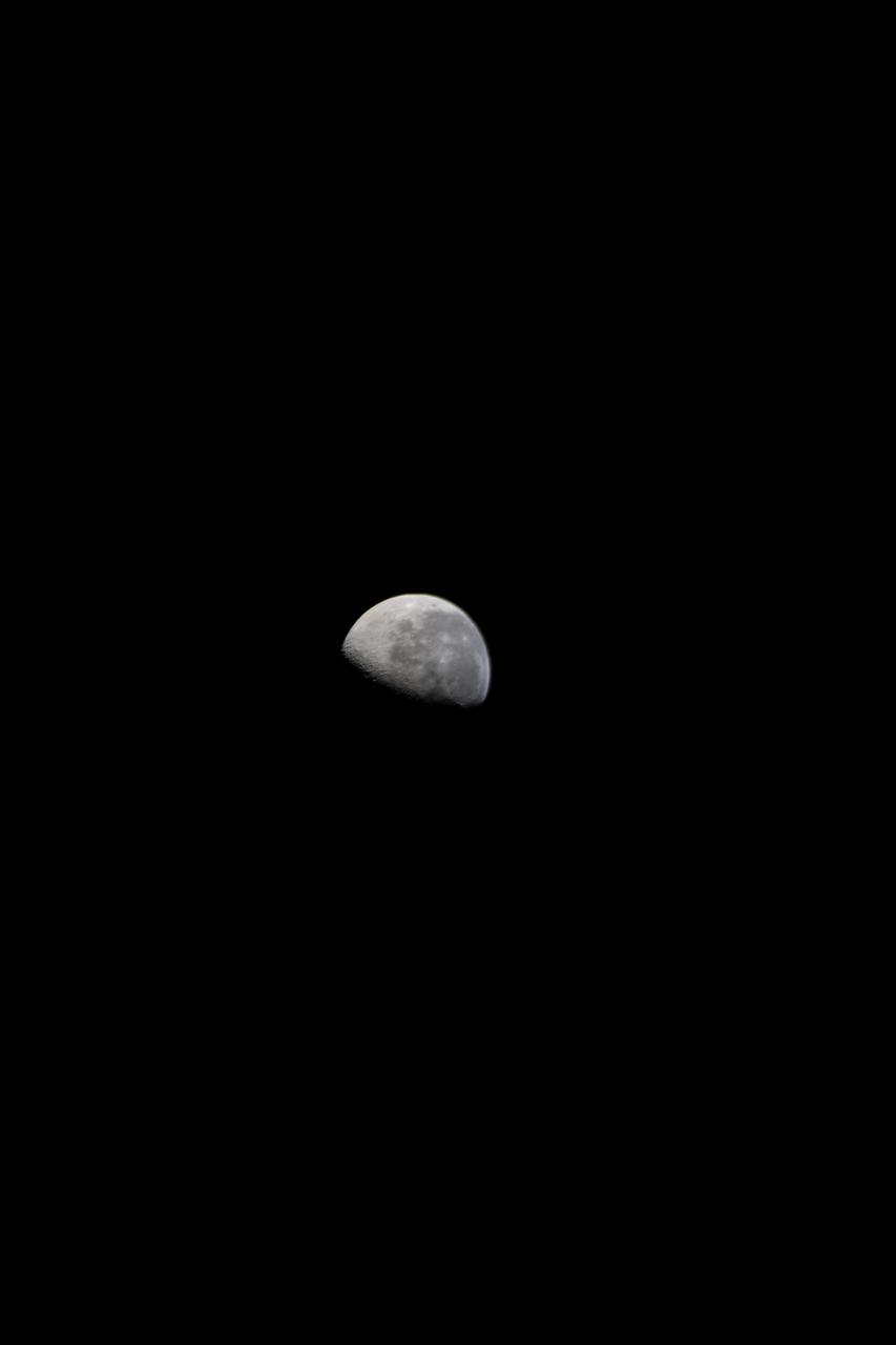
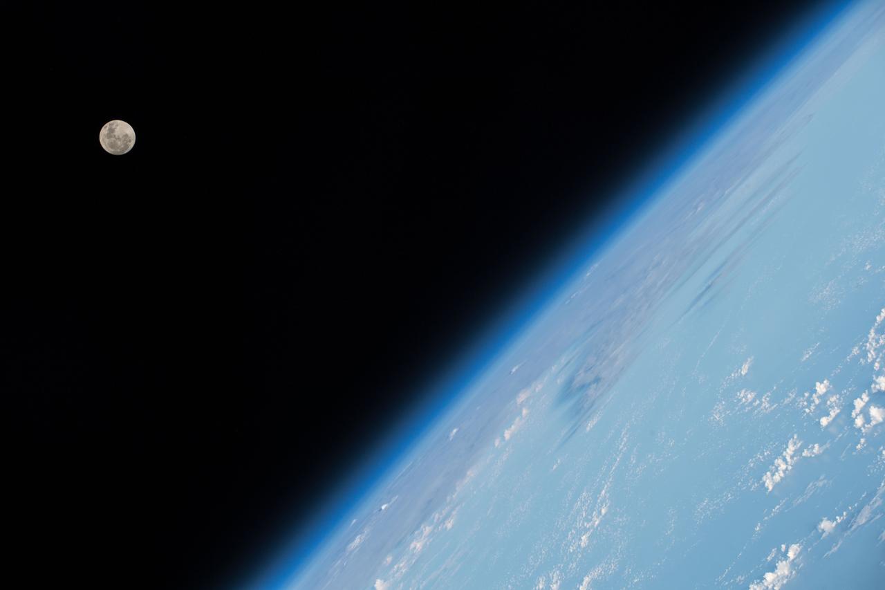
iss071e092177 (May 19, 2024) -- An illuminated waxing gibbous moon is pictured from the International Space Station as it soared 258 miles above the Indian Ocean.
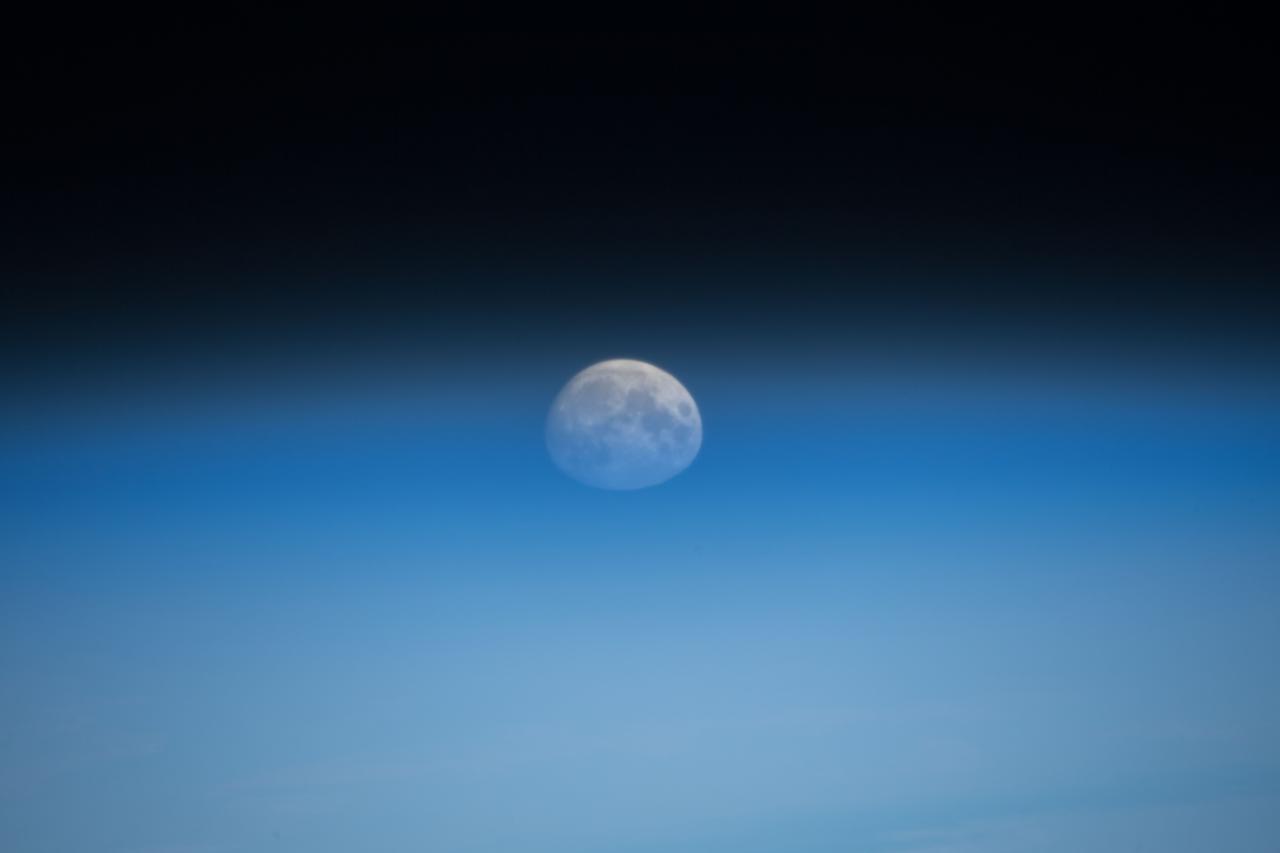
iss071e184156 (June 14, 2024) -- A waxing gibbous moon is illuminated against the black of space as the International Space Station orbited 262 miles above the Indian Ocean.
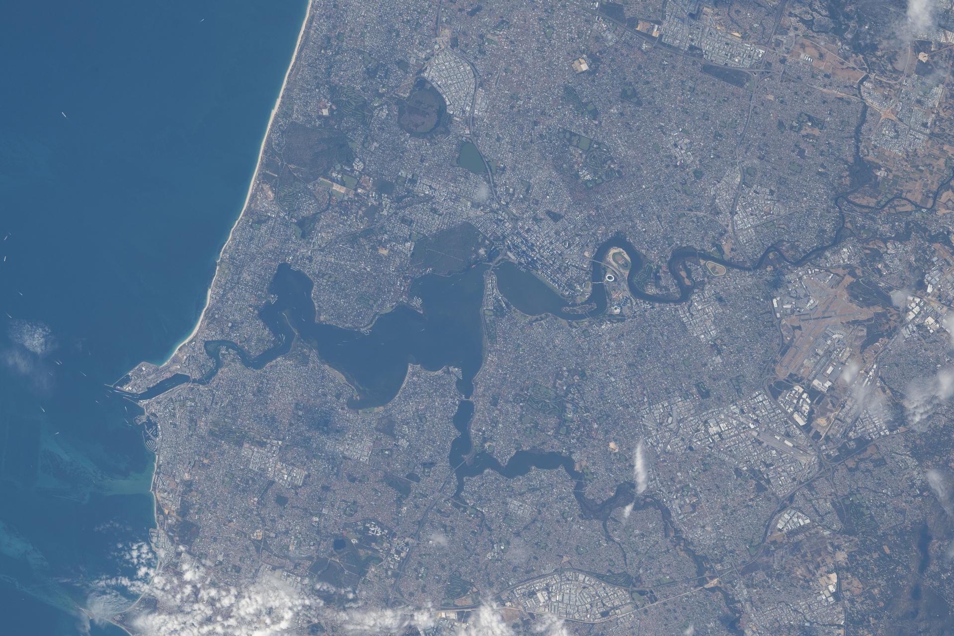
iss074e0376130 (March 26, 2026) --- Perth, Australia, located on the nation’s southwestern coast along the Indian Ocean and home to a metropolitan population of nearly 2.5 million, is pictured from the International Space Station as it orbited 269 miles above the province of Western Australia. The Swan River—popular for recreation and home to a diverse array of fish and migratory birds—splits the city and empties into the Indian Ocean. Credit: NASA/Chris Williams
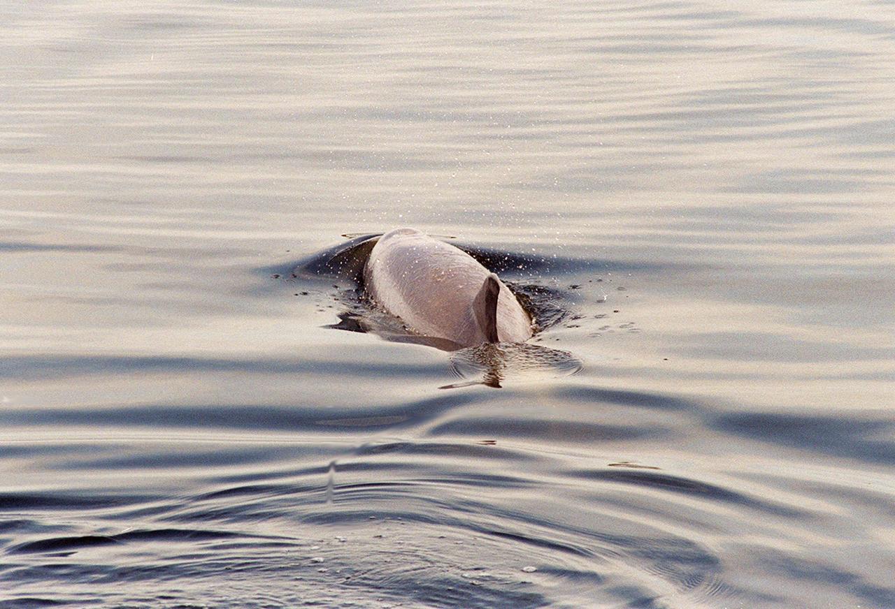
KENNEDY SPACE CENTER, FLA. -- A dolphin glides through the water looking for fish in the turn basin, which is located east of the Vehicle Assembly Building and next to the crawlerway. Dolphins inhabit the waters, known as the Indian River Lagoon, around Kennedy Space Center, along with many different species of oceanic and lagoon fish and shellfish. Mosquito Lagoon to the north, Banana River and Creek to the south and the Indian River to the west make up a special type of estuary called a lagoon, a body of water separated from the ocean by barrier islands, with limited exchange with the ocean through inlets. The Indian River Lagoon has one of the most diverse bird populations anywhere in America. Also, nearly one-third of the nation's manatee population lives here or migrates through the lagoon seasonally. The lagoon varies in width from ½ mile to 5 miles and averages only 3 feet in depth
ISS010-E-13088 (15 January 2005) --- Tsunami damage, northwestern Sumatra (Indonesia) is featured in this image photographed by an Expedition 10 crewmember on the International Space Station. On December 26, 2004 a large (magnitude 9.0) earthquake occurred off the western coast of Sumatra in the Indian Ocean. Scientists believe the earthquake was caused by the release of stresses accumulated as the India tectonic plate is overridden by the Burma tectonic plate. Movement of the seafloor due to the earthquake generated a tsunami, or seismic sea wave, that affected coastal regions around the Indian Ocean. The northwestern Sumatra coastline in particular suffered extensive damage and loss of life. This photo, along with image ISS010-E-13079, illustrates damage along the southwestern coast of Aceh Province in the vicinity of the city of Lho’ Kruet, Indonesia. The image captures the sunglint illuminating the Indian Ocean and standing water inland (light gray). Distortion and scale differences are caused by increased obliquity of the view from the Station.

KENNEDY SPACE CENTER, FLA. -- A dolphin glides through the water looking for fish in the turn basin, which is located east of the Vehicle Assembly Building and next to the crawlerway. Dolphins inhabit the waters, known as the Indian River Lagoon, around Kennedy Space Center, along with many different species of oceanic and lagoon fish and shellfish. Mosquito Lagoon to the north, Banana River and Creek to the south and the Indian River to the west make up a special type of estuary called a lagoon, a body of water separated from the ocean by barrier islands, with limited exchange with the ocean through inlets. The Indian River Lagoon has one of the most diverse bird populations anywhere in America. Also, nearly one-third of the nation's manatee population lives here or migrates through the lagoon seasonally. The lagoon varies in width from ½ mile to 5 miles and averages only 3 feet in depth
iss066e008713 (Oct. 19, 2021) --- A wispy aurora, intersecting with Earth's airglow, is pictured from the International Space Station as it orbited 274 miles above the Indian Ocean in between Australia and Antarctica.
iss064e053179 (April 2, 2021) --- The aurora is pictured streaming above the Earth seemingly intersecting with the airglow as the International Space Station orbited 271 miles over the Indian Ocean southwest of Australia. Credit: Roscosmos
iss071e619284 (Aug. 20, 2024) --- Clouds stream above the southern Indian Ocean in between Madagascar and the French and Southern Antarctic Lands in this nighttime photograph from the International Space Station as it orbited 265 miles above.
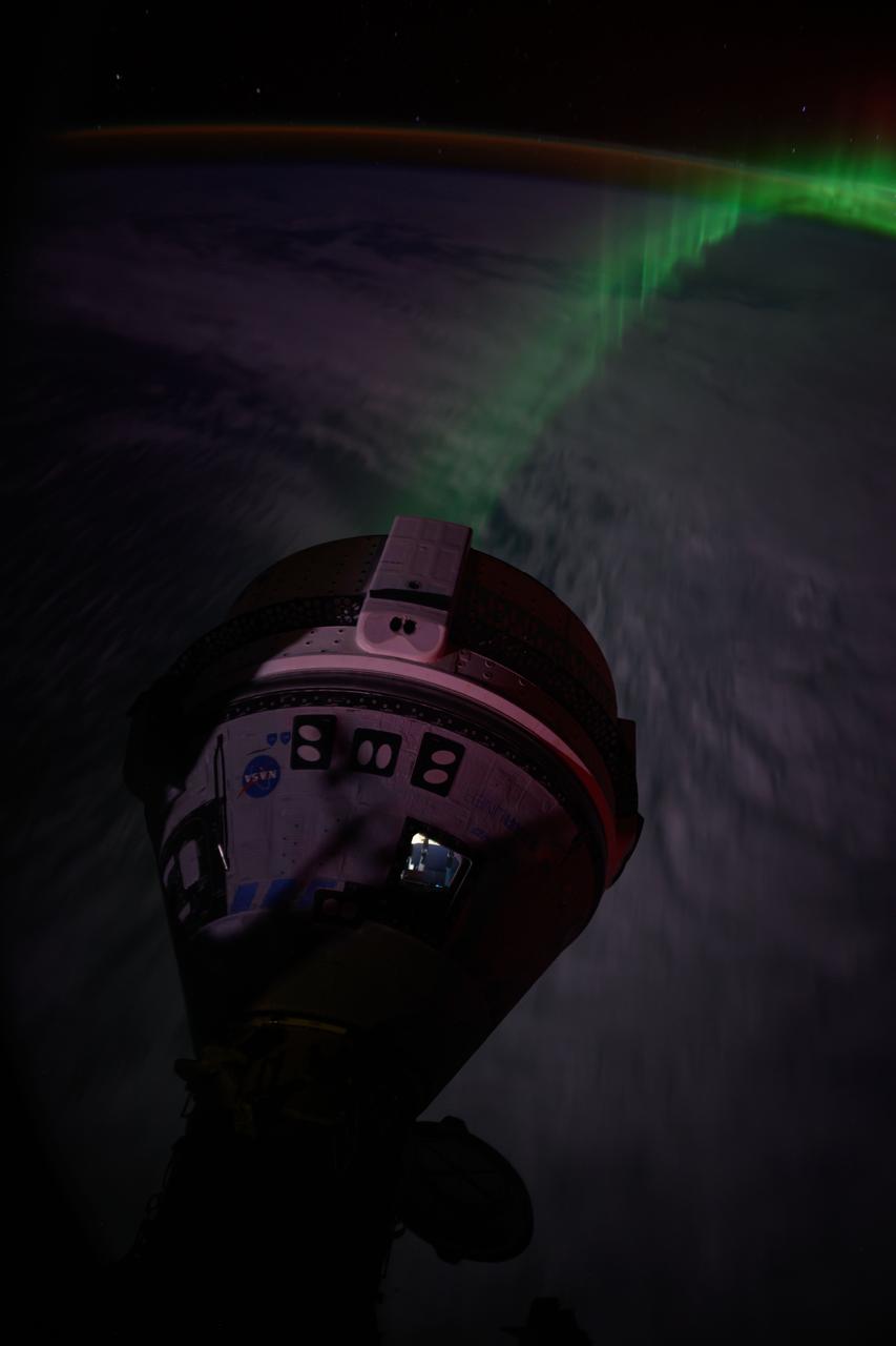
iss071e185130 (June 15, 2024) --- An aurora streams below Boeing's Starliner spacecraft docked to the forward port on the Harmony module as the International Space Station soared 266 miles above the Indian Ocean southwest of Australia.
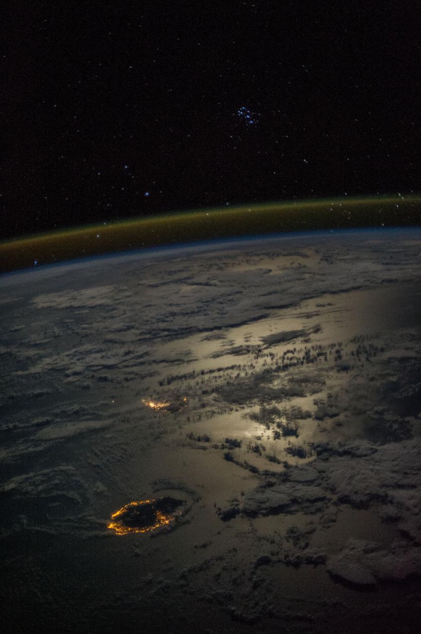
Earth observation taken during a night pass by the Expedition 36 crew. Per Twitter message: Seven Sisters overlooking Reunion & Mauritius Islands in a moonlit Indian Ocean.

iss067e269019 (Aug. 17, 2022) --- An aurora crowns the Earth beneath a starry sky in this night time photograph from the International Space Station as it orbited 270 miles above the Indian Ocean southeast of the African continent.
iss071e522679 (Aug. 20, 2024) --- Wildfires in South Africa's Great Escarpment near the coast of the Indian Ocean are pictured from the International Space Station as it orbited 263 miles above.
iss071e200795 (June 18, 2024) -- A SpaceX Dragon Endeavour spacecraft is pictured docked to the zenith port of the International Space Station's Harmony module as the orbiting complex soared 265 miles above the Indian Ocean.
iss068e010113 (Oct. 4, 2022) --- The aurora australis intersects Earth's atmospheric glow in this photograph from the International Space Station as it orbited 268 miles above the Indian Ocean southeast of South Africa.
iss057e106038 (Nov. 22, 2018) --- The Full Moon is pictured by an Expedition 57 crew member as the International Space Station orbited 252 miles above the Indian Ocean about 1,000 kilometers due south of India.
iss055e000043 (Feb. 28, 2018) --- A waxing gibbous moon was pictured above the Earth's limb as the International Space Station orbited over the southern Indian Ocean just southwest of the African continent.
iss065e081845 (May 20, 2021) --- An orbital sunrise is pictured from the International Space Station as it soared 265 miles above the Indian Ocean off the coast of Western Australia.
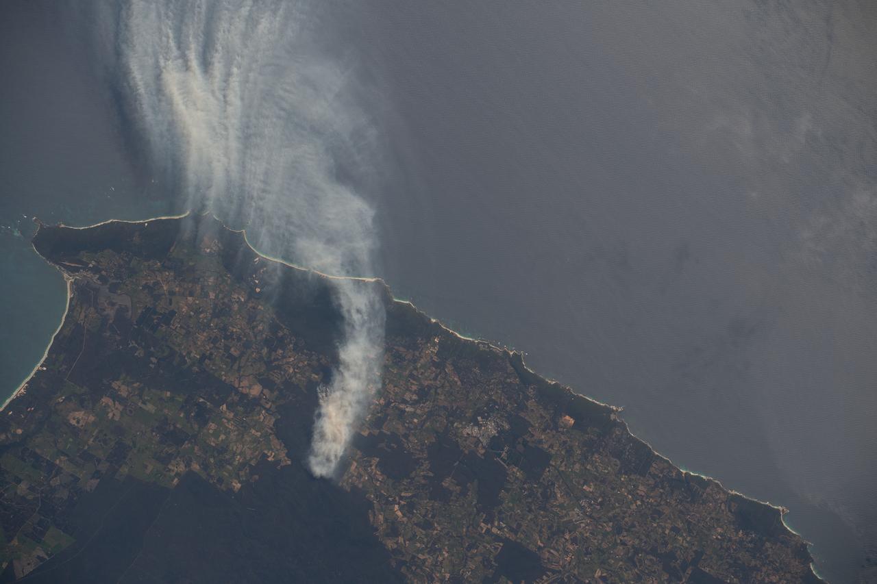
iss070e008930 (Oct. 24, 2023) --- A wildfire in Western Australia's Forest Grove National Park, with smoke billowing out into the Indian Ocean, is pictured from the International Space Station as it orbited 266 miles above.
iss071e178799 (June 6, 2024) --- The International Space Station soars into an orbital sunset 258 miles above the Maldives in the Indian Ocean. In the left foreground, is the Soyuz MS-25 crew ship docked to the Prichal docking module.
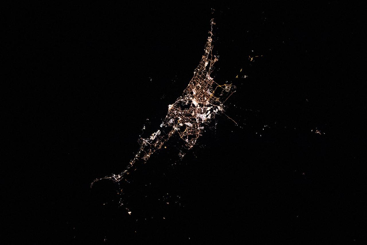
iss063e055126 (July 23, 2020) --- Perth, Australia is pictured from the International Space Station as it orbited west of the city above the Indian Ocean during an orbital night period.
iss065e005949 (April 26, 2021) --- A waxing gibbous Moon, or near Full Moon, is pictured from the International Space Station as it orbited 267 miles above the southern Indian Ocean.
iss072e023504 (Sept. 28, 2024) -- As the International Space Station soared 271 miles above the Indian Ocean during orbital nighttime, a vibrant green aurora begins to fold through Earth's atmosphere.
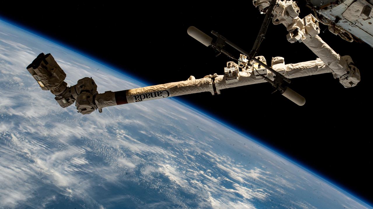
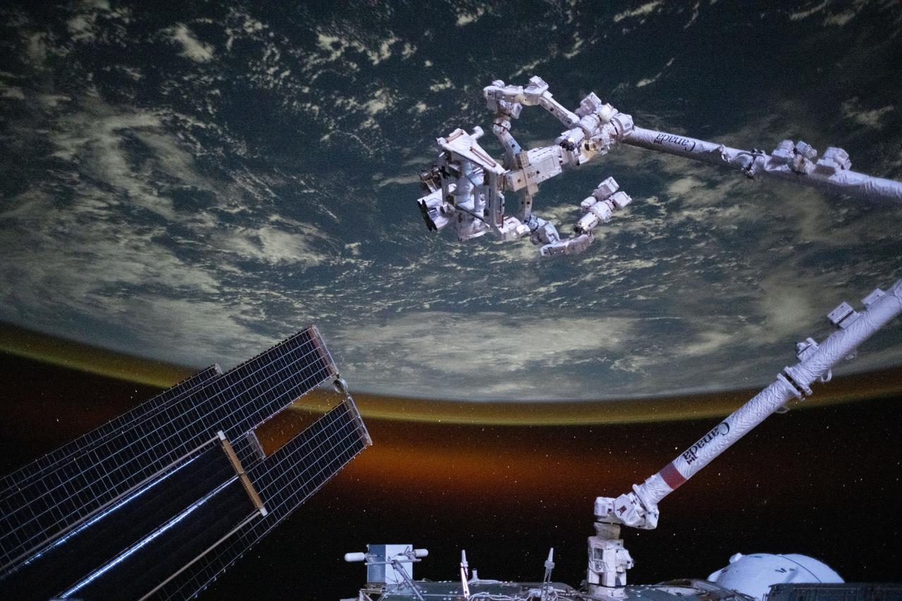
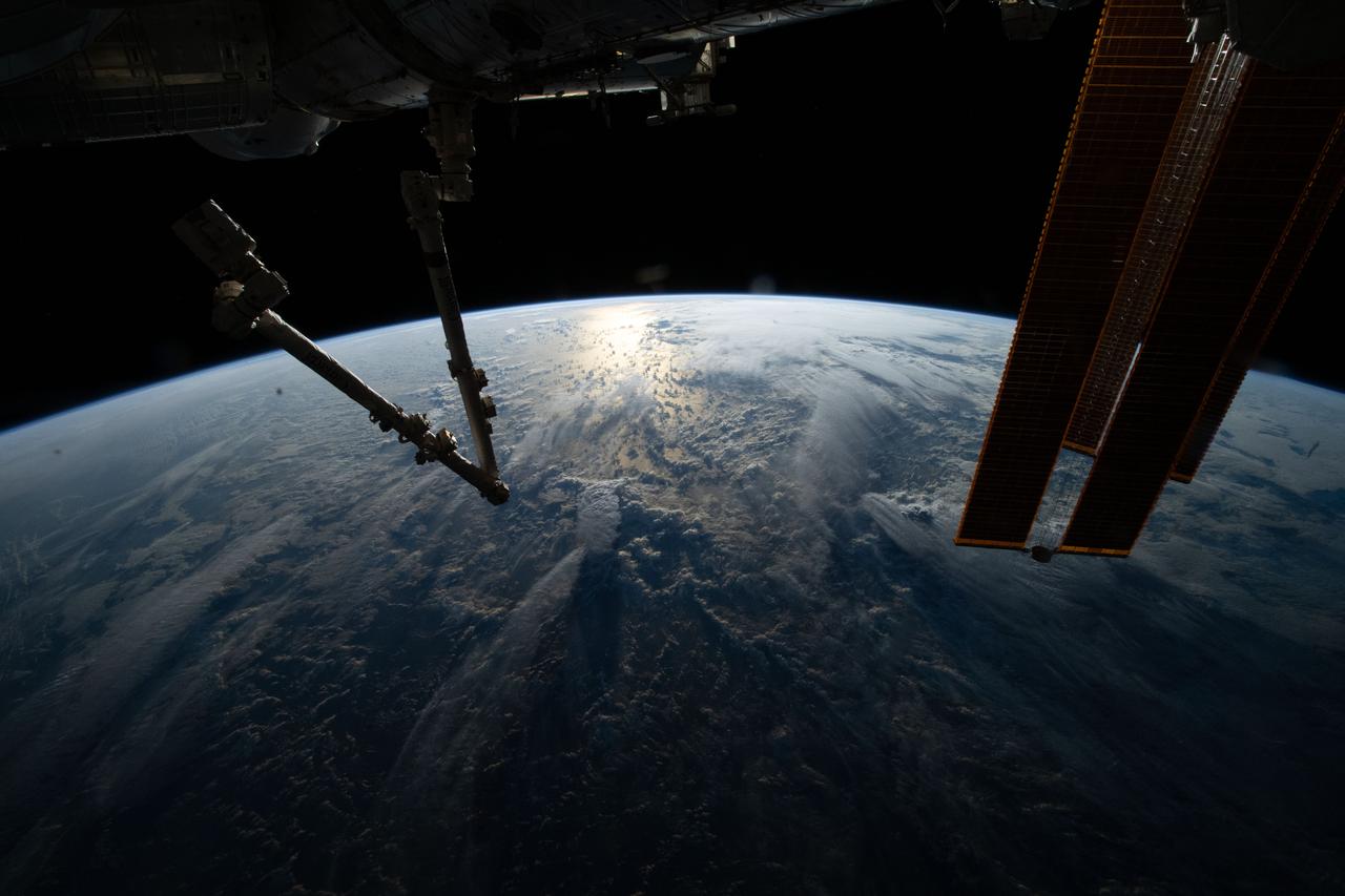
iss071e235690 (June 28, 2024) --- The 57.7-foot-long Canadarm2 robotic arm extends outward from the International Space Station as it orbited 264 miles above the Indian Ocean off the coast of the African nation of Somalia.
iss055e000030 (Feb. 28, 2018) --- A waxing gibbous moon was pictured above the Earth's limb as the International Space Station orbited over the southern Indian Ocean just southwest of the African continent.
iss065e214231 (Aug. 2, 2021) --- The aurora australis streams across the Earth's atmosphere as the International Space Station orbited 271 miles above the southern Indian Ocean in between Asia and Antarctica.
iss059e092459 (June 5, 2019) --- The aurora australis, or "southern lights," highlights a starry nighttime orbital pass as the International Space Station orbited 267 miles above the Indian Ocean southeast of Madagascar.
iss068e007201 (Oct. 2, 2022) --- The First Quarter Moon is pictured above the Earth's horizon as the International Space Station orbited 268 miles above the Indian Ocean south of Australia.

iss063e065220 (July 31, 2020) --- This long-exposure photograph captures a starry sky above the Earth's atmospheric glow as the International Space Station orbited above the Indian Ocean about halfway between South Africa and Australia.
iss067e265002 (Aug. 13, 2022) --- The sun's glint beams off the Indian Ocean in this photograph from the International Space Station as it soared 260 miles above during an early morning orbital trek off the coast of Somalia.