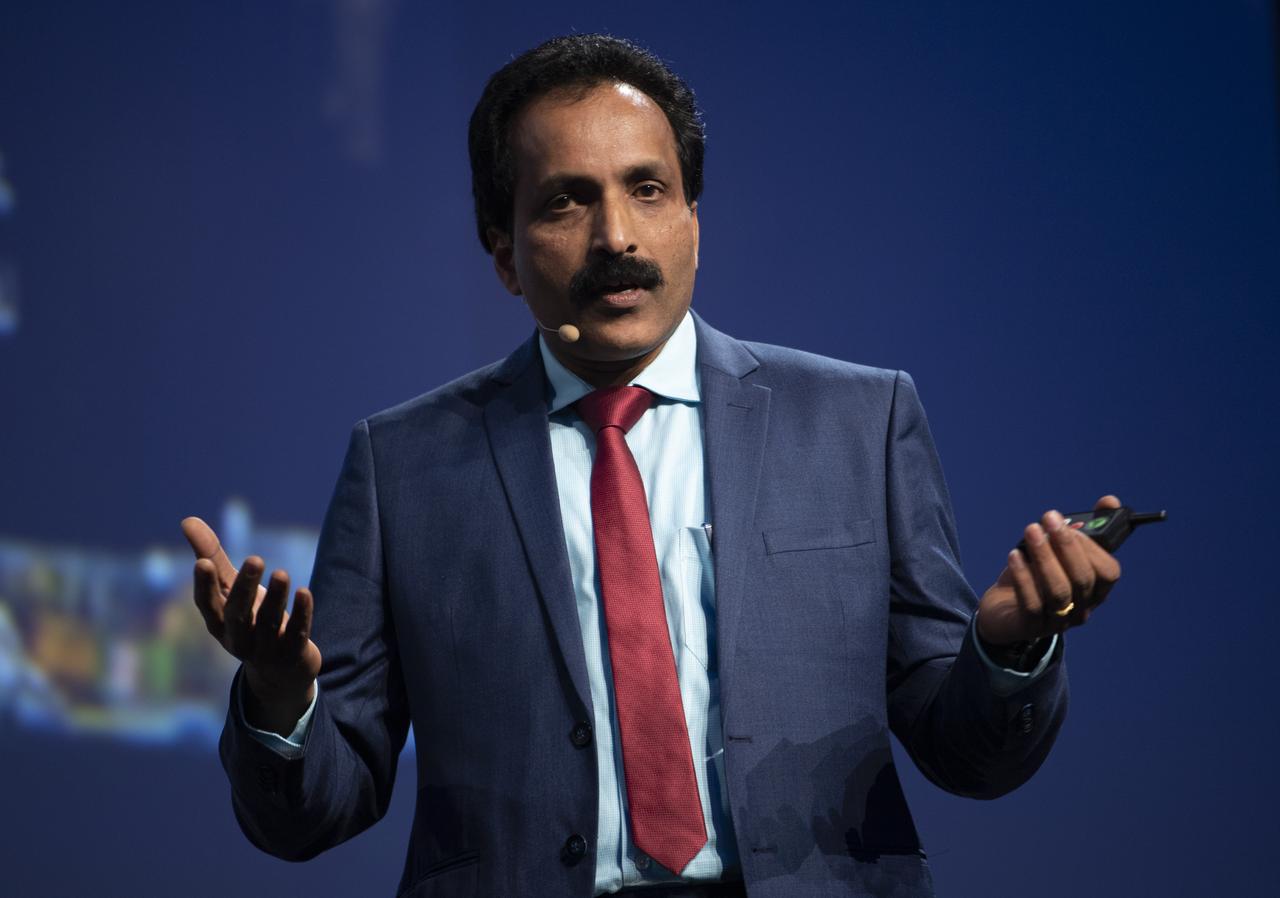
S. Somanath, Director of Vikram Sarabhai Space Centre, Indian Space Research Organization (ISRO), speaks during the Heads of Agency Plenary of the 70th International Astronautical Congress, Monday, Oct. 21, 2019 at the Walter E. Washington Convention Center in Washington. Photo Credit: (NASA/Bill Ingalls)

S. Somanath, Director of Vikram Sarabhai Space Centre, Indian Space Research Organization (ISRO), during the Heads of Agency press conference at the 70th International Astronautical Congress, Monday, Oct. 21, 2019 at the Walter E. Washington Convention Center in Washington. Photo Credit: (NASA/Bill Ingalls)

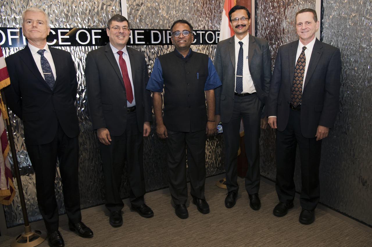
S. Somanath, Director of Vikram Sarabhai Space Centre, Indian Space Research Organization (ISRO), left, NASA Administrator Jim Bridenstine, Hiroshi Yamakawa, President of the Japan Aerospace Exploration Agency (JAXA), Sergey Krikalev, Executive Director for Piloted Spaceflights for Roscosmos, and Johann-Dietrich Woerner, Director General of ESA (European Space Agency), right, are seen during the Heads of Agency press conference at the 70th International Astronautical Congress, Monday, Oct. 21, 2019 at the Walter E. Washington Convention Center in Washington. Photo Credit: (NASA/Joel Kowsky)

S. Somanath, Director of Vikram Sarabhai Space Centre, Indian Space Research Organization (ISRO), left, NASA Administrator Jim Bridenstine, Hiroshi Yamakawa, President of the Japan Aerospace Exploration Agency (JAXA), Sergey Krikalev, Executive Director for Piloted Spaceflights for Roscosmos, and Johann-Dietrich Woerner, Director General of ESA (European Space Agency), right, are seen during the Heads of Agency press conference at the 70th International Astronautical Congress, Monday, Oct. 21, 2019 at the Walter E. Washington Convention Center in Washington. Photo Credit: (NASA/Joel Kowsky)
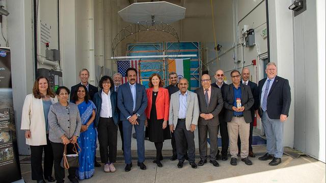
Indian Space Research Organization ISRO visited Goddard March 13, 2019 pictured here with Mark Clampin and Center Director Chris Scolese
On March 20, 2021, members of the NISAR mission at NASA's Jet Propulsion Laboratory in Southern California received the S-band synthetic aperture radar (SAR) from their partner in India. Together with the L-band SAR provided by JPL, the two radars serve as the beating heart of the mission (the "S" and "L" denote the wavelength of the signal they transmit). A collaboration between NASA and the Indian Space Research Organization (ISRO), NISAR (short for NASA-ISRO SAR) will use SAR to track subtle changes in Earth's surface. In doing so, it will spot warning signs of imminent volcanic eruptions, help to monitor groundwater supplies, track the melt rate of ice sheets tied to sea level rise, and observe shifts in the distribution of vegetation around the world. https://photojournal.jpl.nasa.gov/catalog/PIA24138
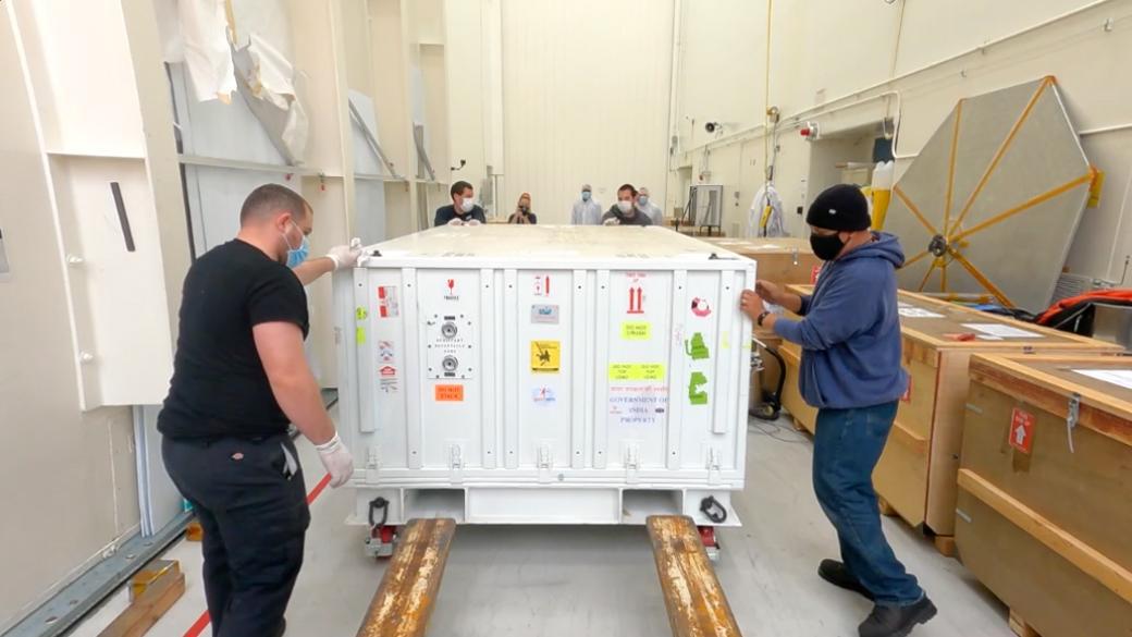
The NISAR mission is a collaboration between NASA and the Indian Space Research Organization (ISRO) that will use two kinds of synthetic aperture radar (SAR) to track subtle changes in Earth's surface: S-band SAR and L-band SAR. (The "S" and "L" denote the wavelength of their signal.) On March 19, 2021, the assembly, test, and launch team at NASA's Jet Propulsion Laboratory in Southern California received the S-band SAR from its partner in India. NISAR, short for NASA-ISRO SAR, will spot warning signs of imminent volcanic eruptions, help to monitor groundwater supplies, track the melt rate of ice sheets tied to sea level rise, and observe shifts in the distribution of vegetation around the world. Movie available at https://photojournal.jpl.nasa.gov/catalog/PIA24137
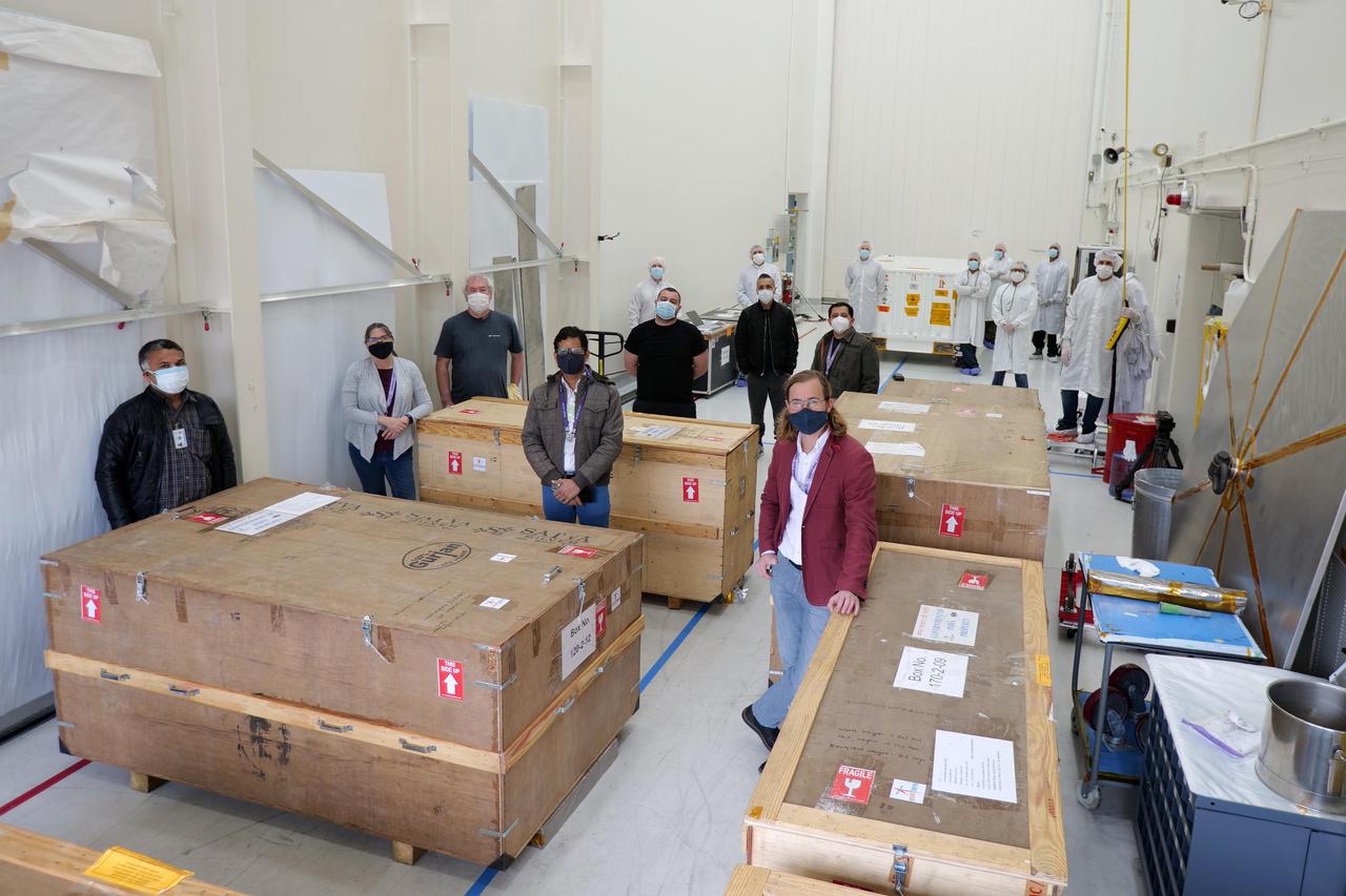
Officials from NASA, the Indian Space Research Organization (ISRO), and the Embassy of India hold a send-off ceremony for the NASA-ISRO Synthetic Aperture Radar (NISAR) science instrument payload on Feb. 3, 2023, outside a clean room at NASA's Jet Propulsion Laboratory in Southern California. The payload is scheduled to be shipped to India in March. Pictured left to right: Karen St. Germain, director, Earth Science Division, NASA; Mitra Dutta, NISAR program executive, NASA; Sripriya Ranganathan, ambassador and deputy chief of mission, Indian Embassy; Larry James, deputy director, JPL; Bhavya Lal, associate administrator for technology, policy, and strategy, NASA; Jim Graf, director, Earth Science and Technology Directorate, JPL; S. Somanath, chairman, ISRO; Laurie Leshin, director, JPL; Krunal Joshi, counselor, space and ISRO technical liaison officer, Indian Embassy; M. Sankaran, director, U R Rao Satellite Centre, ISRO; Shantanu Bhatawdekar, scientific secretary, ISRO; Paul Rosen, NISAR project scientist, JPL; CV Shrikant, NISAR project director, ISRO; Phil Barela, NISAR project manager, JPL; and Gerald Bawden, NISAR program scientist, NASA. NISAR – a joint effort between NASA and ISRO – will measure changes to Earth's land ice surfaces down to fractions of an inch. Data collected by this satellite will help researchers monitor a wide range of changes critical to life on Earth in unprecedented detail. This includes spotting warning signs of imminent volcanic eruptions, helping to monitor groundwater supplies, tracking the melt rate of ice sheets tied to sea level rise, and observing shifts in the distribution of vegetation around the world. The data will inform humanity's responses to urgent challenges posed by natural disasters and climate change, and help communities prepare for and manage hazards. There are two instruments on the satellite that will send and receive radar signals to and from Earth's surface to make the mission's measurements. An L-band synthetic aperture radar (SAR), which uses a signal wavelength of around 9 inches (24 centimeters), and an S-band SAR with a signal wavelength of nearly 5 inches (12 centimeters). Both will bounce their microwave signal off of the planet's surface and record how long it takes the signal to make one roundtrip, as well as the strength of that return signal. This enables the researchers to calculate the distance from the spacecraft to Earth's surface and thereby determine how the land or ice is changing. An antenna reflector nearly 40 feet (12 meters) in diameter, supported by a deployable boom, will focus the microwave signals sent and received by the SARs. JPL, which is managed for NASA by Caltech in Pasadena, leads the U.S. component of NISAR and is providing the mission's L-band SAR instrument. NASA is also providing the radar reflector antenna, the deployable boom, a high-rate communication subsystem for science data, GPS receivers, a solid-state recorder, and payload data subsystem. ISRO is providing the spacecraft bus, the S-band SAR, the launch vehicle, and associated launch services and satellite mission operations. https://photojournal.jpl.nasa.gov/catalog/PIA25600

Pascale Ehrenfreund, Incoming President of the International Astronautical Federation (IAF), left, and Jean-Yves Le Gall, President of International Astronautical Federation (IAF), second from left, facilitate a panel with NASA Administrator Jim Bridenstine, Johann-Dietrich Woerner, Director General of ESA (European Space Agency), Hiroshi Yamakawa, President of the Japan Aerospace Exploration Agency (JAXA), Sylvain Laporte, President of the Canadian Space Agency, Sergey Krikalev, Executive Director for Piloted Spaceflights for Roscosmos, and S. Somanath, Director of Vikram Sarabhai Space Centre, Indian Space Research Organization (ISRO), for the Heads of Agency Plenary of the 70th International Astronautical Congress, Monday, Oct. 21, 2019 at the Walter E. Washington Convention Center in Washington. Photo Credit: (NASA/Joel Kowsky)

iss073e0511059 (July 3, 2025) --- Four astronauts representing Expedition 73 and the four-member Axiom Mission 4 (Ax-4) crew gather for a fun portrait clasping hands and surrounding the Kibo laboratory module's airlock. Clockwise from bottom left are, Expedition 73 Flight Engineer Jonny Kim of NASA, Ax-4 Mission Specialist Sławosz Uznański-Wiśniewski of ESA (European Space Agency), Expedition 73 Flight Engineer Nichole Ayers of NASA, Ax-4 Mission Specialist Tibor Kapu from Hungary, Expedition 73 Commander Takuya Onishi of JAXA (Japan Aerospace Exploration Agency), Ax-4 Pilot Shubhanshu Shukla of ISRO (Indian Space Research Organization), Expedition 73 Flight Engineer Anne McClain of NASA, and Ax-4 Commander Peggy Whitson of Axiom Space.

SRIHARIKOTA, India – The Indian Space Research Organization, or ISRO, launches its robotic Chandrayaan-1 rocket with two NASA instruments aboard on India's maiden moon voyage to map the lunar surface. The Moon Mineralogy Mapper will assess mineral resources, and the Miniature Synthetic Aperture Radar, or Mini-SAR, will map the polar regions and look for ice deposits. Data from the two instruments will contribute to NASA's increased understanding of the lunar environment as it implements the nation's space exploration policy, which calls for robotic and human missions to the moon. In addition to the two science instruments, NASA will provide space communications support to Chandrayaan-1. The primary location for the NASA ground tracking station will be at the Johns Hopkins University Applied Physics Laboratory in Laurel, Md. Photo credit: NASA
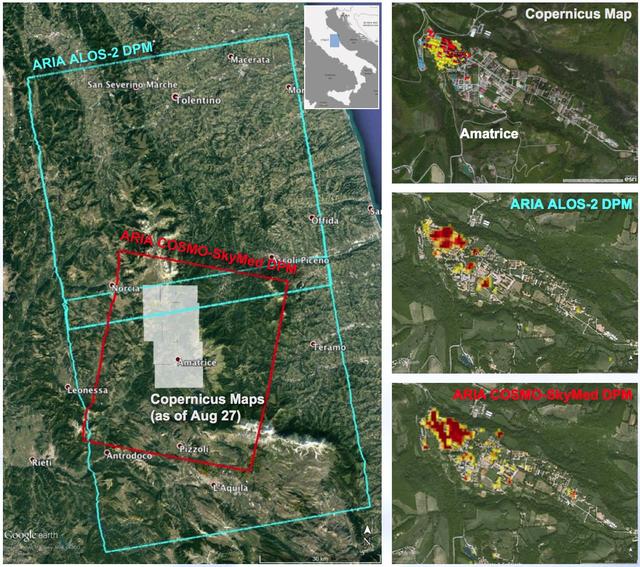
A NASA-funded program provided valuable information for responders and groups supporting the recovery efforts for the Aug. 24, 2016, magnitude 6.2 earthquake that struck central Italy. The earthquake caused significant loss of life and property damage in the town of Amatrice. To assist in the disaster response efforts, scientists at NASA's Jet Propulsion Laboratory and Caltech, both in Pasadena, California, obtained and used radar imagery of the earthquake's hardest-hit region to discriminate areas of damage from that event. The views indicate the extent of damage caused by the earthquake and subsequent aftershocks in and around Amatrice, based on changes to the ground surface detected by radar. The color variations from yellow to red indicate increasingly more significant ground surface change. The damage maps were created from data obtained before and after the earthquake by satellites belonging to the Italian Space Agency (ASI) and the Japan Aerospace Exploration Agency (JAXA). The radar-derived damage maps compare well with a damage map produced by the European Commission Copernicus Emergency Management Service based upon visual inspection of high-resolution pre-earthquake aerial photographs and post-earthquake satellite optical imagery, and provide broader geographic coverage of the earthquake's impact in the region. The X-band COSMO-SkyMed (CSK) data were provided through a research collaboration with ASI and were acquired on July 3, August 20, and August 28, 2016. The L-band ALOS/PALSAR-2 data were provided by JAXA through its science research program and were acquired on September 9, 2015, January 27, 2016, and August 24, 2016. The radar data were processed by the Advanced Rapid Imaging and Analysis (ARIA) team at JPL and Caltech. ARIA is a NASA-funded project that is building an automated system for demonstrating the ability to rapidly and reliably provide GPS and satellite data to support the local, national and international hazard monitoring and response communities. Using space-based imagery of disasters, ARIA data products can provide rapid assessments of the geographic region impacted by a disaster, as well as detailed imaging of the locations where damage occurred. Radar can "see" through clouds day and night and measure centimeter-level ground movements. NASA is partnering with the Indian Space Research Organization (ISRO) to develop the NASA ISRO Synthetic Aperture Radar (NISAR) mission that will routinely provide systematic SAR observations of Earth's land and ice-covered surfaces at least twice every 12 days, enabling greater scientific understanding of the dynamic processes that drive the Earth system and natural hazards, as well as providing actionable support for disaster response and recovery. http://photojournal.jpl.nasa.gov/catalog/PIA21091