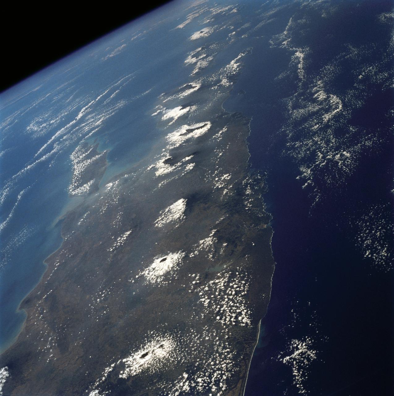
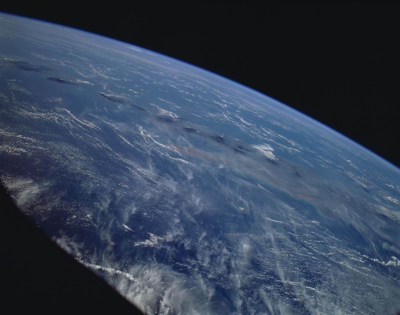
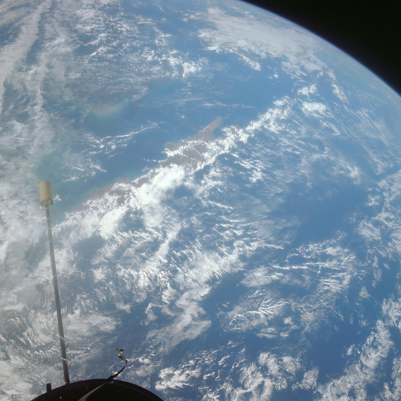
The island of Java (8.0S, 112.0E), perhaps better than any other, illustrates the volcanic origin of Pacific Island groups. Seen in this single view are at least a dozen once active volcano craters. Alignment of the craters even defines the linear fault line of Java as well as the other some 1500 islands of the Indonesian Archipelago. Deep blue water of the Indian Ocean to the south contrasts to the sediment laden waters of the Java Sea to the north.
STS072-737-012 (11-20 Jan. 1996) --- The astronauts photographed this view of Java, an Indonesian island. Java lies between the Java Sea at top and the Indian Ocean at bottom (north is located at top center). A line of volcanoes on the southern edge of the island, trending from central to eastern areas, is highlighted by a ring of clouds. Off the southern coast of Java is the Java Trench where the Australian plate, to the south, is diving under the Eurasia plate to the north. According to anthropologists, Java has one of the highest populations in Indonesia because the soil is enriched by volcanic ash. Merapi volcano, at left edge, second volcano to the right, rises to 9,550 feet and erupts frequently. Madura Island, partially obscured by clouds, can be seen on the upper eastern end of Java.
A ferry carrying more than 600 passengers sank in the Java Sea between the island of Java and Borneo just before midnight on December 29, 2006, during high winds and rough seas.

iss071e373018 (July 18, 2024) --- Silhouetted against the backdrop of the Earth below, is the Soyuz MS-25 crew ship docked to the Prichal docking module during an orbital nighttime pass. The International Space Station was soaring 261 miles above Jakarta on Indonesia's island of Java at the time of this photograph.
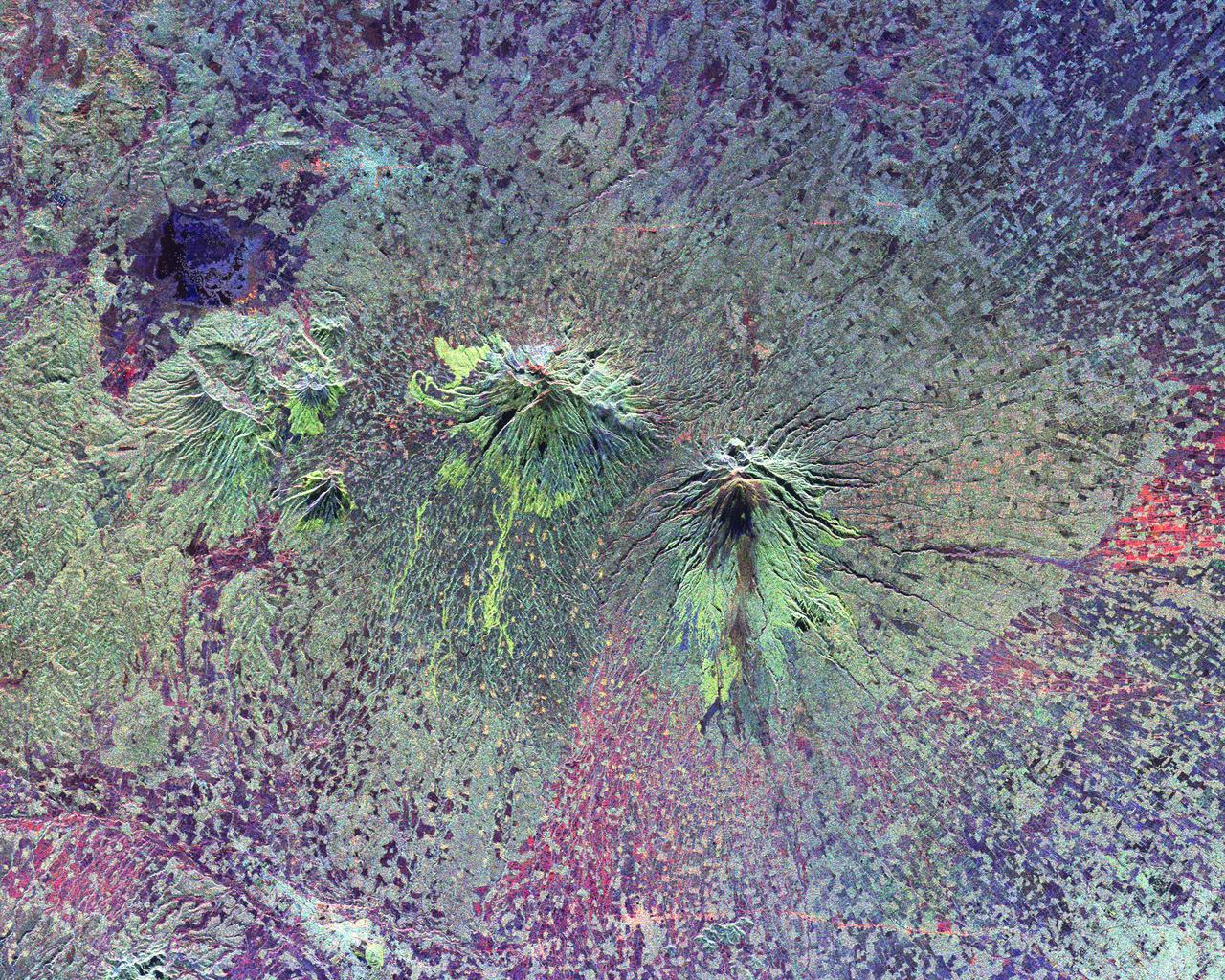
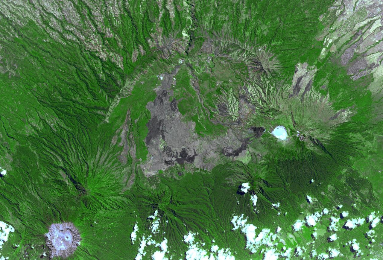
The summits of two large volcanoes in Central Java, Indonesia are shown in the center of this radar image. Lava flows of different ages and surface roughness appear in shades of green and yellow surrounding the summit of Mt. Merbabu (mid-center) and Mt. Merapi (lower center). Mt. Merapi erupted on November 28, 1994 about six weeks after this image was taken. The eruption killed more than 60 people and forced the evacuation of more than 6,000 others. Thousands of other residents were put on alert due to the possibility of volcanic debris mudflows, called lahars, that threatened nearby towns. Mt. Merapi is located approximately 40 kilometers (25 miles) north of Yogyakarta, the capital of Central Java. The older volcano at the top of the image is unnamed. Lake Rawapening is the dark blue feature in the upper right. The light blue area southeast of the lake is the city of Salatiga. Directly south of Salatiga and southeast of Mt. Merapi is the city of Boyolali. Scientists are studying Mt. Merapi as part of the international "Decade Volcanoes" project, because of its recent activity and potential threat to local populations. The radar data are being used to identify and distinguish a variety of volcanic features. http://photojournal.jpl.nasa.gov/catalog/PIA01782

NASA Stennis Director John Bailey hosted the latest Java with John session on Nov. 19 with employees from the NASA Stennis Safety and Mission Assurance Directorate, Rocket Propulsion Test Program Office, and Office of the Chief Information Officer. Java with John is an employee-led discussion in a casual environment aimed at fostering a culture in which employees are welcome to share what matters most to them at work.

NASA Stennis Director John Bailey hosts a Java with John session on Dec. 10 with employees representing the Office of the Chief Financial Officer, Office of STEM Engagement, Office of Diversity and Equal Opportunity, Office of the Chief Human Capital Officer, and the center’s Autonomous Systems Laboratory team. Java with John is an employee-led discussion in a casual environment aimed at fostering a culture in which employees are welcome to share what matters most to them at work.

NASA Stennis Director John Bailey hosted a Java with John session with Office of Procurement employees on Oct. 15. Java with John is an employee-led discussion in a casual environment aimed at fostering a culture in which employees are welcome to share what matters most to them at work.

NASA Stennis Director John Bailey hosted a Java with John session with Office of Procurement employees on Oct. 15. Java with John is an employee-led discussion in a casual environment aimed at fostering a culture in which employees are welcome to share what matters most to them at work.

NASA Stennis Director John Bailey hosted a Java with John session with Office of Procurement employees on Oct. 15. Java with John is an employee-led discussion in a casual environment aimed at fostering a culture in which employees are welcome to share what matters most to them at work.

iss073e0222649 (May 26, 2025) --- Jakarta, Indonesia, with a metropolitan population of about 32.6 million including its suburbs, and fishing boats illuminated on the Java Sea are pictured at approximately 11:47 p.m. local time from the International Space Station as it orbited 261 miles above the Indian Ocean.

NASA Stennis Director John Bailey hosts a Java with John session with agency employees Aug. 22. The employee-led discussion happens in a relaxed environment with conversations aimed at fostering a culture where employees are welcome to share what matters most to them at work.
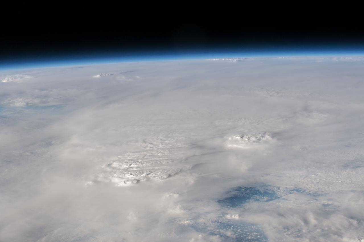
GMT363_23_45_Terry Virts_thunderstorms over the java sea_131
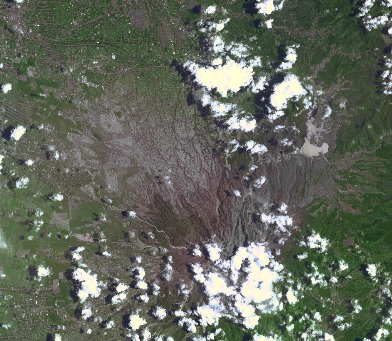
On Feb. 13, 2014, violent eruption of Kelud stratovolcano in Java, Indonesia sent volcanic ash covering an area of 70,000 square miles, prompting the evacuation of tens of thousands of people. This image is from NASA Terra spacecraft.

NASA Stennis Director John Bailey hosts a Java with John session with NASA Stennis supervisors on July 24. Java with John is an ongoing employee-led discussion in a relaxed environment aimed to foster a culture where all are welcome to share what matters most to their work at NASA Stennis.
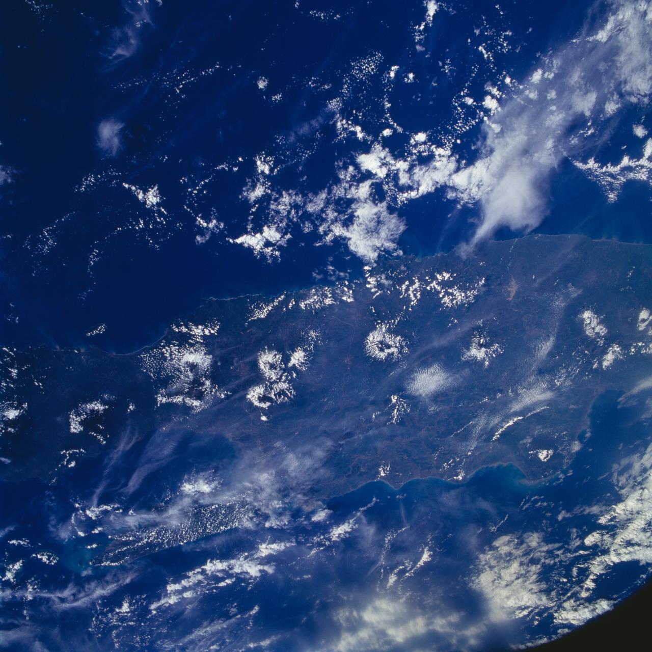
This is a striking, oblique view to the south of the Indonesian islands of Java (right), Bali and Lombok (upper left). The linear array of dark regions across the photo is a chain of volcanoes which make up the back bone of this part of the Indonesian Islands. This chain has been quite active over the past six months. Plumes of steam can be seen rising from the summits of Arjuno (west-central Java) and Merapi (central Java, near the right side of this photo). The region appears hazy due to an extended drought over Indonesia and Australia. Because of drought conditions, huge fires continue to burn over other regions of Indonesia, New Guinea and norther Australia, producing a regional smoke pall.
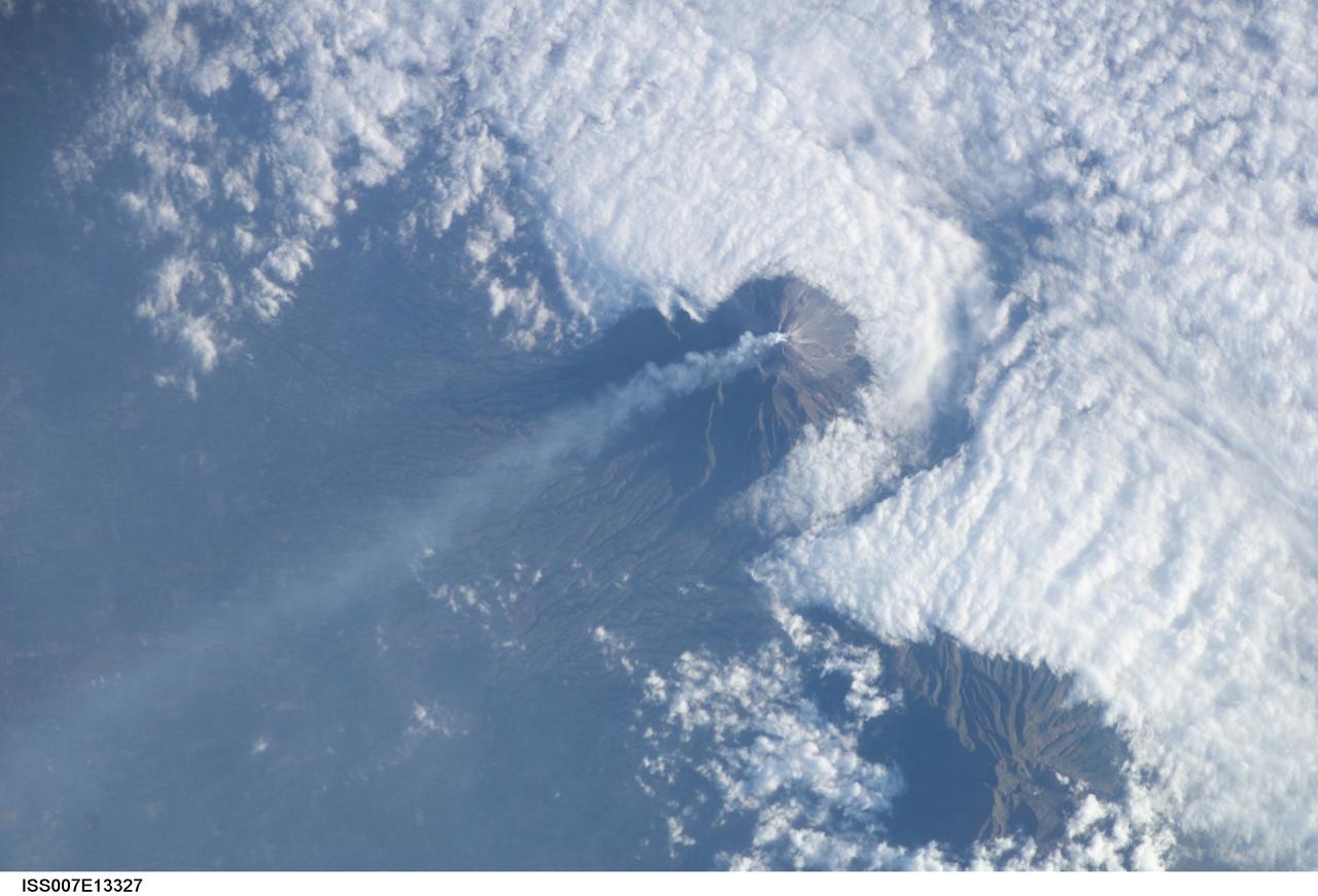
ISS007-E-13327 (24 August 2003) --- This view featuring Java’s Merapi volcano was photographed by one of the Expedition 7 crewmembers onboard the International Space Station (ISS). At 2,911 meters, the summit of Merapi and its vigorous steam plume rises above a bank of stratus clouds. One of Indonesia’s most active volcanoes, it has been almost continuously active for nearly ten years, including periodic pyroclastic flows and avalanches. The volcano is located less than 25 miles north of the city of Yogykarta in central Java.

iss073e0251575 (June 20, 2025) --- This long-duration photograph was taken from the International Space Station orbiting 260 miles above the Indian Ocean off the coast of the Indonesian island of Java. City lights and lightning storms streak below star trails above Earth's atmopsheric glow.
S66-54692 (14 Sept. 1966) --- Indonesian Islands (partial cloud cover): Sumatra, Java, Bali, Borneo, and Sumbawa, as photographed from the Gemini-11 spacecraft during its 26th revolution of Earth, at an altitude of 570 nautical miles. Photo credit: NASA
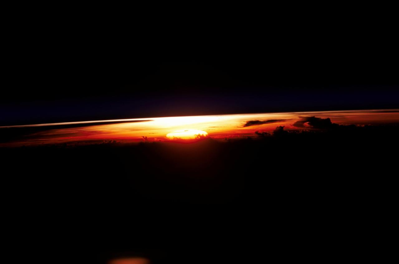
STS109-345-032 (1-12 March 2002) --- One of the astronauts aboard the Space Shuttle Columbia photographed this west-looking view featuring the profile of the atmosphere and the setting sun. The shuttle was located over the Java Sea to the south of Kalimantan (Borneo) in Indonesia when this image was acquired. Visible to the right of the setting sun are cloud tops from some thunderstorms. The sun's reflection (bright spot over the setting sun) can be seen off the upper layers of the earth's atmosphere.
West of Gunung Merapi, East Java, Indonesia, is the Ijen volcano, which has a one-kilometer-wide turquoise-colored acidic crater lake. The lake is the site of a labor-intensive sulfur mining operation, in which sulfur-laden baskets are carried by hand from the crater floor. The lake is recognized as the largest highly acidic crater lake in the world, with a pH of 0.5. The image was acquired 17 September 2008, covers an area of 24 by 39 kilometers, and is located at 8 degrees south, 114.2 degrees east. https://photojournal.jpl.nasa.gov/catalog/PIA21787
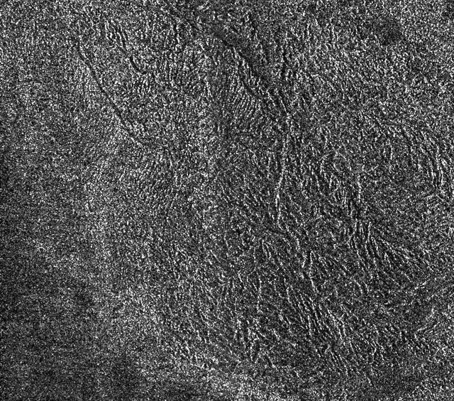
This synthetic-aperture radar image was obtained by NASA's Cassini spacecraft during its T-120 pass over Titan's southern latitudes on June 7, 2016. The image is centered near 47 degrees south, 153 degrees west. It covers an area of 87 by 75 miles (140 by 120 kilometers) and has a resolution of about 1,300 feet (400 meters). Radar illuminates the scene from the left at a 35-degree incidence angle. The features seen here are an excellent example of "labyrinth terrain." Labyrinth terrains on Titan are thought to be higher areas that have been cut apart by rivers of methane, eroded or dissolved as they were either lifted up or left standing above as the region around them lowered. (Other examples of labyrinth terrain can be seen in PIA10219.) In this image, several obvious valley systems have developed, draining liquids from methane rainfall toward the southeast (at top). Several of these systems are near parallel (running from upper left to lower right), suggesting that either the geological structure of the surface or the local topographic gradient (the general slope across the area) may be influencing their direction. Also presented here is an annotated version of the image, along with an aerial photograph of a region in southern Java known as Gunung Kidul that resembles this Titan labyrinth. This region is limestone that has been dissolved and eroded by water, creating a system of canyons called polygonal karst. Like on Titan, the canyons show a trend from upper left to lower right, in this case controlled by faults or joints. (Java photo from Haryono and Day, Journal of Cave and Karst Studies 66 (2004) 62-69, courtesy of Eko Haryono.) http://photojournal.jpl.nasa.gov/catalog/PIA20708

STS032-80-036 (9-20 Jan. 1990) --- This oblique view of Tropical Storm Sam in the eastern Indian Ocean off the western coast of Australia was photographed with a 70mm camera by the astronauts. Tropical Storm Sam (known as Willy-Willy in Australia) was born in the eastern Indian Ocean near the islands of Timor and Sumba in Indonesia. The storm tracked southwestward attaining sustained winds in excess of 60 knots (70 miles per hour). Other than on Christmas Island and the Cocos (Keeling) Islands south of Java, and for strong swells along the western Australia coast, the storm had little impact on land areas. At the time this photograph was taken, the storm was beginning to dissipate in the south Indian Ocean. The eye of the storm is still visible near center, with the swirling bands of the storm propagating in a clockwise direction toward the center. Winds aloft have begun to shear the tops of thunderstorms associated with the storm, forming a high cirrus cloud cover over the center portions of the storm. This picture was used by the crew at their January 30, 1990 Post-Flight Press Conference (PFPC).