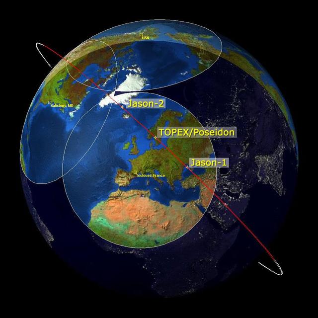
This image is a family portrait of Topex/Poseidon, Jason-1 and Ocean Surface Topography Mission/Jason-2 OSTM/Jason-2, NASA satellites that have measured global sea surface heights since 1992.
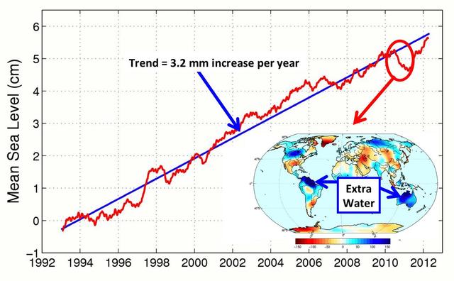
This figure shows changes in global mean sea level as measured by satellite altimetry NASA/CNES Topex/Poseidon and Jason-1; and NASA/CNES/NOAA/EUMETSAT Jason-2 between 1992 to 2012.
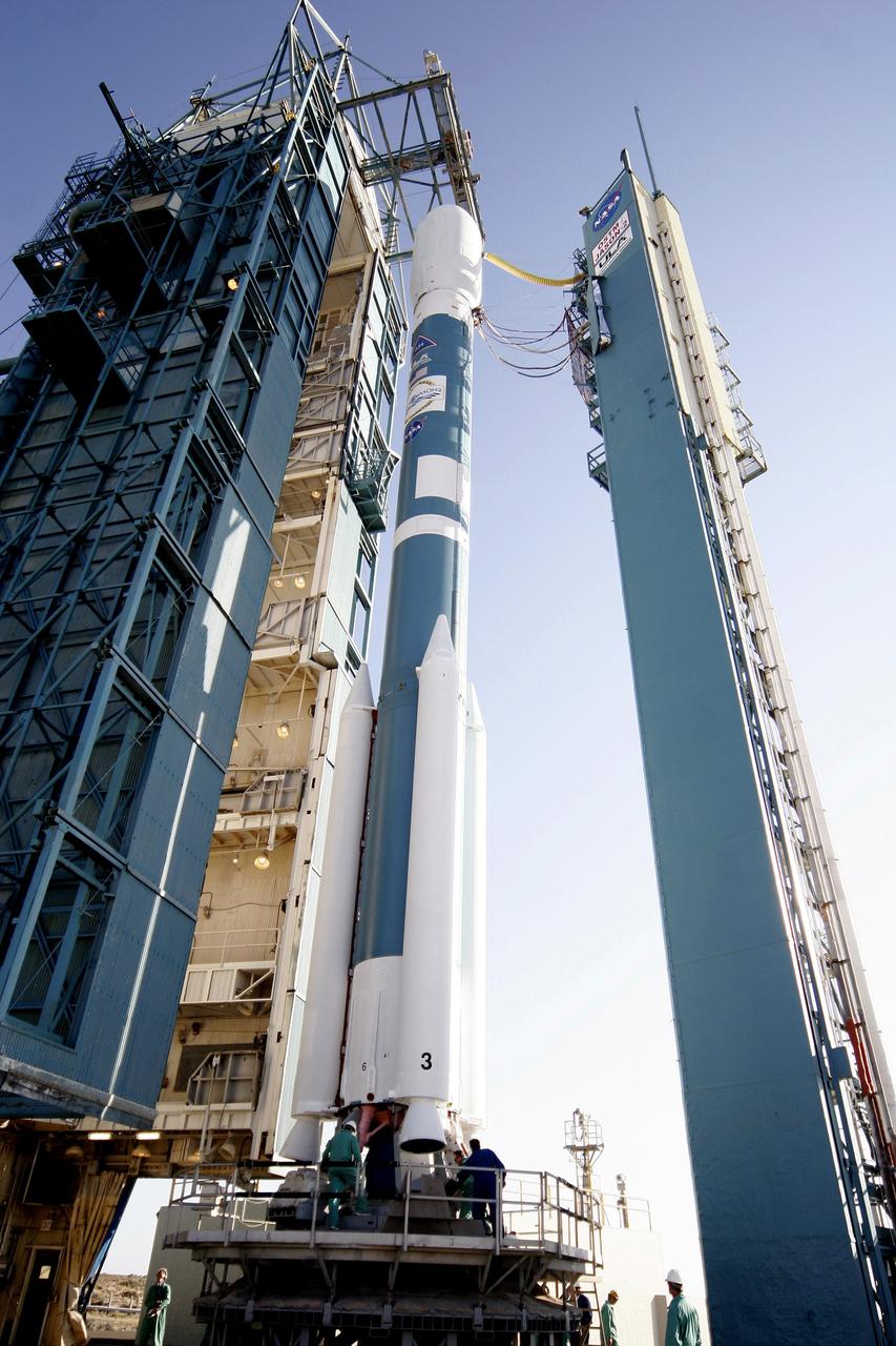
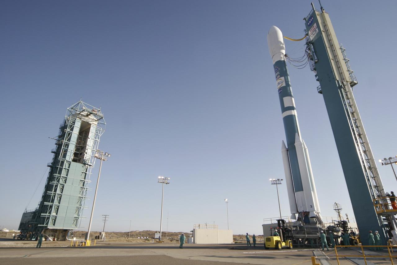
PASADENA, Calif. – A Delta II rocket carrying the Ocean Surface Topography Mission/Jason 2 satellite, is prepared for launch at Space Launch Complex 2 at Vandenberg Air Force Base, Calif. The OSTM/Jason 2 satellite will embark on a globe-circling voyage to continue charting sea level, a vital indicator of global climate change. The mission will return a vast amount of new data that will improve weather, climate and ocean forecasts. OSTM/Jason 2's expected lifetime of at least three years will extend into the next decade the continuous record of these data started in 1992 by NASA and the French space agency Centre National d'Etudes Spatiales, or CNES, with the TOPEX/Poseidon mission. The data collection was continued by the two agencies on Jason 1 in 2001. Photo credit: Carleton Bailie photograph for United Launch Alliance
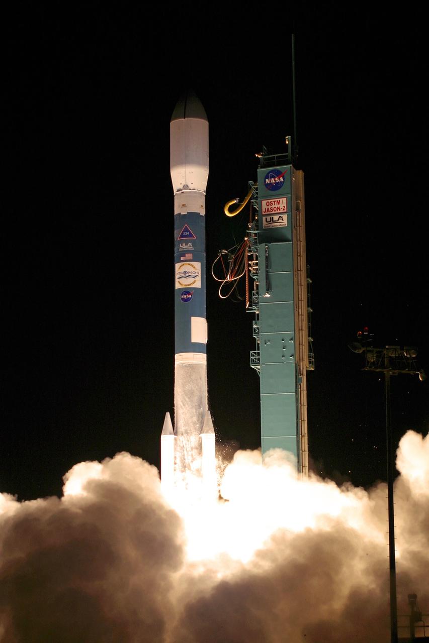
PASADENA, Calif. – The NASA-French space agency Ocean Surface Topography Mission/Jason 2 satellite launched aboard a Delta II rocket from Space Launch Complex 2 at Vandenberg Air Force Base, Calif., at 12:46 a.m. PDT. Fifty-five minutes later, OSTM/Jason 2 separated from the rocket’s second stage, and then, unfurled its twin sets of solar arrays. The OSTM/Jason 2 satellite will embark on a globe-circling voyage to continue charting sea level, a vital indicator of global climate change. The mission will return a vast amount of new data that will improve weather, climate and ocean forecasts. OSTM/Jason 2's expected lifetime of at least three years will extend into the next decade the continuous record of these data started in 1992 by NASA and the French space agency Centre National d'Etudes Spatiales, or CNES, with the TOPEX/Poseidon mission. The data collection was continued by the two agencies on Jason 1 in 2001. Photo credit: Carleton Bailie photograph for United Launch Alliance
VANDENBERG AIR FORCE BASE, Calif. – The Delta II rocket with the Ocean Surface Topography Mission, or OSTM/Jason 2, aboard is poised for launch on Space Launch Complex 2 after rollback of the mobile service tower (at left). The OSTM/Jason 2 satellite will embark on a globe-circling voyage to continue charting sea level, a vital indicator of global climate change. The mission will return a vast amount of new data that will improve weather, climate and ocean forecasts. OSTM/Jason 2's expected lifetime of at least three years will extend into the next decade the continuous record of these data started in 1992 by NASA and the French space agency Centre National d'Etudes Spatiales, or CNES, with the TOPEX/Poseidon mission. The data collection was continued by the two agencies on Jason-1 in 2001. The launch window extends from 12:46 a.m. to 12:55 a.m. PDT. The satellite will be placed in an 830-mile-high orbit at an inclination of 66 degrees after separating from the Delta II 55 minutes after liftoff. Photo credit: Photograph by Carleton Bailie for United Launch Alliance
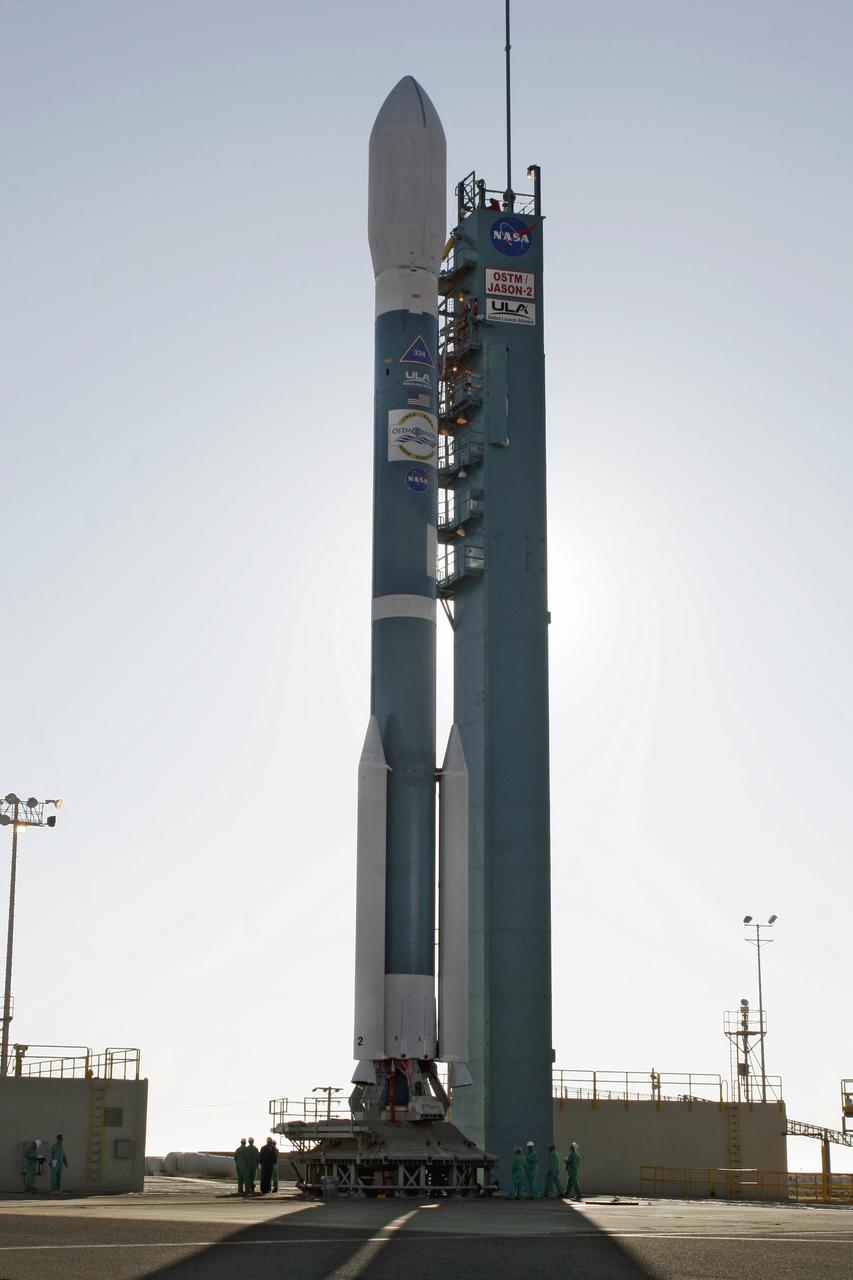
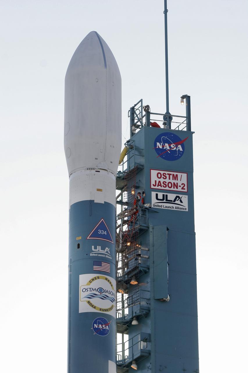
VANDENBERG AIR FORCE BASE, Calif. – The Delta II rocket with the Ocean Surface Topography Mission, or OSTM/Jason 2, aboard is poised for launch on Space Launch Complex 2 after rollback of the mobile service tower. The OSTM/Jason 2 satellite will embark on a globe-circling voyage to continue charting sea level, a vital indicator of global climate change. The mission will return a vast amount of new data that will improve weather, climate and ocean forecasts. OSTM/Jason 2's expected lifetime of at least three years will extend into the next decade the continuous record of these data started in 1992 by NASA and the French space agency Centre National d'Etudes Spatiales, or CNES, with the TOPEX/Poseidon mission. The data collection was continued by the two agencies on Jason-1 in 2001. The launch window extends from 12:46 a.m. to 12:55 a.m. PDT. The satellite will be placed in an 830-mile-high orbit at an inclination of 66 degrees after separating from the Delta II 55 minutes after liftoff. Photo credit: Photograph by Carleton Bailie for United Launch Alliance
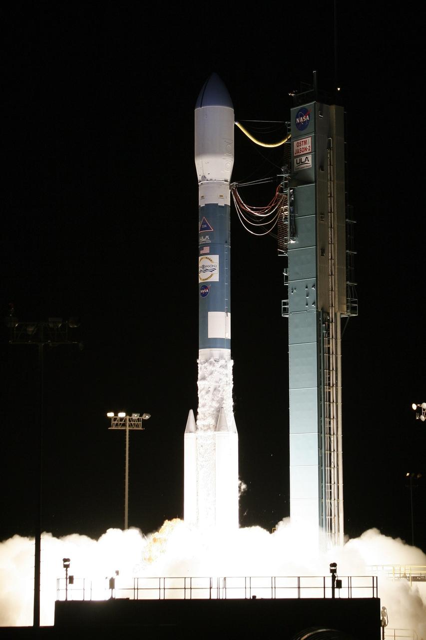
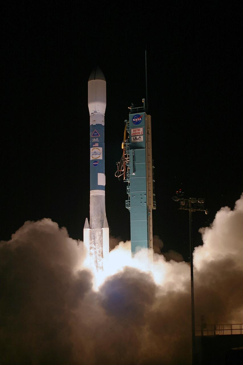
VANDENBERG AIR FORCE BASE, Calif. – Fiery clouds light up Space Launch Complex-2 at the liftoff of the Delta II rocket carrying the Ocean Surface Topography Mission, or OSTM/Jason 2, spacecraft. The OSTM/Jason 2 satellite will embark on a globe-circling voyage to continue charting sea level, a vital indicator of global climate change. The mission will return a vast amount of new data that will improve weather, climate and ocean forecasts. OSTM/Jason 2's expected lifetime of at least three years will extend into the next decade the continuous record of these data started in 1992 by NASA and the French space agency Centre National d'Etudes Spatiales, or CNES, with the TOPEX/Poseidon mission. The data collection was continued by the two agencies on Jason-1 in 2001. The launch window extends from 12:46 a.m. to 12:55 a.m. PDT. The satellite will be placed in an 830-mile-high orbit at an inclination of 66 degrees after separating from the Delta II 55 minutes after liftoff. Photo credit: Photograph by Carleton Bailie for United Launch Alliance
VANDENBERG AIR FORCE BASE, Calif. – Fiery clouds floating over the launch pad on Space Launch Complex-2 signal the liftoff of the Delta II rocket carrying the Ocean Surface Topography Mission, or OSTM/Jason 2, spacecraft. The OSTM/Jason 2 satellite will embark on a globe-circling voyage to continue charting sea level, a vital indicator of global climate change. The mission will return a vast amount of new data that will improve weather, climate and ocean forecasts. OSTM/Jason 2's expected lifetime of at least three years will extend into the next decade the continuous record of these data started in 1992 by NASA and the French space agency Centre National d'Etudes Spatiales, or CNES, with the TOPEX/Poseidon mission. The data collection was continued by the two agencies on Jason-1 in 2001. The launch window extends from 12:46 a.m. to 12:55 a.m. PDT. The satellite will be placed in an 830-mile-high orbit at an inclination of 66 degrees after separating from the Delta II 55 minutes after liftoff. Photo credit: Photograph by Carleton Bailie for United Launch Alliance
VANDENBERG AIR FORCE BASE, Calif. – The Delta II rocket with the Ocean Surface Topography Mission, or OSTM/Jason 2, aboard is poised for launch on Space Launch Complex 2 after rollback of the mobile service tower. The OSTM/Jason 2 satellite will embark on a globe-circling voyage to continue charting sea level, a vital indicator of global climate change. The mission will return a vast amount of new data that will improve weather, climate and ocean forecasts. OSTM/Jason 2's expected lifetime of at least three years will extend into the next decade the continuous record of these data started in 1992 by NASA and the French space agency Centre National d'Etudes Spatiales, or CNES, with the TOPEX/Poseidon mission. The data collection was continued by the two agencies on Jason-1 in 2001. The launch window extends from 12:46 a.m. to 12:55 a.m. PDT. The satellite will be placed in an 830-mile-high orbit at an inclination of 66 degrees after separating from the Delta II 55 minutes after liftoff. Photo credit: Photograph by Carleton Bailie for United Launch Alliance
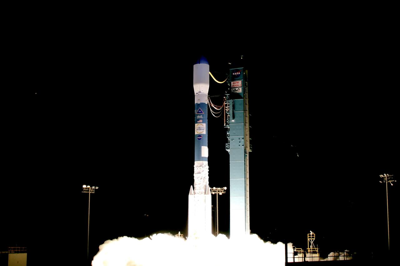
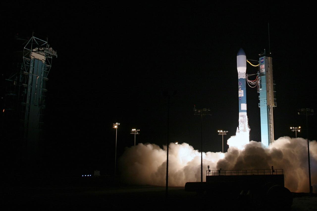
VANDENBERG AIR FORCE BASE, Calif. – Clouds of smoke and steam rise around the Delta II rocket as it lifts off Space Launch Complex-2 with the Ocean Surface Topography Mission, or OSTM/Jason 2, spacecraft aboard. The OSTM/Jason 2 satellite will embark on a globe-circling voyage to continue charting sea level, a vital indicator of global climate change. The mission will return a vast amount of new data that will improve weather, climate and ocean forecasts. OSTM/Jason 2's expected lifetime of at least three years will extend into the next decade the continuous record of these data started in 1992 by NASA and the French space agency Centre National d'Etudes Spatiales, or CNES, with the TOPEX/Poseidon mission. The data collection was continued by the two agencies on Jason-1 in 2001. The launch window extends from 12:46 a.m. to 12:55 a.m. PDT. The satellite will be placed in an 830-mile-high orbit at an inclination of 66 degrees after separating from the Delta II 55 minutes after liftoff. Photo credit: Photograph by Carleton Bailie for United Launch Alliance
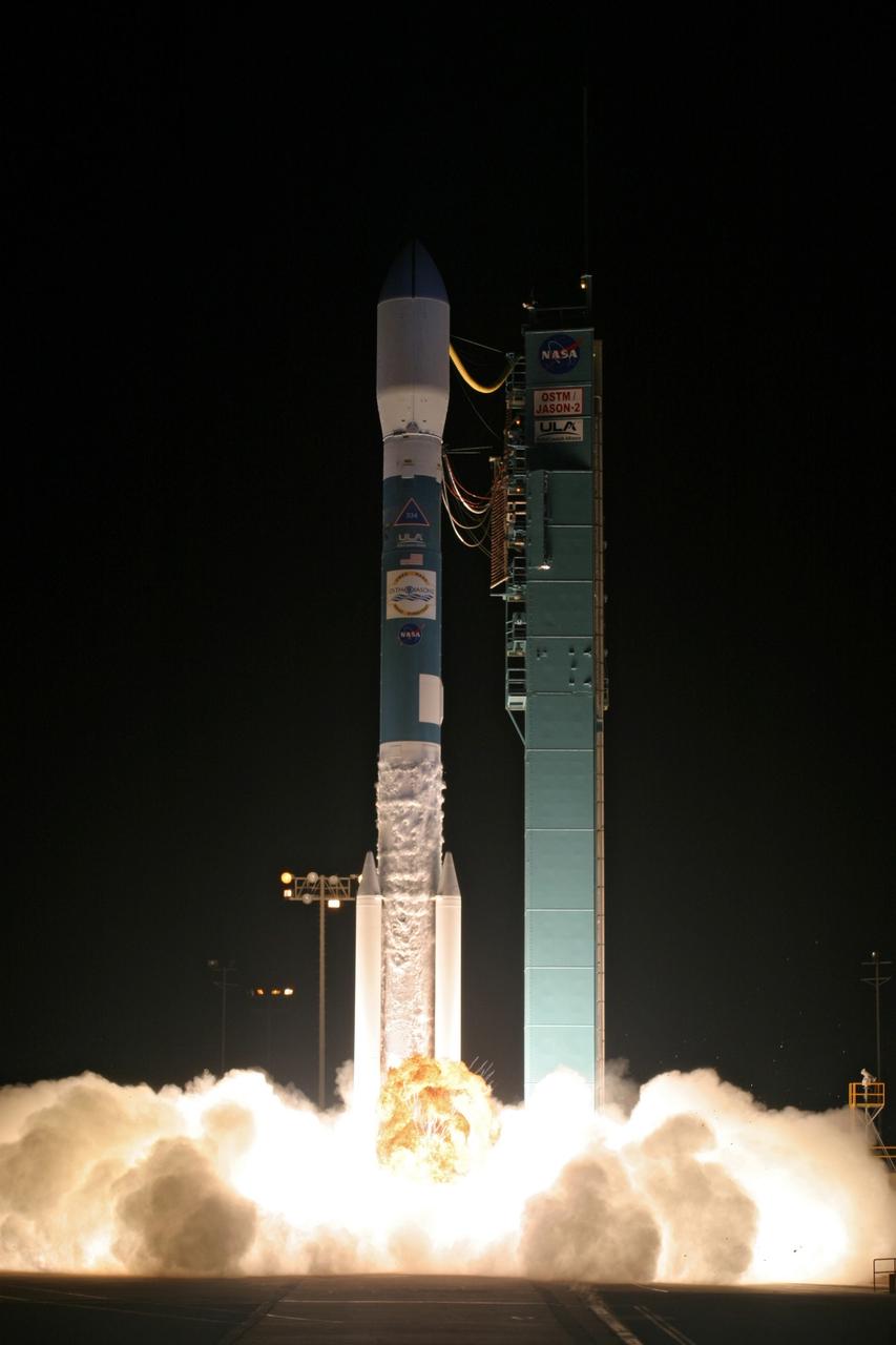
VANDENBERG AIR FORCE BASE, Calif. – Clouds of smoke and steam rise spread across the launch pad on Space Launch Complex-2 as the Delta II rocket lifts off with the Ocean Surface Topography Mission, or OSTM/Jason 2, spacecraft aboard. The OSTM/Jason 2 satellite will embark on a globe-circling voyage to continue charting sea level, a vital indicator of global climate change. The mission will return a vast amount of new data that will improve weather, climate and ocean forecasts. OSTM/Jason 2's expected lifetime of at least three years will extend into the next decade the continuous record of these data started in 1992 by NASA and the French space agency Centre National d'Etudes Spatiales, or CNES, with the TOPEX/Poseidon mission. The data collection was continued by the two agencies on Jason-1 in 2001. The launch window extends from 12:46 a.m. to 12:55 a.m. PDT. The satellite will be placed in an 830-mile-high orbit at an inclination of 66 degrees after separating from the Delta II 55 minutes after liftoff. Photo credit: Photograph by Carleton Bailie for United Launch Alliance

VANDENBERG AIR FORCE BASE, Calif. – The Delta II rocket with the Ocean Surface Topography Mission, or OSTM/Jason 2, aboard is poised for launch on Space Launch Complex 2 after rollback of the mobile service tower. The OSTM/Jason 2 satellite will embark on a globe-circling voyage to continue charting sea level, a vital indicator of global climate change. The mission will return a vast amount of new data that will improve weather, climate and ocean forecasts. OSTM/Jason 2's expected lifetime of at least three years will extend into the next decade the continuous record of these data started in 1992 by NASA and the French space agency Centre National d'Etudes Spatiales, or CNES, with the TOPEX/Poseidon mission. The data collection was continued by the two agencies on Jason-1 in 2001. The launch window extends from 12:46 a.m. to 12:55 a.m. PDT. The satellite will be placed in an 830-mile-high orbit at an inclination of 66 degrees after separating from the Delta II 55 minutes after liftoff. Photo credit: Photograph by Carleton Bailie for United Launch Alliance
VANDENBERG AIR FORCE BASE, Calif. – Fiery clouds floating over the launch pad signal the liftoff of the Delta II rocket carrying the Ocean Surface Topography Mission, or OSTM/Jason 2, spacecraft. The OSTM/Jason 2 satellite will embark on a globe-circling voyage to continue charting sea level, a vital indicator of global climate change. The mission will return a vast amount of new data that will improve weather, climate and ocean forecasts. OSTM/Jason 2's expected lifetime of at least three years will extend into the next decade the continuous record of these data started in 1992 by NASA and the French space agency Centre National d'Etudes Spatiales, or CNES, with the TOPEX/Poseidon mission. The data collection was continued by the two agencies on Jason-1 in 2001. The launch window extends from 12:46 a.m. to 12:55 a.m. PDT. The satellite will be placed in an 830-mile-high orbit at an inclination of 66 degrees after separating from the Delta II 55 minutes after liftoff. Photo credit: Photograph by Carleton Bailie for United Launch Alliance

VANDENBERG AIR FORCE BASE, Calif. – A prelaunch news conference is held on North Vandenberg Air Force Base to present the latest information about the Ocean Surface Topography Mission, or OSTM/Jason 2. Seated from left are the moderator George Diller; Steve Neeck, OSTM/Jason 2 program executive; Omar Baez, NASA launch director at NASA's Kennedy Space Center; Kris Walsh, director of NASA and commercial programs for, United Launch Alliance; Parag Vaze, OSTM/Jason 2 project manager at the NASA's Jet Propulsion Laboratory; and Capt. Andrew M. Frey, launch weather officer with the 30th Weather Squadron. The OSTM/Jason 2 satellite will embark on a globe-circling voyage to continue charting sea level, a vital indicator of global climate change. The mission will return a vast amount of new data that will improve weather, climate and ocean forecasts. OSTM/Jason 2's expected lifetime of at least three years will extend into the next decade the continuous record of these data started in 1992 by NASA and the French space agency Centre National d'Etudes Spatiales, or CNES, with the TOPEX/Poseidon mission. The data collection was continued by the two agencies on Jason-1 in 2001. The launch window extends from 12:46 a.m. to 12:55 a.m. PDT. The satellite will be placed in an 830-mile-high orbit at an inclination of 66 degrees after separating from the Delta II 55 minutes after liftoff. Photo credit: Photograph by Carleton Bailie for United Launch Alliance