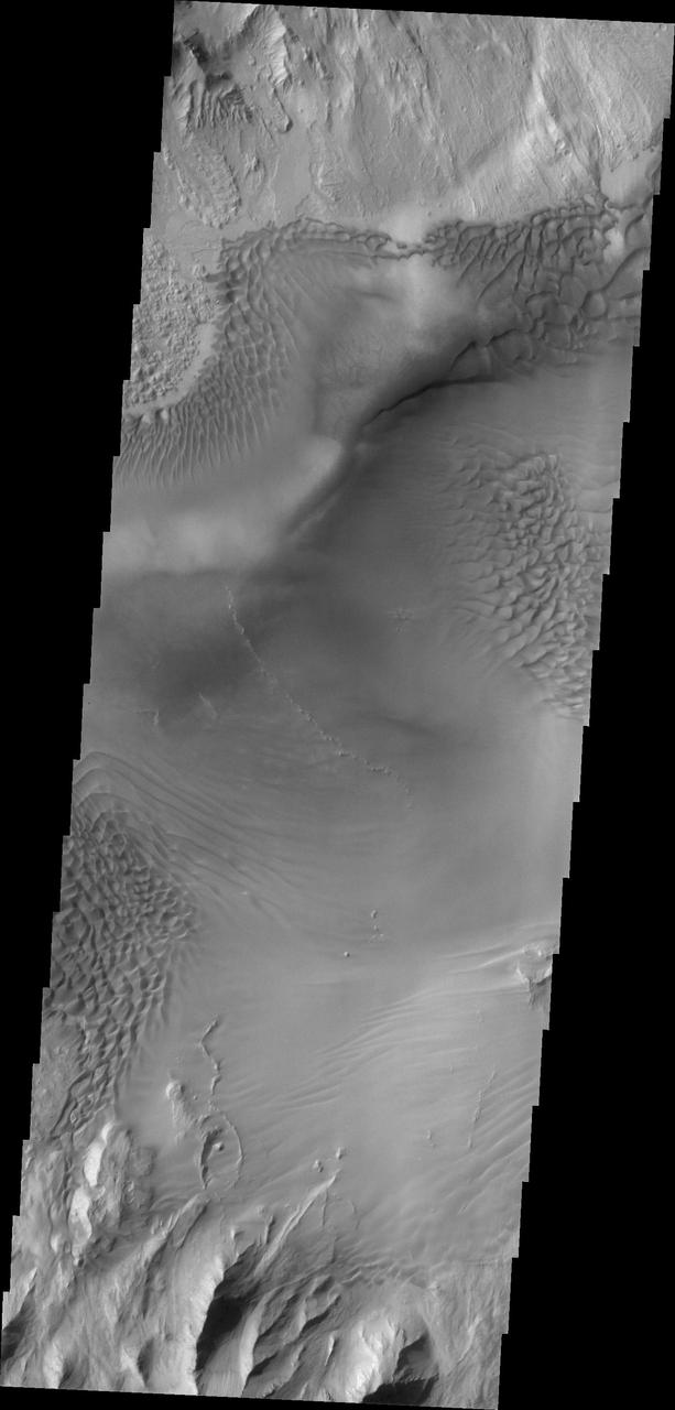
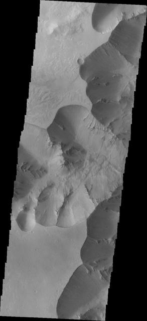
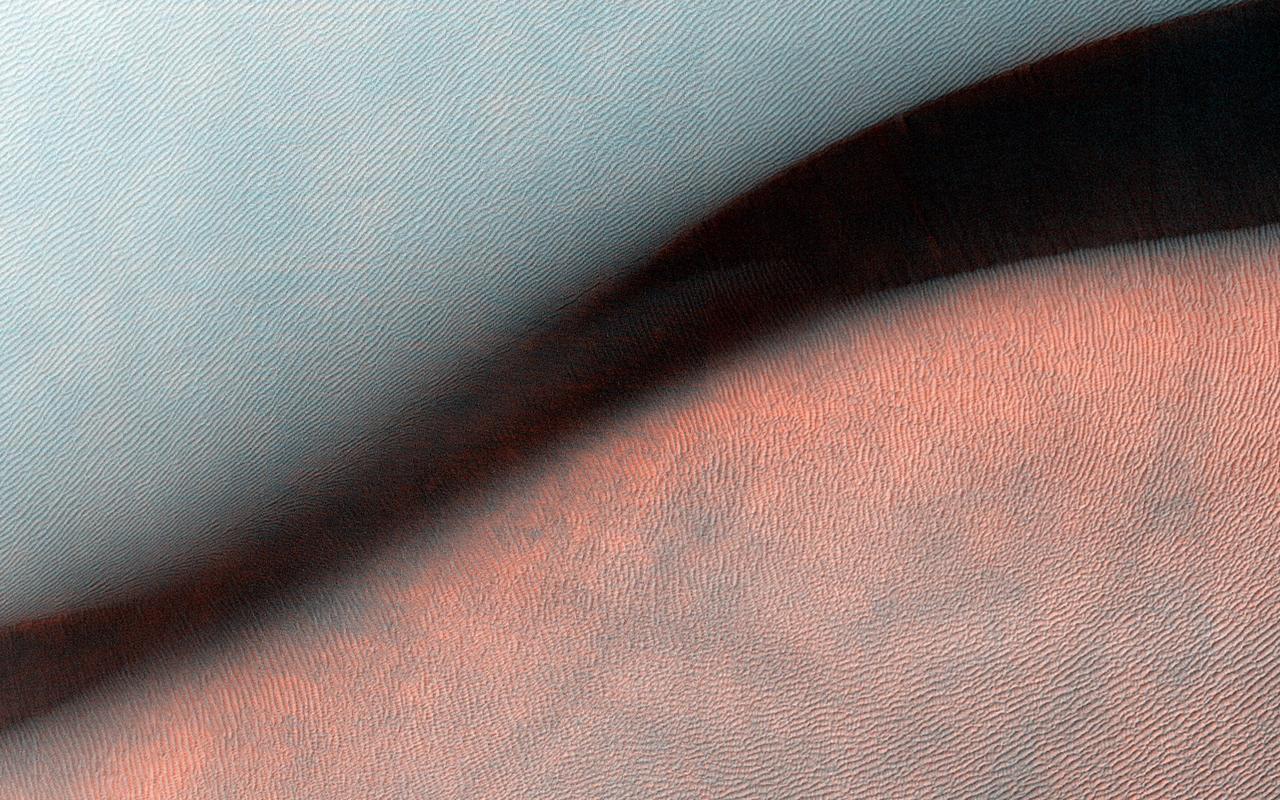
Today's VIS image shows sand dune forms in Juventae Chasma. In this part of Juventae Chasma the entire floor appears to be covered by sand and dunes. Orbit Number: 65083 Latitude: -4.52447 Longitude: 297.293 Instrument: VIS Captured: 2016-08-15 18:39 http://photojournal.jpl.nasa.gov/catalog/PIA21001
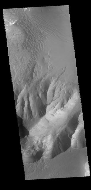
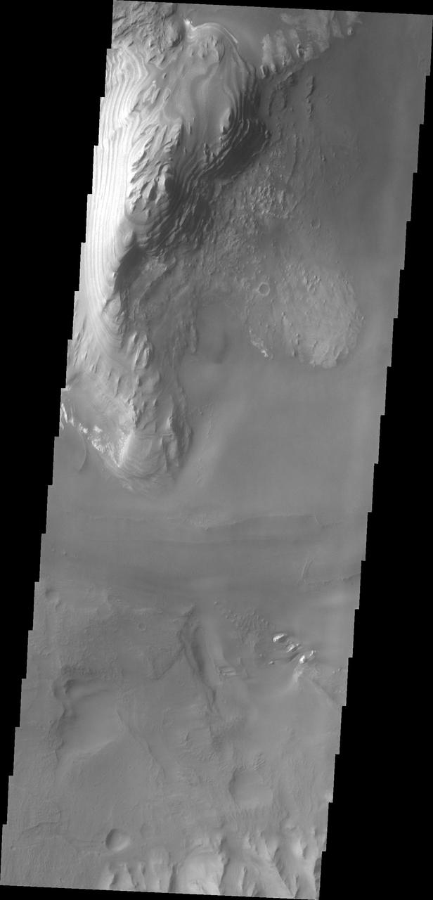
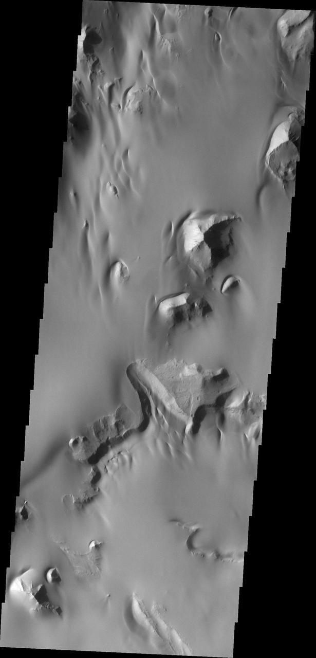
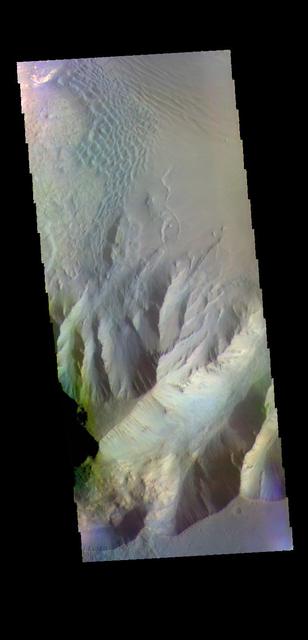
This VIS image shows the southern wall of Juventae Chasma. Orbit Number: 64347 Latitude: -5.0713 Longitude: 298.551 Instrument: VIS Captured: 2016-06-16 03:38 http://photojournal.jpl.nasa.gov/catalog/PIA20807
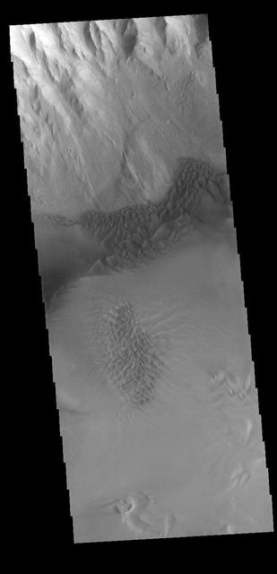
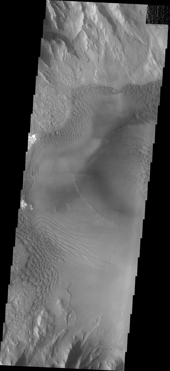
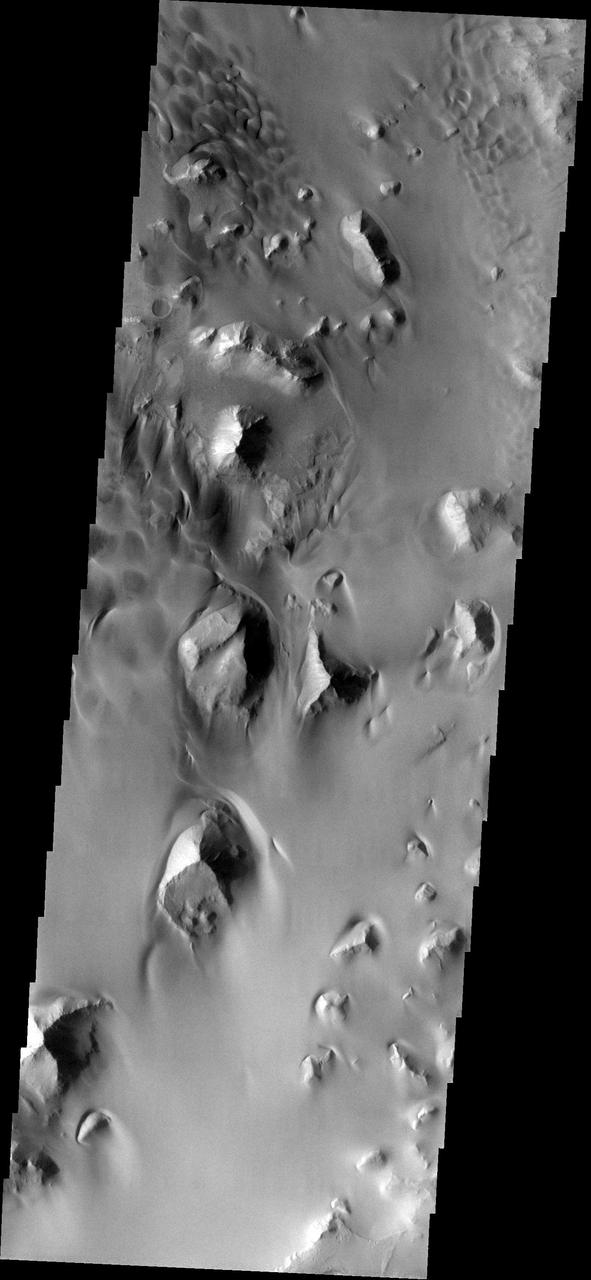
Today's image shows part of the southern margin of Juventae Chasma. Also visible are sand dunes located on the floor of the canyon. Orbit Number: 64372 Latitude: -5.09577 Longitude: 297.061 Instrument: VIS Captured: 2016-06-18 05:03 http://photojournal.jpl.nasa.gov/catalog/PIA20808
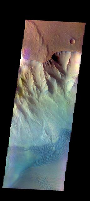
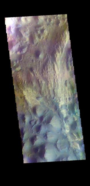
The THEMIS VIS camera contains 5 filters. The data from different filters can be combined in multiple ways to create a false color image. These false color images may reveal subtle variations of the surface not easily identified in a single band image. Today's false color image shows part of Juventae Chasma, including sand dunes on the floor of the chasma. Orbit Number: 48863 Latitude: -4.23406 Longitude: 297.286 Instrument: VIS Captured: 2012-12-19 10:35 http://photojournal.jpl.nasa.gov/catalog/PIA21199
The THEMIS camera contains 5 filters. The data from different filters can be combined in multiple ways to create a false color image. These false color images may reveal subtle variations of the surface not easily identified in a single band image. Today's false color image shows part of Juventae Chasma. Orbit Number: 43345 Latitude: -4.63793 Longitude: 296.778 Instrument: VIS Captured: 2011-09-22 06:32 http://photojournal.jpl.nasa.gov/catalog/PIA20987
Sea of Sand in Juventae Chasma
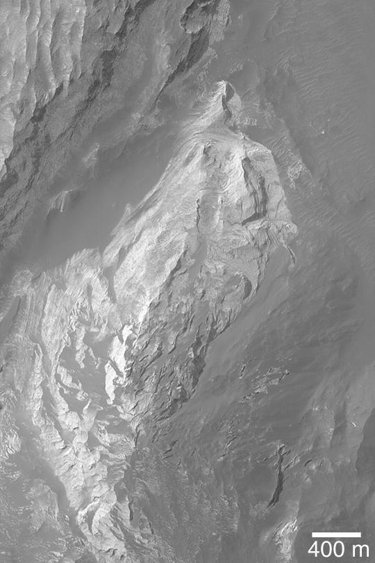
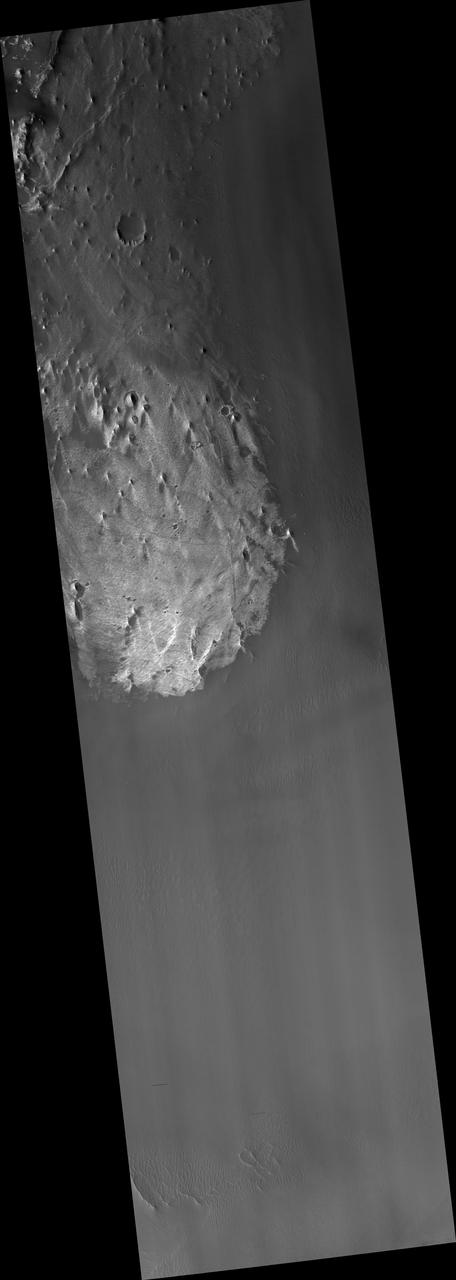
Outcrop In Juventae Chasma
Layers Near Juventae Chasma

Interior Layered Deposits in Juventae Chasma
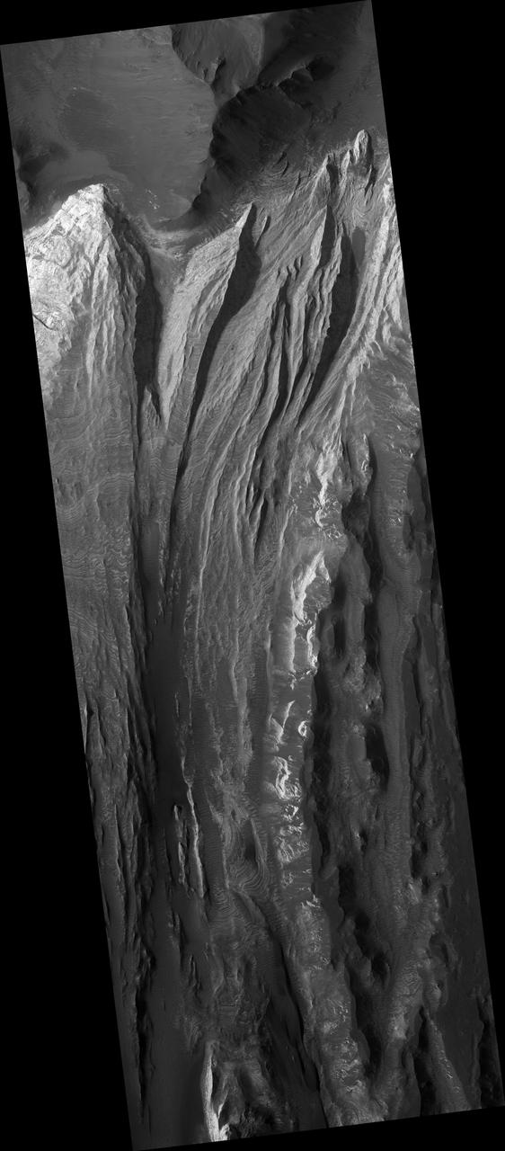
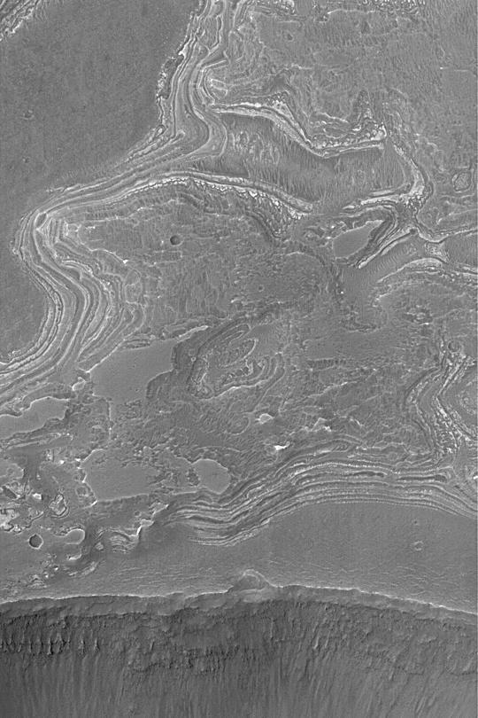
Very Fine Layers in Juventae Chasma
Proposed MSL Site in Juventae Chasma
On the north side of Mars' great equatorial rift Valles Marineris lies a large depression called Juventae Chasma. The chasma stretches for 180 kilometers (110 miles) east-west and 250 km (155 miles) north-south. Most of its floor lies 5km (3 miles) or more below the surrounding surface of Lunae Planum. The large outflow channel Maja Valles originates at the northern end of Juventae Chasma. Sand dunes cover a large portion of the floor of Juventae Chasma, visible in the central part of this VIS image. Orbit Number: 85954 Latitude: -3.98251 Longitude: 298.967 Instrument: VIS Captured: 2021-04-30 18:13 https://photojournal.jpl.nasa.gov/catalog/PIA24889
Baetis Chasma is a chasmata near but not directly connected to Valles Marineris. Dunes are prevalent on the floor of this portion of Juventae Chasma in this image taken by NASA 2001 Mars Odyssey.
Dune forms cover the top of this sand sheet on the floor of Juventae Chasma, a chasma north of the Valles Marineris canyon system in this image from NASA Mars Odyssey.

The sand sheet and dunes in this image, taken by NASA 2001 Mars Odyssey spacecraft, are located on the floor of Juventae Chasma.
Layering is visible in these deposits on the floor of Juventae Chasma in this image captured by NASA 2001 Mars Odyssey.
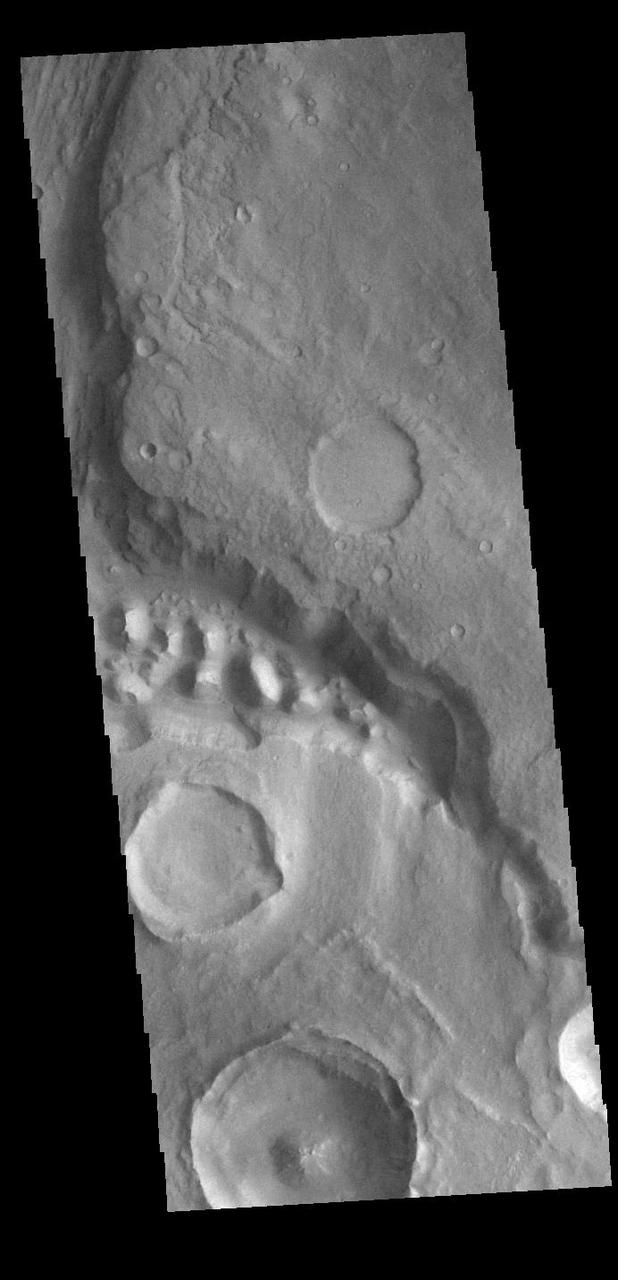
NASA 2001 Mars Odyssey spacecraft captured this image of the southwestern margin of Juventae Chasma. Located to the north of Marineris Vallis, this chasma is elongate in the north-south direction, rather than east-west.
This image captured by NASA 2001 Mars Odyssey spacecraft shows the western margin of Juventae Chasma and the dunes that occur at the base of the chasma cliff.
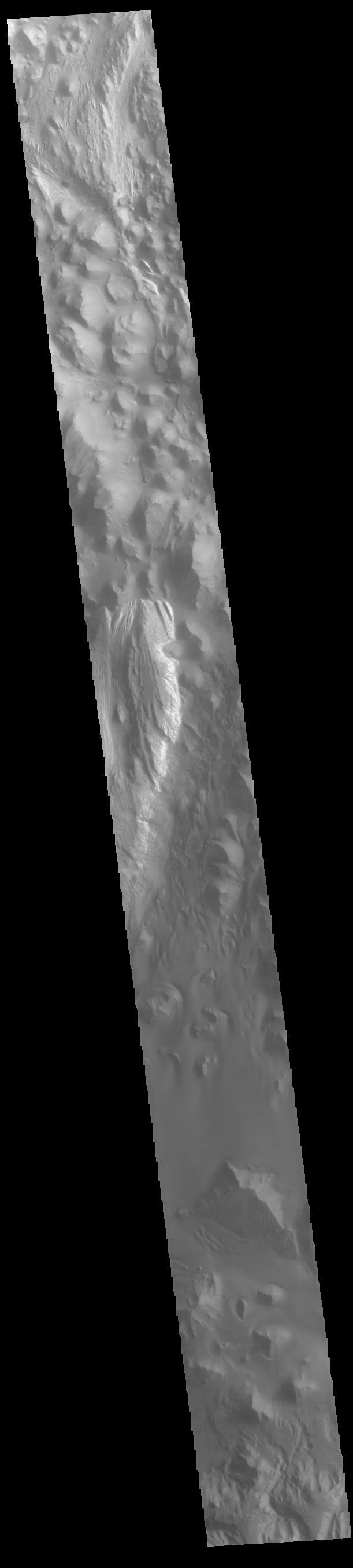
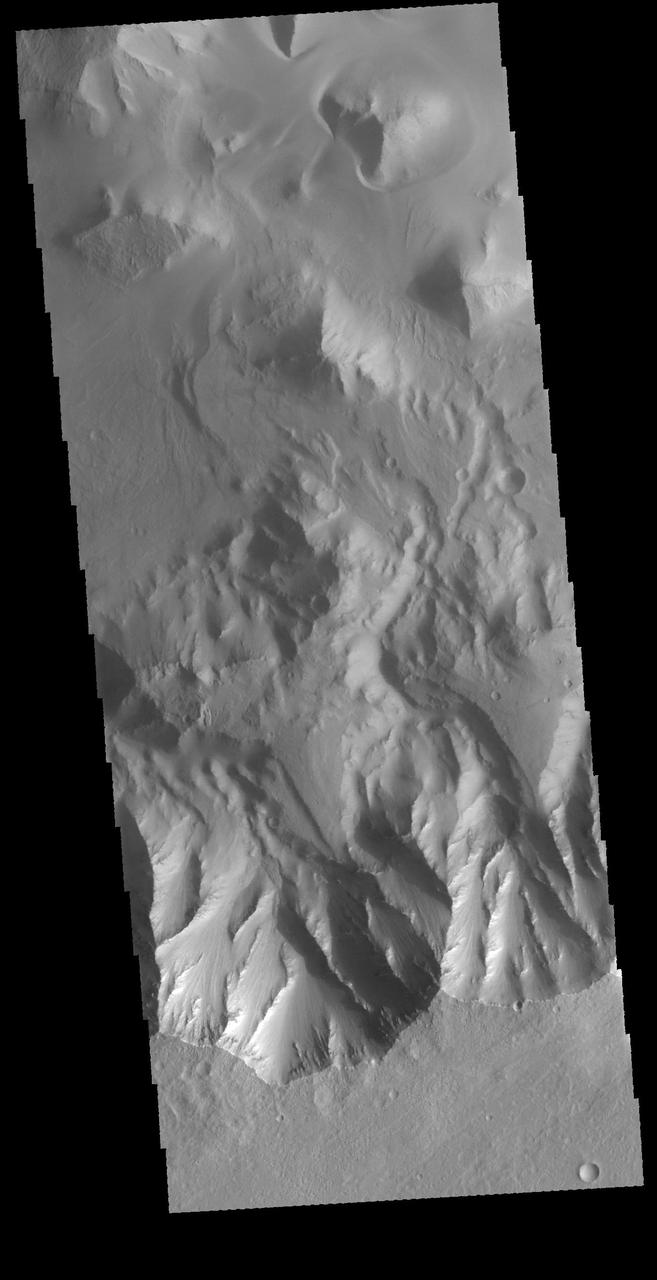
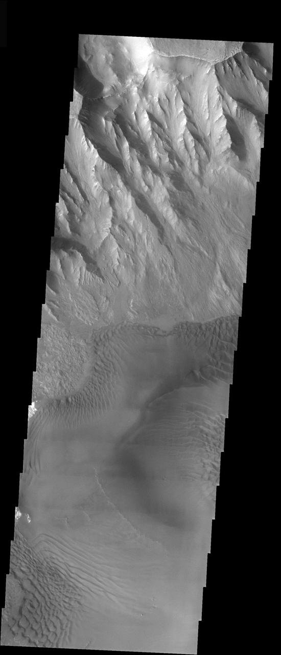
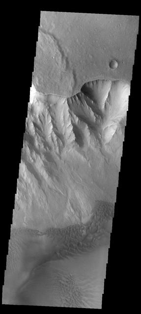
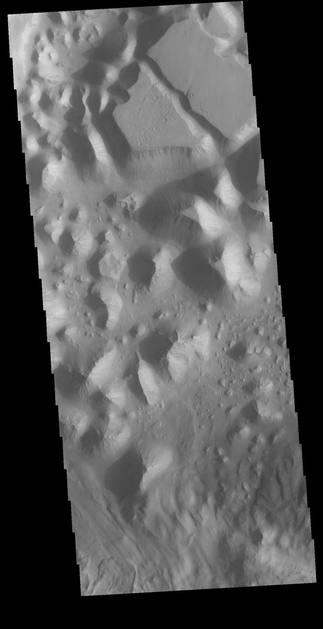
This VIS image runs from northern Juventae Chasma to just short of the southern canyon wall. Illustrating the variety of landforms within the chasma, this image contains the rough canyon floor at the northern extent of the chasma, layered materials in the center of the image and dunes located in the southern, deepest section of the chasma. Orbit Number: 71356 Latitude: -3.55335 Longitude: 298.389 Instrument: VIS Captured: 2018-01-14 14:25 https://photojournal.jpl.nasa.gov/catalog/PIA22381
This false color image shows part of Juventae Chasma. Located north of Valles Marineris, Juventae Chasma stretches for 180 kilometers (110 miles) east-west and 250 km (155 mi) north-south. Most of its floor lies 5,000 meters (16,000 feet) or more below the surrounding surface. Juventae Chasma is the source region for the outflow channel Maja Valles. The THEMIS VIS camera contains 5 filters. The data from different filters can be combined in multiple ways to create a false color image. These false color images may reveal subtle variations of the surface not easily identified in a single band image. Orbit Number: 65981 Latitude: -2.2663 Longitude: 298.189 Instrument: VIS Captured: 2016-10-28 18:05 https://photojournal.jpl.nasa.gov/catalog/PIA23627
The amount of sand in this region of Juventae Chasma has coalesced into a sand sheet, rather than individual dune forms. Wind continues to sculpt the sand around high standing hills in this image from NASA Mars Odyssey.
Juventae Chasma is a giant box canyon, yet a relatively small segment of the enormous Valles Marineris system, seen here by NASA Mars Reconnaissance Orbiter.
The THEMIS VIS camera contains 5 filters. The data from different filters can be combined in multiple ways to create a false color image. These false color images may reveal subtle variations of the surface not easily identified in a single band image. Today's false color image shows part of Juventae Chasma. Dunes are visible on the floor of the chasma. Orbit Number: 64372 Latitude: -5.09926 Longitude: 297.062 Instrument: VIS Captured: 2016-06-18 05:03 http://photojournal.jpl.nasa.gov/catalog/PIA20786
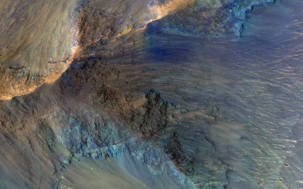
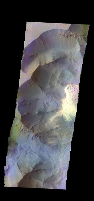
This image captures some of the geologic diversity of Mars. There are hills of ancient terrains on the floor of Juventae Chasma, surrounded by younger sediments, including dark sand sheets and dunes that are likely active today. The hills are heavily eroded by landslides, forming gullies in some places. Diverse colors represent unaltered volcanic minerals (blue and green) and altered minerals (brighter and reddish colors). https://photojournal.jpl.nasa.gov/catalog/PIA23104
This large sand sheet and dune field is located on the floor of Juventae Chasma
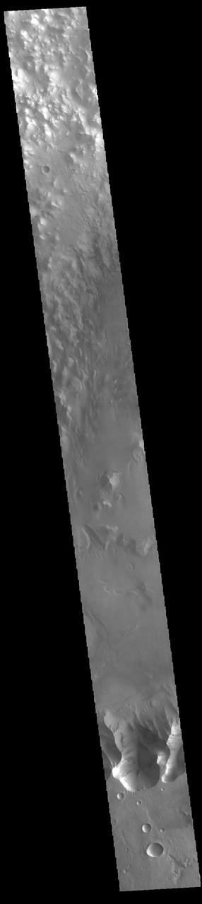
Today's VIS image shows part of Baetis Chaos. This region of chaos is located north of Juventae Chasma. Juventae Chasma is a huge box canyon near Valles Marineris. Water flowed from Juventae Chasma, through Baetis Chaos and created the northward flowing channel called Maja Valles. Orbit Number: 81212 Latitude: -0.365878 Longitude: 299.435 Instrument: VIS Captured: 2020-04-05 07:31 https://photojournal.jpl.nasa.gov/catalog/PIA23942
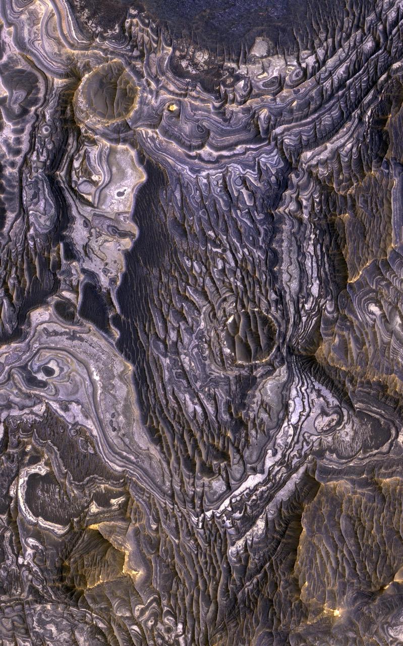
This view, taken by NASA Mars Reconnaissance Orbiter, shows color variations in bright layered deposits on a plateau near Juventae Chasma in the Valles Marineris region of Mars.
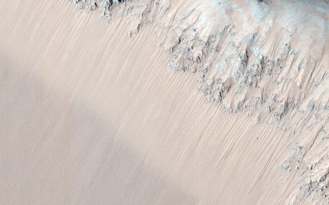
Called draa, ripples, transverse aeolian ridges known as TARs, dunes, are all observed by NASA Mars Reconnaissance Orbiter in this Juventae Chasma image.
![This is an odd-looking image. It shows gullies during the winter while entirely in the shadow of the crater wall. Illumination comes only from the winter skylight. We acquire such images because gullies on Mars actively form in the winter when there is carbon dioxide frost on the ground, so we image them in the winter, even though not well illuminated, to look for signs of activity. The dark streaks might be signs of current activity, removing the frost, but further analysis is needed. NB: North is down in the cutout, and the terrain slopes towards the bottom of the image. The map is projected here at a scale of 50 centimeters (19.7 inches) per pixel. [The original image scale is 62.3 centimeters (24.5 inches) per pixel (with 2 x 2 binning); objects on the order of 187 centimeters (73.6 inches) across are resolved.] North is up. http://photojournal.jpl.nasa.gov/catalog/PIA21568](https://images-assets.nasa.gov/image/PIA21568/PIA21568~medium.jpg)
This is an odd-looking image. It shows gullies during the winter while entirely in the shadow of the crater wall. Illumination comes only from the winter skylight. We acquire such images because gullies on Mars actively form in the winter when there is carbon dioxide frost on the ground, so we image them in the winter, even though not well illuminated, to look for signs of activity. The dark streaks might be signs of current activity, removing the frost, but further analysis is needed. NB: North is down in the cutout, and the terrain slopes towards the bottom of the image. The map is projected here at a scale of 50 centimeters (19.7 inches) per pixel. [The original image scale is 62.3 centimeters (24.5 inches) per pixel (with 2 x 2 binning); objects on the order of 187 centimeters (73.6 inches) across are resolved.] North is up. http://photojournal.jpl.nasa.gov/catalog/PIA21568
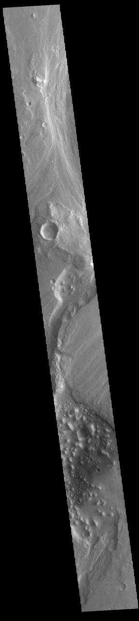
Today's VIS image shows part of Maja Valles, a large channel system in Lunae Planum. Maja Valles in 1600 km (1000 miles) long. Like most outflow channels in the region, Maja Valles arises from the Valles Marineris region and drains into Chryse Planitia. Maja Valles starts in Juventae Chasma. Orbit Number: 85617 Latitude: 4.08955 Longitude: 299.934 Instrument: VIS Captured: 2021-04-03 00:18 https://photojournal.jpl.nasa.gov/catalog/PIA24857

The ultimate origin of the sediment that forms Martian dunes has long been debated. While sand dunes on Earth are primarily sourced by quartz-bearing components of granitic continental crust, it's often suggested that sand on Mars derives from eroded volcanic flows or sedimentary deposits, but exact sources are often vague. This image reveals a unique situation where this small dune field occurs along the summit of the large 1-mile-tall mound near the center of Juventae Chasma. The layered mound slopes are far too steep for dunes to climb, and bedform sand is unlikely to come from purely airborne material. Instead, the mound's summit displays several dark-toned, mantled deposits that are adjacent to the dunes and appear to be eroding into fans of sandy material. Along with local HiRISE images, spectral data from other instruments on MRO have confirmed such units are likely to be the sand source for these mound summit dunes and reveal how landscape evolution on Mars might occur. More information is available at https://photojournal.jpl.nasa.gov/catalog/PIA22785
Today's VIS image shows part of Maja Valles, a large channel system in Lunae Planum. The main part of the channel is visible at the upper left in this image. The lower part of the image is located within an old crater called Stege Crater. The channel in the central part of the image is flowing along the inner rim of the crater and into the main Maja Valles channel just off the image to the left. Maja Valles in 1600 km (1000 miles) long. Like most outflow channels in the region, Maja Valles arises from Valles Marineris and drains into Chryse Planitia. Maja Valles starts in Juventae Chasma. Orbit Number: 89111 Latitude: 4.27445 Longitude: 300.886 Instrument: VIS Captured: 2022-01-15 16:56 https://photojournal.jpl.nasa.gov/catalog/PIA25347