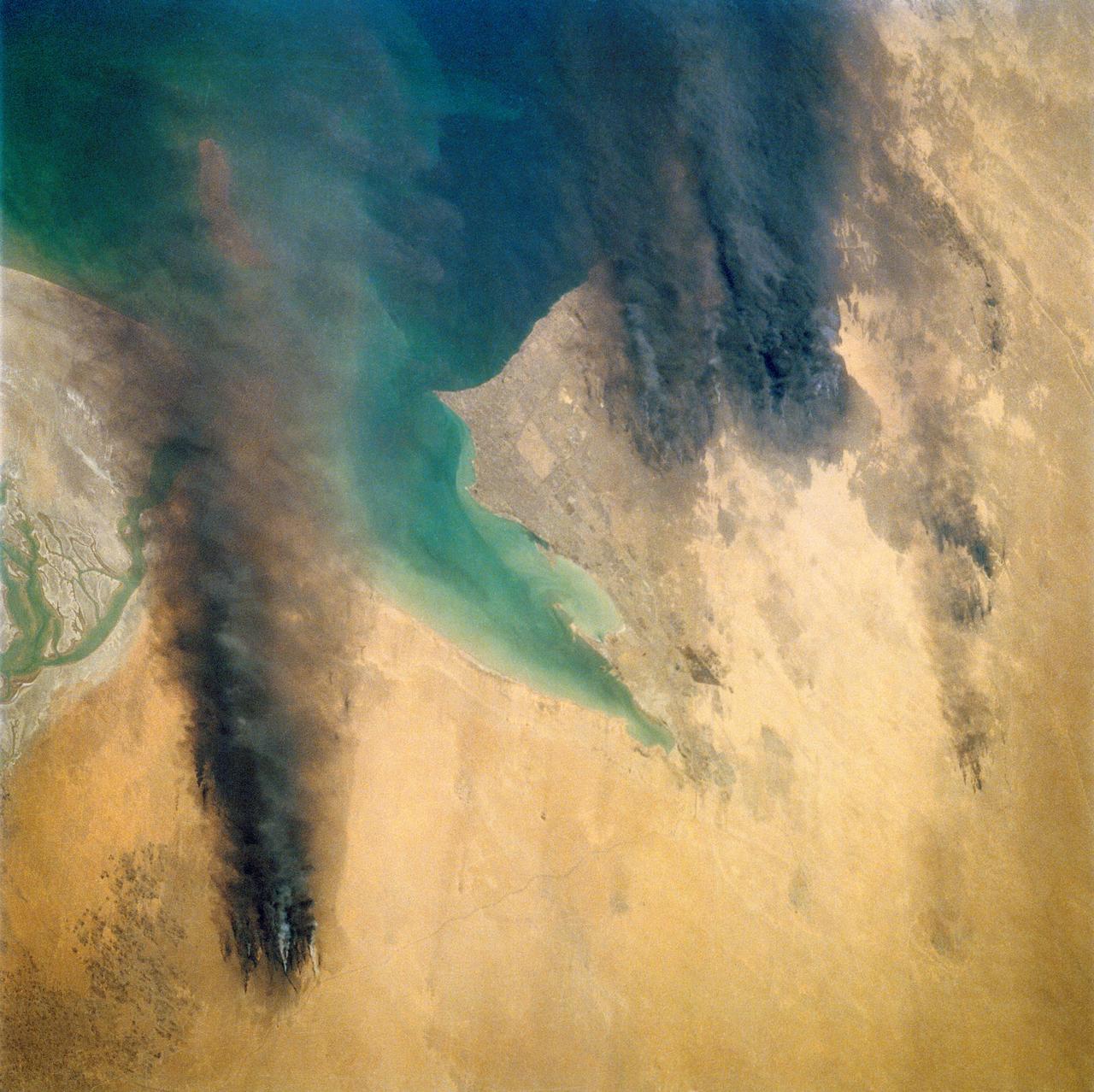
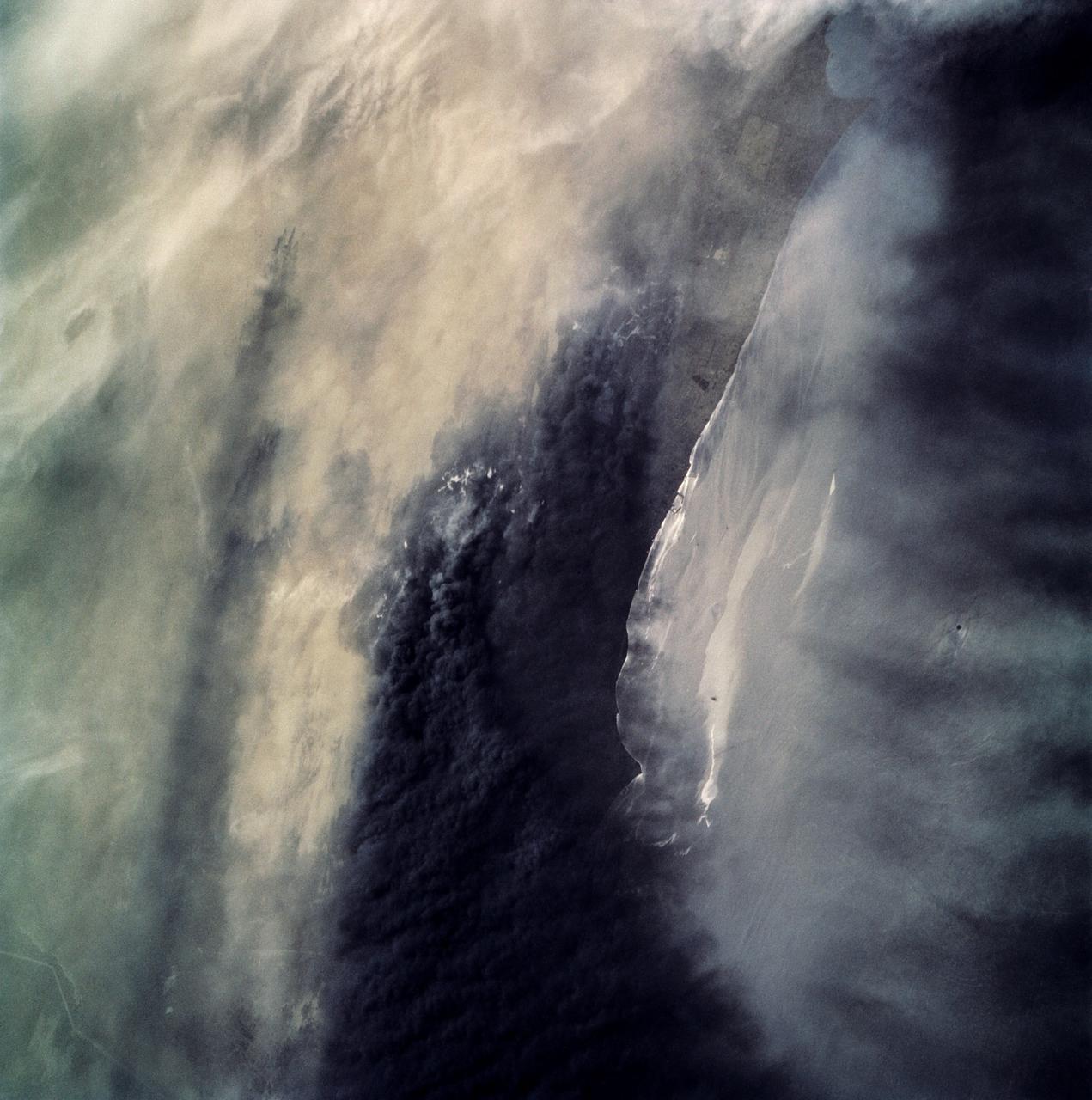
Smoke from the burning oil fields to the north of Kuwait City, seen on the south shore of Kuwayt Bay, almost totally obscures the view of the tiny, but oil rich, nation of Kuwait (30.0N, 48.0E). During the brief war between Iraq and the Allied forces, many of the oil wells in Kuwait were destroyed and set afire. For several months, those fires burned out of control, spewing wind borne smoke and ash for hundreds of miles.
Smoke from the burning oil fields to the north and south of Kuwait City, seen on the south shore of Kuwayt Bay almost totally obscures the view of the tiny, but oil rich, nation of Kuwait (29.0N, 48.0E). During the brief war between Iraq and the Allied forces, many of the oil wells in Kuwait were destroyed and set afire. For several months, those fires burned out of control, spewing wind borne smoke and ash for hundreds of miles.
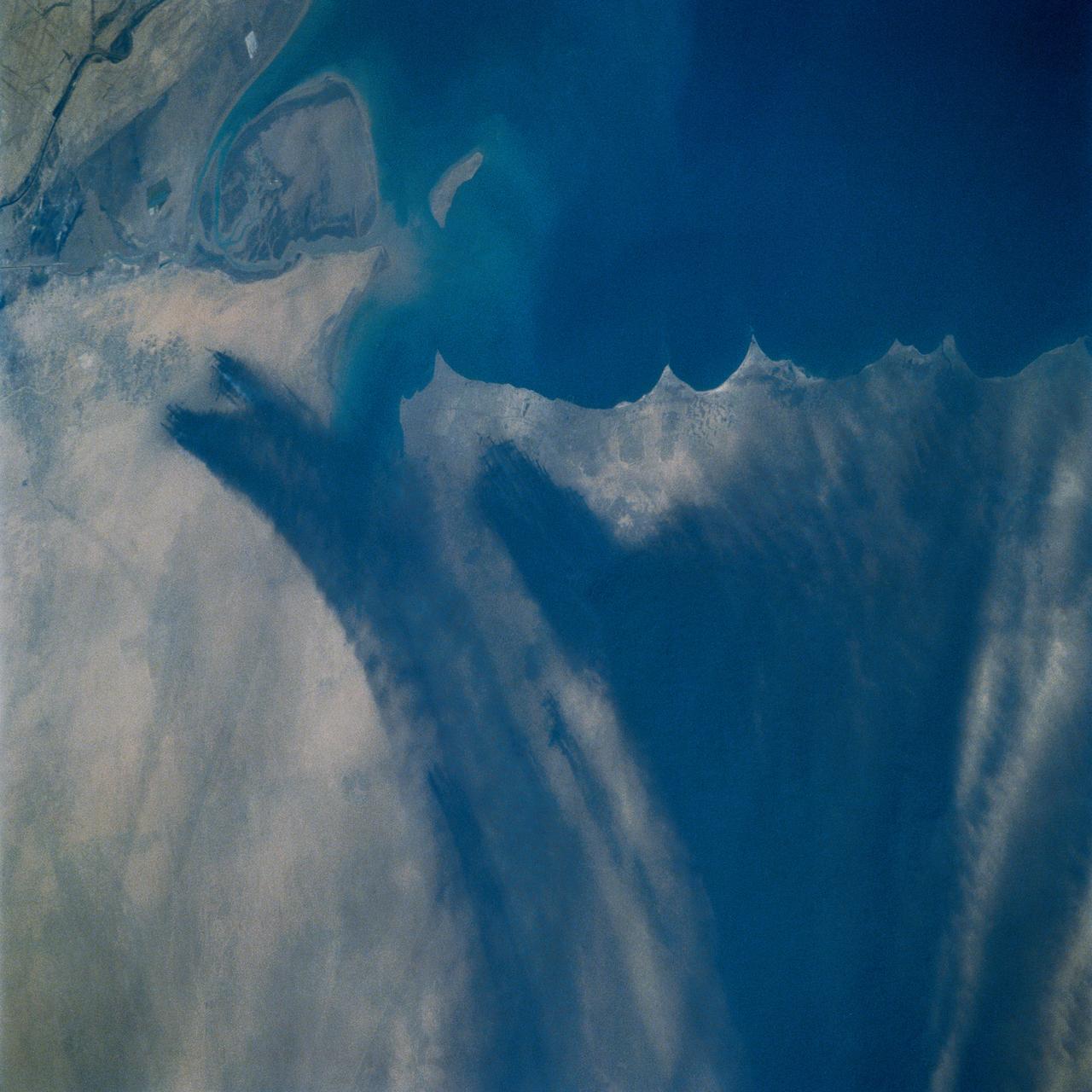
STS039-72-060 (28 April-6 May 1991) --- This view from the Earth-orbiting Space Shuttle Discovery shows the smoke from burning oil well fires, aftermath of Iraqi occupation. Oil wells to the north of the Bay of Kuwait and just south of Kuwait City, on the south shore, can be seen burning out of control. Compared with pictures of the same area shot during STS-37 (April 1991), this frame shows a complete shift of winds, with much of the smoke blowing eastward over the Gulf. The STS-37 scenes showed lengthy southward-blowing sheets of smoke toward Saudi Arabia. In this view, the Gulf island Faylakah Awhah is barely visible through the smoke.

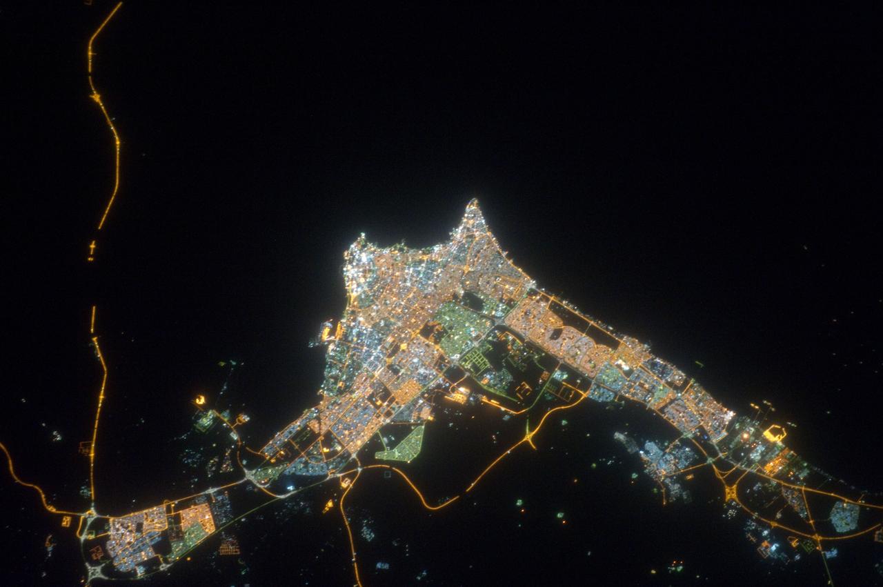
iss072e519889 (Jan. 23, 2025) --- The city lights of Kuwait City, the capital of Kuwait with a population of about 3 million on the Persian Gulf coast, are pictured at approximately 9:49 p.m. local time from the International Space Station as it orbited 258 miles above.
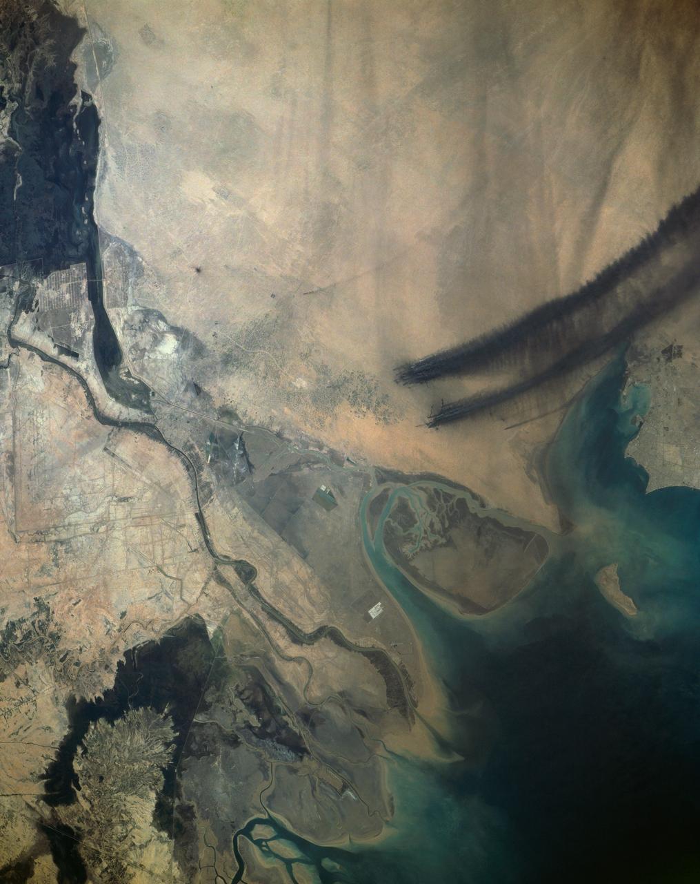
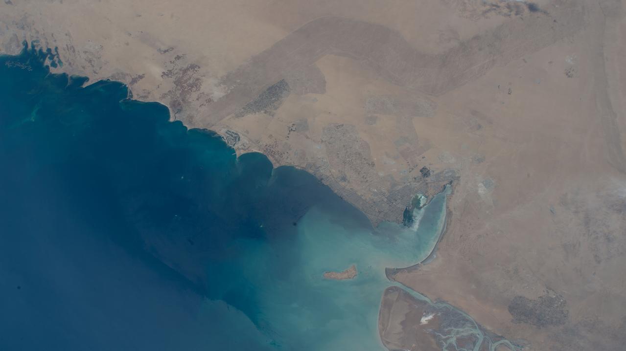
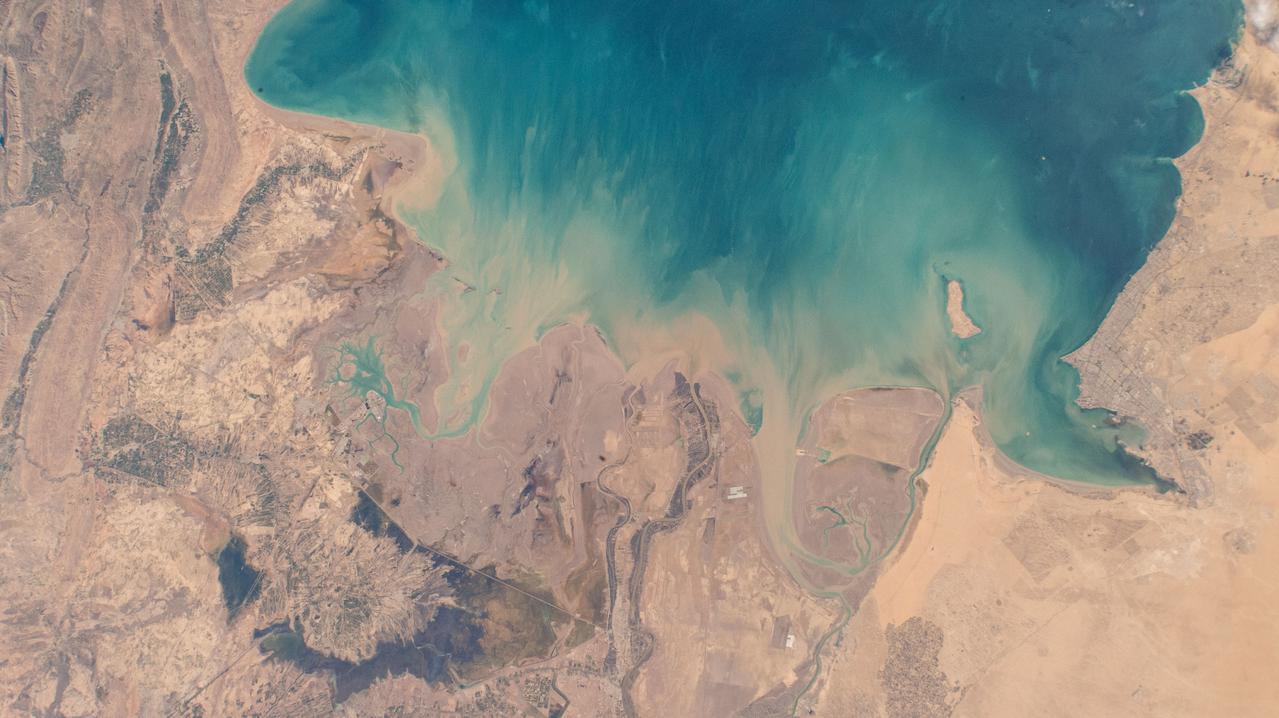
This view of the northern Persian Gulf shows Kuwait City and the Tigris and Euphrates River Deltas (29.5N, 48.5E). The oil laden sands and oil lakes of the Kuwait Oil Fields to the north and south of the city are clearly visible as dark patches surrounded by oil free desert sands. Comparison with earlier photos indicate that the oil laden sands are slowly being covered with clean sand carried by strong NW winds called Shmals.
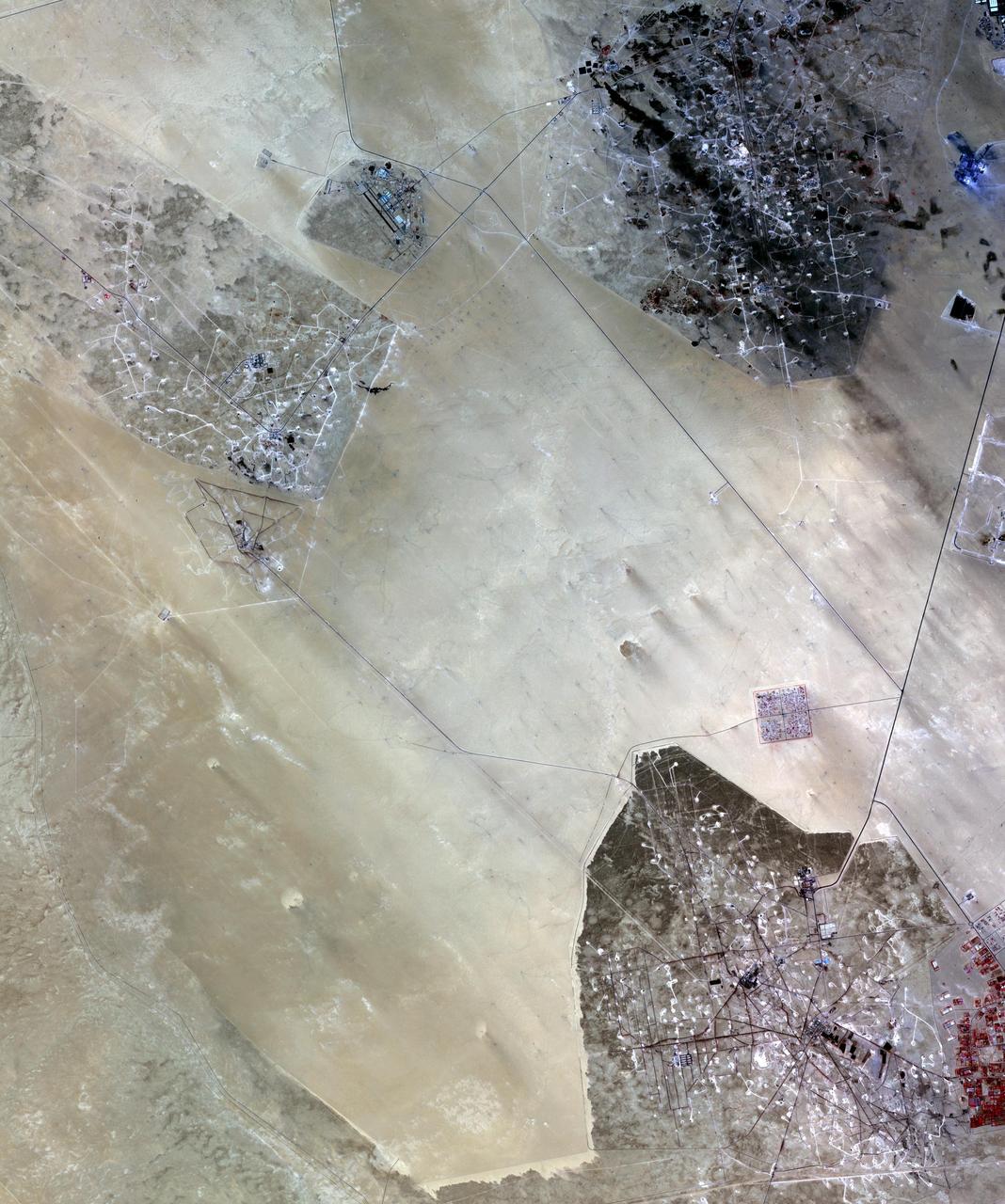
In the desert of southern Kuwait, three oil fields spread out across the empty landscape as seen by NASA Terra spacecraft.
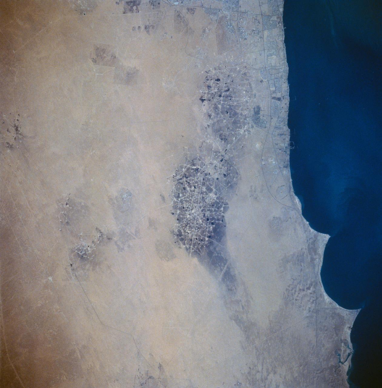
STS058-73-054 (18 Oct-1 Nov 1993) --- A clear view of the northern Kuwaiti coast shows the southern part of Kuwait City, and the major oil fields to the south. Oil-laden sands, where wells were set ablaze during the Gulf War in 1991, are visible south of Kuwait City as a dark, elongated patch surrounded by light-colored sand. Oil-stained sand between well sites (dots) and criss-crossing roads is gradually being covered by clean sand carried by strong, seasonal northwest winds.
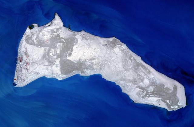
NASA Terra spacecraft captured Kuwait Failaka Island, located 50 km southeast of the spot where the Tigris and Euphrates Rivers empty into the Persian Gulf.
STS039-87-012 (28 April-6 May 1991) --- A handheld 70mm camera onboard the Space Shuttle Discovery exposed this infrared frame showing oil fires near the Kuwait coast as well as south-bound oil slicks in the Gulf. Pools of oil on the land are recognized as white objects near the burning wells.

This image from NASA EarthKAM is of the northern end of the Persian Gulf and the broad delta complex of the Tigris, Euphrates, Shatt al Arab, and Karun rivers has captured the arid-looking wetlands of northeast Kuwait Bubiyan Island,
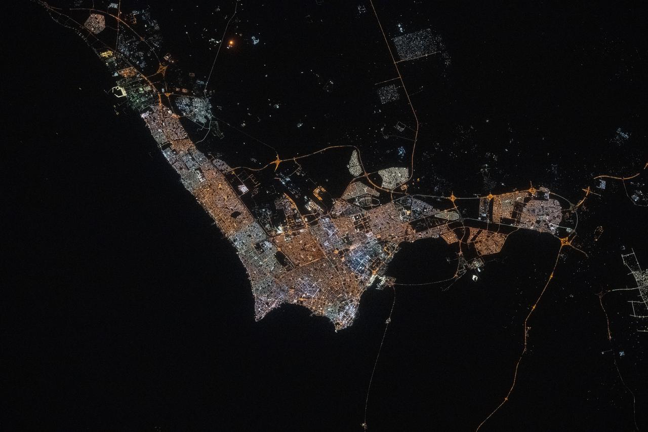
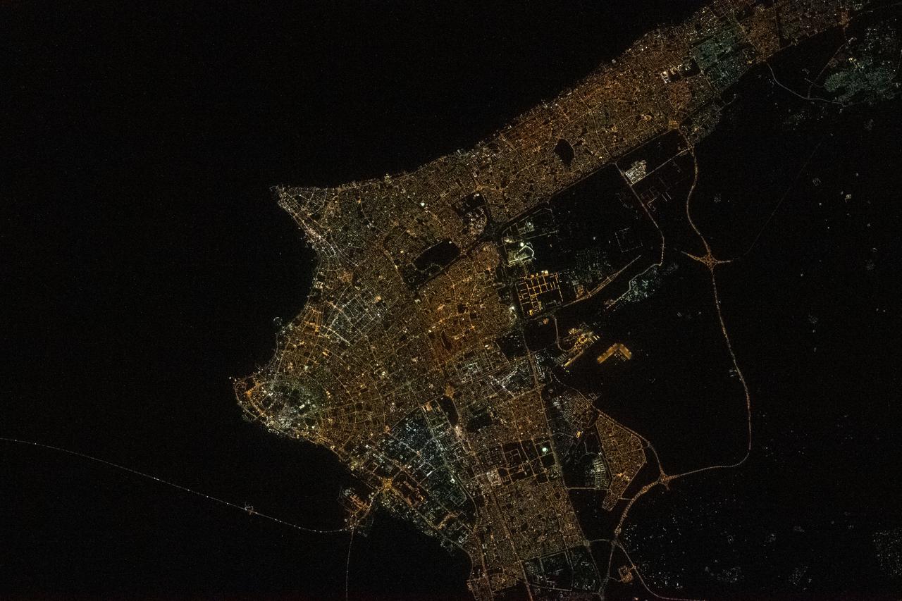
iss073e0134550 (May 22, 2025) --- Kuwait City, with a population of about 3.5 million and where the majority of Kuwait's citizens reside on the Persian Gulf coast, is pictured at approximately 10:42 p.m. local time from the International Space Station as it orbited 259 miles above the Middle East.
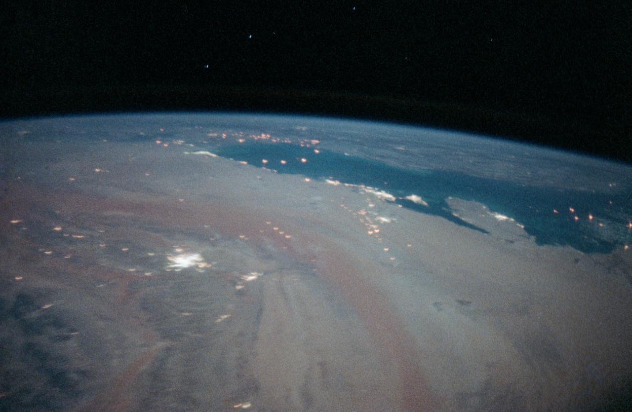
STS-35 Earth observation taken aboard Columbia, Orbiter Vehicle (OV) 102, is of the Persian Gulf area. Major cities and oilfields of the countries of Saudi Arabia (foreground), Iraq (top left), Iran (top center and top right), Kuwait, Bahrain, Qatar, and a portion of the United Arab Emirates are visible in this scene. The cities are the large whitish areas of city lights. Flares characteristic of the Mid-East oil field practices are visible both onshore and offshore throughout the scene. Major cities identifiable are in Iraq - Baghdad, Basra, and Faw; in Qatar - Ab Dawhah; in Kuwait - Kuwait City; in Saudi Arabia - Riyadh, Al Jubayl, Dharan, Al Huf, Ad Dilam and Al Hariq; and Bahrain and its associated causeway to the mainland.
iss064e039346 (Feb. 26, 2021) --- Kuwait City, population 4.1 million, on the south shore of Kuwait Bay is pictured from the International Space Station as it orbited 261 miles above the Persian Gulf. Credit: Roscosmos
iss067e284429 (Aug. 20, 2022) --- Kuwait City, on the south shore of Kuwait Bay on the Persian Gulf, is pictured from the International Space Station as it orbited 257 miles above western Iran.
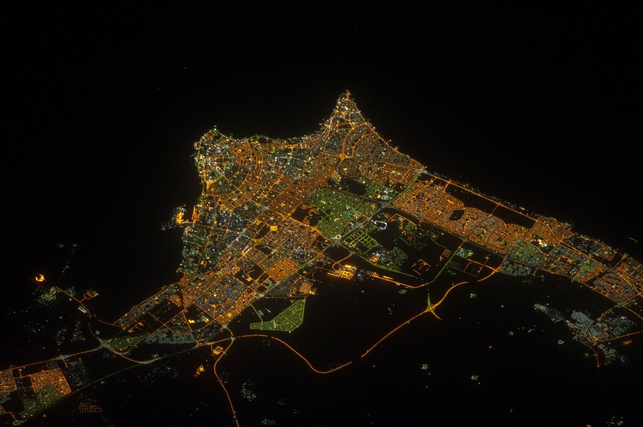
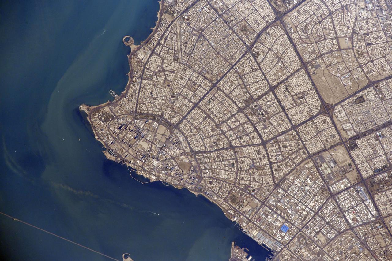
ISS032-E-017635 (9 Aug. 2012) --- A nighttime view of Kuwait City is featured in this image photographed by an Expedition 32 crew member on the International Space Station. Seen at night Kuwait City, the capital of the small Persian Gulf state of Kuwait, contrasts dramatically with the dark surface of the Persian Gulf (top) and the very sparsely populated desert area (bottom). Night views also show at a glance some aspects of urban geography that are difficult to perceive in daylight images. Here the focus of radial traffic arteries and ?ring roads? guide the eye to the financial center of the city?on the cape extending into Kuwait Bay north of the First Ring Road. The numbering of the ring roads shows the progressive southward development of the city, towards the Seventh Ring Road which still lies outside the built-up area at lower right. The striking differences in color of city lighting also provide information on the urban geography. Areas with lighting of a green tinge are, in each case, newer residential districts. The town of Al Ahmadi (lower right), known for its verdant vegetation, was built in 1946 when oil was struck and stands out with its characteristic blue night lights. Kuwait International Airport, like most major airports around the globe, is particularly bright due to the high concentration of lights.

STS080-733-021 (19 Nov.-7 Dec. 1996) --- The crewmembers of the Earth-orbiting space shuttle Columbia took this view that shows Kuwait City (mid-center right and along the coastal area), most of Kuwait, portions of Saudi Arabia, and Iraq. Faylakah Awhah Island is seen in the Persian Gulf to the bottom right. Most of the darkened areas represent the residual from oil well fires during the Gulf War of the early 1990?s.
iss064e021961 (Jan. 9, 2021) --- Kuwait City is pictured during a night time pass from the International Space Station as it orbited 261 miles above the Iraq-Saudi Arabia border. Towards the bottom left, is the Sheikh Jaber Al-Ahmad Al-Sabah Causeway, the world's fourth longest road bridge at 24.5 miles, that crosses Kuwait Bay.
iss067e169965 (July 1, 2022) --- The Khawr az-Zubayr Waterway (at bottom) separates the Middle Eastern nations of Kuwait and Iraq on the Persian Gulf coast. At top left, is the desert town of Abdali, Kuwait. At right, is the fertile, agricultural town of Abu Al-Khaseeb, Iraq. The International Space Station was orbiting 262 miles above Saudi Arabia near the island nation of Bahrain at the time this photograph was taken.
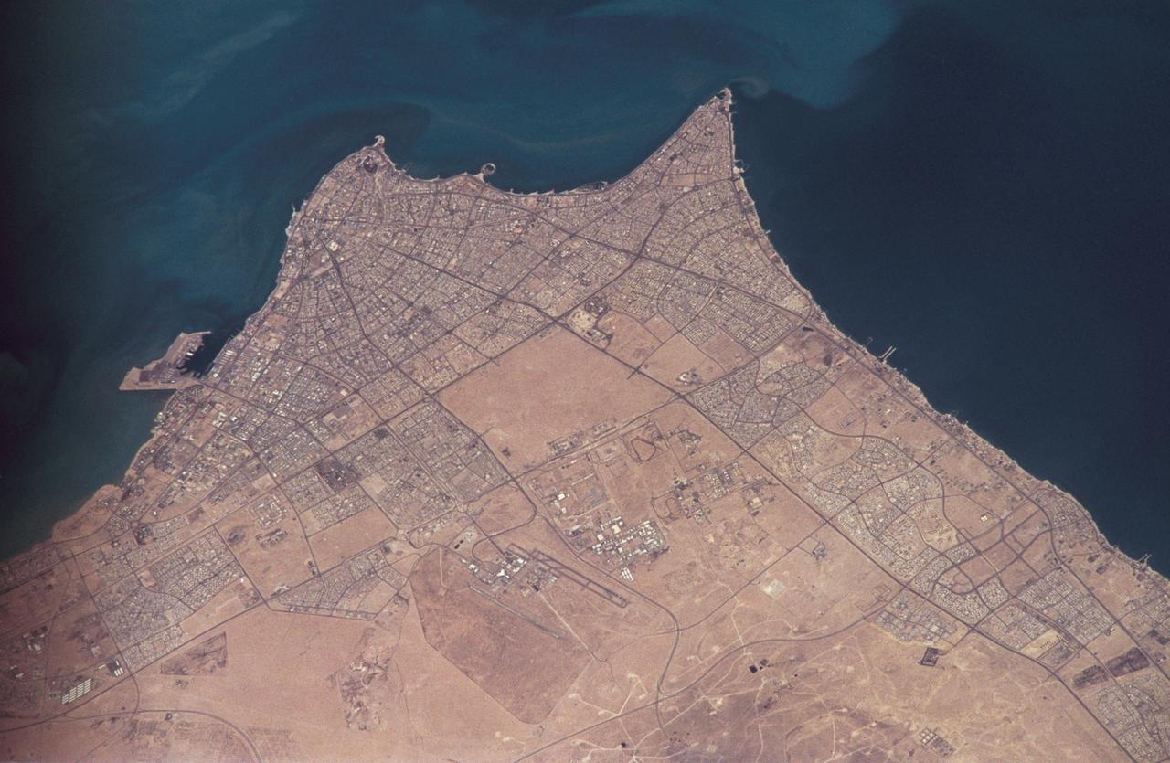
ISS032-E-023646 (15 Aug. 2012) --- This nighttime nadir view of Kuwait City, the coastal city which serves as Kuwait’s political and economic capital, was photographed by one of the Expedition 32 crew members from the International Space Station. The metropolitan area has a population approaching two and a half million. A 200-mm lens was used to record the image.
iss064e029028 (Feb. 2, 2021) --- The northern coast of the Persian Gulf, pictured from the International Space Station at an altitude of 262 miles, leads to the Middle Eastern nations of Kuwait, Iraq and Iran.
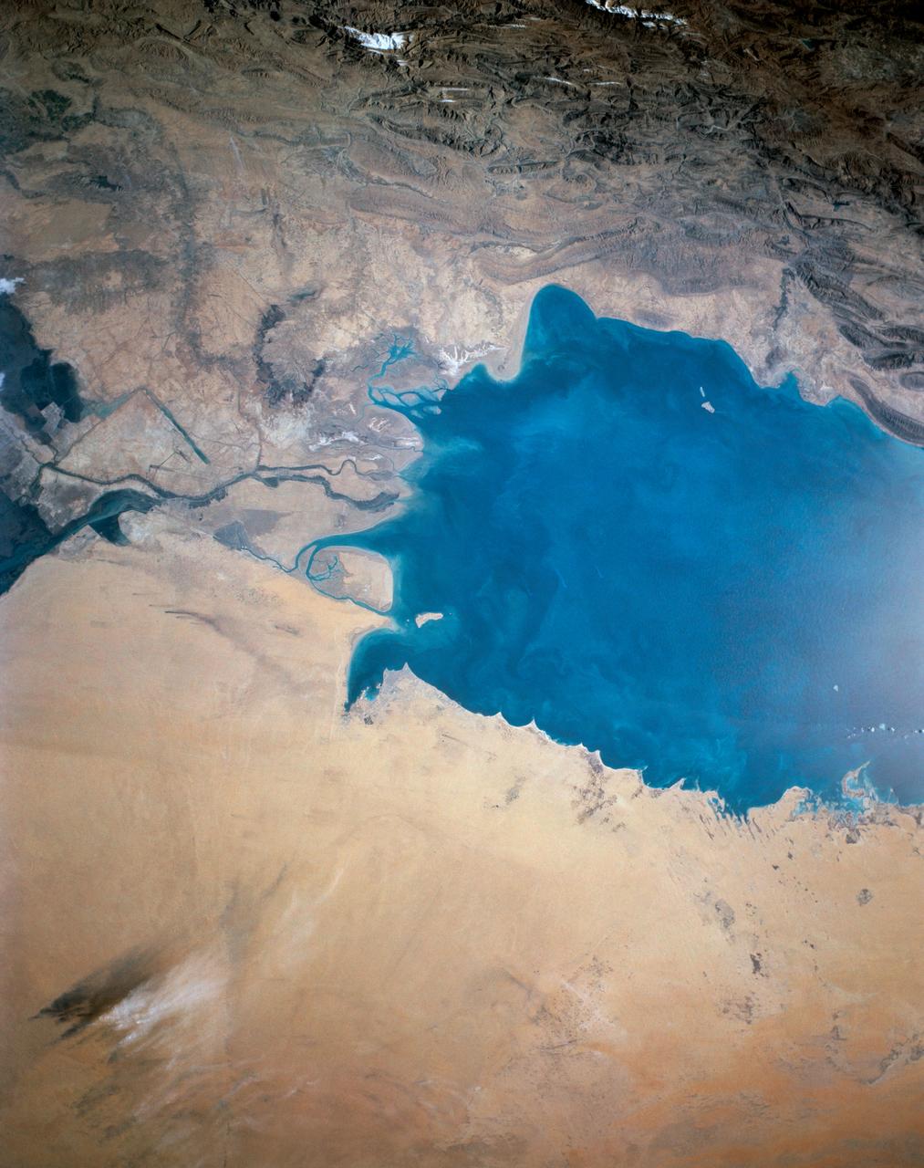
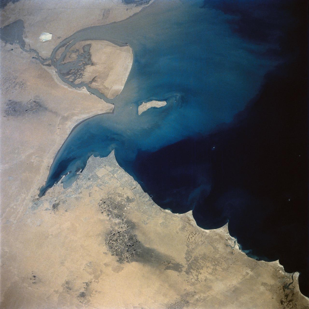
STS027-152-004 (2-6 Dec. 1988) --- Crew members for the STS-27 mission aboard the Earth-orbiting space shuttle Atlantis took this photo of the south Persian Gulf. with a hand-held, large format camera. The mouths of both the Tigris and Euphrates Rivers can be seen, as can nearly all the country of Kuwait. Photo credit: NASA
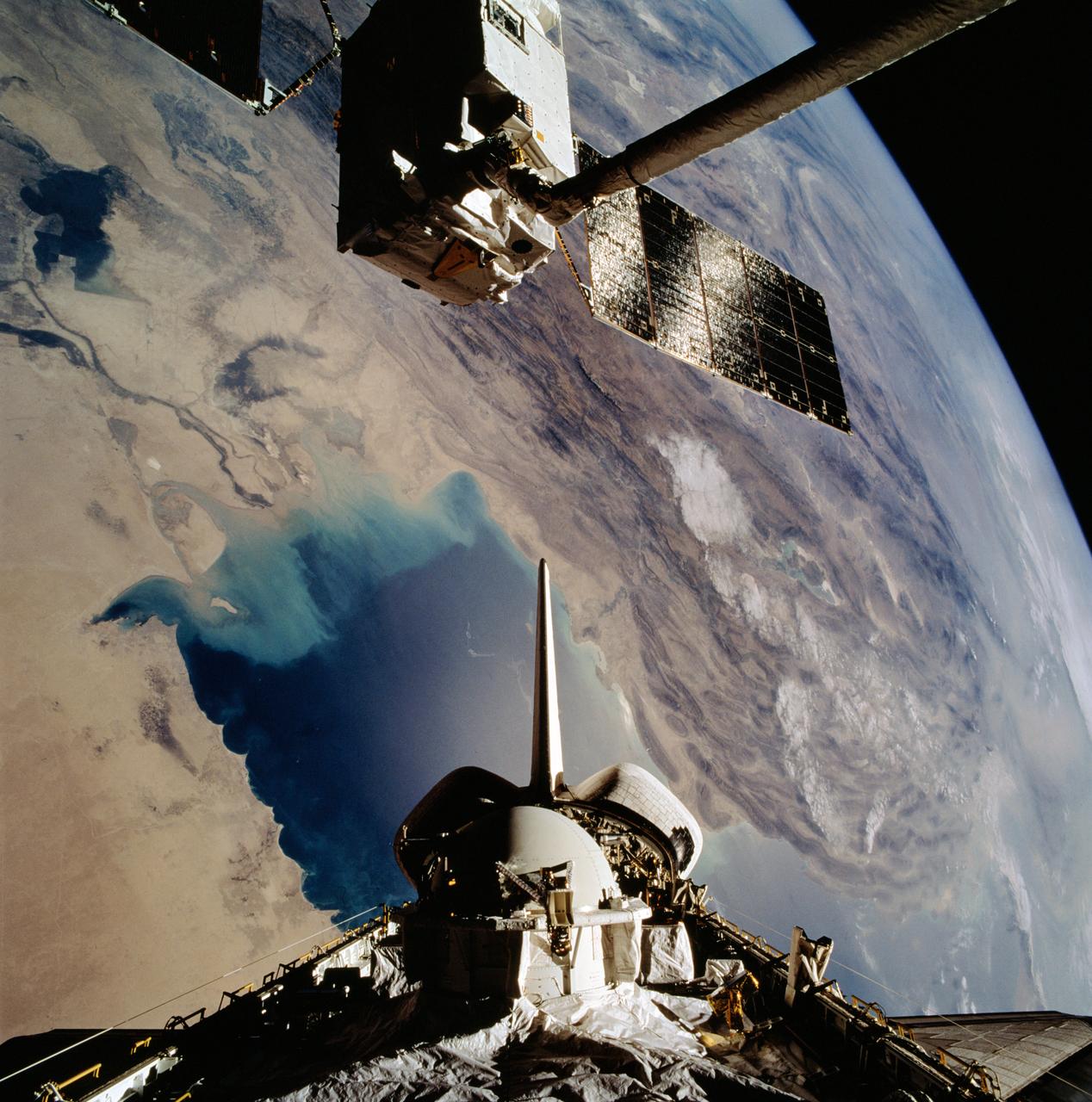
STS046-102-021 (1 Aug 1992) --- The European Space Agency's (ESA) EURECA satellite remains in the grasp of the Space Shuttle Atlantis' Remote Manipulator System (RMS) as the Space Shuttle passes over the Persian Gulf. Most of the theater of the recent war is visible in the frame. Parts of Kuwait, Iraq, Iran and Saudi Arabia can be delineated. The Tethered Satellite System (TSS) remains stowed in the aft cargo bay of Atlantis.
STS059-306-034 (9-20 April 1994) --- The radiating transportation pattern of this 20th-Century urban plan is nicely displayed in this high-resolution photograph. Light-toned spots in the desert mark oil well sites; along the south edge of the scene, some dark residue remains from the fires set during the recent Gulf War. Blown sand has nearly hidden the soot and thick oil that were deposited on the surface. Nikon photograph, 300mm lens.
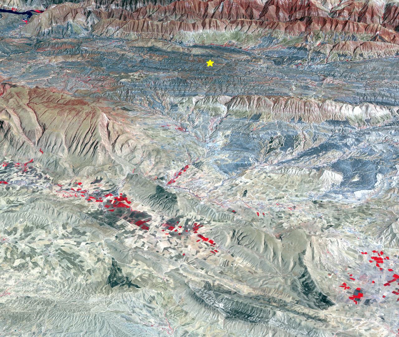
On Sunday, Nov. 12, 2017, a magnitude 7.3 earthquake struck along the Iran-Iraq border near Halabjah, Iraq. The earthquake was felt as far away as Kuwait, Qatar, Turkey, Lebanon and Israel. Extensive damage and numerous casualties were reported in the area near the epicenter (yellow star on image). The earthquake occurred along the boundary between the Arabian and Eurasian tectonic plates. This is an earthquake-prone area, and has experienced many deadly earthquakes in the past. In this perspective-view image, bright red areas are crops in fields, pale red on mountain ridges are shrubs and trees, dark gray areas are traces of earlier brush fires, and gray and tan colors are different rock types. The image was acquired Sept. 8, 2017, and the star marks the earthquake epicenter at 34.9 degrees north, 45.9 degrees east. https://photojournal.jpl.nasa.gov/catalog/PIA22112