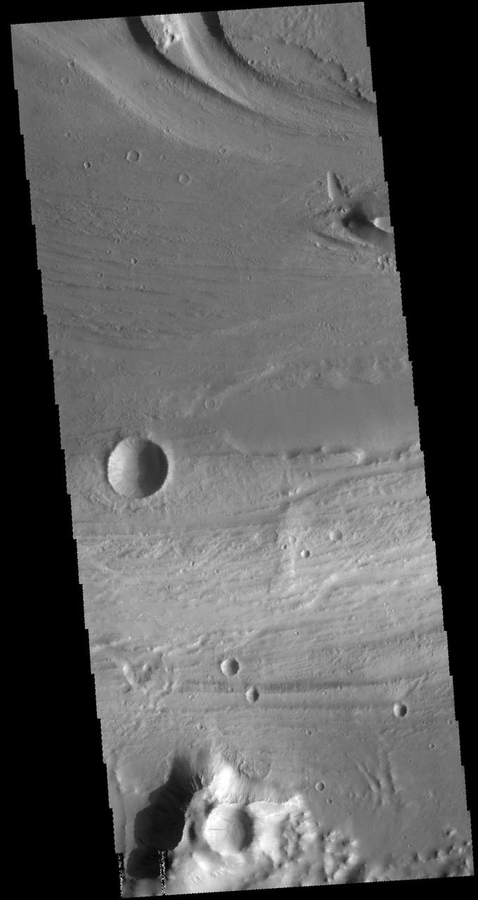
Kasei Valles
Kasei Valles
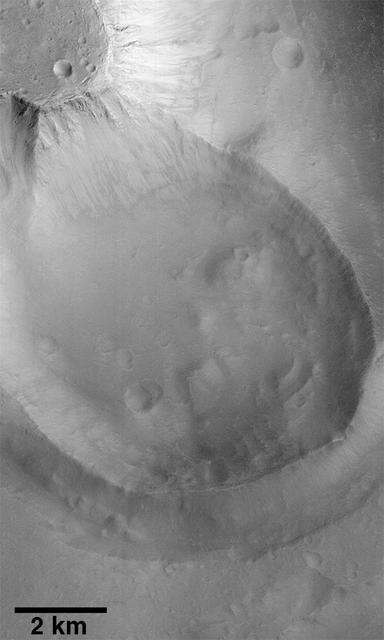
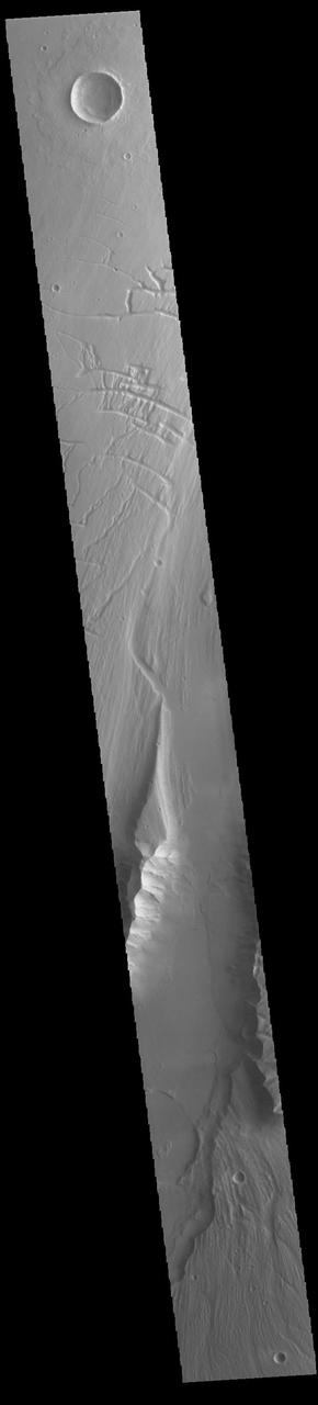
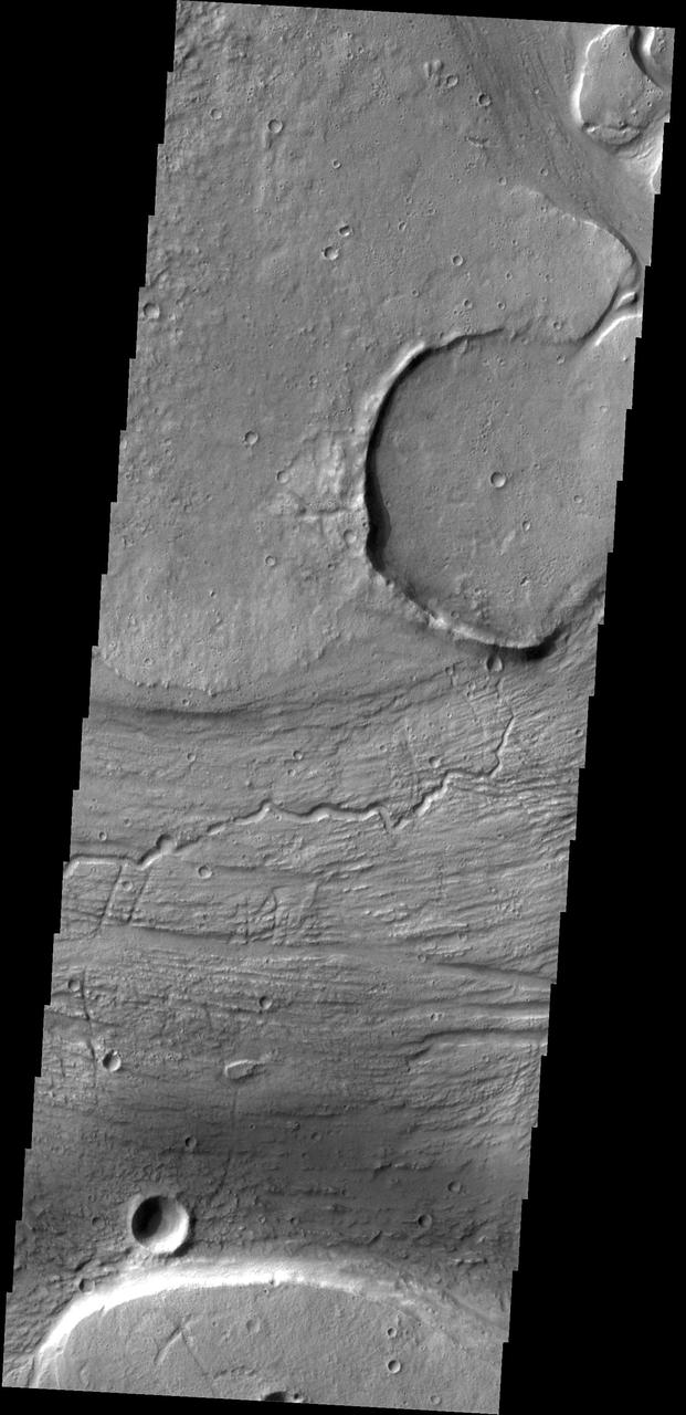
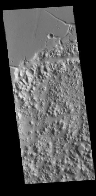
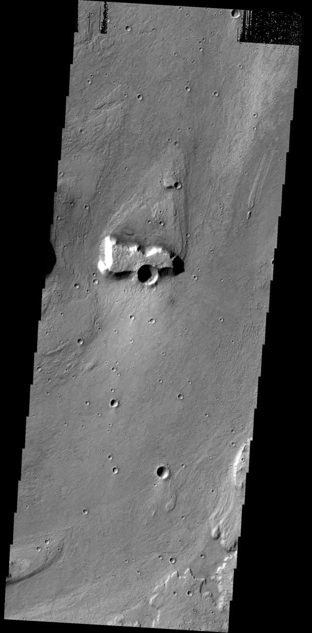
Exhumed Crater in Kasei Valles
Kasei Valles Scene
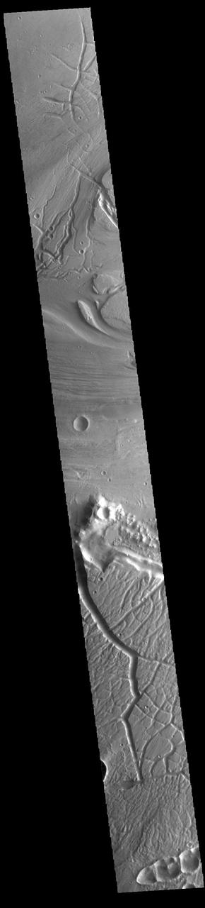
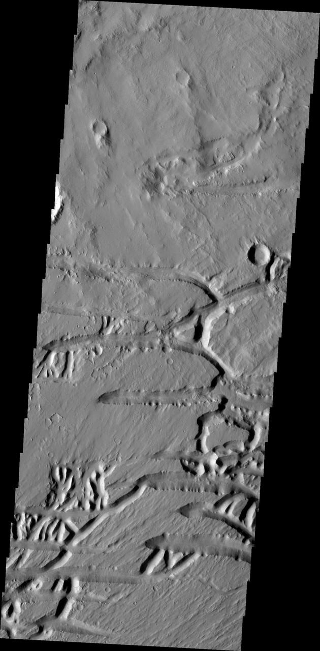
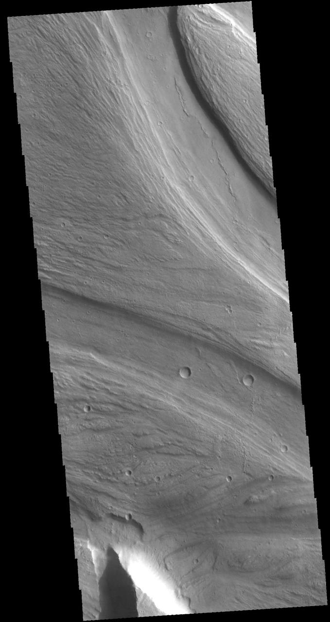
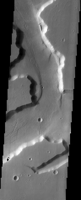
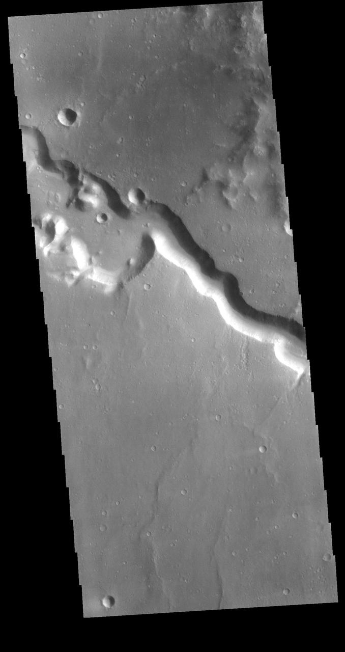
Kasei Valles Flow
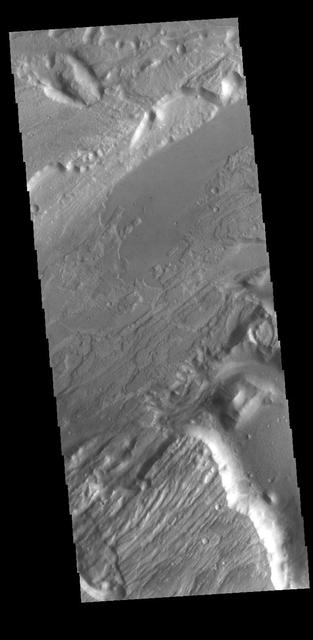
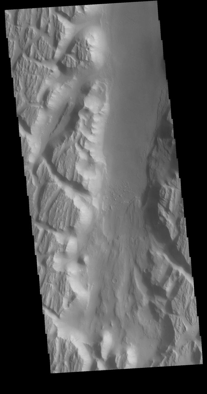
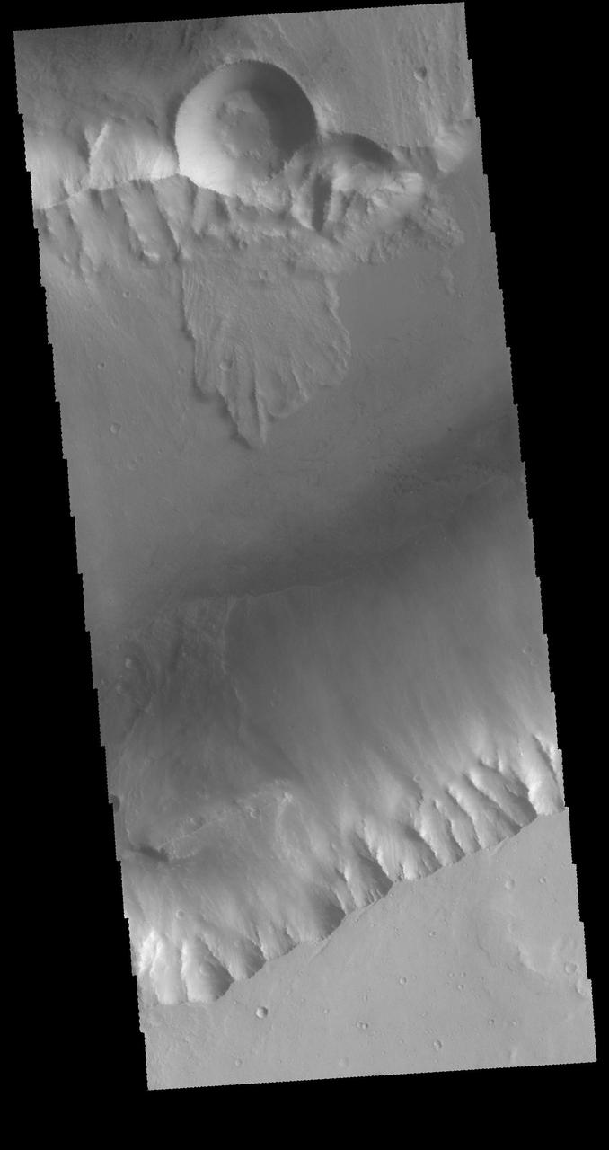
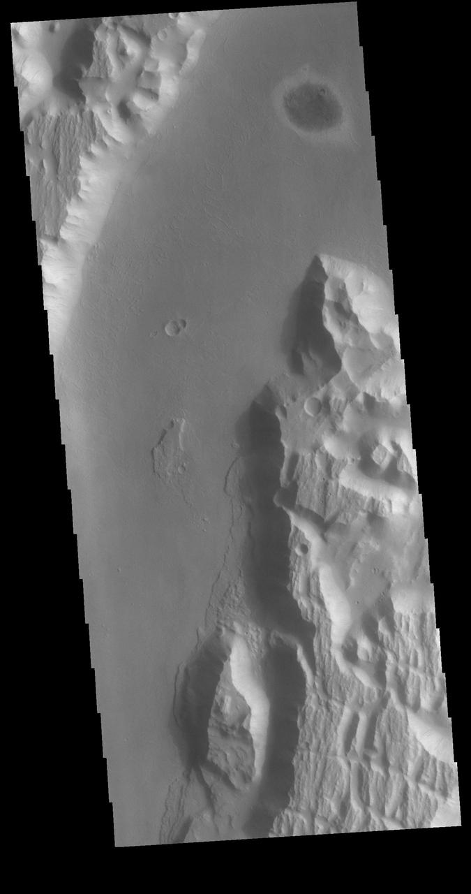
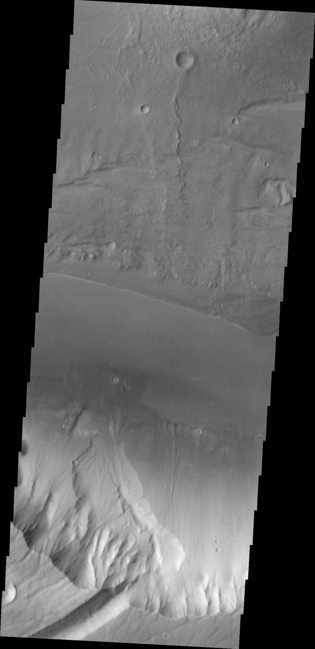
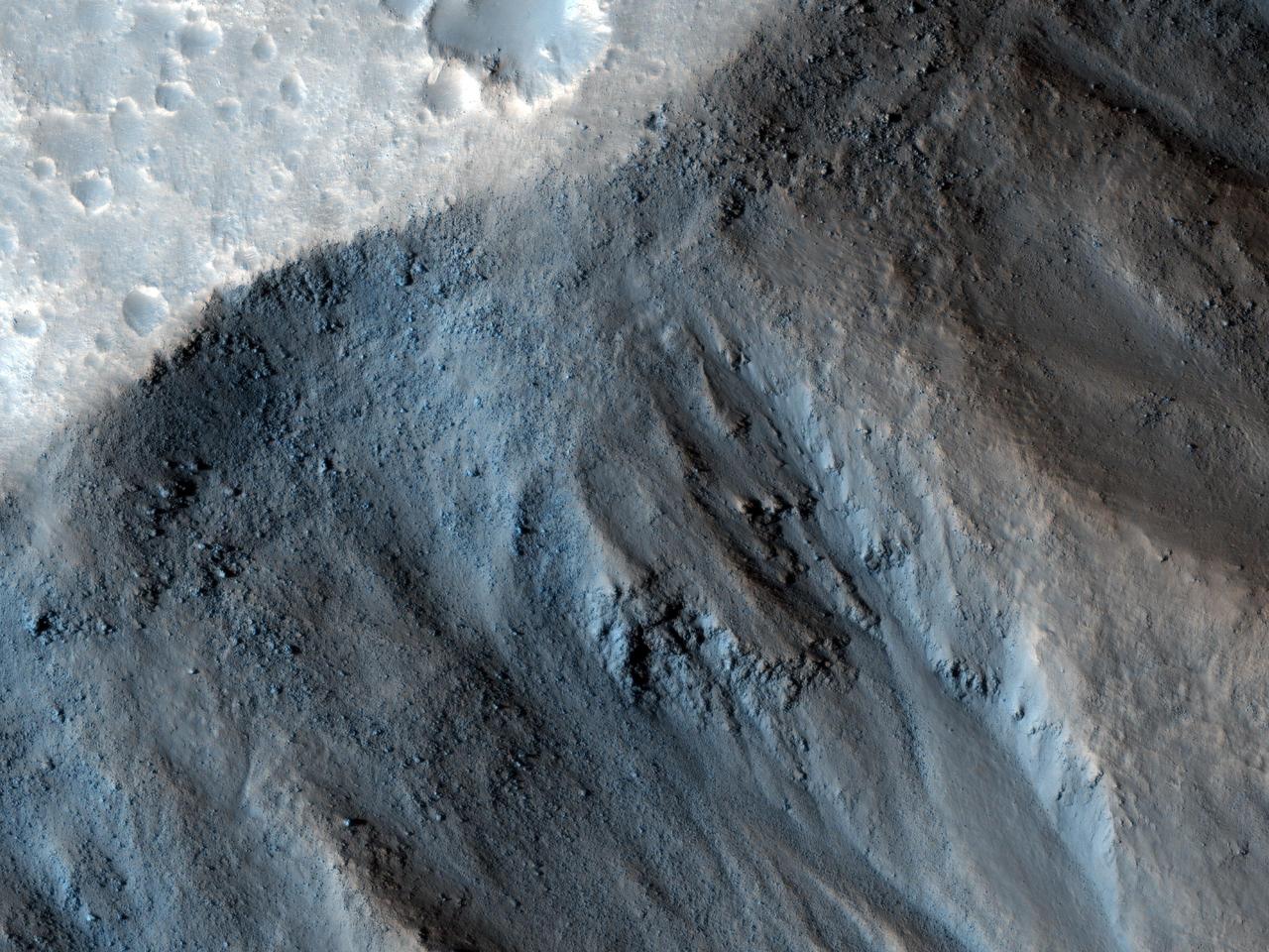
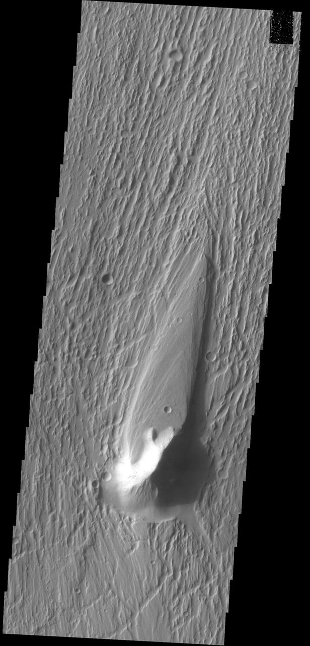
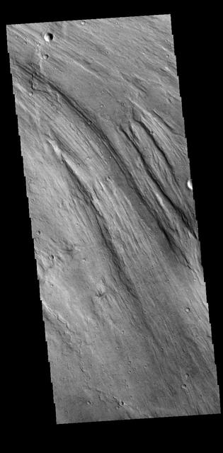
Landslide in Kasei Valles
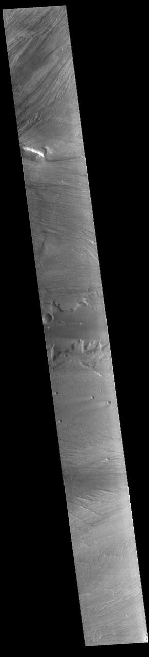
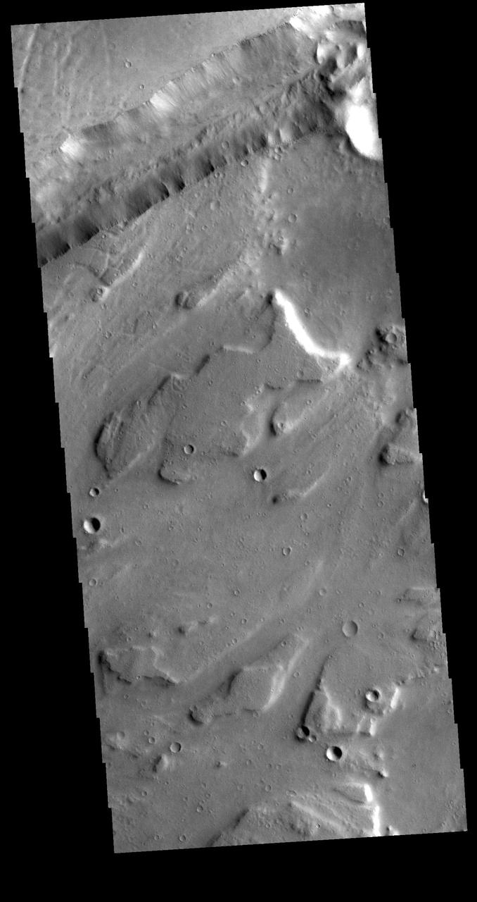
Floor of Kasei Valles
Kasei Valles Flow
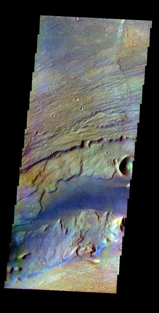
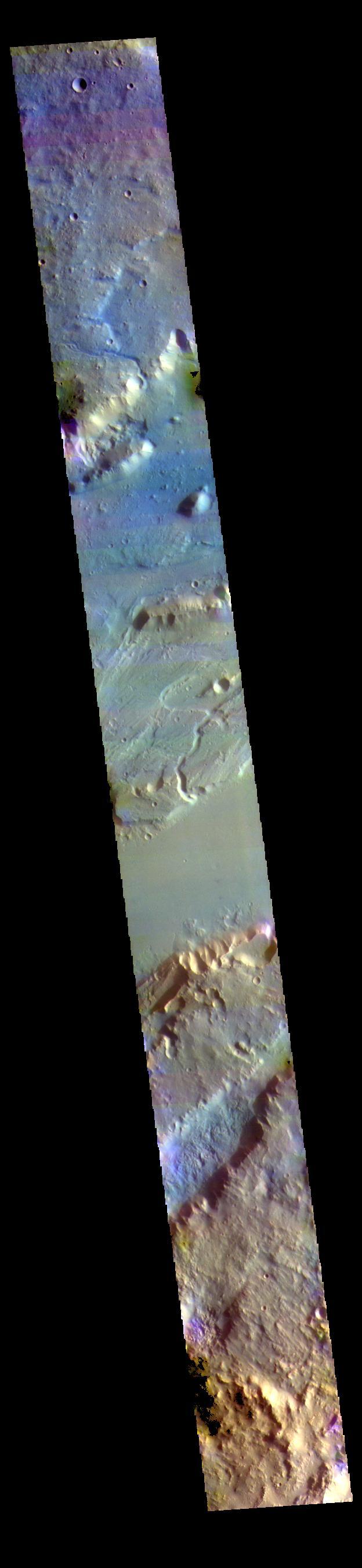
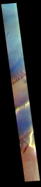
This image was collected July 17, 2002 during northern spring season. The local time at the image location was about 4 pm. The image shows an area in the Kasei Valles region. The THEMIS VIS camera is capable of capturing color images of the martian surface using its five different color filters. In this mode of operation, the spatial resolution and coverage of the image must be reduced to accommodate the additional data volume produced from the use of multiple filters. To make a color image, three of the five filter images (each in grayscale) are selected. Each is contrast enhanced and then converted to a red, green, or blue intensity image. These three images are then combined to produce a full color, single image. Because the THEMIS color filters don't span the full range of colors seen by the human eye, a color THEMIS image does not represent true color. Also, because each single-filter image is contrast enhanced before inclusion in the three-color image, the apparent color variation of the scene is exaggerated. Nevertheless, the color variation that does appear is representative of some change in color, however subtle, in the actual scene. Note that the long edges of THEMIS color images typically contain color artifacts that do not represent surface variation. Image information: VIS instrument. Latitude 25.3, Longitude 298.8 East (61.2 West). 38 meter/pixel resolution. http://photojournal.jpl.nasa.gov/catalog/PIA06372
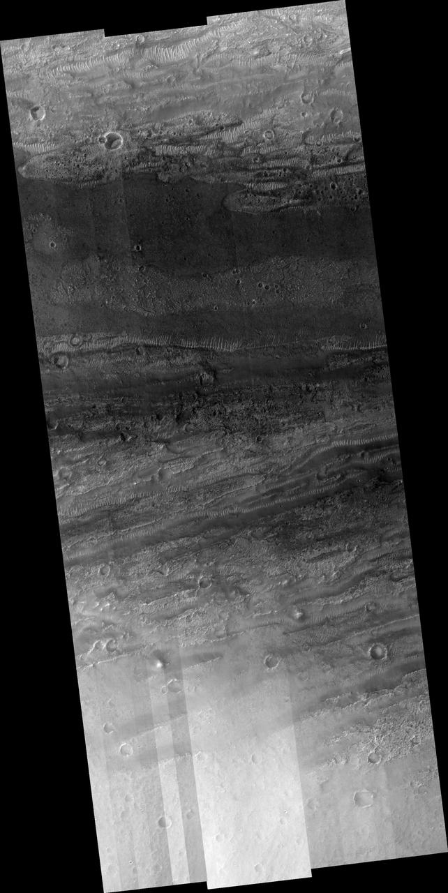
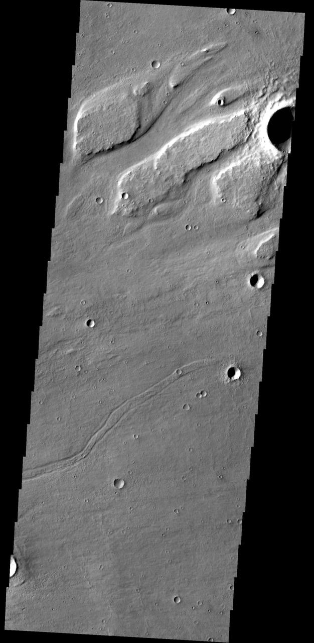
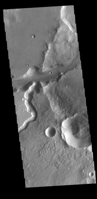
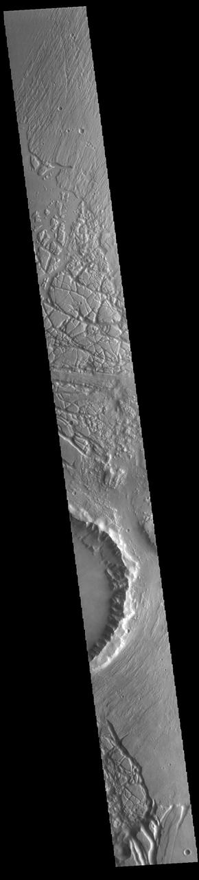
Kasei Valles is one of the largest outflow channels on Mars. This NASA Mars Odyssey image is of the northern branch of Kasei Valles and shows the channel floor and northern channel wall.
This image captured by NASA Mars Odyssey shows the southwestern part of Kasei Valles.
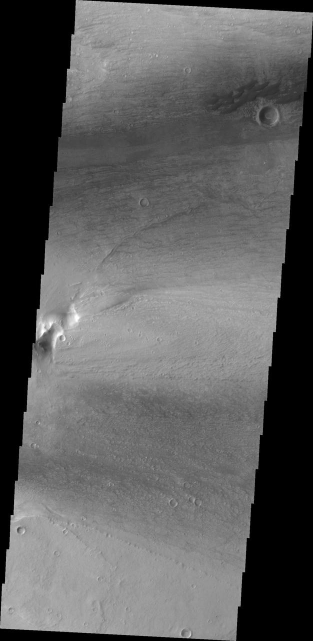
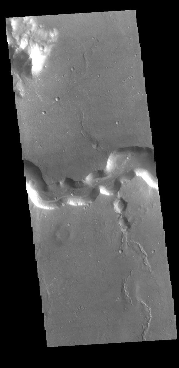
Today's VIS image shows a portion of Kasei Valles. Kasei Valles is one of the largest outflow channel systems on Mars, in places up to 482 km (300 miles) wide and 1580 km (982 miles) long. For comparison, the Grand Canyon in Arizona is is only 29 km (18 miles) at its widest and only 446 km (277 miles) long. Kasei Valles flows eastward through Lunae Planum and empties into Chryse Planitia. Orbit Number: 85218 Latitude: 21.7275 Longitude: 288.166 Instrument: VIS Captured: 2021-03-01 03:56 https://photojournal.jpl.nasa.gov/catalog/PIA24821
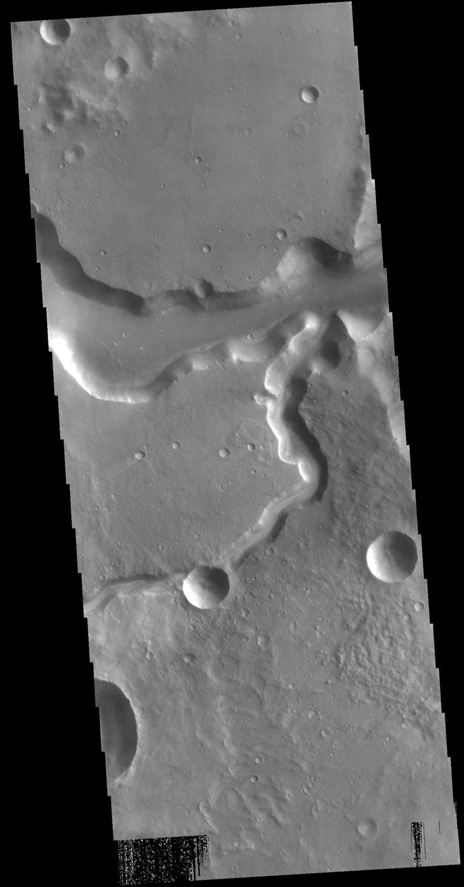
Today's VIS image shows a portion of Kasei Valles. Kasei Valles is one of the largest outflow channel systems on Mars, in places up to 482 km (300 miles) wide and 1580 km (982 miles) long. For comparison, the Grand Canyon in Arizona is is only 29 km (18 miles) at its widest and only 446 km (277 miles) long. Kasei Valles flows eastward through Lunae Planum and empties into Chryse Planitia. Orbit Number: 93978 Latitude: 24.9563 Longitude: 287.171 Instrument: VIS Captured: 2023-02-20 11:01 https://photojournal.jpl.nasa.gov/catalog/PIA25939
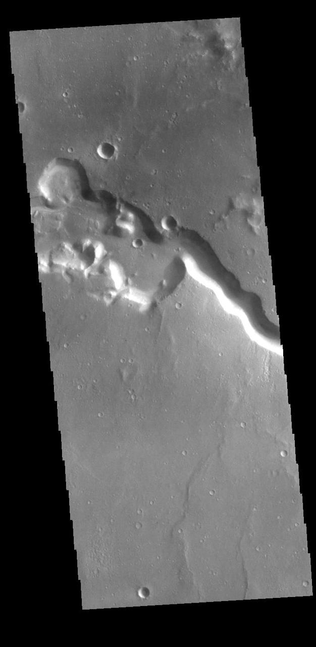
Today's VIS image shows a portion of Kasei Valles. Kasei Valles is one of the largest outflow channel systems on Mars, in places up to 482 km (300 miles) wide and 1580 km (982 miles) long. For comparison, the Grand Canyon in Arizona is is only 29 km (18 miles) at its widest and only 446 km (277 miles) long. Kasei Valles flows eastward through Lunae Planum and empties into Chryse Planitia. Orbit Number: 93928 Latitude: 25.9137 Longitude: 289.462 Instrument: VIS Captured: 2023-02-16 08:13 https://photojournal.jpl.nasa.gov/catalog/PIA25927
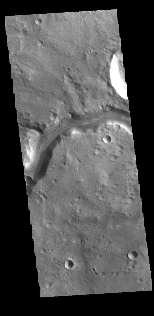
Today's VIS image shows a portion of Kasei Valles. Kasei Valles is one of the largest outflow channel systems on Mars, in places up to 482 km (300 miles) wide and 1580 km (982 miles) long. For comparison, the Grand Canyon in Arizona is is only 29 km (18 miles) at its widest and only 446 km (277 miles) long. Kasei Valles flows eastward through Lunae Planum and empties into Chryse Planitia. Orbit Number: 80538 Latitude: 24.6507 Longitude: 300.343 Instrument: VIS Captured: 2020-02-09 19:44 https://photojournal.jpl.nasa.gov/catalog/PIA23845
Today's VIS image shows a portion of Kasei Valles. Kasei Valles is one of the largest outflow channel systems on Mars, in places up to 482 km (300 miles) wide and 1580 km (982 miles) long. For comparison, the Grand Canyon in Arizona is is only 29 km (18 miles) at its widest and only 446 km (277 miles) long. Kasei Valles flows eastward through Lunae Planum and empties into Chryse Planitia. Orbit Number: 85280 Latitude: 25.2042 Longitude: 299.095 Instrument: VIS Captured: 2021-03-06 06:28 https://photojournal.jpl.nasa.gov/catalog/PIA24822
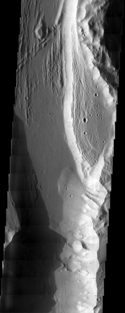
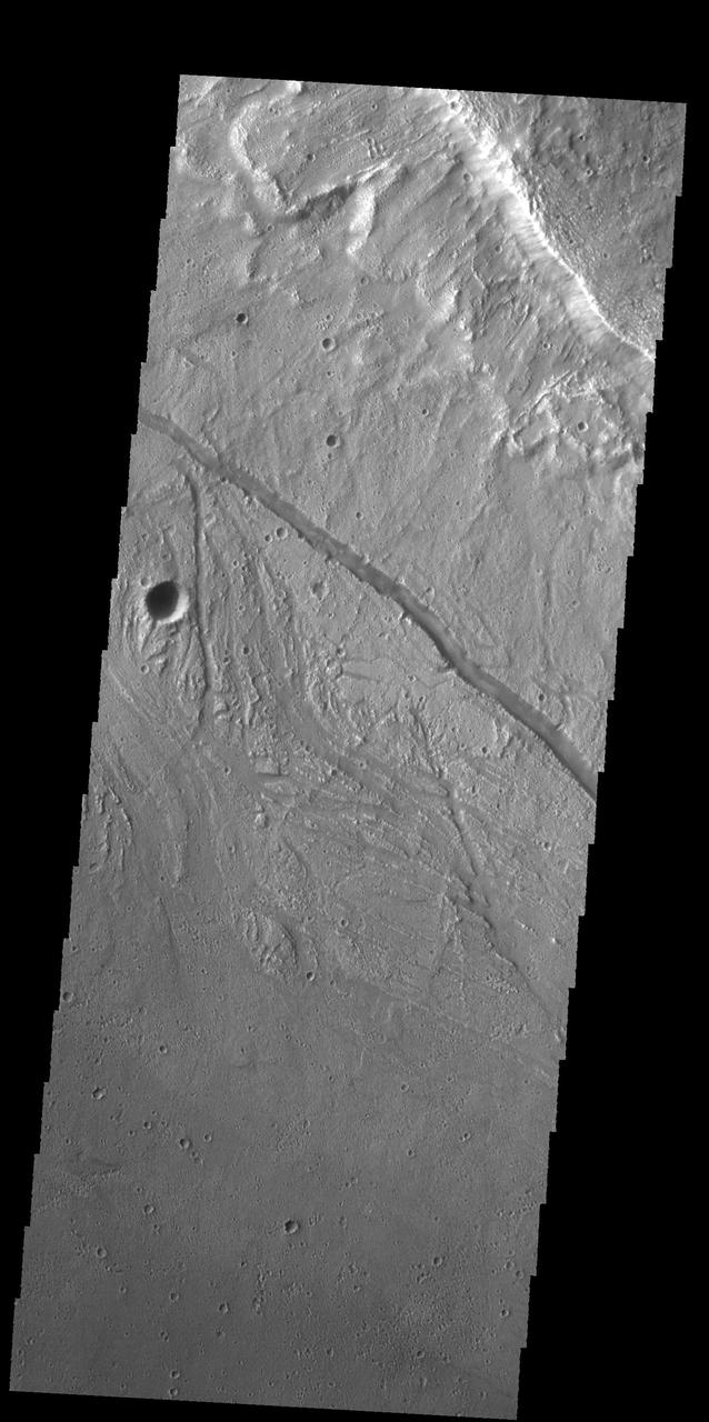
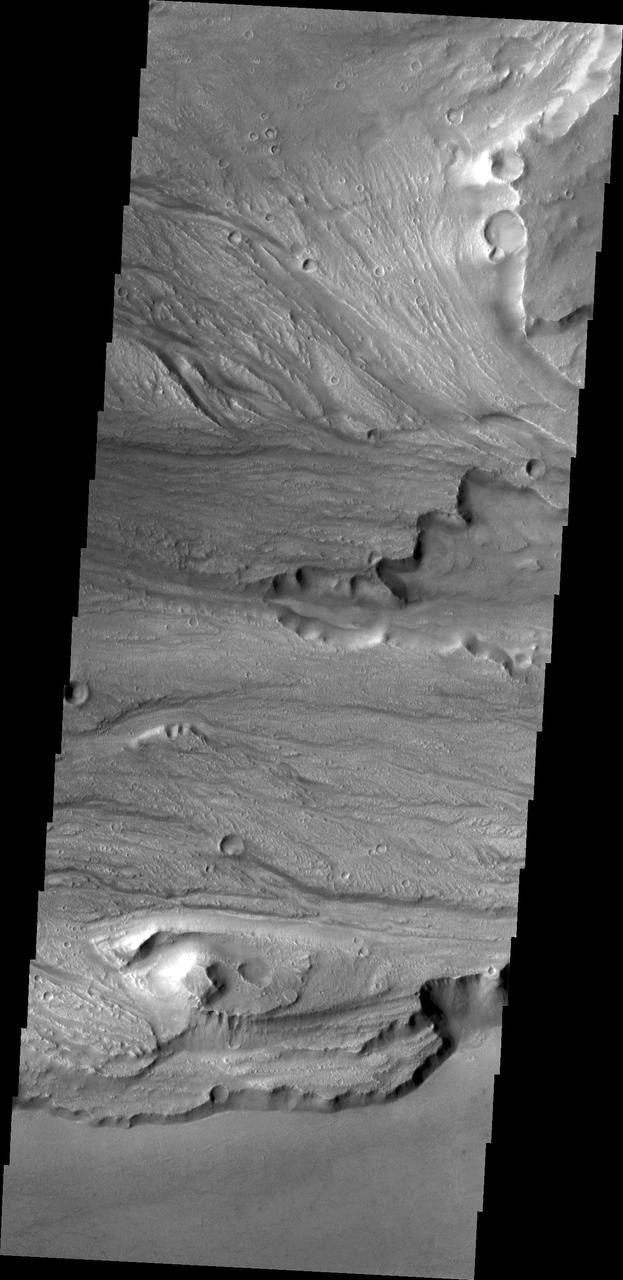
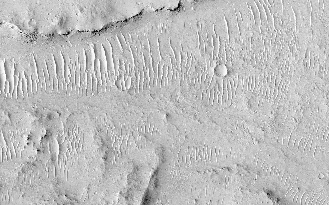
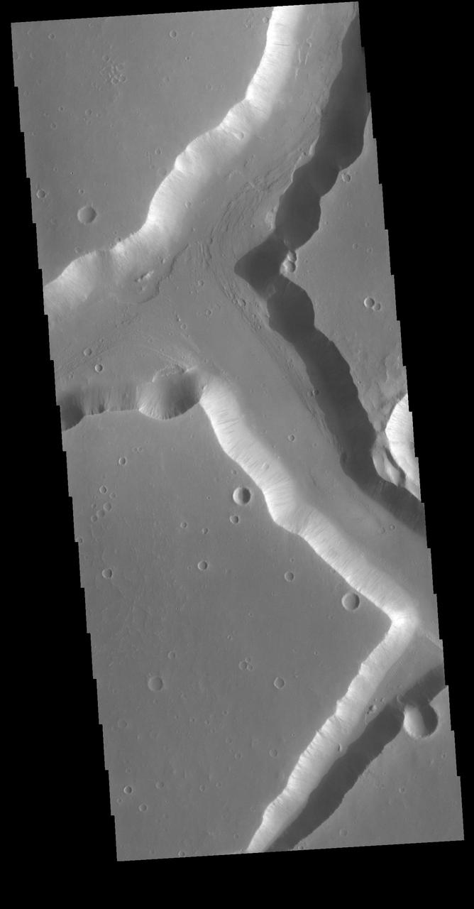
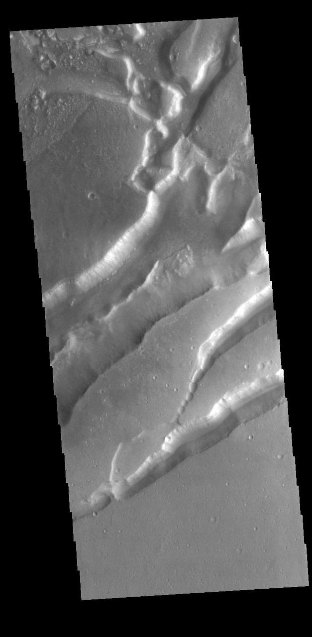
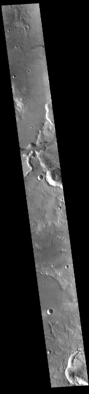
This VIS image shows a portion of Kasei Valles. In the region of this image Kasei Valles is flowing northward from Vallis Marineris. This image contains both fluvial features and tectonic features. The linear features running across the image from the lower right to the upper left are fractures created by tectonic forces. The ones running vertically were created by fluid flow. Kasei Valles is one of the largest outflow channels on Mars and catastrophic flooding carved this massive channel. Orbit Number: 79091 Latitude: 19.5912 Longitude: 286.26 Instrument: VIS Captured: 2019-10-13 16:12 https://photojournal.jpl.nasa.gov/catalog/PIA23565

Today's VIS image shows a portion of Kasei Valles. Kasei Valles is one of the largest outflow channel systems on Mars, in places up to 482 km (300 miles) wide and 1580 km (982 miles) long. For comparison, the Grand Canyon in Arizona is is only 29 km (18 miles) at its widest and only 446 km (277 miles) long. Kasei Valles flows eastward through Lunae Planum and empties into Chryse Planitia. Orbit Number: 88163 Latitude: 22.243 Longitude: 288.106 Instrument: VIS Captured: 2021-10-29 15:37 https://photojournal.jpl.nasa.gov/catalog/PIA25153
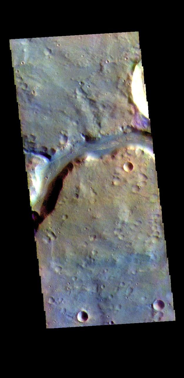
![Today's VIS image shows the region where the northward flow of Kasei Valles turns to the east having split into two large channels. This image is located in the southern branch of Kasei Valles, called the Kasei Valles Canyon. Arising from Vallis Marineris and ending in Chryse Planitia, the valles is over 1,580 km long (982 miles), making Kasei Valles one of the largest outflow channels on Mars. [The US/Canadian border from eastern Montana to western Idaho is ~ 972 miles in length.] Orbit Number: 79041 Latitude: 21.9093 Longitude: 288.446 Instrument: VIS Captured: 2019-10-09 13:24 https://photojournal.jpl.nasa.gov/catalog/PIA23562](https://images-assets.nasa.gov/image/PIA23562/PIA23562~medium.jpg)
Today's VIS image shows the region where the northward flow of Kasei Valles turns to the east having split into two large channels. This image is located in the southern branch of Kasei Valles, called the Kasei Valles Canyon. Arising from Vallis Marineris and ending in Chryse Planitia, the valles is over 1,580 km long (982 miles), making Kasei Valles one of the largest outflow channels on Mars. [The US/Canadian border from eastern Montana to western Idaho is ~ 972 miles in length.] Orbit Number: 79041 Latitude: 21.9093 Longitude: 288.446 Instrument: VIS Captured: 2019-10-09 13:24 https://photojournal.jpl.nasa.gov/catalog/PIA23562
There are several streamlined islands in this image of Kasei Valles. This image captured by NASA 2001 Mars Odyssey spacecraft is located near the region where Kasei Valles empties into Chryse Planitia.
This image from NASA 2001 Mars Odyssey spacecraftshows a small portion of Kasei Valles, one of the largest channel systems on Mars.
The small channels in this image from NASA 2001 Mars Odyssey spacecraft are located within the much larger Kasei Valles channel.
This image captured by NASA Mars Odyssey shows a portion of the northern branch of Kasei Valles.
This image from NASA 2001 Mars Odyssey spacecraft shows streamlined islands within part of Kasei Valles.
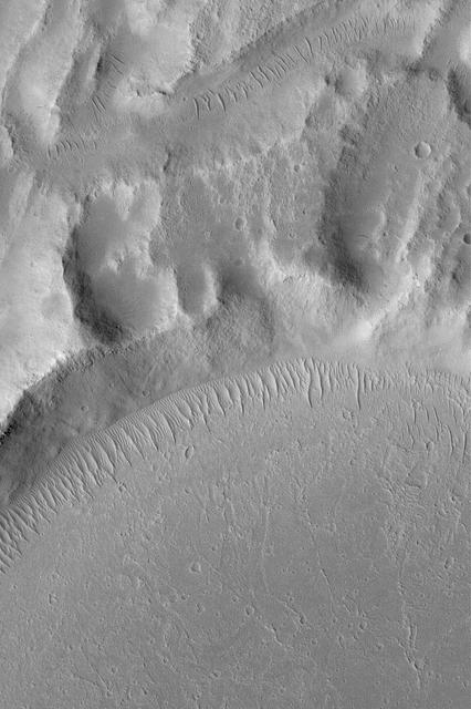
This image taken by NASA 2001 Mars Odyssey shows secondary channeling on a terrace of the huge Kasei Valles outflow system.
Almost Silent Rolling Stones in Kasei Valles
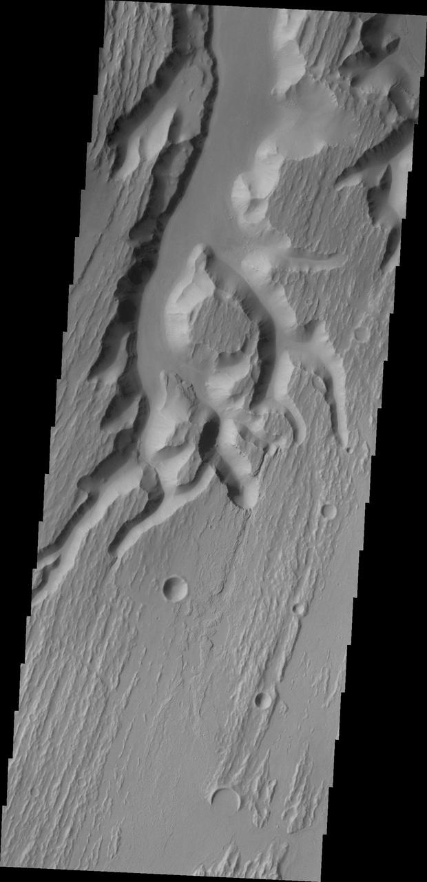
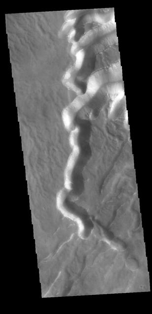
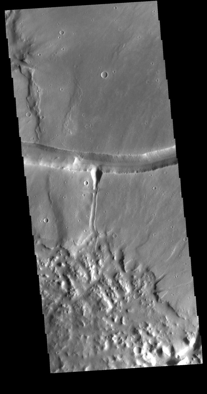
This VIS image shows a portion of Kasei Valles. Kasei Valles is a large channel system that drained from the Tharsis volcanic highlands to the lower elevation Chryse Plainitia. At the top of the image is a deeper section of the channel with a tear-drop shaped central island. The direction of fluid flow is identified by the shape of the island, with the narrow "tail" on the down hill end. Orbit Number: 64185 Latitude: 26.0042 Longitude: 289.472 Instrument: VIS Captured: 2016-06-02 19:34 http://photojournal.jpl.nasa.gov/catalog/PIA20798
The channels, both large and small, in this image from NASA 2001 Mars Odyssey spacecraft are part of Kasei Valles near its terminus in Chryse Planitia.
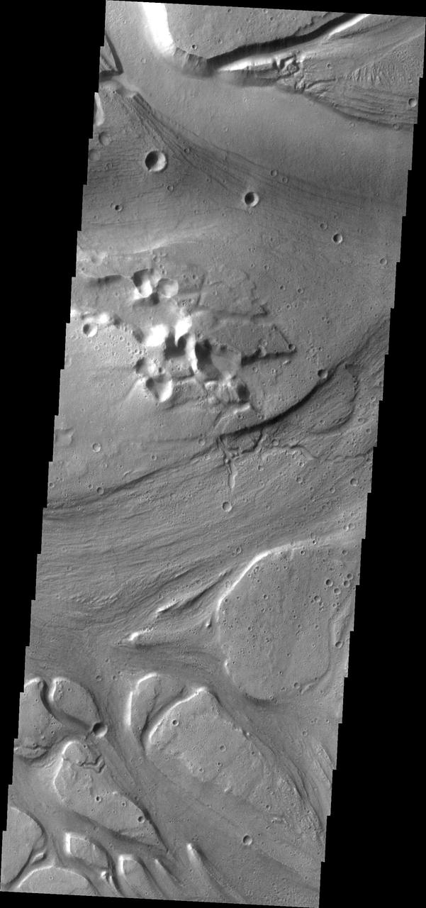
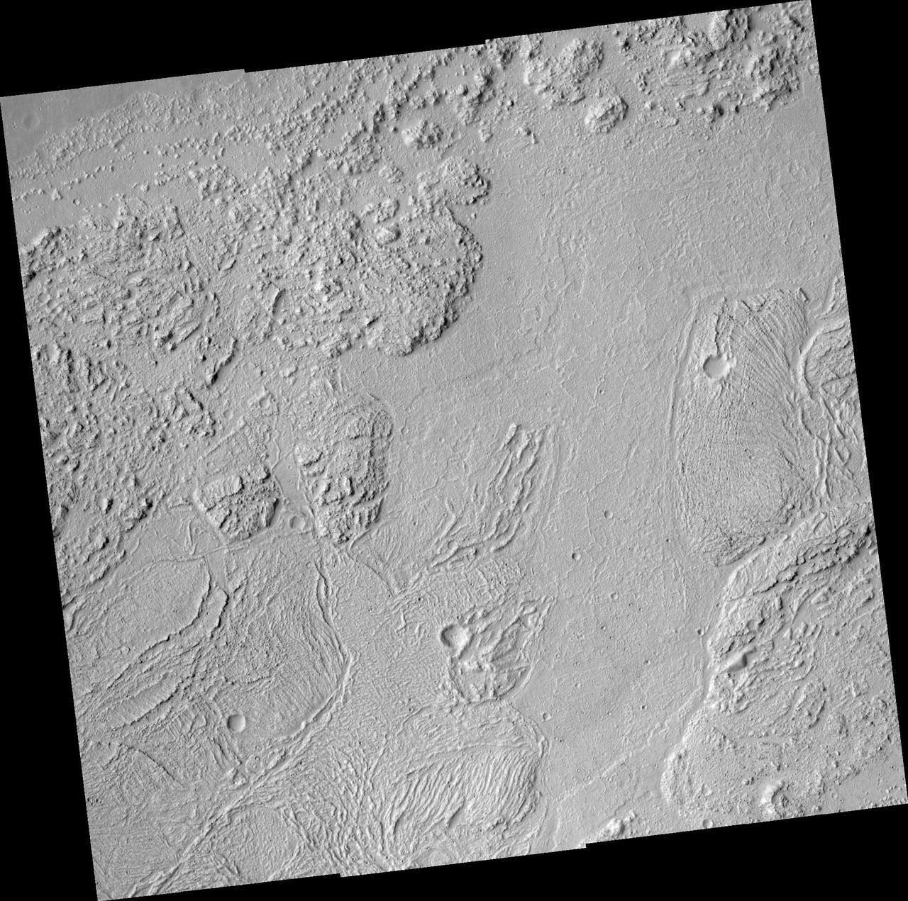
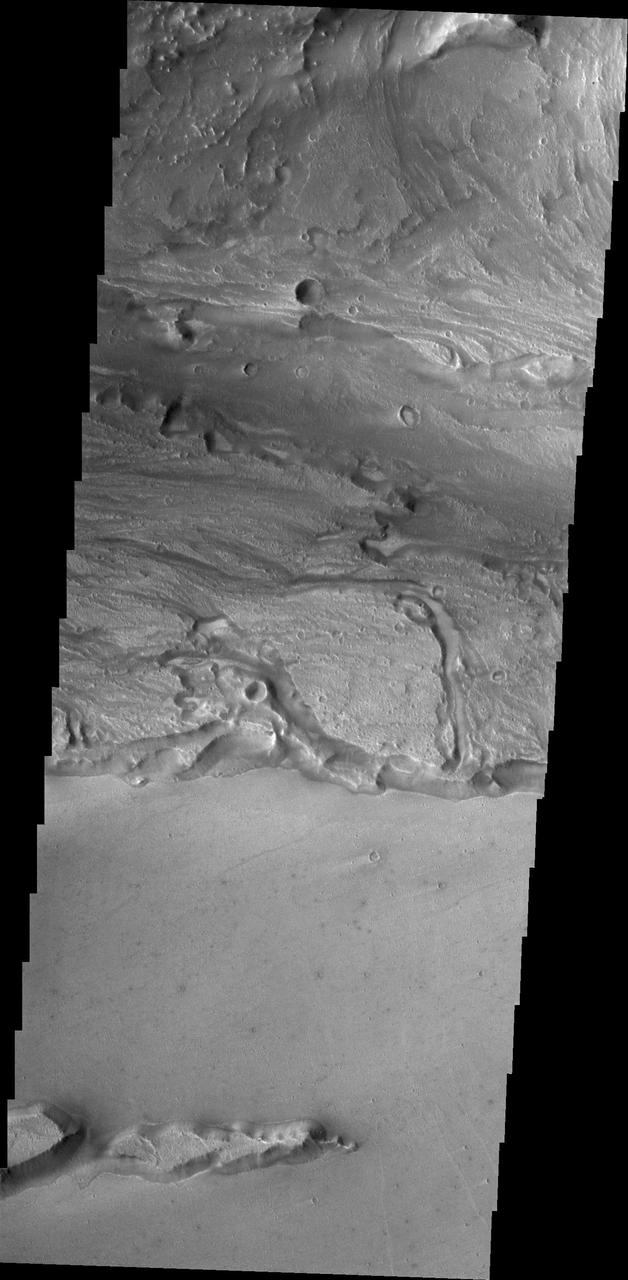
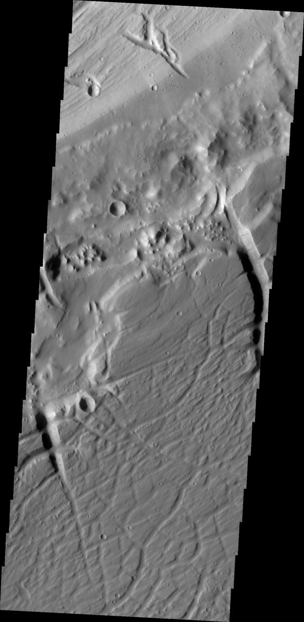
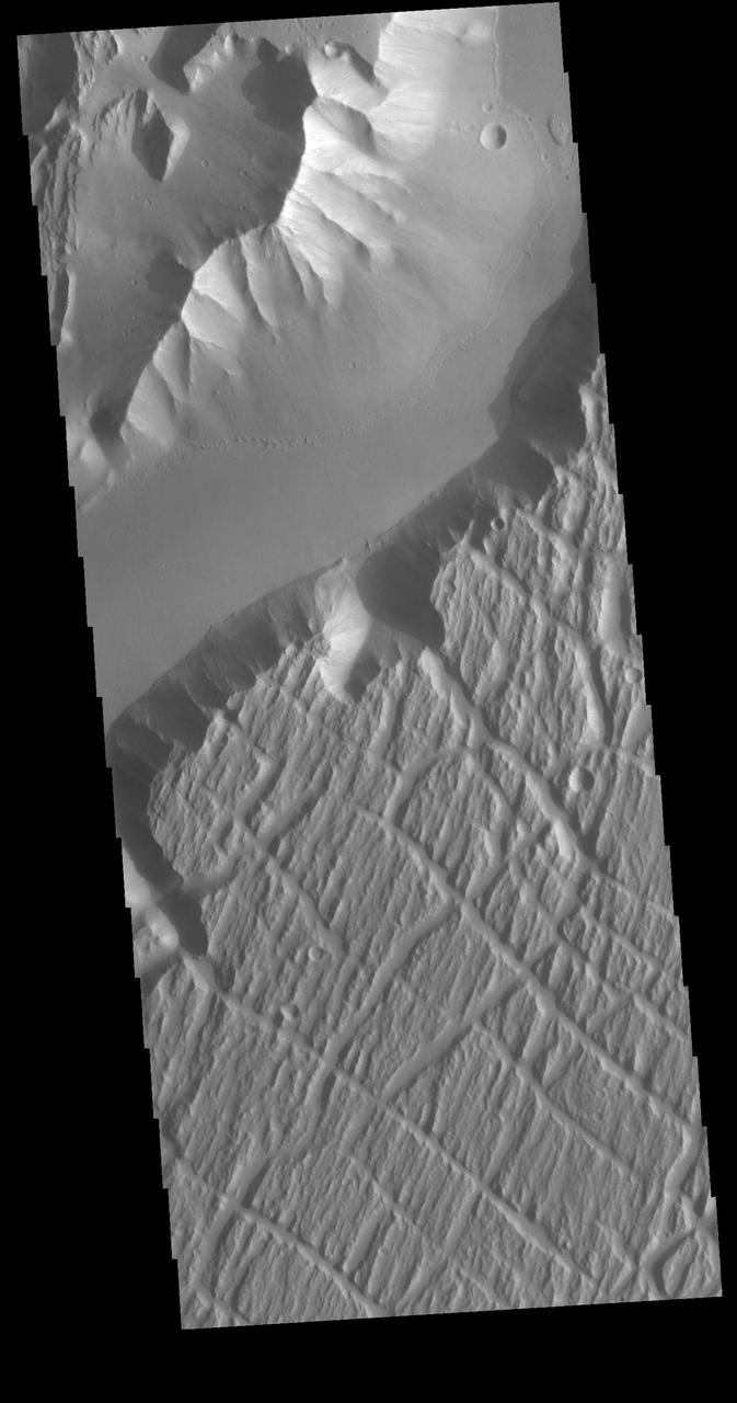
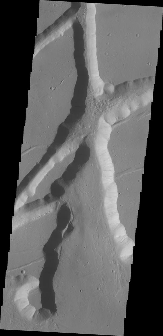
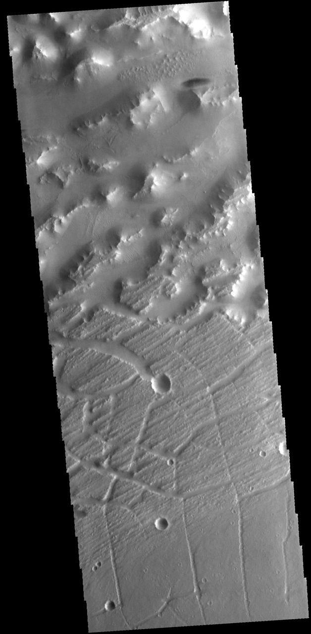
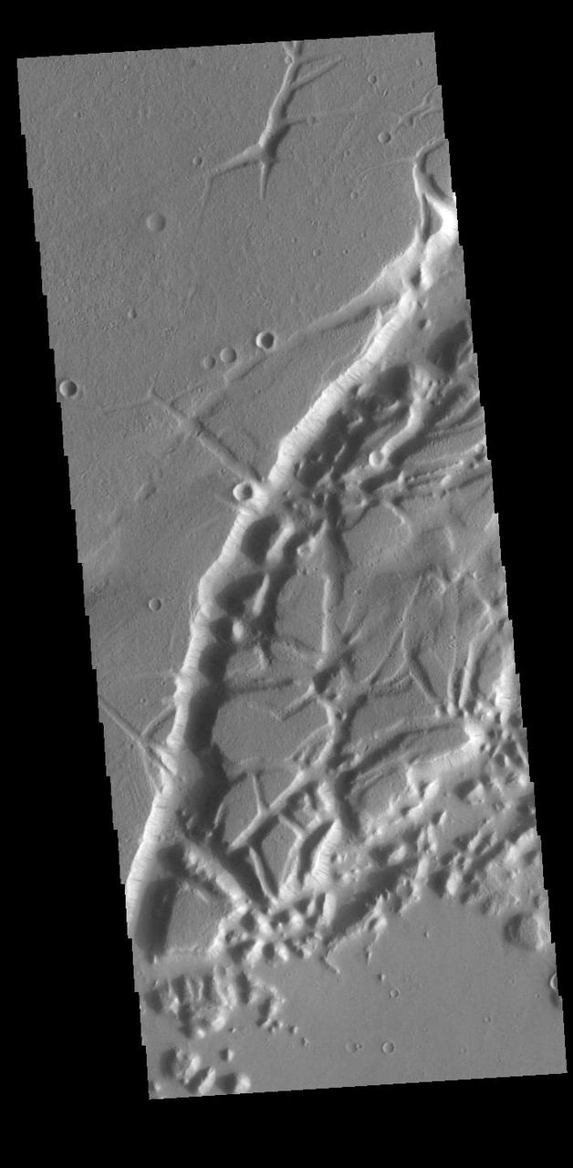
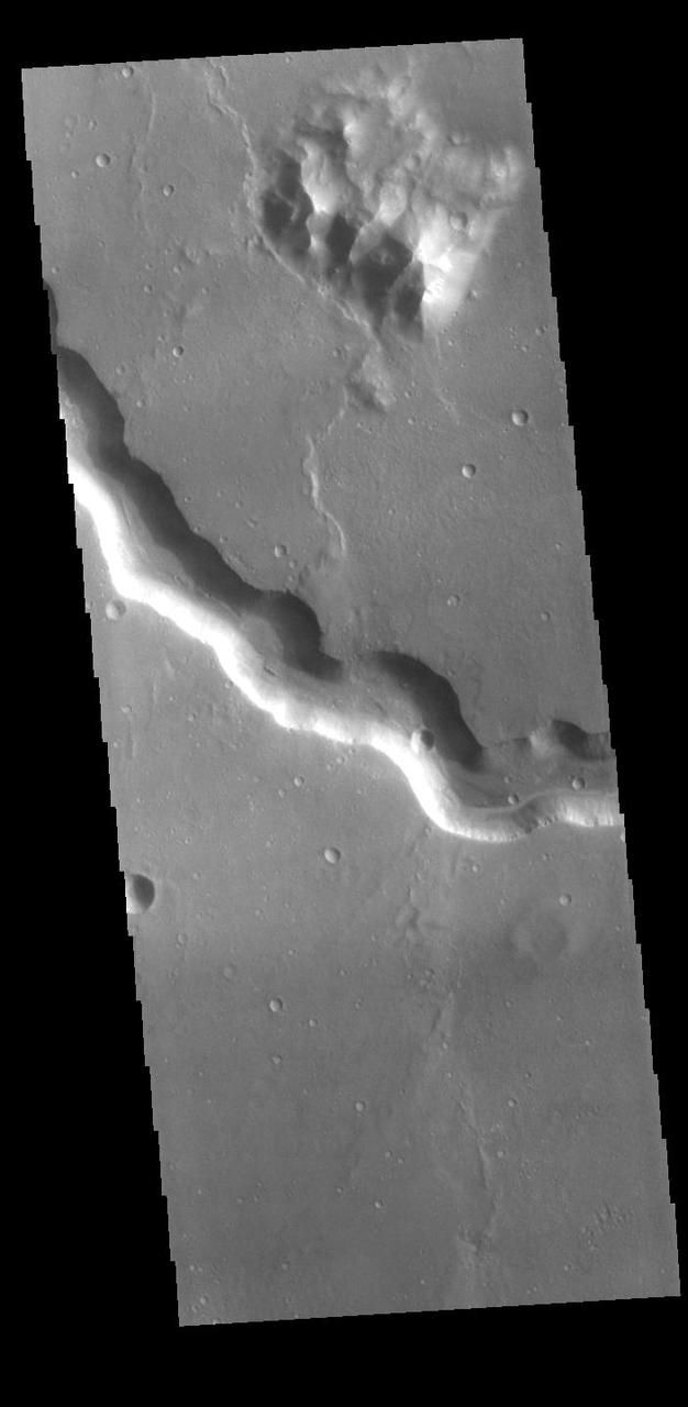
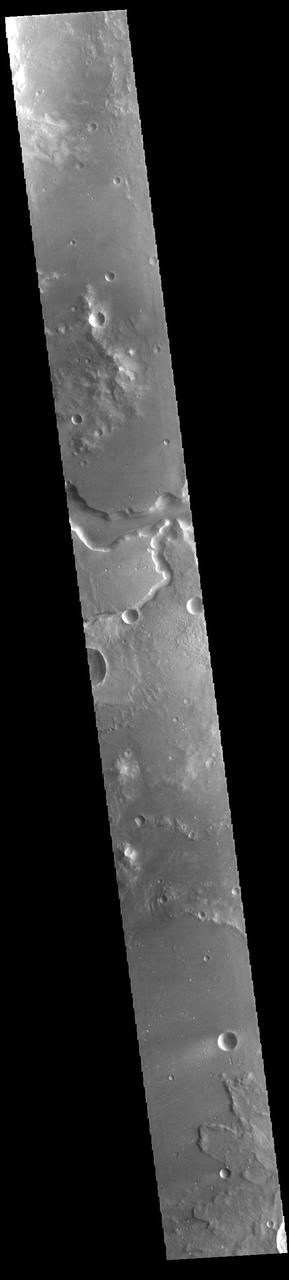
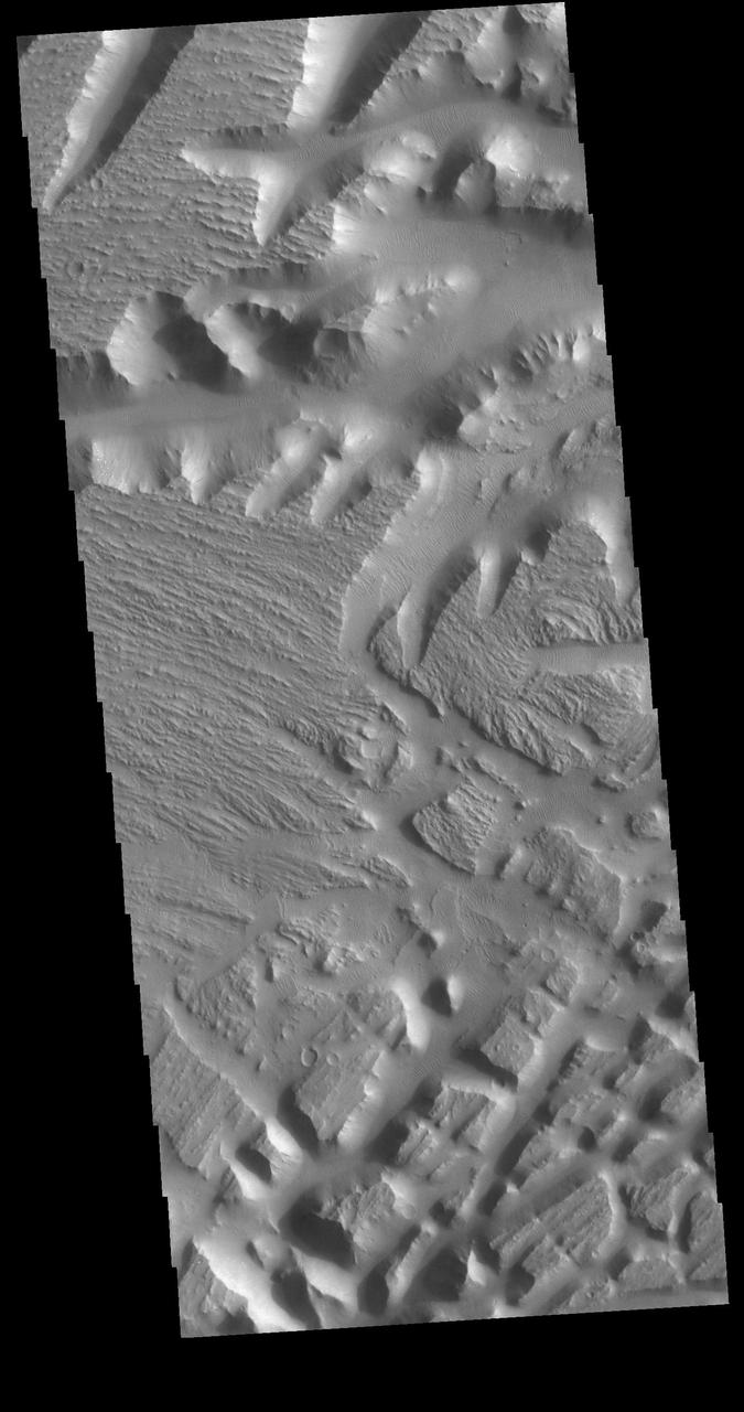
The Kasei Valles region is very complex. This image captured by NASA Mars Odyssey illustrates that complexity with features created by fluvial action channels and tectonic processes fractures.
This image from NASA 2001 Mars Odyssey spacecraft shows a small portion of Kasei Valles. The channel rim at the top of the image shows a complex series of processes.
This small group of dunes in located within Kasei Valles. This image from NASA Mars Odyssey was captured on June 16, 2010.
This image from NASA 2001 Mars Odyssey shows a small portion of the complex channel system, Kasei Valles. In this image, secondary channeling has cut down deeper into the main channel.
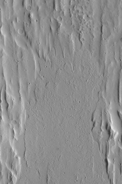
This image from NASA 2001 Mars Odyssey spacecraft shows small channels at many different elevations, all part of the complex region between the northern and southern bottom of image main channels of Kasei Valles.
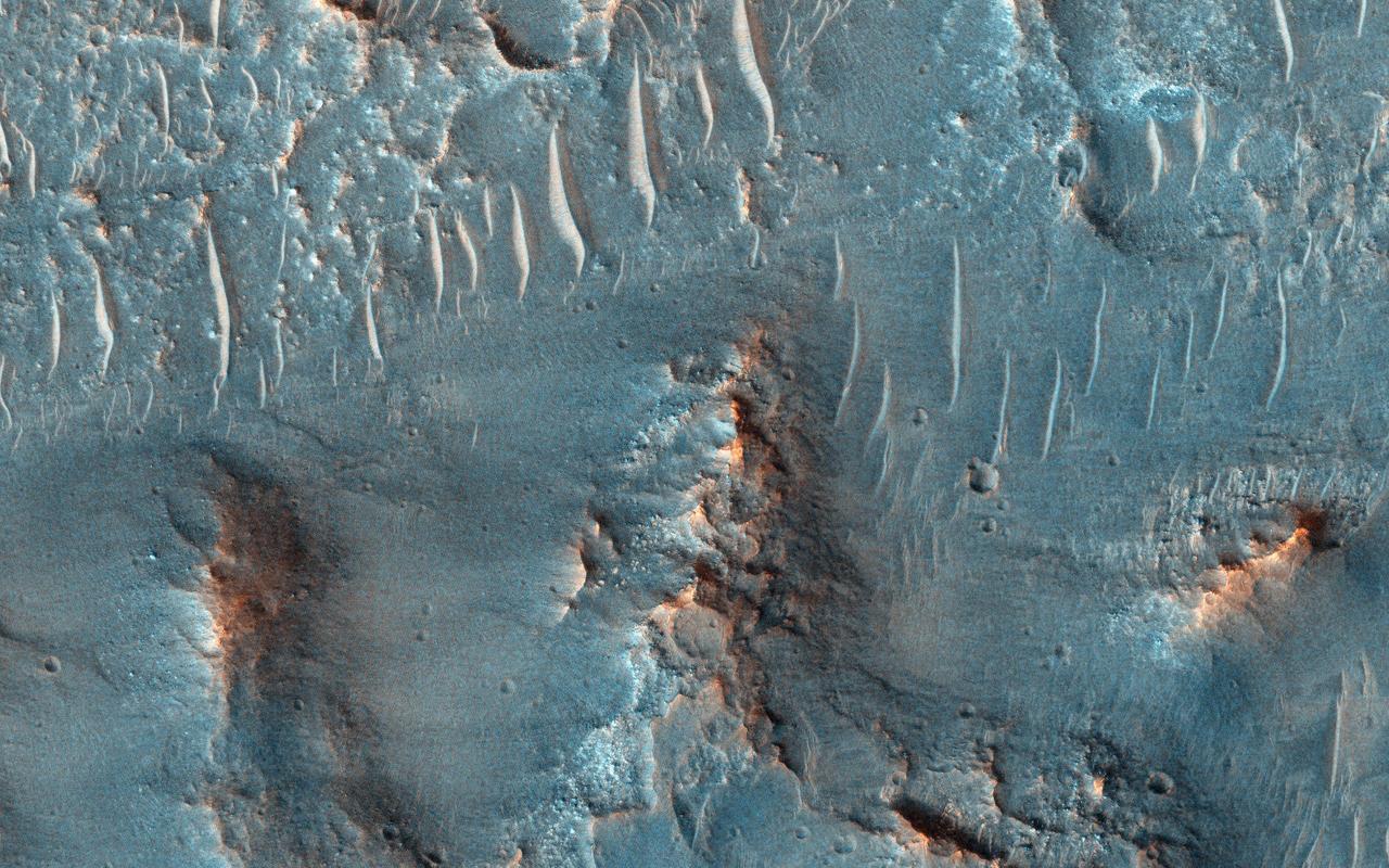
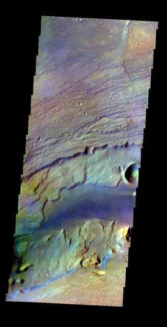
This VIS image shows a section of Kasei Valles. Kasei Valles is a huge outflow channel that drains from the higher elevations of Tharsis down into the lowlands of Chryse Planitia. The THEMIS VIS camera contains 5 filters. The data from different filters can be combined in multiple ways to create a false color image. These false color images may reveal subtle variations of the surface not easily identified in a single band image. Orbit Number: 61365 Latitude: 26.3054 Longitude: 303.514 Instrument: VIS Captured: 2015-10-14 13:23 https://photojournal.jpl.nasa.gov/catalog/PIA22790
Today's VIS image shows a portion of Kasei Valles, just at the region where the northward flow of the channel turns eastward towards it's eventual end in Chryse Planitia. Kasei Valles is one of the largest outflow channel systems on Mars, in places up to 482 km (300 miles) wide and 1580 km (982 miles) long. For comparison, the Grand Canyon in Arizona is is only 29 km (18 miles) at its widest and only 446 km (277 miles) long. Orbit Number: 79952 Latitude: 20.11 Longitude: 286.449 Instrument: VIS Captured: 2019-12-23 13:42 https://photojournal.jpl.nasa.gov/catalog/PIA23748
Today's VIS image is located near the beginning of Kasei Valles. At the top of the image is the relative high land of Lunae Planum. The Kasei Valles channel is just below. The bottom part of the image is an eroded surface that forms an island in the channel. The surface of the island has been modified by the flow of water. The linear features forming right angle intersections were caused by tectonic forces in the region. Orbit Number: 72404 Latitude: 18.9511 Longitude: 286.59 Instrument: VIS Captured: 2018-04-10 22:34 https://photojournal.jpl.nasa.gov/catalog/PIA22584
Kasei Valles is a valley system was likely carved by some combination of flowing water and lava. In some areas, erosion formed cliffs along the flow path resulting in water or lava falls. In some areas, erosion formed cliffs along the flow path resulting in water or lava falls. The flowing liquid is gone but the channels and "dry falls" remain. Since its formation, Kasei Valles has suffered impacts-resulting in craters-and has been mantled in dust, sand, and fine gravel as evidenced by the rippled textures. http://photojournal.jpl.nasa.gov/catalog/PIA20004
Cataracts are large landforms, and this oblique image from NASA's Mars Reconnaissance Orbiter covers only a small area of the innermost channel. The ridged material on the channel floor may be a lava flow that followed this channel after it was initially carved by giant floods of water.Obviously these are not the kind of cataracts that can develop in the lenses of your eyes, but large erosional scallops that form in river channels, like the Niagara Falls draining the Great Lakes of North America. Obviously these are not the kind of cataracts that can develop in the lenses of your eyes, but large erosional scallops that form in river channels, like the Niagara Falls draining the Great Lakes of North America. https://photojournal.jpl.nasa.gov/catalog/PIA21869
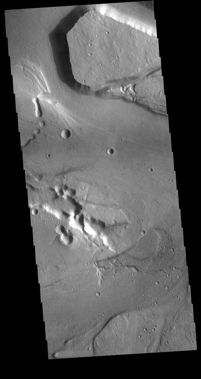
At the base of this slope is a fan-shaped deposit of the slope forming material. The channel that the fan rests upon is Kasei Valles in this image as seen by NASA 2001 Mars Odyssey spacecraft.
The fracture system shown in this image from NASA Mars Odyssey is on the northern margin of the Kasei Valles lowland. Fractures like this can become chaos with continued downdropping of blocks and widening fractures.
Today's VIS image shows a section of Kasei Valles. This complex channel arose in the Tharsis voclanic region and flowed eastward into Chryse Planitia. Chryse Planitia is a large circular basin, probably formed by a meteor impact. Orbit Number: 80675 Latitude: 26.039 Longitude: 307.827 Instrument: VIS Captured: 2020-02-21 02:28 https://photojournal.jpl.nasa.gov/catalog/PIA23858
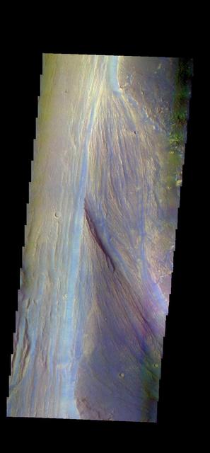
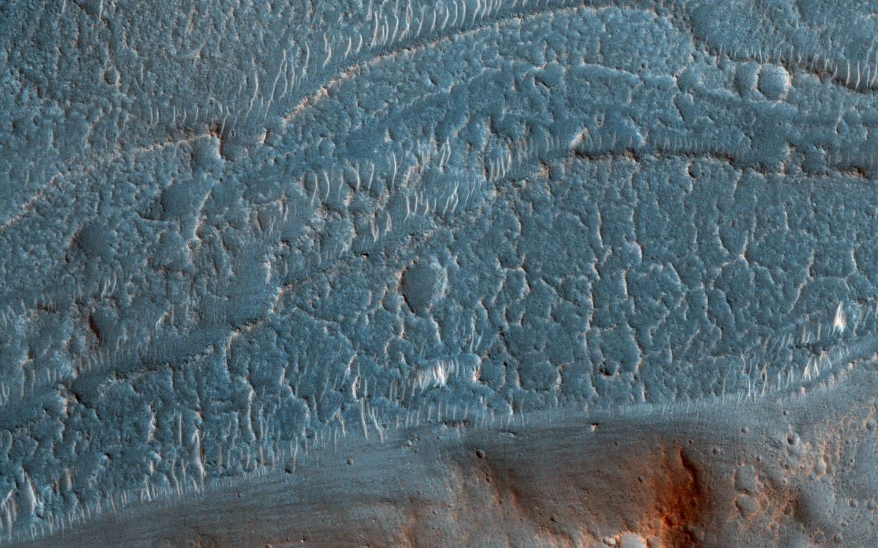
The THEMIS VIS camera contains 5 filters. The data from different filters can be combined in multiple ways to create a false color image. These false color images may reveal subtle variations of the surface not easily identified in a single band image. Today's false color image shows part of Lobo Vallis, which is part of the larger Kasei Valles. The dark blue material is most likely basaltic sand. Orbit Number: 43756 Latitude: 27.9304 Longitude: 299.541 Instrument: VIS Captured: 2011-10-26 04:14 http://photojournal.jpl.nasa.gov/catalog/PIA21015
This image captured by NASA 2001 Mars Odyssey spacecraft shows a small portion of Kasei Valles, a large outflow channel system located between the Tharsis volcanic highlands to the west and the lower elevation Chryse Planitia to the east. Orbit Number: 61889 Latitude: 28.226 Longitude: 305.133 Instrument: VIS Captured: 2015-11-26 17:04 http://photojournal.jpl.nasa.gov/catalog/PIA20241
Today's image shows a portion of Kasei Valles. The plateau in the center of the image is called Lunae Mensa. The THEMIS VIS camera contains 5 filters. The data from different filters can be combined in multiple ways to create a false color image. These false color images may reveal subtle variations of the surface not easily identified in a single band image. Orbit Number: 60604 Latitude: 24.2802 Longitude: 297.794 Instrument: VIS Captured: 2015-08-12 21:22 https://photojournal.jpl.nasa.gov/catalog/PIA22711
On Earth, cataracts represent regions where a river's gradient increases enough to create so much turbulence, that air gets incorporated into the water body forming a bubbly current sometimes called "whitewater". This image covers a location that may have acted as a cataract in the Kasei valley region. This observation from NASA Mars Reconnaissance Orbiter shows samples of bedrock lithologies which give us a measure of the post-flood erosion and modification history for the floor of Kasei Valles While there is a HiRISE stereo pair adjacent to this location that captures much of this cataract, it also misses some of the head scarp that might be the most useful, scientifically. http://photojournal.jpl.nasa.gov/catalog/PIA19351
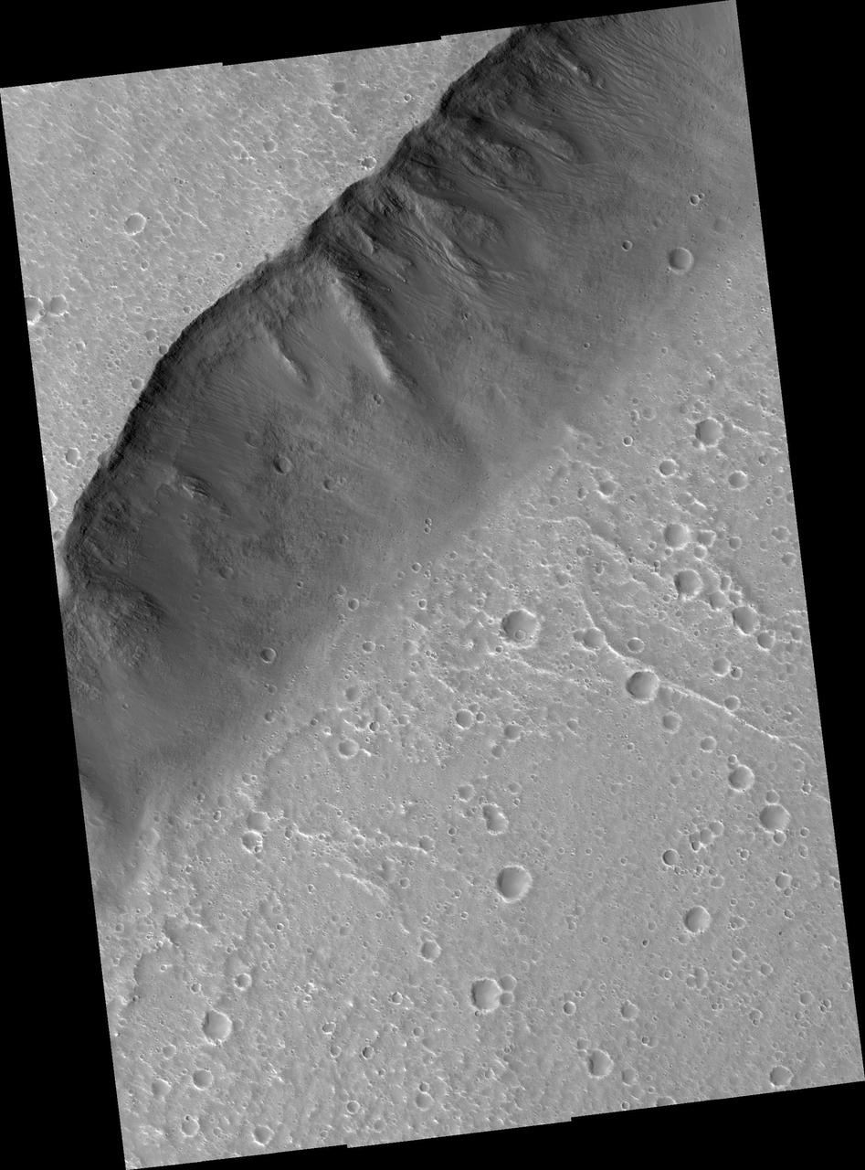
This observation from NASA Mars Reconnaissance Orbiter shows the very steep side of a plateau, part of the northern limit of the Kasei Valles system, which is one of the largest outflow channel systems on Mars.

This MOC image shows gullies a portion of a flood-carved canyon within the larger Kasei Valles system on Mars. This canyon is the result of the very last flood event that poured through the Kasei valleys, long ago
This image captured by NASA 2001 Mars Odyssey spacecraft shows a portion of Nilus Chaos. Located north of Kasei Vallis, this chaos formed at the elevation boundary between Kasei Valles and the surrounding plains.

The alluvial fans on the north side of this channel possibly represent the most recent activity in Kasei Valles
The hills and ridges at the top of this image captured by NASA 2001 Mars Odyssey spacecraft are part of Nilus Mensae, which is part of the complex Kasei Valles channels.
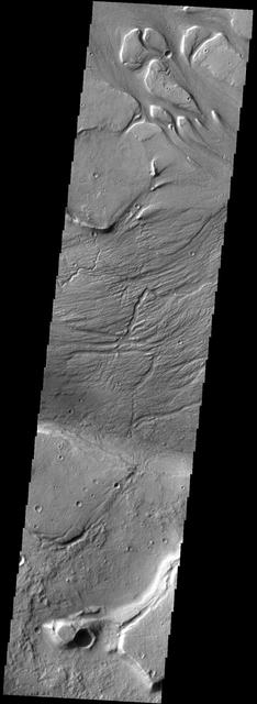
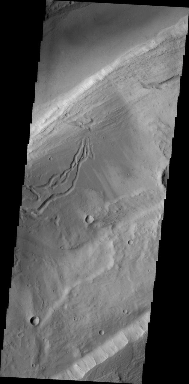
This image from NASA Mars Odyssey spacecraft shows grooves within channels of Kasei Valles that can be interpreted as evidence for fluvial activity.
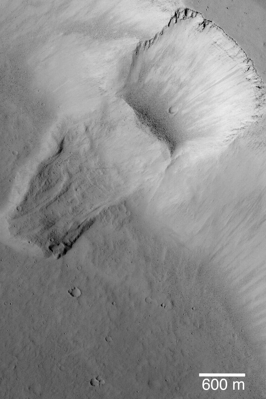
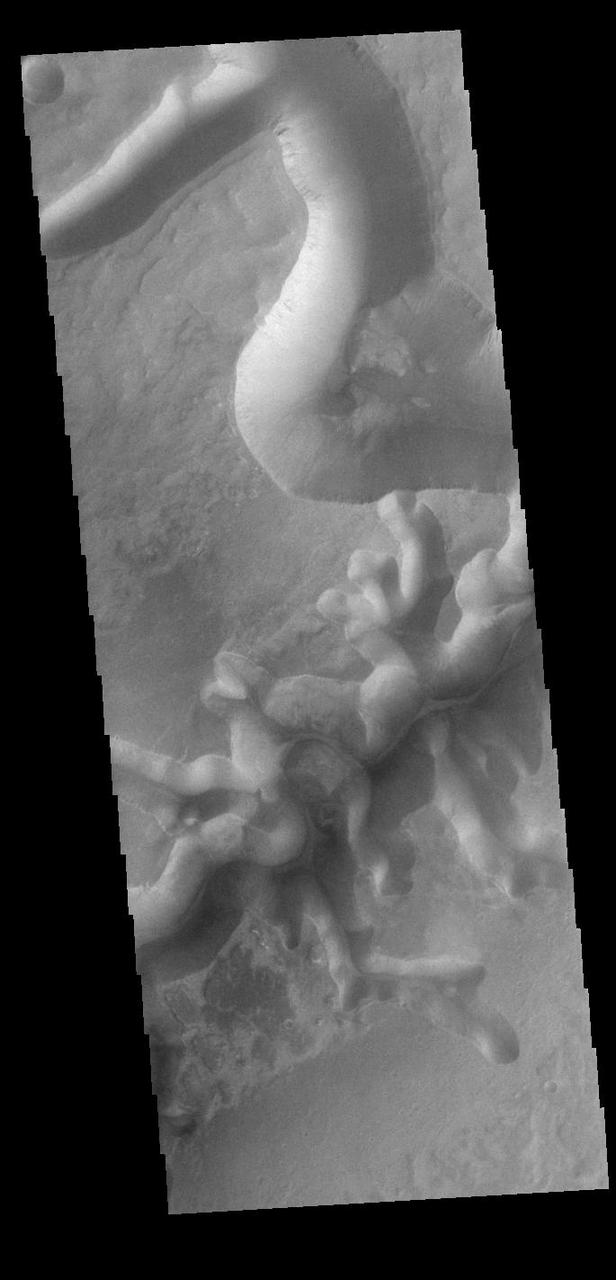
This image captured by NASA 2001 Mars Odyssey spacecraft shows a streamlined island in Kasei Valles. The teardrop shape indicates that flow was from the bottom to the top of the image.
Today's VIS image shows a small portion of Lobo Vallis near where it recombines with Kasei Valles and empties into Chryse Planitia. Kasei Valles is a huge channel system that drained the higher elevations of Tharsis into the low of Chryse Planitia. Orbit Number: 71206 Latitude: 28.9604 Longitude: 303.568 Instrument: VIS Captured: 2018-01-02 06:02 https://photojournal.jpl.nasa.gov/catalog/PIA22374
This VIS image shows part of Sacra Mensa, a large mesa located between the north and south channels of Kasei Valles. The linear feature at the top of the image is one of the many graben found in the mesa and surrounding highlands. Graben are formed by the downward motion of a block of material between paired tectonic faults. Sacra Mensa rises 3 km (almost 2 miles) above Kasei Valles. Orbit Number: 79203 Latitude: 26.0793 Longitude: 294.1 Instrument: VIS Captured: 2019-10-22 21:34 https://photojournal.jpl.nasa.gov/catalog/PIA23634
This image from NASA 2001 Mars Odyssey spacecraft shows a streamlined island in a broad channel in Chryse Planitia. The channel is part of the outflow region of Lobo Vallis, a northern branch of Kasei Valles.
Today's VIS image shows a section of Bahram Vallis. This channel is located in northern Lunae Planum, south of Kasei Valles. Orbit Number: 71256 Latitude: 21.0762 Longitude: 301.486 Instrument: VIS Captured: 2018-01-06 08:51 https://photojournal.jpl.nasa.gov/catalog/PIA22379
This VIS image shows a portion of Nilus Chaos. Located north of Kasei Vallis, this chaos formed at the elevation boundary between Kasei Valles (lower elevation) and the surrounding plains (higher elevation). Chaos terrain is typified by regions of blocky, often steep sided, mesas interspersed with deep valleys. With time and erosion the valleys widen and the mesas become smaller. In this region of chaos, the mesas decrease in size the closer it approaches to the lower elevation surface. Orbit Number: 89748 Latitude: 24.5105 Longitude: 280.641 Instrument: VIS Captured: 2022-03-09 03:53 https://photojournal.jpl.nasa.gov/catalog/PIA25394
This VIS image shows one of the mega-gullies that empties into Echus Chasma. Echus Chasma is approximately 4km deep in this region, and is the source of Kasei Valles. Orbit Number: 71207 Latitude: -1.24174 Longitude: 278.861 Instrument: VIS Captured: 2018-01-02 07:50 https://photojournal.jpl.nasa.gov/catalog/PIA22375
This VIS image shows one of the mega-gullies that empties into Echus Chasma. Echus Chasma is approximately 4km deep in this region, and is the source of Kasei Valles. Orbit Number: 91021 Latitude: 0.839415 Longitude: 278.09 Instrument: VIS Captured: 2022-06-21 23:25 https://photojournal.jpl.nasa.gov/catalog/PIA25539
Today's VIS image shows a section of Bahram Vallis. This channel is located in northern Lunae Planum, south of Kasei Valles. Bharam Vallis drains from the higher elevations of Lunae Planum towards the Chryse Planitia basin. This channel is over 300km long (186miles). Orbit Number: 88175 Latitude: 20.6178 Longitude: 302.162 Instrument: VIS Captured: 2021-10-30 15:19 https://photojournal.jpl.nasa.gov/catalog/PIA25156
Today's VIS image shows a section of Bahram Vallis. This channel is located in northern Lunae Planum, south of Kasei Valles. Bharam Vallis drains from the higher elevations of Lunae Planum towards the Chryse Planitia basin. This channel is over 300km (186 miles) long. Orbit Number: 94564 Latitude: 20.5977 Longitude: 302.359 Instrument: VIS Captured: 2023-04-09 17:00 https://photojournal.jpl.nasa.gov/catalog/PIA26036
Today's VIS image shows a section of Bahram Vallis. This channel is located in northern Lunae Planum, south of Kasei Valles. Bharam Vallis drains from the higher elevations of Lunae Planum towards the Chryse Planitia basin. This channel is over 300km long (186miles). Orbit Number: 87576 Latitude: 20.3115 Longitude: 302.882 Instrument: VIS Captured: 2021-09-11 07:37 https://photojournal.jpl.nasa.gov/catalog/PIA25224
Today's VIS image shows a section of Bahram Vallis. This channel is located in northern Lunae Planum, south of Kasei Valles. Bharam Vallis drains from the higher elevations of Lunae Planum towards the Chryse Planitia basin. This channel is over 300km long (186miles). Orbit Number: 94876 Latitude: 21.1353 Longitude: 301.426 Instrument: VIS Captured: 2023-05-05 09:33 https://photojournal.jpl.nasa.gov/catalog/PIA26211
Today's VIS image shows a section of Bahram Vallis. This channel is located in northern Lunae Planum, south of Kasei Valles. Bharam Vallis drains from the higher elevations of Lunae Planum towards the Chryse Planitia basin. This channel is over 300km long (186miles). Orbit Number: 94826 Latitude: 21.4639 Longitude: 303.82 Instrument: VIS Captured: 2023-05-01 06:44 https://photojournal.jpl.nasa.gov/catalog/PIA26179
Today's VIS image shows a section of Bahram Vallis. This channel is located in northern Lunae Planum, south of Kasei Valles. Bharam Vallis drains from the higher elevations of Lunae Planum towards the Chryse Planitia basin. This channel is over 300km long (186miles). Orbit Number: 93965 Latitude: 20.1543 Longitude: 302.9 Instrument: VIS Captured: 2023-02-19 09:18 https://photojournal.jpl.nasa.gov/catalog/PIA25936
The right angle intersections in this VIS image are some of the graben that form Sacra Fossae. The fossae are located on the margin of Lunae Planum near the beginning of Kasei Valles. Graben are depressions caused by parallel faults where a block of material drops down along the fault face. Orbit Number: 72616 Latitude: 18.1066 Longitude: 287.915 Instrument: VIS Captured: 2018-04-28 09:42 https://photojournal.jpl.nasa.gov/catalog/PIA22617
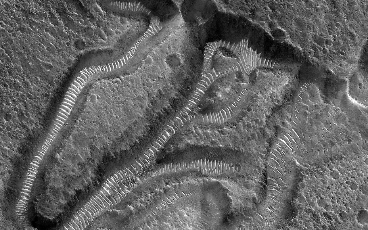
This image focuses on small channels formed on the floor of the much larger Kasei Valles, one of the largest outflow channels on Mars. The enormous floods that formed such channels sometimes flowed around either side of topographic rises forming islands with a streamlined shape. The channels in this image are located on the trailing edge of such a formation (white shaded box). The small channels formed linear coalescing pits, perhaps by ground ice sublimating into the atmosphere leaving the surface material to collapse. Much of the remaining material seems to be made up of easily eroded sediments likely deposited by the floodwaters, which have subsequently formed dunes inside the channels. Kasei extends almost 1600 kilometers (980 miles) across the surface towards the northeast before it empties into Chryse Planitia in the northern lowlands of Mars. https://photojournal.jpl.nasa.gov/catalog/PIA25702
Today's VIS image shows a section of Bahram Vallis. This channel is located in northern Lunae Planum, south of Kasei Valles. Bharam Vallis drains from the higher elevations of Lunae Planum towards the Chryse Planitia basin. This channel is over 300km long (186miles). In this image Bahram Vallis enters Waspam Crater (right side of image) and then exits the crater (top right corner). Orbit Number: 81374 Latitude: 20.3853 Longitude: 303.032 Instrument: VIS Captured: 2020-04-18 15:46 https://photojournal.jpl.nasa.gov/catalog/PIA23956
The THEMIS VIS camera contains 5 filters. The data from different filters can be combined in multiple ways to create a false color image. This false color image from NASA 2001 Mars Odyssey spacecraft shows a portion of Kasei Vallis.
This VIS image covers part of Nilus Mensae. Located in the region where the northward flowing channel from Valles Marineris becomes the eastward flowing Kasei Valles, Nilus Mensae is a complex region of tectonic faulting and fluid flow features. In addition to the scoured surface, sand dunes are visible in depressions throughout the image. Orbit Number: 78517 Latitude: 21.6368 Longitude: 286.455 Instrument: VIS Captured: 2019-08-27 09:50 https://photojournal.jpl.nasa.gov/catalog/PIA23486
The mesas and valleys in the center of this VIS image are part of Echus Chaos. Located on the margin of Lunae Planum and south of Kasei Valles, Echus Chaos is 480 km (298 miles) long. Orbit Number: 85293 Latitude: 13.7712 Longitude: 285.65 Instrument: VIS Captured: 2021-03-07 08:06 https://photojournal.jpl.nasa.gov/catalog/PIA24825
Today's VIS image shows parallel sets of depressions. These are tectonic graben formed when a block of material is down dropped between paired faults. Nilokeras Fossa is located on the margin of Kasei Valles. Orbit Number: 85542 Latitude: 23.3657 Longitude: 300.935 Instrument: VIS Captured: 2021-03-27 20:13 https://photojournal.jpl.nasa.gov/catalog/PIA24854
The right angle intersection of the depressions in this VIS image is one of the graben that form Sacra Fossae. The fossae are located on Sacra Mensa, near the beginning of Kasei Valles. Graben are depressions caused by parallel faults where a block of material drops down along the fault face. Orbit Number: 72803 Latitude: 23.2339 Longitude: 290.007 Instrument: VIS Captured: 2018-05-13 19:26 https://photojournal.jpl.nasa.gov/catalog/PIA22657
Today's VIS image shows a section of Bahram Vallis. This channel is located in northern Lunae Planum, south of Kasei Valles. Bharam Vallis drains from the higher elevations of Lunae Planum towards the Chryse Planitia basin. This channel is over 300km long (186miles). Orbit Number: 95138 Latitude: 20.0779 Longitude: 303.077 Instrument: VIS Captured: 2023-05-26 23:17 https://photojournal.jpl.nasa.gov/catalog/PIA26260
This observation from NASA Mars Reconnaissance Orbite shows a candidate 2018 European Space Agency ExoMars landing site in Hypanis Vallis. Instead of imaging ancient fluvial deposits (thought to be the remnants of a delta feed lake), the image shows patchy concentrations of dust clouds. These clouds are part of the annually occurring Acidalia storm track, a regional dust storm system that originates in the Acidalia-Chryse-Kasei region and propagates southward into equatorial Valles Marineris and beyond. While this image is only partially obscured by dust, many others captured around this time frame were completely dominated by think clouds of dust. For example, this image in Capri Chasma was rendered useless for geology and will have to be reacquired. Landing by the ExoMars rover in these kinds of atmospheric conditions would be complicated. That mission is set to touchdown on Mars in January 2019, hopefully with clear skies. HiRISE will continue to image Hypanis Vallis and other interesting sites on Mars despite the changing weather. http://photojournal.jpl.nasa.gov/catalog/PIA19846
The THEMIS VIS camera contains 5 filters. The data from different filters can be combined in multiple ways to create a false color image. These false color images may reveal subtle variations of the surface not easily identified in a single band image. Today's false color image shows a section of Bahram Vallis. This channel is located in northern Lunae Planum, south of Kasei Valles. Bharam Vallis drains from the higher elevations of Lunae Planum towards the Chryse Planitia basin. This channel is over 300km long (186miles). The THEMIS VIS camera is capable of capturing color images of the Martian surface using five different color filters. In this mode of operation, the spatial resolution and coverage of the image must be reduced to accommodate the additional data volume produced from using multiple filters. To make a color image, three of the five filter images (each in grayscale) are selected. Each is contrast enhanced and then converted to a red, green, or blue intensity image. These three images are then combined to produce a full color, single image. Because the THEMIS color filters don't span the full range of colors seen by the human eye, a color THEMIS image does not represent true color. Also, because each single-filter image is contrast enhanced before inclusion in the three-color image, the apparent color variation of the scene is exaggerated. Nevertheless, the color variation that does appear is representative of some change in color, however subtle, in the actual scene. Note that the long edges of THEMIS color images typically contain color artifacts that do not represent surface variation. Orbit Number: 94826 Latitude: 21.4639 Longitude: 303.82 Instrument: VIS Captured: 2023-05-01 06:44 https://photojournal.jpl.nasa.gov/catalog/PIA26135