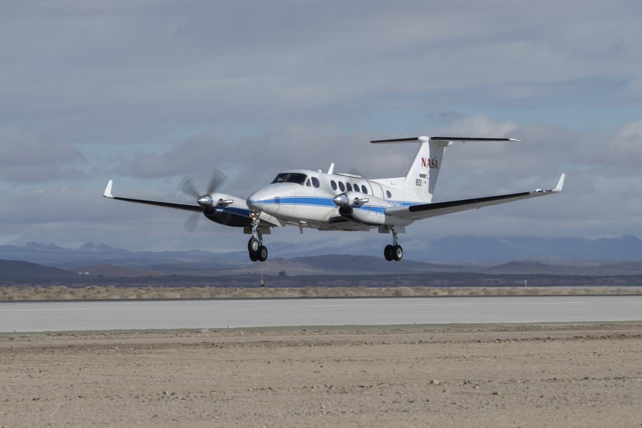
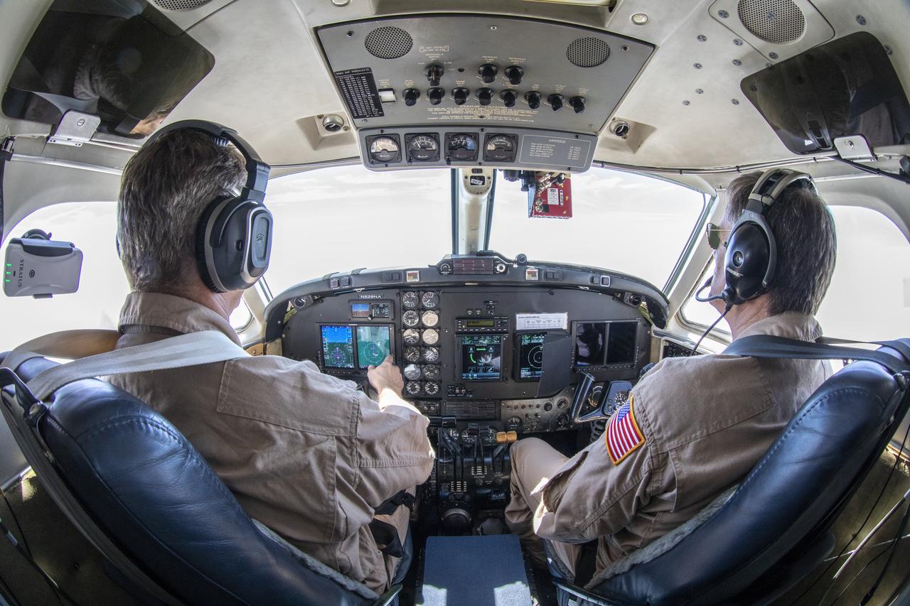
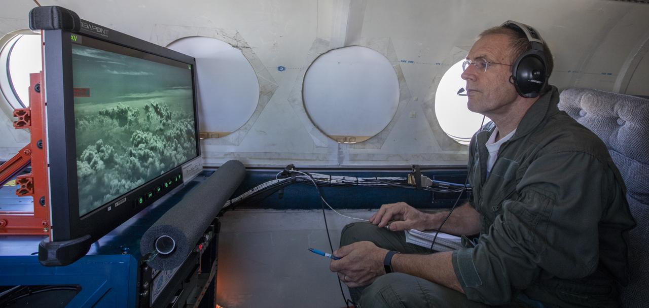
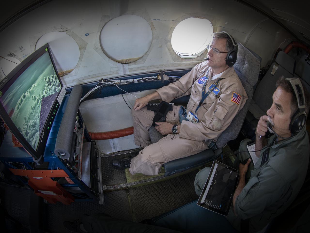
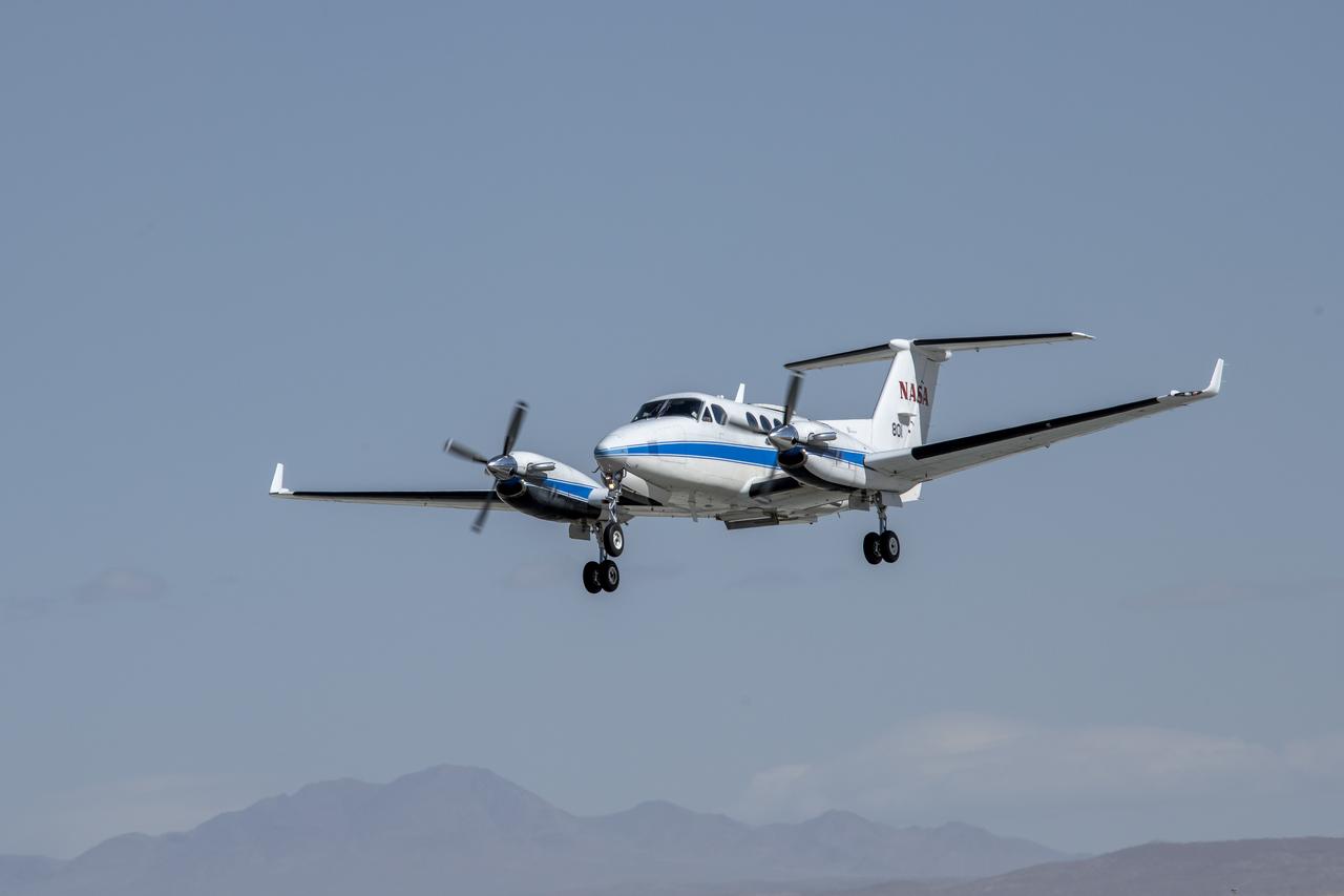
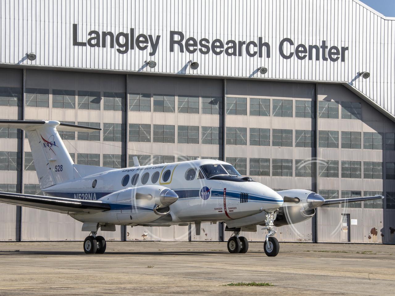
NASA’s Armstrong Flight Research Center in Edwards, California, flew the B200 King Air in support of the Signals of Opportunity Synthetic Aperture Radar (SoOpSAR) campaign on Feb. 27, 2023.
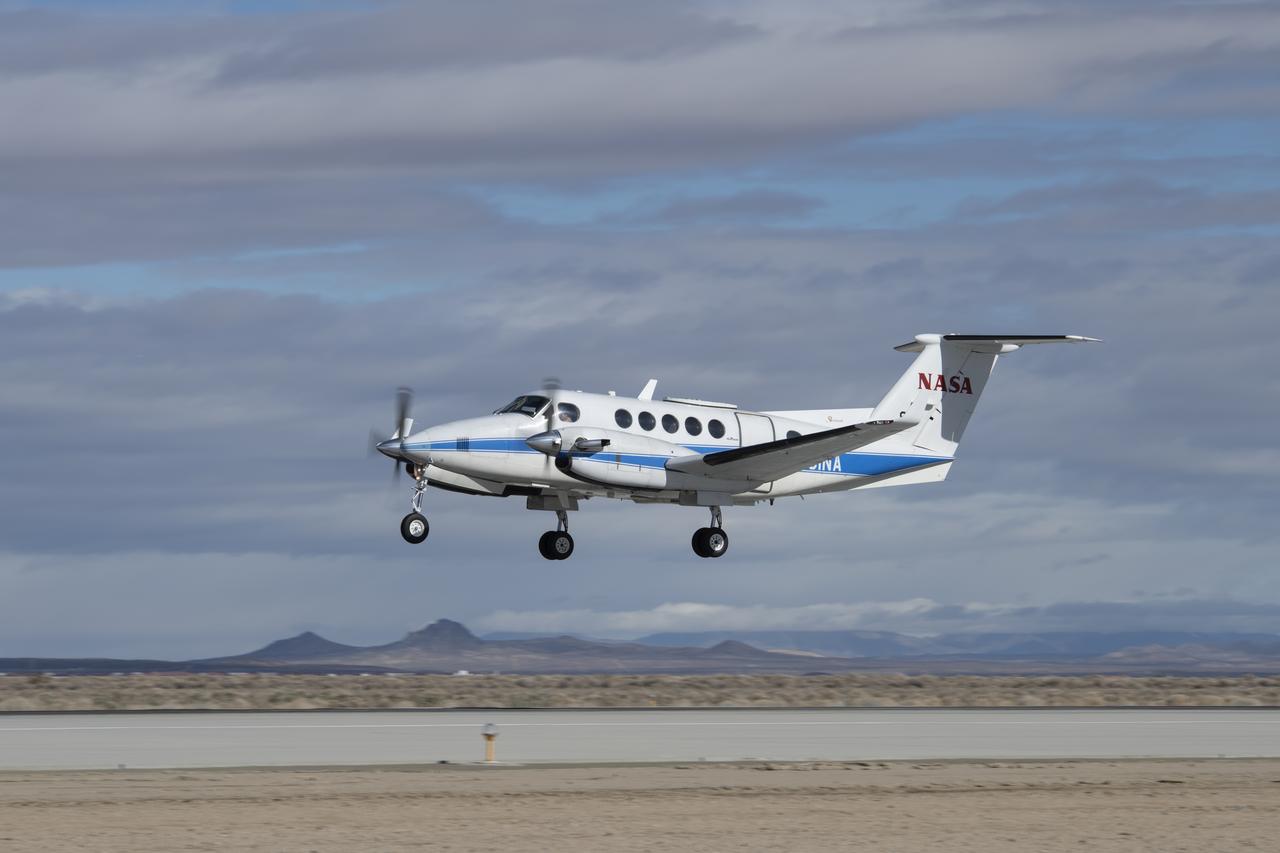
NASA’s Armstrong Flight Research Center in Edwards, California, flew the B200 King Air in support of the Signals of Opportunity Synthetic Aperture Radar (SoOpSAR) campaign on Feb. 27, 2023.
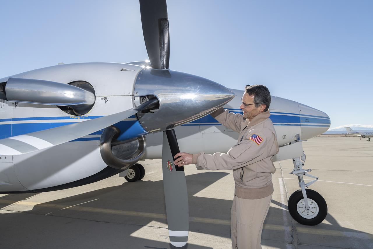
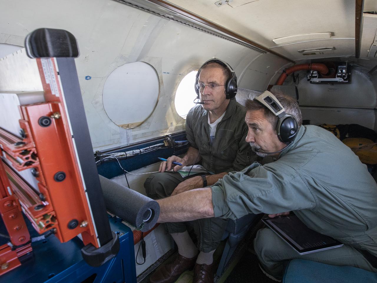
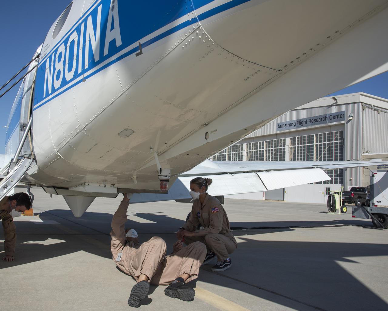
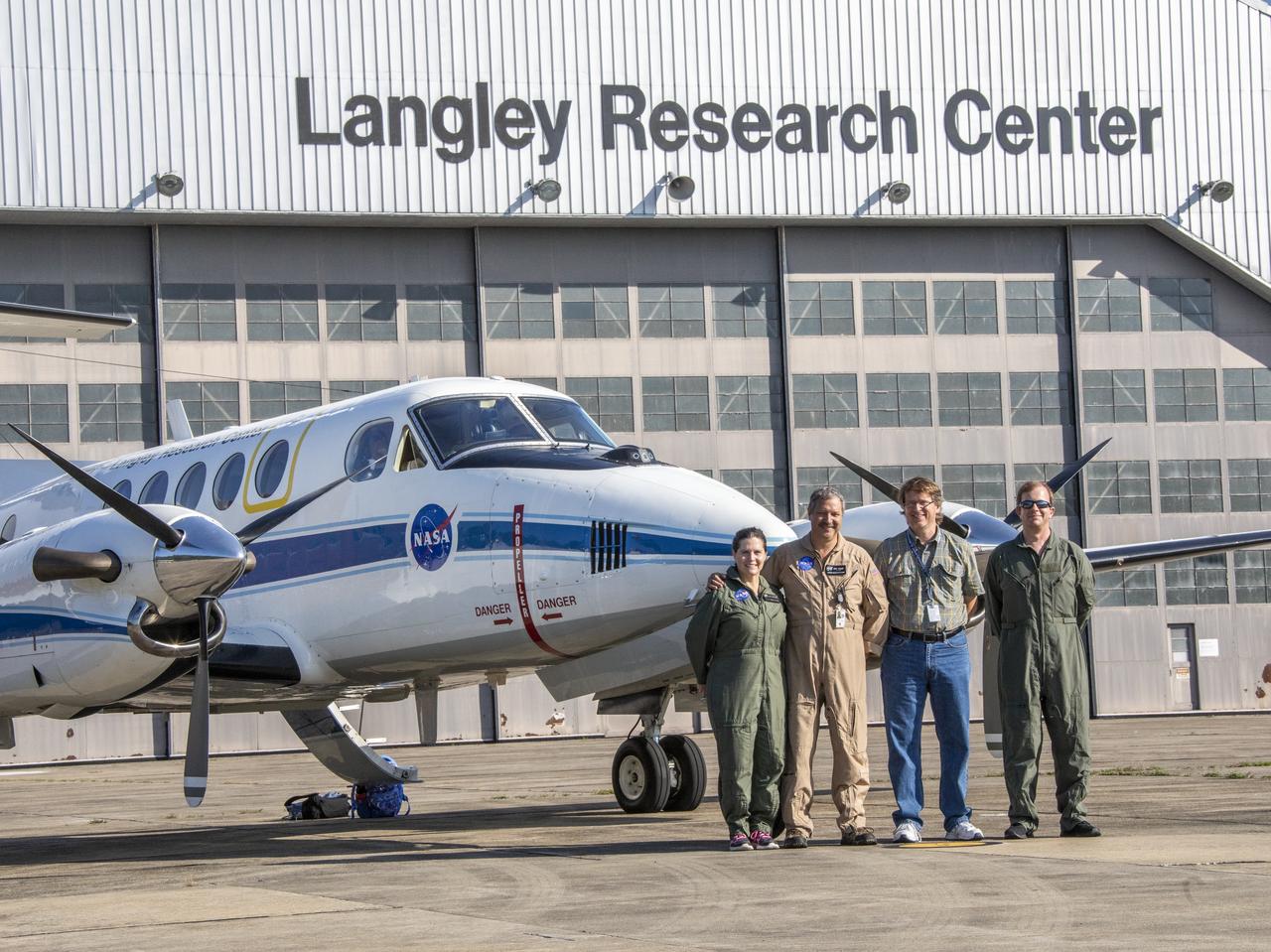
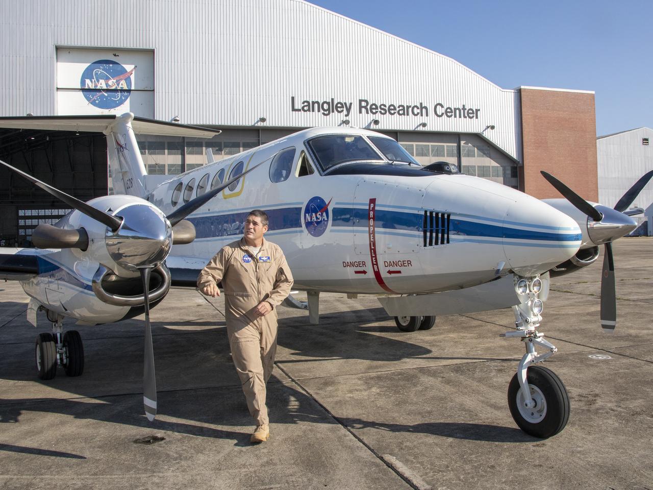
NASA’s Armstrong Flight Research Center in Edwards, California, flew the B200 King Air in support of the Signals of Opportunity Synthetic Aperture Radar (SoOpSAR) campaign. Prior to deploying the plane, NASA research pilot Jeff Borton provides ground checks of the aircraft on Feb. 27, 2023.
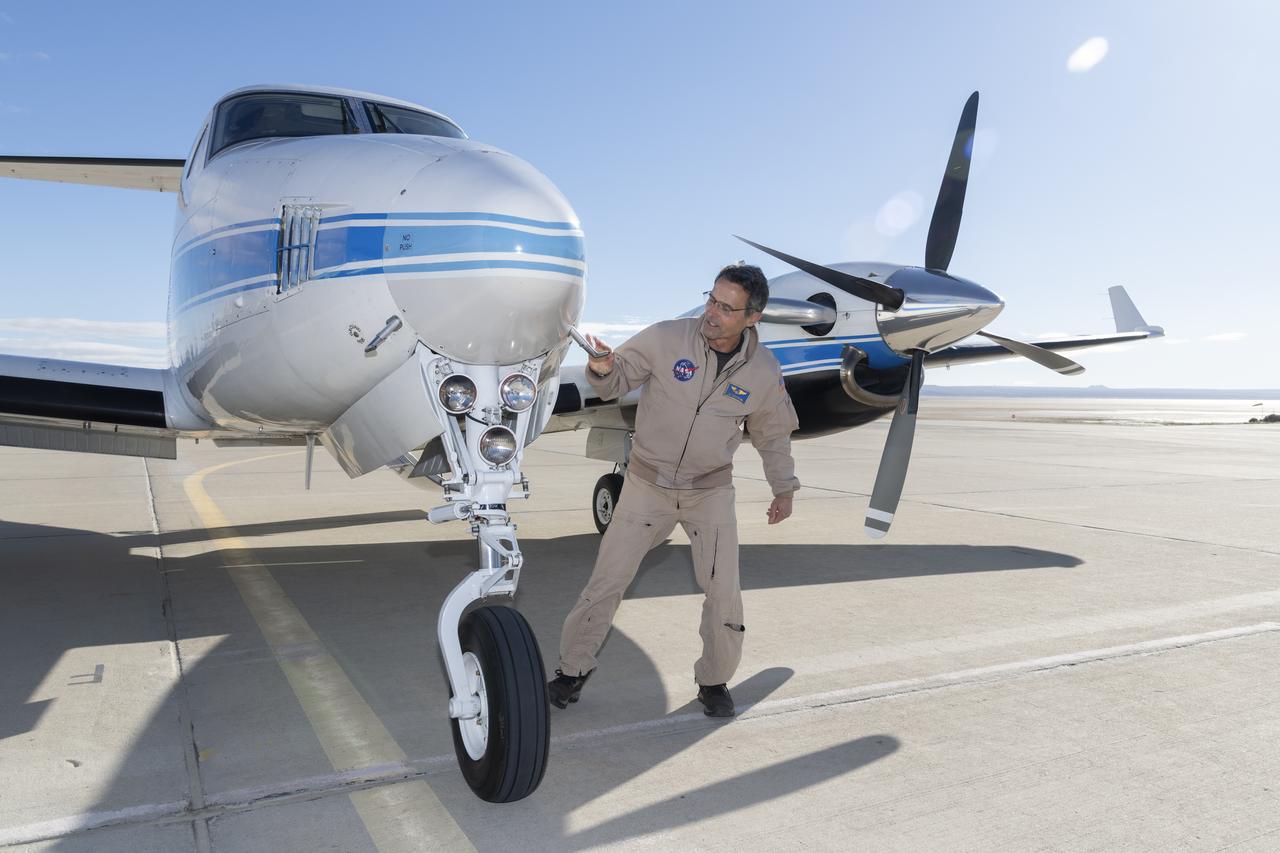
NASA’s Armstrong Flight Research Center in Edwards, California, flew the B200 King Air in support of the Signals of Opportunity Synthetic Aperture Radar (SoOpSAR) campaign. Prior to deploying the plane, NASA research pilot Jeff Borton provides ground checks of the aircraft on Feb. 27, 2023.
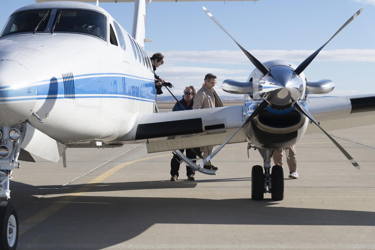
NASA’s Armstrong Flight Research Center in Edwards, California, flew the B200 King Air in support of the Signals of Opportunity Synthetic Aperture Radar (SoOpSAR) campaign. Prior to deploying the plane, NASA research pilot Jeff Borton provides ground checks of the aircraft on Feb. 27, 2023.

NASA’s Armstrong Flight Research Center in Edwards, California, flew the B200 King Air in support of the Signals of Opportunity Synthetic Aperture Radar (SoOpSAR) campaign on Feb. 27, 2023.

NASA’s Armstrong Flight Research Center in Edwards, California, flew the B200 King Air in support of the Signals of Opportunity Synthetic Aperture Radar (SoOpSAR) campaign on Feb. 27, 2023.
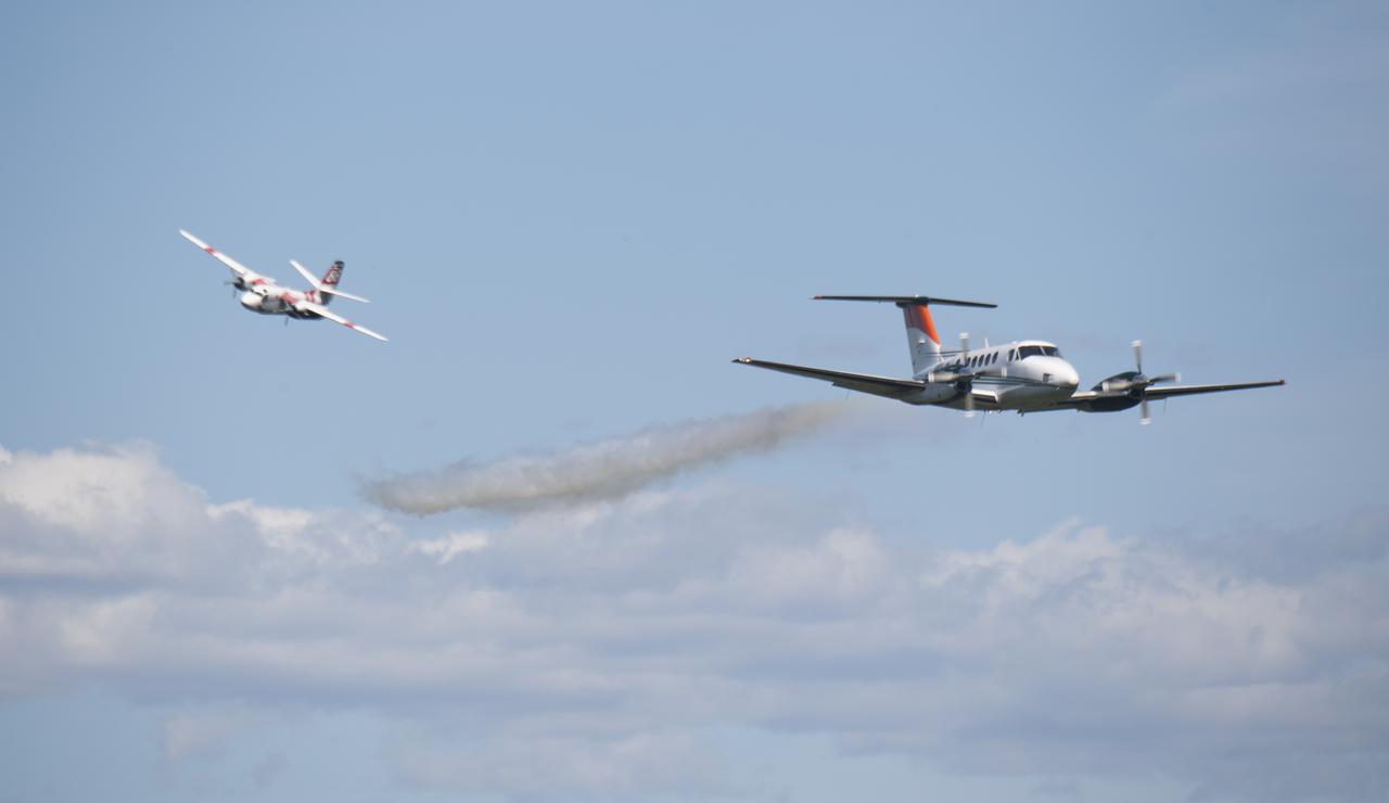
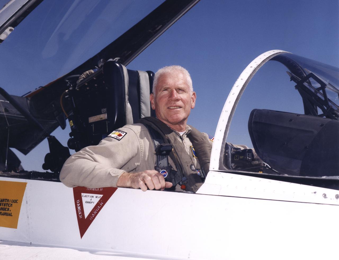
Honeywell supplied a specially instrumented twin-engine King Air to serve as an intruder for NASA’s Ikhana UAS.
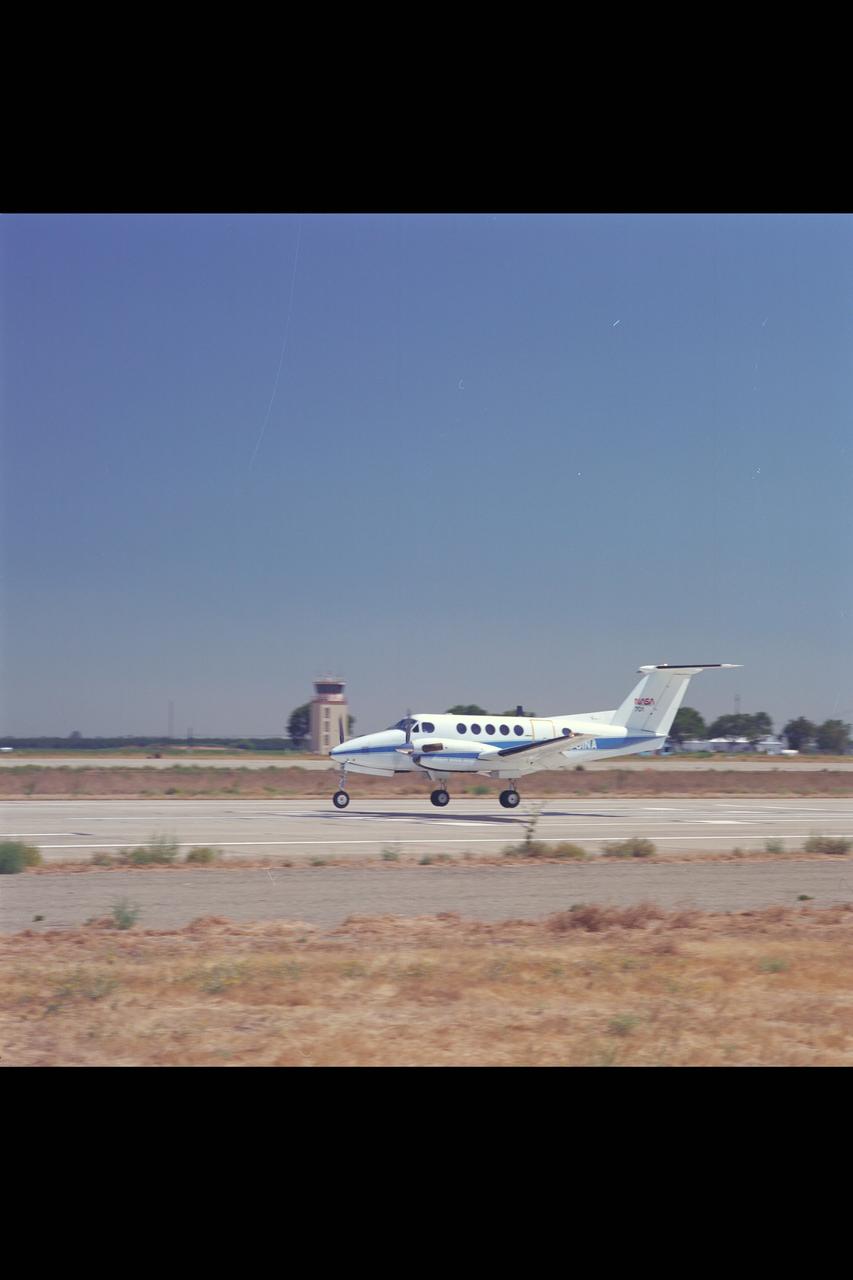
King Air (NASA-701) at Crows Landing
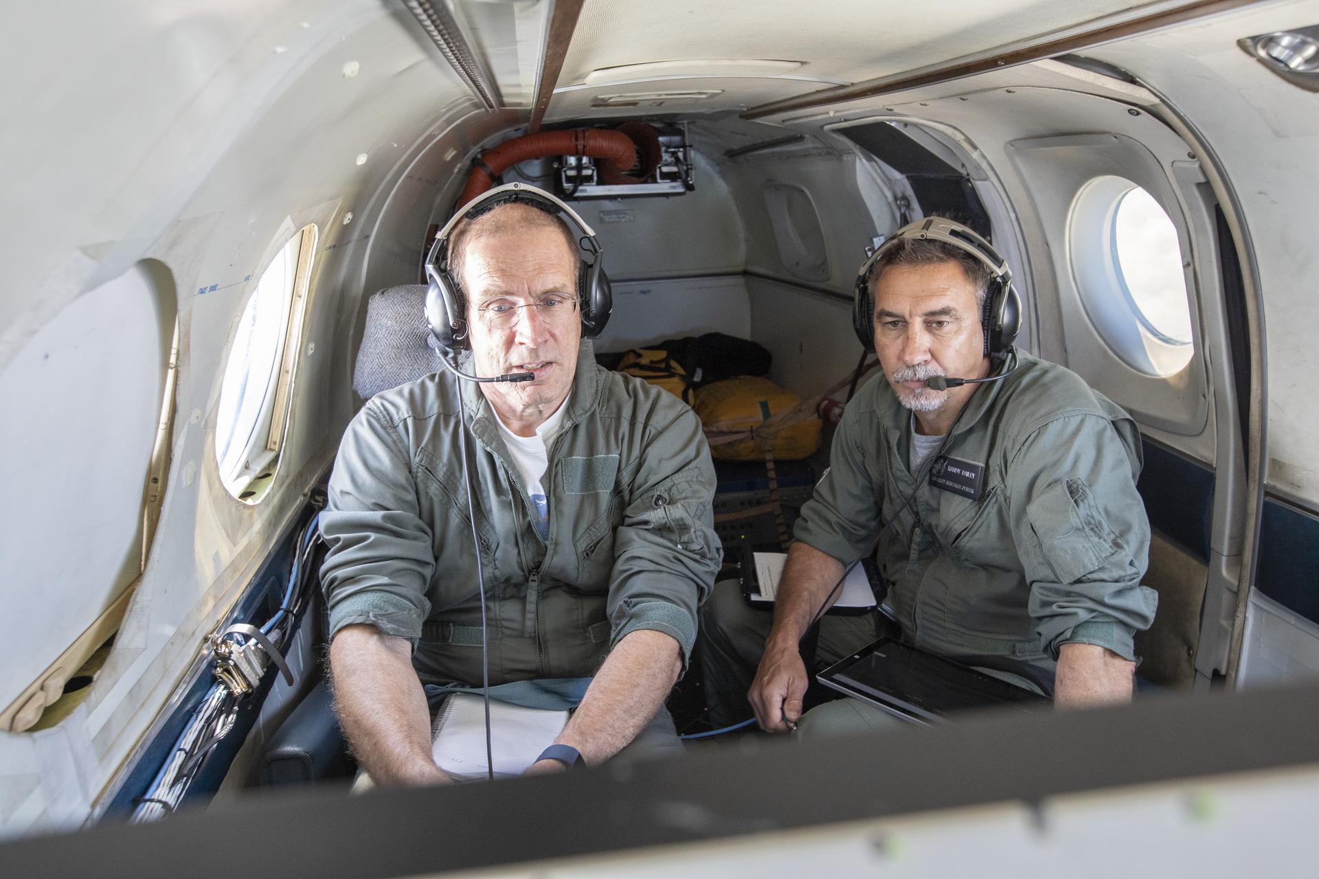
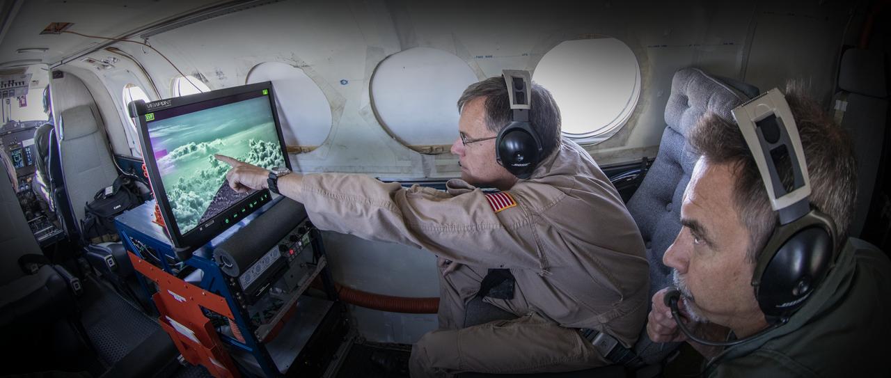
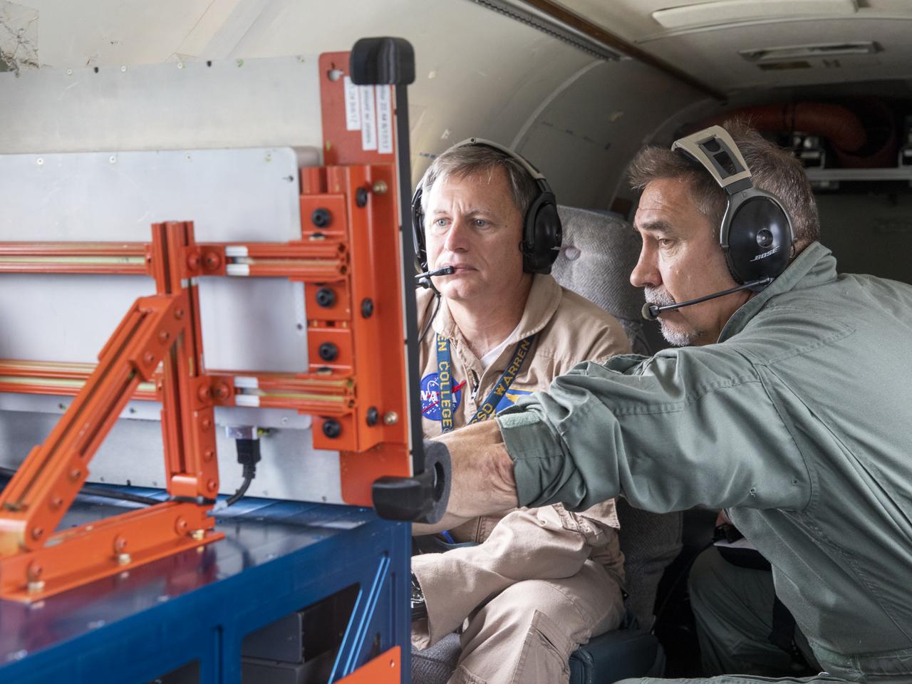
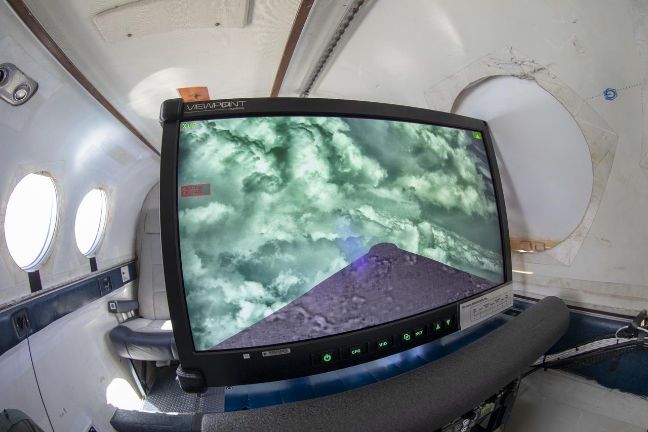
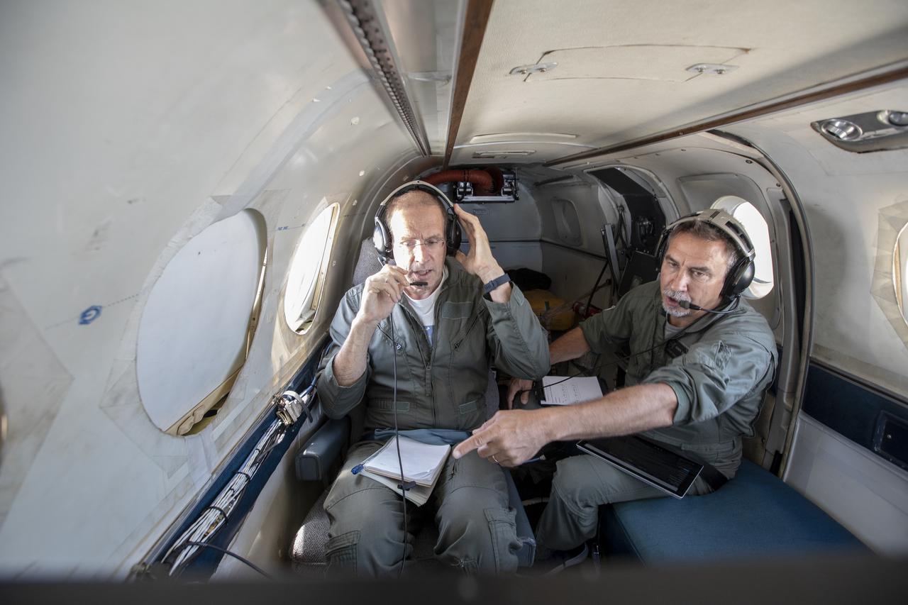
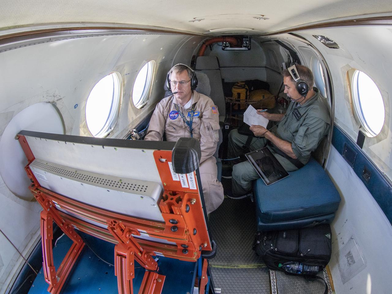
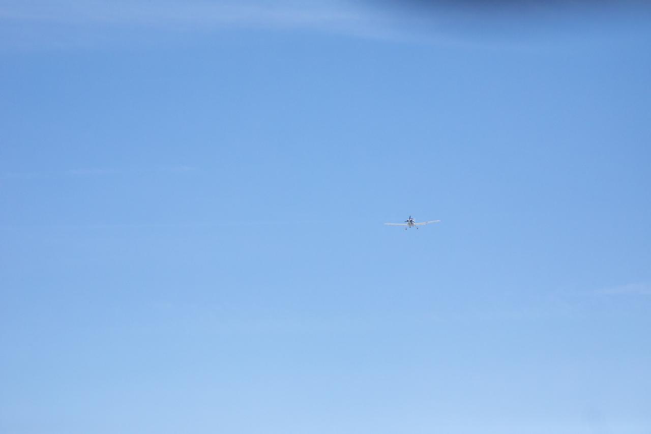
Aerospace Engineers, “from left to right” Peter Coen and Randy Bailey attempt to spot an incoming aircraft on the monitor while performing tests on the External Vision System (XVS) Software. The software testing is being conducted on the B200 King Air Beechcraft airplane.
Cal Poly San Luis Obispo professors Russ Westphal, left, and Aaron Drake posed next to NASA Armstrong Flight Research Center’s Beechcraft Beech 200 Super King Air aircraft. On the King Air’s wing is the Boundary Layer Data System (BLDS), a sensor developed by Cal Poly and Northrop Grumman. BLDS was flown at NASA Armstrong as a step towards creating a process allowing universities, small businesses and other interested parties to quickly test flight technologies.

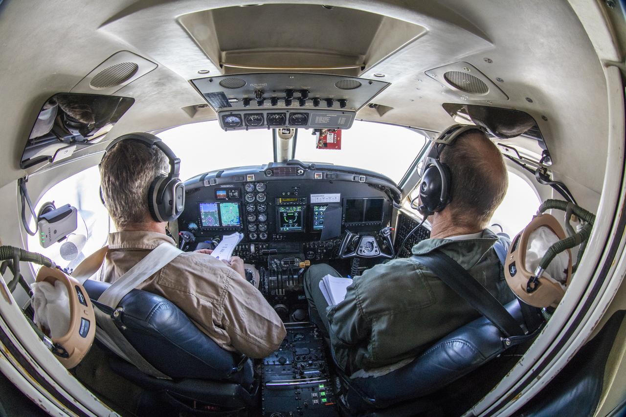
Testing of the External Vision System (EVS) Software on the B200 King Air

Nose camera for the X59 is being prepared for testing on the B200 King Air.
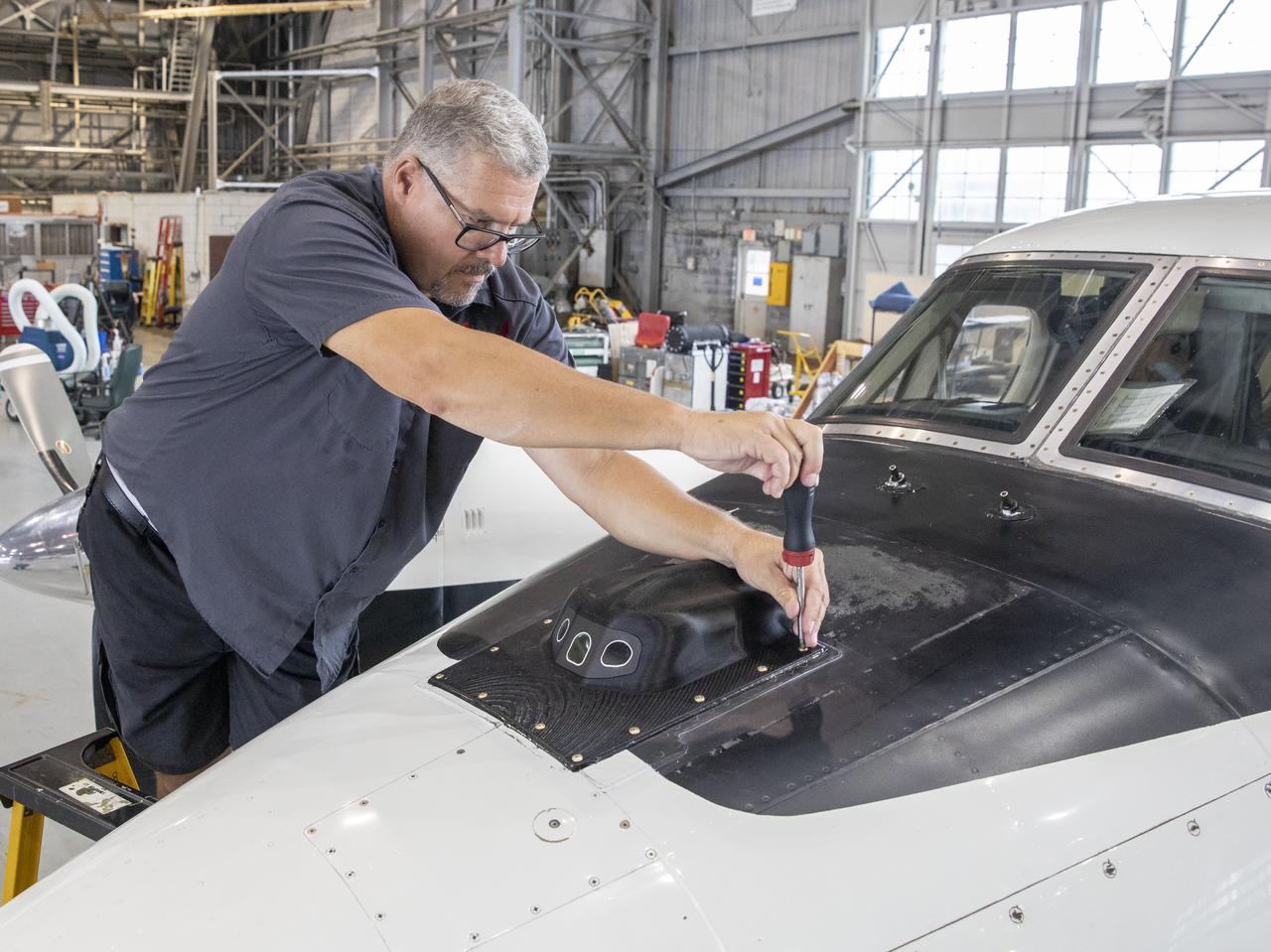
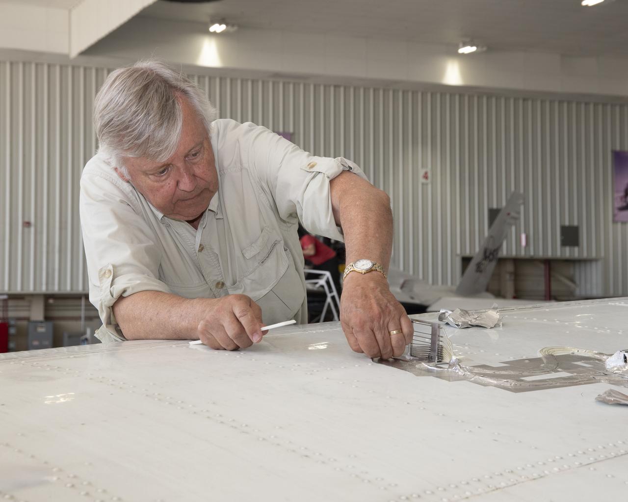
Aircraft mechanic C. Garber working on the camera housing for the flight display for the X59 to tested on the B200 King Air.
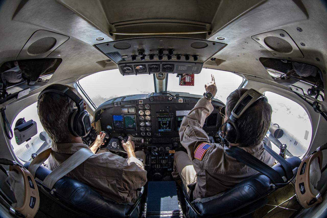
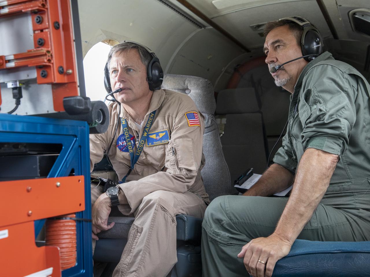
Testing the External Vision System (XVS) software on the B200 King Air. Pilots, Peter Coen and Wayne Ringelberg attempt to spot an incoming aircraft on the XVS monitor.
Testing the External Vision System (XVS) software on the B200 King Air. Pilots, Peter Coen and Wayne Ringelberg attempt to spot an incoming aircraft on the XVS monitor.
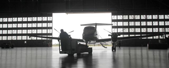
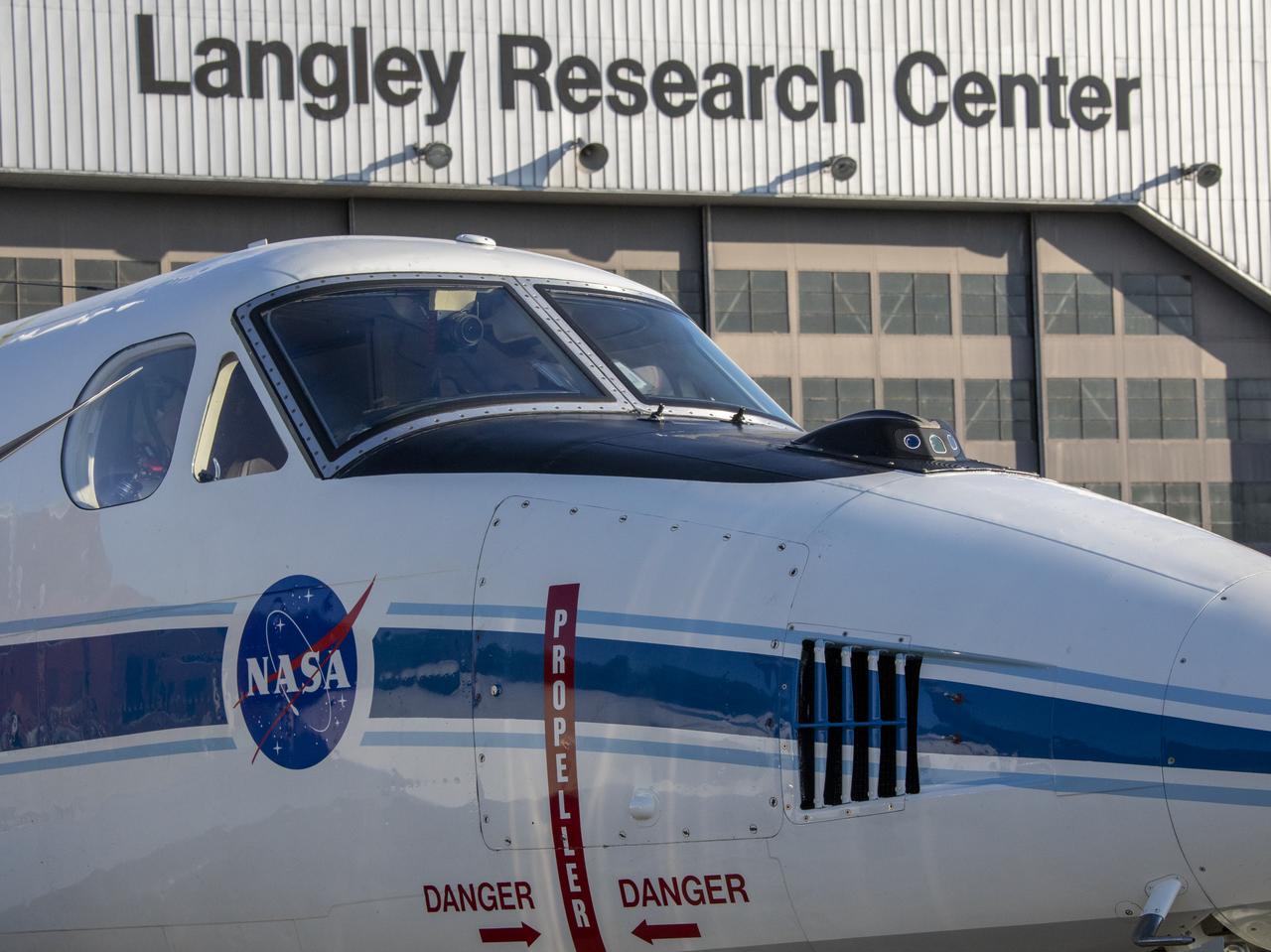
The NASA Langley's twin-engine turboprop, Beechcraft King Air B200 aircraft is towed through the large doors and inside the hangar of the Research Center, Building 1244.
Testing the External Vision System (XVS) software on the B200 King Air. Pilots, Peter Coen and Wayne Ringelberg attempt to spot an incoming aircraft on the XVS monitor.
Testing the External Vision System (XVS) software on the B200 King Air. Pilots, Peter Coen and Wayne Ringelberg attempt to spot an incoming aircraft on the XVS monitor.
Testing the External Vision System (XVS) software on the B200 King Air. Pilots, Peter Coen and Wayne Ringelberg attempt to spot an incoming aircraft on the XVS monitor.

Testing the External Vision System (XVS) software on the B200 King Air. Pilots, Peter Coen and Wayne Ringelberg attempt to spot an incoming aircraft on the XVS monitor.
Testing the External Vision System (XVS) software on the B200 King Air. Pilots, Peter Coen and Wayne Ringelberg attempt to spot an incoming aircraft on the XVS monitor.

Testing the External Vision System (XVS) software on the B200 King Air. Pilots, Peter Coen and Wayne Ringelberg attempt to spot an incoming aircraft on the XVS monitor.
Testing the External Vision System (XVS) software on the B200 King Air. Pilots, Peter Coen and Wayne Ringelberg attempt to spot an incoming aircraft on the XVS monitor.
Testing the External Vision System (XVS) software on the B200 King Air. Pilots, Peter Coen and Wayne Ringelberg attempt to spot an incoming aircraft on the XVS monitor.
Testing the External Vision System (XVS) software on the B200 King Air. Pilots, Peter Coen and Wayne Ringelberg attempt to spot an incoming aircraft on the XVS monitor.
Testing the External Vision System (XVS) software on the B200 King Air. Pilots, Peter Coen and Wayne Ringelberg attempt to spot an incoming aircraft on the XVS monitor.
Testing the External Vision System (XVS) software on the B200 King Air. Pilots, Peter Coen and Wayne Ringelberg attempt to spot an incoming aircraft on the XVS monitor.
Testing the External Vision System (XVS) software on the B200 King Air. Pilots, Peter Coen and Wayne Ringelberg attempt to spot an incoming aircraft on the XVS monitor.
Testing the External Vision System (XVS) software on the B200 King Air. Pilots, Peter Coen and Wayne Ringelberg attempt to spot an incoming aircraft on the XVS monitor.

Testing the External Vision System (XVS) software on the B200 King Air. Pilots, Peter Coen and Wayne Ringelberg attempt to spot an incoming aircraft on the XVS monitor.
Testing the External Vision System (XVS) software on the B200 King Air. Pilots, Peter Coen and Wayne Ringelberg attempt to spot an incoming aircraft on the XVS monitor.
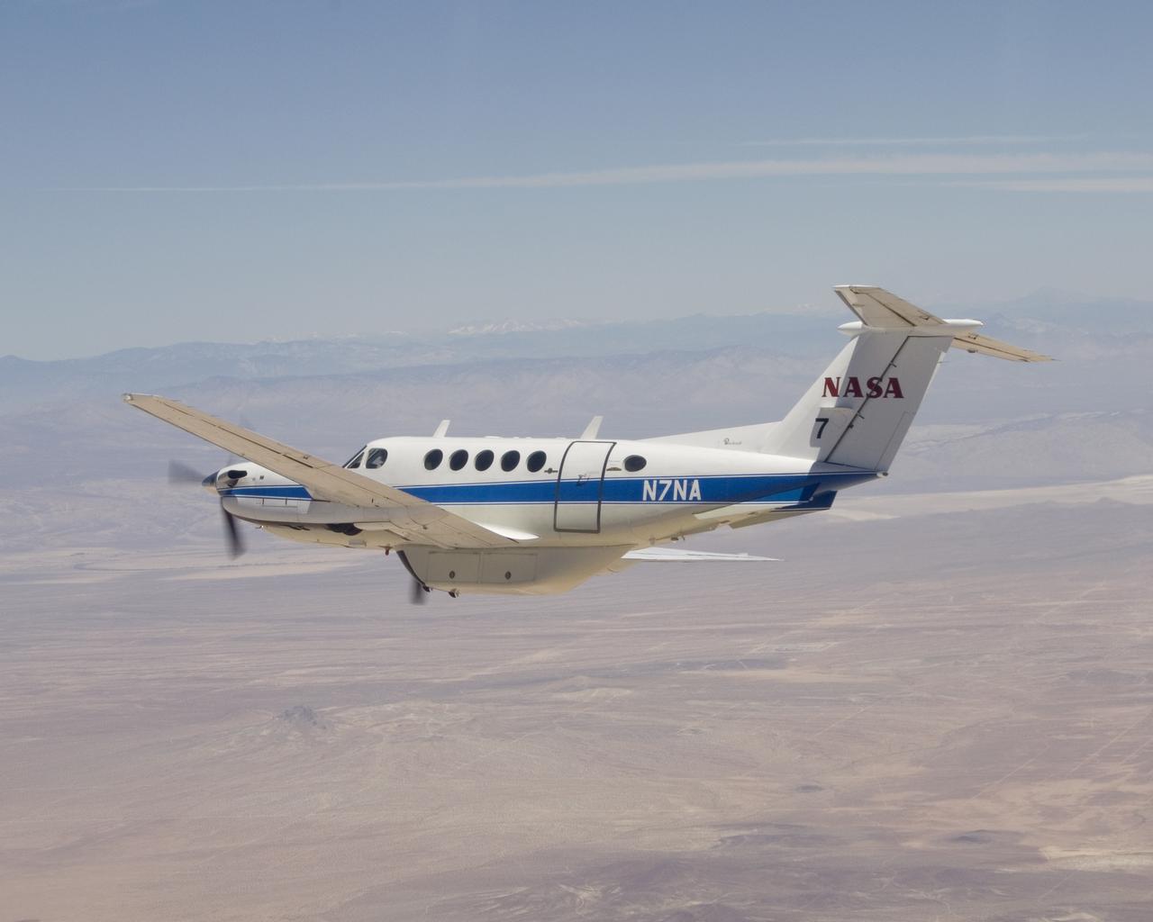
NASA's Dryden Flight Research Center operates this Beechcraft B-200 King Air N7NA for both pilot proficiency and mission management.
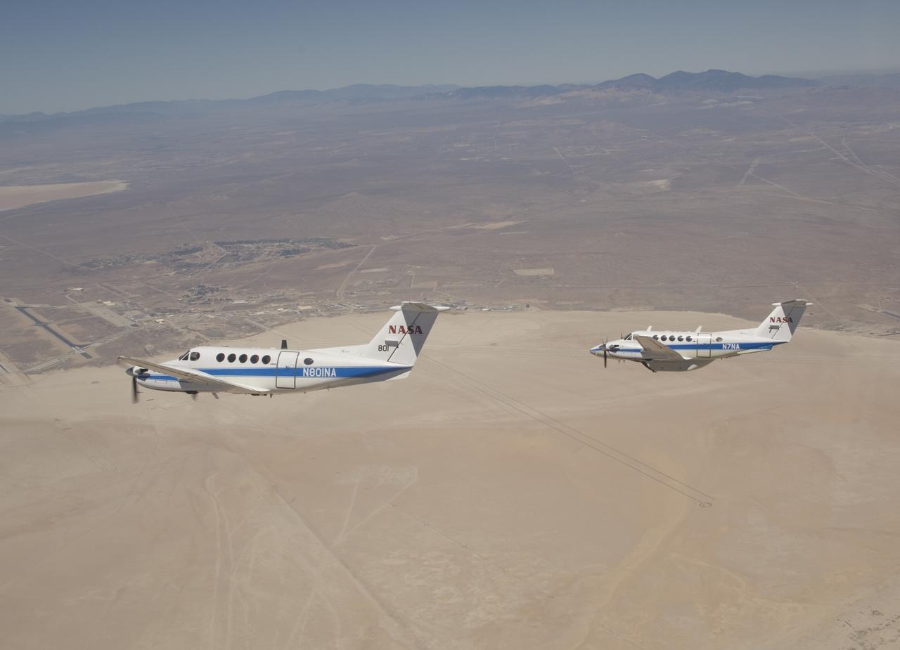
Two Beechcraft King Air mission support aircraft operated by NASA's Dryden Flight Research Center fly in formation over Rogers Dry Lake at Edwards Air Force Base.
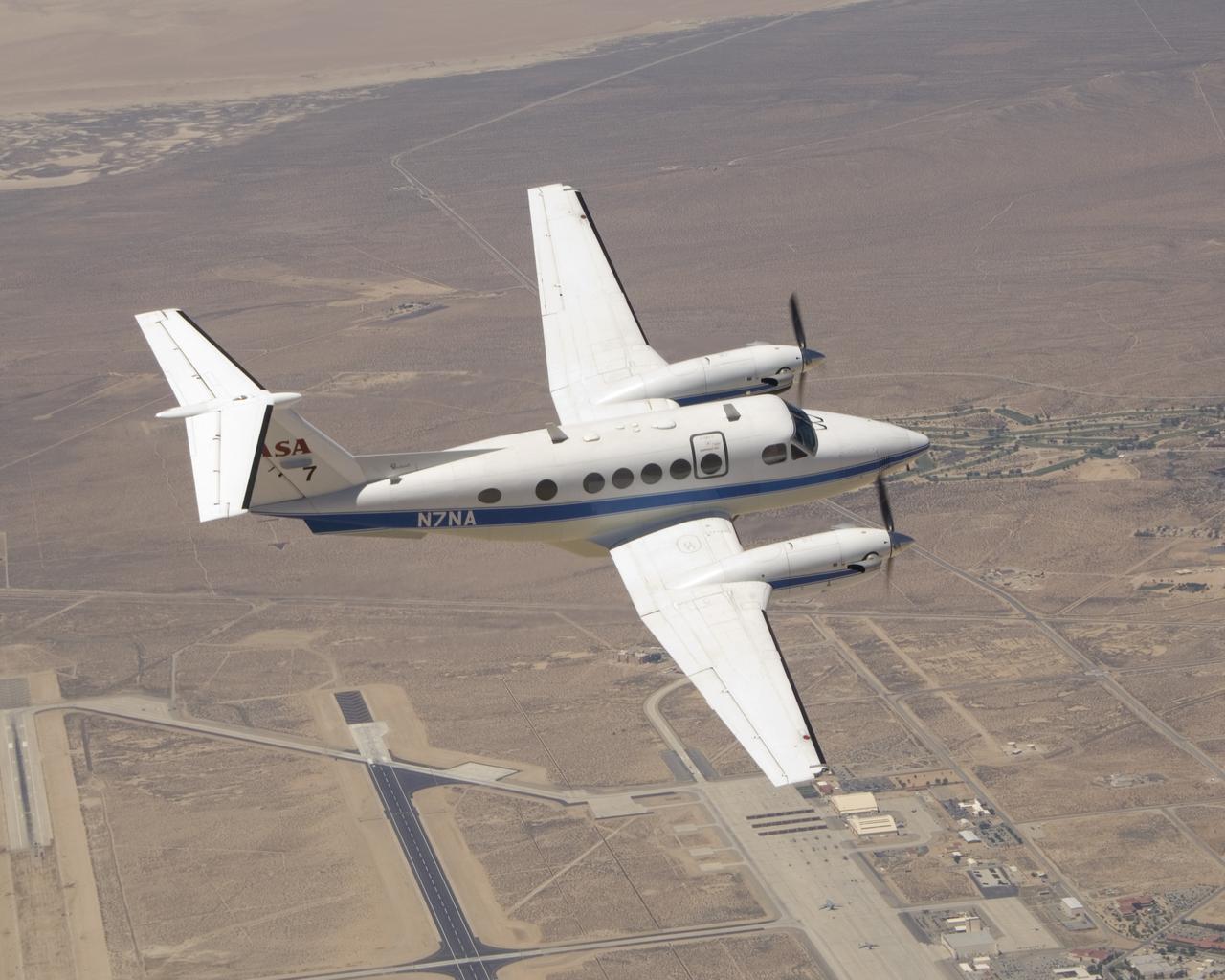
One of NASA Dryden Flight Research Center's two Beechcraft King Air mission support aircraft shows off its lines over Edwards Air Force Base, Calif.
Cal Poly San Luis Obispo Professor Russ Westphal works on the Boundary Layer Data System (BLDS) attached to the wing of a Beechcraft Beech 200 Super King Air aircraft. The BLDS was attached to the aircraft with removable adhesives for a flight test at NASA’s Armstrong Flight Research Center.
Flight crews at NASA's Armstrong Flight Research Center in Edwards, California, flew the Sub-Mesoscale Ocean Dynamics Experiment (S-MODE) installed in the B200 King Air on May 3, 2021.
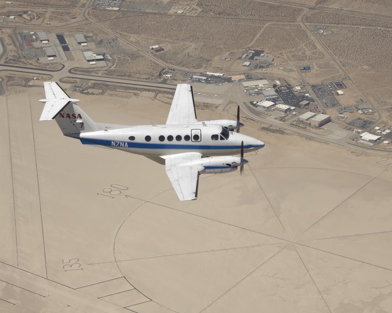
NASA's Beechcraft King Air N7NA mission support aircraft soars over the compass rose on Rogers Dry Lake adjacent to NASA's Dryden Flight Research Center.
A flight crew prepares for the B200 King Air Sub-Mesoscale Ocean Dynamics Experiment (S-MODE) at NASA’s Armstrong Flight Research Center in Edwards, California. From left to right are Jeroen Molemaker and Scott “Jelly” Howe.
A flight crew prepares for the B200 King Air Sub-Mesoscale Ocean Dynamics Experiment (S-MODE) at NASA's Armstrong Flight Research Center in Edwards, California. From left to right are Scott "Jelly" Howe, Jeroen Molemaker and Delphine Hypolite.
A NASA King Air successfully tested the Advanced Data Acquisition and Telemetry System during a recent series of three research flights.
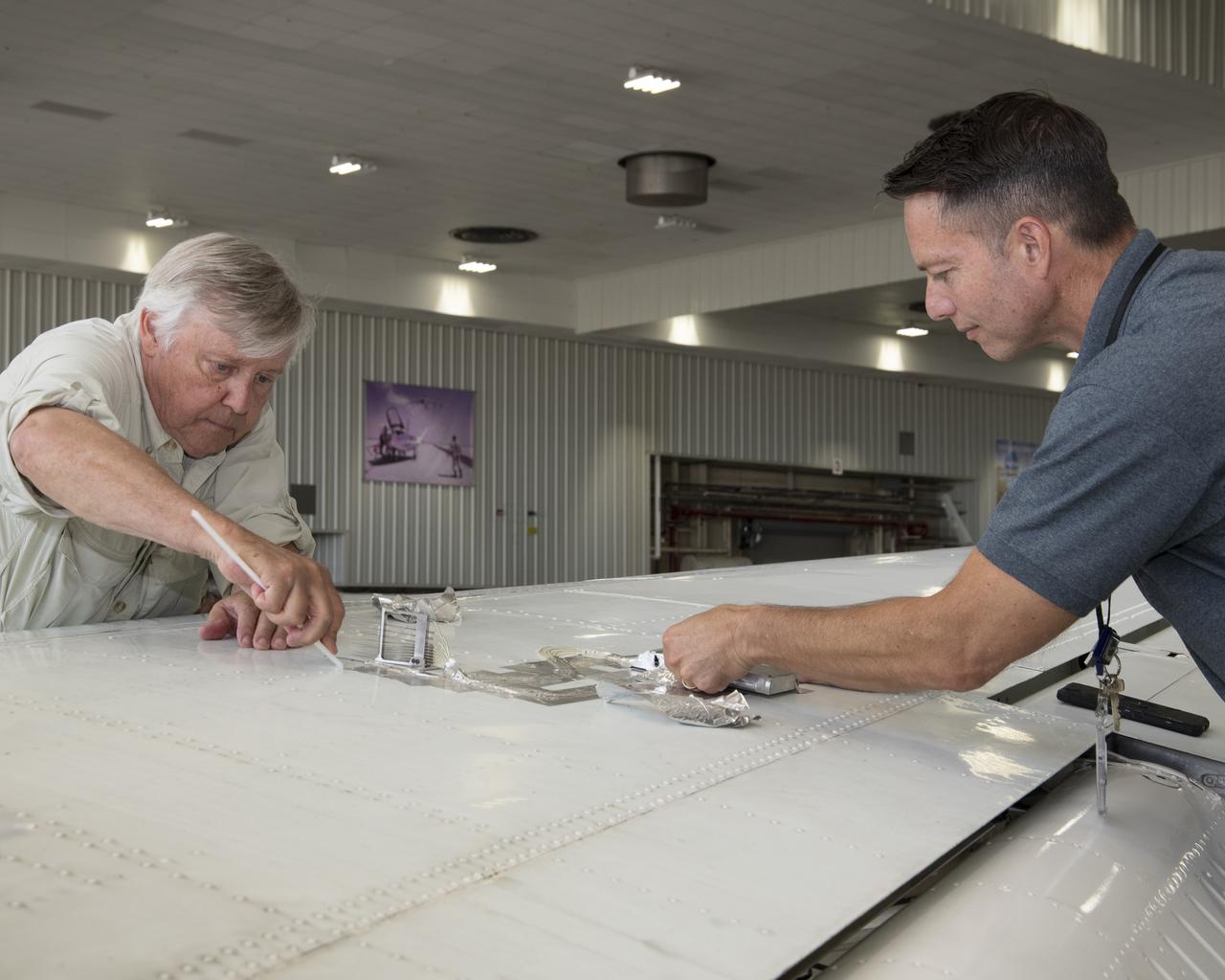
Cal Poly San Luis Obispo Professor Russ Westphal, left, and NASA Armstrong’s Technology Transfer Officer Benjamin Tomlinson remove the Boundary Layer Data System (BLDS) sensor attached to the wing of a Beechcraft Beech 200 Super King Air. The BLDS was flight tested at NASA’s Armstrong Flight Research Center to showcase rapid and flexible flight-testing capabilities.

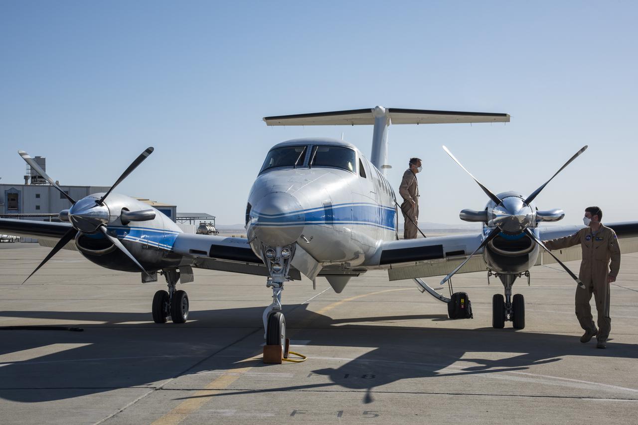
Bridenstine tours main Armstrong hangar that houses the center aircraft used for flight research and safety chase such as F/A-18, F-15B/D, King Air B-200, T-34C and TG-14 aircraft.
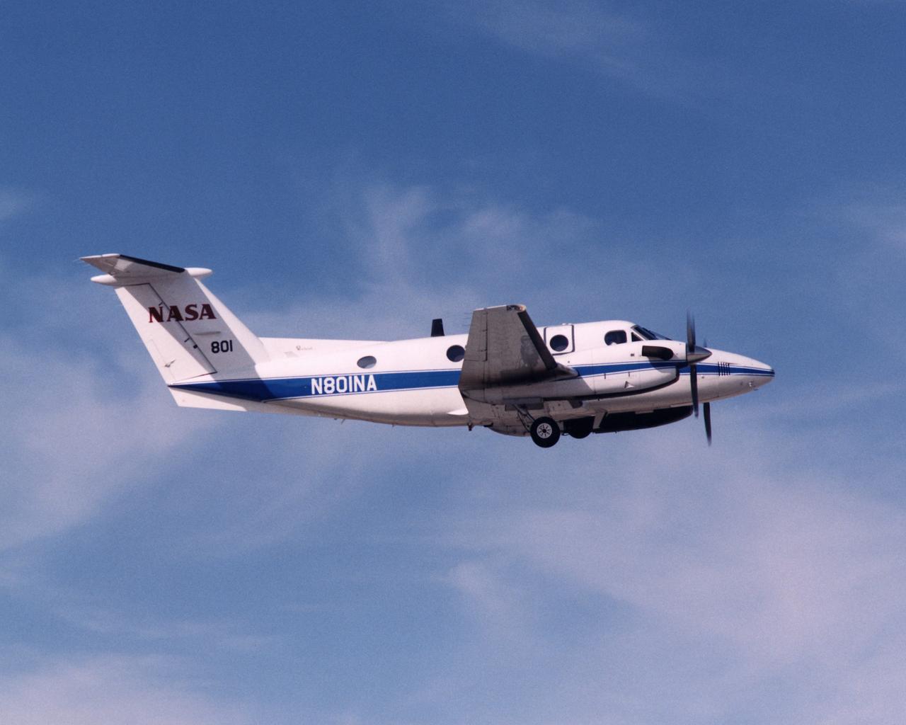
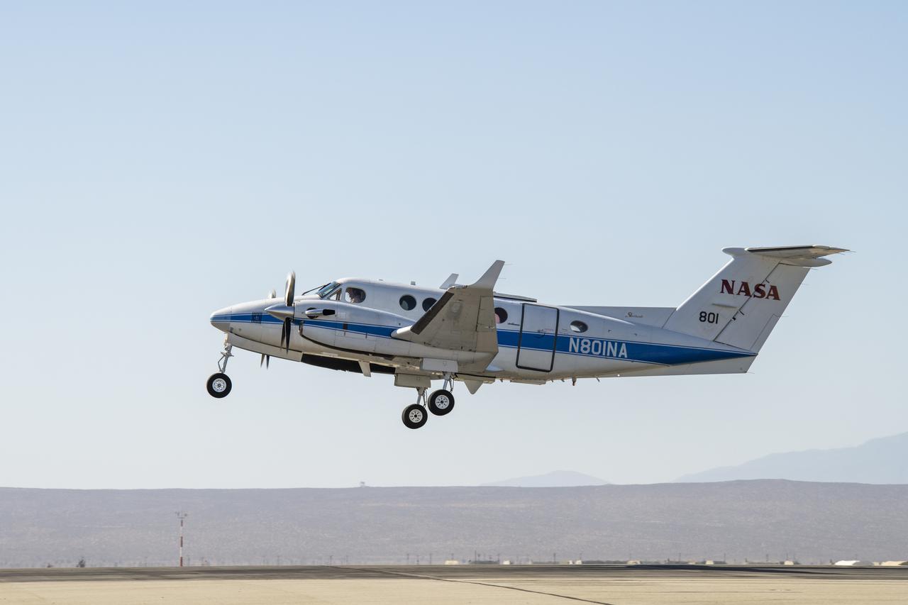
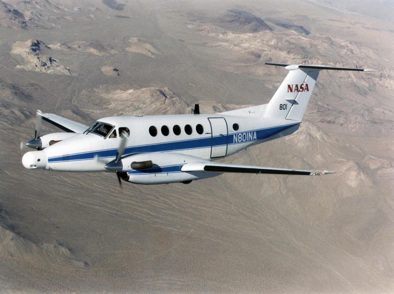
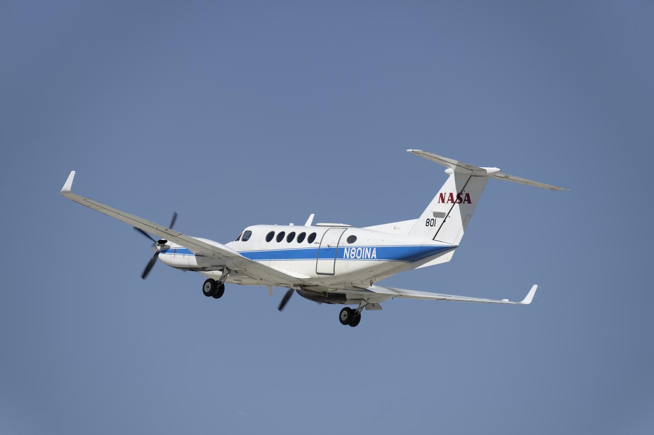
NASA KingAir N801NA during takeoff.
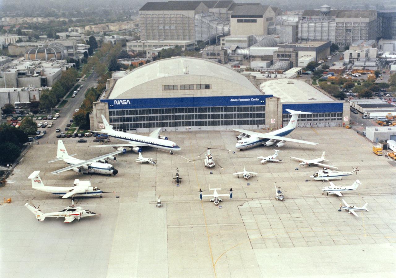
Ames Aircraft complement on ramp DC-8, C-130, QSRA, RSRA, C-141, U-2, SH-3G, King Air, YO-3A, T-38, CH-47, Lear Jet, AH-1G, AV-8B Harrier, OH-58A, XV-15, UH-1H
NASA’s B200 King Air aircraft – based at NASA’s Armstrong Flight Research Center in Edwards, California – ascends to support a prescribed burn in Geneva State Forest, about 100 miles south of Montgomery, Alabama, on March 17, 2025. The effort is part of NASA’s multi-year FireSense project, which aims to test technology that predicts fire and smoke behavior. This data could eventually benefit the U.S. Forest Service as well as local, state, and other federal wildland fire agencies.
NASA’s B200 King Air aircraft – based at NASA’s Armstrong Flight Research Center in Edwards, California – ascends to support a prescribed burn in Geneva State Forest, about 100 miles south of Montgomery, Alabama, on March 17, 2025. The effort is part of NASA’s multi-year FireSense project, which aims to test technology that predicts fire and smoke behavior. This data could eventually benefit the U.S. Forest Service as well as local, state, and other federal wildland fire agencies.
A Cal Fire S2-T airtanker follows a U.S. Forest Service King Air 200 during an aerial attack on a simulated wildfire, Tuesday, May 4, 2021 as Cal Fire conducts aerial fire fighting training exercises near Redding, California. STEReO, the Scalable Traffic Management for Emergency Response Operations project, led by NASA’s Ames Research Center, builds on NASA’s expertise in air traffic management, human factors research, and autonomous technology development to apply the agency’s work in Unmanned Aircraft Systems Traffic Management, or UTM, to public safety uses. Photo Credit: (NASA/Joel Kowsky)

Mark Pestana is a research pilot and project manager at the NASA Dryden Flight Research Center, Edwards, Calif. He is a pilot for the Beech B200 King Air, the T-34C and the Predator B. He flies the F-18 Hornet as a co-pilot and flight test engineer. Pestana has accumulated more than 4,000 hours of military and civilian flight experience. He was also a flight engineer on the NASA DC-8 flying laboratory. Pestana was the project manager and pilot for the Hi–rate Wireless Airborne Network Demonstration flown on the NASA B200 research aircraft. He flew B200 research missions for the X-38 Space Integrated Inertial Navigation Global Positioning System experiment. Pestana also participated in several deployments of the DC-8, including Earth science expeditions ranging from hurricane research over the Caribbean Sea to ozone studies over the North Pole, atmospheric chemistry over the South Pacific, rain forest health in Central America, Rocky Mountain ice pack assessment, and volcanic and tectonic activity around the Pacific Rim. He came to Dryden as a DC-8 mission manager in June 1998 from NASA Johnson Space Center, Houston, where he served as the Earth and Space Science discipline manager for the International Space Station Program at Johnson. Pestana also served as a flight crew operations engineer in the Astronaut Office, developing the controls, displays, tools, crew accommodations and procedures for on-orbit assembly, test, and checkout of the International Space Station. He led the analysis and technical negotiations for modification of the Russian Soyuz spacecraft as an emergency crew return vehicle for space station crews. He joined the U.S. Air Force Reserve in 1991 and held various positions as a research and development engineer, intelligence analyst, and Delta II launch vehicle systems engineer. He retired from the U.S. Air Force Reserve with the rank of colonel in 2005. Prior to 1990, Pestana was on active duty with the U.S. Air Force as the director of mi

NASA’s B200 King Air team includes, from left, principal engineer Cory Hill, operations engineer KC Sujan, pilot Tracy Phelps, crew chief Mario Soto, aircraft technician Ruben Saiza, quality assurance technician Scott Silver, and senior engineer Alexander Soibel. The compact Fire Infrared Radiance Spectral Tracker (c-FIRST) instrument was tested on the B200 aircraft – based at NASA’s Armstrong Flight Research Center in Edwards, California – over the wildfires in the Pacific Palisades and Altadena, California, on November 21, 2024.
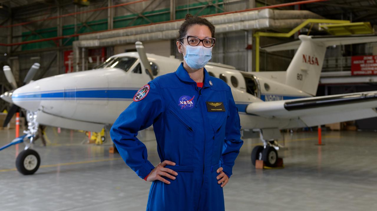
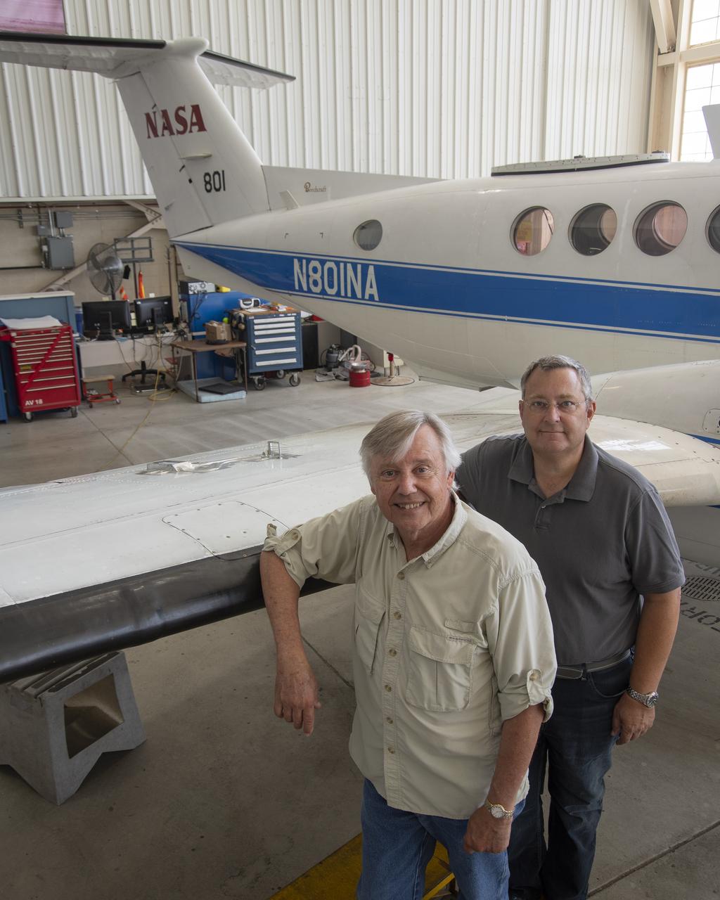
Federica Polverari, post doctorate researcher at the Jet Propulsion Laboratory, in front of NASA's Beechcraft B-200 Super King Air, N801NA, in N248 in support of NASA’s Sub-Mesoscale Ocean Dynamics Experiment, or S-MODE, mission.
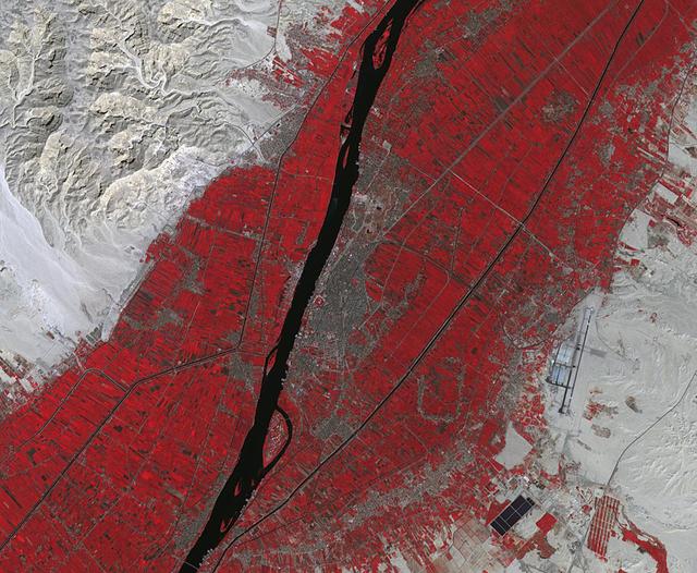
Luxor is a city in Upper Egypt, along the Nile. It is the site of the ancient Egyptian city of Waset, known to the Greeks as Thebes. Luxor is one of the world's greatest open-air museums, with the ruins of the temple complexes of Karnak and Luxor. Immediately across the Nile is the Valley of the Kings, burial place of dozens of Egypt's pharaohs, including King Tutankhamun. The image was acquired October 18, 2017, covers an area of 15.9 by 19.3 kilometers, and is located at 25.7 degrees north, 32.6 degrees east. https://photojournal.jpl.nasa.gov/catalog/PIA23060
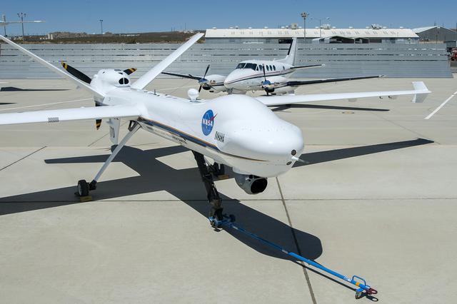
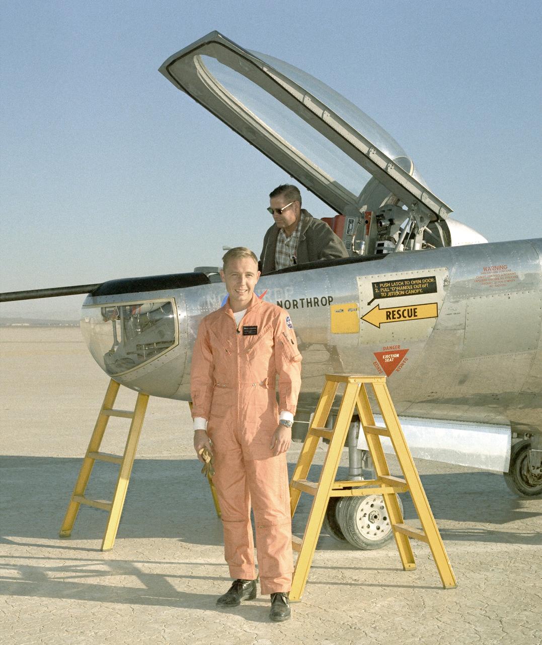
NASA’s Ikhana remotely piloted aircraft (front-right) is situated near NASA Armstrong Flight Research Center’s Hangar 4802 after an Unmanned Aircraft Systems Integration into the National Airspace System Flight Test Series 4 flight, along with five flight “intruders.” These intruders, which include NASA’s TG-14 (front-left), T-34C (front-center), B-200 King Air (back-left), Gulfstream-III (back-center) and a Honeywell C-90 King Air (back-right), fly within a pre-determined distance to Ikhana to test Detect-and-Avoid technology during research flights.
Dan Weishaar, crew chief for the Ames Aircraft Management Office, prepares to deploy NASA's Beechcraft B-200 Super King Air, N801NA, from N248 in support of NASA’s Sub-Mesoscale Ocean Dynamics Experiment, or S-MODE, mission.
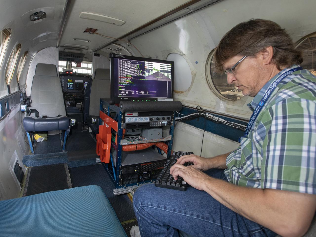
First test flight testing the visual display for the X59. The XVS display is aboard the B200 and the camera is mounted on the nose of the aircraft and inside the cockpit.

First test flight testing the visual display for the X59. The XVS display is aboard the B200 and the LC40 will be interacting as part of the test.
Steve Williams working on the software upgrade for the flight display for the X59.
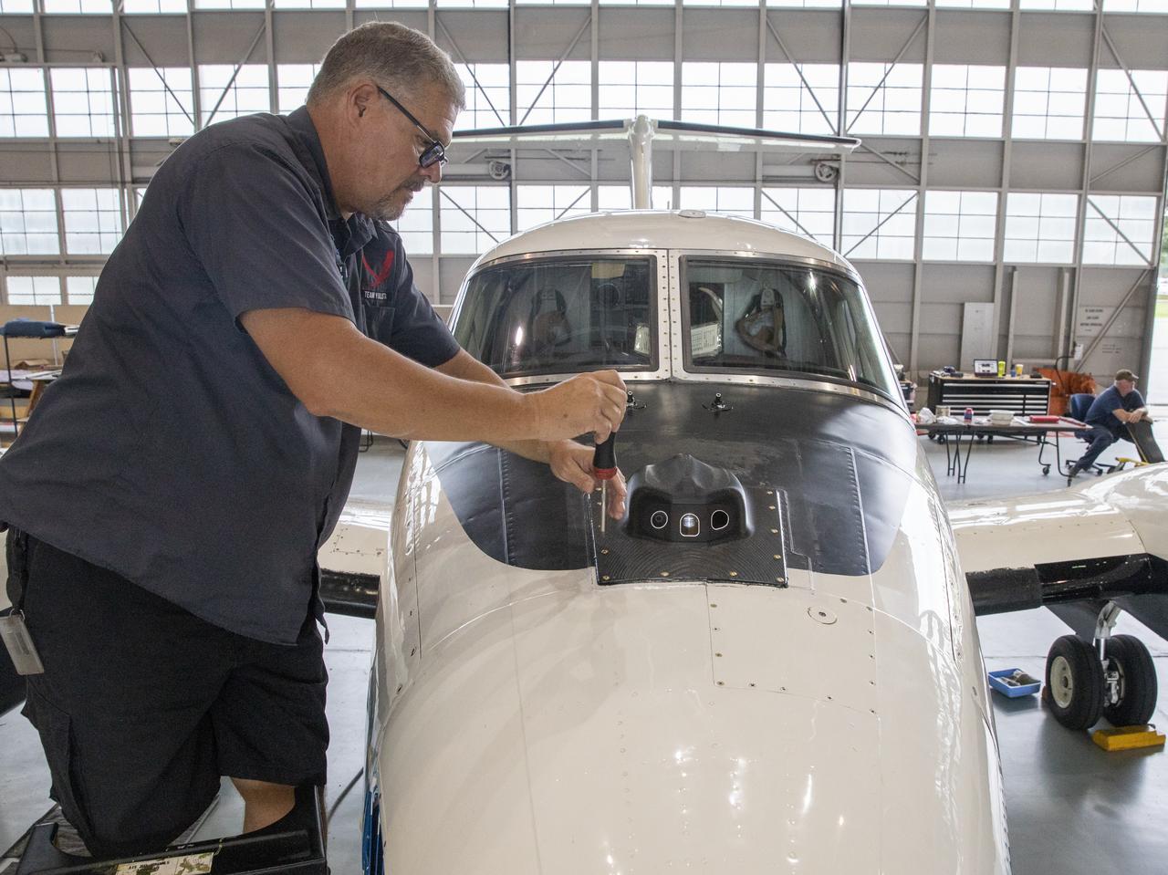
Aircraft mechanic C. Garber working on the camera housing to be tested for the flight display for the X59.

First test flight testing the visual display for the X59. The XVS display is aboard the B200 and the LC40 will be interacting as part of the test.

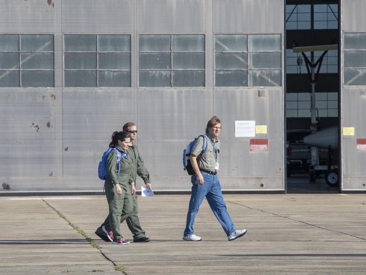
Debriefing before the first test flight testing the visual display for the X59. The XVS display is aboard the B200.
First test flight testing the visual display for the X59. The XVS display is aboard the B200 and the LC40 will be interacting as part of the test.
First test flight testing the visual display for the X59. Researchers Lynda Kramer, pilot Kevin Shelton, Steve Williams and ? pose for photo
First test flight testing the visual display for the X59. Pilot Matt Coldsnow making a flight check before taking off.
First test flight testing the visual display for the X59. The XVS display is aboard the B200 and the camera is mounted on the nose of the aircraft and inside the cockpit.
During an Astronauts Memorial Foundation tribute honoring U.S. Air Foce Maj. Robert Lawrence, vocalist Marva King sings with the Winston Scott “Cosmic Jazz Ensemble.” Selected in 1967 for the Manned Orbiting Laboratory Program, Lawrence was the first African-American astronaut. He lost his life in a training accident 50 years ago. The ceremony took place in the Center for Space Education at the Kennedy Space Center Visitor Complex.
Edwin W. Lewis Jr. is a research pilot in the Airborne Science program, Flight Crew Branch, Dryden Flight Research Center, Edwards, California. He currently flies the DC-8, F/A-18, Lear Jet 24, King Air, and T-34C in support of Dryden's flight operations and is mentor pilot for the King Air and the Lear Jet. Prior to accepting this assignment Lewis was a pilot for eight years at NASA's Ames Research Center, Moffett Field, California, flying 10 different aircraft C-130B, DC-8-72, UH-1, SH-3, King Air, Lear 24, T-38A, T-39G and YO-3A in support of NASA flight missions. Lewis also flew the Kuiper Airborne Observatory (a modified civilian version of the Lockheed C-141 Starlifter). He was project pilot for Ames' 747 and T-38 programs. Lewis was born in New York City on May 19, 1936, and began flight training as a Civil Air Patrol cadet in 1951, ultimately earning his commercial pilot's certificate in 1958. He received a bachelor of arts degree in biology from Hobart College, Geneva, N.Y., and entered the U.S. Air Force through the Reserve Officer Training Corps. Following pilot training he was assigned to Moody Air Force Base, Ga., as an instructor pilot, for both the T-33 and T-37 aircraft. He served in Vietnam in 1965 and 1966, where he was a forward air controller, instructor and standardization/evaluation pilot, flying more than 1,000 hours in the O-1 "Bird Dog." Lewis separated from the regular Air Force and joined Pan American World Airways and the 129th Air Commando Group, California Air National Guard (ANG) based in Hayward, California. During his 18-year career with the California ANG he flew the U-6, U-10, C-119, HC-130 aircraft and the HH-3 helicopter. He retired as commander, 129th Air Rescue and Recovery Group, a composite combat rescue group, in the grade of colonel. During his 22 years as an airline pilot, he flew the Boeing 707, 727 and 747. He took early retirement from Pan American in 1989 to become a pilot with NASA.
Delphine Hypolite, Multiscale Observing System of the Ocean Surface (MOSES) Operator from University of California Los Angeles, performs pre-flight checks on the MOSES Camera System at NASA's Armstrong Flight Research Center in Edwards, California.

At a 50<sup>th</sup> anniversary gala capping a year-long celebration of 50 years of rocket launches from Cape Canaveral Air Force Station, Chris Bailey (left), president of the AFA Cape Canaveral Chapter, receives a rocket model from Maxwell King (right), former president of Brevard Community College. The first launch at CCAFS took place at 9:28 a.m. on July 24, 1950, with the liftoff of Bumper 8 from Launch Complex 3. The gala, hosted by the Cape Canaveral Chapter Air Force Association, featured such speakers as Center Director Roy Bridges; Vice Commander, Air Force Space Command, Lt. Gen. Roger DeKok; and the Honorable David Weldon, U.S. representative of Florida’s 15<sup>th</sup> Congressional District
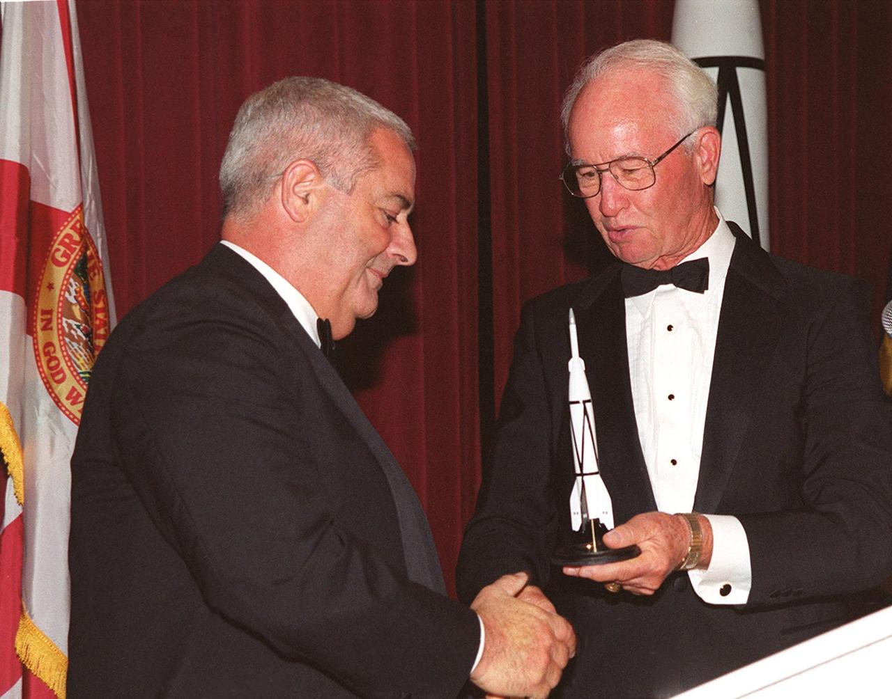
At a 50<sup>th</sup> anniversary gala capping a year-long celebration of 50 years of rocket launches from Cape Canaveral Air Force Station, Chris Bailey (left), president of the AFA Cape Canaveral Chapter, receives a rocket model from Maxwell King (right), former president of Brevard Community College. The first launch at CCAFS took place at 9:28 a.m. on July 24, 1950, with the liftoff of Bumper 8 from Launch Complex 3. The gala, hosted by the Cape Canaveral Chapter Air Force Association, featured such speakers as Center Director Roy Bridges; Vice Commander, Air Force Space Command, Lt. Gen. Roger DeKok; and the Honorable David Weldon, U.S. representative of Florida’s 15<sup>th</sup> Congressional District
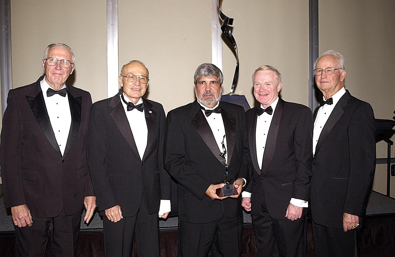
KENNEDY SPACE CENTER, FLA. -- Winners of the Dr. Kurt H. Debus Award attending the 2003 awards dinner are (from left) Lee Solid, Robert B. Sieck, Adrian Laffitte, Roy D. Bridges, and Dr. Maxwell King. Laffitte, director of Atlas Programs for Lockheed Martin Astronautics at Cape Canaveral Air Force Station, was honored as the winner of the 2003 Dr. Kurt H. Debus Award from the National Space Club Florida Committee. The Debus Award was created by the committee to recognize significant achievements and contributions made in Florida to American aerospace efforts.
KENNEDY SPACE CENTER, FLA. -- In the Orbiter Processing Facility (OPF), Paul King, an employee of The Boeing Co., Huntington Beach, Calif., installs a strain gauge on a simulated orbiter wing in preparation for Thermal Protection System (TPS) tile installation. The wing, along with sections of Space Shuttle orbiter Enterprise (OV-101), will be transferred to the Southwest Research Institute for testing after the tile installation is complete. The testing has been requested by the Columbia Accident Investigation Board. For this initiative, sections of Enterprise were borrowed from the Smithsonian Institution's Air and Space Museum where the orbiter is being stored at the Washington Dulles International Airport. Enterprise was the first orbiter built in the Shuttle fleet and was used to conduct the Approach and Landing Test Program before the first powered Shuttle flight.
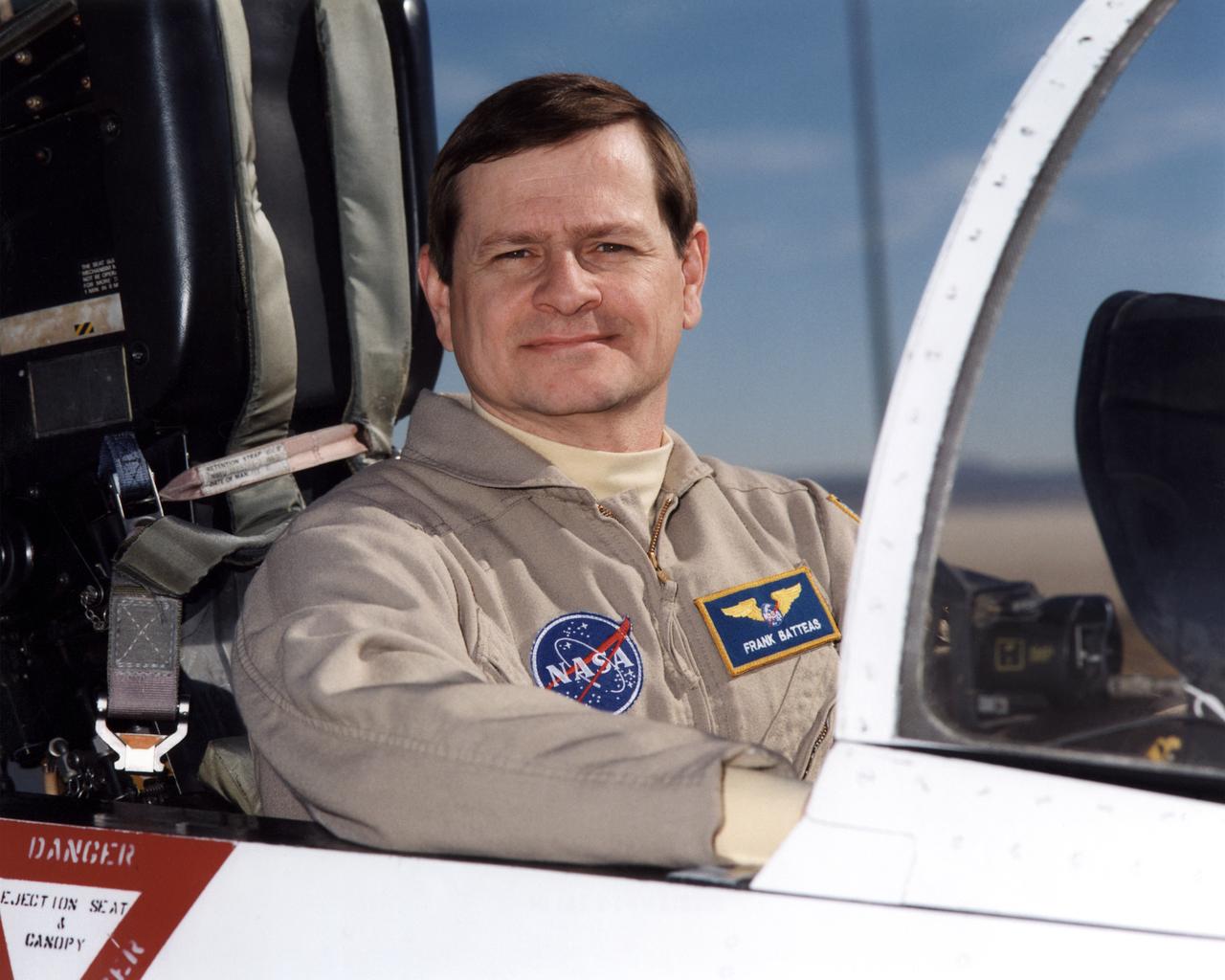
Frank Batteas is a research test pilot in the Flight Crew Branch of NASA's Dryden Flight Research Center, Edwards, California. He is currently a project pilot for the F/A-18 and C-17 flight research projects. In addition, his flying duties include operation of the DC-8 Flying Laboratory in the Airborne Science program, and piloting the B-52B launch aircraft, the King Air, and the T-34C support aircraft. Batteas has accumulated more than 4,700 hours of military and civilian flight experience in more than 40 different aircraft types. Batteas came to NASA Dryden in April 1998, following a career in the U.S. Air Force. His last assignment was at Wright-Patterson Air Force Base, Dayton, Ohio, where Lieutenant Colonel Batteas led the B-2 Systems Test and Evaluation efforts for a two-year period. Batteas graduated from Class 88A of the Air Force Test Pilot School, Edwards Air Force Base, California, in December 1988. He served more than five years as a test pilot for the Air Force's newest airlifter, the C-17, involved in nearly every phase of testing from flutter and high angle-of-attack tests to airdrop and air refueling envelope expansion. In the process, he achieved several C-17 firsts including the first day and night aerial refuelings, the first flight over the North Pole, and a payload-to-altitude world aviation record. As a KC-135 test pilot, he also was involved in aerial refueling certification tests on a number of other Air Force aircraft. Batteas received his commission as a second lieutenant in the U. S. Air Force through the Reserve Officer Training Corps and served initially as an engineer working on the Peacekeeper and Minuteman missile programs at the Ballistic Missile Office, Norton Air Force Base, Calif. After attending pilot training at Williams Air Force Base, Phoenix, Ariz., he flew operational flights in the KC-135 tanker aircraft and then was assigned to research flying at the 4950th Test Wing, Wright-Patterson. He flew extensively modified C-135
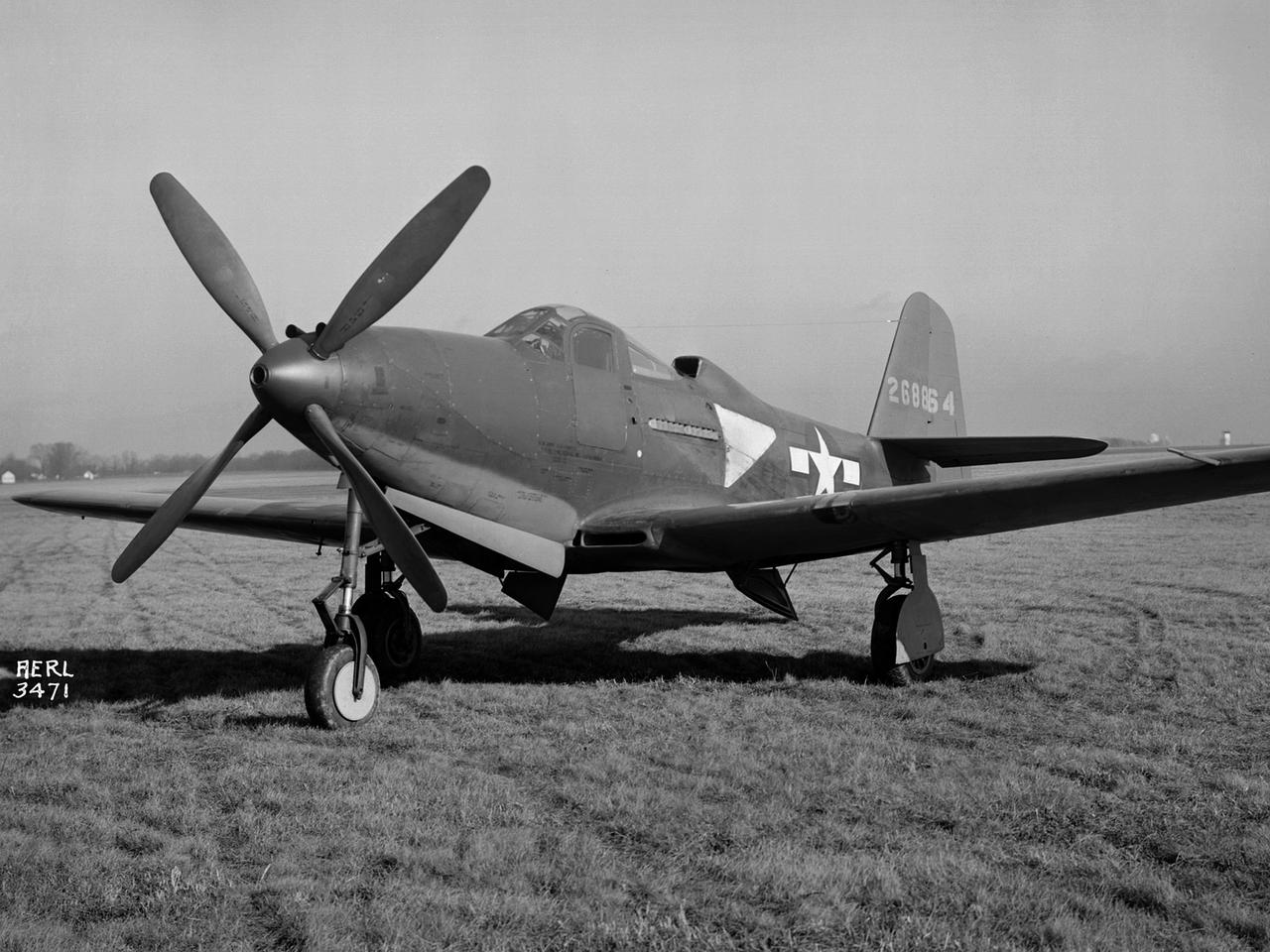
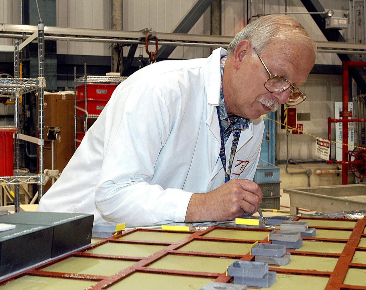
The Army Air Forces lent the National Advisory Committee for Aeronautics (NACA) Aircraft Engine Research Laboratory a Bell P–63A King Cobra in October 1943 to complement the lab's extensive efforts to improve the Allison V–1710 engine. The V–1710-powered P–63A was a single-seat fighter that could reach speeds of 410 miles per hour and an altitude of 43,000 feet. The fighter, first produced in 1942, was an improvement on Bell’s P–39, but persistent performance problems at high altitudes prevented its acceptance by the Air Corps. Instead many of the P–63s were transferred to the Soviet Union. Almost every test facility at the NACA’s engine lab was used to study the Allison V–1710 engine and its supercharger during World War II. Researchers were able to improve the efficiency, capacity and pressure ratio of the supercharger. They found that improved cooling significantly reduced engine knock in the fuel. Once the researchers were satisfied with their improvements, the new supercharger and cooling components were installed on the P–63A. The Flight Research Division first established the aircraft’s normal flight performance parameters such as speed at various altitudes, rate of climb, and peak altitude. Ensuing flights established the performance parameters of the new configuration in order to determine the improved performance. The program increased V–1710’s horsepower from 1650 to 2250.
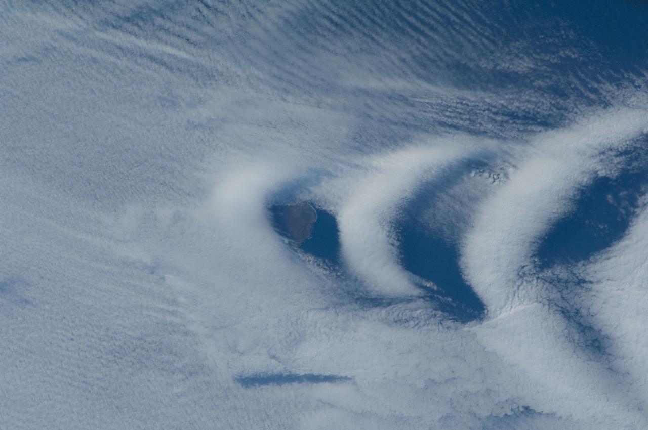
ISS030-E-193144 (25 March 2012) --- Wave clouds near Ile aux Cochons are featured in this image photographed by an Expedition 30 crew member on the International Space Station. This photograph illustrates the formation of wave clouds in the wake—or downwind side—of Ile aux Cochons (“Isle of Pigs”) located in the Southern Indian Ocean. The island is approximately located 3,000 kilometers southeast of the southern tip of the African continent and 2,300 kilometers northwest of Antarctica. The island itself, of which only a part of the eastern coastline is visible at center, is volcanic in origin with a summit elevation of 775 meters above sea level. According to scientists, the Ile aux Cochons stratovolcano is thought to have erupted within the last 12,000 years; however no historical activity has been recorded. The summit elevation is high enough for the land surface to interact with cloud layers and winds flowing past the island. Two major cloud layers are visible; a lower, more uniform layer consists of roughly parallel cloud “streets” that suggest a westerly flow pattern of air. When the air mass encounters the Ile aux Cochons, moisture-laden air rises and cools, causing more water vapor to condense into clouds. As the air mass passes over the summit of Ile aux Cochons and descends, it may encounter alternating moist and dry air layers, enabling the formation of the discontinuous chevron-shaped wave clouds in the wake of the island. While their appearance suggests that the clouds are forming in the wake of the island and moving eastwards, in fact it is the air mass that is moving, with clouds forming in regions of moist air and dissipating in dry regions. Ile aux Cochons is the westernmost of the islands that form the subantarctic Crozet Archipelago (part of the French Southern and Antarctic Lands). Accept for occasional research visits, the island is uninhabited. The island is an important breeding site for seabirds, including the world’s largest King Penguin colony.
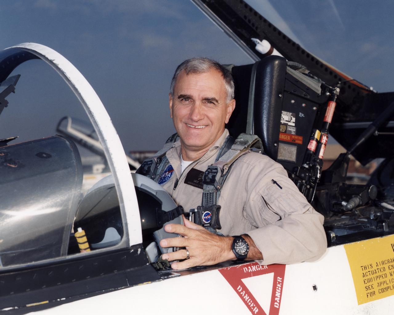
Richard G. (Dick) Ewers became a pilot in the Flight Crew Branch of NASA's Dryden Flight Research Center, Edwards, California, in May 1998. His flying duties focus on operation of the Airborne Science DC-8 and Systems Research F/A-18 aircraft, but he also maintains qualifications in the King Air and T-34C. He has more than 32 years and nearly 9,000 hours of military and civilian flight experience in all types of aircraft from jet fighters to blimps. Ewers came to NASA Dryden from a position as an engineering test pilot with Northrop Grumman's Electronic Sensors and Systems Division (formerly Westinghouse's Electronic Systems Group). He spent eight and a half years with Westinghouse flight testing radar and forward looking infrared systems under development for military and civilian use. Before going to work for Westinghouse, Ewers served for more than 21 years as a U.S. Marine Corps fighter and test pilot, flying F-4, A-4, and F/A-18 aircraft. He underwent flight training at Naval Air Station Pensacola, Fla., in 1969-70. He was subsequently assigned to both fighter/attack and reconnaissance squadrons before ultimately commanding an F-4S squadron for two years. Additionally, his flying included combat service in Vietnam and operational exchange tours with both U.S. Navy and U.S. Air Force squadrons flying F-4s around the world, including off aircraft carriers. Ewers graduated from the U.S. Naval Test Pilot School in 1981 and subsequently served two tours as a test pilot at the Naval Air Test Center, Patuxent River, Md. Most of his flight test experience was with the F/A-18 Hornet. He retired from the Marine Corps in 1989 with the rank of lieutenant colonel. Ewers graduated from the U.S. Air Force Academy in 1968 with a bachelor of science degree in engineering mechanics. He earned a master of science degree in aeronautical systems from the University of West Florida in 1970.
CAPE CANAVERAL, Fla. -- Program participants pose for a group photo in front of a replica of a Mercury-Redstone rocket during a celebration at Complex 5/6 on Cape Canaveral Air Force Station in Florida. From left are Hugh Harris, former director of Public Affairs at Kennedy Space Center; Alice Wackermann, Julie Jenkins and Laura Churchley, daughters of astronaut Alan Shepard; Jack King, former chief, Public Information Office, Marshall Space Flight Center; Bob Moser, former chief test conductor for the Mercury-Redstone launches; NBC reporter Jay Barbree; Mercury astronaut Scott Carpenter; Kennedy Space Center Director Bob Cabana; Lieutenant General Susan J. Helms, commander of the 14th Air Force and former astronaut; and NASA Administrator Charlie Bolden. The celebration was held at the launch site of the first U.S. manned spaceflight May 5, 1961, to mark the 50th anniversary of the flight. Fifty years ago, astronaut Alan Shepard lifted off inside the Mercury capsule, "Freedom 7," atop an 82-foot-tall Mercury-Redstone rocket at 9:34 a.m. EST, sending him on a remarkably successful, 15-minute suborbital flight. The event was attended by more than 200 workers from the original Mercury program and included a re-creation of Shepard's flight and recovery, as well as a tribute to his contributions as a moonwalker on the Apollo 14 lunar mission. For more information, visit www.nasa.gov/topics/history/milestones/index.html. Photo credit: NASA/Kim Shiflett
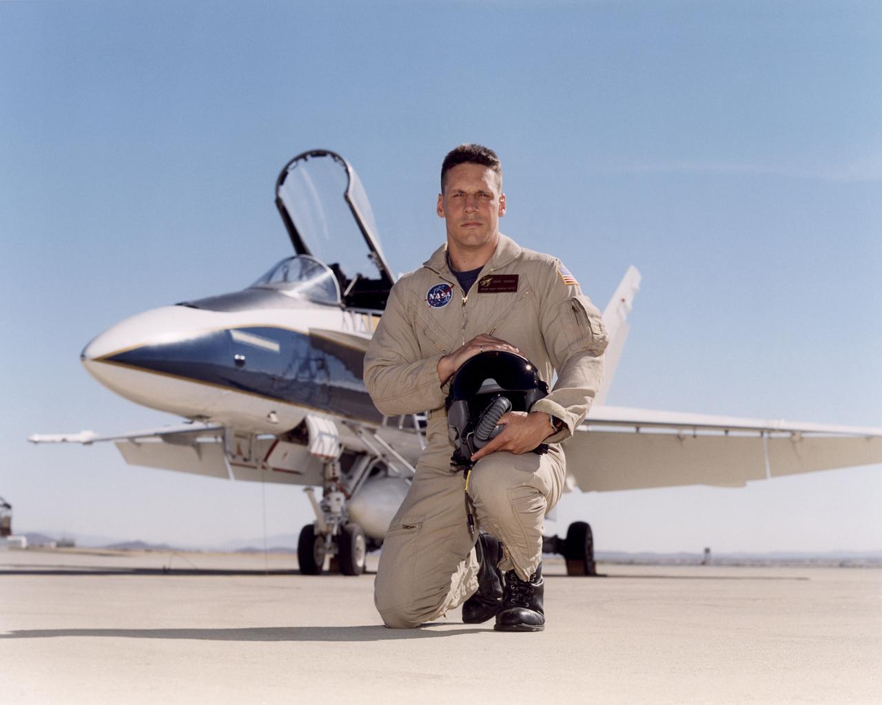
Craig R. Bomben became a pilot in the Flight Crew Branch of NASA's Dryden Flight Research Center, Edwards, Calif., in June 2001. His flying duties include a variety of research and support activities while piloting the F/A-18, DC-8, T-34C and King Air aircraft. He has more than 17 years and 3,800 hours of military and civilian flight experience in over 50 different aircraft types. Bomben came to NASA Dryden from a U.S. Navy assignment to the Personnel Exchange Program, Canada. He served as a test pilot in the Canadian Armed Forces located in Cold Lake, Alberta. He participated in numerous developmental programs to include CT-133 airborne ejection seat testing, F/A-18 weapons flutter testing and F/A-18 night vision goggles integration. Bomben performed U.S. Navy fleet service in 1995 as a strike-fighter department head. He completed two overseas deployments onboard the USS George Washington and USS Stennis. As a combat strike leader, he headed numerous multi-national missions over Iraq in support of Operation Southern Watch. Bomben graduated from the U.S. Naval Test Pilot School in 1992 and was subsequently assigned to the Naval Weapons Test Squadron at Pt. Mugu, Calif. During this tour he developed the F-14D bombsight and worked on various other F-14D and F/A-18 weapon systems developmental programs. Bomben is a 1985 graduate of Washington State University with a bachelor of science degree in electrical engineering. He graduated from naval flight training in 1987 and was recognized as a Commodore List graduate. His first assignment was to Naval Air Station Pensacola, Fla., where he was an instructor in the T-2B Buckeye. When selected to fly the F/A-18 in 1989, he joined a fleet squadron and deployed aboard the USS Forrestal. Bomben is married to the former Aissa Asuncion. They live in Lancaster, Calif., with their 3 children.
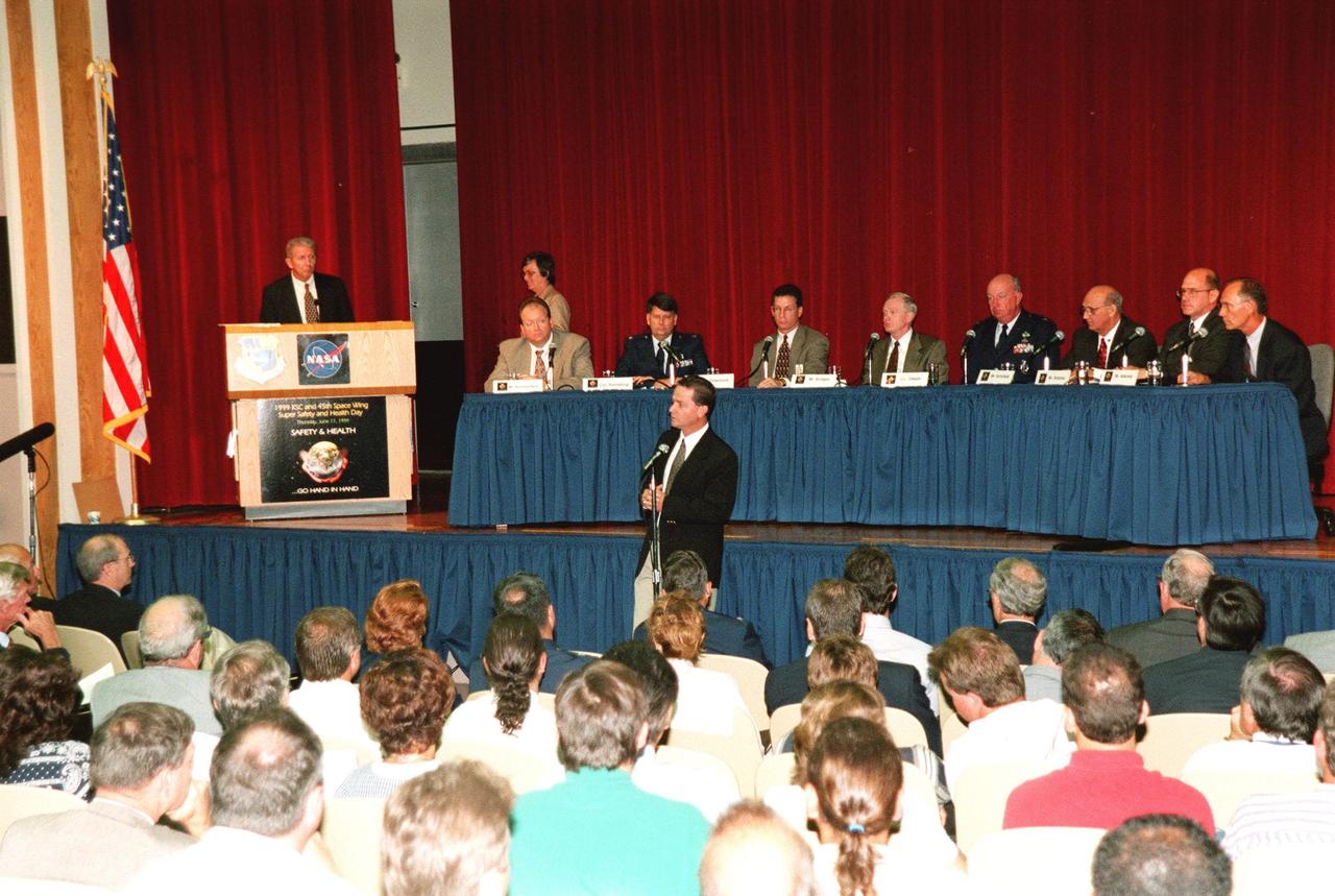
A panel of NASA and contractor senior staff, plus officers from the 45th Space Wing, discuss safetyand health-related concerns in front of an audience of KSC employees as part of Super Safety and Health Day. Moderating at the podium is Loren Shriver, deputy director for Launch & Payload Processing. Seated left to right are Burt Summerfield, associate director of the Biomedical Office; Colonel William S. Swindling, commander, 45th Medical Group, Patrick Air Force Base, Fla.; Ron Dittemore, manager, Space Shuttle Programs, Johnson Space Center; Roy Bridges, Center Director; Col. Tom Deppe, vice commander, 45th Space Wing, Patrick Air Force Base; Jim Schoefield, program manager, Payload Ground Operations, Boeing; Bill Hickman, program manager, Space Gateway Support; and Ed Adamek, vice president and associate program manager for Ground Operations, United Space Alliance. Answering a question at the microphone on the floor is Dave King, director, Shuttle Processing. The panel was one of the presentations during KSC's second annual day-long dedication to safety. Most normal work activities were suspended to allow personnel to attend related activities. The theme, "Safety and Health Go Hand in Hand," emphasized KSC's commitment to place the safety and health of the public, astronauts, employees and space-related resources first and foremost. Events also included a keynote address, vendor exhibits, and safety training in work groups. The keynote address and panel session were also broadcast internally over NASA television
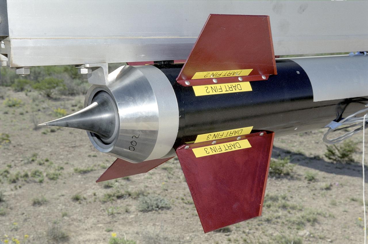
A closeup of one of the Cesaroni Technology, Inc. - constructed aerospike nozzles used in the Dryden Aerospike Rocket Test.
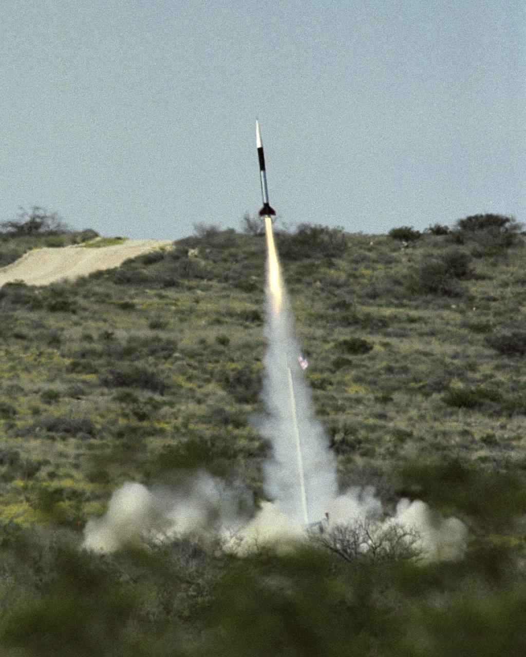
Launch of the first Dryden Aerospike rocket. The Dryden Aerospike Rocket Test provided the first known data from a solid-fueled aerospike rocket in flight.
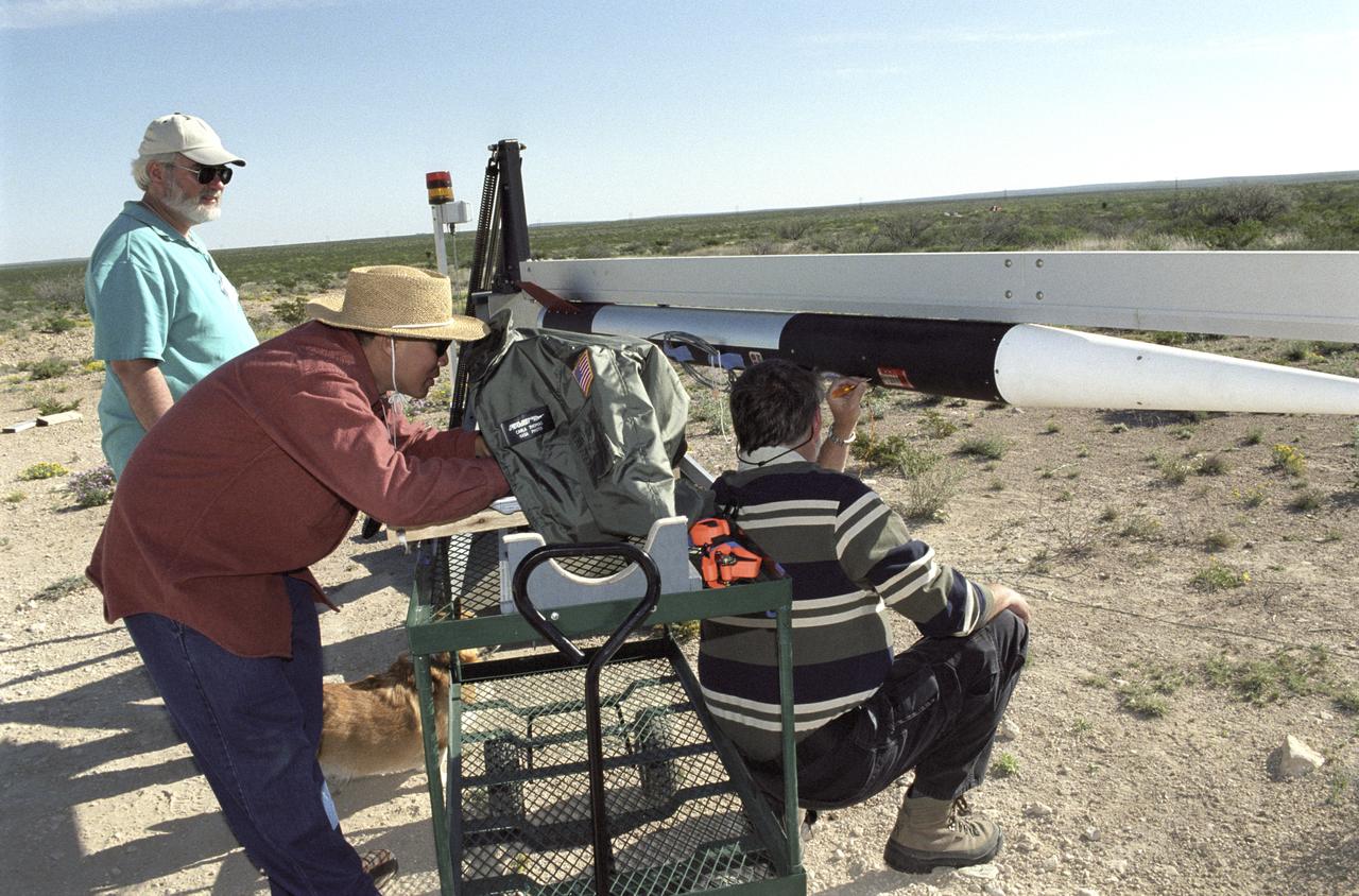
Chuck Rogers, Trong Bui, and Scott Bartel make preflight checks on the second of two aerospike research rockets on March 31, 2004.
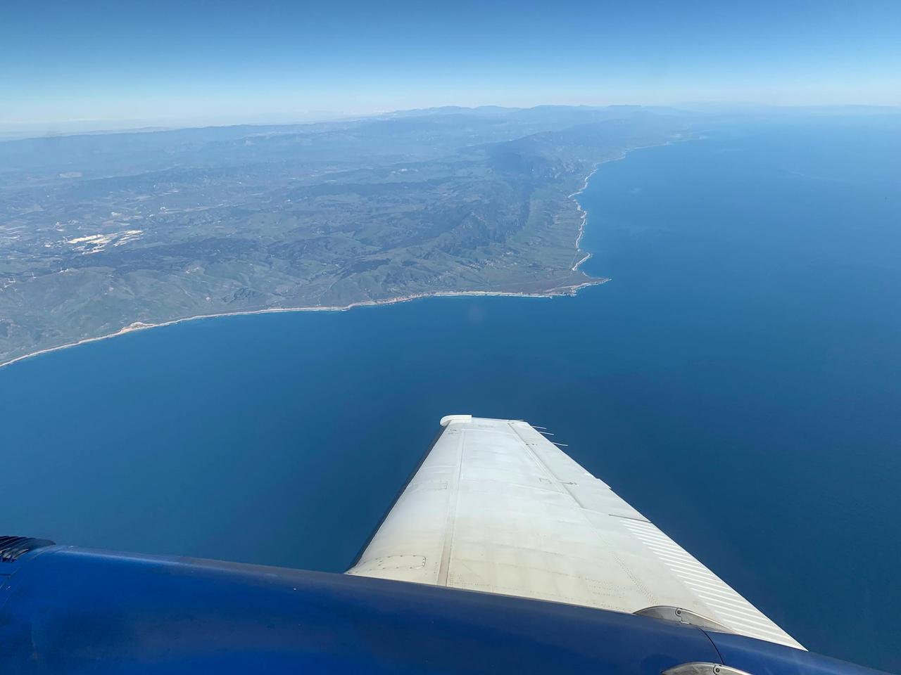
A research plane carrying the AVIRIS-NG (Airborne Visible/Infrared Imaging Spectrometer-Next Generation) instrument flies off the Central Coast of California near Point Conception and the Jack and Laura Dangermond Preserve on Feb. 24, 2022. The flight is part of the Surface Biology and Geology High-Frequency Time Series (SHIFT) campaign, which is jointly led by NASA's Jet Propulsion Laboratory, the University of California, Santa Barbara (UCSB), and The Nature Conservancy. Operating between late February and late May 2022, the aerial portion of SHIFT flies on an approximately weekly basis over a 640-square-mile (1,656-square-kilometer) study area in Santa Barbara County and the nearby ocean, collecting spectral data of plant communities it observes below. SHIFT combines the ability of airborne science instruments to gather data over widespread areas with the more concentrated observations scientists conduct in the field to study the functional characteristics, health, and resilience of plant communities. The sampling and analysis done by researchers on the ground and in the ocean is intended to validate data taken by AVIRIS-NG and help scientists design data collection and processing algorithms for NASA's proposed Surface Biology and Geology (SBG) mission, which would launch no earlier than 2028. The data is also intended to support the research and conservation objectives of The Nature Conservancy, which owns the Dangermond Preserve, and UCSB, which operates the Sedgwick Reserve, another nature preserve within the study area. More than 60 scientists from institutions around the U.S. have indicated they intend to use the SHIFT data in their research. AVIRIS-NG, which was designed at JPL, flies aboard Dynamic Aviation's King Air B-200. https://photojournal.jpl.nasa.gov/catalog/PIA25143
Bruce A. Peterson standing beside the M2-F2 lifting body on Rogers Dry Lake. Peterson became the NASA project pilot for the lifting body program after Milt Thompson retired from flying in late 1966. Peterson had flown the M2-F1, and made the first glide flight of the HL-10 heavy-weight lifting body in December 1966. On May 10, 1967, Peterson made his fourth glide flight in the M2-F2. This was also the M2-F2's 16th glide flight, scheduled to be the last one before the powered flights began. However, as pilot Bruce Peterson neared the lakebed, the M2-F2 suffered a pilot induced oscillation (PIO). The vehicle rolled from side to side in flight as he tried to bring it under control. Peterson recovered, but then observed a rescue helicopter that seemed to pose a collision threat. Distracted, Peterson drifted in a cross-wind to an unmarked area of the lakebed where it was very difficult to judge the height over the lakebed because of a lack of the guidance the markers provided on the lakebed runway. Peterson fired the landing rockets to provide additional lift, but he hit the lakebed before the landing gear was fully down and locked. The M2-F2 rolled over six times, coming to rest upside down. Pulled from the vehicle by Jay King and Joseph Huxman, Peterson was rushed to the base hospital, transferred to March Air Force Base and then the UCLA Hospital. He recovered but lost vision in his right eye due to a staph infection.
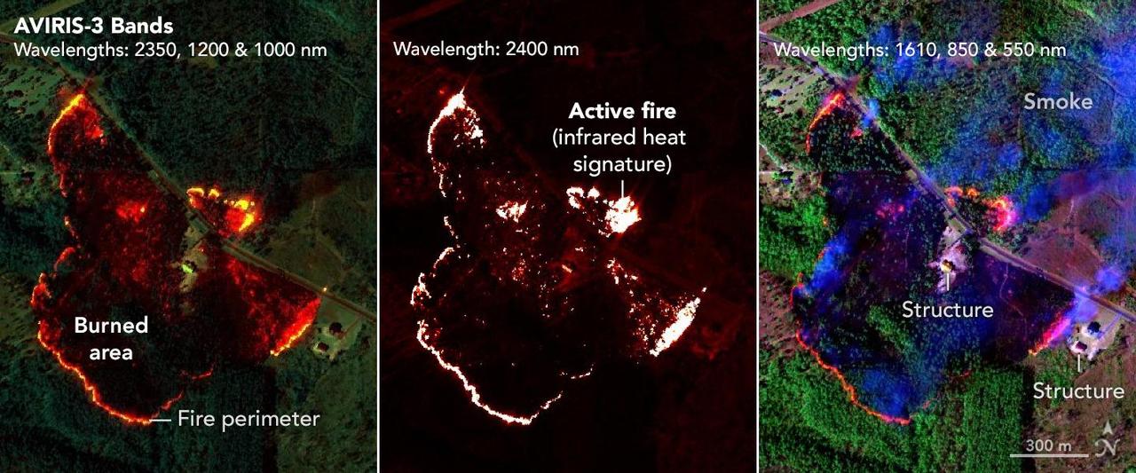
NASA's AVIRIS-3 sensor, an airborne imaging spectrometer built and operated by the agency's Jet Propulsion Laboratory in Southern California, captured infrared data on a wildfire about 3 miles (5 kilometers) west of the town of Mount Vernon, Alabama, on March 21, 2025. Within minutes of flying over, real-time maps of the fire were sent via satellite internet to firefighters with the Alabama Forestry Commission, who used it to contain the fire, preventing it from reaching four buildings. The first image in the series combines reflection data from AVIRIS-3 (Airborne Visible Infrared Imaging Spectrometer 3) at three infrared wavelengths that are invisible to the human eye – 2,350 nanometers, 1,200 nanometers, and 1,000 nanometers. In the resulting composite image, the colors indicate where the fire was burning most intensely. Orange and red areas show cooler-burning areas, while yellow indicates the most intense flames. Burned areas show up as dark red or brown. The second image in the series looks solely at the 2,400 nanometers wavelength. This wavelength is particularly useful for seeing hot spots and the perimeters of fires, which show brightly against a red background. The third image in the series combines light at 1,610 nanometers, 850 nanometers, and 550 nanometers. This view shows burn areas and smoke. The AVIRIS-3 sensor belongs to a line of imaging spectrometers built at JPL since 1986. The instruments have been used to study a wide range of phenomena – including fire – by measuring sunlight reflecting from the planet's surface. Data from imaging spectrometers like AVIRIS-3 typically takes days or weeks to be processed into highly detailed, multilayer image products used for research. By simplifying the calibration algorithms, researchers were able to process data on a computer aboard the plane in a sliver of the time it otherwise would have taken, and airborne satellite internet connectivity enabled the images to be distributed almost immediately, while the plane was still in flight, rather than after it landed. Flying about 9,000 feet (3,000 meters) in altitude aboard a NASA King Air B200 research plane, AVIRIS-3 collected data on the Castleberry Fire while preparing for prescribed burn experiments that took place in the Geneva State Forest in Alabama on March 28 and at Fort Stewart-Hunter Army Airfield in Georgia from April 14 to 20. The burns were part of a NASA 2025 FireSense Airborne Campaign. https://photojournal.jpl.nasa.gov/catalog/PIA26499
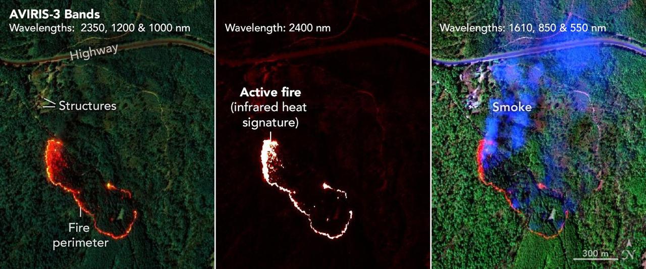
NASA's AVIRIS-3 sensor, an airborne imaging spectrometer built and operated by the agency's Jet Propulsion Laboratory in Southern California, captured infrared data of a wildfire 4 miles (2.5 kilometers) southwest of the unincorporated community of Perdido, Alabama, on March 21, 2025. Within minutes of flying over, real-time maps of the fire were sent via satellite internet to firefighters with the Alabama Forestry Commission, who used it to contain the fire, preventing it from reaching six buildings. The first image in the series combines reflection data from AVIRIS-3 (Airborne Visible Infrared Imaging Spectrometer 3) at three infrared wavelengths that are invisible to the human eye – 2,350 nanometers, 1,200 nanometers, and 1,000 nanometers. In the resulting composite image, the colors indicate where the fire was burning most intensely. Orange and red areas show cooler-burning areas, while yellow indicates the most intense flames. Burned areas show up as dark red or brown. The second image in the series looks solely at the 2,400 nanometers wavelength. The images are particularly useful for seeing hot spots and the perimeters of fires, which show brightly against a red background. The third image in the series combines light at 1,610 nanometers, 850 nanometers, and 550 nanometers. This view shows burn areas and smoke. The AVIRIS-3 sensor belongs to a line of imaging spectrometers built at JPL since 1986. The instruments have been used to study a wide range of phenomena – including fire – by measuring sunlight reflecting from the planet's surface. Data from imaging spectrometers like AVIRIS-3 typically takes days or weeks to be processed into highly detailed, multilayer image products used for research. By simplifying the calibration algorithms, researchers were able to process data on a computer aboard the plane in a sliver of the time it otherwise would have taken, and airborne satellite internet connectivity enabled the images to be distributed almost immediately, while the plane was still in flight, rather than after it landed. Flying about 9,000 feet (3,000 meters) in altitude aboard a NASA King Air B200 research plane, AVIRIS-3 collected data on the Castleberry Fire while preparing for prescribed burn experiments that took place in the Geneva State Forest in Alabama on March 28 and at Fort Stewart-Hunter Army Airfield in Georgia from April 14 to 20. The burns were part of a NASA 2025 FireSense Airborne Campaign. https://photojournal.jpl.nasa.gov/catalog/PIA26498
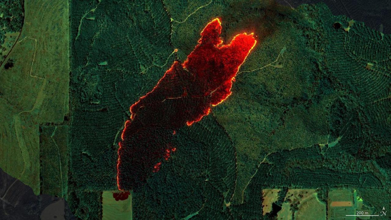
NASA's AVIRIS-3 sensor, an airborne imaging spectrometer built and operated by the agency's Jet Propulsion Laboratory in Southern California, captured infrared data of a roughly 120-acre wildfire about 3 miles (5 kilometers) east of the town of Castleberry, Alabama, on March 19, 2025. Within minutes of flying over the Castleberry Fire, which had not previously been reported to authorities, real-time maps of where burning was most intense were sent via satellite internet to firefighters with the Alabama Forestry Commission, who used it to decide how to deploy their personnel and firefighting equipment. The image combines reflection data from AVIRIS-3 (Airborne Visible Infrared Imaging Spectrometer 3) at three infrared wavelengths that are invisible to the human eye: 2,350 nanometers, 1,200 nanometers, and 1,000 nanometers. In the resulting composite image, the colors indicate where the fire was burning most intensely. Orange and red areas show cooler-burning areas, while yellow indicates the most intense flames. Burned areas show up as dark red or brown. The AVIRIS-3 sensor belongs to a line of imaging spectrometers built at JPL since 1986. The instruments have been used to study a wide range of phenomena – including fire – by measuring sunlight reflecting from the planet's surface. Data from imaging spectrometers like AVIRIS-3 typically takes days or weeks to be processed into highly detailed, multilayer image products used for research. By simplifying the calibration algorithms, researchers were able to process data on a computer aboard the plane in a sliver of the time it otherwise would have taken, and airborne satellite internet connectivity enabled the images to be distributed almost immediately, while the plane was still in flight, rather than after it landed. Flying about 9,000 feet (3,000 meters) in altitude aboard a NASA King Air B200 research plane, AVIRIS-3 collected data on the Castleberry Fire while preparing for prescribed burn experiments that took place in the Geneva State Forest in Alabama on March 28 and at Fort Stewart-Hunter Army Airfield in Georgia from April 14 to 20. The burns were part of a NASA 2025 FireSense Airborne Campaign. https://photojournal.jpl.nasa.gov/catalog/PIA26497