
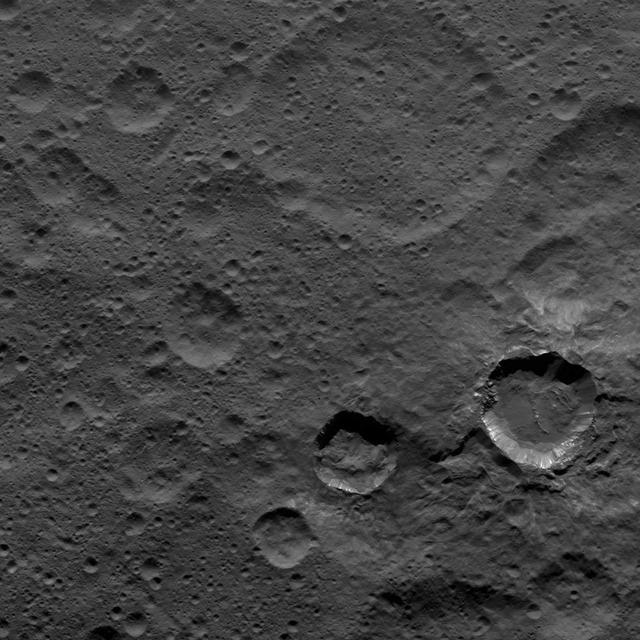
NASA's Dawn spacecraft views Kupalo Crater in this view of Ceres. Kupalo, which measures 16 miles (26 kilometers) across and is located at southern mid-latitudes, is named for the Slavic god of vegetation and harvest. Dawn took this image on June 2, 2016, from its low-altitude mapping orbit, at a distance of about 240 miles (385 kilometers) above the surface. The image resolution is 120 feet (35 meters) per pixel. http://photojournal.jpl.nasa.gov/catalog/PIA20944
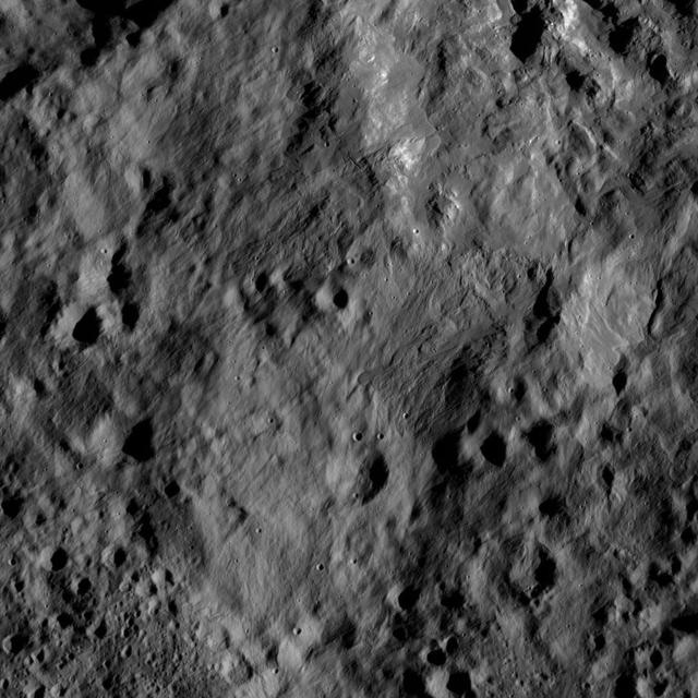
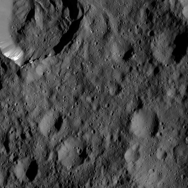
This view from NASA's Dawn spacecraft shows terrain on Ceres directly south of Kupalo Crater. The area is blanketed by smooth ejecta from Kupalo. The image is centered at 44 degrees south latitude, 173 degrees east longitude longitude. Dawn took this image on June 1, 2016, from its low-altitude mapping orbit, at a distance of about 240 miles (385 kilometers) above the surface. The image resolution is 120 feet (35 meters) per pixel. http://photojournal.jpl.nasa.gov/catalog/PIA20934
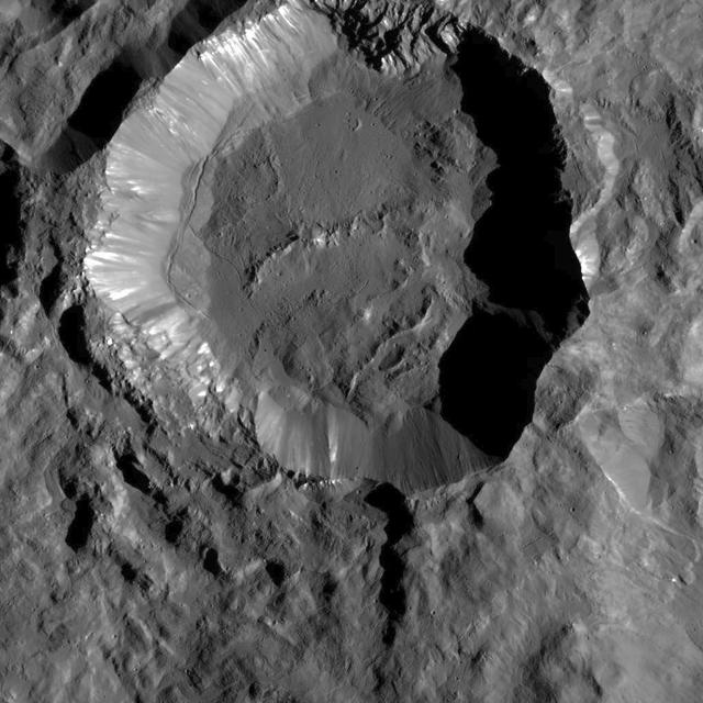
This image from NASA's Dawn spacecraft shows Kupalo Crater, one of the youngest craters on Ceres. The crater has bright material exposed on its rim and walls, which could be salts. Its flat floor likely formed from impact melt and debris. Kupalo, which measures 16 miles (26 kilometers) across and is located at southern mid-latitudes, is named for the Slavic god of vegetation and harvest. Kupalo was imaged earlier in Dawn's science mission at Ceres -- during Survey orbit (see PIA19624) and from the high altitude mapping orbit, or HAMO (see PIA20124). Dawn took this image on Dec. 21 from its low-altitude mapping orbit (LAMO) at an approximate altitude of 240 miles (385 kilometers) above Ceres. The image resolution is 120 feet (35 meters) per pixel. http://photojournal.jpl.nasa.gov/catalog/PIA20192
This region on Ceres, located in the vicinity of Toharu Crater, presents two small craters: Juling at top (12 miles, 20 kilometers in diameter) and Kupalo at bottom (16 miles, 26 kilometers in diameter). Both craters are relatively young, as indicated by their sharp rims. These features are located at about the same latitude (about 38 degrees south) as Tawals Crater and show similar crater shapes and rugged terrain. These features may reflect the presence of ice below the surface. Subtle bright features can be distinguished in places. These likely were excavated by small impacts and landslides along the slopes of the crater rims. This suggests that a different type of material, likely rich in salts, is present in the shallow subsurface. Juling is named after the Sakai/Orang Asli spirit of the crops from Malaysia, and Kupalo gets its name from the Russian god of vegetation and of the harvest. NASA's Dawn spacecraft acquired this picture on August 24, 2016. The image was taken during Dawn's extended mission, from its low altitude mapping orbit at about 240 miles (385 kilometers) above the surface. The center coordinates of this image are 38 degrees south latitude, 165 degrees east longitude. https://photojournal.jpl.nasa.gov/catalog/PIA21753
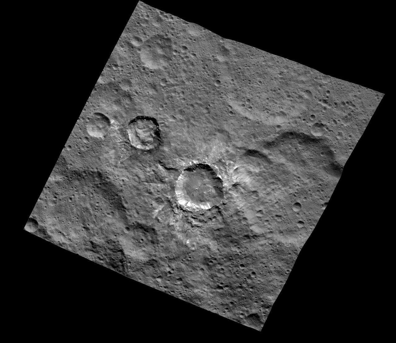
This image of Juling and Kupalo Craters was obtained by NASA's Dawn spacecraft on May 25, 2018 from an altitude of about 855 miles (1380 kilometers). The center coordinates of this image are about 38 degrees south in latitude and 173 degrees east in longitude. https://photojournal.jpl.nasa.gov/catalog/PIA22470
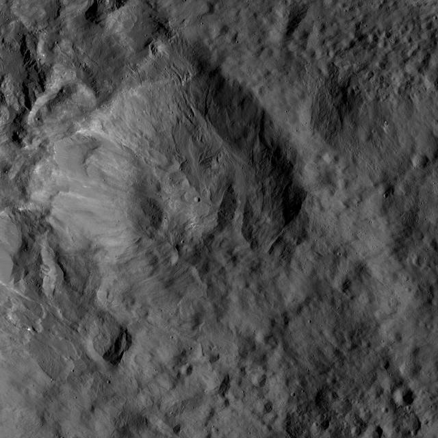
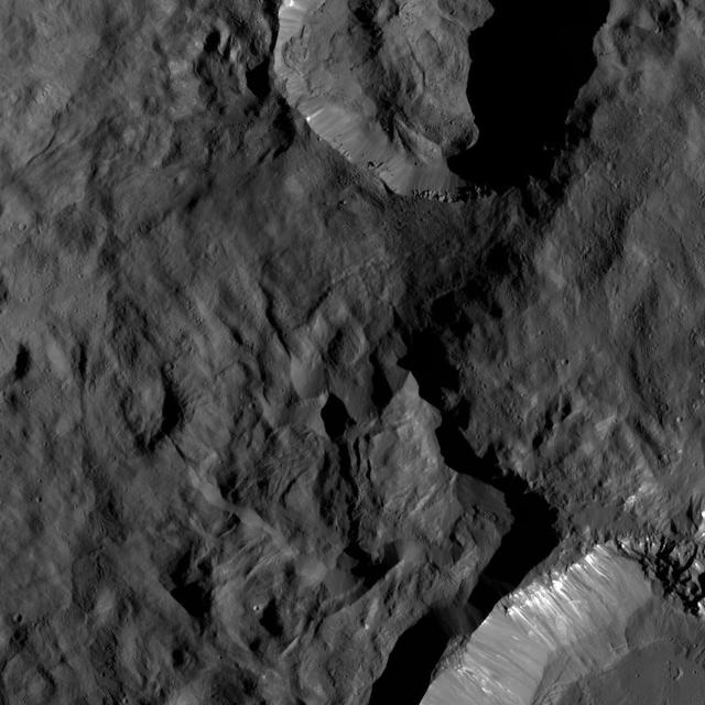
This view from NASA's Dawn spacecraft shows an older crater on Ceres that is smoothly blanketed by ejecta from the nearby, relatively young crater named Kupalo. The image is centered at 38 degrees south latitude, 178 degrees east longitude. Dawn took this image on June 1, 2016, from its low-altitude mapping orbit, at a distance of about 240 miles (385 kilometers) above the surface. The image resolution is 120 feet (35 meters) per pixel. http://photojournal.jpl.nasa.gov/catalog/PIA20932
This view from NASA's Dawn spacecraft shows an older crater on Ceres that is smoothly blanketed by ejecta from the nearby, relatively young crater named Kupalo. The image is centered at 38 degrees south latitude, 178 degrees east longitude. Dawn took this image on June 1, 2016, from its low-altitude mapping orbit, at a distance of about 240 miles (385 kilometers) above the surface. The image resolution is 120 feet (35 meters) per pixel. http://photojournal.jpl.nasa.gov/catalog/PIA20932
Relatively young craters, with sharp crater rims and streaks of bright material, are the focus of this view of Ceres from NASA's Dawn spacecraft. The large, ancient and quite degraded crater Fluusa is seen at top center. The younger craters are Kupalo, at lower right, and Juling, to its left. Dawn took this image on Oct. 17, 2016, from its second extended-mission science orbit (XMO2), at a distance of about 920 miles (1,480 kilometers) above the surface. The image resolution is about 460 feet (140 meters) per pxel. http://photojournal.jpl.nasa.gov/catalog/PIA21223